Angelcomb Peak, Tombstone Territorial Park & the Midnight Dome, Dawson City, Yukon Territory, Canada 8-23-18

Day 20 of Lupe’s 2018 Dingo Vacation to the Yukon, Northwest Territories & Alaska!

5:45 AM, km 107.6 at the East Blackstone River rest area – Cold!  Small wonder.  Ice on the windshield, and new snow on the G6.  A quick step outside was discouraging.  Even chillier out here, and as always, the skies were overcast.  May as well hit the snooze button again.  Lupe and SPHP retreated back inside, and ducked under the blankets.

A chilly start to the new day at km 107.6 of the Dempster Highway. Too cold to bother with details like focusing the camera!

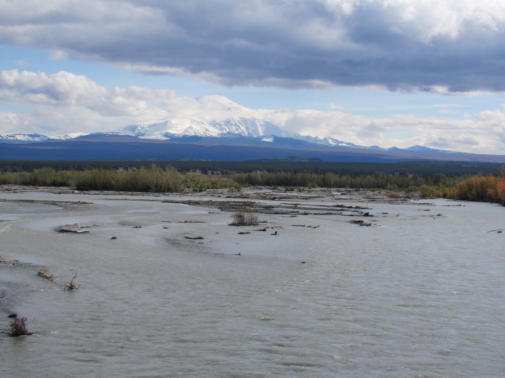
9:18 AM, 31°F, km 94 at the two-tier bubbly pond pullout – Still overcast, but the clouds are tinged blue.  If the sun could just warm things up a bit, maybe some of this stuff would burn off?  SPHP made short work of the last Ensure, and heated up some soup.  Meanwhile, Lupe wandered the edges of the big pullout sniffing among the tall bushes.

11:46 AM, 42°F, km 81 at the Angelcomb trailhead – Good news and bad news!  The good news was that the day had warmed up.  Even better, the sun had broken through!  Blue skies here and there.  As SPHP had driven S on the Dempster Highway, the Ogilvie Mountains were gorgeous, and looking so enticing!

By the time breakfast was over, the Ogilvie Mountains looked like they might be about to escape the cloud cover.
On the drive S, encouraging amounts of blue sky were appearing.

The bad news was that the weather wasn’t consistent.  Still plenty of clouds hanging around.  The mood kept changing depending on which way they went.  Lupe had two peakbagging options nearby to select from.  A longer, more difficult route to Mount Chester Henderson via Charcoal Creek Ridge, or a shorter trail up Angelcomb Peak (6,300 ft.).

Then again, still plenty of clouds hanging around.

With the weather as variable as it was, maybe sticking with the shorter trail up Angelcomb made the most sense?  On the road S, the Carolina Dog decided the question once and for all, by suddenly puking up on her blankets.  The other bad news!  Yeah, better stick with the shorter trail.

Lupe waits near the Dempster Highway during a quick stop to clean up her blankets. She seemed to feel much better immediately after throwing up, but maybe it was best to go for the easiest peak today, in case she got worse again.

On the E side of the Dempster Highway at about km 81, a closed yellow gate across a wide side road blocked access to a highway maintenance area used for gravel storage.  This side road effectively serves as a trailhead for an unofficial trail up Angelcomb Peak (6,300 ft.).  Even though several other vehicles were already here when Lupe arrived, SPHP had plenty of room to park the G6.

The American Dingo was in sunshine, but Angelcomb Peak was still in the clouds as Lupe set out.

Setting out for Angelcomb Peak. Photo looks NE.

Beyond the yellow gate, Lupe quickly came to a big flat area with a huge mound of gravel stacked on one side.  Information SPHP had seen online indicated that Lupe ought to go toward the R (SE) side of the gravel yard to look for a trail.  However, a stack of big boulders sat over that way.

Straight ahead toward Angelcomb Peak, a gentle slope covered with bushes overlooked the gravel yard.  A couple of people up there were working their way R (SE) toward the area the trail was supposed to be in.  Maybe they were already on the trail?  The route they were taking certainly looked easier than dealing with the boulders.

Loop went straight on past the mound of gravel, and got up onto the same slope.  The bushes were chest high on SPHP, and a complete jungle for Lupe.  The trail was nowhere to be seen, but there were lanes among the bushes that were relatively easy to follow.  The people had vanished.  Lupe and SPHP headed off to the R, in the same general direction they had taken.  Sure enough, within minutes, Loopster did come to a trail.

The trail was in decent shape, and gained elevation at a moderate pace.  It headed E up the S side of a little draw toward a high point not too far away.  As Lupe got higher, the bushes began to thin out.  By the time she was close to the high point, they were already becoming scarce.  Back to the W, Looper could see the gravel yard, the Dempster Highway, and the wide upper East Blackstone River valley.

On the S side of the little draw near the start of the unofficial trail to Angelcomb Peak. Photo looks ENE.
The gravel yard Lupe started from is beyond her. The wide valley the East Blackstone River originates from (Center) is across the Dempster Highway. Photo looks W.

The trail didn’t go all the way to the first high point it had been heading toward.  However, only a short side trip was required to go visit it, so Lupe did.  The view of Angelcomb Peak to the N was encouraging.  The clouds had lifted enough so that even the summit was sort of in sight.

The trail heads toward Angelcomb Peak’s S ridge (R). The summit (Center) looked like it might soon be cloud-free. Photo looks N.
Checking out the first little high point. Photo looks NNE.

Lupe returned to the trail, which now headed up Angelcomb Peak’s S ridge.  The next phase of the journey was to get up to a big, relatively flat, rocky shelf that was quite a bit higher.  The trail headed right for it.

Heading up the S ridge. The flat rocky area (R) is an intermediate goal en route to the summit (Center). Photo looks N.
We’re almost to the flatter rocky part of the ridge now! Photo looks NNE.

Even before Loopster reached the first high point, someone had been standing way up on the rocky shelf.  As Lupe got close, a woman was coming down.  SPHP talked to her briefly.  Her husband was still up there watching Dahl sheep through his field glasses.  Pressing onward, Lupe and SPHP soon met Michael Kawerninski.

Michael was friendly, and encouraged SPHP to take a look through his binoculars at 3 Dahl sheep grazing on the slopes of Trapper Mountain (6,628 ft.) to the E.  The sheep were mere tiny white specks, so far away they were difficult to spot without the glasses.  Lupe gave no indication that she was even aware of their existence.

Just like Lupe, Michael and his wife had been all the way to Tuktoyaktuk on the Arctic Ocean, so it was fun talking with him.  They were from Smithers, British Columbia, which Lupe has been to several times.  In fact, Lupe had passed through Smithers on her way N.  Michael was about to follow his wife down, but said he would leave information at the G6 about hiking trails in the Smithers area.

When Michael left, Lupe went on.  The rocky shelf wasn’t completely flat, and the trail wasn’t always right on top of it, but this region was much easier than what was ahead.  Beyond the rocky area, the trail steepened considerably.  Before Lupe even got that far, the sky suddenly started clearing to the E.  The fog blew away.  At one point, Lupe had such a great view of Trapper Mountain, that SPHP thought maybe she could go climb it after summiting Angelcomb!

The sky begins to clear over by Trapper Mountain. Photo looks NE.
Look at that! Maybe we can go climb Trapper Mountain next? Photo looks E.

Excited and spurred on by that notion, Lupe’s now steepening trek up Angelcomb Peak continued.  However, the clouds soon returned.  The next time SPHP glanced over toward Trapper Mountain, it had vanished again!  Lupe could still see to the S and W, though.

The trail didn’t always stay right up on the ridgeline. Here Lupe is W of, and a bit below, the rocky shelf. Photo looks N toward the summit (Center).
Goldensides Mountain, which Lupe had climbed in 2017, is on the L. The Dempster Highway and North Fork Pass are on the R. Photo looks S.
Getting to the final push up Angelcomb Peak. Photo looks NW.
Mount Robert Henderson (6,998 ft.) appears briefly in the distance on the L. Blackcap Mountain (6,000 ft.) is at Center. Goldensides Mountain (6,000 ft.) is beyond Lupe on the R. Photo looks SE.
North Fork Pass and the Dempster Highway. Photo looks S.
Upper East Blackstone River valley with help from the telephoto lens. Photo looks SW.
Angelcomb Peak’s S ridge. This is the way Lupe came up. Photo looks SSE.

On the final steep ascent, the path faded and became braided.  Several times SPHP lost it completely.  Didn’t matter, since it was perfectly clear the route went straight on up to the sharp peak ahead.  That was about the only thing that was clear, though.  Angelcomb Peak (6,300 ft.) was still in the clouds.  During the last 200 feet of elevation gain, Loopster climbed in a cold fog.

Poor Loop didn’t complain, but she wasn’t having much fun.  She felt sick again, and threw up once more.  With encouragement from SPHP, she persevered and managed to reach the summit of Angelcomb Peak.

Feeling sick in the cold fog, but still heading higher. Fortunately, not much farther now!

The top of Angelcomb Peak was an airy, rocky, little hillock.  Most of the hill was covered with dirt or scant vegetation from which a number of rocks protruded a foot or two higher.  Two rocks, quite close together and nearly equal in elevation, formed the true summit.  They were right along the edge of a fog-filled chasm of indeterminable depth to the NE.  A ragged ridgeline to the NW vanished into fog, too.

Despite the gloomy conditions and not feeling so great, the American Dingo immediately perched up on the highest rocks to claim her rather nauseating peakbagging success.

Success! Lupe at the true summit of Angelcomb Peak. Photo looks NW.
On the same summit rock, but this time looking NE.

Only a minute later, the fog began to thin a little.  More of the NW ridge could be seen.  Loop could also see to the S and W.  However, virtually nothing could be seen to the N or E yet.

A minute later, more of the NW ridge came into view. Photo looks NW.
The East Blackstone River valley. Photo looks WSW.
The summit of Angelcomb Peak – just about the whole thing. Photo looks ESE.
Well, we made it! Hope you don’t feel as queasy about it as I do!

After a quick initial look around, SPHP sat leaning against the highest rocks.  Lupe curled up on a patch of dirt nearby.  A 10 mph S breeze felt quite chilly.  Between the breeze, the fog, and the cold hard ground, the Carolina Dog was soon persuaded to get up on SPHP’s lap, which was warmer and more comfortable, and where SPHP could stroke her.

Since Lupe was only 200 feet up into the fog, SPHP figured breaks in the clouds might appear fairly often.  Visibility was poor overall, but with a little patience Looper might get some pretty decent, if brief, views.

This theory worked out fairly well.  Often the fog was so thick, Lupe couldn’t see a thing, but it never stayed that way.  One after another, clouds streamed on by, suddenly revealing big views.  The views never lasted, either.  The next cloud was always on the way.

The views that did appear were almost always to the S or W.  Lupe never saw Trapper Mountain to the E again.  At one point, Angelcomb’s whole NW ridge was completely out in the open, and toward the end of Lupe’s stay, the fog did clear out of the deep valley to the NE enough to be able to see the bottom of that formerly hidden chasm.

Off to the S, Lupe sometimes saw Goldensides Mountain (6,000 ft.), a terrific peak she had climbed almost a year ago, and its close neighbor Blackcap Mountain (6,000 ft.).

Angelcomb Peak’s NW ridge during a brief moment out in the clear. Photo looks NW with help from the telephoto lens.
The East Blackstone River and ponds near North Fork Pass. Photo looks SW.
Looking down Angelcomb’s short SW ridge. The gravel yard where Lupe started out from is on the L. Photo looks SW.
Most of the fog finally drifts away revealing the valley to the NE.

After 30 minutes at the summit of Angelcomb Peak, Lupe was feeling better.  She’d had enough, though, and was ready to start down.

The S ridge Lupe had come up (L) from Angelcomb’s summit. She would go back down this same way. Photo looks S.
At a dramatic point shortly after beginning the descent. Photo looks S.

Lupe went right back down the S ridge, the same way she had come up.  The views improved at first, as she got below the cloud cover.  By now, though, there wasn’t any blue sky anywhere.

Lupe on the descent. Blackcap Mountain (L) and Goldensides Mountain (R) are both near the (Center). Photo looks SSE.
Blackcap Mountain (L) and Goldensides Mountain (R) with help from the telephoto lens. Photo looks SSE.
A glance over at the ridge leading to Trapper Mountain (R). Photo looks E.

Lupe was definitely feeling better.  She ran about sniffing and exploring, exhibiting no signs of her earlier problems.  The descent went quickly.  The American Dingo stayed on the trail all the way to the very end to see where it actually came out at.  In the little draw the path had come up, she came to a 10 foot drop into a gully that appeared to have been washed out during heavy rains.

The washed out gully at the start of the trail. Photo looks W.

A two second scramble down into the gully ultimately led to the pile of boulders in the SE part of the maintenance yard.  When Lupe got back to the G6, SPHP found the note Michael Kawerninski had promised under the windshield wiper.  (4:13 PM, 43°F)

5:16 PM, 42°F, km 71.5 at the Tombstone Interpretive Centre – With so many clouds, and Lupe not at her best, Angelcomb Peak had certainly been the right choice today!  After getting back to the G6, SPHP had driven S to the Tombstone Interpretive Centre to see what the weather forecast was for tomorrow.  Maybe after a good night’s rest, Lupe could do Mount Chester Henderson?  That would be awesome!

The weather forecast posted in the Tombstone Interpretive Centre, dashed that hope.  60% chance of showers tomorrow, 100% chance of rain the next day, then one nice day when it was supposed to be sunny.  After that, 60% chance of showers again.

Forget it!  Not sticking around for days hoping for a single nice one.  Sadly, Lupe’s adventures along the Dempster Highway, and the new all-season road to Tuktoyaktuk and the Arctic Ocean were over.  Angelcomb Peak was the grand finale!  All that remained was the drive back to the start of the Dempster Highway.  What a fantastic, memorable trip it had been, though!

6:32 PM, 59°F, km 0 at the start of the Dempster Highway – SPHP couldn’t believe how much better the weather was S of Tombstone Territorial Park.  Blue skies appeared.  The temperature soared to an amazing 61°F!  Lupe bathed in brilliant sunshine.  SPHP fueled up the G6 at the junction with the North Klondike Highway.

Heading W on the North Klondike Highway to Dawson City, it all lasted 10 glorious minutes.  Back under cloudy skies.  Oh, well!  At least it was still the warmest out it had been in many days.

In Dawson City, Lupe enjoyed an hour spent window shopping.  SPHP broke down and bought an Alaska burger, whatever that was, at Dino’s Restaurant.  An Alaska burger turned out to be a fish sandwich with fries.  Lupe couldn’t stomach fish yet, and turned her nose up at it.

At a Dawson City park near the Yukon River.

9:50 PM, 50°F at Midnight Dome – One last late peakbagging adventure to take care of!  Just E of Dawson City was a L turn off the North Klondike Highway onto Dome Road.  Dome Road was paved and wound all the way up Midnight Dome (2,887 ft.), a big hill overlooking Dawson City and the mighty Yukon River.

The end of the road made a loop past a viewpoint where a couple of plaques told about Dawson City, and related an entertaining tale about how Midnight Dome got its name.The views of Dawson City and the Yukon River from Midnight Dome were lovely, and the peakbagging was a cinch.  From the viewpoint by the road, Lupe only had to gain 20 feet of elevation on a short stroll to the top of a mostly barren, rounded hill.  On top of the hill was a single perfectly ordinary picnic table, and a huge, rustic wooden bench.

After testing out the bench, which easily supported a single American Dingo, Lupe returned to the G6.

Dawson City and the Yukon River from Midnight Dome. The Klondike River joins in from the L (E). Photo looks upstream (SW).
The Yukon River. Photo looks downstream (NW).

On the back side of the Midnight Dome opposite the viewpoint, but still high on the mountain, there was a rest area where the loop at the end of the road started.  Across the road from an outhouse was a decent place to park.  A couple of other vehicles were parked here already, but there was still room for the G6.  It was getting late.  Why not?  Loopster could spend the night on Midnight Dome!

Didn’t take long to get settled in.  The rain started half an hour later.

On Midnight Dome, Yukon Territory, Canada 8-23-18

Links:

Next Adventure                     Prior Adventure

Tombstone Territorial Park

Tombstone Territorial Park Map

The Dempster Highway Travelogue

Surfbird Mountain, Ogilvie Mountains, Tombstone Territorial Park, Yukon Territory, Canada (9-4-17)

Goldensides, Ogilvie Mountains, Tombstone Territorial Park, Yukon Territory, Canada (9-5-17)

Want more Lupe adventures?  Choose from Lupe’s 2018 Dingo Vacation to the Yukon, Northwest Territories & Alaska Adventure IndexDingo Vacations Adventure Index or Master Adventure Index.  Or subscribe free to new Lupe adventures.

Mount Fairplay & Chicken, Alaska to the Top of The World Highway & Dawson City, Yukon Territory (9-2-17 & 9-3-17)

Days 34 & 35 of Lupe’s 2017 Dingo Vacation to the Yukon & Alaska!

9-2-17, 9:30 AM – Overslept!  Good grief.  For once it hadn’t rained at all overnight.  Most of the morning sky was blue.  Maybe the weather really was improving?  Easy to get fooled in Alaska, though.  SPHP was far from certain it wouldn’t rain later in the day.  Should Lupe stick around Palmer, or not?  SPHP pondered the question while buying supplies at the new Fred Meyer store.

11:02 AM, 50°F – No, Lupe wasn’t going to stay.  The day was already looking hazier than “early” on.  The Carolina Dog was going to leave Palmer seeking more reliable skies elsewhere.  September was here.  Maybe she would find fairer weather in the Yukon?  Her time in glorious Alaska was about up.  Sad, but true.  Lupe stared out the window of the G6, as SPHP drove out of Palmer on Glen Highway No. 1.

The day was spent traveling.  SPHP made a number of stops along the way so Loop could stretch her legs, and spend a few minutes appreciating the beauty of Alaska.

Lupe enjoys a view of the Copper River from a pullout along the Tok Cut-off near Gakona.
Another look at the Copper River, this time looking downstream.
Lupe on the Tok Cut-Off bridge over the Chistochina River. Photo looks SE.
Spectacular Mount Sanford is in view beyond the Chistochina River. Photo looks SE with help from the telephoto lens.
Zoomed in on Mount Sanford (16,237 ft.) from the Chistochina River bridge. Photo looks SE.
Looking N up the Chistochina River from the Tok Cut-Off bridge.

After fueling the G6 in Tok (5:43 PM, 58°F), SPHP drove ESE on the Alaska Highway.  A dozen miles later, Lupe crossed the bridge over the Tanana River.  A couple of miles beyond the river, SPHP left the Alaska Highway turning N on Taylor Highway No. 5 at Tetlin Junction.

The persistent sense of sadness over being on the way out of Alaska that SPHP had felt ever since leaving Palmer disappeared immediately.  Lupe had never been this way before!  This was all new territory to explore.  Suddenly the evening possessed an air of excitement and discovery.

Lupe was no longer near jagged or massive Alaskan peaks of the sort she had been seeing most of the afternoon.  Even so, Taylor Highway No. 5 was an interesting and beautiful drive.  The highway was paved, had virtually no traffic, and wound its way N through rounded hills and ridges of stunted, spindly forests.

After 15 miles or so, from a high point, Lupe caught sight of something exciting!   Still far to the NNE, an impressive hill stood alone, clearly much higher than anything else around.  SPHP parked the G6 at a large pullout, so Lupe could get out for a better look at it.

Roughly 15 miles from Tetlin Junction, SPHP stopped at a pullout along Taylor Highway No. 5 so Lupe could get out of the G6 for a better look at the impressive high hill seen on the L. Photo looks NNE.

The mysterious towering hill was a mountain, really, yet it was gently rounded, not jagged.  Why, Lupe could climb that peak easily enough!  Immediately, the desire to see Loopster reach the top of the mighty hill seized SPHP.  If the Taylor Highway would bring the American Dingo close enough to it to make an attempt possible, Lupe was going to try it!

SPHP immediately resolved that if Taylor Highway No. 5 would bring Lupe close enough to this mysterious towering hill, she was going to climb it!

Continuing on, Taylor Highway No. 5 did wend its way ever closer to the mysterious hill!  Before long, it became apparent the highway was going to pass along the lower W slopes of the mountain.  As Lupe drew near, SPHP parked at a pullout on the hill’s long SW ridge.  The summit was still some miles away.

It was far too late in the day to consider an ascent now.  Lupe and SPHP started up the SW ridge, anyway.  The Carolina Dog wasn’t going far.  SPHP just wanted to see what the terrain was like, and what sort of obstacles Loop might encounter.

Lupe climbed for only 8 or 9 minutes, sniffing and exploring a forest of spindly, dead trees.  The trees were thin and small, and hadn’t amounted to much even when alive.  The ground was spongy tundra, but fairly dry.  A few rocks, a little deadfall, a moderately steep slope.  That was about it for obstacles.  SPHP was certain Lupe could climb this hill.

View of E Alaska from the first pullout Looper stopped at near the mysterious high hill. This was beautiful, remote territory. Photo looks WNW.
Lupe on her short exploratory excursion up the mysterious hill’s long SW ridge. Taylor Highway No. 5 continues N beyond her. Photo looks N.
Loop’s brief initial excursion quickly convinced SPHP that the Carolina Dog shouldn’t have any problems climbing this mysterious hill. Photo looks S.

Lupe’s initial exploration was encouraging!  Returning to the G6, SPHP drove farther N on Taylor Highway No. 5 looking for the closest point from which Loop could begin an ascent tomorrow morning.  The road was about as high on the mountain as it was going to get at about milepost 32.9.  SPHP again parked the G6 at a nearby pullout.

Looper made a second exploratory excursion up the slope overlooking the highway.  The top of the mountain was in view another 2,000 feet higher.  A nearby band of live trees and high bushes appeared to be the only significant obstacle.  Lupe ought to be able to get through that easily enough.

Lupe sits on the slope where she would begin her ascent of the mysterious mountain in the morning. The summit (L) was still 2,000 feet above her. The nearby trees and tall bushes looked like the only real obstacle. Lupe shouldn’t have any problem getting through that! Photo looks E.

The tundra colors were striking in the evening light.  Lupe and SPHP stood admiring the beauty of the mountainside, and the amazing views of E Alaska.

The colorful tundra was strikingly beautiful in the evening light. Taylor Highway No. 5 is seen winding its way along the W slopes of the mysterious mountain Lupe intended to climb. Photo looks SSW.

A roasted chicken SPHP had bought this morning back in Palmer served as dinner in the G6.  Loop enjoyed the chicken feast, then spent the last hour of the evening sniffing excitedly in the jungle of tall bushes by the pullout where the G6 was parked.  Meanwhile, SPHP gathered up trash careless travelers had strewn about.

The sky was 90% clear as twilight began to fade.  (9:21 PM)  Hopes were high for a successful ascent in the morning.  After dark, a 3/4 yellow moon rose over the mountain’s ridge.

9-3-17 –  Lupe and SPHP woke hours later to see an orange moonset.  It seemed very late.  The Carolina Dog went out to sniff the air.  For the first time in a month, the night sky was clear.  Looper could see stars, but only the brightest ones.  The night wasn’t very dark.  Long stretches of the N sky were brighter than elsewhere.  Was that the Northern Lights?  The bright streaks didn’t seem to be moving or changing.

Satisfied with her sniffing, Lupe returned to the G6 to continue snoozing.  SPHP wasn’t terribly sleepy, and sat watching the night sky off and on for a couple of hours.  The bright patches of sky below the Big Dipper were indeed the Northern Lights.  They changed only slowly, gradually, except for one 10 or 15 minute period when the lights did suddenly dance and flash.

Perhaps not a particularly good display of Northern Lights for Alaska, but the best SPHP had ever seen.  Certainly worth seeing, too.  Something primal about it, especially when observed here so alone, so remote in E Alaska with Lupe resting peacefully nearby.

6:21 AM, 33°F, clear, calm – Lupe and SPHP sat sharing English muffins and cheese for breakfast.  The heater was on in the G6 to take the chill off.  The sun wasn’t up yet, but it was light enough out.  Loopster was in luck this morning!  The weather had held.  She would soon be on her way up the mysterious mountain.

7:04 AM, 33°F, clear, a light breeze – Loop was on her way!  She climbed steadily.  The band of trees and tall bushes slowed SPHP down, but Lupe was soon above it.  She was up on a broad ridge which became increasingly rocky as she gained elevation, but for a long way there was spongy tundra.  In many places, the tundra was wet or boggy.  Nothing new about that.  This area wasn’t particularly challenging compared to other places the American Dingo had been.

Lupe starts her early morning journey up the mysterious mountain. She’s already well above the band of trees and large bushes here. Photo looks NW.

Above the trees and bushes, it was easy to see where to go.  Lupe headed for a high saddle between the summit and a rocky prominence on the mountain’s S ridge.  The only factor limiting her progress was how fast SPHP could manage to trudge up the long slope.  Lupe had plenty of time to roam and explore as she pleased.

It was easy to see which way to go. Lupe headed for the high saddle seen straight up from her. Photo looks SE.
Lupe had plenty of time to roam and explore as she pleased, while SPHP trudged slowly higher.
The upper slopes of the mountain were strewn with rock. Lupe was able to avoid nearly all that sort of terrain while proceeding up to the saddle (far R). Photo looks E.

Although the sky was clear or covered only by high thin clouds, the air was hazy.  Lupe could see a long way, but the distant views weren’t as clear and crisp as they might have been.  Still, the American Dingo was fortunate to have as good a day as this one.

Despite mostly clear skies, the morning became a bit hazy. Looking down the long SW ridge after Lupe had gained considerable elevation. Taylor Highway No. 5 is seen below on the R. Photo looks SSW.

After a considerable climb, Lupe reached the high saddle she had been striving for S of the summit.  The saddle was broad, fairly rocky, but also had a fair amount of tundra vegetation.  Movement was still quite easy.  Loop had only a few hundred feet of elevation gain left to reach the top of the mountain.  It didn’t look like it would be hard to get there.

The broad saddle S of the summit was rocky, but there was still enough vegetation around to make travel far easier than an endless rock hop would have been. Photo looks S.
Once Lupe reached the high saddle, she only had a few hundred feet of elevation left to gain to reach the top of the mountain. It didn’t look hard at all. Photo looks NNE.

The climb to the mysterious mountain’s summit was cake.  Even the rocky stretches near the top weren’t bad.  The rocks were of moderate size.  No problem picking a route up through them.  Soon structures on top of the mountain that had been faintly visible from the highway were coming into view.  Looper was almost there!

Structures that had been faintly visible from down at the highway came into view again as Lupe neared the summit. She was almost there! Photo looks N.

Lupe had done it!  She arrived at the top of the mysterious mountain.  The summit area was large and quite flat, longer N/S than E/W.  Most of the summit was strewn with small to medium size dark colored rocks.  A small ridge of dark rock close to the SE end of the summit area E of the first structures looked like the true summit.  The diminutive ridge was only slightly higher than the rest of the summit.

Of course, Lupe went right on over to the true summit to claim her latest peakbagging success!

Lupe stands on the rock pile that appeared to be the true summit of the mysterious mountain to claim her peakbagging success. Photo looks ESE.
Lupe at the true summit. A majority, perhaps 75%, of the summit area is in view. Photo looks N.

Lupe’s success in reaching the top of this mountain in E Alaska was very satisfying in several ways.  When Lupe left home on this Dingo Vacation, SPHP had brought along a list of peakbagging possibilities and a few other activities she might find worthwhile.

Slope Mountain (4,010 ft.) N of the Brooks Range was the only other mountain Lupe had climbed that wasn’t on this premeditated list.  The spontaneity of discovering this prominent peak only yesterday, then climbing it this morning without the aid of any roads, trails, or maps was really fun.  Such an unexpected treat!  SPHP didn’t even know what mountain Lupe was on.

Another cool thing was that this mountain felt so alone and remote.  Yesterday evening, Lupe had climbed Bodenburg Butte (886 ft.) near Palmer.  She’d had great views from there, but it really wasn’t much of a feat.  The butte wasn’t all that high, and was frequently climbed being so close to Alaska’s major population centers.  SPHP was glad this much higher and more remote peak was now destined to be the last mountain Lupe would climb in Alaska, instead of little Bodenburg Butte.

SPHP expressed such joy and enthusiasm over Lupe’s successful ascent, that Looper got into the spirit of it all, too.  She began to think maybe she ought to re-enact the final moments of her trek to the top.  After all, she had become the Most High Exalted Dingo of the Arctic Sisterhood on this trip.  Perhaps this moment ought to be preserved for posterity and the Arctic Sisterhood’s archives?

The Most High Exalted Dingo of the Arctic Sisterhood struggles valiantly to the summit of a remote and mysterious peak in E Alaska! Photo looks SSW.
Yes! This is how I did it, coming right up this S side of the mountain from far below!

After the glorious re-enactment was complete, Lupe and SPHP wandered around exploring the summit.  The most dramatic mountains Loopster could see from here were a line of high white ones far to the SW.  They were so far away, the haze made them difficult to see very well without help from the camera’s telephoto lens.

The highest mountains that could be seen were so far away, it took assistance from the camera’s telephoto lens to get a good look at them. Photo looks SW.

Hills, ridges, and mountains as high as the one Lupe was on could be seen in most directions, but they were all many miles away.  This lone mountain dominated a large area.

Lupe along the E edge of the summit area. It was a long way down from here! Photo looks SE.
Looking NE along the E edge of the summit.

While exploring the summit, Lupe made a discovery that solved a key mystery.  On a rock close to the N edge, she found a survey benchmark.  The benchmark was stamped with the hitherto unknown name of the mountain she was on.

Loopster near the N end of the summit area, close to where she made a discovery that revealed the name of this mountain she had climbed. Photo looks S.
Lupe stands on the rock bearing the survey benchmark she found. The benchmark is seen behind her R rear paw. Photo looks N.
Mystery solved! Lupe was on Mount Fairplay!

Mount Fairplay (5,541 ft.)!  SPHP had never heard of it before, but that was where Lupe was right now.  An interesting name.  SPHP wondered how the mountain came by it, and if this name had a particular meaning or story behind it?

For a while, Loopster and SPHP sat together at the N end of the summit area surveying the scenery from the last mountain the American Dingo would climb in Alaska, at least on this Dingo Vacation.

Looking NNW from Mount Fairplay. Taylor Highway No. 5 heads N toward Chicken.

The survey benchmark Lupe had found was stamped No. 2.  SPHP looked around for a No. 1, but didn’t have the same success Lupe did.

When Lupe had spent nearly an hour up on Mount Fairplay, it was time to think about moving on.  The Carolina Dog would go back down using approximately the same route she came up.  Before doing so, Loopster visited a big rock along the E edge of the summit area that appeared to be in contention for the title of true summit.

Before leaving Mount Fairplay, Looper visited this rock along the E edge of the summit area that appeared to be nearly as high as the small ridge SPHP considered to be the true summit. Photo looks S.

Lupe also returned to the true summit, which was nearby.

Lupe returns to the true summit of Mount Fairplay. Photo looks N.

Precisely an hour after she arrived on top of Mount Fairplay, Lupe began her descent from the SW end of the summit area.  The descent was fun and relaxing, with beautiful views all the way down.  The mountain’s dark rocks contrasted with yellows, golds, and reds of the tundra.

The Carolina Dog was wild and free, roaming wherever she pleased.  She returned frequently to check on SPHP before dashing off to explore new mysteries borne on the breeze.  Mount Fairplay (5,541 ft.) was Lupe’s last Alaskan adventure of 2017.  She made the most of it, and had a wonderful time.

Looking SW from Mount Fairplay before starting the descent.
Precisely an hour after reaching the summit, Lupe begins her descent. Photo looks SSW.
Looking back at Mount Fairplay from the high saddle along the S ridge. Photo looks N.
The rocky knob at the S end of the high saddle. Lupe didn’t go all the way over there, though SPHP thought about it. She easily could have. Photo looks S.
Looking back at Mount Fairplay from below the high S saddle. Photo looks NNE.
Mount Fairplay was the last Alaskan peak Lupe climbed in 2017. She had a wonderful time! Photo looks NE.
Looking SSW.
Happy times in Alaska in fields of gold.
Busy, busy, all the way down! Photo looks N.

12:13 PM, 50°F – Mount Fairplay had been great fun, an excellent finale to Lupe’s 2017 adventures in Alaska!  The Carolina Dog arrived back at the G6 only a little after noon.  Time to head for Yukon Territory!  Lupe and SPHP proceeded N on Taylor Highway No. 5.

The road was paved most of the time until Lupe got within 20 miles or so of Chicken.  Then Taylor “Highway” No. 5 turned to rather rough gravel.  Since Chicken was the last metropolis Lupe would visit in Alaska, SPHP stopped for fuel.

Lupe eagerly inspected the chickens in Chicken.  Disappointingly, though gigantic, they didn’t look or sniff tasty at all.  The enormous tasteless chickens appeared to be confined as suspects at a crime scene, judging by the yellow plastic tape encircling them.

Loopster arrives in Chicken, the last Alaskan metropolis she would visit in 2017.
Why the chickens were cordoned off in Chicken wasn’t clear, but Lupe joined them briefly. If these giant chickens hadn’t seemed so tasteless and bland, quite a ruckus might have ensued, though Lupe insisted to SPHP that 3 giant chickens were no match for a lone American Dingo.

Beyond Chicken, Taylor Highway No. 5 remained rough gravel.  The road eventually started climbing steadily, reaching quite a height by the time the turn to Eagle appeared.  Here, Lupe and SPHP left Taylor Highway No. 5 on a beautiful newly paved road.  This road wound around high up on ridges for 12 miles, the rest of the way to customs at the Canadian border.  Lupe crossed into Yukon Territory about 3:15 PM.

On the Canadian side, Lupe was now on the Top of the World Highway, a gravel road which goes 65 miles to the Yukon River at Dawson City.

After crossing the border into Canada, SPHP parked on a hill where Lupe could look back at the border crossing (blue buildings on the L). Photo looks NW.
On a hill just N of the top of the Top of the World Highway, Lupe found this massive cairn with a view of customs where she had just left Alaska to enter the Yukon. Photo looks NW.
Looking WNW from the same cairn.
Some miles into Canada, this sign was posted about the Top of the World Highway that Lupe was taking to Dawson City.

The Top of the World Highway was all gravel, and a bit rough for the G6 in spots, but was in good overall condition.  Most of the way to Dawson City, it wound along a series of high ridges.  Lupe was farther N in the Yukon Territory than she had ever been before.  This was an area of rounded mountains and ridges separated by deep valleys.

SPHP drove slowly, both for the sake of the G6, and to enjoy the remote scenery.  Every now and then, it was time to let Lupe out to stretch, and take an even more leisurely look at particularly beautiful sights.

From the Top of the World Highway, Lupe saw many mountains that looked easy to climb. SPHP didn’t know any way to get close enough to make such aspirations feasible.
The Top of the World Highway stayed high on a series of long ridges. Lupe had lovely Yukon Territory views along virtually the entire route to Dawson City.
Enticing distant mountains with help from the telephoto lens.
Nearby hills and ridges were separated by deep valleys.
The vivid colors seen on the hillsides this time of year were incredible!

The Top of the World Highway finally began coming down off the ridges as Lupe neared Dawson City.  The highway ended on the W bank of the Yukon River.  No bridge exists across the river here.  Lupe would have to take the ferry to get over to Dawson City.

Fortunately, although the ferry would cease its 2017 operations later this month, it was still busy taking vehicles back and forth across the river this evening.  Several other vehicles were in line, so there would be a bit of a wait.  Lupe went down to the Yukon River for a look around.

Loop reaches the E end of the Top of the World Highway at the Yukon River. Dawson City is on the far bank. Photo looks SE.
What! No bridge? Lupe would have to take the ferry to get over to Dawson City.
Looking upstream (S).
This ferry is the only way for vehicles to cross the Yukon River at Dawson City. There was a bit of a wait for a turn, but no charge for taking the ferry.
Looking downstream before crossing the Yukon River. Photo looks NE.

Lupe enjoyed the ferry ride across the Yukon River.  The Carolina Dog had never traveled by ferry before.  The ferry was tame compared to the water taxi ride she’d taken from the Homer Spit across Kachemak Bay to climb Grace Ridge back in 2016.

Upon reaching the E bank, SPHP drove into Dawson City and parked.  When Lupe got out of the G6, she wanted to go right back down to the Yukon River to see how things looked from this side.

Looking downstream (N) from the Dawson City side of the Yukon River. The ferry is in sight on the R.

Satisfied that the river looked quite similar from this bank, Lupe next visited the nearby SS Keno, a sternwheel paddle steamer preserved here in Dawson City for its historic significance.

Lupe visits the SS Keno in Dawson City.

Dawson City reminded SPHP of Skagway on a smaller scale.  It was full of historic old buildings, shops, and restaurants.  People were around, but it was already September.  Overall, things were fairly quiet.  Lupe dropped by the General Store, but it was closed.

The Dawson City General Store was closed when Lupe dropped by. Too bad! The fresh meats they were promoting sounded good to the American Dingo.

Dawson City must boast a gas station somewhere, but SPHP couldn’t find it.  A driving tour of Dawson’s main streets didn’t turn one up.  Hmm.  About sundown, Lupe and SPHP left town heading E on the Klondike Highway.  Expensive fuel was available at the intersection with the Dempster Highway.  SPHP couldn’t afford to be too picky.

After fueling up, Lupe and SPHP set off on the Dempster Highway.  Right away, Lupe crossed a bridge over the Klondike River.  She made it only another 20 kilometers before the fading light signified that it was time to call it a day.  Better get rested up!  Tomorrow the American Dingo’s adventures would take her into Tombstone Territorial Park.

Links:

Next Adventure                           Prior Adventure

Mount Fairplay near Chicken, Alaska (8-25-18)

Want more Lupe adventures?  Choose from Lupe’s 2017 Dingo Vacation to the Yukon & Alaska Adventure IndexDingo Vacations Adventure Index or Master Adventure Index.  Or subscribe free to new Lupe adventures.