Along the Long Road Home (9-12-18 thru 9-15-18)

Days 40 – 43 of Lupe’s 2018 Dingo Vacation to the Yukon, Northwest Territories & Alaska!

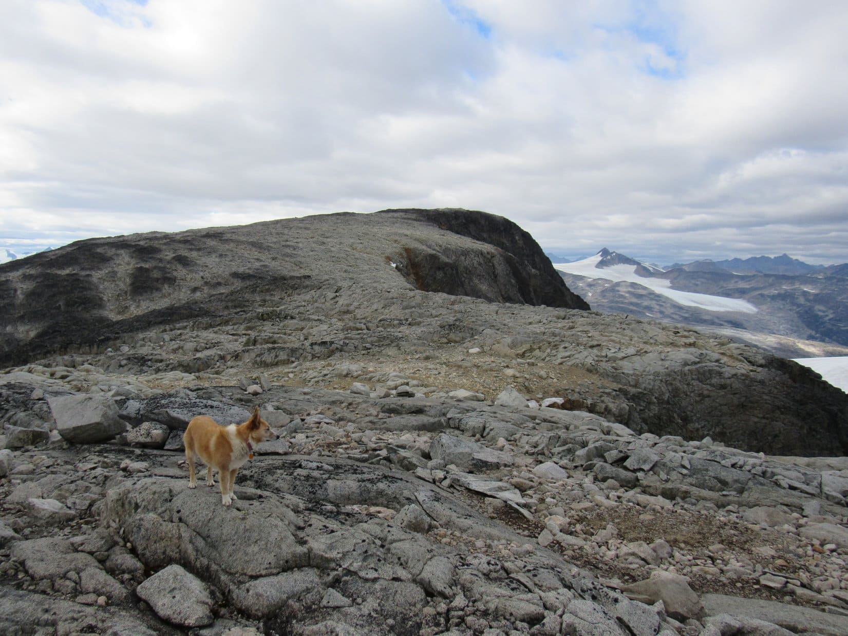
9-12-18, 9:07 AM, International Falls trailhead, South Klondike Highway – The Most High Exalted Dingo of the Arctic Sisterhood had been so lucky yesterday!  She’d finally made it to Peak 6053 on a cool, cloudy day.  Most fortunately, the clouds had been high enough not to interfere with any of the incredible views.  Different story this morning.  100% overcast, low ceiling, all the mountains in fog.

Didn’t matter now.  Peak 6053 had been the last grand hurrah of this Dingo Vacation.  SPHP’s feet were too sore to do anything today, even if the weather had been perfect.  The Carolina Dog wasn’t actually a ball of fire, either.  She seemed perfectly content resting on her pile of blankets and pillows gazing out the windows of the G6.

Lupe’s grand summer of 2018 was ending.  Time to head home.  Less than 1 km from the Alaska border, SPHP turned the key.  The G6 sprang to life.  2,300+ miles to go!  Mountain climbing was done.  Any further adventures along the way were going to be quick and easy.  At this point, that was perfectly fine with both Loop and SPHP.  A long, relaxing drive sounded delightful!

9:45 AM – Canadian customs was only 7.5 miles N on the South Klondike Highway from where Lupe had spent the night.  A short wait in line, and Lupe breezed through.  The long drive began in earnest.  Even from the road, the scenery was gorgeous.  Big mountains, huge lakes, forests, rivers, for mile after mile.

At Carcross, SPHP turned NE on Tagish Road (Highway 8).  It started to rain.  Still weary, the Carolina Dog passed out, snoozing peacefully to the rhythmic slapping of the windshield wipers.  From Jake’s Corner, the rest of the morning and all afternoon were spent cruising E on the Alaska Highway across the southern Yukon.  Lupe did get out for a short break from the G6 at Teslin Lake.  By then, the rain and clouds were long gone.

Miss Sleepyhead revives long enough for a quick sniff along Teslin Lake.
Fake wildlife at a campground next to the gas station in Teslin. No, wait! The American Dingo is real!

Highlights of the day didn’t occur for Lupe or SPHP until the Yukon had been left behind for good.  E of Watson Lake in British Columbia, wide swaths of forest were clear cut along both sides of the Alaska Highway.  Bison roamed wild on the open ground.  That snapped the Carolina Dog to attention!  Lupe saw 7 bison in all, each of them loners.  Naturally, each bison was cause for a hysterical foaming-at-the-mouth barkfest as the G6 raced on by.  What could be more fun?

SPHP’s big moment came at Liard River Hot Springs.  While Lupe waited in the G6, lucky SPHP got to soak in the beautiful outdoor pools.  Warm and clean again for the first time in forever felt heavenly!  Even SPHP’s sore feet were more or less cured by the soothing experience.

Out for a quick romp with a view of the Liard River.

Light was fading by the time SPHP returned from the hot springs.  Only 6 miles after crossing the Liard River, it was time to stop for the night.  The sky was completely clear, and the night promised to be a cold one.  The big show didn’t start until 10:45 PM.  For an hour, the Northern Lights entertained in a true dancing with the stars.

9-13-18, 5:23 AM, 23°F – Ice in Lupe’s water bowl!  After a quick foray out to sniff the chilly air, the Carolina Dog was on her way.  Still pretty dark.  Upon entering Muncho Lake Provincial Park, Looper became excited, barking and whimpering at something she either sniffed or saw out there that SPHP couldn’t detect yet.  More bison?  Maybe.

6:17 AM, 25°F – Muncho Lake is always worth a stop!  The park here has some beautiful peaks, but is so wild and remote that SPHP has never been able to find any information on whether any trails exist providing access to them.  Some fine day Lupe is going to climb a mountain in Muncho Lake Provincial Park!  That great peak at the S end of the lake would be ideal.

By Muncho Lake.
Impressive peaks in Muncho Lake Provincial Park.

The next stop came at a pullout after crossing the bridge over the Racing River.  18°F!  Despite the chilly air, Lupe was totally enthused!  This was a favorite place.  A short dirt road goes through a stretch of forest here where she often finds squirrels on the way to the river.

This morning the Racing River was the lowest Lupe had ever seen it, but still that fabulous icy blue color!

The Racing River between Muncho Lake and Stone Mountain Provincial Parks.

While driving over the bridge, SPHP had noticed some white mountains upstream that looked interesting.  After Lupe’s woodsy stroll to the river, SPHP drove back to the bridge for another look.  Upstream, a pickup truck was in sight parked near some trees.  Must be a road over there!

7:52 AM – Continuing across the bridge, sure enough, there was a side road.  SPHP pulled off the highway, parked again, and the lucky Carolina Dog got to go exploring for a second time.  A short trek through another forest brought her to a relatively open area near the Racing River.  The gleaming white mountains, sporting new snow, looked intriguing.

The scene was so beautiful, that Lupe got to extend her sniff upstream for another 10 minutes.  It appeared she could have followed dry parts of the riverbed for miles, getting much closer to the white mountains.  No time for that today, but this area was certainly worth researching for a future trip.

By the Racing River with the intriguing white mountains in sight. Photo looks SW.
Another look with help from the telephoto lens.
The Alaska Highway bridge over the Racing River. Photo looks NE.
Another look downstream from a little farther up the Racing River.
As close to the white mountains as Lupe went. Photo looks SW with lots of help from the telephoto lens.

Exploring along the Racing River had been fun!  Lupe didn’t have long to wait before there was more excitement.  Upon reaching Stone Mountain Provincial Park, she saw 3 caribou, but barked so fanatically from the G6 that the caribou disappeared before SPHP could get a photo.

A quick stop a mile later provided a grand view of Mount Saint George, which Lupe had nearly succeeded in getting to the top of back in 2017.

Mount Saint George (7,402 ft.) (L). Lupe had made it to the middle high point in 2017 before being forced to retreat due to threatening weather. Photo looks SSE.

9:38 AM, 32°F, Summit Lake, Stone Mountain Provincial Park – Must be an inversion up here.  The temperature was clear up to freezing!  SPHP had stopped at Summit Lake, the high point of the Alaska Highway in Stone Mountain Provincial Park, to let Lupe out for another look at Mount Saint George.  Lupe had successfully climbed both Summit Peak  and Mount Saint Paul from here in 2017.

Mount Saint George from Summit Lake. Photo looks SW.

The American Dingo’s busy morning continued on the way out of Stone Mountain Provincial Park.  More caribou, this time right on the highway, were cause for another barking frenzy.

Caribou on the Alaska Highway.
A recent poll shows that 4 out of 5 caribou don’t care to listen to shrill barking frenzies.

The caribou were just a warm-up for what came next.  Lupe just about busted a gut when a black bear appeared.  The black bear didn’t seem to know what to make of all this racket, but did not run off.  The huge bear appeared quite willing to go a round or two with a pip-squeak Dingo, if it dared to leave the safety of the G6.

American Dingoes are incredibly strong, brave, and ferocious!  Lupe would most certainly have torn that foolish bear to shreds, if SPHP hadn’t spared it by refusing to let her out and driving on.  Later in the day, a grizzly bear near Bonnie Creek S of Fort Nelson had sense enough to flee into the woods rather than take a chance that SPHP might relent and let the feisty Dingo prove her point.

Black bear E of Stone Mountain Provincial Park.
Bring it, Dingo!

Approaching Fort St. John, SPHP skipped the R turn onto Highway 29 to Chetwynd and Prince George.  Although this meant no more mountains on this Dingo Vacation, the Carolina Dog was going to get to travel through more than 1,000 miles of territory neither she nor SPHP had ever seen before.

5:00 PM, 32°F, Fort St. John – In a way, a strange day.  Despite clear skies, the temperature peaked at 47°F early in the afternoon.  Already down to freezing again at Fort St. John, and it stayed that way for many miles.

The Alaska Highway was busy from Fort St. John all the way to where it started in Dawson Creek.  The community of Taylor where the highway crossed the Peace River made a good impression.  A big oil refinery was there, but the whole town was impeccably neat and clean, and the Peace River setting was beautiful.

S of Taylor on the way to Dawson Creek, SPHP was surprised to find the seemingly endless northern forests greatly reduced already.  About half of the land had been cleared.  Hay seemed to be the big crop, although little livestock was seen from the road.  Lupe was thrilled to see a few cows and horses, though, and the G6 became a sporadically noisy place.  Her enthusiasm sometimes extended to huge rolled hay bales, too.

E of Dawson Creek on Hwy 49, the road straightened.  Lupe was now in Alberta.  Remaining woodlands became scarcer, and traffic dwindled.  SPHP drove under a cloud bank as the sun sank in the rear view mirror.  Light began to fade quickly.  Although the land was quite flat, it did slope gradually lower to the N.  Lupe could see a long way in that direction, all the way to the northern forest.

Many fields had snow in them.  In the dim light beneath the gray clouds, it looked and felt like November.  After passing Spirit Lake and Rycroft, SPHP parked for the night before getting to Wanham.  Happy to escape the G6 again, Lupe rolled in snow in the ditch to cool off.

9-14-18, 3:10 AM, 35°F, Hwy 49 – At least it hadn’t gotten any colder out.  3°F warmer, in fact.  SPHP walked along the dark highway, while Lupe sniffed near the ditch.  No stars.  Dead calm.  No traffic.  A coyote howled, and a dog at a farmhouse 0.5 mile N started barking.

7:08 AM, 32°F, Hwy 49 – Back to freezing again.  Another quick sniff outside, then on to the vast metropolis of Wanham!  The edge of the cloud Lupe was under was only a little way N, but it was soon left behind.

Morning along Highway 49 W of Wanham, Alberta.

S of Donnelly, SPHP continued straight at an intersection where Hwy 49 became Hwy 2.  A lovely drive through a mix of farms and woodlands ensued.  The woods began to dominate again.  Driving through forests with snow on the ground, it felt like Christmas was coming.

Highway 2.

10:15 AM, 35°F, Canyon Creek harbor, Lesser Slave Lake – Eventually Hwy 2 had taken Lupe E through the forests S of Lesser Slave Lake.  The big lake was the most interesting natural feature on the map between the mountains and home, so the Carolina Dog simply had to stop for a look.  Waves lapped gently along the shoreline.  The day was gray and calm, peaceful except for the raucous activity of seagulls.

Clearly, a boat was needed to make even a cursory exploration of Lesser Slave Lake, but it was fun to stroll along the shore for a little bit.

Lesser Slave Lake.
Low hills were over toward the E end of the lake. Only a small fraction of Lesser Slave Lake is in view here.
Seagulls provided what excitement and activity there was at Lesser Slave Lake on this cool, gray day.
Looking toward the N shore.

1:23 PM, 39°F, Athabasca – Some sort of big event was just breaking up in a park at the busy little town of Athabasca when Lupe arrived.  The park was right next to the Athabasca river, which Lupe had only seen before in Jasper National Park.  The river was much tamer here than at mighty Athabasca Falls, but Loop still enjoyed sniffing around down on the partially exposed riverbed.

Christmas was in the air on the way to the town of Athabasca!
Along the Athabasca River in Athabasca, Alberta.

From Athabasca, SPHP drove E on Hwy 55, then S on Hwys 63 and 831.  On the road S, the woodlands gave way for a final time to fields and farms of the great northern prairies.

3:36 PM, 39°F, Lamont – Lupe didn’t escape the G6 again until reaching the town of Lamont.  SPHP let her check out the Ukrainian Catholic Church of St. John the Baptist, which featured distinctive architecture.

Ukrainian Catholic Church of St. John the Baptist, Lamont, Alberta.
Churches aren’t usually part of Lupe’s adventures, but this one was quite striking!

At Mundare, Lupe reached 4 lane Hwy 16.  Except where there were cows or horses to bark at, the drive E over gently rolling prairies put her to sleep.  Near Lloydminster, Lupe and SPHP entered Saskatchewan for the first time ever.  The scenery didn’t change, though, and the long drive continued.

7:11 PM, 41°F – As evening came on, SPHP left Hwy 16 looking for a rest area, but didn’t find it.  Lupe’s first outing in Saskatchewan was a walk along a dirt road through a wheat field to see an oil tank.

Visiting Saskatchewan for the first time ever!

The sun set before the American Dingo reached Battleford.  SPHP doesn’t ordinarily like to drive in the dark, but it didn’t seem like Loopster was going to miss much except more prairie, so tonight was an exception.  No longer sleepy, she stayed awake anyway, keeping SPHP company as miles rolled by.  Saskatoon was big and confusing in the dark, but by midnight, Lupe was far beyond it, S of Chamberlain along another Hwy 2.

756 miles today, and that was enough.

9-15-18, 9:13 AM – The morning was cool, overcast, almost foggy.  SPHP parked the G6 at a rest area along the E side of Hwy 6 in S Saskatchewan about an hour N of the Montana border.  The rest area was a triangular 30 acre tract surrounded by wheat farms.  Picnic tables were arranged around a circular drive, with the rest of the 30 acres given over to tall grass and shelter belt trees.

No one else around.  Hardly any traffic.  This rest area was a beautiful little refuge on the quiet prairie, and Lupe’s last adventure of her 2018 Dingo Vacation to the Yukon, Northwest Territories & Alaska.  For two happy hours, she roamed with SPHP through the tall grass and shelter belt woods exploring every nook and cranny, chased tennis balls SPHP threw for her, and sniffed along while SPHP picked up trash.

Happy times at the rest area along Hwy 6 in Saskatchewan.

The rest of the day was devoted to one more long drive.  During the noon hour, Lupe crossed the border into Montana at Regway on the way to Plentywood.  S of Baker, SPHP finally drove out from under the cloud the Carolina Dog had been under since Dawson Creek back at the start of the Alaska Highway.

5:59 PM, 71°F –  The sun was shining at Medicine Rocks State Park.  The air was breezy, and had soared to room temperature.  A quick stop, then Lupe continued S, enjoying a ride with the windows partly open.  This was all eastern Montana ranch land.  Opportunities to bark at cows and horses came one after another!  Toward dusk, SPHP had to slow way down due to all the herds of deer.

At Medicine Rocks State Park in eastern Montana.

The sun set for the last time on her last summer of 2018 Dingo Vacation while Lupe was still in SE Montana on Hwy 323 N of Alzada.

On Hwy 323 as the sun sets in SE Montana.
Lupe’s grand summer of 2018 fades into history.

9-15-18, 9:45 PM – 43 days, 9,691 miles, and countless adventures come and gone.  Home again.  SPHP unlocked the front door.  Home was dark, stuffy, warm.  Sigh.  Back to the old routine.  Time to air things out, and start unloading the G6.

Felt strange to be here.

Oh, for a time machine!  Tomorrow a bright summer morning would dawn, and the Most High Exalted Dingo of the Arctic Sisterhood would be heading N on the long road to adventure.  Tuktoyaktuk, Land of the Pingos, and the Arctic Ocean in her future once again!

At the Arctic Ocean, Tuktoyaktuk, Northwest Territories, Canada 8-19-18

Links:

                 Next Dingo Vacation                      Prior Adventure

              This Dingo Vacation                             Prior Dingo Vacation

Want more Lupe adventures?  Choose from Lupe’s 2018 Dingo Vacation to the Yukon, Northwest Territories & Alaska Adventure IndexDingo Vacations Adventure Index or Master Adventure Index.  Or subscribe free to new Lupe adventures.

On & Off the International Falls Trail to Peak 6053, British Columbia, Canada (9-11-18)

Day 39 of Lupe’s 2018 Dingo Vacation to the Yukon, Northwest Territories & Alaska!

6:30 AM, Nares Mountain trailhead, Blattas Point Road – Nooooo!  Late last night, silver stars had shone overhead as the tired American Dingo settled in for a long snooze.  The sky had been 80 to 90% clear!  Hopes had been high for Peak 6053 this morning, but that was then.  Lupe had just woken up to a dreary uniformly overcast day.  SPHP was dismayed.  Loopster’s final chance for an ascent of Peak 6053 on this Dingo Vacation appeared doomed.

At least it wasn’t raining.  Maybe the situation would improve in the next hour or two?  Seemed unlikely, and certainly no sense sticking around if Peak 6053 simply wasn’t going to happen, but Loop could wait a little while before hitting the road home.  While SPHP straightened out the G6 and made breakfast, the Carolina Dog explored a nearby grove of trees.

8:00 AM – Hmm.  The clouds seemed higher and thinner than before.  Didn’t look like rain was likely at all.  Provided the mountains remained beneath the cloud cover, an attempt on Peak 6053 was actually worth considering!  Even if the sun never came out, Lupe might still enjoy some incredible views.  Now or never!  Lupe and SPHP piled into the G6.

Hopes soared during the drive S from Carcross on the South Klondike Highway.  Expecting darker skies closer to the Alaskan coast, conditions were improving instead!  Far from a perfect day, but the cloud cover was getting higher, lighter, brighter, and even tinged with blue!

9:41 AM, 41°F – Upon arriving at the International Falls trailhead just N of the Alaska border near White Pass, even the highest regions of what could be seen of Peak 6053 were out in the open.  That settled it!  Lupe was going give it a shot!

SE slopes of Peak 6053 from the International Falls trailhead. Photo looks NW.

The International Falls trail starts out with a short descent to Captain William Moore Creek.  The last part of this descent being nearly vertical, SPHP was glad to find 4 ropes in place to help prevent a fall.  Lupe had first taken the International Falls trail a year ago.  Back then, there had been only 1 rope.  4 was better!  Not that Lupe needed any help.  As usual, the American Dingo managed to get down all on her own.

At the bottom of the short, steep descent at the start of the International Falls trail. Photo looks NNE.

This late in the season, Captain William Moore Creek was very low, an easy rock hop for SPHP.  Loopster easily waded across.  Beyond a delta created by a tributary coming in from the W, the International Falls trail started up a slope full of bushes and stunted conifers.  After gaining 200 feet, the trail continued higher along the N side of the tributary taking Lupe past a series of waterfalls.

The waterfalls weren’t as impressive as they had been in early August, 2017.  The volume of flow had been much greater then, but they were still charming.

Captain William Moore Creek was an easy rock hop this time of year. Photo looks SW.
One of many waterfalls along the International Falls trail. Photo looks SW.

The trail kept climbing at a moderate pace.  Somewhere along the way, Lupe left British Columbia and crossed into Alaska, but exactly where wasn’t clear.  The border was unmarked.

Continuing up the slope, probably in Alaska by now. Photo looks NW.
None of the waterfalls were terribly high, but Lupe went by lots of them.
Approaching the tallest waterfalls. Photo looks NW.
This is it! The biggest waterfall along the International Falls trail! Photo looks W.

Just above the tallest of the waterfalls along the International Falls trail, the stream flowed over a wide area of exposed bedrock.  The water was so spread out, it was only inches deep, if that.

Above the biggest waterfall. Photo looks WSW.

The trail went on and on.  Lupe kept coming to more waterfalls, but the steepness of the slope she was climbing was diminishing.  The waterfalls were becoming smaller, and eventually deteriorated into mere rapids.

Looking back after getting beyond the biggest waterfalls. The South Klondike Highway where Lupe had started out from is in sight. Photo looks SE.
Smaller waterfalls ahead. Photo looks WNW.

Loop stayed on the International Falls trail until the terrain leveled out so much that the South Klondike Highway could no longer be seen back to the SE.  Ahead, the trail continued on to the NW, still following the stream and gradually gaining elevation.

Lupe had seen what was up there a year ago.  The trail would eventually disappear in a region of beautiful little lakes and small rocky ridges all down in a vast saddle between Feather Peak (5,889 ft.) and other high ground to the S, and Peak 6053 to the N.  At the far NW end, a gigantic boulder sat atop a final ridge.  Beyond it, the land sloped steeply away into the seemingly bottomless Taiya River canyon, where the famed Chilkoot Trail lay hidden below.

And beyond that?  An inaccessible vast wilderness of seldom seen, much less explored, mostly nameless glacier-clad Alaskan peaks.

Yes!  More than a year ago, Lupe had journeyed to that magical region of sparkling ponds and spectacular views on a sunny day of soft breezes.

As enticing as that magical place was, it wasn’t her destination today.  Lupe was leaving the International Falls trail here to climb Peak 6053, where, if successful, she would see those same incredible views from a lofty summit 2,000 feet higher than where she’d been before.

Peak 6053 from close to where Lupe left the International Falls trail. Photo looks NNW.
Zoomed in on some of the territory Lupe was going to be exploring. Photo looks NNW.
If you ever come to the International Falls trail and don’t feel like climbing mountains, just keep going this way to the magical land of sparkling ponds and spectacular views! Photo looks NW.
A final look back to the SE before leaving the International Falls trail.

Leaving the International Falls trail behind, Lupe began a long, easy trek NNW toward Peak 6053.  Wandering a boulder-strewn plain of spongy tundra, the American Dingo gained elevation steadily.  Upon reaching the SE end of the mountain, she came to a tiny rock-filled creek.

On the way across the boulder-strewn plain. Photo looks NNW.
At the tiny creek at the SE end of the mountain. Photo looks N.

Crossing the stream, Looper started climbing NNW much more steeply toward a big ravine coming down from the W.  Following narrow ramps and benches, Lupe gained a fair amount of elevation rather quickly.  She was already getting to some worthwhile views!  Feather Peak (5,889 ft.) in particular was looking awesome!

Feather Peak (L) and Mount Cleveland (6,362 ft.) (R). Photo looks S.
Feather Peak (Center) and Mount Cleveland (far R). Photo looks SSW.
Looking back. The South Klondike Highway is on the L. The broad valley the International Falls trail follows goes from the highway all the way to the R and well beyond. Photo looks SE.

Upon reaching the S side of the big ravine, Lupe could see a steep, rocky gully entering the ravine from the N.  High above and beyond this gully was a line of dark cliffs.  Near the upper end of the gully was a lower line of cliffs, but it looked like there were ramps leading up through breaks in this cliff wall.  Once above the lower cliffs, Loop ought to at least be able to scramble up to the base of the dark cliffs.

Crossing the ravine, Lupe climbed to the upper end of the gully without difficulty.  Here she turned W looking for an easy way to get above the lower cliffs.  However, this area was rougher than it had seemed from below.  What had appeared to be the best ramp higher, actually ended with a bit of an exposed scramble.

At the upper end of the gully after crossing the big ravine. Photo looks N.
Below the lower line of cliffs looking for an easy way up. Photo looks WNW.
Still along the base of the lower cliffs. Lupe went up to the R from here. Feather Peak (L) and Mount Cleveland (Center). Photo looks SW.

SPHP hates exposure!  After all, should a mishap occur, it takes very little exposure to kill or seriously injure, which might easily amount to the same thing way out here.  However, the exposed section appeared to be very short, and Lupe had no better prospect in sight.  Didn’t look that bad, so up she went.

The Carolina Dog showed off, easily scrambling above the tricky spot.  A couple of cautious moments later, SPHP joined her up on the brink.

Above the short exposed climb. Photo looks SW.

Excellent news!  No more exposure to deal with!  Breaks existed in the line of dark cliffs that still loomed considerably higher along the upper rim of a steep rocky slope.  Lupe had no problem scrambling clear to the top.  Above the dark cliffs, a rumpled flat area provided access to a somewhat easier climb NW up another slope.  Exploring ever higher, Lupe managed to get up to where this slope began to level out.

By now the American Dingo had gained a great deal of elevation!  Lupe had reached a world of rock, sky, and little else.  Lichens and sparse clumps of tundra were the only vegetation.  Magnificent views were on display!  Lupe could see much of the Tormented Valley to the NE and E, and fabulous mountains to the SE and S.  However, incredible snow and ice-draped peaks beyond the Taiya River canyon to the SW caught the eye more than any other scene.

In the rumpled area atop the dark cliffs. Photo looks NE.
Heading higher yet! Photo looks NW.
Looking W upon reaching more level territory after a big climb.
Same view with more help from the telephoto lens.
Jagged peaks to the SW with lots of help from the telephoto lens.

To the NW, Lupe could now see an enormous rocky slope rising toward Peak 6053’s massive main ridge.  Getting to this upper ridge proved more complicated than it looked.  A series of gashes running SW/NE sliced across this region perpendicular to the direction Loopster needed to go.  Exploring this rugged area was fun, but time-consuming.  The Carolina Dog often came to small cliffs, and had to go back and forth looking for ways into and out of the gashes.

Two steps up, one step down!  Lupe and SPHP repeatedly gained and lost the same elevation during a long, winding ascent.

An enormous rocky slope leads up to Peak 6053’s massive main ridge. Photo looks NW.
On rugged terrain. Photo looks WSW.
Looking down one of the gashes. Mount Cleveland on the L. Photo looks SW.
Crossing the same gash.
Searching for a way down into one of the deepest gashes. Photo looks NE.
At the bottom. Photo looks SW.

Finally nearing the E end of Peak 6053’s massive upper ridge, Lupe came to another sizable gash.  On the far side was a wall of white rock.  Loop crossed the gash, and found a way up onto it.

From a distance, more gashes had been evident up on the main ridge, so SPHP had been thinking maybe Lupe ought to skirt along the S side to get closer to the W end before climbing to the top.  That way Loop would gain the upper ridge much closer to the true summit of Peak 6053, which the topo map showed at the far NW end of the mountain.

However, from the wall of white rock, it was clear that this notion was totally impractical.  The terrain S of the main ridge was simply too steep and rough.  Loop’s only realistic option appeared to be to climb straight to the top of the E end of the main ridge, and take her chances from there.  A gully of light-colored rock looked like a possible route up.

Getting close to Peak 6053’s main ridge, Lupe comes to the gash with a wall of white rock on the opposite side. Photo looks NW.
Up on a darker part of the next little ridge connected to the wall of white rock after crossing the gash. Photo looks SW.
The E end of Peak 6053’s massive main ridge. Looked like Lupe could get up there via the light colored gully on the R. Photo looks N.

Staying on top of the wall of white rock, Lupe headed NNE toward the promising gully.  The wall ended near a snowbank next to a big pool of meltwater.  Loop had to down climb and work her way past these minor obstacles before scrambling up the gully.

At the NNE end of the wall of white rock. Lupe had to get past the snow bank and its meltwater before climbing straight up the gully on the L. Photo looks NNE.

At the top of the gully, Lupe found herself in a fairly flat area an acre or two in size.  Venturing N brought her to the edge of towering cliffs.  For the first time, Lupe could see the gigantic canyon between Peak 6053 and Taiya Peak (6,844 ft.) to the N.  She now also had a view to the NW.

Looking NW from the E end of Peak 6053.
Similar view with more help from the telephoto lens.

A tall dark rock outcropping sat at the NE end of the flattish area.  Lupe went over and climbed it.  Views of the Tormented Valley from here were fantastic!  Loop could again see the International Falls trailhead she had started out from way down at the South Klondike Highway.

The Tormented Valley from a high point at the E end of Peak 6053. Summit Lake is on the R. Bernard and Shallow lakes are farther away L of Center. Photo looks NE.
Looking back toward the International Falls trailhead (just about dead Center) along the South Klondike Highway. Photo looks SE.

One view in particular from here was of paramount importance.  For the first time, Lupe could see along the length of the N side of Peak 6053’s main ridge.  The mountain’s true summit was clear over at the far NW end completely opposite of where the American Dingo was now.

The view was worrying.  Felt like Lupe had already been climbing for a long time.  Peak 6053’s summit was a little less than 500 feet higher than where she was now, but it still looked far away.  Much closer, a big fin of rock jutted skyward.  Would Loop be able to get past it?  A deep gash might easily be on the other side.

Looking along the length of the N side of Peak 6053’s massive main ridge. The summit still looked far away, and SPHP was concerned about whether Lupe would be able to get beyond the big fin of rock on the L. Photo looks WNW.
Similar view from the NE high point. Photo looks WNW.

No choice, but to head over there and find out.  The terrain leading to the fin was rocky and sloped higher, but not difficult.  The N end of the fin was close to the gigantic cliffs, and trying to go over the top seemed a poor choice too.  However, going around the S end looked quite feasible.  The big question was what Lupe would find on the other side?

Another look NW before heading for the fin.
Looking back down at the way Lupe had made it up to the E end of Peak 6053’s main ridge. The snow bank she had passed before coming up the steep gully is seen below on the L. Photo looks SW.

Lupe got quite high on the S end of the big fin.  Going this way was a cinch!  Nothing to it!  Best of all was the view Loopster had once she got to where she could see the area W of the fin.  No big gashes or drop offs!  In fact, once beyond the fin, it didn’t look like a fin at all from the W.

The Carolina Dog now made rapid progress journeying WNW along the broad main ridge.  She crossed a series of gashes, but none presented any real difficulties.  Lupe actually lost elevation approaching a final big drainage that sloped down toward the SW.  Staying toward the N edge near the cliffs, Lupe had little difficulty getting past it.

WNW of the fin approaching the last big drainage. Lupe stayed to the N (R) near the cliffs to get past it. Photo looks NW.
Taiya Peak (6,844 ft.) (R) from the N edge. Photo looks NNE.
Near the last big drainage. Photo looks NW.
Looking NE toward the Tormented Valley with help from the telephoto lens. Part of Summit Lake on the R. Bernard and Shallow lakes on the L.

Beyond the last big drainage, Lupe roamed freely heading NW on a broad slope.  A maze of benches and ramps led higher and higher.  This climb wasn’t hard at all; no more going down into gullies!  Loop was having fun, and SPHP was joyful knowing that the summit couldn’t be much farther.  Lupe was actually going to get to the top of Peak 6053!

The terrain finally leveled out in a rough area.  What?  Oh, no!  This wasn’t the top!  Quite close by, the highest point on the mountain was clearly visible a short distance off to the N.  Definitely higher, though not by much, than where Lupe was now, the true summit of Peak 6053 sat isolated beyond one more good-sized drop.  Whether the Carolina Dog could get over there or not wasn’t initially clear, but the situation didn’t look good.  Gah!  All this way, only to fail!

Some old wooden boards were toward the SW end of the rough area, part of a collapsed wooden tripod.  SPHP lifted a couple of rocks off a pile beneath the boards to reveal a survey benchmark dated 1936.

Loop by the wreck of a wooden tripod. Photo looks SW.
The survey benchmark hidden beneath rocks under the tripod.

Lovely.  Apparently the surveyor hadn’t thought it possible to get over to the true summit, and had settled for this location instead.  Discouraging!  After replacing the rocks over the benchmark, Lupe and SPHP went over to the edge of the final drop off to take a better look.

30 feet lower, a snow bank rested in a gash shorter than any others Lupe had come to.  Both ends dropped away into fearsome chasms.  At first, it didn’t look like there was any safe way to scramble down.  Loop had to do it, though, if she was ever going to get to the top of Peak 6053.

Overlooking the final short gash preventing Lupe from getting to the true summit of Peak 6053 (Center). Photo looks NNW.

There was a way down!  Looked like Loop ought to be able to get back up it again during the return, too – critically important, if there ever was going to be a return.  A quick, careful scramble, and Lupe was standing on the snow bank!

Success! Safely down on the snow bank in the last gash. Photo looks W.

The snow bank was more like ice than snow.  Staying away from the NE edge where the drop was almost vertical, Lupe crossed only a short icy section before completing her long journey to the top of Peak 6053.  The true summit was a light gray boulder.  The American Dingo hopped up onto it to claim one of her most remarkable peakbagging successes ever.

At the true summit of Peak 6053! The main ridge Lupe had come up is visible on the R. Photo looks ESE.
Taiya Peak (L of Lupe) from the true summit of Peak 6053. Photo looks NE.
Still at the true summit. Mount Cleveland is beyond Lupe.  Mount Carmack (6,808 ft.) is the high point in the distance on the L.  Photo looks SSW.

SPHP praised Lupe highly, but the Carolina Dog didn’t seem impressed.  Looper willingly participated in a few photos of some of the incredible glacier-clad peaks in Alaska to the W, but after that she just wanted to rest.  Using a jacket and a pullover, SPHP made a little bed where she could doze more comfortably on the rocky ground.

Looking W into Alaska. The summit of Peak 6053 is barely inside British Columbia.
View to the NW.
Lupe had been politely begging SPHP to stop for hours. Several short breaks had been taken, but this was her first real chance to snooze a bit. Photo looks SW.
Lupe’s 4th day of big climbs in a row, and it had taken 7 hours to get here.

While Lupe rested, SPHP gazed at the unbelievably beautiful remote peaks toward the W.

Looking SW with help from the telephoto lens.
The high point toward the L at the upper end of the glaciers in the foreground may be Mount Hoffman (6,079 ft.). The even higher mountain beyond it may be the Skagway High Point (8,239 ft.). Photo looks W.
The telephoto lens revealed an incredible world of spectacular peaks so inaccessible few have names.

Peak 6053’s summit area was about 40 feet wide E/W and 70 feet long N/S.  A similar sized area about 20 feet lower extended farther N.  So there was plenty of room to move around.  At the N end of the summit area, 35 feet from the boulder Lupe had been on, a less conspicuous rock looked equally high.  Might even be a tad bit higher?  SPHP went over to check it out, came to no definite conclusion, then ventured down to the lower region to the N where it was possible to look down on a glacier.

As tired as Lupe was, she wasn’t completely out of it.  Fearing she was being left behind, Loop came looking for SPHP.  Weary or not, the loyal American Dingo stuck closely to SPHP from then on.

On the rock at the N end that was in competition for title of true summit of Peak 6053. Taiya Peak beyond Lupe. Photo looks NE.
Still on the N high point. Photo looks S.
Looking down on the glacier. Photo looks N.
Upper end of the glacier and Taiya Peak (R). Photo looks NNE.
Looking over the Taiya River canyon and the glacier’s toe. Photo looks NW.
Nearly the whole glacier with a bit of help from the telephoto lens. Photo looks N.

Lupe was so lucky!  Although the sky had remained quite cloudy all day, conditions at the top of Peak 6053 weren’t bad at all.  Cool (low 40’s °F), but calm.  Importantly, the cloud deck was high enough to permit clear views of even the highest and most distant peaks.  Nothing was hidden.  Every now and then, the Carolina Dog stood in glimmers of sunshine.

Getting late.  Should be moving on, but Lupe and SPHP lingered in the splendor of Peak 6053.  Glory at every turn!

Peak 6053’s narrow SW ridge in the foreground. Photo looks SW.
What is that monstrous peak looming on the far horizon? It must have a name! Photo looks SW with maximum help from the telephoto lens.
Mount Carmack (6,808 ft.) (R of Center) looks dramatic through the telephoto lens. Photo looks S.
Way down at the bottom of the Taiya River canyon, the famed Chilkoot Trail from gold rush days passes from Skagway, Alaska to Chilkoot Pass at the Canadian border, then on to Carcross in the Yukon Territory. Photo looks W.
Another look at Peak 6053’s SW ridge. Mount Cleveland (L) with Mount Carmacks (far L) more distant. Photo looks SSW.
Simply no end of stunning peaks and glaciers!

7 hours to get here.  50 unforgettable minutes gone by up at the summit of Peak 6053!  3 hours until sunset.  Sadly, time to go.  Past time, actually.

Not far from the summit boulder, Lupe stood perched by the W edge of the mountain overlooking the unseen depths of the Taiya River canyon.  Beyond the gaping chasm, a fabulous world of pristine peaks cloaked in glacial ice – ancient, creeping ice still locking in the frigid cold of countless dark winters eons ago.

Fleeting last moments at the top of Peak 6053!

Looking into Alaska from the edge of British Columbia atop Peak 6053.
Moment of glory!

The race against time was on!  Back down to the short gash and its icy snow bank.  A careful scramble up to the rough area where the survey marker lay hidden beneath rocks and old boards.  Down the ramps and benches to the big drainage to the SW.

Now, a calculated, crucial gamble.  If it didn’t succeed, Lupe was going to be stuck on Peak 6053 all night.  No way on earth could she get down off the mountain before dark going back the way she had come up.  Lupe and SPHP turned SW heading down the big drainage.  If the American Dingo cliffed out, a very long night was ahead.

Starting down the big drainage near the W end of Peak 6053. Photo looks SSW.

Far, far below, Lupe could see the little lakes of the magical region she had visited beyond the end of the International Falls trail on a beautiful evening more than a year ago.  The lakes weren’t sparkling today, but if she could get down close to them, Loopster ought to be able to find the International Falls trail again before dark.

Down steep ramps and gullies, down rough loose rock, down scrambling around rock formations trying to avoid getting cliffed out.

Getting there, but still a long way to go.
Another chute. The far W end of the International Falls area at the edge of the Taiya River canyon is in sight.

At last, success was certain.  Loop’s gamble was going to pay off!  Once she made it down to where the slope became more gradual, SPHP turned and looked back up.  Lupe hadn’t cliffed out, but it sure looked like she should have.

The Carolina Dog was thrilled to be out of all the rock!  She wasn’t nearly as tired as she’d let on up on Peak 6053.  In fact, Lupe was energized!  She raced across the soft tundra far ahead of SPHP joyfully exploring a land of ridges and little streams, glancing back now and then to make sure SPHP was still coming.

Lupe never did get close to most of those once sparkling little lakes again.  However, in the distance, she did see the huge boulder on the far W ridge that she had visited a year ago.  Instead of going all the way to the lakes, Lupe took a shortcut turning SE as soon as it was practical.  The American Dingo roamed a long way.  She finally stumbled upon the International Falls trail again, as she passed by a couple of little ponds reflecting the last glowing beauty of the dying day.

On the International Falls trail again.
International Falls trail, Alaska.

Peak 6053 was the final and most difficult of 4 climbs on 4 consecutive days.  SPHP’s feet had become sore on the rough terrain even before Lupe had reached the summit.  Although the return trip was the easiest possible route back, it was still a long march.  Hobbling along, each step became more difficult to bear.

Darkness fell.  SPHP sometimes lost the trail.  Loopster usually found it again in just a minute or two.  The roar of the now invisible waterfalls the trail went by went on and on.  At last, it was over.  Across Captain William Moore Creek, and up the ropes.  The G6 sat waiting alone at the dark trailhead.  (10:46 PM, 47°F)

So sore!  So weary!  Yet, what a day!  As it turned out, Lupe had likely taken about the longest, hardest route to the top of Peak 6053 possible.  Clearly, the way she had taken back was the fastest, easiest way to go.  What an experience it had been though – the long treks higher on all that rough ground, wandering the wild gashes and gullies, then exploring along the whole massive main ridge.

And at the end of it all, the American Dingo had done what she had set out to do – Lupe had once more gazed over the depths of the enormous Taiya River canyon into a world of ice, snow, and jagged peaks, a world in sight, but forever beyond reach, this time seen from the lofty heights of Peak 6053.

On Peak 6053, British Columbia, Canada 9-11-18

Directions to the International Falls trailhead: The trailhead is a pullout less than a kilometer inside the Canadian border along the W side of the South Klondike Highway.  This pullout is located 7.5 miles (12 km) S of Canadian Customs.  Coming from Skagway, the trailhead is the 2nd pullout on the L shortly after crossing the high point of the highway near White Pass.  A small lake is visible down in the creek valley W of the highway.

There are no facilities or information at the trailhead other than a sign about avalanche dangers.  The trailhead is located between US Customs and Canadian Customs, so it will always be necessary to pass through one or the other on the way back to either Skagway or Carcross.  Remember to bring appropriate documentation!

Links:

Next Adventure                               Prior Adventure

International Falls, Canada to Alaska (8-8-17)

Fraser Peak, British Columbia, Canada (8-9-17)

Want more Lupe adventures?  Choose from Lupe’s 2018 Dingo Vacation to the Yukon, Northwest Territories & Alaska Adventure IndexDingo Vacations Adventure Index or Master Adventure Index.  Or subscribe free to new Lupe adventures.

Nares Mountain, Yukon Territory, Canada (9-10-18)

Day 38 of Lupe’s 2018 Dingo Vacation to the Yukon, Northwest Territories & Alaska!

Found it!  Finally!  No wonder it had taken so long.  A the far S corner of Choutla Subdivision Road, a heavily shaded side road disappeared into the trees.  50 feet after the turn, partially hidden by vegetation, was the sign SPHP had been searching for – Blattas Point Road.

50 feet from the start of Blattas Point Road where the only sign is hidden.

Beyond the elusive sign, Blattas Point Road curved SE (L) and continued in that general direction for a mile or so before ending at a small sandy parking lot.  Two private driveways left this area, one that went straight ahead, and one that went to the R.  SPHP parked the G6.  This was it!  Lupe had arrived at the trailhead for Nares Mountain (5,833 ft.).

The Nares Mountain trailhead at the end of Blattas Point Road. Photo looks SE.

What a fabulous day!  For the first time on this whole Dingo Vacation, not a cloud in the sky.  Incredible!  Should have gotten here hours ago, but after Lupe’s tremendous day on Grey Mountain (4.901 ft.) near Whitehorse yesterday, SPHP had slept a little too well.  An oil change for the G6, a few other errands, and the drive to Carcross had chewed up more time.  Not to mention the maddening search for Blattas Point Road despite what had seemed to be perfectly clear directions.

The American Dingo was here now, though!  A quick bite to eat, then Loopster and SPHP set off on an unmarked trail across from, and a bit beyond, the trailhead.  (11:31 AM, 51°F)

View from the trailhead. Nares Mountain can be climbed along either of the 2 ridges seen beyond Lupe. The ridge on the L is supposed to be easier, and was the way Lupe intended to take. Photo looks NE.

The trail started off passing through stands of aspens that had already lost most of their leaves.  Lupe was soon past the trees out on open ground.  She hadn’t gained much elevation yet, but Carcross and the N end of Bennett Lake were already in sight beyond Nares Lake.

The trail starts off in this pleasant stand of aspens.
Nares Mountain is going to be fabulous! We’ve barely gotten started and look at what we can see! That’s Nares Lake on the L. Carcross is that flat strip of land beyond me separating Nares Lake from Bennett Lake. Photo looks W.

The trail initially climbed NE at an easy to moderate pace.  However, it soon became steep, and stayed that way.  Tight switchbacks helped to slightly reduce the rate of climb.  Most of the time Lupe was out on open terrain, but she came to short stretches of forest, too.  The Carolina Dog liked the woods best of all, but the views from the open ground became steadily more impressive as she rapidly gained elevation.

Gotta love prowling through this!
A better look at Carcross between Nares Lake (near) and Bennett Lake (far). Mount Gray (6,083 ft.) (Center) is the peak beyond Carcross. Photo looks WSW.
Heading higher. Photo looks NE.

Two big ridges separated by a deep drainage lead up to the S summit of Nares Mountain from the W.  The ridge farthest N was supposed to be the easiest route.  The S ridge was closer to Nares Lake, but rougher and much more heavily forested.

Fortunately, the trail Lupe was on was clearly heading for the easier N ridge.  When she got high enough, the Carolina Dog had a good view looking up the drainage separating the two ridges.

The drainage between the two W ridges. Lupe stayed to the N (L). Photo looks E.
Glancing back. The trailhead (Center) is close to Nares Lake on this side of the line of light green trees. Photo looks SW.

The steep climb went on and on.  The views kept improving.  The trail curved gradually E, and Lupe began to see more of the long W ridge she was climbing.  She could now see where the two W ridges joined at the upper end of the drainage between them.

Don’t tell me you’re tired already! It’s still a long way! We are making progress, though. That’s a decent view of the S ridge beyond me. We’re staying to the N (L), though, remember? Photo looks ESE.
Mount Gray (6,083 ft.) again. From this height, more of Bennett Lake is visible beyond Carcross. Photo looks WSW.
In another forest.
Here’s a good view of the two W ridges! Once we get up to where they join, it won’t be too much farther to the S summit of Nares Mountain. Photo looks ESE.
This yellow woods is gorgeous, isn’t it? It’s about the last forest we will be coming to, though.
Looking back at the lakes after passing through the yellow woods. Photo looks WSW.

Loopster had already made tons of progress up the big ridge, when she finally got high enough to see several rounded high points off to the NE.  The big ridge she was climbing was taking her to the S summit of Nares Mountain, but the true summit was actually one of those rounded high points.  SPHP wasn’t certain which one was it, yet, but if the American Dingo had enough time, she was going to visit the true summit, too.

Rounded high points come into view. It eventually turned out that the high point on the R is actually the true summit of Nares Mountain. Photo looks NE.

As Lupe approached the upper end of the drainage between the two W ridges, the slope of the ridge she was on gradually diminished.  Getting easier!  Still a long climb, but with a perfect day, the Carolina Dog was certainly going to make it at least as far as Nares Mountain’s S summit.  The views were already awesome, and Looper ought to be able to see a lot more from up there.

Come on! We’re getting closer to the upper end of the drainage! Photo looks ESE.
High enough to see lots more of Bennett Lake. Photo looks SW.
Montana Mountain (7,233 ft.) (L), and Brute Mountain (7,000 ft.) (R). Photo looks SW.
Hey, look! A big flat spot! This is getting easier. That’s the true summit of Nares Mountain behind me and slightly to the R. Photo looks NNE.
Above tree line. Photo looks ESE.

Once Lupe made it beyond the upper end of the drainage between the 2 W ridges, the terrain flattened to a gentle slope.  Across a grassy plain, one more rise was in sight off to the SE, a rock-strewn ridge certainly no more than another 100 feet higher.  This ridge was an easy climb, and proved to be the S summit of Nares Mountain.

Approaching the S summit of Nares Mountain. Photo looks SE.

From a cairn at the high point, Lupe had some fantastic views.  The true summit of Nares Mountain was in sight 2.5 km NNE.  However, by far the most eye-catching scenes were of the big lakes to the E, S, and W, and of Montana Mountain (7,233 ft.) and Brute Mountain (7,000 ft.) to the SW.

Looper reaches the S summit of Nares Mountain. The true summit is on the R, still 2.5 km away. Photo looks NNE.
Bennett Lake, which the famed Chilkoot trail goes by, winds away into the mountains. Lupe was too far from the edge of Nares Mountain to see Carcross from the cairn at the S summit. Photo looks WSW.
Montana Mountain (L) and Brute Mountain (R) from Nares Mountain S summit. Photo looks SW.
Montana Mountain (Center) with help from the telephoto lens. The high point on the R may be Mount Matheson. Photo looks SSW.
Brute Mountain with help from the telephoto lens. Photo looks SW.

Lupe had gained 3,300 feet of elevation.  The American Dingo was ready for a break.  With temperatures in the upper 40’s °F, the NW breeze felt chilly.  SPHP wrapped Loop in a pullover, and she took a short nap.

Napping at the S summit. Montana Mountain on the R. Photo looks SSE.
Caribou Mountain (6,400 ft.) (Center). Mount Lorne (6,629 ft.), which Lupe had seen yesterday from Grey Mountain, is in the distance on the R. Photo looks NNW.

Two somewhat lower high points on Nares Mountain were visible along ridges extending SE and SW from the S summit.  Since these points were considerably closer to where the S face of Nares Mountain drops off steeply, presumably Lupe would be able to see much more of Nares and Tagish Lakes, if she went down to them.

When Loop was done with her rest break, she did go closer to each of these high points, although not close enough to get to the best possible views.  Worried about Lupe’s late start, SPHP was becoming anxious to head on to the true summit of Nares Mountain instead.

Tagish Lake from SE of Nares Mountain’s S summit. Lime Mountain is beyond Lupe on the other side of the lake. Photo looks ESE.
Tagish Lake and Lime Mountain (5,222 ft.) (R of Center). Photo looks ESE with help from the telephoto lens.
About as far down the SE ridge (L) as Lupe went. Presumably the lake views would have been even more spectacular had she gone all the way down to the high point on the L. Part of the Windy Arm of Tagish Lake is in sight. Photo looks SE.
Mount Armstrong (4,915 ft.) is the small mountain seen in the distance through the gap on the R. Photo looks SE with help from the telephoto lens.
Carcross is the peninsula of land between Nares Lake (near side) and Bennett Lake (far side). Photo looks WSW.
As close to the high point on the SW ridge as Lupe went. Montana Mountain (L) and Brute Mountain (R) in the distance. Photo looks SW.

After quick, sub-optimal forays to the SE and SW, Lupe returned briefly to the S summit of Nares Mountain.  She then began her trek to the true summit by going NNE down to a flat grassy plain and crossing it.  Upon reaching the N end of the plain, Loop faced a 600 foot descent into the broad saddle leading to the true summit of Nares Mountain.

Back at the S summit again ready to head for the true summit of Nares Mountain (Center). Photo looks NNE.
Crossing the grassy plain. Photo looks NNE.
Descending into the saddle leading to the true summit (L). Photo looks NNE.

The descent from the grassy plain down to the saddle was moderately steep and fairly rocky, but totally free of any significant obstacles.  Lupe made it down to the saddle just fine, crossed it, and began climbing again.  She skirted along the W side of the next big hill immediately S of the true summit.  Goat paths helped make this traverse easier.

The Carolina Dog aimed for the saddle N of the hill she was on that led directly to the true summit.  Once she made it to this upper saddle, all that was left was a 400 foot climb up the S face of Nares Mountain.  No obstacles and nothing tricky to contend with.  Lupe charged right on up the slope.

An hour and 20 minutes after leaving the S summit, Lupe reached the top of a 0.5 acre plateau.  At the far N end, a cairn with a post marked the location of the true summit of Nares Mountain (5,833 ft.).

Crossing the lower saddle. True summit on the L. Photo looks NNE.
Traversing the hillside leading to an upper saddle. Photo looks NNE.
Nares Mountain from the upper saddle. Photo looks N.
On the way up the S slope. Photo looks N.
By crimson bushes on the way up Nares. Photo looks NW.
Oh, we’ve done it! Here we are at the top of Nares Mountain! Photo looks NNE.

No longer on the protected S side of the mountain, the American Dingo immediately met with a 25 mph NW wind sweeping over the summit plateau.  Couldn’t have been much more than 40°F, so the wind felt cold as Lupe headed over to the cairn.  SPHP congratulated her on another fabulous peakbagging success as soon as she got there.

At the true summit of Nares Mountain. Tagish Lake and Lime Mountain (5,222 ft.) (R) in view. Photo looks ESE.
Montana Mountain (L) and Brute Mountain (R) from the true summit of Nares Mountain. Photo looks SW.
Caribou Mountain (6,400 ft.) (R) from Nares. Photo looks NW.

Lupe was no fan of the chilly wind, but a discovery soon made her forget all about it.  A marmot lived at the top of Nares Mountain!  Naturally, the Carolina Dog was keenly interested.  However, the marmot had chosen its home wisely.  Ensconced in a collection of dark-colored rocks, the marmot was monarch of a virtually impregnable fortress.  Lupe kept sniffing, circling, and peering into the dark crevasses between the rocks, but to no avail.

Inspecting the marmot fortress. Nares and Bennett lakes in the distance. Photo looks WSW.

SPHP tried to interest Lupe in the amazing views, repeatedly calling her away from the marmot fortress.  The Carolina Dog did come, but as soon as SPHP’s attention was averted to some splendor on the horizon, she tended to slink back to continue searching for some weakness in the marmot’s defenses.

Montana Mountain (L) and Brute Mountain (R) from Nares. The S summit of Nares, which Lupe had just come from, is visible in the foreground a little to the L of Montana Mountain. Photo looks SW.
Tagish Lake and Lime Mountain (R). Photo looks ESE.
Bove Island in Tagish Lake. Mount Armstrong in the distance through the gap in the mountains. Photo looks SE with help from the telephoto lens.
Windy Arm of Tagish Lake. Bove Island (L). Escarpment Mountain (5,800 ft.) (L of Center) on the far shore. Mount Patterson (6,468 ft.) is straight out from Lupe. Photo looks S.
Inspecting marmot fortress defenses again. Caribou Mountain (R). Photo looks NW.
Crag Lake. The S end of Marsh Lake is in the distance. Photo looks NE.
Mount Lorne (6,629 ft.) (Center). Caribou Mountain (L). Photo looks N.

The summit plateau was roughly 0.25 to 0.50 an acre in size.  The only notable features were the cairn and the marmot fortress.  After a look at the views in all directions, Lupe and SPHP retreated slightly below the S rim to escape the wind.  Resting here for a while, SPHP petted Lupe.  Some of the very best views from Nares Mountain were on display.

Bove Island in Tagish Lake. Photo looks SE.
S summit Nares Mountain (R). Montana Mountain (R) on the horizon. Photo looks S.
A wider view of Tagish Lake. Lime Mountain (L) and Bove Island (R). Photo looks SE.
Lime Mountain (Center). Mount Minto (6,913 ft.) is the big peak slightly to the R and beyond Lime Mountain. Photo looks SE.
A wider view looking S. Bove Island and Tagish Lake both on the L. S summit of Nares Mountain and Montana Mountain both on the R.
Bove Island. Photo looks SE.

Nearly 50 minutes shot by up on Nares Mountain.  The sun was sinking.  Lupe returned to the summit cairn once more.  She felt compelled to stop by the marmot fortress again, too, to see if the marmot was ready to come out and play.  However, the marmot told Loop she’d have to take a rain check on that, even though it wasn’t raining.

Back at the summit cairn. Photo looks NE.
Pleading with the marmot to come out and play. Photo looks WSW.

The return trip was such a marvelous time!  As evening shadows began to lengthen, autumn colors glowed in the sunlight.  Incredible sweeping views every step of the way!  Lupe didn’t have to, but she climbed back to the S summit of Nares Mountain for a final look.  Back to the NNE, the true summit was still brightly lit beneath the blue Yukon sky.

Starting down Nares Mountain. Photo looks WSW.
In the early evening glow.
At the S summit again. True summit of Nares Mountain (Center). Photo looks NNE.

Then it was down the long northernmost W ridge at an ever steepening pace, facing the glorious view of Carcross, Nares and Bennett Lakes, and Mount Gray as the sun slid toward a phalanx of western peaks.  Later in the darkening woods, and on down the tight switchbacks, the sense of airiness melted away.

Nares Mountain was destined to be the last Yukon peak Lupe would climb on this Dingo Vacation, but one more fabulous peak remained.  Half an hour away, in far NW British Columbia, was a mountain on the edge of Alaska, one the American Dingo had been close to several times on this trip, but conditions had never been right for it.

Back at the trailhead, tired and hungry, Lupe gobbled her Alpo.  Stars overhead!  The sky was still 80 to 90% clear!  Nares Mountain had been a fantastic day, and tomorrow was full of promise, too.  (9:30 PM, 53°F)

Nares Mountain, Yukon Territory, Canada 9-10-18

Directions to the Nares Mountain trailhead From Carcross go 2 km NE on Tagish Road (Hwy 8) watching for a sign for Choutla Subdivision on the R near the top of a small rise.  A km from the highway, Choutla Road makes a rectangular loop.  Blattas Point Road heads SW into the trees at the far S corner opposite from where the loop begins, the Blattas Point Road sign being hidden 50 feet in after already on it.  Follow Blattas Point Road 2 km to the very end at 2 private driveways.  Park in a small parking area on the R.  No signs or amenities.

Links:

Next Adventure                         Prior Adventure

Want more Lupe adventures?  Choose from Lupe’s 2018 Dingo Vacation to the Yukon, Northwest Territories & Alaska Adventure IndexDingo Vacations Adventure Index or Master Adventure Index.  Or subscribe free to new Lupe adventures.