7-28-23, 8:04 AM, 53ºF, Telkwa River, British Columbia – SPHP turned the key and the RAV4 sprang to life.
Finally get our trip journal caught up, SPHP?
I did, Loopster! Say good-bye to the beautiful Telkwa River, it’s time to make some tracks. You’ve got a couple of rest days ahead while I drive to recover from the long trek to Telkwa Microwave Mountain.
So what’s our next destination, SPHP?
Atlin Lake! Remember when we chartered a boat last summer to take us over to Teresa Island so you could climb Birch Mountain?
How could I ever forget that, SPHP? Birch Mountain was totally awesome!
Well, we’re going to do that again. Atlin Mountain(6,722 ft.) will be your objective this time around.
Wow! I can hardly wait, SPHP. Onward! SPHP, ho!
The drive back to Yellowhead Hwy No. 16 at Telkwa was mostly sunny, but SPHP drove into fog before getting to Smithers. After a quick stop at Safeway for supplies, skies were blue again with big cumulus clouds hanging over the mountains on the way to New Hazelton, but the air seemed oddly hazy. The mountains weren’t very clear at all.
At New Hazelton, SPHP fueled up the RAV4 in preparation for the 450 mile drive N on Cassiar Highway No. 37, and after that nothing notable happened. For hours, the Carolina Dog was happy snoozing on her pink blanket while SPHP drove.
Stops were few and far between. At the Bell I rest area after crossing the Bell-Irving River bridge, Lupe finally got a chance to get out and stretch her legs. She got a second chance to stretch and bark at squirrels after crossing the Stikine River. By early evening the American Dingo had reached the Cottonwood River, and SPHP was sick of driving.
At the Bell I rest area. Cassiar Hwy No. 37 km 188.3.Along the Stikine River, Cassiar Hwy No. 37 km 436.
We’re staying here tonight, Loopster.
The Cottonwood River was a gorgeous spot. However, the haziness first noticed after leaving Smithers had gradually grown worse all day. Well before getting this far, there had been no denying it – the air was full of smoke.
Evening at the Cottonwood River, Cassiar Hwy No. 37 km 582.2.
7-29-23, 7:50 AM, 54ºF, Cassiar Hwy No. 37, km 697 – Barking at 2 foxes and a bunny had gotten the Carolina Dog’s morning off to a great start during the smoky drive to the Blue Lakes. The lake next to the highway that Lupe trotted along the edge of was partially surrounded by burnt boreal forest, but this area had already burned before 2016 when Lupe had been here for the first time. Where the fires were now wasn’t clear.
Blue Lakes, Cassiar Hwy No. 37, km 697.
Gah! Can you believe this smoke, Loop? It’s worse than ever, and we’re practically to the Yukon border! Big fires in Alberta had been in the news since early May long before we ever left home, but I never dreamed that it would be so smoky way up here at the N end of British Columbia!
Me either, SPHP. The part of Alberta we saw wasn’t smoky at all, except for a little bit in Banff when we first got there. Maybe we’ll drive out of it once we turn W on the Alaska Highway?
Hope so. In fact, I’m counting on it, Looper.
7-29-23, 8:32 AM, 59ºF, Cassiar Hwy No. 37, km 720.1 – No farther than the Yukon Territory border was, conditions were just as smoky here as they had been at Blue Lakes. Lupe always got her picture taken here in front of the big Yukon Larger Than Life “Plus Grand Que Nature” sign. This time, SPHP first had to clear out a bunch of trash some numbskull had left beneath it.
At the British Columbia/Yukon Territory border, Cassiar Hwy No. 37, km 720.1.Cassiar Highway No. 37 map posted at the British Columbia/Yukon Territory border.At the Yukon Territory border!
Good grief! Who does this?
Does what, SPHP?
This plastic bag has two glass jars full of gray dust in them, Loopster. One of the jars is broken, and there’s a note here indicating that all this dust is somebody’s ashes. No doubt the poor deceased individual wanted their ashes spread in the Yukon, and this is as far as their dearly beloved friend or relative was willing to take them. Instead of actually spreading the ashes around and taking their plastic and jars with them, this genius left it all sitting here below the Yukon sign.
So are we going to spread the ashes around, SPHP?
No! I’m taking all this trash and stuffing it into the rest area trash bin across the road, ashes and all!
You wouldn’t, SPHP!
Oh, no? Watch me!
The Alaska Highway was only a couple of miles farther N, and in the few minutes it took to get there, SPHP had already gotten over any flicker of remorse due to not spreading the poor deceased soul’s ashes.
That’s just cold, SPHP!
We’re in the Yukon, Loop. Better get used to it!
7-29-23, 12:03 PM, 71ºF, Teslin, Yukon Territory – Even after a long drive W on the Alaska Highway, the air was still smoky when SPHP pulled into the gas station at the Yukon Motel.
Did you find out why the pumps aren’t working, SPHP?
Yup. Power is out all over town. Been out for 3 hours now, Looper. Next fuel is 30 miles away at Johnsons Crossing. Pretty sure we’ve got enough left to get there.
Chancing it wasn’t necessary. Moments later someone came running out of the Yukon Motel. Great news! The power was back on. Lupe was soon on her way to Johnsons Crossing, but with an already full tank.
7-29-23, 2:21 PM, 81ºF, Tagish Road No. 8 – Lupe waded around the boat ramp cooling her paws off in the Tagish River, occasionally lapping up some of the algae-filled water. The river was very wide here as it flowed N into Marsh Lake. Exiting the opposite NW end of the lake this river would have a different, much more famous name, for Marsh Lake was the source of the fabled Yukon River.
Near the Tagish Road No. 8 bridge over the Tagish River.S end of Marsh Lake from the boat ramp.
The sky wasn’t as smoky here, but that wasn’t as comforting as it might have been following the recent shock. After leaving the Alaska Highway at Jake’s Corner and going another mile to the turn-off onto Atlin Road No. 7, the news had been terrible. Miles S, Mount Minto(6,913 ft.) near the N end of Atlin Lake had been barely visible in thick smoke.
Very disappointing! Right then and there, Atlin Mountain was out. It was even farther S, lost somewhere in that thick blanket of smoke. SPHP wasn’t about to charter a boat to climb a peak in that much particulate and severely marred views. Not worth it. A new plan was in order.
Have you decided what we’re going to do yet, SPHP?
Think so. At least I’ve got something in mind, since the smoke isn’t all that bad over this way. There’s a peak that’s been on your list of possibilities for years that would have awesome views, if we can manage to climb it. We can scout out the trailhead on the way to Skagway, then give it a whirl tomorrow, if the smoke doesn’t get any worse.
Skagway! We’re going to Skagway, SPHP? Maybe we’ll see Bingc?
Heh. I’m pretty sure Bingc’s still back in China, Loopster. Even so, it’s about time for the Most High Exalted Dingo of the Arctic Sisterhood to make another appearance in Skagway, though, isn’t it?
Lupe was perfectly happy with the new plan, but then Carolina Dogs aren’t terribly picky about whatever the plan might be as long as they can be part of it. Before heading S to Skagway, Lupe had fun visiting Carcross at the junction with S Klondike Hwy No. 2.
Hordes of tourists were milling around the artsy Carcross shops, but SPHP was more intrigued by the sight of nearby Nares Mountain and Montana Mountain where Lupe had great adventures a few years ago.
Among the native art decorated shops in Carcross.Nares Mountain (R) visible between shops.By the cool Killer Whale totem pole.
7-29-23, 4:21 PM – 4 or 5 miles S of Canadian customs, SPHP parked the RAV4 at a pullout teeming with tourists on the E side of S Klondike Hwy No. 2. Lupe leapt out to join the throng. Down a boulder and bedrock-infested slope full of stunted evergreens, the turquoise blue waters of long, skinny Summit Lake beckoned.
Let’s go down there for a better look, SPHP!
Scrambling closer to the lake over the rough terrain, Lupe perched on a boulder with a view. The air was still hazy with smoke, but not too bad. Certainly better than the scene Mount Minto had presented back at Atlin Lake. Summit Lake was one of many in the Tormented Valley, a region once buried deep beneath and scoured by enormous glaciers.
Summit Lake in the Tormented Valley. Photo looks NE.White Pass (Center) at the S end of Summit Lake. Photo looks SSW.
As much fun as it was scrambling among the boulders and seeing lovely Summit Lake, unlike the other tourists doing the same thing, that wasn’t why Lupe was here. Glancing NW back across S Klondike Hwy No. 2, an impressive mountain loomed 3 miles away.
Awesome! Looks big, SPHP. Is that where we’re going tomorrow?
Yes. If the smoke doesn’t get any worse, we’ll give it a go, Looper. Before we head on to Skagway, though, we need to check out one more thing. If we’re at the right pullout to use as a trailhead, there’s supposed to be a bridge over a big creek just S of it. Let’s go see if there is one.
Sure enough, returning to the pullout, a highway bridge went over signed Summit Creek at the S end.
Taiya Peak (L of Center) from Summit Creek. Photo looks NW.
Satisfied, Lupe and SPHP piled back into the RAV4. The drive continued S over White Pass, then steeply down a giant valley through US Customs and on to major tourist and cruise ship destination Skagway, Alaska.
Going through US Customs S of White Pass, S Klondike Hwy No. 2.
7-29-23, 4:29 PM, ADT – Lupe had originally joined the Arctic Sisterhood way back in 2017 when she’d climbed AB Mountain starting from a little pullout along the road to Dyea where the famous Chilkoot Trail of gold rush days began. Naturally, the first thing the Most High Exalted Dingo of the Arctic Sisterhood wanted to do in Skagway was to visit the historic headquarters of the Arctic Brotherhood.
Back in Skagway again, the Most High Exalted Dingo of the Arctic Sisterhood returns to the Arctic Brotherhood Hall.
After announcing her presence at the Arctic Brotherhood Hall, the Most High Exalted Dingo wandered all around Skagway, hoping to run into friend Bingc Gu again, whom she had met here in 2018 up at the Devils Punchbowl at the end of the Dewey Lakes trail.
Keeping an eye and a nose out for Bingc while exploring Skagway.
Lupe searched for Bingc at all the most likely places she could think of – the Red Onion Saloon, the magnificent cruise ships berthed at the Taiya Inlet harbor, and the White Pass & Yukon Railroad train station.
At the Red Onion.AB Mountain (Center) from the Taiya Inlet harbor. Photo looks N.At the welcome sign first seen by cruise ship passengers.One of the cruise ships.More cruise ships.Near the White Pass & Yukon Route train station.A couple of the colorful locomotives.By the fellow explorers centennial statue.
Under a tent near the train station, a band was playing live music. They weren’t bad. The sly Carolina Dog mingled in, still hoping to see Bingc somewhere among the crowd. A sudden, ear-splitting blast from the horn of one of the locomotives put an end to her search.
The Most High Exalted Dingo of the Arctic Sisterhood fled.
Run, SPHP! Let’s get out of here! You were right, Bingc is in China.
7-29-23, 10:53 PM, PDT, S Klondike Hwy No. 2 – Parked at another pullout just N of White Pass, SPHP closed the trip journal and put down the pen. Still light out, but the highway was quiet now.
All caught up again, SPHP?
Yup. Better get some sleep, Loopster. Really big day ahead tomorrow.
Evening’s end, South Klondike Hwy No. 2, British Columbia, Canada 7-29-23
Day 39 of Lupe’s 2018 Dingo Vacation to the Yukon, Northwest Territories & Alaska!
6:30 AM, Nares Mountain trailhead, Blattas Point Road – Nooooo! Late last night, silver stars had shone overhead as the tired American Dingo settled in for a long snooze. The sky had been 80 to 90% clear! Hopes had been high for Peak6053 this morning, but that was then. Lupe had just woken up to a dreary uniformly overcast day. SPHP was dismayed. Loopster’s final chance for an ascent of Peak 6053 on this Dingo Vacation appeared doomed.
At least it wasn’t raining. Maybe the situation would improve in the next hour or two? Seemed unlikely, and certainly no sense sticking around if Peak 6053 simply wasn’t going to happen, but Loop could wait a little while before hitting the road home. While SPHP straightened out the G6 and made breakfast, the Carolina Dog explored a nearby grove of trees.
8:00 AM – Hmm. The clouds seemed higher and thinner than before. Didn’t look like rain was likely at all. Provided the mountains remained beneath the cloud cover, an attempt on Peak 6053 was actually worth considering! Even if the sun never came out, Lupe might still enjoy some incredible views. Now or never! Lupe and SPHP piled into the G6.
Hopes soared during the drive S from Carcross on the South Klondike Highway. Expecting darker skies closer to the Alaskan coast, conditions were improving instead! Far from a perfect day, but the cloud cover was getting higher, lighter, brighter, and even tinged with blue!
9:41 AM, 41°F – Upon arriving at the International Falls trailhead just N of the Alaska border near White Pass, even the highest regions of what could be seen of Peak 6053 were out in the open. That settled it! Lupe was going give it a shot!
SE slopes of Peak 6053 from the International Falls trailhead. Photo looks NW.
The International Falls trail starts out with a short descent to Captain William Moore Creek. The last part of this descent being nearly vertical, SPHP was glad to find 4 ropes in place to help prevent a fall. Lupe had first taken the International Falls trail a year ago. Back then, there had been only 1 rope. 4 was better! Not that Lupe needed any help. As usual, the American Dingo managed to get down all on her own.
At the bottom of the short, steep descent at the start of the International Falls trail. Photo looks NNE.
This late in the season, Captain William Moore Creek was very low, an easy rock hop for SPHP. Loopster easily waded across. Beyond a delta created by a tributary coming in from the W, the International Falls trail started up a slope full of bushes and stunted conifers. After gaining 200 feet, the trail continued higher along the N side of the tributary taking Lupe past a series of waterfalls.
The waterfalls weren’t as impressive as they had been in early August, 2017. The volume of flow had been much greater then, but they were still charming.
Captain William Moore Creek was an easy rock hop this time of year. Photo looks SW.One of many waterfalls along the International Falls trail. Photo looks SW.
The trail kept climbing at a moderate pace. Somewhere along the way, Lupe left British Columbia and crossed into Alaska, but exactly where wasn’t clear. The border was unmarked.
Continuing up the slope, probably in Alaska by now. Photo looks NW.None of the waterfalls were terribly high, but Lupe went by lots of them.Approaching the tallest waterfalls. Photo looks NW.This is it! The biggest waterfall along the International Falls trail! Photo looks W.
Just above the tallest of the waterfalls along the International Falls trail, the stream flowed over a wide area of exposed bedrock. The water was so spread out, it was only inches deep, if that.
Above the biggest waterfall. Photo looks WSW.
The trail went on and on. Lupe kept coming to more waterfalls, but the steepness of the slope she was climbing was diminishing. The waterfalls were becoming smaller, and eventually deteriorated into mere rapids.
Looking back after getting beyond the biggest waterfalls. The South Klondike Highway where Lupe had started out from is in sight. Photo looks SE.Smaller waterfalls ahead. Photo looks WNW.
Loop stayed on the International Falls trail until the terrain leveled out so much that the South Klondike Highway could no longer be seen back to the SE. Ahead, the trail continued on to the NW, still following the stream and gradually gaining elevation.
Lupe had seen what was up there a year ago. The trail would eventually disappear in a region of beautiful little lakes and small rocky ridges all down in a vast saddle between Feather Peak(5,889 ft.) and other high ground to the S, and Peak 6053 to the N. At the far NW end, a gigantic boulder sat atop a final ridge. Beyond it, the land sloped steeply away into the seemingly bottomless Taiya River canyon, where the famed Chilkoot Trail lay hidden below.
And beyond that? An inaccessible vast wilderness of seldom seen, much less explored, mostly nameless glacier-clad Alaskan peaks.
Yes! More than a year ago, Lupe had journeyed to that magical region of sparkling ponds and spectacular views on a sunny day of soft breezes.
As enticing as that magical place was, it wasn’t her destination today. Lupe was leaving the International Falls trail here to climb Peak 6053, where, if successful, she would see those same incredible views from a lofty summit 2,000 feet higher than where she’d been before.
Peak 6053 from close to where Lupe left the International Falls trail. Photo looks NNW.Zoomed in on some of the territory Lupe was going to be exploring. Photo looks NNW.If you ever come to the International Falls trail and don’t feel like climbing mountains, just keep going this way to the magical land of sparkling ponds and spectacular views! Photo looks NW.A final look back to the SE before leaving the International Falls trail.
Leaving the International Falls trail behind, Lupe began a long, easy trek NNW toward Peak6053. Wandering a boulder-strewn plain of spongy tundra, the American Dingo gained elevation steadily. Upon reaching the SE end of the mountain, she came to a tiny rock-filled creek.
On the way across the boulder-strewn plain. Photo looks NNW.At the tiny creek at the SE end of the mountain. Photo looks N.
Crossing the stream, Looper started climbing NNW much more steeply toward a big ravine coming down from the W. Following narrow ramps and benches, Lupe gained a fair amount of elevation rather quickly. She was already getting to some worthwhile views! Feather Peak(5,889 ft.) in particular was looking awesome!
Feather Peak (L) and Mount Cleveland(6,362 ft.) (R). Photo looks S.Feather Peak (Center) and Mount Cleveland (far R). Photo looks SSW.Looking back. The South Klondike Highway is on the L. The broad valley the International Falls trail follows goes from the highway all the way to the R and well beyond. Photo looks SE.
Upon reaching the S side of the big ravine, Lupe could see a steep, rocky gully entering the ravine from the N. High above and beyond this gully was a line of dark cliffs. Near the upper end of the gully was a lower line of cliffs, but it looked like there were ramps leading up through breaks in this cliff wall. Once above the lower cliffs, Loop ought to at least be able to scramble up to the base of the dark cliffs.
Crossing the ravine, Lupe climbed to the upper end of the gully without difficulty. Here she turned W looking for an easy way to get above the lower cliffs. However, this area was rougher than it had seemed from below. What had appeared to be the best ramp higher, actually ended with a bit of an exposed scramble.
At the upper end of the gully after crossing the big ravine. Photo looks N.Below the lower line of cliffs looking for an easy way up. Photo looks WNW.Still along the base of the lower cliffs. Lupe went up to the R from here. Feather Peak (L) and Mount Cleveland (Center). Photo looks SW.
SPHP hates exposure! After all, should a mishap occur, it takes very little exposure to kill or seriously injure, which might easily amount to the same thing way out here. However, the exposed section appeared to be very short, and Lupe had no better prospect in sight. Didn’t look that bad, so up she went.
The Carolina Dog showed off, easily scrambling above the tricky spot. A couple of cautious moments later, SPHP joined her up on the brink.
Above the short exposed climb. Photo looks SW.
Excellent news! No more exposure to deal with! Breaks existed in the line of dark cliffs that still loomed considerably higher along the upper rim of a steep rocky slope. Lupe had no problem scrambling clear to the top. Above the dark cliffs, a rumpled flat area provided access to a somewhat easier climb NW up another slope. Exploring ever higher, Lupe managed to get up to where this slope began to level out.
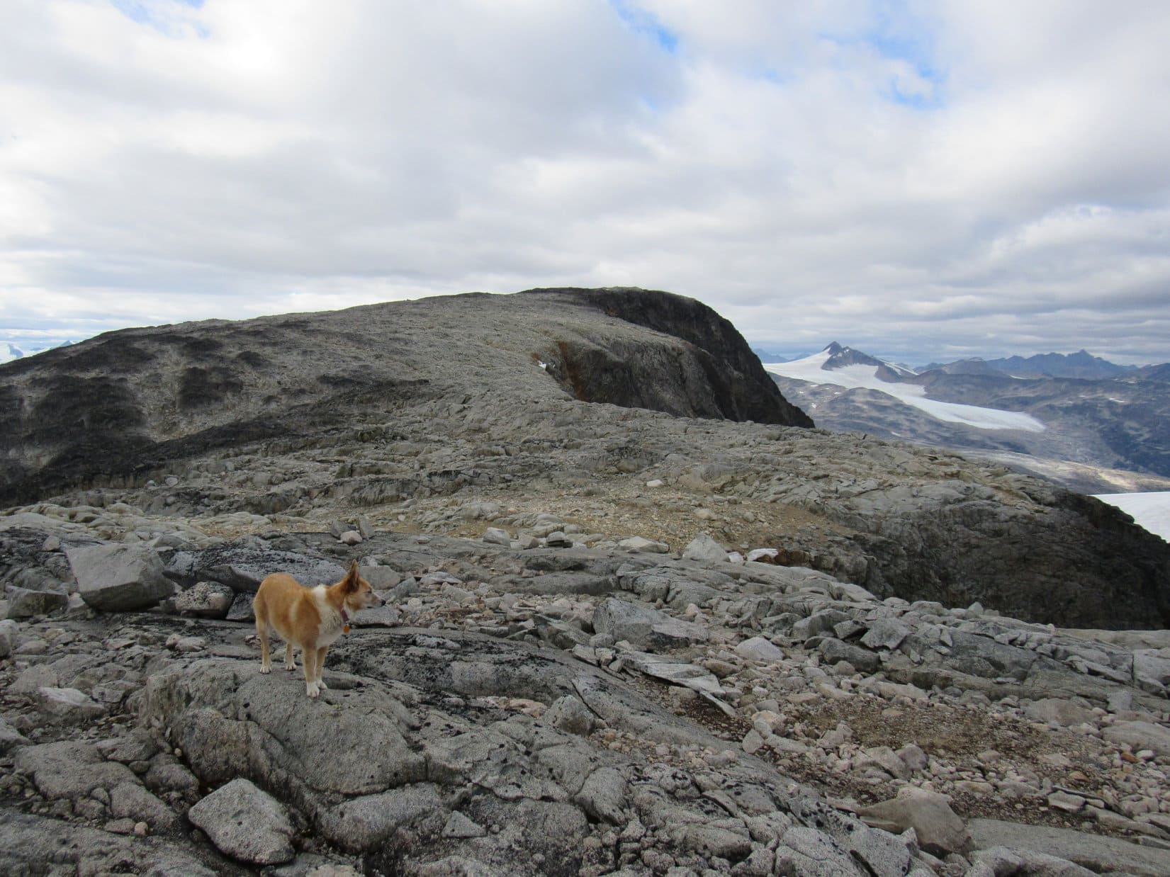
By now the American Dingo had gained a great deal of elevation! Lupe had reached a world of rock, sky, and little else. Lichens and sparse clumps of tundra were the only vegetation. Magnificent views were on display! Lupe could see much of the Tormented Valley to the NE and E, and fabulous mountains to the SE and S. However, incredible snow and ice-draped peaks beyond the Taiya River canyon to the SW caught the eye more than any other scene.
In the rumpled area atop the dark cliffs. Photo looks NE.Heading higher yet! Photo looks NW.Looking W upon reaching more level territory after a big climb.Same view with more help from the telephoto lens.Jagged peaks to the SW with lots of help from the telephoto lens.
To the NW, Lupe could now see an enormous rocky slope rising toward Peak 6053’s massive main ridge. Getting to this upper ridge proved more complicated than it looked. A series of gashes running SW/NE sliced across this region perpendicular to the direction Loopster needed to go. Exploring this rugged area was fun, but time-consuming. The Carolina Dog often came to small cliffs, and had to go back and forth looking for ways into and out of the gashes.
Two steps up, one step down! Lupe and SPHP repeatedly gained and lost the same elevation during a long, winding ascent.
An enormous rocky slope leads up to Peak 6053’s massive main ridge. Photo looks NW.On rugged terrain. Photo looks WSW.Looking down one of the gashes. Mount Cleveland on the L. Photo looks SW.Crossing the same gash.Searching for a way down into one of the deepest gashes. Photo looks NE.At the bottom. Photo looks SW.
Finally nearing the E end of Peak 6053’s massive upper ridge, Lupe came to another sizable gash. On the far side was a wall of white rock. Loop crossed the gash, and found a way up onto it.
From a distance, more gashes had been evident up on the main ridge, so SPHP had been thinking maybe Lupe ought to skirt along the S side to get closer to the W end before climbing to the top. That way Loop would gain the upper ridge much closer to the true summit of Peak 6053, which the topo map showed at the far NW end of the mountain.
However, from the wall of white rock, it was clear that this notion was totally impractical. The terrain S of the main ridge was simply too steep and rough. Loop’s only realistic option appeared to be to climb straight to the top of the E end of the main ridge, and take her chances from there. A gully of light-colored rock looked like a possible route up.
Getting close to Peak 6053’s main ridge, Lupe comes to the gash with a wall of white rock on the opposite side. Photo looks NW.Up on a darker part of the next little ridge connected to the wall of white rock after crossing the gash. Photo looks SW.The E end of Peak 6053’s massive main ridge. Looked like Lupe could get up there via the light colored gully on the R. Photo looks N.
Staying on top of the wall of white rock, Lupe headed NNE toward the promising gully. The wall ended near a snowbank next to a big pool of meltwater. Loop had to down climb and work her way past these minor obstacles before scrambling up the gully.
At the NNE end of the wall of white rock. Lupe had to get past the snow bank and its meltwater before climbing straight up the gully on the L. Photo looks NNE.
At the top of the gully, Lupe found herself in a fairly flat area an acre or two in size. Venturing N brought her to the edge of towering cliffs. For the first time, Lupe could see the gigantic canyon between Peak 6053 and Taiya Peak(6,844 ft.) to the N. She now also had a view to the NW.
Looking NW from the E end of Peak 6053.Similar view with more help from the telephoto lens.
A tall dark rock outcropping sat at the NE end of the flattish area. Lupe went over and climbed it. Views of the Tormented Valley from here were fantastic! Loop could again see the International Falls trailhead she had started out from way down at the South Klondike Highway.
The Tormented Valley from a high point at the E end of Peak 6053. Summit Lake is on the R. Bernard and Shallow lakes are farther away L of Center. Photo looks NE.Looking back toward the International Falls trailhead (just about dead Center) along the South Klondike Highway. Photo looks SE.
One view in particular from here was of paramount importance. For the first time, Lupe could see along the length of the N side of Peak 6053’s main ridge. The mountain’s true summit was clear over at the far NW end completely opposite of where the American Dingo was now.
The view was worrying. Felt like Lupe had already been climbing for a long time. Peak 6053’s summit was a little less than 500 feet higher than where she was now, but it still looked far away. Much closer, a big fin of rock jutted skyward. Would Loop be able to get past it? A deep gash might easily be on the other side.
Looking along the length of the N side of Peak 6053’s massive main ridge. The summit still looked far away, and SPHP was concerned about whether Lupe would be able to get beyond the big fin of rock on the L. Photo looks WNW.Similar view from the NE high point. Photo looks WNW.
No choice, but to head over there and find out. The terrain leading to the fin was rocky and sloped higher, but not difficult. The N end of the fin was close to the gigantic cliffs, and trying to go over the top seemed a poor choice too. However, going around the S end looked quite feasible. The big question was what Lupe would find on the other side?
Another look NW before heading for the fin.Looking back down at the way Lupe had made it up to the E end of Peak 6053’s main ridge. The snow bank she had passed before coming up the steep gully is seen below on the L. Photo looks SW.
Lupe got quite high on the S end of the big fin. Going this way was a cinch! Nothing to it! Best of all was the view Loopster had once she got to where she could see the area W of the fin. No big gashes or drop offs! In fact, once beyond the fin, it didn’t look like a fin at all from the W.
The Carolina Dog now made rapid progress journeying WNW along the broad main ridge. She crossed a series of gashes, but none presented any real difficulties. Lupe actually lost elevation approaching a final big drainage that sloped down toward the SW. Staying toward the N edge near the cliffs, Lupe had little difficulty getting past it.
WNW of the fin approaching the last big drainage. Lupe stayed to the N (R) near the cliffs to get past it. Photo looks NW.Taiya Peak(6,844 ft.) (R) from the N edge. Photo looks NNE.Near the last big drainage. Photo looks NW.Looking NE toward the Tormented Valley with help from the telephoto lens. Part of Summit Lake on the R. Bernard and Shallow lakes on the L.
Beyond the last big drainage, Lupe roamed freely heading NW on a broad slope. A maze of benches and ramps led higher and higher. This climb wasn’t hard at all; no more going down into gullies! Loop was having fun, and SPHP was joyful knowing that the summit couldn’t be much farther. Lupe was actually going to get to the top of Peak 6053!
The terrain finally leveled out in a rough area. What? Oh, no! This wasn’t the top! Quite close by, the highest point on the mountain was clearly visible a short distance off to the N. Definitely higher, though not by much, than where Lupe was now, the true summit of Peak 6053 sat isolated beyond one more good-sized drop. Whether the Carolina Dog could get over there or not wasn’t initially clear, but the situation didn’t look good. Gah! All this way, only to fail!
Some old wooden boards were toward the SW end of the rough area, part of a collapsed wooden tripod. SPHP lifted a couple of rocks off a pile beneath the boards to reveal a survey benchmark dated 1936.
Loop by the wreck of a wooden tripod. Photo looks SW.The survey benchmark hidden beneath rocks under the tripod.
Lovely. Apparently the surveyor hadn’t thought it possible to get over to the true summit, and had settled for this location instead. Discouraging! After replacing the rocks over the benchmark, Lupe and SPHP went over to the edge of the final drop off to take a better look.
30 feet lower, a snow bank rested in a gash shorter than any others Lupe had come to. Both ends dropped away into fearsome chasms. At first, it didn’t look like there was any safe way to scramble down. Loop had to do it, though, if she was ever going to get to the top of Peak 6053.
Overlooking the final short gash preventing Lupe from getting to the true summit of Peak 6053 (Center). Photo looks NNW.
There was a way down! Looked like Loop ought to be able to get back up it again during the return, too – critically important, if there ever was going to be a return. A quick, careful scramble, and Lupe was standing on the snow bank!
Success! Safely down on the snow bank in the last gash. Photo looks W.
The snow bank was more like ice than snow. Staying away from the NE edge where the drop was almost vertical, Lupe crossed only a short icy section before completing her long journey to the top of Peak6053. The true summit was a light gray boulder. The American Dingo hopped up onto it to claim one of her most remarkable peakbagging successes ever.
At the true summit of Peak 6053! The main ridge Lupe had come up is visible on the R. Photo looks ESE.Taiya Peak (L of Lupe) from the true summit of Peak 6053. Photo looks NE.Still at the true summit. Mount Cleveland is beyond Lupe. Mount Carmack(6,808 ft.) is the high point in the distance on the L. Photo looks SSW.
SPHP praised Lupe highly, but the Carolina Dog didn’t seem impressed. Looper willingly participated in a few photos of some of the incredible glacier-clad peaks in Alaska to the W, but after that she just wanted to rest. Using a jacket and a pullover, SPHP made a little bed where she could doze more comfortably on the rocky ground.
Looking W into Alaska. The summit of Peak 6053 is barely inside British Columbia.View to the NW.Lupe had been politely begging SPHP to stop for hours. Several short breaks had been taken, but this was her first real chance to snooze a bit. Photo looks SW.Lupe’s 4th day of big climbs in a row, and it had taken 7 hours to get here.
While Lupe rested, SPHP gazed at the unbelievably beautiful remote peaks toward the W.
Looking SW with help from the telephoto lens.The high point toward the L at the upper end of the glaciers in the foreground may be Mount Hoffman(6,079 ft.). The even higher mountain beyond it may be the Skagway High Point(8,239 ft.). Photo looks W.The telephoto lens revealed an incredible world of spectacular peaks so inaccessible few have names.
Peak 6053’s summit area was about 40 feet wide E/W and 70 feet long N/S. A similar sized area about 20 feet lower extended farther N. So there was plenty of room to move around. At the N end of the summit area, 35 feet from the boulder Lupe had been on, a less conspicuous rock looked equally high. Might even be a tad bit higher? SPHP went over to check it out, came to no definite conclusion, then ventured down to the lower region to the N where it was possible to look down on a glacier.
As tired as Lupe was, she wasn’t completely out of it. Fearing she was being left behind, Loop came looking for SPHP. Weary or not, the loyal American Dingo stuck closely to SPHP from then on.
On the rock at the N end that was in competition for title of true summit of Peak 6053. Taiya Peak beyond Lupe. Photo looks NE.Still on the N high point. Photo looks S.Looking down on the glacier. Photo looks N.Upper end of the glacier and Taiya Peak (R). Photo looks NNE.Looking over the Taiya River canyon and the glacier’s toe. Photo looks NW.Nearly the whole glacier with a bit of help from the telephoto lens. Photo looks N.
Lupe was so lucky! Although the sky had remained quite cloudy all day, conditions at the top of Peak 6053 weren’t bad at all. Cool (low 40’s °F), but calm. Importantly, the cloud deck was high enough to permit clear views of even the highest and most distant peaks. Nothing was hidden. Every now and then, the Carolina Dog stood in glimmers of sunshine.
Getting late. Should be moving on, but Lupe and SPHP lingered in the splendor of Peak6053. Glory at every turn!
Peak 6053’s narrow SW ridge in the foreground. Photo looks SW.What is that monstrous peak looming on the far horizon? It must have a name! Photo looks SW with maximum help from the telephoto lens.Mount Carmack(6,808 ft.) (R of Center) looks dramatic through the telephoto lens. Photo looks S.Way down at the bottom of the Taiya River canyon, the famed Chilkoot Trail from gold rush days passes from Skagway, Alaska to Chilkoot Pass at the Canadian border, then on to Carcross in the Yukon Territory. Photo looks W.Another look at Peak 6053’s SW ridge. Mount Cleveland (L) with Mount Carmacks (far L) more distant. Photo looks SSW.Simply no end of stunning peaks and glaciers!
7 hours to get here. 50 unforgettable minutes gone by up at the summit of Peak 6053! 3 hours until sunset. Sadly, time to go. Past time, actually.
Not far from the summit boulder, Lupe stood perched by the W edge of the mountain overlooking the unseen depths of the Taiya River canyon. Beyond the gaping chasm, a fabulous world of pristine peaks cloaked in glacial ice – ancient, creeping ice still locking in the frigid cold of countless dark winters eons ago.
Fleeting last moments at the top of Peak 6053!
Looking into Alaska from the edge of British Columbia atop Peak 6053.Moment of glory!
The race against time was on! Back down to the short gash and its icy snow bank. A careful scramble up to the rough area where the survey marker lay hidden beneath rocks and old boards. Down the ramps and benches to the big drainage to the SW.
Now, a calculated, crucial gamble. If it didn’t succeed, Lupe was going to be stuck on Peak 6053 all night. No way on earth could she get down off the mountain before dark going back the way she had come up. Lupe and SPHP turned SW heading down the big drainage. If the American Dingo cliffed out, a very long night was ahead.
Starting down the big drainage near the W end of Peak 6053. Photo looks SSW.
Far, far below, Lupe could see the little lakes of the magical region she had visited beyond the end of the International Falls trail on a beautiful evening more than a year ago. The lakes weren’t sparkling today, but if she could get down close to them, Loopster ought to be able to find the International Falls trail again before dark.
Down steep ramps and gullies, down rough loose rock, down scrambling around rock formations trying to avoid getting cliffed out.
Getting there, but still a long way to go.Another chute. The far W end of the International Falls area at the edge of the Taiya River canyon is in sight.
At last, success was certain. Loop’s gamble was going to pay off! Once she made it down to where the slope became more gradual, SPHP turned and looked back up. Lupe hadn’t cliffed out, but it sure looked like she should have.
The Carolina Dog was thrilled to be out of all the rock! She wasn’t nearly as tired as she’d let on up on Peak 6053. In fact, Lupe was energized! She raced across the soft tundra far ahead of SPHP joyfully exploring a land of ridges and little streams, glancing back now and then to make sure SPHP was still coming.
Lupe never did get close to most of those once sparkling little lakes again. However, in the distance, she did see the huge boulder on the far W ridge that she had visited a year ago. Instead of going all the way to the lakes, Lupe took a shortcut turning SE as soon as it was practical. The American Dingo roamed a long way. She finally stumbled upon the International Falls trail again, as she passed by a couple of little ponds reflecting the last glowing beauty of the dying day.
On the International Falls trail again.International Falls trail, Alaska.
Peak 6053 was the final and most difficult of 4 climbs on 4 consecutive days. SPHP’s feet had become sore on the rough terrain even before Lupe had reached the summit. Although the return trip was the easiest possible route back, it was still a long march. Hobbling along, each step became more difficult to bear.
Darkness fell. SPHP sometimes lost the trail. Loopster usually found it again in just a minute or two. The roar of the now invisible waterfalls the trail went by went on and on. At last, it was over. Across Captain William Moore Creek, and up the ropes. The G6 sat waiting alone at the dark trailhead. (10:46 PM, 47°F)
So sore! So weary! Yet, what a day! As it turned out, Lupe had likely taken about the longest, hardest route to the top of Peak 6053 possible. Clearly, the way she had taken back was the fastest, easiest way to go. What an experience it had been though – the long treks higher on all that rough ground, wandering the wild gashes and gullies, then exploring along the whole massive main ridge.
And at the end of it all, the American Dingo had done what she had set out to do – Lupe had once more gazed over the depths of the enormous Taiya River canyon into a world of ice, snow, and jagged peaks, a world in sight, but forever beyond reach, this time seen from the lofty heights of Peak6053.
On Peak 6053, British Columbia, Canada 9-11-18
Directions to the International Falls trailhead: The trailhead is a pullout less than a kilometer inside the Canadian border along the W side of the South Klondike Highway. This pullout is located 7.5 miles (12 km) S of Canadian Customs. Coming from Skagway, the trailhead is the 2nd pullout on the L shortly after crossing the high point of the highway near White Pass. A small lake is visible down in the creek valley W of the highway.
There are no facilities or information at the trailhead other than a sign about avalanche dangers. The trailhead is located between US Customs and Canadian Customs, so it will always be necessary to pass through one or the other on the way back to either Skagway or Carcross. Remember to bring appropriate documentation!