Days 31 & 32 of Lupe’s 2018 Dingo Vacation to the Yukon, Northwest Territories & Alaska!
Morning 9-3-18 – Clear skies! If they would last, this was Lupe’s big chance! As SPHP drove N on George Parks Highway No. 3, the Carolina Dog’s luck was holding. Near midday she arrived at the Denali South Viewpoint (MP 135.2) in Denali State Park.

It was Labor Day, and the parking lot was nearly full. People and dogs all over the place! They had all come to see what Lupe and SPHP had come to see, too – that glorious, monstrous, white mountain, highest in all of North America – Denali (20,310 ft.)!
Loopster had seen Denali in the clear from a great distance in 2016. Yet, although she had been to Denali State Park in both 2016 and 2017, the American Dingo had never caught more than glimpses of tiny portions of the mountain from anywhere nearly this close before. Lower peaks had sometimes been in view, but Denali and all the other white giants of the Alaska Range had always been shrouded by clouds.
The first look at Denali from the viewing area near the parking lot was beautiful, but not the best one available. A 5 minute stroll along a wide path lined by trees and tall bushes brought Loopster to an even better viewpoint. Beyond the Chulitna River valley, there stood Denali, still nearly 40 miles away, gleaming white against the blue, blue sky. Denali was a thrilling sight!


While Denali was the star of the show, many other glorious peaks were on display, too. SPHP wasn’t certain of their names.


With teeming holiday crowds present, it was probably best not to linger too long. Still, it was hard to tear oneself away from Denali! Loop and SPHP hung around for 20 minutes before reluctantly moving on. SPHP drove a little farther N on George Parks Highway No. 3, stopping next at the Ermine Hill trailhead (MP 156.5).
Still early afternoon. What to do? On the one hand, seeing Denali from Ermine Hill (2,700 ft.) would be fantastic! Would take a few hours to get up there, but Lupe had time. On the other hand, Ermine Hill wasn’t the American Dingo’s only anticipated destination up on K’esugi Ridge.
Lupe had climbed Ermine Hill once before. In 2017, she had seen a considerably higher hill from the summit more than 3 miles off to the ENE. This was Peak 3700, an unnamed high point. Peak 3700 had looked easy to climb, just a rounded hill at the far end of a long, gradual ridge. So Looper and SPHP had made an attempt on Peak 3700 that day. Lupe had made great progress, but was ultimately forced to retreat by an ominous cloud threatening rain.
Now Lupe was back! She had returned to Denali State Park not only to see Denali, but also to climb Peak 3700.
It was too late to get to both Ermine Hill and Peak 3700 today. Besides, Loop had spent the last 3 days in a row climbing mountains. Hadn’t she earned a day of rest? While tempting, the thought of climbing Ermine Hill right now to see Denali from on high also seemed exhausting. Loop intended to climb both Ermine Hill and Peak 3700 tomorrow, anyway. Provided the weather would hold for just another 24 hours, an ascent today was simply unnecessary.
Not a cloud in sight. Tomorrow seemed a reasonably safe bet. In the meantime, Looper could rest up. This evening she could go back to the Denali South Viewpoint to see the sunset. Such a nice, easy plan!
SPHP worked on catching up the trip journal. The Carolina Dog snoozed contentedly. After an hour or more, SPHP glanced up to see a single lane of traffic ground to a complete halt on the highway. Odd. The G6 was boxed in here at the Ermine Hill trailhead! Lupe couldn’t leave if she wanted to until the traffic cleared.
It didn’t clear. Nothing budged. Something was wrong. An accident? Perhaps a serious one? No one at all was getting through. Yet everyone seemed patient. No honking, yelling, or arm waving. None of that sort of thing.
Eventually, sirens confirmed it. Emergency vehicles appeared. Low flying helicopters woke Loop up, sending her into barking frenzies. Hours went by. SPHP finally stopped writing, and got out to stretch. Something dreadful must have happened. A man came over to chat. He was from North Pole near Fairbanks, on his way home with his family.
Word was that there had been a terrible tragedy, a fatal crash. The crash had occurred out of sight, but only 100 yards NE of the Ermine Hill trailhead. A car, pickup truck, and 2 motorcycles were involved. Of 5 people, 3 were dead, 2 more in critical condition. One was a little girl. Horrendous!
Not until 8:30 PM did the traffic start moving again. Slowly, one lane at a time, alternating directions. After 10:00 PM the first gaps appeared in the lines. By 11:00 PM it was over, the deadly highway dark and quiet. The end of a sorrowful, sobering evening.
9-4-18, 8:40 AM, 48°F – Ugh! Seriously? Tired or not, should have just done it, and gone with Lupe up to Ermine Hill yesterday afternoon. She could have seen Denali in the clear from that glorious vantage point then. Now blue skies were but a memory. Nearly the entire sky was overcast. Clouds hung so low, it was practically foggy out. So much for getting to see Denali again from on high. A lost opportunity.
Sorry, Looper! Guess I was a dope. Should have known. Alaska is the world champion at clouding up, as far as anywhere I’ve ever been goes.
We’re not going to Ermine Hill? Or Peak 3700?
Oh, yes, we are! At least it’s not raining out. Doesn’t seem like it’s going to either, not yet anyway. Might as well give it a whirl. It’s more or less now or never for Peak 3700, you know.
Let’s get going then! Maybe we’ll have some luck!

Lupe set out full of energy and enthusiasm! Having taken the Ermine Hill trail up onto fabulous K’esugi Ridge only a little over a year ago, it still seemed quite familiar. The trail started out gaining elevation gradually. Lupe passed through an area of tall grasses and colorful plants in a forest meadow.

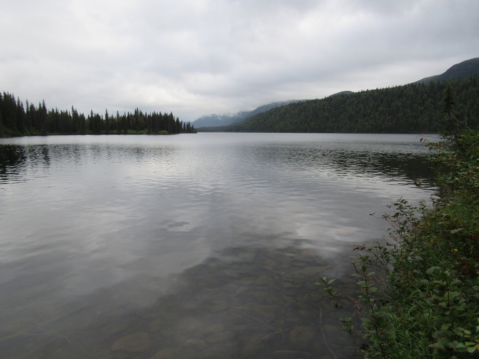
The terrain flattened out. Before long Loop lost 200 feet of elevation on her way down to Byers Creek. The tippy bridge was still here, same as last year.


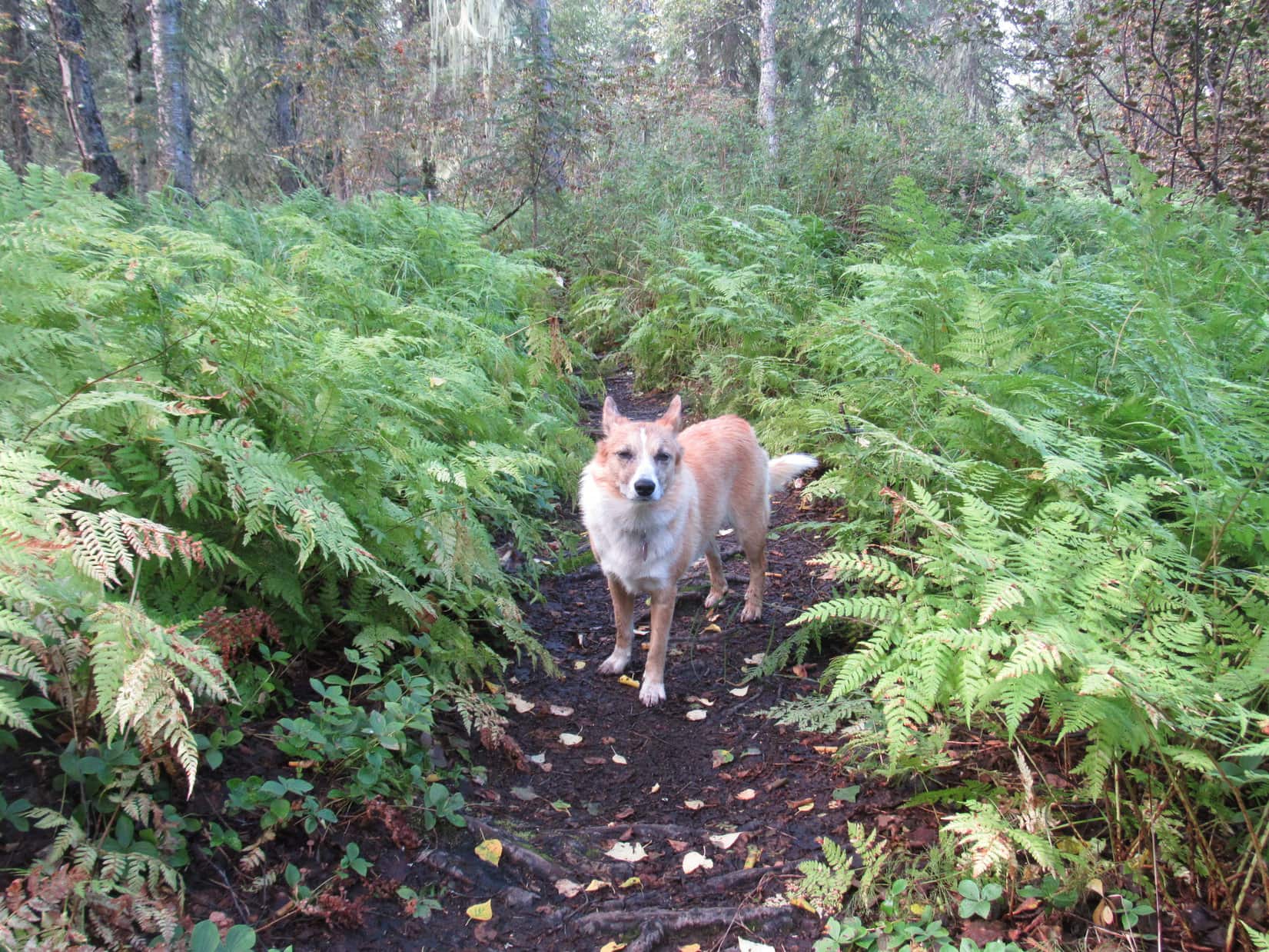
Beyond the tippy bridge came a forested area crowded with ferns. The trail was full of tree roots and mucky spots. It headed downstream past a wider, shallower section of Byers Creek before finally beginning to climb out of the valley.


Before Lupe had gained much elevation, a bridge over gushing Giardia Creek marked the start of a series of long switchbacks. The switchbacks made the climb up the steep lower slopes of K’esugi Ridge a snap for SPHP. Lupe enjoyed racing back and forth on them.


Higher up, K’esugi Ridge wasn’t as steep. The switchbacks came to an end. The trail turned SE climbing more directly up the slope.
The forest thinned as Lupe gained elevation. Ferns disappeared. Birch or aspen mixed in with the conifers. Before long only scattered conifers remained as tall bushes took over.


Eventually, Lupe came to a long slope covered with low bushes. The fall colors were incredible!

Looper left the Ermine Hill trail at the upper end of the colorful slope, shortly before it was about to disappear into tall bushes again.
In 2017, Lupe had stayed on the trail 0.5 mile farther before abandoning it to begin her search for the true summit of Ermine Hill. However, she had learned back then that it wasn’t necessary to stay on the trail for so long. The true summit was up on the very first big hill on the R (S). In fact, it appeared easier to get to the summit from here than it had been from farther along the trail.

The upper slopes of Ermine Hill consist of a crumbly whitish rock. Where vegetation was lacking and the exposed rock was at all steep, it was difficult for SPHP to maintain traction. Fortunately, there weren’t too many troublesome areas. Lupe had a great time exploring on the way up. She had no traction problems at all.
The lower slopes of Ermine Hill were the steepest. Once above them, a series of ramps and benches led higher. The flatter terrain up here was mostly covered with gorgeous tundra. Brilliant reds, oranges, golds and yellows were everywhere. Blueberries were abundant some places, too. SPHP would accept no criticism for the resulting slow pace of advance.

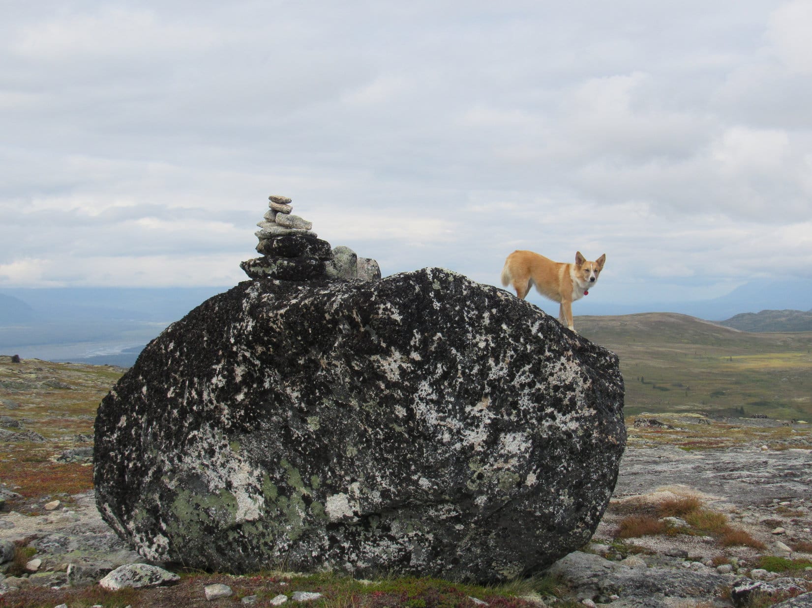
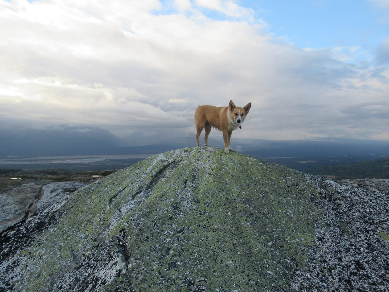
As Lupe neared the top of Ermine Hill, she spotted an oddly shaped rock ahead atop a minor ridge. SPHP dubbed it “Shark Fin Rock”.

Of course, the Carolina Dog went to check it out.

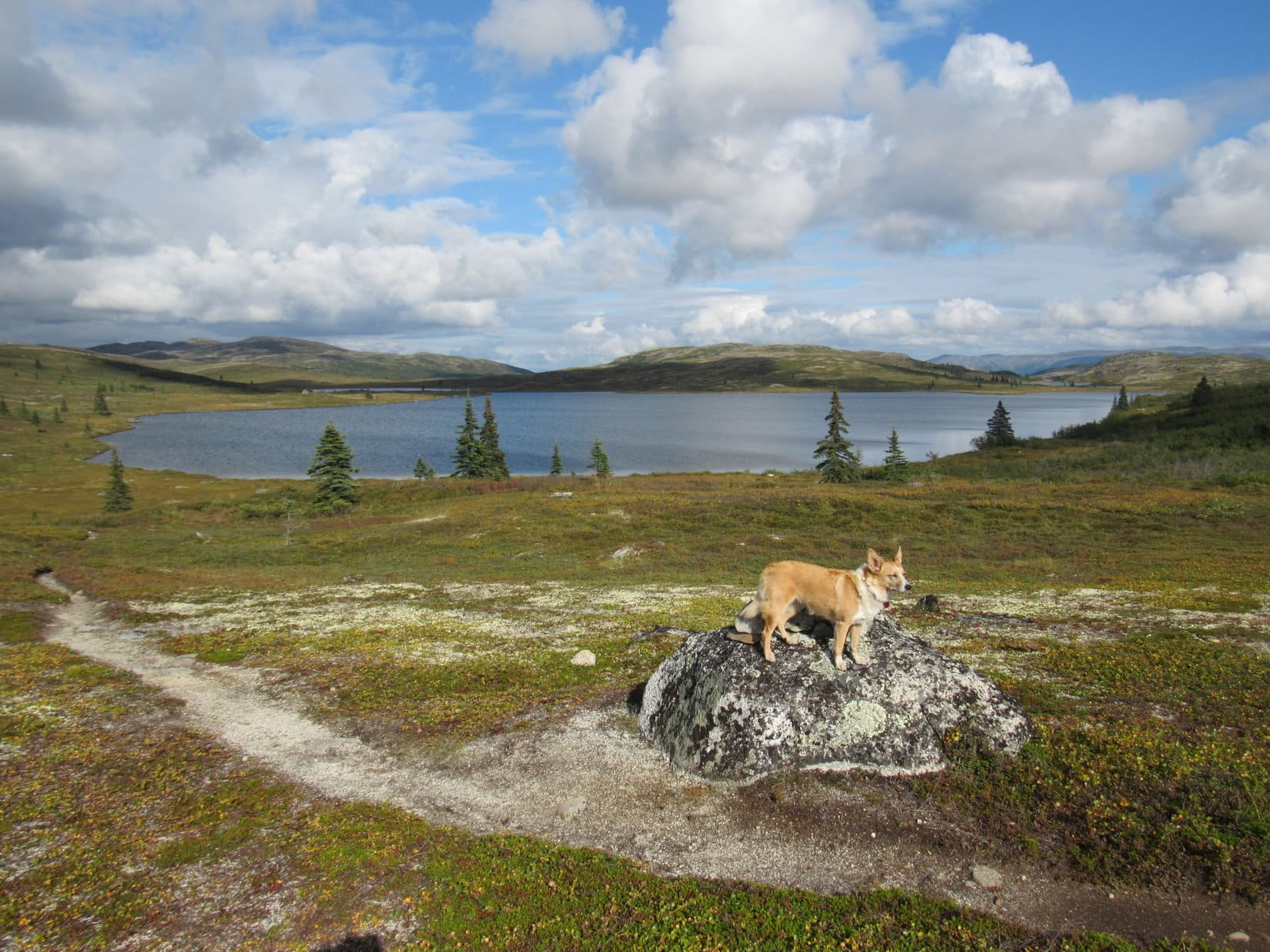
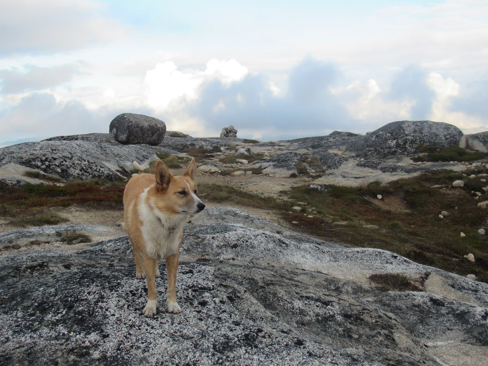
From Shark Fin Rock an easy 5 minute trek up loose white rock brought Loop to the top of the mountain. The whole summit area was awesome with all kinds of weird rock formations. A lovely level pedestal perfect for displaying a triumphant Carolina Dog comprised the true summit.
Yes, Lupe had returned to magnificent, gorgeous Ermine Hill (2,700 ft.)!

A few tiny patches of blue sky had been visible when Lupe had left the trailhead. Now there were none. Rain still didn’t look imminent, but it was easy to believe it might be on the way. Low gray clouds covered the sky. Farther S, though, sunshine could be seen on distant ridges.


Lupe had set out on the Ermine Hill trail full of energy and enthusiasm. However, by the time she had reached Shark Fin Rock, she had already been showing signs fatigue. SPHP was surprised, but perhaps Loopster hadn’t slept well last night? Sometimes she stays awake staring into the darkness for hours on end.
Whatever the reason, after a short initial re-exploration of Ermine Hill’s summit area, the Carolina Dog was done. She didn’t want food or water, simply to rest. No problem. It wasn’t even noon yet. Plenty of time left in the day. SPHP looked forward to relaxing and enjoying the fantastic views from Ermine Hill for a while, anyway.
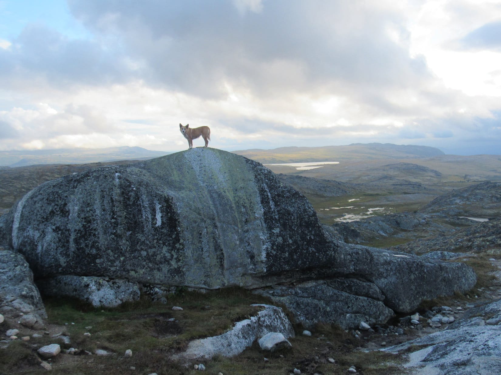
Another rock outcropping almost as high as the true summit was a short distance to the NW. SPHP found a comfy spot to sit down there. Lupe curled up on SPHP’s lap, heaved a great sigh, and closed her eyes. SPHP stroked her soft fur.
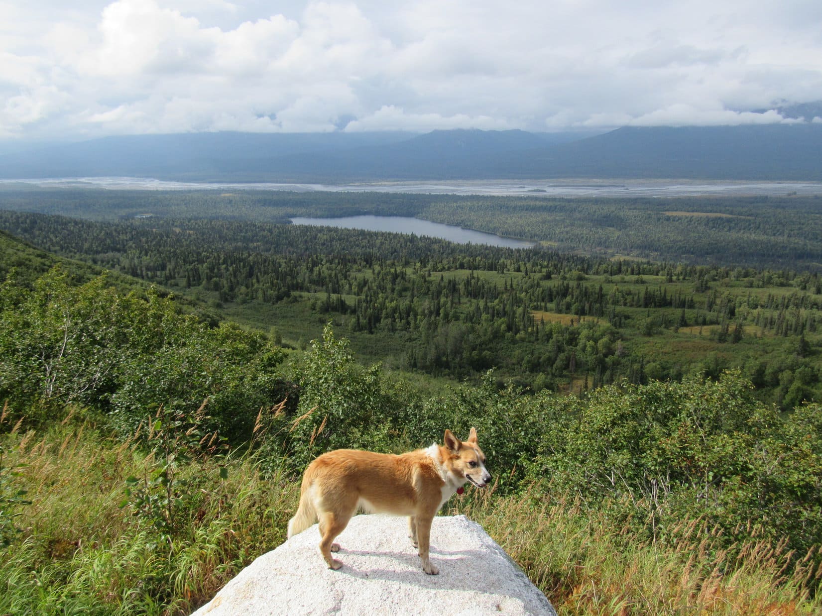
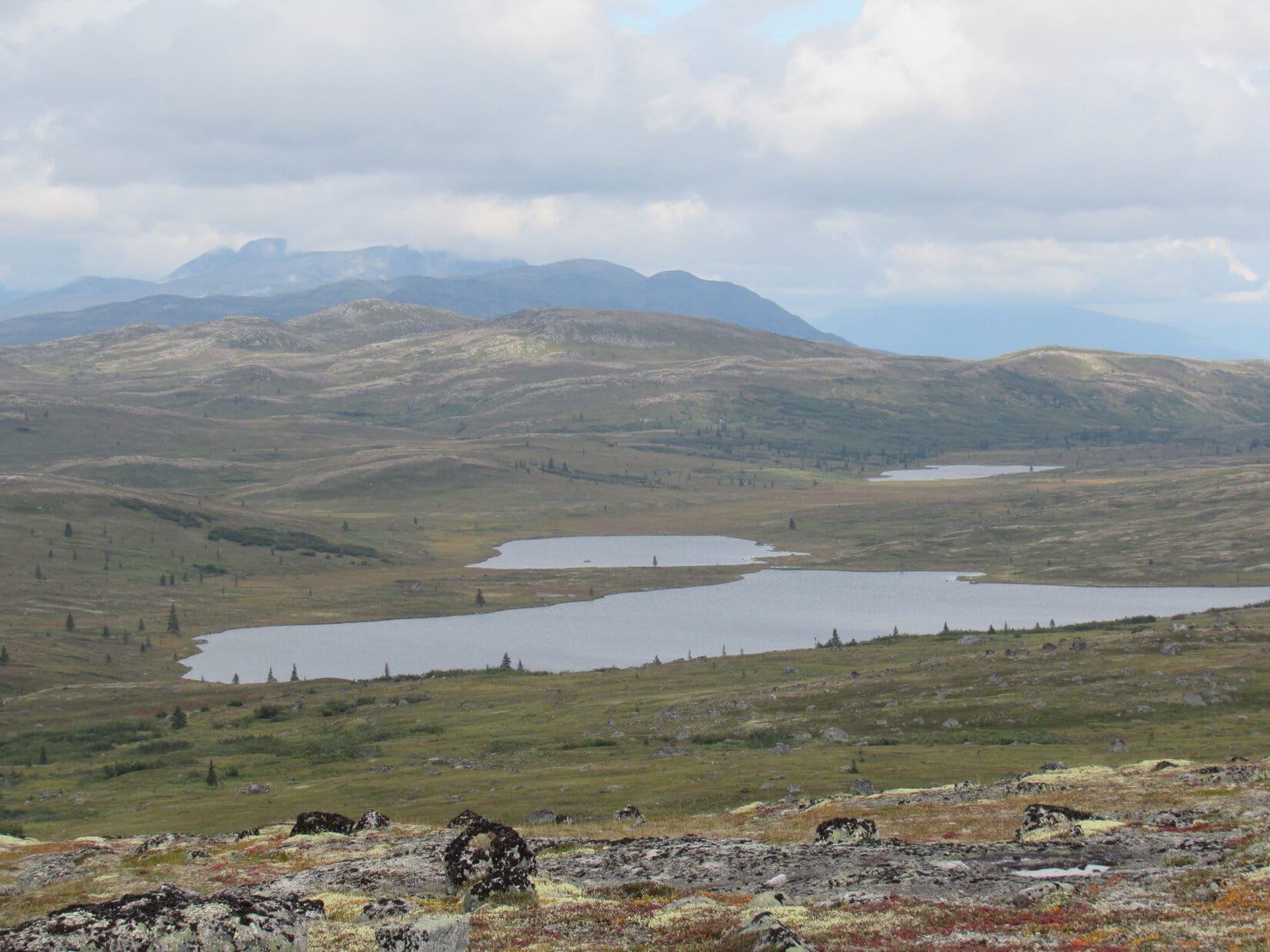
Ermine Hill is a terrific viewpoint! Sadly, but as anticipated, Denali and all the high peaks of the Alaska Range were obscured by clouds. Only the lower peaks and the Chulitna River valley were in view. Golog Benchmark (2,970 ft.) which Lupe had reached on a prior adventure on K’esugi Ridge in 2016 was in sight to the SW. And, of course, Peak 3700, which SPHP hoped and expected Loop would get to this very afternoon, was visible only a little over 3 miles to the ENE.
A serene and wonderful half hour drifted by. Finally, Lupe stirred. Good deal! A few more photos from the top of Ermine Hill and she would be on her way to Peak 3700!


Loop and SPHP set out for Peak 3700 heading SE. Having barely started, the American Dingo paused at the edge of the Ermine Hill summit area.
Ermine Hill(s) is actually plural. Maps show several hills in this region designated as such. The topo map shows 4 separate 2,700 foot contours. The contour farthest NW where Lupe was now clearly contained the true summit of the entire Ermine Hills region.
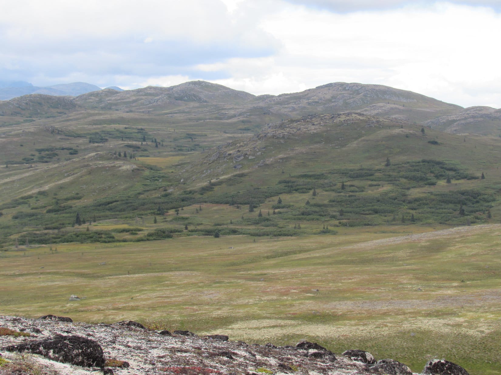
Ahead, Lupe could see some of the lower Ermine Hills. They were all made of the same crumbly white rock. At this time of year, the height of autumn on K’esugi Ridge, all of them were exquisitely beautiful. How fortunate to be here today! A rich tapestry of reds, whites, golds, grays, greens and yellows cloaked the Ermine Hills. They seemed so aptly named!

Peak 3700 was calling. SPHP started down. Lupe didn’t come. Instead, she gazed longingly back at Ermine Hill’s true summit. Was something wrong? Did she want to go back?
Yes, yes she did! Lupe did want to go back. Half an hour hadn’t been enough. The Carolina Dog was still tired.

Well, OK, why not? Lupe and SPHP returned to the true summit. For a while, Loop curled up on SPHP’s lap again. Eventually, she preferred the comfort of a hollow among the summit rocks. SPHP laid out a Columbia pullover and gray jacket for her. Oh, so cozy! Just what the Dingo had ordered! Weary Lupe closed her eyes and slept soundly.


SPHP had plenty of time to enjoy the views from Ermine Hill a while longer. Dead to the world, Lupe snored. She barely stirred. Good things started happening. The cloud cover was breaking up! Patches of blue sky began to appear. The sunlight made everything so much brighter and the colors more vibrant than before.
Early afternoon now. Such a fabulous day to climb Peak 3700! If only Looper would wake up!


More than an hour drifted by. Finally, Miss Sleepyhead stirred.

Welcome back to the land of the living, Sleeping Beauty!
Did I drift off?
Umm, yeah, sort of. Twice now, actually. So, how are you feeling? Still up for Peak 3700?
Oh, much better, thanks. Yes, let’s do this!
Lupe was much better, too! This Dingo nap had been the miracle cure for what ailed her. Suddenly she was full of energy again. The Carolina Dog leapt up onto Ermine Hill’s true summit once more.


The mood of the moment was certainly brighter and cheerier than had been the case a couple of hours ago when Lupe had first reached the top of Ermine Hill. For a few glorious moments, Lupe stood bathed in sunlight at the unique and beautiful true summit.

It was time to get serious about making some progress toward Peak 3700! While still mostly cloudy in that direction, the skies appeared to be clearing. Looper had better get on with it while conditions were so favorable!

The first order of business was to get back down to the Ermine Hill trail. Loop didn’t go down the same way she had come up. Instead she headed ESE off Ermine Hill, bypassing part of the trail.

The key to returning to the Ermine Hill trail efficiently was to avoid the dense stands of tall bushes which form a nearly impenetrable barrier in many places near the trail. Loop had great success. She found a route that wasn’t too steep and completely avoided the bushes.
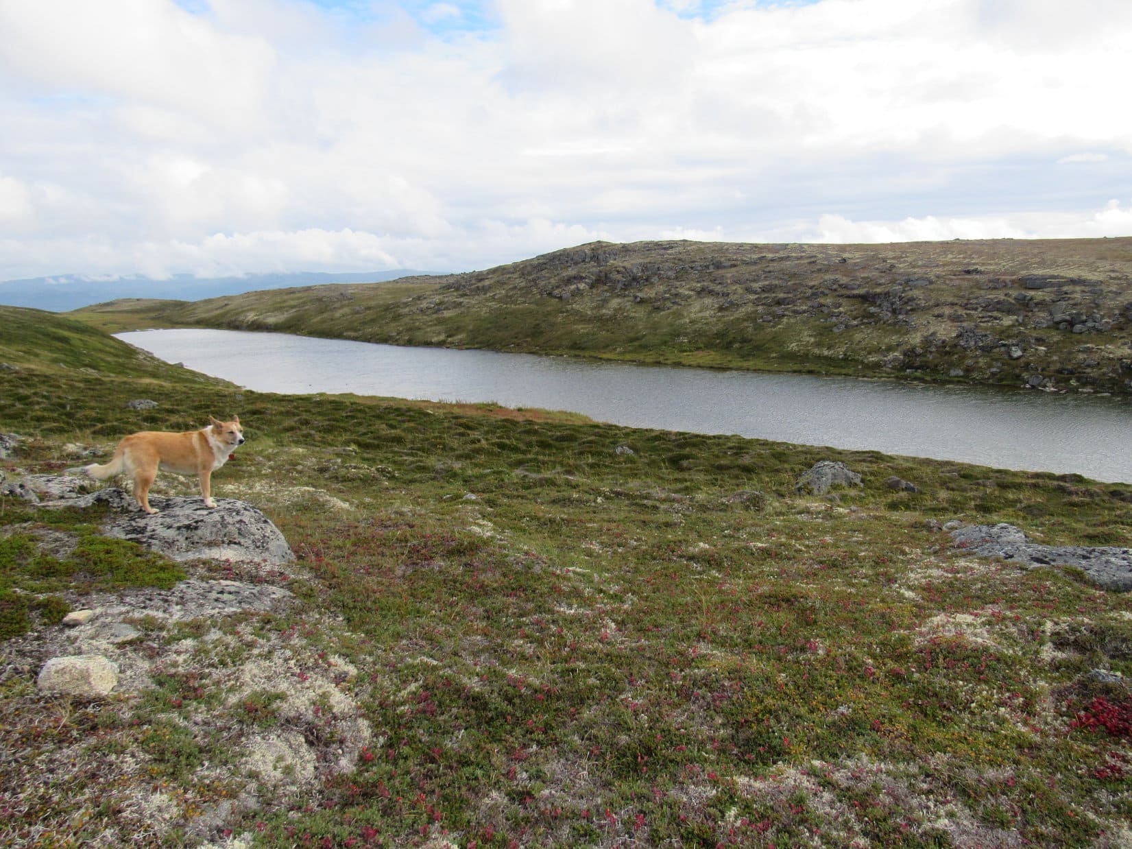
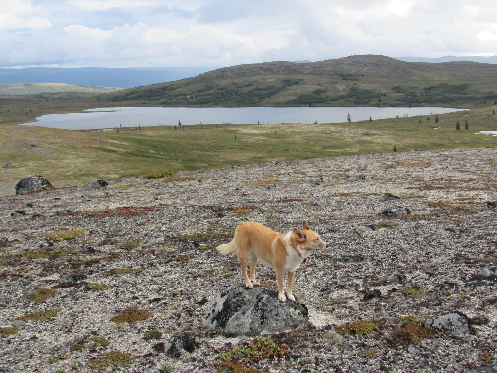
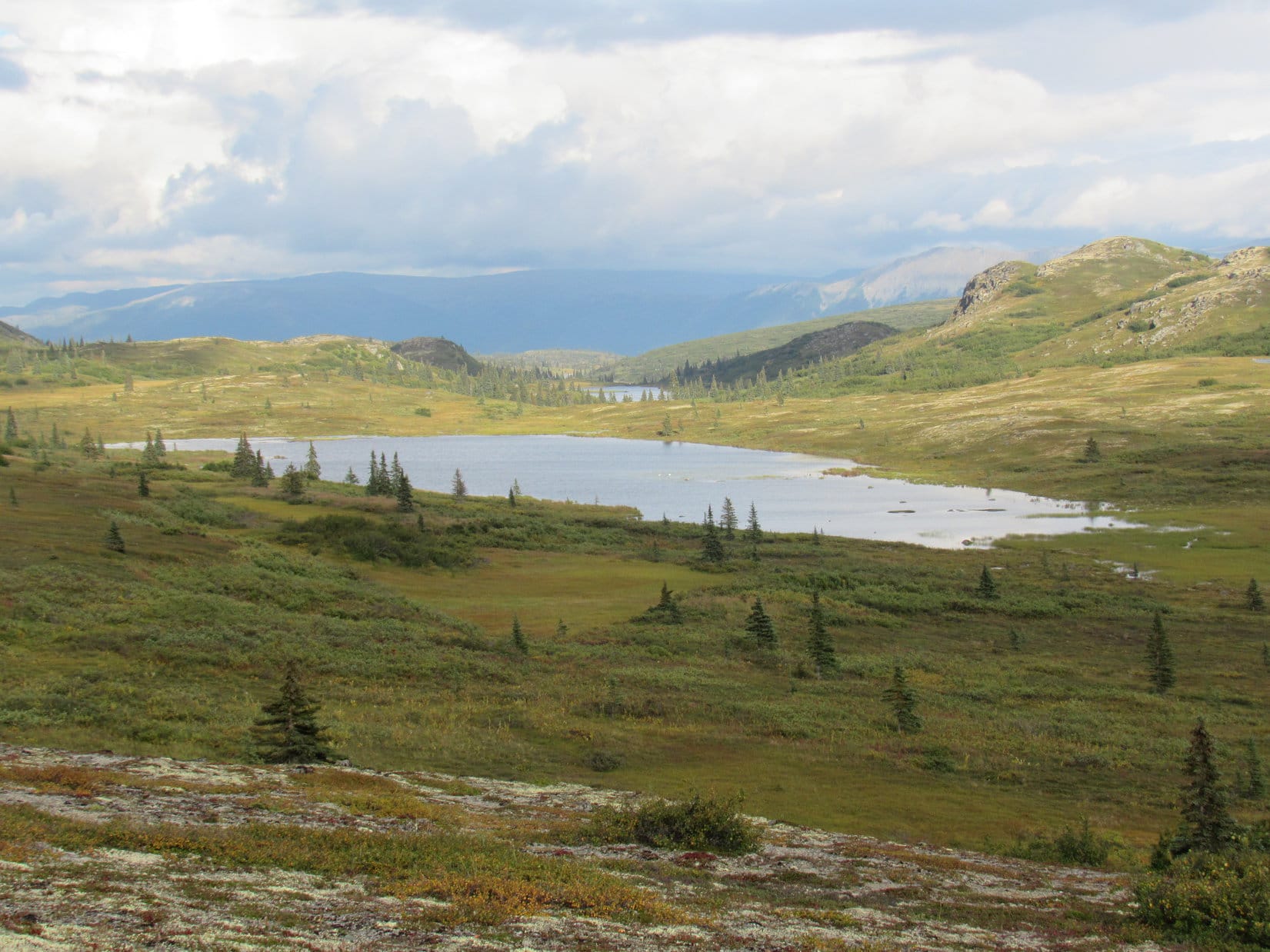
Once on the Ermine Hill trail again, Lupe followed it toward the saddle beyond the E end of the lake. Here, she reached the junction with the K’esugi Ridge trail.

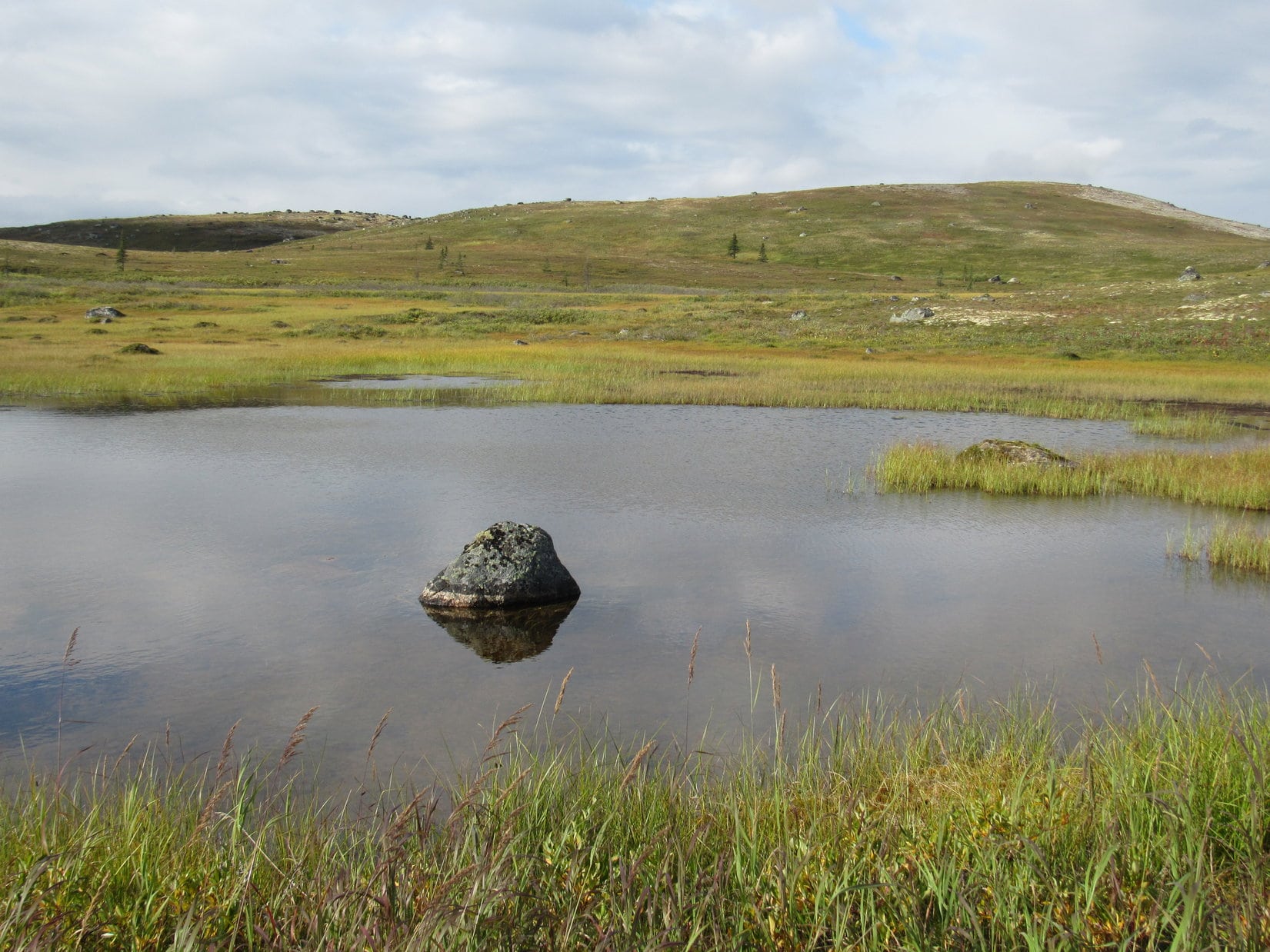
Upon reaching the junction, Lupe turned NE (L) on the K’esugi Ridge trail. The trail crossed a marsh in the broad saddle E of the lake. Lupe had to ford a small stream before the trail started uphill again.
After passing through stands of tall bushes, the trail became quite steep heading N up a ravine containing another small stream. Lupe regained much of the elevation she’d lost coming down off of Ermine Hill.
Leaving the ravine, the K’esugi Ridge trail leveled out heading NW along the base of a steep hillside. This area was also marshy. Stepping stones helped, but there weren’t enough of them. A wet, mucky trudge made SPHP vow to look for an alternative route on the return trip.
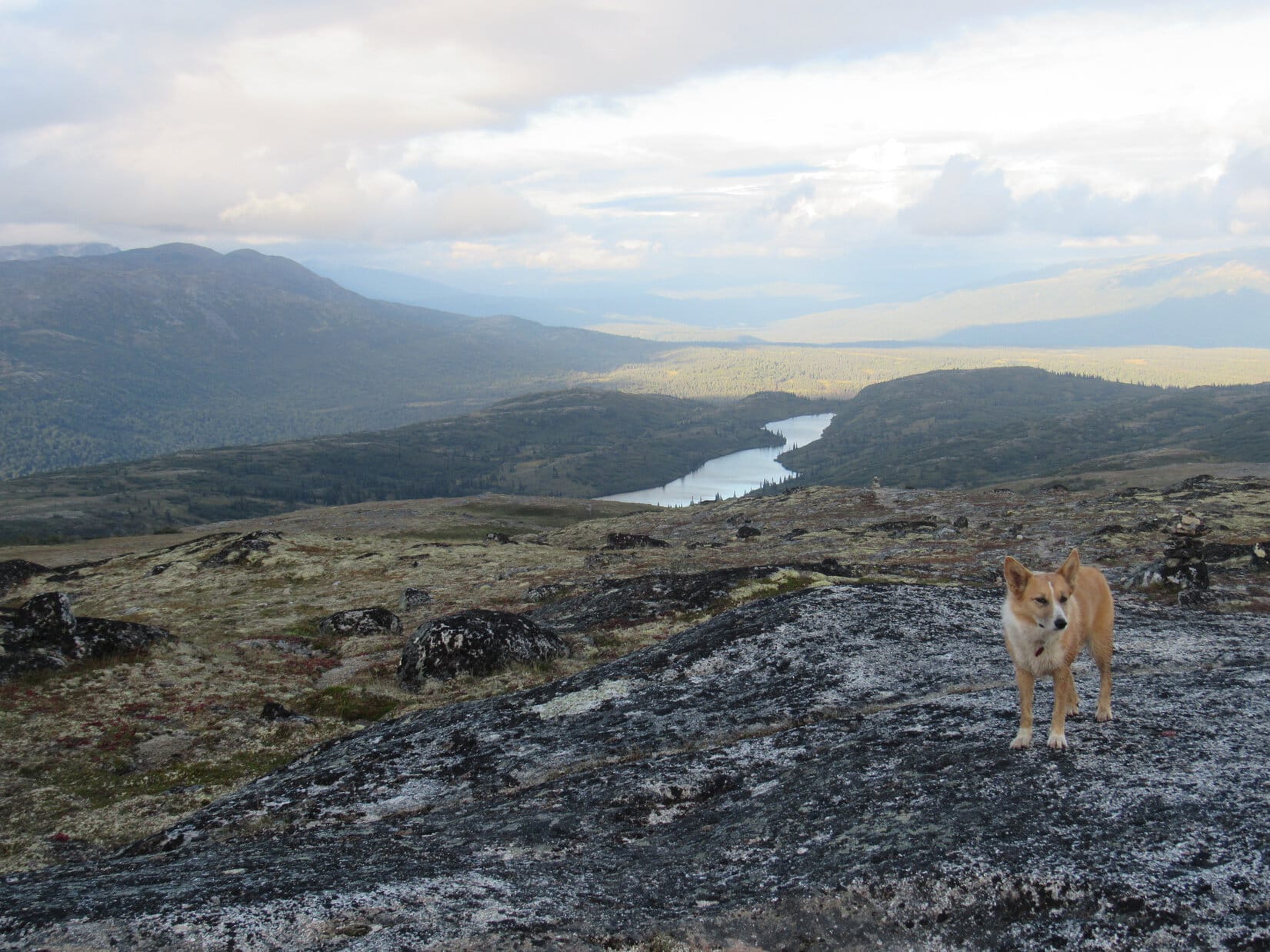
Beyond the marsh, a short side trail led W off to a viewpoint. Here Lupe enjoyed a sweeping panorama of the entire Ermine Hill region.


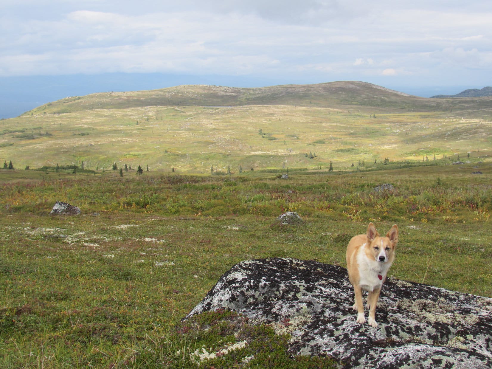
Returning to the K’esugi Ridge trail, Lupe headed NE climbing steadily. Soon she was high enough to see the long ridge leading to Peak 3700.

The K’esugi Ridge trail wouldn’t take Lupe to Peak 3700. No trail went that way. However, it would bring her to the W end of the ridge leading to it. Nearing this ridge, the trail dipped into a little valley where Lupe crossed a small stream. The trail then started up again, eventually leveling out as it curved around the W end of the ridge.
Before leaving the K’esugi Ridge trail to start for Peak 3700, Lupe had another look back at Ermine Hill and the Chulitna River valley beyond it. She was clearly higher than Ermine Hill now.

Lupe was now about 1.5 miles from the junction with the Ermine Hill trail. Peak 3700 was 2 miles due E. Full of enthusiasm, Loop and SPHP left the K’esugi Ridge trail and began to climb.

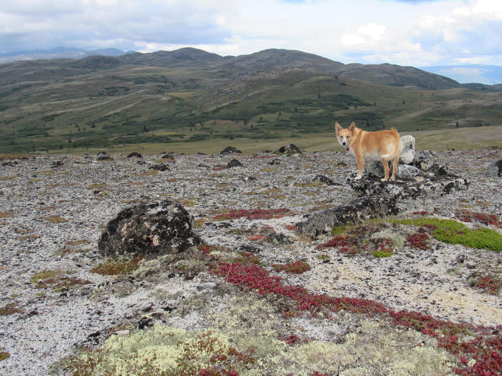
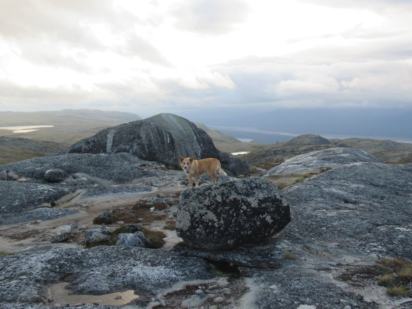
The ridge leading to Peak 3700 was broad and strewn with countless rocks. Many rocks were covered with the thick, crunchy black lichens common in parts of Alaska. The pristine, trackless tundra was gorgeous. So many brilliant colors! So much exquisite detail!


It was an easy climb. Just wandering really, from one modest high point to the next. No tree or bush existed to block any of the tremendous views in all directions. Natural beauties were everywhere from the tiny to the vast.


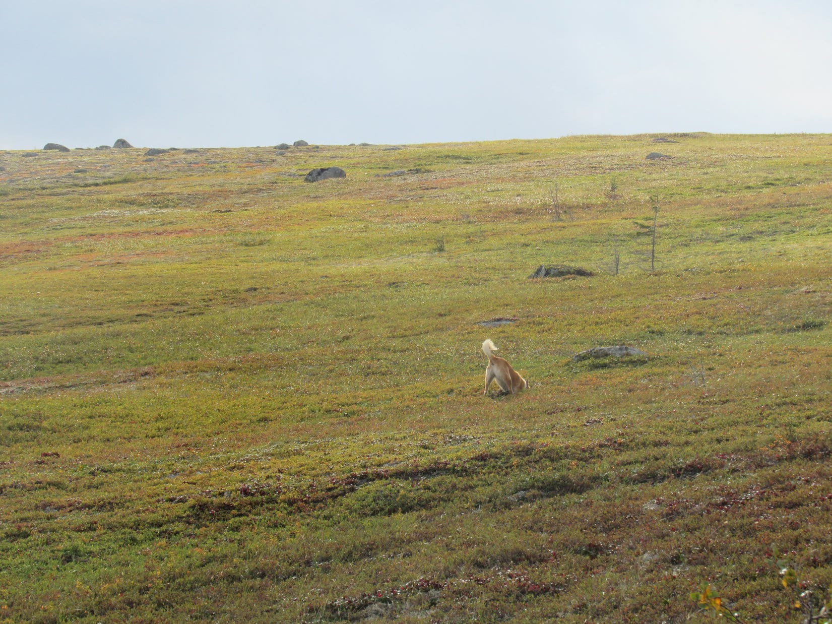
Happy Lupe! So full of joy! She ran great distances, sometimes far from SPHP. She explored and sniffed. She was never gone too long, but came running back frequently. Her pink tongue dangled, her chest heaved. The Dingo’s eyes were bright and spoke of the wonders she was seeing and sensing all around.
SPHP fully shared Looper’s enthusiasm. Except for the clouds still hiding the mighty, but bashful Alaska Range, conditions were perfect. This trek was 10,000 delights, pure fun! The excitement grew as Lupe reached the area where she had been forced to turn back in 2017.
Not this time!


Lupe pressed on. Everything was going great! The American Dingo stayed on the high ground toward the N edge of the ridge. Gradually the tundra became more sparse. The way grew rockier. Lupe crossed one boulder field of white rocks. Nothing too steep or long or difficult.
Peak 3700 was farther than SPHP had believed in 2017, but Loop was getting there!


One more high point to go. Was this really the summit? Yes, it was!
Lupe made it up onto a rather long, rocky ridge 30 to 50 feet wide. This area wasn’t all rocks, there was tundra up here, too. The highest rocks were still a bit farther E. A quick, easy stroll and Lupe had done it! She was poised atop what appeared to be the highest rock on Peak 3700.


Having hoped for this moment ever since Lupe had been forced to turn back in 2017, not knowing if she would ever return, SPHP was thrilled to congratulate Lupe on her grand success. Yet coming here had been so much fun both as a dream and as reality that SPHP felt a touch of sadness that the journey was over.
Well, it certainly had been a grand time, but Lupe wasn’t feeling sad. She was pooped! The Carolina Dog had burnt herself out again with all her enthusiastic exploratory exertions.
Fortunately, right next to the highest rock was a wonderfully convenient Dingo Shelter. It had a soft tundra floor, solid rock walls on 3 sides, and the highest rock on the mountain even overhung it to provide a partial roof. Looper took an immediate liking to it. She curled up there, while SPHP sat on the highest rock gazing out at all the wonders to be seen from Peak 3700 up on K’esugi Ridge.


Some of the most fascinating sights from Peak 3700 were of wonders only hinted at today. Although the afternoon had become mostly sunny over K’esugi Ridge, clouds still hid Denali and the Alaska Range. Every now and then, though, the clouds parted enough to offer tantalizing glimpses of mighty white peaks.


100 yards E of the highest rock, Peak 3700’s summit ridge dropped away sharply. After a short respite in the Dingo Shelter, Loopster decided to accompany SPHP toward that end of the ridge for a look at the Susitna River valley. Lupe could see a huge expanse of Alaskan wilderness.


Returning to the summit, SPHP realized that from a slightly different perspective, at least a couple of other rocks seemed to be in contention for the title of true summit. Lupe hopped up on a long skinny contender barely wide enough to balance upon.

Lupe had seen enough. Running all over mountains is exhausting work! Peak 3700 had a Dingo Shelter and the American Dingo fully intended to return to it! SPHP helped her get comfy. Loop eagerly accepted water and Taste of the Wild. Then, while SPHP sat only a few feet above her on the official highest rock, it was lights out for the Carolina Dog.


A glorious hour at the top of Peak 3700 slipped away. Lupe awakened, batteries freshly recharged. She sat for a few minutes with SPHP on the highest rock. The inevitable moment had arrived.

It was sad to leave Peak 3700, but hours of fun remained. The return trip was a total blast! Downhill nearly the entire way, the American Dingo streaked across the seemingly endless, incredibly gorgeous tundra roaming far and wide, spectacular panoramas on all sides!
Oh, and did Lupe discover a way to avoid taking the K’esugi Ridge trail through the mucky upper marsh on the way back? She did! SPHP was happy to follow her on a detour up onto and along the top of the steep little hill next to the marsh.
It was dark when the Carolina Dog made it back to the G6 at the Ermine Hill trailhead, all tuckered out once more. What a fabulous day it had been, though! Lupe really had returned to K’esugi Ridge. She’d revisited beautiful Ermine Hill, and this time had actually made it to Peak 3700.
Not that any of it had been all that difficult. Quite the contrary! All it had taken was a little cooperation from the weather, and Lupe’s love of adventure. Of course, a few Dingo naps along the way hadn’t hurt a thing, either! (End 10:12 PM, 51°F)

Links:
Next Adventure Prior Adventure
K’esugi Ridge Trail System North
K’esugi Ridge Trail System South
K’esugi Ridge: Ermine Hill, Denali State Park, Alaska (8-26-17)
K’esugi Ridge: Whimbrel Hill & the Golog Benchmark, Denali State Park, Alaska (8-19-16)
K’esugi Ridge: Indian Benchmark & K’esugi Mountain, Denali State Park, Alaska (8-18-16)
Want more Lupe adventures? Choose from Lupe’s 2018 Dingo Vacation to the Yukon, Northwest Territories & Alaska Adventure Index, Dingo Vacations Adventure Index or Master Adventure Index. Or subscribe free to new Lupe adventures.