Sunwapta Falls, Athabasca Falls, Overlander Falls & Rearguard Falls in the Canadian Rockies (8-3-16 & 8-4-16)

Day 5 (Part 2) & Day 6 of Lupe’s 2016 Dingo Vacation to the Canadian Rockies, Yukon & Alaska

After an overcast, drippy morning, Lupe’s excursions to the toe of the Athabasca Glacier and Wilcox Pass had turned out great!  The weather had gradually cleared up as the day went on.  At mid-afternoon, as Lupe and SPHP headed N on Icefields Parkway Hwy 93 looking for the next adventure, sunny blue skies prevailed.

Why not go take a look at Sunwapta Falls?  These mighty falls contain the meltwaters of the Athabasca Glacier, which Lupe had just visited.

Well, one reason not to was that the Sunwapta Falls parking lot was packed.  It took a while for a parking spot to open up.  Lupe and SPHP went to see Sunwapta Falls along with the rest of the teeming throng.  No doubt about it, Sunwapta Falls was gorgeous.  A huge torrent of water plunged into a deep narrow gorge the Sunwapta River has carved over eons right through the rock.

Sunwapta Falls. This is upper Sunwapta Falls located near the parking lot. A trail leads downstream to a series of 3 more waterfalls in quick succession collectively known as lower Sunwapta Falls.

The bridge across the Sunwapta River below the falls was loaded with people.  More tourists lined the chain link fences along the edges of the gorge.  Lupe was lost and confused in the crowd.  Once before, Lupe had taken a trail to lower Sunwapta Falls, a series of three more waterfalls in close succession downstream.  The lower falls were equally impressive and worthwhile.

It wasn’t all that far to lower Sunwapta Falls.  Unfortunately, today that was probably a disadvantage.  The lower falls would likely be pretty busy, too.  Not nearly as crowded as the upper falls, perhaps, but still busy.  Lupe would have more fun somewhere else.  Fortunately, Lupe and SPHP’s favorite picnic ground in Jasper National Park wasn’t that far away.  Lupe and SPHP returned to the G6, and continued N.

Maybe Lupe’s favorite picnic ground in Jasper National Park is only intended for use by locals?  It’s right off the W side of Icefields Parkway Hwy 93, about 5 or 6 miles S of Athabasca Falls, but there is no sign for it anywhere along the highway.  The picnic ground features only a handful of picnic tables situated right up on the E bank overlooking the Athabasca River.  Across the giant river are beautiful peaks of the Canadian Rockies.

When Lupe and SPHP arrived, the picnic ground was empty.  Simply fantastic!  Lupe rushed down to cool off in the meltwater swollen Athabasca River.  She searched for squirrels in the forest, and found a few, too!  Lupe and SPHP played Dingo games.  No one came.  Lupe was free to be herself.  The American Dingo was having a blast!

Lupe shakes herself off after cooling down in the Athabasca River.
Happy times - looking for squirrels.
Happy times – looking for squirrels.
Found one! There's a squirrel in this tree!
Found one! There’s a squirrel in this tree!
Glacial meltwater tastes great when your barker gets dry!
In the Athabasca River next to her favorite picnic ground in Jasper National Park. Photo looks upstream (S).
View across the Athabasca River from Lupe’s favorite picnic ground in Jasper National Park. Not too shabby, aye?

When early evening arrived, it was time to leave the picnic ground to go take a look at Athabasca Falls.  There were still people around this very popular and impressive waterfall, but a big majority of the usual daytime crowds had by now departed.  A tremendous torrent of the combined Sunwapta and Athabasca Rivers roared over the falls.

Lupe at Athabasca Falls, Jasper National Park, Canada.
Mighty Athabasca Falls is located just off the W side of Icefields Parkway Hwy 93. The falls are reached via a turn onto Highway 93A.
Short trails and bridges lead to viewpoints on both sides of Athabasca Falls, and even down to a viewpoint in the gorge below. Lupe explored them all.
The frothy Athabasca River churns through the narrow gorge below the falls.

After visiting Athabasca Falls, Lupe and SPHP continued N to the tourist and railroad town of Jasper.  Lupe didn’t stay in Jasper long, though.  Soon Lupe and SPHP were heading NW on Yellowhead Highway No. 16 toward British Columbia.  It was a beautiful evening for a drive through the Canadian Rockies, but had been another long day, too.  As SPHP drove, the weary American Dingo snoozed on her pile of blankets and pillows.

In Mount Robson Provincial Park, SPHP stopped the G6 at a long pullout near Yellowhead Lake.  The lake was hidden by trees.  Lupe and SPHP got out to take a look.  A trail led through the forest and down a very steep bank to reach the shore of the lake.

Lupe by the shore of scenic Yellowhead Lake in Mount Robson Provincial Park. Photo looks SW.

Yellowhead Lake was gorgeous, but unfortunately, there was no trail along the shore.  After a few minutes spent down by the lake admiring the view, Lupe and SPHP scrambled back up the steep bank.  The dense forest blocked any view of the lake.  Lupe’s last brief adventure of the day was spent sniffing around in the woods near Yellowhead Lake.

Lupe and SPHP drove on, but it was getting late.  The long Canadian twilight was fading.  Day was done.  Time to stop for the night.

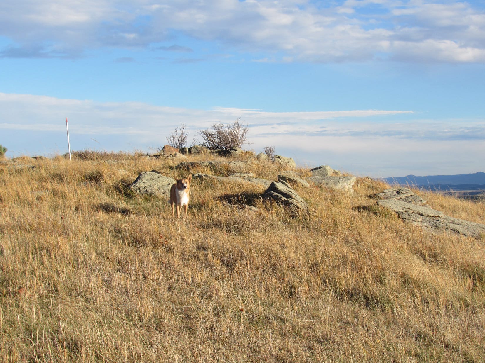
The next morning, Mount Fitzwilliam was in view, tall and impressive in the early light.

Mt. Fitzwilliam looked very tall and impressive in the early morning light on 8-4-16. Photo looks ESE.

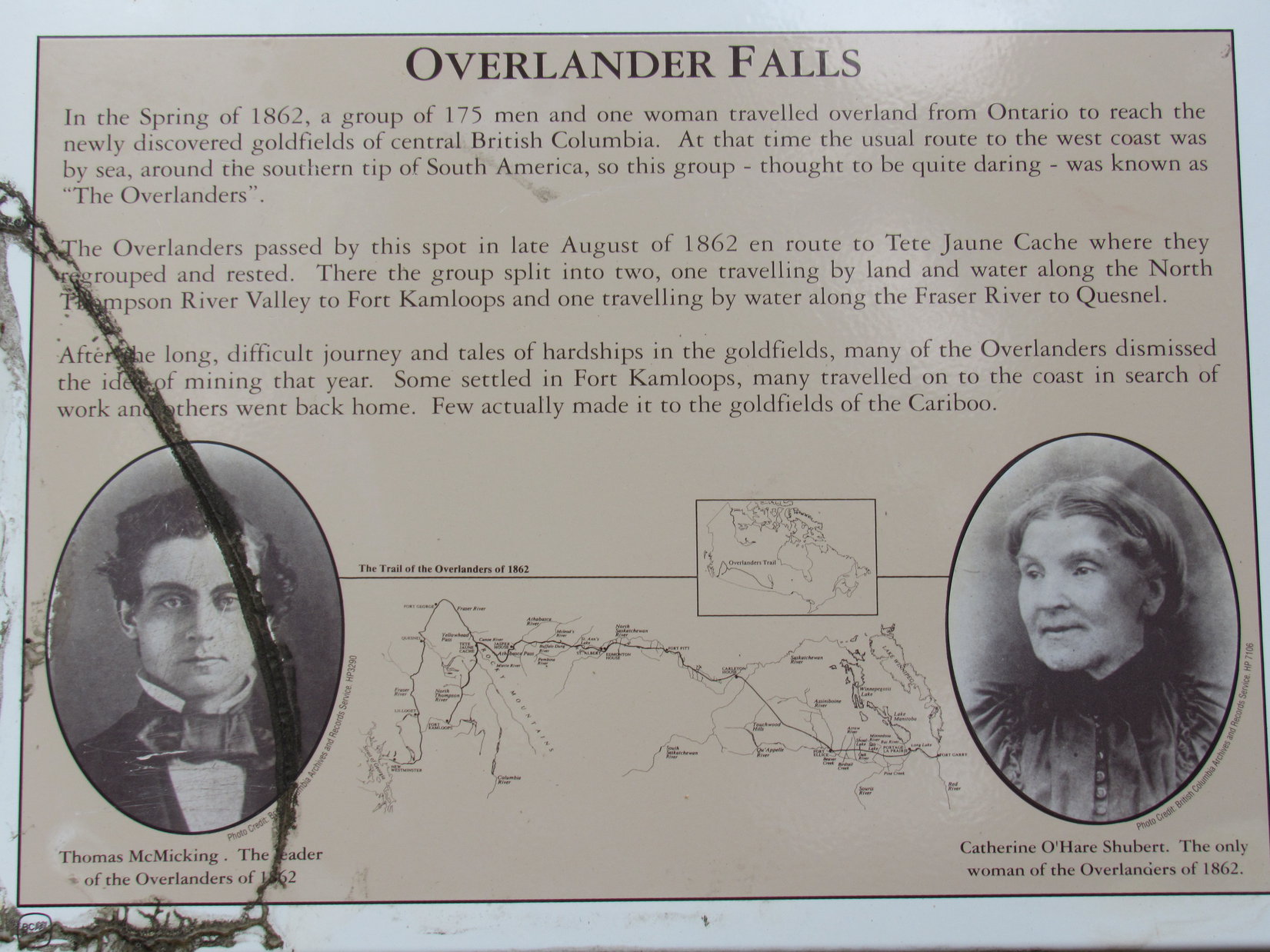
However, Lupe and SPHP were already beyond Mt. Fitzwilliam.  Lupe wasn’t going back.  Today was a special day.  Today Lupe was going N, hundreds of miles farther N than she had ever been before!  Most of the day would be spent traveling, but not too far ahead were two more big Canadian waterfalls Lupe could visit along the way.  The first was Overlander Falls.

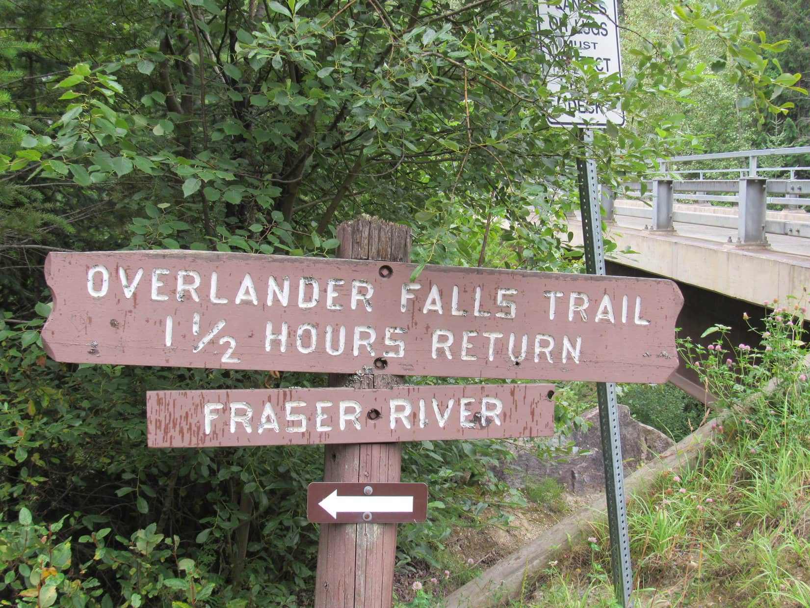
Overlander Falls on the Fraser River is in Mount Robson Provincial Park, within walking distance of the park headquarters.  SPHP parked the G6 at a trailhead along Yellowhead Hwy No. 16.  A sign at the trailhead displayed a simple map of the area.

This simple map was posted at the trailhead E of the Mount Robson Provincial Park headquarters.

Lupe was starting from the E end of the trail system, very close to Overlander Falls.  A wide, well-worn path led into the forest from the highway.  At first, the path lost elevation gradually, but as the roar of the falls grew louder, the trail started switchbacking down a steep slope.

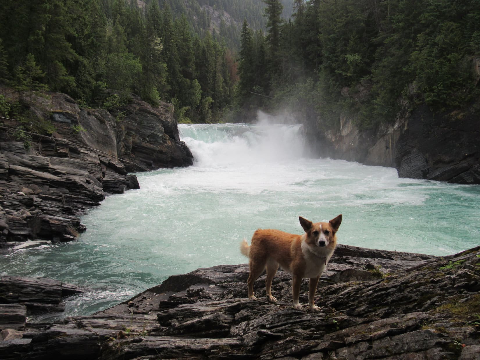
In only 10 minutes, Lupe was at Overlander Falls.  The falls weren’t high at all, but a tremendous volume of beautiful icy blue green water spilled over the brink into a vast swirling pool below.

Overlander Falls wasn't high, but a tremendous volume of beautiful icy blue green water spilled over the brink into a vast swirling pool below.
Overlander Falls wasn’t high, but a tremendous volume of beautiful icy blue green water spilled over the brink into a vast swirling pool below.
Overlander Falls is one of two significant waterfalls on the Fraser River. The other one is Rearguard Falls farther downstream.

A plaque near the falls told the story of how Overlander Falls got its name.

This plaque at the falls relates the history of how Overlander Falls got its name.
Lupe at Overlander Falls, Mount Robson Provincial Park, Canada.
The cool mist from Overlander Falls felt good!

Since most of Lupe’s day was going to be spent traveling in the G6, the 1.6 km Overlander Falls trail along the Fraser River to the Mount Robson Provincial Park headquarters was an appealing option.  No one was around yet, and the trail would provide a peaceful, secluded path through the forest along the scenic blue green river.  Lupe could get some exercise, and SPHP would enjoy the views.  Lupe was most definitely in favor of the idea!

The Fraser River below Overlander Falls.

As it turned out, the Overlander Falls trail did not stay down near the river.  Instead, it paralleled the river mostly 40 to 80 feet above it on the forested slope.  The Fraser River was only occasionally in view.  The trail was in good condition, but didn’t look like it sees an awful lot of use, perhaps because there are trails to more dramatic destinations nearby.  (See Lupe’s fabulous hike to Mount Robson and Berg Lake in 2013 on the Berg Lake Trail!)

The Overlander Falls trail was fairly level most of the time, and an easy hike.  It passed Hogan’s camp, established way back when the railroad was being built.  The Carolina Dog was not too impressed.  Hogan’s camp now amounts to nothing more than a few rotting logs.  However, Lupe did enjoy sniffing and exploring in the forest along the trail.  She found a few squirrels to bark at, which made her day.

Lupe at one of the few viewpoints above the Fraser River along the Overlander Falls Trail.
Fraser River from the Overlander Falls trail.

At the W end of the Overlander Falls trail, Lupe came to a road at a bridge across the Fraser River.  There was no trailhead at this end, just a small sign near the bridge pointing out the trail.  Downstream from the bridge was a bend in the Fraser River.  Lupe and SPHP went down to the river’s edge so Lupe could get a drink.

Lupe along the Fraser River. The Overlander Falls trail heads upstream from the N side of the bridge seen over the river. A small sign on the upstream side of the road at the start of the bridge is the only indication of the trail’s presence. Photo looks upstream.

Overlander Falls trail sign, Mt. Robson PP, Canada 8-4-16After the American Dingo had her drink from the Fraser River, Lupe and SPHP took the road another 0.25 km to the Mount Robson Provincial Park headquarters on the N side of Yellowhead Hwy No. 16.  Unfortunately, the sky had been clouding up.  The summit of Mt. Robson was hidden from view.

Lupe made it to Mount Robson Provincial Park headquarters, but sadly the summit of Mount Robson (behind the visitor center) was hidden in the clouds.

Lupe and SPHP returned to the Overlander Falls trail.  On the way back to the G6, tragedy struck.  Excited by a squirrel, while leaping around in the thick underbrush, Lupe got her right front dewclaw got hooked on something.  Her dewclaw snapped completely off!  It was painful and bled a little, but not much.  The wounded Carolina Dog looked to SPHP for help.

Lupe returns to the Overlander Falls trail.
Lupe in pain with a snapped off right front dewclaw looks to SPHP for help. This photo is typical of the Overlander Falls trail as it went through the deep forest near the Fraser River.

SPHP examined Lupe’s paw, kissed the terrible wound many times, and gave Lupe lots of attention.  When that didn’t cure it, SPHP carried Lupe along the trail.

Naturally, her right front paw hurt where the dewclaw had snapped off right at the base.  Lupe was certain she couldn’t go on.  Until she could.  After 15 minutes of being carted around like a sack of potatoes, at Hogan’s camp Lupe decided she could manage on her own just fine.  Back at the G6, Dr. SPHP applied anti-biotic ointment and a bandage (9:55 AM).

Lupe recuperating in the G6 with her right front paw with the snapped off dewclaw all bandaged up.

Lupe’s adventures (and misadventures) at Overlander Falls were complete.  Time to get back on the road again (10:12 AM), but only for a short stretch.  Lupe had very little chance to recuperate before reaching the trailhead for Rearguard Falls.  She did fine anyway.

This sign at the Rearguard Falls trailhead told of the end of the salmon’s struggle here in their quest to swim up the Fraser River.

The trail to Rearguard Falls wasn’t very long.  Lupe soon came to an elaborate system of walkways with metal railings near the falls.  Like Overlander Falls, Rearguard Falls wasn’t all that high.  Rearguard Falls was almost more like a cascade.  It was still impressive and very beautiful.  Lupe and SPHP stayed at Rearguard Falls for close to an hour.

Rearguard Falls on the Fraser River. Rearguard Falls is downstream from Overlander Falls.
Lupe on the boardwalks leading to Rearguard Falls.
Rearguard Falls in Rearguard Falls Provincial Park, British Columbia, Canada.
Lupe probably would have liked to soak her painful dewclaw wound in the cold waters of Rearguard Falls.
Looking downstream.

Part of the reason Lupe was at Rearguard Falls so long was that other people kept coming and going.  Some of them had very fancy cameras they set up on tripods.  At the closest viewpoint next to the falls, several photographers set up their tripods in succession, each one occupying the coveted spot continuously for 15 or 20 minutes.

It didn’t matter to Lupe or SPHP how long they took.  The stunningly beautiful river, the hypnotic roar of the falls both soothing and powerful, the mountain scenery, and perfect weather made Rearguard Falls a great place to be.  Waiting for a turn at the closest viewpoint, SPHP chatted with people, while Lupe relaxed or enjoyed being admired and petted by friendly tourists.

One lady was here with her husband (who was busy with his camera and tripod at the coveted spot) and two sons.  They were from the Netherlands.  She said they had saved money for 10 years to come to Canada.  Eventually they were going to sail up the inland passage on the Pacific Ocean near the end of their trip.  They loved Canada, and were having a fabulous time!

Finally, it was Lupe’s turn at the closest spot to Rearguard Falls.  Two photos, a final lingering look, and Lupe’s time at Rearguard Falls was over (11:31 AM).

Lupe at the coveted spot closest to Rearguard Falls.

Lupe and SPHP spent nearly all the rest of the day traveling on Yellowhead Hwy No. 16.  Both Lupe and SPHP were farther N than they had ever been before.  Lupe was entering a whole new world!

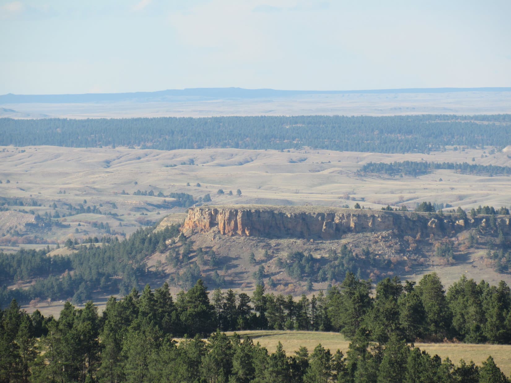
NW of the junction with Hwy 5, traffic on Hwy 16 greatly diminished.  Almost everyone else had turned S on Hwy 5 heading for Kamloops.  Lupe was in a valley miles wide, with a wall of high mountains on each side.  Nearly all the land was forested, but at first there were some farms and fields near the highway, too.  Haystacks were abundant, but curiously, not livestock.  Lupe watched diligently for a long time, but saw only one herd of cows to bark at.

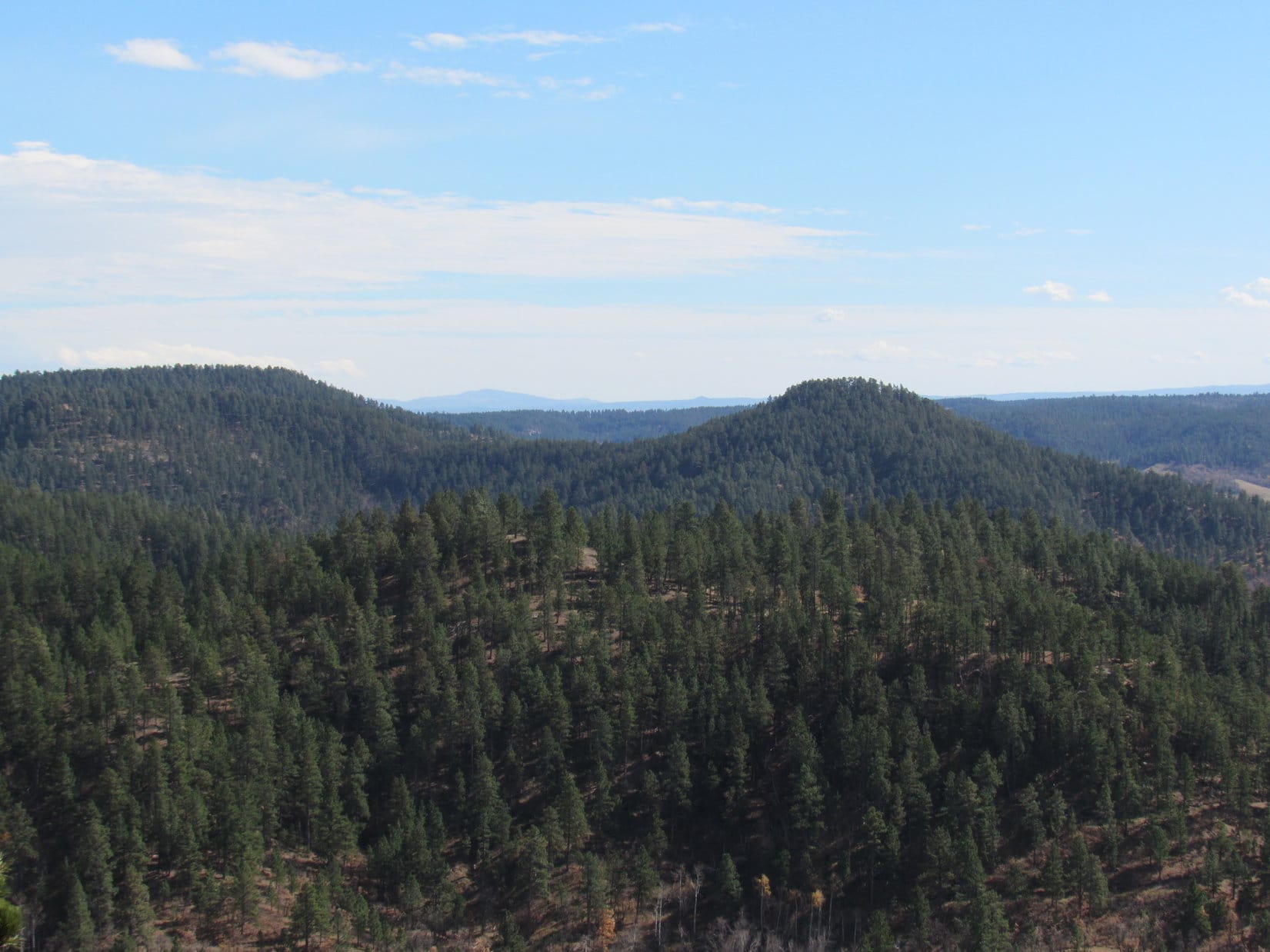
After a while, the farms and fields disappeared.  On both sides of the valley, the high mountains were getting progressively smaller and more distant.  Unbroken forest stretched in every direction as far the eye could see.  Despite being in what appeared to be a complete wilderness, no wildlife was seen except for ravens picking at roadkill.

With no cows or horses to bark at, and no wildlife to hold her attention, Lupe’s eyelids began to droop.  Soon she was snoozing, as the countless miles of endless forest went by.  To SPHP, it was all increasingly magical, to be here, at last, with Lupe in a wilderness that stretched ahead for not only hundreds, but literally thousands of miles, heading toward the unknown.

With no cows or horses to bark at, and no wildlife to hold her attention, Lupe drifted off to a peaceful sleep on her way to more adventures as the miles flew by. Maybe her snooze wasn't all peaceful? While in Dingo Dreamland, sometimes her lips and paws twitched.
With no cows or horses to bark at, and no wildlife to hold her attention, Lupe drifted off to a peaceful sleep on her way to more adventures as the miles flew by. Maybe her snooze wasn’t all peaceful? While in Dingo Dreamland, sometimes her lips and paws twitched.

Granted, what lay ahead wasn’t completely unknown.  SPHP had maps and descriptions, had seen photos online, and had a general plan for Lupe’s 2016 Dingo Vacation adventures.  All that was helpful, necessary and informative to a degree, but only scratched the surface of the possibilities and realities in this gigantic new territory Lupe was traveling through.  And all the preparations weren’t the same as finally being here, actually seeing it all for the very first time.

The mountains were gone, replaced by distant blue ridges, by the time Lupe neared Prince George.  Lupe woke up as the G6 slowed entering the city.  Prince George turned out to be a lively and attractive city situated along the scenic Fraser River.  It was the only large town Lupe would see in all of British Columbia.  SPHP made a couple of stops for gas and groceries.

As Hwy 16 headed WNW from Prince George, farms and fields appeared again, carved out of the seemingly limitless forest.  To Lupe, the open fields meant cows and horses.  This time the Carolina Dog wasn’t disappointed.  Although most of the fields were full of haystacks and bales, Lupe did see lots of cows and horses.  She got plenty of most satisfying barking in.  Now and then she had to stop long enough to slurp up water to wet her poor overworked parched barker.

At a rest stop near Cluculz Lake, Lupe and SPHP devoured half of a whole roasted chicken purchased in Prince George, while a rain shower passed over.  Between the exciting cows and horses, and tasty roasted chicken, Lupe was very much revived.  Back on the road again, she remained awake and watchful.

The long drive was marvelously relaxing.  Lush green fields surrounded by dark forests appeared, and subsequently retreated from view.  Distant blue ridges defined the horizon.  Gray white clouds drifted across a partly sunny blue sky, trailing rain dark streaks of rain behind them.  For a long time, the G6 said it was a perfect 71°F out.

The green fields closer to Prince George gradually disappeared, swallowed by the primal forest.  Lupe passed through a few small towns of significance – Vanderhoof, Fraser Lake, and Burns Lake.  The farther Lupe went, the less traffic remained on the road.  The sun was low by the time Lupe reached Houston, a tiny, quiet community near the Bulkley River.

In Houston, right alongside Yellowhead Highway No. 16, was a very beautiful small park with a fountain, manicured lawn, and a profusion of vibrantly colored flowers.  Here Lupe and SPHP stopped to stretch their legs and admire Houston’s crown jewel, in the little time remaining while it was all still aglow in the sharply slanting rays of earth’s sinking star.

Lupe reached beautiful Steelhead Park in Houston, British Columbia near day's end.
Lupe reached beautiful Steelhead Park in Houston, British Columbia near day’s end.
Steelhead Park was full of a dazzling array of colorful flowers in perfect condition.
Lupe near the fountain.
It must take an enormous amount of work to keep Steelhead Park looking so immaculately manicured. The entire park was in tip top shape!
Rainbow trout and steelheads are the same species, but live very different lives. Rainbow trout live their lives entirely in fresh water, while steelheads are anadromous, meaning they spend part of their lives in the sea.

Lupe at Steelhead Park, Houston, British Columbia, Canada 8-4-16And so, for now, we leave American Dingo explorer and adventurer Lupe in the little town of Houston, deep in northern British Columbia, at the end of Day 6 of her super fabulous Summer of 2016 Dingo Vacation among the brilliant blossoms of Steelhead Park.

At Steelhead Park, Houston, British Columbia, Canada 8-4-16

Links:

Next Adventure                             Prior Adventure

Overlander Falls, Rearguard Falls & Ancient Forest, British Columbia, Canada (8-2-17)

Want more Lupe adventures?  Choose from Lupe’s 2016 Canadian Rockies, Yukon & Alaska Adventure IndexDingo Vacations Adventure Index or Master Adventure Index.  Or subscribe free to new Lupe adventures.

Black Hills, WY Expedition No. 178 – Vision Peak, Bald Mountain & Stoney Point (10-16-16)

Lupe and SPHP hit the road before dawn.  Lupe was on her way to explore the Bear Lodge Mountains, a remote part of the Black Hills in NE Wyoming separate from the main body of the Black Hills in South Dakota.  The sun was up by the time the eager American Dingo reached the Wyoming border.

Lupe reaches the Wyoming border on her way to the Bear Lodge Mountains.

Lupe had 3 peakbagging goals for the day.  SPHP had high hopes for the first one, due to it’s intriguing name – Vision Peak (4,812 ft.).  Those hopes seemed likely to be justified when SPHP parked the G6 off USFS Road No. 830 about 1.5 miles N of Hwy 24 (8:18 AM, 67°F).  Lupe was already high up on a ridge with a view to the S.

The day was unseasonably warm, but with a fairly stiff WSW breeze.  Lupe headed W on USFS Road No. 887.1, a little used side road closed to motor vehicles.  The road climbed a bit, then crossed over to the N side of the ridge, where Lupe was out of the wind.  No. 887.1 then wound around a little below the long ridgeline heading generally W, while slowly losing elevation.

Lupe on the seldom used USFS Road No. 871.1 that leads W toward Vision Peak from USFS Road No. 830. Photo looks SW.

No. 887.1 wound around for more than a mile.  Lupe didn’t find any squirrels, but whitetail deer were abundant.  The road never returned to the ridgeline, although Lupe and SPHP made one foray up onto the ridge before returning to the road again.  To the N, Lupe had views of another high ridge beyond Lucky Gulch.

Looking N toward a high ridge on the other side of Lucky Gulch.

Lupe was making great progress, when suddenly USFS Road No. 887.1 simply ended W of High Point 4805.  Fortunately, Lupe was already almost to the saddle over to Vision Peak.  A short bushwhack through the forest brought Lupe to the E end of the saddle.

Lupe reaches the narrow saddle over to Vision Peak. Here she is at the saddle’s E end, which was surprisingly bare. Most of the saddle was forested. Photo looks WSW.

Lupe crossed the saddle and began climbing.  She encountered a couple of minor rock outcroppings along the way, but the climb was neither long nor difficult.  Soon she reached the top of Vision Peak (4,812 ft.).

Lupe at the summit of Vision Peak. This was the best view. Photo looks S.

Since Vision Peak is positioned way out at the far W end of a long, fairly narrow ridge, SPHP had been hoping for great wide open views, especially toward the W.  Lupe did find quite a nice view to the S right at the true summit, but most of the summit ridge was too heavily forested to see much.  Somewhat disappointingly, Vision Peak seemed to be a BYOV (Bring Your Own Vision) mountain.

Lupe stands on a big rock at the far W end of the Vision Peak summit ridge. She has a narrow view between the trees to the W.
This photo shows much of the summit ridge of Vision Peak. Here Lupe is near the W end. Photo looks E.

Lupe and SPHP lingered on Vision Peak for a little while, taking a break and enjoying the best view, which was to the S.  The wind was out of the SSW about 20 mph, but wasn’t bad at ground level.  The forest provided quite effective protection, although the wind was certainly heard in the treetops.

On the way back to the G6, instead of taking the road, Lupe and SPHP climbed up onto the long ridge after crossing the saddle E of Vision Peak.  There were more impressive rock outcroppings along this climb up onto the ridge, than there had been climbing Vision Peak.

Although it was a bit out of the way, Lupe visited High Point 4805.  On the way there, she caught a glimpse of a high, partly barren hill off to the NW.  That was probably her next peakbagging goal, Bald Mountain (4,800 ft.)!

Near High Point 4805 (ENE of Vision Peak), Lupe caught this glimpse of Bald Mountain (R) off to the NW.

The trek along USFS Road No. 887.1 to get close to Vision Peak had been pleasant and easy, but the return trip along the top of the ridge was more fun.  Distant views to both the N and S occasionally presented themselves, and deer were plentiful.  Lupe even found a couple of squirrels along the way, which she greeted with her usual enormous enthusiasm.

Even though Vision Peak itself had turned out to be somewhat of an anti-climax, the whole excursion had been a pleasant success (10:55 AM, 70°F).

Lupe’s next peakbagging goal was Bald Mountain (4,800 ft.).  Getting to Bald Mountain was supposed to be another relatively easy tromp through the woods over some high ground with little net elevation change.  SPHP drove farther N on USFS Road No. 830 for a couple of miles looking for a closer starting point, ultimately parking at the start of USFS Road No. 830.4C (11:08 AM, 70°F).

Like No. 887.1, No. 830.4C was gated off and closed to motor vehicles, so it hadn’t seen much recent use either.  Lupe and SPHP set off following it WSW through the forest.  At first, everything seemed fine.  Lupe was having a great romp in the woods, and there were deer everywhere.  Gradually, however, the road turned more to the SW, then SSW, as it became fainter and fainter.  Lupe did not come to any of the side roads SPHP was expecting to find.

Eventually No. 830.4C faded away completely.  Lupe was in the middle of the forest.  It looked like there was blue sky between the trees off to the W, so maybe there was a viewpoint over there.  Lupe and SPHP headed W.  Yes, there was a view.  What SPHP presumed was Bald Mountain was in sight off to the W.  However, there was a big canyon between Lupe and Bald Mountain.  Something was wrong.  Time to consult the maps.

The exciting conclusion was that No. 830.4C must not have been the best place to start for Bald Mountain.  The big intervening canyon between Lupe and Bald Mountain was almost certainly Reservoir Gulch.  Lupe was too far S.  She would have to backtrack and go around the upper end of Reservoir Gulch.

It was farther than SPHP expected.  Lupe went up and down, crossing many ravines feeding into Reservoir Gulch as she now headed back to the NE.  Finally, a road appeared dead ahead.  When Lupe reached it, SPHP saw that less than 100 feet off to the SE, this road intersected a bigger road.  Oh, brother!  Lupe was all the way back to USFS Road No. 830.

The G6 was nowhere in sight.  Lupe was farther N along No. 830 than where it had been left.  A sign at the side road showed that Lupe had reached USFS Road No. 881.1.  Another sign showed that it led to Planting Spring.  Time for another map check.

Lupe at the start of USFS Road No. 881.1 to Planting Spring where it leaves USFS Road No. 830. Photo looks NW.

OK, this was it!  No. 881.1 was definitely the right road to take.  Lupe didn’t need to go all the way to Planting Spring, but in less than a mile Lupe should reach another road going SW toward Bald Mountain.  After a short rest break, Lupe and SPHP set off again.

No. 881.1 was a much better road than No. 830.4C had been.  Even so, Lupe soon came to a gate across the road closing No. 881.1 to motor vehicle traffic, too.  Apparently all these minor roads were closed to motor vehicles.

No. 881.1 went up and down little hills on its way W.  After about a mile or so, Lupe did come to a side road that turned S (L) in a sunny meadow.  This side road was marked No. 881.1A.  Lupe followed it, and soon it did turn SW.

Lupe on USFS Road No. 881.1A on her way to Bald Mountain. There were still some fall colors around.

After 0.25 mile or so, Lupe came to a marker for USFS Road No. 881.1C.  A faint track went off to the WNW (R).  Lupe stayed to the L on the better road.  In another 0.25 mile, No. 881.1A reached some cliffs.  Lupe was now on the N side of Reservoir Gulch.  From the cliffs, Lupe could see Vision Peak off to the SE.

Lupe reaches the cliffs along the N edge of Reservoir Gulch. Vision Peak (Center), where Lupe had been a little while ago, is in view. Photo looks SE.

Lupe had only another 0.5 mile to go to reach Bald Mountain.  She came to a variety of scenic points along the way.  She passed by some groves of scrub oaks sporting orangey brown leaves.

Lupe passed by several big groves of scrub oaks with orange or brown leaves. This grove with orange leaves glowing in the sunlight was particularly nice. Photo looks SW.

USFS Road No. 881.1A did not go quite all the way to Bald Mountain.  It played out about 0.25 mile from the summit.  A few hundred feet farther W was a small ridge topped with scattered large boulders.  It was possible to get a distant view to the W from one of the boulders.

Lupe up on a boulder with a view to the WNW. Her fur is being blown by a strong wind from the SW.

Lupe went S following the boulders.  When the small ridge ended, Lupe continued on through the forest.  She eventually wound up back along the N edge of Reservoir Gulch again.  Here she had an even better view of Vision Peak to the SE.  She was getting quite close to her Bald Mountain objective, too.

Lupe reached cliffs along the N edge of Reservoir Gulch again as she was getting close to Bald Mountain. The views of Vision Peak (L of Center) were even better here. Photo looks SE.
Vision Peak (R of Center) looked heavily forested. Small wonder Lupe hadn't been able to see much from there! Photo looks SE.
Vision Peak (R of Center) looked heavily forested. Small wonder Lupe hadn’t been able to see much from there! Photo looks SE.
Lupe along the dramatic line of cliffs leading to Bald Mountain. Lupe's almost there! Photo looks SW.
Lupe along the dramatic line of cliffs leading to Bald Mountain. Lupe’s almost there! Photo looks SW.

Lupe reached the top of Bald Mountain (4,800 ft.).  The summit area was a huge triangular field of tall grass, several hundred feet long on each side.  Forest ringed much of the N and NW edges of the field, and around the S tip, but elsewhere there were great unobstructed views.  This was more like it!  Bald Mountain should have been named Vision Peak!

The most dramatic view was to the SW.  Off in the distance, Lupe could see Devils Tower (5,112 ft.) and Missouri Buttes (5,374 ft.).

On top of Bald Mountain in the Bear Lodge Mountains of NE Wyoming. The views here were fabulous! Off in the distance are Devils Tower (L) and Missouri Buttes (R). Photo looks SW.
Devils Tower from Bald Mountain. Photo looks SW using the telephoto lens.
Vision Peak (Center) from Bald Mountain. Photo looks SE.
In the huge grassy field at the top of Bald Mountain. Photo looks NNW.
Looking pretty happy on Bald Mountain.

Lupe and SPHP took a stroll around the summit field before settling down for a break.  Lupe had water and Taste of the Wild.  SPHP had an apple.  The big view toward Devils Tower and Missouri Buttes was simply marvelous.  It might have been even a little more marvelous if the weather wasn’t deteriorating.

What had been a 20 mph SSW breeze earlier in the day, had built up to a 35 mph gusty SW wind.  Big clouds were moving in from the SW.  The clouds sprinkled light rain for a few minutes, but the rain shower didn’t amount to much.  Lupe didn’t care for that wind, though!  She preferred curling up behind SPHP to facing directly into the wind to see the view.

The big view toward Devils Tower (L) and Missouri Buttes (Center) on the horizon. A 35 mph wind was gusting up Bald Mountain from this direction. View or no view, Lupe preferred hiding behind SPHP to staring into the wind. Photo looks SW.

With Lupe’s second peakbagging success of the day secured, it was time to return to the G6.  Away from the SW edge of Bald Mountain, the wind was hardly noticeable.  As big clouds sailed across the sky overhead, Lupe roamed the forest.  She saw lots of deer.  The occasional squirrel kept her entertained.

Near Bald Mountain, she passed by the orange and brown groves of scrub oak again.  Farther along, were the yellow aspens.

Returning from Bald Mountain, Lupe passed by the orange and brown groves of scrub oak again. Photo looks N.
Yellow aspens near USFS Road No. 881.1A on the return trip from Bald Mountain.
A particularly brilliant stand of aspens that was more orange than golden.

The return trip was simply a retracement of Lupe’s route to Bald Mountain all the way back to USFS Road No. 830.  From there, Lupe had to follow No. 830 going S until she found the G6 again, still parked at the start of USFS Road No. 830.4C (2:47 PM, 66°F).

Most of the big clouds were gone now.  The sun was out again.   A little over three hours remained before sunset.  Lupe had one more peakbagging goal left for the day.  About 6 or 7 miles farther N on No. 830, the old USFS map showed a side road leading close to Stoney Point (4,480 ft.).  SPHP drove N looking for it.

A wooden rail fence curved away from USFS Road No. 830 where SPHP found the side road Lupe needed to follow toward Stoney Point.  A pickup truck and travel trailer were parked near the start of the side road, which was unmarked by any road number or name.  A big black horse with a large white spot on his forehead stood right in the middle of the side road.  “Spot” seemed to be the campsite’s only occupant at the moment.

SPHP parked the G6 on the W side of No. 830, away from the camp (3:22 PM, 64°F).  Lupe and SPHP then cut through a field on the S side of the rail fence away from “Spot”.  SPHP hoped to keep Lupe from playing a game of “See Spot run!  Run, Spot, run!”  Spot was quite curious about what was going on, and watched Lupe nervously.  Although Lupe loves barking at horses from the G6, she paid Spot no mind.  She reached the side road well beyond where Spot had effectively blocked it.

On the side road, Lupe soon arrived at a fence and gate.  Ahh, yes!  This minor dirt road, like all the others, was also closed to motor vehicles from here on.  A pickup truck with Ohio license plates was parked nearby.  Lupe and SPHP continued following the side road.  Stoney Point was still 2.5 miles to the NE.

Before long, Lupe came to a place where there was a grassy hill on the N side of the road.  Up on the hill were a couple of interesting large boulders.  Lupe and SPHP headed for the boulders.  Lupe leaped up on the biggest one for a photo and a look around.

Up on a boulder on the way to Stoney Point. Photo looks ENE.

With nothing else of note in the area, Lupe and SPHP continued on, taking a shortcut over the small grassy hill.  More boulders came into view as Lupe reached the crest of the hill.  As Lupe passed by the first big one, she discovered someone sitting with his back to the boulder only a couple of feet away.  A hunter!

Lupe’s sudden appearance right next to him seemed to startle the hunter for a moment.  When he saw SPHP, he waved, and SPHP waved back.  Lupe and SPHP went on.  From up on the hill, the hunter had a great view of the large field to the E.  Lupe and SPHP crossed the field, reached the road again, and eventually disappeared from his range of view as the road returned to the forest.

Hearing gunfire on Lupe’s expeditions, isn’t that uncommon.  Usually any gunfire is distant and from people doing target practice, but occasionally there are hunters about, especially this time of year.  However, Lupe has seldom actually seen hunters in the field.  Lupe and SPHP rarely see anyone on her Black Hills expeditions, except near major roads.  Lupe had never come right up on a hunter in the field like this before!

The road went close to the edge of a canyon.  There was a big view to the SE.  On the far horizon, Lupe could see the Black Hills back in South Dakota.

Lupe up on the edge of a wide canyon on her way to Stoney Point. The Black Hills of South Dakota are in view on the horizon. Photo looks SE.

The road left the edge of the canyon curving first N, then NW, as it continued through the forest.  However, the road soon left the forest as it turned N again.  Up ahead was a another grassy hill with some big boulders near the top.  Wearing bright orange, another hunter was stationed up there!

Lupe stuck to the road.  The hunter and SPHP waved as the American Dingo passed on by.  When Lupe reached the top of the hill, the road turned NE crossing a huge level field.  This treeless plain was exposed and windy.  Not as windy as Bald Mountain had been, but a 20 mph SW wind swept across the field.  At the far end of the field were some low rocks near a few pine trees.  When she got there, Lupe sought out a place sheltered from the wind.

Lupe escapes the wind at the low rocks near the NE end of the huge field. Photo looks ESE.

SPHP checked the maps.  Stoney Point had to be close by.  It was just a small hill to the ENE beyond this elevated windswept plain.  Lupe could be there in 15 minutes.  Lupe was disappointed to learn she had to leave her cozy windbreak to press on.

Back in the wind, not far from her windbreak, Lupe stands on low rocks strewn across the NE edge of the huge field. Beyond is a mixed forest of scrub oak and pine. Photo looks NW.
From the edge of the huge field, Lupe could see a very long way to the N and E. This photo looks NNW. Somewhere out there is Montana!
Looking NNW from the huge field using the telephoto lens.

A short distance E of Lupe’s rocky windbreak, Stoney Point (4,480 ft.) came into view.  Stoney Point was just a barren hill with a few boulders, bushes and trees scattered over it.  The views would be good from there, though.

Stoney Point is the small barren hill seen beyond Lupe. Photo looks E.

Lupe headed for the biggest rocks on the NW slope of Stoney Point as she approached.  The wind was blowing hard when she jumped up on them.

Getting closer to Stoney Point! Lupe headed for the biggest collection of rocks seen on the L.
Want a weather report, SPHP? Try WINDY! Hurry up and snap the shot so I can get down off of this rock!
Looking NW from Stoney Point. It may have been windy, but at least it wasn’t cold. The wind was out of the SW, not the N.

From the big rocks, it was only a short stroll up to the summit of Stoney Point.  There were huge distant views from the NW to the ESE.  Lupe could see a very long way out across low pine-covered ridges and high prairie.  Despite the wind, Lupe and SPHP hung around a while checking out the views.

Lupe stands on the highest rocks of Stoney Point, successfully completing her 3rd peakbagging goal of the day! Photo looks SSE.
Looking W back toward the high ridge where the huge field is that Lupe traveled across to get to Stoney Point.
Looking ESE from Stoney Point. Bear Butte (4,422 ft.) is seen on the R as a faint, but noticeable bump on the far horizon.

SPHP had noticed a post with a red top up on Stoney Point when Lupe first arrived, but hadn’t though much of it.  SPHP was surprised when Lupe found a survey benchmark a few feet away.  The old USFS map hadn’t shown a benchmark, but here it was!  A closer look at the topo map from Peakbagger.com did show the benchmark.

The “Stoney” survey benchmark.
Lupe sitting right next to the Stoney Point survey benchmark. It is hard to see, but is about 6" to the L of her tail. Photo looks NW.
Lupe sitting right next to the Stoney Point survey benchmark. It is hard to see, but is about 6″ to the L of her tail. Photo looks NW.

When the time came to leave Stoney Point, SPHP started heading W down the hill on the way back to the huge field.  A minute later, SPHP realized Lupe wasn’t coming.  She was still back up near the summit of Stoney Point.  SPHP called her, but she still didn’t come.  She was standing stiffly in place.

When SPHP left Stoney Point, Lupe didn't come along. Instead she stood stiffly in place. She refused to move, even when SPHP called her. Photo looks ESE.
When SPHP left Stoney Point, Lupe didn’t come along. Instead she stood stiffly in place. She refused to move, even when SPHP called her. Photo looks ESE.

Lupe looked like she did earlier in the year when she had encounters with cactus.  SPHP hadn’t noticed any cactus, but maybe she had stepped on one somewhere up on Stoney Point?

SPHP returned to Lupe.  She let SPHP inspect all her paws.  No cactus spines anywhere – nothing was wrong that SPHP could see.  Still, something must have happened.  Maybe she stepped on something sharp, and thought it was a cactus?

In any case, Lupe wouldn’t budge.  SPHP carried her as far as the big rocks on the NW slope of Stoney Point.  She was willing to pose for a couple more photos from the rocks.

SPHP carried Lupe back to the big rocks on the NW slope of Stoney Point. Photo looks NW.
Lupe on the rocks. Photo looks S.

For some reason, being up on the rocks helped Lupe’s confidence.  Presumably she discovered her paws didn’t really hurt as she moved around.  All on her own, off she went, now leading SPHP on the way back to the G6.  When she reached the E end of the huge field, she paused for one more look back at Stoney Point.

Looking back at Stoney Point beyond Lupe. Photo looks NE.

The second hunter was still in position when Lupe went by again.  Once again, the hunter and SPHP waved.  Returning to the forest, Lupe found a squirrel to bark at.  She had a great time, but a little later, as she was approaching the area where she had startled the first hunter, he came down the hill toward SPHP.  Oh, boy.  Maybe he had heard Lupe barking, and was unhappy thinking she had driven away whatever he might be hunting?

Nope.  The hunter was just friendly.  He was really a very nice guy, and simply wanted to meet Lupe and chat with SPHP.  His name was Joe Eberz.  He was from Ohio, and was way out here in NE Wyoming hunting elk.  Had Lupe seen the rest of his party?  Yes, but only half of it.  Turned out there was a third hunter Lupe and SPHP hadn’t noticed somewhere out there.

Joe hadn’t seen any elk in Wyoming yet, and neither had Lupe or SPHP today.  Plenty of deer around, but none of Lupe’s “giant deers”.  Joe and his party still had several more days to hunt.  Maybe they would find elk before they had to return to Ohio.

Joe and SPHP had a pleasant conversation.  Joe said Lupe really had startled him when she made her first sudden appearance.  SPHP had been amazed to see Joe sitting behind the big rock, too!  Joe petted Lupe, and had his picture taken with her.

Lupe in the remote Bear Lodge Mountains of NE Wyoming with her new friend, elk hunter Joe Eberz from Ohio.

So Lupe returned to the G6 (6:11 PM, 55°F) having made a new friend from Ohio – a great finish to a splendid day of peakbagging way out here in the remote Bear Lodge Mountains of NE Wyoming!

img_3138

Links:

Next Black Hills Expedition                    Prior Black Hills Expedition

Want more Lupe adventures?  Choose from Lupe’s Black Hills Expeditions Adventure Index or Master Adventure Index.  Or subscribe free to new Lupe adventures.