Day 6 of Lupe’s 2018 Dingo Vacation to the Bighorn Mountains of Wyoming & Beyond!
1:50 AM at a dispersed camping site near USFS Road No. 11, 1.5 miles N of Highway 14A in the northern Bighorns – The wind hadn’t died down at sunset as expected, yet it was warm in the G6. Too warm. Hot and thirsty, Lupe lay panting hard on her pile of pillows and blankets. She eagerly lapped up the water SPHP gave her. The Carolina Dog coughed as some of it went down the wrong pipe. SPHP opened the door, and a cool breeze flooded in. Relief!
The next time SPHP woke up, it was light out, but still early. Lupe left the G6 to sniff the air. Yesterday hadn’t been all that difficult, but SPHP still felt worn down. Too much sun and wind.
More snoozing. Even Loop seemed content to gaze out the window or doze. She chased a tennis ball a few times, but that was it. Most of a breezy, leisurely morning passed by before action sounded good again.
Happily, nothing too strenuous was on the agenda. Two of the biggest, most scenic waterfalls in the Bighorn Range weren’t far from here. Lupe could go see both of them! Maybe she would even have time enough to climb Duncum Mountain (9,831 ft.) late in the day? USFS Road No. 11 passes over a saddle near the summit. Despite Duncum’s 871 feet of prominence, an ascent wouldn’t involve much more than an easy stroll.
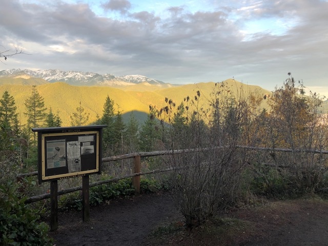
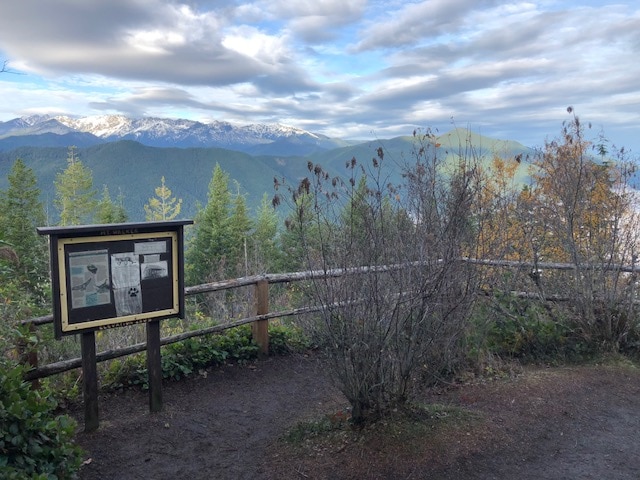
SPHP drove 1.5 miles N on USFS Road No. 11 to an intersection with USFS Road No. 14. Another 6 or 7 miles NW on No. 14 got Lupe to the big Bucking Mule Falls trailhead parking lot at the end of the road. No one was around when Lupe hopped out of the G6. (10:43 AM, 68°F)


The trail to the Bucking Mule Falls overlook is about 2 miles long. Lupe soon found it along the W side of the parking lot.


As Lupe and SPHP set out, the trail entered a lodgepole pine forest.

The trail went gradually downhill most of the time. The forest was open enough to see quite a way through it, but Lupe had no distant views.

After a mile or so, switchbacks went down a steeper slope. Lupe soon arrived at Big Tepee Creek. The creek was 1.2 trail miles from the start. Lupe cooled her paws off and got a drink.

Crossing Big Tepee Creek was cake! A good wooden bridge went over it.

After crossing Big Tepee Creek, the trail regained some elevation. So far the trail had been easy to follow, but Lupe now came to a fork.

SPHP initially had no clue which way to go, but then noticed the answer carved in a log by the path to the L.

Farther on, Lupe came to a sunny clearing. This was the first genuine break in the forest. A sign leaned against the base of a post it had once been attached to.

Apparently the trail to the Bucking Mule Falls overlook parted ways at this clearing with Bucking Mule National Recreation Trail No. 53.
The trail to the falls gets nearly all the traffic. Trail No. 53 was so faint, SPHP wouldn’t even have noticed it if not for the sign. Lupe took the well worn path leading to Bucking Mule Falls.
Bucking Mule Falls overlook wasn’t much farther. The first indication that the American Dingo had arrived came as she approached a flat area containing a partially collapsed log fence. A side path went up a little rise to the L (NW).

On the other side of the rise, a narrow strip of ground led directly to a rocky knob jutting out into a huge canyon. The top of the knob was as spacious as a large room in a house, and surrounded by tremendous cliffs on 3 sides. This area was completely undeveloped without any safety railings.

Lupe ventured out onto the knob. Directly ahead was a grand view of Devil Canyon.

Off to the R, and far below, was what the Carolina Dog had come to see – Bucking Mule Falls!

Nearly 0.2 mile to the NNE, even the top of Bucking Mule Falls was more than 400 feet lower than Lupe’s current position at the overlook. To get a clear view of the entire waterfall, the Carolina Dog had to get mighty close to the huge cliffs along the edge.

The day was sunny and warm. After a good look at Bucking Mule Falls, Looper felt like relaxing in the shade of a nearby pine tree. Probably a better idea than spending too much time on the brink of the precipice.
While Lupe panted in the shade, SPHP admired Bucking Mule Falls.


Bucking Mule Falls may be the tallest waterfall in the entire Bighorn Mountain range, but it isn’t all that accessible. The rocky knob overlook provided a stunning view, but from nearly 0.2 mile away. There wasn’t an easy way to get down close to the waterfall other than going over the edge of the precipice.
American Dingoes are dead set against flinging themselves over the edge of any precipices. SPHP felt pretty much the same way. However, back by the dilapidated log fence it had looked like the trail continued farther E. Maybe there were more viewpoints?
It seemed worth checking out. Lupe and SPHP returned to the the log fence. Proceeding E through a forest, the trail soon shrank to a narrow single track. To the N, the terrain sloped sharply down to unseen cliffs. Perhaps there were places along the cliffs from which the falls could have been seen, but it looked dangerous to go anywhere near them.
The narrow single track trail led to a meadow where it became a two track dirt road. By the time Lupe was 0.25 mile from the rocky knob overlook, it was becoming clear that wherever this road went, Loop wasn’t going to come to any better views of Bucking Mule Falls.
That settled that. Returning to the rocky knob overlook, Loop and SPHP enjoyed Bucking Mule Falls a while longer.


On the way back to the trailhead, Lupe cooled off in Big Tepee Creek again. The return was otherwise uneventful. (1:57 PM, 70°F)

The day was still sunny and bright. The uphill climb back to the parking lot had made it seem warmer out than it really was. Porcupine Falls was next on Lupe’s agenda. The Carolina Dog had been there once before. While Porcupine Falls isn’t nearly as tall as Bucking Mule Falls, a huge pool of water at the base of the falls is easily accessible.
SPHP put on a bathing suit, having come up with the ludicrous notion that a dip in the pool below Porcupine Falls might be a fun, refreshing way to cool off. Prepared for ill-advised action, Lupe and SPHP left the Bucking Mule Falls trailhead. SPHP drove less than 3 miles back along USFS Road No. 14 to a R (W) turn onto USFS Road No. 146. A sign pointed to Porcupine Falls Trail No. 135.

No. 146 went 0.5 mile W before ending at the Porcupine Falls trailhead. Lupe was pleased to see that she wasn’t going to have to carry anything. (2:30 PM, 69°F)

Trail No. 135 to Porcupine Falls was short, but steep. Switchbacking down a forested slope, the trail began a descent into Devil Canyon. The switchbacks eventually led to a long flight of stairs.


Trail No. 135 is less than 0.5 mile long. Near the end of the descent, part of the pool of water at the base of Porcupine Falls came into view. Soon Lupe could see part of the waterfall, too.


SPHP was struck by the beauty and accessibility of Porcupine Falls! Bucking Mule Falls was certainly impressive and much taller, but had been so far away that it’s full splendor wasn’t as easy to appreciate.

Upon reaching the canyon floor, Loop got as close to Porcupine Falls as she could. She scrambled onto a boulder near the edge of the pool below the falls. The swirling gray-green pool looked deep. The Carolina Dog did not venture in.


No one had been at the Bucking Mule Falls overlook, or on the trail to it. However, 4 people were at Porcupine Falls when Lupe arrived. Groups of people kept coming and going. Lupe and SPHP were never alone.
Everyone wanted to get on the rocks closest to the falls. Loopster left her boulder to give them all a turn. She headed over to the downstream side of the pool where Porcupine Creek flows out of it.


The day wasn’t as sunny as it had been earlier. The sky was clouding up. The moment of truth was upon SPHP. Take a plunge into the pool below the falls, or not? No one else was dipping so much as a toe into the water. The idea no longer seemed quite as appealing as it had a little while ago, but SPHP stripped down to the bathing suit, and waded into the shallow downstream end of the pool.
The American Dingo followed, but SPHP told her to stay put. The water was cold and getting deeper fast. There wasn’t going to be any getting used to this. Now or never! While Lupe watched from the shallows, SPHP plunged in.
Still the first half of June. Snow melt. The pool was absolutely frigid! The shock took SPHP’s breath away. Fully “refreshed” in a nanosecond, SPHP splashed about only long enough to get turned around, find firm footing, and make an escape. A few seconds elapsed at most.
SPHP toweled off, then sat shivering on a rock praying for the sun to reappear. Occasionally it did, but it never stuck around long. The day already seemed to be cooling off. While SPHP tried to warm up and dry off, Lupe sniffed around further investigating the whole area near and below Porcupine Falls.


People kept coming. They all seemed to be quite sane. None ventured into the water. A couple of young women had brought along a 5 month old puppy named Cedar. Cedar wanted to play. Loop preferred to relax and listen to the roar of the falls.

Thankfully, the sun finally did come out for a while. SPHP warmed up. Porcupine Falls was sure a beautiful spot! Lupe and SPHP hung around for more than an hour.


The moment arrived when the steep trudge back up Trail No. 135 to the trailhead had to be faced. It was late afternoon when Lupe got back to the G6. (4:40 PM, 69°F) However, days are long in June. Loopster still had plenty of time to visit Duncum Mountain (9,831 ft.).
SPHP drove back to USFS Road No. 11. Taking No. 11 N (L), the road wound steeply up the S end of Duncum Mountain. 3 miles from the intersection, SPHP parked the G6 just N of a cattle guard. (5:55 PM, 63°F)
Duncum Mountain has two summits situated a mile apart. USFS Road No. 11 goes over an enormous saddle between them. The G6 was parked on this saddle roughly halfway between the two high points. According to the topo map, the NW summit is the higher of the two, but only by 1 foot. Since the two high points are so close to the same elevation, Lupe planned on visiting both.
The top of Duncum Mountain is a vast treeless region. Both summits were more or less in view from the G6. The SE summit, crowned by large, irregular dolomite formations looked far more intriguing than the featureless NW one. Lupe headed for it first.


Due to the absence of trees, the views were tremendous in all directions.

A few miles off to the NE, a large cloud bank nestled over lower terrain. SPHP thought nothing of it. The air was calm. For days, whenever there had been wind, it had been out of the W or SW.
The SE summit of Duncum Mountain was an easy 0.5 mile march from the G6. Surprisingly, before the Carolina Dog could get there, a breeze sprang up out of the NE. The cloud bank was coming closer! Soon wisps of fog were streaming over Duncum Mountain.


Lupe discovered a small cairn on some high ground, as she drew near the SE summit. SPHP looked around for a survey benchmark shown on the topo map, but found nothing. 200 feet off to the E, a couple of posts were visible near the highest dolomite formations. The American Dingo headed that way.
Close to the posts, a metal rod stuck up 10″ from a concrete base. Again, a search of the area revealed no survey benchmark of the usual type.
A nearby 30 foot high column of dolomite proved to be the clear location of Duncum Mountain’s SE summit. Good thing the true summit was the NW one! No way on earth was Lupe ever going to be able to get up onto that 30 foot high vertical column!

Since the SE summit’s highest point was beyond reach, Loopster did the next best thing. With a boost from SPHP, she scrambled atop the second highest point, a larger rock formation just W of the vertical column.


Thinking the fog would blow by shortly, SPHP let Loop sniff around the interesting rock formations for a while. The fog only grew denser. All distant views disappeared entirely.

Still believing the fog was likely to dissipate, SPHP gave up on waiting it out at the SE summit. Looper might as well head to the NW high point, which was the true summit, anyway.
The American Dingo returned to USFS Road No. 11. She followed the road N gaining elevation, but eventually left it heading NW. The search was on for Duncum Mountain’s true summit! The fog had not lifted, however. Loop traveled up a long slope strewn with mostly small rocks, minimal vegetation, and numerous depressions in the dolomite.
Somewhere up ahead, a marmot squeaked. Lupe disappeared into the fog. She could be heard barking. SPHP arrived to find Loop circling a large stone looking for a way at the unseen marmot hiding beneath it. However, the marmot had chosen its fortress wisely. The ground was so rocky, the Carolina Dog could make no progress against it.

Enough of that! SPHP called Lupe away.
The search for Duncum Mountain’s true summit continued. The terrain finally began to level out. Ordinarily it ought to have been a simple matter to go straight to the high point. The top of Duncum Mountain was a huge, nearly flat plain with nothing to obstruct the view.
Nothing, but fog, that is. It was worse than ever. Big rocks that must have been somewhere along the W edge of the vast summit area faded in and out of sight like ghostly apparitions. SPHP consulted the topo map. The true summit was supposed to be out in the middle, not too close to the W edge.
Hoping for a cairn, or possibly a large rock, Lupe and SPHP wandered a gray world looking for the highest ground. Despite the fog, it didn’t take long to discover a small cairn. As far as it was possible to tell, Lupe had made it! This was the true summit of Duncum Mountain (9,831 ft.).

A cluster of tiny blue wildflowers grew next to the cairn. Dimly seen through the fog, an unusually large depression 65 feet to the E was the NW summit’s only nearby notable feature. Loopster had come to many depressions in the dolomite, but perhaps this one was large enough to serve as a landmark?

Visibility was only 100 feet. The fog hadn’t lifted as SPHP expected. In fact, it was still getting denser. With no reason to linger, Loop and SPHP left Duncum Mountain’s true summit heading SE for USFS Road No. 11 and the G6.
After a 10 or 15 minute hike, Lupe came across the summit cairn again. What? Impossible! But there it was. SPHP had gone in a complete circle. How silly! Time to quit daydreaming and pay attention. Loop set off for the G6 a second time.
To SPHP’s horror, 15 minutes later Lupe again sauntered up to the little summit cairn. Having once found it, she couldn’t escape it. Thick fog streamed by. Visibility was now reduced to only a few 10’s of feet. This was ridiculous! The road wasn’t even 0.2 mile away by the shortest route, but SPHP hadn’t been able to find it.
For a third time, Lupe left the summit cairn heading SE. This time SPHP simply ignored all visual clues and walked so the NE breeze always came from the L. Suddenly, Lupe streaked away, disappearing instantly into the fog. What now? A few seconds later, SPHP heard faint barking. Loop was a long way off, but straight ahead.
The Carolina Dog knew exactly where she was. SPHP found her back at the marmot’s fortress. Keeping the NE breeze coming from the L had worked! SPHP called Loop away from the marmot. Cold, moist fog swept over Duncum Mountain, as Lupe and SPHP continued down the long slope. (7:56 PM, 44°F)

Links:
Next Adventure Prior Adventure
Shell Falls, Porcupine Falls & Bald Mountain in the Bighorn Range, WY (8-9-12)
Want more Lupe adventures? Choose from Lupe’s 2018 Dingo Vacation to the Bighorn Mountains of Wyoming & Beyond Adventure Index, Dingo Vacations Adventure Index or Master Adventure Index. Or subscribe free to new Lupe adventures.