Mount Edith Cavell, Jasper National Park, Canada (7-29-13)

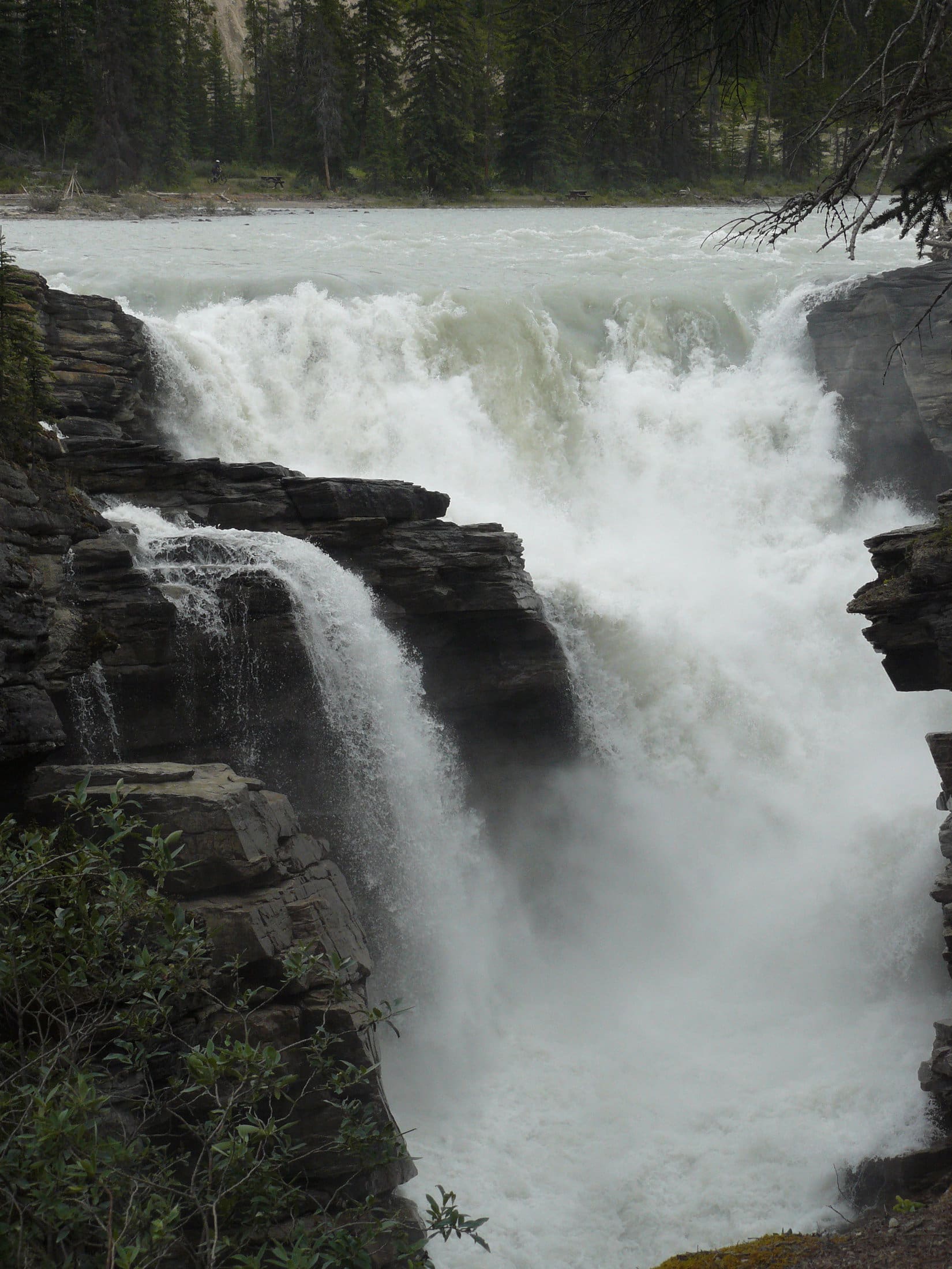
On 7-28-13, Day 19 of her 2013 Dingo Vacation, Lupe visited Sunwapta Falls and Athabasca Falls in Jasper National Park.  After seeing both of these impressive waterfalls, it was still early afternoon, so there was plenty of time for Lupe to look for more adventures.  From Athabasca Falls, SPHP drove N on Hwy 93A instead of returning to the main Icefields Parkway Hwy 93.  Although paved, Hwy 93A proved to be much more of a back woods road than the main highway.  It was bumpy and patchy, and didn’t have much traffic on it.

A paved side road leading W to Moab Lake (7 km) looked interesting, but shortly after getting on it, the pavement ended.  The gravel road that continued onward was full of stones and potholes.  It wasn’t long before SPHP gave up on the Moab Lake idea, and turned the G6 around to return to Hwy 93A and continue N.  Eventually Lupe & SPHP reached the side road to Mount Edith Cavell (11,033 ft.) the main attraction SPHP was aware of accessible from Hwy 93A.

The road to Mt. Edith Cavell was 14 km long, very narrow and windy, but all paved and in beautiful, almost new condition.  It started raining lightly as the G6 wound its way up the mountain.  After quite a distance, Lupe and SPHP arrived at a very small pullout with an overview of a cloudy, but gorgeous mountain valley with a river running through it far below.  Snowy peaks were visible at the upper end miles to the NW.

The Tonquin Valley from the road to Mount Edith Cavell. This looked like a beautiful place to explore, but unfortunately for Lupe, dogs are not allowed in Tonquin Valley.

A sign a bit farther along the road indicated that Lupe and SPHP had just seen a portion of the famous Tonquin Valley.  Unfortunately for Lupe, Tonquin Valley is closed to dogs.  It looked like a beautiful place to explore.

After winding around on the road a bit longer, Lupe and SPHP were getting quite close to Mount Edith Cavell.  The place was so busy, it wasn’t even possible to get to the large parking lot.  There were cars parked along the road well before the parking lot was reached.  SPHP parked the G6 by the side of the road, too.  By now the weather had closed in enough so clouds hid the top of Mount Edith Cavell, while it continued to sprinkle rain.  It was still only about 2:30 PM.  Lupe and SPHP stayed in the G6 and took a nap in the hope that the weather would eventually clear.

SPHP awoke a bit after 5:00 PM to find that it was raining harder, not less.  Quite a few cars had left, but Mt. Edith Cavell must be a very popular destination as cars continued to come and go despite the rain.  SPHP moved the G6 forward to the main paved parking lot, which was now less than 1/2 full.  Lupe stared out the window and watched people, while SPHP wrote in the trip journal.

By 6:45 PM, the rain had stopped.  There were only 5 or 6 other cars left in the parking lot.  The sky was still completely overcast and it was a chilly 45°F out.  Lupe and SPHP hopped out of the G6 and took the not very long trek (about 20 minutes one way) up the trail to see Mount Edith Cavell.  There was a clear view of much of the mountain, including the Angel Glacier, but the top of the mountain remained shrouded in clouds.  There was more trail to explore, but signs said the rest of it was closed to Dingoes.  Since everything was still wet and gloomy, Lupe and SPHP returned to the G6.

The next morning (7-29-13 and Day 20 of Lupe’s 2013 Dingo Vacation), everything had changed.  At 6:30 AM, Lupe and SPHP headed back up the trail to Mount Edith Cavell as far as Lupe was allowed to go.  It was a brisk morning (32°F according to the G6), but the skies were clear and the sun was shining on the mountain.  No one else was around yet.  Lupe and SPHP enjoyed the silent majesty of the scene.

Mount Edith Cavell
Mount Edith Cavell
The melt pond at the base of Mount Edith Cavell. This was as close as Lupe was allowed to get according to signs.
The mostly ice-filled melt pond at the base of Mount Edith Cavell. This was as close as Lupe was allowed to get according to signs.
An arm of the Angel Glacier hangs down from Mount Edith Cavell.

Angel Glacier, Mount Edith Cavell 7-29-13SPHP knew that it wouldn’t be long before people would start coming.  Since Lupe wasn’t permitted to explore any of the additional trails, all too soon it was time for Lupe and SPHP to start back down the valley to the G6.

A look N back down the valley from Mount Edith Cavell.
Lupe on the Mount Edith Cavell trail.

From Mount Edith Cavell, Lupe and SPHP went on to Jasper, a pretty and busy little tourist town.  Coming into town, Lupe was very interested in 2 female elk with fawns standing right on the road!

Since Lupe had been cooped up in the G6 much of the previous afternoon and all of the evening, SPHP knew she really needed a longer walk than she had at Edith Cavell.  Along the road to Pyramid Lake, SPHP found a trailhead on the edge of town.  Lupe and SPHP spent a couple of hours hiking trails No. 8, 6 & 6A.  The trails made a loop past a swamp and through the forest, eventually going past Patricia Lake.  Best of all there were lots of squirrels in the trees to bark at!  Lupe had an exciting time of it, although SPHP was a bit concerned about how noisy the Dingo was this close to town.

Although there wasn’t much elevation change on this loop, near the end on trail No. 6A, the trail climbed a small hill with a clearing from which there was a nice view of Mount Edith Cavell off in the distance.  After having just been there, SPHP now recognized Mount Edith Cavell as the mountain frequently featured on postcards of the town of Jasper.

During the rest of the day, Lupe got to spent a little time at the beach at Pyramid Lake near Jasper and then enjoyed a scenic drive to Miette Hot Springs.  At the picnic ground there, Lupe endured an hour of temptation, while a herd of 6 or 7 bighorn sheep panhandled from all the picnickers and bold squirrels did the same.  Despite ineffective signs everywhere insisting that people shouldn’t feed the bighorn sheep, they were so tame and used to getting their way, people could pat them without them even backing away.

However, when the bighorn sheep got too close to an excitable Dingo which barked furiously and lunged at them (restrained by a leash, of course), the bighorns did seem to think that was a bit rude.  They gave the foamy-mouthed Dingo a wider berth for a little while, but kept forgetting the experience.  The bighorn sheep had to be repeatedly reminded by the Dingo that they looked like Dingo food.  The squirrels only had to be told once, but chattered taunts and insults back from the safety of the trees.  It was almost more than an American Dingo could bear.

The picnic finally done, Lupe was relegated to the G6 for a while, during which time SPHP had a marvelous alternately relaxing, soothing and invigorating time at the Miette Hot Springs, which features a big hot pool, a big warm pool, and much smaller cool and frigid pools.  All-day admission was only $6.05 Canadian for as long as one wanted to stay, an absolute bargain compared to anything else in the Canadian Rockies!  Miette Hot Springs was fabulous!  If Carolina Dogs could have gone in the hot springs, Lupe and SPHP would have stayed there a couple of days.

By evening Lupe and a much cleaner SPHP were back at Jasper again.  Across a bridge over the Athabasca River from Jasper, Lupe and SPHP found a trail around nearby Lake Annette for an evening stroll.  About 1/4 of the way around the lake though, a couple with a baby in a stroller and a dog approached from the opposite direction.  They said their dog had found and treed a bear cub just a few minutes earlier.  Since momma bear was likely still around somewhere close at hand, and not likely to be entirely pleased with the situation, they were beating a hasty retreat to their vehicle.

Bear hunting in the Canadian Rockies sounded even more exciting than bighorn sheep hunting to Lupe.  SPHP had to admit it would sound impressive to the folks back home.  But the cowardly SPHP quickly overruled and headed for the G6 to end all possibility of a truly exciting end to the day and a most memorable blog post.

Edith Cavell was a British nurse who lived in German-occupied Belgium during WW1. She indiscriminately helped save the lives of soldiers of both sides during the war. However, she also helped 200 allied soldiers escape to the Netherlands or England. For this she was found guilty of treason by the Germans and executed by firing squad. She never saw the mountain in the Canadian Rockies that was eventually named after her. The Indian name for the mountain was White Ghost.
Edith Cavell was a British nurse who lived in German-occupied Belgium during WW1. She indiscriminately helped save the lives of soldiers of both sides during the war. However, she also helped 200 allied soldiers escape to the Netherlands or England. For this she was found guilty of treason by the Germans and executed by firing squad. She never saw the mountain in the Canadian Rockies that was eventually named in her honor. The Indian name for the mountain translates as White Ghost.

Links:

Next Adventure                      Prior Adventure

Want more Lupe adventures?  Choose from Lupe’s 2013 Beartooths & Canadian Rockies Adventure IndexDingo Vacations Adventure Index or Master Adventure Index.  Or subscribe free to new Lupe adventures.

Black Hills, SD Expedition No. 137 – Harney Peak & Little Devils Tower (9-7-15)

Harney Peak at 7,242 feet is the highest mountain in the Black Hills and the entire state of South Dakota.  Located in the Black Elk Wilderness, it is a very popular hiking destination and can be approached from half a dozen different trailheads.  One of the shortest (about 3.5 miles one way) and most popular routes is on Trail No. 9 from Sylvan Lake in Custer State Park.  Lots of people don’t realize how easy it is to add variety to the trip without significantly increasing the distance by making a loop back to Sylvan Lake via trails No. 3 & No. 4 and including an ascent of Little Devil’s Tower along the way like Lupe did on this day.

After 27 days spent on Lupe’s great summer of 2015 Dingo Vacation, Lupe and SPHP finally returned home on the afternoon of 9-4-15.  However, the fun wasn’t set to end quite yet.  It was the Friday before Labor Day weekend, which in 2015 came as late as it possibly can with Labor Day falling on September 7th.  Lupe’s uncle Joe, aunt Andrea and cousin Dusty had already arrived at her Grandma’s house the previous evening.  Aunt Mush and uncle David were due to arrive on Sunday the 6th.  So Lupe got to go with SPHP over to Grandma’s house every evening from the 4th through the 7th to hang out with Dusty and all the gang, which she really enjoyed.

The high point of Labor Day weekend, though, was Labor Day itself.  On Labor Day, uncle Joe and cousin Dusty wanted to go with Lupe and SPHP to climb Harney Peak (7,242 ft.), the always popular high point of South Dakota.  Of course, Lupe and SPHP were both more than willing to oblige.  So a little before 10:00 AM on Labor Day, SPHP parked the G6 near Sylvan Lake Lodge, and everyone piled out.

A short trek led down to the cool shady woods below Sylvan Lake dam.  From there Lupe and the gang followed the lakeside trail up around the N and then E sides of scenic Sylvan Lake.  Shortly before reaching the swimming beach (where dogs aren’t allowed), Dusty was ready for a swim.  Joe tossed a stick into the lake to give her swim a purpose.  Dusty was very pleased to have the opportunity to retrieve the stick.

Dusty takes a dip while retrieving a stick for Joe.
Dusty takes a dip in Sylvan Lake while retrieving a stick for Joe.

Once Dusty was sufficiently cooled off, Lupe’s whole troop continued on past the swimming beach to Trail No. 9.  The trail soon proved to be very busy with Labor Day hikers, the most crowded SPHP has ever seen it.  There were quite a few dogs of various descriptions enjoying the trail, too, so Lupe and Dusty had ample opportunities to stop and sniff with interesting new acquaintances.

Maybe 0.5 mile from Sylvan Lake, there are some rock ledges where Harney first comes into view.  Lupe’s little pack paused here for a short photo op.

Lupe, Joe & Dusty at the rock ledges. Photo looks N.
Lupe on the rock ledges with Harney Peak in the background. Photo looks E.
Joe & Dusty with Harney Peak in the background.

Trail No. 9 goes all the way to the summit, or at least to the short spur trail that leads to the summit.  Lots of people and dogs were coming and going.  With all the activity, it didn’t seem like very long before Lupe, Dusty, Joe & SPHP were at the spiral stairway just before reaching the lookout tower at the top.

The first few times Lupe had been to Harney Peak, she was scared of the metal stairs, because she could look right through the grate down to the rocks below.  Back then, SPHP had to carry the nervous dingo over the stairs.  Lupe still doesn’t entirely trust these stairs, but with a little encouragement, she navigated them on her own.  If they bothered Dusty, she didn’t show it.

Upon reaching the lookout tower, everyone first went out to the viewing platform next to the tower.  SPHP held Lupe up above the rock wall so she could see the views.  A little later on, after SPHP put her down, she suddenly leaped up onto the rock wall so she could see all by herself.  SPHP made her get down so she couldn’t fall off.   Meanwhile, Joe went and climbed the short steep stairs (virtually a ladder) up to the top of the lookout tower.

Joe and Dusty on the viewing platform next to the Harney Peak lookout tower.
This huge granite outcropping extends out to the W of Harney Peak just a little below the summit.

Lupe doesn’t like the way the metal grating that forms the floor of the viewing platform feels on her paws, so she was soon done at the lookout tower.  Lupe, Dusty, Joe & SPHP headed down to the tower’s basement and out to a path leading over to the big granite outcropping to the W of the summit.  It was less busy and more peaceful over there, although a bit breezy.  It was a good place to pause for a snack while admiring the views.

Joe & Dusty up on the granite W of Harney's summit.
Joe & Dusty up on the granite W of Harney’s summit.

Lupe and Dusty were quite enthusiastic about sharing the Cliff bar SPHP brought out of the pack, and the Kind bars Joe took out of his pack.  Dusty ate some of Lupe’s Taste of the Wild too, with evident relish.  She even polished off SPHP’s apple core, although that was a step too far for Lupe.  American Dingoes can be picky at times.  Both dogs helped lighten SPHP’s pack by slurping up plenty of water to wash it all down with.

Lupe on the granite W of the Harney Peak lookout tower.
Lupe on the granite looking N from Harney Peak. This photo looks W.
Lupe & Joe
Lupe & Joe
This helicopter buzzed by pretty close while giving tours. Lupe got excited. She loves barking at helicopters and airplanes.

A trip up to Harney Peak on or near Labor Day is becoming a tradition.  On September 2, 2014 (the day after Labor Day), Joe, Dusty, Lupe & SPHP were up here, too.  In 2014, Joe had called his son Matthew from Harney Peak, since it was Matt’s birthday.  This time he called his mother, Audrey, in Wisconsin.

Yes, there is cell phone reception! Joe calls his mother, Audrey in Wisconsin, from the top of South Dakota with Labor Day greetings.
Yes, there is cell phone reception! Joe calls his mother, Audrey, in Wisconsin from the top of South Dakota with Labor Day greetings.
Joe chats with mom in Wisconsin while Dusty listens in to hear if he says anything about dog treats becoming a Labor Day tradition.
Joe chats with mom in Wisconsin while Dusty listens in to hear if he says anything about dog treats on Harney Peak becoming a Labor Day tradition.
The Cathedral Spires (L) and Little Devil's Tower (R) from Harney Peak. Photo looks S.
The Cathedral Spires (L) and Little Devil’s Tower (R) from Harney Peak. Photo looks S.

With snacking, sight-seeing and social obligations completed, it was time to head back down from Harney Peak over the spiral stairway, which Lupe again navigated successfully, back to Trail No. 9.  Quite near the bottom of the stairs were some horses that had brought people up the trail.  Lupe was a good Carolina Dog and did not bark at them, although it was tempting.  Dusty paid no attention to the horses.

The undisturbed horses Lupe didn't bark at.
The undisturbed horses Lupe didn’t bark at.

Maybe 10 minutes or so down from Harney’s summit, there is a rock ledge with a great view to the S of Peak 6735.  Lupe graciously posed for a couple of photos from here.

A rather cheerful looking American Dingo with Peak 6735 in the background. Peak 6735 lies SSE of Harney Peak.

Lupe with Peak 6735 in the background 9-7-15Rather than head straight back down Trail No. 9 all the way to Sylvan Lake, Joe and Dusty were willing to explore the trails over to the Cathedral Spires (6,840 ft.) and possibly climb Little Devils Tower (6,960 ft.), which neither of them had done before.  This had the advantage of showing them some new territory while making a loop back to Sylvan Lake.  So Lupe and her troop took Trail No. 3 where it met up with Trail No. 9.

Joe and Dusty on the way to the Cathedral Spires and Little Devils Tower.
Getting closer. Now along Trail No. 4. Little Devils Tower is at the far right.

A relatively short trek on Trail No. 3 led to Trail No. 4, which passes to the N of the Cathedral Spires over to a little saddle between the Cathedral Spires and Little Devils Tower.  Trail No. 4 goes over this pass heading S where there are some close up views of the Cathedral Spires.

The Cathedral Spires from Trail No. 4 after crossing to the S of the saddle between them and Little Devils Tower.
The Cathedral Spires from Trail No. 4 after crossing to the S of the saddle between them and Little Devils Tower.  Photo looks S.
Cathedral Spires. This photo looks SE from Trail No. 4.

It isn’t far from the saddle to a spur trail that goes perhaps 0.25 mile to Little Devils Tower.  Most of the spur trail is an easy hike along a scenic ridge.  There is one relatively short section of annoyingly steep trail with a lot of loose rock on it, but it soon ends at a little saddle between big granite rocks.

A left turn at the saddle reveals a narrow crevasse in the granite.  This crevasse is marked by a painted blue diamond.  Blue and white diamonds mark the rest of the way up to the summit of Little Devils Tower.   This involves some scrambling up the granite, but even relatively small children can do it with a bit of help.  The rough granite provides good footing and there isn’t much exposure most of the way.  Naturally Lupe, Joe, Dusty and SPHP all made it to the top of Little Devils Tower.

Lupe looks SE from Little Devils Tower toward the Cathedral Spires.
Looking NNE back at Harney Peak from Little Devils Tower.
Looking NW from Little Devils Tower toward Gap Lode Peak and St. Elmo Peak.
Looking NW from Little Devils Tower toward Gap Lode Peak (6,560 ft.) (most distant large rock outcropping at center of photo) and St. Elmo Peak (6,458 ft.) (smallish looking peak at left center beyond the dark rock hump).

From Little Devils Tower, it was just a matter of following the spur trail back to Trail No. 4 and then continuing SW on down the valley.  Trail No. 4 led to the Little Devils Tower trailhead on Hwy 89 (Needles Highway – the Cathedral Spires are also called the Needles).  The trail continues though, another 0.5 mile or so, and leads back to the picnic ground on Sylvan Lake.  Once back at Sylvan Lake, Dusty was ready for another swim with just a little encouragement from Joe and another stick.Joe & Dusty at Sylvan Lake 9-7-15

Dusty’s 2nd swim of the day and another stick rescued.

While Joe and Dusty were engaged with sticks and water, Lupe and SPHP were up on the rocks taking a few pics of the lake.

Sylvan Lake. Photo looks NNW. That pretty Carolina Dog looks mighty familiar!
The swimming beach at Sylvan Lake. Photo looks SE. There used to be a lot more trees and shade near the beach, but sadly pine bark beetles have killed them. Looks like there is another dead one now.
Looking S at a large rock off shore from the swimming beach. Sylvan Lake is a popular place to swim in late summer.

By about 4:30 PM, Lupe, Dusty, Joe & SPHP were all back at the G6.  It had been a great day spent together, but was now time to head back to Grandma’s house for a lasagna dinner.  Of course, Lupe had some!  Carolina Dogs like Italian food!

Black Hills, SD Expedition No. 137 was Lupe’s 6th time up Harney Peak and 4th time up Little Devils Tower.  It was Joe’s 3rd time and Dusty’s 2nd time up Harney, and their 1st time up Little Devils Tower.  For SPHP, we just don’t know anymore.

Links:

Next Black Hills Expedition                      Prior Black Hills Expedition

Want more Lupe adventures?  Choose from Lupe’s Black Hills Expeditions Adventure Index or Master Adventure Index.  Or subscribe free to new Lupe adventures.

Sunwapta & Athabasca Falls, Jasper National Park, Canada (7-28-13)

At 6:00 AM on 7-28-13, Day 19 of Lupe’s 2013 Dingo Vacation to the Beartooths & Canadian Rockies, Lupe was back at the Icefields Centre just off the Icefields Parkway Hwy 93.  The sun was starting to shine on the snowy peaks surrounding the Athabasca Glacier.  No one else was around.  The Icefields Centre wouldn’t open for a quite a while yet.  Even though it was statistically close to the very hottest time of year, the morning had the bright crisp feel of a day in late fall back home.  It was a chilly 32°F.  Lupe and SPHP admired the magnificent mountain scene in the early morning glow.

Dawn at Mt. Athabasca 7-28-13.
Dawn of a new day on Mt. Athabasca (11,453 ft.) 7-28-13.
Snow Dome and the Dome Glacier
Snow Dome (11,483 ft.) and the Dome Glacier

A couple of really big waterfalls were on Lupe’s agenda for the day.  Lupe and SPHP headed N on the Icefields Parkway Hwy 93.  The road steadily lost elevation at a pretty good clip.  After a 15 minute drive admiring the towering mountains in every direction, the G6 descended into a bank of fog that lasted for miles.  There were road signs for Caribou crossings that added to a sense of mystery and isolation.  Lupe was farther N than she had ever been before.

Eventually the fog bank ended.  The mountains were visible again.  The road by now was only losing elevation slowly.  It was almost level.  On the right (E) side of the highway, SPHP spotted a sign for the Poboktan Creek trailhead.  SPHP turned off the highway to check it out, but had to disappoint Lupe when it turned out to be a trailhead for long distance backpacking.  Dogs, even American Dingoes and Carolina Dogs, were prohibited.

Back on the Icefields Parkway Hwy 93 again, it wasn’t long before SPHP drove past a restaurant on the left (W) side of the road.  Going past the restaurant, SPHP saw signs on it that said something about Sunwapta Falls.  SPHP had been watching for road signs for the Sunwapta Falls turnoff, but SPHP had either missed them or they didn’t exist.  No matter.  SPHP turned around and drove back to take the paved side road heading W to the Sunwapta Falls picnic ground and trailhead.  It wasn’t far at all to the falls and Lupe was there within just a few minutes.

Sunwapta Falls, Jasper National Park 7-28-13

The Sunwapta River starts at the Athabasca Glacier, which wasn’t that far away back where Lupe had just started her morning only a little while ago.  It was already a powerful river.  Sunwapta Falls was impressive.  The Sunwapta River is a tributary of the Athabasca River, which it would soon join not too many more miles away downstream.

SPHP casually checked the trail information and map posted near the parking lot.  There were 2 trails.  One went a long distance far beyond anything SPHP had in mind.  However, there was another shorter one going down to Lower Sunwapta Falls.  The information said Lower Sunwapta Falls actually consists of a series of 3 more waterfalls in close succession.

The hike to Lower Sunwapta Falls was supposed to be just a 1 hour round trip.  It sounded like fun.  There probably wouldn’t be that many people going to the lower falls.  Upper Sunwapta Falls was the tallest of the falls, and very conveniently right there at the parking lot.  Lupe could probably bark at squirrels along the trail to the lower falls without annoying anyone.

There was a bridge across the river just downstream of Sunwapta Falls.  Lupe and SPHP admired the falls from the bridge.  SPHP then continued on across and followed the trail on the other side.  The trail disappeared into the forest.  Lupe likes being in forests and was having a good time.  There were, indeed, a few squirrels to bark at, which she did with great enthusiasm.

However, it started becoming clear that the trail was leaving the Sunwapta River far behind.  SPHP started to suspect this was the long distance trail.  SPHP should have paid closer attention to the map back at the falls.  After following this trail for at least a mile, the Sunwapta River could barely be heard in the distance.  It was time to turn around.

Back at Sunwapta Falls again, SPHP looked around.  From the high fenced viewpoint farthest downstream was a trail following the river.  This trail was on the same side of the river as the parking lot.  It proved to be the trail that does lead down to Lower Sunwapta Falls.  It lost elevation at a pretty good clip.  Soon Lupe reached the lower falls.

Lower Sunwapta Falls
Sunwapta River below the falls.
Sunwapta River.

The lower falls were pretty impressive and worth seeing.  The trail continued along the Sunwapta River for some distance downstream beyond the lower falls.  Lupe was having such a good time, that SPHP followed it a while longer before turning around.  The Sunwapta River became a gentler stream as it continued on its way.

Sunwapta River
Sunwapta River

Sunwapta River, Jasper NP 7-28-13When Lupe and SPHP finally got back to the G6, it was after 10:00 AM, but still only 36°F.  Things had gotten busy again.  The parking lot isn’t all that large, but cars and people were coming and going.

Leaving Sunwapta Falls behind, Lupe and SPHP got back on the Icefields Parkway Hwy 93 again still going N.  Very soon SPHP saw another turnout for a trail on the right (E) side of the highway.  Only one other car was at the trailhead when Lupe arrived.  A sign said the trail went to Buck and Osprey Lakes, but there were no maps or distances given.  SPHP had no idea what to expect, but it looked like an opportunity for some exploration with Lupe where there wouldn’t be too many people around.

The forest was leafy and damp.  Lupe was soon quite a soggy doggie, but she was perfectly happy with that.  Lupe didn’t have to look long to find the first lake.  A short trek led to a sign at a trail intersection.  Buck Lake was just 0.1 km straight ahead, and Osprey Lake was only 1.2 km to the left.  Lupe checked out Buck Lake first.  Buck Lake was shallow and weedy, but looked like it might be a great quiet place for ducks or other waterfowl.  Lupe went back to the intersection and took the trail to Osprey Lake.

Osprey Lake was bigger, more open, deeper and cleaner looking.  There were a couple of kayakers on it.  It appeared as though there was better access to Osprey Lake from the other side.  There were more people and kayaks over there.  There was no continuation of the trails Lupe was on along the shores of either Buck or Osprey Lake, so Lupe and SPHP just went to each lake, took a look, and headed back.  Lupe still had a great time in the wet, leafy, mossy forest.

Osprey Lake
Osprey Lake

It was a bit past 11 AM when Lupe returned to the G6.  She had already been on 3 trails this morning.  SPHP found a picnic ground on the W side of the Icefields Parkway Hwy 93 just a short drive N from the Buck & Osprey Lakes trailhead.  This little picnic ground is now a favorite spot.  It is just off the highway, so access is super easy.  Its great attraction, though, is that it is right next to the Athabasca River with some excellent views.  Several of the picnic tables are just a few feet away from the edge of the riverbank.

After lunch, it was only 5 or 6 miles farther N on the Icefields Parkway Hwy 93 to a left turn onto Hwy 93A, which very shortly leads to parking lots for the mighty Athabasca Falls.  By this point, the Sunwapta River has joined the Athabasca.  The flow of water over Athabasca Falls is tremendous and powerful.Athabasca Falls, Jasper NP 7-28-13

The Athabasca River has carved a narrow canyon right through the rock below the falls.
The Athabasca River has carved a narrow channel right through the rock below the falls.

Athabasca Falls, Jasper NP 7-28-13Athabasca Falls, Jasper NP 7-28-13Athabasca River, Jasper NP 7-28-13Athabasca Falls is a huge tourist attraction.  SPHP was very glad Lupe got to see it.  The falls are gorgeous and amazing.

Athabasca Falls was justifiably a very busy place.  Lupe spent a good 30 or 45 minutes there, during which time she made a few friends among the throng.  In truth, though, she probably far preferred the less dramatic and much more ordinary forest trail to Buck and Osprey Lakes.  One good chattering squirrel makes her happier than a crowd of strangers.  SPHP often feels the same way.

Links:

Next Adventure                        Prior Adventure

Takakkaw Falls, Yoho National Park, British Columbia, Canada (7-25-13)

Athabasca Falls & Miette Hot Springs, Jasper National Park, Canada (7-30-14)

Want more Lupe adventures?  Choose from Lupe’s 2013 Beartooths & Canadian Rockies Adventure IndexDingo Vacations Adventure Index or Master Adventure Index.  Or subscribe free to new Lupe adventures.