Days 23 & 24 of Lupe’s 2017 Dingo Vacation to the Yukon & Alaska!
8-22-17, 1:00 AM, near the Sagavanirktok River, Deadhorse, Alaska – SPHP woke up thinking it might be possible for Lupe to see the Northern Lights. Only 2 hours ago, the evening sky had been mostly clear. Dream on. Not now. Foggy, again. Maybe later?
No. A thick fog prevailed every time SPHP checked. Northern Lights? Not happening.
4:14 AM – Still no change. Time to get going anyway. The Aurora Hotel in Deadhorse would be serving breakfast 4:30 AM to 7:30 AM. SPHP didn’t want to miss out on that. May as well beat the crowd and arrive early! Lunch there yesterday had been fabulous.
4:37 AM, 39°F – Beat the crowd? Ridiculous! So naive, it’s funny! The Aurora’s parking lot is already jammed with white pickup trucks. Deadhorse is wide awake and bustling with activity. Oilfield workers are getting breakfast in preparation for the long work day ahead. SPHP finds a spot to squeeze the G6 into. Loopster will have to wait here, but SPHP promises to save her something good from breakfast.
The breakfast buffet is simply awesome! All you can eat for $12.00, tax included. The lady SPHP pays is named Terry. Terry says to feel free when leaving to use one of the paper bags or Styrofoam boxes to take enough extra food for a mid-morning snack later on. Oh, yeah! This is Loopster’s lucky day.
The buffet has pancakes, eggs, muffins, toast, waffles, potatoes, sausages, ham, bacon, fresh fruits, cottage cheese, tea, coffee, fruit juices, soft drinks and so much more. You name it, the Aurora’s got it. Whatever you want, as much as you like. The huge dining room is 80% full with oilfield workers packing it away. They are talking, laughing, and watching the morning news on big flat screen monitors mounted around the room. SPHP sits near one of the huge windows with a view of Lake Colleen, watching ducks and geese in the early morning gloom.
None of the other tourists Lupe and SPHP had met along the Dalton Highway had anything good to say about Deadhorse. Industrial. Ugly. Flat. Boring. Nothing to do. Only a dull, drab turnaround spot for those who bothered going all the way to the end of the Dalton Highway.
Maybe Lupe agreed with them? She hadn’t been able to go on the Arctic Ocean tour with SPHP yesterday, although she’d enjoyed a couple of nice walks along the beautiful Sagavanirktok River.
SPHP didn’t feel that way about Deadhorse at all. Industrial? Yes. Kind of ugly? Yes. Yet it was awesome being way up here near the Arctic Ocean on the N edge of North America. It would be fun to work up here and experience all the radically changing seasons of a long Arctic year, see whatever exotic wildlife might appear, and be part of a crew working long hours to keep the oilfield producing despite tough conditions.
It was exciting just watching the camaraderie of everyone getting ready to go to work in a very special environment. Of course, maybe SPHP is just plain nuts.
Oh, Loop! You lucky, Dingo!
Hmm? What do you mean, SPHP? What are you talking about?
You have just hit the jackpot Most High Exalted Dingo of the Arctic Sisterhood!
I have? How?
Take a look at this! Fresh bacon, sausages, and ham from the Aurora Hotel! No smuggling a few tidbits to you this time around. They said it was alright. They expected and even encouraged me to take it!
Lupe’s eyes sparkled! Why, it was a box full of delicious, delectable treasures! She wasn’t just dreaming either. It was all real. She was rich!
I can’t believe it! All this for me? Can I have some now?
Go right ahead, Loop. Help yourself. Chow down while I find the gas station and fill up the G6. We’ll be on our way out of Deadhorse soon.
What’s the rush? Maybe we should stick around and make this a tradition? Mmmm. Oh my, this is scrumptious! Thanks so much, SPHP!
After fueling up the G6, SPHP wrote up the second postcard that Lupe was sending to her Grandma from Deadhorse, the one with a picture of a sunset over Prudhoe Bay. Then it was back to the Aurora Hotel real quick like to mail it. It was light out now. The fog was beginning to thin as Lupe and SPHP drove past Deadhorse Camp for the last time, starting the long journey S on the Dalton Highway. (6:24 AM, 38°F)
6:58 AM, 34°F – Ten miles out of Deadhorse, the fog dissipates rapidly. It was only a ground fog. The Carolina Dog soon has views of morning sunlight on the flat tundra. Mist rises from ponds and streams.

8:38 AM, 47°F on the Dalton Highway – Woke up too many times last night. After following a pilot car for 14 miles, SPHP is already sleepy. A few miles farther, and Lupe is on a big hill near the place where she’d seen a faint rainbow on the way to Deadhorse a couple of days ago. There’s a pullout by the road. SPHP parks behind a couple of semi trucks. Nap time despite the early hour!
10:19 AM – Awake and feeling much better. Lupe is on her way again. Pretty day. Stop now and then for photos of the Sagavanirktok River. The Brooks Range is in view far beyond the river, but Loop is getting closer to it as she continues S.


11:37 AM, 57°F – On the way N to Deadhorse 2 days ago, Lupe had seen a lone mountain among clouds and mist not terribly far from the W side of the Dalton Highway. Although there were lots more mountains off to the E, none of them were accessible, because Lupe would have had to ford the Sagavanirktok River to get to them. However, that one lone mountain to the W had looked like access might not be an issue. This mountain has been in view now for the past half hour. Loop will soon be drawing near it again.
12:03 PM – Parked at the start of an Alaska oil pipeline access road just W of the Dalton Highway. On the other side of the highway, a different side road heads E. A street sign says “Slope Mountain Camp 1”. The lone mountain W of the Dalton Highway must be Slope Mountain (4,010 ft.)! Even though it’s still a few miles off to the SW, it’s the only notable peak anywhere in this vicinity.
After a couple of days spent mostly in the G6, Lupe is ready for action! It would be great fun to climb a mountain way out here on Alaska’s North Slope, and Slope Mountain is the best candidate she’s seen. It’s not clear if she will have to ford any streams to get to the mountain, but it’s worth a reconnaissance trip to check it out. If Looper can get to the base of Slope Mountain, success seems assured. It looks like an easy climb.

The first part of the trek is a cinch. Lupe and SPHP follow the access road leading to the Alaska oil pipeline, then follow the service road near the pipeline SW. The plan is to get as close as possible to a large saddle between Slope Mountain and a lower hill to the NE before leaving the service road to strike out for the saddle.

As Lupe follows the pipeline, it becomes apparent that there is almost certainly a stream between here and Slope Mountain. No stream is in view, but a telltale line of tall bushes 0.25 mile away runs along the lowest part of a large drainage area. The only way to find out how big the stream might be is to march right on down there.
Away from the service road, the tundra becomes increasingly boggy and full of tussocks as Loop makes her way down a long slope. Upon reaching the bushes, she has to cross a couple of gullies which must represent old, abandoned stream channels. Lupe forces a way through a thick stand of bushes, and arrives on the bank of a small river.

The stream is deepest near the opposite bank, and appears to be at least knee deep on SPHP. Bushes crowding the far shore look like they might make getting out of the stream a bit of a pain, and the current is fairly strong. Yes, the river looks fordable, but SPHP isn’t eager to take it on. Lupe will have to swim, and it isn’t clear where she can get out on the other side.
Lupe and SPHP stand there, pondering the situation. Things don’t look much different either upstream or downstream. Hmm. So close, yet so far! The stream isn’t dangerous, but not wanting to get soaking wet, SPHP finally decides it isn’t worth risking slipping and falling in, which might easily happen. The river is just a little too deep, and the current a little too strong.
Sigh. Lupe and SPHP turn and head back to the Alaska oil pipeline service road. The return trip is a fun hike, and the Carolina Dog has a blast sniffing and exploring all along the way.
Once back at the G6 (2:03 PM), SPHP continues driving S on the Dalton Highway. Even though Looper’s initial reconnaissance hasn’t produced the desired result, perhaps there is an alternative? Maybe a route to Slope Mountain exists which avoids the river, or at least crosses it at a more favorable point?
Not until Lupe is S of Slope Mountain does SPHP find what looks like the most promising approach. Shortly after the Dalton Highway crosses the small river (signed Oskyruk… something or other) that blocked Lupe’s first attempt, SPHP parks the G6 at a small pullout near the top of a rise. This pullout is 100 feet S of milepost 297 on the E side of the road.
Across the highway, a long golden slope beyond the Alaska oil pipeline leads toward the mountain. No major drainages can be seen between here and Slope Mountain’s summit. The summit is once again miles away, and Loop faces a long trek to a big ramp leading up to the top of the mountain. Nevertheless, the American Dingo shouldn’t have any problem getting there from here!

This time (2:33 PM, 57°F), the Carolina Dog follows the Alaska oil pipeline service road a mile NE until it starts to lose elevation. She then leaves the road, turning N to begin a long, steady trek up the golden slope leading to Slope Mountain.
Unsurprisingly, much of the tundra is spongy and wet. Tussocks slow SPHP’s progress, and make the gentle climb far more energy draining than it would be on firmer terrain. Wide bands of greener vegetation mark the course of numerous little streams seeping and trickling down the long slope.
Loop and SPHP plod on and on, aiming for the lower end of a big golden ramp, an obvious route leading almost all the way to the top of Slope Mountain. This is such a remote area, SPHP has high hopes Lupe will see some animals up here, but none ever appear. SPHP does scare up a flight of 5 or 6 birds, which excites the American Dingo! For a while, she dashes around in wide circles searching for more, but doesn’t come across any.
Nothing really changes until Loop reaches the base of a fairly steep rocky hillside. An easy scramble brings Loop up onto the big ramp she has been aiming for all this time. Part of the ramp is strewn with loose rock, and the rest consists of still more spongy, damp tundra.

The rocky parts of the ramp are easier traveling than the soggy tundra. For quite a long way, Lupe sticks to the rocky SE edge of the ramp where the views are best. When the rocks eventually give out, she crosses the tundra to reach the base of the higher ridge to the NW.

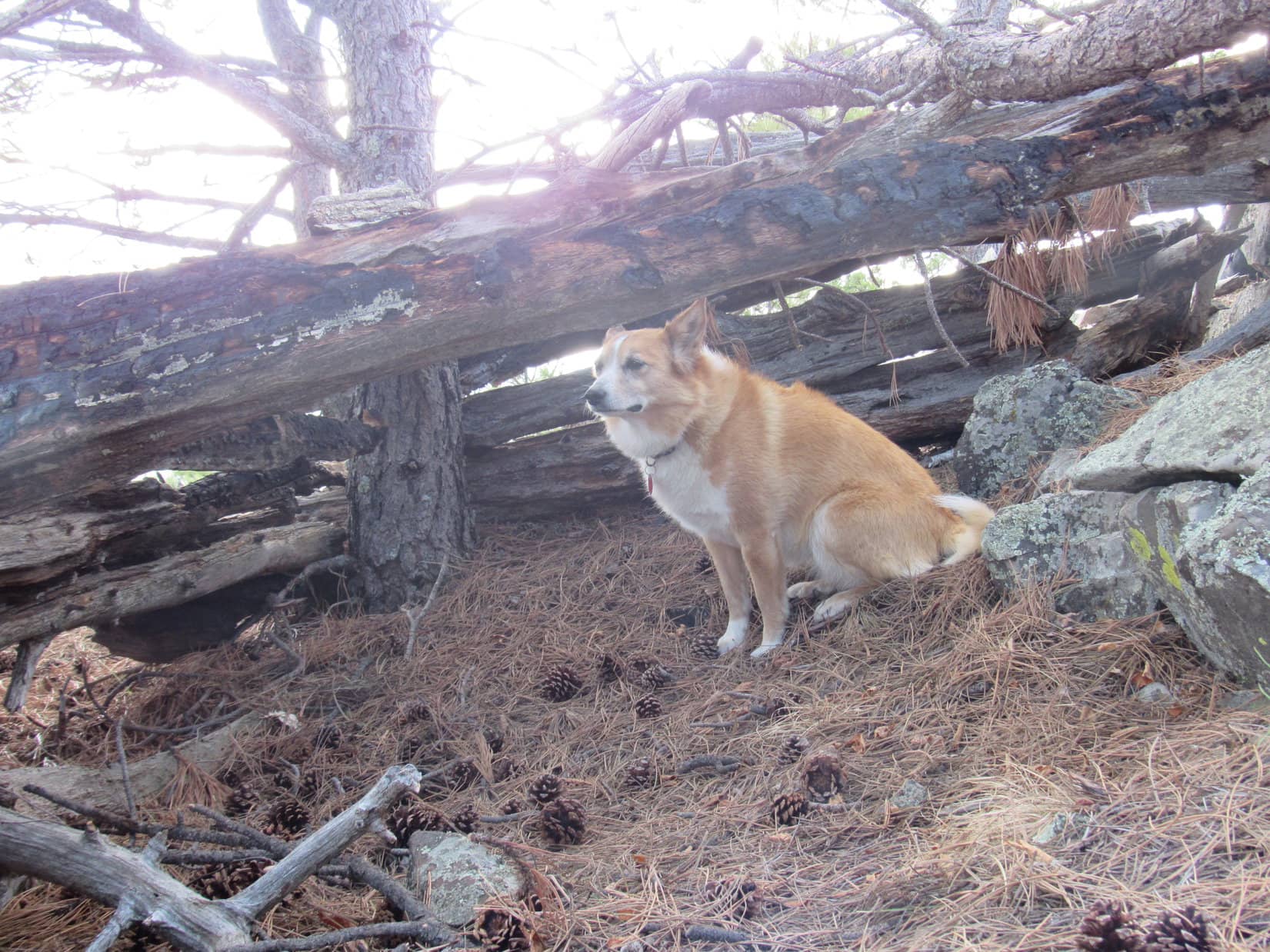
Lupe and SPHP follow the base of the higher ridge, staying close to the area where the rocks and tundra meet. Many rocks have broken into relatively thin flat layers. In some places, they form a sort of natural flagstone pathway.
Back down on the long slope leading to Slope Mountain, Lupe had stuck pretty close to SPHP most of the time. Up on the big ramp, though, Looper takes off running and exploring. She runs far ahead of SPHP, and spends her time investigating whatever her super sensitive Dingo nose tells her might be interesting. Apparently, she finds actually being up on Slope Mountain more to her liking.
Loop hasn’t quite reached the end of the big ramp when SPHP figures maybe it’s time to climb up onto the higher ridge. This involves another easy scramble, and doesn’t take long. Upon reaching the top, a large tower is in sight only 200 yards off to the N. The tower stands at the summit of Slope Mountain (4,010 ft.).


Mechanical noises are coming from a couple of sheds near the tower. The summit area is 5 to 10 acres in size, flat to gently sloping, and covered with small rocks and sparse vegetation. To the N and E, a lip of the mountain drops off rather sharply, but the resulting cliffs aren’t all that high. Passing by the tower, Lupe sees two cairns ahead.
By far the largest cairn is a tower of flat stones near the N edge of the summit area. Someone had put an awful lot of work into creating it.


More than 50 feet to the W, a faded orange wind sock flies above a much smaller cairn. This cairn is decorated with antlers.

Although it had been sunny and comfortably warm when Lupe struck out for Slope Mountain, a chilly S breeze is blowing now. The sky has clouded over to a considerable degree, and is rather dark to the S where a line of showers can be seen N of the Brooks Range. SPHP forgot the rain poncho back at the G6, so a cold rain is nothing to look forward to.
Unfortunately, with the weather deteriorating, Lupe isn’t going to be able to stay up on top of Slope Mountain very long. About 15 minutes is all the Carolina Dog is going to get before it will be time to vamoose. That is a shame. The views of Alaska’s North Slope are fantastic!
Off to the W is a 6 mile long row of big rounded hills featuring sweeping curves. These hills are roughly 400 feet lower than Slope Mountain. Lupe can see the top of slightly higher Imnavait Mountain (3,702 ft.) 10 miles away beyond them.

To the N, dark beneath a purple gray sky, Alaska’s flat, featureless North Slope stretches away to a dim horizon. The Sagavanirktok River, which Lupe has come to know over the past couple of days, can still be seen many miles away to the NE. Both the Alaska oil pipeline and Dalton Highway are visible closer by in this direction, too.
The best views, however, are of Alaska’s mighty Brooks Range running 180° from the NE to the E and S all the way around to the SW. Lupe sees many fabulous snow capped peaks, but SPHP doesn’t know the names of any of them.


SPHP is very glad Lupe has made it to the top of Slope Mountain, but it is disappointing to have to depart so soon. Yet it’s the prudent thing to do. Loopster stands sniffing the breeze for a final few moments, while SPHP gazes in wonder upon the glorious views from the mountain farthest N of all the peaks Lupe has ever climbed.

As Looper and SPHP leave Slope Mountain’s summit, electronic noises similar to animal calls begin being emitted from somewhere over by the big tower. Very strange indeed, but no animals appear in response to the tower’s pleas. The noises are soon left behind. Lupe follows the big ramp back down to about where she first reached it on her way up the mountain.
From here, the Carolina Dog takes a more direct route down to the Alaska oil pipeline. This saves time, but it’s still a long way, and results in a longer, but easier march back on the service road to the G6. Thankfully, the rain showers never do catch up with Lupe, having drifted off in another direction. (8:40 PM, 51°F)
The evening is spent some miles farther S at a very large pullout along the E side of the Dalton Highway where a semi truck sits idling. The pullout is on a high spot from which Lupe can still see Slope Mountain as dusk creeps over the land. (9:40 PM)
8-23-17, 6:25 AM, 38°F at a pullout along the Dalton Highway within sight of Slope Mountain, Toolik Lake, and the N side of the Brooks Range – That semi truck idled for hours here last night, but finally quit. A hard rain then fell for a while, but it’s not raining now. For once it isn’t foggy out. The morning sky is mostly cloudy, but these clouds are high and non-threatening. Small patches of blue sky mean there’s still hope Lupe stands a chance of climbing Table Mountain (6,314 ft.) today, her last peakbagging goal along the Dalton Highway.

7:30 AM, 38°F – After driving S a little way just to warm up, SPHP parks the G6 again at the side road near milepost 278 where Lupe has twice gone on her short Stroll to the North Slope Knoll adventures. Loop and SPHP share a breakfast of soup, while enjoying views of the North Slope and the N side of the Brooks Range for the last time.
9:18 AM, 44°F – It’s a lovely day! Loop has stopped briefly at a side road a short distance S of the Dalton Highway bridge over the Atigun River. Lake Benchmark Mountain, which Loopster climbed 5 days ago in rain, snow, and fog is in clear view. Too bad conditions back then weren’t like they are now. At least the American Dingo had succeeded in reaching the summit, despite climbing the wrong mountain first.

10:10 AM, 32°F – Lovely day? Hah! So much for that. After a gorgeous drive S up the Atigun River valley, a snowstorm greets Loop at Atigun Pass. The snow is already sticking to the road. Probably a good thing Lupe is getting S of the pass. Wouldn’t take much of a snowstorm to make the Dalton Highway impassable here for the G6. Still more than a week to go in August, and it’s a real possibility!

10:52 AM, 39°F – Weather conditions are definitely better here at the Chandalar Shelf than up at Atigun Pass. However, it’s still marginal for an attempt on Table Mountain. There’s actually some blue sky around, but plenty of clouds and patches of fog are sweeping by from out of the Dietrich River valley, too. The summit of Table Mountain can sometimes be seen. Definitely considerably more new snow up there than the last time Lupe dropped by 3 days ago.
Having spent a while dithering over whether it is a good idea or not, Loop and SPHP set off across the Chandalar Shelf heading for Table Mountain (6,314 ft.).


11:26 AM, 39°F – Well, that was a total flopperoo! Already back at the G6. The wind driving clouds up out of the Dietrich River valley was just plain chilly. SPHP’s feet were soon soaking wet from marching across the Chandalar Shelf’s boggy tundra. Visibility was constantly being threatened by fog.
Table Mountain is a good long day hike. No way was Lupe going to make it to the summit under these conditions. Even if she did, who knew if the Carolina Dog would be able to see anything up there hours from now? Spending the whole day cold, wet, and miserable for such an uncertain result simply wasn’t worth it.
Too bad, though. Table Mountain always looked like a terrific, fun peak. Lupe has been by the Chandalar Shelf four times now, but conditions have never been right. This was her last chance. Oh, well. Two minutes after making it back to the G6, it starts to rain. Yeah, returning was the right decision.
SPHP promises Lupe she can go on her 2016 Last Mile North adventure again near Dillon Mountain (4,820 ft.). It’s much shorter, easier, and can be done whether the weather is decent or not. In fact, with Table Mountain now off the table, the rest of the day will be spent revisiting several of Loopster’s favorite quick stops along the Dalton Highway on the way back to Fairbanks.
12:25 PM, 48°F – The G6 is parked W of the Dalton Highway just S of the Dietrich River (S of milepost 207). Lupe is excited! The American Dingo recognizes this place. Her 2016 Last Mile North adventure is one of her very favorites. It’s an easy stroll N along the Alaska oil pipeline service road to a stream flowing W from a valley N of Dillon Mountain.
The original longer version of this adventure follows the stream all the way W to a confluence with the Dietrich River. With 207 miles yet to go on the Dalton Highway today, Loop isn’t going to go all the way to the confluence. Still, this will be a genuine treat for the Carolina Dog.
Lupe is eager to get going! She doesn’t want to waste a single minute. It’s virtually non-stop running, sniffing, chasing, and exploring the whole way.


After crossing the bridge over the Dietrich River, the 1.25 mile long trek N along the Alaska oil pipeline service road is pure fun. Although it’s mostly cloudy out and sometimes sprinkles rain, Loop and SPHP barely even notice. Lupe has been expending so much energy, she plops herself down in the stream NW of Dillon Mountain to cool off as soon as she gets there. She emerges soaking wet, looking like this is the greatest day of her life!


The return trip along the Alaska oil pipeline is no less busy and fun. Lupe crisscrosses the service road umpteen times, dashing back and forth between excursions into the forests on each side. The glorious scenery includes views of Sukakpak Mountain and Dillon Mountain where Lupe had two of her greatest adventures ever in 2016.


All too soon, Lupe is back at the Dietrich River. Loop’s 4th time on her 2016 Last Mile North adventure is about over. Before long she’s back at the G6, saying goodbye to Dillon Mountain. (1:43 PM, 52°F)


Only 6 or 7 miles S of the Dietrich River, Lupe and SPHP stop briefly again. A few minutes are spent bidding farewell to Sukakpak Mountain.

Coldfoot is only 25 miles S of Sukakpak. SPHP stops by the restaurant hoping for another great buffet, like the wonderful breakfast buffet enjoyed here 4 or 5 days ago. It’s too late in the day for that. An enormous “standard” burger with fries for $10.95 isn’t a bad substitute, but Loop doesn’t come away with a buffet windfall like the one SPHP brought her from the Aurora Hotel yesterday morning.
After fueling up, Lupe and SPHP keep cruising S on the Dalton Highway. (3:35 PM) Loop sees Cathedral Mountain again 6 or 7 miles S of Coldfoot, but SPHP doesn’t stop until she’s all the way to the Arctic Circle. (5:01 PM, 51°F)

5:51 PM, 50°F – Lupe’s last summit along the Dalton Highway is a trivial one. She makes the short 100 yard stroll E from the highway to the big cluster of rocks on top of Finger Mountain. SPHP gives her a needed boost. Caribou Mountain is in sight off to the WNW.


Finger Mountain is a short, but worthwhile stop. However, Loopster’s journey S along the Dalton Highway soon continues. (6:09 PM) The last major landmark is the Yukon River. (7:11 PM, 57°F) A couple of dogs down by the river want to be friends with Lupe, but she’s having none of that. Although it’s a beautiful evening, with those dogs pestering her, it’s two photos and the Carolina Dog is ready to scram. (7:26 PM)


S of the Yukon River, Lupe’s 2017 adventures along the Dalton Highway are nearing their end. Loop and SPHP have had a fabulous time. The scenic miles go by one after another. Suddenly, Loop and SPHP both see something they’ve never ever seen before. A big wildcat, a lynx, is near the edge of the highway!
The lynx hesitates 4 or 5 seconds. It had intended to cross the road, but changes its mind. As the G6 approaches, the lynx turns and slinks back into the forest. Lupe is all excited, but she won’t see the lynx again.
Ten minutes later, it’s all over. In two days, Lupe has traveled all 414 miles of the Dalton Highway from Deadhorse near Prudhoe Bay back to its start near Livengood. Eight days after leaving Fairbanks to come here, Lupe stands once again at the big sign marking the S end of the Dalton Highway. (8:59 PM, 50°F)

What tremendous fun it had all been! Climbing glorious mountains, dodging rain, snow and fog, feasting and starving, seeing sights few will ever see while this remote part of the world remains wild and unspoiled, all the way to the Arctic Ocean and back.
Links:
Next Adventure Prior Adventure
Want more Lupe adventures? Choose from Lupe’s 2017 Dingo Vacation to the Yukon & Alaska Adventure Index, Dingo Vacations Adventure Index or Master Adventure Index. Or subscribe free to new Lupe adventures.