Michael Zimny? No, I don’t know any Michael Zimny. Who’s that, Loop?
Mr. Zimny is with South Dakota Public Broadcasting.
That’s nice. Been listening to the radio lately?
He wants to interview you, SPHP!
Oh, come on now! What makes you think that?
That’s what he told me.
Told you? Hah! Dingo feathers! You don’t even know a Michael Zimny from SDPB or anywhere else.
Not yet, but I’m going to!
What’s got into you? Something a little stronger than usual in that water bowl these days?
Don’t believe me? Go take a look at the new comment on my blog!
Alright! A new comment on which post?
Not a post, the About & Adventure Indexes page.
Michael Zimny, March 5, 2020, 2:09 PM – Hi SPHP, I’d like to interview you some time for South Dakota Public Broadcasting, maybe a interview-ascent could be arranged, if you’d be interested. Let me know. Thanks.
Well, I’ll be! Heh, I’ll have to think about how to let Michael down easy, while still appearing grateful for the opportun …. Hey, wait a minute! What’s this? You already answered him?!
Lupe, March 5, 2020, 8:22 PM – Hi, Michael! If there is an ascent involved, count me in! I’ll work on that persnickety SPHP. Look for an email from us soon.
Told ya, SPHP! It’s my big chance at fame and fortune! Plus we get to meet my new publicity director, Michael Zimny, and climb a mountain in the Black Hills! It’s perfect!
Perfect, except for one thing, Miss Fame & Fortune! I’m not doing it!
Oh, yes you are, SPHP! Michael is expecting a list of possible peaks to choose from to climb during this interview, and I’ve promised you would be sending that to him soon. So figure something out, and get with the program.
Listen to me, Loop. I’m no public speaker. I sound like Kermit the Frog! I’m not going to do a radio interview, and be humiliated in my own home state!
Oh, pooh! It’s not public speaking, SPHP. It’s radio! Just you, me, and Michael going on a little trek up a mountain together. A simple private chat that will get recorded and edited. No live audience, so if you still somehow manage to humiliate yourself across South Dakota, you’ll never even know it. Besides, I’m counting on you not to do that. I’ll get Michael to fix your voice somehow. They must have audio technicians at SDPB. Who would you like to sound like?
Oh, I don’t know. How about having them change me into Lady Gaga? That’s about what it’s going to take for your fame and fortune scheme to work.
Lady Gaga? Good choice, but that’s a real stretch, SPHP. I’ll see what Mr. Zimny can do, but don’t expect miracles.
Believe me, I don’t. Not going to do this, anyway. We’ve still got lots of work to do to get Grandma’s house ready for the market. She’s depending on us. Besides, what am I going to say? We climb a bunch of mountains no one has ever heard of in the Black Hills?
Oh, please, please, please, SPHP! You’ve got to do it! Don’t make me look bad in front of Mr. Zimny! I’ve already told him you would. It won’t take all that long. Grandma will understand, and we can get right back to work on her house as soon as it’s over. We haven’t been anywhere in months now! Don’t I deserve a teensy tiny break? Can’t we climb just one little mountain in the Black Hills with Mr. Zimny? What to say is easy! Just talk about me! I’m your favorite subject, aren’t I? And say something good about the Black Hills! They’re our home, and we love them!
Tell you what, Loop. I’ll think about it. Let’s leave it at that for a day or two. No promises. OK?
Only if you agree to give it serious consideration, SPHP. Will you?
I suppose! If that’s what you want.
Fabulous! You’re never going to regret this, SPHP! You’ll see! Soon we’ll be climbing that beautiful mountain with Michael Zimny, and launching ourselves to fame and fortune on SDPB!
Umm, yeah. Now who’s expecting miracles?
3-11-20, 7:00 AM Centennial Trail off Hwy 16, Samelius Peak trailhead – Michael Zimny was right on time! Miss Fame & Fortune was waiting for him. Pre-transformed Lady Gaga, too!
First things first! After brief self-introductions, Miss Fame & Fortune wanted a quick photo with her new publicist, Michael.
Michael Zimny of South Dakota Public Broadcasting and Miss F&F.
The interview plan was simple enough. It started off with an informal recorded chat between SPHP and Michael while hiking a 0.75 mile long section of the Centennial Trail. Lupe would then lead the way up the N ridge of Samelius Peak(5,856 ft.).
Starting up Samelius Peak after leaving Centennial Trail No. 89.
Turned out Michael is originally from Chicago, but has served in the army and lived in many different places. He was easy to talk to since he was enthusiastic about South Dakota, and loves hiking in the Black Hills and Badlands.
See, SPHP? This is going great! Michael is one of us!This way, Michael! Not much farther.Peak 5741 (Center) with Five Points(6,221 ft.) (straight up from Lupe) beyond it. Photo looks NW.
Soon Lupe, Michael, and SPHP were all at the top of the mountain. Loop was thrilled to be out in the Black Hills again, even if only for this one peak.
My 3rd ascent of Samelius Peak, and, sure enough, the 3rd time is a charm! Fame and fortune, here I come! Thank you, Michael & SDPB!Black Elk Peak(7,231 ft.) (Center) from Samelius Peak. Photo looks SW with help from the telephoto lens.
20 or 30 minutes at the summit and the interview was about done. A round of chocolate coconut granola bars for everyone, then it was down the mountain. Partway down, out of the breeze where the microphone worked best, Michael wanted to stop to ask SPHP a few final questions.
And that was it. Back to the trailhead, good-byes and thank yous, and the interview was over. Lupe’s new friend and publicist Michael Zimny was on his way, and so were Looper and SPHP.
Two months went by before Michael sent an email saying the interview was going to be broadcast that Friday, May 15th at 10:27 AM during the “In the Moment” show. Naturally, Lupe and SPHP tuned in!
21 minutes and 44 seconds of fame, Loop! More than our fair share, you know. Normally 15 minutes is about it for us mere mortals.
Went pretty well, don’t you think, SPHP?
Considering how little I gave them to work with, our friend Michael Zimny, along with Lee Strubinger, Joshua Haiar, Cara Hetland and the rest of the gang at SDPB did a fabulous job! I am disappointed with one thing, though.
What’s that?
My transformation into Lady Gaga seems to have been a complete flop.
Some things are technologically impossible, SPHP. You weren’t expecting a miracle, were you?
So as not to disappoint her fans, The (Mostly) True Adventures of Lupe and YouTube hereby present:
Not even close, SPHP! But did you notice those big dogs with Lady Gaga? How do you think I’d look if I dye my fur white? Instead of black spots, I’ll have stripes like a zebra! Since we’ve got the fame, but fortune still eludes us, Michael can bill me as the world’s first American Zingo on South Dakota Public TV! Maybe there’s money in video?
Oh, no you don’t! Just forget it, you crazy Dingo! We’re not doing any video!
Many thanks to Michael Zimny and everyone at South Dakota Public Broadcasting!
So that’s all folks! Thanks for tuning in! Over and out from Samelius Peak in the beautiful Black Hills of South Dakota!
Start: 9:09 AM, 58°F, Spring Creek trailhead of Centennial Trail No. 89
Lupe was back! For the second week in a row, she was starting her day’s adventures at the Spring Creek trailhead of Centennial Trail No. 89. Last week she had gone all the way N to Twin Sisters (5,244 ft.) and the Brush Creek trailhead. This time around, she was going to explore Centennial Trail No. 89 all the way S to the Samelius Peak trailhead.
Like last week, the first order of business was to follow the spur trail from the trailhead up Spring Creek. The spur trail would join the main trail at the Sheridan Lake dam. The Carolina Dog didn’t mind repeating this easy, scenic stroll at all.
Starting up the spur trail along Spring Creek.Spring Creek canyon on the way to Sheridan Lake.
Shortly after crossing the first of three beam bridges over Spring Creek, Lupe heard a rush of water over and above the usual noise made by the creek. She soon came to the source of this noise. A tremendous waterfall was sending a spray of water not only down into Spring Creek, but even raining down upon the opposite shore.
A tremendous waterfall was raining down not only upon Spring Creek, but completely over it! Only a week ago, this waterfall hadn’t even been here.
Lupe had been on this spur trail lots of times. No waterfall had ever been here before! Only a week ago, it hadn’t been here, either. How strange! Loop went closer to investigate.
Hmm. This wasn’t a real waterfall, at least not a natural one. Water was shooting out of the side of the canyon from halfway below the ridgeline above. Must be a pipe or some other man made source up there.
A horizontal waterfall! Now that’s something you don’t see everyday!
The horizontal waterfall made quite an impression. Lupe liked cooling off in its spray. Once she was cool and wet enough, she continued up the spur trail.
Crossing the 2nd beam bridge over Spring Creek.Continuing up the canyon. The trail is nearly level almost all the way to Sheridan Lake.Crossing the 3rd and final beam bridge. Part of the Sheridan Lake dam is now in view ahead. Photo looks WNW.
The spur trail joins the main Centennial Trail No. 89 at the S end of the Sheridan Lake dam. Last week Lupe had gone N across the dam. This time she didn’t. Instead, she left the dam going W across a brushy area, part of the seldom needed lake overflow channel. She quickly reached the S shore of Sheridan Lake.
On the S shore at the far E end of Sheridan Lake. The rounded hill at Center beyond the lake is Clark Mountain(5,267 ft.).Looking back at Sheridan Lake dam. Photo looks NE.
A sign about Sheridan Lake was nearby. The sign mentioned the trail system and showed a map of Flume Trail No. 50. Centennial Trail No. 89 and Flume Trail No. 50 are the same trail along the SE shore of Sheridan Lake, but they split here near the dam. Centennial Trail No. 89 continues N across the dam, but Flume Trail No. 50 goes E.
This sign about Sheridan Lake is posted near the divergence of Centennial Trail No. 89 and Flume Trail No. 50.
Lupe followed the dual Centennial/Flume trail SW along the SE shore of Sheridan Lake. The ground right along the shoreline was fairly steep. The nearly level trail stayed 30 to 40 feet above the lake. A Ponderosa pine forest permitted only tree broken views.
The joint Centennial/Flume trail stays 30 or 40 feet above the SE shore of Sheridan Lake. Photo looks SW.
0.5 mile from the dam, Lupe was getting close to Blue Wing, a residential resort community where the Flume Trail begins. The lakeshore wasn’t as steep here, so she went down to take a look at the Blue Wing inlet. The lake was smooth as glass. A red-wing blackbird was singing from a perch on a cattail. Shouldn’t it have been a blue-wing blackbird?
Lupe visits the Blue Wing inlet of Sheridan Lake. Photo looks NNW.
A footbridge led across an orange creek into the resort community of Blue Wing. The Flume trailhead of Centennial Trail No. 89 was close by. This was the W end of Flume Trail No. 50.
A footbridge leads across an orange creek as Lupe reaches the resort community of Blue Wing. This is the W end of Flume Trail No. 50.
Centennial Trail No. 89 skirted the N end of Blue Wing on a curving stretch of paved road. After only a few hundred feet, the trail left the road heading W into open forest. It soon turned S. Looper was gaining elevation steadily now. The trail began passing small rock formations.
SW of Blue Wing, Lupe reaches small rock formations along Centennial Trail No. 89. Photo looks S.
0.5 mile from Sheridan Lake, Centennial Trail No. 89 crossed a gravel road. The trail now began to steepen. Switchbacks appeared. Lupe started getting glimpses of Sheridan Lake again.
After gaining several hundred feet of elevation, the trail turned W. It passed just S of a couple of big rock formations N of High Point 5412. Lupe left the trail to climb up onto the lowest one. Part of Sheridan Lake was in view a mile away. (topo map)
On the lower of two big rock formations N of the trail. The higher one is on the L. Part of Sheridan Lake is in view. Photo looks N.
Lupe didn’t bother climbing the highest of the two rock formations. It wasn’t until the Carolina dog returned to the trail and went a bit further that she saw that the higher rock formation was already occupied! Way up near the top, a couple of turkey buzzards sat surveying the scene.
Turkey buzzards were already in possession of the rock formation Lupe hadn’t climbed.
Continuing on, Centennial Trail No. 89 went down a few switchbacks and crossed a saddle leading toward High Point 5624. The trail then turned SSW passing E of High Point 5624. Here the trail bounced up and down along the mountainside. Lupe kept gaining elevation only to lose it again. Forest permitted only tree broken views of Calumet Ridge(5,601 ft.) to the ENE, and Mount Warner(5,889 ft.) to the S.
Beyond High Point 5624, Centennial Trail No. 89 left the pine forest. Lupe descended into a valley of aspens and open ground.
Lupe reaches the valley S of High Point 5624. Photo looks SW.
The trail began following a grassy abandoned road which went W up the valley. Lupe ended up back in the pine forest on a saddle at the top of a ridge. For the first time, she had tree broken views of distant ridges and mountains to the SW.
The American Dingo had reached the main ridgeline leading to Mount Warner. For the next 0.75 mile, Centennial Trail No. 89 stayed high on the ridge climbing steadily SSW toward the summit. At the top of the mountain, the trail passed 50 feet N of the true summit.
Light rain showers were sweeping in out of the N when Lupe reached the highest rocks on Mount Warner(5,889 ft.).
At the summit of Mount Warner 50 feet S of Centennial Trail No. 89. Photo looks W.Rain showers were sprinkling Mount Warner when Lupe arrived. Photo looks ENE.On the highest rock.
Lupe and SPHP took shelter from the rain along the S side of a line of rocks at the summit. Time for a break, anyway! Lupe wasn’t hungry yet, but she was ready for water. SPHP had an apple. Half an hour went by simply relaxing. The rain showers moved on and the sun came out.
Trees hid the views from Mount Warner in most directions. From down the S slope a little way, Lupe was able to get a fairly good look at both Samelius Peak(5,856 ft.) and more distant Black Elk Peak(7,231 ft.).
Samelius Peak (L) and Black Elk Peak (Center) from Mount Warner. Photo looks SW.
Lupe still had a lot of exploring to do. She returned to Centennial Trail No. 89, which now lost elevation heading SE. The trail quickly brought her to a rock shelf providing a less obstructed view of Samelius Peak.
Yes, there it is, Samelius Peak!
From the rock shelf, Centennial Trail No. 89 began curving E. Loopster entered a more level area where the forest was full of deadfall timber. Pine bark beetles had taken a heavy toll here. This stretch wasn’t long, however. Soon the forest was looking better again. Lupe briefly went to check out the views from a rock outcropping 100 feet N of the trail.
Hey! Guess what? I can still see a tiny piece of Sheridan Lake from here! Photo looks N.
The view to the N wasn’t bad. Lupe could still see a sliver of Sheridan Lake, but this was the last time she would see it. Lupe returned to the trail. It went E a little way, then turned N losing elevation more rapidly again. The terrain leveled out at a saddle between Mount Warner and High Point 5636.
At the broad saddle between Mount Warner and High Point 5636. Photo looks SE.
From the saddle, Centennial Trail No. 89 turned SE and proceeded clear around the SE end of Mount Warner. At first, Lupe was losing elevation at an easy pace. Later on the trail wound along the mountainside going both up and down with little net elevation change.
Going around the SE end of Mount Warner. Photo looks SSE.
Once around the end of the mountain, Centennial No. 89 turned NW and began climbing toward the still unseen saddle between Mount Warner and Samelius Peak. Another 1.5 miles on the trail would bring Lupe to the Samelius Peak trailhead.
However, Lupe had been on this part of the trail before. Maybe it was time for something a little different? A bit of peakbagging was in order! Lupe and SPHP left Centennial Trail No. 89 heading SE down a valley. After wandering for 0.25 mile, Loopster turned SW and began climbing. Another 0.25 mile brought her to the saddle between Hardesty Peak(5,562 ft.) and Samelius Peak(5,856 ft.).
Off trail in the saddle between Hardesty Peak & Samelius Peak. Photo looks WSW.
Lupe paused in the saddle for another water break, but was soon on her way up the NNW slope of Hardesty Peak. The climb from the saddle was steep, but involved only 200 feet of elevation gain. Loop went up near the E edge of a boulder field. Before long, she was on Hardesty Peak’s E/W running summit ridge.
The true summit was only a little E of where Lupe came up. Although forest hid the views in almost every direction, both Samelius Peak and Mount Warner could be seen from here.
At the true summit of Hardesty Peak. Mount Warner is on the L. Photo looks NE.Oh, we’ve come a way from Mount Warner (Center), SPHP! Samelius Peak (L) is close by, though. Are we going there next? Photo looks N.Samelius Peak from Hardesty Peak. Photo looks NW.
Time was marching on. Lupe needed to as well. Nearby Samelius Peak was her last peakbagging destination for the day. The American Dingo went back down to the saddle leading to Samelius Peak the same way she had come up.
On the way back down to the saddle leading to Samelius Peak (R) Lupe stayed R (E) of this boulder field. Photo looks NW.
The climb up Samelius Peak was longer than going up Hardesty Peak had been. Lupe gained more than 500 feet of elevation following a SE ridge to a S ridge, which led to the summit. Close to the summit were a few minor high points and saddles, but nothing posed any real difficulty along the way.
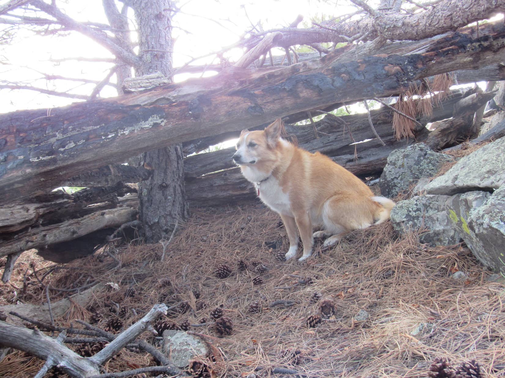
The weather had changed again, however, by the time Lupe reached the top. Rain showers were passing through once more. Loop discovered a crude Dingo shelter at the top of Samelius Peak. Unfortunately, it was so primitive it really didn’t provide any protection from the rain.
At the summit of Samelius Peak. Rain showers are sweeping through once more. The lower hill at Center is Humbolt Mountain(5,722 ft.). Storm Hill(5,656 ft.) is on the L. Photo looks WNW.
Lupe discovers a crude Dingo shelter at the top of Samelius Peak.Would you mind calling a roofing contractor, SPHP? This really isn’t much help.
The Dingo shelter didn’t amount to much, but oh well. Lupe decided she was hungry! As rain sprinkled down, she devoured all of her Taste of the Wild. SPHP ate the last apple. After a while, the rain diminished as the showers moved off.
Although the top of Samelius Peak was forested, there were more openings between the trees here where Lupe could see the views than either Mount Warner or Hardesty Peak had provided.
Black Elk Peak(7,231 ft.) from Samelius Peak. Photo looks SW.Black Elk Peak with help from the telephoto lens.Loop on Samelius Peak’s highest rock. Humbolt Mountain is beyond her on the L. Five Points(6,221 ft.) is on the R. Photo looks NW.Custer Peak(6,804 ft.) is the distant pointy peak on the L. New Year’s Eve Peak(6,046 ft.) is the highest point on the R. Photo looks NW with help from the telephoto lens.
After 45 minutes at the top of Samelius Peak, Lupe was ready to move on. She had a last look around the summit area, then headed down the mountain.
The Samelius Peak trailhead of Centennial Trail No. 89 was only 0.4 mile away to the SW. Lupe headed WSW to intercept the trail only a little N of the trailhead. For a long way, this route was quite steep, but it finally started leveling out to some degree. Lupe soon intercepted Centennial Trail No. 89 as expected.
Samelius Peak summit area. Photo looks NE.Samelius Peak summit again. This time looking SW.Starting down the mountain. Photo looks E back up toward the summit.Back on Centennial Trail No. 89. Photo looks SW.
The Samelius Peak trailhead wasn’t far from here. Even though it was the wrong direction considering the time of day, Lupe went all the way to it.
Climbed 3 mountains and made it all the way to the Samelius Peak trailhead. Pretty good, huh?Centennial Trail map. As the trail goes, it’s 8 miles one way between the Spring Creek & Samelius Peak trailheads.
It was evening. No time to dilly dally here at the trailhead. The sun would still be up for at least an hour, maybe close to two. However, Lupe faced an 8 mile long return to the Spring Creek trailhead. Somewhere along the way, it was going to get dark.
Almost as soon as she reached the Samelius Peak trailhead, Lupe started back. This time she would take Centennial Trail No. 89 the whole way.
Oh, a long beautiful evening stroll ahead. Maybe we’ll see some deers?
The sun was still up, but on the horizon when Lupe reached the summit of Mount Warner for the second time. She no more than tagged the true summit before hurrying on. Sunlight disappeared from the mountains. Dusk, then darkness. The flashlight came out before Loop reached Blue Wing. No moon, but the sky was clear and the stars were brilliant.
A black night, but reflections of starlight sparkled in Sheridan Lake as Lupe trotted by well above the shoreline. In inky darkness, she crossed the beam bridges over Spring Creek. Lupe heard, but did not see, the odd horizontal waterfall still spraying from the mountainside.
The G6 sat alone at the Spring Creek trailhead when Lupe arrived. It had been a long day, but another good one on Centennial Trail No. 89. (10:28 PM, 47°F)
Sunset on Mount Warner, Black Hills of South Dakota, 5-6-18