
Days 17 & 18 of Lupe’s 2018 Dingo Vacation to the Yukon, Northwest Territories & Alaska!
8-20-18, 6:05 AM, 42°F, Pingo Canadian Landmark – Colder this morning, with a uniformly gray sky. Lupe had scarcely seen the sun yesterday, and today didn’t look to be any different. A light, but chilly W breeze blew across Tareoknitok Lagoon from over by Ibyuk and Split Pingos. Lupe watched as fog moved in and swallowed them whole.
Might as well snooze a bit longer.
A while later, Loop was awake again. No longer foggy, but nothing else had changed. Still overcast, still 42°F with a breeze. Today was the only whole day Lupe was going to get to spend in Tuktoyaktuk. If she wanted to make the most of it, the Carolina Dog had better get going. SPHP started up the G6. Within minutes, Lupe was heading back into Tuk.
Lupe had first arrived in Tuktoyaktuk late yesterday afternoon, so she’d already seen some of the main highlights, including, of course, the Arctic Ocean, the main reason everyone comes to Tuk. Today she was going to look around town a bit more carefully before enjoying another lovely romp along the ocean.
Pingo Canadian Landmark, where Lupe had spent the night, is 5 km from town near the “Welcome to Tuktoyaktuk, Land of the Pingos” sign by Tareoknitok Lagoon, the first part of the Arctic Ocean seen on the way into Tuk. The next part of Tuktoyaktuk that had come into view was also the worst. Highway 10 goes right by the unsightly Tuktoyaktuk dump.


After the landfill, though, things get somewhat better. The next thing Lupe saw was a curious one, a cove packed with driftwood. Surprising, since no trees grow anywhere near Tuktoyaktuk, but there is a logical explanation. The driftwood originates from the giant Mackenzie River to the W, and is brought in by ocean currents, wind, and waves.

For a few km beyond the driftwood-laden cove, Highway 10 winds past a number of widely scattered industrial sites. Whether these installations are somehow connected with an energy industry down on its luck, or serve some other purpose wasn’t entirely clear. It all reminded SPHP of what Lupe had seen a year ago in Deadhorse, Alaska, but on a much smaller, less prosperous scale.


After passing the industrial outskirts, Highway 10 goes by a big pond as it enters the village of Tuktoyaktuk. Bob’s gas station (apparently the only gas station in town) was on the R shortly after going by the pond.


Tuktoyaktuk has over 1,000 residents, a number which might grow with the increase in tourism made possible by Highway 10, the new all-season road from Inuvik that opened in November, 2017. Highway 10 was how Lupe had made it to Tuk!
Certainly, the much improved access provided by Highway 10 increases the potential for big changes as Tuk gets better known and businesses consider investing. It was still early in that game, though. In August 2018, as Lupe toured it today, Tuktoyaktuk still looked like an isolated Arctic village. Streets were all dirt. Homes were simple, and up on stilts. Small yards were all dirt, gravel, or natural tundra. Assorted pickup trucks, cars, snowmobiles and ATV’s were parked outside.

One of the attractions Lupe hadn’t visited in Tuktoyaktuk yesterday was the “Pingo with a Trail”, which was on the L shortly after passing Bob’s gas station. That was something the American Dingo could do! Looper was all for the idea.
The Pingo with a Trail might have been 40 feet high. Lupe scampered to the top in only a minute or two. A green bench provided a restful spot from which to take in the surprisingly good views of Tuktoyaktuk and general surroundings. The Arctic Ocean was in sight, too.


After visiting the Pingo with a Trail, Lupe and SPHP drove around Tuk a bit. It was Monday, and traffic consisted mainly of white pickup trucks. Lupe went past some sod houses, but they didn’t strike her fancy. In the evening yesterday, there had been a well-attended baseball game going on in a muddy field. Lots of kids and dogs had been out and about. Near the ocean, children had been bouncing on a trampoline.
Not too much was going on today, though, perhaps because it was colder out. No boats were out on the ocean, or in the harbor. Tuktoyaktuk has an airport, but Lupe hadn’t seen any planes land or take off. Some of the larger buildings in Tuk were in better condition than most of the homes, but the Carolina Dog couldn’t go into any of them.
Lupe and SPHP soon wound up at the park near the visitor information center at the far N end of Tuktoyaktuk. This park was where the tourist facilities were along the Arctic Ocean. Loop sniffed and explored while SPHP made lunch at one of the picnic tables.

Several pickup trucks with campers were around. SPHP chatted with three missionaries for a while. Lupe met Peter, a fellow adventurer and explorer. Peter was from the Czech Republic, and had spent the last 2.5 months bicycling here solo clear across Canada from New Brunswick! From Tuktoyaktuk, he planned on continuing S into the United States and Latin America. Mind-boggling!
The sun never appeared. The gray sky matched the gray sea. A steady stream of tourists came by, but the breeze was a bit chilly. Many didn’t stay long. Photo ops by the Arctic Ocean, a few minutes looking at the waves, and they were on their way.
It was fun for Lupe to have seen more of Tuktoyaktuk today, but the main attraction, and whole reason the Carolina Dog had come all this way, was to see the Arctic Ocean. After lunch was over and done with, and there was a lull in people happening by, it was time to repeat the leisurely stroll Loop had enjoyed yesterday evening along the ocean.
The possibly stray dog that Lupe had met yesterday, had come around during lunch seeking handouts again. By now, SPHP had thought long and hard, and had come up with the clever nickname “Tuk” for her. Tuk decided to join Lupe and SPHP.

Abandoning the G6 at the park for now, Lupe, Tuk and SPHP headed S on Beaufort Road. After passing the cemetery, Loop led the way back to the ocean behind an apartment building to the W. A short trek S brought her to the same nice stretch of shoreline along Kugmallit Bay that Lupe had visited yesterday.
Not another soul out here. The beach wasn’t terribly long, so there was no rush at all. Walking slowly, SPHP gazed out at the restless, remote sea at the top of the world, while enjoying the whole incredible experience of actually being at the Arctic Ocean. Loop and Tuk ran and explored, sometimes together, sometimes going their own separate ways.


“Tuk” eventually realized this trek wasn’t likely to result in a meal. Lupe and SPHP were left alone. At the S end of the beach, Loopster followed the shoreline E along a sheltered cove as far as possible before reaching private property, going a little farther than she had yesterday.

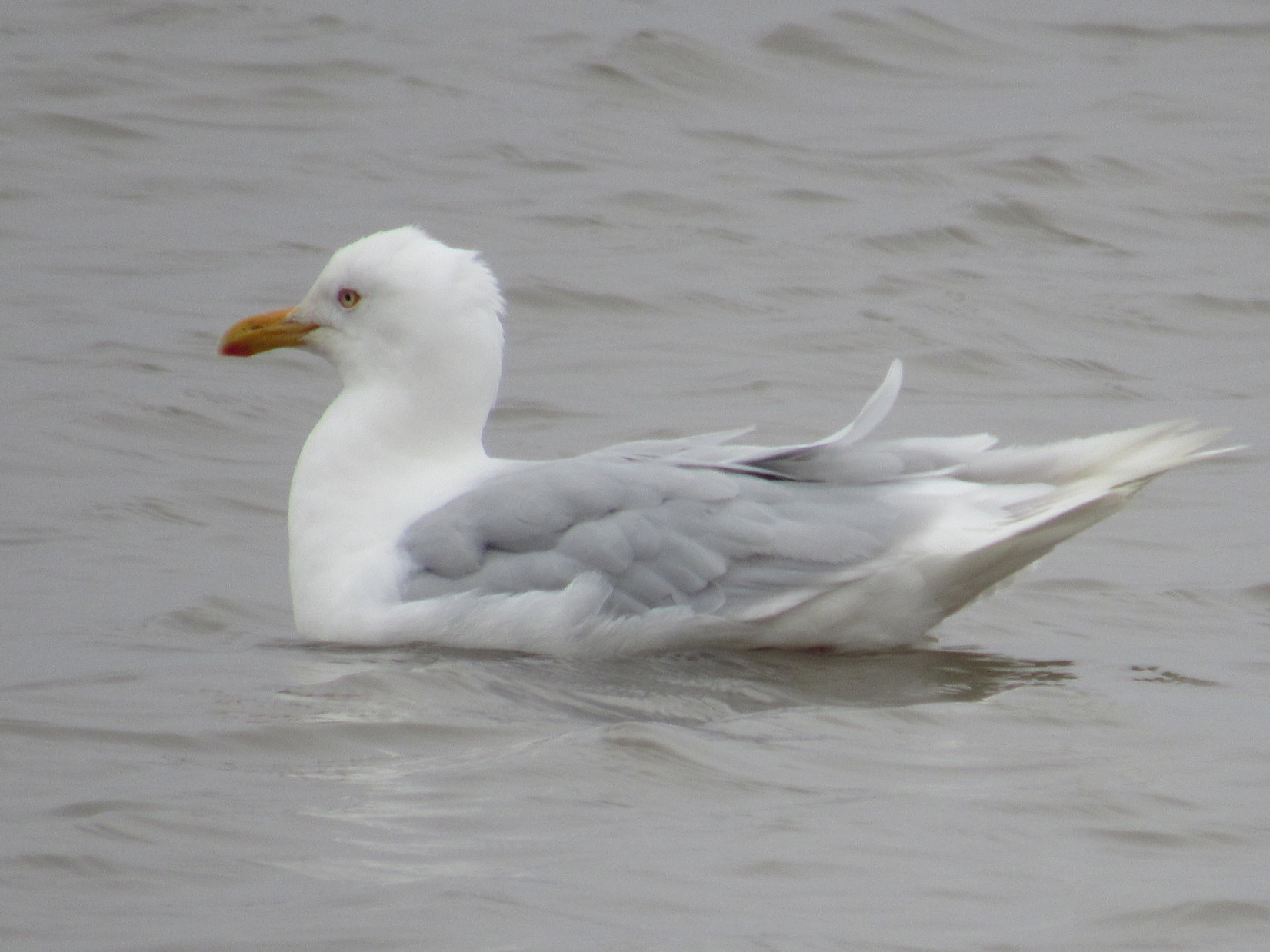
On the way back, a lone seagull came by, and landed on the ocean. SPHP picked out another rock as a souvenir to add to Lupe’s collection. Waves kept rolling in. A little more than an hour after Loop’s second splendid journey along the Arctic Ocean began, it was over, too.

Later, at the park at the N end of Tuktoyaktuk, SPHP heated up clam chowder for dinner. Loop didn’t care for it, preferring Ritz crackers. She must not have been too hungry, as she scarcely touched her Alpo.
“Tuk” reappeared on another panhandling run, and this time was in luck. SPHP gave Tuk some of Lupe’s Taste of the Wild, a whole can of Alpo, and a couple different types of treats Loop had recently received from Pupjoy – Lamb Airy Bites and Coconut Shrimp. Tuk inhaled it all in seconds, looking like 5 times that much would have been preferred. SPHP wondered whether Tuk had a home? Hard to contemplate what might soon be in store for Tuk, if not. Summer was practically over.
The tide was coming in. Lupe and SPHP went over to the spit of big rocks at the N end of the park to watch the ocean gradually submerge formerly exposed seabed. More pingos were in sight on a distant shore.


Evening. Half a dozen pickup trucks with campers were around now, evidently here for the night, but hardly anyone was outside. Along the W edge of the park, just beyond the picnic tables, an embankment of large dark rocks protected the shoreline from the waves of Kugmallit Bay. Scattered among these rocks were large amounts of driftwood.
The ocean breeze was cool, and getting cooler. A fire would be nice! Lupe came along to sniff, while SPHP gathered driftwood. A fire was soon going. SPHP slowly nursed it into a larger and larger bonfire, until it actually threw off some decent heat, if one stood close enough.
A woman came by selling moccasins she had made by hand out of moose hide and seal skin. She was friendly and chatty, but soon discovered she had forgotten to bring any moccasins with her. She left to go back home to get them. After a while, she did return. The moccasins were darling, skillfully made, but for little children or babies. The woman never said how much she wanted for them. She did say she could make 2.5 pairs per day. When SPHP didn’t have a use for them, she moved on looking for someone else to talk to.
After a while, a fog moved in, and it got noticeably colder. Lupe was ready to call it a day. SPHP let her into the G6, and drew her blankie over her. The Carolina Dog settled in for an Arctic Ocean snooze, and did not return.
SPHP kept the bonfire going, while watching and listening to the ocean. No one else was out now. The fog lifted, and it got a little warmer again. Off to the N, a long line of brighter sky appeared. For several hours it drew closer, but never arrived. The fire devoured large quantities of driftwood. Poles 5 feet long, and 7 or 8 inches thick, disappeared.
By midnight, nearly all light had faded from the sky. Weary, and a bit cold from the wind, SPHP doused the fire. What an evening it had been, though! Think of it, only 1,426 miles from the top of the world! The rest of the night was spent at desolate Pingo Canadian Landmark. 8-21-18, 7:30 AM, 33°F – Tiny snowflakes filled the air as SPHP drove back to the park at the N end of Tuktoyaktuk for the last time. The snow was already over and done with when Lupe arrived to find Peter having breakfast in the park’s open air covered shelter. SPHP chatted with him, while Peter gave Loop a pat. He was about to leave Tuktoyaktuk on his bicycle to begin the next leg of his incredible journey to Latin America.
Wishing Peter good luck and safe travels, Lupe and SPHP set off for a third and final stroll along the Arctic Ocean. The morning breeze was quite cold, but Lupe made the whole wonderful trek again. For the first time since she had arrived in Tuk, patches of blue sky could be seen. The bracing journey was over far too soon, but SPHP did remember to pick out a third souvenir stone from Kugmallit Bay.

Not anxious to depart, breakfast was clam chowder again at the same picnic table at the park at the N end of Tuk. SPHP then caught up the trip journal while still enjoying a view of the Arctic Ocean.
10:55 AM, 33°F – What a joyful, incredible experience it had been! The time had come, though, for Lupe to say good-bye, most likely forever, to the Arctic Ocean and Tuktoyaktuk. SPHP was so glad she had come! Lupe got up on a couple of rocks for photos.


And then, for a few final moments, The Most High Exalted Dingo of the Arctic Sisterhood stood poised in the chill breeze on the last of the big rocks she would ever be on next to the Arctic Ocean.

Savored briefly, the moment passed.
Puppy, ho! Onward!
For a few minutes, tiny snowflakes again filled the air as SPHP drove out of Tuktoyaktuk after fueling the G6. The American Dingo was leaving the Land of the Pingos! New adventures lay ahead, but the Arctic Ocean was an adventure never to be forgotten.
20 km from Tuk, Lupe saw Peter again! He was pedaling hard, going fast, and waved as the G6 slowed beside him for a few seconds. Lupe barked. SPHP waved back. Peter was smiling as the G6 re-accelerated. For a few seconds he lingered – receding, then vanishing, in the rear view mirror.
The American Dingo was now destined to repeat her long journey N in reverse. Cruising S on Highway 10 to Inuvik, the plan was to head back to the Richardson Mountains on the Yukon border. Hopefully, the weather would have improved since Lupe had left Wright Pass three days ago. Maybe tomorrow the Most High Exalted Dingo of the Arctic Sisterhood could begin climbing a few of the mountains she had skipped on her way N due to poor weather?
11:49 AM, 35°F, Hwy 10 – The silvery Eskimo Lakes, looking like a vast, lonely sea, were on the horizon. Worth a quick stop! Lupe could see a few small hills near the lakes. Perhaps pingos SPHP hadn’t noticed on the way N? Quite likely.


2:55 PM, 42°F – Along the Dempster Highway S of Inuvik, SPHP stopped at the Tithegeh Chii Vitaii viewpoint again. Loop needed a break from the G6. This time she took the shorter trail to the R at the first fork. The trail led to a viewpoint from which the Carolina Dog would be able to see Campbell Lake.
Lupe never made it to the end of the trail. A large group of people was ahead of her lingering on a big deck at the viewpoint. Since Loop had seen Campbell lake before, there was no sense in disturbing them. Lupe did go far enough to be able to see part of Campbell Lake again, this time on a prettier day.

4:53 PM, 44°F, Mackenzie River – At the Mackenzie River, there was a bit of a wait for the MV Louis Cardinal ferry.

Once aboard the ferry, SPHP recognized a pickup with a camper that Lupe had seen back at Tuktoyaktuk yesterday. SPHP had spoken briefly with the owner, Steve, who was from Alberta. Somewhat surprisingly, Steve appeared outside the G6 on the way over the Mackenzie River. He had important news – a warning, actually.
Steve said he had been amazed to discover that he had internet service on his phone here. He’d just finished checking the weather report. A blizzard was forecast for Eagle Plains and the Richardson Mountains tonight! 80 to 100 kph (50 – 60 mph) winds with 1 to 2 meters (3 – 6 feet) of snow expected! Thought SPHP might like to know. Steve said he was going to try to get to Eagle Plains this evening before the storm hit. At least there were facilities there where he could ride it out.
Gah! Suddenly, that changed everything, didn’t it? Weather forecasts are notoriously over-hyped these days, but even so, if only a fraction of what was predicted came to pass, it spelled the end of any peakbagging hopes Lupe had in the Richardson Mountains. More than a few inches of snow, and the G6 wouldn’t be able to handle it, either.
Summer was about to end. Who knew what getting stranded out here might mean? Big trouble, and a bigger adventure than Loop and SPHP had bargained for, that much was certain. SPHP thought about all the rain that had fallen the night Lupe had spent at the Arctic Circle on the way N. A regular monsoon. If it had been only a few degrees colder out, a meter or two of snow would have fallen back then, easy!
So, as Steve’s pickup pulled away from the ferry after crossing the Mackenzie River, the race to beat the storm was on. Plans demolished, suddenly the Most High Exalted Dingo of the Arctic Sisterhood’s new goal was to flee the true Arctic as fast as possible! Steve was right, she at least had to get to the protection of Eagle Plains.
6:37 PM, 41°F, Peel River – The Dempster Highway had become slick and wet shortly before reaching the Peel River, but the ferry was ready and waiting to go when Lupe arrived. She was across in practically no time, heading for the Richardson Mountains.
7:10 PM, 35°F, Midway Lake – The road is damp, but not as wet as back at the Peel River. The temperature has been dropping, however, and high points ahead are in fog. So far, overall visibility is still good.
7:22 PM, 34°F, 35 km to Wright Pass – Up in the fog now, heading into the first of the Richardson Mountains.
7:43 PM, 32°F – Visibility dropped to as little as 100 yards for a short while, but the road then dropped down into a valley where a rushing stream was on the L. Passed 2 guys on heavily-laden bicycles pedaling hard uphill against the wind. They are still heading N! Wondering how Peter is doing? Maybe he is in Inuvik by now?
Having lost enough elevation to escape the fog, visibility is decent again. More of the Richardson Mountains are ahead, their summits cloaked in fog. The highway is merely damp.

7:55 PM, 35°F – Can see Wright Pass ahead! Peak 3850 immediately to the S of the pass is in view part of the time, too, plus part of the start of the route to Mount Sittichinli (5,165 ft.) to the N. Seems like such a shame that Lupe is going to have to shoot straight on over the pass to continue the journey S, but the forecast is simply too dire to ignore.


8:14 PM, 32°F, Wright Pass – A 30 mph wind is blowing out of the NE over Wright Pass. Only a few minutes ago, Peak 3850 had been visible, but it’s completely hidden by fog now. Too bad, but none of these peaks are going to happen. Lupe must press on. She is already most of the way through the Richardson Mountains now, and can begin her descent down the W side of the range.
Good-bye Northwest Territories, hello Yukon!

8:01 PM, 35°F, Rock River campground – Gained an hour upon entering the Yukon Territory at Wright Pass. Out of the mountains, and heading S. Stopped briefly at Lupe’s favorite No. 6 spot at the Rock River campground, site of the great 2018 Yukon Territory Squirrel Rush not so ago. Gave Loop her dinner. Cleaned windows and headlights. Onward!
8:29 PM, 33°F – Nearly due W of Mount Hare (4,070 ft.), yet another peak in the Richardson Mountains that Lupe never got to see, much less climb. 30 mph wind and light rain. Refreshingly brisk outside, but only for a minute, then it’s back into the G6! The road is a pothole mess, but not as wet, and actually in somewhat better condition than when Lupe was headed N. No blizzard has materialized so far.

10:04 AM, 32°F, Eagle Plains – Apparently, some things never change. It was raining steadily by the time Lupe went past the Arctic Circle again. The Dempster Highway was one pothole after another, each jarring jolt launching a sudden spray of dirty water up over the G6. The windows were a complete mess, especially on Lupe’s side, but SPHP kept driving slowly onward.

The road was super slick going down into and back up out of the Eagle River valley, but the G6 finally made it to civilization at Eagle Plains.
After fueling the G6, SPHP went into the Eagle Plains Hotel. Restaurant closed for the night, but the bar was open. No rooms left, booked solid. Could park at the campground for $20. No snow yet, but 32°F outside, raining, and yeah, the forecast was abysmal for the next three days. Blizzard due to arrive any time now.
Steve from Alberta, who had given the initial warning about the weather back at the Mackenzie River, appeared. He had been able to drive faster in his pickup, and had made it to Eagle Plains a while ago. Steve said he was going to hang out at the campground here overnight, and wait to see what tomorrow would bring. Another guy said he had just gotten in from Tombstone Territorial Park. The weather was worse down there – heavy rain when he’d left some hours ago.
Decision time. Wait here where there were facilities, and see what the morrow would bring, likely getting snowed in at Eagle Plains, or … ?
Or, what? Try to beat the storm and get all the way back to pavement at the start of the Dempster Highway? Probably impossible, and would that even do any good?
Maybe. SPHP thanked Steve from Alberta for the blizzard warning, then went back out into the storm to join Lupe in the G6. Still 32°F, and still just raining. Not even completely dark out yet. SPHP turned the key. The G6 lit up, and sprang to life.
The adventures just keep coming, don’t they Loopster?
No room at the inn, SPHP?
Nope. No vacancy. Sorry about that.
The Carolina Dog heaved a great sigh, and stared out at the long, wet road ahead. A room would have been nice.
Links:
Next Adventure Prior Adventure
The Dempster Highway Travelogue
Want more Lupe adventures? Choose from Lupe’s 2018 Dingo Vacation to the Yukon, Northwest Territories & Alaska Adventure Index, Dingo Vacations Adventure Index or Master Adventure Index. Or subscribe free to new Lupe adventures.