
Days 12 & 13 of Lupe’s 2018 Dingo Vacation to the Yukon, Northwest Territories & Alaska!
8-15-18, 6:00 AM, 42°F at the Mount Haldane trailhead two miles N of the Silver Trail – Looked like rain, darkly overcast without a speck of blue. Lupe had gotten lucky climbing Mount Haldane (6,032 ft.) yesterday. The situation was less promising today, though. Hopefully conditions would be better at Tombstone Territorial Park. SPHP drove back to the Silver Trail, and turned W.

At Stewart Crossing, patches of blue sky could be seen. Encouraging! SPHP took North Klondike Highway No. 2 heading N. It was a sunny day by the time Lupe reached the official start of the Dempster Highway E of Dawson City. SPHP fueled the G6, then accompanied Looper over to the commemorative sign. (9:50 AM, 50°F)
In early September, 2017, the Carolina Dog had explored part of the Dempster Highway, but only as far as Tombstone Territorial Park. The scenery had been absolutely stunning! Below the gloom of a sullen sky, dark grey and silver mountains had loomed over river valleys ablaze with reds, golds, and oranges.
This year, Loopster was going to go farther, much farther! In fact, she was going to travel the entire length of the Dempster to Inuvik in the Northwest Territories, 737 km (458 miles) of gravel away. Not only that, but, if the G6 could manage it, the Most High Exalted Dingo of the Arctic Sisterhood was going to continue N beyond Inuvik, a feat that would have been impossible a year ago. In November, 2017, a brand new all season road had been opened that went another 140 km (87 miles) all the way to Tuktoyaktuk on the Arctic Ocean!
The mighty American Dingo stood at the start of the Dempster Highway blinking and squinting in the sunlight. For good measure, she licked her schnoz at the moment SPHP snapped the photo, a fact not noticed until later. Ah, well. So it goes.

The sun vanished on the road N. Gray clouds blanketed the mountains by the time Lupe reached Tombstone Territorial Park a mere 50 km up the Dempster Highway. Everything was still green in mid-August. The scene was a far cry from the brilliant fall colors Lupe had enjoyed here last September.

11:47 AM, 47°F – SPHP dropped by the visitor center at km 71.5 to get a weather forecast. Not good. Rain showers every day. The plan had been for Lupe to go up Charcoal Ridge to Mount Chester Henderson today, but clearly that wasn’t in the cards. No sense hanging around, either, with days of rain and fog expected.
New plan – just keep heading N. Loop stopped at a few favorite spots in Tombstone Territorial Park along the way.


All these stops were brief. Lupe was soon going by the L turn at km 98 to Surfbird Mountain (5,300 ft.), which was as far N along the Dempster Highway as she had gone in 2017. Everything from here on, for more than 750 km to Tuktoyaktuk, was all new, unexplored territory!
Already beyond the highest and most rugged part of the Ogilvie Range, the Dempster Highway entered the open, gently rolling tundra of the Blackstone Plateau. Two Moose Lake wasn’t much farther at km 102.6. From the lake, Peak 5262 was in view.

The sky was still overcast, but now that Lupe was more or less out of the mountains, bits of blue began to appear. The situation seemed to be improving. Maybe Lupe could climb Peak 5262? That would be awesome! Furthermore, if for some reason the weather forecast was wrong, the Carolina Dog would be close enough to return to Charcoal Ridge for an attempt on Mount Chester Henderson tomorrow morning.
Yeah, that made sense! SPHP parked the G6 at a rest area at km 107.6 next to the East Blackstone River. Loop sniffed among the bushes near the river, while SPHP got ready. (1:00 PM, 51°F)

Lupe and SPHP set out heading N along the Dempster Highway. Ahead the road curved R (NE) to avoid a couple of low ridges. The more distant ridge was slightly higher, but SPHP figured the closer ridge ought to work out just as well. After the road went over a creek coming down from the W, the American Dingo left the highway.
Dense bushes covering the side of the first ridge made getting up on top harder than it should have been. Fortunately, it was no big deal. Lupe gained the ridgeline, and Peak 5262 was in sight again to the WNW.

The top of the ridge was a vast, gentle incline. At the far end, Peak 5262 sat looking like no more than a big hill. A profusion of low bushes too small to impede progress covered the entire ridge. Anywhere else, this sort of terrain would have been cake. Lupe would simply saunter on over to Peak 5262, wander up to the summit, and that would be that.
However, what looks easy in the Arctic, often is not. Firm, reasonably dry ground was crucial to success.

The top of the ridge was fairly dry. However, the ground was not firm. The tundra the bushes grew out of was thick, spongy, tussocky. Loop wasn’t having much trouble with it, but what appeared to be so easy, was a wearying march for SPHP. Still, it wasn’t too bad. Lupe and SPHP kept at it, gradually getting closer and closer to Peak 5262.
For a long way, the tundra stayed dry. Lupe made a lot of progress, but in the end, it was all for naught. Approaching the base of the mountain, Loop came to an enormous bog. SPHP tried tussock hopping, but it was soon clear that wasn’t going to work. The tundra was getting wetter and wetter. The trek turned into a difficult, soggy slog. The terrain ahead looked super easy, but the tussocks kept getting bigger and tougher to navigate, and the gaps between them deeper and full of water.
SPHP now regretted not having had Lupe go to the second, higher ridge before leaving the highway. From here, the other ridge definitely looked like a better choice. However, both the huge bog and an unseen stream filled the gap between here and there. Gazing at the gentle slope head, turning back seemed ridiculous. Peak 5262 wasn’t that much farther! Yet continuing on meant an exhausting, mucky ordeal simply to reach the base of the mountain. No, it just wasn’t worth it.
Lupe may have been puzzled, but she wasn’t perturbed when SPHP gave up and turned back. Even for the Carolina Dog these bigger tussocks, and the deep wet holes around them, weren’t an easy matter.


Though disappointed by not even getting to Peak 5262, much less to the summit, the trek back to the Dalton Highway along the open ridge was a fabulous, beautiful march. Splendid remote hills and mountains of the Yukon were in sight in all directions.

3:25 PM – Despite how wonderful it all was, Lupe and SPHP both arrived back at the G6 rather weary from dealing with the tussocks. A bite to eat was followed by a lazy afternoon nap.
The sun was still shining, when the Carolina Dog woke up refreshed and ready for action. Such a beautiful evening! Without any particular goal in mind, Lupe and SPHP explored the tundra W of the Dalton Highway both N and S of the rest area. Lupe sniffed and explored long stretches of tall bushes near the East Blackstone River, too. Despite setbacks, this had turned out to be such a fun, happy day, after all!


8-16-18, 6:57 AM, 32°F, km 107.6 of the Dempster Highway – Frost! SPHP turned the engine on to let things warm up a bit. Chilly out, but the skies were blue! Not so much back toward the higher peaks to the S where clouds still reigned, but out here on the Blackstone Plateau, it was a beautiful morning.
Cloudy to the S? Go N, young Dingo! Lupe did, but not too far. Her first stop of the day came at Chapman Lake at km 116.0. Though the largest lake anywhere along the Dempster Highway, Chapman Lake still wasn’t all that big.
A display told about the Lost Patrol, which had set out in December, 1910 from Fort McPherson on a 765 km trek to Dawson City without adequate supplies or an experienced guide. The result, while tragic, didn’t seem terribly surprising.


From Chapman Lake, the Dempster Highway proceeded N still following the Blackstone River. A line of mountains was ahead that the river had carved a course through. The resulting valley was very scenic, but after a while the highway turned W abandoning the Blackstone River. A long climb began up to Windy Pass at km 152.8.
SPHP was pleased to see a large pullout along the N side of the highway at the Windy Pass summit. Perfect! How easy is that? SPHP parked, and an enthusiastic American Dingo bounded out of the G6. (8:08 AM)
8:44 AM, 44°F – The setup was great! On the S side of Windy Pass, a long valley coming straight N down toward the pass was flanked on both sides by large ridges. According to the topo map, the ridge on the L (E) led up to Windy Pass Peak (5,249 ft.), Lupe’s peakbagging objective for the day. This ridge was nicely rounded, not too steep, and looked like it would provide an easy, steady ramp higher.

A chilly breeze blew out of the W, as Lupe set out for Windy Pass Peak. Crossing over to the S side of the Dempster Highway, the Carolina Dog sniffed her way SE through a short section of stunted forest followed by a spongy, boggy stretch of open tundra, which fortunately wasn’t too bad. Loop soon reached drier terrain at the base of the big ridge.
The climb up onto the toe of the ridge was a bit steep, but not difficult or the least bit scary. This rocky, dry ground was so much easier to traverse than that much gentler, but tussocky ridge Lupe had roamed yesterday trying to get to Peak 5262! Once Loopster made it up onto the ridgeline, a beautiful, easy route higher was ahead. For a long way, the slope was so gentle that even SPHP seldom had to pause for breath.


Eventually, the ridge steepened and became much rockier. Slower, but still a simple straightforward climb.


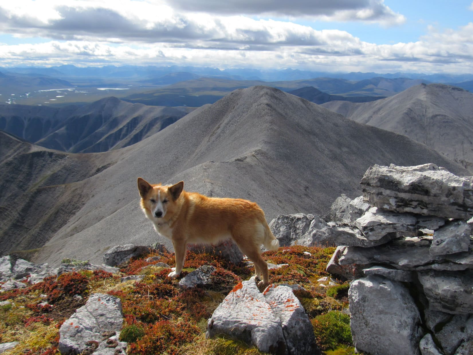
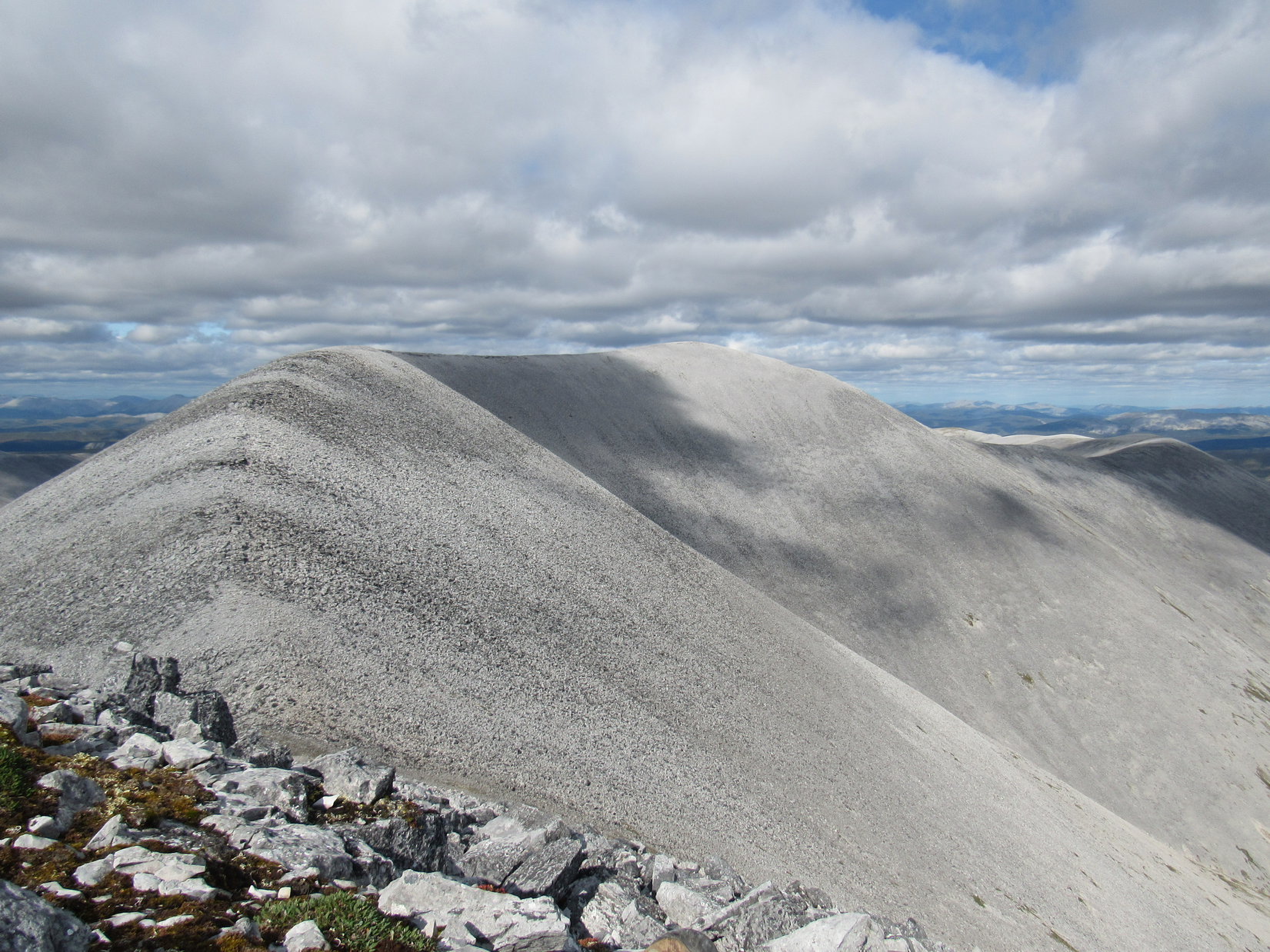
After a nice climb, the terrain began to level out. The going was getting easier again. The N summit of Windy Pass Peak (5,249 ft.) was just ahead. Lupe arrived to find a couple of good-sized cairns, as well as some fabulous views.


Windy Pass Peak has two summits. Slightly higher than the N one, the S summit is the true summit. Naturally Lupe had to visit it, too, in order to claim her peakbagging success. The S summit looked farther away than SPHP expected, but an easy march. After enjoying the tremendous views from the N summit, Looper headed S.

Except for the cold W wind, getting to the S summit was a fun, easy romp. In under 10 minutes, the Carolina Dog was there. After a brief visit to the cairn at the absolute high point, Lupe and SPHP retreated slightly down the E side of the ridge to escape the wind.


As Lupe and SPHP sat together enjoying the wonderful panoramas on display, there was more than just the views to think about. Covering Loop with a jacket, SPHP pondered the situation. This whole trek up to Windy Pass Peak had gone amazingly well, and the day was still young.
Long before the Carolina Dog had ever set out on this Dingo Vacation, SPHP had harbored faint hopes that if the American Dingo was able to get to Windy Pass Peak, she might also be able to continue along the ridgeline as far Distincta Peak (5,775 ft). That had seemed like a rather far-fetched hope, because the ridge leading to Distincta was long. Many hundreds of feet elevation would have to be lost and regained going over other high points along the way.
However, given a nice enough day, the biggest potential problem hadn’t been the distance or the elevation gain/loss, but that this might turn out to be such rugged territory that Lupe wouldn’t stand a chance. Even one technical point anywhere along the whole ridge might easily prove to be an insurmountable obstacle.
That sure hadn’t been the case so far, though. Furthermore, Distincta Peak had been in sight from almost the very start, and nothing that had come into view so far looked all that difficult. Maybe Lupe could get to Distincta Peak? And if that went well, maybe she could even make a huge loop around the whole valley to the W while tagging Peak 5906, too? The whole notion was exciting!
Admittedly, the wind was annoying, but it wasn’t bad enough to be a show-stopper. So far, the weather was actually holding up pretty well. One thing for sure, if Loopster didn’t give it a shot today, when she was already this far along, she would never get another chance.
Puppy, ho! Onward!
And so it began. Lupe briefly returned to the true summit of Windy Pass Peak, before continuing S along the ridge.

Loopster lost more than 400 feet of elevation descending to the saddle leading to High Point 5053, the next big bump along the ridgeline. It all went just fine, though, and soon she was facing a less dramatic loss on the approach to High Point 5381. When that went well, too, confidence soared. Yes! If only the weather would hold, the American Dingo was going to make it to Distincta Peak!


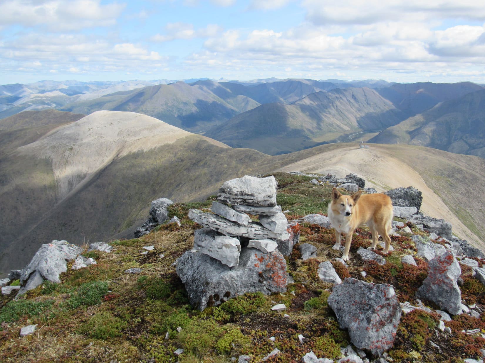
When Lupe reached the top of High Point 5381, a large plateau was in sight to the SW. This plateau, High Point 5371, was almost as high as where Loop was now, and had been visible earlier on much of the way here. Even from a great distance, some sort of structure had been seen on it at the far S end of the long valley W of Windy Pass Peak.
The mysterious structure was now clearly a big microwave tower plus a group of associated buildings. Getting over to the tower was going to be a snap. Once there, all that remained was for Lupe to head directly W to Distincta Peak.


The microwave tower and everything else on High Point 5371 must have been brought in by helicopter. When Lupe got there, she found no sign of any road. The tower stood on the highest ground near the N edge of the plateau, which sloped gradually down toward the S. Ready for a bit of a break prior to tackling Distincta Peak, Lupe and SPHP rested on the barren slope well S of the tower.
The views, of course, were fantastic, but would be even better yet from higher up on Distincta Peak. 15 pleasant minutes were spent relaxing on the S slope of High Point 5371 before Loopster headed NW over to the microwave tower.


Distincta Peak (5,775 ft.) was only a short distance W of the microwave tower. The climb up Distincta’s E slope was the steepest Lupe would have to face all day. Near the top, a bit of scrambling was required, but it was easy – pure fun! Before long, Loop was approaching the summit.


Unlike all the other peaks and high points Lupe visited today, the summit of Distincta Peak encompassed only a relatively small area. Still, there was plenty of room to move around a bit, plus a little more on a slightly lower shelf to the E. Distincta was a truly beautiful summit, nearly flat, adorned with colorful tundra and a cairn of suitable size. Best of all, the views were absolutely grand!


The wind was now out of the S instead of the W, but hadn’t warmed up at all. Thrilled with Lupe’s success at reaching Distincta Peak, a longer rest break was in order. SPHP sought refuge from the cold breeze a few feet below the N edge of the summit. Lupe curled up on SPHP’s lap, and kindly granted permission to pet and praise her.
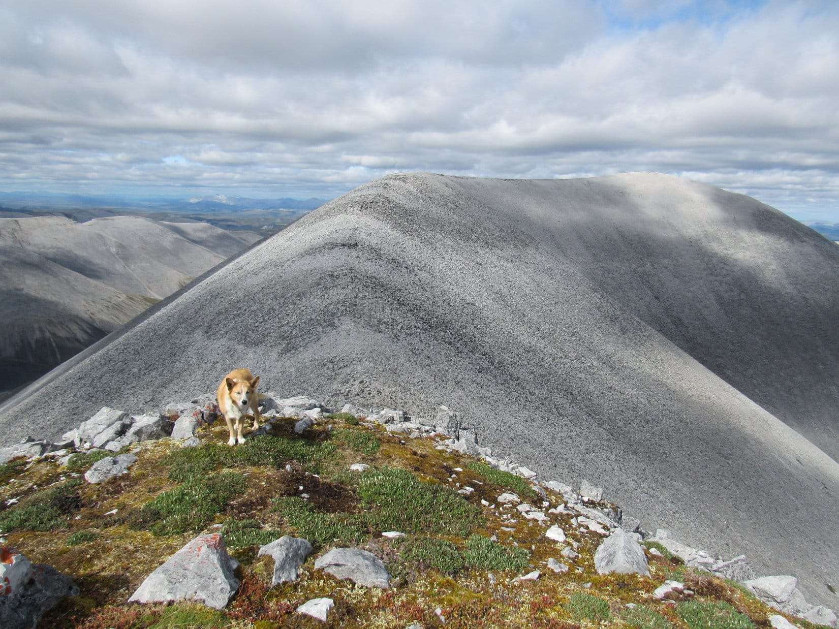
In a pale blue Yukon sky, cotton ball clouds sailed overhead. Facing N, Windy Pass was out of sight beyond a curve in the valley below, but both summits of Windy Pass Peak (5,249 ft.) were in view. Nearly the entire long ridge route Lupe had taken to get here was, too. Remote, unspoiled mountains stretched away to the horizon. Few appeared to be as high as Distincta Peak where Lupe was right now.
However, that big light grey ridge off to the L was an exception. Peak 5906 was a bit higher, and wasn’t very far off now, either. With no rain showers in sight, the American Dingo simply had to visit it, too! In fact, having come this far, Peak 5906 was by now probably the quickest way back to the G6. No rush on that yet, though.

A fabulous half hour shot by. One more peak to go!
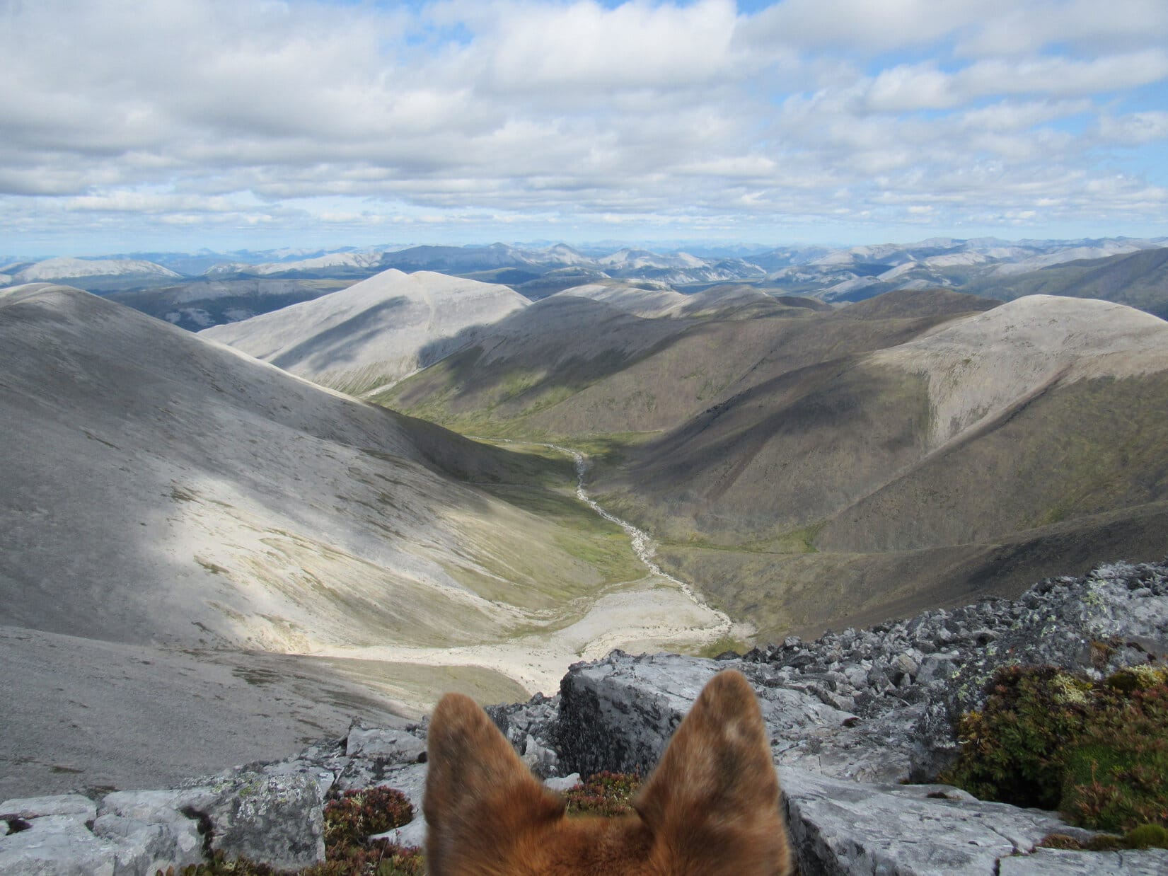
The trek down Distincta Peak’s NW face was nearly as steep as coming up from the E had been. Surprisingly large rocks were prone to shifting unexpectedly, making progress trickier than it looked. Lupe had plenty of time to sniff around while SPHP lost the 350 feet of elevation required to get down to the saddle leading to Peak 5906.
Of course, Loop immediately had to regain all that lost elevation and more, before getting to where the S shoulder of Peak 5906 leveled out. The true summit was still some distance away at the opposite far N end, but the rest was easy. The views were spectacular during the relaxing trek along the massive ridge, on a journey only sweetened by obviously guaranteed success.


Near the E edge of the mountain, a modest cairn sat at the true summit of Peak 5906. Fields of light gray stones sloped gradually away in all other directions. Bits and pieces of humanity’s junk were strewn around nearby – cables, wires, metal rods, bolts, a rotten rope. SPHP stuffed as much of this trash into the backpack as possible for disposal later on.
Lupe stood near the cairn. This was a dream come true! Windy Pass Peak, Distincta Peak, and now even Peak 5906 – way up here in the Yukon, N of Tombstone Territorial Park, the Carolina Dog had actually made it to them all! An undeniable moment of joy and glory.

The weather seemed to be changing. Not drastically, but something to keep an eye on. The wind had shifted slightly, and was now out of the SW. Made no difference. Nowhere to escape it up here, anyway. More concerning, some clouds were starting to look darker. A distant line of showers was drifting this way, and others were developing to the NW.
Lupe wanted to curl up on SPHP’s lap again. Of course, sweet Dingo! SPHP sat facing away from the wind, while Loop settled in.
What an incredible scene! The Yukon – a seemingly endless expanse, all of it mountainous, a sea of desolate, unexplored peaks. Only a chosen distant few appeared to be any higher than Peak 5906. No enormous, towering, monstrous crags in any direction, but the overall effect was deeply moving.
So amazingly beautiful and untouched! It was like gazing upon a world none had ever seen before.

SPHP sat mesmerized. Loop rested completely content, a sublime half hour ticking away right there on SPHP’s lap. Dark clouds swept by, but the rain showers never arrived. Lucky! The weather was holding up just fine.
Eventually, though, the time came to move around a bit. The summit area was so large that it was necessary to get closer to the various edges, in order to see as much as possible.


After traipsing back and forth all over the summit, Lupe returned to the cairn one last time. She had been on Peak 5906 for more than an hour. Although plenty of daylight remained, and the Carolina Dog intended to take a shortcut back to the highway, she still had a long way to go.
SPHP enthusiastically congratulated the Most High Exalted Dingo of the Arctic Sisterhood, and praised her for her grand peakbagging successes on this fabulous day. And then, after a last look around from glorious Peak 5906, Loop headed N.


No more peaks to climb, but the fun wasn’t over yet. Lupe had a grand time on the way back. This was still all new territory, downhill practically all the way, on easy terrain where the wind wasn’t blowing nearly as hard as higher up. The views remained tremendous.

A little more than halfway back, Lupe came to rock formations at the E end of a high point. Nearby, Peak 5906’s N ridge split in two. Since it was the most direct route to Windy Pass, Lupe took the NE prong.


The American Dingo still had a lot of elevation to lose when she reached the end of the NE prong. No choice, but to make a long, steep descent. As usual, this was no big deal for Loop. She roamed and sniffed, while SPHP slowly picked a way down all the steep, loose rock.
Windy Pass was in sight the whole time. Getting there was taking forever, but it wasn’t far away now. Yet one potential obstacle remained. Lupe would have to cross the creek flowing out of the valley to the E to get back to the road. SPHP had plenty of time to fret about this during the long descent. What if it couldn’t be done?

Fortunately, at mid-August the creek turned out to be an easy rock hop. A quick, squishy, spongy march up a tundra slope to the stunted forest near the Dalton Highway was all that remained.
What a day! Couldn’t have turned out any better. Loop had made the big loop, clear around from Windy Pass Peak to Distincta Peak, on to Peak 5906, and back down the long N ridge. Exactly as hoped, though prospects for success had seemed dim when originally conceived. A magnificent Yukon dream come true! (8:02 PM, 50°F)
Links:
Next Adventure Prior Adventure
The Dempster Highway Travelogue Guide
Want more Lupe adventures? Choose from Lupe’s 2018 Dingo Vacation to the Yukon, Northwest Territories & Alaska Adventure Index, Dingo Vacations Adventure Index or Master Adventure Index. Or subscribe free to new Lupe adventures.