Mount Hyland, Babine Mountains, British Columbia, Canada – Part 2: Summit Pass to the Summit! (8-5-22)

Day 7 of Lupe’s 2nd Summer of 2022 Dingo Vacation to Canada & Alaska!

Wee hours, 0.5 km W of Summit Pass – A gentle paw woke SPHP from a sound sleep.  Lupe wanted out.  Unzipping the door to the tiny house, SPHP let her go.  Shining the flashlight after her revealed only thick fog.  Not good.

Don’t get lost out there, Loop!

Started to rain shortly after the Carolina Dog left.  She was soon back, her fur already quite damp.

At least, I’m smart enough to come in out of the rain, SPHP!

You’re a wise Dingo, Looper.

Not looking very good for our plan to climb Mount Hyland tomorrow, SPHP.  Thought your forecast said it was going to be sunny?

Yeah, I know.  Maybe it’ll clear off?  Might as well get some more shut-eye in the meantime.

Lupe went out in the night once more later on.  Still foggy, but the rain had ended, only a light mist remaining.

7:31 AM, chilly – What luck!  Sunshine was on Mount Hyland’s massive SW ridge.  No fog now!  Only high, thin clouds sailed over the enormous valley the American Dingo was supposed to explore today.

Get cracking, SPHP!  Mount Hyland (7,477 ft.) is a go!

Mount Hyland’s SW bowl from the tiny house. Photo looks NNE.

Lupe set out heading E to the McCabe Trail as if she intended to return to Summit Pass, which she’d visited yesterday evening.  However, SPHP led her off-trail well before she got that far, turning NW across a level field of rich green grass.

The American Dingo was in her element!  Freshly rested and energetic, Lupe raced this way and that over the soft green carpet, sniffing madly, while marmots whistled all around.

Roaming Mount Hyland’s Dingo Paradise! Photo looks NW.

The wonderful field soon led to a green bench that rose gradually as it wrapped around the SW corner of Mount Hyland’s gigantic S ridge.  The bench ended before Lupe got too much farther.  Suddenly, a view of rockier terrain appeared ahead.

Entering rockier ground. Photo looks NW.

Climbed a bit too fast already, didn’t we, Loop?

Story of our lives, SPHP.

Still some greenery ahead.  Descending 50 feet or so, Loopster got back to her kind of terrain.  In high spirits, she wandered among a maze of rocks and tundra.  Prime marmot territory!  Before long she’d gone far enough NW.

Think we can turn N now, Loop.  Time to start climbing again!

A final steep grassy slope, etched by rivulets pouring down from above, quickly led to a world of rock.  To the NE, a ravine choked with big talus swept up along the base of Mount Hyland’s S ridge.  Immediately ahead, the Carolina Dog faced a hill of exposed bedrock.

Ascending the last green slope. Photo looks NNW.
Ravine of talus below the S ridge (R). Bedrock hill (L). Photo looks NE.

Let’s avoid all that rock-hopping in this ravine if we can, SPHP!

With you on that, Looper, provided we can get over this hill.

The bedrock hill was actually quite a fun climb, full of little benches and ramps.  Once on top, another small rocky ridge was just ahead, barely any higher than this first hill.

Climbing the bedrock hill. Photo looks NNW.
On the bedrock hill, with another minor ridge ahead. Photo looks NE.

Although Loopster was just getting started up Mount Hyland, looking back to the SSW, there was already quite a view.

Lupe, look!  See that mountain toward the L?  You’ve been there!  That’s got to be Astlais Mountain (6,037 ft.)!

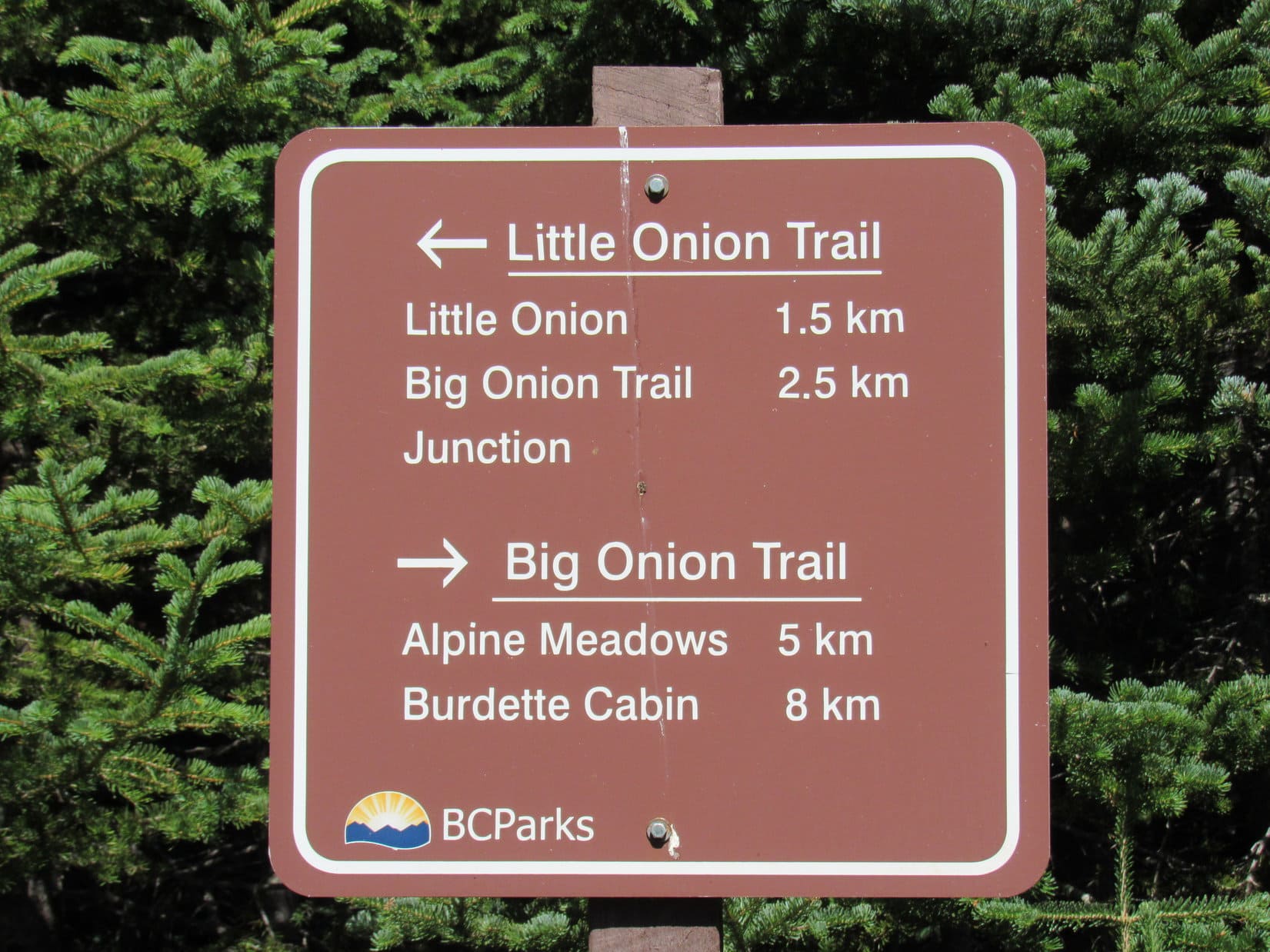
Really, SPHP?  Astlais Mountain was fabulous!  That must mean that lower triangle in shadow even farther L is the Big Onion (5,840 ft.)!

No doubt about it, Loop!  Awesome to see them again from here!

Big Onion Mountain (far L) in shadow, Astlais Mountain (L), NE part of Pyramid Mountain (R). Photo looks SSW.

After climbing up and over the next little ridge, then wandering a region of exposed bedrock slabs beyond it, the central valley of the enormous bowl nestled between Mount Hyland’s massive S and SW ridges came into view.  A wide river of talus swept down the middle of it.

Holy schmoley, SPHP!  That’s a lot of rock!

Nothing too difficult, Looper, but will certainly be slow going for me.

A first snowbank on the way over the next ridge. Photo looks NE.
The river of talus in the central valley. Photo looks NE.

Before taking on the talus, SPHP used the camera’s telephoto lens to scan the far upper end of the valley.  Mount Hyland’s summit was somewhere beyond what could be seen from here, but starting to ponder what might be the easiest way to get up to it couldn’t hurt.  Staying toward the E (R) once higher up looked like the thing to do.

Upper end of the central valley. Photo looks NNE with help from the telephoto lens.

Pressing on, Lupe descended to the river of talus.  Snowbanks strong enough to provide support helped a little.  Angling NNW across the talus, Lupe reached another bedrock ridge.  Once up it, there was more talus.  The American Dingo passed a beautiful shallow tarn.

About to head down into the talus. Photo looks ENE.
At the next bedrock ridge. Photo looks N.
By the shallow tarn. Photo looks NNW.

Beyond the tarn, a steeper climb NW came next on a combination of mostly talus and some bedrock to get past a huge wall of rock extending W from the S ridge.  This led to a flat region where Looper crossed a big snowfield.  Turning N, and scrambling higher, the Carolina Dog reached a large, flat slab.  This seemed like a good spot to take a break.

Relaxing on the slab, Lupe now had a better view of the upper valley.

Crossing the snowfield after the steeper climb beyond the tarn. Photo looks SSE.
The upper valley from the rest break slab. Photo looks NE.

Still a ways to go, but it doesn’t look too bad from here, SPHP.

Yeah, I can’t decide if we should stick with the valley as far as possible, and head straight toward that high point at the upper end, or if we ought to scramble up onto the S ridge.  Maybe there’s some tundra up there, Loop?

That would sure speed things along compared to all this rock, SPHP.

Break time over, Lupe headed NE among the talus, avoiding it whenever possible.  Progress wasn’t too bad, and there were opportunities to cool off on snowbanks too steep to climb.  Turning NNE, after a quite a steep ascent, to SPHP’s surprise, the American Dingo reached an oasis, a bench of soft, green moss that felt good on the paws, with a lovely little stream gurgling through it.  Lupe was clearly delighted!

So was SPHP.  From the look of things, Loop was already getting pretty high on the mountain.

At the unexpected green oasis. Photo looks WNW.

This is encouraging, Loop!  Maybe we ought to scramble up to the S ridge right now?

How much higher is it, SPHP?

Not sure, Looper, but probably only a few hundred feet.

That wasn’t a bad estimate as it turned out, but it took a little persuading to convince Loopster to abandon her lovely oasis.  She got into it, though, which was a good thing, because the rocky scramble was just plain steep for a good 150 feet, before getting somewhat easier.

Scrambling up the S ridge. Photo looks E.

Results, unfortunately, were not as hoped.  A glance in any direction was more than enough to shatter dreams of an easy stroll along the tundra.  What tundra?  The entire S ridge was an endless jumble of rock.  A small, level, relatively rock-free patch of dirt with a few wisps of brown grass was as good as it got.

Off to the N, though, a hill with a long snowbank below it was visible a bit beyond the junction of the S and SW ridges.

Oh, my gosh, Loop!  Is that Mount Hyland’s summit?  Sure looks like it from here!

Let’s hope so, SPHP.  At least it doesn’t look too far away.

At the “grassy” spot on the S ridge. SW ridge (L), summit (R). Photo looks NW.

Despite the rocky terrain, which wasn’t too terrible since the rocks were mostly of modest size, SPHP was enthused.

Hey, hey!  We’re going to make it, Looper!  That little hill is an easy climb!  All we have to do is get to it.

Nearby to the N, a high point jutted out to the E.  There seemed to be no reason to bother climbing it.  Skirting along the W side turned out to be a good decision.  Immediately beyond the E high point, Lupe came to a long snowbank.  Afraid of what might lay beyond it, SPHP wouldn’t let her cool off on the snow.  Another good decision!

By the long snowbank. Photo looks E.
E high point along the S ridge (Center), Peak 7390 (L), the dangerous snowbank (by Lupe). Photo looks ESE.

Continuing N, a more flat-topped knob was ahead.  This time, trying to go around the W side didn’t work.  Too steep!  Lupe had to scramble up onto the knob.  Happily, this wasn’t too difficult, but upon reaching the top, a shock was in store.

The small hill SPHP had taken for Mount Hyland’s true summit wasn’t the only high point ahead.  Another one was now visible a few hundred feet farther NNE along what appeared to be an extremely narrow ridge.  Worse yet, this second high point also appeared to be not only a little higher, but capped by a massive, vertical-sided boulder.

Original high point (L of Center), boulder high point (R of Center). Photo looks N.

Yikes!  That better not be Hyland’s true summit, Looper!  I don’t think we can get up on that boulder, even if we manage to get over to it.

There’s not much difference in elevation between those two high points, SPHP.  Maybe it’s just an illusion that the boulder one is higher?

Maybe.  Won’t know until we get closer, I guess.  Onward!  Puppy ho!

Fortunately, there was a safe way to scramble down to the N from the E end of the knob Lupe was on.  Losing roughly 50 feet of elevation, the Carolina Dog managed to reach the base of the knob.

No further significant obstacles were visible on the broad rocky ridge leading toward the closest high point, but a new threat was developing.  Although the weather had been mostly sunny this morning, now that it was mid-day, clouds were rapidly building.  Fog sometimes boiled up from the SW valley Lupe had explored, and many big clouds were now streaming in from out of the W.

Clouds sweep in toward both high points (L). Photo looks N.

We better get there while we can still see something, Looper!  Onward!

The trek N up the rocky slope was all relatively easy.  SPHP couldn’t help staring over at that second high point farther NNE, hoping it wasn’t the true summit.  Actually, it didn’t look like it was from here, so excitement was growing.  Loopster was going to make it!  SPHP hadn’t the least bit of doubt that she’d soon be at the first high point.

Getting close! Photo looks N.

Suddenly, Lupe was nearly there!  She’d reached the junction of Mount Hyland’s S and SW ridges.  The first high point was now very close by, up a much narrower ridge.  As anticipated, the American Dingo had plenty of room to get there without ever having to set paw on the steep snow.

Success in sight! Photo looks N.

Skirting around W of the snow revealed the final simple romp to a cairn atop the first high point!

Approaching the summit! Photo looks NE.

12:54 PM, 58ºF, Mount Hyland (7,477 ft.) – She’d done it!  Fog swept in from out of the W, as Lupe stood proudly on the cairn at the first high point.  A moment later, the only views remaining were to the E and S.  Peak 7390 was in sight out that way, and Lupe could also see both the knob she’d gone over along Hyland’s S ridge, as well as that initial high point that jutted out to the E.

A mighty American Dingo atop the cairn on Mount Hyland. Photo looks NE.
Peak 7390 (L), the knob Lupe went over (R) with the E high point along Mount Hyland’s S ridge beyond it. Photo looks SE.

Congratulations, Loopster!  Magnificent job!  May I shake your paw?

Lupe meekly extended her paw.  SPHP shook it, and the Carolina Dog came down off the cairn.

It’s been a long, rocky climb, SPHP!  Think I’ve earned a chocolate coconut bar by now, haven’t I?

Yes and no, Loop.  We’ll have to talk about that.

Talk about it?  What do you mean by that, SPHP?  Don’t tell me you didn’t even bring one!

Oh, of course I did, Looper.  Have no fear!  C’mon, let’s sit down.  Guess what?  I brought beef jerky, too.

The American Dingo was more than happy to curl up on SPHP’s lap just below the cairn.  A chocolate coconut bar, beef jerky, Taste of the Wild, and water feast ensued.  SPHP munched on honey-roasted peanuts.

Fog continued to stream by, the only views remaining to the E.  Fulton Lake was visible far beyond Peak 7390.  Somewhat closer, Chapman Lake was off to the NE, also beyond the Babines.

Fulton Lake (L & Center), Peak 7390 (R). Photo looks ESE with help from the telephoto lens.
Chapman Lake. Photo looks NE with help from the telephoto lens.

So, what’s there to talk about, SPHP?  A shame we arrived too late to see much of anything.

Yeah, it is!  Very disappointing!  But I did get a glimpse around before we got here, and even while you first stood on the cairn.  This isn’t Mount Hyland’s true summit.

What?  It isn’t, SPHP?

Sadly, no.  That next high point with the boulder is definitely higher.  Not by a lot, but maybe 10 feet, or so, plus or minus a bit.

Are we going over there then, SPHP?

No!  Not worth it, Loop.  We could maybe get over to that big boulder, but even the narrow ridge leading to it looks kind of dicey.  From what I saw, I’m highly doubtful we can safely get on top.  Too risky to take the chance.

So, I’m not going to get credit for climbing Mount Hyland, SPHP?

That’s what we need to discuss, Loopster.  Maybe this is close enough for Dingo work?  Technically, from a purist’s standpoint, we clearly can’t claim success, but the cairn is here.  Probably a sign that few actually go on to the boulder.  Most people that make it this far would likely say they climbed Mount Hyland, and hardly anyone would object.

The earlier sense of elation when it looked like Lupe was about to tag the true summit as she leapt up onto the cairn was gone.  Whether or not to call this good, fudging a bit to claim a successful ascent was something to ponder while watching the fog gradually spread.  Even Mount Hyland’s S ridge was starting to disappear from view.  Kind of concerning in this rugged territory.

Time ticked away.  The situation wasn’t getting any better.

Well, what do you think, Loop?  How long should we stay up here?  Can’t see much.  Been hoping the sky would clear, since the forecast was sunny, but it appears to be going the other way.

It’s not cold or windy, SPHP.  Can we stay my usual full summit hour, or at least until all the views are gone?  Still sort of awesome just being here, isn’t it?  Besides, I’m tired, and like resting on your lap.

Yeah, it is cool being here, Loopster, but it’s sure not all it could be due to the fog.  Fair enough, though.  We’ll stay your whole hour, if the views don’t completely vanish.

40 minutes after arriving at the cairn, fog swept over the entire S ridge.  Scarcely any views left now, only the lowlands to the E.

Then suddenly everything changed!  Mount Hyland’s SW ridge was in sight!  Pyramid Mountain (6,273 ft.) was beyond it.  WSW, way over by Smithers, Hudson Bay Mountain (8,494 ft.) was in view.

Mount Hyland’s SW ridge (foreground), Pyramid Mountain (L) beyond it, Hudson Bay Mountain (R) in the distance. Photo looks SW with help from the telephoto lens.
Zoomed in on Hudson Bay Mountain (Center). Photo looks WSW.

The clouds weren’t departing; the ceiling was lifting.  Mountains were popping into view all over the place!  Mount Elmsted (7,244 ft.) and Lagopus Mountain (6,982 ft.) were to the NW, beyond Mount Hyland’s W ridge.  A little farther N, The Galleon (7,844 ft.) was emerging, too!

Lagopus Mountain (L of Center), Mount Hyland’s W ridge (R) in the foreground with Mount Elmsted beyond. The Galleon (far R). Photo looks NW.
The Galleon (Center). Mount Hyland’s W ridge (L), Mount Elmsted (far L). Photo looks NW.
The Galleon (Center). Photo looks NW with lots of help from the telephoto lens.

Upon seeing Mount Hyland’s W ridge, SPHP was suddenly confused.

Where are we, Loopster?

What?  We’re on Mount Hyland (7,477 ft.), SPHP!  Are you OK?

Yeah, but I thought that Mount Hyland’s W ridge connected directly to the summit, Loop, and it doesn’t.  At least, it doesn’t connect to where we are.

Are you sure that’s Mount Hyland’s W ridge, SPHP?  Maybe you ought to check your topo map?

SPHP did.  Yes, that was Mount Hyland’s W ridge, alright.  Shaped like the map showed.  As the clouds lifted to the N, a stunning revelation!

Good grief, Loopster!  We’re nowhere near Mount Hyland’s true summit!  It’s way over there!

0.5 km NNW, several more high points were linked not only to the W ridge, but also to the nearby boulder summit by another ridge that was clearly skilled mountaineer territory.  The highest N points certainly did look a little higher than where Lupe was, higher even than the boulder summit.  Beyond them Mount Cronin (7,861 ft.) was starting to emerge, confirming the diagnosis.

Even Lupe felt dejected.

We’ll never get over there, SPHP!

Mount Hyland’s true summit (L), the Boulder Summit (R). Photo looks N.
Mount Hyland’s true summit (Center). Mount Cronin (R of Center). Photo looks NNW.
Mount Hyland’s true summit (L) with Mount Cronin in the background. Photo looks N with lots of help from the telephoto lens.

That was it.  Mount Hyland was a fail.  No fudging this!  The true summit wasn’t that much higher than the cairn Lupe stood on, maybe a mere 20 feet, but even for Dingo work, you can’t be 0.5 km away, and still claim a peakbagging success.  A relatively near miss elevation-wise considering the size of the mountain, but such a distance was a killer.

At least we didn’t break our necks trying to get to the boulder summit, SPHP!

No arguing that, Looper!  Too scary by our standards.

Coming to Mount Hyland may have been a peakbagging fail, but it was also a tremendous scenic success!  Lupe had never been this high, or in such a rugged part of the Babine Mountains before.  The views from up here near the heart of the range were awesome, and Lupe’s old friends Astlais Mountain (6,037 ft.) and Big Onion Mountain (5,840 ft.) were in sight, looking diminutive from such a lofty perch.

Big Onion Mountain (L of Center) and Astlais Mountain (R of Center). Photo looks S.
Big Onion Mountain (L) and Astlais Mountain (R) beyond Ganokwa Basin. Photo looks S with lots of help from the telephoto lens.

The American Dingo lingered long after her traditional summit hour had come and gone.  And why not?  Conditions were near perfect, wasn’t that late yet, and the rugged beauty of the Babines was all around.  Lupe and SPHP both wandered about, gazing at this and that as whim and fancy directed.

Mount Hyland’s SW ridge (foreground), Pyramid Mountain (L) and Harvey Mountain (Center) beyond it, Hudson Bay Mountain (R) in the distance. Photo looks SW.
Mount Hyland’s W ridge (Center) in the foreground, Lagopus Mountain (far L), Mount Elmsted (L), The Galleon (R). Photo looks NW with help from the telephoto lens.

2:49 PM, Mount Hyland (7,477 ft.) – Nearly 2 hours after arriving, Lupe stood on the cairn once hoped, and initially considered to be, the true summit for the last time.

The Galleon (L) Mount Hyland’s true summit (Center), Mount Cronin (R of Center). Photo looks NNW.
Mount Hyland’s true summit (L) in the foreground, Mount Cronin (L of Center), the boulder summit (R). Photo looks N.

You still look a little tired, Loop.  Are you feeling alright?

Yes, but just thinking about all the zillions of rocks we’ve got to hop on the way back makes me wish we were already down on the tundra with the marmots, SPHP.

At least it’s downhill, Loop.  Take one more look at where we are, though!  Can’t win ’em all, and for a fail, Mount Hyland has got to be one of our most magnificent ones ever, don’t you think?

Oh, of course!  Mount Hyland has been a glorious adventure, SPHP!

No matter how glorious, you can’t stay on the mountain forever.  It was time.  A final glance around, and Lupe left the cairn, starting the long journey back to her tiny house.

Soon headed down. E high point on Mount Hyland’s S ridge (far L), SW ridge (far R), Big Onion Mountain (R) and Astlais Mountain (far R) in the distance. Photo looks SSE.
On the S ridge on the way back. Astlais Mountain (far L), Pyramid Mountain (Center), Harvey Mountain (R), Hudson Bay Mountain (far R). Photo looks SW.

The views were spectacular, and the return went fine, at first.  Then SPHP stayed up on the S ridge too long before attempting the descent to the central valley.  Coming down S of the big wall that jutted out to the W, the terrain was so steep that Lupe got nervous, pawing the back of SPHP’s legs many times, seeking reassurance.

At a safe spot during the scramble down to the central valley. Pyramid Mountain (L of Center), Harvey Mountain (R of Center), Hudson Bay Mountain (R). Photo looks SW.

Took a long, cautious effort to reach the valley floor, but Lupe got there.  The shallow tarn was now ahead.  Still plenty of extremely rocky terrain beyond it, but the worst was over.

Down safely, approaching the shallow tarn. Photo looks SE.

At last, the Carolina Dog made it beyond the world of rock.  As soon as the first big expanse of green appeared, she was off!  Joyful, Lupe raced ahead, roaming freely through the Mount Hyland Dingo Paradise as marmots whistled once more.

SPHP didn’t catch up until the end.  The sun was nearly down as, tired and hungry, the American Dingo reached the tiny house.  Lupe’s Mount Hyland adventure was over, but what a magnificent day it had been!

Mount Hyland, Babine Mountains, British Columbia, Canada 8-5-22

Links:

Next Adventure                           Prior Adventure

Babine Mountains Provincial Park Map

Mount Hyland, Babine Mountains, British Columbia, Canada – Part 1: The McCabe Trail from Driftwood Canyon to Summit Pass (8-4-22)

Harvey Mountain, Babine Mountains Provincial Park, British Columbia, Canada (9-9-17)

The Little Onion, Astlais Mountain, & The Big Onion, Babine Mountains, British Columbia, Canada (8-8-18) 

Want more Lupe adventures?  Choose from Lupe’s Summer of 2022 Dingo Vacations to Wyoming, Canada & Alaska Adventure Index, Dingo Vacations Adventure Index or Master Adventure Index.  Or subscribe free to new Lupe adventures.

The Little Onion, Astlais Mountain & The Big Onion, Babine Mountains, British Columbia, Canada (8-8-18)

Part of Day 5 of Lupe’s 2018 Dingo Vacation to the Yukon, Northwest Territories & Alaska!

This had to be it, didn’t it?  Two short gravel roads had led up a forested embankment on the N side of Old Babine Lake Road to opposite ends of a big level area, which certainly looked like a trailhead.  Absolutely no one around, though.  Not even one other vehicle here.  SPHP parked the G6 (11:27 AM, 68°F), and Lupe hopped out.

Lupe arrives at the Onion Mountain trailhead off Old Babine Lake Road E of Smithers, British Columbia. The Onion Mountain trail starts out as the jeep trail seen beyond her. Photo looks NE.

A jeep trail disappeared into the forest from the NE end of the parking area.  This was a trailhead, alright.  A sign warned about avalanches, a threat not particularly high on Lupe’s worry list in early August.  At each of the entrance roads were signs saying user fees were in effect, and trail passes were mandatory.  Upon closer inspection, it appeared these rules only applied to snowmobilers.

Avalanches? Nah, not in August.
One of the signs posted at both entrances to the trailhead. Upon closer inspection, the rules about fees and mandatory trail passes only pertained to snowmobilers.

This must be the place, but would be nice to confirm it before wandering off up the jeep trail.  Looper and SPHP took a stroll back down to Old Babine Lake Road.  Ah, yes!  A sign was posted up on the embankment.  Although looking for a sign on the way in, SPHP hadn’t seen it.  No doubt at all now.  Lupe was definitely at the Onion Mountain trailhead.

Although looking for a sign, SPHP had missed this one along Old Babine Lake Road.

Lupe had barely left the trailhead when a colorful billboard appeared in the forest.  Posted by the Smithers Snowmobile Association, it was all about The Big Onion Snowmobile trails.

This colorful billboard was in the forest not far from the trailhead.

The billboard only served to confirm that Loopster was on the correct route.  Her peakbagging objective for the day was to reach the summit of The Little Onion (5,220 ft.).  If that went well, maybe she could try for Astlais Mountain (6,037 ft.) and The Big Onion (5,840 ft.), too.

The road climbed steeply through the forest. Loopster had taken a trail to the top of Harvey Mountain (6,083 ft.), which was actually in Babine Mountains Provincial Park nearly a year ago.  Back then she had gained something like 2,000 feet of elevation on the Harvey Mountain trail before the forest had thinned enough to get any distant views.

Since Harvey Mountain wasn’t too many miles NW of The Little Onion, SPHP suspected Lupe once again had a long climb ahead of her before she might see much of anything other than the forest.  In fact, since The Little Onion was more than 800 feet lower than Harvey Mountain, the big worry was that the summit itself might be heavily forested.  Even if Lupe could get there, she might not see a thing.

However, Lupe had only gained a few hundred feet of elevation when the road entered an area where the forest was much more open.  She was already getting mountain views to the S and W.

Hey, look! We’re already out in the open where we can see.

The relentlessly steep march along the road combined with mid-day sun quickly made the day feel hot.  Whenever SPHP paused to catch breath, Lupe found shady spots to hide out.

Gets warm out even way up here in the Babine Mountains of British Columbia in August.

Skies were mostly clear with only a few small clouds, but off to the SE the air was hazy with the smoke of distant forest fires.  Yesterday Lupe had traveled hundreds of miles through that smoke.  SPHP had driven out of it only a little while ago this morning.

To the SE the sky was hazy with the smoke of distant forest fires.

The topo map SPHP had with showed a network of trails or routes in this region, none of which were labeled.  As Lupe progressed higher, though, it became clear that this road was definitely one of the routes shown on the map.  That was encouraging.

Lupe began coming to places where, according to the map, there were supposed to be intersections.  The intersecting routes were frequently overgrown, or faded beyond recognition.  Even when these alternate roads actually existed, the route SPHP hoped Looper could take up the Little Onion was consistently in better condition than anything else.  And that was very encouraging!

1,841 feet of elevation gain to the summit of The Little Onion from the trailhead. So far, so good! Photo looks SW.

The American Dingo had made substantial progress up the mountain when there was another encouraging development.  Many hundreds of feet higher, what looked like it must be the summit of The Little Onion came into view.  Although dense forest extended most of the way to the top, the summit appeared to be open ground.  Lupe might actually have some fabulous views from up there!

The summit of The Little Onion comes into view. Photo looks N.

Around 1300 meters (4,265 ft.) elevation, a large shut metal gate similar to one Lupe had seen at Harvey Mountain blocked the road to vehicle traffic.  Beyond this gate, the road leveled out in a thickly forested area.  This flat stretch led to a signed junction at around 1320 meters (4,331 ft.).

Lupe at the first signed junction.
Only 1.5 km left to go to The Little Onion!

Lupe went L taking the Little Onion Trail.  The trail, which was still a road, went through a beautiful forest.  The road began climbing again and gradually deteriorated.  Although the trailhead was S of The Little Onion, the trail passed well E of the summit before finally arriving at a saddle a short distance NNE.

Looking back along the beautifully forested Little Onion Trail. Photo looks SW.

Upon reaching the saddle, Lupe could see Astlais Mountain (6037 ft.) and The Big Onion (5,840 ft.) off to the N.

Lupe reaches the saddle NNE of the summit of The Little Onion. Astlais Mountain (L) and The Big Onion (Center) are in view for the first time. Photo looks N.

The Little Onion Trail was quite rocky by the time it reached the saddle.  The trail continued over the saddle going NW down the other side.  A much rougher spur road left the saddle heading SSW toward the summit of The Little Onion (5,220 ft.), which was only another 100 feet higher.  The spur ended close to the top.  Lupe finished her ascent with a short, easy stroll.

The Little Onion’s summit was an open ridge covered with grasses and small stones.  The ridge was 20 or 30 feet long, big enough to provide plenty of room to move around.  A few stunted trees grew at slightly lower levels along the flanks.  None were tall enough to interfere with the marvelous views in all directions.

Lupe reaches the top of The Little Onion. The big rock on top is actually SPHP’s pack. Photo looks SE.

After SPHP congratulated Lupe on reaching The Little Onion, it was time for a look around.  The most eye-catching view was of Hudson Bay Mountain (8,494 ft.) off to the W.

Hudson Bay Mountain (R) from The Little Onion. Photo looks W.
Hudson Bay Mountain with help from the telephoto lens. Photo looks W.

To the SW, a line of snowy peaks looked equally rugged, but they were far away.  Notable peaks were off the NW, too, but they were even more distant.

Looking SW toward another range of rugged, snowy peaks (L) on the horizon.
These unfamiliar peaks had quite a large glacier hidden up among them. Photo looks SW with help from the telephoto lens.
Looking NW at even more distant peaks.

To the N, was a terrific view of Astlais Mountain and The Big Onion.

Looper at the absolute highest point on The Little Onion. Astlais Mountain (Center) and The Big Onion (R) in the background. Photo looks NNW.
Astlais Mountain with help from the telephoto lens. Photo looks NNW.
The Big Onion. Photo looks N with help from the telephoto lens.

Views to the S and E were pretty, but less dramatic.  Mostly big forested hills and ridges.  A SW wind was blowing, which SPHP welcomed, since mosquitoes and small flies had at times been bothersome on the way up.  Lupe could see smoke to the SE drifting many miles NE on the breeze.

A small loosely constructed cairn sat 10 or 15 feet SW of the highest ground.  The weather was ideal, 60°F and mostly sunny.  Lupe and SPHP were both glad to take a break and enjoy the views for a while.  SPHP draped a jacket over Loop, since she wasn’t a fan of the wind.

Llama Lake from The Little Onion. Photo looks SW.
Mt. McKendrick (5,7515 ft.) (Center). Photo looks ENE.
The other side of the high, barren ridge at Center overlooks Four Lakes Basin in Babine Mountains Provincial Park. Photo looks NE.
The smoky region to the SE.

More than half an hour passed by at the summit of The Little Onion.  The American Dingo’s ascent had gone surprisingly well.  The possibility of going on to The Big Onion and Astlais Mountain had always been there.  However, at first, they had looked much higher and far away.  The longer SPHP contemplated the view, though, the easier it appeared.

Glimpses of roads could be seen on the ridge leading over to The Big Onion, and the map showed a road going up to the high saddle between The Big Onion and Astlais Mountain.  Maybe it wouldn’t hurt to go back down to the Little Onion Trail, and follow it NW down the other side of the nearby saddle?  That was the right direction, and according to the signs Lupe had seen, the Little Onion Trail was supposed to link up with the Big Onion Trail again.

Perfect day.  Why not?  May as well try it.  Now or never, in any case!  A last look around from The Little Onion, then Lupe headed back down the rough spur road to the Little Onion Trail.

Since we’re about to leave The Little Onion, thought we’d sneak in one more peak at this great view of Hudson Bay Mountain (R)! Photo looks W.
Last moments atop The Little Onion. Photo looks SE.
Another look at Lupe’s new objectives. Astlais Mountain (Center) and The Big Onion (R). Photo looks NNW.
Back on the Little Onion Trail at the saddle a little NNE of The Little Onion’s summit. Photo looks SE back the way Lupe originally came up.

Upon reaching the Little Onion Trail again, Lupe followed it NW.  The road lost elevation in fits and starts.  The trail divided unexpectedly, causing confusion, but merged again almost immediately.  The trail then turned N near the start of the ridge leading to The Big Onion.

Heading NW on the Little Onion Trail. Astlais Mountain on the R.

Instead of going N directly up the ridgeline, the road stayed lower along the E side of the ridge in a heavily forested area.  The trail was level, or nearly so, along in here.  Before too long, Lupe reached a junction with the Big Onion Trail.

This junction was the official end of the Little Onion Trail.  Looper kept going N, now taking the Big Onion Trail toward Alpine Meadows.

Sign at the end of the Little Onion Trail. Lupe kept going N toward Alpine Meadows.

A little farther on, the Carolina Dog reached another signed junction.  This was the critical one!  Lupe had no intention of going all the way to Alpine Meadows.  That wasn’t the way to Astlais Mountain or The Big Onion.

At this second junction, a road went W back up onto the ridge leading to The Big Onion.  The sign said this road was the Astlais Mountain Trail.  The pass below Astlais Mountain was 1.4 km away.

Great news!  That was exactly where Lupe needed to go!

Sign at the critical junction. Lupe abandoned the Big Onion Trail in favor of the Astlais Mountain Trail here.

So Lupe abandoned The Big Onion Trail, and took the Astlais Mountain Trail W up onto the ridge.  Once on the ridge, the road turned N, then subsequently deteriorated to the point where it would be impassable for any vehicle other than an ATV, or perhaps a snowmobile in winter.

The trail did go on, however, and went through a low area where Lupe came to the only water to be found all day.  A trickle of a stream formed from little seeping springs ran over the road here, just enough for the Carolina Dog to get a drink.  Beyond this point the trail gained elevation at a moderate pace, heading NNW along the SW slope of The Big Onion, but still far below the summit.

The Astlais Mountain Trail along SW slopes of The Big Onion. Photo looks NNW.
Looking back toward The Little Onion. Photo looks SSE.
Looper on the Astlais Mountain Trail. The Little Onion at Center. Photo looks SSE.
Hudson Bay Mountain from the Astlais Mountain Trail. Photo looks W.

Worries that the trail might fade away completely proved unfounded.  A much better road soon came in from somewhere off to the SW, and swung sharply around continuing toward the high saddle between The Big Onion and Astlais Mountain.

Luck of the Dingo again! This road will get us up to the pass! Photo looks NW at Astlais Mountain.

The new road promptly began climbing at an incredible pace along the very steep W slopes of The Big Onion.  Lupe had no troubles, but SPHP lost traction on any loose debris to the point where walking wherever the ground looked firmest, or in piles of loose rock thick enough to offer at least some support, became standard practice.

The mere thought of being in a vehicle going up or down this road was rather frightening to contemplate.  Being on paw and foot was certainly much better, even if the long trudge higher was exhausting.

Well, it is a mountain road, SPHP! What did you expect? Photo looks NNW.
Whew! That was sort of steep, wasn’t it? Glad that’s over with! Photo looks SSE.

It was a huge relief when the road finally began to level out.  Lupe had made it to the high pass between Astlais Mountain and The Big Onion!  Beyond the pass, she could see higher peaks to the N for the first time.  Those peaks were in Babine Mountains Provincial Park.

We’ve made it to the end of the Astlais Mountain Trail! Those mountains to the N are in Babine Mountains Provincial Park. Photo looks N.

After a rest break, the only question now was which to climb first – The Big Onion or Astlais Mountain?  Both looked like big hills, basically easy climbs from here.  The Big Onion was closer and lower.  After initially starting that way, SPHP changed the plan.

Still a lovely day, but more clouds were present than only a little while ago.  Maybe Lupe ought to take on Astlais Mountain first?  Would be nice to get the higher peak in case the weather deteriorated fast enough to prevent the American Dingo from visiting both.  Whatever!  Lupe was fine with that.

By the time Lupe was getting close to the high saddle, The Big Onion (Center) wasn’t that much higher. Photo looks SE.
Astlais Mountain looks like just a big hill from here! Photo looks WNW.
Astlais Mountain from the high saddle. Photo looks W.

So Lupe charged up the E slope of Astlais Mountain, while SPHP plodded higher.  It hadn’t looked this steep!  Nevertheless, this was just a big grassy trudge until fairly close to the top.  The terrain then began to get rockier as the slope decreased.  The huge summit region was somewhat complex with various rocky knobs and ridges among areas of tundra or bare ground consisting of small loose rock.

It wasn’t immediately clear where the summit was, but a big cairn was soon spotted well W of where Lupe had come up.

Lupe already reaching the easy terrain close to the top of Astlais Mountain.
Which way do you think, SPHP? Gotta be one of these rocky high points, but which one? Photo looks S.
Oh, I think I see it! There’s a big cairn (R) over this way! Photo looks WNW.
Lupe near the summit. Photo looks WNW.
Yes, this is it! Almost there!

The weather hadn’t deteriorated at all during the time it took Lupe to reach the big summit cairn on Astlais Mountain (6,037 ft.).  60°F with a 10 to 15 mph SW breeze, just like at The Little Onion.  A beautiful day!  Which was great news.  Lupe could stay a while!

Loop reaches the summit of Astlais Mountain. Photo looks NNW.
Loop at the summit cairn. Photo looks NW.
Hudson Bay Mountain (L) from Astlais Mountain. Photo looks W.
Another look showing more of the W end of the summit area. Hudson Bay Mountain (Center R) beyond Lupe. Photo looks WSW.
A closer look at the W portion of the greater summit area. Lupe didn’t venture all the way over there. Hudson Bay Mountain on the R. Photo looks WSW.
Here’s the last stretch of the summit region the way we came up! Photo looks ESE.

Hudson Bay Mountain (8,494 ft.) and the other rugged more distant peaks to the SW and NW were all just as beautiful and interesting as they had been from The Little Onion, but the views really weren’t much different in those directions from Astlais Mountain.

Hudson Bay Mountain from Astlais Mountain with help from the telephoto lens. Photo looks W.
Looking NW with help from the telephoto lens.
Part of Tyhee Lake (the larger lake R of Center) near Telkwa is in view. Photo looks SW.
Rugged peaks far to the SW with help from the telephoto lens.

The Little Onion (5,220 ft.), which had seemed such an impressive high point only a short while ago, looked small and much lower from Astlais Mountain.  Lupe could see part of The Little Onion trail on the N slopes.

The Little Onion (Center) did look little from Astlais Mountain. Photo looks SSE.
The Little Onion with help from the telephoto lens. Photo looks SSE.

Smoke from the forest fires to the S could be seen actually billowing up.  The wind must still have been out of the SW way over there, too.  A huge plume was drifting NE.

A huge plume of smoke billows up (Center R) and drifts off to the NE (L). Photo looks S.

Though Lupe had seen essentially these same views in most directions from The Little Onion, coming to Astlais Mountain had been worthwhile, for off to the N the scene was much different.  The American Dingo now had a tremendous view of closer peaks in Babine Mountains Provincial Park (map).

Lupe and SPHP spent a long time gazing N at the splendors on display.  SPHP knew the names of a few of the peaks.  The Galleon (7,844 ft.) was the most impressive from Astlais Mountain.  SPHP scanned the horizon for Mount Cronin (7,861 ft.), and thought Lupe had a glimpse of it, though partially hidden by Mount Hyland (7,478 ft.).

Lupe gazing across Ganokwa Basin toward the high peaks of the Babine Mountains. Photo looks N.
The Galleon (Center) was the most impressive peak Lupe saw from Astlais Mountain. Photo looks N with help from the telephoto lens.
Another look across Ganokwa Basin. SPHP believes the high dark ridge at Center is Mount Hyland. The distant dark ridge L of Center which is only partially in view is likely part of Mount Cronin. The Galleon is at far L. Photo looks NNE.
Still looking NNE, but with help from the telephoto lens. Mount Cronin is the ridge in shadow L of Center. Mount Hyland is the dark ridge on the R.
Perhaps a clearer view. Mount Cronin’s summit may be the distant sunlit little bump at Center. Mount Hyland at far R. Ganokwa Basin in the foreground. Photo looks NNE.
Zoomed in on Mount Hyland. Photo looks NNE.
Mount Hyland on the L. The distant spire at Center is likely High Point 6470 (1972 M). Photo looks NNE.

The highest peaks weren’t the only ones of interest.  Nearly a year ago Lupe had climbed Harvey Mountain (6,083 ft.), which was off to the NNW.  It would have been fun to see Harvey Mountain again, but as it turned out, Padella Peak (6,300 ft.) was in the way.

Perhaps looking for Harvey Mountain, Lupe gazes across a deep canyon toward Padella Peak (L in foreground). Pyramid Mountain (6,234 ft.) is the lower sunlit peak just to the R of Padella. The Galleon is in the distance at Center. Photo looks N.
Padella Peak (Center) from Astlais Mountain. Pyramid Mountain in the foreground on the R. Photo looks NNW.
Padella Peak (R). Lagopus Mountain (6,956 ft.) (Center) is in view beyond Padella. Photo looks NNW.
Isn’t Astlais Mountain great? So much to see! Photo looks NE.
Lagopus Mountain (far L), Padella Peak (L), Pyramid Mountain (Center L), and The Galleon (Center). Photo looks N.

Astlais Mountain was a fantastic peak!  Such a great day, and so much to see from here!  50 glorious minutes shot by at the summit.  If Lupe still wanted to visit The Big Onion, too, which she did, it was getting to be time to bid farewell to Astlais.  A final look at the mighty Galleon, and the Carolina Dog was on her way.

The Galleon (Center) from Astlais Mountain. Photo looks N.
Sadly, it’s time to leave Astlais Mountain if we’re going to visit The Big Onion, too. Our stay here has been splendid, hasn’t it? Photo looks NNW.
Final moments at the summit of Astlais Mountain. Photo looks NNW.
Astlais Mountain’s N ridge as seen from the summit is in the foreground. Lupe would head down this way after a quick jaunt to the R (S) for a view of The Big Onion before completing her descent. Mt. McKendrick is at far R. Photo looks ENE.
Looking back at the summit of Astlais Mountain (R). Hudson Bay Mountain (Center). Photo looks W.

Upon leaving the summit cairn, Lupe headed E to a high point where she could look down on The Big Onion (5,840 ft.).  She then headed N a little way losing elevation gradually, before turning E and descending the much steeper slope to the saddle.

Looking down on the saddle leading to The Big Onion (R). Mt. McKendrick (L) in the distance. Photo looks E.
Looking back up at the summit of Astlais Mountain near the start of Lupe’s descent. Photo looks SW.
The Big Onion (R) as seen before beginning the steepest part of the descent. Photo looks SE.
Won’t be long now! Soon we’ll be at the top of The Big Onion! Photo looks SE.

Once down, Lupe crossed the saddle and headed for The Big Onion.  She followed a road part of the way, and eventually reached the ridgeline a little way N of the summit.  An easy, short trek S along the narrow ridge brought the American Dingo to the top of The Big Onion (5,840 ft.).

This is it! We’ve arrived at the true summit of The Big Onion. Quite a view of Astlais Mountain behind me, isn’t it? Photo looks WNW.

The absolute high point consisted of several medium-sized rocks amid tufts of brown grass.  The summit was a mostly grassy area atop a rocky knob which dropped off steeply, though not precipitously.

The Big Onion wasn’t high enough to give Lupe quite as grand a view of the heart of the Babine Mountains to the N as she’d had from Astlais Mountain.  However, she could see more territory to the E, and the view of Astlais Mountain itself was quite interesting.

Lupe at the true summit of The Big Onion. Hudson Bay Mountain (L) in the distance. Astlais Mountain (R). Photo looks W.
View along The Big Onion’s N ridge. The Galleon is on the L. Mount Hyland on the R. Photo looks N.
View to the NNE. Mount Hyland on the L.
Mount Hyland (Center) with help from the telephoto lens. Photo looks N.
Looking over the saddle between The Big Onion and Astlais Mountain toward Padella Peak (Center). Pyramid Mountain is on the R with Lagopus Mountain peeping up between Padella and Pyramid. Photo looks NW.
Looking S. The Little Onion is on the L.
The Little Onion (Center) from The Big Onion. Photo looks S.
A view of the entire saddle area between The Big Onion and Astlais Mountain (L). Padella Peak on the R. Photo looks NW.
Loop relaxing on The Big Onion summit. Photo looks WNW.
Mt. McKendrick (R). Photo looks ENE.
The Galleon (Center) from The Big Onion. Padella Peak (L) and Mount Hyland (R). Photo looks N.

Lupe relaxed and enjoyed the beautiful Babine Mountains from the top of The Big Onion for half an hour.  Her journey to Astlais Mountain and both Onions had been a huge success!  The day had gone far better than SPHP had ever dared to hope.  Evening was approaching, however.  Lupe began the trek back to the Onion Mountain trailhead.

Lupe on The Big Onion shortly before departure. Photo looks SSW.

Lupe’s route back was the same one she’d taken up.  The Carolina Dog and SPHP were both in high spirits.  The return trip went fast.  So fast, in fact, that Loop returned briefly to the summit of The Little Onion.  Even after visiting The Big Onion and Astlais Mountain, The Little Onion was still an amazing place!  And far to the S, the smoke of distant fires still billowed into the sky.

Then it was down, down, all the way back to the trailhead.  (7:26 PM)

Final moments atop The Big Onion. Photo looks S.
Hardy little tundra plants on The Big Onion’s N ridge.
Here we go again on the Astlais Mountain Trail! Thankfully we’re heading down this time. Photo looks SSE.
Forest fires still burned as evening approached. Looking S from The Little Onion.

SPHP stopped in Smithers for fuel and dinner from Safeway.  Twilight was coming on by the time Lupe arrived at a big field along Yellowhead Hwy 16 S of Moricetown.  Ancient picnic tables with white peeling paint stood on a bluff overlooking the Bulkley River.

Despite her long afternoon in the Babine Mountains, the American Dingo was still energized.  She raced around the G6 playing chase with SPHP, who was, as always, totally outmatched.  Lupe was happy, oh, so very happy!  And seeing her so, SPHP shared her joy.  What a wonderful day this had been!

Lupe on The Little Onion again, Babine Mountains, British Columbia, Canada 8-8-18

Links:

Next Adventure                  Prior Adventure

Babine Mountains Provincial Park Map

Babine Mountains Provincial Park Brochure

Harvey Mountain, Babine Mountains Provincial Park, British Columbia,  Canada (9-9-17)

Want more Lupe adventures?  Choose from Lupe’s 2018 Dingo Vacation to the Yukon, Northwest Territories & Alaska Adventure IndexDingo Vacations Adventure Index or Master Adventure Index.  Or subscribe free to new Lupe adventures.

Harvey Mountain, Babine Mountains Provincial Park, British Columbia, Canada (9-9-17)

Days 39, 40 & 41 of Lupe’s 2017 Dingo Vacation to the Yukon & Alaska!

9-7-17, 6:24 AM, 44°F, Tombstone Territorial Park, Yukon Territory – Lupe and SPHP were awake dark and early.  That’s right – dark and early.  A week into September now, long days of the far north were ending.  SPHP drove S on the Dempster Highway just to let the G6 warm things up a bit.  Lupe stopped and had breakfast near the big sign at the entrance to Tombstone Territorial Park.

Lupe’s Tombstone Park adventures were over.  She’d had a grand time climbing Surfbird Mountain, Goldensides, and taking the Grizzly Ridge trail to Grizzly Lake.  In fact, Loopster was done here in the Yukon.  It was time to head home, but home was thousands of miles away.  Most of the remaining days of her 2017 Dingo Vacation to the Yukon & Alaska would be spent on the road.  Still, there would be stops at various sights, and a couple more big adventures along the way.

After breakfast, Lupe rode shotgun watching for wildlife, while SPHP drove.  The fall scenery was magnificent.

A week into September, the fall scenery along the Dempster Highway was magnificent.

Upon reaching the North Klondike Highway, SPHP turned SE toward Whitehorse, the capitol city of Yukon Territory.  Whitehorse, which was 550 kilometers from where the Carolina Dog started this morning, was as far as Lupe was going today.

Lupe and SPHP had never been on the North Klondike Highway before.  The road wound among countless hills, ridges, and valleys.  There were mountains to be seen, but the highest ones were generally far away on some horizon.  The highway crossed streams and rivers, and went past small lakes.  Everywhere Loop looked, bright yellow forests of deciduous trees mixed with the dark greens of conifers.

The long, peaceful drive was beautiful and relaxing – just the ticket after Lupe’s nearly 14 hour day on the Grizzly Ridge trail yesterday.  Loopster snoozed when she felt like it, but was always eager to get out of the G6 to look around when SPHP stopped briefly at memorable spots along the highway.

A view of the Tintina Trench from along the North Klondike Highway. Photo looks N.
The Tintina Trench is a geological feature which extends across the Yukon into Alaska. A fault line along the trench has shifted laterally 450 kilometers.
Patches of low clouds hang over the Tintina Trench. Photo looks N with help from the telephoto lens.
View of the Five Finger Rapids area on the Yukon River. Photo looks W.
At Fox Lake. Photo looks S.
Fox Lake was the largest lake Lupe saw along the North Klondike Highway. She wasn’t far from Whitehorse by the time she got here. Photo looks NW.

Late in the afternoon, Lupe arrived in Whitehorse.  SPHP found a Jiffy Lube, and the G6 got a needed oil change.  Evening featured a roasted chicken from President’s Choice.  The American Dingo enthusiastically helped to devour the chicken at Takhini Hot Pools, which SPHP enjoyed for the second time on this Dingo Vacation.

9-8-17, 4:41 AM, 48°F in Whitehorse – Two foxes!  SPHP watched them for a couple of minutes before Lupe woke up and saw them, too.  A Dingo barkfest ensued, but the foxes only seemed perplexed and curious.  After a minute or two of this abuse, they sauntered off together heading for downtown.  Awesome!

Another relaxing day on the road.  The morning featured gorgeous S Yukon Territory scenery along the Alaska Highway.  After turning S on the Cassiar Highway, Lupe spent the afternoon in British Colombia.  The Cassiar Highway was in better shape this year than in 2016.  No more long stretches of gravel.  Those had been replaced with new pavement.  Smooth!  Lupe passed by many beautiful lakes – Good Hope, Lang, Deese and others.

Lupe by the Yukon River SE of Whitehorse. Photo looks W.

With so many miles to go, it wasn’t possible to stop much.  By late afternoon, after nearly 2 days in the G6, Lupe was getting restless.  Something had to be done.  A stop along the Stikine River for a 30 minute break helped.  Loop found a squirrel up in the trees.  Superb Dingo therapy!

Loop licks her schnoz after enjoying some Stikine River water. Photo looks ESE.
About time you let me out of the G6! Photo looks SW.
This is more like it! Searching for squirrels in the trees along the Stikine River. Found one, too! Oh, happy half hour!

Two black bears and a horse along the highway provided what little excitement there was the rest of the day.  Between these episodes, Lupe’s eyelids grew heavy.  She went back to snoozing.  The highway went by many beautiful snow-capped peaks.  Made 550 miles today.  Stopped for the night somewhere S Ningunsaw Pass.  Out of Alpo.  Out of everything.  Crackers for dinner.  Oh, yum!  (8:37 PM, 50°F)

9-9-17, 4:11 AM – Out to sniff the air, then onward!  Turned out Lupe hadn’t been far from the Bell 2 rest stop last night.  Reached it within 15 minutes.  Later stopped briefly at Bell 1 near the Bell Irving River where Lupe had spent a night on her 2016 Dingo Vacation.  In the dark, Bell 1 seemed just as mysterious now as it had back then.

5:55 AM – Still dark.  Stopped to fuel up at Meziadin Junction.  Raining!  Not good.  Hours to Smithers yet, though.  Hopefully the rain will stop, so Lupe can climb Harvey Mountain (6,083 ft)!

From Meziadin Junction, it rained for a long way.  Finally, though, the rain slackened to only intermittent showers.  Still lots of clouds around, but even that situation improved enough so that by the time Lupe was approaching Smithers on Hwy 16, it was decided the American Dingo was at least going to take a shot at Harvey Mountain.

After a quick stop at Safeway in Smithers, Lupe and SPHP continued SE on Hwy 16.  On the way out of town, the highway crossed a bridge over the Bulkley River.  SPHP watched for a N (L) turn onto Old Babine Lake Road.  The turn soon materialized.  Several miles of twists and turns later, Lupe was heading up Driftwood Canyon.

10:10 AM, 47°F – The Harvey Mountain trailhead has limited parking.  No problem.  There was plenty of room for the G6.  No other vehicles around.  As soon as Lupe got out of the G6, she ran across the road over to Driftwood Creek for a drink.  The rushing creek was shaded in deep forest.  Mossy rocks lined the creek banks, and formed mossy islands midstream.  Pretty, but once Looper was hydrated, it was time to hit the trail for Harvey Mountain (6,083 ft.)!

At Driftwood Creek right across Driftwood Road from the Harvey Mountain trailhead.
This way to Harvey Mountain, SPHP!

The Harvey Mountain trail proved to be an abandoned road or former jeep trail.  Most of it was grassy, though a single track was beaten down to dirt a lot of the way.  In some places, forest undergrowth had taken over all but the single track.

Looper hits the Harvey Mountain trail in Babine Mountains Provincial Park.

The trail started off easy enough, but that didn’t last long.  Soon it was a steady uphill grind at a pretty fierce rate of climb.  It stayed that way for a long way with only occasional short level stretches.  SPHP was pausing frequently to catch breath.  Lupe enjoyed showing off, trotting easily up and down the trail, while SPHP stood gasping between pushes onward and upward.

The trail switchbacked up a steep mountainside though dense forest.  Other than the challenging rate of ascent, everything about this was easy.  No rocks, no roots, no cliffs, no rough terrain or obstacles.  In many places the whole grassy roadbed was exposed, so the trail was plenty wide, too.  This was simply a relentlessly steep road hike.

Due to the dense forest, there were also no views.  Even after gaining 2,000 feet of elevation, Lupe still hadn’t seen much of anything except trees.  Oh, there were hints of views now and then, but not even a single decent opening appeared to allow some contemplation and appreciation of what was out there just beyond the forest.

Lupe came to a large yellow metal gate.  The gate was padlocked shut to prevent any possibility of vehicle traffic on the trail.  After passing this gate, the situation finally started to show some signs of changing.  The forest ahead was beginning to thin out.  Before long, Loop was emerging from the trees.  A huge sloping alpine meadow was ahead.

After passing a large yellow metal gate, Lupe finally began to emerge from the forest.
As Lupe left the forest, she entered a huge, sloping alpine meadow. The trail went on in the general direction of the high point seen on the L. Photo looks E.
Onward and upward! Climbing the steep alpine meadow. Photo looks NW.

Lupe had gone a long way up the slope, when it became apparent rain was approaching from the SW.  SPHP donned the blue rain poncho, then sat next to a modest-sized rock which had a cairn on it.  Looper curled up on SPHP’s lap inside the rain poncho, hoping to stay dry, too.

Lupe was high on the long slope she’d been climbing when it became clear rain was on the way. Photo looks SW.
Better get that rain poncho on fast, SPHP! The rain is almost here! Photo looks W.
Staying dry while rain and fog sweep over Harvey Mountain.

Rain and fog swept over Harvey Mountain.  Visibility was close to zero.  The rain showers had seemed limited in scope, when SPHP saw them coming.  30 minutes later, however, Lupe and SPHP were still sitting next to the rock with the cairn in dense fog.  Rain continued to fall.

The rain fell hardest shortly before suddenly ending.  The fog flew away.  Loop was out of the rain poncho like a shot when SPHP urged her to move.  Locally the sky was brighter again, but ragged clouds clung to nearby mountains.  More rain wasn’t far off in several directions.

Conditions after the shower weren’t nearly so bright and encouraging as SPHP had expected, but Harvey Mountain wasn’t being threatened at the moment.  This was Lupe’s chance to make a break for the summit.  Puppy, ho!  Onward!

Yes, we hid right here from the rain! Photo looks S.
Lupe still at the rock with the cairn. From here she headed for the high point beyond her. Photo looks SE.
Although Harvey Mountain wasn’t directly threatened at the moment, ragged clouds clung to nearby mountains. Photo looks N.

The trail had completely faded away even before the rain hit.  Loop was climbing SE following Harvey Mountain’s broad NW ridge.  Cairns were seen every now and then, but the route was clear enough without them.  The obstacle free terrain was getting even easier.  The slope of the ridge was decreasing as Lupe progressed.

Going up the very broad NW ridge. A small cairn is seen beyond Lupe a little to the R. Photo looks SE.

The topo map showed a high point labeled “Mt. Harvey” toward the N end of the mountain.  This N high point couldn’t be the true summit.  The map also clearly showed a higher contour well to the SSE.  Since the N high point was closest, Lupe went looking for it first.

The Carolina Dog climbed or skirted several minor high points along the N end of the mountain before reaching the highest one.  She sometimes had glimpses of impressive mountains and the deep valley to the N, but even during this break in the clouds, Looper could seldom see very far.  She did get a good look at the true summit of Harvey Mountain from one of the minor high points.

Even during this local break in the clouds, Lupe could seldom see very far. She did get glimpses now and then like this one of the huge, deep Driftwood Creek valley to the N. The S end of Mt. Elmsted is on the L. Photo looks NNE.
The true summit at the S end of Harvey Mountain is the dark knob directly beyond Lupe. Photo looks SSE.
The true summit (L) from the same spot with help from the telephoto lens.
Looking toward Mt. Hyland (R) during a rare semi-break in the clouds in that direction. Photo looks NE.

Once Lupe made it to the highest of the N high points, the one marked “Mt. Harvey” on the topo map, all that remained was an easy trek across an undulating summit plateau to the true summit.  Loop could see her destination from here.

Lupe at the N high point. The true summit is in the distance at Center. Photo looks SSE.
Another view from the N high point showing more of Harvey Mountain’s summit plateau. The true summit is on the L. Clearly there’s another spot on the mountain higher than where Lupe is on the R. Call it the S Central high point. Photo looks S.

The weather made the otherwise simple trek to the summit far more dramatic than it otherwise would have been.  Fog repeatedly streamed by out of the SW producing temporary whiteouts, or giving the summit plateau a ghostly aura.  Big patches of blue sky also appeared, suddenly bathing the American Dingo in brilliant sunshine.

Lupe nearing the S Central high point (R). She did not climb it on the way to the true summit (L). Photo looks SE.
Another look at the true summit from the same spot. Photo looks SE with help from the telephoto lens.
Getting closer! Photo looks SE.
Nearly there! Photo looks SE.

The true summit of Harvey Mountain was up on a small ridge of dark colored rock.  This ridge was 25 to 30 feet long, 5 to 10 feet wide, and sat 25 to 30 feet above the immediately surrounding terrain.  Looper easily scrambled to the top from the W end.  Except for doubt caused by the weather, Harvey Mountain (6,083 ft.) had been cake!

Loopster claims another peakbagging success at the summit of Harvey Mountain. Photo looks E.
On a clear day, Lupe would have had some spectacular views of the Babine Mountains from Harvey Mountain. No such luck today!
With the weather as dicey as it was, Lupe only got to spend 10 minutes at the summit before SPHP thought it best to start the descent. Reaching Harvey Mountain’s summit was still an accomplishment, even if Lupe didn’t have long to relish her success.
More rain showers in the distance. Photo looks SW.
Looking NNW back across the summit plateau. Lupe came here from this direction. The S Central high point is on the L. The N high point is the dark bump R of Center.
Sunshine in the distance. The S Central high point is on the R. Photo looks W.
Fog sweeps in again. Photo looks SW.

SE of the summit, Harvey Mountain dropped very steeply away into a deep canyon.  Lupe could see clear to the bottom.  Clouds continually hid Pyramid Mountain on the other side.  The topo map suggested it might be possible to journey over to Pyramid Mountain and an even higher peak to the E traversing a saddle farther N, but the weather squelched all ideas of giving that a try.

In fact, after only 10 or 12 minutes at the summit, with another line of showers approaching from the SW, Lupe had spent long enough up here.  The American Dingo would have had tremendous views of the Babine Mountains on a clear day, but that didn’t seem to be in the cards.  Loop had better start her descent in case the situation decided to take a turn for the worse.

So Lupe left the summit of Harvey Mountain.  She proceeded NW toward the S Central high point.

On the way to the S Central high point (L) after leaving the summit. Photo looks NW.

This time, Lupe did go to the top of the S Central high point.  By the time she got there, though, the next squall had arrived.  This one was mostly a dense fog.  Once again, everything disappeared from view.  Raindrops fell at first, quickly followed by snow granules.

Lupe was stuck here.  The snow granules, which stung a little driven by the wind, weren’t the problem.  With no trail and no visibility, it would be way too easy to get turned around.

Another wait doing nothing.  The wind and snow made it cold.  SPHP started getting nervous when the fog didn’t show any sign of breaking up quickly.  20 minutes went by.  Finally, the outline of another hill not far to the N could be seen.  Lupe headed for it, and the fog thinned some more.  Enough so Loop could keep going.

After waiting more than 20 minutes up on the S Central high point, the outline of another hill to the N could be seen. Lupe headed for it. Photo looks N.

By the time Loop was near the N end of the mountain again, the fog was only wispy.  She turned and started down the broad NW ridge.  Blue sky appeared!  Oh, yeah!  Nearby, though, clouds still prevailed.

Looper back near the N end of Harvey Mountain again as wisps of fog continue to sweep by. The summit she’d left behind is on the L, the S Central high point on the R. Photo looks S.
Blue sky returns! Summit on the L. Photo looks S.
Improvements in the weather looked potentially temporary. Photo looks W.

By the time Lupe reached the last big rock formations on the NW ridge, she was in sunshine.  She had it made now.  The trail was just down the big alpine slope from here.  Once she reached the trail, it wouldn’t matter how foggy it got.

In sunshine on the last big rock formation on the NW ridge. Photo looks SSW.
Looking W from the same spot. Lupe would pick up the trail again down toward the L.
A peek back to the NE before continuing the descent.
Beautiful W slope of Harvey Mountain. Photo looks S.

Of course, Lupe did reach the trail.  The return was super simple the rest of the way.  Gravity helped to make it all so easy compared to SPHP’s huffing and puffing ascent.  The weather steadily improved (naturally!).  Looper even saw the glacier on Hudson Bay Mountain (8,494 ft.) off to the WSW, although the summit remained shrouded.

Hudson Bay Mountain W of Smithers is an ultra prominent peak (more than 5,000 ft. of prominence). Photo looks WSW.
Zoomed in on Hudson Bay Mountain.

After glimpsing Hudson Bay Mountain, it was down the winding trail through the forest all the way back to the trailhead.  (3:46 PM, 59°F)

On the pleasant, now sunlit, journey back to the trailhead.
Back for another taste of refreshing Driftwood Creek.
Delicious! Why don’t you ever have any, SPHP?
Mossy banked Driftwood Creek.

Harvey Mountain was destined to be the last peak Lupe climbed in Canada in 2017.  After another round of refreshment in Driftwood Creek, the Carolina Dog left the Babine Mountains returning to Highway 16.  The rest of the day was spent on the road, traveling SE through gorgeous British Columbia toward Prince George.

Loop didn’t make it all the way to Prince George.  Toward evening she stopped for another adventure.  This adventure wasn’t about climbing mountains, instead it was an adventure in beauty.   In 2016, when Lupe had been on her way NW on Hwy 16, she had stopped at the prettiest city park, Steelhead Park, in the little town of Houston.

Steelhead Park is right along the highway.  It isn’t very large, but walkways lead across a beautifully manicured lawn past shady trees and carefully cultivated flower beds.  There is even a fountain.  A stop to stretch those legs and enjoy Steelhead Park again was a must!

Lupe sets out on an adventure in beauty at Steelhead Park.
Steelhead Park features beautifully manicured lawns and carefully cultivated flower beds.
Whatcha think, SPHP? Do I look good in pink? …. Oh, yes! You’re so beautiful, Looper!
See any tall, dark, and handsome Dingoes around, SPHP? This is my sweet come hither look. …… Oh my, deadly!
By the fountain featuring leaping Steelheads.
Harvey Mountain was the last mountain I’m going to get to climb in Canada this year? That’s a sad thought!
Purple and gold! Think the Minnesota Vikings need an American Dingo mascot? I’d be pretty scary with horns, you know. Give me the ball, and I’m fast enough to score touchdowns, too!
No, on second thought, maybe I’ll just stick with beautiful things like mountains and flowers. Hard to win when they out weigh you 10 to 1. One good hit in the NFL, and I would be a Dingo pancake!
Yes, beautiful things are the way to go. I fit right in, don’t I?
Steelhead Park really is wonderful. So glad we stopped to enjoy it again! There’s mountains near Houston, too, SPHP! Maybe we could come back and climb one or two around here some day?

After visiting Steelhead Park, Lupe continued on.  Near Cluculz Lake SE of Vanderhoof, it got dark.  Lupe and SPHP stopped for the night.  No sense missing any scenery!  Tomorrow was another day.

Harvey Mountain trailhead directions: From Smithers, British Columbia head SE on Hwy 16.  After crossing the Bulkley River bridge, watch for Old Babine Lake Road, which soon appears on the L.  Follow Old Babine Lake Road approximately 4 miles to another L turn onto Telkwa High Road.  Go 1 mile to a R turn onto Driftwood Canyon Road.  Follow signs to Driftwood Canyon Provincial Park.  Keep going 6 km up Driftwood Canyon.  After crossing a series of single lane bridges over Driftwood Creek, the Harvey Mountain trailhead appears on the R.  Parking is limited.  Additional parking is available 1 km farther on at the Silver King trailhead.  Total elevation gain to the summit is 2,943 feet.

Links:

Next Adventure                       Prior Adventure

Babine Mountains Provincial Park

The Little Onion, Astlais Mountain & The Big Onion, Babine Mountains, British Columbia, Canada (8-8-18)

Want more Lupe adventures?  Choose from Lupe’s 2017 Dingo Vacation to the Yukon & Alaska Adventure IndexDingo Vacations Adventure Index or Master Adventure Index.  Or subscribe free to new Lupe adventures.