9:49 AM, 44°F, junction of Lower French Creek Road & USFS Road No. 341 – More snow than SPHP expected. Although lots of snow had finally started melting back home, not much appeared to have melted here. Either that, or this part of the Black Hills had received considerably more new snow out of the last little storm.
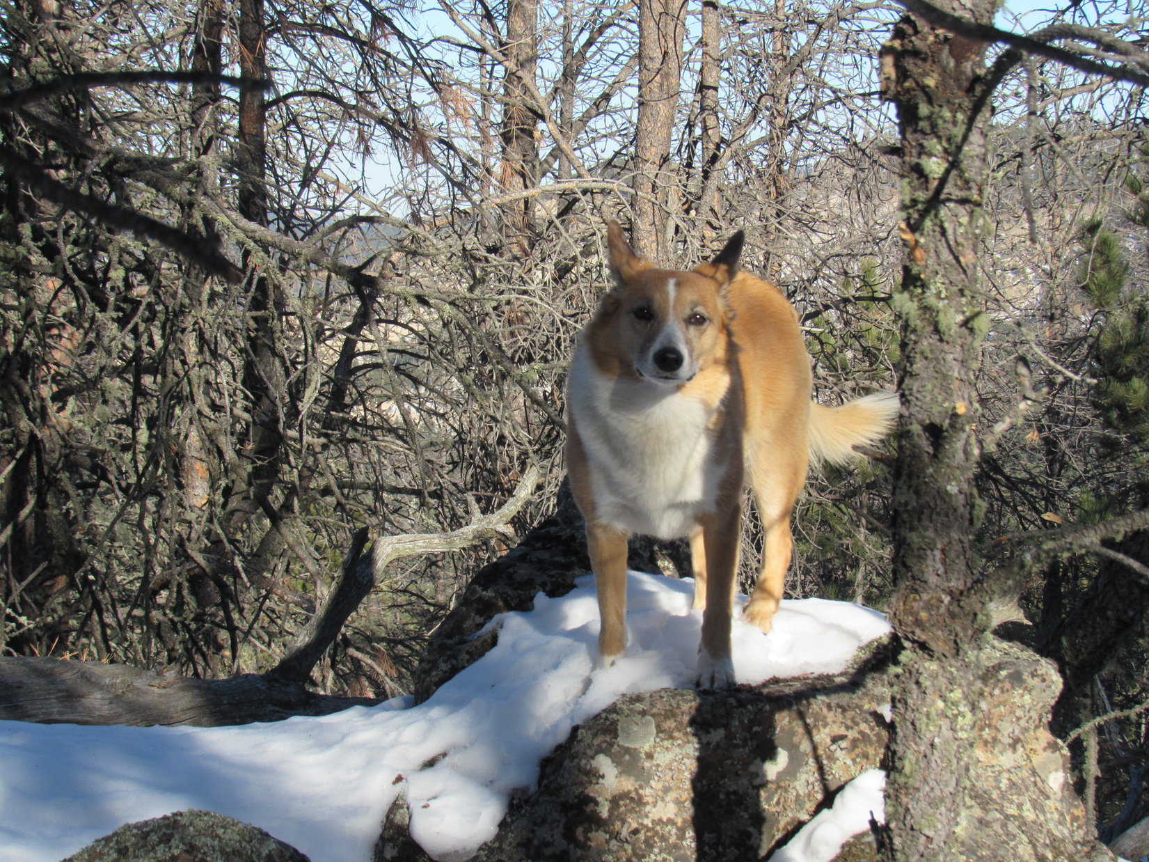
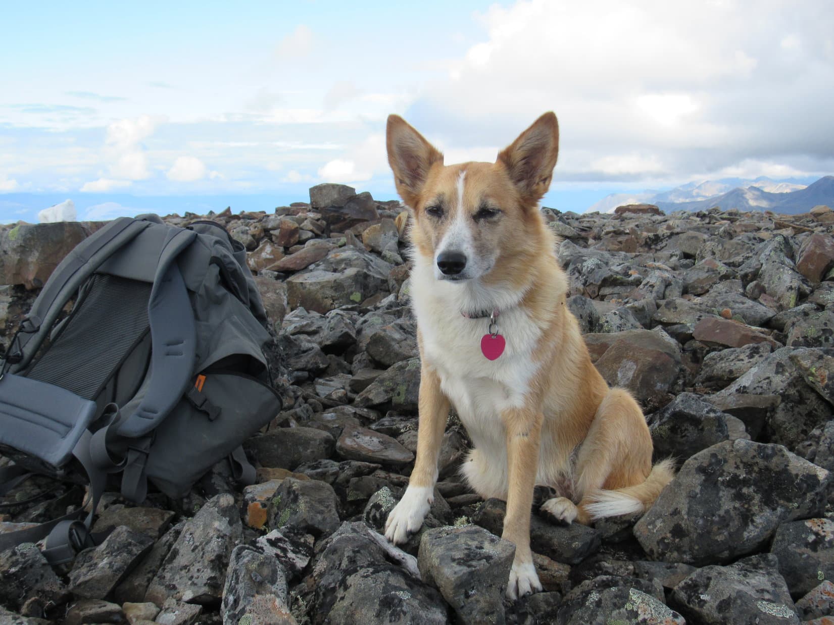
Whatever. Lupe didn’t care. She was just happy to be doing something again. January had been a tough month on the American Dingo. Way too much time had been spent staring out the window at the cold, barren winter landscape. This was only her 2nd Black Hills, SD expedition of 2017. By this time in 2016, she’d been on 5. Lupe was raring to go!
The Carolina Dog was here to continue her explorations of the southern Black Hills peaks Brian Kalet had added to the Peakbagger.com data base last spring. Her first objective was Peak5778, located 0.33 mile SE of Stockade Lake, and 1 mile due E of where Lupe was starting out from. She crossed over to the E side of Lower French Creek Road, and headed ENE into the snowy forest.
A gradual climb ended on a forested ridge where Lupe had a nice view to the N. She could also see part of Stockade Lake.
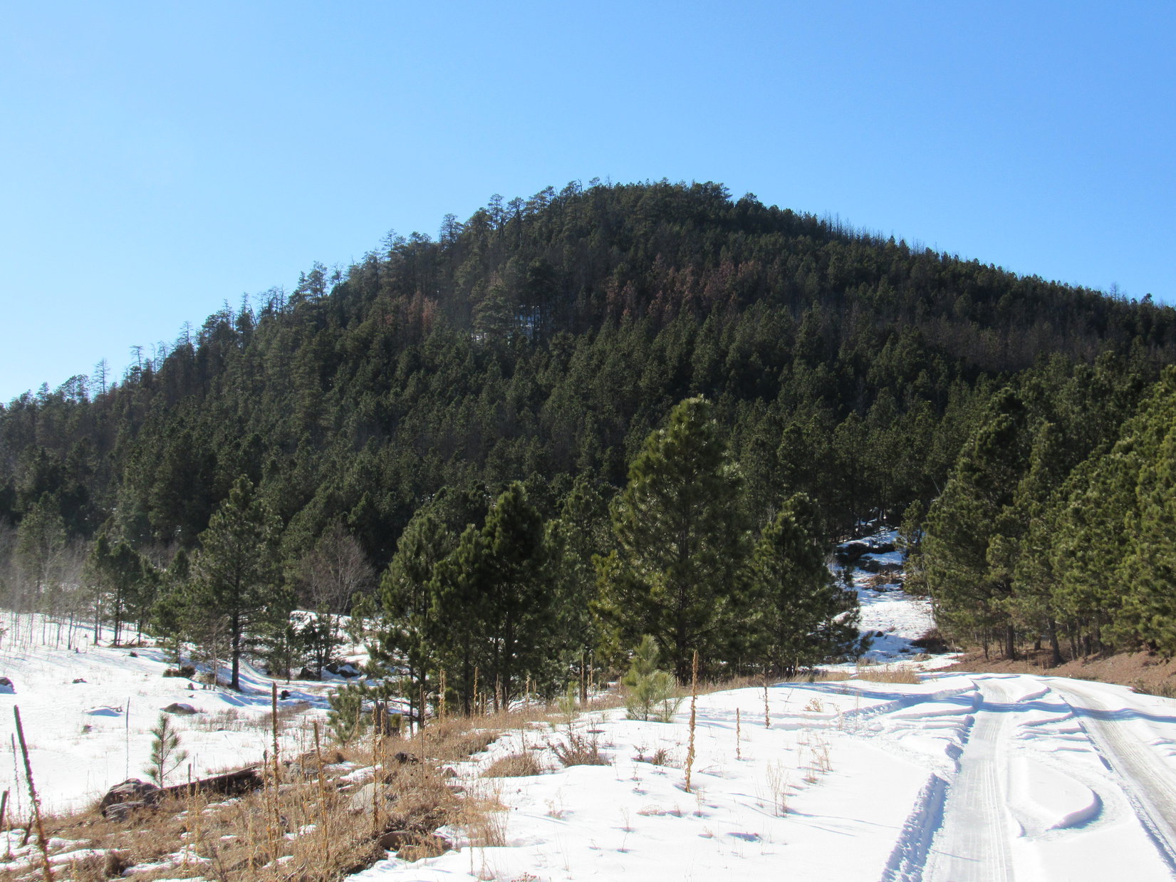
A gradual climb through the snowy forest led to this small ridge with a view to the N. On the L from L to R are Little Devil’s Tower(6,960 ft.), Cathedral Spires(6,840 ft.), and Black Elk Peak(7,231 ft.). The middle peak on the R is Peak6735 . Photo looks N.Loopster looking quite happy about finally being out in the Black Hills again on Expedition No. 189. Part of frozen Stockade Lake is seen beyond her. Photo looks ENE.
From this first viewpoint, Lupe turned E, following the ridgeline down through the forest. She hadn’t gone too far before the road leading to the Stockade Lake dam came into view below. Lupe went N down a short, snowy slope to the road.
Here in the shade, the road was snow-packed and slippery, but it soon led Lupe E to sunshine at Stockade Lake. Peak5778 was now in view dead ahead.
Lupe reaches the Stockade Lake dam. The spillway is on the other side of the road at the far end. Peak 5778 is in view on the R. Lupe planned to climb it going up the long N slope from the L. Photo looks E.
Before crossing the bridge over French Creek, Lupe left the road to take a quick look at French Creek below the spillway. The stream was mostly iced over, but part of it was open and free flowing. A little downstream of the bridge, it went over another drop where a small waterfall was bordered on each side by ice formations.
Ice on part of the Stockade Lake spillway is seen beyond the bridge over French Creek. Photo looks ENE.French Creek just below Stockade Lake. Photo looks ENE.
After checking out French Creek, Lupe returned to the road, crossed the bridge, and continued on around the SE end of Stockade Lake. From a deserted picnic ground along the S shore, Lupe had a view of the biggest part of Stockade Lake. Some of the highest and roughest ground in the Black Hills could be seen beyond the lake in the distance.
Stockade Lake from the SSE shore. Photo looks NNW.Little Devil’s Tower is the dome of rock on the L. The jagged rocks to the R of it are the Cathedral Spires. Black Elk Peak is the highest point on the R. The wall of rock just to the L of Black Elk is Peak6920. Photo looks NNW using the telephoto lens.
Lupe continued on around the SE shore of Stockade Lake until she was almost even with the far E end of the lake. She then left the road to scramble up a bank to the E which brought her to the top of a small ridge. Upon reaching the ridgeline, Lupe was excited to see a few deer. The deer ran off, but Lupe found a squirrel tree, too, another encouraging development!
Lupe was now directly NW of Peak 5778. It was time to begin her journey up the NW slope. The minor ridgeline she was on slowly faded, blending into the rest of the slope. The terrain gradually became steeper as Lupe climbed. The forest in this area had been thinned by logging operations. Lupe had some tree-broken views, but no clear views.
The climb was steady, but only moderately steep. A good 6″ of snow covered the entire slope most of the way up. The snow, and a fair amount of slash left behind by the logging operations, were the only obstacles. The route up wasn’t very rocky. Lupe had an easy time, but somehow the climb seemed tougher to SPHP than it should have been. All that sitting around during the holidays and cold weather in December and January hadn’t done SPHP any good, either.
After a steady slog up the snowy slope, Lupe was finally getting close to the summit. The ground started leveling out. Lupe encountered much less snow up here, but many more rocks.
Lupe near the top of the NW slope of Peak 5778. She’s coming back down to see what’s keeping SPHP. Deconditioning from inactivity during the holidays and two months of cold weather were SPHP’s lame excuse. Photo looks SE.
At the top of Peak 5778, Lupe reached a narrow summit ridge oriented NW/SE. It wasn’t very long, maybe 40 or 50 feet. Lupe found the highest rocks of the true summit near the SE end. SPHP congratulated Lupe on her successful ascent of another Brian Kalet peak!
Lupe reaches the true summit of Peak 5778. Photo looks SE.Looper looking good on Peak 5778. Another successful ascent of a Brian Kalet peak!
The forest on much of the NW slope of Peak 5778 had been thinned by loggers, but the logging operations hadn’t extended to the upper part of the mountain. The summit ridge was still heavily forested. Although glimpses of nearby mountains could be seen between the trees, the only even partially clear view from the top of Peak 5778 was toward Custer Mountain(6,089 ft.) to the WSW.
Lupe had been on top of Custer Mountain only 12 days ago near the end of Black Hills, SD Expedition No. 188.
The only even partially clear view Lupe had from Peak 5778 was toward Custer Mountain(6,089 ft.) to the WSW. Lupe had been on top of Custer Mountain only 12 days ago near the end of Black Hills, SD Expedition No. 188.The forest had not been thinned on top of Peak 5778. Here, Lupe is on the summit ridge with a typical “view”. Photo looks NNW from the true summit.
It hadn’t taken Lupe long to climb Peak 5778. With no views to ponder, there wasn’t much reason to stick around and take a break this early in the day. Lupe and SPHP stayed only 10-15 minutes up on Peak 5778 before starting down again.
Lupe explored a different route on the way down the mountain. She followed a ridge going WSW. This was actually a more interesting route than the NW slope had been. The Carolina Dog discovered a series of rock outcroppings in the forest along the way. Before losing much elevation, Lupe found a fairly decent viewpoint.
From one of the rock outcroppings, Lupe could see several peaks she had been to before. Kruger Peak(5,838 ft.) and Daisy Peak(5,948 ft.) were both lined up directly in front of higher and more distant Northeast Cicero Peak(6,240 ft.).
Kruger, Daisy and Northeast Cicero Peaks are all lined up L of Center, with NE Cicero Peak being the distant high point. Lupe has been to all 3 of those peaks a couple of times on earlier Black Hills expeditions. Expedition No. 189’s next peakbagging goal is also in view here as the small, darkly forested hill seen on the far R in front of the distant ridge. That hill is Peak5834. Photo looks SSW.
After losing quite a bit of elevation going down the WSW slope of Peak 5778, Lupe started turning NW. By the time she reached the base of the mountain, Looper was close to the road near the SE end of Stockade Lake. Upon reaching the road, Lupe retraced much of her original route back to the G6 (12:28 PM, 48°F).
With the days still being as short as they are in late January, Lupe got a ride in the G6 closer to her next Brian Kalet peak objective, Peak5834. S of Custer Mountain, SPHP parked the G6 again along USFS Road No. 337 (Glen Erin Road) about 0.33 mile S of County Road No. 343 (the Hazelrodt Cut-Off). Lupe was still a couple miles NNE of Peak 5834 (12:43 PM, 48°F).
Lupe followed No. 337 going SSW for 1.5 miles, passing to the W of both Kruger and Daisy Peaks. The road was snow-packed and quite slippery. Even Lupe skidded around on some wet, icy spots. However, there was no traffic at all, and the road was an otherwise easy stroll. Lupe gained elevation along the way, but very slowly.
Lupe more than a mile S of the G6 on USFS Road No. 337 on her way to Peak 5834. The road was snow-packed and slippery, but a lovely walk with no traffic at all. Photo looks S.
When Lupe was getting close to Peak 5834, she saw a big rock formation of rounded boulders on the W side of No. 337.
As Lupe was getting close to Peak 5834, she came to this big rock formation on the W side of USFS Road No. 337. Photo looks SW.A closer look at this rock formation NNE of Peak 5834. Photo looks SW using the telephoto lens.
Peak 5834 was soon in view ahead.
After passing by the big rock formation, Peak 5834 came into view ahead. Photo looks SW.
Lupe followed USFS Road No. 337 until she was at the base of Peak 5834. She wasn’t quite far enough S to be directly E of the summit yet, but left the road here to follow a drainage leading up to the WNW. She followed this draw almost all of the way up to a saddle N of the mountain. Nearing the saddle, she turned S to start her climb up the N slope of Peak 5834.
Peak 5834 was densely forested. Many trees had been killed by pine bark beetles, but there were still plenty of live trees, too. Once again, there were no views to speak of as Lupe climbed.
For some reason, the snow was even deeper on the N slope of Peak 5834 than it had been on the NW slope of Peak 5778. For most of the way up, Lupe was having to leap through foot deep snow. In places, it had drifted even deeper. As usual, Lupe did fine, though, leading the way while SPHP brought up the rear. Other than the deeper snow, the climb was pretty similar to Lupe’s trek up Peak 5778.
However, when Lupe reached the summit, she found the top of Peak 5834 was quite different. The summit area on Peak 5778 had only been a short narrow ridge. The top of Peak 5834 included a much larger area. Peak 5834’s summit was shaped like a big boomerang, with the center of the boomerang toward the NW. Two big arms extended out from the center, one to the E and the other to the SW. Lupe reached the summit area near the middle of the E arm.
Lupe explored the E arm of the boomerang, but found no clear views. She then went W toward the high point, perhaps 200 feet away. This was the true summit of Peak 5834. It was none too pretty. Lupe got up on the highest rocks of a small rock formation to claim her latest peakbagging success, but dead pines were all she could see.
Lupe reaches the summit of another Brian Kalet peak, Peak 5834! What a great look at dead pines! Photo looks NE.Lupe on the true summit of Peak 5834. She first reached the summit area back in the pines seen a little R of Center. Photo looks ENE.
A dead tree trunk extended out to the W from the true summit. The W end of the dead tree was even a little higher than Peak 5834’s summit. Lupe readily agreed to strike a dramatic conquering Dingo pose from this lofty dead tree.
The best view from the summit of Peak 5834 was of this mighty American Dingo! Photo looks NNE.
A little to the W of the true summit was another minor high point, but it wasn’t quite as high. More interesting was a ridge only a few feet high toward the end of the SW arm of the boomerang. It looked sunnier and more open over there. Maybe there would be some views and less snow?
Looking SW along the SW arm of the boomerang from a point not too far from the true summit of Peak 5834. Maybe there would be less snow and more of a view over this way?
Lupe went over to the little ridge at the end of the SW arm of the boomerang. The ridge was very small, just a line of medium-sized rocks really. However, the SW side of the little ridge was snow-free and dry. Lupe did have better views from here, too. Trees still interfered to a significant extent, but Lupe could see a few things.
Lupe reaches the minor ridge at the end of the SW arm of the boomerang. The SW side is snow-free and dry, while the NE side is all snowy. Photo looks WNW.So, SPHP, how’s this for a Dingo-on-a-dead-tree look? Photo looks NE. Same great Carolina Dog, but I liked the other dead tree better, actually.Another Dingo-on-a-dead-tree look. Photo looks NW.
With a bit of a view and some nice dry, snow-free ground on the SW side of the little ridge, this was the place to finally take a break. Before settling down, Lupe posed for a photo of the best view from here, a distant forested ridge off to the SW. Somewhere in that direction 3 more Brian Kalet peaks were lined up in a row.
Maybe that distant ridge was where those Brian Kalet peaks were? It seemed quite likely. If so, Lupe would probably soon be exploring that ridge on Expedition No. 190. It was fun to think about the adventure to come, and fun to simply relax and enjoy being right here, right now, with Lupe on seldom visited Peak 5834.
The best view from Peak 5834 was from the SW end of the boomerang. Here, Lupe could see a distant ridge of blue hills off to the SW. Somewhere in this general direction are 3 more Brian Kalet peaks Lupe might go see on Expedition No. 190. Maybe Lupe would be exploring that far ridge before long? Photo looks SW.Lupe could also see Northeast Cicero Peak from the SW end of Peak 5834. There wasn’t a good clear view, but the summit could be seen. This photo looks SSE at the summit using the telephoto lens.
SPHP sat on the ground beside Lupe, while eating an apple. Lupe was offered some Taste of the Wild, but she wasn’t hungry. Instead, she sat contentedly basking in the sunshine.
Lupe had plenty of daylight left to get back to the G6, but not enough to tackle any more peaks on Expedition No. 189. For now, she was happy right here on quiet Peak 5834, staring off toward that distant blue ridge.
Lupe basks contentedly in the sunshine. Photo looks ENE.It was great being out in the Black Hills again on Peak 5834.
All told, Lupe and SPHP spent 40 minutes or so up on Peak 5834 before it was time to mosey on. On the way back, Lupe went down the N slope again, but a little farther to the W. When she reached the saddle to the N, instead of going down the draw to the ESE to the road, Lupe angled NNE staying on higher ground. Together, Lupe and SPHP explored the snowy forest.
Lupe went quite a distance NNE before she finally lost the rest of the elevation she’d gained, and hit USFS Road No. 337 again. From then on, it was an easy trot back along the road to the G6 (4:31 PM, 38°F).
It had been a nice day, a beautiful outing. Lupe had successfully climbed 2 more Brian Kalet peaks. They weren’t the most spectacular peaks around, but it was still fun to be out and seeing someplace new.
Sometimes that, and being together, is all it’s about.
On USFS Road No. 337 on the way back to the G6 from Peak 5834.
Days 18, 19 & 20 of Lupe’s 2016 Dingo Vacation to the Canadian Rockies, Yukon & Alaska
8-16-16. Morning in the Arctic. Still lots of clouds around, but the sun was shining promisingly on a field W of the Dalton Highway. Lupe and SPHP weren’t going anywhere.
Yesterday had been incredible! Lupe had succeeded in climbing Dillon Mountain(4,820 ft.), close to 90 miles N of the Arctic Circle. Cold and soaking wet, Lupe and SPHP had returned after midnight, only to find the G6’s battery was dead.
Fortunately, the G6 was parked at a small pullout N of milepost 207 right alongside the Dalton Highway. SPHP raised the hood. Someone would stop to help. While Lupe sniffed around outside, SPHP arranged sopping wet clothes to dry on top of the G6, then proceeded to put things back in order inside. About the time SPHP was finishing up, a vehicle pulled up.
A couple of guys jumped out, and asked if everything was OK. Well, not quite. SPHP had jumper cables along, could they give the G6 a quick jump? Yeah, no problem. A couple minutes later, the G6 was purring again. Thanks, so very, very much! Would they take payment for their assistance? Nope. What great guys!
Lupe’s benefactors were Devon Drayton and John Antes. Devon had gotten a job and moved to Fairbanks 2.5 months ago. John lives in Pennsylvania, where he works as a website graphics designer. They were on their way N to Deadhorse on Prudhoe Bay to see the Arctic Ocean.
Devon and John were both friendly and kind to Lupe. After the jump start, they stayed chatting with SPHP for a while. They were impressed that Lupe had climbed Sukakpak and Dillon mountains. Devon had a scary tale about a narrow escape from being alone half-buried in snow. John described difficult hikes and mountain climbs in virtually impenetrable forests. The visit was fun, but eventually Devon and John had to hit the road.
Devon Drayton(L) and John Antes(R) helped Lupe and SPHP out with a jumpstart for the G6 on the morning of 8-16-16. Devon and John were on their way N to see the Arctic Ocean at Prudhoe Bay.
Thanks to Devon and John, the G6 was running! Lupe and SPHP spent the whole day driving S. Lupe crossed the Arctic Circle. She shared a beef stew picnic with SPHP at the Yukon River. By evening, Lupe was way down S in Fairbanks. She visited Pioneer Park there shortly before sunset.
Lupe visited Pioneer Park in Fairbanks shortly before sunset.
The next morning, Lupe left Fairbanks on Alaska Route 3, the George Parks Highway. Half an hour after leaving town, SPHP stopped at a pullout at a high point. Far away to the S were many impressive peaks. Even more remotely off to the SW, however, was a shocking sight.
Visible across an incredible distance, a colossal mountain clad in white rose to an impossible height! Otherwise totally exposed, the monster’s summit scraped the clouds. There could be no mistaking that gigantic peak. Lupe was getting her first look at Denali(20,310 ft.), the highest mountain in North America!
There was no mistaking this massive white mountain, totally dominating the far horizon. Lupe was getting her first look at Denali, the highest mountain in North America! Photo looks SW using the telephoto lens.
The sight of Denali was exciting! Often the mountain is obscured by clouds for many days at a time. Today, it appeared Lupe had an excellent chance of getting a grand view of the mountain up close! Plans for the day changed instantly. Suddenly, Lupe’s primary objective was to reach the N Denali viewpoint at milepost 162.6 along the George Parks Highway as soon as possible.
It was farther to the viewpoint than SPHP realized. Traffic was heavy. There was considerable road construction. A lot of time was lost waiting for pilot cars. Hours went by. When Lupe arrived at the N Denali viewpoint in Denali State Park, the mountain had vanished. A bank of clouds hung over the Alaska Range. Most disappointing.
SPHP drove over to the Little Coal Creek trailhead at milepost 163.9. Lupe could take the Little Coal Creek trail up onto K’esugi Ridge. If Denali reappeared, Lupe would have a fantastic view from up there! The sky had been clouding up, though. It was already after 3 PM. How likely was it Denali would reappear today? No, maybe it was best to just go back to the original plan for the day.
That meant driving 50 miles back to Cantwell. The plan had been for Lupe to check out a couple of mountains in that area, and get positioned to be ready to climb one or the other of them tomorrow.
The drive back to Cantwell was gorgeous. Some of the rugged lower peaks of the Alaska Range, were in view N of the highway. They weren’t Denali by a long shot, but they were still impressive.
Lower peaks of the Alaska Range seen N of the George Parks Highway on the way back to Cantwell.
About 10 miles NE of Cantwell, Lupe checked out Panorama Mountain(5,778 ft.) from the George Parks Highway. There was no trail up Panorama Mountain as far as SPHP knew. Almost none of the route up Slime Creek that SPHP had hoped Lupe might be able to take was visible from the highway. Panorama Mountain looked challenging. The probability of success was too low.
Panorama Mountain near Denali National Park from the George Parks Highway. Photo looks SE.
Next Lupe went to check out Reindeer Hills(5,102 ft.), situated 6 or 7 miles E of Cantwell, and 2 miles N of gravel Denali Highway (No. 8). There was no trail up Reindeer Hills, either, but Reindeer Hills looked much easier to climb than Panorama Mountain. SPHP liked the idea. Lupe would easily be able to do this! Reindeer Hills looked like a fun climb.
The Reindeer Hills located ENE of Cantwell looked very promising as a possible Lupe peakbagging objective! The high point is on the R. Photo looks NE.The Reindeer Hills high point. This looked like a fun, relatively easy climb for Lupe. There were much more rugged mountains around in every direction, too. The views from the top would be fabulous! Photo looks NE.
Unfortunately, as SPHP drove E on Denali Highway No. 8 looking for the best point for Lupe to start her trek up the Reindeer Hills, there were “No Trespassing” signs posted all along the road. Land in the area was owned by a Native American tribe. The signs said a permit was required to enter.
Lupe made stops at a number of scenic points along Denali Highway No. 8. Near a small lake of SE Reindeer Hills, an old map was posted showing the extent of the Native American lands. Reindeer Hills didn’t appear to be included, but there was no reasonable access point that didn’t cross the Native American property.
Lupe at the small lake SE of Reindeer Hills where a map was posted which appeared to show there was no access to Reindeer Hills without crossing Native American property. Photo looks SE at different mountains beyond the lake.Lupe made one foray toward Reindeer Hills from the SE where the map showed a possible route avoiding the Native American tribe’s land. The terrain wasn’t favorable on this approach. A lake, and possibly a river, blocked the way. Photo looks NW at Reindeer Hills.
Sadly, the Reindeer Hills idea had to be abandoned. The long drive back to the Cantwell area had been a waste, but at least the situation was clear. Tomorrow, Lupe would go to K’esugi Ridge in Denali State Park. Her objectives would be to climb to the Indian Benchmark and K’esugi Mountain. SPHP hoped the weather would be clear, so Lupe would get a great view of Denali.
Lupe and SPHP enjoyed a beautiful evening drive back toward Denali State Park.
Lupe briefly visited this lovely creek S of Denali Hwy No. 8 before leaving the Cantwell area. Photo looks SE.Looking SW over Summit Lake along the George Parks Highway.A pensive Lupe in the G6 enjoying the ride back toward Denali State Park in Alaska, 8-17-16.Evening sky in Alaska.
As Lupe got closer to Denali State Park again, there it was, off in the distance. Denali was back! SPHP hoped it was a good omen for Lupe tomorrow.
On the way back toward Denali State Park, Lupe caught a glimpse of Denali in the evening light. Was it a good omen for Lupe tomorrow? SPHP hoped so. Photo looks WSW using the telephoto lens.
The next morning, conditions weren’t nearly as encouraging. The sky was totally overcast. Rain looked like a real possibility. Low fog drifted among the mountains. Denali was nowhere in sight.
The morning of 8-18-16, the weather was looking iffy. Photo looks SW toward Indian Benchmark(L) and K’esugi Mountain(Center).
SPHP wasn’t at all certain Lupe should even attempt the climb up to the Indian Benchmark and K’esugi Mountain. No point in going in rain or fog. SPHP drove to the Little Coal Creek trailhead at milepost 163.9 along the George Parks Highway, anyway. At the trailhead, Lupe waited in suspense, while SPHP checked maps and prepared for the trek.
There was no discernable change in the weather by the time everything was ready. May as well try it, and hope for the best. Lupe could always turn back, if conditions deteriorated. Lupe and SPHP set off on the Little Coal Creek Trail (11:10 AM, 56°F).
The trail started out in the forest. At first, there no views and only gradual elevation gain, but that began to change when the trail got closer to Little Coal Creek. The trail turned ESE staying N of the creek, and began to climb steadily. Little Coal Creek was seldom seen, down in a deep ravine.
Lupe’s first real views came when the trail reached treeline. The sky was still overcast. Clouds clung to the mountaintops. At least it wasn’t raining.
Lupe above treeline on the Little Coal Creek Trail. Clouds were still clinging to the peaks. Photo looks SE.Only the lowest glories of the Alaska Range beyond the broad Chulitna River valley were in view below the clouds. Photo looks NW using the telephoto lens.
The last part of the climb along the Little Coal Creek Trail was fairly steep. The trail then leveled out entirely, even beginning to lose a little elevation as it turned SW. Lupe was almost to the end of the 3.3 mile long Little Coal Creek Trail. Soon it would become the K’esugi Ridge Trail where it crosses the ravine Little Coal Creek originates from N of K’esugi Mountain.
Lupe had already gained 1,750 feet of elevation from the trailhead. By now she was well above treeline, even bushline, up on open tundra. The views would already have been spectacular, if it had been a clear day.
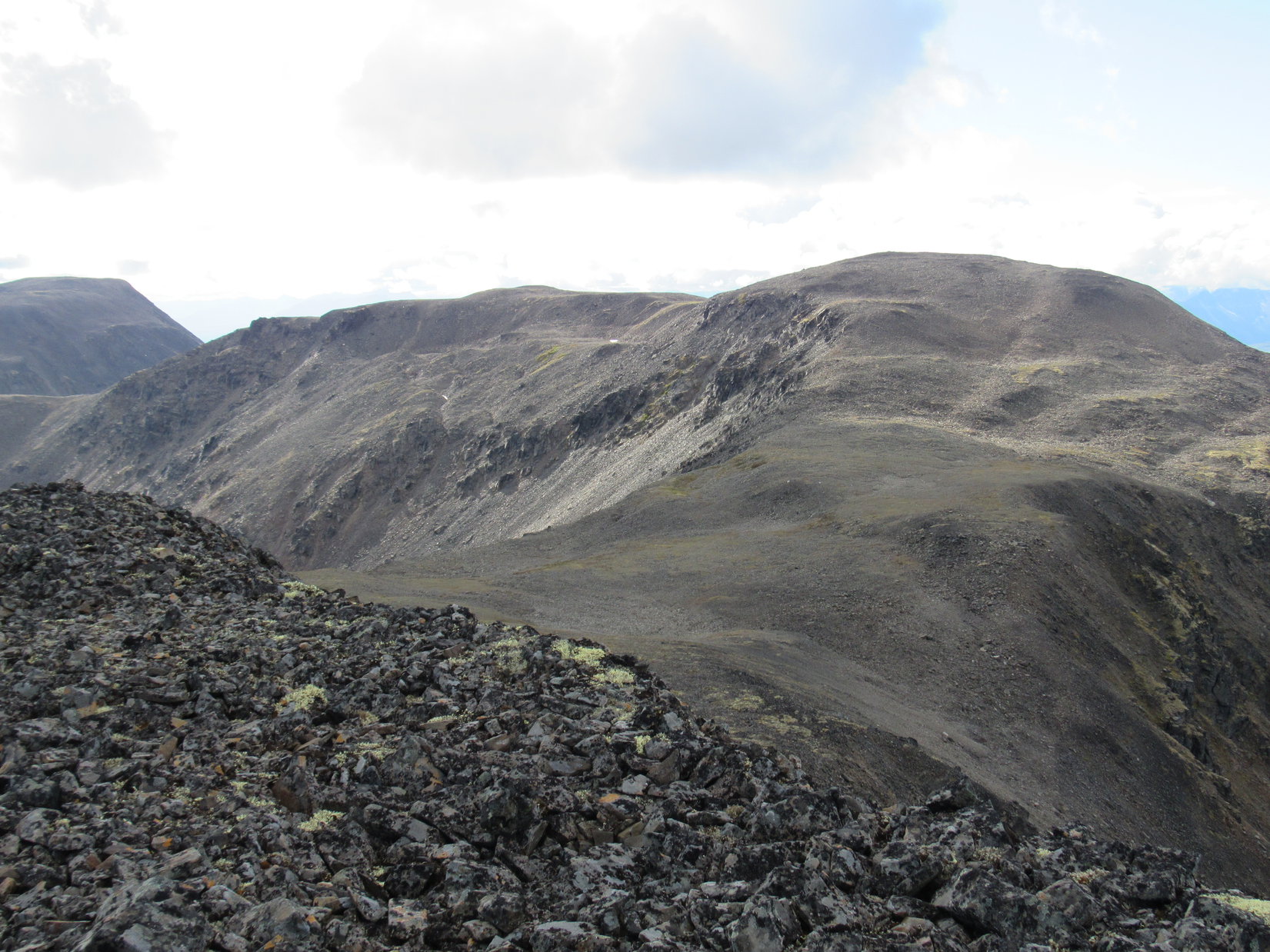
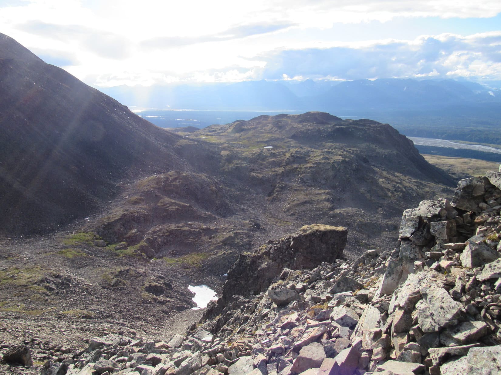
Lupe wasn’t continuing on to the K’esugi Ridge Trail. Her first peakbagging objective, the Indian Benchmark(4,558 ft.) was off trail to the SE. Ahead, Lupe could see a large ridge that swept around to the E before curving to approach Indian Benchmark from the NE. The long ridge looked like an easy climb. Only the last little bit near the summit, partially hidden in the clouds, looked like it might present a problem. What could be seen from down here didn’t look too bad.
Lupe reaches flat open tundra near the end of the Little Coal Creek Trail. Ahead, seen directly above her partially hidden in the clouds, is her first peakbagging objective, the Indian Benchmark. The plan was to take the long, sweeping ridge over to the E (L) and then back to the SW (R) up to the summit. In practice, Lupe took a shortcut up to the saddle seen almost straight up from the L edge of the backpack. Photo looks SE.
Lupe abandoned the Little Coal Creek Trail, and made for the start of the long sweeping ridge to the Indian Benchmark. The ridge route was easy. So easy that Lupe followed the sweeping ridge only partway. To save time, she cut straight across the tundra past a small pond on her way SSE to the base of a higher saddle. After a steep climb, she regained the ridgeline only 0.33 mile NE of the summit.
Lupe on the long sweeping ridge before taking a shortcut directly to the saddle seen on the L. Indian Benchmark is now nearly cloud-free on the R. Photo looks S.A pond comes into view. Lupe would pass to the R of it. Photo looks S.Looking SSW at Indian Benchmark using the telephoto lens now that the lowest clouds have drifted away from the summit. The N face looked daunting. Lupe wouldn’t be able to climb that!Lupe takes a break (SPHP needed one) on her way up to the saddle NE of Indian Benchmark. The long, high ridge in the background is part of K’esugi Mountain. Photo looks WSW.Still on the climb to the high saddle, which is to the R of this photo. Taking this shortcut enabled Lupe to skip going over the rocky part of the sweeping E ridge seen beyond her. Photo looks NE.
When Lupe regained the ridgeline, SPHP was concerned. The upper slopes of Indian Benchmark looked mighty steep. Lupe went SW along the ridge to get as close and high as possible prior to a final assessment.
Yikes! Lupe has reached the ridgeline up on the high saddle, but the upper slopes of Indian Benchmark look a lot steeper and more formidable than they had from below. Photo looks SW.
As Lupe drew near the base of the sharp final rise up to the top of Indian Benchmark, SPHP became increasingly dismayed. The N face of the mountain was way too cliffy to consider, as expected. Any hopes of climbing straight up the narrow NE ridge were dashed, too. Lupe could get partway up, but then it looked way too intimidating.
However, the previously unseen SE face was the real disappointment. A very long, steep, rocky slope plunged far, far below to the Indian River valley. Above Lupe’s current position, the slope began at the base of even steeper, more intact rock formations, almost cliffs, close to the top of the mountain.
Lupe near the base of the final steep rise to the top of Indian Benchmark. SPHP had hoped Lupe would be able to climb directly up the narrow NE ridge (straight ahead) or the SE face (on the L), but they both looked intimidating. What now? Photo looks SW.Even though she was still below the top of Indian Benchmark, Lupe had this tremendous view to the E. Encouragingly, blue sky was visible toward the S.
Had coming this way all been a huge mistake? Lupe was only 100-150 feet below the summit. Up to this point, her route up Indian Benchmark had been simple and sweet. Now there appeared to be no safe way up the final short stretch.
Maybe Lupe should have climbed K’esugi Mountain first? The topo map showed a gently sloping ridge 0.125 mile wide going all the way to the summit of Indian Benchmark from K’esugi Mountain. In fact, Lupe could see part of that wide ridge from here. There was no way over to it. Lupe would have to traverse the N face of Indian Benchmark to get there. That just wasn’t happening.
Lupe could see part of the broad, gentle ridge leading to Indian Benchmark from K’esugi Mountain. Getting to the top of Indian Benchmark from that direction would have been a stroll in the park for Lupe. Unfortunately, there was no safe way over there from here. Photo looks W at K’esugi Mountain.
Time to calm down and consider the possibilities, all the possibilities – including retreat. Lupe and SPHP milled around on the ridgeline, studying the views, especially the view of that unexpectedly steep SE face of the mountain. The N face was definitely out. It didn’t take long to conclude the narrow spine of the NE ridge to the top wasn’t worth trying, either, but that SE face … maybe it was possible to traverse that SE face and find a way?
If it hadn’t been for some of the experiences Lupe had already been through on her Summer of 2016 Dingo Vacation, SPHP would most certainly have called a retreat. King’s Throne and Decoeli in the Yukon, Sukakpak and Dillon here in Alaska N of the Arctic Circle, they had all been challenging, daunting, even scary. Yet Lupe had made it to the top of them all.
Most of those rocks on the SE face were fairly large. They looked pretty stable.
Loop, let’s see how it goes!
Despite the dizzying view, things went fine, at first. The rocks were mostly stable. Lupe and SPHP picked a way along to the SW, gaining elevation gradually. After some of Lupe’s other recent climbs, this wasn’t even scary. Hopes began to soar.
Soon Lupe was near the base of some of the larger intact rock formations. There appeared to be a reasonable route higher near one of the first ones. Lupe and SPHP started up. After a little progress, it was a no go. Too cliffy! Lupe retreated. She continued working SW.
Another opportunity to climb higher soon presented itself beyond another rock formation. Up and up. Slowly, carefully. The route got steeper, but there were handholds and footholds for SPHP. Somehow, Lupe never seems to have a problem scrambling. She was getting close to the top of the ridge visible above.
A false summit! The top couldn’t be much farther, though. Wrong again. Lupe climbed and climbed. The route was getting steeper. Progress was slow. There was starting to be more exposure than SPHP cared for. The intrepid Carolina Dog showed no concern, but SPHP was on the verge of retreat again.
Another 5 or 6 feet almost straight up, there appeared to be some kind of a top, or at least a ledge. SPHP made Lupe wait below, carefully climbing and then hoisting up onto the ledge, face and stomach down on the rock. SPHP looked up, legs still dangling over the edge. The view ahead was amazing and unexpected.
SPHP was at the far NE end of a narrow ridge. The ridge was flat, perhaps 3 or 4 feet wide, 20 feet long, and covered with smallish to medium-sized rocks. Drop-offs were on both sides. After 20 feet, the ridge broadened out tremendously.
Looper! You’ve done it! We’re here!
Lupe was up in a flash. SPHP literally crawled along the ridge, not daring to stand up until it had broadened out. As soon as SPHP stood up, there it was! One step to the N, sat the Indian Benchmark.
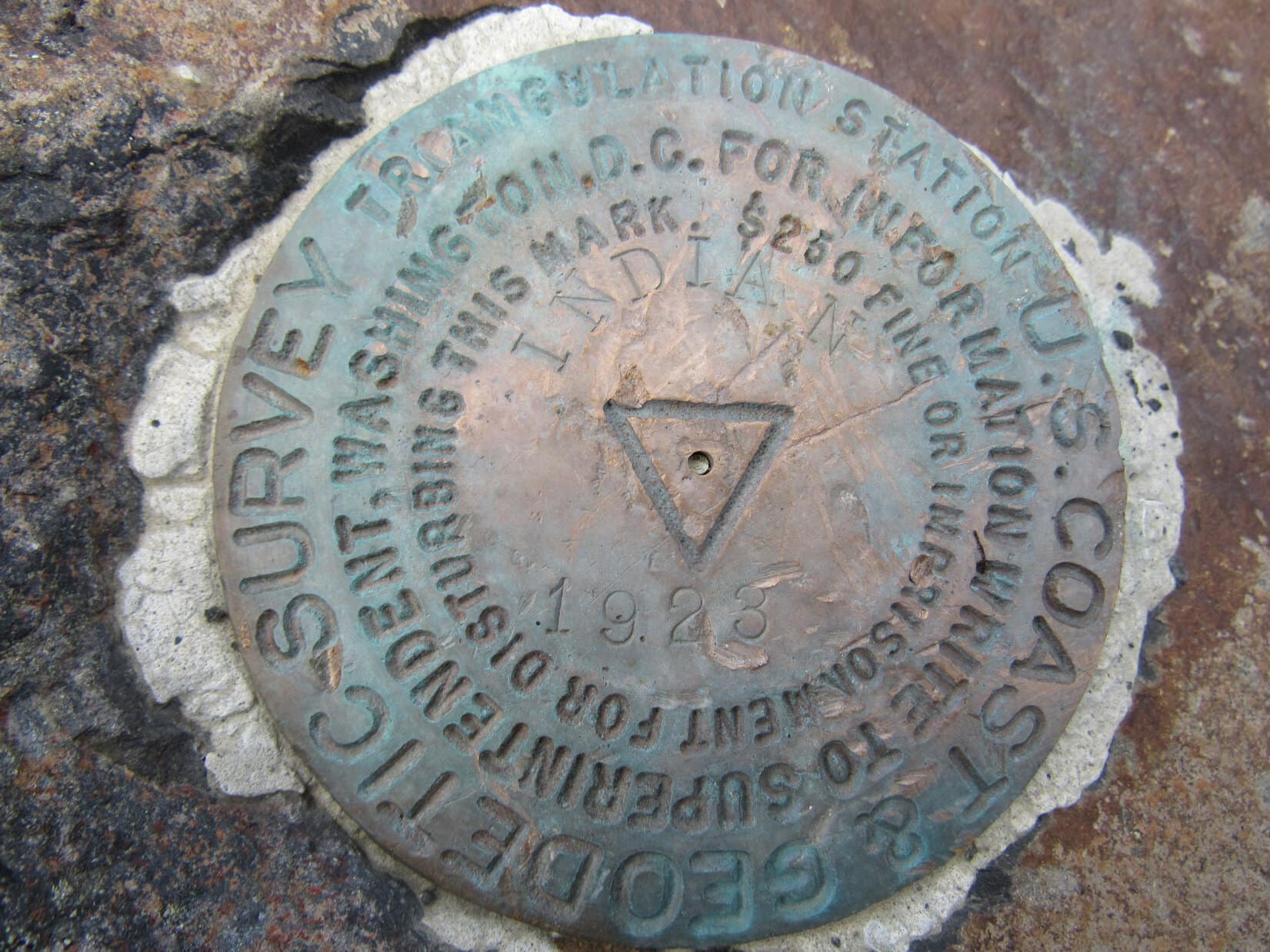
The Indian Benchmark sits near the far NE end of the vast summit area at the high point of the mountain. A register is nearby, but there’s not much of a summit cairn. Plenty of rocks around to build one, though!
This was it! The summit of Indian Benchmark mountain. SPHP congratulated Lupe heartily on her latest peakbagging success! Somehow Lupe had reached the top of the mountain right at its very NE end. SPHP must have turned to climb directly up the SE slope much sooner than intended. Lupe hadn’t been very far from coming right up that NE spine of the mountain SPHP had supposedly ruled out.
The sky was clearing. Off to the NW, the top of a gigantic peak peered over the remaining clouds. Denali!? For 10 minutes, Denali spied on Lupe, then vanished.
Skies were clearing as Lupe reached the Indian Benchmark. The top of Denali, or some massive peak, appeared briefly above the remaining clouds, as if the mountain was peering over to see how Lupe was faring. Photo looks NW.
That was a little spooky, Loop! It’s as if Sauron has taken over Denali and is spying on you! You aren’t carrying some ring of power on a necklace concealed under your fur with the intention of destroying it at Mt. Doom are you?
Mind your own business, SPHP! The burdens of an American Dingo are no concern of yours. My precious is … I mean, my burdens are my own.
Just wondering, for a few minutes there, I was starting to believe we were climbing Mt. Doom.
By the way, SPHP, is Mt. Doom somewhere around here? Is it on our itinerary?
No, not as far as I know.
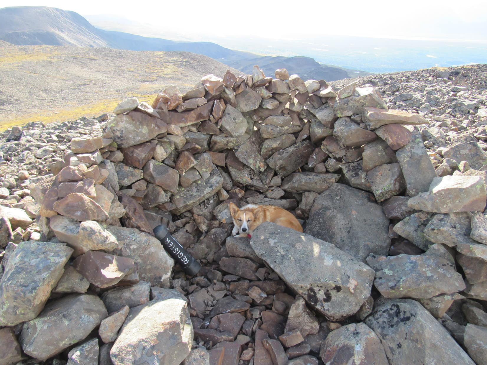
Not far from the survey benchmark, a little out onto the broad summit area, Lupe came to a ridiculously small cairn for a mountain covered with loose rocks. A heavy-duty registry container leaned against it. Lupe’s name is not on the registry. Someone had closed the container so tightly, SPHP couldn’t get it open. Oh well, time for a short break and photos.
Lupe on Indian Benchmark mountain at the pathetic little summit cairn. Photo looks SW.Looking NE toward the end of the mountain where Lupe came up.Intrepid Loopster on Indian Benchmark. Photo looks NNE.Looking down on a good deal of the territory Lupe traveled through on her way to Indian Benchmark from the Little Coal Creek Trail.K’esugi Mountain(R), Lupe’s next peakbagging objective, from Indian Benchmark. Getting across that broad, gentle ridge was going to be a snap! Photo looks W.Looking SE across the Indian River valley. The large lake on the R is the one marked 1395 ft. elevation on the Peakbagger.com topo map.
As glorious as the views were, Lupe and SPHP stayed only 15 or 20 minutes up on Indian Benchmark. Time waits for no Dingo. Although it had certainly turned into a beautiful day with blue skies and white clouds, Lupe had gotten a rather late start due to the questionable morning weather. Lupe still had to get to K’esugi Mountain(4,700 ft.), her next peakbagging objective.
Lupe about ready to leave Indian Benchmark for K’esugi Mountain, seen beyond her. Photo looks W.A final look SW along K’esugi Ridge from Indian Benchmark. The K’esugi Ridge Trail popular with backpackers doesn’t come up onto the top of the ridge in this area, staying much lower down NW of K’esugi Mountain. Meanwhile, Carolina Dogs prowl among these remote high points.Lupe starts down Indian Benchmark. Photo looks E.
Lupe went W, crossing the huge ridge over to K’esugi Mountain. Along the way, Lupe had a great view back at Indian Benchmark and much of the NE ridge she had traveled to get there.
Indian Benchmark(R) from the E slopes of K’esugi Mountain. Much of the upper part of Lupe’s route up to Indian Benchmark is seen from the saddle(Center) then R along the NE ridge toward the summit. Photo looks ENE.
Less than an hour after leaving Indian Benchmark, Lupe arrived at the summit of K’esugi Mountain. A 3 or 4 foot high semi-circular rock wall served as a summit cairn. Lupe liked the rock wall. It provided a bit of shelter from a cold breeze.
A registry was in a sturdy container nearly identical in every respect to the one on Indian Benchmark, with the single important exception that SPHP was able to get this one open. While Lupe hid out in the semi-circle, SPHP logged her K’esugi Mountain peakbagging success into the summit registry.
Lupe reaches the summit of K’esugi Peak. The Chulitna River valley is seen in the distance. Photo looks WSW.The summit area on Indian Benchmark had been large, but the top of K’esugi Mountain was even bigger. While the part of it seen here is quite flat, large areas sloped gently down at gradually increasing rates from the perimeter in most directions. Photo looks N.Lupe takes shelter from the wind. Finally, a useful summit cairn! Photo looks WSW.
Lupe spent nearly an hour up on K’esugi Mountain. She explored parts of the huge summit area. SPHP had the idea that she would be able to go down the NW side of the mountain. Not terribly thorough investigations in that direction were not encouraging.
Indian Benchmark from K’esugi Mountain. Photo looks E.Lupe explores the huge summit area. The rock wall cairn at the actual true summit is in view to the SSW.
It would have been absolutely awesome fun if Denali would have come out to play. The views would have been so tremendous! To the S, skies were blue with puffy white clouds, but Denali and the rest of the Alaska Range to the NW stubbornly remained hidden in the clouds. If anything, the sky was gradually clouding up even more in that direction again.
Denali and the rest of the Alaska Range NW of the Chulitna River valley refused to come out of the clouds to play with Lupe. If anything, the sky was clouding up even more in that direction. The rocks on parts of K’esugi Mountain were very dark, almost black, like those seen here. On closer inspection, they were all covered with thick black lichens. Photo looks WSW.The beautiful Chulitna River valley. Photo looks W.
Lupe never went back to the NW end of the mountain to see if there really was a way down, or not. There seemed to be enough time left in the day for Lupe to explore a longer route. When it was time to leave, Lupe went S instead of N.
The route became a little worrisome. The S ridge Lupe was going down became progressively narrower and steeper. SPHP feared Lupe might cliff out, but she didn’t. Lupe made it down to a big saddle leading over to the next high hill to the W.
Going down the steep S ridge of K’esugi Mountain. Photo looks W.
Lupe left the saddle going NW down a long rocky slope. She lost another 300 feet of elevation before the terrain leveled out. SPHP took a long time, but finally made it down. Lupe turned N.
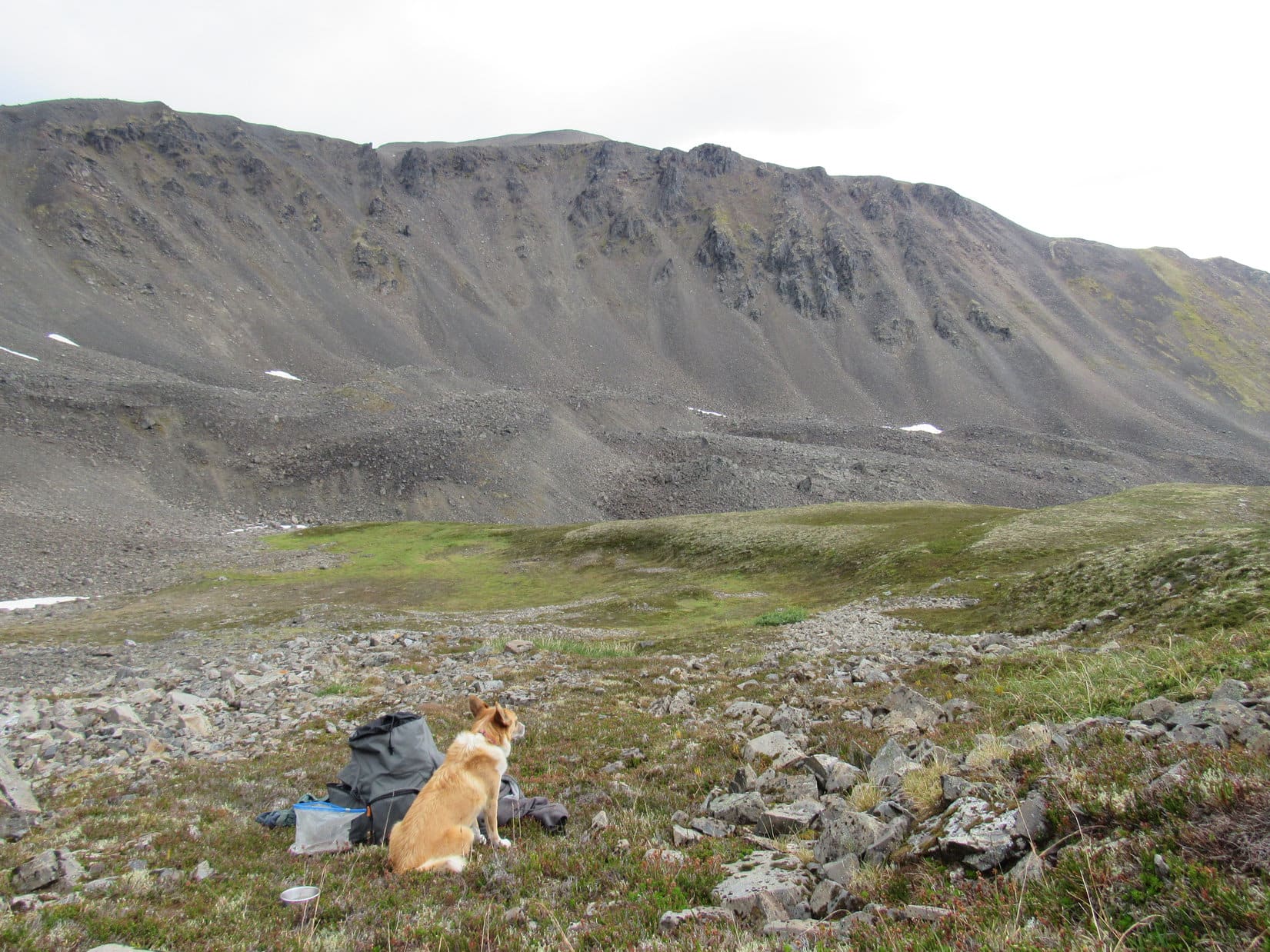
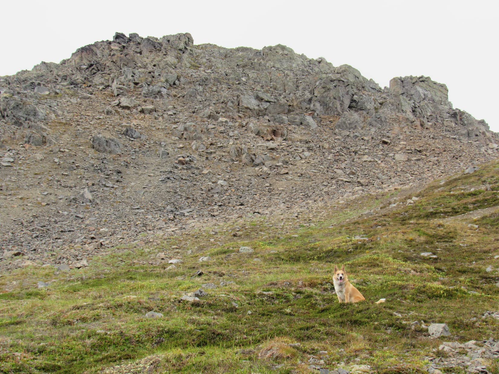
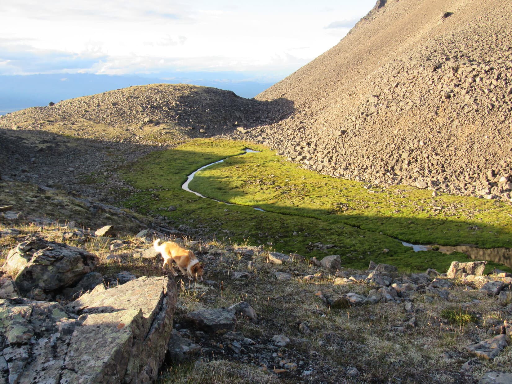
Ahead was rough terrain, an open wilderness filled with a variety of features. There were rocks and ridges, hills and drop-offs, large boulder fields left by landslides or erosion. Green oases surrounded diminutive mirror-like ponds connected by sparkling streams. Soft tundra, easy on the paws, blanketed part of the scene. A slowly melting snowbank invited Lupe to cool off.
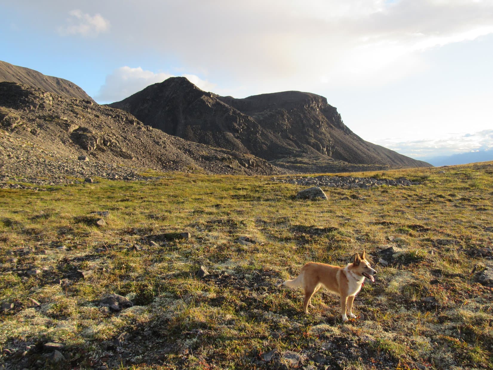
The air was cool; the evening light, dramatic; the solitude, complete. Lupe dashed around at great speed, abruptly changing directions, exploring wherever she wanted to go. She stopped to drink cold water, and sniff the wild world. As far as Lupe was concerned, this was the best part of the day. For an hour, she was in Dingo Paradise.
Looking NE along part of the NW face of K’esugi Mountain.Pure joy NW of K’esugi Mountain. Photo looks W.N face of K’esugi Mountain. Photo looks S.
At a little pass near 3,500 foot elevation, Lupe found the K’esugi Ridge Trail. She followed it E back to the Little Coal Creek Trail she had left many hours before. Three guys from Houston, Texas were standing on the trail. They had expensive wonderful cameras, and were planning to camp nearby, hoping to get some shots of Denali at sunrise tomorrow.
Twilight was already fading fast, but for a few minutes, a little patch of Denali peered stealthily at Lupe through a hole in the clouds. Everyone was tremendously excited and encouraged. SPHP wished the guys from Houston well. Then Lupe proceeded down Little Coal Creek Trail looking forward to a meal and 40 winks at the G6. (11:31 PM)
Note: The 3.3 mile long Little Coal Creek Trail is the northernmost of several access routes to the K’esugi Ridge Trail in Denali State Park. The K’esugi Ridge Trail is popular with multi-day backpackers for its alpine terrain and sweeping views to the N of Denali and the Alaska Range. The traverse of K’esugi Ridge from the Little Coal Creek trailhead is as much as 37 miles to the Upper Troublesome Creek trailhead, but shorter treks are possible using other access trails.