Every year on the weekend before Memorial Day weekend in May, South Dakota holds an open house at all state parks to kick off the summer tourist season. Admission to the parks is free, although normal campground fees still apply. SPHP decided Lupe should take advantage of this chance to do some peakbagging of some of the higher peaks in the Custer State Park region without having to pay an entrance fee.
Lupe’s peakbagging efforts started at the Little Devils Tower trailhead along Hwy 87 (Needles Highway) less than a mile SE of Sylvan Lake (10:44 AM, 45°F). Lupe had four peakbagging goals – Harney Peak(7,242 ft.), Peak 6920, Little Devils Tower(6,960 ft.), and Peak 6735. Only Little Devils Tower was actually in Custer State Park, but the others were all relatively close by. SPHP thought they could all be easily approached from this location.
Lupe and SPHP left the trailhead taking Little Devils Tower Trail No. 4. The trail entered the forest, soon crossed a small creek, and then started a gentle climb NE up a valley. As the trail gained elevation, it entered more open terrain. The forest had been virtually clear cut along in here due to heavy damage from pine bark beetles. Big granite rock formations were scattered along the sides of the valley.
Slowly the trail became steeper, eventually reaching the crest of a ridge about 0.75 mile from the trailhead. From the ridge, Lupe could see the Cathedral Spires(6,840 ft.) close by to the E. A well marked spur trail went NNW to the summit of Little Devils Tower. Lupe and SPHP took the spur trail, which climbed a little bit and then followed a fairly level ridgeline.
Lupe enjoys a great view of a portion of the Cathedral Spires from a high point on the ridge the spur trail follows to Little Devils Tower. Photo looks E.Looking NE from a high point near the start of the spur trail to Little Devils Tower.
After less than 0.25 mile, the spur trail lost a little elevation as it descended into a ravine coming up from the SW. The bottom of the ravine rose steeply to meet the spur trail, which turned N to climb straight up a badly eroding stretch of loose rocks. Fortunately, the climb up the loose rocks wasn’t a long one. It ended at a little pass between big granite rock formations.
From here on, the rest of the way up to the summit of Little Devils Tower was a scramble on the granite. At the little pass, the trail turned sharply W (L) going up a narrow cleft in the rock. Beyond the cleft, things opened up a bit. Blue and white arrows painted on the granite marked the trail. The scramble wasn’t hard, and featured only minor exposure.
When Lupe and SPHP arrived up on top of Little Devils Tower, no one else was around. A steady stream of people and dogs could be heard on the way, though. Lupe’s solitude wasn’t going to last long.
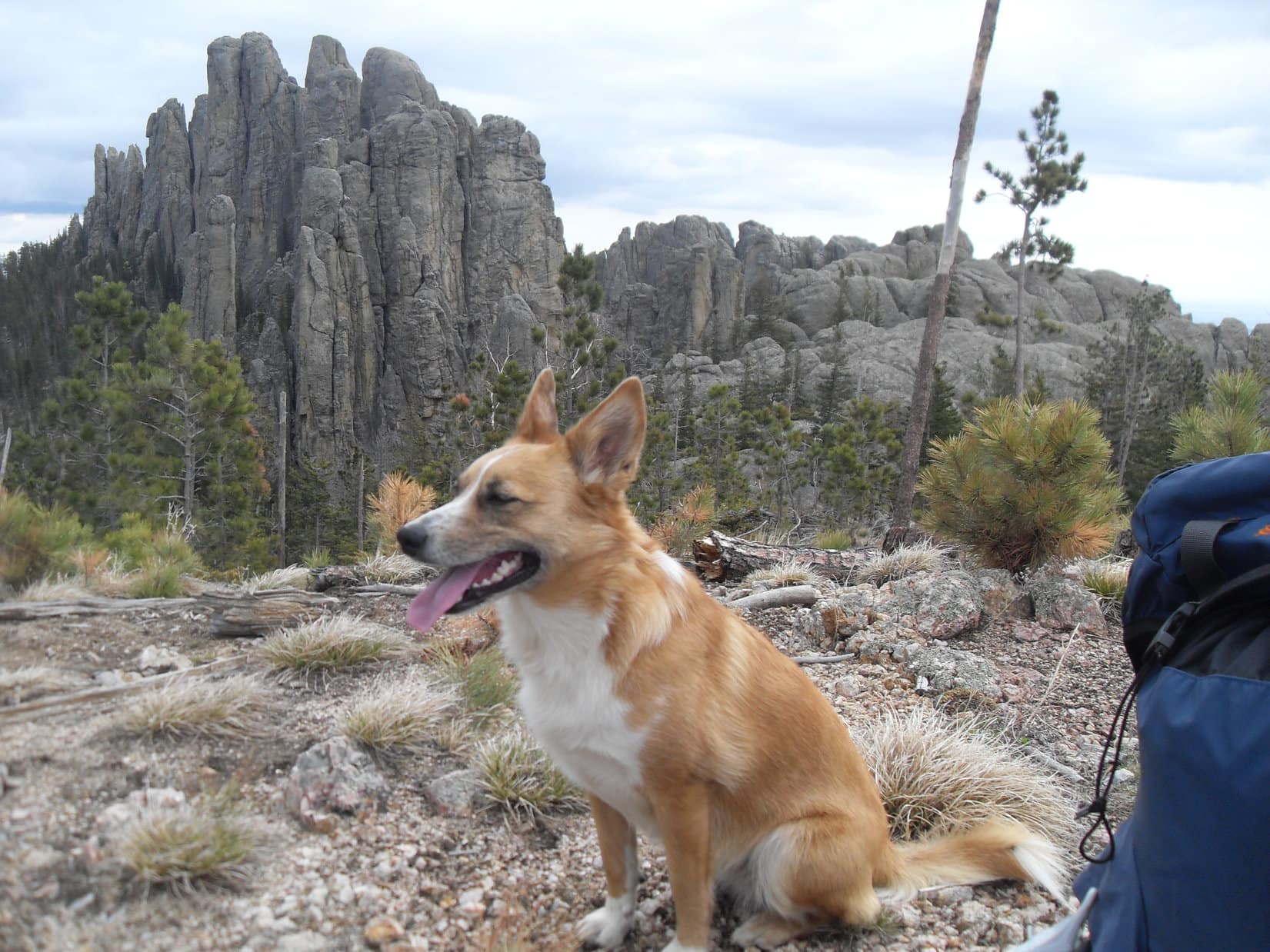
Lupe arrives at the summit of Little Devils Tower(6,960 ft.)! Harney Peak(7,242 ft.) is seen in the background R of Center. One of the first things SPHP realized upon seeing the view, was that there was no way Lupe was going to be able to climb Peak 6920, the huge near vertical granite formation seen above Lupe’s head. Peak 6920 was to have been one of Lupe’s peakbagging goals, but unless she charters a helicopter, it ain’t gonna happen! Photo looks N.An intrepid Carolina Dog strikes a dramatic pose atop Little Devils Tower. Harney Peak, the highest mountain of the Black Hills range, and the highest point in South Dakota, looms in the distance. Photo looks N.
The views were great up on Little Devils Tower! The summit area was fairly large and divided into a couple of big sections of uneven granite that were fun to explore. It was no place for unwatched small children, however. The summit area was nearly surrounded by cliffs. SPHP kept a close eye on Lupe as she sniffed around exploring. By moving around the summit a bit, it was possible to get a tremendous open view in any direction one wanted.
One of the first things SPHP realized upon seeing the view to the N toward Harney Peak, was that Lupe was not going to be able to achieve one of her peakbagging objectives. Peak 6920 could be seen between Little Devils Tower and Harney Peak. It was a huge granite formation with near vertical sides in every direction. No way Lupe and SPHP could get up there without a helicopter.
The Cathedral Spires (6,840 ft.) from Little Devils Tower. Photo looks SE.Looking S toward Mt. Coolidge(6,023 ft.).Sylvan Hill(7,000 ft.) is the long high ridge in the background. Photo looks WSW.
Lupe and SPHP lingered for a while up on top of Little Devils Tower. A steady parade of people and dogs came and went. Even small children were making the climb, with a little assistance from parents and siblings. Although the solitude was broken, the wonderful views made it fun to stick around up on top for a while. SPHP chatted pleasantly with some of the other hikers. Lupe sniffed with the dogs, although she sometimes forgot her manners and growled.
A steady stream of people and dogs came and went. The summit area on Little Devils Tower was large enough so they could be mostly avoided, if one wanted to. Photo looks N.Another look at the Cathedral Spires. Photo looks SE.
Eventually, it was time to move on. Lupe returned to the main Little Devils Tower Trail No. 4 via the spur trail. She followed it NE past a junction with Cathedral Spires Trail No. 4A, which she did not take. Trail No. 4 went around the W end of the Cathedral Spires, and then turned E on the N side of them.
Since SPHP had seen from Little Devils Tower that Lupe wasn’t going to be able to climb Peak 6920, her next peakbagging goal was Harney Peak(7,242 ft.). On the way to Harney, SPHP kept an eye out toward the SE searching for Peak 6735, to see what Lupe’s chances of climbing it might be like.
After skirting the N side of the Cathedral Spires for a little way, Trail No. 4 turned NE and then N. Trail No. 4 ended where it reached a junction with Norbeck Trail No. 3, which came up from the SE. Lupe continued N on Norbeck Trail No. 3. SPHP started seeing views of Peak 6735 off to the SE.
The views weren’t very encouraging. While Peak 6735 was only a little over a mile away, and looked like it should be climbable for Lupe, the intervening terrain looked very rugged with lots of elevation change and big rock formations. Even more daunting, the forest looked almost totally dead, ravaged by pine bark beetles. Getting to Peak 6735 would take a long time. Lupe was certain to encounter huge amounts of deadfall timber along the way.
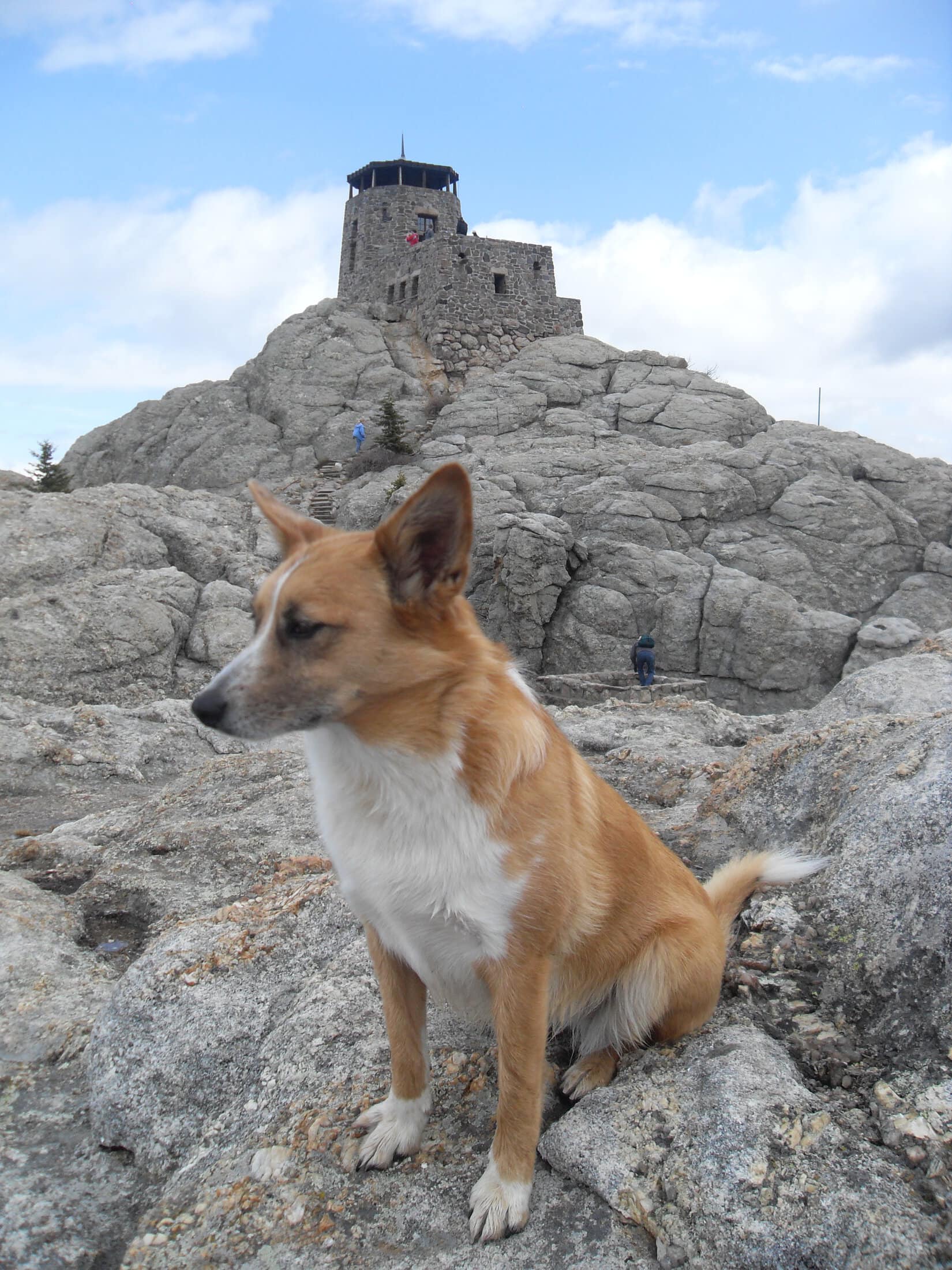
Trail No. 4 led to Trail No. 9, a spur of which goes all the way up to the top of Harney Peak. Near the very end of the climb, a metal stairway spirals up a cleft in the granite. Lupe did not like the metal stairway, because she could see through it down to the ground below. SPHP had to carry the nervous Carolina Dog up the stairs.
At the top of Harney Peak, Lupe and SPHP stopped for only a few minutes at the lookout tower’s observation deck. As the highest point in the Black Hills and the state of South Dakota, Harney Peak is a popular destination. The lookout tower and observation deck were busy with people enjoying the fabulous 360° views, certainly among the best anywhere in the Black Hills.
To the W of Harney’s summit is a huge granite shoulder of the mountain. This shoulder is only slightly lower, offers essentially the same terrific views in most directions, and is less crowded. Lupe and SPHP retreated from the observation deck to the exit from the lookout tower’s basement, and headed over there. SPHP took in the views, while Lupe engaged in the fascinating sport of chipmunk watching.
Lupe’s attention is focused on chipmunks scampering around the W granite shoulder of Harney Peak. Photo looks E back toward the lookout tower and observation deck at the summit.
Lupe and SPHP stayed out on the W shoulder of Harney Peak for half an hour. Lupe never tired of the chipmunks, but did divert her attention from them for a little while when SPHP brought chocolate oatmeal cookies out of the backpack.
The cookie monster Dingo inquires of SPHP as to the state of the chocolate oatmeal cookie supply.Cathedral Spires(6,840 ft.) from Harney Peak. Photo looks S.Harney Peak(7,242 ft.) summit from the W shoulder of the mountain. Photo looks E.
When it was time to press on, Lupe and SPHP returned briefly to the lookout tower and observation deck. After a few photos from the top, Lupe started down the stone steps to the spiral metal stairway, where SPHP had to carry her again to the bottom of the metal stairs.
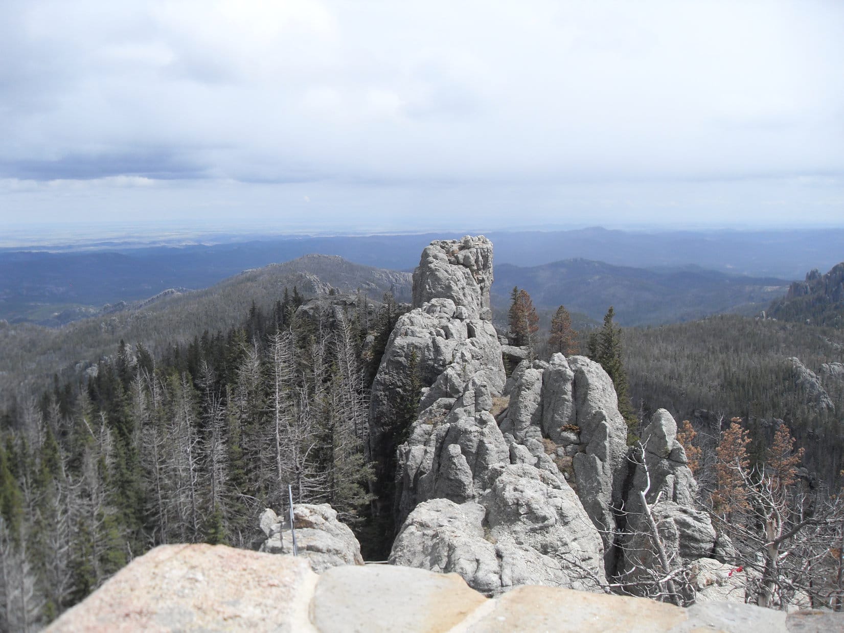
Looking SE from the lookout tower. Peak 6735 is in view just L of the narrow rock ridge protruding from Harney.Little Devils Tower(6,960 ft.) (L) and unclimbable (for Lupe and SPHP) Peak 6920 (R) from the top of Harney. Photo looks SSW.Cathedral Spires(6,840 ft.). Photo looks S.
On Trail No. 9 going down Harney, Lupe came to a big rock platform extending a little to the SE from the trail. The platform provided a great view of Peak 6735. Although Peak 6735 was supposed to have been one of Lupe’s peakbagging goals, a good look at all the rugged terrain and deadfall timber Lupe would have to cross to get there made SPHP decide that maybe today wasn’t the day to tackle Peak 6735.
Peak 6735 is seen directly above Lupe’s head. Photo looks SE from near Trail No. 9 on the way down Harney Peak.Peak 6735. Photo looks SE.
Lupe returned to the Little Devils Tower trailhead via the same route she had taken to Harney Peak – Trails No. 9, No. 3, and then No. 4. She was back at the G6 at 4:37 PM (59°F). Although Lupe hadn’t climbed Peak 6920 or Peak 6735, there was still time in the day to climb another high peak in the area. Lupe went on to climb Sylvan Hill(7,000 ft.) for a glorious finish to her day in the hills – but that’s another post!
Less than a month later, Lupe did climb Peak 6735 on Black Hills, SD Expedition No. 92 (6-9-14).
Part 2 of Day 3, plus Day 4 of Lupe’s 2017 Dingo Vacation to the Yukon & Alaska
(Day 3, 8-2-17, noon) My how things had changed! When Lupe and SPHP got back to the Bow Glacier Falls trailhead near Simpson’s Num-Ti-Jah Lodge on beautiful Bow Lake shortly before noon, the parking lot, which had been nearly vacant when the American Dingo arrived early this morning, was jam packed with vehicles. A long line was waiting to get in, and another trying to get out.
After some delay, the G6 made it out onto Icefields Parkway Hwy 93. Only a few miles farther N at Bow Summit, SPHP made the mistake of taking the turn for Peyto Lake. The situation was the same here. No place to park, vehicles circling endlessly, and throngs of tourists everywhere.
Another delay getting back onto Hwy 93 ensued, but eventually Lupe was headed N again. It was the height of the summer tourist season. After an overcast late autumn feel to the start of the day back in Banff this morning, the sky was bright blue and temperatures were soaring. As a result, the magnificent Canadian Rockies were completely overrun.
Loopster, you were dang lucky to have Bow Glacier Falls all to yourself this morning!
The early Dingo gets the … uh, squirrel, you know, SPHP!
Apparently, that was absolutely the case. The mid-day drive N through Banff and Jasper National Parks was stunning as always, but at all the other short day hikes Lupe might have done, the story was the same. No room to park at Parker Ridge, no room at Wilcox Pass, not even a single available spot at the giant paved parking lot at the Icefields Centre across from the Athabasca Glacier.
Heading N through the Canadian Rockies on Icefields Parkway Hwy 93.
SPHP did manage to sneak the G6 into a couple of pullouts on the way N. Lupe got brief looks at splendid views before having to hit the road again to let someone else have a turn.
Looper at a pullout with a view across the Sunwapta River of the Stutfield Glacier, part of the Columbia Icefield. Photo looks SW.
Despite the crowds, SPHP thought Lupe had an ace in the hole. She would stop at her favorite secret picnic ground on the Athabasca river 5 or 6 miles S of Athabasca Falls. Due to a total lack of signage, only a few locals ever seemed to realize it was there. Everyone else roared right on by the inconspicuous turn.
When Lupe got there, SPHP was aghast. New signage! The formerly secret picnic ground wasn’t completely overrun, but it was no longer the Carolina Dog’s private preserve, either. Lupe and SPHP stopped long enough to go over to the river to take a look at the familiar lovely views, but the solitude which had been so exquisite here even on super touristy days was gone.
At the Athabasca River near what used to be a very private picnic ground due to a lack of signage. Unfortunately, new signs were up and the solitude Lupe used to enjoy here on previous years had vanished. Photo looks NW.Looking upstream.
Since the Canadian Rockies were so busy on what was rapidly becoming a hot summer afternoon, SPHP decided Lupe ought to just keep going. After a quick stop for fuel and supplies in Jasper, Lupe enjoyed an air-conditioned ride W on Yellowhead Hwy No. 16.
Upon reaching the British Columbia border, Lupe entered Mount Robson Provincial Park. When SPHP spotted the Overlander Falls trailhead next to the highway, no one was there. Perfect! SPHP pulled into the nearly empty parking lot.
Lupe had stopped at Overlander Falls on her 2016 Dingo Vacation to the Canadian Rockies, Yukon & Alaska, too, so she knew what to expect. The main trail down to the falls is a nice, shady 10 minute stroll through the forest.
On the main trail to Overlander Falls, only a 10 minute, mostly downhill stroll away.
Last year, Lupe had visited Overlander Falls on a cloudy, drippy day. The falls had been impressive then, but in the sunshine this afternoon Overlander Falls was absolutely gorgeous! The Fraser River was an amazing pale blue color mixed with a clean, foamy white.
Overlander Falls was absolutely gorgeous on this sunny afternoon! Only 30 ft. high, Overlander Falls is one of only 2 significant waterfalls on the Fraser River, the other being Rearguard Falls farther downstream. The trailhead is located on the S side of Yellowhead Hwy 16 about 2 km E of the Mount Robson Provincial Park headquarters and visitor center.
Lupe was glad to see Overlander Falls again! The waterfall put out a cool, misty spray, which felt great on a hot afternoon. The torrent pouring over the falls produced a soothing continuous roar.
Lupe was glad to see Overlander Falls again! The falls produced a cool, misty spray which felt great on a hot afternoon.Loop by the downstream end of the big, beautiful swirling pool of water below the falls.
Lupe had lovely Overlander Falls all to herself, but only for 10 minutes or so. Soon people were coming. Best to let them enjoy some privacy here, too. The Carolina Dog started back up the trail to the parking lot.
Enjoying a few minutes of cool, misty solitude down by Overlander Falls.
Not far from Overlander Falls, a longer side trail branches off the main trail and follows the Fraser River downstream for 2 km. The side trail stays well above the Fraser River, which isn’t even in view a good deal of the time. It ends at a road 0.5 km from Mount Robson Provincial Park headquarters and visitor center.
Lupe had taken the side trail last year, but had a painful experience when she got too excited about a squirrel. A dewclaw caught on a root or branch while she was leaping about. The dewclaw had broken off, which hadn’t been much fun at all. Instead of taking the side trail, this time around Lupe let SPHP drive her to the Mount Robson Provincial Park visitor center.
Mount Robson(12,989 ft.) is the highest mountain in the Canadian Rockies. In 2013, Lupe had taken the Berg Lake trail all the way up to Berg Lake, where she’d had a grand view of Mount Robson and the Berg and Mist Glaciers after traveling through the Valley of a Thousand Falls. That had been a truly glorious adventure, but a long, long day.
Last year, Mount Robson had been mostly hidden in clouds when Lupe dropped by the visitor center. Today the mountain soared in sunshine, highlighted against a brilliant blue sky. The sight was enough to make the American Dingo want to take the Berg Lake trail again.
Lupe drops by the Mount Robson Provincial Park visitor center to see Mount Robson (L), the highest mountain in the Canadian Rockies.Lupe would have been willing to stay and take the Berg Lake trail all the way around to the other side of Mount Robson (23 km one way!). SPHP had to admit that would have been a tremendously fun thing to do, but Loop had other great adventures in store for her on this year’s grand Dingo Vacation!Mount Robson with help from the telephoto lens. Photo looks NNE.
From the visitor center, it was only eight miles to Lupe’s next stop at Rearguard Falls. On the way, the temperature hit a sweltering 89°F!
Like at Overlander Falls, the Rearguard Falls trailhead was right along Yellowhead Hwy 16. A 10 minute walk down a good trail brought Lupe to an extensive boardwalk system with metal railings.
Lupe on the boardwalk platform closest to Rearguard Falls. Rearguard Falls wasn’t as high as Overlander Falls, but being downstream, contained an even more tremendous flow.
Rearguard Falls, though not as high as Overlander Falls roughly 10 miles upstream, has great significance as the only other waterfall on the 854 mile long Fraser River. Rearguard Falls is high enough and powerful enough to be an effective barrier against nearly all migrating salmon. While a few salmon may be strong enough or lucky enough to make it over Rearguard Falls, none make it past Overlander Falls.
Few migrating salmon can make it past Rearguard Falls. Even those that do are ultimately blocked only 10 miles upstream by Overlander Falls.
Rearguard Falls was the last stop Lupe would make for a while, so she lingered as long as she could by the beautiful waterfall until SPHP said it was time to be moving on again.
Oh, mighty interesting about the salmon getting stuck here, SPHP! Sounds pretty good! Think we can catch one? I like salmon!Don’t think so Looper. Not seeing any salmon here today. Maybe it’s the wrong time of year? This is a provincial park, anyway. I’m pretty sure they wouldn’t be too happy with us feasting on the salmon here.The beautiful Fraser River immediately downstream of Rearguard Falls.
Lupe and SPHP went on, continuing W on Yellowhead Hwy 16. Soon after leaving Rearguard Falls, Hwy 5 branched off going S to Kamloops. Nearly all the traffic went that way. Lupe stayed on Hwy 16 following the Fraser River valley toward Prince George.
The Carolina Dog barked at cows and horses as she cruised by occasional green fields scattered among the forest. The Fraser River was seldom in view. The valley was miles wide, and bordered by high mountains on both sides. The mountains to the NE were closest. They weren’t as spectacular as Mount Robson, but were still very scenic.
Gradually the fields with their cows and horses disappeared. Forests lined the highway. Lupe calmed down and relaxed. The late afternoon heat faded to a comfortable level. The busy crowds had vanished. SPHP owned the road, driving with the windows partially down to let fresh air swirl through. As mile after gorgeous mile went by, the drive took on a peaceful, dream-like quality. The G6 hummed steadily NW.
It was evening, when a sign came into view. It was a big new sign where a year ago there had only been a small one. “Ancient Forest”. Well, why not? A huge, wide, short gravel road led up a hillside to an enormous gravel parking lot. Everything was new. The immediate area had been stripped of trees. At one end of the parking lot were two picnic tables and a couple of outhouses. That was it for facilities.
Lupe arrives at the Ancient Forest along Yellowhead Hwy 16, about 70 miles SE of Prince George, British Columbia.
A guy with a bicycle was using one of the picnic tables. Only one pickup truck was parked in the absurdly gigantic parking lot. No one else was in sight. Lupe and SPHP got out for a look around.
A few signs were posted near a registry at the start of a boardwalk trail leading into the forest. The signs said this area was a rare ancient inland rainforest. Huge western redcedars, many over 1,000 years old, and some over 2,000 years old are the dominant tree. A map showed a trail system with two loops and a couple of spurs.
One of the signs at the registration station near the start of the loop trails leading into the Ancient Forest.
Several vehicles came and went while SPHP read the signs. The occupants were only interested in using the outhouses. No one else came to explore a trail, or even glance at what the Ancient Forest was all about.
The Ancient Forest seemed quite different from Lupe’s usual adventures, but she was here now, and Loopster was certainly ready for action. SPHP registered for her, and the American Dingo set out on the handi-cap accessible boardwalk leading into the rainforest. (7:43 PM, 70°F)
Lupe enters the Ancient Forest of western redcedars on the handi-cap accessible boardwalk.
The ancient western redcedars were enormous! The redcedars stood straight and tall with few branches until high above the ground. Most branches seemed pathetically small for the size of the trees. Clumps of moss clung to the tree trunks. The forest floor was covered with ferns, plants with huge leaves, and more moss.
Moss clung to the trunks of the ancient western redcedars. These trees were enormous – straight and tall, with few branches until high above the ground.
The level handi-cap accessible “universal” boardwalk was on supports keeping it several feet above the forest floor, and had railings on both sides. Lupe followed it all the way to a promised viewpoint at its far end, a distance of several hundred meters. The “viewpoint” turned out to be just another spot in the forest like any other, except that a foot trail left the boardwalk and continued on from here.
The foot trail was the E end of a much longer trail that crosses a small creek nearby before gaining more than 3,800 feet (1,169 m) of elevation on its way up to a high point in the subalpine on Driscoll Ridge. The 8.1 mile (15.5 km) long Driscoll Ridge trail ultimately loops back down to Yellowhead Hwy 16 at a point 3 miles (5 km) W of the Ancient Forest trailhead.
Well, Lupe certainly didn’t have time to do all that this evening, so she turned around and went back to where the Waterfall/Tree Beard loop of the Ancient Forest trail system left the handi-cap accessible trail.
On the handicap-accessible “universal” trail heading back to where the Waterfall/Tree Beard loop leaves it.
Once off the handicap-accessible trail, Lupe headed for Tree Beard. The loop trail was still raised boardwalk, but it wasn’t nearly as high above the forest floor as on the universal trail, and now there were low steps and no railings. Most of the boardwalk was covered with a shingle-like material for better traction. The trail gained elevation at a moderate pace as it went up the slope leading to Tree Beard.
Maps like this one were posted at several points along the Ancient Forest loop trails.
Tree Beard was a particularly large, ancient western redcedar, and still very much alive. Nearly all its spindly little branches were way, way up above the ground.
Lupe next to Tree Beard, a particularly large, ancient western redcedar.Gazing up Tree Beard’s enormous trunk.
Lupe’s next stop was the waterfall. The waterfall was located at the end of a spur off the main loop trail. This was the high point of the whole Ancient Forest trail system, some 343 feet (104 m) above the trailhead.
The pretty waterfall flowed down green moss-covered rocks, but was sort of small. After seeing Overlander Falls and Rearguard Falls earlier in the day, the Carolina Dog wasn’t particularly impressed. Of course, the waterfall might be more impressive at other times of year. Perhaps this was the dry season? For a rainforest, everything seemed very dry.
The pretty waterfall at the high point of the Ancient Forest trail system.
Lupe returned to the main Waterfall/Tree Beard loop and continued on through the prehistoric forest.
This Ancient Forest really is cool, don’t you think, Looper? Seems like a place where you could meet a dinosaur!
A dinosaur! In Canada? Not too likely, SPHP. Haven’t seen a single one since we got here. In fact, I really can’t remember the last time I saw one anywhere. Dinosaurs are pretty scarce these days.
True enough. Maybe a bear, then. You saw bears in Canada last year, remember?
Oh yeah! A bear would be exciting! Maybe we’ll see a bear?
Lupe keeping an eye out for bears, and maybe even dinosaurs! Who knew what might lurk in the Ancient Forest?
When Lupe reached the Gold-Dust Tree, she found the tree had taken the unusual step of posting a sign boasting about the view it had of a distant mountain named Mount Sir Alexander(10,745 ft.). The sign said Mount Sir Alexander had been climbed only a few times, though the Gold-Dust Tree didn’t claim to have done it.
The sign posted by the Gold-Dust Tree about Mount Sir Alexander.
This was all quite interesting to a peakbagging Carolina Dog. She was fortunate enough to be here on a clear day when she could actually see the real Mount Sir Alexander, too. It was an impressive peak, glistening with glaciers just as the Gold-Dust Tree claimed.
Lupe was disappointed, though, to see that the mountain appeared well beyond SPHP’s peakbagging capabilities. That being the case, she knew she wouldn’t ever get to climb Mount Sir Alexander herself, either.
Mount Sir Alexander was an impressive peak, but Lupe could see that SPHP would never make it up something like that. Sadly, that meant she would never get to climb it, either. Photo looks NE with lots of help from the telephoto lens.
Apparently, the sight of Mount Sir Alexander had gotten Lupe thinking.
You know what, SPHP? This Ancient Forest would be a great place to come to on a cloudy wet day. It wouldn’t be worth climbing any mountains on a day like that, because you wouldn’t see anything anyway, but the Ancient Forest would be fantastic! All drippy, misty, foggy and spooky-like! Makes me feel all scary and wild and ferocious just thinking about it!
Hah! Great idea, Loopster! Makes me wish it was all misty, drippy, and foggy right now!
I’d be the top predator, the most ferocious Dingo in the Ancient Forest! I’d go roaming and prowling among these monstrous trees on the hunt, ripping apart and devouring everything and anything I came to. Most fun ever! You could come with, SPHP, and help out. It’s always smart to hunt in packs, you know.
Maybe. I dunno know, Loop, we might run into Big Claw!
Big Claw? Who’s that?
Oh, don’t you remember fighting Big Paw on the Olympic Peninsula in Washington state? That was a rain forest, too. Down there, they had Big Paw, and he almost got the best of you. Up here, they probably have Big Claw, maybe a massive bear or something like that. Perhaps a giant grizzly! Big Paw was bad enough. You might not survive an encounter with Big Claw!
Lupe glanced around the forest, ears pricked up, nose twitching.
Big Claw wouldn’t be here on a day like today, do you think, SPHP?
Not entirely certain about that, Loop. I don’t see any ripe berries around, so probably not, but who knows? Best to stay alert. Don’t go wandering off.
Maybe we should get out of here before it gets dark, SPHP. Let’s keep going and see what’s next.
What was next was the Radies Tree, another huge western redcedar. The tree was named after Dave Radies, a graduate student at the University of Northern British Columbia, who had noticed in 2005 that trees in this area were marked for logging. Mr. Radies alerted the public, which led to the preservation of the Ancient Forest.
Loop near the Radies Tree (R).
A few hundred feet (100 m) beyond the Radies Tree, Lupe came to a trail junction. She could take a shortcut back to the G6 completing the Waterfall/Tree Beard loop, or explore the Big Tree loop.
The Big Tree loop was the smaller of the two loops. It wouldn’t take much longer to check it out, too. There was still plenty of light out, and exploring the lonely Ancient Forest was pretty fun. Loop decided she’d like to see Big Tree.
Big Tree was a monster so large SPHP couldn’t even get a decent photo of it. A short side trail went to a platform right at the base of the tree. To get to the platform, Lupe had to pass beneath a huge tree that had fallen over. That fallen tree was mighty cool, too.
Lupe on the short spur off the Big Tree loop leading to a platform at the base of Big Tree. Big Tree is just around the corner from here.
Having seen Big Tree, it was time to head back to the G6. Most of the return trip was an easy, downhill stroll on the boardwalk. Lupe never did see Big Claw, nor Medium Claw, Small Claw, or Tiny Claw, either for that matter.
Although forest was already getting gloomy, it was quite light out despite the late hour when Lupe and SPHP emerged from the Ancient Forest back at the huge, open parking lot (9:44 PM). The guy with the bicycle was gone. Only one other vehicle was around, a pickup with a camper which appeared intent on spending the night parked way down at the far end. Good idea. Lupe would spent the night here, too.
(Day 4, 8-3-17) Early, very early. The Big Dipper was so bright in the night sky, SPHP could see it without glasses, which was saying something. Later, a single bright spot appeared near the horizon. Must be Venus. Dawn was coming. Up at 5:48 AM, SPHP made use of one of the picnic tables, while Lupe sniffed around close by. Soon she was on Yellowhead Hwy 16 again, heading W for Prince George.
Prince George was only 65 miles (104 km) from Ancient Forest, so it was still early when Lupe arrived. SPHP fueled up the G6, then discovered that Save on Food didn’t even open until 8:00 AM, which seemed crazy. It was such a long way to the next substantial town, however, it was best to wait. Shortly after 8:00 AM, Lupe was on her way again, the G6 stocked with fresh provisions.
Loop and SPHP headed N out of Prince George on Hwy 97. The Carolina Dog enjoyed lapping up newly acquired chocolate milk, as she watched the scenery go by. Lupe had lots of nice breaks from the G6 yesterday, so this was going to be a travel day, spent mainly making tracks N. Even so, there would be a few stops along the way.
Looking at maps, SPHP had gotten the idea that it might be fun to see the Parsnip Reach of Williston Lake. This involved a 19 mile (30 km) side trip (one way) on Hwy 39 to Mackenzie, which according to SPHP’s wholly inadequate and deceptive maps appeared to be on the lake. No doubt the lake wasn’t too far away, but despite driving through the entire length of Mackenzie, and several miles past it on a dusty gravel road, Williston Lake refused to appear.
Driving back through Mackenzie again, SPHP saw no signs indicating how one might obtain lake access. Fiddlesticks! However, there was one strange thing Lupe might have a look at in Mackenzie. A gigantic yellow machine sat next to Hwy 39 right at the edge of town. Lupe stopped by to see what it was.
The yellow monster turned out to be “The World’s Largest Tree Crusher“. The electrically powered tree crusher had arrived at Kennedy Siding, wherever that was, in late 1964. Plagued with problems, it saw use in 1965 clearing 2,590 acres of forest, but apparently little actual use for its intended purpose after that. Now it was a tourist attraction.
Lupe visits “The World’s Largest Tree Crusher” in Mackenzie, British Columbia.
It’s a mighty odd tourist attraction, Loop. How many people make travel plans to see a giant tree crusher, anyway?
You did.
I did not! This is purely accidental. We came here to see Williston Lake, and found this beastly behemoth instead. No doubt it’s an engineering feat of sorts, although the sign says it had lots of problems, but it’s kind of a nightmarish thing, isn’t it? Can you imagine this metal monster smashing down entire forests, leaving an indiscriminate wake of destruction in its path?
It does look terrifying. I’m glad it’s dead!
The World’s Largest Tree Crusher was just plain scary to think about!
Without ever catching so much as a glimpse of Williston Lake, Lupe and SPHP returned to Hwy 97 and continued N. Near Chetwynd, SPHP took Hwy 29, a shortcut to the Alaska Highway NW of Fort St. John. Lupe stopped by Moberly Lake, which looked beautiful and remote where the highway first reached it.
Lupe at the E end of Moberly Lake where Hwy 29 first reaches it coming from Chetwynd. Photo looks W.
Lupe and SPHP took a short walk. Moberly Lake was certainly beautiful, surrounded by low mountains. Lupe could see only part of it from here, since it was miles long. However, the lake was not as remote as it first appeared. It turned out there were recreational facilities along the S shore, and lots of homes in the community of Moberly Lake along the N shore where Hwy 29 went.
Moberly Lake wasn’t as remote as it first appeared, but was beautiful nevertheless. Lupe discovered there were recreational facilities along the S shore. The community of Moberly Lake was strung out along the N shore where Hwy 29 went.
Beyond Moberly Lake, Hwy 29 eventually crossed a bridge over the Peace River, whereupon it turned NE following the Peace River valley downstream. The valley was very pretty, bordered by forested ridges on both sides, and full of fields along the river bottom After some distance, Hwy 29 climbed out of the valley to a high point where there was a rest area with a great view.
Lupe had a great view of the Peace River valley from a rest stop positioned at this high point along Hwy 29. Photo looks SW.The Peace River with a bit of help from the telephoto lens.
The Peace River flows out of Williston Lake. Information at the rest stop showed that Lupe would have been able to access the Peace Reach of Williston Lake, if she had left Hwy 29 at Hudson’s Hope taking Canyon Drive to the W.A.C Bennett Dam. Oh well, too late now. SPHP had no intention of backtracking that far.
Looking downstream from the rest stop. Photo looks ENE.
The nice Peace River sight-seeing break at the rest stop was the last big one Lupe got all day. Hwy 29 ended at the Alaska Highway a few miles NW of Fort St. John. SPHP drove into town to gas up the G6. Then Lupe cruised N and W on the Alaska Highway the rest of the day with only a few brief stops along the way.
Dusk found Lupe W of Fort Nelson, stopped for the night at a pullout at a low spot along the Alaska Highway. A creek could be heard nearby, but this must have been a swampy area. Swarms of mosquitoes discouraged any lengthy ventures out of the G6. The world turned dark. After a bite to eat, SPHP pulled Lupe’s blankie over her, and it was off to adventures in Dingo dreamland.
Taking a brief break along the Alaska Highway somewhere between Fort St. John and Fort Nelson.Big clouds sailed over the Alaska Highway on the way to Fort Nelson. Lupe eventually passed through rain showers, then saw a rainbow in Fort Nelson.