Exhaustion. Near total exhaustion. SPHP sat down right on the pavement. Both dogs laid down nearby. Even they were incredibly weary. All the provisions SPHP had brought were long gone. Stars glittered in the night sky. The full moon shone down on a silent world. What a gorgeous, still evening!
Everything was going to be fine. Lupe, Big Sid and SPHP had made it to the intersection of Hwy 17 and USFS Road No. 256, a little N of Nahant in the W central Black Hills. A few minutes rest, and Lupe and company would push on to the G6 parked less than 0.5 mile away. After nearly 11 hours in the field, the Snow Trek ordeal would come to an end (9:05 PM, 35°F).
Of course, only the last few hours had really been an ordeal. Most of the day had been beautiful, spent wandering the snowy forest. It had all started this morning with a forecast high of 61°F back home. The day had never been anywhere near that warm up here, but that forecast had gotten SPHP to thinking Lupe ought to continue her explorations of Minnesota Ridge.
Lupe had gone over to Dog Heaven, to see if the neighbor’s dog, Sidney, wanted to come with. Yes, indeed! Big Sid was excited! He got permission to go. So off in the G6 went Lupe, Big Sid and SPHP, all looking forward to a grand romp in the hills.
Arriving at the N end of Minnesota Ridge on USFS Road No. 256, it was clear that the plan for the day needed adjustment. Snow was plowed up 3 or 4 feet deep all along the road. The snow wasn’t that deep in the forest, but there was plenty of it there, too. In any case, there was nowhere to park the G6. Snow was everywhere.
SPHP drove another mile W before finding a place to park (10:12 AM, 36°F). Everyone piled out of the G6. Lupe was barking and leaping for joy! Pristine white snow sparkled in the bright sunlight. Lupe, Big Sid and SPHP headed SE through a field going up a gentle rise. The Snow Trek was underway!
Lupe was joyful, full of energy, and looking forward to a romp in the hills when the Snow Trek began.
Beyond the little rise, the snowy field went SW down to Hwy 17. Lupe, Sidney and SPHP followed a short segment of the road continuing SW, but left Hwy 17 shortly after it turned sharply N. Everyone went down to the Mickelson Trail, which was nearby to the W.
Lupe was now at Nahant. She could have followed the trail N or S, but SPHP decided to lead the way S, thinking Lupe might eventually get on USFS Road No. 259 and explore Telegraph Gulch.
Looking N along the Mickelson Trail at Nahant.
Lupe wasn’t on the Mickelson Trail very long. She left it to climb a small slope up to USFS Road No. 259, where she and Big Sid continued S. The road was sloppy with melting snow and mud.
Lupe and Big Sid soon left the Mickelson Trail to climb up the snowy slope on the R, which led to USFS Road No. 259. Photo looks S.Big Sid on USFS Road No. 259. The road was a sloppy mess with mud and melting snow. The Mickelson Trail is seen on the L. Photo looks SSW.
The mucky road was icky to walk on. Most of the time, it was best staying entirely off to one side or the other. Lupe and Sidney passed by a dilapidated old house and barn on the W side of No. 259. Shortly after that, the road turned W up into the forest. No. 259 soon turned S again, and went over a small ridge.
The plan had sort of been to take No. 259 several miles S all the way through Telegraph Gulch to USFS Road No. 231. However, after going over the small ridge, an unmarked side road went W up a beautiful little valley. This side road wasn’t shown at all on SPHP’s old USFS map, but looked intriguing. It certainly seemed more interesting than continuing the muddy march along No. 259.
Exploring the mysterious side road became the new plan.
Sidney leads the way up the mysterious side road into a valley W of USFS Road No. 259 S of Nahant. Photo looks WNW.
At first, it was possible to follow the side road. Farther up the valley, the snow got progressively deeper. It became difficult to tell where the road was, or if it was even still here at all. Most of the time, it was easiest to stay toward the N side of the valley where there was a little S exposure and less snow.
As the snow became deeper, it was hard to tell where the road was, but Lupe and Sidney were having fun exploring this seldom visited valley. Photo looks WNW.
Lupe had the easiest time dealing with the deeper snow. A hard crust was under a few inches of fresh powder. The crust generally supported Lupe’s weight, so she could trot along on top, but Sidney and SPHP often broke through to the deeper stuff below. Conditions varied, though. Some places the crust was even strong enough to support both Sidney and SPHP.
Lupe comes dashing back over the snow. A hard crust below a few inches of fluffy powder generally supported Lupe’s weight. Big Sid and SPHP broke through the crust more frequently, and had a much harder time. Photo looks W.
After going close to a mile up the valley, it split in two. One branch went SW, while the other went NW. The road, if it still existed, was long lost beneath the snow. SPHP hadn’t seen it for a while.
Lupe and Sidney had already been drifting farther and farther up the N side of the valley to avoid the deepest snow, so it was easiest to follow the NW branch of the valley. Deadfall timber made the somewhat steeper climb here tougher for a while, but it wasn’t bad. Less than 0.5 mile brought Lupe and Sid to a saddle on a big ridge. (Pass 6194)
From the ridge, it was possible to see a considerable distance to the N. Both Terry Peak(7,064 ft.) and Custer Peak(6,804 ft.) were in view miles away. The local terrain dropped steeply to the N. Swede Gulch had to be somewhere out there not too far away.
At the saddle, Lupe and Big Sid turned W, following the ridge higher. The views to the N and NE steadily improved. Meanwhile, the snow kept getting deeper.
The views to the N and NE kept improving as Lupe and Big Sid gained elevation following the ridgeline W. Custer Peak is in view in the distance to the L of this nice stand of birch trees. Photo looks NE.
On and on through the snow. Higher and higher. Maybe it hit 61°F back at home, but not here. Here it was only in the low 40’s. Finally, Lupe and Sidney were high enough to start seeing views off to the S and SW, but SPHP didn’t recognize the nearby terrain.
A small rock outcropping at a high point presented an opportunity to dust the snow off the rocks and sit down for a break. Lupe and Sidney made short work of the Taste of the Wild supply. SPHP had an apple while admiring the view to the S, then checked the USFS map.
It was starting to seem like a long time since losing the side road under the snow back down in the valley. The map showed only one possible road in this area. USFS Road No. 234 wound for miles around the W end and along the S side of Swede Gulch. Hmmm. With all the snow, SPHP wasn’t even certain of being able to recognize a road, even if Lupe and Sid did come to one.
Lupe and Sidney in the snow high up on the ridge shortly before reaching the break area at the rock outcropping. Photo looks W.
Break time was over. Loop, Sidney and SPHP resumed the march W. The ridge now flattened and broadened out tremendously. For a while, elevation was being gained only slowly, if at all. The snow made it tough going. The need to find a road grew. Each step was still taking Lupe and Sidney farther away from the G6. It was time to think about finding a way back.
Fortunately, Lupe and Sidney did discover a road! It continued W, gaining elevation again at a modest pace. Either this was, or would likely feed into USFS Road No. 234 at some point along the way. However, finding the road was not the expected solution to the difficulties with the snow. The road was covered by an even deeper white blanket than the forest had been. The snow was in pristine condition. No sign anyone had been here. The struggle continued.
Finally, after passing first a fence, and then a tree that had fallen across the road, there were tracks. Snowmobiles had been here! The snow was compacted enough so Lupe could usually race along right on top. Sidney and SPHP had some luck staying up on top, too, but not always. Each failure meant post holing down a couple of feet.
If this really was No. 234, sooner or later, the road would have to turn N. It did turn N, several times, but each time swung back to the W again. On and on. Farther and farther from the G6. The condition of the snow varied. Sometimes even Lupe was sinking in. Other times both Sidney and SPHP could stay on the crunchy compacted crust. Overall, though, pressing onward was an increasingly time and energy-consuming effort.
Lupe and Sidney were in high territory. The scenery was beautiful and remote. The dogs still seemed to be having fun. The snowmobile tracks often stretched on through big openings in the forest where everything was gorgeous and white. The actual road was three feet below the level of the tracks. Where the snow held, it was like traveling over the top of a crusty cloud.
At last, the tracks swung N and kept going that way. Time went by. How much farther? A bit of a curve to the NNE. The road passed through a dense, old forest and started to descend. SPHP expected Lupe would arrive at Tillson Creek pretty soon. She had been there before on a prior expedition. SPHP was elated when the creek came into view.
Decision time. Take the long, but certain route back to the G by staying on No. 234 to No. 206 all the way back to Hwy 17? No. 206 wasn’t far away, and would have had enough traffic to pack the snow down hard for a good walking surface. Or try the shortcut down along Tillson Creek through Swede Gulch to Nahant?
The sun would still be up for a couple of hours. Lupe had followed Tillson Creek through Swede Gulch once before back on Expedition No. 58 on 5-11-13. SPHP remembered it as an easy and beautiful route. It was still miles long, though, and conditions were very different now.
A quick decision. Lupe and Sidney would take the shorter route through Swede Gulch.
It wasn’t long before SPHP began to realize what Lupe and Sidney were in for. Tillson Creek flowed merrily along with plenty of water in it. However, the snow was even deeper down by the creek than before. Snowdrifts 4 to 5 feet high filled the narrow valley, often burying the small creek beneath them.
To make any progress, Lupe and Sidney had to stay up in the forest on the N side of the valley where the snow wasn’t quite as deep. The forest was a mess. Pine bark beetles had killed many trees since Lupe had last been here. A slow, difficult struggle through snow and deadfall timber ensued. Energy drained away. Time flew by. The distance traversed was pitiful.
Suddenly SPHP realized Lupe was coming to open ground ahead. Tillson Creek flowed into a broad, gentle valley of pasture lands intersecting from the NNW. Maybe this was the start of Swede Gulch? SPHP had forgotten about this place, but was very glad to see it. Lupe and Sidney made it past the last big snowbank. A snow-free trail led SE!
We’re saved! Even Lupe and Big Sid were visibly encouraged.
By the time Lupe reached the open ground here in the intersecting broad valley, the sun was getting low. Lupe still had miles to go down Swede Gulch. Photo looks W in the direction she had been coming from.Sidney stands at the start of the snow-free trail in upper end of Swede Gulch. Rapid progress could finally be made, but it wouldn’t last long. Photo looks SE.
For a little while, Lupe and Sidney made fast progress along the muddy trail, but SPHP’s announcement was premature. The gravel road leading to Nahant from Swede Gulch was still miles away. The valley soon narrowed again. Swede Gulch became a twisting, turning canyon. SPHP expected to see the W fork of Tillson Creek coming in from a narrow side canyon, but never did.
Deep snow returned. Occasionally there were short snow-free stretches of trail, but for the most part, the endless struggle through snow and deadfall timber on the forested N slope of the canyon resumed. We’re doomed! or We’re saved! became the cry around every bend depending on the scene ahead.
Doomed! For real. At a sharp bend, the narrow canyon ahead was completely choked with dense forest and deadfall. Huge mounds of snow among the trees blocked any reasonable way forward. Advance was impossible, thought of retreat unbearable. In desperation, Lupe began to climb the steep canyon wall. With no other choice, Big Sid and SPHP tried to follow.
The American Dingo reached the top of a high, thin rock wall. She’d made it! Big Sid and SPHP managed to get there, too. This was it! Lupe had found a shortcut bypassing the worst part of the canyon! On the other side of the rock wall was a way down again. Back down to the canyon. The situation was better here. It was possible to continue downstream.
The sun was long down, and twilight fading, by the time the canyon seemed to widen out a bit. The going became a little easier. It became possible to spend more time on the trail, and less fighting the deadfall on the wretched N slope. SPHP kept expecting to see the gravel road to Nahant around every bend, but it did not appear.
Then it did appear! No, it wasn’t true. The road proved to be an illusion in the growing darkness. No choice. Puppies, ho! Onward, as rapidly as possible!
Finally, finally, the road appeared again some distance ahead. This time SPHP was almost certain of it. Stopping to peer through the darkness, what was that? A strange, muffled sound. Listen! Where was it coming from? Below! It took a moment to realize that the sound was Tillson Creek. The creek was underfoot, buried beneath snow and ice. Lupe, Big Sid and SPHP were all standing on it!
At least it made for an easy creek crossing. Lupe, Big Sid and SPHP made it to the road. This was it! The real deal and not an illusion. Stars shone above, but the expedition was saved once again. Lupe and Sidney left Tillson Creek behind. Soon the last of Swede Gulch would be left behind, too. Following the level road for a mile E back to Nahant would be easy.
Hah, fools! Around a bit of a bend, to everyone’s dismay, a 5 foot high snowdrift covered the entire roadbed as far as it was possible to see. On both sides, forested slopes dropped steeply N toward the lower end of Swede Gulch where Tillson Creek could still be heard rippling away.
This snow was soft. It wouldn’t even support Lupe. Half a mile of post holing lay ahead. No alternative. Sidney, especially, struggled mightily. Tough, very tough. And cold.
At last it was over. The rest of the way was easy, except for pervading weariness and cramping muscles. An exhausted final march E to Nahant, and then N to the intersection of Hwy 17 and USFS Road No. 256.
A snow and mud-free spot! SPHP collapsed on the pavement to recover. Lupe and Sidney laid down nearby for the same purpose. What a day! Stars twinkled above. The full moon shone down. Silence. The eternal blackness of space and time. Still a little farther to go, but what a glorious moment! What a glorious night!
Day 8 of Lupe’s 2017 Dingo Vacation to the Yukon & Alaska!
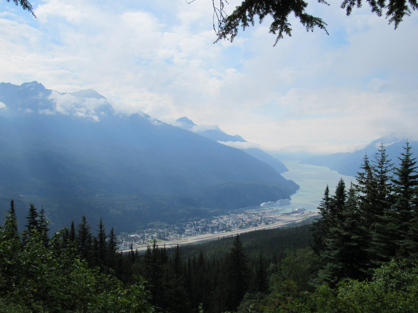
Loopster was right! When Monday morning arrived, Skagway bore no resemblance to the virtual ghost town it had been at dusk on Sunday night. It was still early. Skagway wasn’t terribly busy yet, but you could just feel that the whole town would soon be teeming with activity. Before that happened, Lupe and SPHP took a walk down to the Skagway Sea Terminal for a look around.
Loop at at small park on the way to the Skagway Sea Terminal.This old engine used take trains from Skagway over White Pass to Carcross and Whitehorse in the Yukon.Skagway is located on the Taiya Inlet of the Lynn Canal, an arm of the North Pacific Ocean. Photo looks SW.
Three big cruise ships were in port, plus a yacht named Playpen and a number of smaller boats tucked away in a separate little cove.
Lupe at the Taiya Inlet. Cruise ship Explorer of the Seas is on the L. Photo looks SSW.Radiance of the Seas, one of three large cruise ships in port. The almost identical Explorer of the Seas is docked right behind it.The yacht Playpen and the 3rd big cruise ship.Lots of smaller boats were tucked safely away in this separate cove. Photo looks NE.
Seeing the ocean and the beautiful mountains along the Taiya Inlet was fun. However, Lupe had already figured out that just like yesterday’s bush pilot flight-seeing tour to Virginia Falls leaving from Muncho Lake, SPHP would announce that taking a cruise on one of these luxurious cruise ships wasn’t in the budget, either.
That was OK. American Dingoes are flexible. They’re open to all sorts of ideas. Lupe had seen another less expensive entertainment possibility on the walk through town. Maybe SPHP could be talked into this one?
SPHP, look at how good I’m being, and how pretty I am next to all these beautiful flowers! You’ll take me out to the Red Onion, won’t you, please? It’s right across the street, just follow me!Lupe had hopes for some high times at the Red Onion!
Lupe was in for high times, alright, but not at the Red Onion Saloon, at least not now. Today Lupe’s high times were going to involve 4,740 feet of elevation gain climbing AB Mountain(5,036 ft.). She was going to join the Arctic Sisterhood!
In 1899, back in the Klondike gold rush days, the Arctic Brotherhood had been founded by 11 gold prospectors on a steamship headed for Skagway from Seattle. The Arctic Brotherhood was originally a fraternal order whose members pledged to assist one another on the way to and while at the goldfields near Dawson City in the Yukon.
The in-land journey to the goldfields started at Skagway, where a unique two story hall decorated on the exterior with driftwood was built as the Arctic Brotherhood’s headquarters. For a while, the Arctic Brotherhood became very popular and expanded rapidly, at one point having over 10,000 members and up to 34 different camps distributed throughout the Yukon and southern Alaska.
A NNE trending ridge starting at Yakutania Point just W of Skagway rises from Taiya Inlet some 5,036 feet to a mountaintop more than 5 miles away. The letters “AB” appear on this mountain when snow conditions are right, so the mountain became known as A.B. Mountain or Arctic Brotherhood Mountain. It’s sometimes said in modern times that climbing AB Mountain makes one a member of the Arctic Brotherhood.
The real Arctic Brotherhood never accepted female members, but SPHP didn’t want to worry Lupe with such trivial details. As far as SPHP was concerned, if the plucky Carolina Dog could get to the top of the mountain today, she was going to become a member of the Arctic Sisterhood. SPHP told her as much.
Of course, after all her wonderful adventures in the Yukon and Alaska both last year and yet to come on this 2017 Dingo Vacation, Lupe was excited about the prospect of joining the Arctic Sisterhood! She was eager to get going right away!
SPHP found the small trailhead for AB Mountain on the S (L) side of the road to Dyea almost immediately after the road turned to gravel. On the opposite side of the road Lupe spotted a small sign saying A.B. Mountain next to the start of the Skyline Trail. (9:30 AM, 59°F)
Come on, SPHP! This is it, the Skyline Trail to AB Mountain!
For the first 2.25 miles, the trail was wide and easy to follow. It varied quite a bit on how steep it was, with both fairly steep and almost level sections. Lupe even came to a few dips. Overall, Lupe gained elevation at a moderate pace.
This early part of the trail went through a forest. Not far from the trailhead, Lupe explored a short side spur leading off the main trail to an exposed boulder. This boulder provided a view back toward Skagway and the Taiya Inlet. Everywhere else the only views were of the forest.
The wide, well worn trail to AB Mountain starts off in a forest.Early in the trek, a boulder at the end of a short spur off the main trail provides this view of the Taiya Inlet. This is the only viewpoint for more than 2 miles. Photo looks SSW.
Shortly after returning to the main trail, Lupe crossed the first of two small streams.
Lupe wades in the first small stream that crosses the trail.Continuing past the first small stream, the forest was tall and thick for a long way.
After crossing the first stream, the trail went a long way through the forest before eventually crossing a second small stream. Beyond the second stream, the trail began to steepen rapidly. It was soon so steep that SPHP was often grabbing branches, tree trunks, rocks – whatever was available for assistance. The steep climb didn’t bother Lupe, though.
At the start of this steep section, the trail had still been in thick forest. As Lupe gained elevation, however, the situation began to change. Tall bushes and Devil’s club mingled in among the trees. Lupe even saw a few blueberries and crowberries. Gradually, the trees became smaller and fewer. The tall bushes and Devil’s club prevailed. Views were now starting to open up.
As Lupe got higher, the trees began to thin. Tall bushes and Devil’s club began to dominate, and views started opening up. Photo looks SSW toward Skagway and Taiya Inlet.
SPHP had previously read online about an obstacle that Lupe had to be fast approaching. Somewhere along this steep section of the trail, trip reports stated there was a rope needed to get up a particularly slippery, dangerous spot. How bad was this spot? Was it a small cliff? Would Lupe even be able to get past it? SPHP was worried that the rope might be as far as the Carolina Dog could go.
Lupe finally did reach a yellow rope dangling 40 or 50 feet down a long, smooth-surfaced rock. The rock was plenty steep, but this wasn’t nearly as bad as SPHP had feared it might be. No exposure, no insurmountable obstacles. In fact, the American Dingo could scamper up and down the rock at will. The rope was a tremendous help to SPHP. With its assistance SPHP simply walked right on up the rock no problem at all.
Lupe reaches the dreaded rope section. It turned out to be nothing to worry about at all. The rope made it easy for SPHP to walk right on up. Lupe was perfectly capable of scampering up and down the steep rock at will without it.
Lupe kept climbing. SPHP had to stop frequently to catch breath. Lupe was starting to get above all the trees. The trail remained very steep. Even the tall bushes and Devil’s club were starting to give way to shorter vegetation. A high point up ahead looked like the start of easier terrain, and some fabulous sweeping views.
The trail remained very steep above the rope, but this high point eventually came into view promising both easier terrain and sweeping views ahead.Starting to get above not only the trees, but the tall bushes, too. Skagway is on the L. Yakutania Point and the forest Lupe had come through on the way up are at Center. Dyea Point is the skinny peninsula on the R. Photo looks SSW along Taiya Inlet.
The climb up to the first sweeping viewpoint was farther than it looked, but Lupe and SPHP made it. The terrain was a lot easier here. The vegetation was reduced to tundra plants. Nothing obstructed the glorious views which were absolutely amazing in virtually every direction.
Lupe reaches the first sweeping viewpoint above the steepest section of the trail to AB Mountain. Dyea is in the valley at lower R. Parsons Peak(5,600 ft.) towers across the bay on the L. Photo looks WSW.Lupe with a terrific view of Taiya Inlet. Photo looks SSW.
Lupe met two people at this first sweeping viewpoint. Sean and Rebecca Riordan from Brooklyn, New York were here enjoying the grand views. They had come to Skagway aboard the Explorer of the Seas, which Lupe had seen docked down at Skagway this morning. Sean and Rebecca were super friendly and nice to Lupe. Rebecca said her grandma was named Lupe, too!
Lupe met Sean & Rebecca Riordan from Brooklyn, New York at this first sweeping viewpoint. Photo looks E.Sean and Rebecca were super friendly and nice to Lupe. Photo looks E.Rebecca and Lupe with Taiya Inlet in the background. Photo looks S.Rebecca has a grandma named Lupe, too!Sean and Lupe together. Sean was looking forward to pizza and drinks aboard the Explorer of the Seas this evening. Lupe thought maybe she’d join Sean if the Red Onion Saloon didn’t work out with SPHP. Photo looks N.
Sean, Rebecca and SPHP had a good time chatting for quite a while. Lupe certainly didn’t mind taking a break being petted and loved.
Relaxing with Sean and Rebecca Riordan before they depart for Skagway and pizza and drinks aboard the luxurious Explorer of the Seas. Photo looks SSW.
Sean and Rebecca had to be back down to the Explorer of the Seas in time for an 8:00 PM departure, so eventually Lupe and SPHP had to bid them farewell and bon voyage. If the American Dingo hadn’t been committed to joining the Arctic Sisterhood today, she might well have followed Sean and Rebecca down for pizza and drinks aboard the luxurious Explorer of the Seas.
As it was, it was time to get moving again. The summit of AB Mountain was still a long way off, not even in sight yet. Up ahead, Lupe could see two rounded higher hills along the ridge. The trail led toward a closer wall of rock, as if destined to skirt these hills to the W (L).
After Sean and Rebecca headed down, Lupe and SPHP continued on looking for the summit of AB Mountain. Two rounded hills were in sight. The trail led toward the wall of rock partly in view on the L. Photo looks NNE.
The trail was no longer as wide, well-worn and easy to follow as it had been way back down in the forest. SPHP somehow lost it, and wound up on a boulder field below the E side of the rock wall. About half way through the boulder field, people were seen up on top of the rock wall. Apparently the trail was actually up there.
It was slow going on this boulder field below the wall of rock on the L. The trail was actually up on top, but SPHP had somehow lost it. Photo looks NNE.
Lupe and SPHP made it past the boulder field, and up onto the ridgeline beyond the two rounded hills. The trail continued winding along the top of the ridge, and after a while Lupe could see two distant high points ahead. The closer, lower one was marked on the topo map as the location of Hump Benchmark.
After following the ridge a long way beyond the two rounded hills, two distant high points appear ahead in shadow. The closer, lower one is the location of Hump Benchmark on the topo map. SPHP thought the summit of AB Mountain was the higher point beyond it. Photo looks NNE.
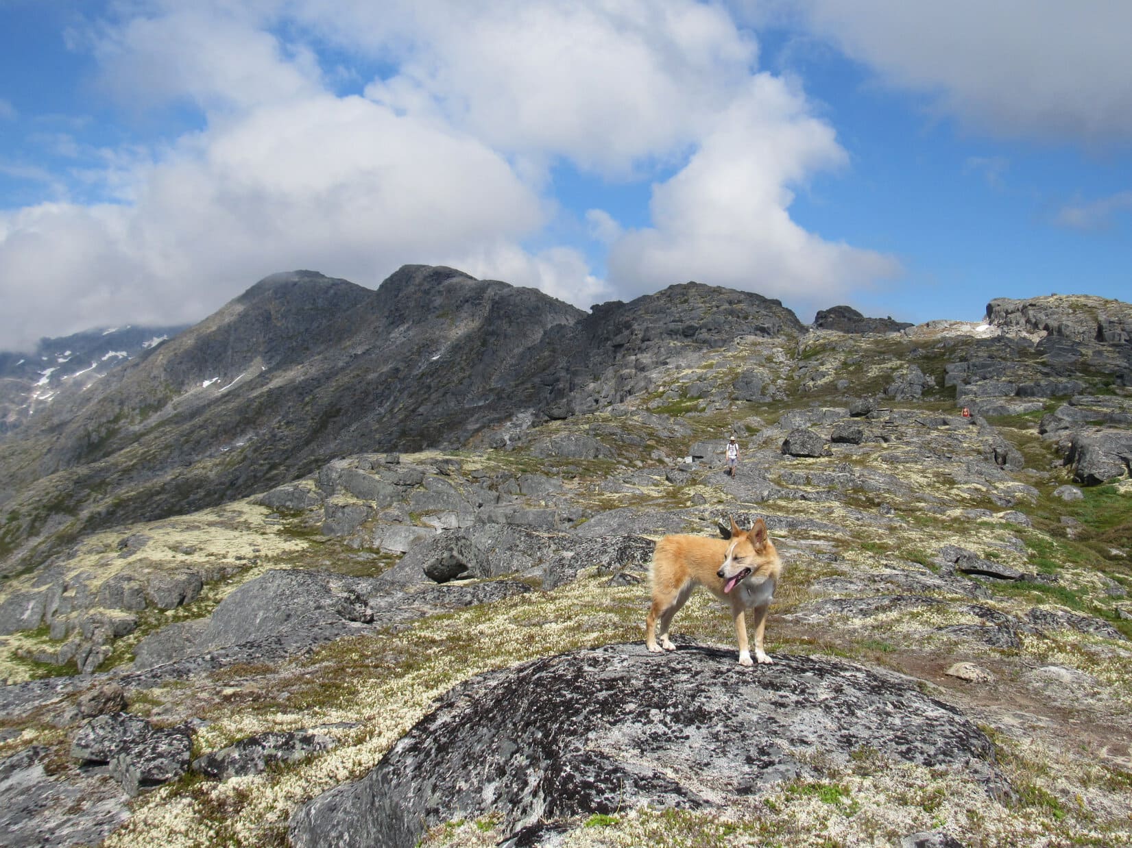
It was still a long way to Hump Benchmark, never mind the summit. Lupe continued up the ridgeline. Sometimes the trail was easy to follow, sometimes cairns marked the way, sometimes there was no indication at all of where to go except onward and upward. Lupe was still gaining elevation steadily. The views were fantastic on all sides.
Lupe continued gaining elevation along the giant ridgeline. The views were simply tremendous on all sides! Photo looks NNW.Looking NE with help from the telephoto lens.The East Fork of the Skagway River valley. Photo looks ESE with help from the telephoto lens.The Reid Creek valley. Photo looks SE with help from the telephoto lens.Parson Peak(5,600 ft.) (far L) from the AB Mountain ridge. Photo looks W.Looking WNW with help from the telephoto lens.Lupe passing by a small pond up on the ridge. This pond is shown at 4,186 feet (1,276 m) on the topo map. Still 1,050 feet of elevation gain to go from here! Photo looks ENE.
SPHP was getting tired. It seemed like Lupe had already gone a long, long way, but it was clear she still had significant ground left to cover. Several groups of people had either started out earlier in the morning, or had passed Loop and SPHP on the way up. Every now and then one of these groups was met making their way back down.
No one seemed to know how far it was to the summit of AB Mountain(5,036 ft.), although SPHP was pretty certain Lupe had been seeing the summit beyond the Hump from various vantage points along the ridge. However, everyone had turned back before getting there.
Only the last couple of guys Lupe met, one from England and the other from New Zealand, told SPHP they had been to the summit. They had found a large cairn at the top. They claimed it was only another 30 to 60 minutes away from where Lupe was now.
Two people approach Lupe on their way back down. Lupe met several such groups, but only the last two guys from England and New Zealand said they had made it to the summit of AB Mountain. In the distance on the L is the apparent summit, the high point just to its R is Hump Benchmark, or simply “the Hump” as SPHP came to call it. Photo looks NNE.
The Brit and the New Zealander had lied. Not on purpose maybe, perhaps they had gotten to the cairn that quickly, but SPHP couldn’t get there that fast. Not even close. An hour zipped by and the summit, wherever it was, still didn’t appear to be anywhere nearby. Lupe wasn’t even to the Hump yet.
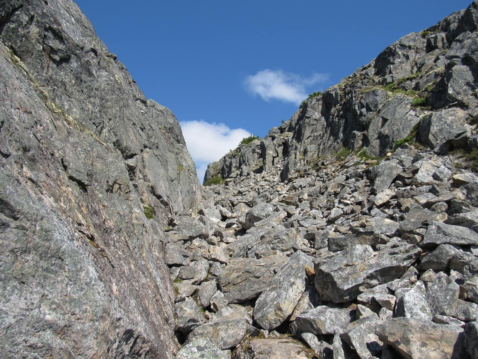
The trail had all but vanished. Lupe rarely even saw a cairn. Another problem now existed. The character of the long ridge was changing. Lupe came to a series of long gashes. Each gash extended all the way across from one side of the big ridge to the other, forcing Loop to find a way around or through each one.
These gashes were all oriented SW/NE. They seemed like they had been created by a giant wielding a dull knife to slice a series of cuts partway into the ridge, as if it were a loaf of bread. Each cut amounted to a gap, and at the edge of each gap Lupe found herself at the top of a wall of rock 10 to 30 feet high. Sometimes there were relatively easy routes down into the gashes and up the other side. Sometimes there weren’t.
The gashes made this part of the ridge an interesting trek, but really slowed SPHP’s progress down. Lupe sometimes had to go way around the end of a gash. Usually it was too steep to go around the W side, but it was always possible to get around the E side, provided Lupe and SPHP down climbed enough.
Instead of gaining elevation steadily, Loop sniffed and explored her way along a twisting up and down off-trail route wherever the terrain appeared most favorable. Some of the gaps she crossed were full of loose rock and boulders. Others contained snow banks.
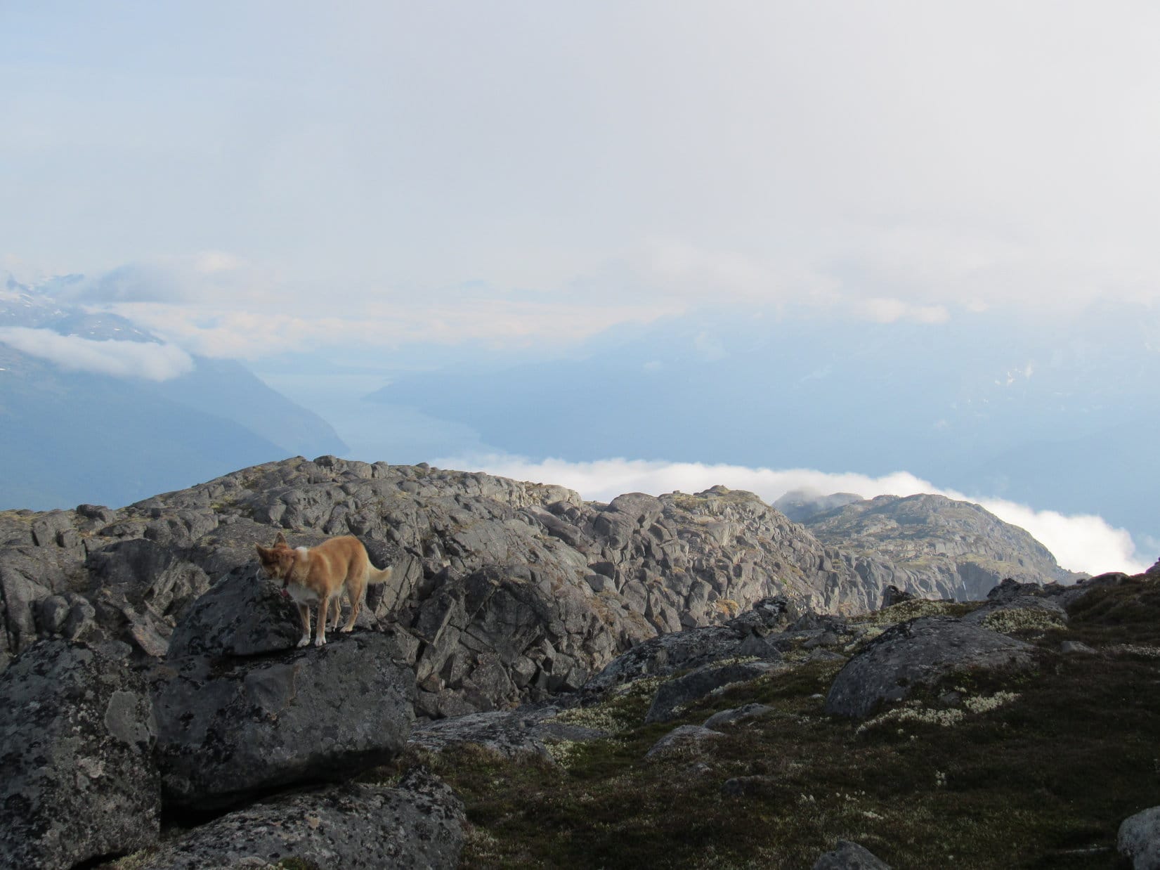
Lupe discovers a snow bank in one of the gashes.Lupe always likes finding snow banks.Having to find ways around rock walls like the one on the R that extended clear across the ridge, made for an interesting, but long, tiring route.Lupe down in another gash near the steep W end. The Irene Glacier is seen on the L. Photo looks NNW.Irene Glacier (L). Photo looks NNW with help from the telephoto lens.
At last, Lupe was nearing the Hump. However, the biggest, deepest gash yet appeared between her and the Hump. Looper had to lose 150 feet of elevation going around the far NE end of this gash. Then it was a long climb up a series of benches to reach the top of the Hump from the E.
The Hump is dead ahead. Unfortunately, there is an unseen deep gash between here and there. Lupe had to down climb at least 150 feet of elevation going around the NE (R) end. Part of Mount Clifford (5,696 ft.), is seen ahead on the R. Photo looks N.East Fork of the Skagway River valley. Photo looks SE.Loopster climbing the benches on the Hump. Photo looks NE.In yet another gash on the way up the Hump.Nearing the top of the Hump. Photo looks SSW.East Fork of the Skagway River (L) from the Hump. Photo looks SE.Part of Goat Lake is in view from the Hump. Photo looks NE.
When Lupe reached the top of the Hump, the weather was changing. All day long the sky had been slowly clouding up. Now clouds swept over the ridge to AB Mountain. Lupe and SPHP were periodically engulfed in fog, only to have sunshine reappear a few minutes later. The clouds sailing by came out of the W.
From the top of the Hump, Lupe could finally see the summit again. It wasn’t that far away! Loop had to lose some elevation to get there, but the terrain was now less rugged than it had been getting to the Hump. Lupe had an almost direct route to the summit!
From the the Hump, Lupe can see the summit of AB Mountain ahead! It isn’t that far away now, and the terrain is becoming easier again. Photo looks NNE.Lupe enjoys a brief moment of sunshine as she closes in on the summit of AB Mountain. Photo looks N.Looking back down the ridge as another cloud closes in. Dyea is nearly 5,000 feet below on the R. Photo looks SSW.Looper looks down on Dyea. Photo looks SSW.Almost there! It was exciting to think that Lupe was about to join the Arctic Sisterhood with a successful ascent of AB Mountain! Photo looks N.
Lupe and SPHP made it to the summit cairn on AB Mountain(5,036 ft.)! Another cloud was sweeping over the ridge. Nothing could be seen except the nearby terrain. The rest of the world was gray.
It was still a joyful moment! Lupe was at the top of AB Mountain. She had joined the Arctic Sisterhood! The long trek had been completely worth it. SPHP congratulated Lupe, shaking her paw and praising her persistent effort.
Lupe reaches the summit cairn on AB Mountain! Photo looks N.The newest member of the Arctic Sisterhood stands proudly next to the summit cairn on AB Mountain. Photo looks N.Lupe wondered if she was the first Carolina Dog to join the Arctic Sisterhood? SPHP said she might well be. This was a great honor for Looper and a notable achievement on behalf of all Carolina Dogs everywhere.Lupe gained more than 4,740 feet of elevation and had traveled more than 5 miles from the trailhead to get here.Lupe squints in bright light as the fog thins.
Lupe had been standing up at the summit cairn for 6 or 7 minutes when a hole in the clouds opened up a partial view to the N. SPHP was surprised to see another high point not even 0.2 mile away! It looked to be almost identical in elevation to where Lupe was at the cairn. Was it possible it was even higher? Probably not, since the cairn was here, but SPHP checked the topo map anyway.
Oh, good grief! That other high point to the N actually was the true summit of AB Mountain! The topo map showed the other high point as 1535 meters (5,036 feet) compared to 1532 meters (5,026 feet) where Loopster was standing at the cairn. No denying it. Assuming the topo map was correct, which one had to, that other high point was 10 feet higher. The map even showed the name AB Mountain right at that N high point.
After Lupe had been at the summit cairn 6 or 7 minutes, the clouds parted to reveal this other high point to the N. A check of the topo map revealed it was 10 feet higher than where the cairn was, and actually the true summit of AB Mountain. Photo looks N.
It was now 2 hours since the Englishman and New Zealander had told SPHP it was only 30 to 60 minutes to the summit of AB Mountain. Clearly they hadn’t bothered going over to the N high point. They’d only mentioned the cairn. It was getting rather late in the afternoon, and the weather was continuing to degrade with more clouds moving in.
No matter! Lupe was going to the true summit! It didn’t look hard to get there, and shouldn’t take long. No time to lose, though. SPHP explained to Looper that to make her ascent of AB Mountain and new membership in the Arctic Sisterhood official, she needed to tag that N high point.
SPHP didn’t have to tell her twice. Loop led the way to the true summit.
Lupe approaches a snow drift in a low spot on the way to AB Mountain’s true summit. Photo looks N.
Clouds obscured all views again as Lupe reached the true summit of AB Mountain. A small rock stuck in a crack atop a massive rock appeared to be the absolute highest point on AB Mountain(5,036 ft.). Lupe was happy to make her ascent and membership in the Arctic Sisterhood official by standing next to it. SPHP put one of her front paws on top of the little rock and it was done.
All official now! Lupe stands proudly next to the highest little rock on AB Mountain. Photo looks N.First Carolina Dog ever at the true summit of AB Mountain? SPHP thought there was a good chance Lupe had that honor.So did I do it? Can I relax now? ……. Yep, you’re official now Miss Arctic Sisterhood!
Lupe remained at the true summit of AB Mountain for more than 20 minutes. A 10 mph SW breeze blew a steady stream of fog across the mountaintop. Every now and then, a partial view to the NE was momentarily revealed. A few times Lupe saw blue sky and sunshine directly overhead, while surrounded by fog. Most of the time the summit was simply socked in. Loop never did see more than a faint outline of Mount Clifford, the next higher peak farther N along the ridge.
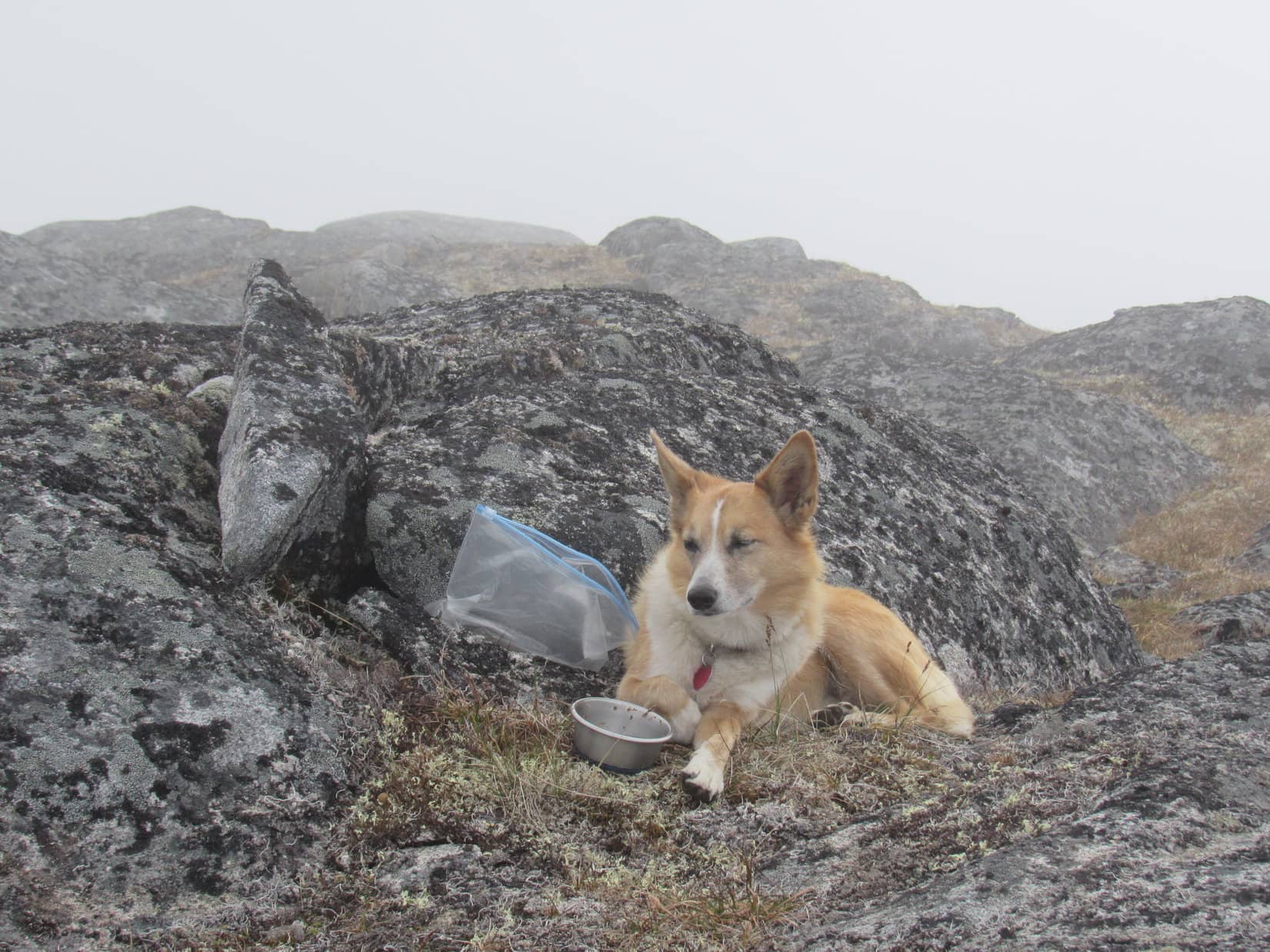
The American Dingo rested peacefully next to the little rock at the top of AB Mountain enjoying her status as the newest member of the Arctic Sisterhood. There were a couple of other rocks nearby competing closely for the title of true summit. After resting up and having some Taste of the Wild, Lupe tagged them, too. No cairn or registry was found.
The clouds parted enough to permit a few brief glimpses off to the NE while Lupe was at true summit of AB Mountain. Photo looks ENE.The newest official member of the Arctic Sisterhood relaxes at the true summit of AB Mountain.Tagging a competing high point.Looking SSW, the direction Lupe had come from and would have to return.Final moments in the fog near the true summit of AB Mountain.
It was already early evening when Lupe and SPHP finally left the true summit of AB Mountain in a dark fog. Lupe returned briefly to the cairn at the false summit, but could see nothing.
Looking toward the false summit shortly after starting back. The cairn is up there somewhere. Lupe returned to it briefly. Photo looks S.
Lupe and SPHP hurried on due to the lateness of the hour. The long trek back was a happy one and most enjoyable. The solitude was unbroken. Lupe seemed energized by the cool clouds and now mostly downhill route. She ran and sniffed and explored far more than she had on the way up.
Fog prevailed much of the way, continuing to stream by from out of the WSW. Once in a while there were holes in the clouds. Dramatic glacier-clad mountain views popped into sight. Lupe bathed in sunlight on the beautiful ridge for anywhere from a few seconds to a few minutes before it all disappeared again.
For a long time, Lupe and SPHP worked in dense fog back past all the gashes cutting across the ridge. The Carolina Dog still faced significant down climbs to the NE, especially getting beyond the Hump. Once past all the gashes, Lupe generally stayed right on top of the ridgeline and had more luck finding the best routes. A few well-positioned cairns proved much more helpful pointing out the faint trail now than on the way up.
Lupe was in fog most of the way back down, but every so often holes in the clouds permitted a better look at her surroundings.Coming to a large snowbank in another gash. Mountains and glaciers pop back into view. Photo looks SE.Snow break! Time for a bit of frolicking!Another look SE from this same gash.Lupe pauses for a look at the valley of the East Fork of the Skagway River. Photo looks SE.Zoomed in on some of the incredible peaks and glaciers. Photo looks SE.A good look down a long stretch of the AB Mountain ridge. Lupe had met Sean and Rebecca many hours ago way down at the last lowest bump of the ridge in view on the R. Taiya Inlet is seen faintly beyond Lupe. Photo looks S.
After a while, the clouds became so thick no more breaks appeared. Lupe and SPHP continued lower traveling through dense fog. It wasn’t until Lupe was working her way down the steep section that she lost enough elevation to emerge below the cloud cover.
Lupe could see Skagway now. The Explorer of the Seas and Radiance of the Seas remained in port. Sean and Rebecca were still in Skagway!
It wasn’t until Lupe was way back down to the steep section that she got below the clouds and could see Skagway again. The Explorer of the Seas and Radiance of the Seas were still in port. Sean and Rebecca were still in Skagway! Photo looks SSW.
Any hopes the Carolina Dog might have had of having pizza and drinks with the Riordans were soon dashed, however. The Explorer of the Seas was leaving! Lupe and SPHP stood watching Explorer of the Seas sail S away from Skagway down Taiya Inlet. Sean and Rebecca were probably enjoying their pizza and drinks right this very moment.
30 minutes later, Lupe saw the Radiance of the Seas follow the Explorer of the Seas away from Skagway.
Explorer of the Seas sails away from Skagway starting S down Taiya Inlet. No doubt Sean and Rebecca were aboard enjoying their pizza and drinks right this very minute.
So Lupe never did get to see Sean and Rebecca again. They sailed away on adventures of their own. Lupe’s fabulous expedition up AB Mountain had been successful. The Carolina Dog had made it all the long, long way to the true summit. Lupe had joined the Arctic Sisterhood! Tomorrow would bring another fantastic northern adventure worthy of any official new member.
Down in the dark forest, dusk faded to the unbroken blackness of a starless night. Lupe and SPHP traveled on through the gloom until at long last, the A.B. Mountain sign appeared in the flashlight’s beam at the start of the trail. Lupe crossed the road to the G6, ready for Alpo and dreams of days gone by striking it rich in the faraway Klondike gold fields. (11:16 PM)
New Arctic Sisterhood member, Lupe, reports in at the Arctic Brotherhood hall in Skagway the next morning.
AB Mountain trailhead directions: From the South Klondike Highway (No. 98) take the turn onto Dyea Road (0.5 mile from Skagway, or 4 miles from US Customs). Follow Dyea Road 2 miles. Shortly before reaching the trailhead on the L (S) side of Dyea Road, you will pass a paved parking lot at a pullout on the L with a view of Skagway. Dyea road turns to gravel a little past the pullout, and the trailhead appears soon after on the L (S) side of the road. The trail starts at the A.B. Mountain sign on the other (N) side of the road directly across from the trailhead. The trailhead has room for only 3 or 4 vehicles.