Day 32 & Part 1 of Day 33 of Lupe’s 2017 Dingo Vacation to the Yukon & Alaska!
8-31-17, 10:00 AM at Bottenintnin Lake on the Kenai Peninsula, Alaska – Of course, it had rained overnight. It rained every day here in Alaska, usually every few hours. It wasn’t raining at 6:00 AM, though, or when SPHP woke up again now, either, but the sky was completely overcast both times. The day really wasn’t looking too promising. Meanwhile, Lupe was off barking in the forest. She must have found a squirrel as soon as she’d escaped the G6. Better go check on her.
Loopster was close by. Yes, she had found a squirrel, almost instantly! If SPHP didn’t think the day was shaping up the way it ought to, she had a different opinion. She was having a good time at Bottenintnin Lake. A forest full of moss, ferns, squirrels and exotic aromas was a Dingo playground. The Most High Exalted Dingo of the Arctic Sisterhood was a busy girl, and in no hurry to leave.
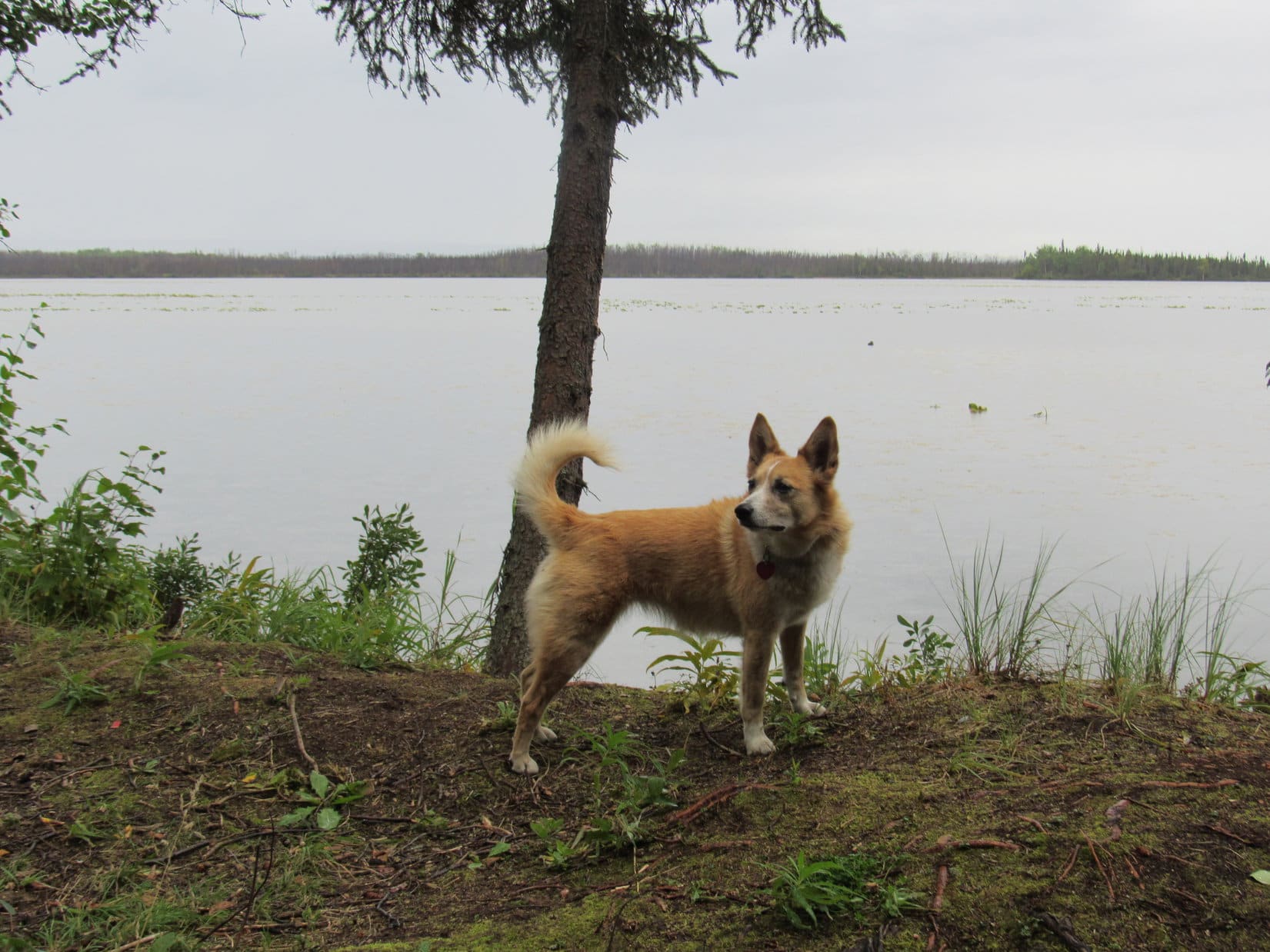
Lupe at Bottenintnin Lake where she had spent the night after visiting Skilak Lookout yesterday afternoon.Well, hello there sleepyhead! Up so soon? Not even noon yet. Don’t get any big ideas now. It’s a cloudy day, so we may as well stay here at Bottenintnin Lake where there is plenty of fun stuff for a Dingo to do!The squirrel watching is excellent!And there’s lots of important sniffing to do, too, if you will excuse me a moment.And of course, there’s this lovely lake. Bottenintnin Lake is shallow and full of water lilies. Seems like a great place for waterfowl, SPHP, but I haven’t seen any yet. Maybe if we hang around, though, we’ll see some?
Loopster was right. No need to rush off given the weather. If she wanted to bark at squirrels and play in the forest for a while, why not?
11:23 AM – The trip journal was caught up. Loop was back in the G6, her good times squirrel watching cut short by a steady rain. The day was looking gloomier and gloomier. What to do? Two choices. The first was to cut and run. The current weather on the Kenai Peninsula wasn’t conducive to outdoor adventures. No sign it was going to clear up, either. Maybe it was best to go back to Palmer, and then just keep going until Lupe found sunshine somewhere far from the rainy S Alaska coast?
The other option was to carry on as originally planned. Head W all the way to Homer, and hope that the weather would improve by tomorrow. If it did, Loopster could take a water taxi across Kachemak Bay like she did last year when she got to spend a fabulous day on Grace Ridge in Kachemak Bay State Park. This year, the Grewingk Glacier might be a fun adventure.
Yes, I kind of gathered that. Did you change your mind? Are we going to Homer after all?
Yeah, I can’t stand the thought that we’re leaving after getting so close. Might be a complete waste of time, but let’s give it one more day. You never know, the weather might clear up and be beautiful like it did last year. We have an awful lot of great stuff we can do on the Kenai Peninsula, if we can catch a break. If it doesn’t work out, at least we tried.
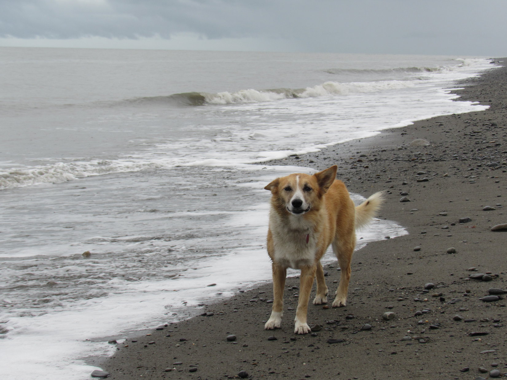
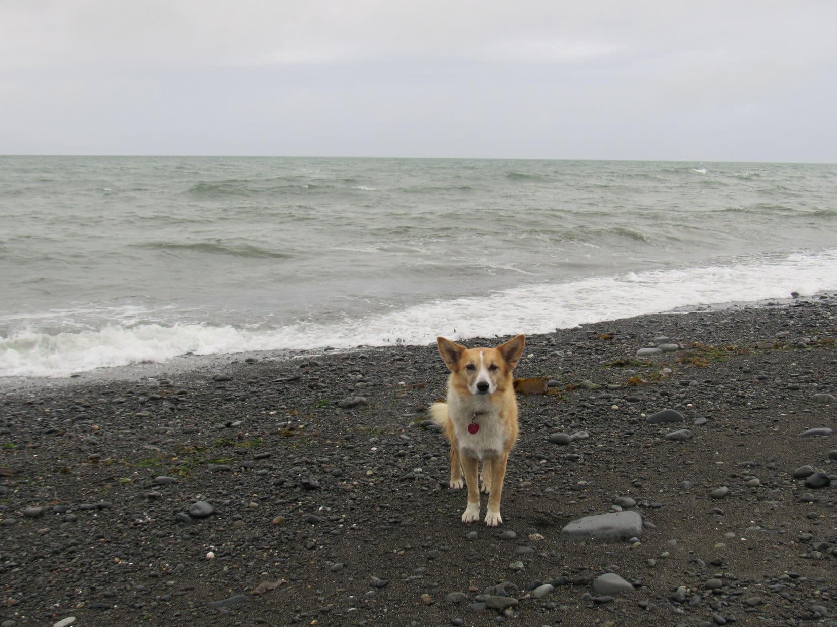
3:20 PM, 52°F at the Cook Inlet beach at Ninilchik – So far, still not too promising. Lupe had just had a bit of luck, though. When she arrived at Ninilchik, the rain had quit for a little while. She’d just had a good romp along Cook Inlet before the rain started in again.
A year ago, Lupe had spent a wonderful evening here in Ninilchik. She’d had gorgeous views of both Iliamna Volcano(10,016 ft.) and Redoubt Volcano(10,197 ft.) far across Cook Inlet as the sun went down behind the mountains. Nothing like that today. Dull, gray clouds hid everything except the ocean and the nearby beach, but watching seagulls and listening to the roar of the waves as they collapsed exhausting their energy on the beach had been fun.
When Lupe arrived at Ninilchik, the rain had abated for a little while. As a result, she got to enjoy a romp along Cook Inlet.Not standing here long, SPHP. The tide is coming in. Let me know if you see one of those sneaker waves coming up behind me!Even though we can’t see the volcanoes across Cook Inlet today, it’s always fun to take a stroll along the beach, isn’t it, SPHP?Looper along Cook Inlet near Ninilchik on the Kenai Peninsula.
By 5:00 PM, Lupe was in Homer near the end of Sterling Highway No. 1. Sadly, the weather showed no signs of improving. Only the base of the mountains across Kachemak Bay could be seen beneath low clouds. A heavy mist was falling as SPHP drove out to the Homer Spit.
Despite the gloomy atmosphere, Homer Spit was alive with activity. Vehicles and people in rain gear were everywhere. SPHP dropped by a restaurant, and got an order of fish and chips to go. Lupe didn’t care for them, preferring salami and English muffins. Oatmeal cookies for dessert. Together Loop and SPHP sat in the G6 having dinner, while watching rain and fog over Kachemak Bay.
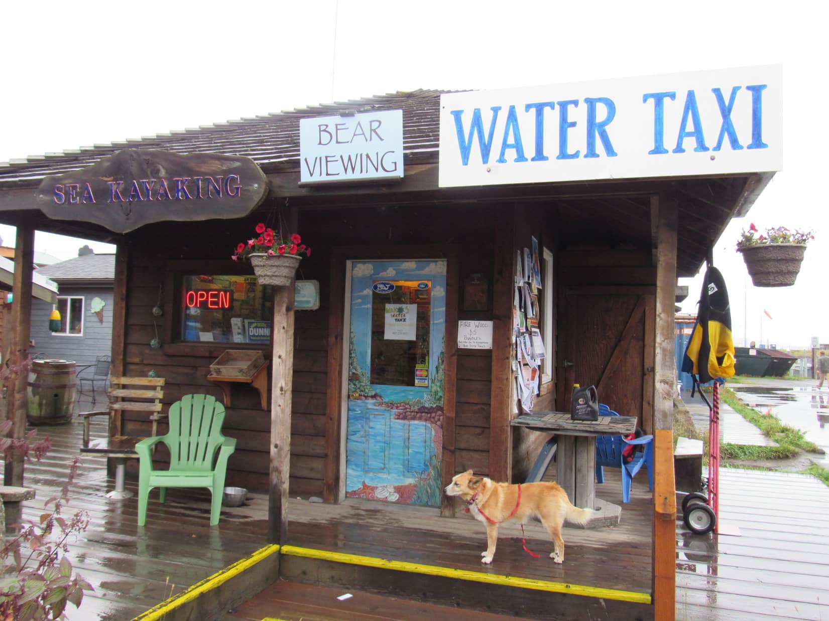
6:32 PM, 52°F, rain and fog at the Homer Spit – After dinner, Lupe went with SPHP to Mako’s Water Taxi to inquire about prospects for a trip across Kachemak Bay to see the Grewingk Glacier tomorrow. Unfortunately, it didn’t take a rocket scientist to realize what a long shot this was likely to be.
Despite long odds, Lupe went with SPHP to inquire at Mako’s Water Taxi about the prospects for a trip across Kachemak Bay to see the Grewingk Glacier tomorrow.In 2016, Lupe had sailed across Kachemak Bay aboard Mako’s water taxi “Xtra Tuff” to enjoy a fabulous day on Grace Ridge.As a former customer, Loop hoped the good people at Mako’s could do something about this weather for her, but they weren’t making any promises.
Lupe could go to see the Grewingk Glacier tomorrow, if she wanted to. The price of the round trip water taxi ride across Kachemak Bay was $80.33 including all taxes and fees. That was the good news. No problem, if that was the only consideration. However, there was the all important weather issue, too. The people at Mako’s weren’t expecting much change in the weather anytime soon.
Well, if that turned out to be true, no Grewingk Glacier trip for Loopster. No sense in spending $80.33 to spend a whole day soaking wet, cold and miserable. Disappointing, but not unexpected. Nothing to be done about it, except wait to see what things looked like in the morning.
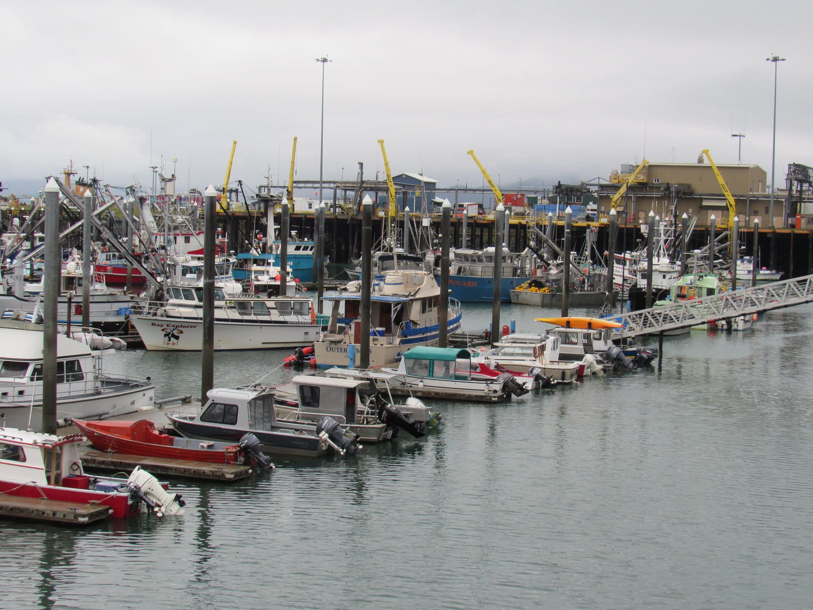
Despite fog and light rain, after leaving Mako’s, Loop and SPHP took a walking tour of the Homer Spit. Lupe saw many boats on the protected NE side of the spit.
Lupe saw many boats moored on the protected NE side of Homer Spit.
Loop also visited Kachemak Bay on the unprotected SW side of the spit. The ocean was still beautiful despite the dismal sky.
On the unprotected SW side of Homer Spit next to Kachemak Bay. Photo looks SSE.Looking NNW along Homer Spit.Not looking too good for another boat ride tomorrow, is it, SPHP? …. No, afraid not, Looper.
After a damp stroll along Kachemak Bay, Loopster went to take a look at some of the shops along Homer Spit’s main drag. All sorts of adventures were being advertised! It all sounded like fun, but Lupe and SPHP were set on going to see the Grewingk Glacier tomorrow.
Bears were a top draw at places advertising wildlife adventures.Fishing adventures, especially for halibut, were apparently the most popular here.Sea kayaking was popular, too.
As the evening wore on, already faint hopes for the Grewingk Glacier dream were fading fast. Sometimes it rained, sometimes it didn’t, but the sky looked like it could rain forever.
9-1-17, 7:29 AM, 45°F – Seemed like a long night. Rained off and on for hours. But what was this?
Loopster, look, blue sky!
Oh, maybe we’re in luck!
Can you believe it? Maybe not, though. Still some clouds around.
Well, let’s go see what we can find out! Drive us back to Mako’s, SPHP!
When Lupe and SPHP returned to Homer Spit, there was a lot of blue sky around. So encouraging, but would it last? Before going to Mako’s, Lupe ran down to Kachemak Bay. There was a rainbow over the ocean!
Upon returning to Homer Spit in the morning, Lupe saw a rainbow over Kachemak Bay. Photo looks SW.
The rainbow wasn’t all the American Dingo could see. High snow and ice clad peaks of Kachemak Bay State Park were in sight across the bay! Looper could even see Grace Ridge, where she had such a good time last year. Suddenly, prospects for a Grewingk Glacier adventure were looking bright!
Most of the sky was clear! Lupe could see high snow and ice clad peaks of Kachemak Bay State Park across the bay. Photo looks SSE.Oh, this looks promising, SPHP! Maybe we can go see the Grewingk Glacier today, after all!Grace Ridge(3,136 ft.) (Center) where Lupe had such a great adventure in 2016 was in view, too. It was all so encouraging! Photo looks S.
Lupe and SPHP inquired again at Mako’s. Lupe could sail at 9:00 AM, with a 9:30 AM arrival at Glacier Spit. 4:00 PM pickup at Saddle Point. Total price was still $80.33. Yes, yes, yes! Want to book it?
Hold on. And the weather forecast?
Supposed to close in again, and get nasty around noon.
Oh.
Loop and SPHP went back to the G6 to think about it. Not much time to decide. 15 minutes. The sun was still shining on Kachemak Bay. The rainbow was bigger and brighter than before.
Sadly, there really wasn’t much to think over.
Sorry, Looper.
I’m not going to get to see the Grewingk Glacier, am I, SPHP?
Nope. ‘Fraid not.
The rainbow and all the blue sky had my hopes up.
Mine too. That’s the way the cookie crumbles, though.
So, now what?
Well, I don’t suppose there’s any sense hanging around here now. Weather is supposed to be OK for a little while yet. Maybe we can go to Anchor Point, and you can visit the Rock of the West again? Anchor Point isn’t far from here.
Oh, wasn’t that where all the seagulls were last year? That was fun!
OK then, let’s do it!
SPHP had bought a postcard of the Homer Spit yesterday evening for Lupe to send to her Grandma. Looper told SPHP what to write on it, making sure to send lots of love. The rainbow was still shining brightly over the ocean as Lupe and SPHP drove away from Homer Spit. SPHP stopped to mail the postcard before leaving Homer. When SPHP came out of the post office, it was raining hard. (9:03 AM, 47°F)
Sheesh, Loopster, glad we didn’t spend $80.33! We would have enjoyed blue skies only until the moment of departure.
Sigh. Don’t suppose we will even get to go to the Rock of the West now.
Not true! Astonishingly, when Lupe arrived at Anchor Point (9:59 AM, 52°F), skies were sunny here. Distant mountains N of Cook Inlet were cloaked in clouds, but the sky over the ocean was clear and bright.
Lupe returns to Anchor Point for a repeat of her 2016 Last Mile West journey along Cook Inlet.
After leaving the G6, Lupe and SPHP traveled S along the beach. SPHP ambled along watching the sky, listening to the restless sea, and enjoying the breeze. Lupe barked at seagulls flying by, and sniffed seaweed and odd bits and pieces of things from the ocean, all while dodging incoming waves.
Lupe by Cook Inlet, an arm of the North Pacific Ocean at Anchor Point. Photo looks W.
Loopster had been to Anchor Point in 2016, too. She had explored this same stretch of beach. Since no road connected to the North American highway system goes any farther W than Anchor Point, Lupe was as far W here on this beach as she was ever likely to be in her entire life.
Lupe had taken this same stroll along the beach S from Anchor Point in 2016. At the time, SPHP believed the Carolina Dog was as far W as she would ever be in her life. Yet only a little more than a year later, here she was again. Photo looks SW.
Earlier on this Dingo Vacation, Lupe had returned to the Brooks Range and broken her 2016 Last Mile North record for how far N she had ever been by continuing N on the Dalton Highway all the way to Deadhorse near the Arctic Ocean.
Lupe couldn’t break her 2016 Last Mile West record today. All she could do was tie it. The ocean prevented her from going any farther W than this beach. Even so, it was remarkable to think the American Dingo had actually returned to this remote place.
Lupe stands among strands of seaweed on her 2017 Last Mile West trek along the beach at Anchor Point. Photo looks W.
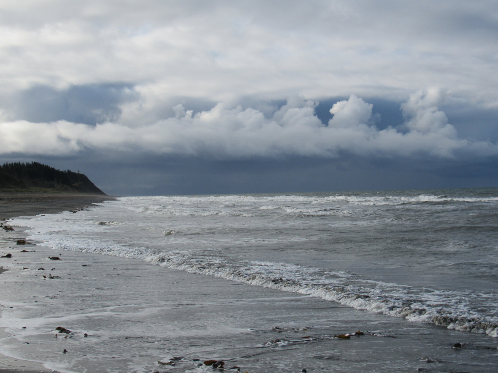
As Lupe continued S along the beach, it was evident that not taking the water taxi to the Grewingk Glacier across Kachemak Bay from Homer Spit had been a good decision. The sky to the S toward Kachemak Bay looked dark and stormy. Heavy rain was falling over that way.
The sky to the S was dark and stormy. Not taking the water taxi to see the Grewingk Glacier had been a good decision. Photo looks S.
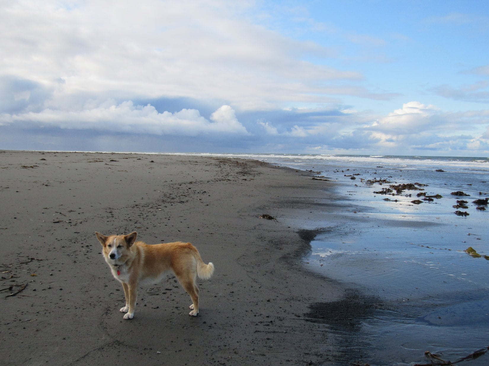
Lupe was having a good time on the beach here, so things were working out about as well as they could have today.
Lupe was staying busy and having fun on the beach S of Anchor Point. Photo looks SSW.Loopster races by a big patch of seaweed. Fun times! Way better than getting drenched would have been.
For about an hour, Loop and SPHP continued S along the beach. SPHP thought Lupe made it at least as far S as she had gone in 2016. Back then, Lupe had stood on a dark rock next to the ocean before turning around to return to Anchor Point. That dark rock had been officially dubbed the Rock of the West, representing the farthest point W Lupe had ever been.
SPHP had expected to be able to recognize the Rock of the West again, but hadn’t seen it. Maybe the tide was higher or lower now than a year ago? Entirely possible. If the Rock of the West was underwater, SPHP wouldn’t have seen it for sure. Since 2016’s Rock of the West couldn’t be found, Lupe climbed up on a different boulder. This greenish boulder could serve as 2017’s official Rock of the West.
Lupe astride the all new, 2017 official Rock of the West. Photo looks W.Lupe never seemed very comfortable up on the 2017 Rock of the West. Photo looks S.Is that rock slippery or what, Loop? You are perched so strangely on it! Photo looks SW.I did come back to my westernmost point ever, didn’t I, SPHP? …. You certainly did, Looper! Congratulations! Photo looks NW.
The stroll back to Anchor Point was beautiful and relaxing. Loop and SPHP were in no rush. Lupe’s home in the Black Hills of South Dakota is a long way from any ocean. Being next to the ocean all the way up here in Alaska was such a treat! Lupe and SPHP savored every moment.
Looking N across Cook Inlet.White sub-peaks of Iliamna Volcano (10,016 ft.) stick up out of the clouds on the L. The true summit is hidden from view. In 2016, Lupe had seen it. Photo looks NW.Seagulls afloat on Cook Inlet.Looking S one more time. The weather didn’t seem to have improved much. At least the rain stayed down there while Lupe enjoyed her 2017 Last Mile West.
Lupe caught glimpses of the Iliamna Volcano(10,016 ft.), but she never did see Iliamna’s true summit or any of Redoubt Volcano(10,197 ft.) like she had in 2016. Both volcanoes remained hidden by the clouds on the far side of Cook Inlet. However, Loopster could clearly make out the Augustine Volcano(4,025 ft.), which is on an island of its own making, even though it was far across the water on the SW horizon.
This is a far more comfortable rock than that slick green one you chose to be the 2017 Rock of the West, SPHP. You should have picked this one instead!Nearing Anchor Point again at the end of Lupe’s 2017 Last Mile West trek. She’d had a great time! Living as far from the sea as she does, even short adventures along the ocean are a rare treat for Loop. Photo looks NE.
Seagulls flew by, then either landed to rest on Cook Inlet, or joined flocks strutting about farther along the beach. A fresh breeze blew out of the SW. Waves rolled into shore, retreated, reformed, and resumed their ceaseless attacks on the coast. Puffy white clouds plied a blue, blue sky above the sea.
It was all wonderful! When Lupe reached Anchor Point again, she stood with SPHP near the shore, watching and listening to the waves roll in a while longer.
Lupe’s last moments near the North Pacific Ocean in 2017. Photo looks NW.By the sea, by the sea, by the beautiful sea.
After returning to the G6 (12:22 PM), Loop and SPHP still sat watching the ocean while sharing English muffins and salami again for lunch. A peaceful, leisurely hour went by. When lunch was over, it was time to move on. (1:40 PM, 54°F)
Sadly, after only a single brief day, Lupe was leaving the Kenai Peninsula. If the weather had been better and more reliable, she had a week’s worth of adventures planned here. As SPHP drove toward Soldotna, there were signs that maybe the weather was going to improve. Sunny skies prevailed over Cook Inlet. Even to the S, where rain showers were in progress, patches of blue sky could now be seen over the mountains.
But SPHP had no faith that the weather was really going to clear up and stay that way. It was September now. Maybe it was time to leave rainy Alaska? Lupe did have an alternate backup plan in case the Kenai Peninsula didn’t work out. Perhaps it was time to put it into action?
Months ago, Lupe’s friend, Australian adventurer Luke Hall, whom she had met at the top of Gunsight Mountain in 2016, had recommended that the Carolina Dog visit Tombstone Territorial Park in the Yukon. SPHP had been thinking Lupe wouldn’t have time to get over there on this Dingo Vacation, but she still could, if she started that way now.
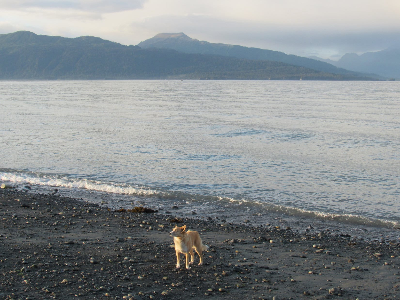
Several hours after leaving Anchor Point, Lupe was restless. She was ready to get out of the G6 and do something. Since Bottenintnin Lake wasn’t that far away now, SPHP asked if she like to make the short side trip off Sterling Highway No. 1 to visit the lake again for a little while?
Bottenintnin Lake where there were lots of squirrels in the forest? The American Dingo’s response was most enthusiastic!
Oh, yes, all you Dingoes out there. I highly recommend the blue ribbon squirrel watching here at Bottenintnin Lake next time you’re in the area! Photo looks S.Oh, I won’t go far, SPHP! There’s plenty of squirrels in this forest close by. Call if you need me! I’ll be back in a bit.
Day 28 of Lupe’s Summer of 2016 Dingo Vacation to the Canadian Rockies, Yukon & Alaska
Ugh, what is it Loop? What now? Lupe kept pawing at SPHP. Oh, Loopster, what do you want? Do you need out? … 7:00 AM! … Oh, my gosh, Loop! Thanks for waking me up! We’ve got to get going!
Lupe may have just saved the day. SPHP meant to be up an hour ago. The sun was already above the horizon. Was there still time? The day was perfect – clear and bright, as SPHP drove out to the Homer Spit.
Narrow Homer Spit protruding 6 miles into Kachemak Bay was awesome! Hundreds of boats of all descriptions were moored in a gigantic pack on the protected NE side. Sea gulls whirled overhead. The one road along the spit was lined with restaurants, colorful tourist shops, and fishing and sight-seeing charter businesses. People were up and about. The whole place hummed with activity.
SPHP drove slowly, looking for Homer Ocean Charters. There it was, on the SW side of the street! SPHP parked and went in, while Lupe waited in the G6. SPHP asked the lady at the counter about getting a water taxi ride over to Grace Ridge in Kachemak Bay State Park.
The good news was that dogs were welcome, and Lupe could come along for free! The bad news was they had a 2 person minimum requirement. Grace Ridge wasn’t that popular. They had no one else scheduled to go to Grace Ridge today. The lady suggested either a different destination, or trying Mako’s Water Taxi across the street.
Mako’s wasn’t right across the street, although it wasn’t far away. It took SPHP a few minutes to spot it. Once again, Lupe waited in the G6 while SPHP went in, a little fearful of another negative response. Mako’s was busy. It took a few minutes for SPHP’s turn to come. Another woman behind a counter asked what SPHP wanted.
Water taxi service to Grace Ridge? They had only one group scheduled for Grace Ridge today. Three people were leaving right now. Round trip price was $81 plus tax (total a bit over $91). Pickup at 6 PM. Lupe could come along, no extra charge. Was now OK?
Perfect! Now was absolutely perfect! SPHP paid up, then ran out to move the G6 to free parking a couple blocks away next to the Homer Grill. As SPHP and a somewhat alarmed Lupe started running back to the dock, Mako’s captain of the water taxi XtraTuff was already yelling at SPHP to hurry up. When Mako says now, they mean NOW! They were leaving!
Lupe on Homer Spit, moments before dashing off to catch a ride to Grace Ridge on Mako’s water taxi XtraTuff. Photo looks NE.
Lupe was afraid of the open metal grate dock. She could see the water below her. SPHP picked the surprised Carolina Dog up, and ran carrying her to the XtraTuff. Moments later, she was aboard. Immediately, the captain put the engine into reverse, and started easing the XtraTuff away from the dock. Lupe and SPHP sat out in the open air on a bench in the front of the boat.
Sea dog, Loopster, aboard Mako’s water taxi XtraTuff, embarks from Homer Spit to sail across Kachemak Bay of the North Pacific Ocean on her way to Grace Ridge! Photo looks NW.
The XtraTuff cruised slowly, leaving little wake, while maneuvering around all the other boats on the way out of port. The XtraTuff picked up a little speed once it was clear of the moored boats. The captain steered SE toward the end of Homer Spit.
Lupe aboard the XtraTuff nearing the SE end of Homer Spit. Grace Ridge is in view above the 2nd support from the L. Photo looks S.Rounding Homer Spit. Grace Ridge on the L. Photo looks S.
As the XtraTuff rounded Homer Spit and headed out across Kachemak Bay, the captain put her in high gear. XtraTuff was fast! The water taxi bounded across the waves.
Even though the sea wasn’t that rough, it was a bumpy ride. Every now and then XtraTuff hit a wave with a jarring jolt. The morning’s cool breeze became rather chilly, as the XtraTuff raced toward Eldred Passage. SPHP hung onto Lupe, so there wouldn’t be an American Dingo overboard.
On Kachemak Bay heading for Eldred Passage. Photo looks SSW.
The captain asked if Lupe and SPHP would like to come in the enclosed cabin to get out of the cold wind. Thanks, but hell no! This was what Lupe had come for! Here she was, bounding across Kachemak Bay of the North Pacific Ocean on her way to Grace Ridge(3,136 ft.) in Alaska with fabulous views everywhere. This was exciting! This was glorious!
Mountains along Kachemak Bay. Photo looks SE.Approaching Yukon Island (Center) aboard the XtraTuff. Photo looks SSW.OK, SPHP, we’re way out here now. So level with me, what the heck are you getting us into?Grace Ridge from Kachemak Bay aboard the XtraTuff. Photo looks S.In Eldred Passage on the way to Tutka Bay. Billy, one of the other passengers, later told SPHP that the sharp peak on the L is called Broken Knife, although SPHP doesn’t find that name on any map. Photo looks SSW.
The Grace Ridge Trail is 9 miles long. Lupe was going to take the entire trail from one end to the other, making only a single traverse. A water taxi would pick her up at the other end. SPHP had a choice of where to get dropped off. At the N end, closest to Kachemak Bay, is Kayak Beach. The more remote S trailhead is along the NE shore of Tutka Bay. The other 3 passengers were going to the S trailhead. SPHP told the captain that was where Lupe wanted to be dropped off, too.
The XtraTuff raced over smoother waters through Eldred Passage. Lupe passed by the entrance to Sadie Cove to the E. XtraTuff sailed S around the NW end of Grace Ridge. Entering Tutka Bay, XtraTuff was still making great time. After a few miles, though, a dense fog bank was dead ahead right on the water.
The captain slowed XtraTuff to a crawl as Lupe entered the fog. Everything disappeared from view. The drop-off point wasn’t much farther. XtraTuff crept cautiously forward, the captain straining to see something, anything. After 5 minutes, a tiny beach appeared close by and directly ahead. The captain had found it! This tiny beach was the Grace Ridge S trailhead.
XtraTuff glided into shore. Lupe, SPHP, and the other 3 passengers disembarked. It only took a minute. As the XtraTuff backed slowly away, everyone waved and thanked the captain, who waved back. XtraTuff disappeared like a ghost.
XtraTuff about to disappear into the fog on Tutka Bay. Photo looks, uh, well, let’s see, NW maybe?
Wow! Incredible! If the 3 other passengers hadn’t been here, this place would have been just plain spooky. A dark, dense, primeval forest extended right down to the tiny beach at water’s edge. Leafy ferns, thick clumps of moss, ancient trees. In the fog, it all looked unnervingly prehistoric. It could have been 10,000 years ago, maybe 10,000,000 years ago. What was out there? Bears? Dinosaurs!? Lupe was lost in time.
Lupe lost in time, and looking a tad concerned about it, at the South Grace Ridge trailhead.
The other 3 passengers seemed to know where they were. They set right off, following a good single track trail through the jungle. The trail gained elevation slowly at first, but soon started switchbacking up a steep slope. Lupe and SPHP followed the rest of the group, trailing a little behind.
So far, so good. No bears or dinosaurs yet.
The fog bank was dense, but wasn’t all that thick. Soon Lupe was getting up high enough to where sunshine could be seen filtering through the trees. The other 3 XtraTuff passengers set a fairly brisk pace. Lupe and SPHP continued following along behind.
As Lupe climbed above the fog, sunlight began filtering through the trees.
The trail was good. The switchbacks made the pace of elevation gain moderate. Lupe was making great time and gaining elevation steadily. The rest of the group was traveling almost too fast for SPHP’s taste. What was the hurry? Lupe had been dropped off at the S trailhead around 9 AM. She didn’t need to be at the N trailhead until 6 PM, 9 hours later. Since the trail was only 9 miles long, she only had to travel one mile per hour.
Soon everyone, except Lupe, was sweating. The group stopped for a break. SPHP stripped down to a T-shirt. The woman of the group introduced herself as Sandy. With her were Kevin and Billy. They were all friendly, but spent much of their time deeply engaged in their own conversations. They were friends who all live in Homer, as near as SPHP could gather.
Everyone set off again. The rapid pace continued. Lupe and SPHP lagged behind when Lupe found, not a bear or a dinosaur, but a squirrel in the forest. A brief, enthusiastic barkfest ensued. A bit later, Lupe and SPHP caught up with the group again. As Lupe gained elevation, the primeval forest gave way to a more normal looking forest minus all the moss and ferns. The normal forest then began to thin out, with some of the tall bushes common in Alaska starting to take over.
There were other people on the trail! The XtraTuff group overtook and passed a family of four. Soon after that, Lupe got her first look at a barren high point ahead.
As the Grace Ridge Trail neared the ridgeline, Lupe got her first look at a barren high point ahead. Photo looks NNW.
The trail reached the ridgeline. The switchbacks were done. From now on, the trail would stay up on the ridgeline following it all the way NNW to the summit. Tall bushes and scattered trees dominated at first, but that didn’t last long. The moderate pace of elevation gain enjoyed while on the switchbacks was over. The trail climbed steeply, quickly bringing Lupe up above all the tall vegetation.
The American Dingo wasn’t anywhere near the summit of Grace Ridge yet, but truly awesome views were opening up all around.
Tutka Bay, which Lupe had come sailing over on the water taxi XtraTuff on her way to the Grace Ridge S trailhead. The broader expanse of Kachemak Bay is seen in the distance. Photo looks WNW.Looking down at the S end of Sadie Cove, which borders Grace Ridge to the N and E. Photo looks SE.Lupe on the Grace Ridge trail having reached the first high point along the ridgeline above all the trees and tall bushes. Photo looks SSE back down along Grace Ridge. Part of Tutka Bay is seen on the R.
Ahead, Grace Ridge was covered only with alpine tundra. A marvelous ridgeline trek of sweeping unobstructed panoramas was in store for Lupe. The Carolina Dog still had a long way to go to reach the summit. It wasn’t even in view yet.
Ahead, a marvelous ridge hike over alpine tundra was in store for Lupe. The summit was still far off. It wasn’t even in view yet. Photo looks NNW.
From her vantage point high on Grace Ridge, Lupe was now able to see great distances over the tundra. She saw something move far below. Suddenly, Lupe took off straight down the steep W slope toward Tutka Bay. SPHP called her, but she disappeared over the edge of an embankment. She had lost hundreds of feet of elevation in hardly any time at all! SPHP kept calling her.
After a few minutes, here came the American Dingo, charging straight back up almost as fast as she had gone down. Lupe arrived with a long pink tongue dangling from her mouth, panting as though she might burst. Did she ever look happy, though! Wow, what would SPHP give to be in that kind of shape? Simply amazing! However, Lupe was now under orders not to go running off like that again. SPHP never did see whatever it was she chased after.
Lupe and SPHP had fallen a little behind the XtraTuff group, but caught up with them again between two small rocky hills where they had stopped for a snack. Up on the exposed ridgeline, an E breeze was blowing, but between these small hills the trail was protected from the wind.
While everyone was still eating, Lupe climbed up the small hill on the E side of the trail for a look around. The views were getting better! Lupe could even see Iliamna Volcano(10,016 ft.) faint and far away across Kachemak Bay and Cook Inlet to the NW.
Lupe up on the small rocky hill E of where the XtraTuff gang stopped for a rest break. A small part of Sadie Cove is seen on the lower L. The highest peak on the L may be Sadie Peak(4,320 ft.). Photo looks SE.The views kept getting better as Lupe gained elevation. This photo looks S farther into Kachemak Bay State Park.Lupe back down in the sheltered area near the trail. The rest of the XtraTuff gang has already finished their break and moved on. Iliamna Volcano is seen very faintly far across Cook Inlet to the L of Lupe. Photo looks NW.
When the rest of the XtraTuff group moved on, Lupe and SPHP stayed at the sheltered spot between the two hills. Everyone else seemed to be in a hurry to get to the summit. No reason for it that SPHP could see. Lupe had plenty of time.
SPHP had asked how much more elevation was left to be gained. Sandy, Keven and Billy had all insisted Lupe was only halfway up, but that seemed to be a gross underestimate of the progress already made. Lupe must have gained at least 67% of the 3,136 feet required to reach the summit. Probably more like 75% or even 80%.
After a nice break, Lupe and SPHP continued on. The trail remained good. The route was obvious, in any case. The exposed ridge hike was a ton of fun. Fantastic views everywhere, all the time. After passing through a dip into a big saddle, there was one more fairly long steep climb.
Lupe near the top of the next big climb. Tutka Bay is seen below. The mountain Billy called Broken Knife is on the R. SPHP wonders if it isn’t really Red Mountain(3,524 ft.), though the name would make more sense for the more distant tan colored peak seen straight up from Lupe. Photo looks SW.
Grace Ridge’s easily recognizable big summit ridge came into view ahead. There was no mistaking it. The trail headed straight for it, passing over several prominent high points. This part of the ridge was often narrow and steep.
Grace Ridge’s easily recognizable big summit ridge(R) came into view. To get there, Lupe followed the trail up and down over several high points. Along the way, the trail was often steep and the ridge quite narrow.How’s this for a view, SPHP? I’m not even at the summit yet! Kachemak Bay from Grace Ridge. Photo looks WNW.
Beyond the last of the prominences, Lupe had an unobstructed view of the big summit ridge running SE/NW ahead. Getting there was going to be a piece of cake. The ridgeline became much wider here. The trail would take Lupe up to the SE end of the summit ridge. The true summit of Grace Ridge was a knob of rock relatively close to that end. Lupe was almost there!
From the last prominence, Lupe had an unobstructed view of Grace Ridge’s big summit ridge ahead. The trail would take Lupe to the SE (R) end. From there it wasn’t far to the true summit, the small knob of rock seen a little to the L.Lupe at the last of the prominences prior to going on to the summit ridge. Sadie Cove is seen below on the L. Photo looks SSE.Looking SSE using the telephoto lens.
Fifteen minutes later, Lupe was up at the SE end of the summit ridge. While it had been breezy down along the lower ridge, it was just plain windy up here. The E wind was strong! Lupe didn’t like the wind one bit, but tried to wait patiently for SPHP to finish loitering around.
Lupe found a survey benchmark(R) at the end of a long pipe at the SE end of Grace Ridge’s big summit ridge. The near ridge in view is on the other side of Sadie Cove. Part of Kachemak Bay is in the distance on the L. Photo looks NE.Peaks of Kachemak Bay State Park. Photo looks NE using the telephoto lens.Lupe enduring the wind at the SE end of the Grace Ridge summit ridge. Photo looks SW.The survey benchmark at the SE end of the Grace Ridge summit ridge.Looking SSE back the way Lupe came up. Sadie Cove is on the L. The survey benchmark is at the lower L corner. A windswept Carolina Dog is on the R.
The true summit of Grace Ridge was only 200 yards away. Sandy, Kevin and Billy were all over there, sitting below the SW side of the summit sheltered from the wind. Lupe was going to get a lot more fresh air on her way over there.
The true summit of Grace Ridge is seen only 200 yards away to the NW. Sandy, Kevin and Billy were already over there taking shelter from the wind. Photo looks NW.
Of course, before rejoining the rest of the XtraTuff gang, Lupe had to climb up on top of the true summit to claim her windy Grace Ridge peakbagging success!
Lupe reaches the true summit of Grace Ridge in Alaska’s remote Kachemak Bay State Park! Photo looks NW.Skinny Homer Spit is seen extending 6 miles into Kachemak Bay. Photo looks NNW from the true summit of Grace Ridge.Mighty Loopster astride the true summit of Grace Ridge. Photo looks NW.
Kachemak Bay from the summit of Grace Ridge. Photo looks NNE.Homer Spit again, this time using the telephoto lens. Photo looks N.Looking SSE. Lupe’s route up was along the barren hilly ridgeline seen on the R.
Lupe was glad to get down off the true summit to take refuge from the wind on the SW side of the big rock outcropping. Sandy, Kevin and Billy were still relaxing and finishing up lunch there for a little while longer. They said it was noon, which meant it had taken Lupe only 3 hours to get here from the S Grace Ridge trailhead. Lupe had 6 whole hours until she needed to be down at the N trailhead for the scheduled water taxi pickup at Kayak Beach.
Before long, the rest of the XtraTuff gang moved on. Lupe and SPHP stayed alone, enjoying the solitude and the magnificent scenery. The family of 4 that had been passed on the way up came by, continuing farther NW along the summit ridge. For more than half an hour, Lupe and SPHP did not stir from the sheltered spot below the summit. What a magnificent place! Eventually, though, the time came to start exploring the big summit ridge.
The view to the SW from the sheltered spot where Lupe relaxed out of the wind just below the summit. Tutka Bay is down below.
First, Lupe returned to the SE end of the summit ridge near the survey benchmark. The views of the mountains to the S were best from this end of the ridge. Lupe and SPHP wanted to see them from this vantage point one more time before leaving.
Looking SE using the telephoto lens.Worth a second look, aye?Looking SSE.Sadie Cove and Sadie Peak(L). Photo looks SE.Lupe rests on the tundra near the SE end of Grace Ridge’s big summit ridge. The true summit is on the R. Tutka Bay is on the L. Photo looks WNW.
Bidding farewell to the S mountain views, Lupe headed NW, passing by the true summit for the final time.
Grace Ridge’s big summit ridge is about 0.25 mile long. Unlike the lower SSE ridge Lupe followed to get here, which was narrow and steep in some places, the big summit ridge is broad and flat to gently rolling. No clear trail exists most of the way, but the general route is totally obvious. If you still don’t get it, NW of the true summit the route is marked by a series of big cairns.
Tutka Bay. A fog bank hangs over adjoining Kachemak Bay. Photo looks WNW.Lupe NW of the true summit, seen on the L. Of course, American Dingoes can find their way across this broad, gentle ridge with their eyes closed. Huge cairns showed SPHP the way. Photo looks SSE.
Going NW along the big ridge, Lupe was heading away from the mountains and toward the ocean. There was one impressive mountain view, however, which she was going toward. Faint and far away, beyond Kachemak Bay and Cook Inlet, was Iliamna Volcano(10,016 ft.).
Naturally, faint and far away aren’t normally associated with impressive. A look through the camera’s telephoto lens told a different story.
Iliamna Volcano from Grace Ridge. Bring those binoculars, if you want to see it looking like this instead of simply faint and far away. Photo looks NW.
A 0.25 mile long summit ridge is a pretty big summit, but even at a very leisurely pace with stops to sniff and admire the views, it took Lupe only half an hour to reach the NW end where the best ocean views were.
Lupe near the NW end of the big summit ridge. Photo looks back to the SSE. The true summit is seen on the L.At the NW end. Photo looks WNW.Anchor Point along Cook Inlet is in view here beyond Kachemak Bay. Photo looks NW.Iliamna Volcano towers above low clouds covering Cook Inlet. Photo looks NW using the telephoto lens.Anchor Point from the NW end of the Grace Ridge summit ridge. And, hey, isn’t that the peakbagging Carolina Dog from the Black Hills of South Dakota up there?! Photo looks NW.
Lupe and SPHP had first reached the SE end of the Grace Ridge summit ridge an hour and forty minutes ago. If the wind hadn’t been so strong, Lupe would have remained at least another hour. However, as wonderful as the views were, the wind was wearing enough to make starting down sound like a good idea.
A final look back at the true summit of Grace Ridge(R) before starting down. Sadie Peak is seen R of Center. Photo looks ESE.Homer and the Homer Spit across Kachemak Bay. Lupe’s route down off Grace Ridge started toward the R in the direction of the cairn. Photo looks N.
The wind soon abated as Lupe lost elevation, a welcome development as far as she was concerned. Going down the NW end of Grace Ridge was a lot different from coming up the SE end. Lupe was facing views of the ocean. The trail going down didn’t follow any distinct ridgeline, but wound around in open country.
Lupe in open country on her way down. Photo looks S.On the trail down. Photo looks SSE.
Lupe had already lost a lot of elevation when she reached some flat ground. Ahead was a small rise the trail was about to go over. People were down here, and up on the rise, too.
Kevin from the XtraTuff group was in the flat area picking blueberries using a blueberry rake, a simple contraption SPHP had never seen before. A woman named Poppy was picking blueberries, too. Sandy and Billy were up ahead on the rise talking to still more people.
It was sunny and comfortably warm out. The air was still. Lupe had hours to reach Kayak Beach. Picking blueberries sounded like a good idea. The others were saving blueberries in plastic bags, but SPHP sat on the ground picking and eating them on the spot. Lupe dozed contentedly in the shade of an evergreen tree.
Lupe’s nap and SPHP’s blueberry feast went on for 30 or 40 minutes. Then almost everyone decided it was time to mosey on down the trail to the Kayak Beach pickup point. Lupe and SPHP went with, tagging along at the end of the group. Only Kevin and Poppy remained, picking blueberries for a while longer.
Looking back at Grace Ridge from the small rise. The trail Lupe had come down wound its way around in the territory seen on the L. Part of the trail is in view below, L of Center. The flat land where all the blueberry picking went on was down there next to the trail. Photo looks SE.Hesketh Island(L) and Yukon Island(R) from the small rise. Anchor Point is in the distance on the far R. Photo looks NW.
As Lupe lost more elevation, the trail entered steeper terrain. Tall bushes and trees hid the views. The forest was full of Devil’s club, a tall plant with very large leaves, a thick and thorny stem, all crowned by numerous clusters of bright red berries. A sort of giant blueberry plant grew 5 or 6 feet high here, too.
The trail was much wetter and muddier down here than anywhere else. A couple of times, people fell on the slick mud. Fortunately, no one sustained any injury beyond wounded pride.
Lupe investigates a small stream along the trail.Devil’s club berries.
This larger group Lupe and SPHP were now part of traveled very slowly down the steeper part of the trail. The pace finally picked up lower down, when the slope of the incline finally decreased. Near the coast, the trees of the forest took over. There were fewer bushes and tall plants.
Lupe reached Kayak Beach about 5:15 PM. Kayak Beach proved to be much larger than the tiny beach at the S trailhead. Still more people were on the beach, and several dogs, too. Even though pickup time wasn’t supposed to be until 6:00 PM, Mako already had two water taxis here, ready and waiting.
Surprisingly, Lupe wasn’t interested in the other dogs. Something else had caught her attention! In the ocean, right next to the shore, was something very odd. Lupe had never seen anything like it before! A round translucent creature marked with an emblem of the sun moved with each wave. Lupe was fascinated, but regarded the strange creature with deep suspicion.
Lupe discovered a jellyfish in the ocean at water’s edge on Kayak beach.Loopster had never seen a jellyfish before. She regarded it with both fascination and suspicion, following it toward the sea when it retreated with the waves, and leaping back when the jellyfish surged forward, seemingly on the attack!The jellyfish was a most puzzling creature to the Carolina Dog. Lupe spent a long time keeping a watchful eye on it. Who knew jellyfish could be so entertaining?Lupe maintains her jellyfish vigil (it’s barely visible right in front of her nose) as one of the water taxis moves in to shore to begin boarding. Iliamna Volcano is seen faintly far beyond Eldred Passage(Center). Yukon Island is on the L. Photo looks NW.Iliamna Volcano from Kayak Beach. Yukon Island on the L. Photo looks NW using the telephoto lens.
There was quite a large group of people milling around on the beach. In addition to the two Mako water taxis, there was a third water taxi from another company waiting to return passengers to Homer Spit.
Apparently, there is a regulation prohibiting the water taxis from carrying more than 6 passengers at a time. Everyone seemed worried about securing a spot on the water taxis. Everyone except Lupe and SPHP, and two women who were staying to camp out at Kayak Beach.
Yes! Mako had 13 passengers waiting for pickup, but could only take 12. The water taxis filled up. Lupe and SPHP were left standing on the beach. Totally awesome! Mako promised another water taxi was on the way. It would be here in 15 minutes. Whatever. As long as it came eventually, Lupe and SPHP were happy.
The two women who were going to camp out here had two large dogs with them. The biggest one, Ruby, acted so aggressively toward Lupe, that Ruby got put on a leash. The women invited SPHP to join them for a cup of wine. Who was SPHP to disappoint them? While Lupe and the friendly dog played and explored, SPHP and the two women sat watching the ocean, chatting, and sipping wine.
Fifteen minutes was a lousy estimate. The water taxi, Orca, didn’t show up until 7:00 PM, which was totally cool as far as Lupe and SPHP were concerned. SPHP bid farewell to the two women, thanking them for the wine. Lupe and SPHP boarded the Orca, and it pulled away from shore.
Mako’s water taxi, Orca, arrives at 7:00 PM to pick up Lupe and SPHP. Ruby, who was back off leash by now, is the dark brown dog on the R. The light brown dog is the friendly one that played with Lupe. The black dog came with the Orca. Yukon Island in the background. Photo looks NW.
A guy came running out of the woods from the direction of the trail. Wait!!! Come back!!! His group had a 7:00 PM scheduled pickup with Mako. Two more were still coming. They would be here shortly.
Mako was confused. The guy’s story didn’t seem to add up at first. The confusion arose, because, just like the original XtraTuff group of 3, this group of 3 also had a Kevin and a Sandy. For a few minutes, Mako thought they had already done their duty and picked up everyone they needed to. However, instead of a Billy, this group had a Mark.
It all got straightened out over the radio. Back to shore. The two remaining members of the new Kevin, Sandy, and Mark group appeared. Everyone boarded. Out to sea again. Soon the Orca was dashing over a glassy sea through Eldred Passage. Lupe and SPHP enjoyed the ride seated out front in the open air again.
Aboard the Orca on Kachemak Bay.
Turned out the Orca wasn’t going directly back to the Homer Spit. A package needed to be delivered to China Cove farther N on the E side of Kachemak Bay. Fantastic! A free extra long water taxi ride on a gorgeous evening! The farther away China Cove was, the better.
The side trip to China Cove added an extra half hour. Flocks of seagulls raced the Orca. Lupe saw boats and ships on Kachemak Bay. Beauty, light, and the cool, clean Alaskan air Orca rushed through were everywhere. Life couldn’t be better!
It had to end. The Orca returned to Homer Spit.
Kachemak Bay from the Orca near Homer Spit. Photo looks E.Lupe aboard the Orca as it pulls into port at Homer Spit.Her Kachemak Bay of the North Pacific Ocean and Grace Ridge adventure over, Lupe returned to land on Homer Spit.
What a day! What an adventure! Lupe and SPHP were famished. Back in the G6, SPHP drove to Safeway in Homer and bought a whole roasted chicken. Then it was back to a park on the SW side of Homer Spit. Lupe and SPHP dined in the G6 watching gentle waves roll into shore.
The tide was coming in. Across Kachemak Bay, there was Grace Ridge in the evening light. Full of chicken, Lupe and SPHP left the G6 and strolled down to the ocean shore. A woman from Homer was gathering pretty or unusual rocks she would use to line the sides of her driveway. Most everyone else had gone home.
Grace Ridge(L) from Homer Spit. Photo looks SSW.Grace Ridge using the telephoto lens. Photo looks S.
Well, Looper, you did save the day! I’m sure glad you woke me up in the nick of time when you did. There aren’t many days like this one in a lifetime. We are so lucky we didn’t miss it!
And so it ended, with Lupe standing at the edge of the North Pacific Ocean on Homer Spit, Grace Ridge in view, beneath the fading glory of a rare epic day.