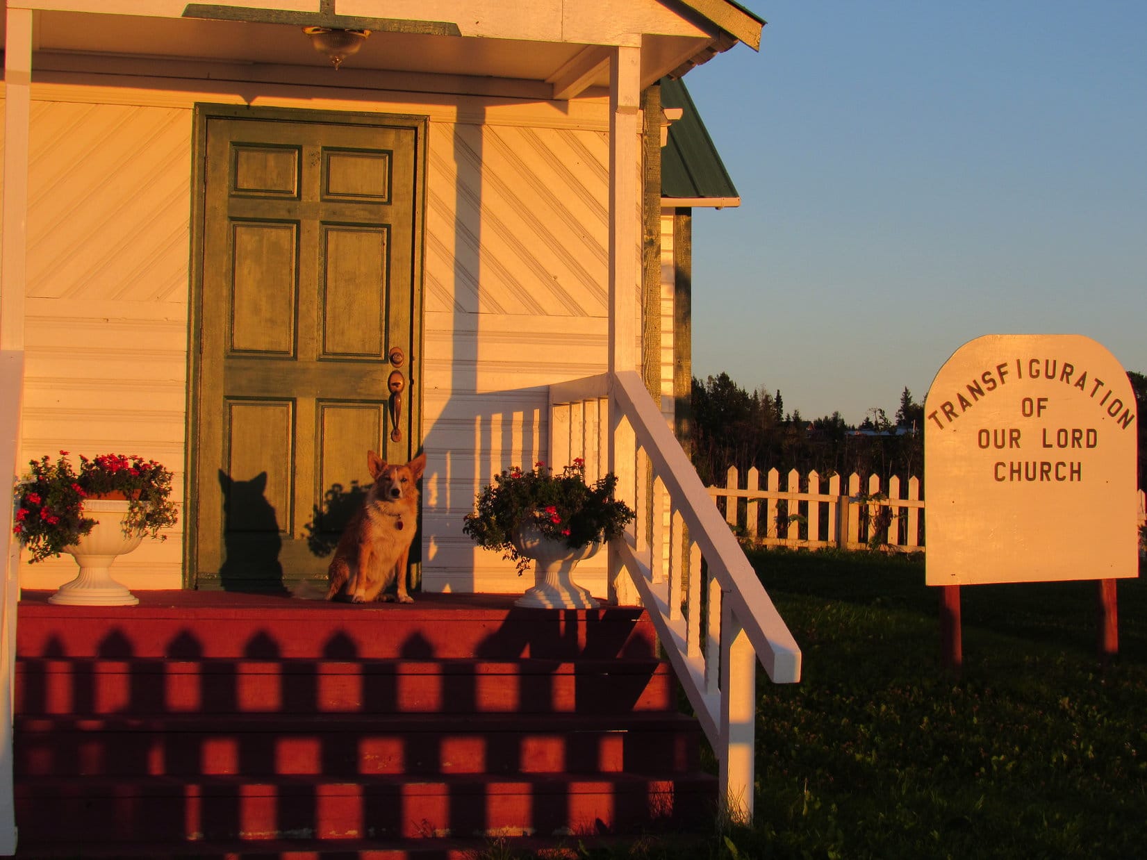
Day 29, Part 1, of Lupe’s Summer of 2016 Dingo Vacation to the Canadian Rockies, Yukon & Alaska
No sign along the Sterling Highway (Alaska Route 1) mentioned beach access. There had to be a way to get there, though, didn’t there? The first road W that SPHP tried in the small community of Anchor Point led to a housing subdivision on a bluff overlooking Cook Inlet. No way down. This couldn’t be right. Back to the Sterling Highway.
There had been a sign a little S of here for the Anchor River State Recreation Area. SPHP drove back to try that. This was it! The road wound downhill, crossed the Anchor River, and ended a mile or so later at a parking lot next to Cook Inlet. SPHP parked the G6 (8:10 AM), and Lupe jumped out.
It was a beautiful morning – bright, mostly sunny, with a cool fresh ocean breeze. Lupe and SPHP headed down to the beach. A little to the N, a tractor was busy launching a boat into the ocean. Across Cook Inlet of the North Pacific Ocean, two massive volcanoes, Iliamna and Redoubt, white with ice and snow, stood out as giants among lesser peaks on the far shore.
Lupe arrives at Anchor Point on the shore of Cook Inlet, a huge bay of the North Pacific Ocean. Iliamna Volcano is visible on the far shore. Photo looks NW.A tractor was busy launching boats, one by one, into Cook Inlet.Iliamna Volcano(10,016 ft.). Photo looks NW using the telephoto lens.Redoubt Volcano(10,197 ft.), the highest mountain of the Aleutian Range, is less than 200 feet higher than Iliamna. Photo looks NNW using the telephoto lens.
According to legend, Anchor Point got its name in 1778 when famous explorer Captain James Cook of the British Navy lost an anchor somewhere near the mouth of the Anchor River.
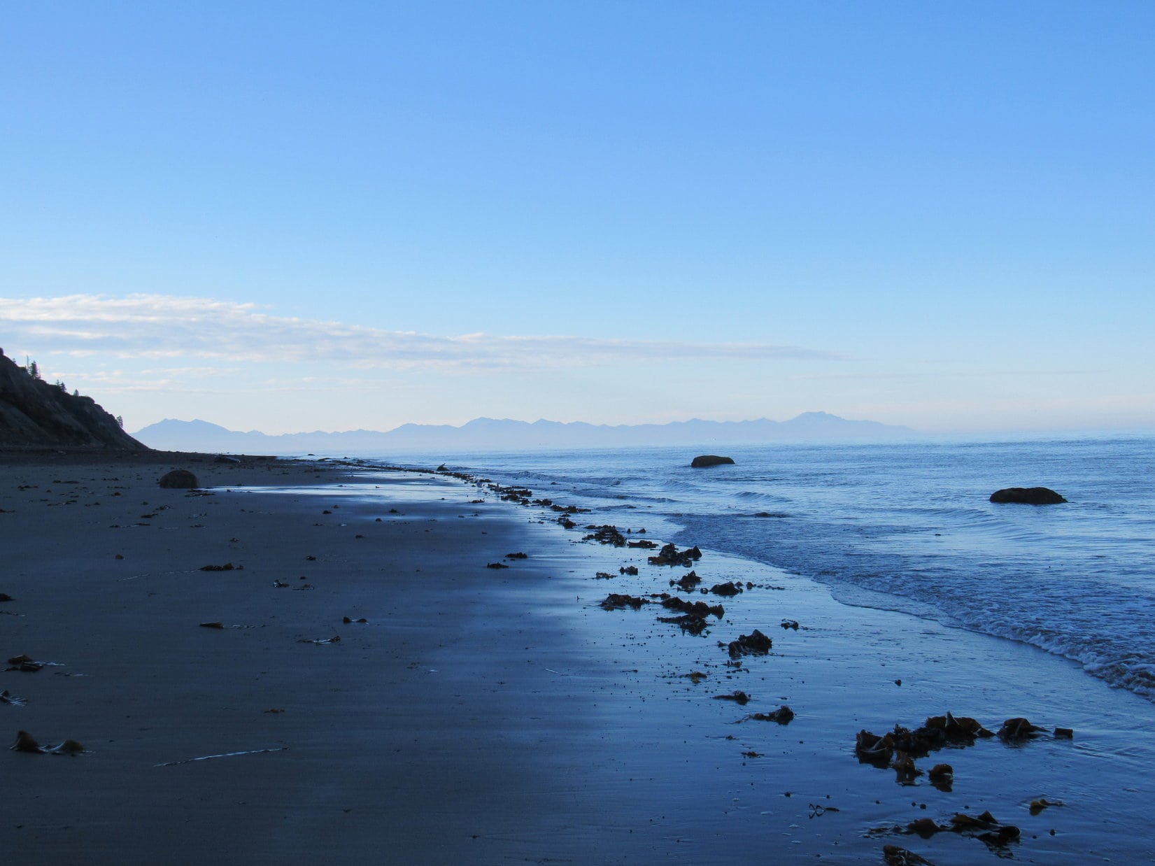
Lupe wasn’t here to search for Captain Cook’s anchor. She was here to reach a personal milestone, one that would likely endure the rest of her life. No road connected to the North American highway system goes any farther W than the road she had just taken to Anchor Point. Somewhere along the gently curving stretch of beach to the S, a mile away or less, was the westernmost point on earth Lupe would ever reach.
Somewhere less than a mile beyond Lupe, this beach reaches its westernmost point and starts curving slightly back toward the E. At that point, Lupe would be as far W as she will likely ever be in her whole life. Photo looks SW.
Despite having had a huge adventure yesterday crossing Kachemak Bay aboard the water taxi XtraTuff to climb Grace Ridge(3,136 ft.), Lupe was energized! She raced along the deserted sand and mud flats exposed by low tide, seagulls swirling overhead. SPHP plodded along after her, enjoying every moment of the exhilarating seaside stroll.
Lupe streaks away over sand and mud exposed by low tide, seagulls swirling overhead. Photo looks S.Whee! Lupe was energized!
The shoreline headed only slightly W of S from where Lupe and SPHP started. It would gradually curve back to true S, and then slightly E of S. SPHP had no way of knowing which particular spot was the farthest point W along Lupe’s route. It would hardly matter, since the entire beach was only marginally farther E than the exact westernmost point.
Lupe posed nicely in the sun for a couple of shots looking W toward the open ocean. If Lupe wasn’t at her westernmost point here, she was very close to it.
Lupe on the shore of Cook Inlet very nearly as far W as she will likely ever be. Photo looks W.
Lupe and SPHP continued S, and perhaps a bit farther W along the shore. Seagulls took flight whenever Lupe or SPHP got too close, only to land again a short distance away to resume strutting about the beach.
Seagulls liked to strut about the beach picking at whatever they found of interest. Whenever Lupe or SPHP got too close, they took off, only to land again a short distance away. Another part of the Kenai Peninsula is seen in the distance, beyond Kachemak Bay. Some of it is farther W than Anchor Point, but access is limited. There are no roads over there. Photo looks SSW.
The exposed beach was very flat. Most of it was quite damp. In some places it was simply muddy. Lupe passed over large patches of seaweed left stranded by the ocean. Strange odors arose from the seaweed. Lupe sniffed to her heart’s content, learning about life in and near the ocean.
Lupe sniffs the strange odors given off by seaweed. Large stretches of the beach were completely covered with it.
Far to the SW, barely visible on the horizon, was another volcano. It was much smaller than Iliamna or Redoubt, and looked blue instead of white. This was Augustine Volcano(4,025 ft.), which sits on an island presumably of its own making, in Cook Inlet.
Augustine Volcano was barely visible on the far horizon. Photo looks SW using the telephoto lens.
Not a soul was around. The shoreline was deserted, except for the seagulls. The fresh ocean breeze blew. Waves rolled endlessly ashore. Lupe explored and sniffed. SPHP continued S. Finally, a long straight stretch of beach was ahead. To the E was a bluff. To the W, several large rocks could be seen at or near the edge of the water.
A busy Carolina Dog explores the shoreline along Cook Inlet. A long stretch of beach was ahead, with a bluff to the E. Photo looks S.Over near the end of the bluff, a few large rocks could be seen close to the shoreline. Photo looks S.
Beyond the bluff, the beach made a more noticeable turn E. If Lupe hadn’t already passed by her actual farthest point W, it was almost certainly near one of those big rocks W of the bluff. That was as far as Lupe needed to go. SPHP christened the largest, most distant rock as the “Rock of the West”.
Approaching the “Rock of the West” (R of Center).
Although the Rock of the West had appeared to be on shore when SPHP first spotted it, by the time Lupe reached it, the tide had come in further. The Rock of the West was now a small island.
This point on the beach was the end for Lupe. She must have been at least a mile from the Anchor Point parking lot by now. More of the Kenai Peninsula across Kachemak Bay to the S was gradually coming into view as Lupe had approached the Rock of the West. Either this was it, or Lupe had already completed her last mile W somewhere along the way.
Here, a few feet from the Rock of the West, Lupe was as far W as she would ever be in her whole life.
Lupe as far W as she will ever be, a few feet away from the Rock of the West at Anchor Point, Alaska. Photo looks W.
Only 13 days ago, Lupe had reached her farthest point N along the Dietrich River nearly 90 miles N of the Arctic Circle. Now she had reached another milestone in life. Both moments were beautiful and wonderful, but also bittersweet.
It was wonderful that Lupe had journeyed so far, and expanded her world so much. She had seen so many new places, and had so many memorable experiences. Yet it was sad to think that this was also an end, a boundary beyond which she would never go.
For a while, Lupe and SPHP stayed together, looking out to sea near the Rock of the West. The same sea encircles the globe. Far beyond the horizon was a world of exotic lands, entire continents to explore. Lupe would never see them.
So, Looper, if you had a ship like Captain James Cook did so long ago, where would you sail? What distant, exotic lands would you explore?
Squirrel island!
Oh, for Pete’s sake! Come on, let’s go!
The return trip along the beach was every bit as relaxing and beautiful as Lupe’s journey to the Rock of the West had been. Sea and sky were blue. Seagulls and mighty volcanoes were white. Boats bobbed on the water or zoomed away over the waves, no doubt in a rush to reach Squirrel Island. Surf exhausted itself uselessly against the edge of North America, but made the most calming, relaxing sound on earth doing so.
Right here, right now, was a glorious place to be!
Iliamna Volcano across Cook Inlet. Photo looks NW.Redoubt Volcano(L) on the way back. Photo looks NW.Blue sky, blue sea. White seagulls, white volcano.Seagulls with a grand view of Iliamna Volcano. Photo looks NW.Augustine Volcano(L). Wouldn’t it have been fun, if Lupe had only had a ship that would have taken her over to the island it’s on? Photo looks SW.American Dingoes are known to roam as far W as Anchor Point, Alaska. They seem to like it here! Photo looks NW.Another boat launched by the tractor gets underway. Redoubt Volcano in the background. Photo looks NNW.Someone sets off in search of fabled Squirrel Island.
Despite an unrushed, easy pace, Lupe’s last mile West hadn’t taken long. By 9:35 AM, she was back at the G6. A major milestone was now behind her, but more adventures were in store, this very day! This afternoon she would be on the Skyline Trail to the Mystery Hills, which certainly sounded like fun.
Yet it would be a long time before Lupe and SPHP would forget the Rock of the West and being here together at beautiful Anchor Point, the farthest W Lupe ever went, standing at the edge of the sea, gazing out toward the world of possibilities that lay beyond the restless waves.
Day 28 of Lupe’s Summer of 2016 Dingo Vacation to the Canadian Rockies, Yukon & Alaska
Ugh, what is it Loop? What now? Lupe kept pawing at SPHP. Oh, Loopster, what do you want? Do you need out? … 7:00 AM! … Oh, my gosh, Loop! Thanks for waking me up! We’ve got to get going!
Lupe may have just saved the day. SPHP meant to be up an hour ago. The sun was already above the horizon. Was there still time? The day was perfect – clear and bright, as SPHP drove out to the Homer Spit.
Narrow Homer Spit protruding 6 miles into Kachemak Bay was awesome! Hundreds of boats of all descriptions were moored in a gigantic pack on the protected NE side. Sea gulls whirled overhead. The one road along the spit was lined with restaurants, colorful tourist shops, and fishing and sight-seeing charter businesses. People were up and about. The whole place hummed with activity.
SPHP drove slowly, looking for Homer Ocean Charters. There it was, on the SW side of the street! SPHP parked and went in, while Lupe waited in the G6. SPHP asked the lady at the counter about getting a water taxi ride over to Grace Ridge in Kachemak Bay State Park.
The good news was that dogs were welcome, and Lupe could come along for free! The bad news was they had a 2 person minimum requirement. Grace Ridge wasn’t that popular. They had no one else scheduled to go to Grace Ridge today. The lady suggested either a different destination, or trying Mako’s Water Taxi across the street.
Mako’s wasn’t right across the street, although it wasn’t far away. It took SPHP a few minutes to spot it. Once again, Lupe waited in the G6 while SPHP went in, a little fearful of another negative response. Mako’s was busy. It took a few minutes for SPHP’s turn to come. Another woman behind a counter asked what SPHP wanted.
Water taxi service to Grace Ridge? They had only one group scheduled for Grace Ridge today. Three people were leaving right now. Round trip price was $81 plus tax (total a bit over $91). Pickup at 6 PM. Lupe could come along, no extra charge. Was now OK?
Perfect! Now was absolutely perfect! SPHP paid up, then ran out to move the G6 to free parking a couple blocks away next to the Homer Grill. As SPHP and a somewhat alarmed Lupe started running back to the dock, Mako’s captain of the water taxi XtraTuff was already yelling at SPHP to hurry up. When Mako says now, they mean NOW! They were leaving!
Lupe on Homer Spit, moments before dashing off to catch a ride to Grace Ridge on Mako’s water taxi XtraTuff. Photo looks NE.
Lupe was afraid of the open metal grate dock. She could see the water below her. SPHP picked the surprised Carolina Dog up, and ran carrying her to the XtraTuff. Moments later, she was aboard. Immediately, the captain put the engine into reverse, and started easing the XtraTuff away from the dock. Lupe and SPHP sat out in the open air on a bench in the front of the boat.
Sea dog, Loopster, aboard Mako’s water taxi XtraTuff, embarks from Homer Spit to sail across Kachemak Bay of the North Pacific Ocean on her way to Grace Ridge! Photo looks NW.
The XtraTuff cruised slowly, leaving little wake, while maneuvering around all the other boats on the way out of port. The XtraTuff picked up a little speed once it was clear of the moored boats. The captain steered SE toward the end of Homer Spit.
Lupe aboard the XtraTuff nearing the SE end of Homer Spit. Grace Ridge is in view above the 2nd support from the L. Photo looks S.Rounding Homer Spit. Grace Ridge on the L. Photo looks S.
As the XtraTuff rounded Homer Spit and headed out across Kachemak Bay, the captain put her in high gear. XtraTuff was fast! The water taxi bounded across the waves.
Even though the sea wasn’t that rough, it was a bumpy ride. Every now and then XtraTuff hit a wave with a jarring jolt. The morning’s cool breeze became rather chilly, as the XtraTuff raced toward Eldred Passage. SPHP hung onto Lupe, so there wouldn’t be an American Dingo overboard.
On Kachemak Bay heading for Eldred Passage. Photo looks SSW.
The captain asked if Lupe and SPHP would like to come in the enclosed cabin to get out of the cold wind. Thanks, but hell no! This was what Lupe had come for! Here she was, bounding across Kachemak Bay of the North Pacific Ocean on her way to Grace Ridge(3,136 ft.) in Alaska with fabulous views everywhere. This was exciting! This was glorious!
Mountains along Kachemak Bay. Photo looks SE.Approaching Yukon Island (Center) aboard the XtraTuff. Photo looks SSW.OK, SPHP, we’re way out here now. So level with me, what the heck are you getting us into?Grace Ridge from Kachemak Bay aboard the XtraTuff. Photo looks S.In Eldred Passage on the way to Tutka Bay. Billy, one of the other passengers, later told SPHP that the sharp peak on the L is called Broken Knife, although SPHP doesn’t find that name on any map. Photo looks SSW.
The Grace Ridge Trail is 9 miles long. Lupe was going to take the entire trail from one end to the other, making only a single traverse. A water taxi would pick her up at the other end. SPHP had a choice of where to get dropped off. At the N end, closest to Kachemak Bay, is Kayak Beach. The more remote S trailhead is along the NE shore of Tutka Bay. The other 3 passengers were going to the S trailhead. SPHP told the captain that was where Lupe wanted to be dropped off, too.
The XtraTuff raced over smoother waters through Eldred Passage. Lupe passed by the entrance to Sadie Cove to the E. XtraTuff sailed S around the NW end of Grace Ridge. Entering Tutka Bay, XtraTuff was still making great time. After a few miles, though, a dense fog bank was dead ahead right on the water.
The captain slowed XtraTuff to a crawl as Lupe entered the fog. Everything disappeared from view. The drop-off point wasn’t much farther. XtraTuff crept cautiously forward, the captain straining to see something, anything. After 5 minutes, a tiny beach appeared close by and directly ahead. The captain had found it! This tiny beach was the Grace Ridge S trailhead.
XtraTuff glided into shore. Lupe, SPHP, and the other 3 passengers disembarked. It only took a minute. As the XtraTuff backed slowly away, everyone waved and thanked the captain, who waved back. XtraTuff disappeared like a ghost.
XtraTuff about to disappear into the fog on Tutka Bay. Photo looks, uh, well, let’s see, NW maybe?
Wow! Incredible! If the 3 other passengers hadn’t been here, this place would have been just plain spooky. A dark, dense, primeval forest extended right down to the tiny beach at water’s edge. Leafy ferns, thick clumps of moss, ancient trees. In the fog, it all looked unnervingly prehistoric. It could have been 10,000 years ago, maybe 10,000,000 years ago. What was out there? Bears? Dinosaurs!? Lupe was lost in time.
Lupe lost in time, and looking a tad concerned about it, at the South Grace Ridge trailhead.
The other 3 passengers seemed to know where they were. They set right off, following a good single track trail through the jungle. The trail gained elevation slowly at first, but soon started switchbacking up a steep slope. Lupe and SPHP followed the rest of the group, trailing a little behind.
So far, so good. No bears or dinosaurs yet.
The fog bank was dense, but wasn’t all that thick. Soon Lupe was getting up high enough to where sunshine could be seen filtering through the trees. The other 3 XtraTuff passengers set a fairly brisk pace. Lupe and SPHP continued following along behind.
As Lupe climbed above the fog, sunlight began filtering through the trees.
The trail was good. The switchbacks made the pace of elevation gain moderate. Lupe was making great time and gaining elevation steadily. The rest of the group was traveling almost too fast for SPHP’s taste. What was the hurry? Lupe had been dropped off at the S trailhead around 9 AM. She didn’t need to be at the N trailhead until 6 PM, 9 hours later. Since the trail was only 9 miles long, she only had to travel one mile per hour.
Soon everyone, except Lupe, was sweating. The group stopped for a break. SPHP stripped down to a T-shirt. The woman of the group introduced herself as Sandy. With her were Kevin and Billy. They were all friendly, but spent much of their time deeply engaged in their own conversations. They were friends who all live in Homer, as near as SPHP could gather.
Everyone set off again. The rapid pace continued. Lupe and SPHP lagged behind when Lupe found, not a bear or a dinosaur, but a squirrel in the forest. A brief, enthusiastic barkfest ensued. A bit later, Lupe and SPHP caught up with the group again. As Lupe gained elevation, the primeval forest gave way to a more normal looking forest minus all the moss and ferns. The normal forest then began to thin out, with some of the tall bushes common in Alaska starting to take over.
There were other people on the trail! The XtraTuff group overtook and passed a family of four. Soon after that, Lupe got her first look at a barren high point ahead.
As the Grace Ridge Trail neared the ridgeline, Lupe got her first look at a barren high point ahead. Photo looks NNW.
The trail reached the ridgeline. The switchbacks were done. From now on, the trail would stay up on the ridgeline following it all the way NNW to the summit. Tall bushes and scattered trees dominated at first, but that didn’t last long. The moderate pace of elevation gain enjoyed while on the switchbacks was over. The trail climbed steeply, quickly bringing Lupe up above all the tall vegetation.
The American Dingo wasn’t anywhere near the summit of Grace Ridge yet, but truly awesome views were opening up all around.
Tutka Bay, which Lupe had come sailing over on the water taxi XtraTuff on her way to the Grace Ridge S trailhead. The broader expanse of Kachemak Bay is seen in the distance. Photo looks WNW.Looking down at the S end of Sadie Cove, which borders Grace Ridge to the N and E. Photo looks SE.Lupe on the Grace Ridge trail having reached the first high point along the ridgeline above all the trees and tall bushes. Photo looks SSE back down along Grace Ridge. Part of Tutka Bay is seen on the R.
Ahead, Grace Ridge was covered only with alpine tundra. A marvelous ridgeline trek of sweeping unobstructed panoramas was in store for Lupe. The Carolina Dog still had a long way to go to reach the summit. It wasn’t even in view yet.
Ahead, a marvelous ridge hike over alpine tundra was in store for Lupe. The summit was still far off. It wasn’t even in view yet. Photo looks NNW.
From her vantage point high on Grace Ridge, Lupe was now able to see great distances over the tundra. She saw something move far below. Suddenly, Lupe took off straight down the steep W slope toward Tutka Bay. SPHP called her, but she disappeared over the edge of an embankment. She had lost hundreds of feet of elevation in hardly any time at all! SPHP kept calling her.
After a few minutes, here came the American Dingo, charging straight back up almost as fast as she had gone down. Lupe arrived with a long pink tongue dangling from her mouth, panting as though she might burst. Did she ever look happy, though! Wow, what would SPHP give to be in that kind of shape? Simply amazing! However, Lupe was now under orders not to go running off like that again. SPHP never did see whatever it was she chased after.
Lupe and SPHP had fallen a little behind the XtraTuff group, but caught up with them again between two small rocky hills where they had stopped for a snack. Up on the exposed ridgeline, an E breeze was blowing, but between these small hills the trail was protected from the wind.
While everyone was still eating, Lupe climbed up the small hill on the E side of the trail for a look around. The views were getting better! Lupe could even see Iliamna Volcano(10,016 ft.) faint and far away across Kachemak Bay and Cook Inlet to the NW.
Lupe up on the small rocky hill E of where the XtraTuff gang stopped for a rest break. A small part of Sadie Cove is seen on the lower L. The highest peak on the L may be Sadie Peak(4,320 ft.). Photo looks SE.The views kept getting better as Lupe gained elevation. This photo looks S farther into Kachemak Bay State Park.Lupe back down in the sheltered area near the trail. The rest of the XtraTuff gang has already finished their break and moved on. Iliamna Volcano is seen very faintly far across Cook Inlet to the L of Lupe. Photo looks NW.
When the rest of the XtraTuff group moved on, Lupe and SPHP stayed at the sheltered spot between the two hills. Everyone else seemed to be in a hurry to get to the summit. No reason for it that SPHP could see. Lupe had plenty of time.
SPHP had asked how much more elevation was left to be gained. Sandy, Keven and Billy had all insisted Lupe was only halfway up, but that seemed to be a gross underestimate of the progress already made. Lupe must have gained at least 67% of the 3,136 feet required to reach the summit. Probably more like 75% or even 80%.
After a nice break, Lupe and SPHP continued on. The trail remained good. The route was obvious, in any case. The exposed ridge hike was a ton of fun. Fantastic views everywhere, all the time. After passing through a dip into a big saddle, there was one more fairly long steep climb.
Lupe near the top of the next big climb. Tutka Bay is seen below. The mountain Billy called Broken Knife is on the R. SPHP wonders if it isn’t really Red Mountain(3,524 ft.), though the name would make more sense for the more distant tan colored peak seen straight up from Lupe. Photo looks SW.
Grace Ridge’s easily recognizable big summit ridge came into view ahead. There was no mistaking it. The trail headed straight for it, passing over several prominent high points. This part of the ridge was often narrow and steep.
Grace Ridge’s easily recognizable big summit ridge(R) came into view. To get there, Lupe followed the trail up and down over several high points. Along the way, the trail was often steep and the ridge quite narrow.How’s this for a view, SPHP? I’m not even at the summit yet! Kachemak Bay from Grace Ridge. Photo looks WNW.
Beyond the last of the prominences, Lupe had an unobstructed view of the big summit ridge running SE/NW ahead. Getting there was going to be a piece of cake. The ridgeline became much wider here. The trail would take Lupe up to the SE end of the summit ridge. The true summit of Grace Ridge was a knob of rock relatively close to that end. Lupe was almost there!
From the last prominence, Lupe had an unobstructed view of Grace Ridge’s big summit ridge ahead. The trail would take Lupe to the SE (R) end. From there it wasn’t far to the true summit, the small knob of rock seen a little to the L.Lupe at the last of the prominences prior to going on to the summit ridge. Sadie Cove is seen below on the L. Photo looks SSE.Looking SSE using the telephoto lens.
Fifteen minutes later, Lupe was up at the SE end of the summit ridge. While it had been breezy down along the lower ridge, it was just plain windy up here. The E wind was strong! Lupe didn’t like the wind one bit, but tried to wait patiently for SPHP to finish loitering around.
Lupe found a survey benchmark(R) at the end of a long pipe at the SE end of Grace Ridge’s big summit ridge. The near ridge in view is on the other side of Sadie Cove. Part of Kachemak Bay is in the distance on the L. Photo looks NE.Peaks of Kachemak Bay State Park. Photo looks NE using the telephoto lens.Lupe enduring the wind at the SE end of the Grace Ridge summit ridge. Photo looks SW.The survey benchmark at the SE end of the Grace Ridge summit ridge.Looking SSE back the way Lupe came up. Sadie Cove is on the L. The survey benchmark is at the lower L corner. A windswept Carolina Dog is on the R.
The true summit of Grace Ridge was only 200 yards away. Sandy, Kevin and Billy were all over there, sitting below the SW side of the summit sheltered from the wind. Lupe was going to get a lot more fresh air on her way over there.
The true summit of Grace Ridge is seen only 200 yards away to the NW. Sandy, Kevin and Billy were already over there taking shelter from the wind. Photo looks NW.
Of course, before rejoining the rest of the XtraTuff gang, Lupe had to climb up on top of the true summit to claim her windy Grace Ridge peakbagging success!
Lupe reaches the true summit of Grace Ridge in Alaska’s remote Kachemak Bay State Park! Photo looks NW.Skinny Homer Spit is seen extending 6 miles into Kachemak Bay. Photo looks NNW from the true summit of Grace Ridge.Mighty Loopster astride the true summit of Grace Ridge. Photo looks NW.
Kachemak Bay from the summit of Grace Ridge. Photo looks NNE.Homer Spit again, this time using the telephoto lens. Photo looks N.Looking SSE. Lupe’s route up was along the barren hilly ridgeline seen on the R.
Lupe was glad to get down off the true summit to take refuge from the wind on the SW side of the big rock outcropping. Sandy, Kevin and Billy were still relaxing and finishing up lunch there for a little while longer. They said it was noon, which meant it had taken Lupe only 3 hours to get here from the S Grace Ridge trailhead. Lupe had 6 whole hours until she needed to be down at the N trailhead for the scheduled water taxi pickup at Kayak Beach.
Before long, the rest of the XtraTuff gang moved on. Lupe and SPHP stayed alone, enjoying the solitude and the magnificent scenery. The family of 4 that had been passed on the way up came by, continuing farther NW along the summit ridge. For more than half an hour, Lupe and SPHP did not stir from the sheltered spot below the summit. What a magnificent place! Eventually, though, the time came to start exploring the big summit ridge.
The view to the SW from the sheltered spot where Lupe relaxed out of the wind just below the summit. Tutka Bay is down below.
First, Lupe returned to the SE end of the summit ridge near the survey benchmark. The views of the mountains to the S were best from this end of the ridge. Lupe and SPHP wanted to see them from this vantage point one more time before leaving.
Looking SE using the telephoto lens.Worth a second look, aye?Looking SSE.Sadie Cove and Sadie Peak(L). Photo looks SE.Lupe rests on the tundra near the SE end of Grace Ridge’s big summit ridge. The true summit is on the R. Tutka Bay is on the L. Photo looks WNW.
Bidding farewell to the S mountain views, Lupe headed NW, passing by the true summit for the final time.
Grace Ridge’s big summit ridge is about 0.25 mile long. Unlike the lower SSE ridge Lupe followed to get here, which was narrow and steep in some places, the big summit ridge is broad and flat to gently rolling. No clear trail exists most of the way, but the general route is totally obvious. If you still don’t get it, NW of the true summit the route is marked by a series of big cairns.
Tutka Bay. A fog bank hangs over adjoining Kachemak Bay. Photo looks WNW.Lupe NW of the true summit, seen on the L. Of course, American Dingoes can find their way across this broad, gentle ridge with their eyes closed. Huge cairns showed SPHP the way. Photo looks SSE.
Going NW along the big ridge, Lupe was heading away from the mountains and toward the ocean. There was one impressive mountain view, however, which she was going toward. Faint and far away, beyond Kachemak Bay and Cook Inlet, was Iliamna Volcano(10,016 ft.).
Naturally, faint and far away aren’t normally associated with impressive. A look through the camera’s telephoto lens told a different story.
Iliamna Volcano from Grace Ridge. Bring those binoculars, if you want to see it looking like this instead of simply faint and far away. Photo looks NW.
A 0.25 mile long summit ridge is a pretty big summit, but even at a very leisurely pace with stops to sniff and admire the views, it took Lupe only half an hour to reach the NW end where the best ocean views were.
Lupe near the NW end of the big summit ridge. Photo looks back to the SSE. The true summit is seen on the L.At the NW end. Photo looks WNW.Anchor Point along Cook Inlet is in view here beyond Kachemak Bay. Photo looks NW.Iliamna Volcano towers above low clouds covering Cook Inlet. Photo looks NW using the telephoto lens.Anchor Point from the NW end of the Grace Ridge summit ridge. And, hey, isn’t that the peakbagging Carolina Dog from the Black Hills of South Dakota up there?! Photo looks NW.
Lupe and SPHP had first reached the SE end of the Grace Ridge summit ridge an hour and forty minutes ago. If the wind hadn’t been so strong, Lupe would have remained at least another hour. However, as wonderful as the views were, the wind was wearing enough to make starting down sound like a good idea.
A final look back at the true summit of Grace Ridge(R) before starting down. Sadie Peak is seen R of Center. Photo looks ESE.Homer and the Homer Spit across Kachemak Bay. Lupe’s route down off Grace Ridge started toward the R in the direction of the cairn. Photo looks N.
The wind soon abated as Lupe lost elevation, a welcome development as far as she was concerned. Going down the NW end of Grace Ridge was a lot different from coming up the SE end. Lupe was facing views of the ocean. The trail going down didn’t follow any distinct ridgeline, but wound around in open country.
Lupe in open country on her way down. Photo looks S.On the trail down. Photo looks SSE.
Lupe had already lost a lot of elevation when she reached some flat ground. Ahead was a small rise the trail was about to go over. People were down here, and up on the rise, too.
Kevin from the XtraTuff group was in the flat area picking blueberries using a blueberry rake, a simple contraption SPHP had never seen before. A woman named Poppy was picking blueberries, too. Sandy and Billy were up ahead on the rise talking to still more people.
It was sunny and comfortably warm out. The air was still. Lupe had hours to reach Kayak Beach. Picking blueberries sounded like a good idea. The others were saving blueberries in plastic bags, but SPHP sat on the ground picking and eating them on the spot. Lupe dozed contentedly in the shade of an evergreen tree.
Lupe’s nap and SPHP’s blueberry feast went on for 30 or 40 minutes. Then almost everyone decided it was time to mosey on down the trail to the Kayak Beach pickup point. Lupe and SPHP went with, tagging along at the end of the group. Only Kevin and Poppy remained, picking blueberries for a while longer.
Looking back at Grace Ridge from the small rise. The trail Lupe had come down wound its way around in the territory seen on the L. Part of the trail is in view below, L of Center. The flat land where all the blueberry picking went on was down there next to the trail. Photo looks SE.Hesketh Island(L) and Yukon Island(R) from the small rise. Anchor Point is in the distance on the far R. Photo looks NW.
As Lupe lost more elevation, the trail entered steeper terrain. Tall bushes and trees hid the views. The forest was full of Devil’s club, a tall plant with very large leaves, a thick and thorny stem, all crowned by numerous clusters of bright red berries. A sort of giant blueberry plant grew 5 or 6 feet high here, too.
The trail was much wetter and muddier down here than anywhere else. A couple of times, people fell on the slick mud. Fortunately, no one sustained any injury beyond wounded pride.
Lupe investigates a small stream along the trail.Devil’s club berries.
This larger group Lupe and SPHP were now part of traveled very slowly down the steeper part of the trail. The pace finally picked up lower down, when the slope of the incline finally decreased. Near the coast, the trees of the forest took over. There were fewer bushes and tall plants.
Lupe reached Kayak Beach about 5:15 PM. Kayak Beach proved to be much larger than the tiny beach at the S trailhead. Still more people were on the beach, and several dogs, too. Even though pickup time wasn’t supposed to be until 6:00 PM, Mako already had two water taxis here, ready and waiting.
Surprisingly, Lupe wasn’t interested in the other dogs. Something else had caught her attention! In the ocean, right next to the shore, was something very odd. Lupe had never seen anything like it before! A round translucent creature marked with an emblem of the sun moved with each wave. Lupe was fascinated, but regarded the strange creature with deep suspicion.
Lupe discovered a jellyfish in the ocean at water’s edge on Kayak beach.Loopster had never seen a jellyfish before. She regarded it with both fascination and suspicion, following it toward the sea when it retreated with the waves, and leaping back when the jellyfish surged forward, seemingly on the attack!The jellyfish was a most puzzling creature to the Carolina Dog. Lupe spent a long time keeping a watchful eye on it. Who knew jellyfish could be so entertaining?Lupe maintains her jellyfish vigil (it’s barely visible right in front of her nose) as one of the water taxis moves in to shore to begin boarding. Iliamna Volcano is seen faintly far beyond Eldred Passage(Center). Yukon Island is on the L. Photo looks NW.Iliamna Volcano from Kayak Beach. Yukon Island on the L. Photo looks NW using the telephoto lens.
There was quite a large group of people milling around on the beach. In addition to the two Mako water taxis, there was a third water taxi from another company waiting to return passengers to Homer Spit.
Apparently, there is a regulation prohibiting the water taxis from carrying more than 6 passengers at a time. Everyone seemed worried about securing a spot on the water taxis. Everyone except Lupe and SPHP, and two women who were staying to camp out at Kayak Beach.
Yes! Mako had 13 passengers waiting for pickup, but could only take 12. The water taxis filled up. Lupe and SPHP were left standing on the beach. Totally awesome! Mako promised another water taxi was on the way. It would be here in 15 minutes. Whatever. As long as it came eventually, Lupe and SPHP were happy.
The two women who were going to camp out here had two large dogs with them. The biggest one, Ruby, acted so aggressively toward Lupe, that Ruby got put on a leash. The women invited SPHP to join them for a cup of wine. Who was SPHP to disappoint them? While Lupe and the friendly dog played and explored, SPHP and the two women sat watching the ocean, chatting, and sipping wine.
Fifteen minutes was a lousy estimate. The water taxi, Orca, didn’t show up until 7:00 PM, which was totally cool as far as Lupe and SPHP were concerned. SPHP bid farewell to the two women, thanking them for the wine. Lupe and SPHP boarded the Orca, and it pulled away from shore.
Mako’s water taxi, Orca, arrives at 7:00 PM to pick up Lupe and SPHP. Ruby, who was back off leash by now, is the dark brown dog on the R. The light brown dog is the friendly one that played with Lupe. The black dog came with the Orca. Yukon Island in the background. Photo looks NW.
A guy came running out of the woods from the direction of the trail. Wait!!! Come back!!! His group had a 7:00 PM scheduled pickup with Mako. Two more were still coming. They would be here shortly.
Mako was confused. The guy’s story didn’t seem to add up at first. The confusion arose, because, just like the original XtraTuff group of 3, this group of 3 also had a Kevin and a Sandy. For a few minutes, Mako thought they had already done their duty and picked up everyone they needed to. However, instead of a Billy, this group had a Mark.
It all got straightened out over the radio. Back to shore. The two remaining members of the new Kevin, Sandy, and Mark group appeared. Everyone boarded. Out to sea again. Soon the Orca was dashing over a glassy sea through Eldred Passage. Lupe and SPHP enjoyed the ride seated out front in the open air again.
Aboard the Orca on Kachemak Bay.
Turned out the Orca wasn’t going directly back to the Homer Spit. A package needed to be delivered to China Cove farther N on the E side of Kachemak Bay. Fantastic! A free extra long water taxi ride on a gorgeous evening! The farther away China Cove was, the better.
The side trip to China Cove added an extra half hour. Flocks of seagulls raced the Orca. Lupe saw boats and ships on Kachemak Bay. Beauty, light, and the cool, clean Alaskan air Orca rushed through were everywhere. Life couldn’t be better!
It had to end. The Orca returned to Homer Spit.
Kachemak Bay from the Orca near Homer Spit. Photo looks E.Lupe aboard the Orca as it pulls into port at Homer Spit.Her Kachemak Bay of the North Pacific Ocean and Grace Ridge adventure over, Lupe returned to land on Homer Spit.
What a day! What an adventure! Lupe and SPHP were famished. Back in the G6, SPHP drove to Safeway in Homer and bought a whole roasted chicken. Then it was back to a park on the SW side of Homer Spit. Lupe and SPHP dined in the G6 watching gentle waves roll into shore.
The tide was coming in. Across Kachemak Bay, there was Grace Ridge in the evening light. Full of chicken, Lupe and SPHP left the G6 and strolled down to the ocean shore. A woman from Homer was gathering pretty or unusual rocks she would use to line the sides of her driveway. Most everyone else had gone home.
Grace Ridge(L) from Homer Spit. Photo looks SSW.Grace Ridge using the telephoto lens. Photo looks S.
Well, Looper, you did save the day! I’m sure glad you woke me up in the nick of time when you did. There aren’t many days like this one in a lifetime. We are so lucky we didn’t miss it!
And so it ended, with Lupe standing at the edge of the North Pacific Ocean on Homer Spit, Grace Ridge in view, beneath the fading glory of a rare epic day.
Day 27 of Lupe’s Summer of 2016 Dingo Vacation to the Canadian Rockies, Yukon & Alaska
Everything hung on what the radio would say in the morning. Yesterday evening, the rain had started in again in Palmer, Alaska before the light had faded completely away. Every time Lupe woke up during the night, the relentless rain continued. Once there was only fog, but that was hardly any better.
As near as SPHP could tell, the S coast of Alaska had already seen a solid month of rain and gloom. A couple days ago, the forecast had been for 3 more days of rain, then clearing skies. Lupe had left Palmer then, resigned to going all the way back to Canada. Luckily, only an hour’s drive away, the skies had cleared enough so she could spend a couple days climbing Gunsight Mountain(6,441 ft.) and Lion Head(3,185 ft.). Lupe was still in Alaska! She had returned to Palmer hoping for the best.
Morning came. Still raining. For the 3rd time on this Summer of 2016 Dingo Vacation, SPHP cheated and turned on the radio. If the forecast was unchanged, if the skies really were going to clear in only another day or two, Lupe would stay in Alaska. On the other hand, if the forecast had been revised again to yet another vague promise of better days another 3 or 4 or 5 days in the future, this was it. Lupe was abandoning hope, and going back to Canada.
Finally, the weather report came on. Rain continuing throughout the day in Anchorage … yes, yes, and then? … clearing skies into the weekend, with highs near 70°F. Click. That was enough. No Pepper Peak(5,381 ft.) today, but that was OK. The clearing skies would likely be coming from the SW. Lupe was going to greet them. Well, Loopster, you lucky Dingo, you’re going to get to see Anchorage after all, and a whole lot more!
Anchorage was a big city, like other big cities. Rush hour traffic slowed to a crawl for miles on the wet Glenn Highway due to an accident. Downtown, SPHP missed the turn S on the Seward Highway, but managed to get back to it. S of Anchorage, the rain was lighter. Skies were still overcast, with occasional patches of fog.
The Seward Highway turned SE following the railroad right along the Turnagain Arm of the North Pacific Ocean. At Beluga Point, Lupe and SPHP stopped for a look.
Lupe reaches Beluga Point on the Turnagain Arm of Cook Inlet, part of the North Pacific Ocean. Photo looks W.Beluga Point is SE of Anchorage along the Seward Highway, which follows the coast of the Turnagain Arm. Photo looks NW.
Beluga Point is a popular place for watching Beluga whales. Although the white whales are usually easy to spot, Lupe didn’t see any. Several people at the Beluga Point pullout told SPHP they often saw whales here. One claimed to have seen 28 Beluga whales during a single recent visit.
A powerful tide was coming in. The strong, rippling current looked dangerous, as the ocean surged SE into the Turnagain Arm past Beluga Point. Less than 10 miles away on the misty far shore, Lupe had her first glimpse of the Kenai Peninsula.
A powerful tidal current ripples past Beluga Point as the ocean surges SE (L) into the Turnagain Arm. On the far shore, Lupe could see the misty N coast of the Kenai Peninsula. Photo looks SW.Looking S from Beluga Point.
Lupe and SPHP continued on. The murky brown waters of the Turnagain Arm didn’t look very deep. From the G6, Lupe saw huge expanses of exposed mud flats. The incoming tide was in the process of inundating them again. When the SE end of the Turnagain Arm came into view, Lupe made a brief stop at another viewpoint.
Near Girdwood, the SE end of the Turnagain Arm came into view. Photo looks SE.Even on a cloudy, misty day, the scenery was beautiful. Photo looks SE at a glacier perched on a steep mountainside near the end of the Turnagain Arm.
The last several miles of the Turnagain Arm was nothing but mud flats and marshlands with a river flowing through it all. Rounding the very SE end, Lupe and SPHP left the Seward Highway, turning E (L) on Portage Glacier Road. Lupe didn’t take the road quite all the way to the Anton Anderson Memorial Tunnel to Whittier. Instead, she went to see Portage Lake, bypassing the Begich Boggs Visitor Center along the way.
Lupe arrives at Portage Lake. The Portage Glacier used to fill this entire valley, but has since retreated out of sight behind the mountain on the R. Portage Lake is 3 miles long and up to 1 mile wide. Photo looks SE along 2/3 of the length of the lake.
Note: The Begich Boggs Visitor Center is located at the NW end of Portage Lake about 6 miles from the Seward Highway. It was built in 1986 on the 1914 terminal moraine of the Portage Glacier. The Portage Glacier used to be visible at the far SE end of the lake from the visitor center, but has since retreated out of sight. Among other services, commercial boat tours to see the glacier are available at the visitor center.
The Portage Glacier can also be viewed from Portage Pass, accessed via a good hiking trail with 800 ft. of elevation gain. From the pass, it is possible to hike on toward Portage Lake for a closer look at the glacier, which is less than a mile directly across the lake. The turn to the Portage Pass trailhead is located on the SW (R) side of the road to Whittier about 0.25 mile after going through the 2.5 mile long Anton Anderson Memorial Tunnel. A $13.00 round trip fee (passenger car, 2016) is charged to go through the tunnel.
Even under drippy, overcast skies, Portage Lake was very beautiful. On the opposite NE shore of the lake, Lupe saw waterfalls cascading down from a hanging glacier on Maynard Mountain(4,137 ft.).
Across Portage Lake, waterfalls cascaded down from a hanging glacier on Maynard Mountain. Photo looks NE.Maynard Mountain from across Portage Lake. Photo looks NE.From Portage Lake, Lupe could hear these waterfalls on Maynard Mountain, as well as others on nearby peaks. Photo looks NE using the telephoto lens.
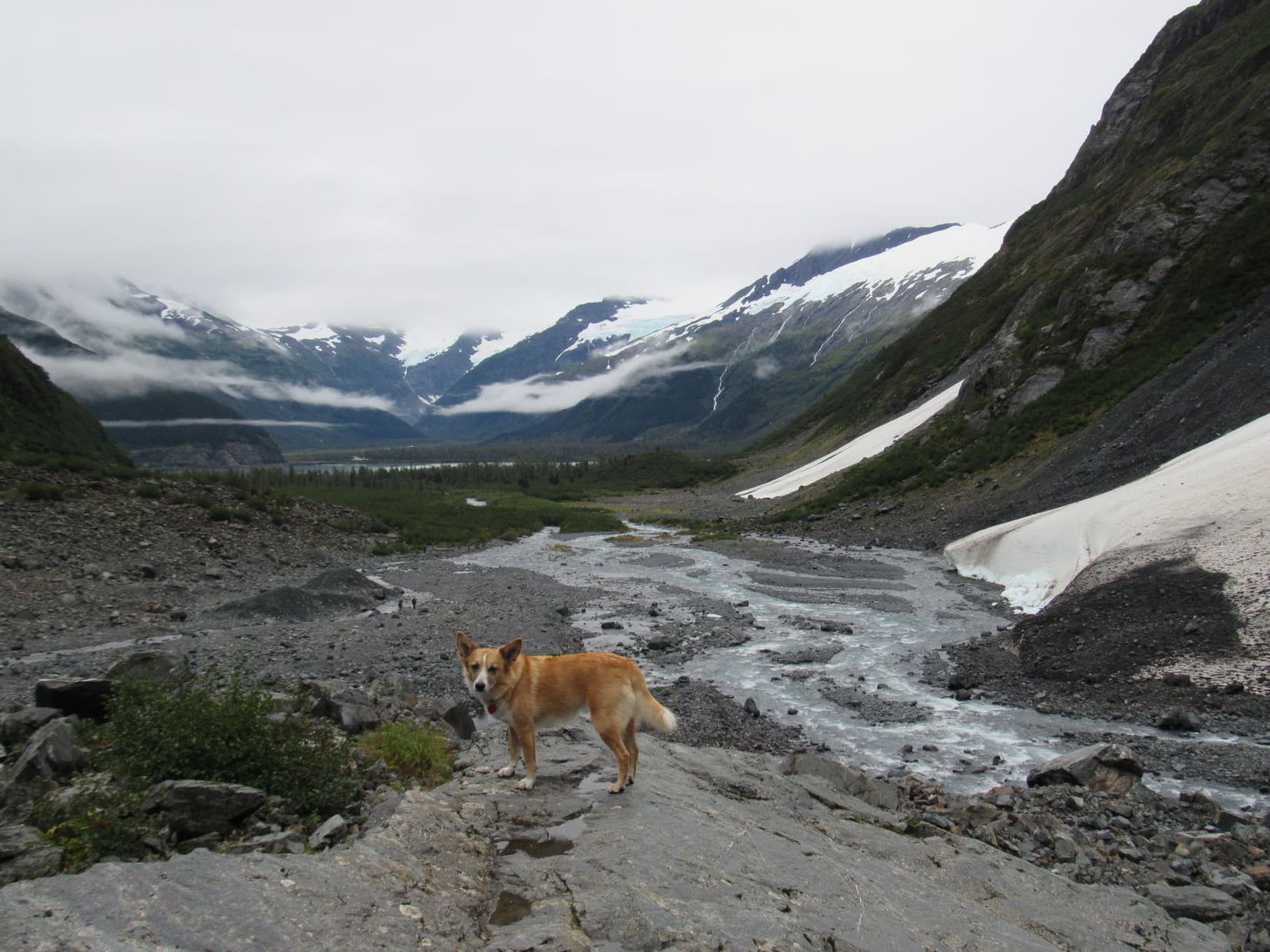
Less than 0.5 mile before Lupe reached Portage Lake, she had passed by the trailhead to the Byron Glacier. This easy trail with very modest elevation gain leads about a mile up a valley to the SW where the Byron Glacier can be seen. Lupe and SPHP left Portage Lake to go check it out, parking the G6 at the trailhead (11:52 AM, 53°F).
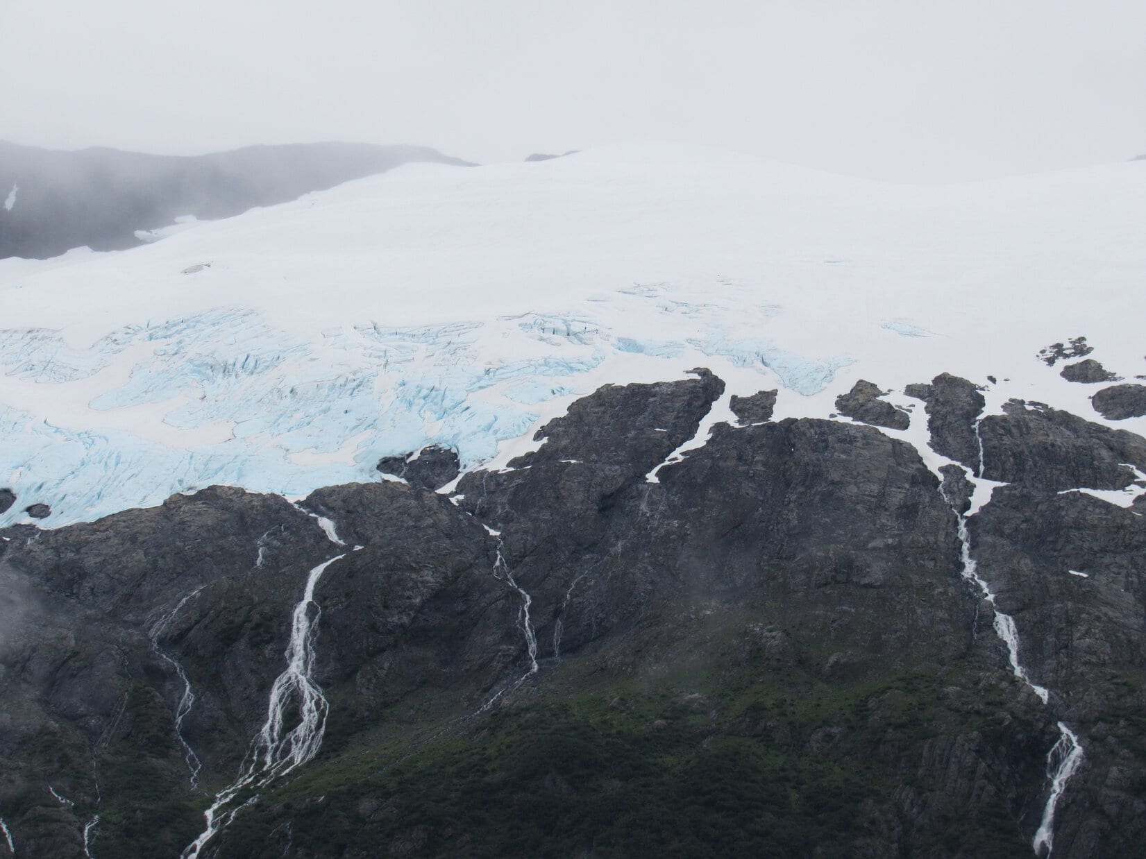
The first part of the trail was an easy stroll through a forest. Meltwaters from the Byron Glacier formed a rushing stream on the SE side of the trail. The trail did not cross the stream, but followed it up the valley. When the trail left the forest, the Byron Glacier, which has retreated up onto the steep N slopes of Byron Peak(4,700 ft.), was in view ahead.
When the trail left the forest, the Byron Glacier was in view clinging to the steep N face of Byron Peak. Photo looks SW.The Byron Glacier has retreated from the valley, and is now a hanging glacier. Photo looks SW using the telephoto lens.The top of Byron Peak was hidden in the clouds, but most of the glacier was in view. Photo looks SW using the telephoto lens.
The official Byron Glacier trail ended at a low rock wall. The trail was busy, even on this overcast day, and some people turned back here. However, many went farther up the valley to get closer to the glacier, scrambling among the rocky terrain left by the glacier’s retreat. Lupe and SPHP continued beyond the trail’s end, too.
Lupe on the low rock wall at the official end of the Byron Glacier trail. The glacier has retreated so far that the end of the trail is no longer all that close to the glacier. Photo looks SW.
The Byron Glacier is famous for having accessible ice caves. Lupe didn’t go that far, but she did go beyond the official end of the trail far enough to see what appeared to be a large ice cave ahead.
Lupe went far enough up the valley to where she could see what looked like a large ice cave ahead. Photo looks SW.The ice cave looked less like a cave through the telephoto lens, but maybe there was a cave up there somewhere. What was clear was that the Byron Glacier was larger than it looked. A lot of snow and ice was hidden beneath rocks and debris. Photo looks SW.
The closer Lupe got, the easier it was to see the blue ice high up on the Byron Glacier. The glacier was a beautiful sight with the gorgeous blue and white ice above, and waterfalls plunging down the gray mountainside below.
The Byron Glacier was a gorgeous sight with blue and white ice above, and waterfalls plunging down the gray mountainside below. Photo looks SW.Love that glacial blue ice!
Lupe explored up the valley far enough to where she could look back down and see Portage Lake surrounded by mountains in the distance.
Looking back down the valley, Lupe could see Portage Lake surrounded by mountains in the distance. Photo looks NE.Meltwaters from the Byron Glacier stream toward Portage Lake. The waters will eventually leave Portage Lake flowing only 6 miles NW to the Turnagain Arm of the North Pacific Ocean. Photo looks NE.
Lupe and SPHP returned to the G6 (1:51 PM). Even at a leisurely pace, the easy trek to see the Byron Glacier had only taken a couple of hours. At least it had given Lupe a chance to get some exercise. Most of the rest of the day would be spent in the G6 looking for those sunny skies.
SPHP drove back to the Seward Highway and turned S (L). Almost immediately, the highway curved around to the NW. A few miles later, it turned SW where a big sign welcomed Lupe to the Kenai Peninsula!
Lupe reaches Alaska’s Kenai Peninsula.
The drive through the Kenai Peninsula was gorgeous. Lupe saw forests, towering mountains, big lakes and rivers. At a junction, SPHP took the Sterling Highway toward Soldotna. Lupe passed Kenai Lake, traveled for miles along the beautiful blue-green Kenai River, saw the turnoffs for huge Skilak Lake and the Russian River where bears fish for salmon.
A few miles after passing the Mystery Hills trailhead, the Sterling Highway left the mountains. This part of the Kenai Peninsula was low, forested, flat, and dotted with lakes and marshlands. Sterling was hardly noticeable as a community, but Soldotna was a thriving, busy place. A quick stop for supplies at the Safeway in Soldotna, and Lupe continued on.
The Sterling Highway headed SW from Soldotna, eventually reaching bluffs above the Cook Inlet of the North Pacific Ocean. By now the skies had cleared. At last, Lupe basked in sunshine! Perched along the bluffs overlooking Cook Inlet were homes, campgrounds, RV parks and restaurants. They all had a stupendous view.
Far to the W across Cook Inlet was a grand, lofty mountain. At first, SPHP wasn’t sure what mountain that was, but Lupe was seeing the highest peak of the Aleutian Range, the Redoubt Volcano(10,197 ft.), for the first time.
SW of Soldotna, the Sterling Highway reached bluffs above the Cook Inlet of the North Pacific Ocean. Far away to the W, on the other side of Cook Inlet, Lupe saw a grand, lofty mountain – the Redoubt Volcano! Photo looks W.
Near the tiny village of Ninilchik, SPHP left the highway to drive a couple miles down a deeply potholed road to the beach. Lupe and SPHP left the G6, and walked down to the shore of Cook Inlet.
Bathed in evening sunlight, Lupe reaches Cook Inlet of the North Pacific Ocean near the tiny community of Ninilchik. Redoubt Volcano is very faintly seen on the far horizon straight up from Lupe’s head. Photo looks NW.
Faintly, beyond the shining sea, Lupe saw not just one, but two magnificent peaks! To the NW was the Redoubt Volcano, which she had already glimpsed from the highway. To the W was another glacier-covered stratovolcano, nearly as high, the Iliamna Volcano(10,016 ft.).
Redoubt Volcano from the Cook Inlet beach at Ninilchik. Photo looks NW using the telephoto lens.Across the shining sea was a 2nd magnificent mountain, the Iliamna Volcano. Photo looks W using the telephoto lens.
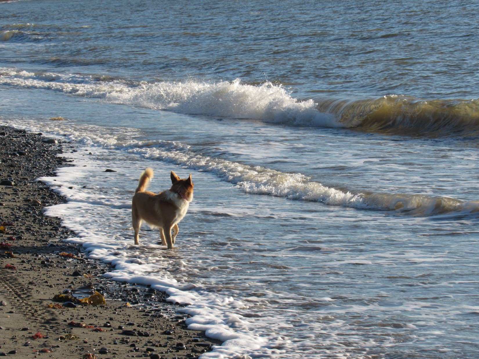
Lupe had seen the ocean twice already on her Summer of 2016 Dingo Vacation, once at Hyder, Alaska on her trip to see the Salmon Glacier, and then again earlier today at Beluga Point. At Ninilchik, though, for the first time since she was only 1.5 years old during her 2012 Dingo Vacation to the West Coast, Lupe got to go for a walk along the ocean.
Here at Ninilchik, a happy Lupe got to go for a walk along the ocean for the first time since she was only 1.5 years old on her 2012 Dingo Vacation to the West Coast. She went as far as the end of the bluff seen in the distance. Photo looks SW.
SPHP wondered if Lupe remembered playing at the ocean? Did she remember what a fabulous time she had on the West Coast in 2012 racing along the beach, while barking at seagulls flying overhead? At first, Lupe seemed uncertain about the ocean, but somewhere in that Dingo mind, she did recall something.
Soon she was watching for seagulls again, but saw only one fly by. She made up for it by barking at some crows. Loop began to run around exploring, stopping to sniff the very strange smells of seaweed, dead crabs, and other things washed up on the beach. She remained cautious, though, when it came to the cold waves rolling in to shore. She was careful not to let more than her paws get wet.
Lupe looks out to sea, being careful not to let more than her paws get wet in the cold water. If Lupe had been here 238 years earlier in late May, 1778, she might have seen the HMS Resolution sail by under the command of famous explorer Captain James Cook on his search for the fabled Northwest Passage.Exploring the beach.
The evening stroll along Cook Inlet was fantastic! Living in the Black Hills of South Dakota more than 1,000 miles from any ocean, being here was a rare treat. The glowing sunlight, the sound and motion of the surf, and the distant wild mountains of Alaska on the far shore watched over by the giant Redoubt and Iliamna Volcanoes were an unforgettable combination.
Lupe went SW along Cook Inlet as far as Deep Creek, right across from Cape Ninilchik. She was perhaps 2 miles from where she’d started near Ninilchik village. Then it was time to turn around, and enjoy it all over again.
Lupe on the shore of Cook Inlet. Buildings back at the village of Ninilchik are seen on the far bluff. Photo looks NE.
A woman was searching for her lost 9 year old dog named Ola, when Lupe and SPHP neared Ninilchik again. Unfortunately, Lupe and SPHP hadn’t seen Ola, and couldn’t help her. Lupe’s fur was full of sand from her romp on the beach, so SPHP drove her over to a campground to rinse it off.
It wasn’t long until sunset now, but there was still time to go take a look at Ninilchik’s most famous building. On a steep bluff above the village of Ninilchik sits a Russian Orthodox church dedicated on this site in 1901. Lupe and SPHP went to pay it a visit. When Lupe arrived, the lady looking for Ola was there, too. Someone had seen Ola not too far from here a short time ago.
Since Ola was likely to be found soon, Lupe went on to take a look at the little church.
This Russian Orthodox church sits on a bluff above the village of Ninilchik.The church was closed, but Lupe at least got to sit on the front porch.
The churchyard seemed to double as a graveyard with many white crosses around. The grounds also featured a profusion of flowers.
The Russian Orthodox church was a quaint reminder of the Russian origins of Ninilchik back in the 1800’s before the United States purchased Alaska from Russia. Lupe had a good time sniffing among the many flowers growing in the churchyard, but she couldn’t stay long.
Before the sun was down, Lupe returned to the beach on the Cook Inlet. A handful of other people and dogs were around (though not the elusive Ola), too. Everyone was gathered here to enjoy sunset over Cook Inlet and the mountains on the far shore.
Iliamna Volcano from Ninilchik near sunset. Photo looks W using the telephoto lens.Lupe made it back to the beach on Cook Inlet near Ninilchik with little time to spare before sunset. Redoubt Volcano can be seen beyond Lupe. Photo looks NW using the telephoto lens.Cook Inlet and Redoubt Volcano. Photo looks NW.Cook Inlet and Iliamna Volcano. Photo looks W.
Sunset at Ninilchik was an amazingly beautiful and peaceful time. Everyone was friendly and happy. Lupe had found her sunshine at last, after many long days of trying to dodge, or wait out, frequent rain beneath dark skies.
Sunset over Cook Inlet from Ninilchik. Iliamna Volcano on L. Photo looks W.Carolina Dog, Lupe was 238 years too late to see Captain James Cook of the British navy sail by on his search for the Northwest Passage, but at least she was here now to discover Cook Inlet for all American Dingoes!Day’s end at Cook Inlet, Ninilchik, Alaska. Photo looks WNW.Iliamna Volcano.Redoubt Volcano.
And then it was over. The last rays of sunset disappeared from view.
The sun was down, but Lupe’s day wasn’t over yet. As golden twilight faded to night, SPHP drove SSW on the Sterling Highway. Near Anchor Point, Lupe was running out of land farther W on the Kenai Peninsula. The road curved S, then SE.
It was 10:30 PM, by the time Lupe rolled into Homer. Her next big Alaska adventure would start here. Today, Lupe had reached and enjoyed time spent along the North Pacific Ocean at Cook Inlet. Tomorrow, if the weather held, explorer Lupe would set sail.