Day 1 of Lupe’s 2018 Dingo Vacation to the Bighorn Mountains of Wyoming & Beyond!
6-9-18 – Early afternoon found Lupe streaking across the border into Wyoming riding high in air-conditioned comfort upon her pile of gear, pillows and blankets. The G6, all shined up for the occasion, raced W on I-90. Oh, yeah! It was on! The glorious Summer of 2018 was officially underway!
Lupe was thrilled! After nearly 9 long months spent close to home in the Black Hills of South Dakota, it seemed like forever since she’d headed off to new adventures in faraway places. Yet the American Dingo clearly remembered exactly what Dingo Vacations are all about.
Furious barking, mostly – at least en route! Loopster eagerly scanned the fields along I-90 for the next herd of cows or horses she was rapidly bearing down upon. Barking at cows, horses, sheep, antelope, barns, outbuildings and suspicious haystacks is a joyous game that never gets old! The decibel level in the G6 seldom meets safety standards while in cattle country.
The first respite from the din came at the Moorcroft, WY rest area. Loop and SPHP both got out to stretch. Lupe sniffed about the grounds, which featured big, shady cottonwood trees. Sadly, no cows or horses were right here today, but SPHP read an interesting true story to Lupe about some mighty fine days long ago in the Old West when there had been plenty of cows in Moorcroft.
Oh, what a wonderful day! I can hardly believe it’s really summer again and we’re setting off on another Dingo Vacation!Lupe liked this true story about thousands of cows and sheep! SPHP said the cowboys must have had a bunch of horses, too. Those were the days!
The Bighorn Mountains of N central Wyoming were Lupe’s destination for most of this first Dingo Vacation of 2018. The Bighorns are only a few hours from the Black Hills. Despite an afternoon start, Lupe would easily arrive by evening.
Even before getting to the Bighorns, though, Loopster had one quick peakbagging possibility SPHP wanted her to check out along the way. At Gillette, SPHP turned S on Hwy 59. Antelope Butte(5,073 ft.), a hill with 30 miles of isolation (minimum distance to a higher point) was only 6 or 7 miles S of I-90. Curiously, it was seldom climbed according to statistics on Peakbagger.com.
The map showed Antelope Butte was situated only a mile W of Hwy 59. A side road went to towers on top of it. If hardly anyone was getting to the summit of a hill so close to town with a road to it, access issues were likely. A long shot, perhaps, but maybe it was worth a short side trip to check it out? Lupe liked the notion that there might be antelopes.
Antelope Butte was easily spotted before Loop was even out of Gillette. It wasn’t anything too impressive, just a grassy hill with towers on it. Disappointingly, not a single antelope was in sight, either. The Carolina Dog would still climb it, though, if she could. Why not?
Antelope Butte from Hwy 59. Photo looks WSW with help from the telephoto lens.
SPHP turned W on a promisingly located side road SE of Antelope Butte. A 0.5 mile drive past a couple of businesses brought Lupe to a locked gate. Looked like this was the right place, alright. It wouldn’t have taken Looper long to get to Antelope Butte and back from here. However, in addition to the locked gate there were other subtle hints that maybe it was best not to.
Hmm. This was the road to Antelope Butte. Photo looks WSW.Frustrating! Antelope Butte was right over there! Photo looks NW.Zoomed in on Antelope Butte. Photo looks NW.
A lot of equipment was stacked around, apparently related to the energy industry. Lupe had passed some sort of Halliburton shop on the way in from Hwy 59. SPHP drove back to see if Lupe might be able to obtain permission to climb Antelope Butte.
Saturday afternoon. The Halliburton shop was closed. No one at all around. Posted signs weren’t the least bit encouraging. The gist of them was that if you weren’t an employee or officially invited, just go away. OK. Whatever. Antelope Butte wasn’t happening. Not today. Lupe and SPHP returned to I-90 and headed W.
3 hours later, Lupe was at the Sand Turn overlook along Hwy 14 on her way up into the Bighorn Mountains. Lupe could see the town of Dayton in the distance and a long way out onto the prairie.
Looking NNE from the Sand Turn overlook.
At Burgess Junction SPHP veered S staying on Hwy 14. Another 9 or 10 miles brought Lupe to road construction at Prospect Creek. Here SPHP turned W on USFS Road No. 10.
No. 10 climbed steadily and wound around quite a bit. After a couple of miles, Lupe had her first look at Prospect Benchmark (9,774 ft.).
Even though Antelope Butte hadn’t worked out, Lupe was still going to get to log a peakbagging success on her first day of this Dingo Vacation. Prospect Benchmark looked like a snap!
So far, most of USFS Road No. 10 had been fairly rough. It deteriorated further as SPHP drove on. The last stretch of road leading to a cattle guard was deeply rutted, and would have been impassible if wet. Nevertheless, the G6 managed to make it up to a broad, gentle saddle 4 miles from Hwy 14.
Lupe on USFS Road No. 10. The last stretch of road to get to this cattle guard had been the worst, and would have been impassible for the G6 if wet. Photo looks SE.
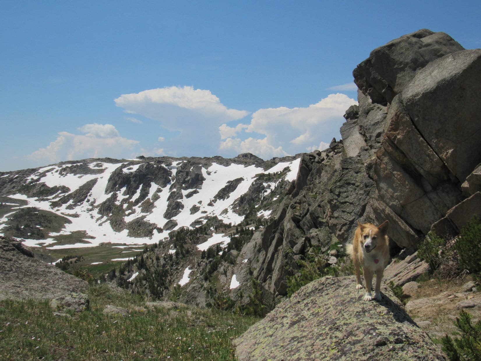
After crossing the cattle guard, SPHP parked the G6 by a barbed wire fence. Prospect Benchmark was now only a ridiculously easy 0.33 mile away to the S. This was going to be cake!
This is it? Looks like you’re starting us out mighty easy on this Dingo Vacation, SPHP! Loop standing by USFS Road No. 217 ready to start for Prospect Benchmark, the ridge in sight beyond the snowbank. Photo looks SSW.
Although the temperature had hit 95°F while traveling across the Wyoming plains on I-90, the evening was pleasantly cool way up here in the Bighorns as Lupe set off for Prospect Benchmark. (7:19 PM, 62°F) Loop started out following USFS Road No. 217, a simple dirt road which headed SW up a long, gentle incline.
Once beyond a large snowdrift, Lupe abandoned No. 217 near the road’s high point just N of the summit area. She scampered S up the remaining grassy slope to a partially broken down escarpment. A mere 5 or 10 foot scramble among the rocks brought Loop up onto the N edge of Prospect Benchmark’s vast, flat, barren summit area.
That had been easy! All Lupe had to do now was find the actual survey benchmark. A cairn of white rocks not too far away along the edge of the escarpment seemed like a logical place to begin. The Carolina Dog found nothing near the cairn, however, except a nice view back toward the saddle where the G6 was parked.
Lupe reaches a cairn near the N edge of Prospect Benchmark‘s summit area. The G6 is parked down at the intersection seen in the saddle. USFS Road No. 10 crosses the saddle, while USFS Road No. 217 is seen heading this general direction, and No. 220 winds away up the distant hill. Photo looks NE.
A check of the topo map showed that the survey benchmark ought to be located toward the SE end of Prospect Benchmark’s huge summit area. Loop and SPHP traveled SE along the escarpment forming the NE edge of the summit keeping a lookout for the benchmark.
Looking SE along the minor escarpment forming the NE edge of Prospect Benchmark’s summit area.
Lupe found nothing of interest until she got close to the end. A 2nd cairn of white rocks sat perched upon a high spot right along the escarpment’s edge, but the survey benchmark wasn’t here, either.
Loop reaches a 2nd cairn near the SE end of the escarpment. Photo looks NE.
However, Loop could see a metal rod sticking up from a smaller 3rd cairn 20 feet to the SW. That seemed promising! Lupe went to check it out.
Nothing here, either, SPHP! Lupe checks out the 3rd cairn with the metal rod sticking out of it. Still no luck. Photo looks SW.
Still nothing! Hmm.
The far SE end of the summit area was now quite close, so Lupe went to it. Again nice views, including a distant view of Cloud Peak(13,167 ft.), the highest mountain in the Bighorn Range, but no survey benchmark.
A distant view of Cloud Peak from the SE end of the Prospect Benchmark summit. Photo looks SE.Looper at the SE end of the Prospect Benchmark summit area. Photo looks NE.Cedar Mountain(9,813 ft.) (L) from Prospect Benchmark. Photo looks SW.
Lupe and SPHP wandered back toward the NW still looking for the benchmark. Even though the terrain was flat and exposed, if the survey benchmark really wasn’t somewhere close to this SE end, it was going to be hard to find. The summit area was just that big.
Could you be a little more specific, SPHP? “It’s gotta be up here somewhere!” isn’t much of a clue! Photo looks WNW.
Maybe Lupe wasn’t going to be able to find the benchmark? Maybe it wasn’t even up here anymore? Even if it was, finding the benchmark might be like looking for a needle in a haystack. Then suddenly, there it was, right in the general vicinity shown on the topo map.
Prospect survey benchmark.
The benchmark was on exposed rock, which made it easy to spot. The marker was only 20 feet NW of the 3rd cairn Lupe had come to, the one with the metal rod sticking up out of it. A fair number of loose white rocks were nearby. SPHP used them to build a cairn. The largest rock had a stiff wire wrapped around it.
The survey benchmark is seen right in front of the big cairn SPHP built. The smaller 3rd cairn with the metal rod is beyond it. Cloud Peak (Center) is on the distant horizon. Photo looks SE.
Well, that was that! SPHP congratulated Lupe on her now completely successful ascent of Prospect Benchmark(9,774 ft.). It was an easy start to her Dingo Vacation, but this was just the beginning.
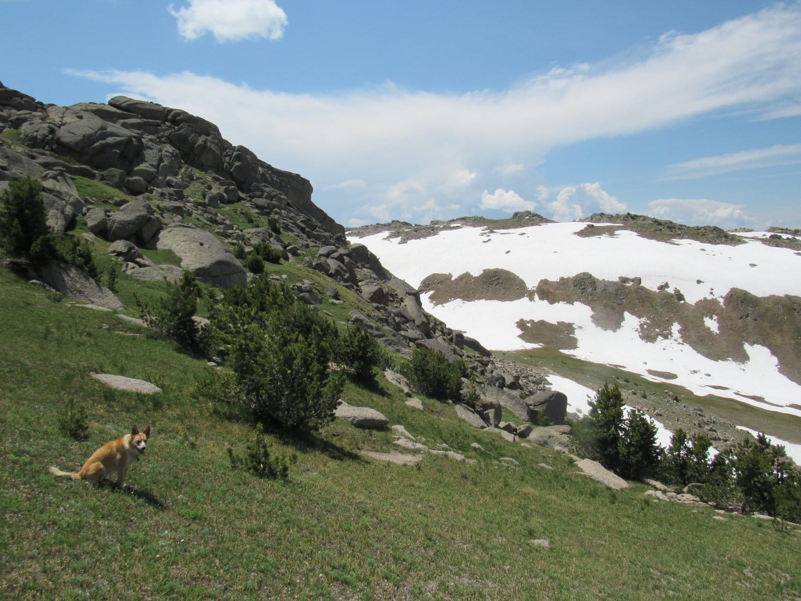
At any rate, the sun wouldn’t be down for a little while yet. Lupe could spend this extra time exploring the area. Just for fun, the Carolina Dog and SPHP wandered 0.33 mile off to the W and SW. The temperature was dropping, but it was a pleasant trek on a beautiful evening with mostly clear skies and only a light SW breeze.
Lupe at the endpoint of her wanderings W of the Prospect Benchmark summit. Photo looks WSW.Looking NE back toward Prospect Benchmark.Sweet Lupe on a beautiful evening in the Bighorns.
The sun sank toward the horizon. Time to head back to the G6. Lupe had fun sniffing and exploring along the way. She crossed snowbanks, and returned to Prospect Benchmark once more.
Crossing a snowbank near sunset. Photo looks ENE.Lupe back at Prospect Benchmark next to the cairn SPHP built. The actual survey benchmark is hidden behind the cairn. Photo looks NW.Here it is!Cloud Peak (Center) from Prospect Benchmark late in the day. Photo looks SE.Crossing a snowbank on the way back to the G6. Photo looks SSE.A look back at the escarpment. Photo looks S.
As Lupe’s adventures go, Prospect Benchmark had been a pretty short one – less than 2 hours, even including wandering off to the W. Loopster arrived back at the G6 still all corked up and full of Dingo energy. (End – 9:00 PM, 54°F)
As twilight faded, SPHP threw a tennis ball for Lupe to chase, then joined in the fun chasing her back and forth around the G6. As far as Lupe was concerned, this exciting game of chase was the highlight of the whole day! She got to show off how fast, agile, and tricky she is, while making a complete fool of SPHP.
Thankfully, it was getting dark. SPHP can only put up with so much abuse. Yet seeing Lupe having so much fun really was the best part of the day, a great finish to the first day of her 2018 summer adventures way up here in the beautiful Bighorn Mountains at almost 10,000 feet by Prospect Benchmark.
Sunset from Prospect Benchmark, Bighorn Mountains of Wyoming, 6-9-18
Day 9 of Lupe’s 2017 Dingo Vacation to the Wind River Range, Wyoming & Select Peaks in Montana
Lightning! Oh, boy. Nothing like getting drenched in the middle of the night. Unable to sleep, SPHP used a small flashlight to study maps. Meanwhile, the American Dingo, tired from yesterday’s fun and games on New Benchmark, and stuffed full of her entire food supply which she had devoured upon returning to Porcupine Pass, snoozed peacefully in the “tiny house” on her red sleeping bag.
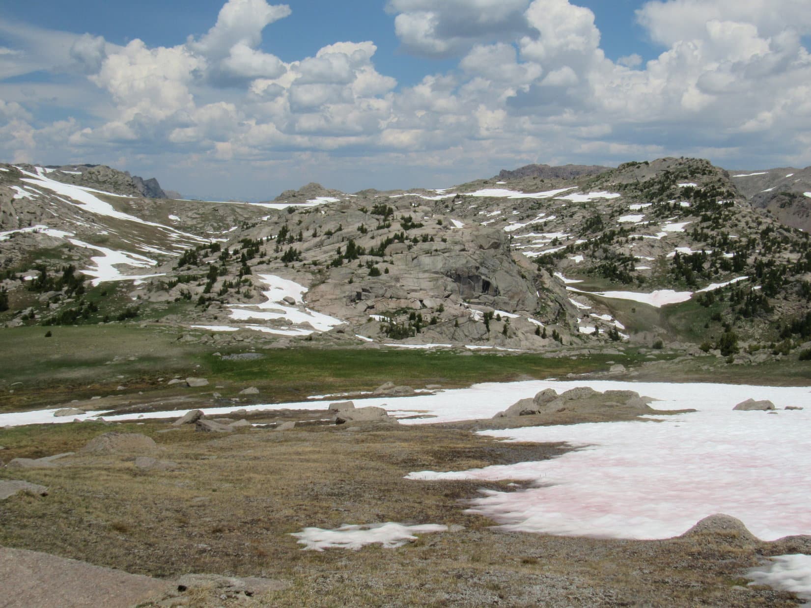
Thunder rumbled for a couple of hours, but thankfully only a little rain fell. At least that was a bit of luck. The maps didn’t have any good news, though. Lupe had made it to New Benchmark(11,850 ft.) yesterday, only to have her route E to Squaretop Mountain(11,695 ft.) blocked by a huge, steep snowbank. What had been seen of a possible alternate route E from N of Porcupine Pass, hadn’t looked promising from New Benchmark, either.
The only other alternative was to go S from Porcupine Pass down the Dodge Creek valley far enough to pick up a trail heading E to the Lozier Lakes area. Loop could then try going N from Kenny or Marten Lakes. She would lose more than 1,000 feet of elevation from her current position at Porcupine Pass, though, all of which would have to be regained, plus a lot more. And it was a long, long way around. With supplies low already, circling clear around to the S wasn’t realistic.
What that meant was failure. Lupe simply wasn’t going to make it to her prime objective. Sadly, Squaretop Mountain was out. No matter how SPHP looked at it, that was the depressing news the maps contained. May as well beat a retreat back down to Green River Lakes when dawn arrived.
Leaving! Why are we leaving? Just because we can’t get all the way to Squaretop Mountain doesn’t mean we have to turn tail and flee, does it, SPHP? We have more time don’t we? It took us a whole day to get here! It’s a wonderful morning. We’re already at nearly 11,000 feet. What’s wrong with all these mountains around here? Can’t we climb one of them instead?
All true, Looper. If you’re up for trying something else, I guess we could. Didn’t really bring any decent maps of anything other than the route I thought we could take to Squaretop, but some of the territory W of here looked pretty fun and not too difficult from New Benchmark yesterday. The maps do show a Dome Peak(11,234 ft.) a few miles SSW of here. We could salvage something from this day, and try for Dome Peak if you like.
Sure! Why not? Dome Peak is fine with me. Let the salvage operations begin! I’m raring to go!
SPHP disassembled Lupe’s tiny house and packed everything up. The first step in the journey to Dome Peak was to head SW over Porcupine Pass Peak(10,890 ft.), which Lupe had visited yesterday morning, too. It was a short, easy walk to the top, a nice change of pace after a couple of long, hard days.
Loop back up on Porcupine Pass Peak for the 2nd morning in a row. Porcupine Pass is below on the L. Photo looks E toward New Benchmark, which Lupe had climbed yesterday, and where she’d had to abort her journey to Squaretop Mountain due to steep snow.Loop at the summit of Porcupine Pass Peak again. Dome Peak, her new peakbagging objective, is in the distance straight up from Looper. Photo looks SSW with help from the telephoto lens.
A beautiful sunny trek across Porcupine Pass Peak brought Lupe to a rounded slope that descended gradually to another pass. This pass was unnamed on the maps, but might easily be considered Porcupine Pass SW.
Looking down on the unnamed pass SW of Porcupine Pass Peak. On the way to Dome Peak, Lupe would climb up the other side of this pass. She discovered a trail going up the far slope, which SPHP should have paid more attention to, since it would have been useful later in the day. It was the correct route to the Jim Creek Trail. Peak 11,125, the first of 3 major high points Lupe would come to on her way to Dome Peak is seen on the L. Photo looks SW.
A trail went over the unnamed pass. A quick look at the map showed this would be a longer, but perhaps far less steep route down into the Porcupine Creek drainage than going N from Porcupine Pass when the time came to head back to Green River Lakes. SPHP liked this idea, and decided to stash the tiny house and sleeping bags behind a big rock in the pass.
Lupe cools off on a big snowfield on the S side of the unnamed pass SW of Porcupine Pass Peak. Photo looks SSE.
Lupe continued SW on across the unnamed pass. She climbed up the slope on the far side, which was somewhat steeper than the slope from Porcupine Pass Peak had been, but it wasn’t a problem. SPHP was puzzled when more than halfway up the Carolina Dog discovered a trail winding up this slope.
This trail was unexpected, and SPHP paid little attention to it, assuming it was only a side trail from the main one going over the unnamed pass. This incorrect assessment would have repercussions later in the day. At any rate, Lupe made it up the slope on the far side of the pass, where she had a great view back toward Porcupine Pass Peak(10,890 ft.).
Looking back from the far (SW) side of the unnamed pass. Porcupine Pass Peak is the gentle green hill at Center. Peak 11,420 is on the L. Part of New Benchmark is seen along the R edge. Photo looks NE.
Lupe turned S and headed for Peak 11,125. This was great territory! Open and rolling in a rugged, but not difficult, sort of way. Big snowfields and grassy slopes, scattered rocks, and a myriad of clear trickling streams. Beneath blue skies and sunshine, Lupe ran and ran, streaking over great distances. SPHP strode easily along. Oh, yeah! This was fun!
30 minutes later, Lupe arrived at the top of Peak 11,125. The summit was a relatively small area of big rocks and bigger views.
Lupe at the top of Peak 11,125. The upper Boulder Creek drainage area is seen below. Photo looks WSW.Lupe’s objective, Dome Peak (L), is the distant rounded high point on the horizon. Photo looks SSW.Looking across Dodge Creek canyon from Peak 11,125. In the foreground on the other side are Peak 11,695 (far L) and Peak 11,290 (L). Between them on the horizon is Gannett Peak (L), the highest mountain in Wyoming. Photo looks E.Gannett Peak(13,804 ft.) (far L) is on the horizon. Peak 11,290 is in the foreground. Photo looks ESE from Peak11,125 with help from the telephoto lens.Lupe on Peak 11,125. Photo looks NW with help from the telephoto lens.Looking NNW.The impressive view to the S with a lot of help from the telephoto lens. Peak 11,166 is the high point L of Center. Dome Peak is the rounded high point on the R.
Dome Peak was still close to 3 miles away, so Lupe didn’t linger long at Peak 11,125. To get down off the mountain, she circled back around to the NW until the terrain permitted her to turn SW. She crossed a snowy basin which was part of the uppermost NE portion of the Boulder Creek drainage area.
Loop cools down in the snowy basin SW of Peak 11,125. This basin is part of Boulder Creek’s uppermost NE drainage area. The next high point Lupe headed for is seen on the L. Photo looks SW.
The next high point on Lupe’s way was immediately S of the snowy basin. The lower slopes of this hill were also snow-covered. SPHP found the climb easiest staying on lanes of bare ground when possible. Meanwhile, the Carolina Dog wandered wherever she pleased.
This hill wasn’t as high as Peak 11,125. The upper slopes were far less snowy than lower down. Scattered stands of stunted trees grew amid a great deal of rock. In fact, the whole hill was almost solid rock.
Lupe reaches the top of the 2nd high point on her way to Dome Peak. This hill wasn’t quite 11,000 feet. Photo looks SE.Same view with help from the telephoto lens. Palmer Canyon is across the way on the L. Peak 10,985 is at Center, and Peak 11,166 is on the R. Photo looks SE.
From the second high point, Lupe could see the next hill ahead to the S. It was higher than this one, and must have been nearly the same elevation as Peak 11,125. A long, broad green slope with patches of snow to the E led toward a rocky summit. The slope was a steady climb, but getting to the top should be a piece of cake.
Lupe lost elevation again going W down off the second high point. She soon turned S and headed straight for the third high point.
The long green slope leading up the third high point. Lupe headed for the highest rocks seen just R of Center. Photo looks S,
Loop reached the top of the long green slope at a big rock outcropping at the NE end of a long summit ridge. Dome Peak was in view again. The American Dingo had been making good progress toward her objective. She was already halfway there!
Lupe at the NE end of the 3rd high point’s long summit ridge. Dome Peak (R of Center) was in view again. Loop was already halfway there! Photo looks S.
Cliffs prevented the Carolina Dog from going any farther straight S. It was clear the highest portions of the third high point’s long summit ridge were still off to the SW. Lupe went W, skirting a series of large rocks a bit below and to the N of them.
Lupe had been doing great so far, but while she was working her way toward the true summit of the 3rd high point, SPHP suddenly realized there were problems ahead.
The first problem was the weather. The sky had been almost completely clear all morning. Now pillars of cumulus clouds could be seen boiling up off to the W. They weren’t too big yet, but looked like trouble.
On the way to the highest part of the 3rd high point, SPHP suddenly realized there were problems ahead. The first problem was the weather. Pillars of cumulus clouds were boiling up in the W. Photo looks SW.On the way to the top of the 3rd high point. Photo looks WSW.
The second problem was the realization that this 3rd high point still wasn’t part of the long ridge leading to Dome Peak. That ridge was now in view to the SW. Lupe would have to lose a couple hundred feet of elevation to get over to it. That wasn’t a problem, and the long ridge wasn’t more than a few hundred feet high itself, but its sides were steep. Steep with a continuous, big, long snowbank clinging to its upper slopes.
Lupe retreated a little down to the N from the 3rd high point. She would have to come down this way to get over to the ridge on the R leading to Dome Peak. That ridge wasn’t terribly high, but it was steep with a long continuous band of snow on its upper slopes. Photo looks WSW.
Lupe retreated a little down to the N from the 3rd high point. She had to go this way to get around to the W, and head over to the ridge leading to Dome Peak. SPHP stopped and stared at the long ridge for several minutes while Loop sat waiting patiently.
That ridge isn’t that high Loop. It’s totally ridiculous, but I don’t see a way up it. Not with that steep band of snow all along the upper edge.
We need to go over there?
Yeah, if you’re going to make it to Dome Peak, we need to get up on top. It’s a really long ridge. There’s part of it we don’t see from here farther S. Maybe there’s a way up somewhere along the way?
Well, let’s go check it out! I’ll help you find a way up, SPHP.
Thanks, Lupe, but hold on! I’d say yes, but these clouds look like trouble. They’re building fast. Naturally, Dome Peak seems to be ground zero. I hope you’ve had a good time on this romp, but we better call it.
What! No Dome Peak?
Uh-uh. It’s been fun, but I’m afraid our Dome Peak salvage operation is doomed to failure, too. Thunderstorms will be on the way soon. Let’s get out of here, while the getting is good.
Loop didn’t argue. She just sighed, turned, and started trotting N back down the long green slope back toward the 2nd high point. SPHP followed after her.
A look back at the 3rd high point and approaching weather shortly after giving up on Dome Peak and starting the retreat back N. Photo looks SW.A look WNW down into the Boulder Creek canyon on the way down the long green slope.Even though Lupe’s retreat had already begun, and her Dome Peak salvage operation had ended in failure, the scenery was still stunning. Gannett Peak (R) is on the horizon, along with many other huge peaks. Photo looks E on the way down the long green slope.Heading back toward the 2nd high point, the low, almost solid rock hill at Center. Lupe wouldn’t climb it again. Instead, she went around the W (L) side. Peak 11,125, which was the first high point Lupe reached is in view on the R. Lupe didn’t climb it again either. Photo looks N.Looking back at the long green slope to the 3rd high point (L). The long ridge Lupe never reached leading to Dome Peak is on the R. Photo looks SSW.
The American Dingo didn’t climb the 2nd high point again. It was easier to just skip it and go around the W side.
Lupe came to this narrow tarn going around the W side of the 2nd high point on her way back N. Photo looks NNW.
Loop didn’t return to the top of Peak 11,125, either. She stayed NW of it. By the time she reached the snowfields N of Peak 11,125, it was clear the decision to abandon the effort to reach Dome Peak had been a good one. The sky had grown dark. Thunder rumbled to the S, back in the direction of Dome Peak.
By the time Lupe reached the snowfields N of Peak 11,125 again, the sky had turned dark. Thunder rumbled to the S. Photo looks W.
On the way back down into the unnamed pass SW of Porcupine Pass Peak to retrieve the tiny house and sleeping bags, Lupe came across the odd side trail once more. Again, SPHP thought nothing of it. Down in the pass, the weather was so threatening SPHP quickly dug the green plastic rain poncho out of the pack and put it on, before grabbing everything else and hurrying on.
Following the main trail NNW over the pass, Lupe and SPHP started the descent into the Porcupine Creek drainage area. The trail quickly steepened, then vanished! Light rain fell while Loop and SPHP searched for where the trail had disappeared to. Nothing!
Lupe almost started down a large snowfield that went into a big gash in the mountainside. The gash had high, steep sides of bare, loose soil and rocks. The snowfield sloped ever more steeply down until it went out of sight. It was impossible to tell how far down the snow went or how steep it became.
SPHP took another quick look at the map. The trail Lupe wanted went quite a distance W before turning NE down into the Porcupine Creek drainage. Hmm. SPHP led Lupe partway back up to the pass, but only far enough to get around the upper end of the big gash. Once W of the gash, the search for the trail resumed.
Still no trail. The terrain quickly steepened. Lupe was descending fast. To the W was a large snowfield beneath a long rim of cliffs that curved NW. Rocks and boulders stuck up out of the snow in some places. If there was a trail here, it was almost certainly hidden beneath the snow.
W of the big gash, Lupe soon came to the edge of this snowfield beneath the line of cliffs seen curving away to the NW. If there was a trail here, it was buried beneath the snow. Photo looks WNW.
Lupe turned N descending a steep slope of bare ground along the E edge of the snowfield. After losing some elevation, she saw a wall of rock extending W out into the snowfield, creating a partial break in it. As Lupe and SPHP descended into a 2 foot gap between the wall of rock and the snowfield below, it started to rain harder. The rock wall had a bit of an overhang offering partial protection from the weather.
Looking WNW from the narrow gap between the wall of rock and the snowfield below it.Lupe takes shelter from the rain beneath a small overhang.
Standing around waiting for the storm to end, SPHP had time for reflection. The light finally went on. That odd side trail Lupe had found twice, the one that went up the slope on the W side of the pass, wasn’t a side trail at all! It was the main trail Lupe had been looking for leading over to the Jim Creek trail! It stayed way up high, and didn’t come down here at all. The trail going N over the pass was just a dead end. A more careful look at the maps confirmed it.
Lupe had already lost too much elevation to consider climbing all the way back up to the pass. The main trail went through some beautiful, easy high country that would have been fun to see, but going that way would add at least a couple of miles to the trek back to Green River Lakes. Besides, the storm was still back in that direction. The snowfield below the wall of rock wasn’t so steep that Lupe and SPHP couldn’t just descend it instead.
This snowfield below the wall of rock wasn’t so steep that Lupe and SPHP couldn’t simply walk right on down it. That became the new plan when SPHP finally realized there wasn’t actually any trail going down this way. Photo looks NW toward Peak 11,246 (Center).
Despite all the thunder, it didn’t rain very hard or long. The American Dingo emerged from her hiding place ready to tackle the long snowfield. Down, down, down she went. Progress was fast on the snow, but lower down it finally ran out. Lupe then had to wait while SPHP slowly picked a way through boulder fields, occasionally assisted by lanes of vegetation.
Heading down the long snowfield. Peak 11,246 is on the L. Porcupine Creek valley on the R. Photo looks NNW.Lower down, there was far less snow. Lupe had to wait around while SPHP slowly picked a way down through boulder fields. Although thunder continued to rumble off to the S for another couple of hours, the sky cleared to the N, and it didn’t rain again. Photo looks NW.
It took a long time for SPHP to finally reach the valley floor. Another long march ensued in the forest looking for the Porcupine Trail. The Carolina Dog eventually found it. From then on, Lupe stuck to the trail, with only two exceptions. Just as she had inadvertently done 2 days ago on the way up, Loop twice bushwhacked through the forest to avoid 4 unnecessary fordings of raging Porcupine Creek.
Flowers like these were common in the forests and fields of the miles long Porcupine Creek valley.Looking for the Porcupine Trail down in the Porcupine Creek valley. Photo looks N.
The sun had gone down behind the mountains. Light was fading by the time Lupe reached the final ford of Porcupine Creek near Green River Lakes. The roar of the water was tremendous. If anything, Porcupine Creek looked more dangerous than it had been 2 days ago.
Weary from the long trek, SPHP dithered for 15 minutes. The courage to attempt the ford carrying both Lupe and the backpack could not be summoned. The deafening, powerful flow was too intimidating. A slip might end tragically, with dear Lupe swept away almost instantly to be pinned against debris clogging the stream immediately below the ford. SPHP would have little chance of saving her, if that happened. The thought was too terrible to bear.
The creek had to be forded somewhere, though. There was no way to bushwhack around it this time. SPHP finally led Lupe downstream through a bog, looking for a safer place to cross. After a 10 minute march, Porcupine Creek spread out evenly so the water wasn’t so deep. The creek was wide, but had a fairly long straight stretch here with no obstacles nearby downstream. The water was still moving fast. It wasn’t whitewater, though, and was only knee deep.
This was probably as good as it was going to get. SPHP stepped down into the stream. Lupe sat on the bank, lifting up her little freckled front paw to plead for help. SPHP picked her up and started across.
The bottom of Porcupine Creek was full of medium-sized rounded rocks. The rocks were slimy and slippery. SPHP had a hard time finding good footing. It was a real struggle to maintain balance against the swift current.
Two thirds of the way across, SPHP began to lose it. Fighting for control, Lupe got slung around wildly this way and that. For close to 10 seconds, the outcome remained uncertain. Then Lupe was flung unceremoniously aside as SPHP fell face first in Porcupine Creek.
SPHP was totally drenched from head to toe, but recovered quickly. Thankfully, the backpack with the camera and all the rest of the gear had stayed above water. That was all fine. But where was Lupe? SPHP immediately turned to look downstream. She wasn’t there!
Over here!
There she was! The totally soaked Dingo was already standing safely on the far shore. After her unexpected plunge into Porcupine Creek, she’d made it in a flash the rest of the way across unharmed on her own. SPHP sloshed over to her, and stepped dripping up onto the bank.
That was better than a Tilt-A-Whirl, SPHP, but you might have warned me about the grand finale! What do you call that exciting little maneuver?
Sorry about that Loop. Glad you’re OK. I think that last bit of excitement is what’s known as our final ignominious defeat on this whole failure prone trek striving to get to Squaretop Mountain.
We aren’t coming to any more fords, are we?
No, I saved the best for last. This was it, we’re done with fords. Think I’m all forded out. At least we’re across this damn creek in one piece. Come on, we still have miles to go, and the skeeters are bad.
The flashlight had to come out on the Lakeside Trail. Stars shone above, but it was plenty dark in the forest. Once back at the G6 (10:24 PM), Lupe devoured a whole can of Alpo before turning in for the night. It was nearly midnight by the time SPHP was in dry clothes, and could join her in Dingo dreamland.
Lupe at Lower Green River Lake the next morning, with beautiful, iconic Squaretop Mountain, which she still hadn’t made it to the top of, in the distance on the R. Wind River Range, Wyoming.