Kings Throne, Kluane National Park, Yukon Territory, Canada (8-7-16)

Days 8 and 9 of Lupe’s Summer of 2016 Dingo Vacation to the Canadian Rockies, Yukon & Alaska

That guy at the Bell 1 rest area yesterday evening had been right.  There were bears in these woods!  As Lupe and SPHP rolled N along Cassiar Highway No. 37 early on August 6th, Lupe saw 7 bears near the road in a span of 1.5 hours.  Each bear was cause for a ferocious barkfest – from the safety of the G6, of course – as Lupe sped on by.

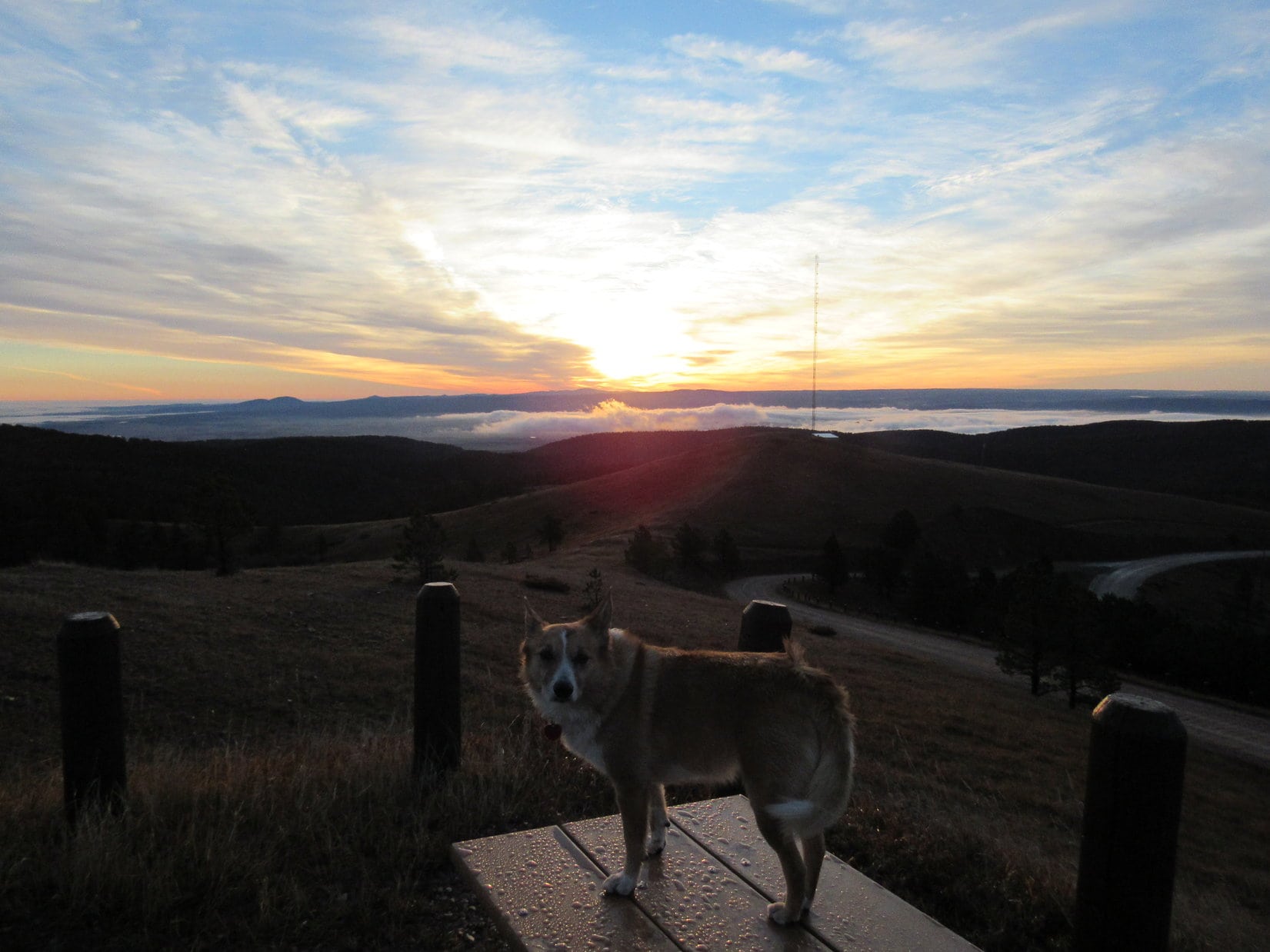
Day 8 of Lupe’s summer of 2016 Dingo Vacation was going to be a travel day.  SPHP drove.  Lupe looked out the window watching for wildlife.  After the bears, though, no wildlife appeared.  Lupe got bored and snoozed.

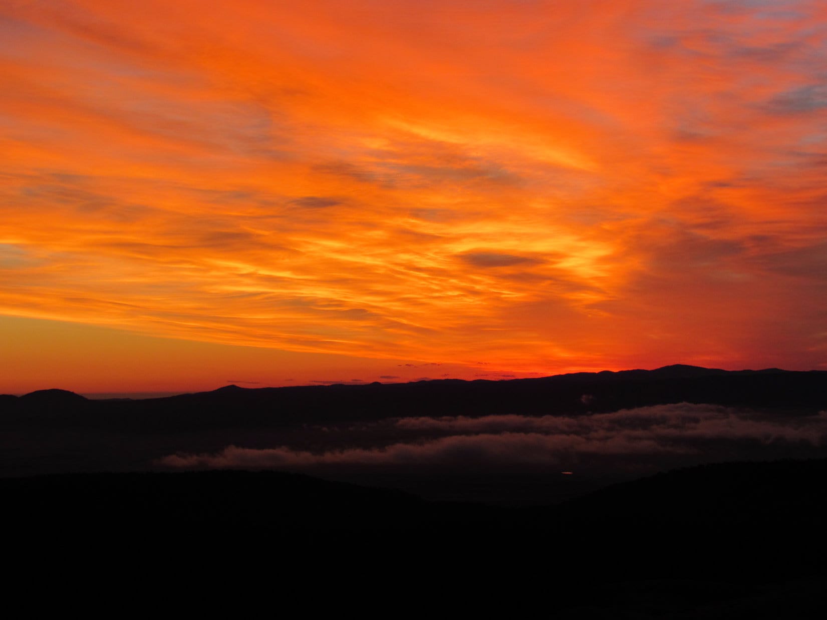
Cassiar Highway No. 37 went past beautiful mountains and lakes.  It crossed scenic rivers.  The forest never ended.  Even now, in 2016, with 7.5 billion people on the planet, Lupe really was in an unbelievably vast, uninhabited land.  The narrow strip of highway was the only link to civilization.  Everything else was unspoiled wilderness.  It all hardly seemed possible.  It felt like going back in time.  Columbus may have landed in the Americas almost 524 years ago, but along the Cassiar Highway there were still few visible consequences.

Mehan Lake from the Bell 2 rest stop along the Cassiar Highway. The Cassiar Highway passed many beautiful lakes, some of them far larger than Mehan.

The hours and miles went by.  There was traffic on Cassiar Highway No. 37, more than SPHP expected.  Most of it was big trucks.  Civilization may not have made much of a dent yet, but it is coming soon, even here.

For hundreds of miles, Cassiar Highway No. 37 had been good pavement, but N of the Bell 2 rest stop the road deteriorated.  Rough, broken, patchy pavement appeared.  Stretches of very dusty gravel became common.  N of the tiny community of Dease Lake, the road turned to gravel for a long way.  SPHP feared the Cassiar Highway might be nothing but dust from here on, but Lupe hit pavement again after 25 miles or so.  The worst was over.  Gradually, the Cassiar Highway improved again.

Now and then Lupe and SPHP stopped for short breaks.  At least, they were supposed to be short.  At the Beaver Dam rest stop, SPHP was so weary of driving that 15 minutes of shuteye unintentionally turned into nearly 2 hours of unconsciousness.

On the road again, SPHP felt better.  Unconsciousness has its benefits!  Lupe wasn’t far now from 2 major milestones on her journey.  Suddenly, up ahead, there it was!  A much anticipated sign was up on an embankment near the road.  Lupe just had to stop for this!

Lupe reached the Yukon border on the afternoon of 8-6-16. It was hard to believe she was really here! Photo looks N, of course!

Lupe had made it to the Yukon!  It was hard to believe she was really here.  A relatively short drive N of the Yukon border brought Lupe to the next big milestone of the day.  Lupe’s long journey on Cassiar Highway No. 37 was over.  She had reached the Alaska Highway!  Lupe and SPHP turned W, heading for Whitehorse.

The afternoon wore on.  It was a long way to Whitehorse, hundreds of miles.  Evening came.  Nearing Teslin Lake, there was a bit of Dingo excitement when Lupe saw her 8th black bear of the day.  Lupe didn’t make it to Whitehorse.  Day 6 ended for Lupe W of Teslin Lake.  Time to stop for the night.

Evening along the Alaska Highway, 8-6-16.
Approaching Teslin Lake.

The next morning, Lupe did make it to Whitehorse, the capital city of the Yukon.  She didn’t stay long, though.  Lupe was on her way to her first mountain climbing adventure in the Yukon, instead!

Although there had been mountains much of the way along the Alaska Highway, Lupe first caught sight of the higher, more rugged peaks of the Saint Elias Range approaching Haines Junction.

Lupe along the Alaska Highway. Peaks of the Saint Elias Range near Haines Junction are in view ahead. Photo looks WSW.

At Haines Junction, Lupe and SPHP left the Alaska Highway, turning S on Hwy 3 to Haines.  Lupe wasn’t going all the way to Haines.  Her objective was only 17 miles away now.  About halfway there, SPHP saw a mountain to the SSW resembling a long high wall.  Was that it?  It looked incredibly steep!  SPHP’s heart sank.  Would Lupe be able to climb anything like that?

The realization quickly grew that the N end of the mountain wall really was Lupe’s objective!  Well, there was supposed to be a trail, or at least a route, to the top.  It had taken hours to get here, and was already late in the morning.  No time to second guess things, Lupe would just have to try it and see how things went.

A short drive from a turn off Hwy 3 brought Lupe to the Cottonwood Trailhead.  SPHP parked the G6.  Ten minutes later (10:32 AM, 63°F), Lupe was on the Cottonwood Trail.  The first part of the trail was quite level and followed a road through a shady forest.  Up ahead was Lupe’s mighty objective – King’s Throne Peak (6,529 ft.).

King’s Throne from the Cottonwood Trail. Photo looks SW.
Lupe on the Cottonwood Trail.
To climb King's Throne, Lupe first had to get to the base of the giant cirque in the area shown in the lower R part of this photo. From there, she would follow the steep ridge leading up to the L, before circling back around to the summit on the R via the upper ridgeline. Photo looks SW.
To climb King’s Throne, Lupe first had to get to the base of the giant cirque in the area shown in the lower R part of this photo. From there, she would follow the steep ridge leading up to the L, before circling back around to the summit on the R via the upper ridgeline. Photo looks SW.

About a mile from the trailhead, Lupe came to an intersection.  The Cottonwood Trail headed NW on its way past Kathleen Lake.  It is ultimately part of an 87 km 4-6 day backpacking loop.  Lupe took the King’s Throne trail instead.  The single track trail began to climb steeply.

At first, the trail was switchbacking up through forest, and Lupe couldn’t see much.  Eventually, though, Lupe got above tree line.  The views of Kathleen Lake to the N were already fabulous!

Lupe on the King's Throne trail. Beautiful Kathleen Lake dominates the view to the N.
Lupe on the King’s Throne trail. Beautiful Kathleen Lake dominates the view to the N.
The Cottonwood Trail starts in the forest to the R of the small bay seen on the far side of Kathleen Lake on the R side of this photo. The trail stays in the forest some distance from Kathleen Lake, which was not generally visible from the trail. The smaller long narrow lake seen beyond Kathleen Lake is Lower Kathleen Lake (Center). Beyond it to the L is even smaller Rainbow Lake. Photo looks NNE.

King’s Throne Peak is clearly named for the giant cirque which faces NNE.  The cirque is the seat of the throne, with the high ridges wrapping around it serving as the throne’s arms and back.  It really is pretty easy to imagine the mountain serving as the throne of a titan-sized king.

Evidently the giant cirque is the ultimate destination for many hikers, and they go no farther.  As described in Kluane National Park literature, the King’s Throne trail goes only as far as the cirque.  Elevation gain from Kathleen Lake required to reach the cirque is about 1,800 feet.

Lupe nearing the giant cirque. The steep NE ridge she would have to follow to reach King’s Throne summit is up ahead. Photo looks S.

Down in the forest below, it had been a nice calm day, but as Lupe approached the giant cirque, it was starting to get pretty windy out.  The American Dingo is no great fan of wind, but she had no choice but to put up with it.

Lupe reaches the giant cirque, which is the imaginary seat of King’s Throne. It was annoyingly windy. Photo looks SW.
Just getting to this giant cirque is the ultimate objective of many hikers. Several turned around here while Lupe was in the area, encouraged by the wind to do so. Photo looks SSW.

Lupe and SPHP weren’t the only ones on the King’s Throne trail.  Quite a few other hikers were around.  Some of them turned around at the giant cirque, satisfied with the grand view of Kathleen Lake and being able to say they had hiked King’s Throne trail, which officially ends here.

Of course, Lupe was going onward!  Kluane National Park literature describes the rest of the way up to King’s Throne summit as a “route” rather than a “trail”, because it isn’t officially maintained.  The first part of the route was every bit as good as the official trail had been.  It climbed toward the steep NE ridge of the mountain.

Lupe starts on the “route” to King’s Throne summit. The steep rate of climb the route would soon adopt is evident on the slope ahead. Photo looks SE.
Kathleen Lake from near the start of the "route" part of the trek to the summit. The trail leading to the base of the giant cirque is seen below. Lupe is on her way up to the summit, but hasn't gotten to the steep part of the "route" yet.
Kathleen Lake from near the start of the “route” part of the trek to the summit. The trail leading to the base of the giant cirque is seen below. Lupe is on her way up to the summit, but hasn’t gotten to the steep part of the “route” yet.

When the route reached the steep NE ridge, it turned and worked its way almost straight up it.  For a while there was some grass around.  Later on it was all rock.  The ridgeline became increasingly narrow.  Most of the time, the trail was a bit to the E of the ridgeline.  Off to the W, on the side of the ridge toward the giant cirque, were increasingly fearsome cliffs.

Lupe starts up the route along the NE ridge. Here it was still grassy and not so steep, narrow and rocky. The giant cirque is still in view. Higher up, it was too scary to look over the cliffs in the violent swirling winds to see it. Photo looks SW.
Lupe gaining elevation, but still in the zone where some plants survived. Lupe's goal, the summit of King's Throne, is seen above on the R. Photo looks WSW.
Lupe gaining elevation, but still in the zone where some plants survived. Lupe’s goal, the summit of King’s Throne, is seen above on the R. Photo looks WSW.

The NE ridge was hard going.  The route was either loose rocks or very hard packed soil difficult to maintain traction on.  Hiking poles would have been an enormous help, but SPHP had none.  Even some of the bigger rocks Lupe passed by at certain points were often crumbly, loose and rotten.  Everything had to be tested.

The Carolina Dog had no problems, except for the wind.  She hated it!  As Lupe gained elevation, it swirled more and more violently around the ridgeline.  SPHP joined Lupe on all fours, and virtually crawled up the mountain.  Just trying to stand up and maintain balance was scary.  The wind attacked first from one direction, then suddenly reversed and blew just as strongly from a completely different one.

Lupe in the rocky zone. She would see almost no plants the rest of the way along the route. The big lake in the distance is Dezadeash Lake. Photo looks SE.

Fortunately, it wasn’t cold out, which would have been unbearable in this wind.  Still, the wind was taking a toll.  People were coming down the mountain.

Most had simply turned around, having decided it wasn’t worth it in this gale.  Among them Lupe saw climbers who had passed SPHP on the way up.  A few groups who had left earlier in the day had succeeded in reaching the summit.  They reported even windier conditions there.  Looking down, climbers who had been gaining on Lupe and SPHP could no longer be seen.  They had turned around, too.

The climb up the long, steep NE ridge seemed endless, but Lupe was gaining ground steadily. The last long stretch of the climb is seen here. Photo looks S.

Lupe kept climbing.  Finally, a group of four guys appeared coming down the route.  They had foreign accents and seemed very experienced.  They too, reported very windy conditions at the summit, which they had successfully attained.  They were the last people Lupe saw the rest of the day.  Lupe and SPHP were alone on the mountain.

Lupe still had a ways to go up the steep NE ridge.  Lupe pressed on.  At last, she reached the end.  She came upon a broad rocky plain which was almost level by comparison.  The difficult part of the climb was over.  The rest of the way to the summit would be much easier!

Wow, was it ever windy here, though!  SPHP wouldn’t let Lupe get too close to the cliffs above the giant cirque for fear the Carolina Dog would sail right over the edge.  For a few minutes, SPHP could only stand in one place.  Taking a step was nearly impossible.

Lupe on the extremely windy rocky plain she came to at the end of the very steep climb up the NE ridge. The summit of King's Throne Peak is the more distant high point seen on the R. Photo looks W.
Lupe on the extremely windy rocky plain she came to at the end of the very steep climb up the NE ridge. The summit of King’s Throne Peak is the more distant high point seen on the R. Photo looks W.
Kathleen Lake from the edge of the rocky plain above the NE ridge. SPHP wouldn't let Lupe get any closer to the edge than this due to the gale. Photo looks N.
Kathleen Lake from the edge of the rocky plain above the NE ridge. SPHP wouldn’t let Lupe get any closer to the edge than this due to the gale. Photo looks N.

After a few minutes, a slight lull in the wind allowed SPHP to move again.  For a little while, that was how it went.  When the wind blew hardest, SPHP had to stand stock still, ready to crouch, if necessary.  When there was a lull, progress resumed.  Maybe it would be less windy away from the edge of the giant cirque?

It was!  Away from the cliffs, the wind was noticeably weaker.  Lupe and SPHP were on the move again.  Lupe headed W toward the S side of a rounded high point where a saddle led over to the next peak to the S.

To avoid the worst of the wind, Lupe stayed to the L (S) of the near ridge. Cliffs above the giant cirque were on the other side. Photo looks WNW.
The wide valley S of King's Throne Peak on the back side of the throne is seen here on the R. Dezadeash Lake is in the distance. Photo looks SE.
The wide valley S of King’s Throne Peak on the back side of the throne is seen here on the R. Dezadeash Lake is in the distance. Photo looks SE.
The saddle connecting to the next peak S of King's Throne Peak. Photo looks SSW.
The saddle connecting to the next peak S of King’s Throne Peak. Photo looks SSW.

Maybe it was White Dingo Magic, but contrary to reports from climbers who had been here earlier, the wind was getting weaker, not worse!  Lupe worked her way up and over a high point, and turned NW toward the King’s Throne summit.  The reduced wind speed was a welcome relief.

On the high point N of the saddle leading to the peak to the S, Lupe came to this view of the King's Throne summit ahead. Lupe was almost there! Photo looks NW.
On the high point N of the saddle leading to the peak to the S, Lupe came to this view of the King’s Throne summit ahead. Lupe was almost there! Photo looks NW.

Lupe and SPHP were making good time now.  Even before Lupe reached King’s Throne summit, glorious sights came into view to the W.

Glorious sights appeared to the W as Lupe drew near King's Throne Peak's summit. The biggest lake seen here is actually the W end of Kathleen Lake. Beyond it is Louise Lake. Photo looks W.
Glorious sights appeared to the W as Lupe drew near King’s Throne Peak’s summit. The biggest lake seen here is actually the W end of Kathleen Lake. Beyond it is Louise Lake. Photo looks W.
Lupe on the final approach to the King’s Throne Peak summit. Photo looks NNW.

By the time Lupe reached the summit of King’s Throne Peak, the wind had died down to just a breeze.  Lupe and SPHP were free to really enjoy the stupendous views in every direction!

Lupe atop the summit cairn on King's Throne Peak! It was still breezy when Lupe arrived, but nothing like the gale she'd faced coming up. The views were stupendous in every direction! Louise Lake is seen in the huge valley below. Photo looks W.
Lupe atop the summit cairn on King’s Throne Peak! It was still breezy when Lupe arrived, but nothing like the gale she’d faced coming up. The views were stupendous in every direction! Louise Lake is seen in the huge valley below. Photo looks W.
Louis Lake from King's Throne Peak summit. It was hard to believe Lupe was really here, high on this fabulous mountain in remote Kluane National Park in the Yukon! Photo looks W.
Louis Lake from King’s Throne Peak summit. It was hard to believe Lupe was really here, high on this fabulous mountain in remote Kluane National Park in the Yukon! Photo looks W.
Looking SE from the summit. Dezadeash Lake is on the L. Part of Lupe's route up is visible to the R of Lupe, and also along the top of the dark lower ridge on the L.
Looking SE from the summit. Dezadeash Lake is on the L. Part of Lupe’s route up is visible to the R of Lupe, and also along the top of the dark lower ridge on the L.
Far beyond Kathleen and Louise lakes, mysterious towering snow-capped peaks of the Saint Elias Range lurked partially hidden in the clouds. Photo looks W.
Kathleen Lake from King's Throne Peak. Mount Decoeli is the distant sharp peak seen faintly straight up from the island in Kathleen Lake. Photo looks NW.
Kathleen Lake from King’s Throne Peak. Mount Decoeli is the distant sharp peak seen faintly straight up from the island in Kathleen Lake. Photo looks NW.

On the NE side of the summit, the air was almost calm.  SPHP sat down out of the wind to rest while taking in the magnificent views.  Lupe curled up in SPHP’s lap.  Lupe got petted and praised for bringing SPHP to such a wonderful place.  The Carolina Dog seemed to enjoy every moment.

The W end of Kathleen Lake and Louise Lake again. A small part of Sockeye Lake is visible toward the L beyond Louise Lake. Photo looks W.
Kathleen Lake. Photo looks NNW.

One distant peak Lupe could see was of particular interest.  The steep top of Mount Decoeli (7,650 ft.) was faintly in view to the NW far beyond Kathleen Lake.  Mount Decoeli was on the short list of peaks in Kluane National Park that SPHP hoped Lupe might be able to climb.

However, Mount Decoeli looked every bit as steep as the NE ridge coming up King’s Throne Peak.  Clearly, Decoeli would be a huge challenge.  SPHP gazed at Decoeli filled with both hope and doubt.  Would Lupe ever be on top of that daunting mountain?

Mount Decoeli is the sharp most distant peak on the R. Decoeli was on the short list of peaks SPHP thought Lupe might be able to climb in Kluane National Park. However, the mountain looked daunting from King's Throne Peak. Photo looks NW using the telephoto lens.
Mount Decoeli is the sharp most distant peak on the R. Decoeli was on the short list of peaks SPHP thought Lupe might be able to climb in Kluane National Park. However, the mountain looked daunting from King’s Throne Peak. Photo looks NW using the telephoto lens.

Lupe and SPHP lingered at the summit of King’s Throne Peak for more than 45 minutes.  Conditions were great, and the views were awe-inspiring.  Lupe would have stayed much longer, but she had gotten a late morning start, and it had taken a very long time for SPHP to climb, crawl and stagger all the way to the top.

The time came when Lupe had to think about starting down.  She returned to the King’s Throne summit cairn for a final look.  SPHP took another round of photos.  After all the effort expended to get here, it was hard to think about leaving already to face the steep, windy NE ridge again.

Lupe returned to the summit cairn for a final look around. Photo looks SSE.
The first part of Lupe's route back is in view below on the lower L. It took her over the rounded hills above the snowbank. Photo looks SSE.
The first part of Lupe’s route back is in view below on the lower L. It took her over the rounded hills above the snowbank. Photo looks SSE.
This photo is a pretty good look at the easy part of the climb up King's Throne Peak along the back of the throne. The upper end of the steep NE ridge is seen on the L. Dezadeash Lake is in the distance. Photo looks SE.
This photo is a pretty good look at the easy part of the climb up King’s Throne Peak along the back of the throne. The upper end of the steep NE ridge is seen on the L. Dezadeash Lake is in the distance. Photo looks SE.
A good deal of the steep NE ridge is in view here. Photo looks ESE.
Far to the W of King's Throne Peak were mysterious higher peaks of the Saint Elias range. Lupe never got a clear look at them, but what could be seen was most intriguing. Photo looks W using the telephoto lens.
Far to the W of King’s Throne Peak were mysterious higher peaks of the Saint Elias range. Lupe never got a clear look at them, but what could be seen was most intriguing. Photo looks W using the telephoto lens.

The relative calm Lupe experienced on top of King’s Throne summit did not prevail elsewhere, although the wind wasn’t as bad as it had been earlier in the day.  Lupe and SPHP made good time on the route back until reaching the steep NE ridge.

Going down the NE ridge, the wind was still strong and unpredictable.  The terrain was so steep, the footing so unreliable, and the swirling wind so unnerving that SPHP became extraordinarily slow and cautious.  SPHP crawled, slid, and took baby steps down the mountain.  Lupe became so impatient with SPHP, the were-puppy attacked repeatedly to encourage some movement.

This was taking forever!  The sun was long gone.  The creeping Yukon twilight slowly faded.  Yet the sweeping views of the desolate mountains of the far N were chillingly inspiring.  Thousands of feet below, whitecaps could be seen on Kathleen Lake.

Even the official King’s Throne trail below the giant cirque seemed steeper and more difficult than SPHP remembered.  By now SPHP’s toes were all sore from being mashed against the front of the boots for hours.  The painful trek continued.

By the time Lupe was back on the Cottonwood Trail, SPHP was beat.  Amazingly, Lupe was bursting with American Dingo energy.  The dark forest, roaring waves crashing on the unseen shore of Kathleen Lake, and wildly swaying treetops made Lupe wild, too.  Something darted across the trail in the gloom ahead.  A coyote!  Who knew, maybe it was a wolf?  This was the Yukon!  Lupe seemed ready to dash off into the forest to live wild and free, too!

11:07 PM.  The animated American Dingo was finally back at the G6.  SPHP was still mostly alive.  What a day it had been!  Lupe had succeeded in climbing King’s Throne Peak, a feat dreamed of for a long time now.  Despite exhaustion, SPHP was filled with joy.

Congratulations, Loopster!  You did it – all the way to the top!  Well done, sweet puppy!  King’s Throne was amazingly amazing!  And you know what?  Tomorrow you aren’t even going to think about trying another stunt like that again.  Bunny hill, here you come!

Bunnies?  That grabbed Lupe’s attention!  The Carolina Dog was all in favor of Bunny Hill.

Last photo of Lupe on King's Throne Peak summit before she headed down. 8-7-16
Last photo of Lupe on King’s Throne Peak summit before she headed down. 8-7-16

Links:

Next Adventure                     Prior Adventure

Want more Lupe adventures?  Choose from Lupe’s 2016 Canadian Rockies, Yukon & Alaska Adventure IndexDingo Vacations Adventure Index or Master Adventure Index.  Or subscribe free to new Lupe adventures.

Black Hills, WY Expedition No. 180 – Warren Peaks, Bull Hill, Ragged Top & Lone Tree Hill (10-30-16)

Fog!  Must be just a ground fog, though.  Stars could still be seen above.  With any luck at all, we’ll drive out of it, Loop.  Lupe whined.  She couldn’t see them, but she could smell ’em.  Cows were hidden out there in the foggy darkness!  The Carolina Dog barked, leaping from window to window trying to catch sight of them.

On the way up to Warren Peaks, the G6 did emerge from the fog.  Lupe was going to get to see sunrise from the highest point in the Bear Lodge Mountains after all!

Sunrise from Warren Peaks. The dark outline of the Black Hills in South Dakota is on the horizon. Photo looks ESE.

It was cool and a bit windy when Lupe arrived up on Warren Peaks (6,650 ft.) (7:18 AM, 38°F).  For almost the end of October, conditions were actually exceptionally nice.  Off to the ENE, Lupe could see a thin layer of very low clouds.  That had to be part of the fog she’d gone through to get here.  To the W, the Bear Lodge Mountains were acting like a dam, holding back a sea of more substantial low clouds.

Very low, thin clouds were in view to the ENE. They were part of the ground fog Lupe had traveled through to get here. Photo looks ENE.
Lupe on the highest rocks on the mountain near the Warren Peaks fire lookout tower.

Lupe and SPHP watched the sunrise develop.  Just for fun, Lupe took a little stroll down to a slightly lower hill SE of the fire tower.

The Warren Peaks fire tower from the barren hill to the SE.

Lupe returned to the summit of Warren Peaks.  Sunrise was taking longer than anticipated.  The sun was above the horizon, but obscured by clouds.  SPHP was still interested in watching the display, but Lupe was ready for action!

The sun was up, but obscured by clouds.
Lupe on a picnic table waiting for SPHP to lose interest in the sunrise. It was time to get going!

This was Lupe’s third expedition in a row to the Bear Lodge Mountains in NE Wyoming.  Once again, she had 3 peakbagging goals for the day.  The first one was Bull Hill, only a mile N of Warren Peaks.

The big rounded partly bare hill seen beyond Lupe is Bull Hill, Lupe’s first peakbagging goal on Expedition No. 180. This photo was taken a week before when Lupe visited Warren Peaks on Expedition No. 179. Photo looks N from Warren Peaks.

When SPHP finally quit dawdling watching the sunrise, Lupe and SPHP drove N on USFS Road No. 838.  Before going to Bull Hill, SPHP wanted to check out a viewpoint a short distance NW of Warren Peaks, the same viewpoint where Lupe had seen Devils Tower and Missouri Buttes in twilight at the end of the day on Expedition No. 179.  Now that it was morning, maybe it would be possible to get a clearer view?  (7:49 AM, 38°F)

Heh.  No view at all.  The white sea of low clouds trapped to the W of the Bear Lodge Mountains blanketed all of the territory in that direction.  Lupe and SPHP went on.  SPHP parked the G6 near the intersection of USFS Roads No. 838 and No. 847 (8:06 AM, 38°F).

Getting to Bull Hill (6,394 ft.) was easy.  Lupe trotted E down USFS Road No. 847 to a side road with a Bull Hill Road sign.  She followed Bull Hill Road around the N side of a forested ridge, then SE up the Whitetail Creek valley.  Bull Hill Road curved E, going up and over a saddle.  At the saddle, Lupe was directly S of Bull Hill.  She left the road, climbing up a pasture to the open forest at the top of the mountain.

Lupe on Bull Hill. The fire tower on Warren Peaks is seen in the distance. The cairn and pipe next to Lupe were a little W of the highest point on Bull Hill. Photo looks S.
Lupe stands near the highest point on Bull Hill. Photo looks ENE.

Lupe and SPHP explored the top of Bull Hill.  Toward the E was a nice view of Crow Peak (5,787 ft.) in South Dakota, but Lupe had just seen essentially the same view from even higher Warren Peaks.  After a short stay on Bull Hill, Lupe headed back to the G6 (9:31 AM, 45°F).

Lupe’s next peakbagging goal, Ragged Top, was back to the S a few miles, not really all that far away.  After a short drive, SPHP parked the G6 at the intersection of USFS Road No. 838 and an unmarked road on the E side of No. 838.  (This intersection is a few hundred feet N of the start of No. 838.1B on the W side of No. 838, and marked as 6,374 ft. elevation on the Peakbagger.com topo map.)

To get to Ragged Top (6,260 ft.), Lupe didn’t really have to gain any elevation at all.  In fact, she would lose a little on the way there.  Ragged Top is the high point at the SW end of a mile long ridge.  The G6 was already parked near the higher NE end of the ridge.  Lupe cut through the forest on the W side of USFS Road No. 838 to reach No. 838.1B.  She followed the road SW toward Ragged Top.

Lupe on USFS Road No. 838.1B on her way to Ragged Top. Photo looks SW.

USFS Road No. 838.1B ended at a meadow at a high point.  Lupe was more than half way to Ragged Top, but would have to do some bushwhacking from here.  American Dingoes are great at bushwhacking!  Lupe descended into a saddle leading to a lower forested hill along the ridge.

Lupe in the meadow where USFS Road No. 838.1B ended. She was a little over halfway to Ragged Top here. Next she had to descend into the saddle leading to the forested hill seen beyond her. That hill was part of the main ridgeline leading to Ragged Top, and where she would encounter the first significant rock outcroppings on the way. Photo looks SW.

The saddle area was forested, too.  What’s more, the forest floor was densely carpeted with low juniper bushes.  Lupe found easier traveling over less vegetated ground along the SE side of the ridge.  When Lupe climbed up the forested hill on the SW side of the saddle, she reached the first significant rock outcroppings.

Lupe on the first significant rock outcropping she encountered on her way to Ragged Top. Photo looks SW.

From here on, the now undulating ridge to Ragged Top was much narrower than before.  Lupe passed by, or went over, several more rock formations along the way.  The last part of the ridge turned S as Lupe approached the final high point – the small summit known as Ragged Top.  Soon Lupe was surveying the situation from the top of Ragged Top.

Lupe surveys the world from the top of Ragged Top! Photo looks N.
Lupe on Ragged Top. Photo looks NE.

The best views were actually from rocks farther S where the ridge ended.  Lupe could see both Inyan Kara (6,360 ft.) and Sundance Mountain (5,824 ft.) beyond a bank of clouds sneaking out to the E from the sea of clouds to the W.

Inyan Kara (Center - on the horizon) from a bit S of the Ragged Top summit. Photo looks S.
Inyan Kara (Center – on the horizon) from a bit S of the Ragged Top summit. Photo looks S.
Sundance Mountain (L just beyond the clouds). Photo looks SE.

Lupe was still at the S viewpoint, when a sudden loud explosion echoed up from the valley below!  Gunfire!  Lupe ran to SPHP.  That was it for the photo session.  More gunfire rang out every few minutes.  No way Lupe was letting SPHP get more than a foot away.  The final photo of the Ragged Top summit, taken from the S, had to be Lupe-less.

S face of the Ragged Top summit. There was supposed to be a courageous Carolina Dog poised dramatically atop the highest rocks, but loud gunfire put an end to that notion. Photo looks N.

Lupe had made it to Ragged Top, but she didn’t want to be there now!  With gunfire going on sporadically, all she wanted to do was hide.  Time to get the Carolina Dog out of here!  SPHP led the way back to the G6.

When Lupe reached the forested saddle again, she decided to slink along hidden pathways between the low juniper bushes that dominated the forest floor.  In this manner, she slunk along all by herself clear up to the edge of the meadow where USFS Road No. 838.1B had ended.  As far as the American Dingo was concerned, her slinking worked just fine!  Lupe didn’t get shot.  Not even once.

At the meadow, Lupe and SPHP took a break.  Lupe curled up on SPHP’s lap, so SPHP could pet her and hold her.  This was most reassuring.  It certainly helped that the gunfire stopped, too.  Lupe and SPHP shared a chocolate coconut granola bar.  Things were looking up!  Things were also looking like a mess.  SPHP noticed Lupe treasures scattered along the edge of the forest.

Cleanup ensued.  As Lupe and SPHP continued back to the G6, more Lupe treasures were encountered, this time in the form of empty shotgun shells.  By the time Lupe was back at the G6 (12:07 PM, 55°F), she had two grocery sacks full of treasures.

Warren Peaks from near USFS Road No. 838.1B on the way back to the G6. Photo looks N.

Lupe had one more peakbagging goal for Expedition No. 180, but it was a long way N from here.  On the way, Lupe and SPHP stopped again (12:15 PM, 55°F) at the viewpoint NW of Warren Peaks where she had seen Devils Tower (5,112 ft.) and Missouri Buttes (5,374 ft.) a week ago.

The clouds were gone!  Devils Tower and Missouri Buttes were in view to the NW.  The air was rather hazy, but it was much easier to see them now than at sundown last week.

Devils Tower and Missouri Buttes from the viewpoint NW of Warren Peaks. Photo looks NW using the telephoto lens.

Lupe had a great time in the G6 traveling N to start her journey to her 3rd and final peakbagging goal of the day.  She rode with her head out the window, with the wind in her face.  She saw lots of deer in the forest, plus cows to bark at near Hwy 24.

When SPHP finally parked the G6 (1:17 PM, 61°F) again, Lupe recognized this place.  She had been here before.  She was at the intersection of Planting Spring Road (USFS Road No. 881.1) and USFS Road No. 830.  Two weeks ago on Expedition No. 178, she had stumbled onto this junction on her way to Bald Mountain (4,800 ft.).  Now it was the starting point for her journey to Lone Tree Hill (4,600 ft.).

The first part of Lupe’s route to Lone Tree Hill she had already been on before.  Lupe and SPHP set out going WNW on USFS Road No. 881.1.  Almost right away, Lupe passed by a rather elaborate tent and camper setup on the N side of the road.  Several guys planning on going deer hunting occupied the camp.

Once past the hunters, Lupe had a blast running around in the woods along No. 881.1.  She made good time to the intersection with USFS Road No. 881.1A, which leads to Bald Mountain.  Lupe did not take the turn to Bald Mountain, staying instead on No. 881.1.  The road quickly turned N.

No. 881.1 eventually angled NW for a while.  When it finally turned W, Lupe could see sky between trees at the far end of a slight rise ahead.  Lupe was about to reach the W edge of the large flat ridge she had been traveling along.  Lone Tree Hill (4,600 ft.) was supposed to be off to the NW beyond the edge of the ridge.  Would she be able to see it?

The Peakbagger.com topo map showed No. 881.1 ending (near elevation 4,768 ft.) before reaching the edge of the ridge.  The road didn’t actually end.  Instead, it curved SW on its way down to a somewhat lower area.  Lupe and SPHP left the road going W through the forest, and up the slight rise.

Lupe reaches the W edge of the big, relatively flat ridge she had been traveling. This photo looks SW, the only direction with a relatively clear view. Devils Tower is seen faintly on the horizon above Lupe’s ear. Missouri Buttes are on the R.

Lupe arrived at the edge of a N/S running line of small cliffs.  There weren’t any discernable breaks in the cliff line.  Due to the forest, the only relatively clear view was off toward the SW, where Lupe could see Devils Tower and Missouri Buttes on the far horizon.

It was hard to see between the trees, but there did seem to be a large hill off to the NW where Lone Tree Hill should be.  That had to be it!  Lone Tree Hill appeared to be poorly named.  Although some of the slopes below the line of rock at the summit were bare or sparsely forested, there were plenty of trees on Lone Tree Hill.

Aptly named or not, from a distance Lone Tree Hill looked like an easy climb.  There was one problem, though.  Lone Tree Hill stood off by itself a mile NW of the ridge Lupe was on.  How could Lupe get safely down off these cliffs to cross the low ground between here and there?

The topo map showed only one semi-promising route nearby.  A ravine to the NE trended W to the lower ground Lupe needed to reach.  SPHP hesitated.  No. 881.1 had turned SW where Lupe had left it, heading down toward lower territory, too.  Maybe the road would take Lupe safely down below the cliffs?  That might be a lot easier than bushwhacking through a steep ravine!

Lupe and SPHP left the cliff edge to return to No. 881.1.  Once there, Lupe followed it SW.  The road lost some elevation, but then started to level out and turn S.  It looked like it was going to continue S, staying above a band of cliffs.  Hmmm.  Not good.  Lupe left the road briefly, entering a small ravine leading W.  No dice.  The ravine quickly cliffed out.  The drop was only 15 or 20 feet.  Didn’t matter, it may as well have been 10 times that much.

OK.  The ravine to the NE really was the only reasonable possibility.  Of course, there must be other routes, but they would all be significantly longer.  Lupe had made good time getting to the cliffs.  Even so, it was late enough in the day so the amount of time left before sunset was something to keep in mind.  The afternoon was clouding up.  It wouldn’t be a good idea to still be wandering around in a trackless forest trying to find and bushwhack back up a steep ravine after dark, especially with no moon or stars to help stay oriented.

Better get a move on!  Lupe and SPHP headed back up the road.  Lupe regained all her lost elevation, before leaving the road again to go try the ravine to the NE.  The ravine started out fine.  Gradually, Lupe lost elevation again.  She found an animal trail to follow.  Rock formations appeared on the slopes of the ravine, but Lupe didn’t come to any cliffs on the way W.

The NE ravine route worked!  Lupe lost over 400 feet of elevation.  She found herself safely down in a tall grove of white-barked aspens where the ground leveled out.  She was actually having a great time exploring this remote forest.  SPHP was confident Lupe was going to successfully climb Lone Tree Hill now!

Lupe had been going W down the ravine.  Now it was time to turn NW.  The tall aspens gave way to a forest of scrub oak.  Lupe romped around among fallen leaves looking for squirrels in the oak trees.  She found several squirrels, much to her delight and the squirrels’ annoyance.  Sometimes scrub oaks grow in dense clusters, but this forest was more open than that.  It wasn’t hard to move around.  Lupe was making great progress again.

Exploring the scrub oak forest.

Lupe turned N upon reaching a long saddle leading to Lone Tree Hill’s S Ridge.  By climbing the S ridge, Lupe could get to the lower E end of Lone Tree Hill’s summit ridge.  As Lupe progressed along the saddle, she encountered areas of open ground interspersed between stands of forest.

Lupe was making progress! As she got to the saddle leading to Lone Tree Hill’s S ridge, she came to this view of Lone Tree Hill up ahead. Photo looks NNW.

Lupe reached the S ridge.  Her climb up Lone Tree Hill was about to begin in earnest.  She immediately encountered a new obstacle.  The scrub oak forest was now behind her, and the S ridge leading up was all pine forest.  At least it had been.  The pine forest was devastated!

A tangle of dead trees, most laying perpendicular to Lupe’s route, was blocking the way forward.  It looked like a tornado had hit this place!  The trunks of many trees had simply snapped.

As Lupe started her climb up the S ridge, her route was blocked by a devastated pine forest.

Progress became excruciatingly slow, as Lupe and SPHP struggled over, under, and around the deadfall timber.  Fortunately, the S ridge wasn’t very long.  Lupe only had to gain 200 feet of elevation to reach the lower E end of Lone Tree Hill’s summit ridge.  This was taking forever, though!  SPHP started to worry about how much time was going by.

Slowly, ever so slowly, Lupe and SPHP picked a way up through the shattered forest.  “Lone Tree” Hill, indeed!  If, only!  That “Lone Tree” term had been used rather loosely, hadn’t it?  As in, “Lone Tree” means less than 10,000 trees.  Silly SPHP had been expecting like, maybe, one tree – perhaps a few more, if one counted little trees springing up around the big one.  Not this!  Who had named this place, anyway?  Must have been an Indian 300 years ago.  The name hadn’t been justified in at least that long.

As Lupe starting getting close to the E ridge, the deadfall gradually diminished.  Then, finally, she was out of it.  Hallelujah!  Lupe reached the lower E end of Lone Tree Hill’s summit ridge.  The top of the mountain was in view not too far to the W.

Lupe reaches the lower E section of Lone Tree Hill's main E/W trending summit ridge. The top of the mountain is in view to the W. Photo looks W.
Lupe reaches the lower E section of Lone Tree Hill’s main E/W trending summit ridge. The top of the mountain is in view to the W. Photo looks W.
Getting closer! There was actually a fair amount of deadfall timber near the top of Lone Tree Hill, but nothing like what Lupe had already come through on the S ridge.

Lupe started making good progress again.  She headed for the higher W portion of Lone Tree Hill’s summit ridge.  Near the top, she encountered more deadfall timber.  The deadfall slowed SPHP down, but not Lupe.  Lupe went straight to the top of the mountain.  She had made it!  Lupe stood on the summit of Lone Tree Hill.

Lupe reaches the summit of Lone Tree Hill! Photo looks SE in the direction she came from to get here. The ravine she came down along the distant ridge is a bit hard to see from this angle, but is almost directly above her. Just to the L of that ravine is the part of the big flat ridge where the Peakbagger.com topo map shows High Point 4801.
Looking S from the true summit.

The true summit of Lone Tree Hill was a bit W of where Lupe had come up.  The mountain featured a band of rock and very small cliffs along the S edge of the summit ridge.  Views toward the S were generally quite good.  By moving around the summit, it was possible to see a long way in almost any direction.

The S edge of the summit ridge featured a band of very small orange-yellow cliffs. Photo looks ESE toward High Point 4801 (R).
The top of Lone Tree Hill had some deadfall timber, but it wasn’t too bad. Photo looks E.

The far W end of the summit ridge was a bit lower than the rest of it, but had hardly any trees.  Lupe had a 270° panoramic view from here!  It was a great place to take a break, and celebrate Lupe’s final peakbagging success of the day.

Lupe reaches the far W end of the Lone Tree Hill summit ridge. She had 270° panoramic views from here. Missouri Buttes are on the far horizon directly above Lupe. The top of Devils Tower pokes above the forested ridge on the L. Photo looks SW.
Looking SSW.
Looking SSW.
Looking NW.
Looking NW.

Lupe and SPHP shared water and chocolate coconut granola bars.  Lupe had her Taste of the Wild.  SPHP consumed an apple.  The sun was getting lower, but Lupe would have time to get back to the road before dark.  Actually, it was getting hard to even tell where the sun was.  The sky, which had been at least partly sunny and blue in the morning, was now a boring, indistinct, gray smudge in almost every direction.

Lupe lingered on Lone Tree Hill as long as possible.  Best to enjoy the moment!  Lone Tree Hill was the type of small peakbagging objective that Lupe might well never ever return to again.  It was sort of far from home, sort of hard to get to, and there are higher and more dramatic places to go.

Yet, being on Lone Tree Hill was great!  The sweeping views of the wide open spaces, forested hills, and long dark ridges of remote NE Wyoming were wonderful.  And even if the pine trees weren’t alone on Lone Tree Hill, Lupe and SPHP were.  The solitude and serenity was unbroken, except by the distant mooing of cattle and occasional twittering of small birds.  Lone Tree Hill was good for the spirit.

As it always does, the time came to start for home.  No devastated S ridge for Lupe this time, though!  It would be much easier to head right on down the mostly barren S slope of the mountain from the W end of the summit ridge.  Lupe was ready.  The return trip was something to look forward to, too!

Lupe starts down Lone Tree Hill, eager for more adventures on the long way back to the G6.

The busy American Dingo made the most of the return trip.  She stopped frequently on her way down the mountain to scan the scene below.  She streaked across meadows, sniffed around in forests, barked at squirrels, saw some deer, found and climbed back up the ravine onto the big ridge, ultimately returning to USFS Road No. 881.1.  She traveled the road in fading light, as the forest darkened and grew more mysterious around her.

Lupe on her way back from Lone Tree Hill. Photo looks N.

The deer hunters were in their big tent, talking and laughing, when Lupe passed by again.  Brightly glowing light escaped the tent at various openings.  Smoke drifted out a black smokestack.  Sounded like good times going on inside.

The hunters didn’t see the American Dingo trot by.  She was almost to the G6 (6:09 PM, 54°F), her day’s adventures nearly over, destined for a long ride home to a late Alpo dinner, warm bed, and sweet dreams of a day spent alive and free in the Bear Lodge Mountains of Wyoming.

Lupe on the way back, in the scrub oak forest SE of Lone Tree Hill.
In the scrub oak forest SE of Lone Tree Hill.

Note:  Lupe treasures gathered on Black Hills, WY Expedition No. 180 included 19 aluminum cans, 9 plastic bottles, 3 glass bottles, 48 shotgun shells.

Links:

Next Black Hills Expedition                 Prior Black Hills Expedition

Want more Lupe adventures?  Choose from Lupe’s Black Hills Expeditions Adventure Index or Master Adventure Index.  Or subscribe free to new Lupe adventures.