Decoeli, Kluane National Park, Yukon Territory, Canada (8-9-16)

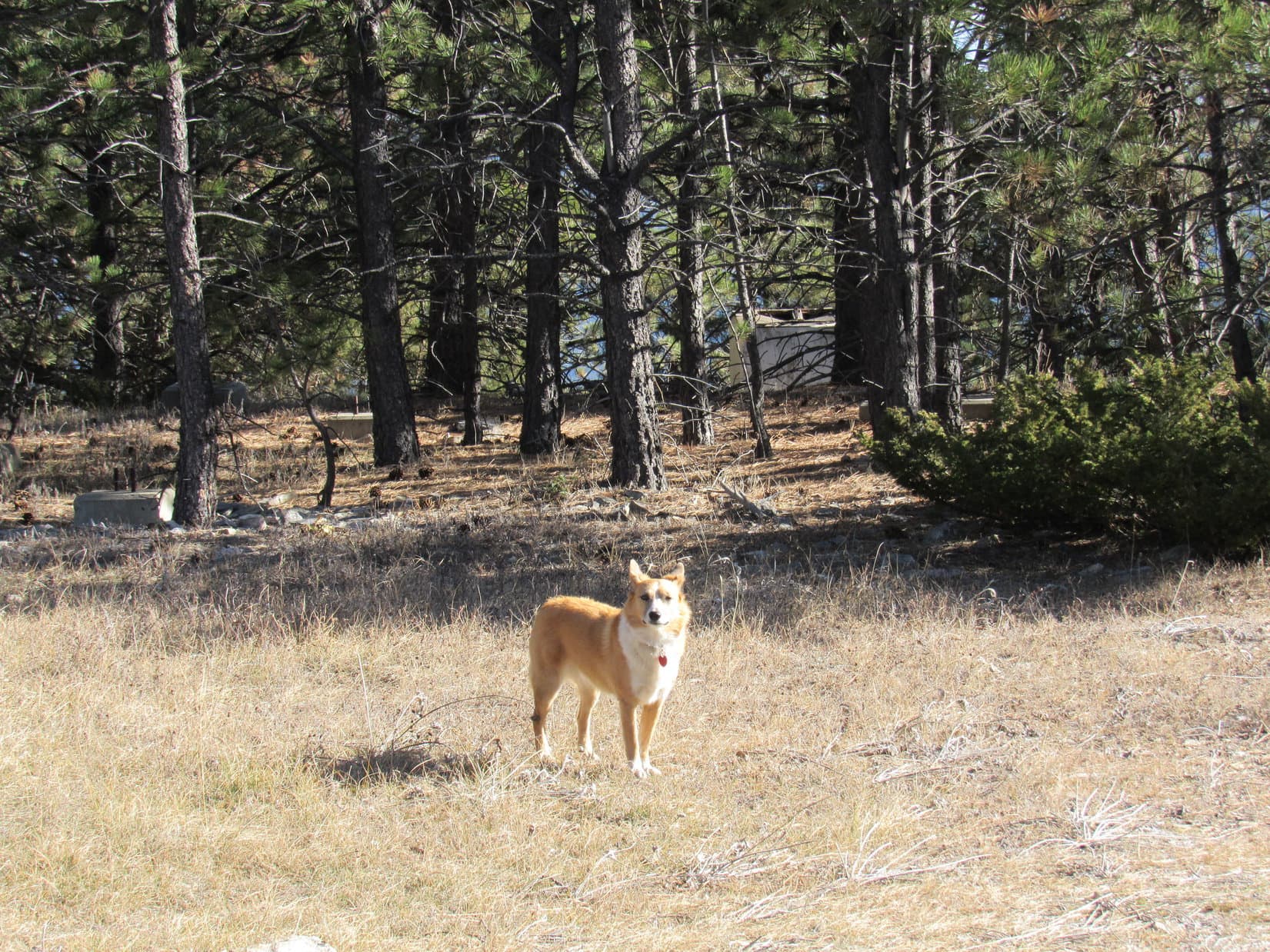
Day 11 of Lupe’s Summer of 2016 Dingo Vacation to the Canadian Rockies, Yukon & Alaska.

No matter what hour of the night Lupe woke up, there was light in the northern sky.  Twilight moved slowly around the horizon, but never completely disappeared.  Lupe was N, as far N as she had ever been in her life.  Beyond huge, dark Kluane Lake, a line of mysterious unknown mountains marched away to the Arctic.  It all seemed surreal, but Lupe really was here, in the fabled Yukon!

Two days ago, Lupe had climbed her first peak in the Yukon, King’s Throne Peak (6,529 ft.) in Kluane National Park.  It had been a long, hard climb in powerful, swirling winds, but Lupe had made it to the top.  She had been rewarded with spectacular views of Kathleen Lake, Louise Lake and mountains of the Saint Elias range.

From King’s Throne Peak, Lupe had seen another peak off to the NW, the mountain she would attempt to climb today – Mount Decoeli (7,650 ft.).  If Lupe could reach the summit of Decoeli, it was possible she would get to see the highest mountain in Canada, Mount Logan (19,541 ft.), far off to the WSW!

At some point, the long twilight became a long dawn, as the sun started sneaking back up toward the horizon again.  Twenty minutes after the sun finally appeared (6:30 AM, 39°F), Lupe was at the long, paved pullout on the W side of the Alaska Highway that serves as the trailhead for the trek to Decoeli.  No one else was here.  The G6 was alone in the huge parking area.

At 7:23 AM, all was ready.  Lupe and SPHP left the pullout heading S to a cairn marking the start of the route to Decoeli.  Nearby an old jeep trail headed SW into a forest of stunted trees and tall soapberry bushes.  Lupe and SPHP followed the jeep trail, which soon met another similar road coming from the E.  Lupe took the new road W.  Mount Decoeli was in sight up ahead.

Mount Decoeli from along the jeep trail. Photo looks WSW using the telephoto lens.

About a kilometer from the Alaska Highway, the road ended at Summit Creek.  From here, Lupe’s route followed Summit Creek upstream.  The creek led Lupe toward a still unseen rock glacier S of Mount Decoeli.

Lupe reaches Summit Creek at the end of the road. From here, Lupe followed the creek upstream toward a still unseen rock glacier at the base of the snow streaked mountain on the L. Lupe's objective, the summit of Decoeli, is seen on the R. Photo looks WSW.
Lupe reaches Summit Creek at the end of the road. From here, Lupe followed the creek upstream toward a still unseen rock glacier at the base of the snow streaked mountain on the L. Lupe’s objective, the summit of Decoeli, is seen on the R. Photo looks WSW.

Summit Creek was running low, but not low enough for SPHP to cross without getting wet feet.  Lupe and SPHP stayed on the S side of the creek for as long as possible.  It was generally easiest to simply travel right up the creek bed.  However, Summit Creek often ran right along the S bank of the stream channel, forcing Lupe and SPHP up into the bushes above the bank.

At first, there were usually some pretty decent trails to follow through the brush, but as Lupe got farther and farther upstream, these trails deteriorated, becoming hard to find and follow.  The jungle of bushes was so dense, it was almost impossible to make any headway where there wasn’t some kind of path.

Being in the tall bushes made SPHP increasingly nervous.  Nothing more than a few feet away was in view.  With the stream babbling along close by, it wasn’t easy to hear anything else.  SPHP kept up a lively, loud conversation with Lupe, counting on Lupe to give some warning if she smelled bears in the area.

After being repeatedly forced up into the jungle, SPHP finally decided enough was enough!  Lupe and SPHP forded Summit Creek, and stayed out in the open on the wide, rocky creek bed.

Of course, fording the stream meant SPHP’s feet were now soaking wet.  They stayed that way.  Summit Creek kept insisting upon flowing back and forth all the way from one side of the stream channel to the other, so Lupe and SPHP had to keep crossing the creek.  Nevertheless, Lupe’s upstream progress was much faster out on the rocks.  Furthermore, if any bears were in the area, at least out on the creek bed they could be seen well before coming right up on them.

After a long trek, Lupe could see the rock glacier S of Decoeli up ahead.

The rock glacier is now in view below the snow-streaked mountain up ahead. Photo looks WSW.

By the time Lupe reached the toe of the rock glacier, the dense jungle of bushes on the banks of Summit Creek was gone.  Lupe left the creek bed to start climbing the green, mossy slope on the N bank.  A trail showed others had taken this route before.  Lupe liked being out on the spongy, mossy slope a lot better than being down on the rocky stream bed.

Lupe nears the toe of the rock glacier. About the time she reached it, she left the creek bed to follow a trail up the mossy slope on the R. Photo looks WSW.
Lupe greatly preferred being on this spongy, mossy ground. She would eventually climb from the little knob seen on the ridgeline at (Center), up to the summit of Mount Decoeli on the R. Photo looks NW.
Lupe had already gained a fair amount of elevation on the long, gentle trek up Summit Creek to the rock glacier. Now that she had left the creek bed, though, things were about to get a lot steeper! Photo looks NW.

Only a few minutes after Lupe left the creek bed, SPHP heard voices.  Looking back, two people and a big brown dog were in sight not too far away.  They were moving fast, coming up the creek bed, just like Lupe and SPHP had.

Lupe’s route was much steeper up on the green, spongy ground, than it had been down by Summit Creek.  Rather than turn NW directly up the steep slope, it seemed best to follow the trail W for a little while making a more gradual climb.  Lupe had already crossed a big ravine and gained a fair amount of elevation above the rock glacier, by the time the two hikers and their dog overtook SPHP.

Two hikers and their big brown dog overtook SPHP near this point. Photo looks SW over the rock glacier.

The two hikers were Milo and Ben, from Smithers, British Columbia, with their dog, Lucca.  Lucca was bigger than Lupe, and not too sociable.  Lucca growled menacingly.  Lupe wisely kept her distance.  Milo, Ben and SPHP had a brief, friendly conversation.

Had Lupe and SPHP seen the grizzly bear?  Uh, no.  What grizzly bear?  Where?  Milo and Ben said they had come across a huge, steaming, fresh grizzly scat at the junction of the two roads leading to Summit Creek.  Shortly after that, they saw the grizzly.  Fortunately, it just ambled off into the bushes where they lost sight of it.

SPHP was certain that a giant steaming bear scat hadn’t been at the road intersection when Lupe passed by.  Even if SPHP hadn’t noticed it, Lupe certainly would have!  The bear must have been fairly close by, though, for it to come through before Milo and Ben showed up.  Yeah, avoiding the bushes, and staying out on the rocks on the wide Summit Creek channel was definitely the way to go on the way back!

All resumed the climb up Decoeli.  Milo, Ben and Luca were soon well ahead of Lupe and SPHP.  Everyone had turned NW going directly up the steep slope.  For a little way farther, the ground was still covered with nice spongy, green plants.  Pretty soon, though, Lupe reached rocky ground again.  From here on, Lupe faced a long, steep climb up very loose scree mixed with occasional large rocks.

Lupe reaches the scree. She isn't to the steepest part of the climb quite yet. Worryingly, a cloud had appeared, and now clung to the summit of Decoeli. Photo looks NW.
Lupe reaches the scree. She isn’t to the steepest part of the climb quite yet. Worryingly, a cloud had appeared, and now clung to the summit of Decoeli. Photo looks NW.
Lupe on her way up Decoeli. She went over the orange-tan colored knob beyond her, and then climbed toward the saddle seen L of Center on the ridge. Photo looks NW.

Although most of the sky was clear, a worrisome cloud formed and grew around the summit of Decoeli.  It hung around for a while, but eventually blew away to the E.  In the meantime, Lupe was making steady progress up Decoeli.  She was now approaching the most challenging part of the climb.

Lupe and SPHP reached a long, incredibly steep, scree slope.  The climb became rather unnerving.  Virtually everything was loose.  With each step up, the mountain gave way.  Rocks slid and careened down the mountain from under SPHP’s feet.  Now and then, entire areas began to slide, taking SPHP sliding back down, too, before stabilizing.  Nothing wanted to hold.  It was like trying to navigate a river of rock flowing in the opposite direction.

Most of the few large rocks on the slope were loose, too.  SPHP avoided coming up directly below them.  Even Lupe was causing showers of rocks to tumble, sometimes bounding hundreds of feet down the mountain.  It was dangerous for Lupe and SPHP to be directly above or below each other, for fear of the projectiles being released from above.

Lupe on the scary steep scree slope. The American Dingo was doing fine. She was heading for the saddle just L of Center. Photo looks NW.

Lupe headed up toward large rock formations along the ridge to the WNW.  She gained elevation relentlessly.  The view back down the precipitous scree slope toward the rock glacier was tremendous.  Lupe was as calm as ever.  SPHP, however, found it better not to look down too long upon the dizzying scene.

Lupe nears the first big rock formation. No wonder the Carolina Dog was so calm on this steep scree slope – she was keeping her eyes closed! Photo looks WNW.

Lupe reached the top of the first big rock formation.  On a small area of relatively level terra firma, Lupe and SPHP took a break.  At Summit Creek, the air had been calm, but up here a cool breeze was blowing.  The views were already fantastic, even though Lupe still had a considerable climb ahead.  Lupe and SPHP relaxed for 10 minutes, recovering from the ordeal on the treacherous scree slope.

Lupe at the first rock formation above the treacherous scree slope. Photo looks S toward the rock glacier, now many hundreds of feet below.

Lupe was now on the ridge that had been visible from below.  Another, longer ridge was in view off to the W.  The longer ridge looked like it might very well have been a considerably easier route up.  Perhaps Lupe should have stayed down near the rock glacier longer, following it farther SW before turning N to start her climb.  Maybe she should take that ridge on the way back down?

The long, low ridge seen beyond Lupe would have been a much easier route up Decoeli. To get to it, Lupe would have had to follow the rock glacier farther SW before turning N to start her climb. Photo looks W.

Off to the NW, SPHP saw another climber!  He was at about Lupe’s level.  Apparently, he had come up somewhere along that longer ridge, thereby avoiding the super steep, scree slope.  This new climber also saw SPHP, and waved.  SPHP waved back.  No doubt, Lupe would get to meet him at the top of the mountain.

Lupe continued her climb up Decoeli.  She was now traveling up the ridgeline, no longer on the scree slope.  The ridge was still very rocky, and quite steep, but the rocks were more stable than before.  Soon, Lupe came to another rock formation where there was a small patch of level ground.

Lupe reaches a 2nd rock formation along the ridgeline. There was a little level ground here, but Lupe still faced a fairly long climb to reach the top of Decoeli. Photo looks NW.

Lupe was getting closer to the top of Decoeli.  She still had to gain hundreds of feet of elevation, but the nature of the climb was changing.  The slope ahead, while still steep, was broader and covered with talus.  The large rocks were much more stable.  Projectiles were no longer being released with every step.

Lupe and SPHP toiled upward.  A cold W wind was blowing.  The sky overhead was a clear, brilliant blue.  The slope diminished.  A weather vane, spinning rapidly, came into view.  Beyond it, a silver metal shack perched atop the mountain.  Milo, Ben and the new climber were all there, engaged in conversation.  Weary, Lucca had collapsed on the rocks.  She didn’t stir at all, as Lupe went by.

After gaining nearly 4,400 ft. of elevation, Lupe had made it to the top of Decoeli (7,650 ft.)!  The views were fantastic, but disappointingly, off to the WSW, there were clouds in the direction where Mount Logan should be.  High, snowy peaks were partially in view, but many summits were not.

Far to the WSW, partially shrouded by clouds, were giant snowy peaks of the Saint Elias range. This photo was taken as Lupe arrived at the summit of Decoeli. Even a partial view was a stirring sight! SPHP wondered if Lupe was gazing upon Mount Logan, the highest peak in all of Canada, among the distant giants she could see? Photo taken with the telephoto lens.
Lupe on top of Decoeli! Photo looks S.
The view toward Haines Junction. Photo looks SE.
Milo and Ben chat with Richard Baker. Poor, exhausted Lucca was passed out on the rocks. Photo looks WNW.

After a few minutes gazing at the amazing views, Lupe and SPHP went to see Ben, Milo, and Lucca and meet the other climber.  He was Richard Baker, owner of a seasonal window cleaning business in Tucson, Arizona.  Richard was quite animated, and busy expounding upon his philosophy of life among other topics.

Milo and Ben were telling the tale of the grizzly bear.  Richard couldn’t believe he hadn’t seen the bear scat, or noticed the grizzly.  He is normally very wary in bear country, and was well-equipped with bear spray and other protective devices.

Milo and Ben were both wearing shorts, and feeling a bit uncomfortable in the cold breeze.  Since they intended to start back down soon, it was time for a photo op with them at the summit cairn.  Milo said they had just built the cairn higher while Lupe was coming up Decoeli, which explained it’s magnificently balanced slender height.

Ben (L) and Milo (R) at the newly improved Decoeli summit cairn with their dog, Lucca, and Lupe. Ben is 16, and in school. Milo is 50, and works in the lumber industry. They were all from Smithers, British Columbia. They had been climbing mountains on 5 of the past 7 days. Like Lupe, they had also been to King's Throne. Photo looks S.
Ben (L) and Milo (R) at the newly improved Decoeli summit cairn with their dog, Lucca, and Lupe. Ben is 16, and in school. Milo is 50, and works in the lumber industry. They were all from Smithers, British Columbia. They had been climbing mountains on 5 of the past 7 days. Like Lupe, they had also been to King’s Throne. Photo looks S.

Spurred on by the cold wind, Milo, Ben and Lucca started down Decoeli.  Lupe did not see them again.  Richard, Lupe and SPHP were in no hurry to leave.  Richard and SPHP chatted while admiring the views.  Gradually, the clouds were lifting in the W!  Many towering ice-clad mountains were in sight.  Richard shared his binoculars with SPHP.

Both Richard and SPHP wondered whether or not Mount Logan was in sight, and if so, which giant peak it might be.  Richard thought it was one farther to the N than SPHP believed.  In truth, neither Richard nor SPHP really knew, but it was fun to speculate.  It remained a pretty good bet that Lupe was seeing Mount Logan somewhere over there!

Lupe scans distant giants of snow and ice from Decoeli. Somewhere over there was Mount Logan, the highest peak in all of Canada, and 2nd highest peak in North America! SPHP believes Lupe did see Mount Logan, even though neither Richard nor SPHP knew exactly which peak was it. Photo looks WSW.
SPHP believes the highest mountain at Center is Mount Cairns (9,186 ft.). Photo looks WNW.
Looking SE from Decoeli. Two large lakes are seen faintly on the L. Kathleen Lake is the closest. Dezadeash Lake is the more distant. The long slope rising to the R from between them is the NE ridge that Lupe climbed 2 days earlier to reach the summit of King's Throne (6,529 ft.), which is barely in view.
Looking SE from Decoeli. Two large lakes are seen faintly on the L. Kathleen Lake is the closest. Dezadeash Lake is the more distant. The long slope rising to the R from between them is the NE ridge that Lupe climbed 2 days earlier to reach the summit of King’s Throne (6,529 ft.), which is barely in view.
Kluane Lake from Decoeli. Photo looks NW.
Gradually, the clouds to the W lifted, allowing a better view of the stunning, distant peaks of the Saint Elias range. Neither Richard nor SPHP knew the names of any of them, but nevertheless, they were an inspiring sight! Photo looks W.
A world of snow and ice. Was that huge snowy ramp on the R, Mt. Logan? It was SPHP's favorite candidate. It would be fun to know the truth! Photo looks WSW using the telephoto lens.
A world of snow and ice. Was that huge snowy ramp on the R, Mt. Logan? It was SPHP’s favorite candidate. It would be fun to know the truth! Photo looks WSW using the telephoto lens.
Mount Logan? No one knew. It's some grand and massive peak, for certain! Photo looks WSW using the telephoto lens.
Mount Logan? No one knew. It’s some grand and massive peak, for certain! Photo looks WSW using the telephoto lens.
More spectacular high peaks. Photo looks W.
A lofty white peak R of Center looks almost made of clouds. But what's that slope on the L? It was hard to tell if it was a cloud or part of some colossal mountain. Photo looks W.
A lofty white peak R of Center looks almost made of clouds. But what’s that slope on the L? It was hard to tell if it was a cloud or part of some colossal mountain. Photo looks W.

Richard and SPHP spent so long taking turns looking through the binoculars, that Lupe became a bit bored with it all.  She was tired of standing around, and disliked the cold wind.  Lupe had water, some Taste of the Wild, and curled up on as flat a spot as she could find.  SPHP covered her with a jacket to help her keep warm.

Richard Baker on Decoeli. Richard was quite animated and friendly. He shared his binoculars and philosophy with SPHP. Richard’s window cleaning business in Tucson, AZ is seasonal enough to permit him time to travel and climb mountains part of the year.

After Lupe and SPHP had been at the summit for 50 minutes, Richard announced that he was ready to head down.  Lupe and SPHP remained on top of Decoeli alone a little longer for a last look around.  The views remained simply astounding!  Climbing Decoeli had been a challenging, yet magnificently rewarding experience.

Lupe not far from the Decoeli summit cairn for the last time. Photo looks S.
The best route down Decoeli passes to the R of the small prominence seen L of Center overlooking the rock glacier. Photo looks S..
Richard Baker starts down Decoeli. Mount Cairnes is in view at Center. Photo looks WNW.

Sadly, it was time to move on.  Lupe and SPHP set off following Richard down the mountain.  This time, Lupe stayed on the longer ridge going SSW.  The first part of the descent down the talus slope was still quite steep and slow, but by staying on the SSW ridge, Lupe was able to avoid having to go down the treacherous scree slope to the SE where she and SPHP had come up.

Richard was leading the way, taking the same long SSW ridge.  Even this route was steep enough so SPHP had to be careful not to send rocks bounding down the mountain toward him.  Several times SPHP had to shout a warning.

The SSW ridge led down toward a wide saddle. The rock glacier Lupe would eventually have to turn toward is out of sight farther down to the L. Although this route wasn't as difficult as the scree slope Lupe and SPHP climbed going up, it was still plenty steep. Richard can be seen ahead. SPHP had to be careful not to send loose rocks bounding down the mountain at him. Photo looks SSW.
The SSW ridge led down toward a wide saddle. The rock glacier Lupe would eventually have to turn toward is out of sight farther down to the L. Although this route wasn’t as difficult as the scree slope Lupe and SPHP climbed going up, it was still plenty steep. Richard can be seen ahead. SPHP had to be careful not to send loose rocks bounding down the mountain at him. Photo looks SSW.
Unnamed peaks beyond the saddle SSW of Decoeli. Photo looks SSW.

Partly out of fear of rocks hurtling down the mountain, Richard stopped off to the side long enough to let Lupe and SPHP catch up.  While climbing Decoeli, Richard had originally come up from the SE to reach this broad, gentler slope on the long SSW ridge.  He had also had to climb up a steep, scree slope on the way, but not for nearly as far as Lupe.

Ahead was a small prominence overlooking the rock glacier to the S.  The question was whether to start down to the SE now, or circle around the W side of the prominence?  After a little discussion and scouting around, it was decided to go the long way around the W side.  There were numerous sheep trails Lupe could follow in this area.

Going down around the prominence overlooking the rock glacier. The top of the prominence is out of sight up the L slope. Richard leads the way, while Lupe wonders what's keeping SPHP? The rock glacier is in view ahead. Photo looks SSE.
Going down around the prominence overlooking the rock glacier. The top of the prominence is out of sight up the L slope. Richard leads the way, while Lupe wonders what’s keeping SPHP? The rock glacier is in view ahead. Photo looks SSE.
Looking SSE at the mountains beyond the rock glacier. It's possible the more distant peak on the L is Mount Archibald (8,491 ft.), but SPHP isn't certain.
Looking SSE at the mountains beyond the rock glacier. It’s possible the more distant peak on the L is Mount Archibald (8,491 ft.), but SPHP isn’t certain.
Lupe on her way down Decoeli. Photo looks N.

Eventually, Lupe, Richard and SPHP all arrived down at the rock glacier.  Up close, it was possible to see there really was melting snow and glacial ice under all the rock.

Lupe down by the rock glacier.

Richard, Lupe and SPHP all started the journey NE toward the rock glacier’s toe.  The terrain along the NW side of the glacier was often rough and broken.  After staying near the glacier’s edge for a while, SPHP tried leading Lupe up a steep bank to a green, spongy area overlooking the glacier.  This maneuver did not help.  Lupe quickly arrived at a ravine leading right back down to the glacier.

Richard had stayed down by the rock glacier.  He forged ahead, while Lupe and SPHP navigated the ravine.  By the time Lupe reached the toe of the glacier, Richard was out of sight somewhere down Summit Creek.

Lupe and SPHP made great progress going down the wide, rock-strewn Summit Creek channel.  This time, SPHP didn’t hesitate to simply ford the creek whenever necessary.  Every now and then, Lupe caught sight of Richard far ahead.  The long trek down the creek bed was actually quite easy and fun.  Lupe and SPHP enjoyed the beautiful long Yukon evening.

Near the start of the jeep trail, Lupe and SPHP caught up with Richard again.  Richard and SPHP chatted as Lupe trotted along the road.  Richard expounded upon grizzly bears.  He was carrying bear spray and other anti-bear devices to deal with them.  He talked about how all these tall bushes with small red berries growing along the road were soapberry bushes, and how bears love soapberries!

At the intersection where the road forked, there it was, just like Milo and Ben had said.  A huge grizzly bear scat full of soapberries was right there at the intersection.  Richard still couldn’t believe he hadn’t seen it in the morning!

The sun was getting low when Lupe reached the G6.  She’d had a long, long day.  Without the slightest hesitation, she hopped into the G6.  Lupe curled up on her blankets and pillows, looking forward to a soft, comfy snooze.  For more than an hour outside, Richard and SPHP conversed about Decoeli, bears, and other things.  Richard even offered SPHP a free canister of bear spray.  SPHP thanked him, but declined.

When Richard said good-bye and drove off, SPHP joined Lupe in the G6.  The sun was about to set.  What a fantastic, memorable day it had been!  Lupe had made it to the top of Decoeli.  She had almost certainly seen Mount Logan, the highest mountain in all of Canada.

Lupe and SPHP drove N on the Alaska Highway on the way to Kluane Lake, as the still glowing evening faded slowly from the wild Yukon mountains and sky.

Half moon over mountains NW of Decoeli.
Lupe's long, fabulous Day of Decoeli draws to a close.
Lupe’s long, fabulous Day of Decoeli draws to a close.
Sunset, Kluane National Park, Yukon Territory, Canada 8-9-16

Note: The trailhead for Mount Decoeli is a long, paved pullout 12.5 miles N of Haines Junction on the W side of the Alaska Highway.  (1.4 miles N of the Spruce Beetle trailhead.) Decoeli is near, but not actually in, Kluane National Park.  The route up is not maintained or signed in any manner.  There is no formal trail.  Elevation gain is a bit under 4,400 feet, or 1330 meters.  Distance is roughly 11 miles or 18 km round trip.

A free description of the route up Decoeli is available from visitor centers near Haines Junction and Kluane Lake.

Links:

Next Adventure                         Prior Adventure

Want more Lupe adventures?  Choose from Lupe’s 2016 Canadian Rockies, Yukon & Alaska Adventure Index, Dingo Vacations Adventure Index or Master Adventure Index.  Or subscribe free to New Lupe Adventures.

Black Hills Expedition No. 182 – Mount Pisgah (WY) & Laird Peak (SD) (11-13-16)

The sign said “Lunney”.  This was it!  Beyond a gravel parking area, SPHP opened a wire gate, then drove the G6 down a steep little slope, parking it next to an old building (8:49 AM, 48°F).  SPHP closed the gate again.  Lupe could come out now.  She bounded out of the G6 expecting great things!

Lupe arrives at the Lunney place, ready to start on her next Black Hills, WY adventure. Photo looks E.
The G6 parked on land owned by rancher Lauris Tysdal. The Lunney place just off US Hwy 85 is seen just beyond the fence. Photo looks W.

Lupe was in the Black Hills of Wyoming, about 5 miles S of the junction of Highways 85 & 585 at Four Corners.  She had just seen Red Butte on the E side of Hwy 85 less than a half mile to the N.  SPHP had been watching for the Lunney place, mentioned in a May, 2009 trip report by Edward Earl on Peakbagger.com.

The Lunney place was important as an access point to rancher Lauris Tysdal’s land and Mount Pisgah (6,380 ft.).  Mount Pisgah was one of two peakbagging goals Lupe had in this vicinity.  She already had Mr. Tysdal’s permission to cross his land to climb Mount Pisgah.  Later in the day, Lupe and SPHP would be looking for the owner of the ranch where Sweetwater Mountain (6,440 ft.) was, hoping to get permission to climb it, too.

First things first, though.  Before climbing Mount Pisgah, Lupe was going to go see Red Butte, a fin of red clay topped with a layer of limestone.  Lupe and SPHP went N through a field just E of US Hwy 85.  Red Butte was soon in view.

Lupe S of Red Butte. This fin of red clay capped by a layer of limestone is a somewhat unusual landmark in the Black Hills area. It is more typical of parts of Wyoming farther W. Photo looks N.
Red Butte, WY from the S. The butte is just E of US Hwy 85, about 5 miles S of Four Corners. It is seen to be much longer than it appears here when viewed from the E or W. Photo looks N.

After a good look at Red Butte, Lupe and SPHP returned to the G6 where a dirt road on the Tysdal Ranch headed SE.  This road would take Lupe all the way up to the top of Mount Pisgah.

Lupe about to start for Mount Pisgah. She would follow the dirt road seen here. It went SE beyond the building, then turned NE (L) before reaching the trees. Photo looks SE.

The road took Lupe SE past an old, low building, then turned NE before reaching the trees.  Lupe soon came to a fence across the road.  The fence wasn’t mentioned in Edward Earl’s report.  The Carolina Dog slipped under the fence.  She stayed on the road, as it entered the forest and wound its way up a small canyon.

Coming out into more open ground again, Lupe could see the same rock formations Red Butte was made of evident along the NW side of the canyon.

The same rock formations Red Butte was made of were also evident on the NW side of the canyon the road to Mount Pisgah passed through. Photo looks NW.

Now and then, side roads left the road Lupe was following.  She didn’t take any of the side roads, per Edward Earl’s advice.  The main dirt road slowly turned ENE as it went up the canyon.  For a while, the road looked like it was heading for a minor pass to the E.  Instead, it made a sweeping curve to the S before reaching the pass.

The road grew steeper, and wound around quite a bit, but was generally heading S.  Suddenly, Lupe dashed ahead.   She was looking up into the forest to the SE.  SPHP saw it, too.  Not too far away, a large coyote was watching Lupe!  As soon as it made eye contact with SPHP, it fled E into the forest.  Lupe was disappointed that the wild dog didn’t want to be friends, but it was probably for the best.

Lupe reached an orange well pump mentioned by Edward Earl.  By now, Lupe could see a tall tower up on the NW end of the huge Mount Pisgah summit plateau.  Edward Earl’s trip report had mentioned that a tower shown on the topo map at the N end of Mount Pisgah was not there, but Lupe most definitely saw one.  It was in plain sight.

Lupe at the orange hydrant, mentioned (as an orange well pump) by Edward Earl's trip report. Photo looks SE.
Lupe at the orange hydrant, mentioned (as an orange well pump) by Edward Earl’s trip report. Photo looks SE.

By now, Lupe was fairly high up on the NW slope of Mount Pisgah.  There were tree-broken views off to the N and W, but Lupe hadn’t come to any clear views.

From the orange hydrant, the road leveled out.  It turned sharply E, passing below the steep N face of the mountain.  Within a few minutes, Lupe came to a fetid brown pond in a depression S of the road.  The pond was shrunken by drought.  Hoof prints showed thirsty cattle had churned up the mud around the pond.  Apparently, cattle aren’t overly concerned about water quality.

Lupe at the fetid stock pond shrunken by drought. This pond is just S of the road, and N of the steep upper N face of Mount Pisgah. The brown water looked simply horrid. Photo looks ENE.

Beyond the nasty pond, the road swung toward the NNE before rounding the end of a narrow ridge extending in that direction from the summit plateau.  The road then turned S along the less steep E face of Mount Pisgah.  The forest was left behind.  Lupe was out in grasslands.  Here, she had a clear view to the E of the Black Hills in South Dakota across a valley several miles wide.

On the E slope of Mount Pisgah, Lupe had a sweeping view to the E of the Black Hills in South Dakota across a wide valley. Photo looks NE.
Lupe on the road up Mount Pisgah. Here she is on the upper E slope of the mountain. The road eventually entered the forest again, before making a couple of switchbacks to emerge up on the summit plateau. Photo looks S.

Another tower was visible ahead on top of the mountain, as Lupe followed the road S along the upper E slope.  The road re-entered the forest, made a couple of switchbacks, and emerged on open ground up on the E side of the huge summit plateau.

Most of the plateau was grassland, but the N end was pine forest.  Pines also ringed the edges of the plateau, cutting off the views, which was a little disappointing.  Not just one, but three large towers were visible to the S, a little W of a stand of pines where the true summit of Mount Pisgah was hidden from view.

Lupe reaches the open ground on the huge Mount Pisgah summit plateau. The road continued S toward 3 large towers. The towers were W of a stand of pines where the true summit of Mount Pisgah was still hidden from view. Photo looks S.

The road led toward the three large towers.  Lupe went that way, but her top priority was to find the true summit of Mount Pisgah.  Edward Earl had reported that the highest ground was somewhere under a cluster of young evergreens, along with no fewer than 8 concrete slabs with anchor bolts.  The concrete footings were likely part of a structure that was started, but never completed.

Two of the three large towers W of the true summit of Mount Pisgah. Photo looks SW.

W of the towers, Lupe slipped under a barbed wire fence running E/W that Edward Earl hadn’t mentioned.  Not too far S of the fence, she found the concrete slabs with anchor bolts.  The ground in this area was all quite level.  There was no clear, exact, high point, but Lupe had reached the true summit of Mount Pisgah.

Lupe stands on one of the concrete slabs Edward Earl mentioned in the area of the true summit of Mount Pisgah. Photo looks NE.

The cluster of young evergreens, wasn’t as young as it had been when Edward Earl was here nearly 7.5 years ago.

Lupe at the summit of Mount Pisgah. A couple of the concrete footings with anchor bolts are in view on the L. The young evergreens Edward Earl had seen nearly 7.5 years ago weren't so young anymore. Photo looks E.
Lupe at the summit of Mount Pisgah. A couple of the concrete footings with anchor bolts are in view on the L. The young evergreens Edward Earl had seen nearly 7.5 years ago weren’t so young anymore. Photo looks E.

The true summit of Mount Pisgah wasn’t too exciting, really.  Although the highest ground was quite close to the E edge of the summit plateau, there were too many trees around to see much of anything.  With Lupe’s peakbagging goal accomplished, she left the summit to take a closer look at the towers.

To the SSE of the three towers was a battered old blue and yellow school bus.  Due to broken glass on the ground, SPHP wouldn’t let Lupe get too close to it.  SPHP gathered up a number of Lupe treasures someone had carelessly discarded near the bus.

Lupe near the battered blue and yellow bus. Broken glass nearby meant Lupe couldn't get too close to it. Why on earth it was here was unfathomable. Photo looks NE.
Lupe near the battered blue and yellow bus. Broken glass nearby meant Lupe couldn’t get too close to it. Why on earth it was here was unfathomable. Photo looks NE.

Edward Earl had only mentioned one tower W of the summit, but now there were three.  The two farthest to the N had new-looking concrete slabs for support, and new outbuildings near them.  The N towers must have been installed after Mr. Earl had been to Mount Pisgah.

The three towers W of the summit. The towers on the L and R were new since Edward Earl was here in May, 2009. Photo looks N.

It doesn’t take a Carolina Dog long to look at a few towers!  Lupe was soon ready to move on.  Of course, she still had one tower left to check out, the one at the NW end of the summit plateau that she had seen from down by the orange hydrant.

Lupe and SPHP went N along the E edge of the summit plateau, hoping to catch an open view, but found none.  Lupe then went NW to the road again on her way to the NW tower.  A side road off the main dirt road went N into the forest.  Near the N edge of the plateau, it turned W and took Lupe to the lone tower Edward Earl had somehow missed. it turned W and took Lupe to the lone tower Edward Earl had somehow missed.

Part of the Mount Pisgah summit plateau. Photo looks NW.
Looking S back at the 3 towers W of the summit.
The 3 towers W of the summit from near the start of the side road to the 4th tower at the NW end of the mountain. The intersection with the main dirt road is at the L edge of this photo near the trees. Photo looks S.
Lupe nears the NW tower. It must have been here when Edward Earl was around; the outbuilding next to it looked quite old. How he missed it is unclear. Photo looks W.

The NW tower had broken wires hanging off of it.  Paint had peeled off much of the old shack next to it.  However, a heater or air-conditioner on the NE side of the shack was running.  How had Edward Earl missed this tower?  It must have been here, as old as it appeared to be.  Strange.

SPHP went over to the N edge of the summit plateau, hoping for a view.  Lupe didn’t come.  She was standing frozen near the shack.  She looked like she does whenever she steps on a cactus.  SPHP went back to her.  Lupe held up a little front paw, pleading to be carried.

SPHP carried Lupe over to the edge of the plateau.  Lupe rolled over on the ground, so SPHP could check her paws for cactus spines.  Nothing.  SPHP hadn’t seen any cactus anywhere on Mount Pisgah, either.  Maybe Lupe had stepped on something else sharp?  Ever since her bad experience with cactus in the Wildcat Hills of Nebraska, Lupe tends to assume cactus is everywhere any time her paws hurt.

Lupe at the NW end of the summit plateau before starting down the mountain. For a minute or two, she wanted to just sit here. Worried about cactus, she was hoping SPHP was going to carry her back to the G6. Photo looks SE.

Apparently, Lupe would have liked SPHP to carry her all the way back to the G6.  She stopped several times on the way down the mountain.  There really wasn’t anything wrong with her that SPHP could see.  She always came running when SPHP got too far ahead.

Instead of taking the road back, Lupe and SPHP went down Mount Pisgah’s NW slope.  A power line went down this way, too.  Most of the time Lupe stayed within sight of it.

Surprisingly, although Lupe hadn’t found any clear views from the edge of the summit plateau on top of the mountain, coming down the NW slope, she did!  Red Butte and Sweetwater Mountain (6,440 ft.), Lupe’s next peakbagging objective, were both in view from several spots on the way down.

Red Butte (L) and Sweetwater Mountain (the long forested ridge on the horizon) as seen from the NW slopes of Mount Pisgah. The canyon seen below Red Butte is the same one Lupe traveled through (from L to R) on the road leading to the top of Mount Pisgah. Photo looks NW.
Looking down on Red Butte with a little help from the telephoto lens. Photo looks NW.

The NW slope was steep until Lupe reached a road after losing 200 to 300 feet of elevation.  Lupe took the road SW a short distance to the edge of a small meadow where it looked like there might be a view.

The meadow turned out to be part of a much more extensive grassland.  Lupe did have a great view to the SW.

Lupe finds a much more extensive grassland than she'd been expecting. She had a great view from here. Photo looks SW.
Lupe finds a much more extensive grassland than she’d been expecting. She had a great view from here. Photo looks SW.

Lupe went through the grassland, and continued on down the NW slope of Mount Pisgah.  Down here, it wasn’t so steep.  Most of the time Lupe was in forest, but a forest full of small openings and glens.  Lupe’s route down was an easy one.

Crossing the big grassland, Lupe could see the entire length of the Sweetwater Mountain plateau off to the NW.
Lupe came to several dirt roads on the way down Mount Pisgah. She didn't follow any of them very far, but she did travel a short stretch of this road. Photo looks NNE.
Lupe came to several dirt roads on the way down Mount Pisgah. She didn’t follow any of them very far, but she did travel a short stretch of this road. Photo looks NNE.

The American Dingo eventually reached the road she had followed to the top of Mount Pisgah down in the canyon.  She followed it back to the Lunney place, which was only 10 or 15 minutes away (12:25 PM, 55°F).

The G6 was already up on the gravel parking area on the Lunney place with Lupe in it, and SPHP was just closing the gate to Lauris Tysdal’s land, when a jeep drove up.  Mr. Lunney was in it, somewhat surprised, no doubt, to find Lupe and SPHP on the property.

SPHP explained how Lupe had come to be here.  Mr. Lunney seemed satisfied with the explanation.  He began to tell SPHP a little bit about the history of the Lunney place.  His grandparents had bought the property, which includes over 8 acres of land with the house and outbuildings, back in the 1940’s.  In recent years, it had belonged to his mother, but she passed away earlier this year.

Mr. Lunney has another home, so this Lunney property is eventually going to be sold, although exactly when wasn’t clear.  There was no big rush to sell it.  Having been in the family so many decades, Mr. Lunney has a lot of fond memories of this place.

Lupe still had another peakbagging objective today.  After SPHP’s pleasant chat with Mr. Lunney, it was time to go look for the owner of the ranch that Sweetwater Mountain is on.  The ranch wasn’t far away, but the owner didn’t seem to be home.  Without permission from the owner, Lupe couldn’t climb Sweetwater Mountain.

SPHP was writing a note to leave on the door of the rancher’s home, when the owner drove up on an ATV.  SPHP had a conversation with him.  The upshot of it all was that Lupe was refused permission to climb Sweetwater Mountain.  However, when hunting season is over at the end of November, she is welcome to come back to climb it in December.

Well, that was that.  No Sweetwater Mountain today.  Lupe still had a few hours of daylight to do something with.  In the end, it was decided she might just as well climb Laird Peak (6,906 ft.) N of O’Neil Pass in South Dakota.  Laird Peak wasn’t a hard climb at all, and was on the way home.

Lupe and SPHP left the G6 parked S of a corral about 0.33 mile N of Hwy 85 along USFS Road No. 106 (2:35 PM, 48°F).  Lupe took a dirt road E up a shallow valley past Tom Spring.  The road reached an intersection at the upper end of the valley.  From there, Lupe bushwhacked E along the N side of a fence to a small forested rise.  She found the Laird Peak survey benchmark on top of the rise.

The Laird Peak survey benchmark was at the top of a small forested rise.
Lupe on Laird Peak. The survey benchmark is seen below her tummy. Photo looks N.
Sweet Lupe on Laird Peak.
Even though at 6,906 feet, Laird Peak is quite high for the Black Hills, it was another mountain with no views due to so many trees. The summit area is of modest size. A significant part of it is seen here. The post marking the survey benchmark location is seen on the R. Photo looks N.

Climbing Laird Peak had been quick and easy.  Lupe had no more peakbagging to do.  It was only around 3:00 PM, but the November sun was already quite low.  It would be dark in another 2 hours.

Since it would only take half an hour to get back to the G6, Lupe had some free time to roam and sniff.  She had no real purpose other than to enjoy life as a free-roaming Dingo in the woods.  Lupe and SPHP wandered through the forest.  The Carolina Dog made a big loop to the N, before returning to Laird Peak’s summit.  She then made a big loop to the S, getting fairly close to US Hwy 85.

Lupe nearly back to the Laird Peak summit at the end of her exploratory loop to the N. Photo looks S.

Sharply slanting pine-filtered rays of sunlight announced the imminent arrival of sunset.  Time to start back to the G6.  Lupe’s Black Hills Expedition No. 182 was drawing to a close.  Happily, she’d made it to Mount Pisgah in Wyoming, one of her two main peakbagging objectives, and Laird Peak in South Dakota, but Sweetwater Mountain had eluded her.

Hopefully, sweet Lupe will see the world from the top of Sweetwater Mountain sometime in December, but life’s uncertain, and that’s another adventure for another day.

Roaming free S of Laird Peak near day’s end. Photo looks NNE.

Links:

Next Black Hills Expedition                  Prior Black Hills Expedition

Want more Lupe adventures?  Choose from Lupe’s Black Hills Expeditions Adventure Index or Master Adventure Index.  Or subscribe free to new Lupe adventures.