Sukakpak Mountain, Brooks Range, Alaska (8-13-16)

Day 15, Part 2 of Lupe’s Summer of 2016 Dingo Vacation to the Canadian Rockies, Yukon & Alaska.

Dead ahead!  There it was – the most famous mountain along the Dalton Highway in the Brooks Range of northern Alaska – Sukakpak!  Lupe was thousands of miles from home, over 90 miles N of where the Dalton Highway crossed the Arctic Circle.  Sukakpak Mountain (4,459 ft.) was one of the top highlights Lupe had come all this way to see.

Lupe 200 miles N of the start of the Dalton Highway, and 90 miles N of the Arctic Circle, approaching famed Sukakpak Mountain in the Brooks Range. Photo looks NE.
Sukakpak Mountain, Brooks Range, Alaska

After all the many months of planning and long miles, it was still hard to believe Lupe was really, actually here!  SPHP drove slowly past the mountain, to see it from various angles.  After crossing the Dietrich River near its confluence with the Bettles River, SPHP parked the G6 at a pullout near milepost 207.  Lupe went over to the Bettles River for a drink, and to admire Sukakpak from the N.

Lupe at the Bettles River with Sukakpak Mountain in the background. Photo looks S.
Sukakpak Mountain from the Bettles River. Photo looks S.

Of course, being an American Dingo of the peakbagging variety, Lupe was here to do more than just admire Sukakpak, she was here to climb it!

It was already late in the day to consider climbing such a large peak, but Lupe and SPHP were full of enthusiasm.  The weather was good, 60°F with thin white clouds, and only a light breeze.  Furthermore, this far N the sun wouldn’t go down until very late.  Even twilight would last a long time.

SPHP had a copy of a trip report from Peakbagger.com written by Richard Carey, who had climbed Sukakpak more than 21 years ago on July 30, 1995.  It would serve as a guide.  Lupe and SPHP returned S to a pullout near milepost 203 located W of Sukakpak Mountain.  It was the obvious, easiest place to begin any ascent of Sukakpak, and was where Carey had started from.  At 1:11 PM, Lupe left the G6, and headed E for the mountain.

Sukakpak Mountain from the pullout near milepost 203 of the Dalton Highway where Lupe started her trek. Photo looks ENE.

The plan was to head SE toward the S end of Sukakpak, as recommended by Carey, but that route proved to be marshy as Carey had indicated.  It seemed easier to head straight E toward the mountain following higher, drier ground until Lupe got above the marshlands.  Lupe gained a fair amount of elevation just getting close to the rock base of Sukakpak.

Approaching the W face of Sukakpak. Photo looks ENE.

When Lupe was high enough to be above all the swampy ground, she turned SSE, still climbing steadily.  As she got closer to the S end of the mountain, she was approaching a steep chute that looked like it might be a shortcut.  Carey had recommended heading toward a gash caused by a landslide at the S end of the mountain.  Maybe this chute was what he had been talking about?  Lupe headed for it.

Lupe now above the swampy ground, and not too far below the steep W rock face. Here she turned SSE working her way toward the SW end of the mountain. The start of the lower end of “The Chute” can be seen almost straight up from Lupe at the base of the rock face. Photo looks SSE.

Lupe and SPHP started climbing up the chute.  To the S was a wall of rock, to the N, the massive S face of Sukakpak.  The chute was steep, full of boulders and small trees, but not too hard a climb.  The view back to the W was steadily improving as Lupe gained elevation.

Lupe on her way up toward the chute at the SW end of Sukakpak. Photo looks NW.
Looking up toward the start of the “The Chute”. Photo looks SE.

The hope was that Lupe would be able to easily pass around the S side of Sukakpak from the top of the chute.  However, the chute was higher and longer than SPHP anticipated.  When Lupe finally reached the top, the situation was more complicated than expected.

Not far away to the SE was a boulder field, and beyond it a forest.  Both rose toward the E, and were clearly viable paths along the S end of Sukakpak.  Unfortunately, there was a minor drop-off to get over to that terrain.  Lupe wouldn’t have any problem negotiating it, but despite not being very high, the drop-off looked treacherous to SPHP.

Maybe it was possible to climb high enough to get beyond the drop-off?  It looked like a reasonable proposition.  Lupe and SPHP left the chute traversing SE toward the easier ground, climbing steadily while looking for a way over to it.

The climb was steep and getting steeper.  It kept looking like the slope would diminish just a little higher up the mountain, but it didn’t.  Over every little rise was another disappointment.  Soon SPHP was hanging onto bushes and anything within reach for support.  Lupe was fine.  She kept appearing above SPHP, looking down with a questioning look on her face.

SPHP wasn’t getting any closer to the safer ground.  In fact, things were getting worse.  The situation became unnerving.  Above, only a scary steep rock slope could be seen.

Loopster, we can’t keep going this way!  Sorry, puppy, but we are rapidly getting into trouble.  I can’t do this, and a mistake would be terrible.  We have to go back down, now!

Slowly, carefully, all the way back down to the chute, then back down it, too.  Lupe lost hundreds of feet of elevation.  What, close to two hours wasted on the chute?  Seemed like it.  However, long it had taken, the chute had been a real setback.  Either Carey’s momma was a mountain goat, or there was a better way.

Was there still time to climb Sukakpak, today?  SPHP wasn’t certain.  May as well try it, though.  Lupe could always turn back, if it was getting too late.  Below the chute, Lupe and SPHP slowly traversed the boulder field to the S.  Lupe finally reached the forest, where it was easier to turn E and start climbing again.

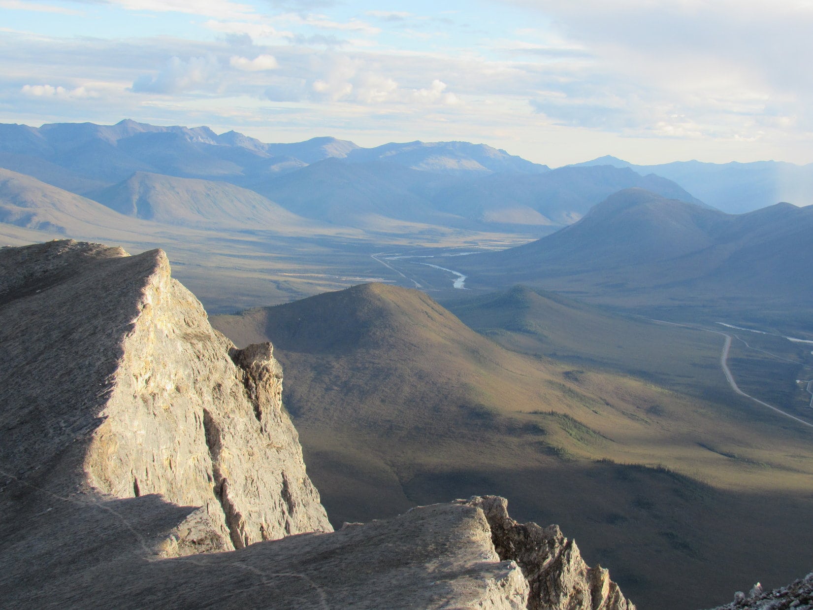
After a considerable climb, the ground leveled out as Lupe topped out on a ridge heading S from Sukakpak’s S face.  The view from the top was discouraging.  SPHP had thought this ridge would lead directly to the easiest way up Sukakpak.  To the N, though, there was a very steep rock slope.  Farther E, across a deep drainage, was another ridge like the one Lupe was on, except it was considerably larger and higher.

Lupe reaches the top of the lower minor S ridge. The larger and higher main S ridge is seen across a deep drainage. Lupe would have to lose a lot of elevation to cross the drainage and get over there. Photo looks E.
Looking up the steep S face of Sukakpak, from somewhere close to the minor S ridge. Carey's trip report indicated it was possible to go up this way, but recommended starting up from the main S ridge farther E instead. SPHP rejected the route seen here as too challenging. Lupe headed for the main ridge, even though it meant losing a bunch of elevation crossing the intervening drainage. Photo looks NNE.
Looking up the steep S face of Sukakpak, from somewhere close to the minor S ridge. Carey’s trip report indicated it was possible to go up this way, but recommended starting up from the main S ridge farther E instead. SPHP rejected the route seen here as too challenging. Lupe headed for the main ridge, even though it meant losing a bunch of elevation crossing the intervening drainage. Photo looks NNE.

Lupe took a little break while SPHP consulted the Carey trip report.  Ugh!  This must be the first ridgeline.  Yeah, Lupe was just above tree line.  Carey said it was possible to go up from here, but easier to contour around the creek drainage to get to the main ridge.  Up from here looked really hard.  No way SPHP could do that.  Lupe would have to go to the main ridge.

Lupe was already so high, and the terrain at the N end of the creek drainage so steep, there wasn’t a lot of contouring to be done.  Before climbing even higher up to the main ridge, Lupe was going to have to lose a bunch of elevation again crossing the drainage.  No other reasonable choice.  OK, whatever.  Puppy, ho!  Onward!

At least navigating through the drainage wasn’t difficult.  It was all straightforward.  Down and around, then up.  Long and tiring, but not scary or impossible.  Lupe made it to the main ridge.

View looking back from the main S ridge. High point 2929 is the big barren hill on the L. The lower minor S ridge of Sukakpak is in view on the R. The Dalton Highway and Middle Fork of the Koyukuk River are seen in the distance. Photo looks SW.

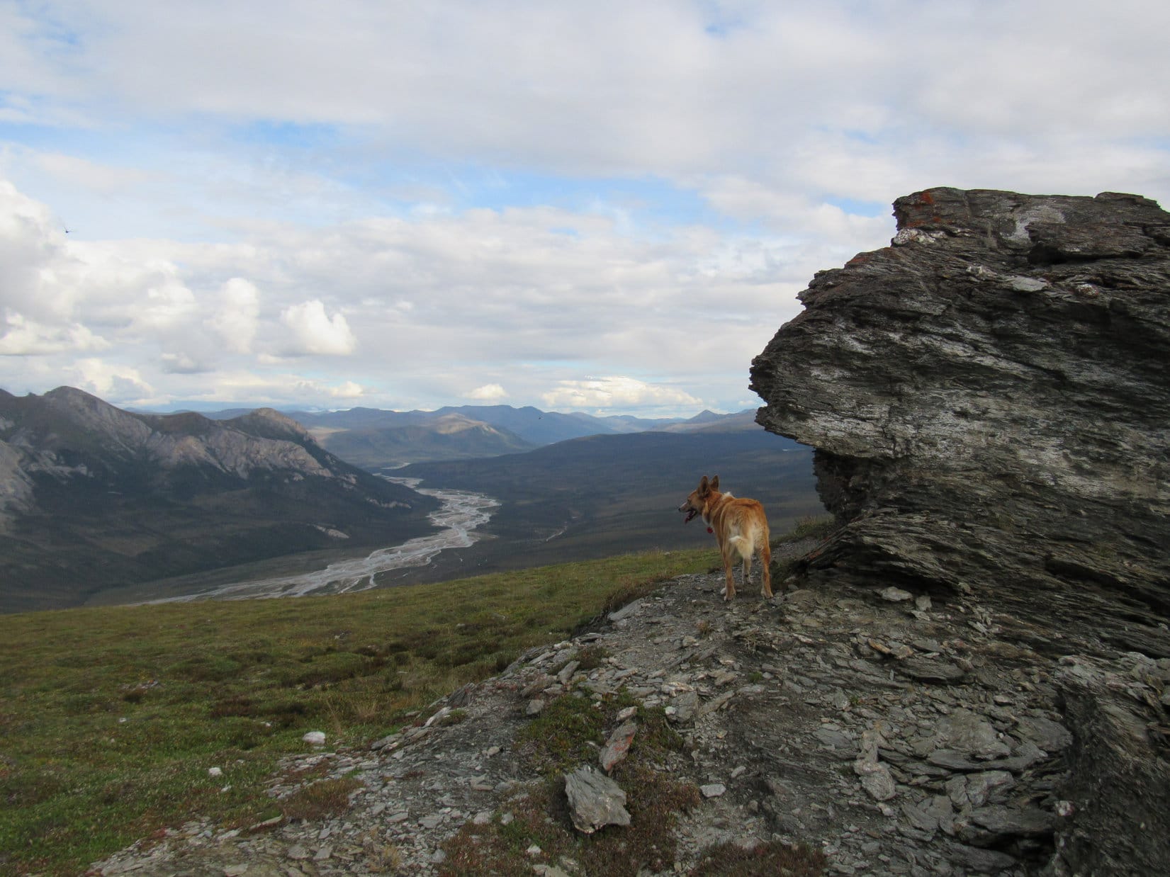
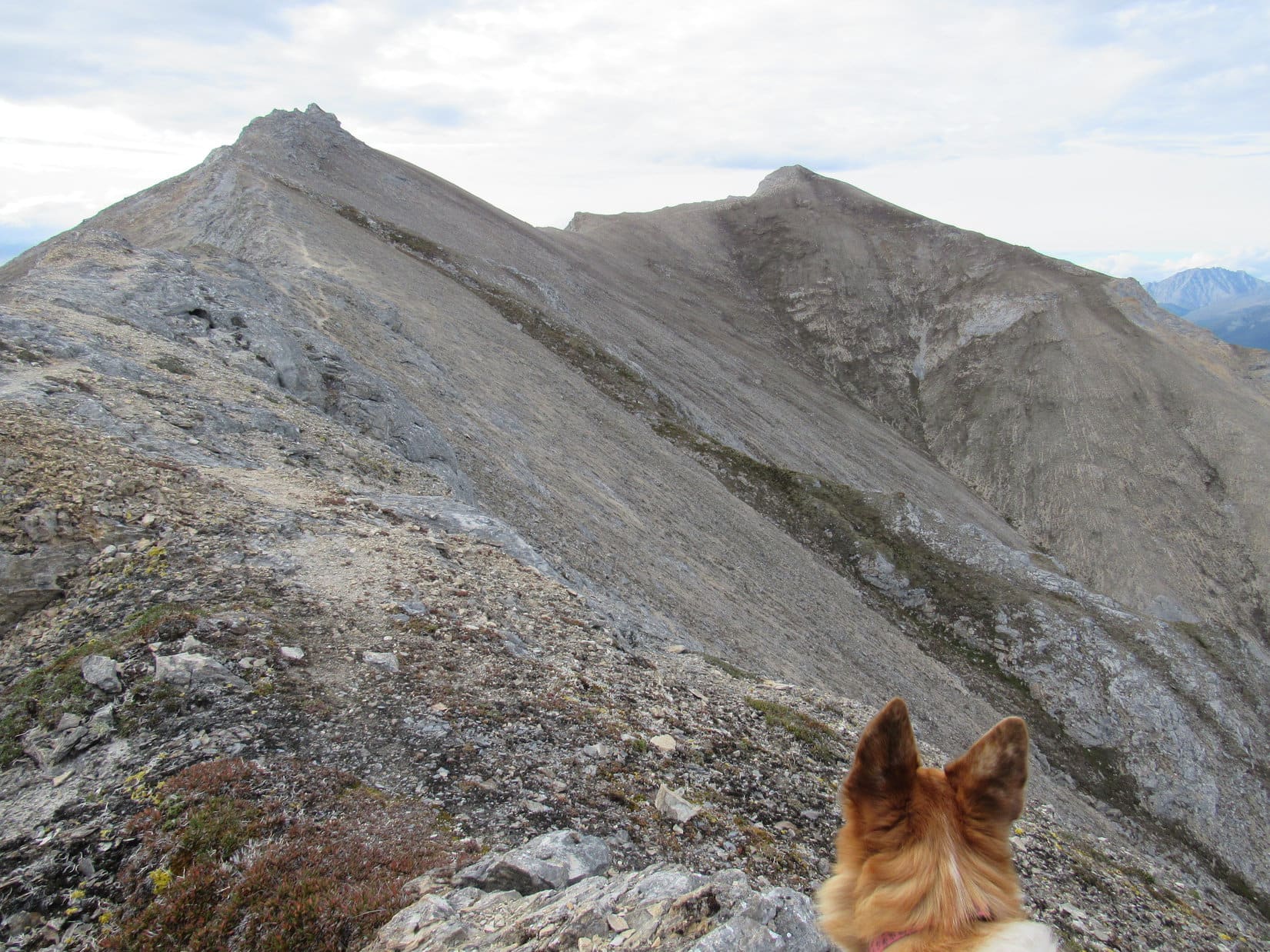
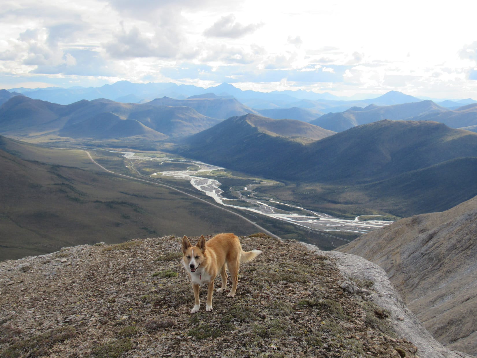
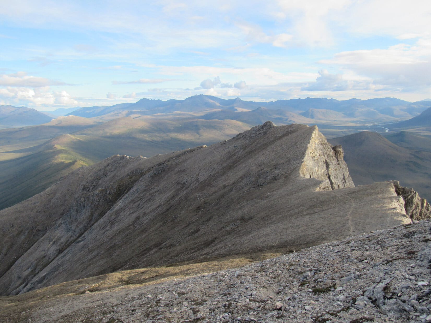
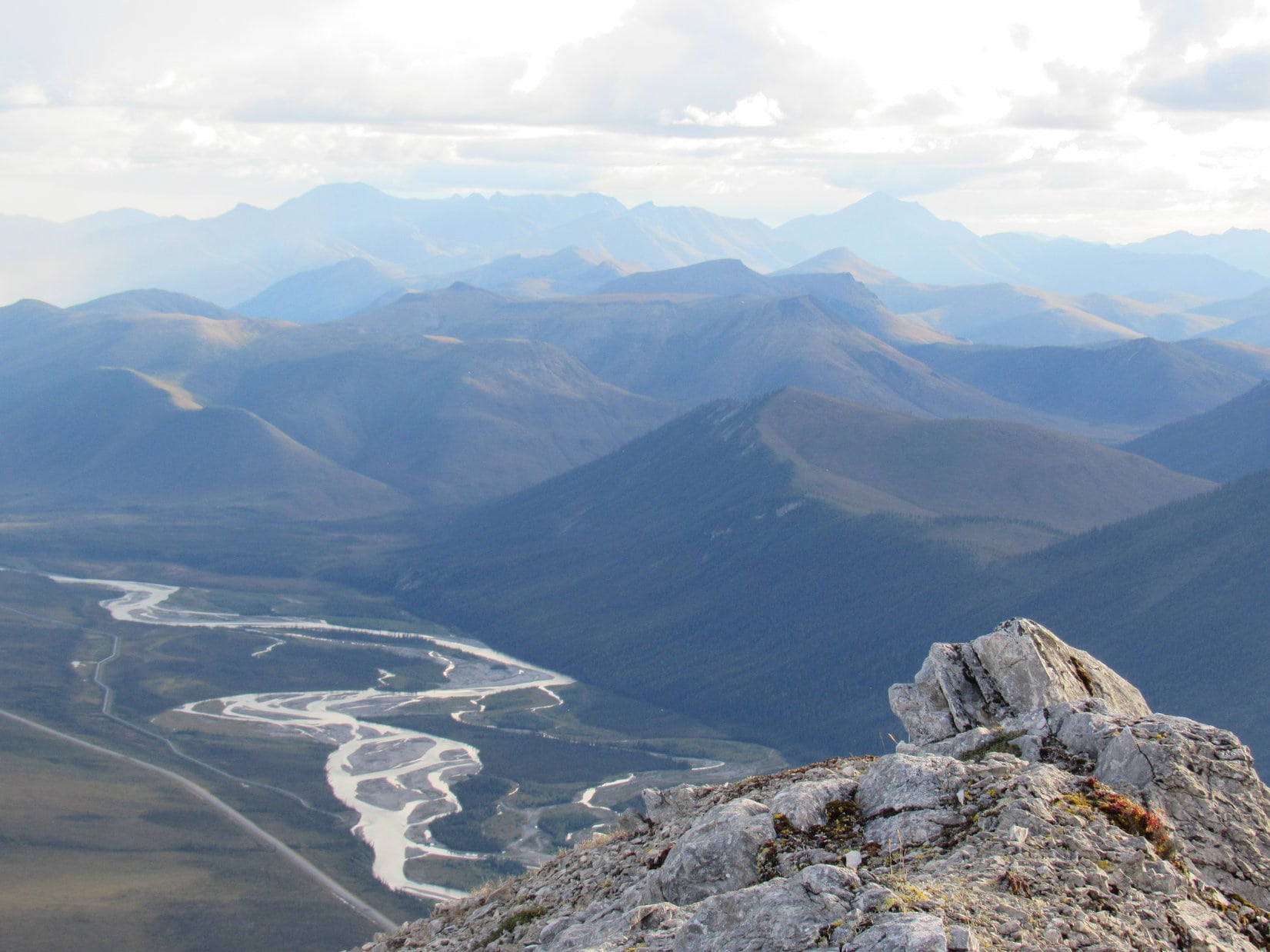
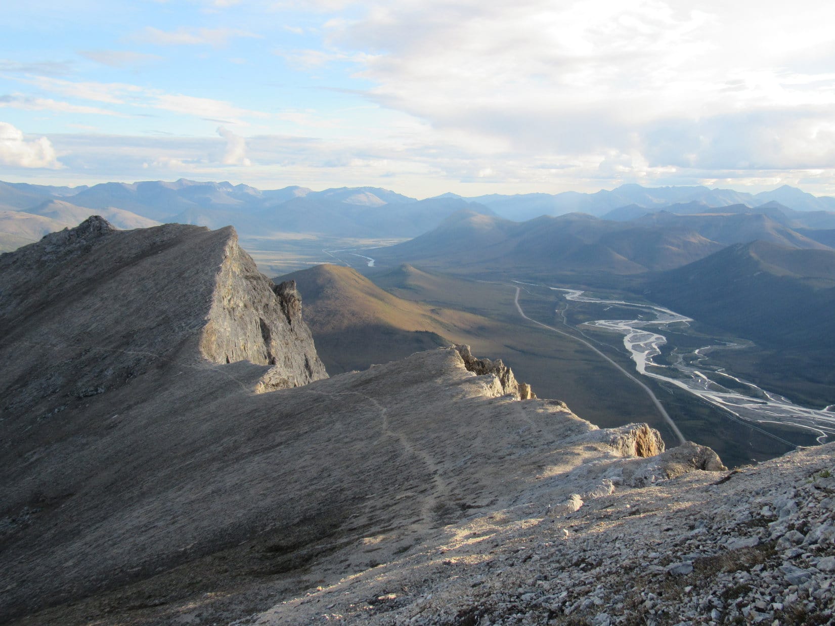
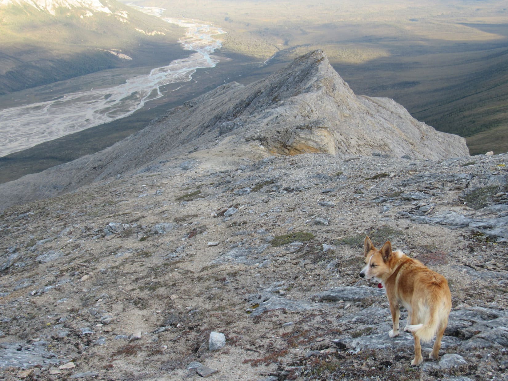
The main ridge was interesting.  It was large, long, roomy, and gently rounded at the top.  It stretched for 2 or 3 miles to the SSE, gradually losing elevation.  Lupe found sizable rock formations at the top, but most of the ground was even and covered with small rocks and plants of the tundra.  On the other side of this main ridge, Lupe had a huge sweeping view toward the E of the broad Bettles River valley and many mountains beyond it.

Lupe at the rock formations on top of the higher, main S ridge extending SSE from Sukakpak. From here, Lupe gazes out at the Bettles River valley on the opposite side of the ridge from where she came up. Photo looks SE.
Bettles River valley from the SSE main ridge of Sukakpak. Photo looks ESE.

Just N of where Lupe reached the main ridge, it joined the steep, rocky S face of Sukakpak.  The only way up from here was N.  Nearly all vegetation was about to be left behind.  The slope looked steep, but it wasn’t as bad as going up from the lower ridge to the W.  There was a sort of trail, too.  It wasn’t maintained in any way, or really of much help, other than as a general guide as to where to start.

Lupe on the main ridge at the base of the S rock face of Sukakpak. A faint trail can be seen starting almost straight above her head. The trail went a little to the R, then zigged well to the L, before zagging back toward the top. This is the easiest way up! Photo looks N.
Lupe on the main ridge at the base of the S rock face of Sukakpak. A faint trail can be seen almost straight above her head. The trail went a little to the R, then zigged well to the L, before zagging back toward the top. This is the easiest way up! Photo looks N.

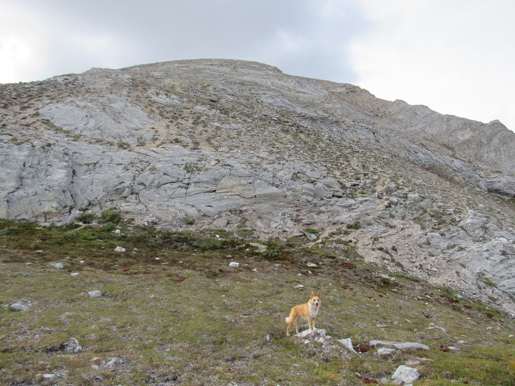
The route up was plenty steep, especially near the start.  The trail was often braided and full of loose rocks.  Up and up, Lupe went.  The panoramic views of the Brooks Range were becoming incredible.  The sense of being at a great height grew steadily.  Completely unfazed, the Carolina Dog led the way up the mountain, gaining hundreds of feet of elevation.

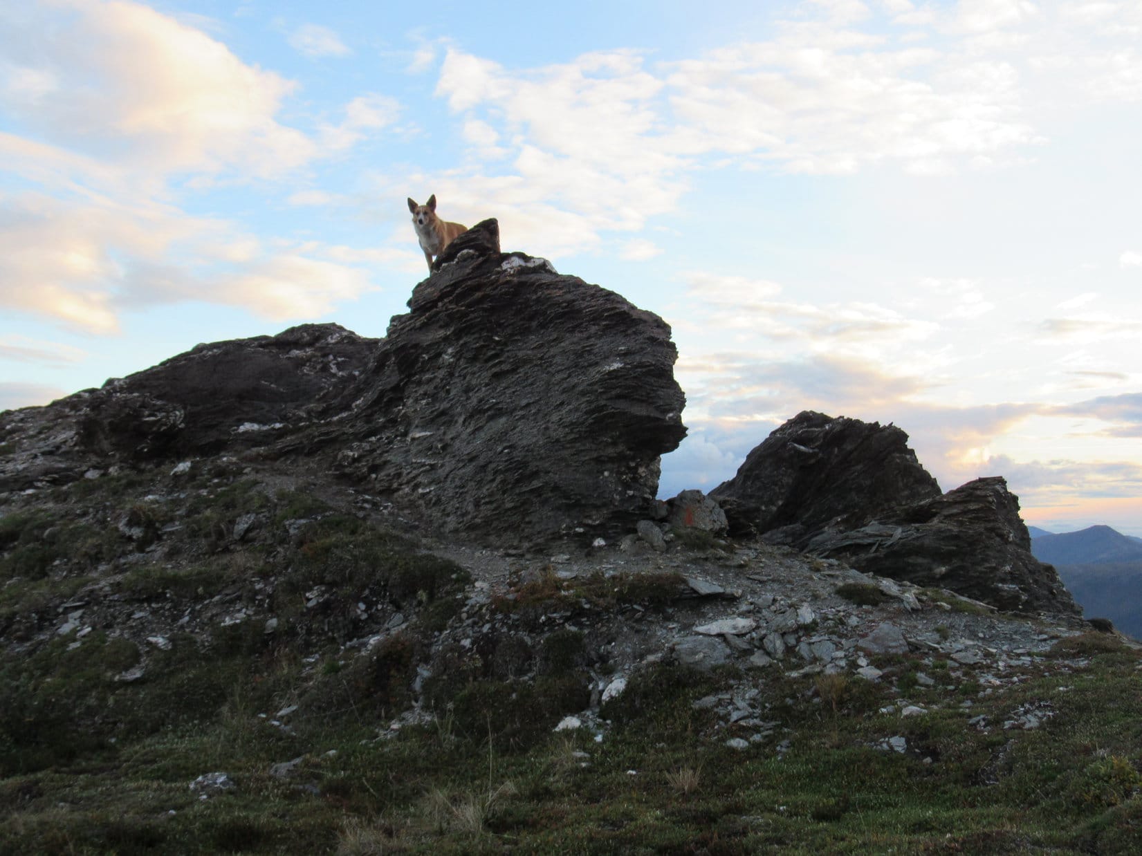
Gradually, the slope lessened.  Lupe arrived up on a roomy, rounded area that wasn’t completely flat, but not steep at all either.  Close at hand to the W, SPHP did not see, but only perceived, the presence of towering cliffs.  The terrain to the E was also mostly unseen, but perceived to be an incredibly steep slope dropping a thousand feet or more.  Very close to the NNE was a small ridge, not high at all – 10 or 20 feet, which could be easily walked up.  The ridge led up to the W, connecting to a nearby high point immediately to the N.

What would Lupe see on the other side of that small ridge?  Suddenly filled with both hope and apprehension, SPHP followed the unconcerned American Dingo up onto the little NNE ridge.  Unmistakable, half a mile to the NNE, there it was – the true summit of Sukakpak!  It wasn’t all that much higher, a few hundreds of feet. Lupe was almost there!

Lupe on the small ridge she had climbed up from the SSW. (This is actually part of the long ridge leading SE from the false S summit seen on the L.) The true summit of Sukakpak is still 0.5 mile away to the NNE on the R. Lupe was almost there! Photo looks N.

Off to the NW, a slightly lower S summit was in view, too.  Lupe was closer to it.  A faint trail was visible traversing the barren, upper E slope below the S summit to a saddle between the two high points.  The trail continued all the way to the true summit.

Climbing W on the little ridge to the closest high point, perhaps only 50 feet higher than where Lupe was now, was clearly the only route from here toward the trail below the S summit.  Lupe and SPHP started up.  The ridge narrowed as Lupe got close to the top.  Right on up went Lupe, but SPHP crouched down before the final few steps, ultimately collapsing against the rocks a foot or two below the absolute top.

Just as tightly as SPHP gripped the rocks, fear gripped SPHP.  Lupe came close, to see what was the matter.  Petting her helped a little.  The views were daunting enough.  What was only sensed, but still unseen was terrifying.  To the N, the steep slope of the E face of Sukakpak dropped away ever more steeply many hundreds of feet into the abyss.  That could be seen.  Just 2 or 3 feet W of Lupe, were perceived, but unseen precipices of towering height.

A narrow, level ridge, a couple feet wide, extended to the NW for 20 feet to a rise only inches high.  To the R (NE) of it was the start of the long slide into the abyss.  To the L (SW), the unseen precipice.  Close by, nothing could be seen beyond the little rise 20 feet away.  Farther off, the ridge clearly continued for quite a distance, rising ultimately to the false S summit.

Taking the narrow, level ridge would be like walking the plank.  What was beyond the little rise?  SPHP feared a drop-off of some sort.  Climbing straight down a wall of rock even a short distance from such a narrow perch was virtually unthinkable.  Lupe and SPHP were only day hikers, not mountaineers!  There was nothing at home in the Black Hills like this to compare with.  What was Lupe doing up on this little point of rock in the sky N of the Arctic Circle!?

Minutes ticked away.  At a vast height, Lupe and SPHP sat immobile, surrounded by fabulous wild mountains of the Brooks Range in the Arctic.  Yet, courage could not be summoned.  The monster, Fear, only grew.

I’m sorry, Loop.  I’m truly sorry!  I can’t do this.  It’s too much.  I know you could have made it, and you are so very close, sweet puppy, so very, very close, but I need to go down.  Let’s try to get a photo or two, first.  It’s over.

A few quick photos at the top, and Lupe and SPHP started back down.  If Lupe was disappointed, she didn’t show it.  Fifty feet lower, back where Lupe had first climbed onto this part of the ridge, SPHP had her pose with the true summit of Sukakpak in the background.  It was to be her souvenir photo showing how very close to success Lupe had been.

As close as Lupe got before SPHP led her back down. The slightly lower S summit is seen on the L, the true summit more distant on the R. Part of the narrow "plank" beyond which SPHP could not see the nearby terrain, heads off to the L from Lupe. Photo looks NW.
As close as Lupe got before SPHP led her back down. The slightly lower S summit is seen on the L, the true summit more distant on the R. Part of the narrow “plank” beyond which SPHP could not see the nearby terrain, heads off to the L from Lupe. Photo looks NW.
Dillon Mountain (4,820 ft.) to the NNE.
Dillon Mountain (4,820 ft.) (Center) to the NNE.
Bettles River valley. Photo looks ESE.
Lupe where she first reached the ridge above the roomy, rounded area. The valley between Dillon Mountain (L), and Wiehl Mountain (partly out of view on the R) is seen beyond her. Photo looks NE.
Lupe's souvenir shot showing how very close to reaching the summit of Sukakpak she had gotten. Photo looks NNW.
Lupe’s souvenir shot showing how very close to reaching the summit of Sukakpak she had gotten. Photo looks NNW.

Only a couple of steps down off Point Fear, a tremendous sense of relief flooded into SPHP.  Yeah, it was too bad Lupe didn’t get to finish her climb of Sukakpak, but not doing something stupid was just smart.  She had gotten to see the mountain, and make 90% of the climb.  Just being here, seeing Sukakpak, getting this far, and seeing these awe (not to mention, terror) -inspiring views was a tremendous accomplishment.  It was something Lupe and SPHP would always remember.

Even SPHP didn’t believe that crap.  For 10 minutes, SPHP apologized profusely to Lupe.  She paid close attention, but only seemed bewildered.  She licked SPHP’s hand, trying to make it better.

After the souvenir photos were taken, Lupe and SPHP left the little ridge and went back down to the roomy, rounded area.  To the S was the increasingly steep slope leading way back down to Sukakpak’s main ridge extending SSE.  Time to descend.

Lupe on the roomy, rounded area near its SW edge. The Middle Fork of the Koyukuk River and Dalton Highway are in view below. Photo looks SW.

SPHP hesitated.  Lupe gazed up wonderingly.  She was smiling.  What was the hold up?  What was going on?  There was a problem.  SPHP couldn’t go down.  Fear lay in that direction, too – a fear that was growing fast.  Not the fear of falling, but yes, still the fear of doing something stupid.

Fear of regret, fear of failure, were both waiting to ambush SPHP only a little farther down the mountain.  And SPHP knew it.  If SPHP went down any farther, it was certain Lupe would never be back to claim success.  Yes, Lupe and SPHP would always remember being here, on glorious Sukakpak Mountain so close to triumph – and SPHP would always remember being a coward.

Lupe was more than 3,000 miles from home.  She had come all this way to Sukakpak Mountain to climb it.  The summit of Sukakpak, the most famous mountain along the Dalton Highway, way up here N of the Arctic Circle, had been the most coveted of all the mountaintops SPHP had hoped Lupe would be able to reach on her long Summer of 2016 Dingo Vacation.  It was to have been her crowning glory.

A mental war raged.  SPHP hadn’t even seen the feared drop at the far end of the “plank”.  Was it even real?  Conditions were perfect for climbing Sukakpak – no wind, no snow, no ice, comfortable temperatures, blue skies and little white clouds.  Carey hadn’t mentioned any technical aspects to the route in his trip report, surely he would have if there were any, wouldn’t he?  Maybe not.  Carey had been to Nepal, climbed Denali and Kilimanjaro.  No doubt Sukakpak was mere child’s play to him.

One of the things bugging SPHP was the feeling that maybe Lupe wasn’t really on the correct route.  It seemed like she had to be, but mountains can be tricky.  Did the cliffs to the SW of Fear Point exist, or was there an easier way up from that direction?  Lupe and SPHP went over near the edge of the roomy, rounded area to take a look.  Still nervous, SPHP got only close enough to see that those cliffs were real enough.  No way in hell would anyone go up that way.

Loopster, let’s try again.  No guarantees, but let’s take another look.  I’ve at least got to see what it is I’m afraid of.  Maybe I can do that much now.  Lupe was game.  She always is, for anything not totally nuts.

The second time up was easier.  Fear made SPHP crouch again a little near the top, but did not pin SPHP to the ground.  SPHP walked out onto the fearsome “plank”.  Two or three steps, then … JOY!  Jubilation!

Loop, LOOP!  You’re going to make it, sweet puppy!  We’re on our way!  OMG, to think we almost left!  It would have been an epic fail!

What SPHP saw beyond the inches high rise at the end of the plank was a slight dip, nothing more.  There was no big drop.  That was all a figment of SPHP’s imagination.  A step down or two, that was it!  A clear, though seldom-used trail stretched NW along the narrow ridgeline, on the way toward the S summit.  Lupe and SPHP made rapid, joy-filled progress.

Nearing the S summit, Lupe did reach one significant drop.  The drop was about 10 feet down from a ledge, but near the end of the ledge were a few naturally well-positioned big rocks.  SPHP climbed down carefully, but easily enough.  Lupe jumped down from one rock to the next.  Lupe was now quite close to the S summit.  The path to the true summit was wide open and unobstructed ahead.

Nearing the false S summit (L). Nothing stands in Lupe's way to the true summit (R) now! Photo looks NNW.
Nearing the false S summit (L). Nothing stands in Lupe’s way to the true summit (R) now! Photo looks NNW.

The trail didn’t go up the S summit, instead skirting it to the E.  Lupe stayed on the trail.  Soon she was beyond the S summit.  To the N was Lupe’s long sought objective, the true summit of Sukakpak.  To the W was a long line of giant cliffs.  No matter, the trail just stayed a little to the E.

Now past the false S summit, Lupe follows the easy trail to success. What a fun, awesome, happy trek this was! Photo looks NNW.
The W cliffs were very close to the trail at one point. Lupe could see the Middle Fork of the Koyukuk River and the Dalton Highway 3,000 feet below. Photo looks W.

The whole trek from the “plank” to the summit of Sukakpak Mountain was amazing, easy, full of joy, happiness, and breath-taking views.  A short scramble up a slope of loose dirt and rock brought Lupe to the top.  Success, wonderful, stupendous, glorious, success!  Lupe was here, at the summit of Sukakpak!

Yes, yes, YES! Lupe at the summit cairn on Sukakpak Mountain. Photo looks N.

Lupe on Sukakpak Mountain, Brooks Range, AK 8-13-16

Looking along the jagged NNW ridge of Sukakpak from the summit cairn. Below on the R, the confluence of the Dietrich and Bettles River to form the Middle Fork of the Koyukuk River can be seen. The distant mountain on the R side of the photo is the mountain Lupe and SPHP came to call the Mountain of the Midnight Sun. Photo looks N.

There were cliffs immediately to the W and N of the summit.  The cairn sat at the top of the mountain on a tiny area with little extra room.  Lupe and SPHP relaxed a foot or two below and SE of the cairn.  The unfamiliar feeling of having conquered fear added to the joy of being here.  All around were mountains of the Brooks Range, bathed in the slanting sunlight of the far N.  Lupe was really here, way up on Sukakpak in the Arctic!

SPHP praised Lupe and stroked her soft fur.  She listened very carefully.  She was soothed so much, she soon dozed at SPHP’s side.  Wonderful, tired puppy!  All around were tremendous views Lupe and SPHP would most likely never see again.  SPHP thought about the long journey that brought Lupe here, adventures from long ago, adventures yet to come, the relentless, unmerciful passage of time.

45 precious, beautiful minutes ticked by.  It was getting late.  Lupe was ready.  A few more pictures were in order before leaving the splendor of Sukakpak.

Looking S from the summit. Part of the trail, the lower S summit, and much of the long, narrow ridge Lupe had to climb are in view. Even the more gently rounded, lower green "main" ridge is seen far below on the L trailing off to the SSE.
Looking S from the summit. Part of the trail, the lower S summit, and much of the long, narrow ridge Lupe had to climb are in view. Even the more gently rounded, lower green “main” ridge is seen far below on the L trailing off to the SSE.
Looking SW at mountains of the Brooks Range. The Dalton Highway and Middle Fork of the Koyukuk River are 3,000 feet below.
Looking S, possibly at Poss Mountain (6,180 ft.) using the telephoto lens. The 10 foot drop Lupe and SPHP had to negotiate on the ridgeline is in view in the foreground near (Center).
Looking S, possibly at Poss Mountain (6,180 ft.) (Center) using the telephoto lens. The 10 foot drop Lupe and SPHP had to negotiate on the ridgeline is in view in the foreground near (Center).  The trail leads right to it.
The lower S summit of Sukakpak is bathed in sunlight on the L. Much lower down is bare, rounded High Point 2929 (Center). Photo looks SSW.
Lupe near the summit cairn, before saying good-bye to Sukakpak. Photo looks NNW.

There was no other plausible way back, other than the way Lupe had come up.  The return trip was incredible, and still a little scary, but Lupe and SPHP had no problems.  It was a fun, happy, spectacularly beautiful time together.

Starting back, still near the true summit. Looking SSW along the trail.
Now below and SE of the S summit. Going down the long SE ridge which eventually leads to SPHP's "plank" and Point Fear. Bettles River is seen on the L.
Now below and SE of the S summit. Going down the long SE ridge which eventually leads to SPHP’s “plank” and Point Fear. Bettles River is seen on the L.
Lupe makes it back down to the start of the higher "main" SSE ridge at the base of the S face of Sukakpak. Photo looks ENE toward Wiehl Mountain.
Lupe makes it back down to the start of the higher “main” SSE ridge at the base of the S face of Sukakpak. Photo looks ENE toward Wiehl Mountain.

Once down at the start of the higher, main SSE ridge at the base of the S face of the mountain, all the scarier parts of the return trip were over.  Lupe just had to go W down into the drainage, then back up to the lower S ridge she had been on much earlier in the day.  From there it was downhill all the way.  Lupe and SPHP passed through forest, boulder fields, and finally, way down below, the swampy ground leading to the G6 (12:08 AM).

Twilight at 11:55 PM nearing the G6.

After midnight, still light in the sky!  The Arctic was such an amazing place.  What a day it had been – the Dalton Highway, crossing the Yukon River, Finger Mountain, reaching the Arctic Circle, and finally – the never to be forgotten moments of fear, cowardice, courage and joy climbing Sukakpak Mountain!

Lupe on her way back to the G6 atop the rock formations on the SSE main ridge below the S face of Sukakpak, Brooks Range, Alaska 8-13-16.

Many thanks to Richard Carey, whose Sukakpak Mountain trip report on Peakbagger.com both inspired and helped make this Lupe adventure come true.

Related Links:

Next Adventure                               Prior Adventure

Lupe’s Last Mile North, Brooks Range, Alaska (8-14-16)

Dillon Mountain, Brooks Range, Alaska (8-15-16)

Want more Lupe adventures?  Choose from Lupe’s 2016 Canadian Rockies, Yukon & Alaska Adventure IndexDingo Vacations Adventure Index or Master Adventure Index.  Or subscribe free to new Lupe adventures.

Black Hills, SD Expedition No. 186 – Iron Mountain & Peak 5440 (12-23-16)

The cold came first.  Single and low double digit highs.  Subzero nights.  Ten days later, the snow arrived.  Lupe was in for a white Christmas.

Yes, Christmas was coming, and what Lupe wanted most for Christmas was action!  All these days laying around waiting for the weather to improve were excruciatingly dull for the Carolina Dog.  Three weeks into December, a break in the weather came.  Three days with highs in the 40’s.  A little snow melted the first two days.  Only one day remained before things turned cold again.

Lupe’s Christmas wish was going to be granted a little early.  When she saw SPHP starting to get the pack ready, Loop was as excited as if she had caught Santa Claus himself coming down the chimney.  Leaping!  Barking!  Hurry!  Hurry!  Lupe was anxious to go.

SPHP did a poor job of hurrying.  Much of the morning got chewed up by pre-Christmas errands.  Two days after winter solstice, this wasn’t going to be a very long expedition.  Lupe didn’t care.  She was taking what she could get.

Iron Mountain (5,446 ft.) was once again on the way to Lupe’s peakbagging objective.  Since Iron Mountain Road essentially winds all the way up to the top of Iron Mountain, Lupe stopped briefly to check out the view from the summit (11:42 AM, 41°F).  Maybe the Black Hills looked more like Christmas now that there was some snow around?

Lupe arrives up on Iron Mountain on her first Black Hills expedition in 19 dreadfully long days!

Mount Rushmore (5,725 ft.) from Iron Mountain. Lupe saw some snow around, but there wasn’t any up in the trees to make the views look Christmas white.  Photo looks NW.
Harney Peak (7,242 ft.) from Iron Mountain. Photo looks W.

From Iron Mountain, Lupe saw some snow around, but the scene wasn’t exactly a winter wonderland.  There wasn’t any snow up in the trees to make things really look Christmas white.  Lupe and SPHP returned to the G6 and continued on.

Lupe’s peakbagging objective for the day was Peak 5440.  Although the mountain is only 0.25 mile E of the Needles Highway (Hwy 87), Lupe would start for it from Center Lake (12:04 PM, 45°F), 2 miles to the NE.  Her actual route would be longer than that.  After all, Lupe was here to enjoy the day, not to be done with it all as soon as possible!

Lupe started for Peak 5440 here at Center Lake. Center Lake looked plenty white enough, with a good 6″ of snow or more. Photo looks SE.

From Center Lake, Lupe climbed an embankment to reach a road W of the lake.  The map showed this road would lead to some kind of trail following Grace Coolidge Creek to the SSE.  The road climbed a little to the SW, then turned S and dropped down to creek level.

It turned out the trail along Grace Coolidge Creek was actually an abandoned dirt road.  That made it easy to follow, even with half a foot of snow on the ground.  Lupe had a great time looking for squirrels in the forest, while SPHP plodded along.  She found several to bark at that had emerged to enjoy the relatively warm, sunny afternoon.

On the abandoned road that serves as a trail near Grace Coolidge Creek.

Despite the recent long cold snap, Grace Coolidge Creek wasn’t entirely frozen.  In places there was still open flowing water.  Even where there wasn’t, the ice couldn’t be trusted.  The trail crossed the creek a number of times.  It wasn’t a problem, since a single, long sturdy plank provided a footbridge at each crossing.

Lupe pauses on the snowy trail to listen and look for squirrels. She had some success finding squirrels that had emerged to bask in the sunshine on this relatively warm afternoon.

While the mighty squirrel hunter was busily occupied, SPHP was looking for the turn where Lupe needed to leave the creek to start climbing.  The plan was to follow a side trail up a canyon to the W passing N of High Point 4924.  There was no telling what that side trail or canyon might look like.  SPHP rejected a couple of possibilities after comparing actual terrain to the topo map.

The turn couldn’t be much farther.  Lupe came to a place where the trail was about to cross to the E side of the creek again.  Ahead was a small concrete dam next to the base of a natural solid rock wall.  A narrow side canyon full of trees veered off to the NW.

The terrain seemed right, but at first there didn’t appear to be any trail going up the canyon.  That would be bad news.  Lupe and SPHP left the trail by the creek to investigate further.

Yes!  Lupe came across a faint, remnant of a road.  Clearly, it had been a long time since any vehicle had come this way.  The old road was impassable for vehicles now, but looked easy enough to follow on foot and paw.

Lupe looks for the turn to the W. A little concrete dam on Grace Coolidge Creek next to a natural wall of rock is seen beyond Lupe. This was where Lupe needed to leave the creek and start following a narrow side canyon leading NW. Photo looks S.

Lupe left Grace Coolidge Creek behind, following what remained of the ancient road going NW up the narrow side canyon.  The canyon eventually broadened out becoming a wider valley, which wound around toward the W.  SPHP wasn’t entirely certain Lupe had taken the correct route, but things seemed to be matching up pretty well with the topo map.  Lupe passed to the N of a hill which was likely High Point 4924.

This valley was a beautiful and obviously seldom visited place.  Lupe gained elevation steadily, but so did the sides of the valley.  There was lots of snow, but it wasn’t too deep for Lupe to get through.  The big disappointment was that there weren’t nearly as many squirrels here as back along the creek.

For a mile or so, everything seemed fine, but then the valley narrowed sharply, becoming a canyon again.  What was left of the old road had completely vanished.  The canyon floor became increasingly rocky and steep.  This didn’t seem right.  The topo map had shown this route climbing gradually toward Pass 5111.  SPHP halted for another look at the map.

Lupe having a good time in a seldom visited valley W of Grace Coolidge Creek. She is already more than a mile from the creek, near the start of a side valley SPHP took by mistake. Photo looks W.

The map showed Lupe was likely in a minor side canyon SPHP mistook for the main route to Pass 5111.  Lupe was probably N of High Point 5196.  If so, she wasn’t off track by much at all.  Lupe could easily backtrack a short distance back to the main route, or she could climb up the ridge to the N, then follow it W to Pass 5111.

Lupe continued up the narrow canyon.  She left it as soon as an opportunity arose to climb up onto the ridge to the N.  It wasn’t hard to reach a high point along the ridgeline.  From here, Lupe could see a big hill to the N.  SPHP tried to place it on the map.  It seemed to be a hill 0.25 mile NE of Pass 5111.

Lupe reaches the ridgeline N of High Point 5196. She could see this hill off to the N. After consulting the topo map, SPHP concluded this hill was 0.25 mile NE of Pass 5111.

Off to the SW, barely in view due to the forest, was an even higher hill that might well be Peak 5440.  At least everything seemed to make sense again.  Lupe headed W along the ridgeline, climbing steadily.  She soon came to a road that led her right to Pass 5111.  Lupe could see Harney Peak to the NW on the other side of the pass.

At Pass 5111. Harney Peak (Center) is in view. From here, Lupe only needed to follow a ridgeline S to reach Peak 5440. Photo looks NW.

From Pass 5111, Lupe only had to follow one more ridge SSW to Peak 5440.  This ridge has a couple of high spots along the way.  Although the topo map didn’t show any trail leading toward Peak 5440, Lupe found a side road that took her SW partway up onto this next ridge.

Lupe on a snowy side road that went SW from Pass 5111 partway up onto the ridge that would take Lupe to Peak 5440. Photo looks SW.

Lupe reached the ridgeline.  She followed it SSW, still climbing, until she reached the first of the two high points along the way.  This first high point was the highest, and open enough so Lupe had some great views from here.

Cathedral Spires (6,840 ft.)(L) and Harney Peak (7,242 ft.)(R of Center) from the first high point Lupe came to on the ridge leading to Peak 5440. Photo looks NW.
From here, Lupe had her first good look at her peakbagging objective, Peak 5440(L of Center). It was less than 0.5 mile away. Photo looks SSW.
Looking NNW. Cathedral Spires(L), Harney Peak(L of Center) and Peak 5688(far R). Lupe recently visited Peak 5688 for the first time on a windy day in November on Expedition No. 184.
Looking E.

Lupe continued S along the ridge.  She lost some elevation coming off the first high point, crossed over the second lower high spot, and began a fairly steep climb up the forested N face of Peak 5440.  Soon she reached the top of the mountain.  A small rock outcropping only a few feet high toward the NW was the true summit.

Success! Lupe on the true summit of Peak 5440. Harney Peak is in view beyond her. Photo looks NW.

Lupe had her peakbagging success for the day!  Time for a break.  SPHP sat on a rock near the true summit munching an apple.  Lupe wasn’t hungry or thirsty.

At least this expedition had accomplished something!  Lupe was tired enough to want to curl up and lay down next to SPHP for a little bit.  The temperature had been dropping.  It was now close to freezing, yet Lupe insisted upon laying on a patch of snow.

Break time lasted only until the apple was gone.  The sun was getting low.  Lupe and SPHP explored the summit area, which was of modest size.  Most of the summit area was SE of the true summit.  There were good views in most directions, although forest screened everything to the NE.

Looking SE from the true summit.
Cathedral Spires through the telephoto lens. Photo looks NW.
Looking up toward the top of Peak 5440 from the S.
Looking S from the top.
Mount Coolidge (6,023 ft.)(L of Center). Lupe hasn’t been to Mount Coolidge since Black Hills, SD Expedition No. 13, way back on 3-22-12. Photo looks SW.
Looking SE using the telephoto lens.

Time to be heading back, or it would get pitch black out before Lupe would reach the G6.  Lupe and SPHP left Peak 5440 heading down the N slope.  Lupe would retrace her route up back to Pass 5111.  There, a decision would have to be made on which way to go.

Lupe sniffs around in the forest on her way back down the N slope of Peak 5440.
Looking back at Peak 5440 from the N ridge. Sunlight illuminates some of the pine trees for a little while longer. Soon the sun would be down. Photo looks S.

The sun was down by the time Lupe reached Pass 5111 again.  Which way?  Taking the road going NNW would quickly bring Lupe down to the Needles Highway only 0.25 mile away.  It was the safest choice.  Lupe could then take known roads back to the G6.

The other option was the road going SE from the pass.  The topo map showed it going down to the canyon leading to Grace Coolidge Creek.  Once at the creek, Lupe could easily follow the trail back to Center Lake.  This route was more remote, and a little chancy.  Twilight would fade.  However, Lupe should reach the canyon in plenty of time to verify she was on the right track before it got dark.

Lupe took the remote route instead of going to the highway.

Soon there was a problem.  The road didn’t go SE as expected.  Instead, it went NE, staying high on a ridge.  Lupe pressed onward.  As long as the road didn’t play out, NE was actually the shortest route back.

The luck of the Dingo held.  The road didn’t play out.  It remained high on the ridge until finally descending to come out at the Black Hills Playhouse.  Lupe had taken a shortcut on a road not shown on the map.  All was well.  White Dingo magic again!  (5:06 PM, 28°F)

A last look back at Peak 5440 from the high point SW of Pass 5111.

Links:

Next Black Hills Expedition                      Prior Black Hills Expedition

Want more Lupe adventures?  Choose from Lupe’s Black Hills Expeditions Adventure Index or Master Adventure Index.  Or subscribe free to new Lupe Adventures.