Day 1 of Lupe’s 2018 Dingo Vacation to the Bighorn Mountains of Wyoming & Beyond!
6-9-18 – Early afternoon found Lupe streaking across the border into Wyoming riding high in air-conditioned comfort upon her pile of gear, pillows and blankets. The G6, all shined up for the occasion, raced W on I-90. Oh, yeah! It was on! The glorious Summer of 2018 was officially underway!
Lupe was thrilled! After nearly 9 long months spent close to home in the Black Hills of South Dakota, it seemed like forever since she’d headed off to new adventures in faraway places. Yet the American Dingo clearly remembered exactly what Dingo Vacations are all about.
Furious barking, mostly – at least en route! Loopster eagerly scanned the fields along I-90 for the next herd of cows or horses she was rapidly bearing down upon. Barking at cows, horses, sheep, antelope, barns, outbuildings and suspicious haystacks is a joyous game that never gets old! The decibel level in the G6 seldom meets safety standards while in cattle country.
The first respite from the din came at the Moorcroft, WY rest area. Loop and SPHP both got out to stretch. Lupe sniffed about the grounds, which featured big, shady cottonwood trees. Sadly, no cows or horses were right here today, but SPHP read an interesting true story to Lupe about some mighty fine days long ago in the Old West when there had been plenty of cows in Moorcroft.
Oh, what a wonderful day! I can hardly believe it’s really summer again and we’re setting off on another Dingo Vacation!Lupe liked this true story about thousands of cows and sheep! SPHP said the cowboys must have had a bunch of horses, too. Those were the days!
The Bighorn Mountains of N central Wyoming were Lupe’s destination for most of this first Dingo Vacation of 2018. The Bighorns are only a few hours from the Black Hills. Despite an afternoon start, Lupe would easily arrive by evening.
Even before getting to the Bighorns, though, Loopster had one quick peakbagging possibility SPHP wanted her to check out along the way. At Gillette, SPHP turned S on Hwy 59. Antelope Butte(5,073 ft.), a hill with 30 miles of isolation (minimum distance to a higher point) was only 6 or 7 miles S of I-90. Curiously, it was seldom climbed according to statistics on Peakbagger.com.
The map showed Antelope Butte was situated only a mile W of Hwy 59. A side road went to towers on top of it. If hardly anyone was getting to the summit of a hill so close to town with a road to it, access issues were likely. A long shot, perhaps, but maybe it was worth a short side trip to check it out? Lupe liked the notion that there might be antelopes.
Antelope Butte was easily spotted before Loop was even out of Gillette. It wasn’t anything too impressive, just a grassy hill with towers on it. Disappointingly, not a single antelope was in sight, either. The Carolina Dog would still climb it, though, if she could. Why not?
Antelope Butte from Hwy 59. Photo looks WSW with help from the telephoto lens.
SPHP turned W on a promisingly located side road SE of Antelope Butte. A 0.5 mile drive past a couple of businesses brought Lupe to a locked gate. Looked like this was the right place, alright. It wouldn’t have taken Looper long to get to Antelope Butte and back from here. However, in addition to the locked gate there were other subtle hints that maybe it was best not to.
Hmm. This was the road to Antelope Butte. Photo looks WSW.Frustrating! Antelope Butte was right over there! Photo looks NW.Zoomed in on Antelope Butte. Photo looks NW.
A lot of equipment was stacked around, apparently related to the energy industry. Lupe had passed some sort of Halliburton shop on the way in from Hwy 59. SPHP drove back to see if Lupe might be able to obtain permission to climb Antelope Butte.
Saturday afternoon. The Halliburton shop was closed. No one at all around. Posted signs weren’t the least bit encouraging. The gist of them was that if you weren’t an employee or officially invited, just go away. OK. Whatever. Antelope Butte wasn’t happening. Not today. Lupe and SPHP returned to I-90 and headed W.
3 hours later, Lupe was at the Sand Turn overlook along Hwy 14 on her way up into the Bighorn Mountains. Lupe could see the town of Dayton in the distance and a long way out onto the prairie.
Looking NNE from the Sand Turn overlook.
At Burgess Junction SPHP veered S staying on Hwy 14. Another 9 or 10 miles brought Lupe to road construction at Prospect Creek. Here SPHP turned W on USFS Road No. 10.
No. 10 climbed steadily and wound around quite a bit. After a couple of miles, Lupe had her first look at Prospect Benchmark (9,774 ft.).
Even though Antelope Butte hadn’t worked out, Lupe was still going to get to log a peakbagging success on her first day of this Dingo Vacation. Prospect Benchmark looked like a snap!
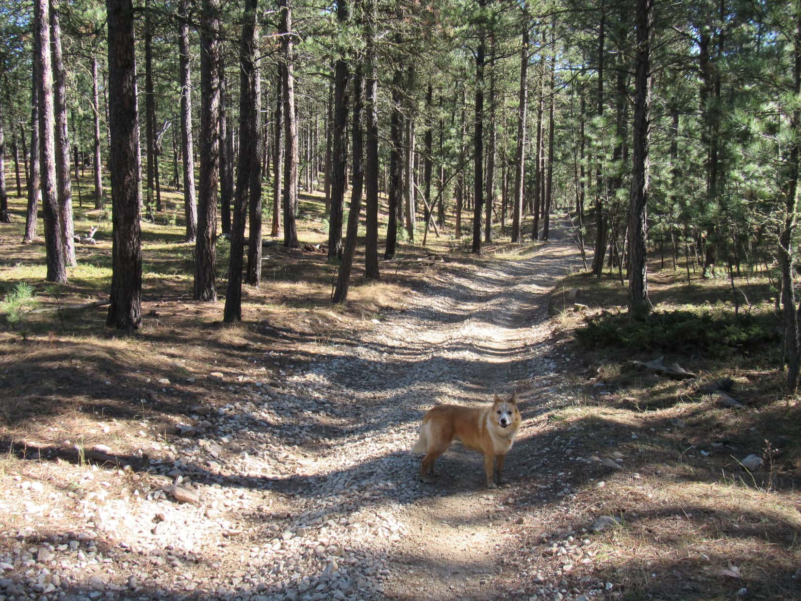
So far, most of USFS Road No. 10 had been fairly rough. It deteriorated further as SPHP drove on. The last stretch of road leading to a cattle guard was deeply rutted, and would have been impassible if wet. Nevertheless, the G6 managed to make it up to a broad, gentle saddle 4 miles from Hwy 14.
Lupe on USFS Road No. 10. The last stretch of road to get to this cattle guard had been the worst, and would have been impassible for the G6 if wet. Photo looks SE.
After crossing the cattle guard, SPHP parked the G6 by a barbed wire fence. Prospect Benchmark was now only a ridiculously easy 0.33 mile away to the S. This was going to be cake!
This is it? Looks like you’re starting us out mighty easy on this Dingo Vacation, SPHP! Loop standing by USFS Road No. 217 ready to start for Prospect Benchmark, the ridge in sight beyond the snowbank. Photo looks SSW.
Although the temperature had hit 95°F while traveling across the Wyoming plains on I-90, the evening was pleasantly cool way up here in the Bighorns as Lupe set off for Prospect Benchmark. (7:19 PM, 62°F) Loop started out following USFS Road No. 217, a simple dirt road which headed SW up a long, gentle incline.
Once beyond a large snowdrift, Lupe abandoned No. 217 near the road’s high point just N of the summit area. She scampered S up the remaining grassy slope to a partially broken down escarpment. A mere 5 or 10 foot scramble among the rocks brought Loop up onto the N edge of Prospect Benchmark’s vast, flat, barren summit area.
That had been easy! All Lupe had to do now was find the actual survey benchmark. A cairn of white rocks not too far away along the edge of the escarpment seemed like a logical place to begin. The Carolina Dog found nothing near the cairn, however, except a nice view back toward the saddle where the G6 was parked.
Lupe reaches a cairn near the N edge of Prospect Benchmark‘s summit area. The G6 is parked down at the intersection seen in the saddle. USFS Road No. 10 crosses the saddle, while USFS Road No. 217 is seen heading this general direction, and No. 220 winds away up the distant hill. Photo looks NE.
A check of the topo map showed that the survey benchmark ought to be located toward the SE end of Prospect Benchmark’s huge summit area. Loop and SPHP traveled SE along the escarpment forming the NE edge of the summit keeping a lookout for the benchmark.
Looking SE along the minor escarpment forming the NE edge of Prospect Benchmark’s summit area.
Lupe found nothing of interest until she got close to the end. A 2nd cairn of white rocks sat perched upon a high spot right along the escarpment’s edge, but the survey benchmark wasn’t here, either.
Loop reaches a 2nd cairn near the SE end of the escarpment. Photo looks NE.
However, Loop could see a metal rod sticking up from a smaller 3rd cairn 20 feet to the SW. That seemed promising! Lupe went to check it out.
Nothing here, either, SPHP! Lupe checks out the 3rd cairn with the metal rod sticking out of it. Still no luck. Photo looks SW.
Still nothing! Hmm.
The far SE end of the summit area was now quite close, so Lupe went to it. Again nice views, including a distant view of Cloud Peak(13,167 ft.), the highest mountain in the Bighorn Range, but no survey benchmark.
A distant view of Cloud Peak from the SE end of the Prospect Benchmark summit. Photo looks SE.Looper at the SE end of the Prospect Benchmark summit area. Photo looks NE.Cedar Mountain(9,813 ft.) (L) from Prospect Benchmark. Photo looks SW.
Lupe and SPHP wandered back toward the NW still looking for the benchmark. Even though the terrain was flat and exposed, if the survey benchmark really wasn’t somewhere close to this SE end, it was going to be hard to find. The summit area was just that big.
Could you be a little more specific, SPHP? “It’s gotta be up here somewhere!” isn’t much of a clue! Photo looks WNW.
Maybe Lupe wasn’t going to be able to find the benchmark? Maybe it wasn’t even up here anymore? Even if it was, finding the benchmark might be like looking for a needle in a haystack. Then suddenly, there it was, right in the general vicinity shown on the topo map.
Prospect survey benchmark.
The benchmark was on exposed rock, which made it easy to spot. The marker was only 20 feet NW of the 3rd cairn Lupe had come to, the one with the metal rod sticking up out of it. A fair number of loose white rocks were nearby. SPHP used them to build a cairn. The largest rock had a stiff wire wrapped around it.
The survey benchmark is seen right in front of the big cairn SPHP built. The smaller 3rd cairn with the metal rod is beyond it. Cloud Peak (Center) is on the distant horizon. Photo looks SE.
Well, that was that! SPHP congratulated Lupe on her now completely successful ascent of Prospect Benchmark(9,774 ft.). It was an easy start to her Dingo Vacation, but this was just the beginning.
At any rate, the sun wouldn’t be down for a little while yet. Lupe could spend this extra time exploring the area. Just for fun, the Carolina Dog and SPHP wandered 0.33 mile off to the W and SW. The temperature was dropping, but it was a pleasant trek on a beautiful evening with mostly clear skies and only a light SW breeze.
Lupe at the endpoint of her wanderings W of the Prospect Benchmark summit. Photo looks WSW.Looking NE back toward Prospect Benchmark.Sweet Lupe on a beautiful evening in the Bighorns.
The sun sank toward the horizon. Time to head back to the G6. Lupe had fun sniffing and exploring along the way. She crossed snowbanks, and returned to Prospect Benchmark once more.
Crossing a snowbank near sunset. Photo looks ENE.Lupe back at Prospect Benchmark next to the cairn SPHP built. The actual survey benchmark is hidden behind the cairn. Photo looks NW.Here it is!Cloud Peak (Center) from Prospect Benchmark late in the day. Photo looks SE.Crossing a snowbank on the way back to the G6. Photo looks SSE.A look back at the escarpment. Photo looks S.
As Lupe’s adventures go, Prospect Benchmark had been a pretty short one – less than 2 hours, even including wandering off to the W. Loopster arrived back at the G6 still all corked up and full of Dingo energy. (End – 9:00 PM, 54°F)
As twilight faded, SPHP threw a tennis ball for Lupe to chase, then joined in the fun chasing her back and forth around the G6. As far as Lupe was concerned, this exciting game of chase was the highlight of the whole day! She got to show off how fast, agile, and tricky she is, while making a complete fool of SPHP.
Thankfully, it was getting dark. SPHP can only put up with so much abuse. Yet seeing Lupe having so much fun really was the best part of the day, a great finish to the first day of her 2018 summer adventures way up here in the beautiful Bighorn Mountains at almost 10,000 feet by Prospect Benchmark.
Sunset from Prospect Benchmark, Bighorn Mountains of Wyoming, 6-9-18
Start – 8:55 AM, 50 °F, Pilot Knob trailhead of Centennial Trail No. 89
The first half of October had been cold and wet, but that was history now. This morning was clear and bright, and it was already 50 °F when Lupe and SPHP arrived at the Pilot Knob trailhead along USFS Road No. 208 (Merritt Road). The air was calm down here at the trailhead, but Lupe could hear a breeze up in the pines.
Lupe arrives at the Pilot Knob trailhead of Centennial Trail No. 89. It was going to be a great day with highs near 60°F expected. Photo looks NNE.
Lupe was eager to get started, which was a good thing. Days are getting short by the second half of October, and she had a long way to go. The South Boxelder Creek trailhead of Centennial Trail No. 89 near Nemo was 7.6 miles away, a 15.2 mile round trip. And that was if Loop stayed on the trail, which she wouldn’t, because a little off-trail peakbagging was part of the plan for the day, too.
It’s 7.6 miles one way to the South Boxelder Creek trailhead from the Pilot Knob trailhead – 15.2 miles round trip. And that’s if you don’t climb any mountains on the side along the way!
Only a few minutes on the trail got Loopster up the first forested slope and around the bend to the N where she could see Pilot Knob(5,440 ft.) beyond a big field. Pilot Knob didn’t look like much from here, but Loop had been there recently on Expedition No. 235. Pilot Knob was actually a fun little climb and the views from the top had been surprisingly good.
Hey, SPHP! There’s Pilot Knob (L) again! We were just up there not too long ago, remember? Photo looks WNW.
Lupe followed Centennial Trail No. 89 NNW along the E side of the big field. Near the end of the field, the trail curved NE and went past a sign for Boodleman Spring, which didn’t seem to have much in the way of water. The trail got steeper after passing Boodleman Spring, and soon turned N again going up a forested valley.
After passing under a big power line, Centennial Trail No. 89 bent NW paralleling the power line. When the power line reached a high point, the trail curved away to the E. Lupe briefly left the trail to check out this high point, but there really wasn’t much to see.
Returning to the trail, Loop and SPHP followed it around the S end of a nearby hill to the E.
Going around the S end of the hill E of the power line’s high point. Photo looks E.
Lupe had been gaining elevation ever since leaving the Pilot Knob trailhead. However, as Centennial Trail No. 89 curved back around to the N on the E side the hill, the trail reached a high point, too.
Ahead was a limited view of a high ridge beyond a deep valley. Several high points could be seen along this ridge, which extended off toward the NNW. The topo map revealed that the closest high point was Peak5701, the highest spot along the entire ridge.
Peak 5701 (Center) is in view as Centennial Trail No. 89 descends into the valley of the West Fork of Estes Creek. Photo looks NNE.
Although Peak 5701 and the rest of the ridge it was on looked intriguing, Centennial Trail No. 89 wasn’t going up there. The trail went toward Peak 5701, but upon reaching the floor of the deep valley it turned E at the base of the mountain.
The American Dingo had entered the valley of the West Fork of Estes Creek. Looper soon came to a large puddle where Estes Creek crossed Centennial Trail No. 89. The creek itself was a mere trickle only an inch or two deep.
Lupe reaches the puddle where the West Fork of Estes Creek crosses Centennial Trail No. 89. Photo looks ESE.
For 0.5 mile, Lupe continued E going down the valley on the N side of the West Fork of Estes Creek. The creek gained some flow along the way, but remained quite a small stream. NW of High Point 5452 the trail left the valley floor climbing up onto a small rise. From here, the trail turned N gaining elevation gradually as it wound around the SE end of Peak 5701.
Lupe at a junction of Centennial Trail No. 89 and ATV trail No. 8251 shortly after leaving the West Fork of Estes Creek. Centennial Trail No. 89 is also an ATV trail all the way from Pilot Knob to South Boxelder Creek. In fact, it’s possible to go even farther on an ATV all the way to the Dalton Lake trailhead. Photo looks NNW.Going around Peak 5701’s E ridge. Photo looks ENE.
Centennial Trail No. 89 eventually brought Lupe around E of Peak 5701. For 0.75 mile, the trail now headed NNW roughly paralleling the long ridge between Peak5701 and Peak5628.
Now E of Peak 5701 heading NNW.
While the first part of this area was forested, farther on Lupe came to meadows, too. The Carolina Dog reached a spot where she had a fairly clear view of Peak5440 off to the NE.
Peak 5440 didn’t look too impressive. It was just a flat-topped forested hill. Yet with 360 feet of prominence, Peak 5440 was the most prominent mountain along the entire route Lupe would be traveling today. So the plan was to take a little off-trail side trip to climb Peak 5440. After seeing it, though, expectations were none too high. Loop probably wouldn’t be able to see anything but trees from up there.
Despite technically being the most prominent peak along this section of Centennial Trail No. 89, Peak 5440 didn’t look too impressive. Lupe intended to climb it anyway. Photo looks NE.
Continuing on, Looper soon had views of Peak5701 again and the long ridge going NNW from it to Peak5628. That big ridge looked a lot more intriguing than Peak 5440 did. Despite not having as much prominence, it was higher and appeared to at least offer some views. Peak 5701 even had a little snow.
Peak 5701 (L) looked more interesting than Peak 5440, and even had some snow. Photo looks SW.
The trail gradually curved toward the NE. Stands of aspens sported a few yellow leaves, the last of 2018’s autumn colors. Approaching Peak 5440, Lupe came to a couple of ponds surrounded by wooden fences.
A few colorful aspen leaves were about the last of this autumn’s display. Peak 5701 is on the R. Photo looks S.Lupe comes to a fenced-in pond as Centennial Trail No. 89 approaches Peak 5440. Photo looks NE.
Beyond the ponds, Centennial Trail No. 89 curved N again. This was as close as the trail was going to get to Peak 5440. Looper left the trail and began to climb, heading first E, then SE as she got higher up.
Lupe soon reached a grassy area on the W face of Peak 5440 that she had seen earlier from a distance. This was the only place she was likely to see much from Peak 5440. She actually had a rather nice view of Peak 5701 and the long ridge to Peak 5628 from here.
Peak 5701 (L) and Peak 5628 (R) from the upper W slope of Peak 5440. Photo looks SW.Peak 5701 from Peak 5440. SPHP sort of wished Lupe was climbing Peak 5701 instead. It looked far more interesting. Photo looks SW.
From the grassy area with a view, Lupe still faced the steepest part of the climb up Peak5440, but even so, it wasn’t difficult and didn’t take her long. The terrain soon began to level out. The topo map showed two 5,440 foot contours on the mountain. Lupe headed NE through dense forest looking for the first one, which contained by far the smallest area. A single large boulder proved to be the clear high point of this contour.
Lupe on the big boulder which appeared to be the high point of the first and smallest 5,440 contour shown on the topo map. Photo looks NW.
The area contained by the larger 5,440 foot contour was only a couple hundred yards farther NE. Loopster traveled through dense forest the entire way. She seemed to gain at least some elevation. This larger area was almost certainly higher than the big boulder, and had to be the location of the true summit.
No big boulder or other definite high point existed here, however. The true summit might have been any of a number of smallish rocks located on nearly flat terrain that sloped only very gradually toward the SE. The most interesting thing about this place was actually a 15 or 20 foot high escarpment along the NW edge of the area. Forest blocked all views, but the escarpment featured some interesting rock formations.
The true summit of Peak 5440 is right around here somewhere! Photo looks N.Hardly matters which of these rocks is the true summit of Peak 5540. Can’t see a thing except trees from any of them anyway! I’m calling this good enough for Dingo work!This escarpment along the NW edge of the summit area is cool, though! Photo looks N.
Exploring is always fun, but Peak5440 was the sort of place Lupe was only likely to get to once. Might as well linger a while to enjoy whatever the experience had to offer. It was time for a short break, anyway. The usual fare was on offer. Water and Taste of the Wild for Lupe. An apple for SPHP.
When break time was over, it was back to Centennial Trail No. 89 by the same route Lupe had taken up. Upon reaching the trail, Lupe continued N. She soon came to a sign saying it was 4.5 miles to Nemo or 3.5 miles back to Pilot Knob. Nemo was about a mile beyond the South Boxelder Creek trailhead, so this was about the halfway point.
Lupe reaches a sign near the halfway point between the Pilot Knob and South Boxelder Creek trailheads. Photo looks E.
It wasn’t much farther to another high point. Centennial Trail No. 89 had been gaining elevation, albeit quite gradually, ever since leaving the West Fork of Estes Creek. N of Peak 5440, however, the trail went over a broad, gentle pass. On the other side Lupe was soon losing elevation faster than she had gained it. She was entering the upper reaches of yet another valley.
Loop hadn’t gone far beyond the high point when she reached a sign for Caryl Spring. Caryl Spring consisted of several inches of standing water full of fallen leaves. Lupe cooled her paws off, and helped herself to a drink.
As Lupe headed toward the pass N of Peak 5440, she caught sight of this high ridge N of Peak 5628. Photo looks WSW.Loopster at the high point of Centennial Trail No. 89 N of Peak 5440. There was a major road junction here, but not much in the way of signage. Photo looks E.Starting down into the next valley. Caryl Spring is right around the bend.Lupe standing paw deep in Caryl Spring, which did have a few inches of water.
From Caryl Spring the trail continued E farther down the valley, but not for long. When the valley turned N, Centennial Trail No. 89 took off to the SE up a side draw. Lupe gained close to 100 feet of elevation going over a minor ridge extending NNE from Peak 5440. The Carolina Dog was soon over this ridge and starting a descent that would take her into Blue Draw.
Loop reached a sign indicating the South Boxelder Creek trailhead was only a mile ahead.
Gaining elevation again going over the minor ridge NNE of Peak 5440. Photo looks SE.Beginning the descent into Blue Draw after crossing the ridge. Photo looks ESE.Getting there! Only a mile to go to the South Boxelder Creek trailhead!
A junction existed where Centennial Trail No. 89 reached Blue Draw. It wasn’t clear where the road heading SW was going other than farther up the draw. Where it went didn’t really matter. Loop just needed to head down the valley. At the lower end of Blue Draw she would find the South Boxelder Creek trailhead. The trail headed NE at first, then E the rest of the way.
Lupe in Blue Draw.Approaching a seasonal stream in Blue Draw. It was just a puddle today.
The trek down Blue Draw was shady and pleasant, but it seemed like Lupe had gone more than a mile since seeing the sign about the trailhead. Finally she saw a ramp for ATV’s and a gate ahead. Just beyond the gate was the bridge over Boxelder Creek. This was it! Looper had reached the trailhead!
Oh, look! There’s the gate and ATV access ramp. We’re just about to the South Boxelder Creek trailhead!Loop on the bridge over Boxelder Creek. Photo looks NE.Boxelder Creek looking downstream (SE) from the bridge.Looking upstream (NNW) from the bridge.Lupe reaches her Centennial Trail No. 89 destination for the day, the South Boxelder Creek trailhead. Photo looks ESE in the direction of Nemo, which is out of sight about a mile away.
Despite Lupe’s side trip to Peak 5440, she had made fairly good time getting to the South Boxelder Creek trailhead. Her Centennial Trail No. 89 explorations were complete for the day, although she still had to repeat the experience going all the way back to Pilot Knob again.
Not yet, though! Time for another rest break. Lupe and SPHP relaxed for a while on a grassy bank by the creek.
So we made it! That wasn’t so hard now, was it? And look at this beautiful stream and scenic bridge to adventure!Guess that’s about it unless we come up with some other grand scheme on the way back to Pilot Knob!
Well, that would have been it, but on the way back to Pilot Knob the American Dingo made such excellent progress that when she reached the pass N of Peak 5440 again, SPHP realized that the sun wouldn’t set for at least another couple of hours.
So what do you say, SPHP? Still want to explore that big ridge going from Peak 5628 (R) to Peak 5701 (L)? Photo looks SW.
The big ridge with Peak5701 at the S end and Peak5628 at the N end was now in sight. Seemed like Lupe had enough daylight left to explore it. The American Dingo was willing, so why not?
Lupe and SPHP left Centennial Trail No. 89 heading SW for a saddle N of Peak 5628.
Lupe now off trail on her way to the saddle N of Peak 5628. Photo looks SW.
At first, the way was easy. The terrain gained elevation slowly. Lupe came to few obstacles. For a while, SPHP even thought Loop might be on a long abandoned road, but it was hard to tell for certain.
As the Carolina Dog got closer to the saddle, though, the going got tougher. No road here! Lupe passed through a very dense pine forest. Beyond that was an area of mixed pines and aspens thick with deadfall timber. Loop didn’t have much farther to go to reach the saddle, but progress in the middle of this mess was slow, slow, slow.
The map showed a road going up to the saddle. Lupe ought to come to it, but for a long way she didn’t. SPHP had about decided the road didn’t exist any more, when suddenly there was Lupe, standing right on it. Loop headed W on this road until it was clear she was due N of Peak 5628 and wasn’t going to gain any more elevation sticking with the road.
Time to start up Peak 5628! Lupe and SPHP left the road heading S up a fairly steep slope.
Lupe reaches the road leading to the saddle N of Peak 5628. Photo looks SW.Loop in the saddle N of Peak 5628. She left the road here. Photo looks SW.
The hardest part of the climb was the very beginning. The slope was steepest here, and again full of deadfall timber. Once Lupe was above the deadfall, the rest of the way was much easier. The elevation gain from the saddle to the top of Peak 5628 was only about 300 feet, so it didn’t take long.
Close to the summit, Lupe discovered a platform of rock with a good view of Custer Peak(6,804 ft.). A nearby rock formation proved to be the true summit of Peak 5628. Looper had no problem getting up onto the highest rock.
This platform of rock near the true summit of Peak 5628 provided a distant view of Custer Peak (Center). Photo looks NW.Lupe at the summit of Peak 5628. Photo looks N.Oh, I’m glad we came here, SPHP! Quite a few trees around, but the views are most definitely better from here than they were at Peak 5440! Photo looks E.
Quite a few trees grew near the top of Peak 5628, so views were limited. However, this was definitely better than Peak 5440 had been. Not only could Lupe see Custer Peak, but a little way S of the summit was an open area where she had a good look at Peak 5701 at the opposite end of the ridge.
Looper could also see a broad expanse of territory to the S and W. Even Black Elk Peak(7,231 ft.) was in view, although it was quite far away.
There’s our next peakbagging objective, Peak 5701 (Center)! Photo looks SE.A broad expanse of Black Hills territory was visible to the S & W. Photo looks S.Looking back toward the summit of Peak 5628 from the S.
SPHP had expected Lupe would have an easy time traveling along the ridgeline from Peak 5628 to Peak 5701. However, the highest part of the ridge was capped by large rock formations. Large quantities of deadfall timber existed in some places, too.
Traveling the highest part of the ridge would have taken too much time. Lupe made far faster progress staying somewhat lower on the W side of the ridge. She avoided the much steeper E side.
Loop heading S along the ridge from Peak 5628 to Peak 5701. The highest part of the ridgeline was too rocky for efficient travel. Photo looks SE.
The climb up Peak 5701 was short, but fairly steep and rocky. The top of the mountain had quite a bit of rock, too. The summit area was forested, but breaks in the trees provided some views. The highest point was toward the SE at the edge of an uneven rocky platform.
The sun was getting low by the time Lupe reached Peak 5701. Photo looks SW.Looking back over the ridgeline Lupe had just traversed toward Peak 5628 (Center). Photo looks NW.Looper reaches the true summit of Peak 5701. Photo looks ESE.
Lupe and SPHP took the last rest break of the day up on Peak 5701. The best views were toward the N and E from a rocks a little below and SE of the true summit. Lupe could see both of the other mountains she had climbed today, and a big expanse of territory she had passed through on Centennial Trail No. 89.
Looking down on Peak 5440 (Center) from Peak 5701. Photo looks NE.Peak 5628 (Center) from Peak 5701. Photo looks NW.
The sun was still up when Lupe headed N off Peak 5701 back down to the ridge leading to Peak 5628. She went only far enough to reach a slope she could easily descend into the valley to the W. This valley drained S into the valley of the West Fork of Estes Creek, but SPHP wasn’t certain which direction Lupe ought to go once she got there.
Which way to Centennial Trail No. 89? The sun had set. Light was now fading fast. A decision needed to be made quickly. When a brief foray to the E didn’t reveal anything that looked familiar, the Carolina Dog turned and went W.
W proved to be the wrong direction. No matter. Lupe continued up the valley of the West Fork of Estes Creek until she reached the power line she had been to much earlier in the day. Following the power line SE got Loop back to Centennial Trail No. 89.
Since striking out for Peak 5628, Lupe’s return route had bypassed most of the trail. Less than a mile remained to the Pilot Knob trailhead. It had been a great day, and was now a beautiful evening. Darkness reigned. Stars twinkled. A coyote howled. Puppy, ho! Onward! Almost there. (End 6:38 PM, 44°F)
Lupe on Peak 5701, Black Hills, South Dakota 10-18-18