Black Hills, SD Expedition No. 331 – Waterfalls, Trails, A Lake & A Trip Down Memory Lane with Cousin Dixie (5-24-24 to 5-26-24)

5-24-24, 1:00 PM – It was still mighty early to call it a day, but after the Ponderosa Hike along Centennial Trail No. 89, Uncle Joe’s right foot was feeling a little sore.  What to do?  SPHP recommended a scenic drive to Cheyenne Crossing for some hamburger therapy.

This suggestion proved to be a hit, and seemed to work.  Uncle Joe and Aunt Andrea both pronounced their hamburgers delicious, and Joe’s foot must have recovered to some degree, because no more complaints were heard about it.

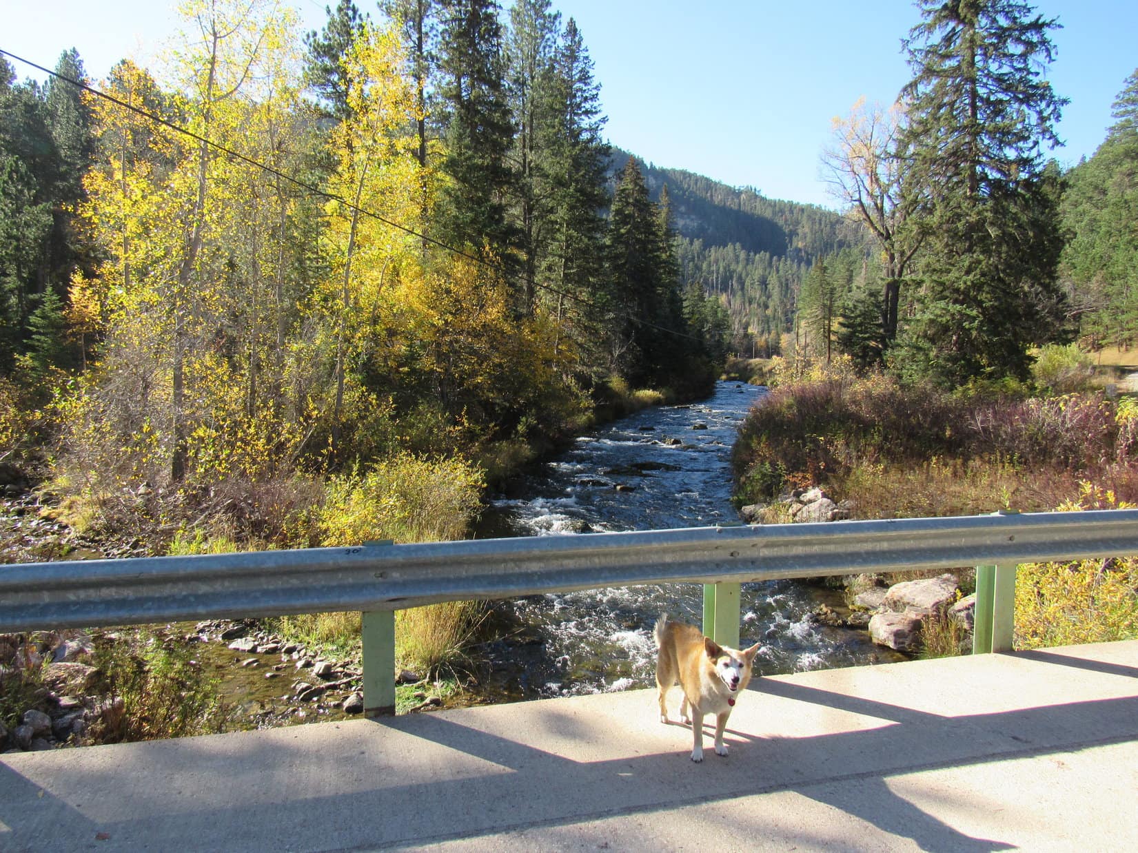
From Cheyenne Crossing, easy hikes to a couple of the biggest and most popular waterfalls in the Black Hills were only a short drive away.

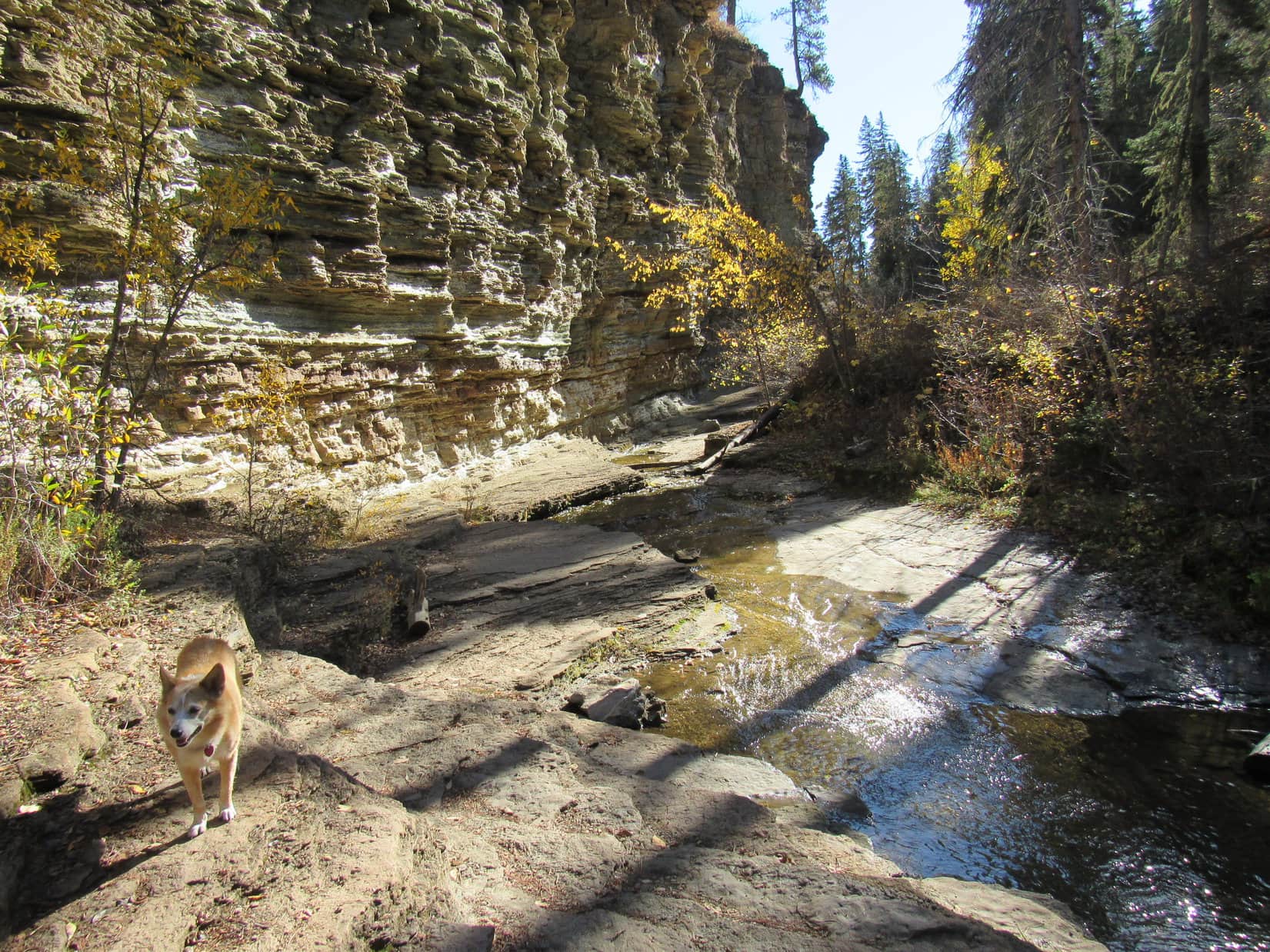
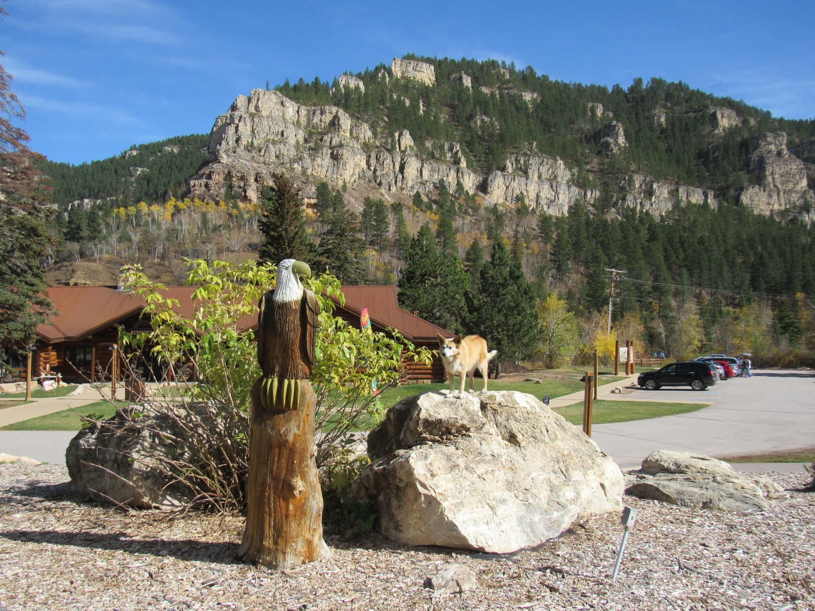
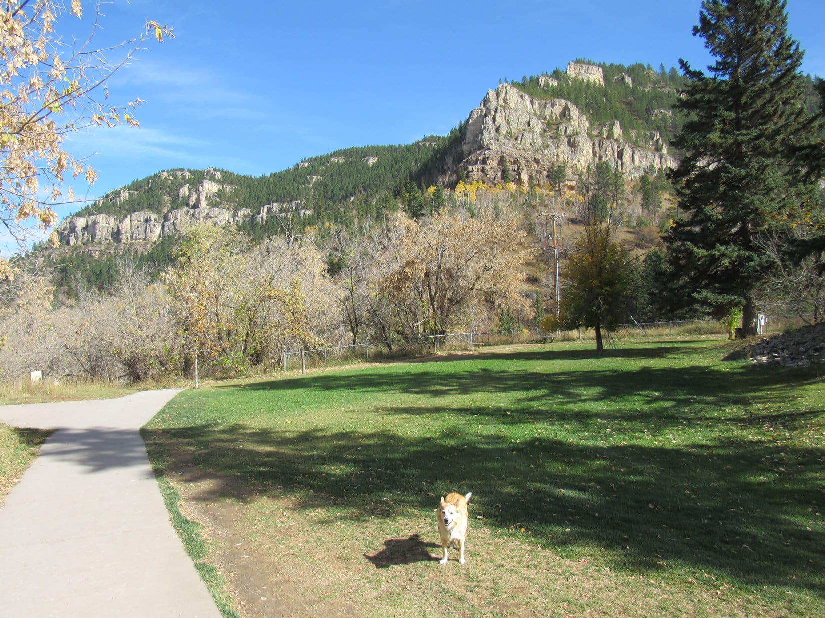
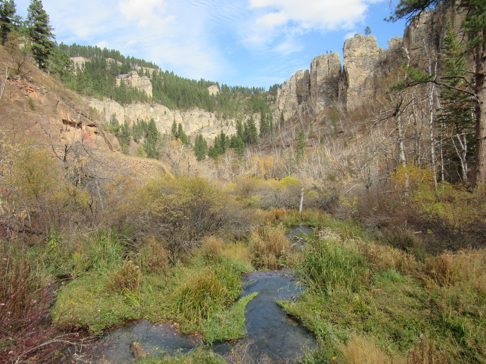
5-24-24, 3:00 PM – Enthused by the prospect of another outing, Lupe and Cousin Dixie scrambled to the top of the landscaping rocks out in front of the Latchstring Restaurant at Savoy.  The beautiful limestone cliffs of Spearfish Canyon were in all directions.

Lupe, Dixie and Andrea out in front of the Latchstring Restaurant (L) at Savoy in Spearfish Canyon. Photo looks NE.

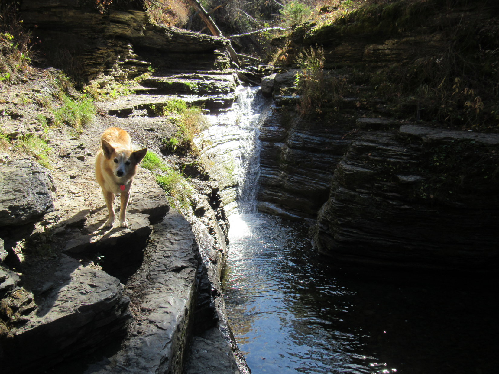
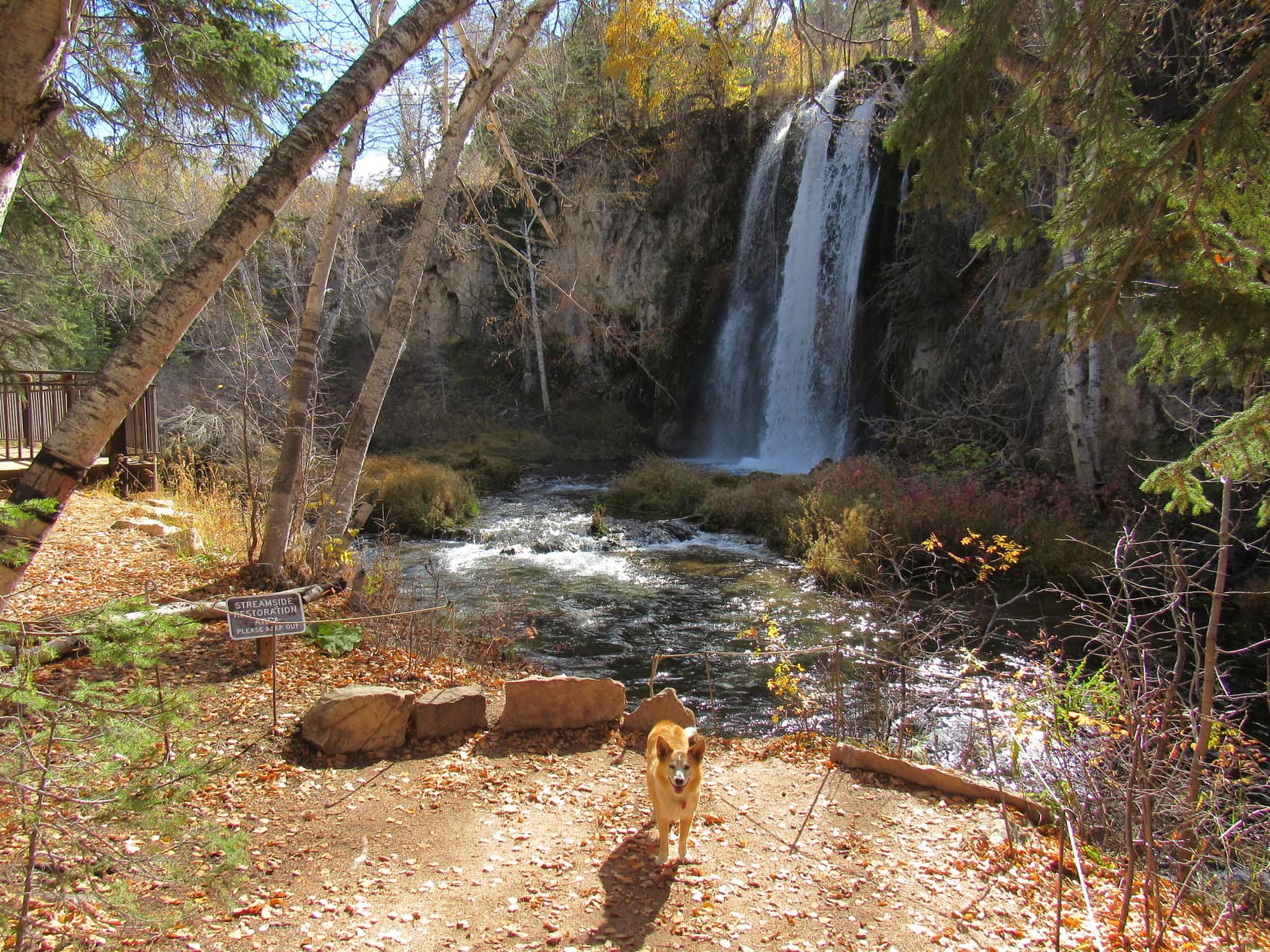
From the N (L) side of the restaurant, a 0.3 mile long trail wound down to a bridge over Spearfish Creek before ending at Spearfish Falls.

Spearfish Creek.
Spearfish Falls.

A large deck near the base of Spearfish Falls offered the best view, but the falls could be seen from other angles, too.

Lupe, Dixie, Joe & Andrea on the Spearfish Falls view deck.
From a bit farther downstream.

Spearfish Falls is where Little Spearfish Creek plunges to the bottom of Spearfish Canyon and joins Spearfish Creek.  Only 1.25 miles upstream, Little Spearfish Creek boasts another iconic Black Hills waterfall.  While certainly possible to drive to Roughlock Falls, an excellent trail starts from behind the Spearfish Canyon Lodge right across Hwy 14A from the Latchstring Restaurant.

Naturally, Lupe and Cousin Dixie were both eager to explore the trail.

Crossing the Spearfish Canyon Lodge lawn on the way to the Roughlock Falls trail. Photo looks NE.

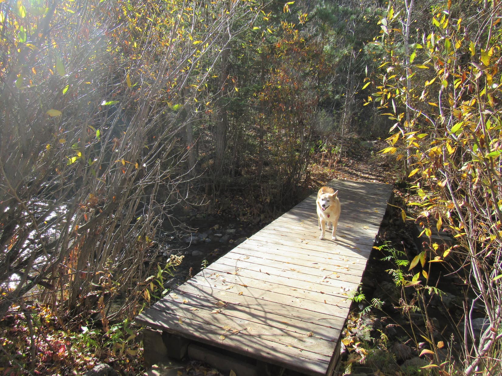
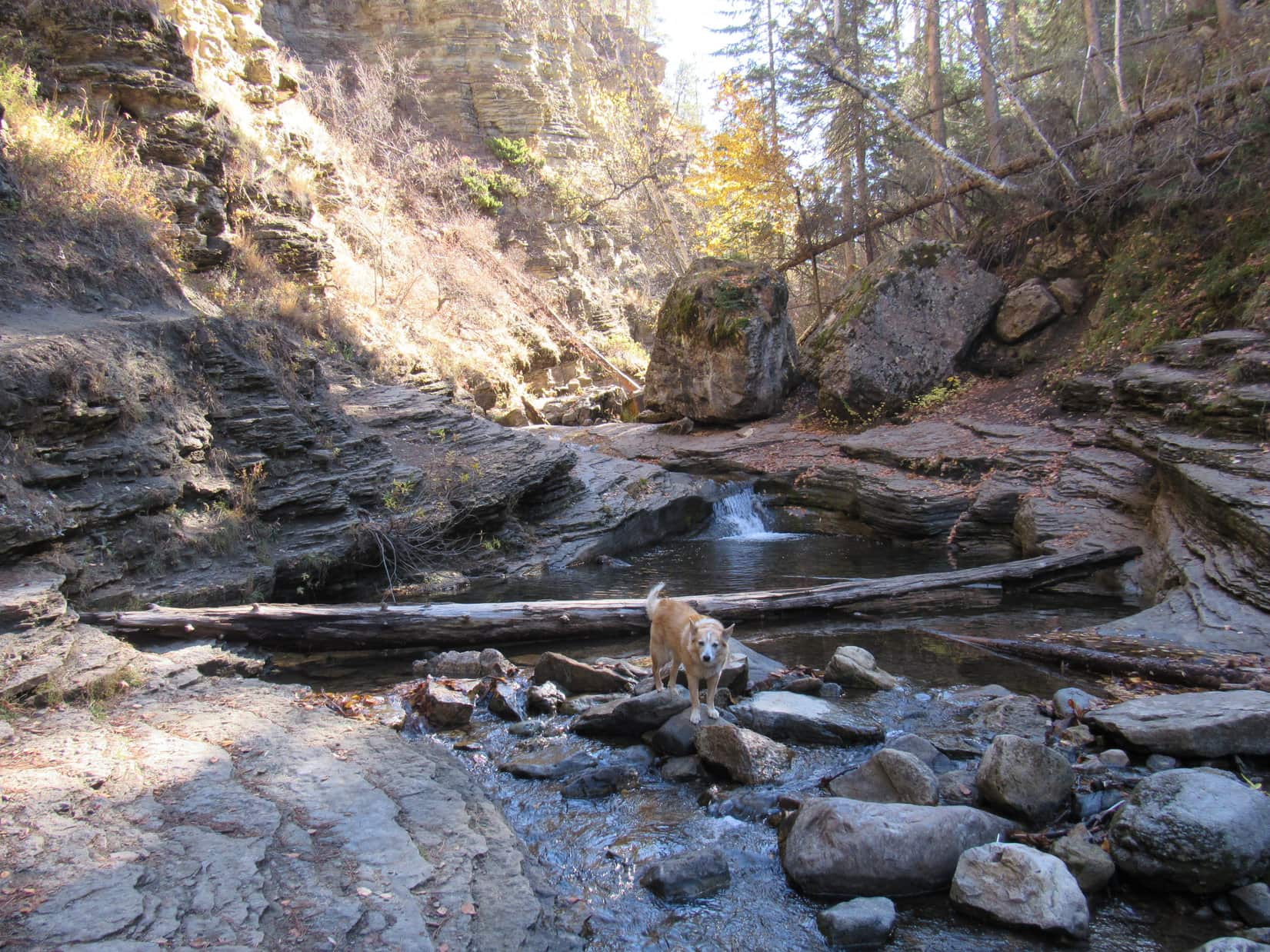
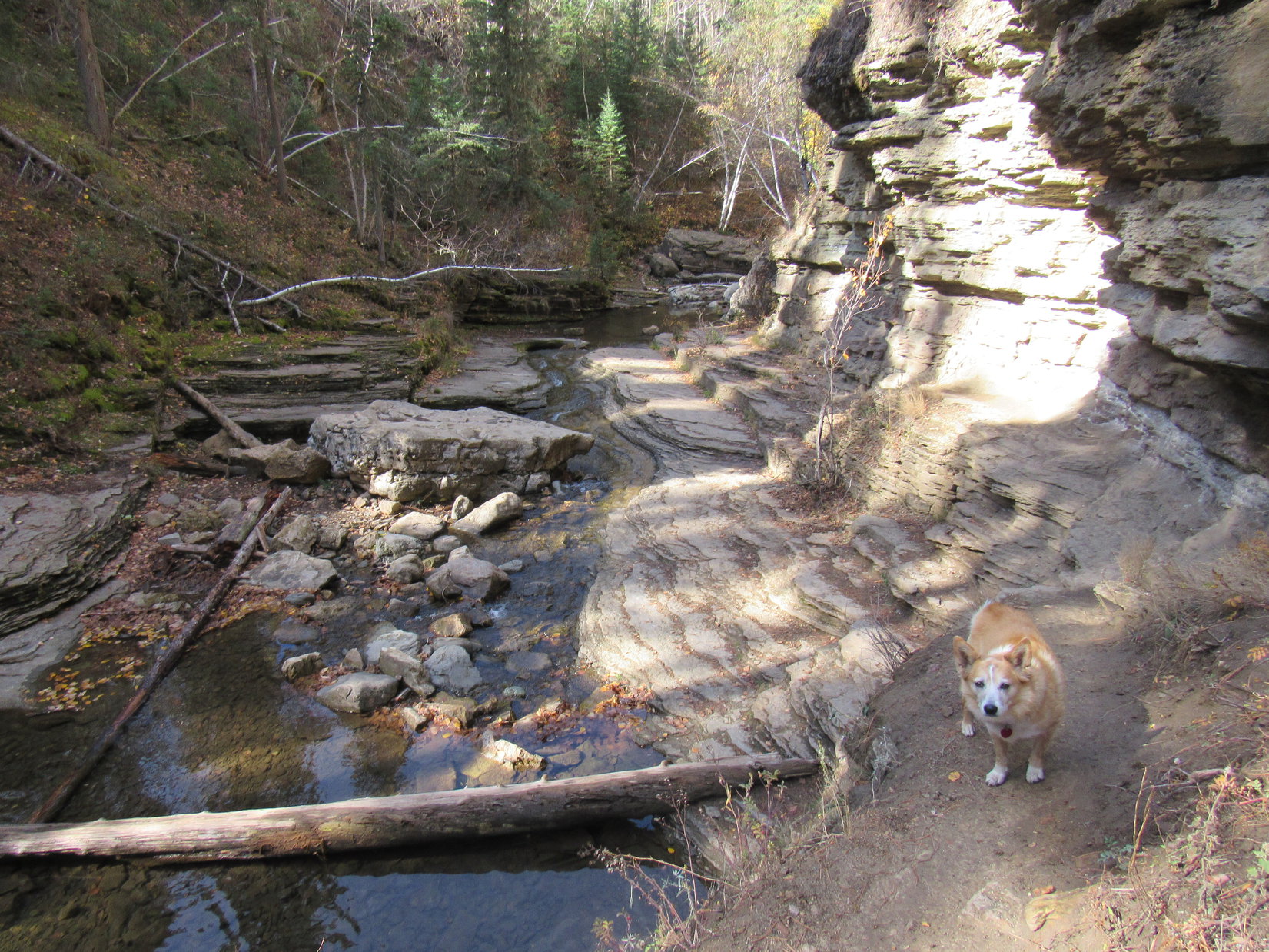
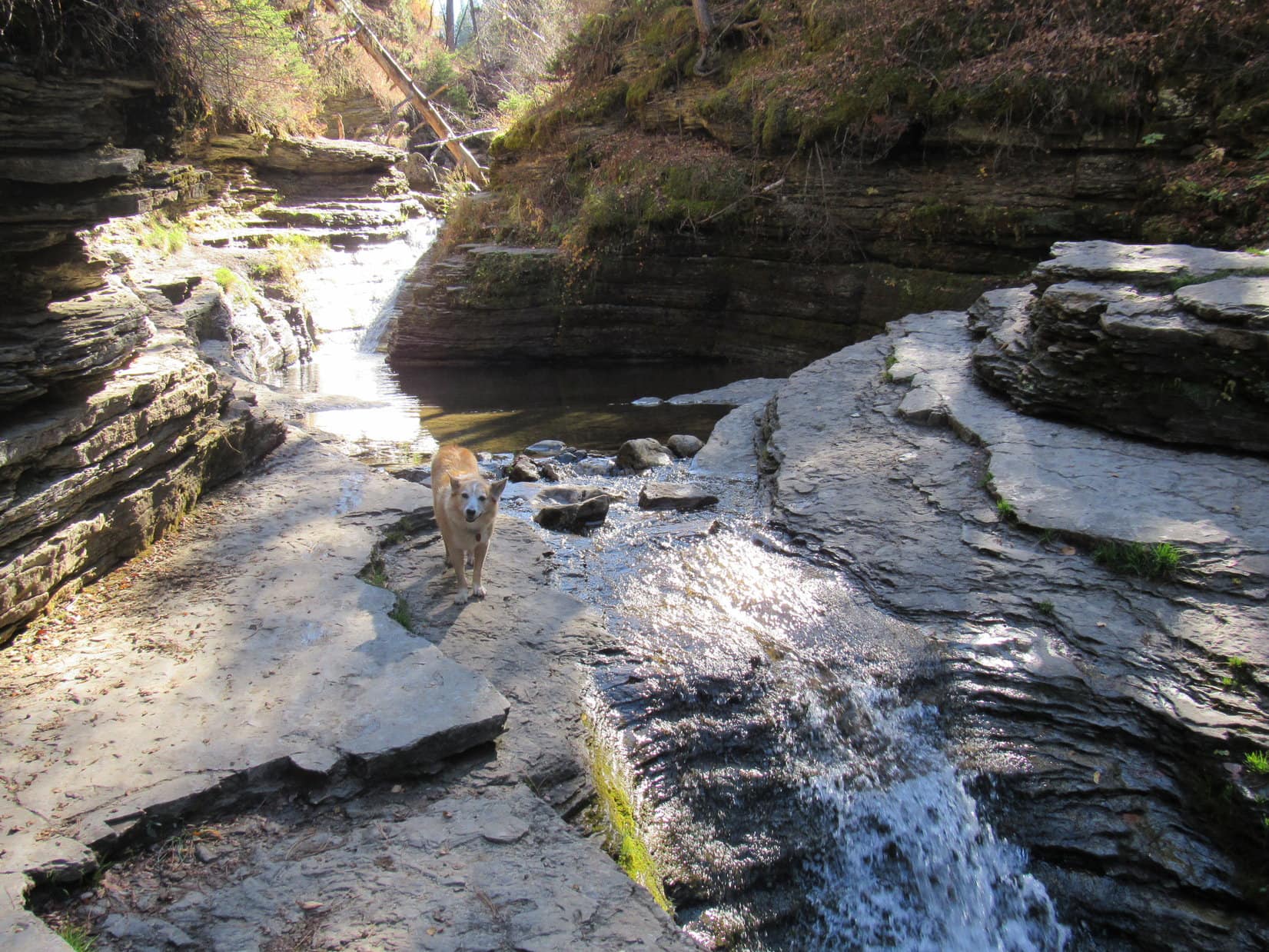
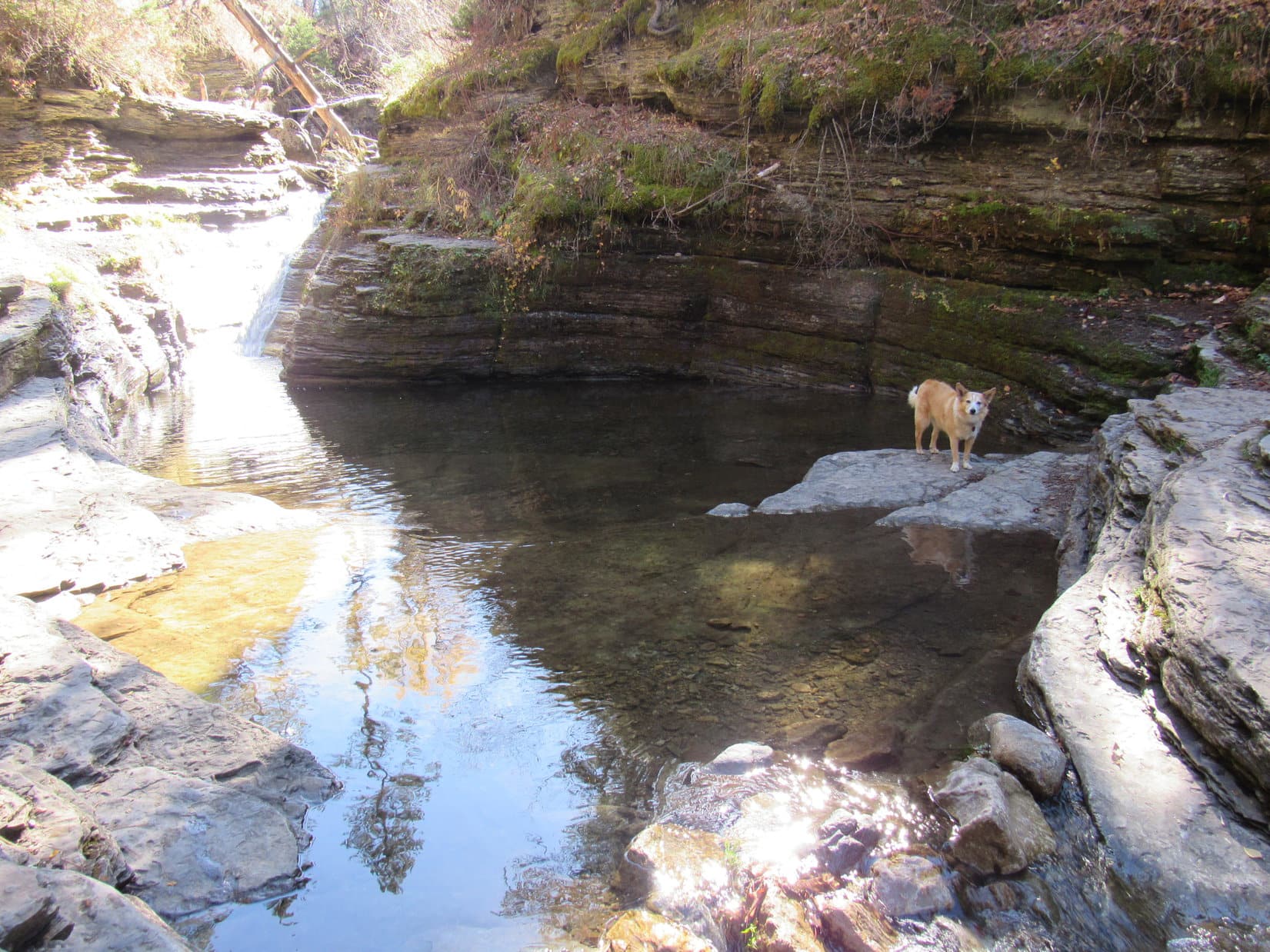
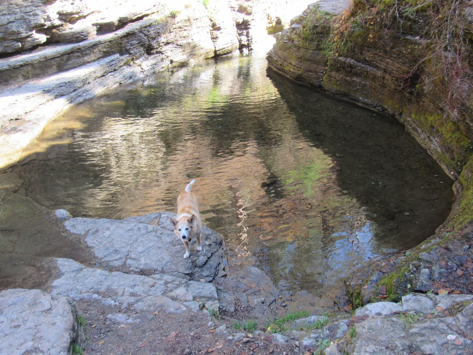
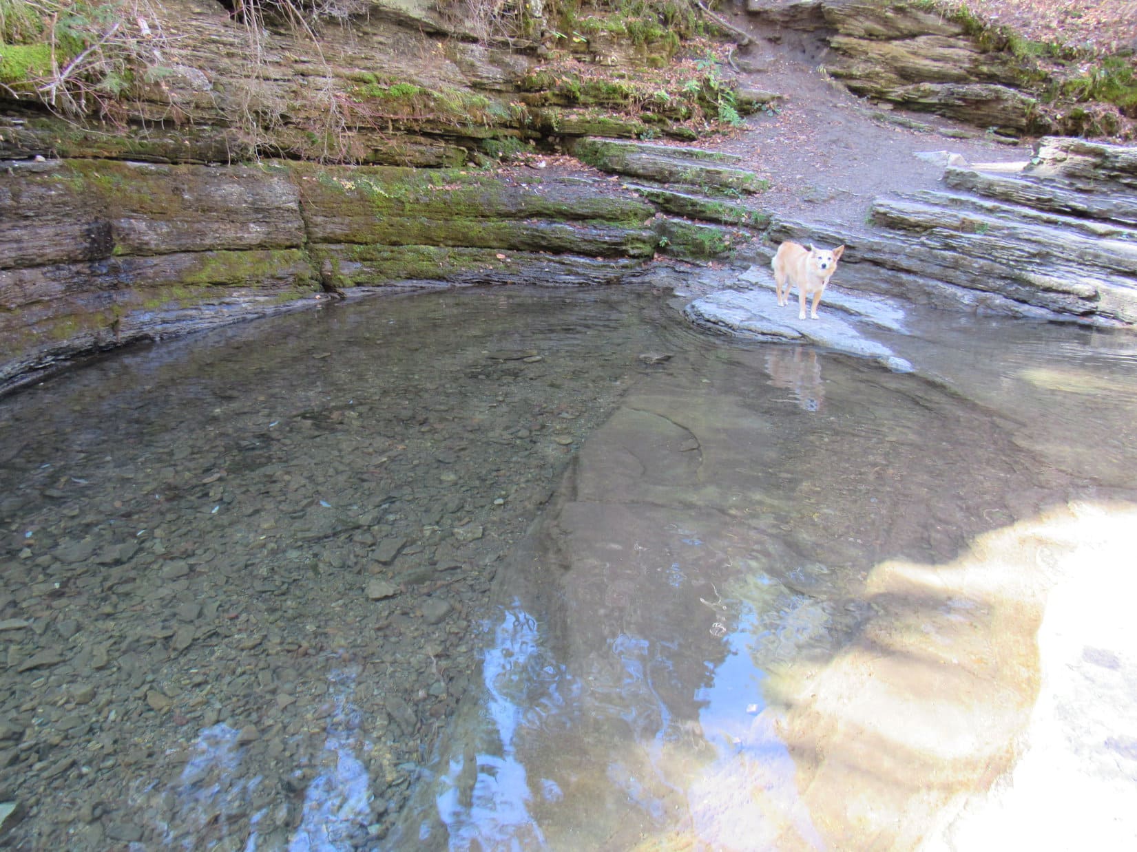
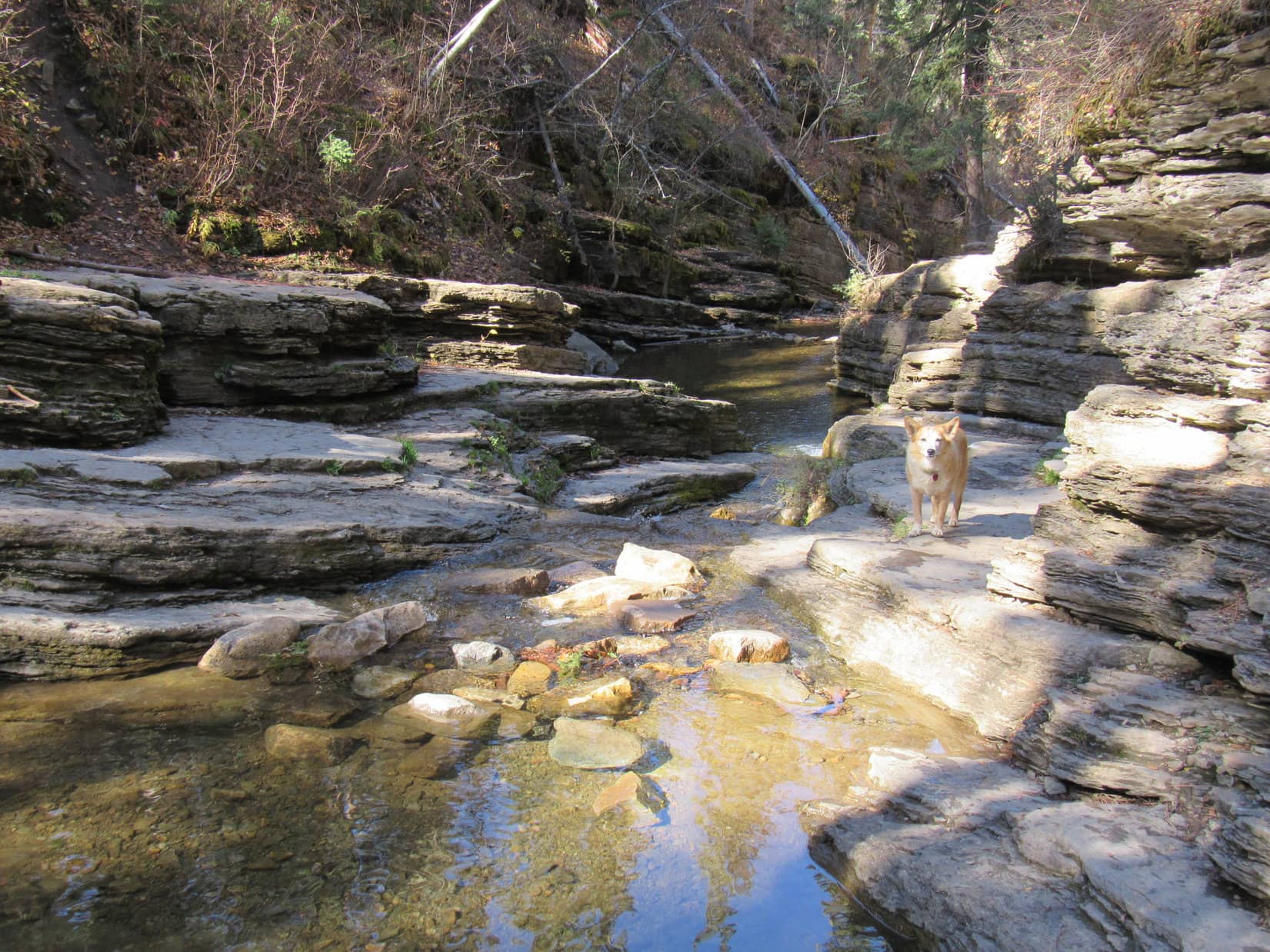
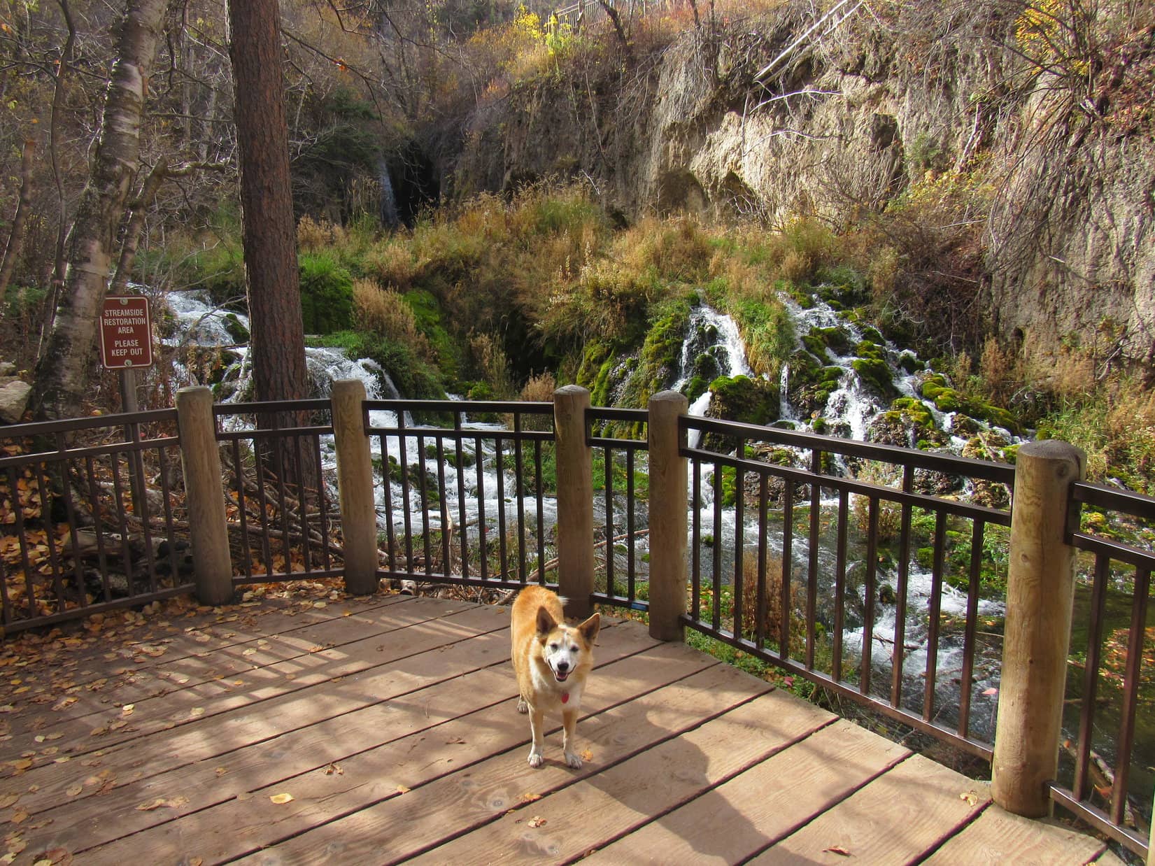
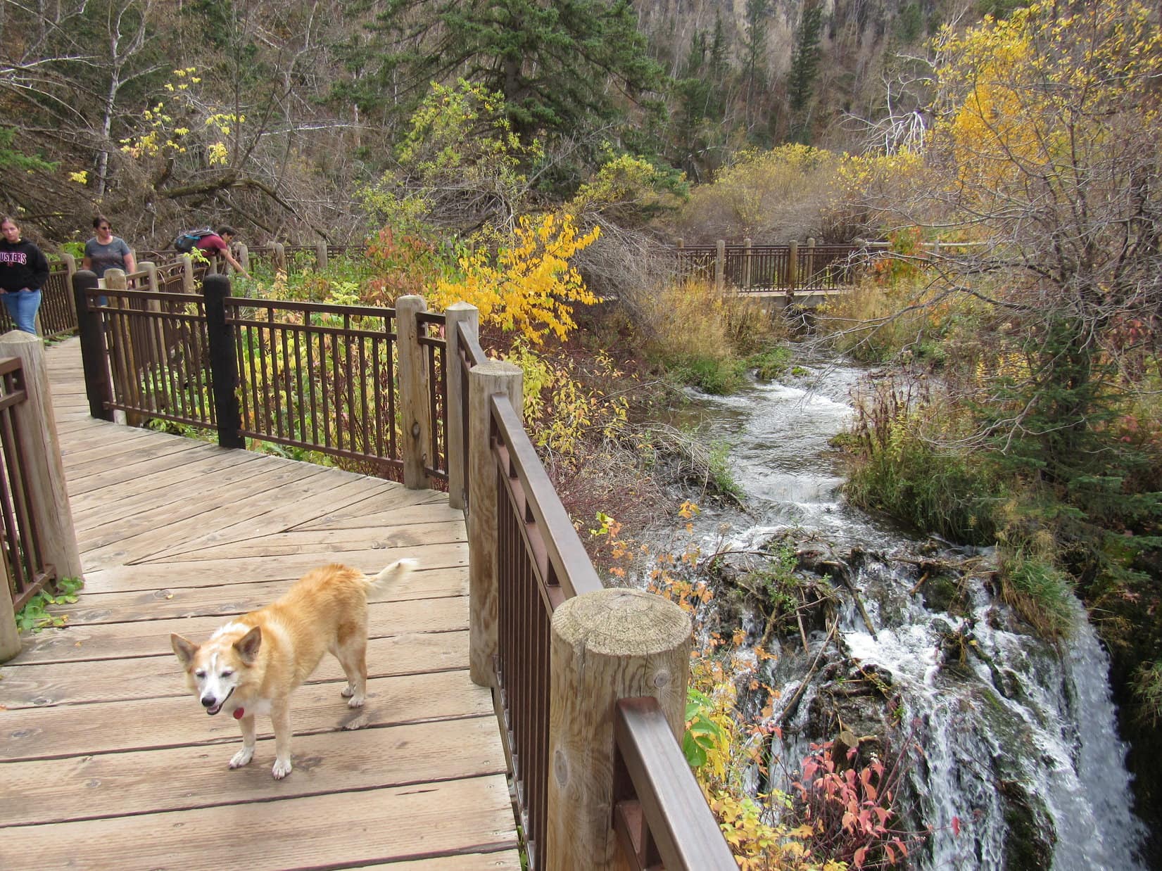
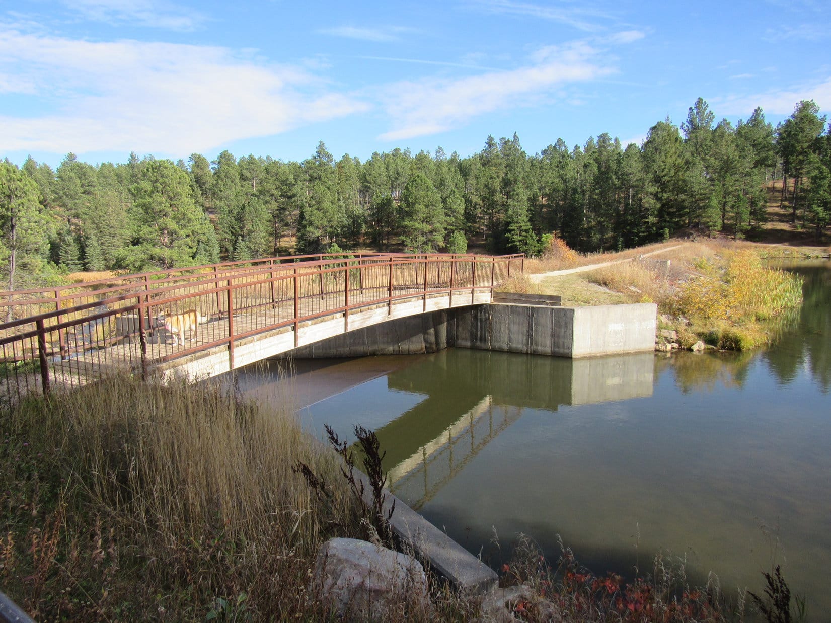
Shortly after picking up the Roughlock Falls Trail, it went past a dam on Little Spearfish Creek.  Beyond the dam, the trail paralleled the creek as it wound up this side canyon, ultimately leading to a deck with a view of a mossy cascade below Roughlock Falls.  From here, Roughlock Falls was only partially visible in the dark recesses of a narrow slot canyon.

The dam on Little Spearfish Creek. Photo looks NE.
Roughlock Falls (R) from the lower deck. Photo looks SW.

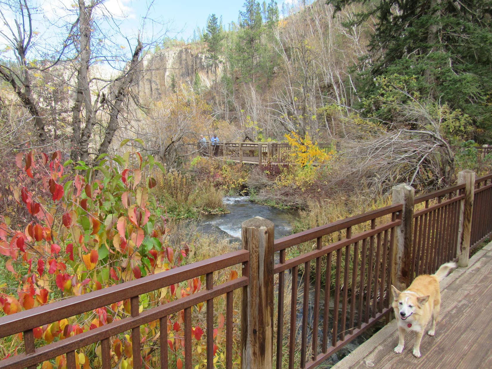
From the lower deck, a bridge over Little Spearfish Creek connected to a sidewalk that continued on up to the Roughlock Falls picnic area where 2 upper decks provided closer views of the falls.

Roughlock Falls (R) from one of the upper view decks. Photo looks SSW.
An unobstructed view from the same spot.
Zoomed in.

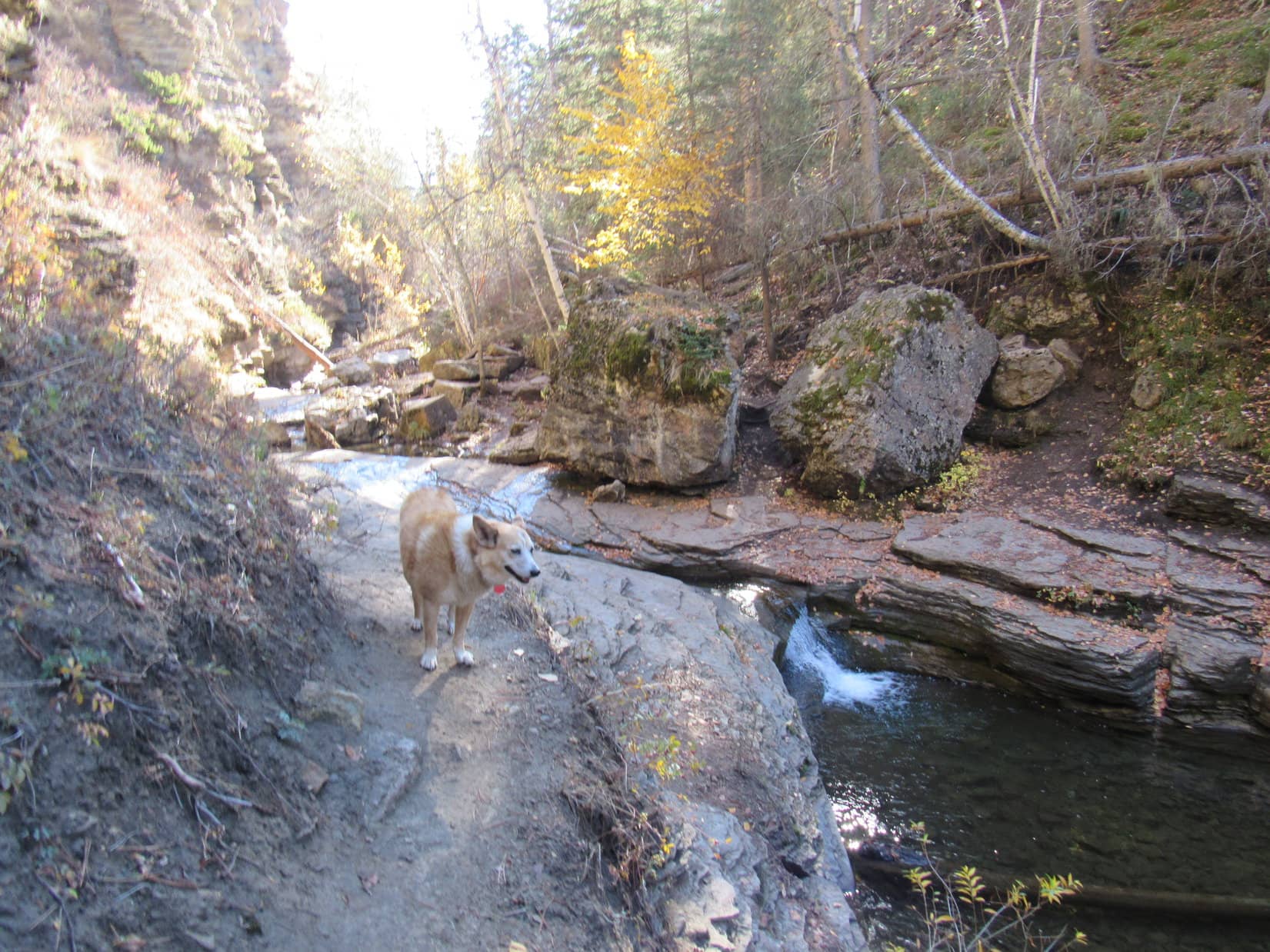
The upper deck situated closest to Roughlock Falls was accessible from another bridge over Little Spearfish Creek.  This deck provided a view from the very brink of the falls.

Joe, Dixie & Andrea (L) on the deck right next to Roughlock Falls. Photo looks SSE.
Both upper decks (L of Center & R) from the upper bridge. Photo looks ENE.
Roughlock Falls upstream view from the closest deck. Photo looks WSW.

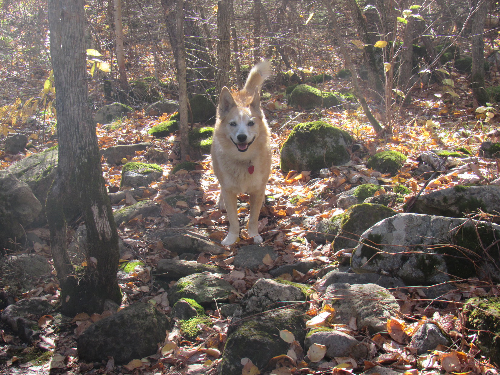
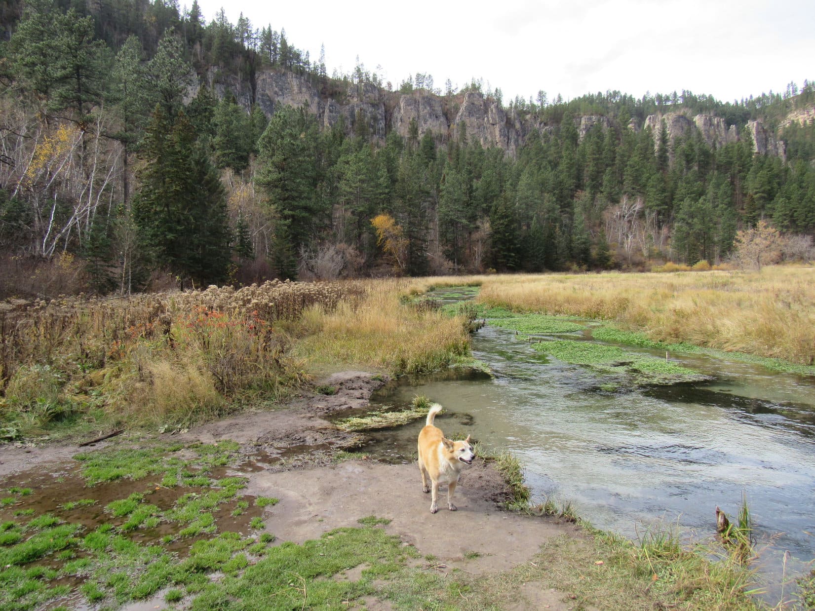
Before heading back, a short hike through the Roughlock Falls picnic area led to a small scenic rapid along Little Spearfish Creek.

By the scenic rapid at the far end of the picnic ground. Photo looks WSW.
Lupe enjoying a fun day with Aunt Andrea, Uncle Joe & Cousin Dixie.

On the way back to the RAV4, still parked at the Latchstring Restaurant, a stroll along the walkway over the small dam was necessary so Uncle Joe could observe all the trout lurking in the deep water near the spillway.

Crossing the dam while Uncle Joe peers into deep green waters full of rainbow trout. Photo looks N.

5-25-24 – With Cousin Dixie, Aunt Andrea, and Uncle Joe still at Hotel Lupe for a couple more days, the American Dingo was certain more Black Hills adventures were ahead.  However, things got off to a slow start this morning, due to some business that had to be taken care of.  Mush and David showed up at 11:00 AM for the Green Metal Box party.

The Green Metal Box contained some of Grandma’s old valuables, and today was the day SPHP intended to distribute them among Grandma’s heirs.  The party took only an hour before everyone seemed satisfied with the result, but the humans all went to the Pizza Ranch for lunch when it was over.

During this excursion, Lupe and Cousin Dixie were both abandoned at Hotel Lupe, which was a bummer, but the humans did eventually return from their high calorie experience in need of some exercise.  Something not too strenuous, though, so soon after the damage was done.  SPHP suggested a trek on Centennial Trail No. 89 to Mount Warner (5,880 ft.).

Since no one objected, or expressed any other preference, that became the plan.

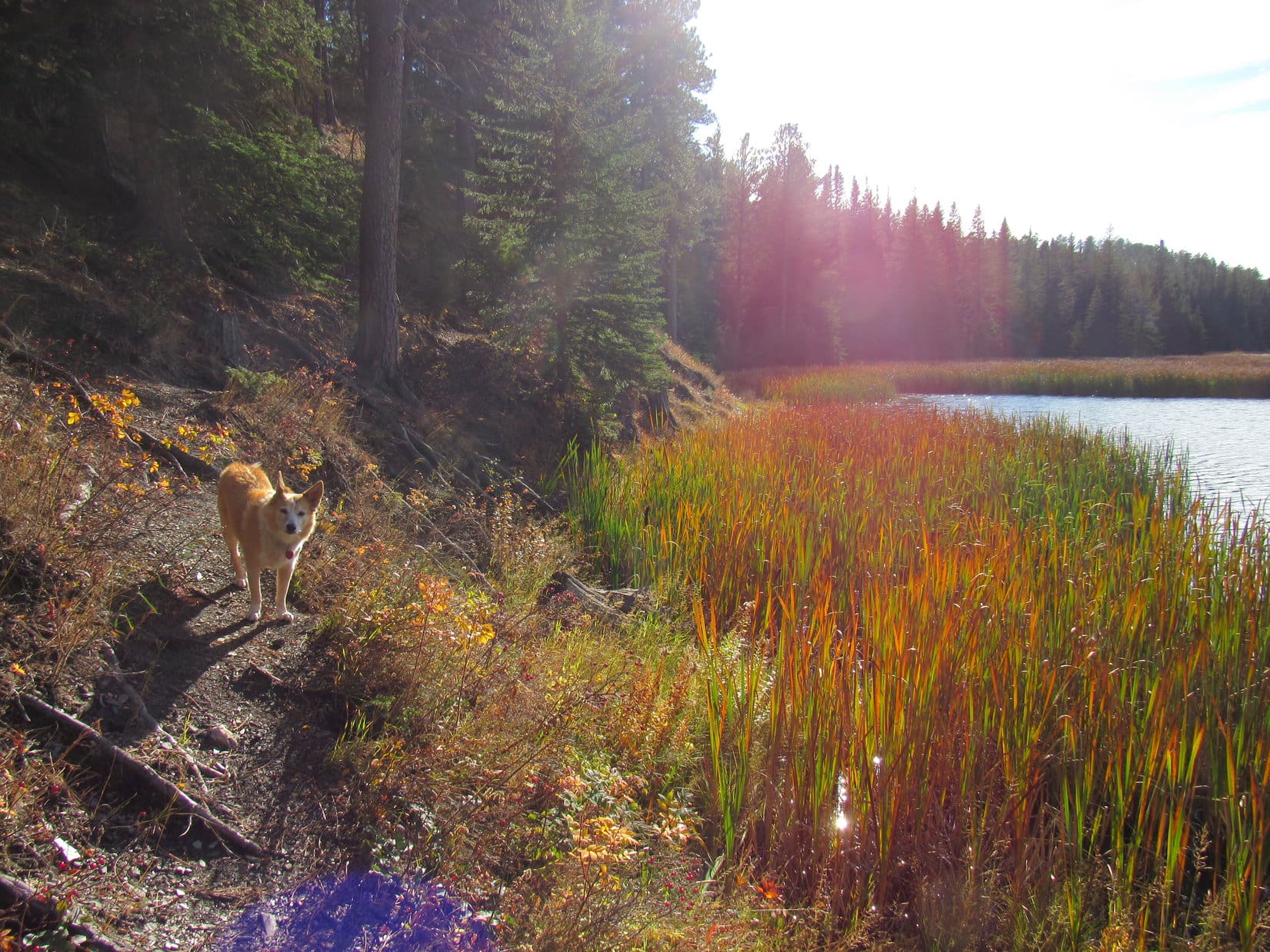
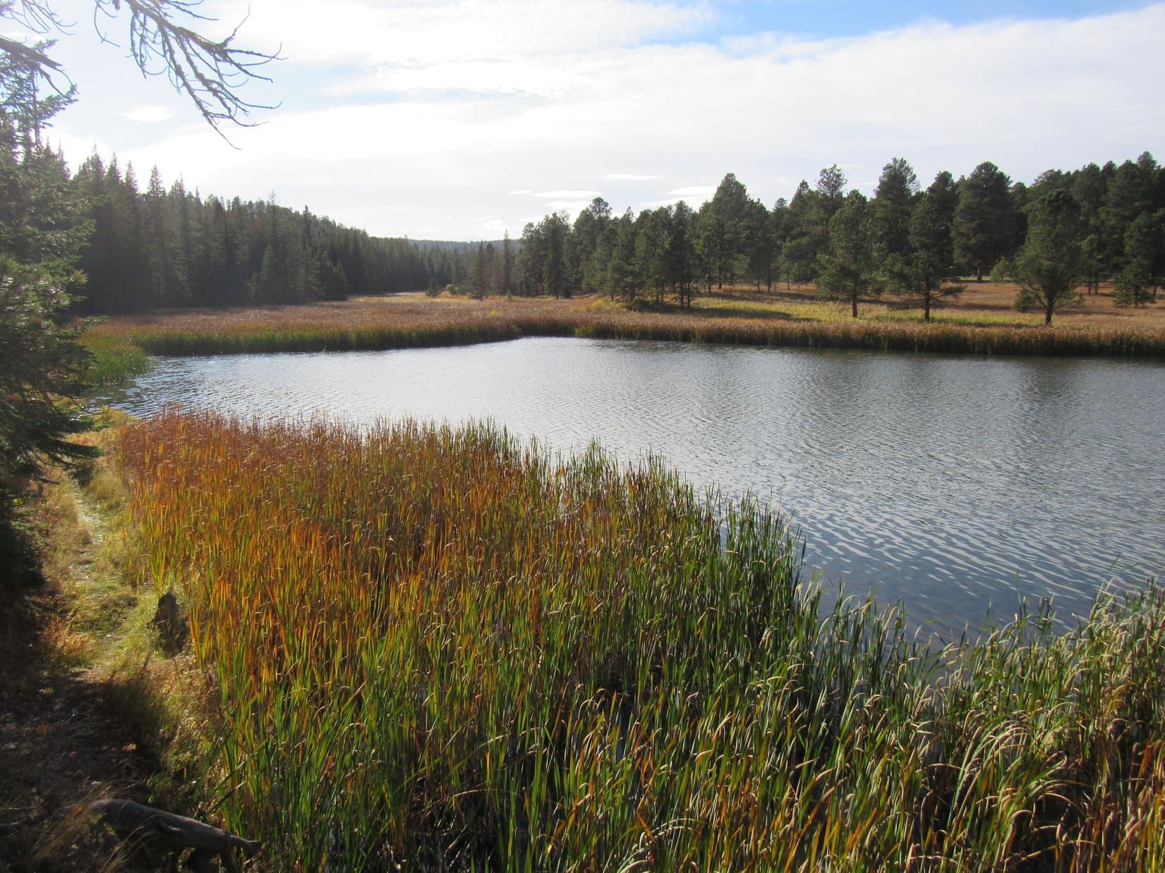
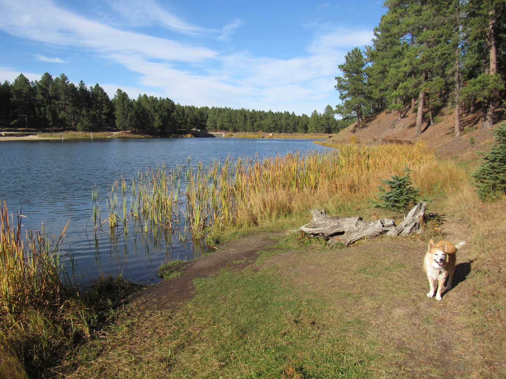
5-25-24, 5:08 PM, Samelias Trailhead – It was a lovely late spring evening as Cousin Dixie, Uncle Joe, and Aunt Andrea started up USFS Road No. 531.  This wasn’t the official Centennial Trail No. 89 route, which actually winds up into the forest SW of Samelias Peak (5,860 ft.) before joining No. 531, but it was a bit of a shortcut on the way to Mount Warner.

Andrea, Dixie, and Joe start up USFS Road No. 531. Photo looks NW.
Centennial Trail No. 89 joins the No. 531 route. Photo looks N.

After heading up to the pass between Peak 5741 and Samelias Peak, the road leveled out and turned ESE, soon leading to another pass between Samelias Peak and Mount Warner.  From here, Centennial Trail No. 89 lost some elevation traversing Mount Warner’s lower S slopes.

On a level stretch in the region between the passes. Photo looks ESE.

A little over halfway to Mount Warner’s summit, Uncle Joe was ready to turn around.  Maybe his right foot was feeling a little sore again?  In any case, it was time to head back to the trailhead.

At the turnaround point. Black Elk Peak (L) in the distance. Photo looks SW.
What? You’re going back already? Lupe and Dixie can’t believe the humans are bailing before reaching Mount Warner’s summit. Samelias Peak (L). Photo looks W.

The jaunt along Centennial Trail No. 89 wasn’t the day’s final adventure, though.  On the way back to Hotel Lupe, Uncle Joe had a thought.  Why not stop somewhere near Grandma’s former home just for old time’s sake, and take a walk up to the cul-de-sac?

It was a great idea!  Over the years, Lupe and SPHP had walked up to that cul-de-sac more than 1,000 times, but had never returned once the sale of Grandma’s house closed on 5-1-20 during the pandemic, more than 4 years ago.  Lupe hadn’t even seen Grandma’s house since then where she’d spent so many happy days so long ago.

5-25-24, 6:58 PM – Joe’s suggestion worked out even better than anyone might have expected.  Approaching Grandma’s former home, the new owners came walking out the driveway along with their dog.  Turned out they were going to the cul-de-sac, too!

Approaching Grandma’s former driveway by the white mailbox (R). Photo looks WSW.

Meeting the new owners after they turned around at the cul-de-sac, Joe struck up a conversation with them.  They promptly and very graciously invited everyone to come and take a look at what they’d done with the house since purchasing it on the way back.

Back at the familiar cul-de-sac at the end of the road past Grandma’s house for the first time in more than 4 years. Photo looks SSW.

Well, why not?

Stopping by Grandma’s house, Dixie got tied up by the old apple tree, but everyone else, including Lupe, got the grand tour both inside and out.

The new owners had done a fabulous job making many improvements.  Everything was beautifully remodeled.  Grandma’s house had never looked better, but it wasn’t the same.  It didn’t feel like Grandma’s house anymore, and it wasn’t.  Those days were long gone.

Aunt Andrea (Center) and one of the new owners in the completely remodeled living, dining, and kitchen area.

One thing hadn’t changed, and did feel the same.  Out back, in the little yard where Lupe used to bark at squirrels, watch deer, and make wild turkeys fly, the red cliffs of Spring Creek canyon were still glowing in the evening sun.

The red cliffs of Spring Creek canyon from Grandma’s former backyard. Photo looks SE.

The new owners couldn’t have been nicer, and seeing that view again was truly awesome.  Lupe was happy, yet SPHP left feeling a little sad.

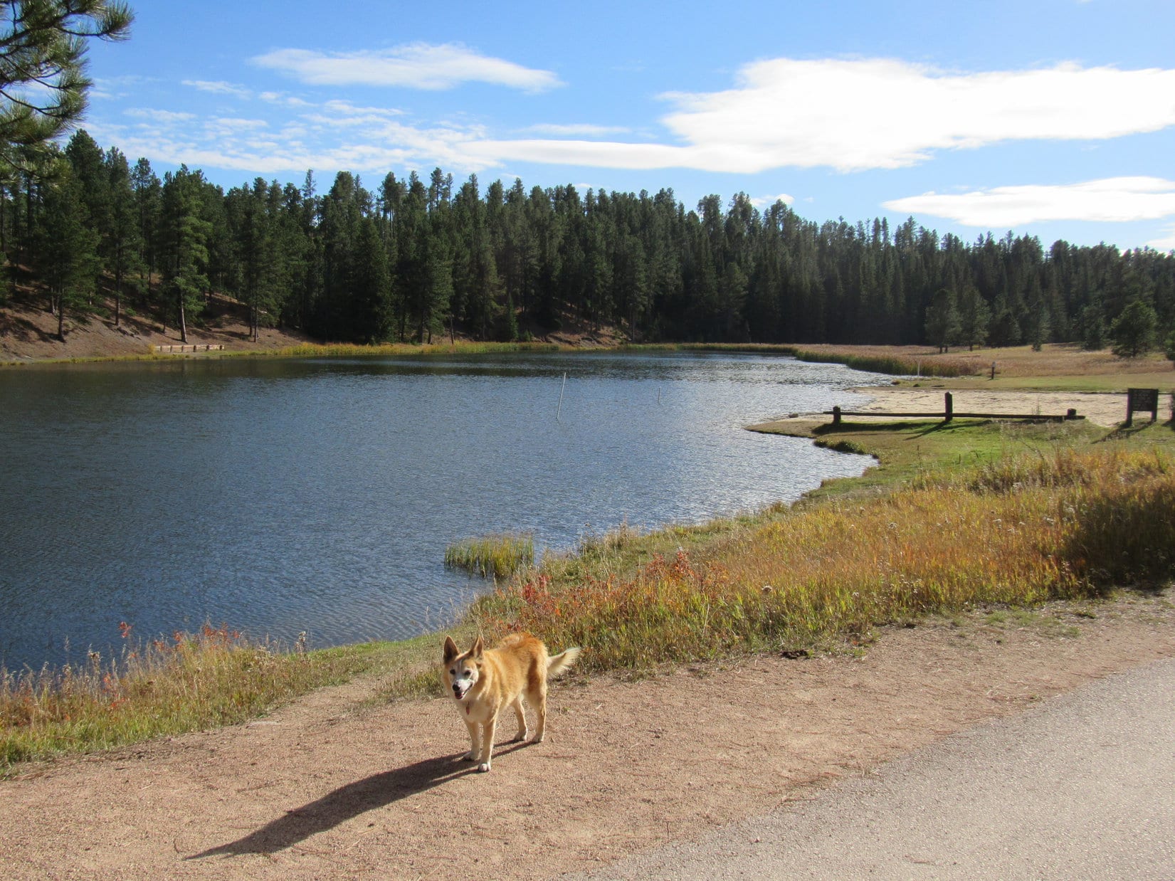
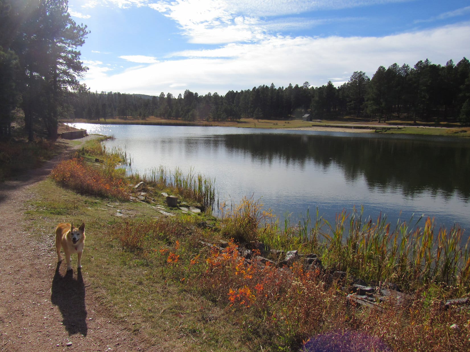
5-26-24, 3:52 PM – Cousin Dixie, Aunt Andrea, and Uncle Joe’s last day at Hotel Lupe!  Unfortunately, the morning had been unseasonably cold and rainy, although the weather was supposed to improve after noon.  However, the sky was still rather gloomily overcast upon arrival at the picnic ground along the SW shore of Deerfield Reservoir.

At Deerfield Reservoir in the W central Black Hills. Photo looks W.

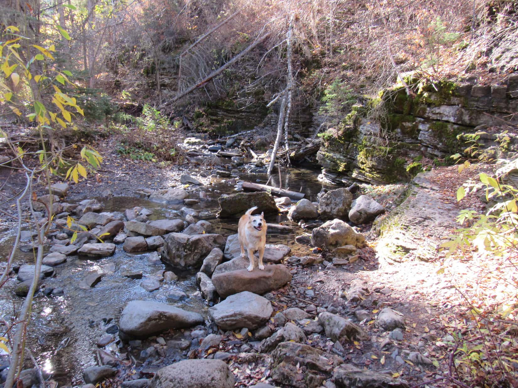
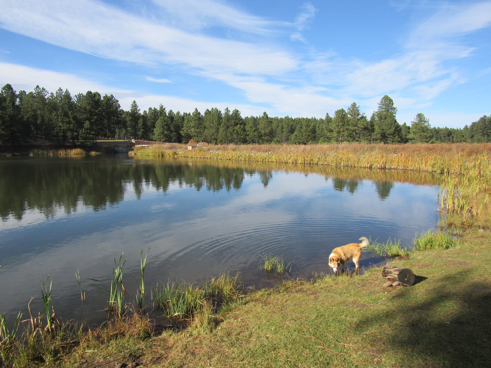
After a short romp along the lake near the picnic area, SPHP suggested doing a segment of Deerfield Lake Loop Trail No. 40L.  This 11 mile long trail goes clear around the entire reservoir.  Way too far for this late in the day,  however, setting out from the Gold Run trailhead, it might be possible to get to the dam, which is seldom seen except by boat.

Approaching Deerfield Reservoir (Center) after setting out along Deerfield Lake Loop Trail No. 40L from the Gold Run trailhead. Photo looks NW.

Hmm.  Not to be!  SPHP realized too late that it would have been much better to start out from the road to the Dutchman campground, or even the Kinney Canyon trailhead along Deerfield Trail No. 40.  The dam was just too far from Gold Run.  Nevertheless, Lupe and Cousin Dixie both had a wonderful time roaming the forest along the trail.

Near the end, the sky began to clear.  The sun was shining when the last adventure of Dixie, Joe, and Andrea’s visit to the Black Hills reached its turnaround point.  Tomorrow morning they would be leaving Hotel Lupe and returning home to Colorado.

End of the line with Joe, Andrea, and Dixie for this Black Hills visit.

Oh, it had all been such fun!  And, best of all, more adventures together were in store in the not too distant future.  In just a few short weeks, Lupe and SPHP would be visiting Hotel Dixie in Arvada!

Links:

Next Black Hills Expedition              Prior Black Hills Expedition

Centennial Trail No. 89 Map & Brochure

Deerfield Lake Loop Trail No. 40L – Map & Brochure

2020 – The Year of Perfect Vision!

Black Hills, SD Expedition No. 240 – Deerfield Lake Loop Trail No. 40L & Hat Mountain (11-14-18)

Want more Lupe adventures?  Check out Lupe’s Black Hills, SD & WY Expeditions Adventure Index, Master Adventure Index, or subscribe free to new Lupe adventures!

Black Hills, SD Expedition No. 279 – Devils Bathtub, Spearfish Falls, Roughlock Falls & Roubaix Lake (10-11-21)

10:13 AM, 56ºF – A gorgeous morning, comfortably cool and clear as a bell!  Lupe paused on the Cleopatra Place bridge for a look at Spearfish Creek.  SPHP was surprised by how much water there was even after a summer of drought.  Squaw Creek, a tributary joining in immediately upstream of the bridge, was another matter.  Squaw Creek did look low.  Not a bad thing, since it would have to be rock-hopped a bunch of times on the way to the Devils Bathtub.

Spearfish Creek from the Cleopatra Place bridge. Squaw Creek visible at lower L.

The Carolina Dog had attempted to visit the Devils Bathtub a couple of times in recent years, but had never made it all the way there.  The first time, SPHP thought she had, and didn’t figure out until later that the Devils Bathtub actually must have been farther up Squaw Creek.  The second time, ice and snow had made the rock-hopping so treacherous that SPHP had given up on it.  Lupe wound up climbing Spearfish Peak (5,800 ft.) and Little Crow Peak (5,885 ft.) instead.

Third time a charm?  Hopefully!  Lupe continued on across the Cleopatra Place bridge.  The Devils Bathtub trail, which goes up the Squaw Creek canyon, started just off to the R.  The Carolina Dog quickly arrived at the first and only bridge over the little creek.

On the first (and last) bridge over Squaw Creek.

Although the Devils Bathtub trail would cross Squaw Creek numerous times, right after the bridge it stayed on the SW side of the creek for a while.  Even here near the start, the canyon Lupe was venturing into was fairly narrow and steep-sided.  The entire canyon was full of trees and bushes sporting fall colors.  Loop enjoyed prowling among dead leaves and mossy stones looking for squirrels.

Among the leaves and mossy stones.

It didn’t take too long to get to the first stream ford, a crossing forced by a pinch point where Squaw Creek flowed right next to a wall of rock.  With the water so low this time of year, the ford was an easy rock-hop for SPHP.  Lupe didn’t bother rock-hopping, she just waded on through.

At the first ford.

As Loop continued up the canyon, the cliffs forcing many of the stream crossings became taller and more impressive.  In some places the trail was braided, with viable paths on both sides of Squaw Creek.  None of the frequent fords presented any real difficulties.  Slick, damp stones were the biggest worry for SPHP.  Lupe didn’t worry at all.

The rock walls forcing the stream crossings kept getting taller.
Father upstream at another ford. One of many.

Less than a mile from the start, the canyon narrowed some more.  Lupe reached a spot where Squaw Creek flowed over bedrock at the base of a long cliff.  Hugging the cliff, the Devils Bathtub trail went over shelves of solid rock right next to the stream.

Approaching the start of the continuous rock wall on the NE side of Squaw Creek.
The Devils Bathtub trail goes over these shelves of bedrock along the base of the cliff.

Lupe soon came to a series of waterfalls plunging into pools several feet deep.  Between these pools Squaw Creek raced through narrow chutes carved into the bedrock.  The overall effect was very beautiful.  In lots of places Lupe could leap over Squaw Creek in a single bound.  Even SPHP could just step across.

It didn’t take long to reach the large pool SPHP had mistakenly taken for the Devils Bathtub during Lupe’s first attempt to find it 2 years ago.

Continuing upstream along the cliffs.
On a midstream rock.
Looking downstream.
As far as Lupe had made it on her first attempt to find the Devils Bathtub back in 2019. She’d turned around here when SPHP mistook this pool for the real deal.

A little bit of scrambling around on the rocks had been required shortly before reaching this point.  Somewhat more challenging scrambling was required to go any further.  Nothing too daunting, but Lupe did have to traverse short stretches on narrow ledges 15 or 20 feet above the creek.

Up on a ledge above the Fake Devils Bathtub (L). Photo looks downstream.
Continuing past Fake Devils Bathtub (R).
Just past the Fake Devils Bathtub near the small waterfall that pours into it.

As it turned out, Lupe had almost made it to the real Devils Bathtub two years ago.  Only a few hundred feet upstream of the Fake Devils Bathtub, there it was!

On the ledges approaching the real Devils Bathtub, the upper pool seen here.

Trotting along narrow ledges with complete confidence, Lupe arrived in jig time.  SPHP, on the other paw, crept cautiously along the skinniest parts, but even that delayed arrival only momentarily.

At the Devils Bathtub. The official one!

Congratulations, Loopster, you made it!

So this is the Devils Bathtub, SPHP?  The real one?

Yes, the official one!  No doubt about it this time.

I’m not seeing any devils.  Can’t sniff them, either.  Are they invisible?

Hmm.  Well, I’m not sure, maybe so?  Or maybe it isn’t bath time?  I hear they like to play dirty tricks, so they probably don’t bathe very often.  Maybe just on Saturday nights?

Saturday night doesn’t make much sense to me, SPHP.  I doubt the devils dress up and go to church on Sunday morning!

Good point, Looper.  I really don’t know.  Anyway, this is a beautiful spot, isn’t it?  Let’s have a look around.

The Devils Bathtub wasn’t very big, so the “tour” didn’t take long at all.

Except close to the waterfall that raced down a slippery chute shaped like a waterslide into the Devils Bathtub, most of the pool wasn’t all that deep, just a few feet.  That was plenty deep for a Carolina Dog, though.  Lupe was not inclined to take a bath.  She waded along the edge of the shallow downstream outlet getting her paws wet, but otherwise did not go in.  SPHP avoided the water completely.  July or August was really the time to be here.

The water was cold and clear.  SPHP looked for fish, but they seemed to be just as scarce as devils.

Not all that much to the Devils Bathtub, is there, SPHP?

No, but it’s a scenic spot at the end of a nice hike, and quite a popular place to cool off in the summer.

I suppose its more exciting when the dirty devils show up.  Want to go up by the waterfall, SPHP?

Sure!

To get to the waterfall meant scrambling up on another narrow ledge, but it was no big deal and gave a different perspective.

On the ledge leading to the waterfall that feeds the Devils Bathtub.
Looking down the waterslide chute.

Neither Lupe nor SPHP was inclined to test the waterslide concept.  Might not be as smooth and as slippery a ride as it looked, and it was October, after all.  Would have been an exceedingly brisk experience.

Are we going any farther up the canyon, SPHP?  Looks like we could!

No, think this is it, Loop.  I went up there once a long time ago, before you were even around.  Don’t really remember too much about it.  There was a big old mine high on a steep hillside, the Cleopatra Mine, if memory serves, but the structure was crumbling away and dangerous even back then.  From what I can remember, the Devils Bathtub is the last of these scenic larger pools along Squaw Creek.

If we aren’t going any farther then, SPHP, why don’t we relax right here for a while?  Maybe we’ll get to see a devil!

Fine with me, but do you actually want to see a devil?  They’re evil you know.  Might be pretty dangerous if one comes along.

Oh, don’t worry about that, SPHP!  I’ll bite any devils that try to give us a hard time.

That’s why I always travel with a Carolina Dog!  You’re the best, Loopster!

A chocolate coconut bar, the American Dingo’s portion instantly inhaled, was shared at a sunny spot overlooking the Devils Bathtub.  Sadly, not a single devil turned up for Lupe to do battle with before it was time to start back down the canyon.

At the outlet from the Devils Bathtub, ready to head back to the RAV4.

12:10 PM, 61ºF, Devils Bathtub trailhead along Hwy 14A, Spearfish Canyon –  The return trek was just as gorgeous as the journey to the Devils Bathtub had been, but seemed to go even faster.  It was barely even lunchtime when Lupe arrived back at the RAV4.

What now, SPHP?  We aren’t done for the day already are we?

Oh, no!  Want to visit Spearfish Falls and Roughlock Falls while we’re in the area?  The trailheads aren’t that far away, just a few miles up Spearfish Canyon at Savoy.

The American Dingo was fine with that.  SPHP was soon parking the RAV4 at the Latchstring Restaurant.  The restaurant grounds bordered Spearfish Falls, but to actually get a good look, it was necessary to take a short trail down to the bottom of Spearfish Canyon.

A huge bald eagle was sitting on a stump out in front of the restaurant.  Before hitting the trail, Lupe went over to take a look at it.

Checking out the bald eagle in front of the Latchstring Restaurant in Spearfish Canyon.

Although a handsome specimen, the eagle proved none too lively, sitting completely motionless on its stump.  The action-oriented Carolina Dog quickly lost interest.  Heading over to the Spearfish Falls trail, she started the short journey down to the canyon floor.

The Spearfish Falls trail leaves the Latchstring Restaurant grounds just ahead on the L.
Sign at the trailhead.
View from a bench along the descent to the canyon floor.

The sign posted at the trailhead claimed that the Spearfish Falls trail was moderate difficulty and 1.5 miles round trip.  Both were exaggerations.  The wide, well-beaten path was mighty easy for Lupe, and it hardly seemed possible that it could have been 0.75 mile one way to the falls.  Once down to the canyon floor, a short trek brought Lupe to a bridge over Spearfish Creek.  The falls were only a little farther.

Spearfish Falls.
Spearfish Falls is on Little Spearfish Creek, which joins Spearfish Creek at the base of the falls. Got that?

Spearfish Falls may well be the tallest and most impressive waterfall in the entire Black Hills region.  Certainly worth the minor effort required to go see it!  Even at SPHP’s relaxed pace, the round trip took just a half an hour.

Next up was Roughlock Falls, only a mile away on USFS Road No. 222, which took off from Hwy 14A over by the Latchstring Inn across from the restaurant.  The Carolina Dog still had plenty of time left in the day, though.  Instead of driving all the way, SPHP merely moved the RAV4 over to the Roughlock Falls trailhead just past the inn.

The Roughlock Falls trail was broad and smooth.  Most of it was flat, or nearly so.  Super easy!  It went up the scenic side canyon carved by Little Spearfish Creek.  The trail generally wasn’t all that close to the creek, but shortly after Lupe set out, there was an opportunity to head down to it.

Little Spearfish Creek was cold, clear, and several feet deep.  Below the surface, dark green plants swayed in a swift current.  Small trout darted from one hiding spot to the next.

By Little Spearfish Creek. Photo looks upstream.
Same spot, looking toward the limestone cliffs across the creek. Photo looks N.

A mile went by fast.  Loop was soon standing on the boardwalk next to the cascades below Roughlock Falls.  From down here there was a great view of the cascades, but only a glimpse of the main waterfall could be seen at the far end of a narrow gorge.

On the lower boardwalk with a view of the cascades below Roughlock Falls.

For the best views of Roughlock Falls itself, Looper needed to get to the upper viewing platforms.  Crossing a nice bridge over Little Spearfish Creek, a short stroll along a sidewalk quickly brought her to the first of the upper viewpoints.

Looking downstream from the bridge over Little Spearfish Creek.
Roughlock Falls from the first upper viewpoint.

To get to the final viewpoint, Lupe crossed another bridge just upstream of the falls.  This viewpoint overlooked the brink of the falls.

Crossing Little Spearfish Creek again, this time just upstream of the falls.
Near the brink.

After enjoying Roughlock Falls from all these different vantage points, Loopster completed her tour by wandering through the picnic ground immediately upstream.

Little Spearfish Creek from the Roughlock Falls picnic area.

It was mid-afternoon when Lupe got back to the RAV4.  The sky had been clouding up on the way to Roughlock Falls, but it was getting sunnier again now.  The Carolina Dog had completed everything planned in the Spearfish Canyon area for today, so what now?  Tomorrow snow was in the forecast.  It would be a shame to just go home instead of enjoying what remained of this beautiful day.

This Black Hills Expedition seemed to be all about water.  Since Lupe had never been to Roubaix Lake before, SPHP decided a relaxing drive through the central hills to go see it might be just the ticket.

On the way, a stop was made up on Minnesota Ridge (6,240 ft.).  Lupe enjoyed a short romp looking for squirrels while SPHP had a look at the fall colors.

Enjoying a romp on Minnesota Ridge.
Fall colors.

Then it was on to Roubaix Lake!

Roubaix Lake wasn’t very big, sort of a glorified pond, but it did feature a campground with a sandy beach, plus a trail that went about halfway around the lake.

Arriving at Roubaix Lake, which is just a mile off Hwy 385 in the central Black Hills.

The trail started at a bridge over the outlet for Middle Box Elder Creek.  After crossing both the bridge and the dam, the trail headed SW right along the shoreline.

On the bridge over the outlet for Middle Box Elder Creek. Photo looks SE.
Along the SE shore after crossing the dam. Photo looks W.
Getting a drink not far from the dam. Photo looks N.

Middle Box Elder Creek enters Roubaix Lake over at the far SW end.  The trail began to fade away as Lupe drew near.  This part of the lake looked very shallow, full of mud and thick stands of tall reeds.  Late afternoon sunlight highlighted the reeds’ colors, making them glow.

By the colorful, glowing reeds. Photo looks SW.
SW end of Roubaix Lake. Photo looks W.

The trail went on, but appeared destined to disappear entirely.  Probably about time to call it a day by now, anyway.  A squirrel provided several minutes of excitement on the way back to the RAV4.

Black Hills, SD Expedition No. 279 had been a success!  Getting all the way to the Devils Bathtub for time ever had been the main objective, and Lupe had made it.  Third time had been a charm!  Really hadn’t been hard at all.  Spearfish Falls, Roughlock Falls, and Roubaix Lake were all just icing on the cake.

A lovely Black Hills autumn day, but tomorrow, a first taste of winter!

Roubaix Lake, Black Hills, SD 10-11-21

Links:

Next Black Hills Expedition                  Prior Black Hills Expedition

Black Hills, SD Expedition No. 251 – Bridal Veil Falls, the Devils Bathtub trail, Spearfish Falls & Roughlock Falls (10-17-19)

Want more Lupe adventures?  Check out Lupe’s Black Hills, SD & WY Expeditions Adventure Index, Master Adventure Index, or subscribe free to new Lupe adventures!