
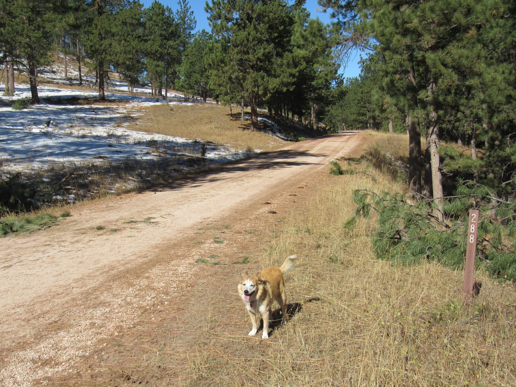
11:20 AM, 58ºF – W of Custer SPHP turned off Hwy 16, parking the RAV4 along Lightning Creek Road (USFS Road No. 288). Lupe bounded out. Blue skies, warm and sunny! A superb day for a Black Hills expedition!
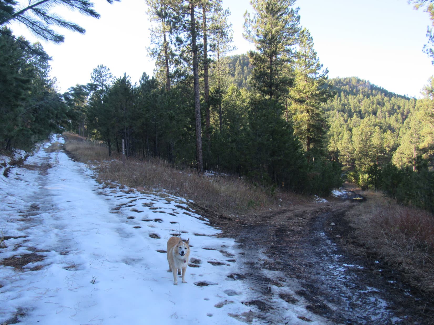
Snow left over from last week’s storm was melting away in the forest as Loopster trotted NW along Lightning Creek Road. The Carolina Dog had barely gotten started, when she suddenly noticed movement down the steep bank to the E.
SPHP, look! A buffalo!
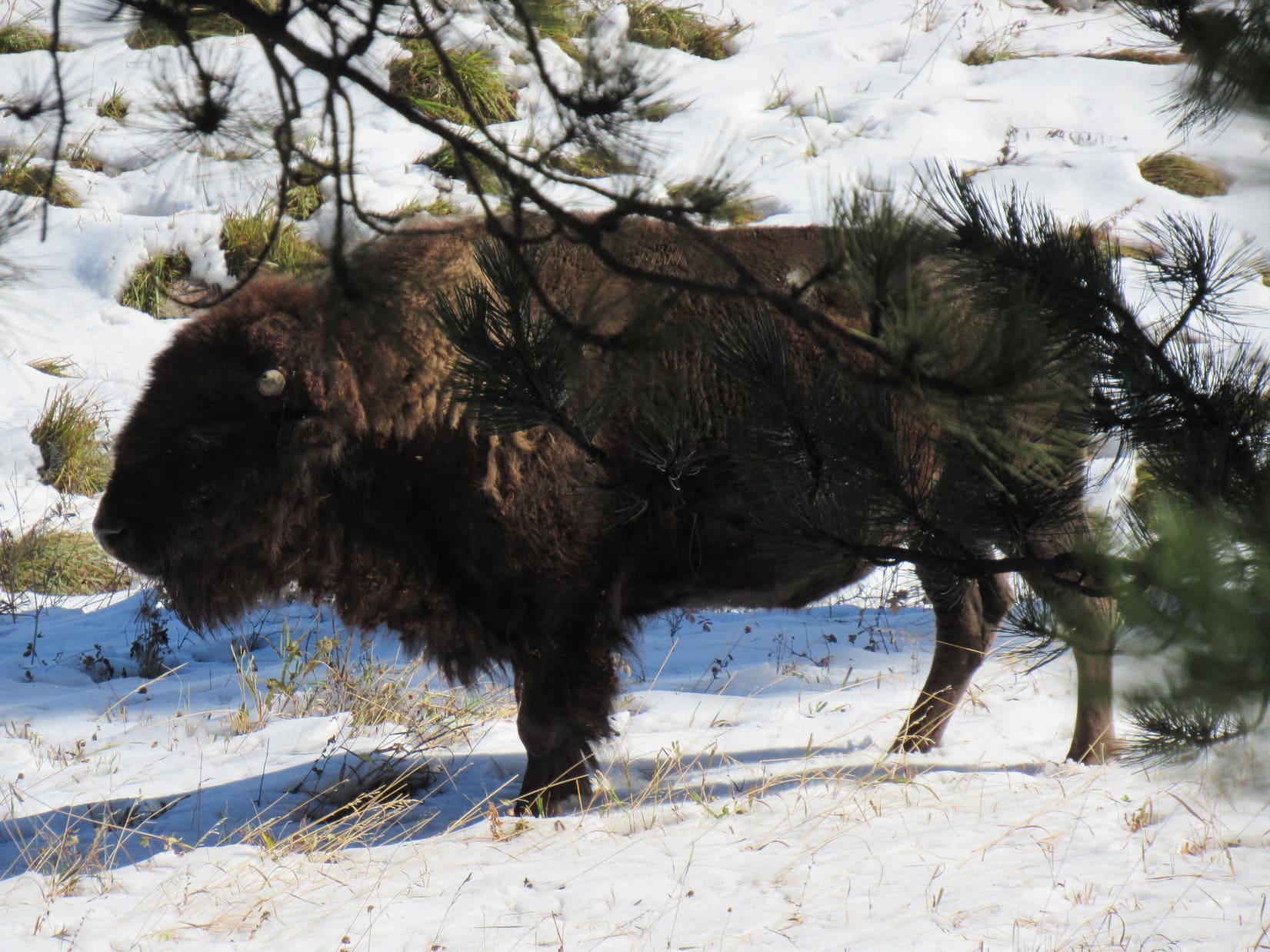
Yup! There’s a bison ranch down there, Loop.
You mean to say that’s a tame buffalo, not a wild one?
Tame? Hmm. Don’t know I’d go that far. Used to seeing people and traffic maybe, but bison have minds of their own.
I bet it’s delicious!
Delicious? I’ll say! Don’t go getting any ideas, though, Loop. That buffalo is even bigger than it looks from up here. Easily more than a match for any pipsqueak American Dingo, no matter how feisty.
Pipsqueak!
Yeah, pipsqueak, so leave that buffalo alone! Come on, let’s go! We’ve got mountains to climb!
Lupe hesitated. The buffalo was fascinating! When it just stood around for several minutes, though, the Carolina Dog finally decided she might as well move on, and went running off after SPHP.
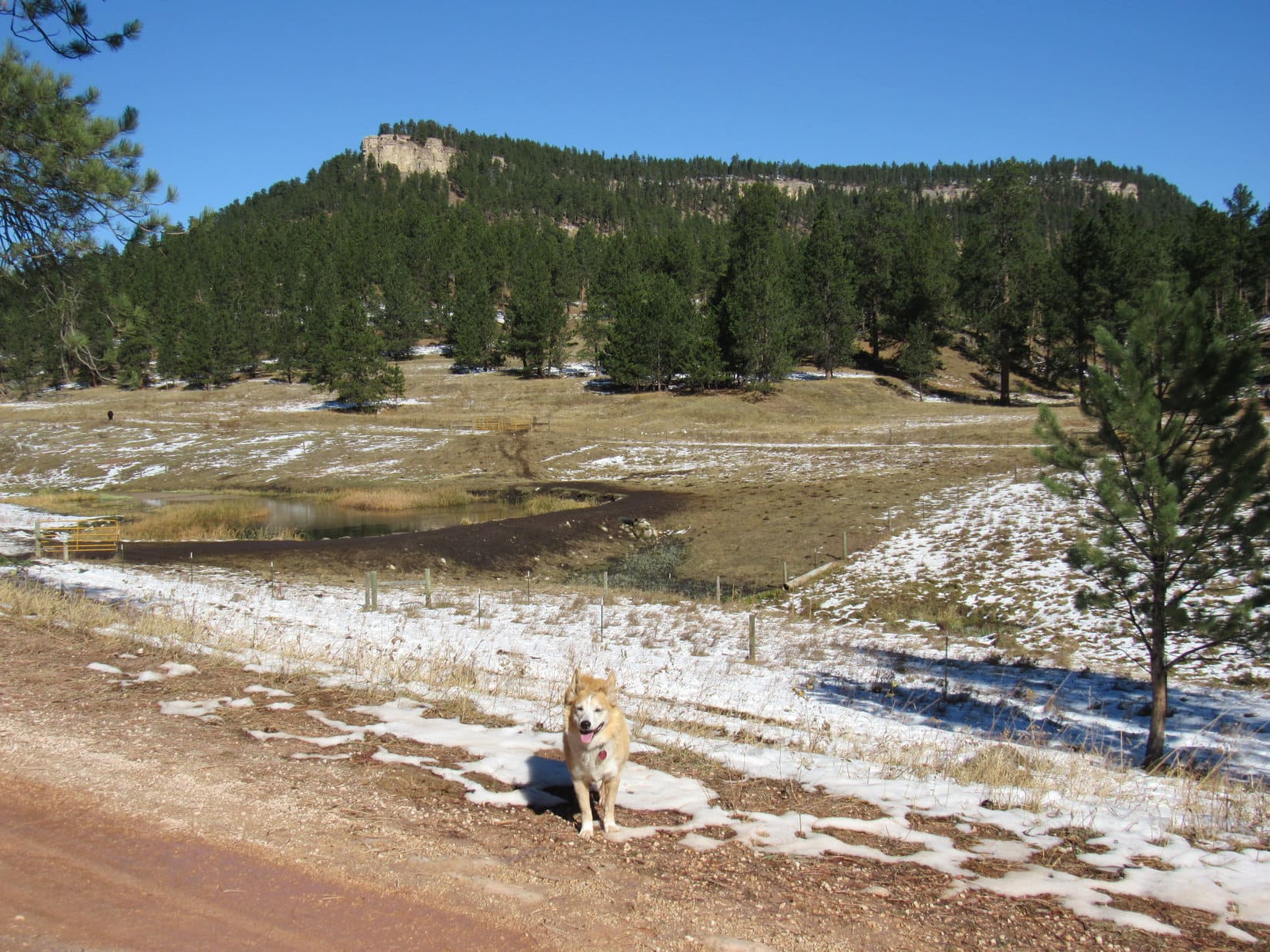
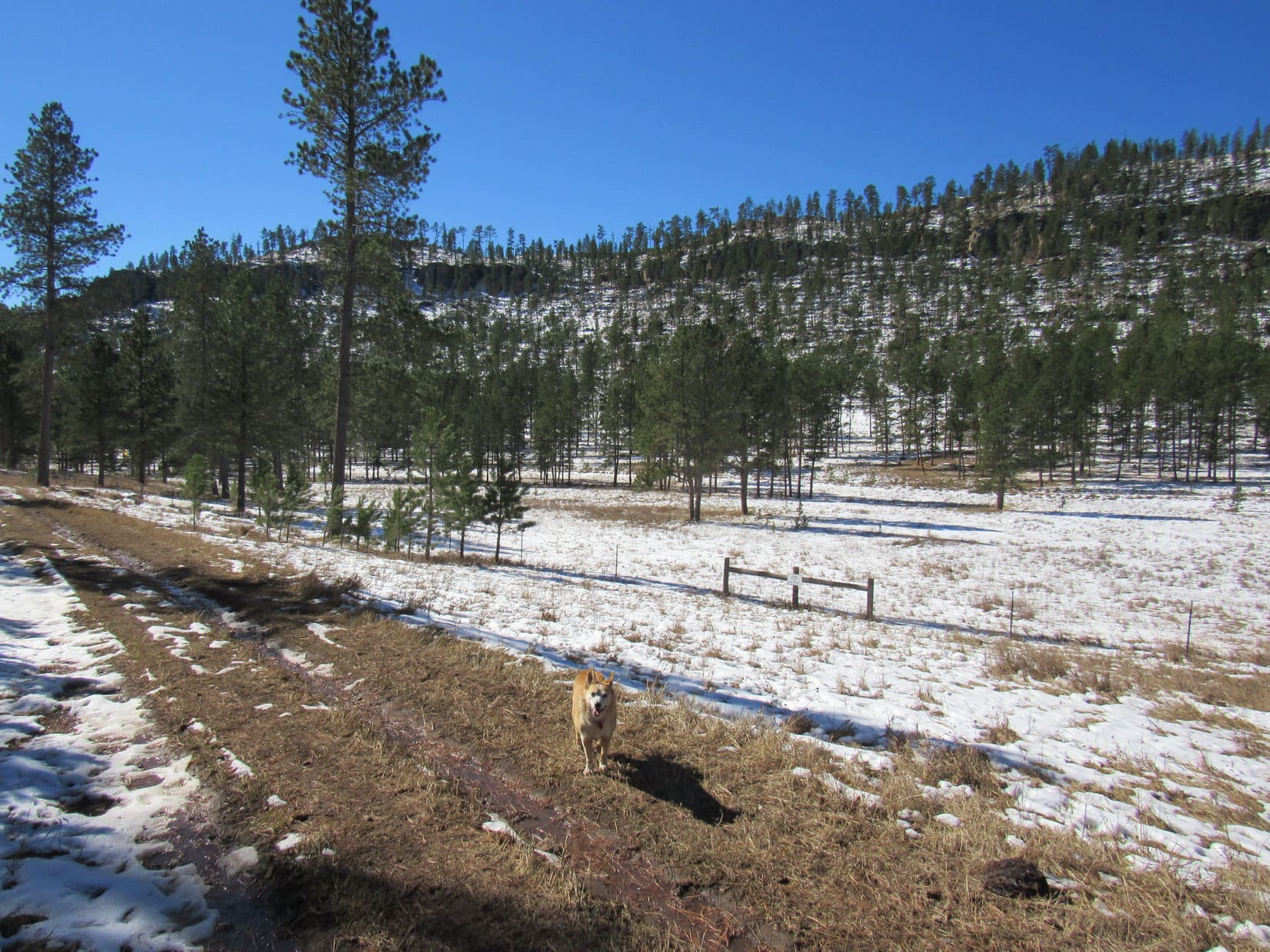
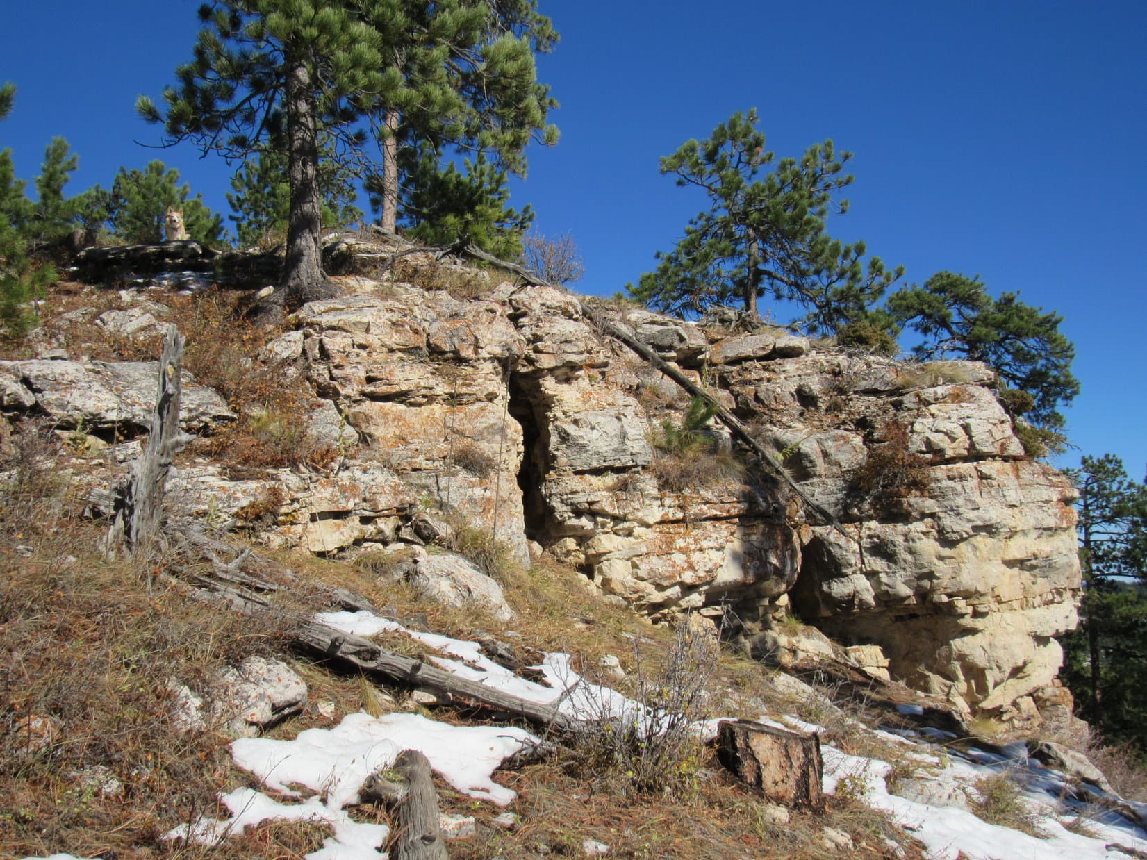
Where the pines shaded it, Lightning Creek Road was sloppy with mud and slush from melting ice. Loop soon came to a partial view of a long forested ridge. Near the top, a seemingly unbroken line of limestone cliffs ran along its entire length.
Wow, might be harder than I thought, Looper!
Is that the mountain we’re going to climb, SPHP?
Yes. One of them. That’s Peak 6361!
Oh! Another one of your numbered Lists of John peaks with more than 300 feet of prominence, SPHP?
Yup. Figure we might as well do some of them, since you’ve already been to all the named peaks we can climb in the Black Hills, most more than once. These Lists of John peaks are something new and different. Never know what we might see!
Or not see, like a way up!
Eh, don’t worry about that yet, Looper. Topo map looks like Peak 6361 might be easier from over on the other side of the mountain, so let’s head over that way to check it out.
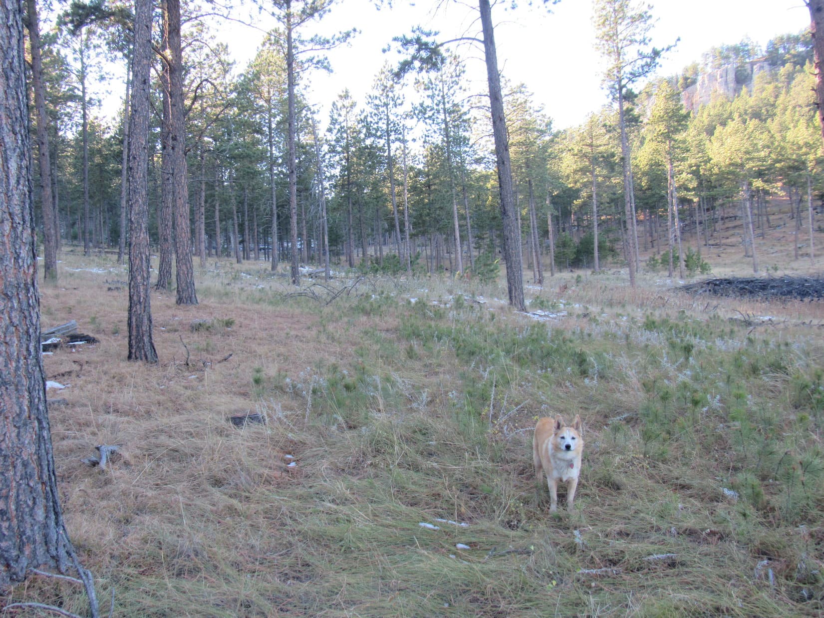
As Lupe continued NW along Lightning Creek Road, SPHP kept an eye on Peak 6361. There really didn’t seem to be any way up from the S. Not too worrisome yet. Loop probably really could climb it from the N.
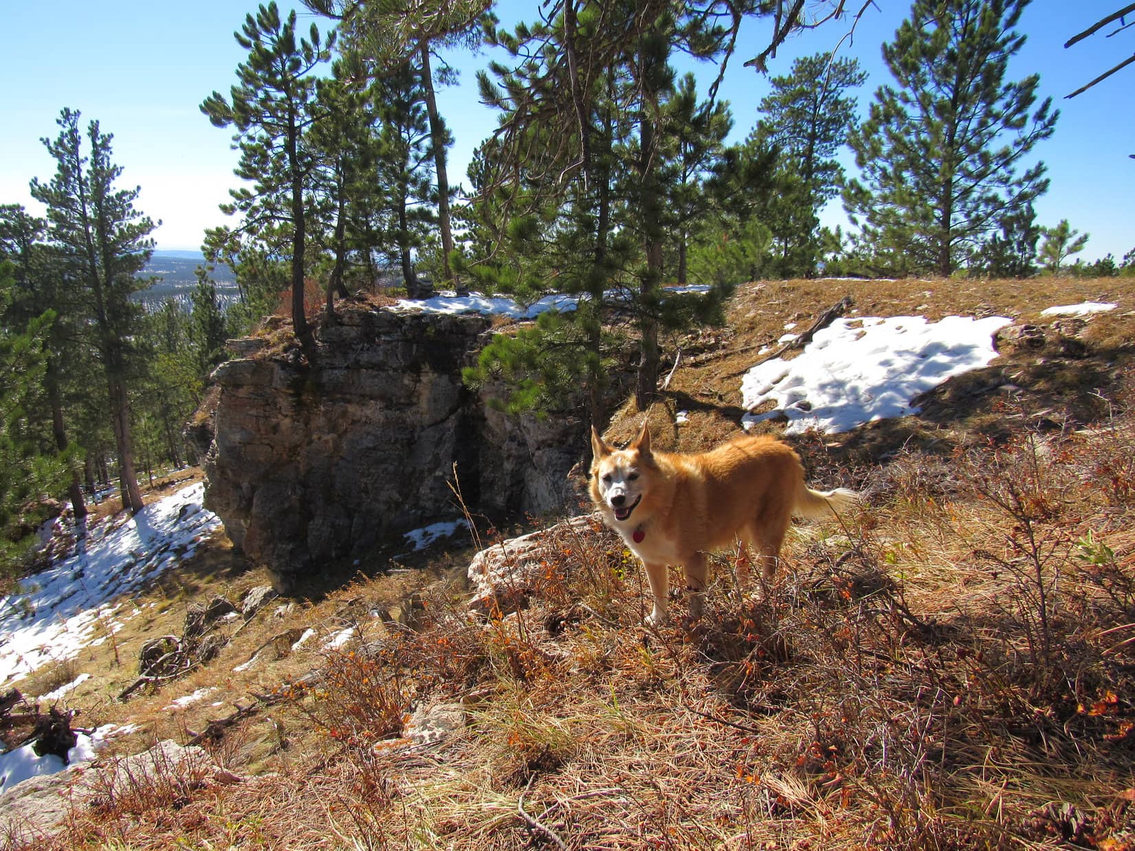
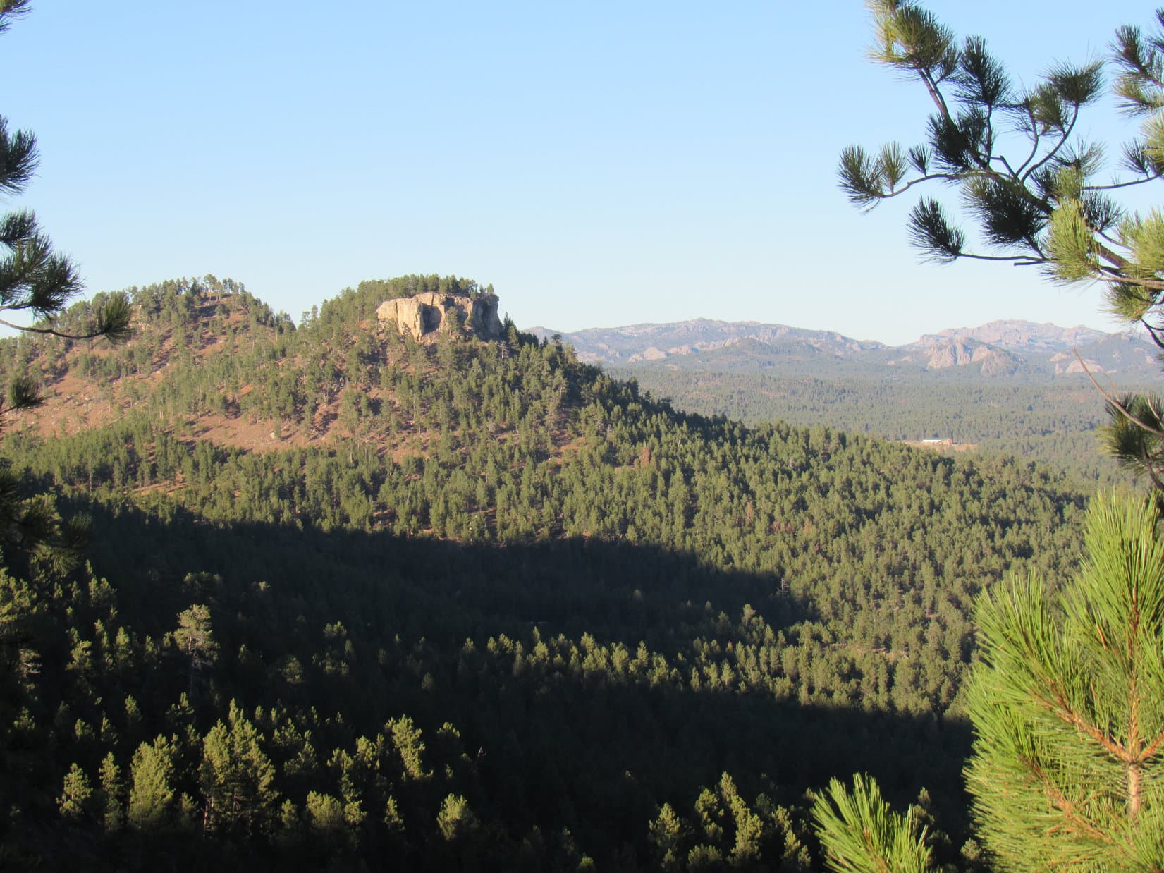
Peak 6361’s true summit was near the E end of the mountain, but the biggest, most impressive cliffs were clearly way over at the SW end. After summiting, Lupe ought to visit those cliffs! The best views Peak 6361 had to offer might well be from up there.
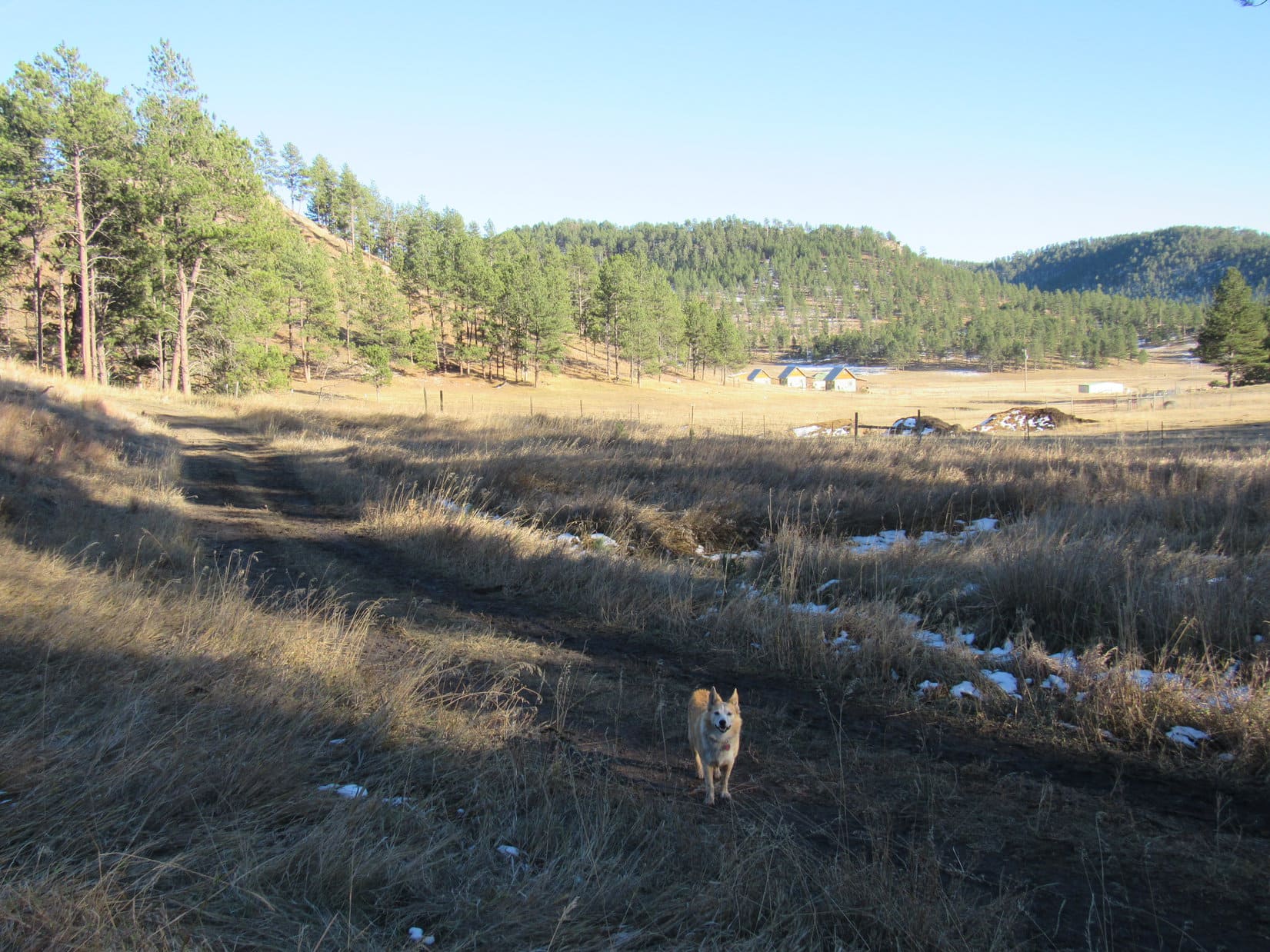
A mile from Hwy 16, Lupe came to some corrals shortly before reaching a junction with USFS Road No. 288.1A. Taking a shortcut through a big parking area for horse trailers W of the corrals, she reached No. 288.1A NE of the junction.
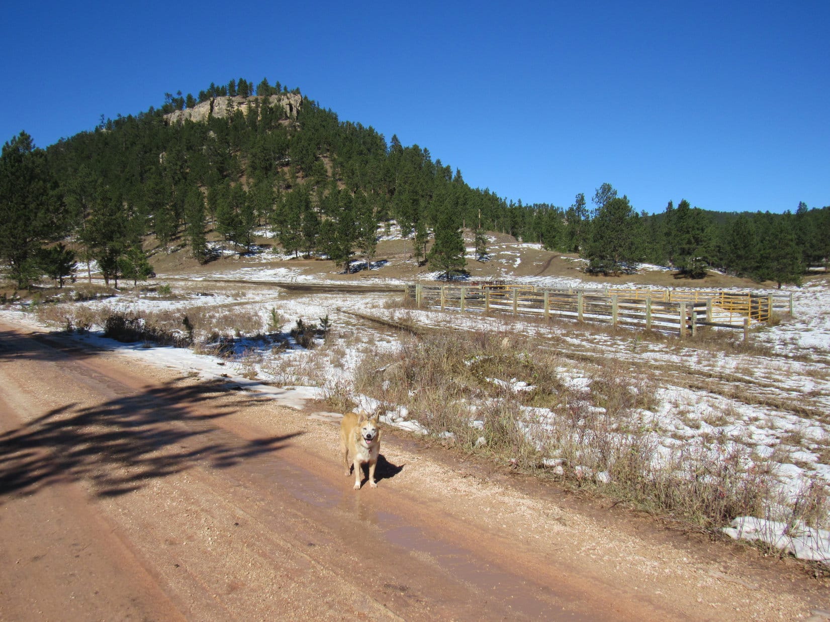
More than 0.25 mile N on No. 288.1A brought Lupe to another junction, this time with No. 288.1B. The Carolina Dog was now due W of Peak 6361. A short section of No. 288.1B headed right for the base of the mountain, where the road forked again.
From here, No. 288.1B veered R (S), destined to curl around to the S side of Peak 6361, an approach that wasn’t going to work. Loopster went L instead, taking No. 288.1C N. To access this route, she had to go under an odd single strand bungie rope gate in a barbed wire fence. Suspecting the rope might be electrified, SPHP was a little leery, but passed through without incident.
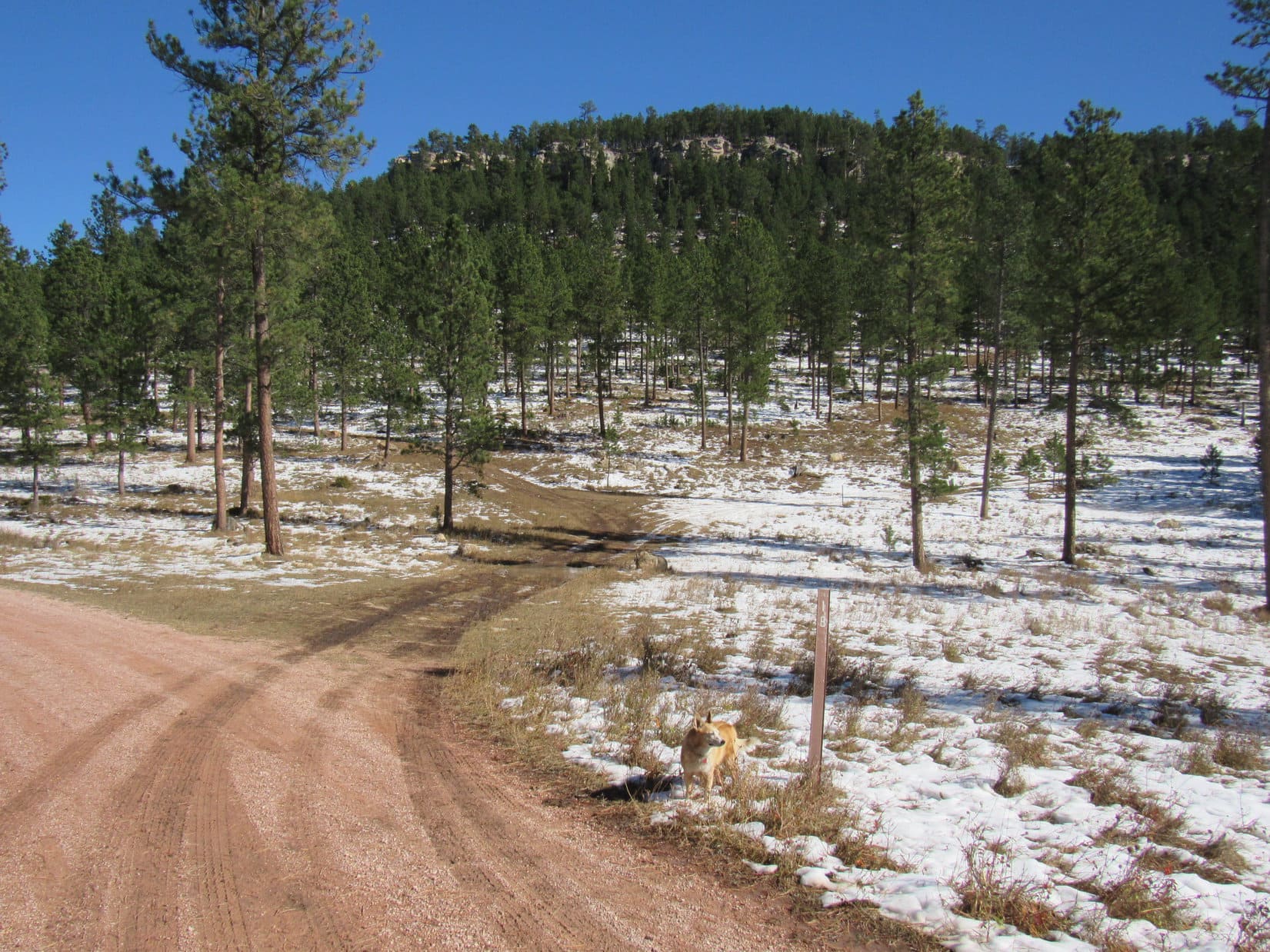
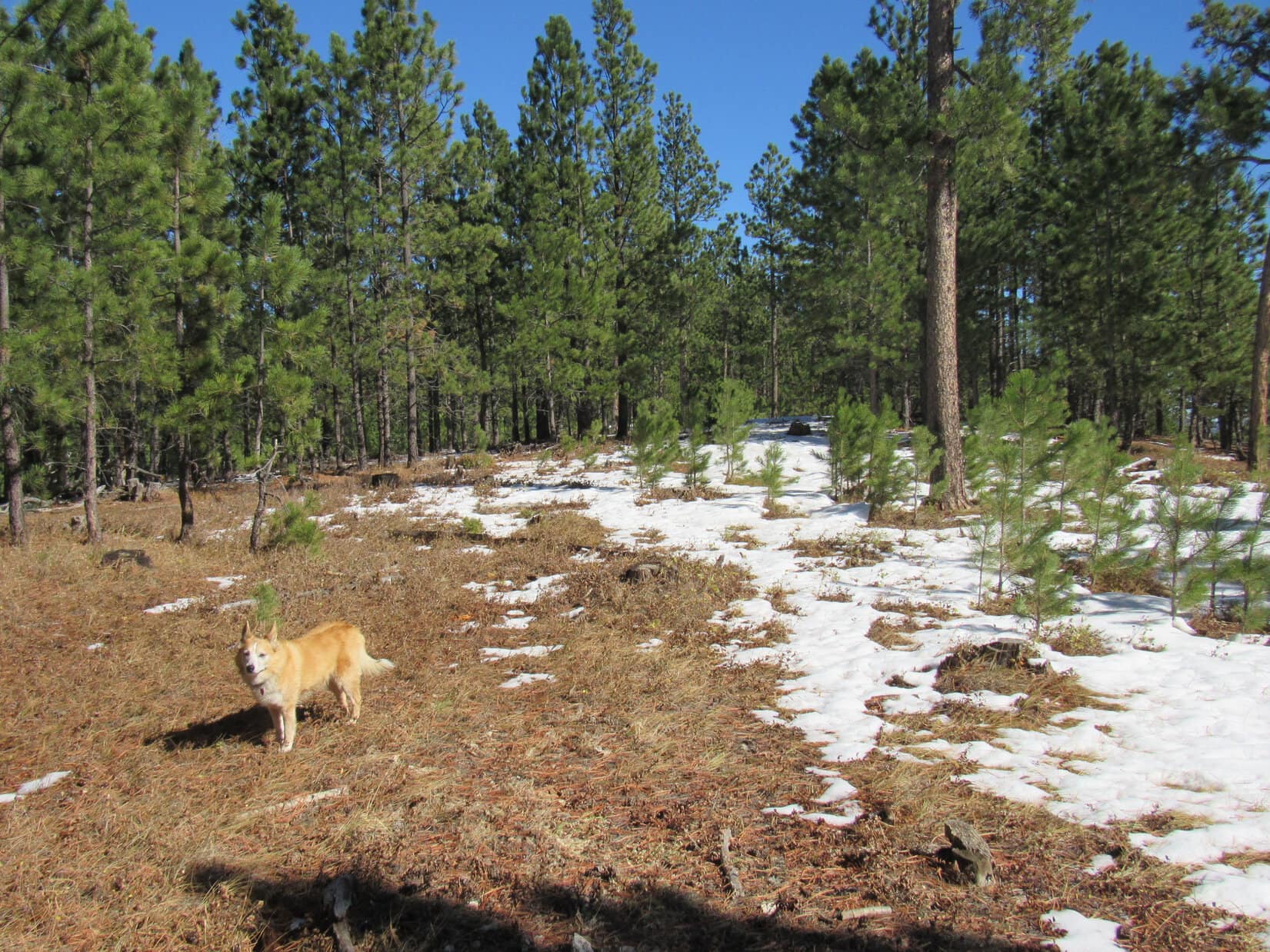
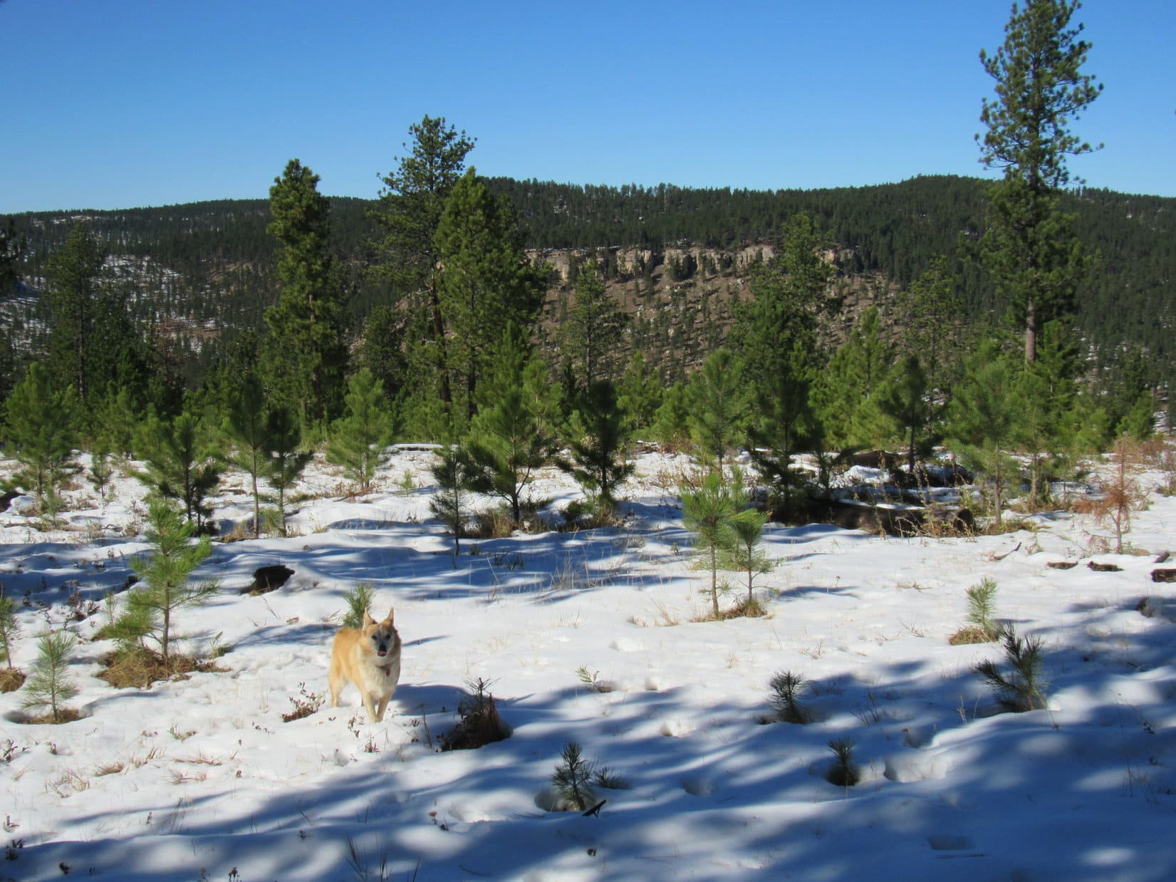
As No. 288.1C swung around to the ENE, the N slopes of Peak 6361 began coming into view. This side of the mountain was a lot snowier, but the terrain was otherwise much more favorable for an ascent. No line of cliffs visible near the top!
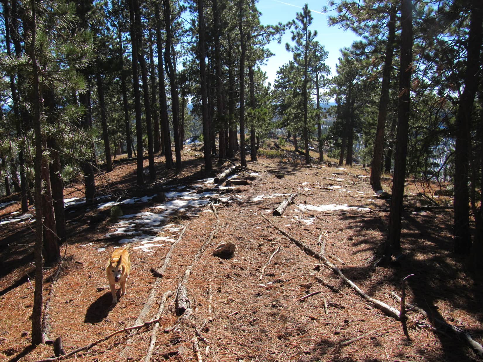
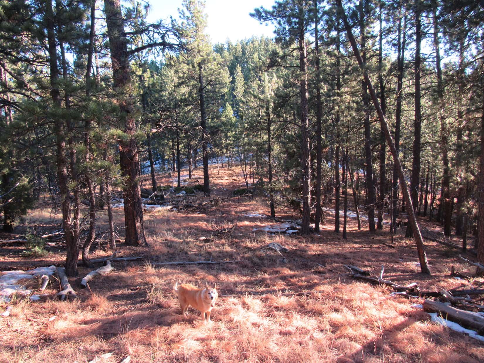
Lupe stuck with the road, slowly gaining elevation, until she reached what appeared to be a favorable spot. The Carolina Dog then left the road, plunging into the forest climbing SSE through 4″ to 6″ of snow.
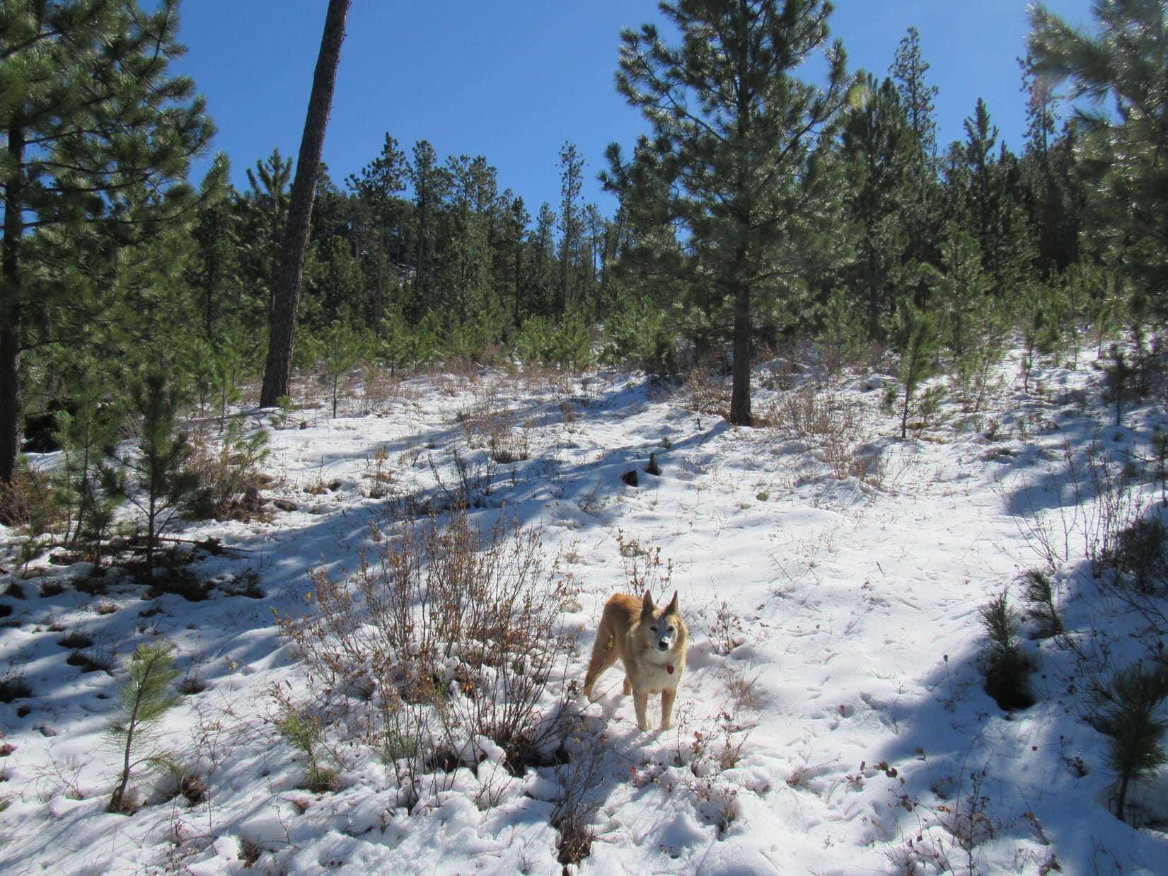
The snowy ascent through the forest never got very steep. Near the top, Lupe saw a yellow cliff off to the E, but never came to one herself. A steady romp higher, and that was about it.
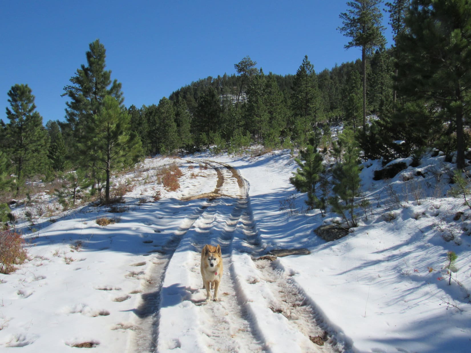
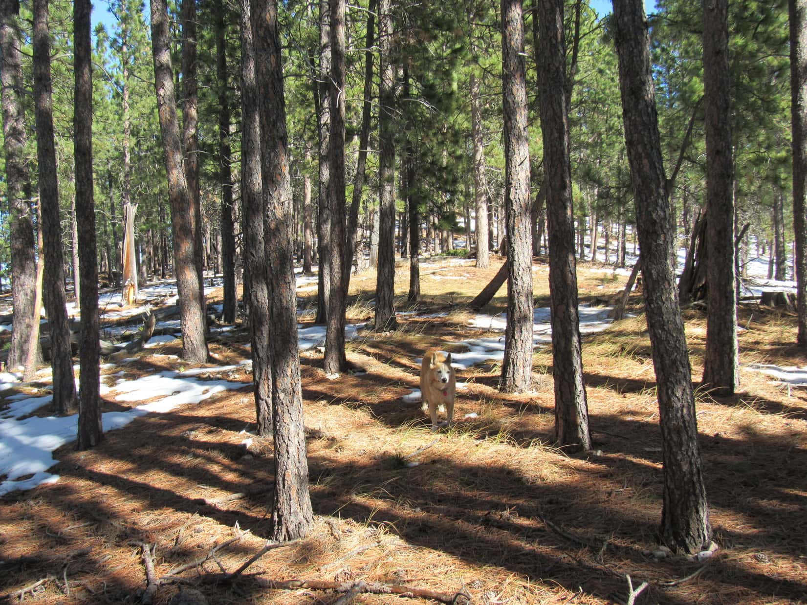
As the American Dingo gained Peak 6361’s main E/W ridge, she made an unexpected discovery. A road was up here! Apparently it originated somewhere farther E along No. 288.1C than Lupe had been.
Lupe had come up near the low point of the main ridge about a third of the way E along the mountain from the cliffs at the SW end. Saving the views from those cliffs for last, Loop headed E looking for Peak 6361’s true summit.
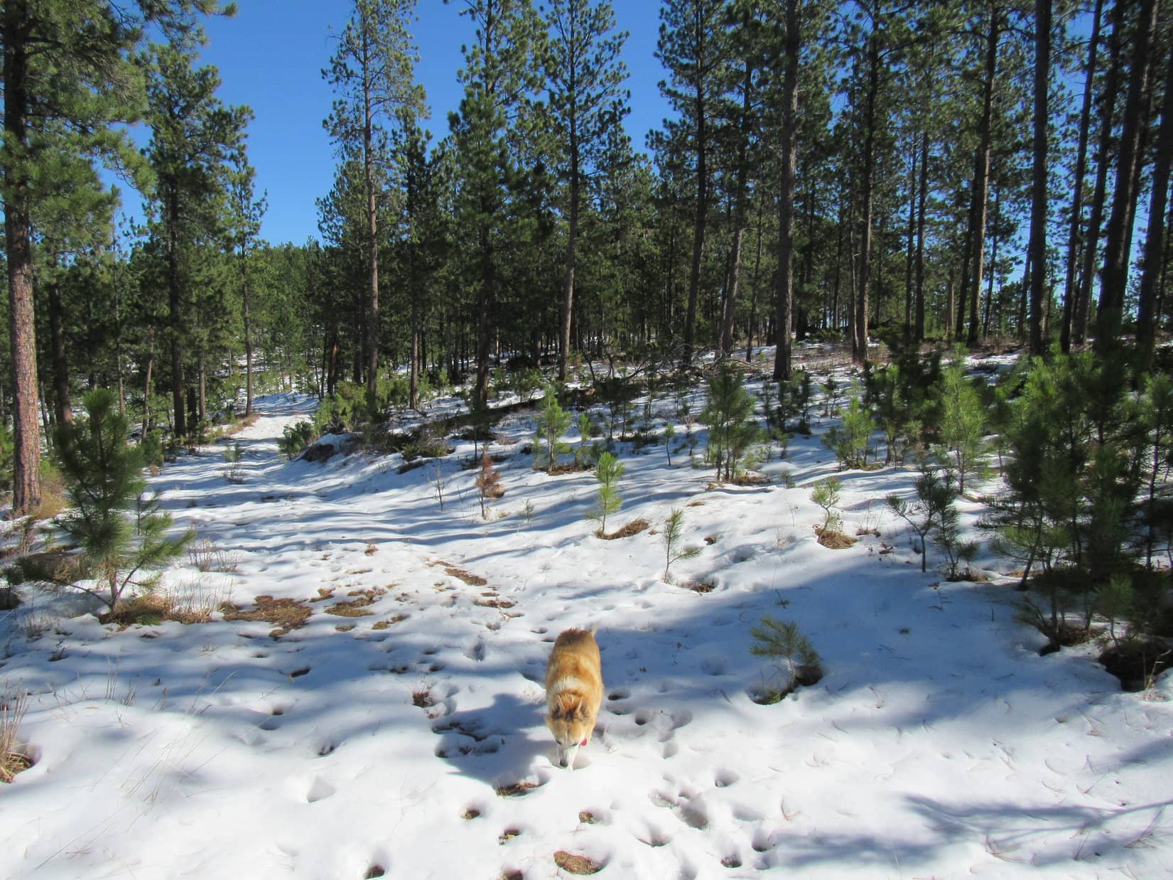
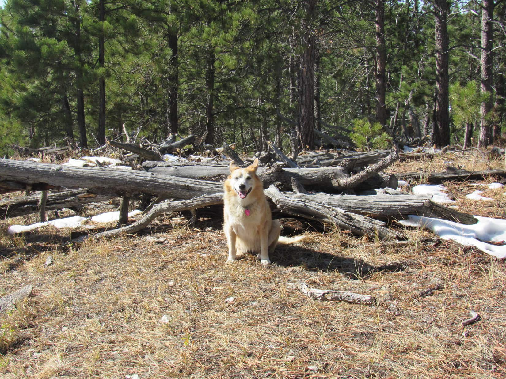
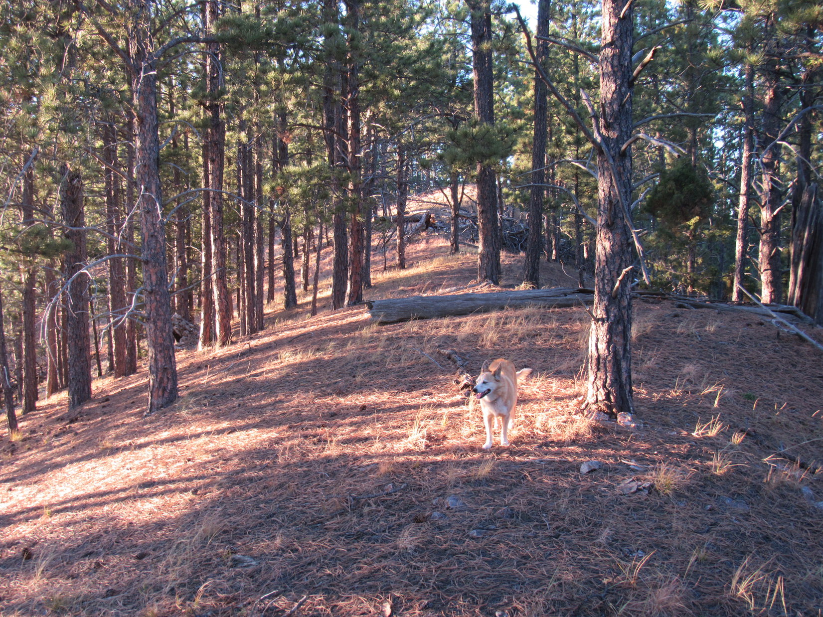
The main ridge was plenty wide and almost flat. Travel was easiest S of the crest where there wasn’t much snow. Forest effectively hid the views, although there were tree-broken glimpses. The terrain rose slowly as Lupe roamed E. The ridge eventually narrowed somewhat. Loop came to a path which began climbing a little more aggressively. It soon brought her to the base of a small hill at Peak 6361’s far E end.
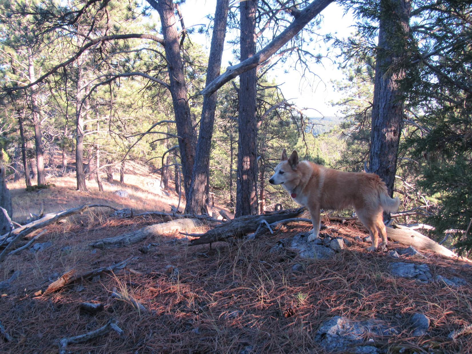
An easy stroll higher, and Lupe was at true summit of Peak 6361.


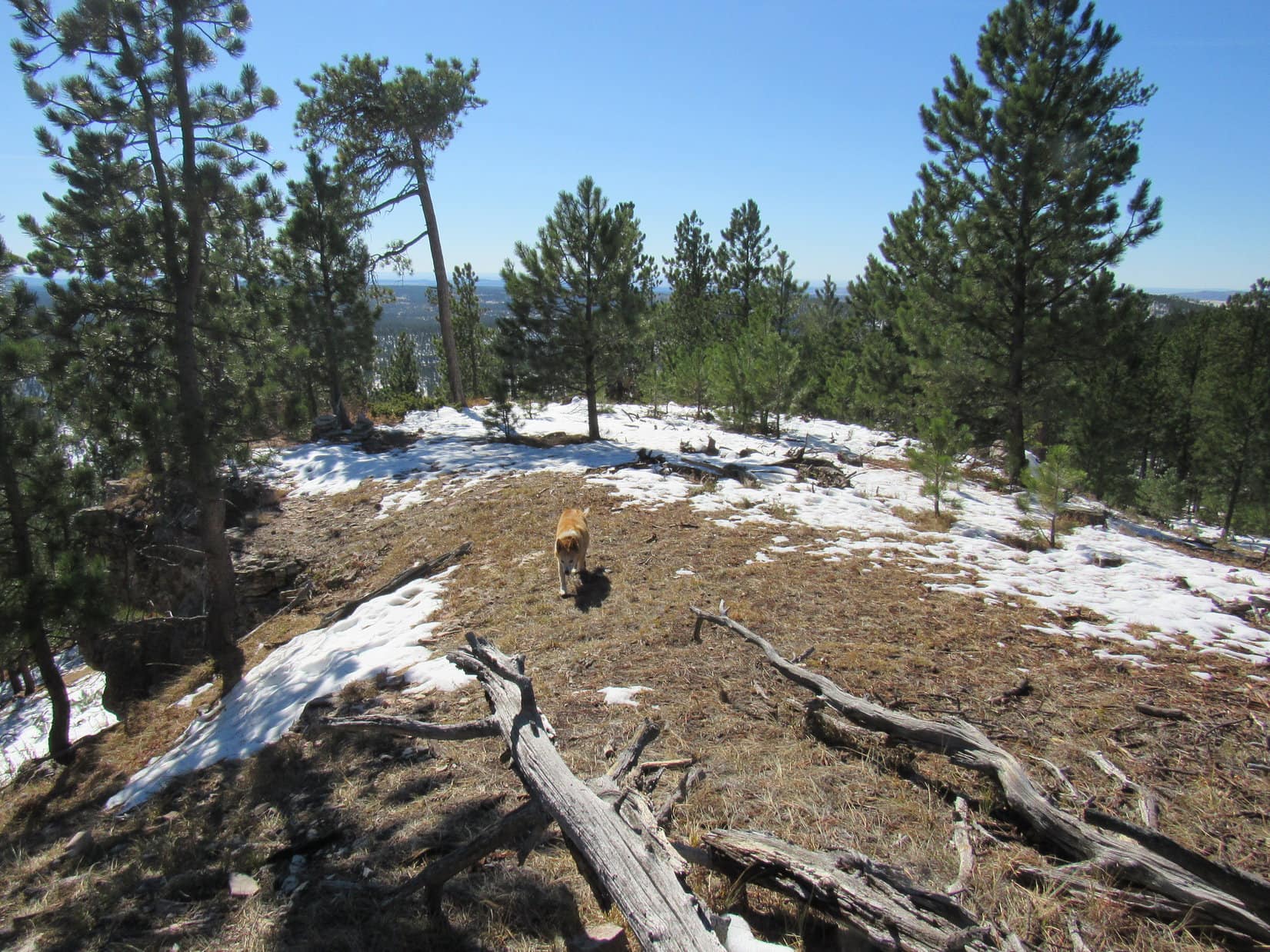
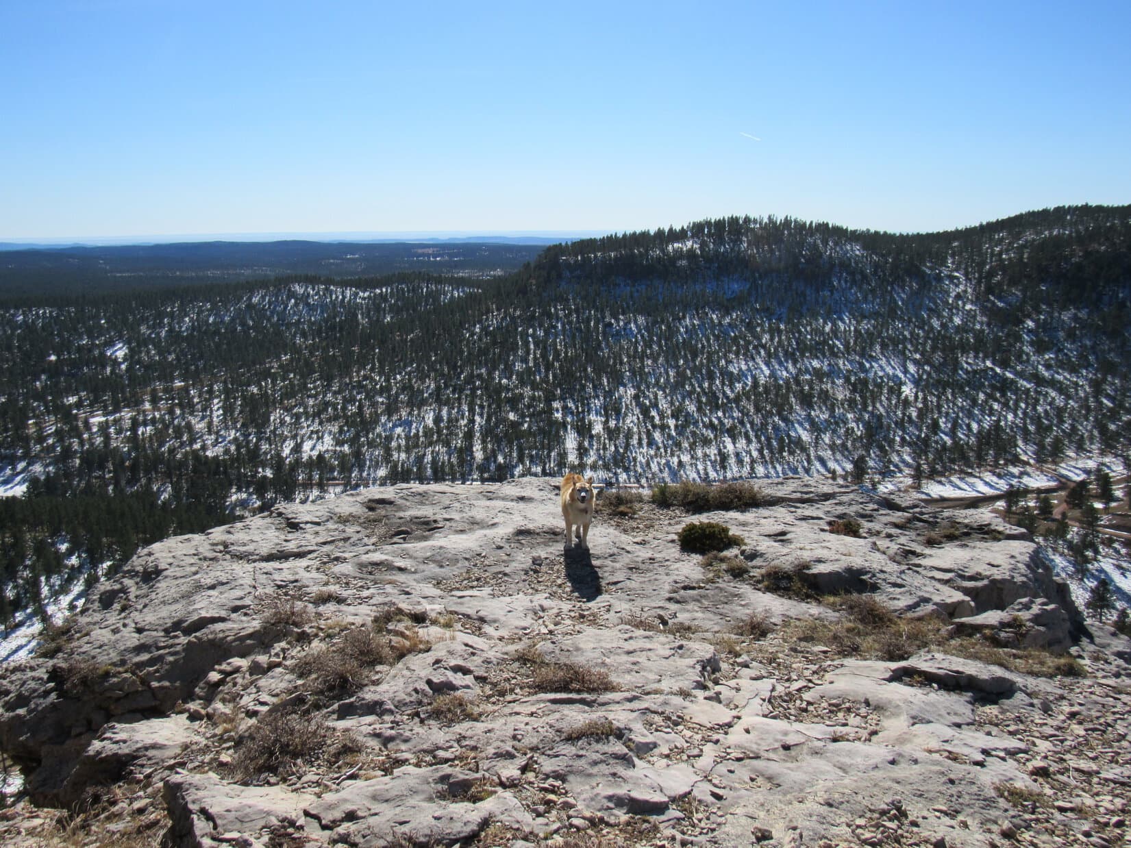
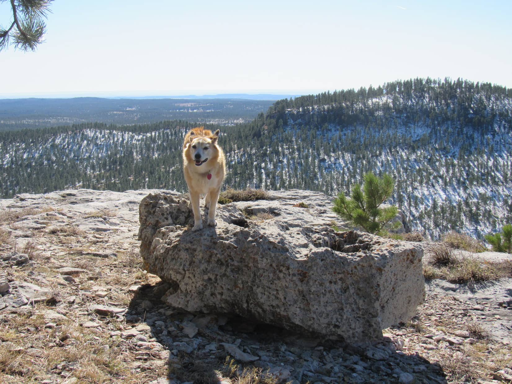
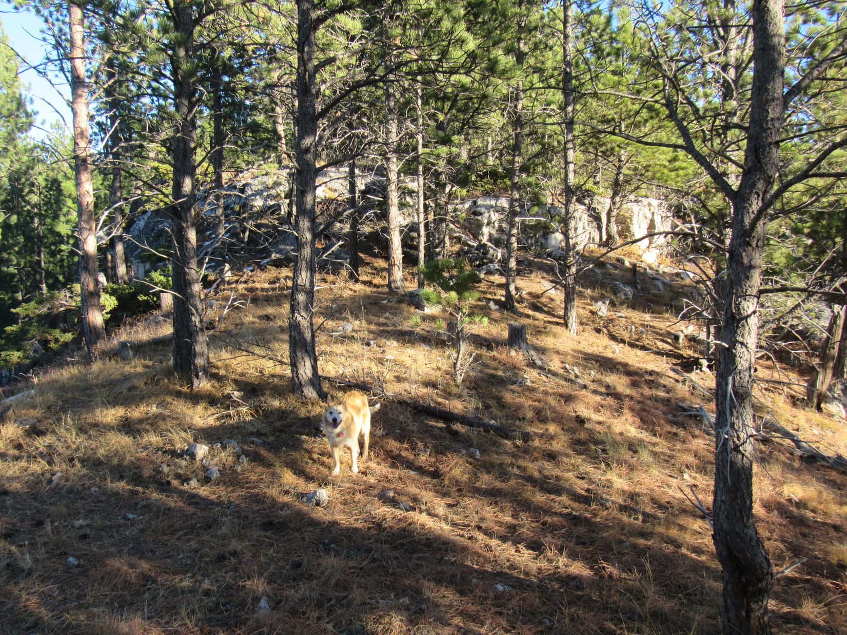
12:57 PM, 64ºF, Peak 6361 summit – Peak 6361’s summit had 3 lobes. From a central high point, which was grassy and partly covered with old deadfall, an uninteresting NW lobe extended only a short distance into the forest. Another short lobe went E, also into the forest. As the top of a limestone outcropping, this lobe was more scenic.
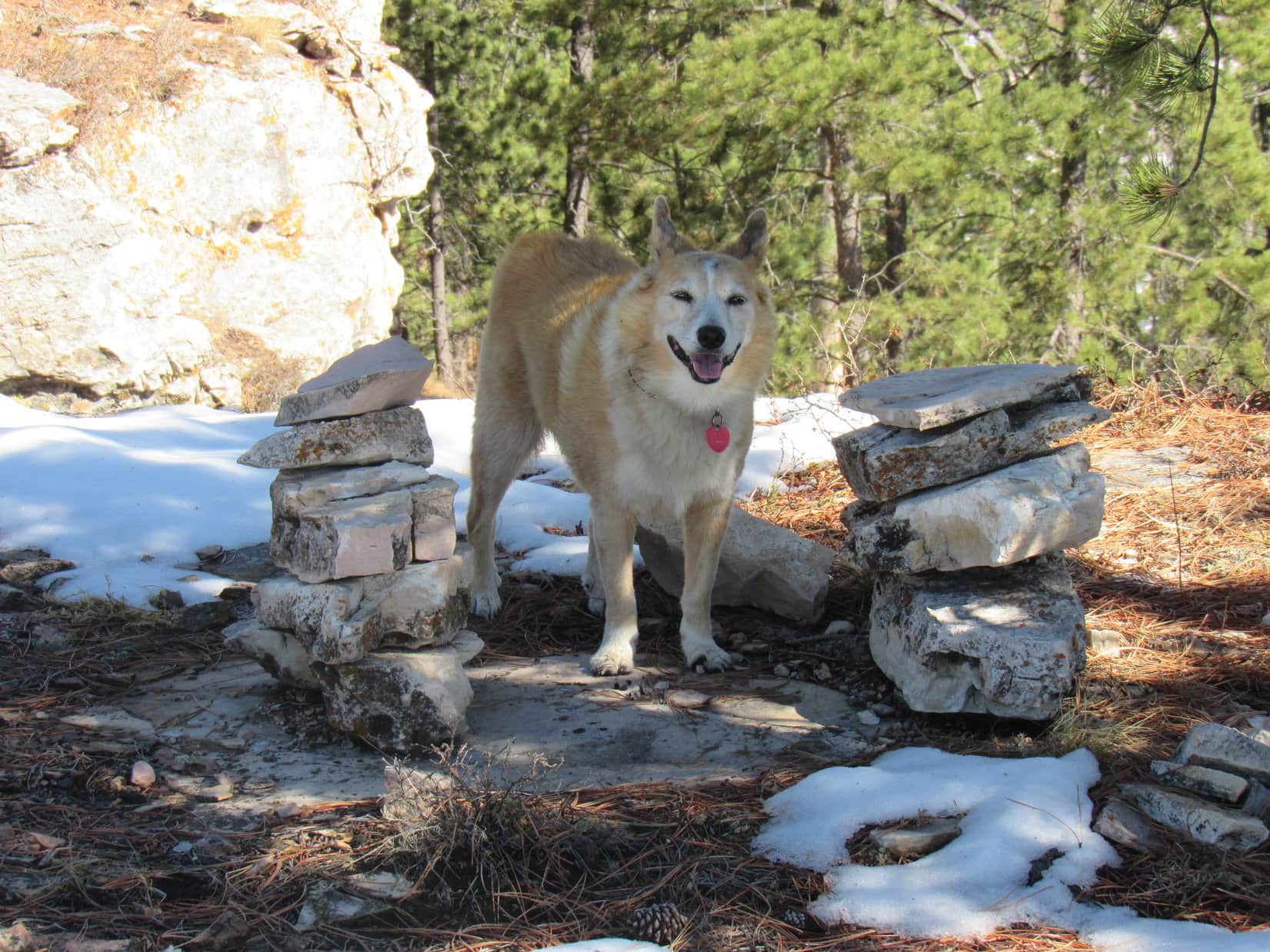
The most interesting lobe was the SW one, which was somewhat larger than the others. The SW lobe featured two cairns sitting next to each other near the best viewpoint, which was where Lupe first came up. After venturing briefly over to the true summit, Loopster returned to this viewpoint to bask in the warm sunshine, and help SPHP polish off a chocolate coconut bar, a task effortlessly completed in nanoseconds.
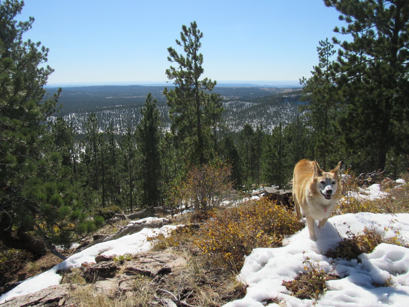
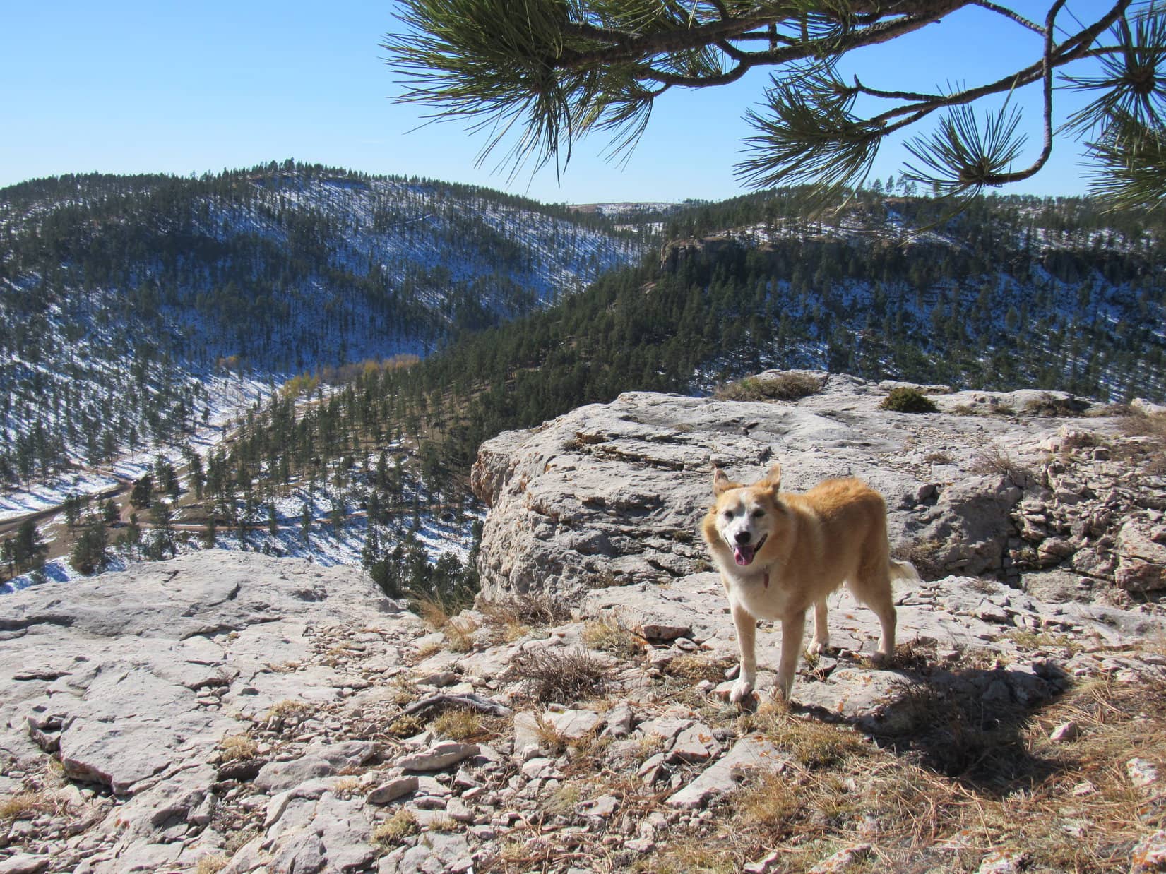
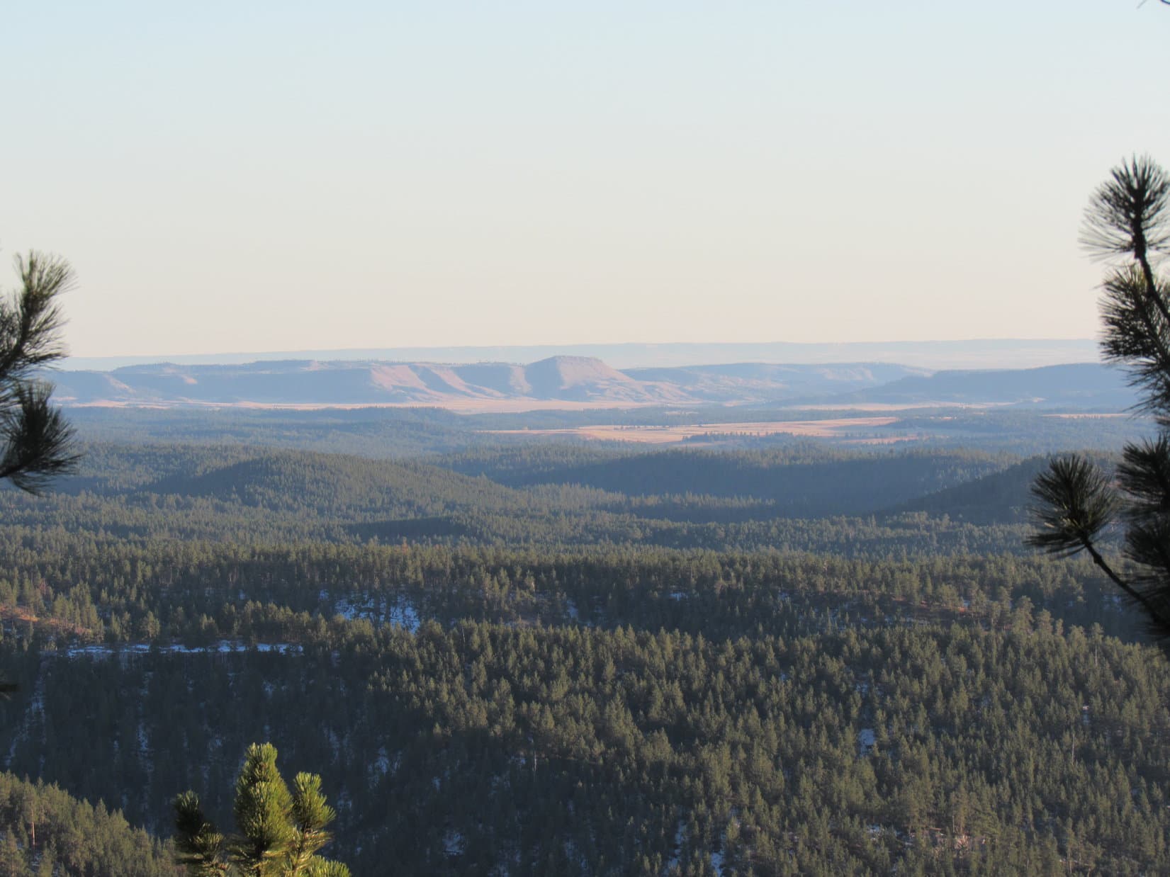
Lupe followed up the chocolate coconut bar with some Taste of the Wild, while SPHP munched an apple. Northeast Cicero Peak (6,240 ft.) off to the SE was the big view on display.

By getting up and moving around the summit region a bit, other decent views were on offer from various gaps between the pines. Lupe saw the plains of Wyoming far to the SW, and both Twin Sisters (5,920 ft.) and Peak 5802 to the SSE. Loop had been to Twin Sisters before. The plan was to climb Peak 5802 later on today. It didn’t look very big from here.
Since Lupe still intended to visit the viewpoint from the cliffs 0.5 mile away way over at Peak 6361’s far SW end before heading down the mountain, she spent only 35 minutes at the summit. Before departing, she toured all 3 summit lobes, and briefly returned to the true summit.
As she headed back W, Lupe explored more of the main E/W ridge. NE of where she’d first reached it earlier in the day she came to a fairly open area featuring just about the only view to the N from Peak 6361. Nothing too dramatic, just some even higher forested ridges beyond the next valley.
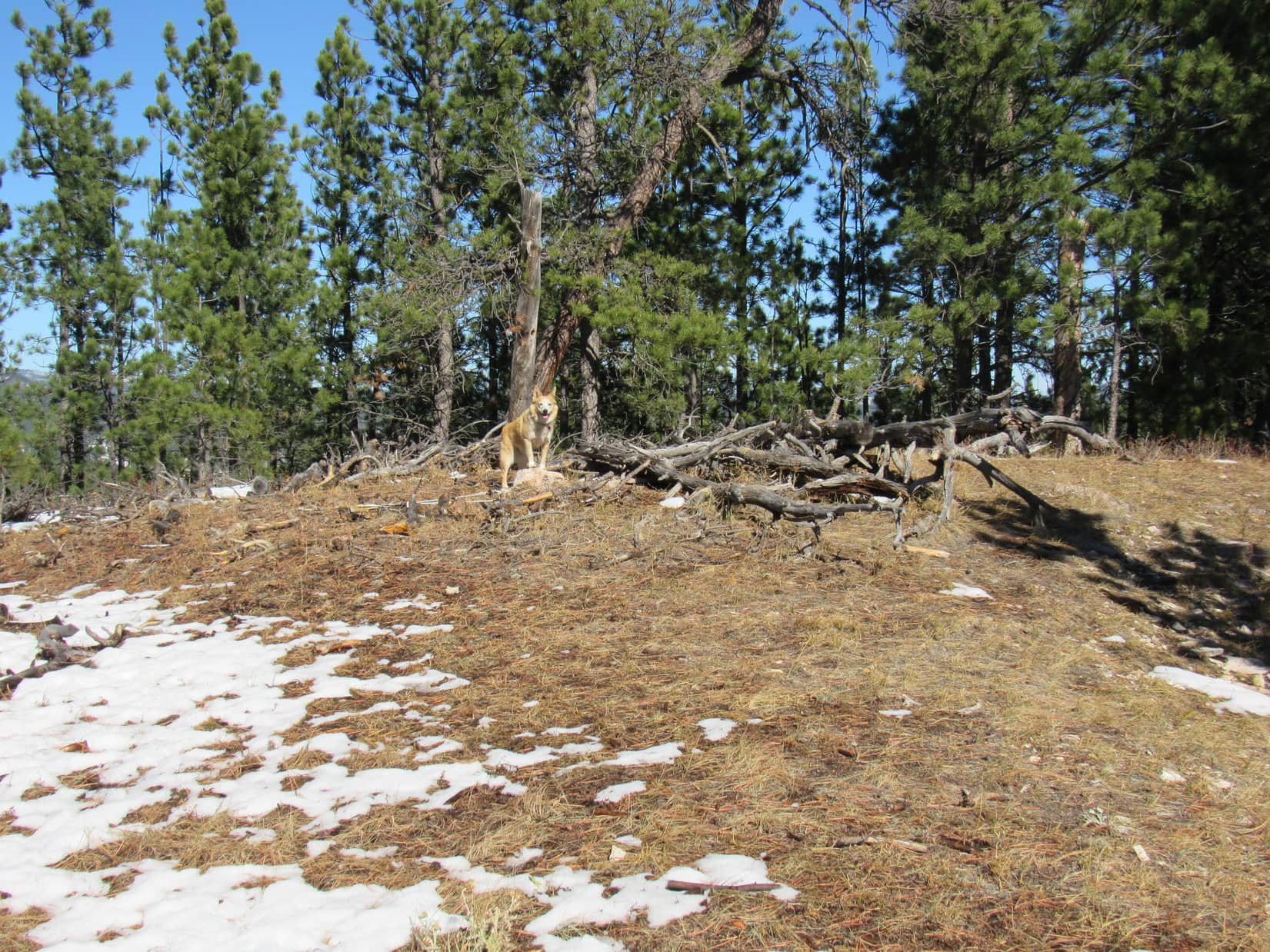
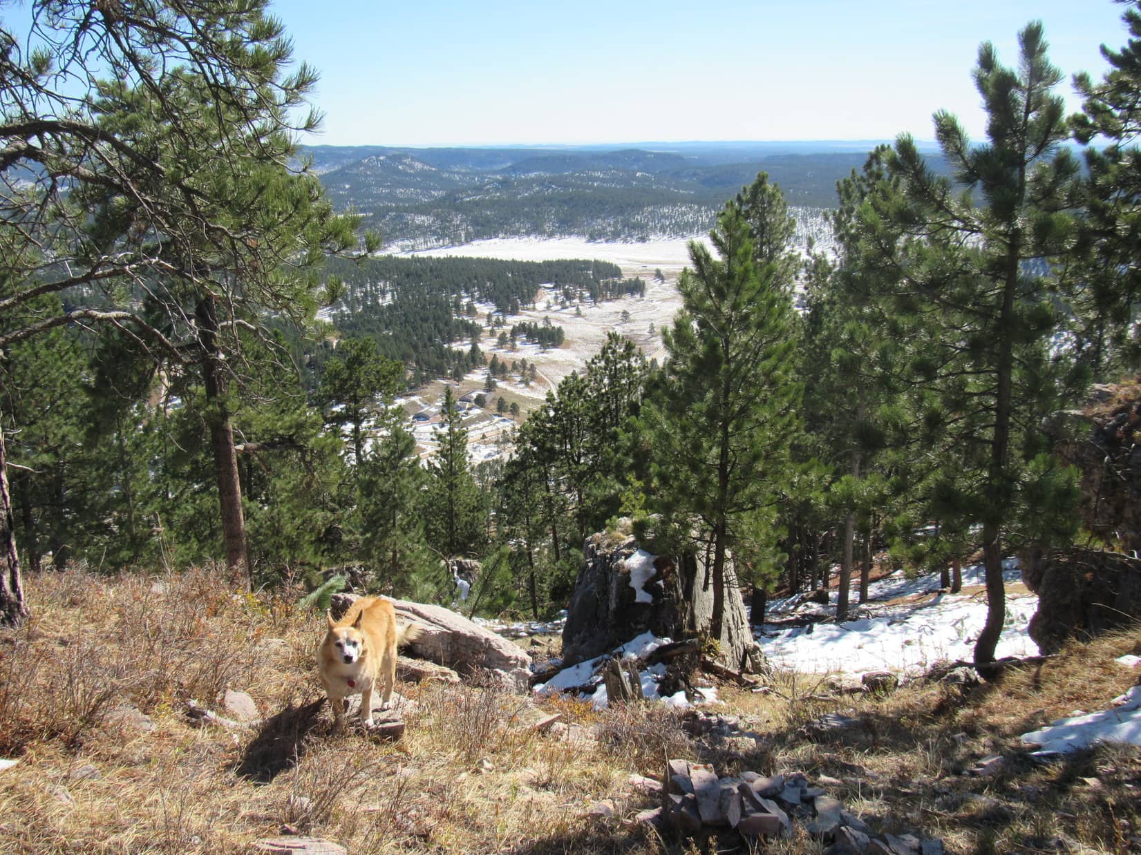
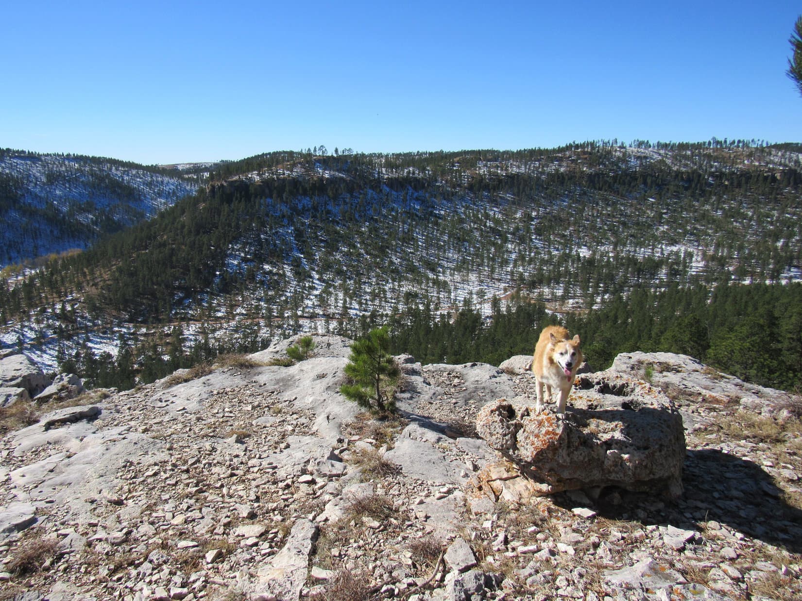
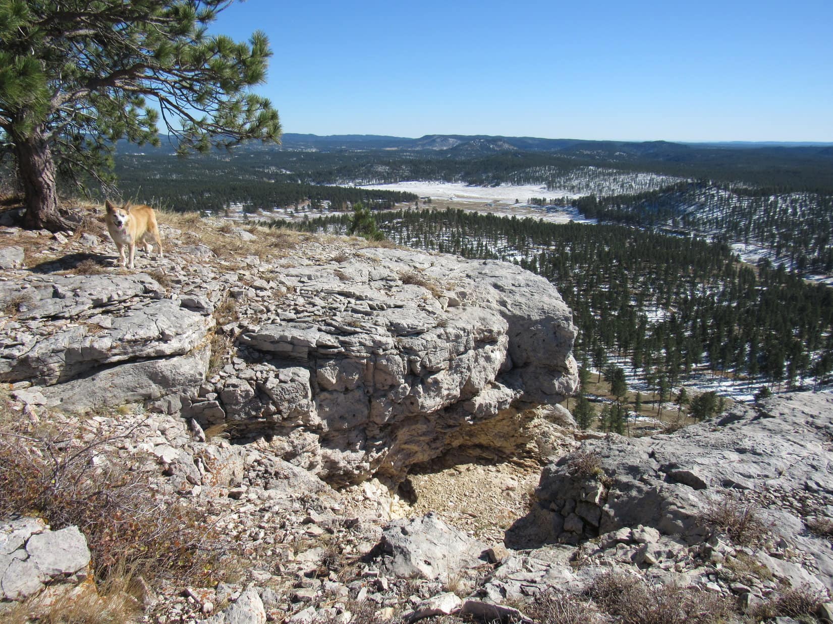
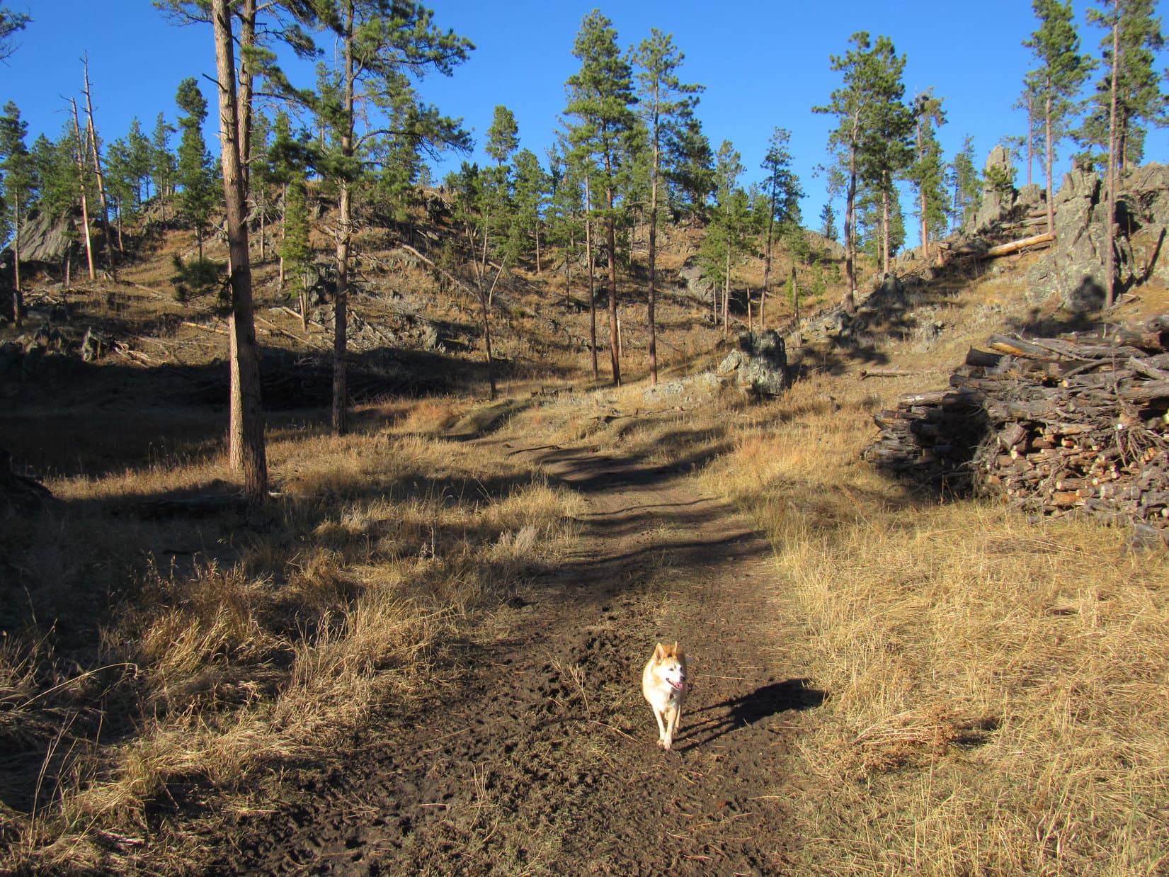
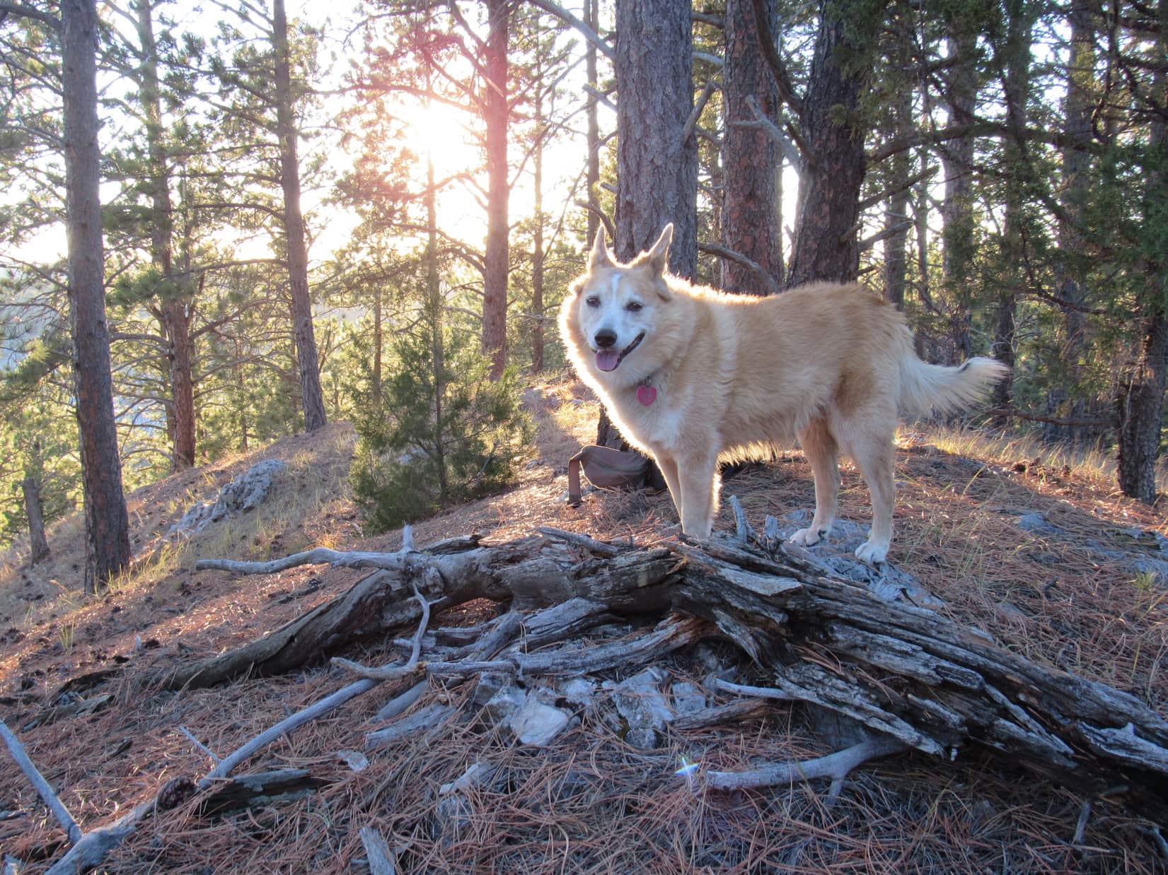
The far SW viewpoint was considerably lower than Peak 6361’s true summit, but did turn out to be a great vantage point. Approaching it, Lupe discovered another trail heading that way. As anticipated, this trail ended at a big flat spot, but instead of the expected exposed limestone, the ground was covered with pine needles.
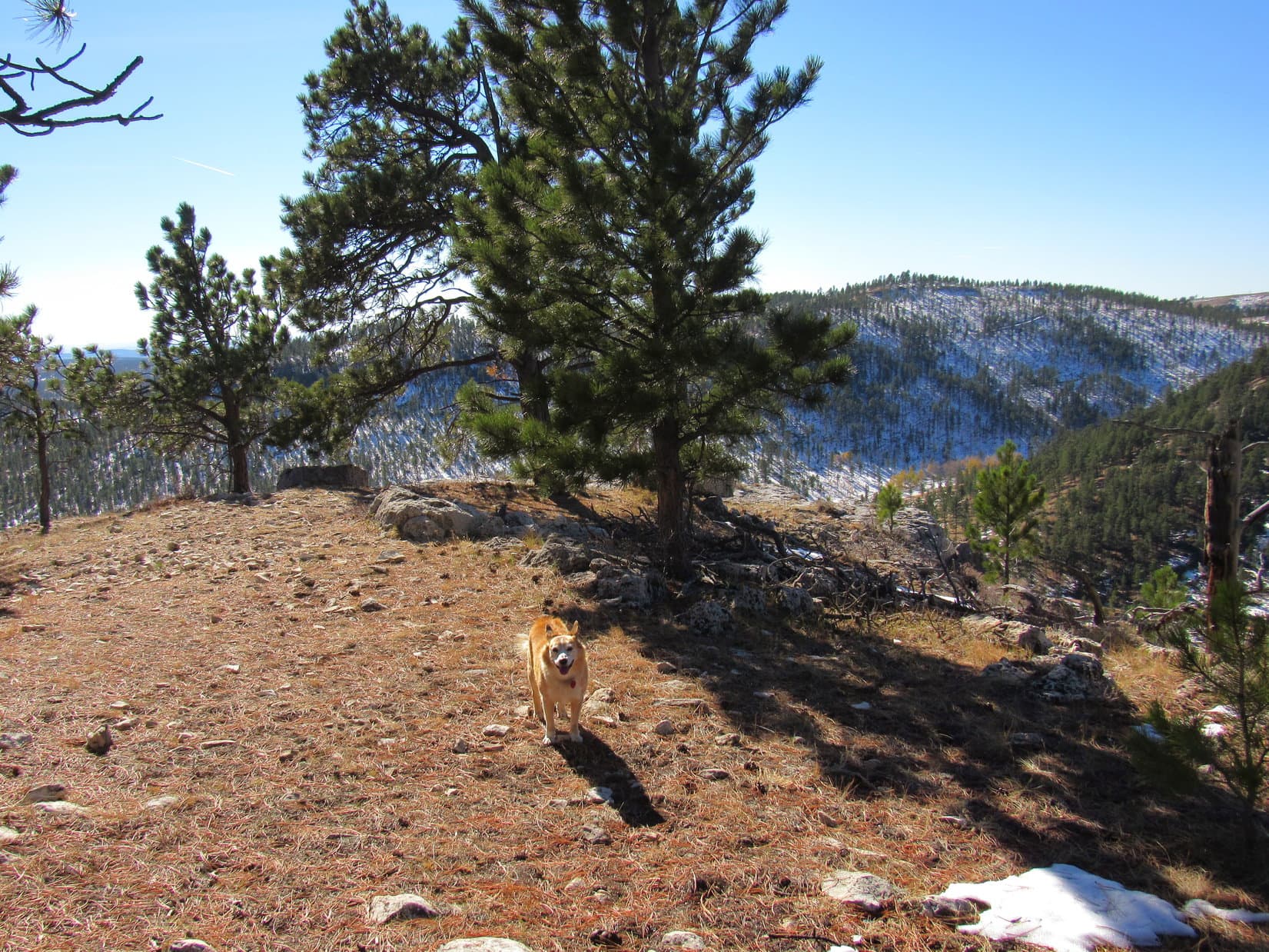
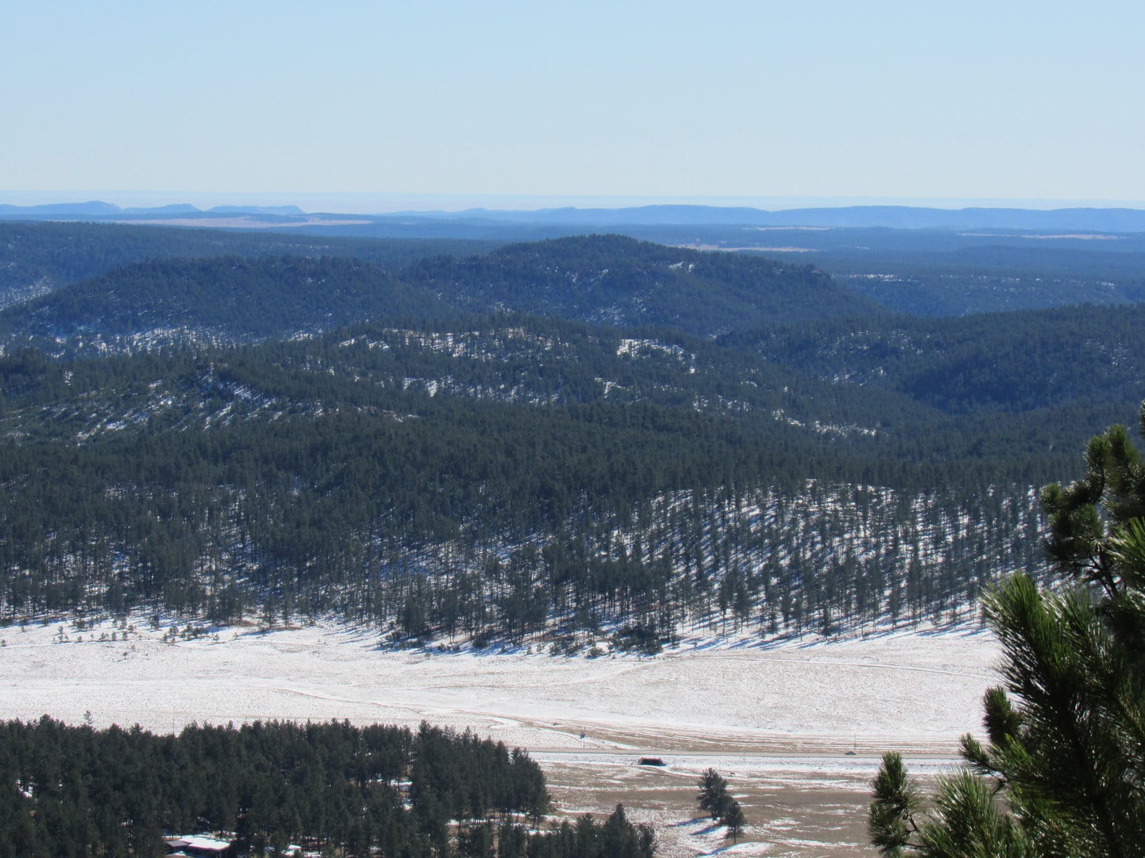
Turned out that the limestone platform was actually a bit lower beyond the initially visible edge. A short easy slope led down to it. Venturing out onto the platform for a look around, the views were certainly worth the effort expended to get here!
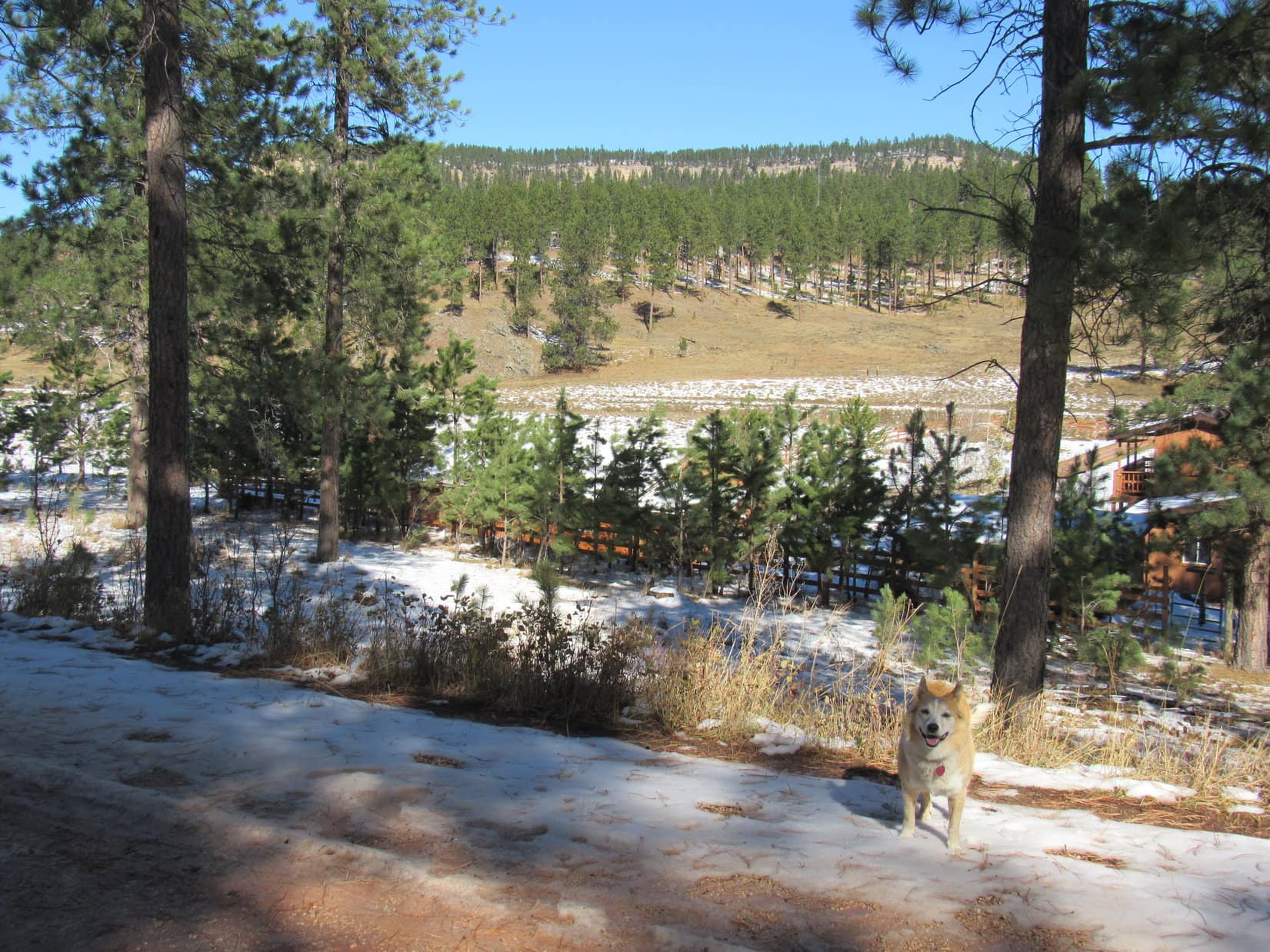
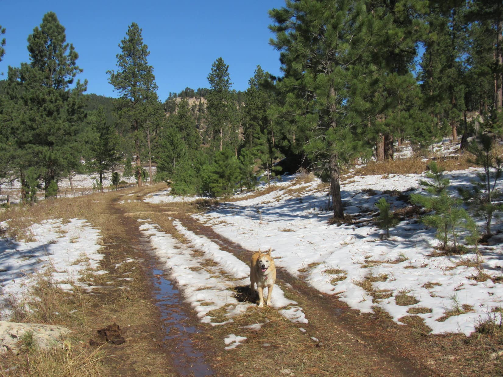
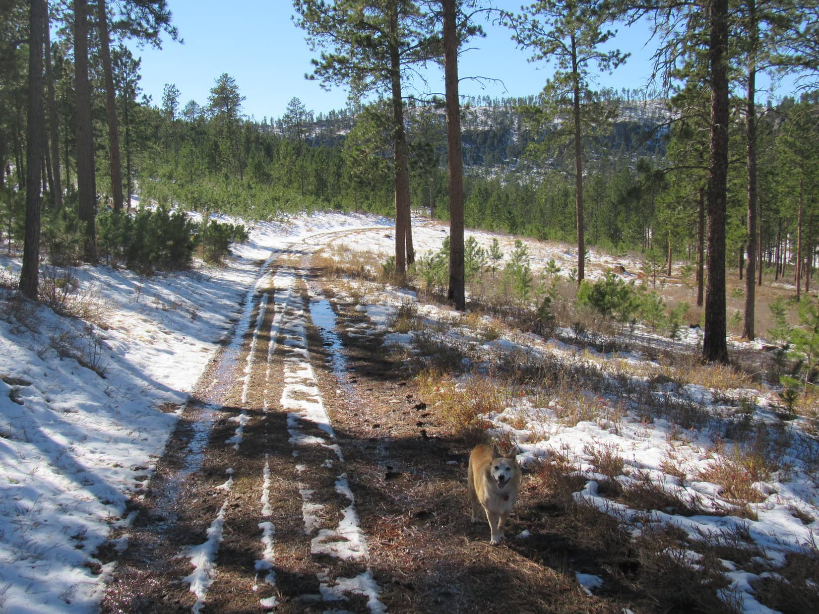
Satisfied with her SW viewpoint experience, Lupe returned to the road she’d found earlier, following it all the way back down the mountain. Sure enough, it linked up with USFS Road No. 288.1C well E of where she’d left it. Enjoying a pleasant, easy return, Loop retraced her former route back to the RAV4. (3:12 PM, 71ºF)
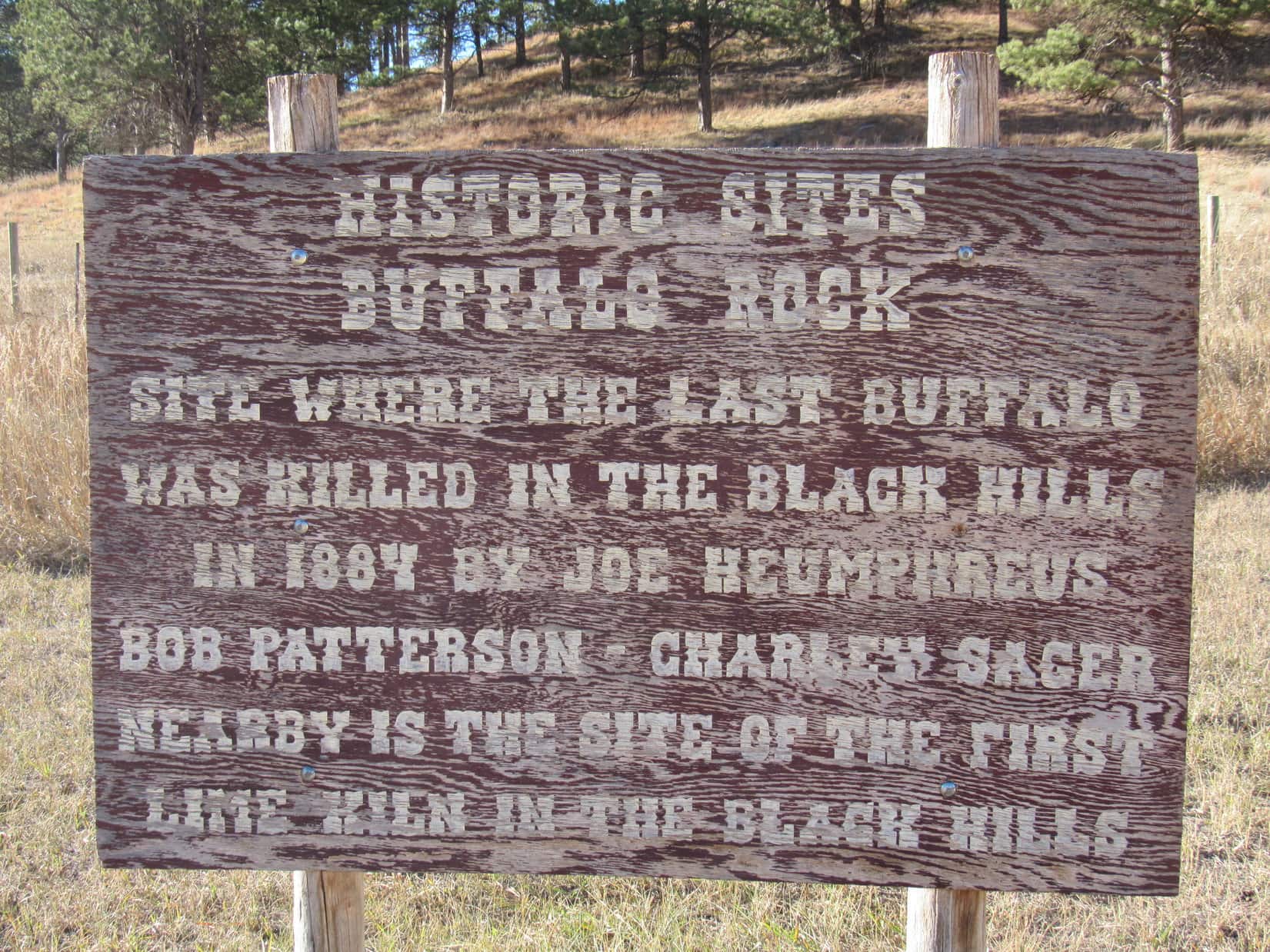
Mid-afternoon on a short October day, Peak 5802 was too far away to simply hoof it on over there from where the RAV4 was parked, so SPHP had to drive a bit to get closer. On the way, 3.5 miles S of Hwy 16 along Pleasant Valley Road (USFS Road No. 715), there was a curious site – a pullout by a big rock with a plaque on it.
Eh, why not? SPHP stopped so Lupe could take a look. The plaque and a wooden sign nearby both bore a distressing message.
It’s a lie! A complete and total lie, SPHP! We both saw the proof just a few hours ago! Why is this here? Who would ever do such a terrible thing?
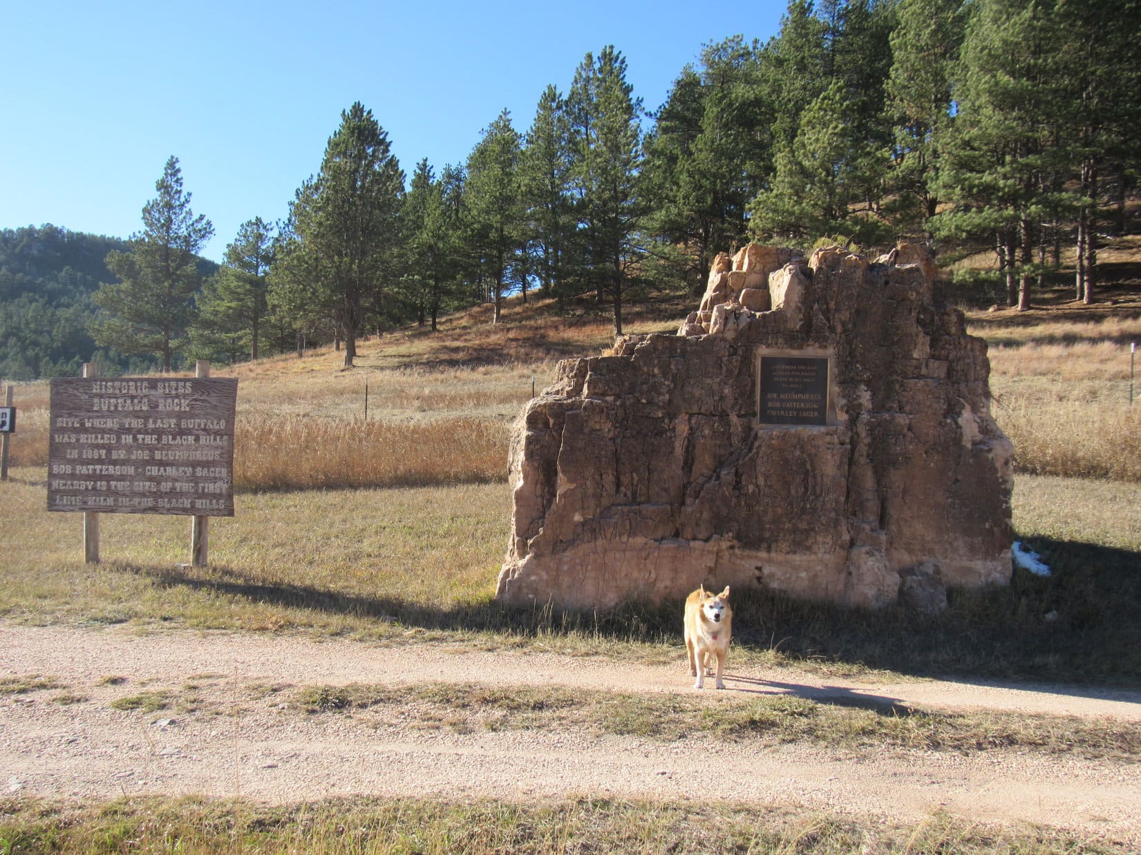
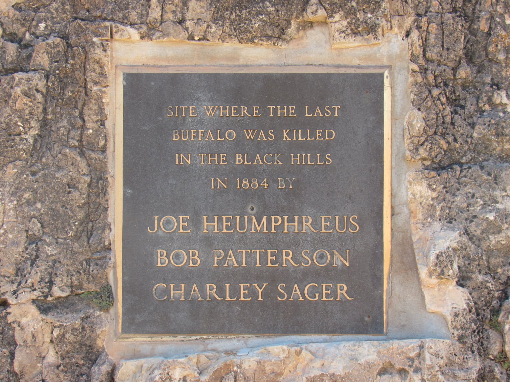
Says right here on the plaque, Loop – Joe Heumphreus, Bob Patterson and Charley Sager.
Well. that’s awful! It’s not true, either, SPHP! We saw that buffalo on the way to Peak 6361 today! Remember? It was alive! We’ve seen plenty of other buffalos in the Black Hills, too! Custer State Park has hundreds of them, maybe thousands!
About 1,300 to 1,500, I think. The sign is probably right, though, Loop. The last native buffalo in the Black Hills probably was killed here in 1884, but there were still some buffalo left in Yellowstone and a few other spots. Wind Cave National Park eventually acquired 14 buffalo in 1913, and Custer State Park brought in another 36 buffalo the following year.
Oh! Really? That’s why we still see buffalo?
As far as I know, yes. The parks aren’t the only places with buffalo these days. There are private herds owned by ranchers, too. The bison we saw this morning was part of a private herd.
Well, however they got here, I’m glad there are still buffalos in South Dakota, SPHP! Hope no one ever kills the last one again!
Me, too, Looper!
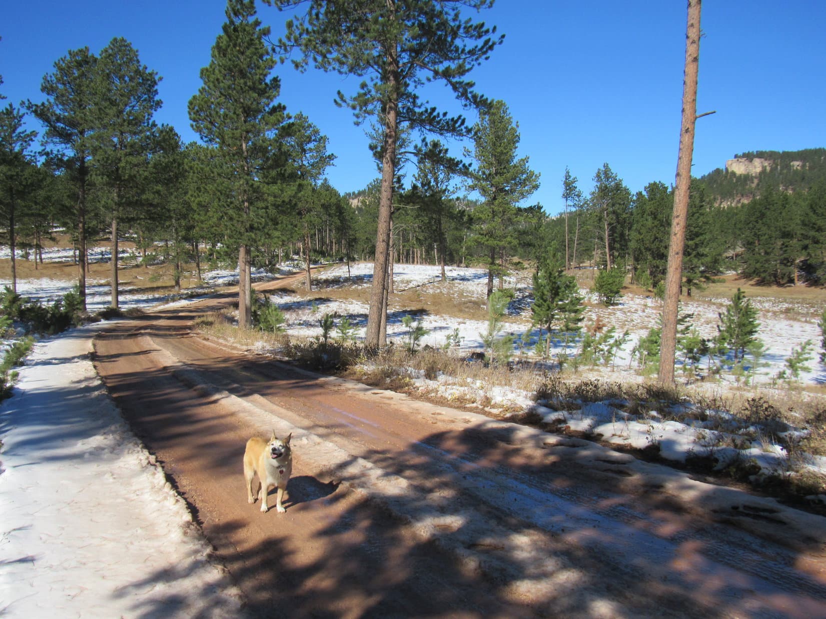
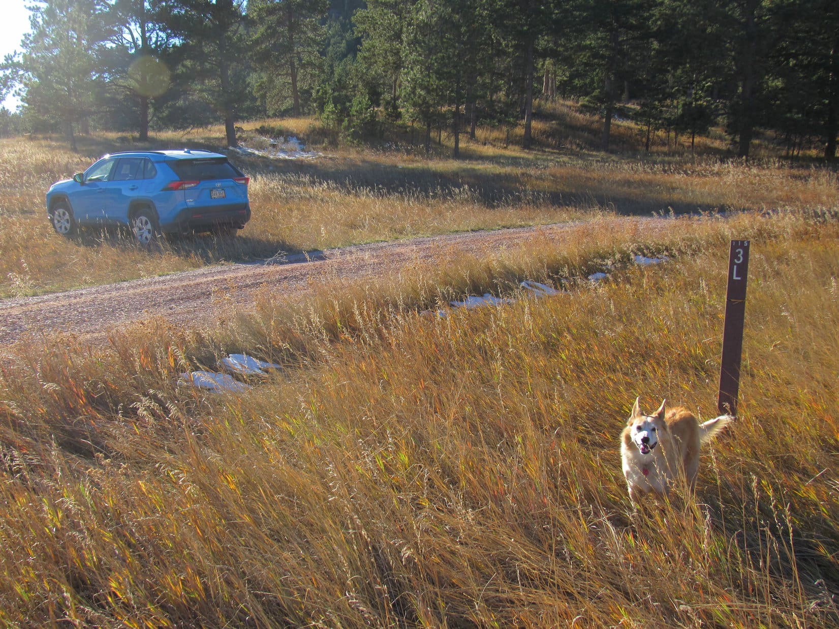
3:37 PM, 68ºF – Roughly 0.6 mile S of Buffalo Rock, SPHP turned off Pleasant Valley Road onto USFS Road No. 715.3L, parking the RAV4 on a grassy slope. Getting a little late in the day, but Peak 5802 was only about a mile NW as the crow flies. Lupe could start for it from here.
In the shadow of a mountain to the W, USFS Road No. 715.3L was sloppy with mud and slush as Lupe followed it NW. 0.5 mile brought her to a fork where No. 715.3M split off heading WNW. Peak 5802 was already in sight, but looked quite steep from here.
A check of the topo map showed that the easiest route up was likely from the E on a slope N of the mountain. Since No. 715.3L would go right past the base of that slope, Lupe stuck with it, staying to the R.
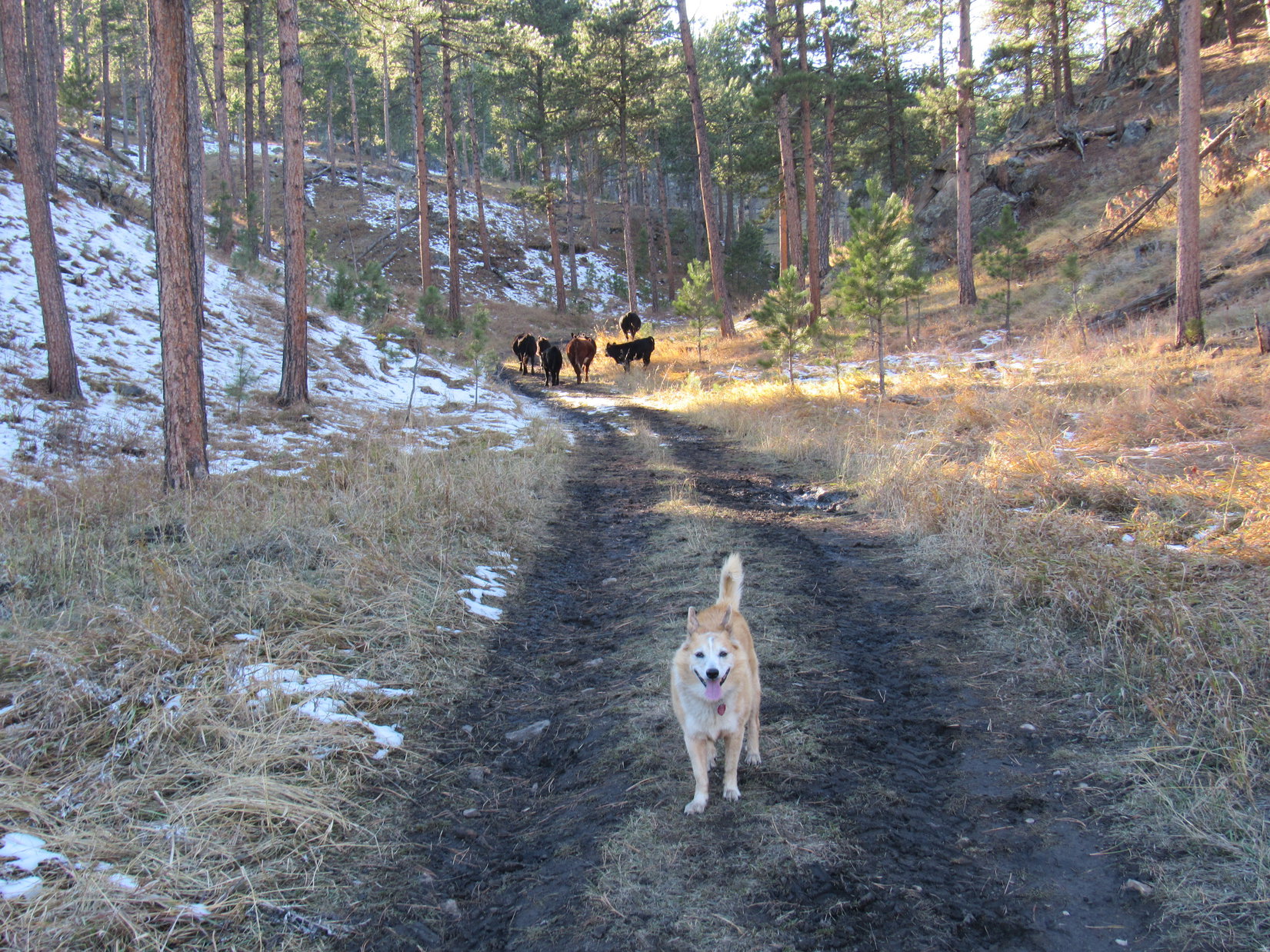
No. 715.3L now went N avoiding a ranch to the E. The road gradually lost elevation, reaching a low point less than 0.25 mile NW of Buffalo Rock, which wasn’t visible from here. No. 715.3L then turned NW going up a narrow valley. A small herd of cattle, concerned by the unexpected appearance of an American Dingo, led the way.
About a mile from the fork where No. 715.3M had split off, No. 715.3L flattened out. Lupe left the road here heading W up a forested slope, gradually curving SW as she climbed higher. The slope steepened and became snowier as she approached a saddle on the ridge to the W, but getting up there was no problem. A short break was taken up on the ridgeline, which was sunny and snow-free.
Loop was now 0.25 mile N of Peak 5802, already at 5,700 feet. Heading SE after her break, she climbed a rock outcropping where the ridge was very narrow. These rocks provided a view of Twin Sisters (5,920 ft.) to the NNE. Sylvan Hill (7,000 ft.) and Black Elk Peak (7,231 ft.) were also visible in the distance.
Beyond the rocky viewpoint, the ridge broadened out. Lupe started up a gently-sloping forested hill. Angling S to avoid having to go all the way to the top, she was soon past the hill on a shallow descent toward the saddle leading to Peak 5802.
Crossing the saddle, a moderately steep trek 100 feet up Peak 5802’s N slope, and the American Dingo was there.
5:11 PM, 66ºF, Peak 5802 – The true summit, which was right where Lupe came up, was a small knoll a few feet higher than than anywhere else on a 500 foot long summit ridge that curved away to the SE. To the W, the ridge extended only another 25 feet. Ponderosa pines blocked the views to such an extent that there really wasn’t much to see. A narrow view of Parker Peak (4,848 ft.) far to the S was about it.
The sun was already getting quite low. After tagging the high point, Lupe explored the SE ridge. A single large boulder sat at the far end next to where the ridge began dropping off steeply. Loop got up on it briefly before returning to the true summit.

Shall we take a break here, Loopster? Just to absorb a little Peak 5802 ambiance?
Sure, SPHP! Kind of quiet up here, though, and not much to see, either.
Sometimes that’s just the way it goes, Loop. Not every mountain is going to turn out to be a scenic wonder. They are all unique, though, and simply being up here together sharing the experience makes it a special place. How many other Dingos have ever been to Peak 5802? Hardly any, I bet!
You’re right, of course, SPHP! We like the peace and solitude, don’t we? Still, the ambiance could be improved.
How so, Loop?
Got another chocolate coconut bar in the pack?
As a matter of fact, I do! Hang on, I’ll get it!
The sun was about to set when Lupe started down. At the saddle just N of the true summit, SPHP peered down the steep slope to the W. Looked doable, and would be a bit of a shortcut back to the RAV4. The Carolina Dog gave it a go.
Turned out that a jeep trail must have come up this way once upon a time. As Lupe lost elevation, the faint old road became more and more apparent. Hundreds of feet lower, the road faded away again, the slope of the hillside diminishing as Loopster entered a big valley. Gradually turning SW, the Carolina Dog eventually reached a much better road.
USFS Road No. 715.3M? Probably. Following the road SE for nearly a mile confirmed SPHP’s suspicions. Lupe arrived back at the fork where No. 715.3M left No. 715.3L. Still 0.5 mile to go to get back to the RAV4.
Splish-splash! At the end of a perfect day, her belly dirty and wet, Lupe trotted along the muddy, slushy road in the gathering gloom happy as could be. (End 6:41 PM, 42ºF)
Links:
Next Black Hills Expedition Prior Black Hills Expedition
Want more Lupe adventures? Check out Lupe’s Black Hills, SD & WY Expeditions Adventure Index, Master Adventure Index, or subscribe free to new Lupe adventures!
Hey guys, Chinle here. Remember me? I’ve been off grid for a long time. Lots to catch up on here. Glad you’re doing OK.
Chinle! Of course we remember our favorite Klondike Cafe author!
Off the grid? Since April? You have a bright career ahead of you as a survival training instructor! Here we thought you’d just moved on to better things.
Drop us a line sometime when you have the chance. Looking forward to hearing what you’ve been up to! Must be quite the tale!