Mount Bourgeau, Banff National Park, Canada (8-1-16)

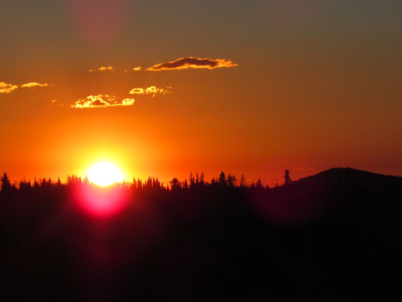
Day 3 of Lupe’s Summer of 2016 Dingo Vacation.

The trailhead for Mount Bourgeau (9,616 ft.) was empty when Lupe arrived (7:09 AM, 41°F).  That didn’t last long.  Another vehicle pulled in within 2 minutes, and 5 or 6 more pulled in within 10 minutes.  Lupe was anxious to get started.  SPHP agreed.  SPHP helped Lupe up the metal grate stairway, opened the gate, and let Lupe down in the forest on the other side.

Mount Bourgeau as seen from Trans-Canada Hwy No. 1 a few miles W of Banff. The trail to the top comes up from Harvey Pass on the opposite side. Photo looks WSW.

There wouldn’t be much to see except forest for quite a long way.  The trail wouldn’t get out in the open until Lupe was close to Bourgeau Lake, more than 2,000 feet higher than the trailhead.  On the way, Lupe would get occasional glimpses of nearby mountains, pass by a creek and a waterfall, but that would be about it.

In the forest on the first part of the trail to Bourgeau Lake, Harvey Pass, and ultimately the summit of Mt. Bourgeau.

Lupe and SPHP hurried along the trail to stay ahead of the crowd that would soon be coming.  The trail gained elevation at a relentless, but moderate pace.  SPHP grew concerned about the weather.  The sky was clouding up.  Fortunately, after a while it gradually cleared again enough to alleviate any real worries.

If successful, this would be Lupe’s 2nd trip up Mount Bourgeau.  She had climbed it more than two years ago on 7-22-14 during her 2014 Dingo Vacation.  That time SPHP had forgotten the camera, a mistake not realized until Lupe was already far from the G6, too far to go back for it.

If that hadn’t happened, Lupe would probably have been exploring a new trail to a different mountain today.  However, the views from Mount Bourgeau had been too grand not to have some photos of Lupe up there.  So now, 2 years later, Lupe was back!  And this time, SPHP made 100% certain to bring the camera.

Lupe pressed on.  Despite the unchanging appearance of the forest, she was making progress.  First, traffic noise from Trans-Canada Hwy No. 1 faded away.  Then she could hear a rushing creek far below to the N.  She eventually crossed a nice wooden bridge over another creek.

When Lupe reached the big waterfall cascading down a headwall, SPHP knew the trail was about to get steeper.  The good news was that Lupe didn’t have much farther to go to reach Bourgeau Lake.

Lupe approaches the waterfall cascading down the headwall. After crossing the creek below the falls, the trail would become steeper.
At the base of the falls on the stream that comes down from Bourgeau Lake.

There was no bridge across the creek below the falls.  However, rocks were grouped up in wire cages, forming platforms that stood well above the water level.  Crossing the creek was no problem at all.  Once past the falls, the trail steepened.  Long switchbacks kept the rate of climb from becoming too difficult.  Lupe had plenty of time to sniff around off trail during SPHP’s air and water breaks.

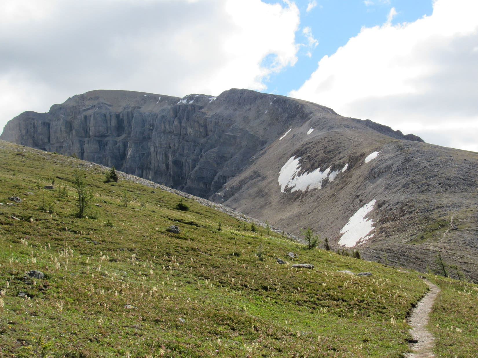
Lupe had already covered the vast majority of the distance from the trailhead to Bourgeau Lake.  As soon as she was up over the headwall, the trail would level out, the views would open up, and Lupe would see the cliffs of the NW face of Mount Bourgeau, below which Bourgeau Lake is hidden in a small section of forest.

Above the headwall, the trail leveled out and the views opened up. This photo looks WSW toward a 2nd headwall the trail passes over beyond Bourgeau Lake on its way to Harvey Pass.
Looking WNW from the trail above the first headwall.
Lupe on the trail. She is getting close to reaching Bourgeau Lake, still hidden by the forest ahead. Photo looks SW.

Lupe and SPHP reached the level trail above the headwall.  The forest gave way to more open territory where the views were every bit as wonderful as SPHP remembered.  From now on, Lupe would see increasingly spectacular country all the rest of the way up to the summit of Mount Bourgeau.

It wasn’t much farther to Bourgeau Lake, tucked away in a corner at the base of towering cliffs to the S and W.  A small forested area kept the lake hidden from view until Lupe was almost upon it.  The main trail doesn’t go quite all the way to the lake.  Upon re-entering the forest, Lupe and SPHP took a minor side trail leading to the NE shore of Bourgeau Lake.

Lupe reaches Bourgeau Lake, her first major objective. Photo looks W.
On her way up Mount Bourgeau, Lupe would eventually go around the back side of the cliffs on the R, before climbing along the top of the ridge on the L high above Bourgeau Lake.
At the outlet stream from Bourgeau Lake. Photo looks NE.

At Bourgeau Lake, Lupe had already gone well over half the distance along the trail to the top of Mount Bourgeau, but more than half of the elevation gain required was still ahead.  Lupe stayed at Bourgeau Lake only a short while.  Lupe and SPHP returned to the main trail to continue the trek.

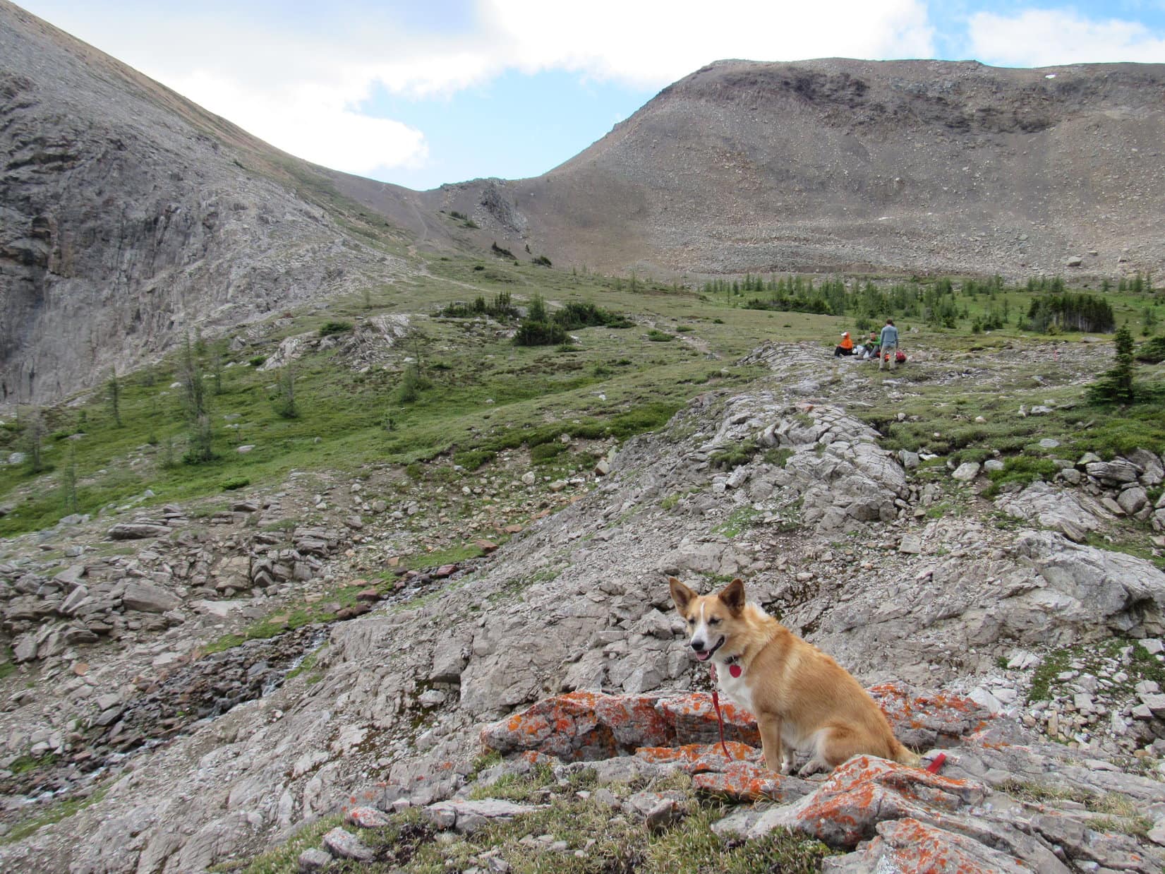
The trail wound SW through the forest a little to the NW of Bourgeau Lake, which was no longer in view.  Before long, the trail turned NW and started climbing again.  Lupe left the forest behind as she gained elevation.  The trail now climbed steeply traversing a long slope of loose rock toward the top of a 2nd headwall.  Well to the left of the trail, a creek tumbled noisily down a series of small waterfalls.

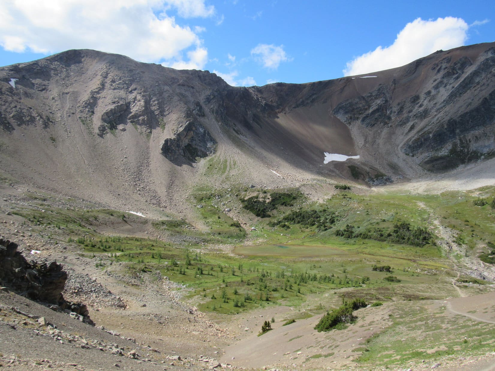
By the time Lupe reached the top of the 2nd headwall, the trail had turned W.  A small lake could be seen ahead.  Beyond the lake, the trail continued up yet another smaller rise.

Lupe reaches the top of the 2nd headwall. A small lake lies ahead. The trail can be seen passing to the R of the lake. Lupe was essentially above tree line at this point. Only a few stunted trees and bushes remained in this area. Photo looks W.

Lupe followed the trail past the N shore of the small lake, and then up the next rise beyond it.  Although there were a few stunted trees and bushes around, Lupe was effectively at or above tree line.

Looking back E from the NW shore of the very pretty small lake above the 2nd headwall.
Lupe reaches the top of the rise beyond the small lake above the 2nd headwall. Photo looks E.

From the top of the rise beyond the small lake, Lupe could see a big grassy area containing a pond fed by small streams.  High rock walls sheltered this area on the N, W and SW.  However, the trail did not continue W toward the pond.  Instead, it turned S, gradually steepening as it went up a long slope.  Lupe’s 2nd major objective, Harvey Pass, was at the top of the slope.

Looking S toward Harvey Pass.
Lupe reaches the N end of Harvey Pass. Photo looks N back down toward the stream-fed pond.

Lupe and SPHP followed the trail on up to Harvey Pass.  Another pond was nestled in a low spot up at the pass.

Lupe at Harvey Pass. Photo looks S across the pond.

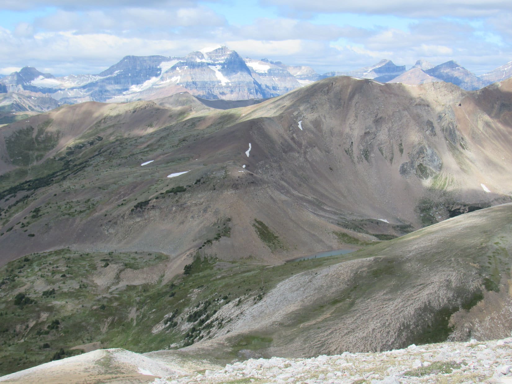
Reaching Harvey Pass was an important milestone.  From the S end of the pass, Lupe got her first expansive view of the territory SW of Mount Bourgeau.  Lupe could even see Mount Assiniboine (11,864 ft.), sometimes called the Matterhorn of the Canadian Rockies, although the top of the peak was lost in the clouds.

Mt. Assiniboini, with its summit in the clouds, is seen on the L from Harvey Pass. Photo looks S using the telephoto lens.

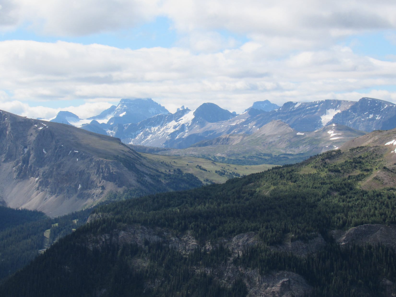
Near the S end of Harvey Pass, the trail to Mount Bourgeau splits off and angles SE up a grassy slope.  As the trail reaches the top of the near ridge, it turns more to the E.  From here, much of Lupe’s route on the final leg up to the summit could be seen ahead.

Much of the last leg of the route from Harvey Pass up Mount Bourgeau is seen ahead. Photo looks ESE.

As Lupe and SPHP climbed along the trail from Harvey Pass the rest of the way up Mount Bourgeau, the views got better and better.  The trail was often steep, but easy to follow.  The general route was always clear, even though parts of the trail were braided.  Caution was occasionally required.  The trail sometimes passed very close to the edge of the cliffs to the N.

Lupe at one of SPHP's first rest stops on the way up Mount Bourgeau from Harvey Pass. Photo looks SW.
Lupe at one of SPHP’s first rest stops on the way up Mount Bourgeau from Harvey Pass. Photo looks SW.
Looking NE from the trail above Harvey Pass. The valley where the closest trees are seen is the same valley Bourgeau Lake is in. The lake can't be seen from here, because is it tucked in beneath the cliffs on the near side of the valley.
Looking NE from the trail above Harvey Pass. The valley where the closest trees are seen is the same valley Bourgeau Lake is in. The lake can’t be seen from here, because is it tucked in beneath the cliffs on the near side of the valley.
Making progress! Lupe on the trail with Mount Bourgeau up ahead. Photo looks E.
Looking down on Harvey Pass (where the light blue pond is) from Mt. Bourgeau. SPHP believes the high point on the horizon L of Center may be Mount Ball (10,807 ft.). Photo looks WNW.
Getting closer! Photo looks ENE.
Oh, looks like Lupe is going to make it! She's looking good and the summit of Mount Bourgeau is dead ahead. Photo looks E.
Oh, looks like Lupe is going to make it! She’s looking good and the summit of Mount Bourgeau is dead ahead. Photo looks E.
Looking ENE at the Canadian Rockies.
Lupe takes a break. She didn't really need one, but she sometimes takes them anyway when SPHP does. Photo looks W.
Lupe takes a break. She didn’t really need one, but she sometimes takes them anyway when SPHP does. Photo looks W.

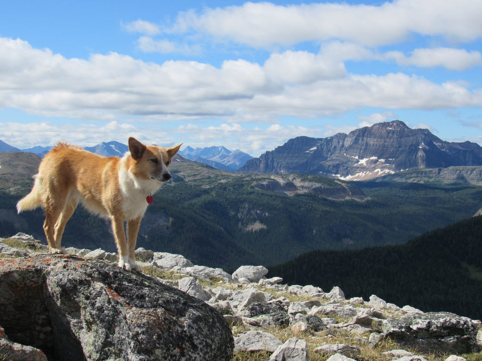
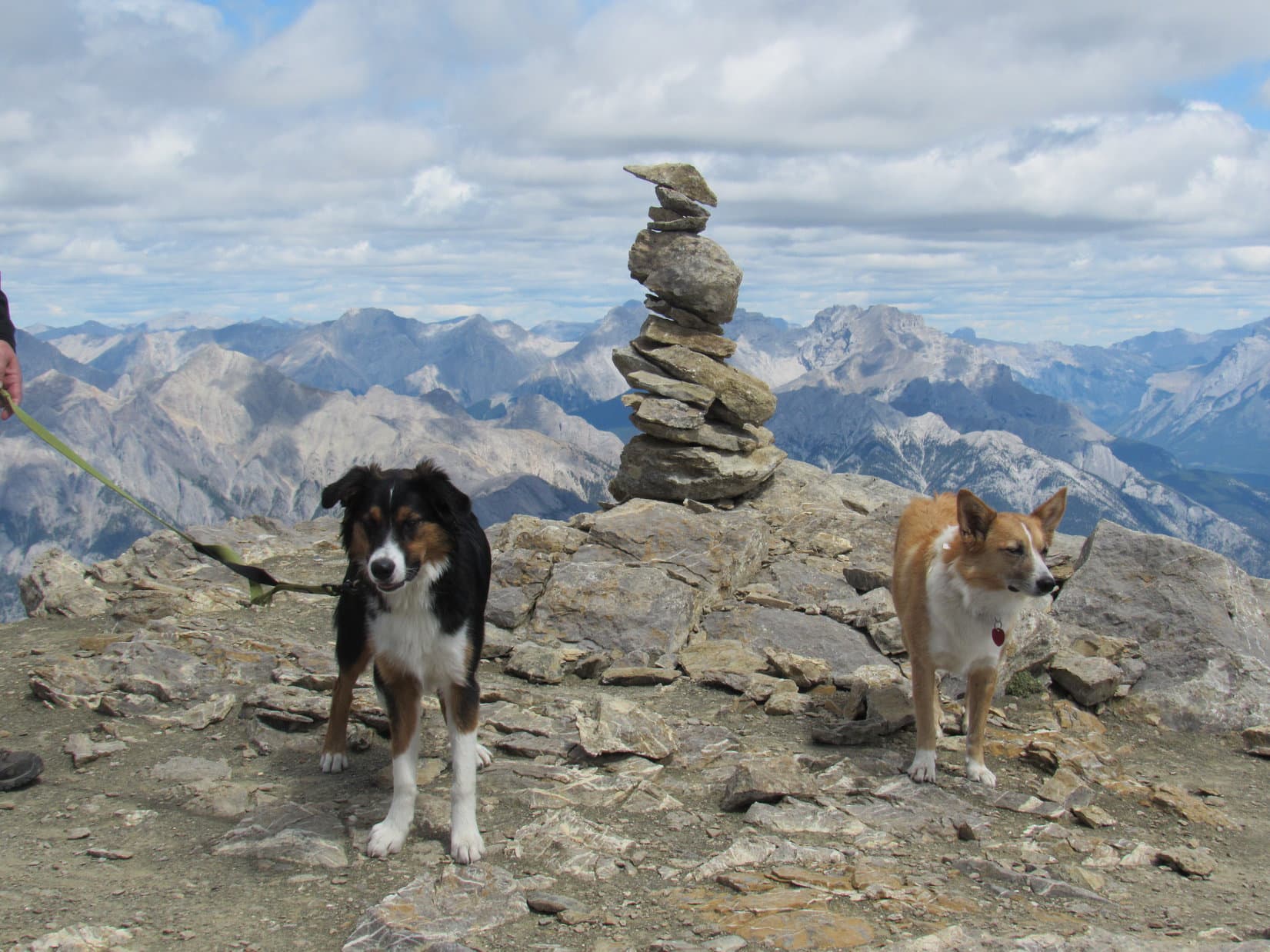
Lupe reached the summit of Mount Bourgeau.  A few people who had passed her on the way up, while she was checking out Bourgeau Lake or waiting for SPHP along the trail, were already at the top of the mountain.  More people kept arriving every 5 minutes or so.  Soon there was quite a crowd near the summit cairn.  Fortunately, the overall summit area is quite large.  There was plenty of room for everyone.

Several hardy people arrived at the top of Mount Bourgeau wearing shorts.  They generally regretted their choice of attire.  The temperature was in the low 40’s °F with an often brisk SW breeze.

Lupe easily reached the summit of Mount Bourgeau. There were only a few people on top when she first arrived, but more started arriving every 5 minutes or so until there was a small crowd. Photo looks S.

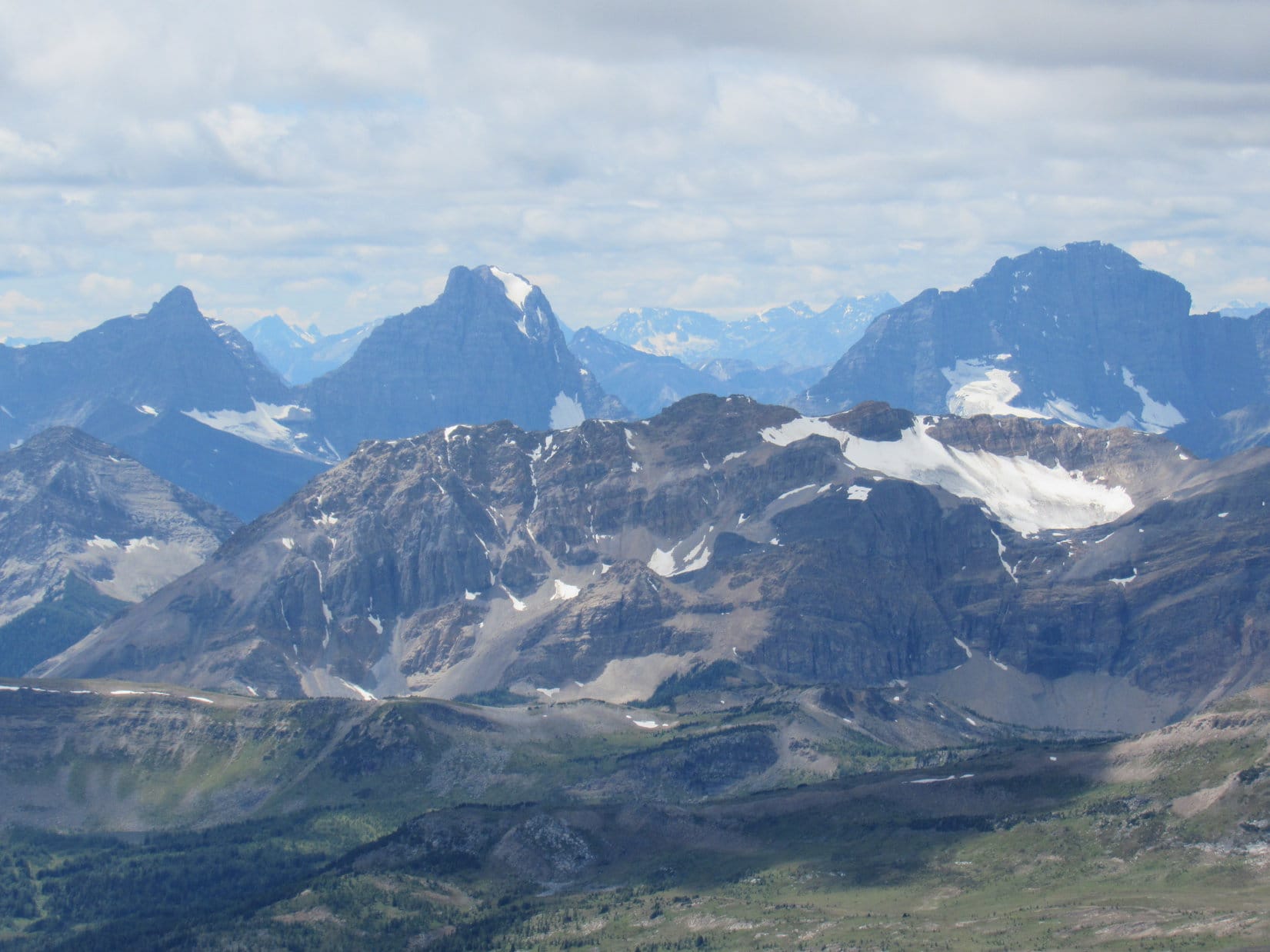
The views from Mount Bourgeau were spectacular.  Scenes of the Canadian Rockies like those from airline magazines were in every direction.  While everyone else was milling around near the summit cairn, Lupe and SPHP wandered around looking at the splendid views.

Looking NNW toward Mount Brett (9,790 ft.) (L) and Pilot Mountain (9,580 ft.) (L of Center).
Looking WNW. Just above Lupe's head, part of the small lake she passed by above the 2nd headwall can be seen far below.
Looking WNW. Just above Lupe’s head, part of the small lake she passed by above the 2nd headwall can be seen far below.
Looking SSE. Mt. Assiniboine is in the distance, still in the clouds, just R of Center. Part of the Sunshine Village area is seen in the forested area along the R side of this photo.

When the area near the summit cairn was briefly vacated by the crowd, Lupe went over to it for her official summit of Mount Bourgeau photo.

Lupe at the cairn in her official summit of Mount Bourgeau photo. Photo looks NE.

There were so many wonderful views from Mount Bourgeau, it was easy to just keep clicking away taking pictures.

View to the WNW using the telephoto lens.
The Egypt Lakes area. Photo looks WSW.
Looking ENE at Banff and the Bow River Valley.

Lupe and SPHP took a long break up on Mount Bourgeau.  Lupe was ready for Taste of the Wild and water.  SPHP had pudding and fruit cups.  During the break, SPHP kept hoping for a clear view of Mount Assiniboine, but the summit remained shrouded by clouds.

The top of Mt. Assiniboine (L of Center) remained stuck in the clouds. Photo looks S.

Lupe checked out the white shed at the top of Mount Bourgeau.  When Lupe had been here before on 7-22-14, there had been a couple of marmots living under this shed.  The marmots had done a great job keeping Lupe entertained.  Sadly, there was no sign of any marmots this time.

When Lupe was on Mount Bourgeau in July, 2014, she had been kept entertained by a couple of marmots living under this shed. Sadly, there was no trace of the marmots now. Photo looks S.

Lupe may have been disappointed that the marmots were gone, but she didn’t have time to get bored.  Plenty of people were paying attention to Lupe.  She was suddenly quite popular.  She got petted and loved and talked to by lots of kind strangers.  Lupe basked in the attention.

A couple of Chinese guys were among the first to pay attention to Lupe. The one who could speak English said he lived in Beijing!
The summit remained a busy place much of the time Lupe was on Mount Bourgeau.
A friendly girl wanted to pose with Lupe. She was part of a group from Europe who were here on a guided tour. Lupe was busy making friends from all over the world!

Not all of the friends Lupe made on Mount Bourgeau were human.  After Lupe had been at the summit for an hour or so, along came a dog named Marshall.  Lupe and Marshall had a good time wrestling.  When they got tired of that, they posed for a “canines only” photo at the summit cairn.

Lupe and Marshall go at it. They had a good time wrestling. Marshall was only 2 years old, but was bigger than Lupe. Of course, the rambunctious Carolina Dog had no problem holding her own against Marshall, though it was a spirited encounter.
Lupe and Marshall at the Mount Bourgeau summit cairn.

Lupe and SPHP remained on Mount Bourgeau for over 1.5 hours.  During that time, many people came and went.  Gradually the crowd began to thin out, although there were still occasional new arrivals.  Eventually, it was time to think about heading back down.  Lupe and SPHP took one last tour around the summit area.

Looking WNW. Parts of the trail Lupe would be taking back down are visible far below. One section leads down to the small lake, the other is on the scree slope below the lake near the lower R corner.
Looking W using the telephoto lens.
The view to the SSE.
Looking NE back up toward the top.
Looking N.
Looking N.

Finally, it was time for Lupe to say good-bye to Mount Bourgeau.  She would return by the same route she came up.  The scenery was just as fabulous the 2nd time around!

On the trail shortly after leaving the summit. Photo looks WNW.
Frolicking on a big snowbank.

On the way down to Harvey Pass, Lupe met two amazing young girls still hiking up with their parents.  They were less than 30 minutes away from the top of the mountain, a climb of over 4,900 feet of elevation gain from the trailhead.  Jasmine was just 8 years old.  Her sister, Angelica, was only 6.  They were both still climbing under their own power!  Angelica was quite taken with Lupe.

When Lupe reached Harvey Pass again, the weather was beautiful.  It was much warmer than up on top of Mount Bourgeau, and with hardly any wind.  Best of all, there was finally a clear view of Mount Assiniboine, too!  Lupe and SPHP dawdled for half an hour at Harvey Pass, enjoying the day and the glorious surroundings.

At Harvey Pass again on the way back to the G6. Lupe and SPHP hung out here enjoying the day for half an hour before continuing on. Photo looks NNW.
Mount Assiniboini was finally out of the clouds! Photo looks S from Harvey Pass using the telephoto lens.
Mount Assiniboine was finally out of the clouds! Photo looks S from Harvey Pass using the telephoto lens.
Looking NW from Harvey Pass down on the stream-fed pond.
Lupe at the N end of Harvey Pass with Mount Assiniboine in the distance. Photo looks S.
A final look at Mt. Assiniboini from Harvey Pass.

Lupe finally said good-bye to Harvey Pass, too.  The scenery continued to be wonderful all the way back down past Bourgeau Lake.  After that, Lupe entered the forest again, as the trail switchbacked down the first headwall.  The rest of the way back was a long, pleasant stroll downhill to the trailhead and the G6 (6:54 PM, 65°F).

A day in the Canadian Rockies at Mount Bourgeau is hard to beat, but Lupe’s Summer of 2016 Dingo Vacation was just getting going!

Looking back at the trail up to Harvey Pass. Photo looks SSE.
The small lake above the 2nd headwall. Photo looks E.
Bourgeau Lake as seen while coming down the 2nd headwall. The NW face of Mount Bourgeau towers above the lake. Photo looks ESE.

Note:  The Mount Bourgeau trailhead is located on the SW (Eastbound) side of Trans-Canada Hwy No. 1.  It is perhaps a 10 minute drive W of the town of Banff.  For westbound traffic there is a sign for Mount Bourgeau (or Bourgeau Lake?) along Hwy 1 a little past the exit to Sunshine Meadows.  The left turn to the TH is 2 km past the sign.  (Watch for eastbound traffic after crossing the forested median.)  There is no sign at the actual turning point.  The TH is very close to Hwy 1, but hidden in the forest.

Links:

Next Adventure                           Prior Adventure

Want more Lupe adventures?  Choose from Lupe’s 2016 Canadian Rockies, Yukon & Alaska Adventure Index,  Dingo Vacations Adventure Index or Master Adventure Index.  Or subscribe free to new Lupe adventures.

Porphyry Peak (7-30-16) & King’s Hill (7-31-16), Montana

Days 1 & 2 of Lupe’s Summer of 2016 Dingo Vacation

Lupe was happy, oh so happy!  Loopster, it’s going to be a while yet, I need to finish loading everything in the G6.  You will be in the car all day.  Why don’t you come out, and run around a bit before we go?

Nothing doing!  Lupe knew good things were about to happen.  She had already jumped up into the G6 onto her comfy spot where she would be riding shotgun.  She wasn’t about to get out of the car and risk being left behind.  This Carolina Dog wasn’t taking any chances on missing out on her Summer of 2016 Dingo Vacation, which SPHP kept telling her would be the best ever!

I'm staying right here, SPHP! Hurry and finish loading up. I can't wait for my Summer of 2016 Dingo Vacation to begin! You've told me this is going to be the best one ever. Where are we going? Squirrel Mountain, I hope!
I’m staying right here, SPHP! Hurry and finish loading up. I can’t wait for my Summer of 2016 Dingo Vacation to begin! You’ve told me this is going to be the best one ever. Where are we going? Squirrel Mountain, I hope!

At 10:06 AM, SPHP backed the G6 out of the driveway.  Lupe was on her way!

It was a very long way to where Lupe was going.  Most of today and tomorrow would be spent traveling.  Lupe didn’t mind.  She loves riding, looking out the window, and sniffing the air.  Mostly she watches for animals to bark at.  She was going to see plenty of them in the next two days.  Cows, horses, and occasionally sheep, deer or pronghorn antelope.

Lupe’s very satisfying barking frenzy began long before her Black Hills of South Dakota disappeared in the rear view mirror.  It continued for hours across the high rolling plains and pine-covered ridges of SE Montana.  W of Lame Deer, Montana the temperature hit 100°F.  By then, Lupe was barking in air-conditioned comfort.

The miles rolled by.  It was an easy, relaxing drive on lightly traveled highways.  SPHP grinned at Lupe.  You know, Loop, things might never get any better than they are right now.  We are free as birds, and have your whole Dingo Vacation ahead of us!

Well, actually they could be a little better, SPHP!

What do you mean?

Did you bring any water?  My barker is dry!

Oh, sorry!  So, you’re one parched puppy, aye?  Small wonder.  Hang on a sec.  Here you go.  Lupe slurped up an entire bowl of water and requested a refill, which she also drained in short order.  Better?

Much!  Thank you!  Lupe returned to vigilance.  More cows could appear at any moment.  If not, haystacks, barns or suspicious-looking outbuildings would do, too.  The G6 was a noisy place.

At 6:30 PM, SPHP parked the G6 at King’s Hill Pass on Hwy 89 in the Little Belt Mountains of central Montana.  That’s enough driving for today, Loop.  We’ll stay here tonight.  Remember this place?  You were here a couple of years ago.  How about climbing Porphyry Peak (8,192 ft.) again to stretch our legs?

By now, Lupe was very ready to get out of the G6, eager to go exploring for a while.  A dirt road left King’s Hill Pass heading W for Porphyry Peak.  It wound around a bit, but went all the way to the summit.  By the time Lupe reached the ranger tower on top of the mountain, she had gone at least 1.5 miles along the road, and gained nearly 800 feet of elevation.

No one else seemed to be around.

Lupe near the base of the ranger tower on Porphyry Peak.
Photo looks ESE.

Without climbing the ranger tower, the best views from Porphyry Peak are from the E end of the large, flat summit area over by the Showdown ski resort facilities.  Lupe and SPHP headed over there for a look.

Big Baldy Mountain (9,177 ft.) (L) and Yogo Peak (8,801 ft.) (R) from Porphyry Peak. Photo looks NE.
SPHP believes this is Big Baldy Mountain, the highest peak of the Little Belt Mountain Range in Montana. Photo looks NE using the telephoto lens.
Lupe was a little nervous up on the Showdown ski resort chairlift on Porphyry Peak. She wasn't ready to take up skiing yet, which was just as well, since there wasn't any snow at the end of July.
Lupe was a little nervous up on the Showdown ski resort chairlift on Porphyry Peak. She wasn’t ready to take up skiing yet, which was just as well, since there wasn’t any snow at the end of July.

After taking a look at the views from the Showdown ski area, Lupe and SPHP wandered back over toward the ranger tower again.  The hatch door to the observation deck at the top was closed, but Lupe could still go partway up to check out the views.  SPHP started up the stairs.  Lupe came along behind, but she wasn’t so sure this was a good idea.

Upon returning to the ranger tower, SPHP noticed this Porphyry Peak benchmark nearby. Photo looks, uh, down.
Although Lupe is used to climbing mountains, the ranger tower seemed somewhat scary. She was rather reluctant going up the stairs due to the unprotected openings between them.

Even from only partway up the ranger tower, it was possible to see mountains to the W that weren’t visible from ground level due to the forest.  SPHP thought it might be nice to get a sunset photo from up here, but the sun wasn’t going to set for a while yet.

It had turned out that Lupe and SPHP weren’t alone on Porphyry Peak.  Over by the Showdown ski area there had been a parked vehicle.  Someone had been busy rearranging gear in it.  Lupe and SPHP had time to go over there to see who it was, which is how Lupe met Cooper from Sacramento, CA.

Lupe with Cooper from Sacramento, CA at the Showdown ski resort. Cooper had recently graduated from high school and was off on long adventures of his own now.

Cooper had graduated from high school 2 months ago, and since then had been off exploring the American West on his own.  He had a beautiful camera and hopes of becoming a “digital nomad”, turning photography into a profession.

Cooper had another month of exploring ahead of him before flying to Hawaii to work on a farm for room and board for 3 months.  After that, he intended to find work on a ship.  Basically, he was taking a year off for various adventures before starting college.  Lupe and SPHP were both impressed.

By the time Lupe and SPHP had heard Cooper’s story, the sun was getting near the horizon.  Cooper also wanted to get some photos from the ranger tower.  Lupe, Cooper and SPHP all went over to the ranger tower together.  This time, Lupe felt braver.  She climbed a long way up the tower steps.

Lupe felt braver and climbed much higher up the steps of the Porphyry Peak ranger tower the 2nd time around.
Sunset from the Porphyry Peak ranger tower, 7-30-16.

After the sun sank below the horizon, Lupe and SPHP bid Cooper good-bye and good luck.  Lupe took a shortcut down one of the ski runs to get to the road back to King’s Hill Pass.  By the time she reached the G6, the light was fading.  Day 1 of her 2016 Dingo Vacation was over.  It had been a good, promising start.  Lupe had Alpo for dinner, then settled down on her soft perch for the night.

Early the next morning, Lupe was totally energized and ready for many more long hours of enthusiastic barking.  The sun wasn’t even up yet (5:33 AM).  Let’s climb King’s Hill before we leave, Loop.  You look ready for a romp!  Burning off a little of that American Dingo energy now wouldn’t hurt a thing.

No argument there!  A trek up King’s Hill (8,008 ft.) sounded like an even better way to start the day to Lupe than barking at cows.  She burst out of the G6 as soon as the door was open, and dashed into the woods.  On the prowl and sniffing excitedly, she wound around racing between the trees.

SPHP followed Lupe into the forest, and quickly came upon USFS Road No. 487, which headed S angling up the W slope of King’s Hill.  The road curved around to the E as it reached the open ground near the top of the hill.  At a 3-way intersection, Lupe and SPHP turned N on USFS Road No. 251 (Dry Wolf Road).

SPHP didn’t stay on the road much farther.  Lupe was running around up on the open ground leading to the summit.  A cool W wind was making things a bit chilly up here, but the sun would be up in minutes.  Lupe reached the summit of King’s Hill, marked by a survey benchmark near the N end, about the time the sun peeped up over the horizon.

Sunrise from King's Hill, 7-31-16.
Sunrise from King’s Hill, 7-31-16.
Lupe reached the summit of King's Hill just as the sun peeped up above the horizon. A chilly W breeze was blowing.
Lupe reached the summit of King’s Hill just as the sun peeped up above the horizon. A chilly W breeze was blowing.
The survey benchmark at the summit.
Porphyry Peak from King's Hill. The Showdown ski runs are in view. Photo looks W.
Porphyry Peak from King’s Hill. The Showdown ski runs are in view. Photo looks W.

It was going to be a beautiful day in the Little Belt Mountains, but Lupe couldn’t linger up on King’s Hill for very long.  She had many miles to go.  A power line goes NW back down to Hwy 89 from near the summit.  Lupe and SPHP took this steeper shortcut to return to the G6 (7:09 AM).

Lupe had many miles to go, so she couldn't stay up on King's Hill very long. She took this shortcut under the power line back down to King's Hill Pass and the G6. Photo looks NW.
Lupe had many miles to go, so she couldn’t stay up on King’s Hill very long. She took this shortcut under the power line back down to King’s Hill Pass and the G6. Photo looks NW.

As Lupe resumed her journey, there wasn’t too much for her to bark at for a little while.  The Little Belt Mountains were mostly forested, so there weren’t many cows or horses.

Hwy 89 lost elevation steadily for miles N of King’s Hill Pass.  When the highway was about out of the mountains, SPHP stopped at the Al Buck Memorial Park.  Time to let Lupe run off a little more steam!  Lupe was quick to take advantage of the opportunity.

Lupe visited Isaac Walton Spring where a tiny waterfall poured right out of the hill beside the park.  She waded in the cool water and had a nice drink.  She found a chipmunk to bark at in one of the trees in the park.  She went across Hwy 89, and took a look at scenic Belt Creek.

Lupe cools her paws off near the tiny waterfall created by Isaac Walton Spring at Al Buck Memorial Park along Hwy 89.
Belt Creek, MT. Photo looks SSW.

Lupe enjoyed a few more short breaks out of the G6 during the day, but once out of the mountains, Day 2 was mostly another Carolina Dog barkfest.  Shortly before noon, Lupe crossed the border into Canada.  Yesterday’s 100°F heat in Montana was long gone.  The high in Canada was only in the low 60’s °F.  The rest of Lupe’s summer was going to be cool and comfortable!

NW of Lethbridge, there were big clouds and scattered rainstorms, even a short stretch of small hail.  It had been nearly 2 years since Lupe was last in Canada, and it was good to be back.  Off to the W, the Canadian Rockies were beckoning Lupe to come and play!

By early evening, Lupe was entering the gorgeous Canadian Rockies.  She got to stop and take the Many Springs Trail in Bow Valley Provincial Park.  The Many Springs Trail was super easy, with little elevation change as it went around a big pond in a wetlands area that looked like prime wildlife habitat.

Lupe on a footbridge along the Many Springs Trail in Bow Valley Provincial Park, Alberta. The trail featured wetlands and views of Yamnuska (7,349 ft.).

Maybe there was dangerous wildlife out there!?  About 2/3 of the way around the pond, a boardwalk served as the trail where it went right along the edge of the pond.  Something spooked Lupe just as she reached the boardwalk.  She absolutely refused to go on the boardwalk to complete the loop.  The American Dingo insisted on going back the way she had come rather than set one paw on that frightening 6″ high boardwalk.

Oh, well.  That was fine.  Lupe and SPHP returned to the G6.  Exploring a couple of winding roads revealed a lovely picnic area along the Bow River.  Lupe wasn’t too hungry yet, but she sniffed around part of the time while SPHP dined.

The first long leg of Lupe’s journey was complete.  Lupe’s two day Barkfest was over.  Tomorrow Lupe would be climbing and playing in the spectacular Canadian Rockies.

Lupe along the Bow River in Bow Valley Provincial Park, Alberta, Canada.

Links:

Next Adventure

Want more Lupe adventures?  Choose from Lupe’s 2016 Canadian Rockies, Yukon & Alaska Adventure Index,  Dingo Vacations Adventure Index or Master Adventure Index.  Or subscribe free to New Lupe Adventures.