Black Hills, SD Expedition No. 193 – Seven Sisters Range High Point, Peak 4371 & Peak 4310 (2-27-17)

Good grief!  The temperature, already chilly enough back at home, was dropping instead of rising.  Maybe a Black Hills expedition today wasn’t such a great idea after all?  Lupe had been as enthusiastic as always, though.  Hopefully the morning would warm up as forecast.  This afternoon it was supposed to get a little above freezing, a heatwave compared to the 14°F the G6 was registering.

By the time Lupe was on East Cascade Mountain Road off Hwy 71 approaching the Seven Sisters Range High Point (4,420 ft.), the G6 said it was 20°F out.  Better, but still a crispy start.  SPHP parked the G6 just N of the junction with Big Buck Boulevard (7:49 AM).  A few minutes later, Lupe had permission to enter and inspect the private property to the E.

The Seven Sisters Range High Point is dead ahead. Photo looks E along East Cascade Mountain Road.

20 acres were for sale by owner E of Big Buck Boulevard.  The property was all barb wire fenced and had a small, partially finished cabin on it.  The acreage was tucked in a scenic spot at the base of the Seven Sisters Range High Point, and went partway up the mountainside.  Although some of the land was a bit steep and rocky, most of it was horse pasture.  The asking price was $100,000.

Lupe starts her inspection of the 20 acres for sale W of the Seven Sisters Range High Point. Photo looks ENE.

Two horses were supposedly on the property.  Lupe saw no sign of them, but did see horses in pastures to the N and S.  Cows at a cattle operation W of Big Buck Boulevard were mooing loudly.  The property had an ambiance that an American Dingo could certainly appreciate!  Lupe went to sniff around the little cabin.  She got up on the deck that faced N toward the best view.

The cabin was 7 years old, but only partially completed.  No heat, no power and no water.  Kind of a Spartan existence.  Lupe couldn’t go inside, and it didn’t take her long to complete her outside inspection.  She left the cabin to head up the mountain for an even better look at the view.

After inspecting the rustic cabin, Lupe climbed higher up on the 20 acres for a better look at the views. Lupe knew people looking for horse property in the Black Hills. Maybe she could earn a finder’s fee? She was disappointed when SPHP explained that she lacked the necessary real estate license. Photo looks W.

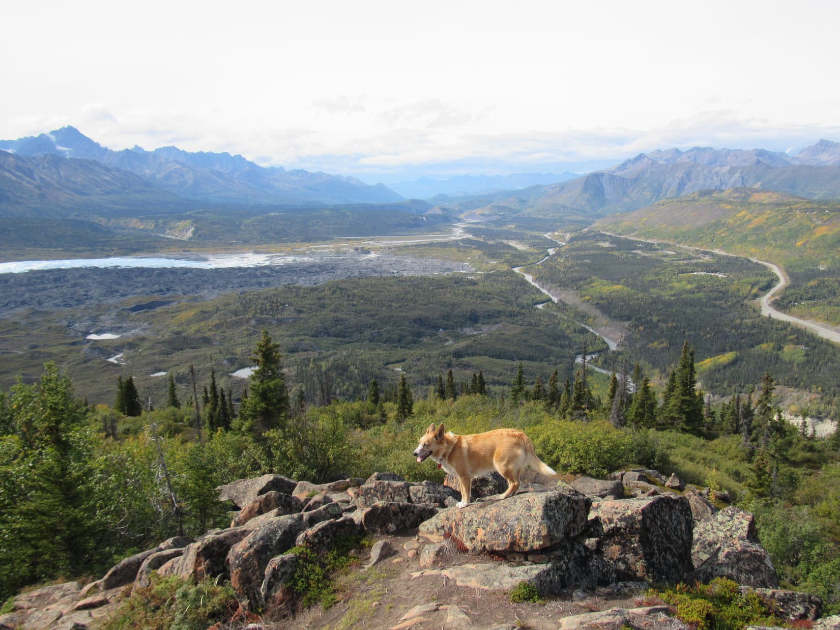
Lupe kept climbing.  The higher she went, the better the views were.

A wintery view from the upper W slopes of the Seven Sisters Range High Point. Peak 4371 is seen on the L. Photo looks SSW.

Lupe reached the top of the W face of the mountain near the N end.  For the most part, trees hid the views.  Lupe could no longer see the little cabin, but managed to find a few gaps between the trees from which she could see off into the distance.

Looper at the N end of the W face of the mountain. Photo looks WSW.
Looking N.

The mountain’s true summit was clearly farther S, somewhere close to the edge of the W face.  Loopster led the way S to go look for it.

The high point is this way, SPHP! Come on! Photo looks SSE.

Winter had made a comeback in the past week.  It certainly felt like February again!  When Lupe came to a small snow-free patch of ground before even reaching the high point, SPHP called a halt.  Time to warm up!  Lupe huddled inside SPHP’s jacket.  She was shivering a little.  SPHP took off a shoe to warm up a foot.

After a few minutes resting quietly, Lupe tensed up.  Off to the NE, a herd of deer was running through the snow.  Although quite a distance away, the deer were of keen interest to the Carolina Dog.  Lupe watched excitedly until the last deer disappeared into the forest.

When Lupe quit shivering and SPHP’s foot had warmed up, it was time to carry on.  The high point couldn’t be much farther.

Lupe stands next to the little bare patch of ground where she stopped to warm up inside SPHP’s jacket. She’d enjoyed watching a herd of deer running through the snow in the thinly treed area down the slope seen behind her. Photo looks NE.
Lupe stands at a viewpoint only 20 feet from where she’d warmed up at the bare patch of ground. Peak 4371 is the closest big ridge on the L. Photo looks SSW.

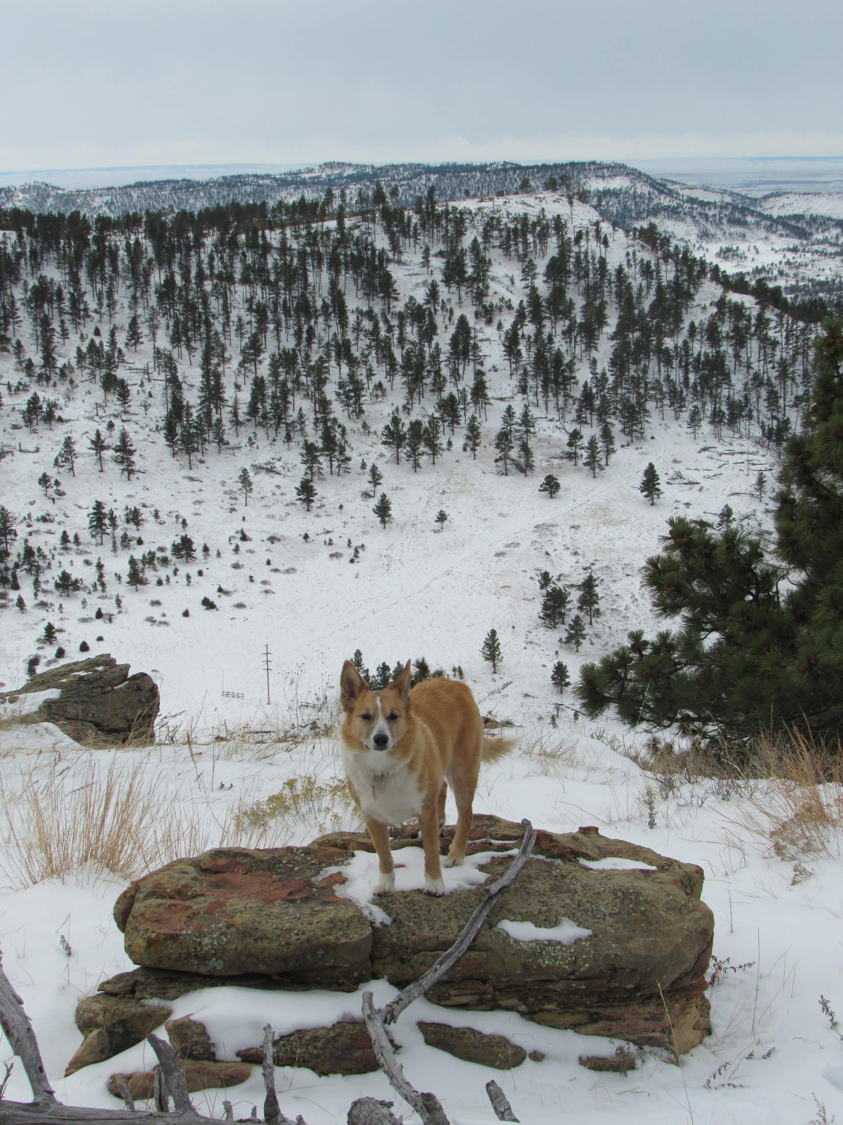
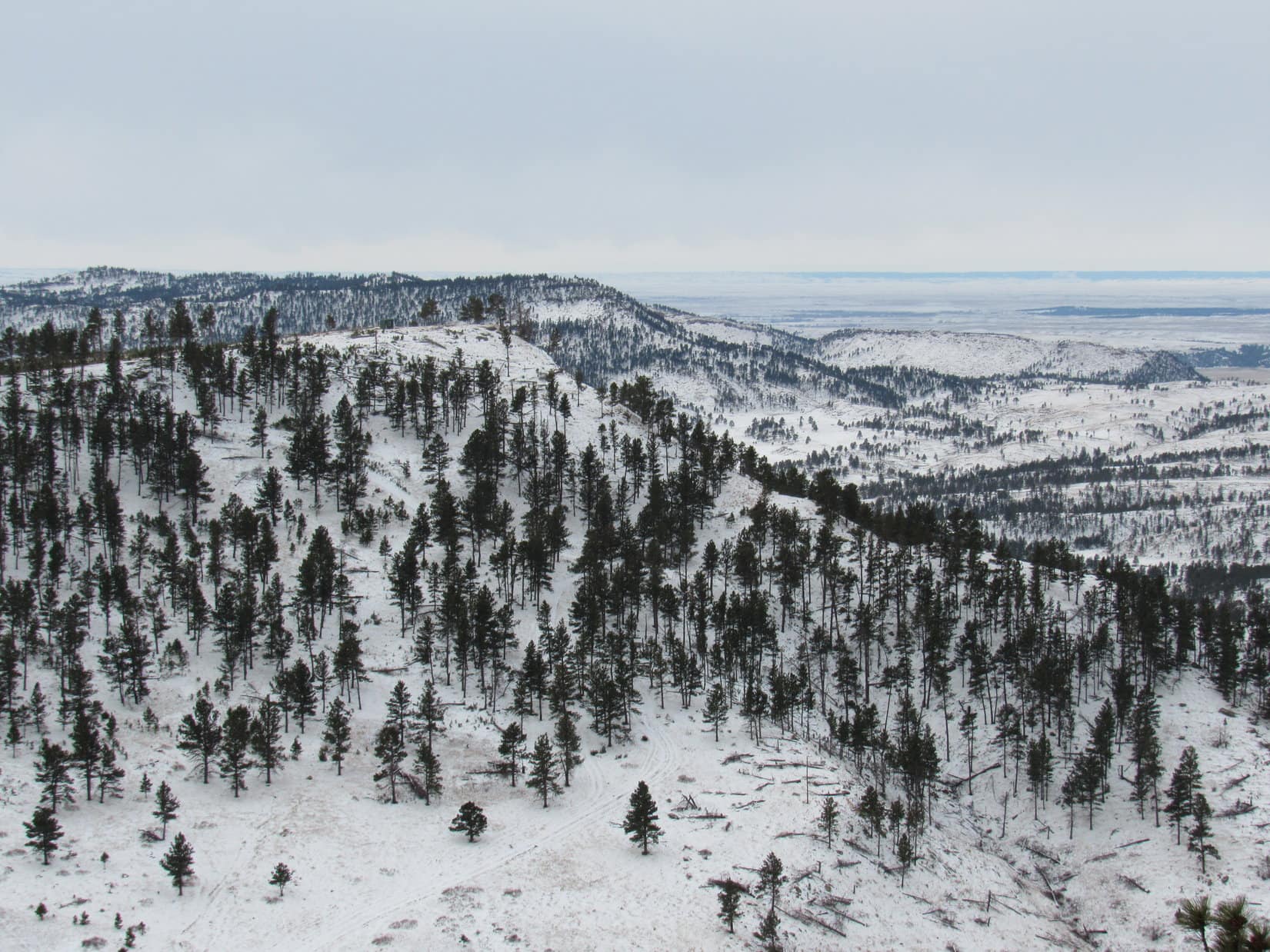
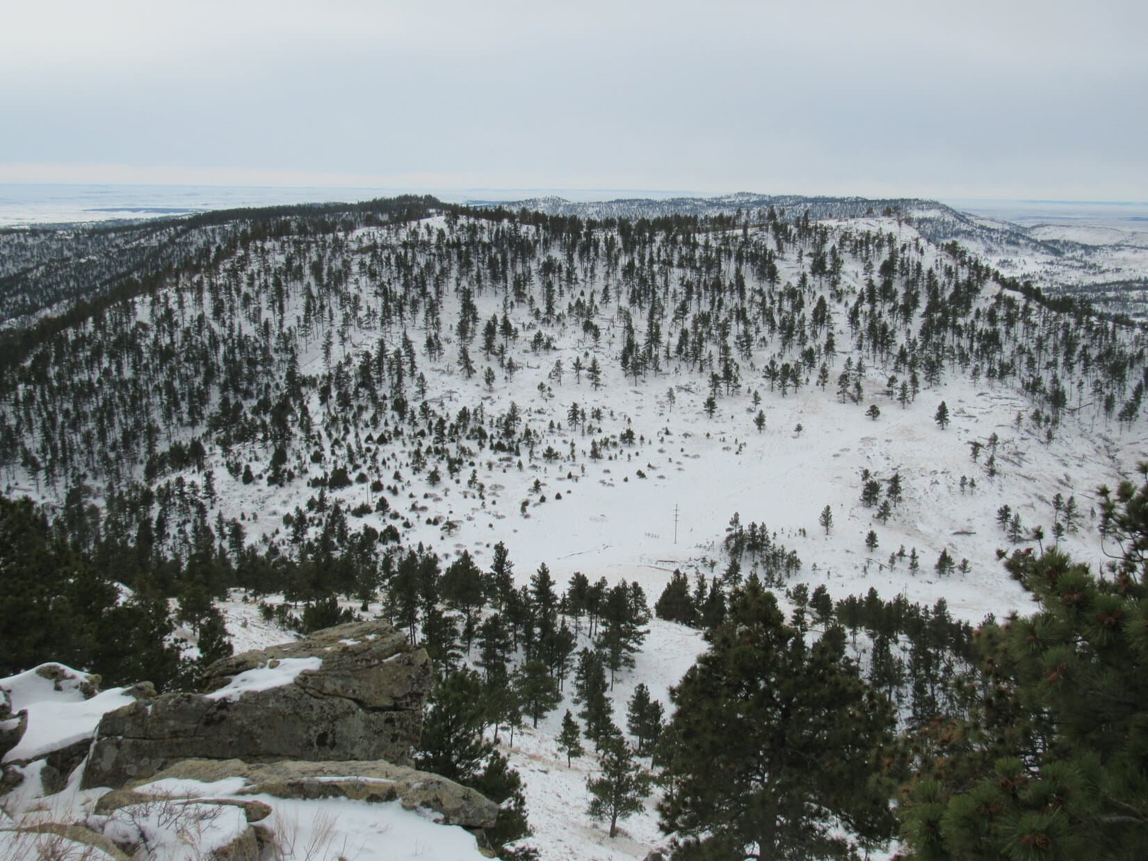
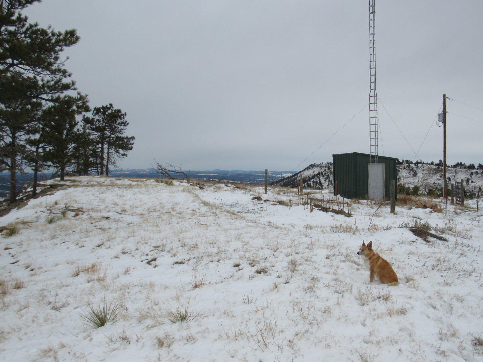
The Seven Sisters Range High Point (4,420 ft.) wasn’t far from where Lupe had warmed up.  The summit area turned out to be quite large, 200 – 300 feet long N/S and not quite as wide E/W.  The whole area was thinly forested.  The terrain was so flat it was hard to discern any definite exact highest spot among the snow drifts.

The best views were along the edge of the steep W face of the mountain, though the ground seemed slightly higher a little farther E.   Lupe toured the summit area hoping to find a squirrel in one of the trees, but it was so cold out any squirrels must have been curled up in their holes and wrapped in their bushy tails for warmth.

Lupe reaches the Seven Sisters Range High Point. The summit area was large, thinly forested and quite flat. Photo looks SSW toward Peak 4371.
Looking WNW from along the W rim of the summit area.
Lupe stands at what seemed to be the true summit of the Seven Sisters Range, although there was a lot of ground around very nearly as high. Photo looks WSW.

Disappointed by the lack of squirrels, Lupe continued S near the W rim of the mountain.  Grand open vistas were on display to the SW.  Under the overcast sky, the snow made the scene look clean and white, remote and desolate.  What a great place to be!  Off to the E, South Knapple Canyon was in view.

Looking E down South Knapple Canyon. The high prairies of western South Dakota are seen beyond the edge of the Black Hills.

When Lupe got to the area near High Point 4360 on the Peakbagger.com topo map, she had a clear view of her next peakbagging objective, Peak 4371, ahead.

When Lupe reached the area near High Point 4360 toward the S end of the Seven Sisters Range High Point, she had a clear view of Peak 4371 ahead. Photo looks SW.
Looking back toward the summit of the Seven Sisters Range from near High Point 4360. The sky was dark off to the NW (L) where a snow shower was going on. Photo looks N.

Beyond High Point 4360, the ridgeline turned SE.  Soon Lupe could see far below a snowy pass she would have to traverse to get to Peak 4371.

SE of High Point 4360, Lupe came to this overlook where she could see the snowy pass leading to Peak 4371.

As Lupe continued SE, she discovered a snow-covered road.  The road descended gradually at first, but became steep, rocky, and soft as it made a sharp turn down to the pass.  Following the road made it much easier for Lupe to get down to the pass than it would have been otherwise.

The road did not continue up Peak 4371.  Upon reaching the pass, Lupe left it.  She enjoyed a snowy romp over to the base of Peak 4371’s NE ridge.  The NE ridge was the steepest part of the climb up the mountain, but wasn’t bad at all.  When Lupe was halfway up, the ridgeline turned W gaining elevation at an easier pace.

Peak 4371 had looked fairly heavily forested from a distance.  SPHP wasn’t certain if Lupe would find any clear views from the top.  On her way up the W ridge, Looper agreed to pose for a photo at nice viewpoint, just in case the summit was buried in trees.

The Seven Sisters Range High Point from the NE ridge of Peak 4371. Photo looks N.
Lupe on her way up Peak 4371. She is on the upper E ridge here, with a great view of the Seven Sisters Range High Point to the NNE.

Lupe didn’t reach the summit of Peak 4371 until she made it all the way to the far W end of the mountain.  The summit area here was much smaller than at the Seven Sisters Range High Point, though there was still plenty of room to move around.  The whole area sloped moderately down toward the E.  A rock very close to the W edge of the mountain was clearly the true summit.

Success! Lupe stands on the rock that’s the true summit of Peak 4371. Photo looks SW.
Lupe still perched on Peak 4371’s summit rock. This photo shows a little wider view of part of the summit area. Peak 4310 is the next snowy ridge seen on the L. Lupe was going there next! Photo looks SSW.

Trees were at the summit of Peak 4371, but the top of the mountain wasn’t buried in them as SPHP had feared.  Views could be seen in most directions, although Lupe often had to move around a bit to get a clear look.  The whole summit area was only 50 or 60 feet in diameter, so it didn’t take Lupe long to explore it.

Loopster on another rock along the W rim of Peak 4371. Photo looks NW.

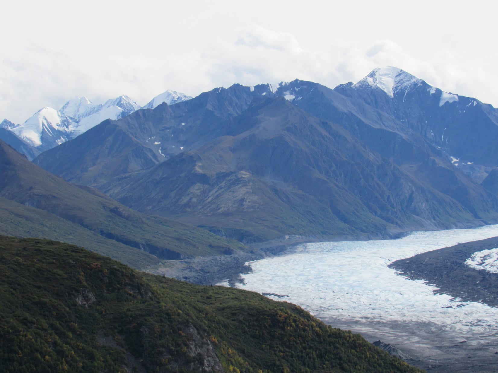
The best view from Peak 4371 was a sweeping panorama to the SSW.  Lupe was fortunate to be here on a day when the white snow made the scene particularly beautiful.  Lupe could see her next peakbagging objective, Peak 4310, plus a couple other peaks of interest.

Peak 4310, the nearest snowy ridge and Lupe’s next peakbagging objective, was in clear view from Peak 4371. Photo looks SSW.
Lupe was fortunate to be on Peak 4371 on a day when the snow made the scene so beautiful and grand! Snowy Peak 4310 (L) is in view close by. The highest point in the distance on the far L is Flagpole Mountain (4,320 ft.). The most distant of the low ridges in the foreground on the R may be part of Devil’s Slide Mountain (3,965 ft.). Photo looks SSW using the telephoto lens.
A wider look at Peak 4310 nearby. To get there, Lupe would have to go all the way down to the big treeless patch of snow seen at Center below. From this pass, she could follow a road going first SW (R) then SE (L) up the mountain. Photo looks S.

Lupe left the summit of Peak 4371 following the SE ridge.  She was losing elevation steadily, but it was soon apparent that she was going to have to lose it even faster.  Below to the S, she could see the wide pass leading to Peak 4310.  The slope leading down to it was rather steep.

This time there wasn’t any road to follow.  Lupe started directly down the steep S slope.  She had barely left Peak 4371’s SE ridgeline, however, when suddenly Lupe wanted to stop.  Exactly why wasn’t clear.  Nevertheless, only 10 or 12 feet below the edge of the ridge, Lupe and SPHP stopped to rest on a small rock ledge.

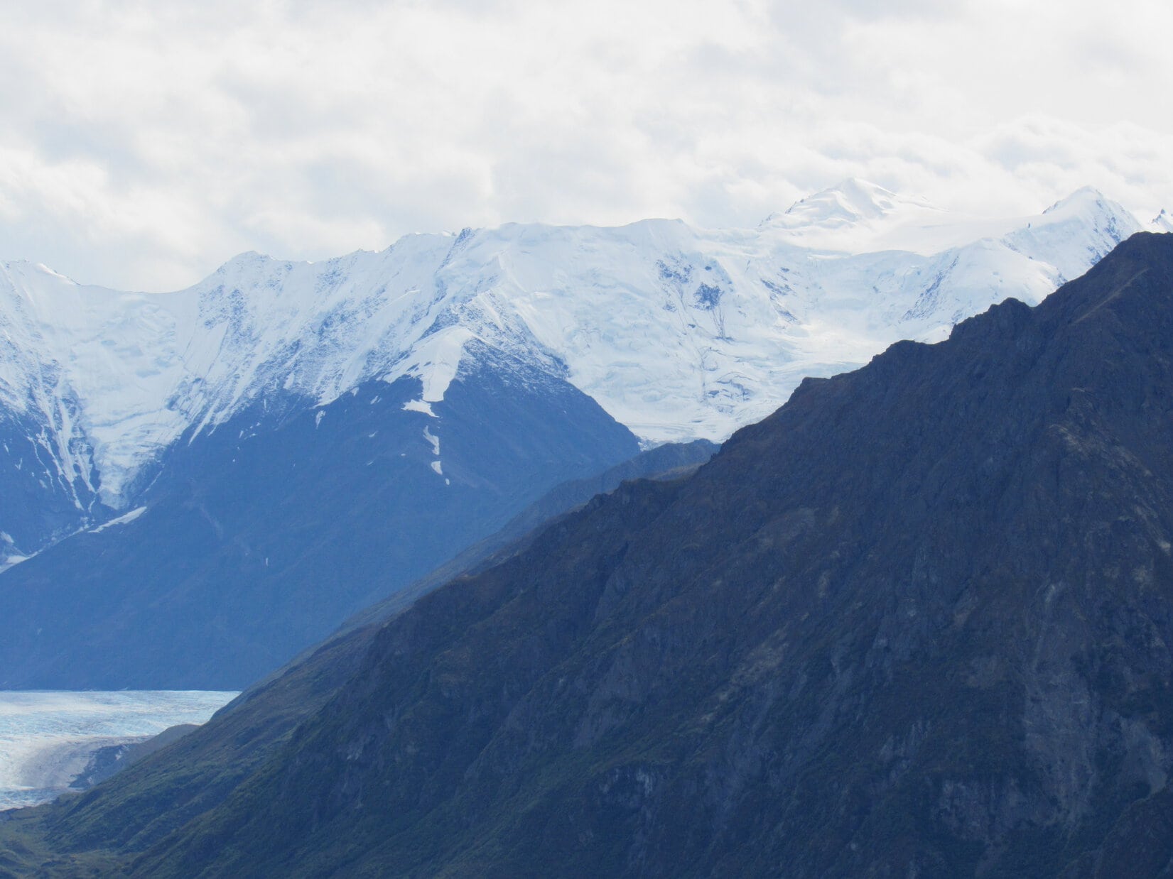
Even though it had warmed up enough to be helpful by now, SPHP let Lupe huddle inside the jacket.  She wasn’t shivering, though, like last time.  Maybe she had stepped on a cactus under the snow?  Maybe she had heard something that had made her nervous?  Her reason for wanting to stop wasn’t clear, but Lupe seemed happy resting right here.  At least the view of Peak 4310 was splendid.

Lupe on the little rock ledge she wanted to stop at for a while on the upper S slope of Peak 4371. The view of Peak 4310 to the SSW was splendid from here.

Another idea.  Maybe Lupe was hungry?  She was!  She devoured an entire bowl of Taste of the Wild.  The poor Carolina Dog was famished!  Climbing two mountains already had built up an appetite.

While Lupe was crunching happily away, SPHP noticed what appeared to be a structure near the W end of Peak 4310 where the true summit was supposed to be.  A house or some sort of outbuilding?  A tower was in view near it, too.  Using the camera’s telephoto lens, SPHP saw that the structure was a shed of some sort, not a home.  A road could also be seen winding up the NW side of the mountain to reach a high saddle E of the true summit.

Even after dining, Lupe was perfectly content right where she was.  However, it was time to press on.  Puppy, ho!  Picking a way down the steep, snowy slope took a while, but Lupe made it down to the pass.  From the pass, she took the road up to the high saddle in the middle of Peak 4310.  On the other side of the saddle, off to the SE, was another surprise.  A rather nice cabin was situated in a wooded area.

Peak 4310 has two high points at opposite ends of the mountain.  The true summit is to the W.  Slightly lower High Point 4304 is to the E.  Lupe went to check out High Point 4304 first, passing to the N of the hidden cabin.

At High Point 4304, Lupe found a large rock.  From it, she had a great view to the SE down Red Canyon.  She could see Angostura Reservoir, the largest lake in the Black Hills region.  The lake is formed by a dam on the Cheyenne River.

Lupe on the big rock at the top of High Point 4304. Photo looks SE down Red Canyon toward frozen Angostura Reservoir.
Another look at Angostura Reservoir using the telephoto lens. Photo looks SE.

The view toward Angostura Reservoir was the best, but Loop could also see Flagpole Mountain (4,320 ft.) to the S.

Flagpole Mountain is the distant high point straight up from Lupe’s head. Photo looks S.

Having seen what there was to see from High Point 4304, Lupe headed W to visit the true summit of Peak 4310.  She passed by the hidden cabin again.

Lupe passed to the N of this rather nice cabin on Peak 4310 both on her way to and back from High Point 4304. Photo looks SW using the telephoto lens.

Although Peak 4310 was the lowest hill Lupe climbed on Expedition No. 193, the true summit was the most barren and open here.  Consequently, the views were amazing!  The summit area was larger than Peak 4371’s, but smaller than at the Seven Sisters Range High Point.

Although Peak 4310 was the lowest of all the peaks Lupe climbed on Expedition No. 193, the views were simply amazing. A beautifully wintery look at Sheps Canyon is seen here. The high point in the distance L of Center is Flagpole Mountain (4,320 ft.). Photo looks S.
This photo shows much of the summit area at the W end of Peak 4310. Lupe found the highest rock on the mountain near the trees on the L. Photo looks N.
Another look at Angostura, this time from the W end of Peak 4310. Photo looks SE.
The great view to the WNW.

With fantastic views in practically every direction, Lupe and SPHP lingered on top of Peak 4310 longer than anywhere else.  A medium-sized flat rock was at the true summit of the mountain.  Lupe and SPHP sat here for a while admiring the wintery scenes all around.  SPHP ate an apple.  Lupe sat contently on SPHP’s lap, enjoying being petted and adored.

Lupe stands on the flat rock at the true summit of Peak 4310. For a minor Black Hills peak, the views were outstanding! Photo looks WSW.
At the N end of the summit area, Lupe had this fabulous view back to the N. Peaks 4371 and the Seven Sisters Range High Point are seen on the R.
Looking NW.

Upon reaching Peak 4310, Lupe had achieved all of her primary peakbagging goals for Black Hills, SD Expedition No. 193.  Yet the position of the sun, seen dimly through the clouds, indicated it was only mid-day.  Lupe had a few secondary goals in the general area.  Maybe she still had time to climb another peak, if she got back to the G6 soon enough?

After the apple was gone, Lupe and SPHP spent an extra 10 minutes on Peak 4310, simply wandering around looking at all the splendid views again.  Before departing, Lupe returned to the rock at the true summit.  It was a little sad to be leaving such a great place.

Before departing, Lupe returned to the rock at the true summit of Peak 4310. Photo looks SE.

To return to the G6, Lupe had to retrace her entire route.  She took the road from the high saddle on Peak 4310 all the way back down to the pass leading to Peak 4371.  She climbed Peak 4371’s steep S slope, passing by her prior rest stop at the little rock ledge just below the SE ridgeline.  Here she turned for one last look at Peak 4310.  It was as beautiful as a Christmas card.

Looking back at Peak 4310 for a final time, it was as beautiful as a Christmas card. Photo looks SSW.

Since it was on her way, Lupe tagged the rock at the true summit of Peak 4371 again.  Then she went back down the E ridge along the N side of the mountain.  Where the E ridge angled NE, the Carolina Dog climbed up on a big rock outcropping for yet another look around.

Lupe returns to the rock at the true summit of Peak 4371 to complete her 2nd ascent of the mountain on Expedition No. 193. Photo looks NW.
Partway down the E ridge of Peak 4371, Lupe got up on this big rock formation. From here, the ridge turns NE and drops more steeply down to the pass leading to the Seven Sisters Range High Point. Photo looks SE.
This American Dingo can be encountered almost anywhere in the Black Hills of South Dakota. No need to exercise any special caution, however. Dingoes are wary, but extraordinarily friendly once you get to know them.

As Lupe continued down the NE ridge to the next pass, the sun made its best effort of the day to break through the clouds.  Patches of blue sky began appearing.  The day felt warmer.  Snow softened and began to melt.

As Lupe came down Peak 4371’s NE ridge, patches of blue sky appeared. As the sun tried to break through the clouds, it became noticeably warmer out. Photo looks N toward the Seven Sisters Range High Point.

Down at the pass, Lupe got back on the road leading up to the Seven Sisters Range High Point.  Approaching High Point 4360 again, she saw another herd of deer up there.  The Carolina Dog raced off to investigate, perhaps with the intention of procuring dinner, but the deer had a huge head start on her.  They were long gone well before she reached High Point 4360.

As far as Lupe was concerned, it was still an exhilarating experience!

Lupe comes running back from High Point 4360. No venison for dinner, not even close, but it had still been a fun romp. Hope springs eternal in a Carolina Dog’s heart!

SPHP went back up to High Point 4360 with Lupe to see where the deer had been.  No telling if this had been the same herd Lupe saw early in the day when she stopped at the snow-free spot to warm up.  Probably not, since this was the opposite S end of the mountain, and those deer had been heading N.

Back to the road.  Lupe didn’t have much farther to go to reach the Seven Sisters Range High Point again.

Approaching the Seven Sisters Range High Point. This time coming from the SSE.

Lupe had to leave the road to return to the Seven Sisters Range High Point summit.  Another mountain successfully ascended for a 2nd time today!

This time, Lupe didn’t linger very long.  She already knew there weren’t any squirrels to be found here!  She continued N along the scenic W rim of the mountain.

The sunshine hadn’t lasted long. By the time Lupe made it back up to the summit of the Seven Sisters Range, the sky was overcast again. Photo looks W from the W rim of the mountain.

Lupe went all the way back to the N end of the mountain for a final look at the view there.  Then she started down the W slope where she had originally come up early in the day.  SPHP took a long time to picking a way down the steep slope, but Lupe eventually arrived back at the rustic cabin and 20 acres for sale (2:04 PM, 35°F).

With 3.5 hours left before sunset, it seemed like Lupe ought to be able to climb another peak today.  However, the G6 fell just short of making it up a long snowy slope on West Cascade Mountain Road.  SPHP wasn’t even certain this was the way to Peak 4340, so decided to forget this one until the snow was gone.  Miles farther N, the road to Peak 4160 was a muddy, sloppy mess.

So that was it.  No more peaks.  Expedition No. 193 was over.  Oh, well!  Lupe didn’t care.  She had a wonderful time barking at cows and horses all the way home.  SPHP didn’t really care either.  What a wonderful day it had already been, roaming the Seven Sisters Range with the plucky Carolina Dog, exploring an unexpectedly gorgeous part of Lupe’s world!

At the N end of the W rim of the Seven Sisters Range High Point, Lupe’s last stop before heading down to the G6. Photo looks WSW.

Links:

Next Black Hills Expedition                  Prior Black Hills Expedition

Want more Lupe adventures?  Choose from Lupe’s Black Hills Expeditions Adventure Index or Master Adventure Index.  Or subscribe free to new Lupe Adventures.

Lion Head & the Matanuska Glacier, Chugach Range, Alaska (8-24-16)

Day 26 of Lupe’s Summer of 2016 Dingo Vacation to the Canadian Rockies, Yukon & Alaska

For once it wasn’t raining when Lupe woke up.  However, evidence some moisture had been received overnight was present S of the Glenn Highway (Alaska Route 1).  The highest peaks of the Chugach Range had a light dusting of new snow.

Finally, a day without rain! Some moisture had been received overnight, though. The highest peaks of the Chugach Range S of the Glenn Highway had a dusting of new snow. Photo looks SW from the Gunsight Mountain TH.
New snow on the Chugach Range.

No rain was good news!  Lupe could climb Lion Head today, famous for its fabulous views of the Matanuska Glacier.  The trail up Lion Head is short, but steep, gaining over 1,000 feet of elevation in less than a mile.  The climb wouldn’t take Lupe very long.  She had plenty of time for a leisurely breakfast.  Beef stew was on the menu.  Carolina Dogs love beef stew!

Lupe had a pleasant surprise when Luke Hall, the Australian whom she had met at the top of Gunsight Mountain (6,441 ft.) yesterday, dropped by for a visit.  Luke showed Lupe and SPHP his gray Chevy van that has served as both transportation and base camp on his extended adventures in Canada and Alaska over the past 3 years.

Luke and SPHP chatted about past adventures and plans for the day.  SPHP told Luke about Lupe’s intention to visit Lion Head to see the Matanuska Glacier.  Luke said he was heading for Long Lake.  After a good visit, Luke bid Lupe and SPHP farewell, and was off.

With the American Dingo contentedly full of beef stew, SPHP drove over to the S side of the Glen Highway, taking the Alascom Access Road leading to the Knob Lakes.  The intention wasn’t to go all the way to the lakes, only far enough to get a good view from a distance of Gunsight Mountain.

Gunsight Mountain, a really fun climb Lupe had made the day before. Lupe’s route up had been along the easy NE ridge seen on the R. Photo looks W from the Alascom Access Road leading to the Knob Lakes.

After a good look at Gunsight Mountain from the E, Lupe and SPHP returned to the Glenn Highway and headed W.  The turn onto the short Lion Head access road at milepost 106 was only 12 miles away.  On the approach, Lupe had a fantastic view of Lion Head (3,185 ft.) from the highway.

Lion Head is the distinctive rocky prominence seen at Center. Nearby peaks of the Chugach Range tower above it. Photo looks SW along the Glenn Highway (Alaska Route 1).

SPHP parked the G6 along the Lion Head access road.  Half a dozen other vehicles were around, all parked before the gate across the road.  Yesterday the gate had been closed, but today it was standing wide open.

Within a few minutes of Lupe’s arrival, Luke Hall appeared again!  He was already on his way back from climbing Lion Head.  He pronounced the climb a lot of bang for one’s hiking buck.  The views of the Matanuska Glacier were fantastic!  After a brief conversation, Luke was on his way to Long Lake.

Lupe and SPHP left the G6 (1:19 PM, 63°F) taking the access road through the open gate.  The road started out going SW, but almost immediately started curving around to the E, where a trail left it going S.  There was no sign, but the trail had to be the one going up Lion Head.

A woman from Girdwood, Alaska came along, and confirmed this was the trail.  She had two dogs with her, one larger than Lupe and one much smaller.  The little dog was 9 years old, a purebred, and totally deaf.  Lupe liked the little doggie, but was snarly toward the larger one.  She’s often that way.  She feels threatened by bigger dogs, and wants them to understand from the start not to mess with a Carolina Dog.

For a little while, the woman from Girdwood, her two dogs, Lupe and SPHP all took the trail climbing Lion Head together.  Since she was from Alaska, SPHP asked what she knew about the “No Trespassing” sign AT&T had on the access road gate.  Evidently no one pays any attention to that sign.  What was the real deal?

The Girdwood woman said the AT&T guys were really nice.  AT&T has a big tower on the N side of Lion Head.  AT&T doesn’t want people wandering over by the tower, but doesn’t care if people climb Lion Head, if they act responsibly.  Of course, without official permission from AT&T, it’s all at your own risk.  If you get hurt, AT&T doesn’t want you and your lawyer to come crying to them.

Lupe on the trail up Lion Head. She’s getting close to the top here. Photo looks SE.

The trail was steep most of the way.  Trees and large bushes blocked the views most of the time.  In places, the trail was braided, with two or more possible routes up.  It wasn’t until Lupe started getting close to the top of the mountain, that the trail began to level out.  Fewer trees and bushes were here.  Tremendous views started opening up!

As Lupe drew near the summit of Lion Head, tremendous views began to open up. The Matanuska River below the Glenn Highway is visible on the R. The Matanuska Glacier, much of it covered with dark-colored debris, is seen on the L. Photo looks W.
Only a little below the summit, Lupe had this fabulous view of the Matanuska Glacier. Photo looks SSE.

The last part of the climb was easy.  Lupe reached her peakbagging goal for the day up on the highest rocks on Lion Head.  What a gorgeous place!  The stunning view of the Matanuska Glacier winding for miles down a broad valley between snow-capped peaks was the main attraction, but glorious sights were in every direction.

Matanuska Glacier from the summit of Lion Head. Photo looks SSE.
Lupe at the summit. The Glenn Highway is seen below. Beyond it is Fortress Ridge. Photo looks NNW.
Sheep Mountain (6,223 ft.) (L) and the Matanuska River(Center). Photo looks NE.

When Lupe reached the top of Lion Head, she found 3 more people with 2 more dogs already there.  Both dogs were much bigger than Lupe, and she stayed away from them.  Fortunately, the summit area was roomy enough for everyone to enjoy it from their own space.

Lupe found more people and dogs on top of Lion Head, but the summit area was easily large enough to accommodate everyone with room to spread out a bit. About the W half of the summit area is shown here. Photo looks W.

The views were so wonderful, Lupe was in no hurry to leave.  Eventually everyone else did.  Lupe and SPHP stayed to enjoy this special place.  The Matanuska Glacier was simply awesome!

What a sight! The Matanuska Glacier from Lion Head. Photo looks SSE with some help from the telephoto lens.
E edge of the Matanuska Glacier(R) with possibly Fog Peak (8,555 ft.)(R) seen beyond it. Other mysterious snow and ice-capped peaks of the Chugach Range are on the L. Photo looks SE.
The W edge of the Matanuska Glacier is on the L. The highest, dramatic snow-covered peak on the R may be Icing Peak (10,955 ft.). Photo looks S.

Before long, someone else appeared at the top of Lion Head.  Incredibly, it was someone Lupe knew!  Laura from Montana, who had hailed Lupe and SPHP on her way down Gunsight Mountain yesterday, had arrived.  She was equally astonished to find Lupe here.

Once again, Laura was very friendly.  She was so, so kind to Lupe, and spent a long time talking with SPHP.  After climbing Gunsight Mountain yesterday, she’d had a dinner date that went well.  Today was her last day in Alaska.  Tomorrow she would fly home to Montana.  She was thinking about her college options, whether to complete a degree she had been working on, or switch majors.  She talked about going to school in Vermont.

Laura from Montana, who had hailed Lupe and SPHP yesterday on her way down Gunsight Mountain, made a surprise appearance on Lion Head, too! She was equally astonished to find Lupe and SPHP here.
Laura was so, so kind to Lupe on Lion Head. Lupe was enjoying every moment!

Laura happened to come up Lion Head on the recommendation of friends she was visiting in Alaska.  They worked nearby for a private company offering guided ice-climbing tours on the Matanuska Glacier.  They also told Laura that AT&T had no problem with people climbing Lion Head.

Laura and SPHP conversed for a long time.  Lupe enjoyed all the loving attention Laura gave her.  For an hour and a half, Laura, Lupe and SPHP shared the top of Lion Head and all the amazing sights.

The fabulous Matanuska Glacier is 26 miles long. It is the largest glacier accessible by road in Alaska. Photo looks SSE.
Looking as far up the Matanuska Glacier valley as it was possible to see. Photo looks SSE using the telephoto lens.
The Matanuska Glacier is larger than it appears. In the vicinity of Lion Head, the glacier spreads out to almost 4 miles wide. Much of the snow and ice is hidden beneath rocks and dirt being transported by the glacier. Photo looks SW.
Part of the Matanuska Glacier viewed through the telephoto lens. Photo looks SW.
Another look at the Matanuska Glacier through the telephoto lens. The glacier is more than 1.5 miles wide here. Photo looks SSE.

The time spent with Laura was fun, but eventually the moment arrived to leave Laura alone with her thoughts.  She retreated to the E end of the summit area, and sat on the brink of a precipice contemplating the Matanuska River valley, and the decisions she would face upon flying home to Montana tomorrow.  Lupe and SPHP spent a short while taking a final look around at the magnificent scenes from Lion Head, then bid Laura good luck and good-bye.

Lupe never saw Laura again, but she did hear her once.  Laura hadn’t stayed much longer up on lonely Lion Head after Lupe and SPHP departed.  She wound up on a different part of the braided trail on the way down, but saw Lupe from above.  Laura shouted a final farewell to Lupe.  SPHP answered for Lupe in return.

Back at the G6 (5:29 PM), Luke and Laura were gone.  Lupe’s Lion Head adventure was over.  Of course, Lupe and SPHP still had each other.  The question was, which way from here?  Easy answer.  Since the weather was good, back to Palmer!  Maybe Lupe could climb nearby Pepper Peak (5,381 ft.), tomorrow?

The road stayed dry all the way back to Palmer, but in town dark clouds could be seen hanging low in a valley to the SE.  Before the evening’s light was gone, rain started in again.  As usual, nothing could be done about it, except wait to see what tomorrow would bring.

Lupe and Laura a few moments before parting.

Links:

Next Adventure                    Prior Adventure

Matanuska Glacier State Recreation Site

Matanuska Glacier Adventures

Want more Lupe adventures?  Choose from Lupe’s 2016 Canadian Rockies, Yukon & Alaska Adventure Index, Dingo Vacations Adventure Index or Master Adventure Index.  Or subscribe free to New Lupe Adventures.