Christmas had come and gone. The year was almost shot, but Lupe had a final chance for adventure in 2017. Xochitl, Steve and baby Felix were flying into the Denver area from Chicago for a couple of days. They would be staying at Matt, Cassie and baby Owen’s home in Parker. Lupe and SPHP had an invitation from Joe and Andrea to come and stay in the Cowboy room at cousin Dusty’s home in Arvada.
Adventures with babies? That was something new, and a rare opportunity! Babies have a way of changing fast, and not being babies any more. SPHP told Lupe that even though it would be a quick trip, there might be time for an outdoor adventure or two as well. Even if Loop wasn’t certain about how adventures with babies might turn out, the year was going to end with bitterly cold subzero weather in the Black Hills. Nothing was going to happen these last few days here at home. So, did Loopster want to go to Colorado?
Cousin Dusty comes to visit the Black Hills every so often, so Lupe’s ears pricked up at the mention of Dusty’s name. Loop hadn’t been to Colorado, though, for a very long time – not since November, 2015. She could scarcely remember the Cowboy room at Dusty’s house, other than a vague sense that it had been a great place to stay. There hadn’t been any babies around back then, but Lupe had climbed a couple of choice Colorado county high points. That had been fun!
Babies in Colorado, with the possibility of an outdoor adventure or two? Or stay home and spend the rest of the year laying on the living room rug staring bored-to-tears out the window at a subzero polar display? Hah! Lupe knew the answer to that one!
The novel adventure began on the frosty morning of 12-28-17 (6:58 AM, 16°F) when Lupe left home in the G6 comfortably riding shotgun atop her usual pile of pillows and blankets. A Dingo Vacation in the winter was something completely unheard of up until now. Lupe had great expectations!
At first those expectations were disappointed. Hwy 471 S of Edgemont was snow-packed and slippery. The day hadn’t warmed up a bit. SPHP cancelled two possible short peakbagging breaks in the Nebraska panhandle, deciding to stay on main Hwy 18 which was clear to Mule Creek Junction in Wyoming. No consideration was given to any other significant breaks the rest of the way.
Lupe arrived at cousin Dusty’s house in Arvada before mid-afternoon (2:06 PM, 39°F). Dusty and Andrea were both home and answered the door. Lupe dashed right in all excited to see them! After the initial excitement, Loop sniffed around for a few minutes. Yes, it was all coming back to her now. The Carolina Dog did remember this place!
A lot of pent-up canine energy needed to be released. Dusty, Andrea, Lupe and SPHP set out on a favorite walk around the 100 acre field out in back of Dusty’s house.


Cousin Dusty loves to fetch sticks. The bigger the stick, the better. She ran ahead of Andrea and SPHP looking for sticks to drop in their path, hoping to entice them to throw them for her. Dusty would then zoom away after the stick, often catching it on the first bounce after a good throw.

Lupe never shows the slightest interest in chasing Dusty’s sticks. Instead, she loves to act as defense on the stick’s behalf. As soon as the stick gets tossed, she focuses entirely on barking and trying to herd Dusty. While Lupe ignores the stick, Dusty ignores Lupe. It’s a game they rarely tire of.

When the journey around the 100 acre field was over, Lupe was quick to reclaim the Cowboy room back at Dusty’s house. Even though they like to spend time in the wilderness, American Dingoes are big fans of luxury, too!

As sunset approached, Lupe, Dusty and SPHP took one more trip around the 100 acre field. There was more Dingo excitement when Joe came home after work. After dinner, Joe, Dusty, Lupe and SPHP went on a long evening walk on the bike path near Ralston Creek. Lupe went all the way past Jungle and Utah bridges.
The next day, Joe and Andrea had to work. Dusty and Lupe went on dawn patrol with SPHP around the 100 acre field to get the day off to a good start. Lupe and SPHP then drove down to Matt, Cassie and Owen’s house in Parker, arriving late in the morning.
Babies Owen (6 months) and Felix (9 months) were up looking bright-eyed and happy, but the adults were about shot. The plane Steve, Xochitl and Felix had taken last evening had been hours late, arriving in Denver after midnight. Felix had then proceeded to cry and scream until 3:30 AM. A bleary-eyed Xochitl was up, and so was Matt. Matt was probably exhausted, too, but he is always so calm natured, it was hard to tell. Cassie and Steve were both asleep.

The afternoon was spent watching, feeding, and playing with Felix and Owen. Lupe also played with Matt and Cassie’s dog, Maya. She went on a neighborhood walk with Matt, Maya and SPHP. Cassie eventually appeared, long before Steve finally regained consciousness at 3:45 PM. By then, Felix was taking a nap.
Steve, Xochitl, Matt, Cassie and Owen all went out for sushi around dinnertime. Lupe and SPHP stayed at the house with Felix. Felix is known for not sleeping much, so he was expected to wake up at any moment. Instead he was still snoozing when everyone returned from the restaurant at 9 PM. Lupe and SPHP then headed back to the Cowboy room at Dusty’s house in Arvada.
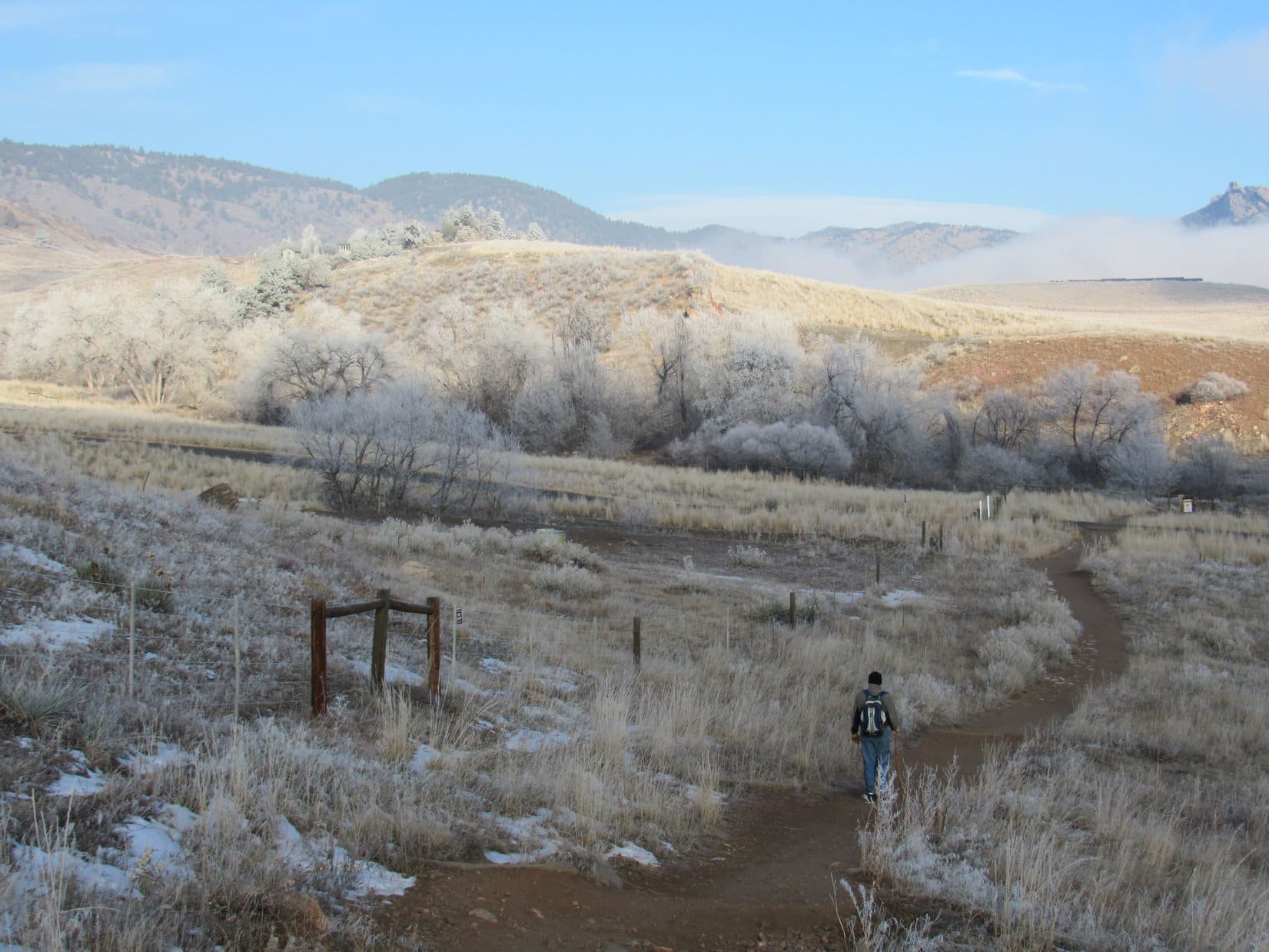
Saturday morning was Lupe’s one chance on this short Dingo Vacation for an adventure in the Colorado front range foothills. Joe, Dusty, Lupe and SPHP headed for the lower E trailhead at White Ranch Park, which was only 10 minutes from Dusty’s house.

It was a chilly 14°F when Lupe and her pack set out on the Belcher Hill trail. The trees and fields were frosty, wisps of fog and low clouds hung in the air, but the sky overhead was blue. The trail lost a bit of elevation on the way N to a low spot, then started climbing gradually as it followed the dry Van Bibber creek drainage NW.

The Belcher Hill trail starts out on an easement across private property that leads to the rest of White Ranch Park. At first there were homes not far from the trail. It wasn’t long before Lupe had gained enough elevation to be looking down on several Colorado shacks.
As shacks go, they were really quite nice. No doubt one can be had for only a few million dollars. Lupe liked the looks of them, and asked SPHP’s opinion. SPHP liked them too, but sadly checked pocket change and came up rather short.

After 1.1 mile, Lupe reached a junction with the Whippletree trail. She stayed on the Belcher Hill trail, which turned SW here. By now it was clear that a huge expanse of cold air E of the foothills was capped with a layer of low clouds. The city of Denver and all its surrounding suburbs were hidden from view. Lupe could see the top of North Table Mountain (6,570 ft.) off to the SE floating barely above the clouds.


Shortly after bypassing the Whippletree trail, the effects of a powerful inversion became evident. The temperature started changing rapidly, sometimes quite noticeably within only a few feet. Overall it was getting a lot warmer out, but Lupe came to pockets of cold air, too.

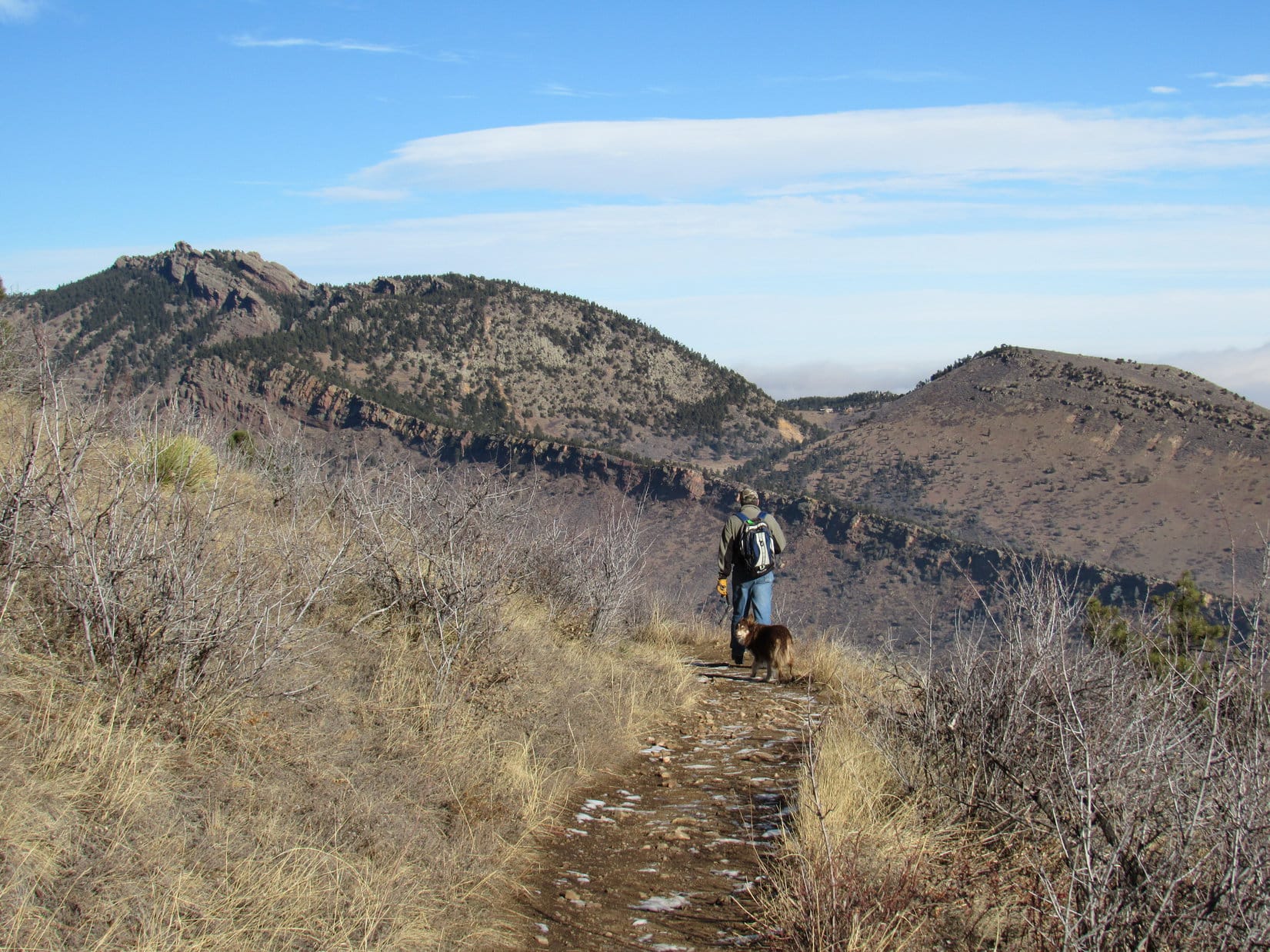
The Belcher Hill trail steepened, and made a switchback shortly before coming to another junction, this time with the Longhorn Trail.


At an intersection 1.8 miles from the E trailhead where Lupe had started, Joe and Dusty led the way onto the Longhorn Trail.


After a short steep section, the Longhorn trail leveled out and became more of an up and down affair as it headed N. After 0.4 mile, a junction with the Shorthorn trail was reached. A longer loop could be made by taking the Shorthorn trail. It was such a nice warm day this high up due to the temperature inversion, longer was definitely the better choice. Everyone hit the Shorthorn trail.
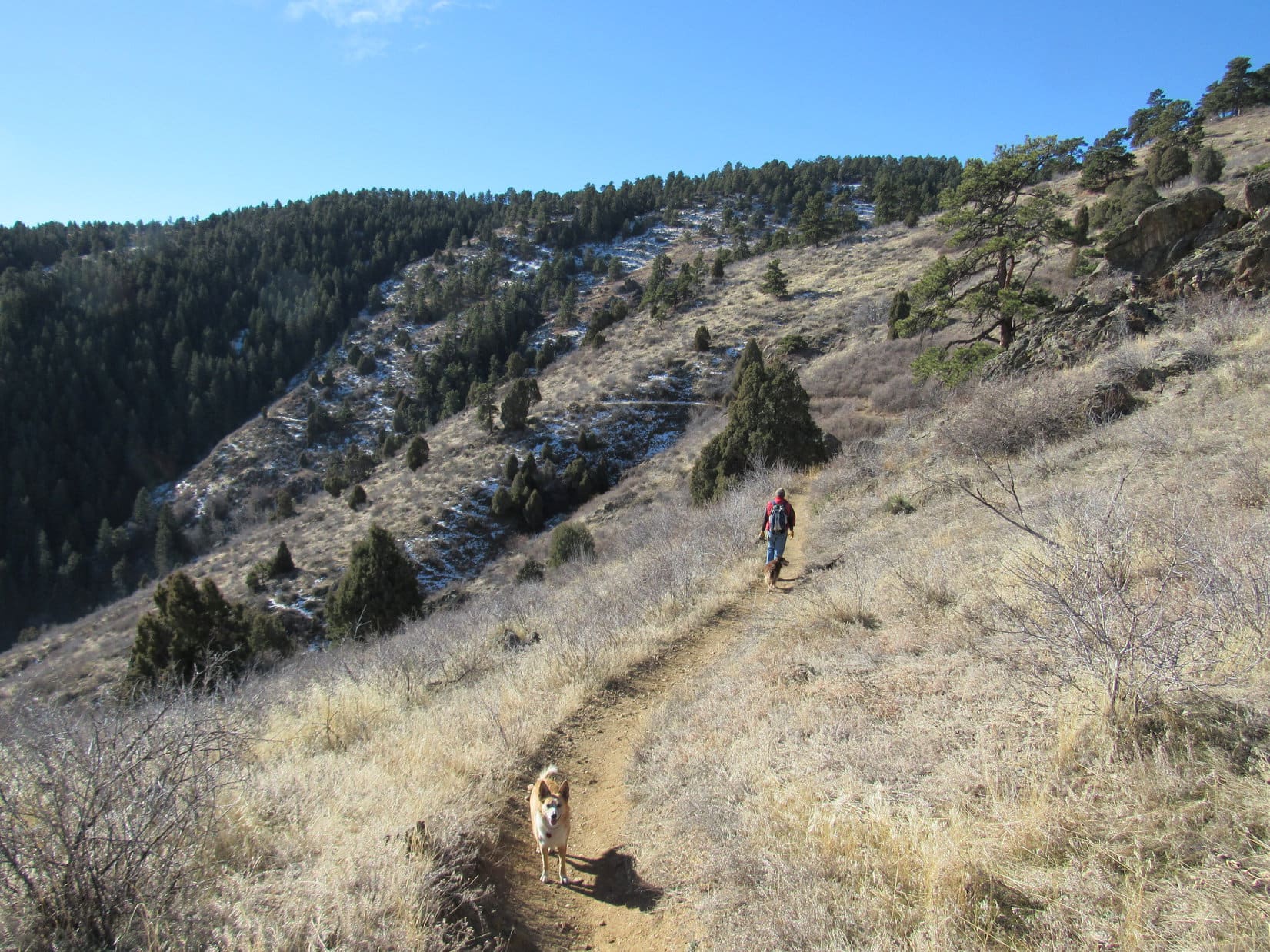
The Shorthorn trail gained a bit more elevation, but only gradually with both up and down stretches along the way. At first it headed NW. This was a unique part of the hike, because the trail went through a shady forest of large pines. Later on the trail turned NE, and wound around a series of ravines on much more exposed sunny slopes.


A 1.1 mile trek on the Shorthorn trail led to a different point on the Longhorn trail. Shortly after reaching this junction, Joe discovered he had forgotten his walking stick about 0.33 mile back while shedding layers due to the near 60°F temperatures. Everyone doubled back to retrieve it.

The walking stick successfully retrieved, it was back to the second junction of the Shorthorn and Longhorn trails. A short hike up the Longhorn trail led to a tiny creek in a ravine. At a big rock beside the little stream, it was time for a break. Lupe and Dusty shared some Taste of the Wild. Joe and SPHP had apples. Dusty enjoyed polishing off the apple cores.

After the break, it was time to head back down to the trailhead. Joe and Dusty lead the way, using the Longhorn and Whippletree trails to complete a loop back to the Belcher Hill trail. By the time Lupe arrived back at the trailhead, the air had warmed up some down here, but it was still only 30°F compared to near 60°F higher up.

The White Ranch Park adventure was over, but more good things were about to happen! Joe, Andrea, Dusty, Lupe and SPHP were soon on the way back to Matt and Cassie’s house in Parker. It was time for more fun with babies! Owen was the only baby there at first. Steve and Xochitl had taken Felix with them to visit friends. Felix hadn’t woken up until 7 AM this morning, a recent personal record of 16 consecutive hours of sleep!
Knowing that SPHP was certain to sneak her some, Lupe was especially pleased at the news that Matt was going to smoke a huge chicken and ribs this afternoon!


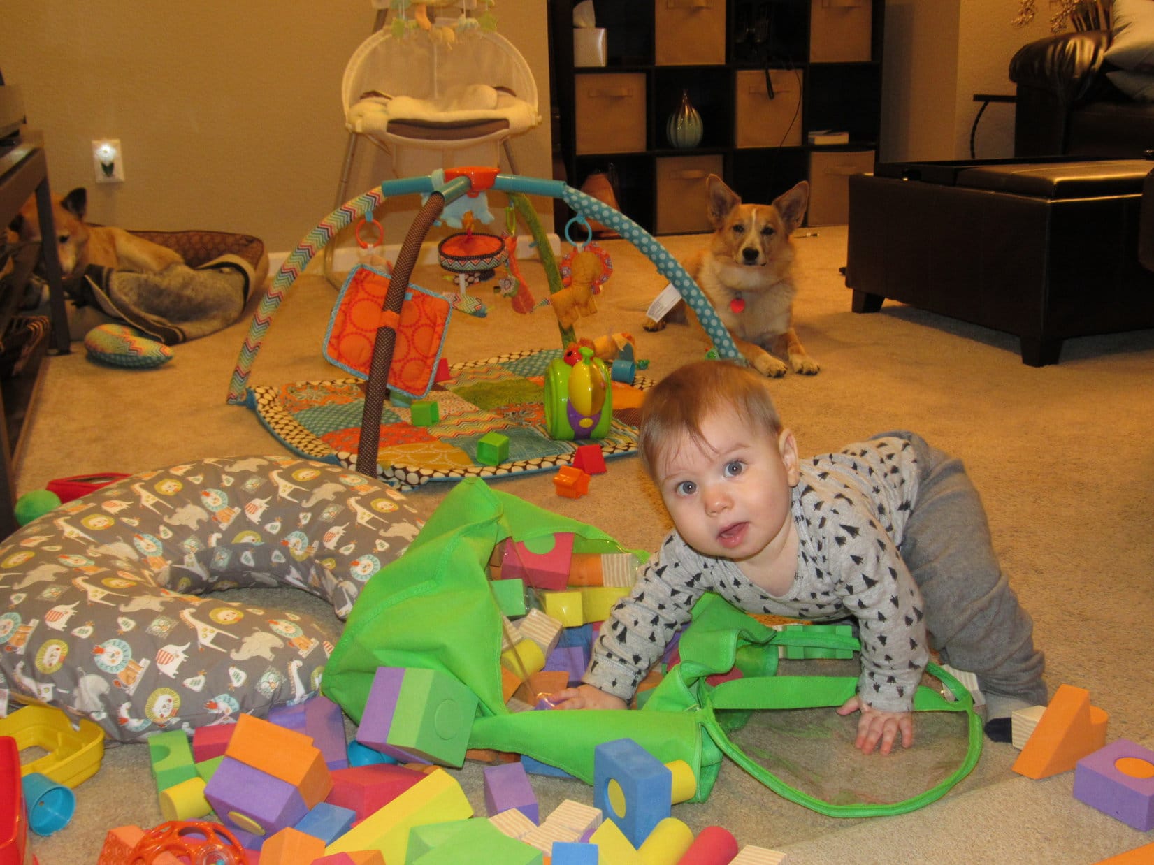
Lupe had fun with Maya. Eventually Steve, Xochitl and Felix showed up. Mark did, too. SPHP built towers with Owen’s blocks. Felix had a good time knocking them down.


The big chicken and ribs took a long time to smoke. Steve, Dusty, Maya, Lupe and SPHP took a walk at dusk. Upon return, the smoked chicken and ribs were nearly ready. The feast was soon served. The smoked chicken and ribs were delicious! Everyone had a great time! A certain sly Dingo feasted on both chicken and ribs.

All too soon, it was time to head back to the Cowboy room in Arvada with Joe, Andrea and Dusty. The next morning, Lupe left Dusty’s house after one last spin around the 100 acre field with Joe, Dusty and SPHP. The trip to Arvada and Parker, Colorado had been a quick one, but a fun time!
By the time the sun set for the last time in 2017, Lupe was back in her Black Hills of South Dakota. The G6 said it was 5 below zero when Lupe finally got home. 2018 was destined to get off to a frigid start.


Related Links:
Want more Lupe adventures? Choose from Lupe’s Dingo Vacations Adventure Index or Master Adventure Index. Or subscribe free to new Lupe adventures.