10:39 AM, 31°F – Intersection of USFS Road No. 710 & Hwy 385, a few miles S of Pactola Reservoir
Lupe was off to a late start, but for a good reason – two good reasons, actually. Last week’s Expedition No. 79 – The Snow Trek, had been an 11 hour in the field ordeal, and subsequent complete social fiasco. Big Sid, the neighbor’s dog who had been joining Lupe on recent expeditions, had been returned home late – 10 PM, and totally exhausted. Though Loop recovered quickly, Sidney had hardly been able to move for days afterward.
The neighbors were not amused. They’d been worried sick about Sidney being gone so long. Apparently Big Sid had a curfew. Who knew? Sid’s exhausted condition had earned SPHP the rather unflattering nickname “Dog Killer”. Sidney wasn’t going to be allowed to join Lupe on her expeditions any more. SPHP hadn’t even bothered checking this morning whether there had been a change of heart. Back to the old ways – just SPHP and Loop from now on.
So after The Snow Trek fiasco, something less arduous had sounded good to get back into the swing of things again. Rushing off early for another super long day wasn’t in the cards this time around.
The other reason Lupe was off to a late start was that it had been only 6°F when she’d gotten up. No sense in following up The Snow Trek with the Frozen Solid Trek was there? Lupe’s adventures are supposed to be fun, not dubious episodes of “Survivor”. Although Lupe had been eager to get going, SPHP had insisted on hanging around the house for a few hours letting the day warm up.
At any rate, Lupe was here now, and happy to be out and about again. She trotted W on USFS Road No. 710, following it gradually up a forested valley. A dusting of new snow that had fallen overnight was unspoiled, showing no tracks. Snow was plentiful, but not nearly as plentiful as it had been in the higher hills W of Nahant last week.
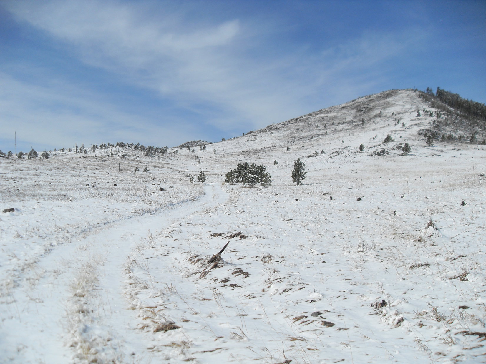
After going a mile, Lupe reached the upper end of the valley. Here the road leveled out as it went through an open forest of large, beautiful pines. Beyond the pines was barren ground, all clean and white beneath a blanket of snow. Lupe saw a big white hill (High Point 5217) only 0.33 mile away to the W.
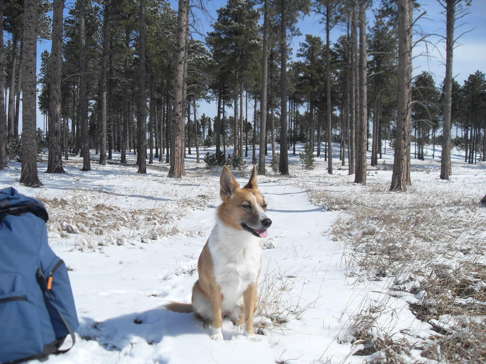
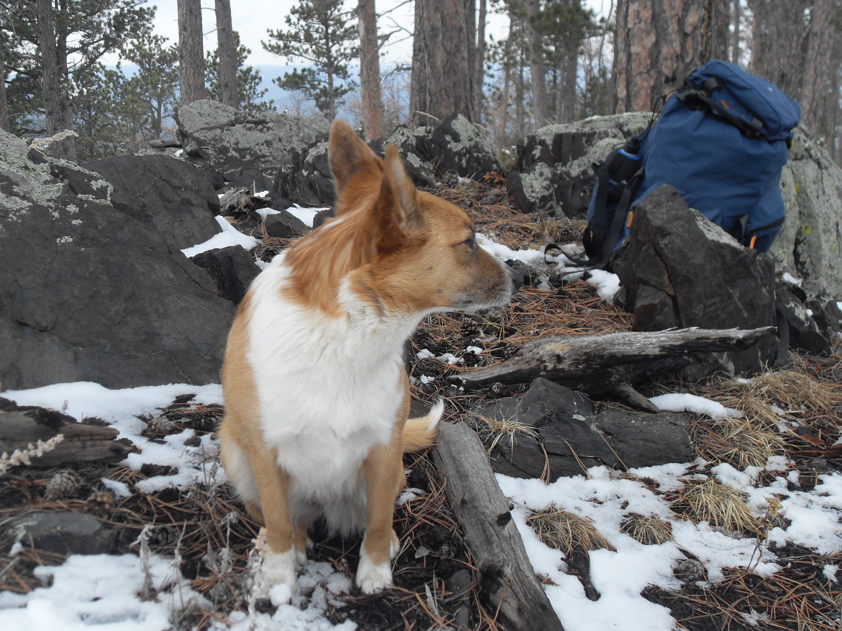
Lupe on USFS Road No. 710 after passing through the open forest of tall pines at the upper end of the valley. Photo looks NE.After emerging from the forest at the upper end of the mile long valley, USFS Road No. 710 headed into a barren area where the forest had burned years ago. Blue skies and the white snow made everything look clean, bright and cheerful. High Point 5917 is the hill on the R. Photo looks W.
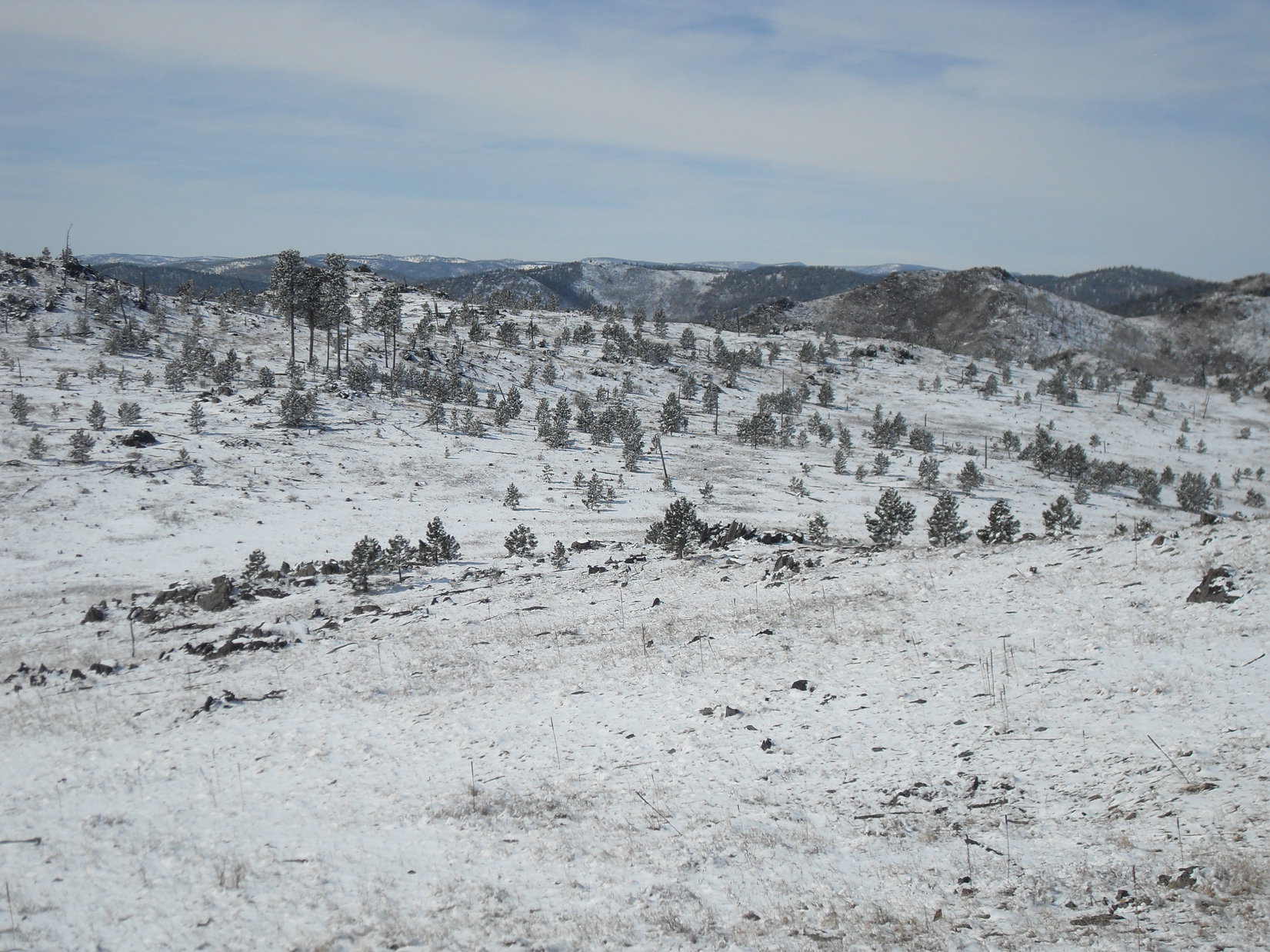
This barren area must have burned in a forest fire many years ago. The dazzling white snow beneath the blue sky made everything look bright and cheerful. Lupe stayed on No. 710 as it curved to the S. The road soon circled back to the SE, passing through another stand of tall pines on the way.
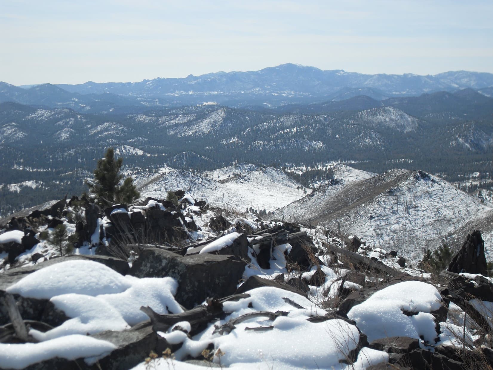
By the time No. 710 emerged from this second stand of trees, Lupe was gaining elevation again. Off to the N was a smaller, snowy hill. The American Dingo left the road to climb it. From here, Lupe could see much more of the burn area. With so few trees around, she was treated to a panoramic view to the S and W, a rare sight in the mostly heavily forested central Black Hills.
Looking SW from the small hill N of the road, Lupe could see quite an extensive area that had burned years ago. Small pines were growing, indicating the forest will eventually take over again. In the meantime, the panoramic views were great!Harney Peak(7,242 ft.), the highest mountain in South Dakota, was in view from the hill Lupe was on. Photo looks S.
To the SE, Peak5800 was in view only 0.5 mile away. Earlier, SPHP had been thinking maybe Lupe should climb it. However, the day was now so nice out that greater ambitions had started to set in. SPHP had visions of Lupe making it all the way to Old Bald Peak(6,130 ft.).
Peak 5800 was in view only 0.5 mile away from the small hill. Earlier, SPHP had been thinking maybe Lupe should climb it today. By now, though, SPHP had a grander vision that Lupe might make it all the way W to Old Bald Peak instead. Photo looks SE at Peak 5800.
The views were so wonderful from this small hill, that it seemed to make sense for Lupe to head W up to High Point 5917, the first snowy hill she had seen. High Point 5917 was considerably higher than where Lupe was now, so the views should be even better over there. Furthermore, High Point 5917 was on the way to Old Bald Peak, if Lupe was really going that far.
So instead of continuing SE to climb Peak 5800, Lupe went S back down to the road and started following it NW. She passed through the second grove of trees again, then kept going NW, leaving the road and ultimately climbing all the way to the top of High Point 5917.
No doubt about it, the views were even better here!
Looking back at Peak 5800 (L) from High Point 5917. The smaller hill Lupe had been on earlier is the closest hill on the far L. Part of Sheridan Lake is seen as a patch of white in the distance on the R. Photo looks SE.Harney Peak again. This time as seen from High Point 5917. Photo looks S.Lupe on High Point 5917 in happy expectation of some kind of treat or attention from SPHP as a reward for having reached such a lofty height.
After enjoying the terrific views from High Point 5917, Lupe left going SW down the hill. She lost a couple hundred feet of elevation on the way down to a saddle leading over to the next ridge. Right away, she had to regain nearly all of the elevation she had just lost. When she arrived up at the first real high point on the next ridge, SPHP recognized this place.
Lupe had been here before, way back on Expedition No. 41. This ridge would go a little farther W, and then turn N on its way up to Peak 6046 about 0.5 mile away. Lupe had come down this way on Expedition No. 41 after climbing Peak 6046 by another route. It had been the last day of 2012, which was how Peak 6046 had become privately known as New Year’s Eve Peak(6046 ft.).
Returning to New Year’s Eve Peak was an appealing idea. 2014 wasn’t exactly new anymore, but there was still snow on the ground and the year was still young! Lupe set off to the W, following the ridgeline as it curved N. The final climb up the S slope was a little steep, but soon Lupe was back on New Year’s Eve Peak again.
Lupe back on top of New Year’s Eve Peak for the first time since the end of 2012. Photo looks N.
It hadn’t taken all that long to get here, but the mood of the day had changed by the time Lupe reached the top of the mountain. The blue skies were gone. Gray clouds hung low over the hills. A chill light breeze blew in from the NE.
Lupe and SPHP sat together looking at the view to the W. Lupe had some Taste of the Wild. SPHP ate an apple. Old Bald Peak was still 2.5 miles off to the WSW. It was easy to see Lupe would have to lose hundreds of feet of elevation again to continue any farther W. Then it would be up and down all the way to Old Bald Peak.
The weather had changed by the time Lupe reached the top of New Year’s Eve Peak. The sky was overcast and a chill breeze blew in from the NE. In the end, SPHP decided she shouldn’t continue on to Old Bald Peak. Photo looks W in the direction she would have taken.
In the end, SPHP decided the change in weather meant Lupe shouldn’t continue W looking for Old Bald Peak. Instead, the original idea of climbing Peak 5800 returned. It was much closer to where the G6 was parked.
Even that never happened. After leaving New Year’s Eve Peak, Lupe made it all the way back E to the NW face of Peak 5800. By then, the mountaintops were all hidden in the clouds. Beneath the dark, foggy sky, the gloom was thicker than ever. Tiny snowflakes fell. The top of Peak 5800 was no more than 200 feet higher, but Lupe would have to start by climbing a slippery snow-covered boulder field.
SPHP hesitated. Snowflakes swirled in the cold breeze. Maybe this wasn’t the day for Peak 5800, either.
And that was it. Lupe and SPHP left the mountain. Lupe took a shortcut going N down a long slope through a snowy forest. On the way, she heard gunfire. Now she was desperate for SPHP’s protection. SPHP urged her onward. Lupe reached USFS Road No. 710 again. Still, she didn’t feel safe until she was back in the G6 (3:07 PM, 32°F).
Barely 4.5 hours. Not much of an expedition compared to The Snow Trek ordeal a week ago. Too bad big Sid hadn’t been along today, he would have loved it! The shorter day would have been better suited to his needs. Who knew, though, if Big Sid would ever come along again?
As for Lupe, she hadn’t made it back to Old Bald Peak (which she had visited once before) or to the top of Peak 5800, but maybe she still would some day. At least, she’d had a good time, and seen some beautiful sights. And whether the calendar said it was the right day for it or not, she had enjoyed her journey back to the cold, lonely summit of New Year’s Eve Peak.
Harney Peak is seen in the distance between pine trees on the summit of New Year’s Eve Peak. Photo looks S.
Day 7 of Lupe’s 2017 Dingo Vacation to the Yukon & Alaska!
(5:20 AM, Summit Lake, Stone Mountain Provincial Park, British Columbia) Sometime during the night, the evening’s steady rain quit. Now it was light out, but a dense fog hid everything. Lupe sawed wood peacefully under her blankie, still weary from two long days of mountain climbing.
Can you lick yourself dry? Apparently you can. Loop had done it. The Carolina Dog was toasty warm and felt completely dry, despite having returned to the G6 cold, drenched, and starving after yesterday’s crazy adventures on Mount Saint George(7,402 ft.).
No need to wonder what to do today. A day of rest was in order. A nice long drive, most of it cruising W across southern Yukon Territory was on tap. Should be a fun, relaxing day with plenty of opportunities for quick stops at beautiful places along the Alaska Highway.
SPHP turned the key. The G6 sprang to life. Headlights on, SPHP drove carefully down the slick, wet highway. Summit Pass, the dense fog, and Lupe’s grand adventures in Stone Mountain Provincial Park were left behind. The American Dingo was awake and alert now, not wanting to miss a thing (5:42 AM).
Lupe and SPHP were still in British Columbia. Loopster would have plenty to do and see before she even got to the Yukon. Her first stop was at a pullout along the Alaska Highway right before the bridge over the Racing River. Lupe had stopped here briefly on her way home last year, too. She’d been delighted to find a beautiful short walk along a grassy road hidden in the woods near the river. There were dispersed camping sites, squirrels in the trees, and at the end of the road, a viewpoint next to the gorgeous river.
Not a soul was around. The squirrels were still here. Lupe had a blast! The woods rang with the shrill joy of an enthusiastic Dingo. Only the sky and the river had changed. Last year Loop had been here in September. The Racing River had been a stunning icy blue on a mostly sunny day. Now the river was swollen with silt, a murky light gray color matching the somber sky.
Lupe at a silty, light gray Racing River. 11 months ago the river had been a gorgeous icy blue. Photo looks upstream (SW).The Racing River wasn’t as pretty as last year, but Lupe had a blast barking at squirrels in the woods on the short walk to this viewpoint. Photo looks downstream (NE).
Loop’s next stop was at a pullout with a view of the Toad River reached shortly after entering Muncho Lake Provincial Park. The Toad River wasn’t as silty as the Racing River, but still only offered a hint of the fabulous icy blue color both it and the Racing River had been when Lupe was here in 2016.
The Alaska Highway winds up the Toad River valley in Muncho Lake Provincial Park.Looking across the Toad River at a big alluvial fan.
Lupe made two more stops in Muncho Lake Provincial Park. Since the Alaska Highway passes right along the E shore of Muncho Lake, her next break from the G6 was to take a good look at the gorgeous lake itself.
Muncho Lake sits in a pass high in the Muskwa Range. The Alaska Highway follows the E shore of the lake. Photo looks N.A gorgeous snow-capped peak sits beyond Muncho Lake in the direction this photo is looking. Lupe had seen it last year, but today it’s hidden by clouds. Photo looks SSW.
Lupe’s final stop along Muncho Lake was at the impressive Northern Rockies Lodge, which seems to be the center of activity in Muncho Lake Provincial Park.
The Northern Rockies Lodge on the E shore of Muncho Lake is right off the Alaska Highway, and seems to be the hub of most activity in Muncho Lake Provincial Park.Lupe drops by the Northern Rockies Lodge in Muncho Lake Provincial Park. She wasn’t an official guest, so she didn’t get to go in, but she would have liked to. It looked luxurious, and American Dingoes love both adventure and luxury!
Lupe wasn’t an official guest at the Northern Rockies Lodge, so she didn’t get to go inside to check it out. She most definitely liked the looks of it, though, and would have gladly gone in, if SPHP hadn’t been such a cheapskate and had booked her a room. SPHP wasn’t an official guest, either, but did sneak in to pick up a brochure about flight-seeing tours.
The bush pilot flight-seeing tour to Victoria Falls in Nahanni National Park, one of the largest waterfalls in Canada, sounded absolutely spectacular! The float plane leaves right from Muncho Lake at the Northern Rockies Lodge. The tour alone was a measly $750 Canadian, and accommodations at the fabulous Northern Rockies Lodge could be included in a package deal for a little more. Loopster was all for it!
SPHP muttered something about not being in the budget, an unknown price per Dingo, and unkindly made Lupe’s disappointment even worse by taking her down to see the very float plane she might have soared off to visit Virginia Falls in.
Following the lure of the North, that was exactly what Lupe was here for!Oh, yeah! Here was the very float plane Lupe might have soared off to Victoria Falls in!
Lupe didn’t get to fly to Victoria Falls, but then SPHP didn’t either, so at least it was fair. However, at the next stop along the Alaska Highway at Liard River Hot Springs Provincial Park, SPHP had all the fun.
Lupe arrives at Liard River Hot Springs Provincial Park in NE British Columbia.
It wasn’t fair at all that SPHP got to enjoy Liard River Hot Springs and Lupe didn’t, but it really wasn’t SPHP’s fault. Signs made it clear Dingoes were prohibited. Poor Looper couldn’t even take the boardwalk leading to the hot springs for a look around.
It was sort of OK. Loopster was still pretty bushed from her mountain climbing adventures the past two days. An hour’s snooze curled up in the G6 didn’t sound all bad. Besides, it had been awhile, and SPHP would return from the hot springs all fresh and clean as a sweeter-smelling more tolerable traveling companion. SPHP promised not to be gone too long. (8:48 AM, 57°F)
SPHP returned a little more than an hour later sniffing better, warm and relaxed. For only a $5 day-use fee, Liard River Hot Springs had been really unique and a great experience. SPHP was careful not to make it sound too wonderful, though, so Loop wouldn’t get jealous again.
At Liard River Hot Springs bathers follow this long boardwalk to get to the actual hot springs. The Liard River is some distance away (on the other side of the Alaska Highway actually) and not in view.The boardwalk starts out crossing a natural warm water swamp.The warm water swamp often attracts wildlife, but SPHP saw none today. On the bright side, there weren’t any mosquitoes either.Once beyond the swamp, the boardwalk goes through a boreal spruce forest.The boardwalk leads to a changing house next to the hot springs. There are separate rooms for the two sexes with benches and hooks, but no lights, electricity, heat, lockers or running water.Liard River Hot Springs is a totally outdoor experience in a natural lush boreal spruce forest setting. So unique and beautiful!The hot springs are divided into two sections. This is the upper section where the water has been dammed up a bit. It is only a few feet deep. The water is hottest here, coming from a very hot spring entering this pool at the far end.This is the lower, cooler downstream pool. It’s only a few feet deep, too. It is not dammed up and drains naturally into a creek at the far end. Choose whatever water temperature you like! The water cools rapidly the farther downstream you go. Like it really hot? Stick with the upper pool.A view of both pools and the transition between them. Beyond the far end of the upper pool, a boardwalk going L leads to a short trail to the “hanging gardens” which were closed this day due to bear activity. A boardwalk to the R leads directly to a nice outhouse style restroom.The hot springs enter the upper pool here on the opposite bank. The boardwalk to the hanging gardens trail is in view.Looking back at Liard River Hot Springs from the start of the short boardwalk to the rest rooms. What an awesome wilderness setting! For a $5 day-use fee, you can soak in the hot springs all day if you like. Such a bargain!Heading back all warm and clean to check on Lupe. There’s a picnic ground and campground at the parking lot, too. Gates close nightly until morning, so don’t stay too late unless you intend to camp!
Once done at Liard River Hot Springs, Lupe and SPHP returned to the Alaska Highway (10:33 AM). There wouldn’t be any more long stops during the day, but Lupe would have plenty of brief opportunities to stretch her legs. Most of the time, the G6 purred its way W.
There were moments of frenzied Dingo excitement!
That crazy little Dingo could make all the racket she wanted to. If anyone was going to do any intimidating, it was this guy.Along many miles of the Alaska Highway from Muncho Lake Provincial Park to close to Watson Lake, the forest is clear cut far back from the road on both sides. Buffalo like to graze in the resulting adjacent fields. Elsewhere, forests extend to the horizon.
Lupe saw the big gray-green Liard River.
Loop stopped to admire the beautiful Liard River that the hot springs are named after.Arising in the Pelly Mountains of SE Yukon, the Liard River flows 693 miles through the Yukon, British Columbia, and Northwest Territories. It’s a tributary of the Mackenzie River, which ultimately flows N to the Arctic Ocean at the Beaufort Sea.
Lupe left British Columbia, entering Yukon Territory before arriving in the small town of Watson Lake. As she continued W, the Alaska Highway sometimes curved back into British Columbia for a while, but most of the time Lupe was in the Yukon. She saw many beautiful peaks along the way.
On the drive W across the southern Yukon, Lupe saw many beautiful peaks from the Alaska Highway.
Although there was lots to see on the long drive, eternal vigilance wasn’t a strict requirement.
Loop enjoys a bit of peakbagging recovery therapy.
By afternoon, the sky was no longer completely overcast. The day warmed up considerably, hitting 84°F at one point. Sunlight highlighted beauty everywhere. SPHP stopped at a picnic ground near the Morley River. Lupe had high hopes at first, but didn’t care for it in the end. Too many biting flies, bees and mosquitoes. Not enough squirrels. SPHP ate and managed to dry out some wet clothing on the G6 before hitting the road again.
Late in the afternoon, Lupe came to huge Teslin Lake.
Late afternoon found Lupe at Teslin Lake.Teslin Lake is many miles long, but relatively narrow. The Alaska Highway follows the NE shore along the N half of the lake. Photo looks NW.
W of Teslin Lake, Lupe and SPHP finally left the Alaska Highway at Jake’s Corner, continuing W on Hwy No. 8. After crossing a long bridge over the Tagish River, SPHP pulled into a parking lot along the W bank. Apparently there are recreational facilities in this area. Lupe quickly discovered a boat ramp, and could see people around.
Lupe at a boat ramp on the W bank of the Tagish River. Photo looks ENE.
The Tagish River flows N into Marsh Lake. The American Dingo went up on the long bridge over the river for a look at the S end of the lake. The Yukon River flows out of the N end of Marsh Lake, but Looper couldn’t see it from here.
The S end of Marsh Lake from the Highway No. 8 bridge over the Tagish River. The Yukon River flows out of the N end of Tagish Lake, but Loop couldn’t see it from here. Photo looks N with help from the telephoto lens.
It was evening when Lupe reached Carcross, a small picturesque village. This was Sunday, so there weren’t many people around. All the tourist shops were closed, except for one restaurant where all the action was at the moment.
Lupe and SPHP took a stroll around Carcross just window shopping. SPHP said window shopping was well within budget. Loopster could window shop to her heart’s content! Most of the shops contained artwork or jewelry of one type or another. The buildings themselves were works of art!
Lupe enjoyed a window shopping extravaganza in Carcross! That SPHP sure knows how to show a Dingo a good time!A Carcross style killer whale was on display.Artwork and jewelry were central themes in Carcross. Even the shop buildings were works of art!
Window shopping was a nice change of pace. Lupe was soon satisfied with what she hadn’t bought. It was time to move on. Lupe and SPHP headed S from Carcross on the South Klondike Highway No. 2.
South Klondike Highway No. 2 passed along the W shore of two long mountain lakes. First came Tagish Lake. Lupe and SPHP stopped at a pullout to see Bove Island.
Lupe and SPHP stopped at a pullout along Highway No. 2 SE of Carcross where placards touted this view of Bove Island (L) in Tagish Lake. The forest had grown up so much Bove Island was actually only in view from a couple of specific spots. Photo looks NE.
Next up was Tutshi Lake. By the time Lupe reached Tutshi Lake, she had crossed back over the border into British Columbia again.
Tutshi Lake from Highway No. 2 S of Carcross. Lupe was back in British Columbia here. Photo looks S.
The sun was low when Lupe reached a strange land S of Tutshi Lake. The valley South Klondike Highway No. 2 was passing through widened out a great deal forming a broad basin. Mountains surrounded this relatively level, but roughly rumpled, basin at a distance. Vegetation was scarce. Trees were sparsely distributed. There seemed to be very little soil, and not much of the loose, broken rock typically seen in mountainous terrain.
Low hills having the appearance of exposed bedrock stretched across the basin among a network of numerous odd-shaped lakes of varying sizes. The sides of the mountains surrounding this weird land all appeared to be exposed bedrock to a level far above the basin floor.
The sun was getting low when Lupe left the G6 S of Tutshi Lake to investigate this very strange land. Bedrock seemed to be exposed almost everywhere, very little loose rock or soil was evident, vegetation was sparse, and a network of many odd-shaped lakes of varying sizes existed among low hills of solid rock. Photo looks E.Got it figured out yet, SPHP?
What an odd place! What had made it this way? This basin was unlike anything Lupe and SPHP had ever seen before. At least that’s how it seemed at first. SPHP thought for a while. A light finally went on. No, that wasn’t really true. Lupe had seen this sort of thing before, but never on such a grand scale.
Eons ago, this basin must have been buried beneath a massive glacier of gigantic proportions. Before it melted away, the glacier had scrapped the soil away down to bedrock. The glacier had been thousands of feet deep, so that even the mountainsides had been scraped clear of loose debris to a great height. Yes, that must be the explanation. It all made sense now.
The Carolina Dog seemed satisfied with this hypothesis. A day or two later, while window shopping again in Skagway, she would eventually see a poster of this unusual territory. The poster billed this region as the “Tormented Valley”, apparently a popular stop on sight-seeing tours between Skagway and Carcross.
Looking SSW across part of the Tormented Valley.
Lupe and SPHP continued S on Highway No. 2 passing Canadian Customs located along the W edge of the Tormented Valley. The highway left the Tormented valley going up over a hill at White Pass, before beginning a long descent into a tremendous, steep, V-shaped valley. This made sense, too. This sharp valley must have been eroded out by a once torrential river fed by the meltwaters of the ancient glacier.
Before she had lost too much elevation, Lupe passed through US customs. She had reached Alaska! Then it was down, down, down the deep, impressive valley. When it all ended, Lupe was practically at sea level. She had arrived in Skagway, Alaska.
Though the sun was long down and twilight had already faded to a considerable degree, Lupe and SPHP took an hour long stroll through Skagway. Perhaps it was only because it was sort of late on a Sunday night, but Skagway struck SPHP as a queer place. However, Lupe seemed happy enough with it. Perhaps she was simply glad to be out of the G6 again for a while, even if no one in this town except SPHP paid the least bit of attention to her.
Skagway seemed possessed of virtually no modern buildings, not even a gas station or a hotel. There was almost no traffic. The dim deserted business section was all touristy shops with an old-fashioned look to them. Posted prices reflected Skagway’s reputation as a famous tourist destination. Window shopping would be the order of the day here, too.
But everything was closed and dark, except for a few restaurants and bars. Even they were virtually empty and quiet. No crowds anywhere. A few people were out walking about in small groups of 2 or 3 engaged in low conversation. Occasionally someone shot by on a bicycle or skateboard. Everyone was young. The smell of dope rose from small gatherings seated outside old houses.
I don’t know what I was expecting of Skagway, Looper, but this wasn’t it. This joint is practically a ghost town. Wonder how you get to the ocean? Seems like it ought to be easy to find.
Oh, it’s over that way, SPHP. I can smell it. Can’t be too far. Skagway seems fine to me. What were you expecting, anyway?
Something newer, brighter, livelier, I guess. I suppose that’s all on the cruise ships. That’s how most everyone gets here you know. No doubt that’s why there’s so little traffic and no place to stay. Everyone’s on the ships. Looks like Skagway is still selling the gold rush days with all these old timey buildings.
Gold rush! What’s wrong with that? Maybe we’ll strike it rich!
Oh, nothing. Nothing at all. Except Skagway’s gold rush has been over for a long time. It’s interesting history, but we’re too late to strike it rich. Where is everyone, anyway? It’s summer! Aren’t there any cruise ships in port tonight? I didn’t expect they’d be rolling up the sidewalks at sundown here. Skagway is famous! Why, even I’d heard of it.
It’s Sunday night! Maybe tomorrow will be different?
Perhaps so, Loop. We’ll know soon enough. Doesn’t really matter if it isn’t except for one thing.
What’s that?
There better be a gas station around here somewhere. It’s a long walk to Whitehorse.
In the Tormented Valley, British Columbia, Canada on the way to Skagway, Alaska. 8-6-17