Harvey Mountain, Babine Mountains Provincial Park, British Columbia, Canada (9-9-17)

Days 39, 40 & 41 of Lupe’s 2017 Dingo Vacation to the Yukon & Alaska!

9-7-17, 6:24 AM, 44°F, Tombstone Territorial Park, Yukon Territory – Lupe and SPHP were awake dark and early.  That’s right – dark and early.  A week into September now, long days of the far north were ending.  SPHP drove S on the Dempster Highway just to let the G6 warm things up a bit.  Lupe stopped and had breakfast near the big sign at the entrance to Tombstone Territorial Park.

Lupe’s Tombstone Park adventures were over.  She’d had a grand time climbing Surfbird Mountain, Goldensides, and taking the Grizzly Ridge trail to Grizzly Lake.  In fact, Loopster was done here in the Yukon.  It was time to head home, but home was thousands of miles away.  Most of the remaining days of her 2017 Dingo Vacation to the Yukon & Alaska would be spent on the road.  Still, there would be stops at various sights, and a couple more big adventures along the way.

After breakfast, Lupe rode shotgun watching for wildlife, while SPHP drove.  The fall scenery was magnificent.

A week into September, the fall scenery along the Dempster Highway was magnificent.

Upon reaching the North Klondike Highway, SPHP turned SE toward Whitehorse, the capitol city of Yukon Territory.  Whitehorse, which was 550 kilometers from where the Carolina Dog started this morning, was as far as Lupe was going today.

Lupe and SPHP had never been on the North Klondike Highway before.  The road wound among countless hills, ridges, and valleys.  There were mountains to be seen, but the highest ones were generally far away on some horizon.  The highway crossed streams and rivers, and went past small lakes.  Everywhere Loop looked, bright yellow forests of deciduous trees mixed with the dark greens of conifers.

The long, peaceful drive was beautiful and relaxing – just the ticket after Lupe’s nearly 14 hour day on the Grizzly Ridge trail yesterday.  Loopster snoozed when she felt like it, but was always eager to get out of the G6 to look around when SPHP stopped briefly at memorable spots along the highway.

A view of the Tintina Trench from along the North Klondike Highway. Photo looks N.
The Tintina Trench is a geological feature which extends across the Yukon into Alaska. A fault line along the trench has shifted laterally 450 kilometers.
Patches of low clouds hang over the Tintina Trench. Photo looks N with help from the telephoto lens.
View of the Five Finger Rapids area on the Yukon River. Photo looks W.
At Fox Lake. Photo looks S.
Fox Lake was the largest lake Lupe saw along the North Klondike Highway. She wasn’t far from Whitehorse by the time she got here. Photo looks NW.

Late in the afternoon, Lupe arrived in Whitehorse.  SPHP found a Jiffy Lube, and the G6 got a needed oil change.  Evening featured a roasted chicken from President’s Choice.  The American Dingo enthusiastically helped to devour the chicken at Takhini Hot Pools, which SPHP enjoyed for the second time on this Dingo Vacation.

9-8-17, 4:41 AM, 48°F in Whitehorse – Two foxes!  SPHP watched them for a couple of minutes before Lupe woke up and saw them, too.  A Dingo barkfest ensued, but the foxes only seemed perplexed and curious.  After a minute or two of this abuse, they sauntered off together heading for downtown.  Awesome!

Another relaxing day on the road.  The morning featured gorgeous S Yukon Territory scenery along the Alaska Highway.  After turning S on the Cassiar Highway, Lupe spent the afternoon in British Colombia.  The Cassiar Highway was in better shape this year than in 2016.  No more long stretches of gravel.  Those had been replaced with new pavement.  Smooth!  Lupe passed by many beautiful lakes – Good Hope, Lang, Deese and others.

Lupe by the Yukon River SE of Whitehorse. Photo looks W.

With so many miles to go, it wasn’t possible to stop much.  By late afternoon, after nearly 2 days in the G6, Lupe was getting restless.  Something had to be done.  A stop along the Stikine River for a 30 minute break helped.  Loop found a squirrel up in the trees.  Superb Dingo therapy!

Loop licks her schnoz after enjoying some Stikine River water. Photo looks ESE.
About time you let me out of the G6! Photo looks SW.
This is more like it! Searching for squirrels in the trees along the Stikine River. Found one, too! Oh, happy half hour!

Two black bears and a horse along the highway provided what little excitement there was the rest of the day.  Between these episodes, Lupe’s eyelids grew heavy.  She went back to snoozing.  The highway went by many beautiful snow-capped peaks.  Made 550 miles today.  Stopped for the night somewhere S Ningunsaw Pass.  Out of Alpo.  Out of everything.  Crackers for dinner.  Oh, yum!  (8:37 PM, 50°F)

9-9-17, 4:11 AM – Out to sniff the air, then onward!  Turned out Lupe hadn’t been far from the Bell 2 rest stop last night.  Reached it within 15 minutes.  Later stopped briefly at Bell 1 near the Bell Irving River where Lupe had spent a night on her 2016 Dingo Vacation.  In the dark, Bell 1 seemed just as mysterious now as it had back then.

5:55 AM – Still dark.  Stopped to fuel up at Meziadin Junction.  Raining!  Not good.  Hours to Smithers yet, though.  Hopefully the rain will stop, so Lupe can climb Harvey Mountain (6,083 ft)!

From Meziadin Junction, it rained for a long way.  Finally, though, the rain slackened to only intermittent showers.  Still lots of clouds around, but even that situation improved enough so that by the time Lupe was approaching Smithers on Hwy 16, it was decided the American Dingo was at least going to take a shot at Harvey Mountain.

After a quick stop at Safeway in Smithers, Lupe and SPHP continued SE on Hwy 16.  On the way out of town, the highway crossed a bridge over the Bulkley River.  SPHP watched for a N (L) turn onto Old Babine Lake Road.  The turn soon materialized.  Several miles of twists and turns later, Lupe was heading up Driftwood Canyon.

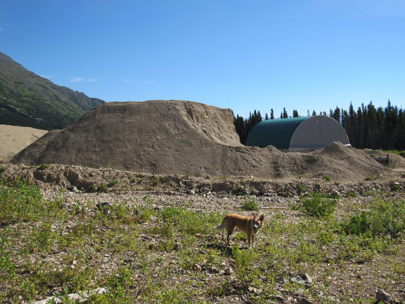
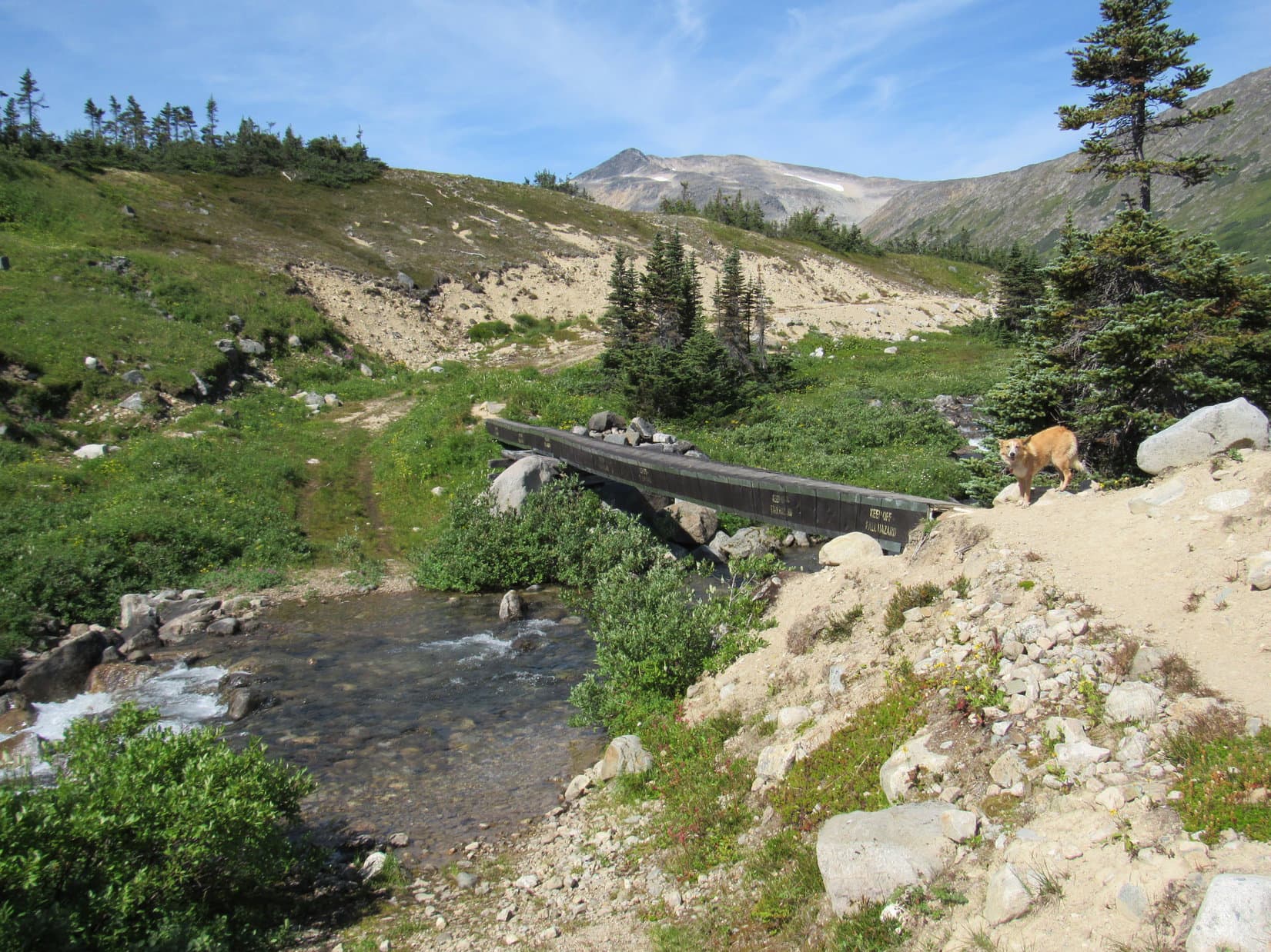
10:10 AM, 47°F – The Harvey Mountain trailhead has limited parking.  No problem.  There was plenty of room for the G6.  No other vehicles around.  As soon as Lupe got out of the G6, she ran across the road over to Driftwood Creek for a drink.  The rushing creek was shaded in deep forest.  Mossy rocks lined the creek banks, and formed mossy islands midstream.  Pretty, but once Looper was hydrated, it was time to hit the trail for Harvey Mountain (6,083 ft.)!

At Driftwood Creek right across Driftwood Road from the Harvey Mountain trailhead.
This way to Harvey Mountain, SPHP!

The Harvey Mountain trail proved to be an abandoned road or former jeep trail.  Most of it was grassy, though a single track was beaten down to dirt a lot of the way.  In some places, forest undergrowth had taken over all but the single track.

Looper hits the Harvey Mountain trail in Babine Mountains Provincial Park.

The trail started off easy enough, but that didn’t last long.  Soon it was a steady uphill grind at a pretty fierce rate of climb.  It stayed that way for a long way with only occasional short level stretches.  SPHP was pausing frequently to catch breath.  Lupe enjoyed showing off, trotting easily up and down the trail, while SPHP stood gasping between pushes onward and upward.

The trail switchbacked up a steep mountainside though dense forest.  Other than the challenging rate of ascent, everything about this was easy.  No rocks, no roots, no cliffs, no rough terrain or obstacles.  In many places the whole grassy roadbed was exposed, so the trail was plenty wide, too.  This was simply a relentlessly steep road hike.

Due to the dense forest, there were also no views.  Even after gaining 2,000 feet of elevation, Lupe still hadn’t seen much of anything except trees.  Oh, there were hints of views now and then, but not even a single decent opening appeared to allow some contemplation and appreciation of what was out there just beyond the forest.

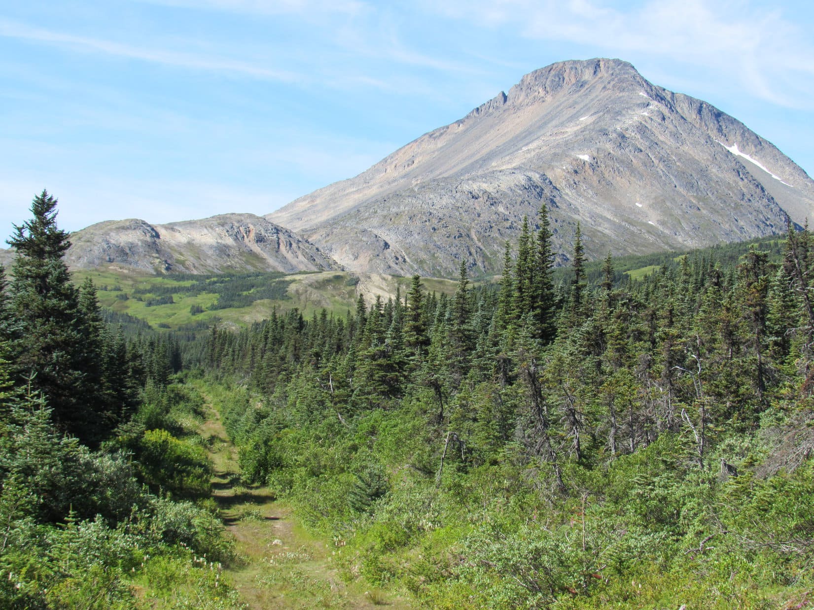
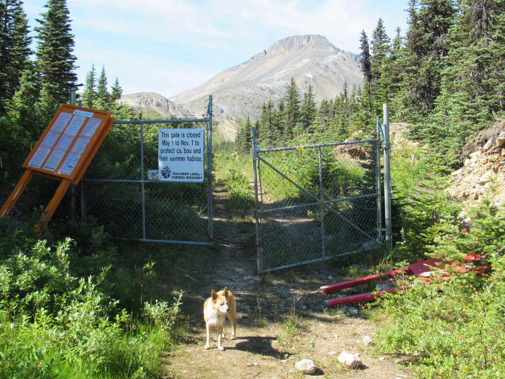
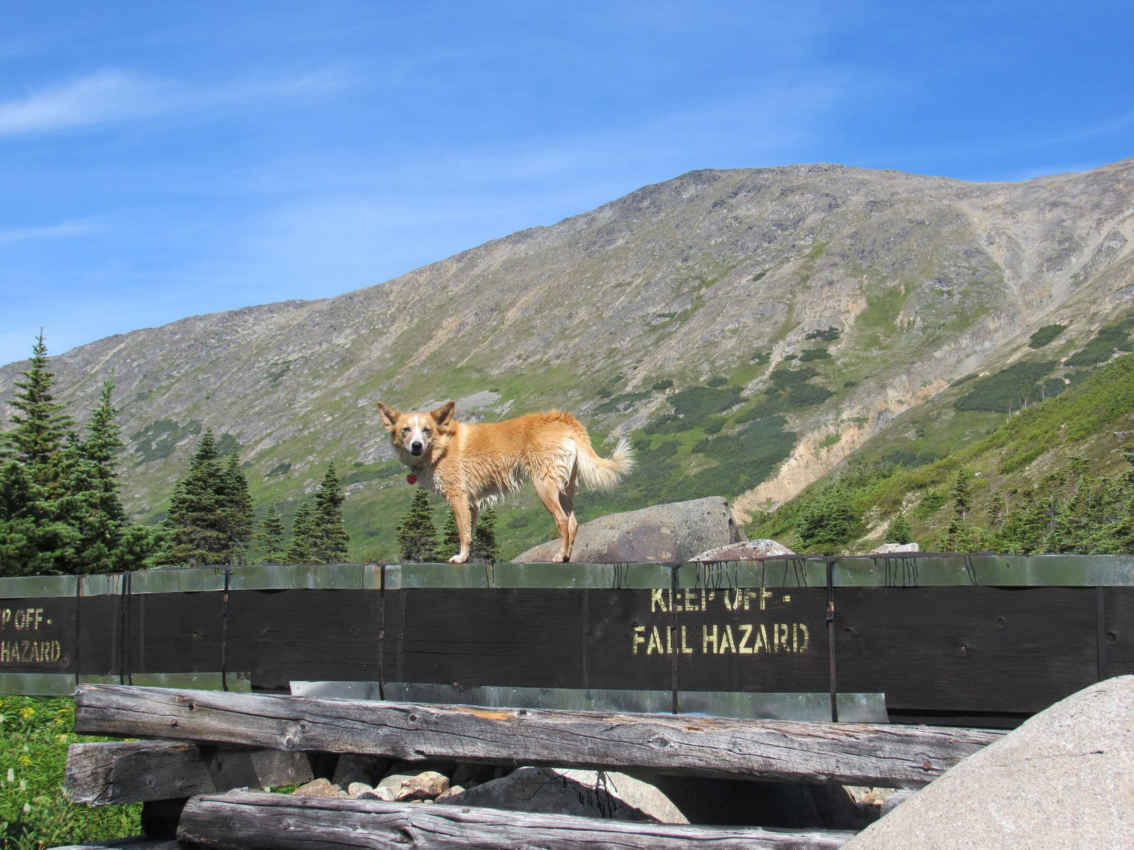
Lupe came to a large yellow metal gate.  The gate was padlocked shut to prevent any possibility of vehicle traffic on the trail.  After passing this gate, the situation finally started to show some signs of changing.  The forest ahead was beginning to thin out.  Before long, Loop was emerging from the trees.  A huge sloping alpine meadow was ahead.

After passing a large yellow metal gate, Lupe finally began to emerge from the forest.
As Lupe left the forest, she entered a huge, sloping alpine meadow. The trail went on in the general direction of the high point seen on the L. Photo looks E.
Onward and upward! Climbing the steep alpine meadow. Photo looks NW.

Lupe had gone a long way up the slope, when it became apparent rain was approaching from the SW.  SPHP donned the blue rain poncho, then sat next to a modest-sized rock which had a cairn on it.  Looper curled up on SPHP’s lap inside the rain poncho, hoping to stay dry, too.

Lupe was high on the long slope she’d been climbing when it became clear rain was on the way. Photo looks SW.
Better get that rain poncho on fast, SPHP! The rain is almost here! Photo looks W.
Staying dry while rain and fog sweep over Harvey Mountain.

Rain and fog swept over Harvey Mountain.  Visibility was close to zero.  The rain showers had seemed limited in scope, when SPHP saw them coming.  30 minutes later, however, Lupe and SPHP were still sitting next to the rock with the cairn in dense fog.  Rain continued to fall.

The rain fell hardest shortly before suddenly ending.  The fog flew away.  Loop was out of the rain poncho like a shot when SPHP urged her to move.  Locally the sky was brighter again, but ragged clouds clung to nearby mountains.  More rain wasn’t far off in several directions.

Conditions after the shower weren’t nearly so bright and encouraging as SPHP had expected, but Harvey Mountain wasn’t being threatened at the moment.  This was Lupe’s chance to make a break for the summit.  Puppy, ho!  Onward!

Yes, we hid right here from the rain! Photo looks S.
Lupe still at the rock with the cairn. From here she headed for the high point beyond her. Photo looks SE.
Although Harvey Mountain wasn’t directly threatened at the moment, ragged clouds clung to nearby mountains. Photo looks N.

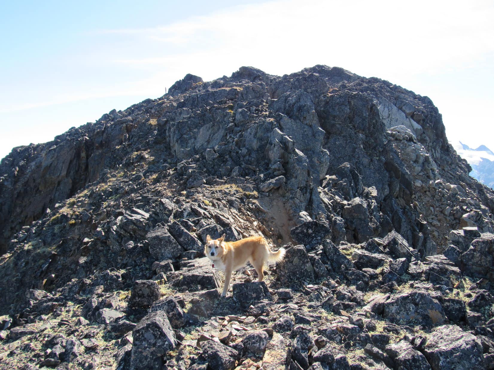
The trail had completely faded away even before the rain hit.  Loop was climbing SE following Harvey Mountain’s broad NW ridge.  Cairns were seen every now and then, but the route was clear enough without them.  The obstacle free terrain was getting even easier.  The slope of the ridge was decreasing as Lupe progressed.

Going up the very broad NW ridge. A small cairn is seen beyond Lupe a little to the R. Photo looks SE.

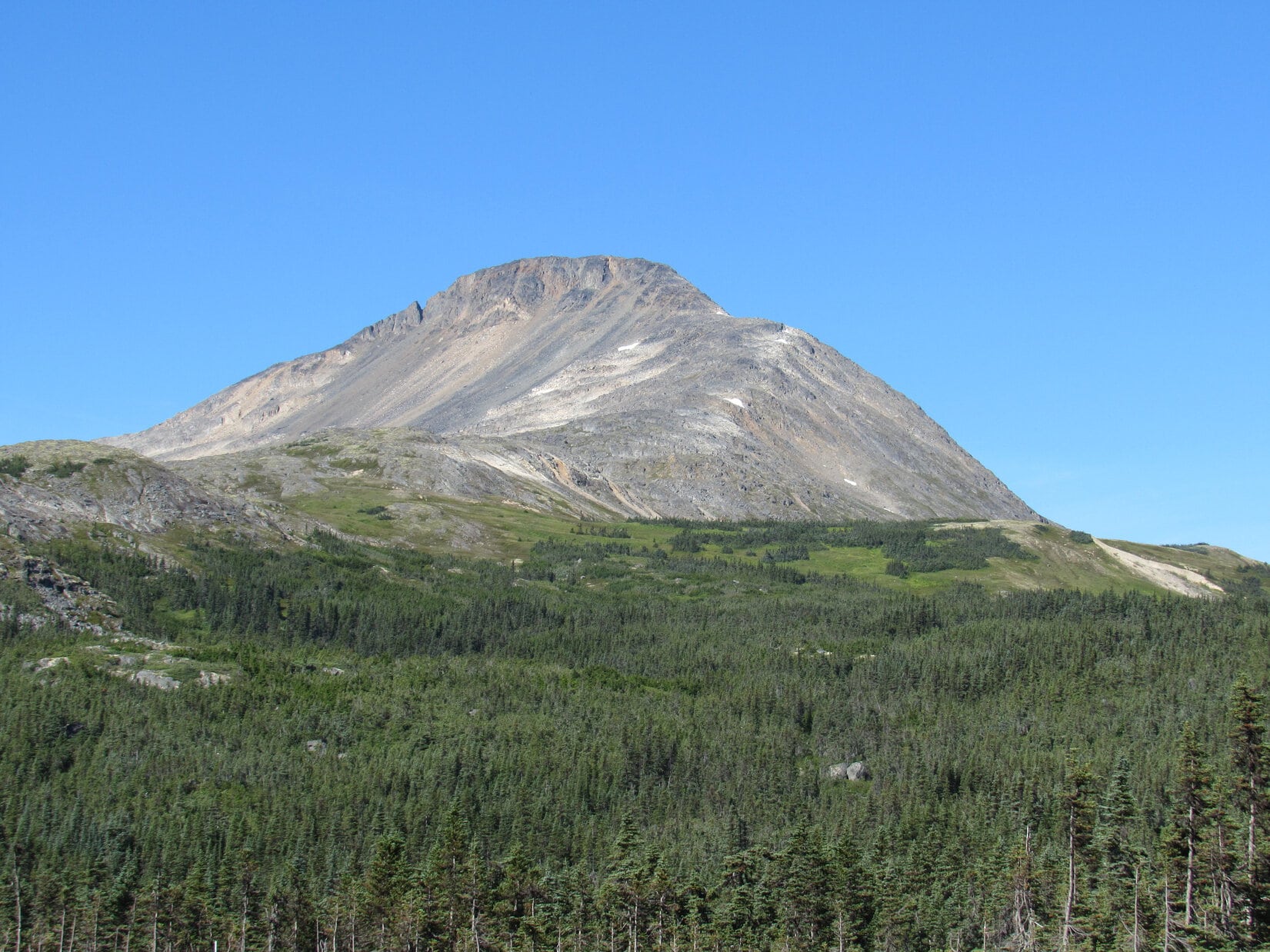
The topo map showed a high point labeled “Mt. Harvey” toward the N end of the mountain.  This N high point couldn’t be the true summit.  The map also clearly showed a higher contour well to the SSE.  Since the N high point was closest, Lupe went looking for it first.

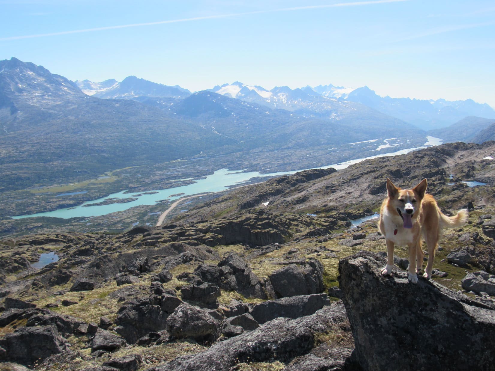
The Carolina Dog climbed or skirted several minor high points along the N end of the mountain before reaching the highest one.  She sometimes had glimpses of impressive mountains and the deep valley to the N, but even during this break in the clouds, Looper could seldom see very far.  She did get a good look at the true summit of Harvey Mountain from one of the minor high points.

Even during this local break in the clouds, Lupe could seldom see very far. She did get glimpses now and then like this one of the huge, deep Driftwood Creek valley to the N. The S end of Mt. Elmsted is on the L. Photo looks NNE.
The true summit at the S end of Harvey Mountain is the dark knob directly beyond Lupe. Photo looks SSE.
The true summit (L) from the same spot with help from the telephoto lens.
Looking toward Mt. Hyland (R) during a rare semi-break in the clouds in that direction. Photo looks NE.

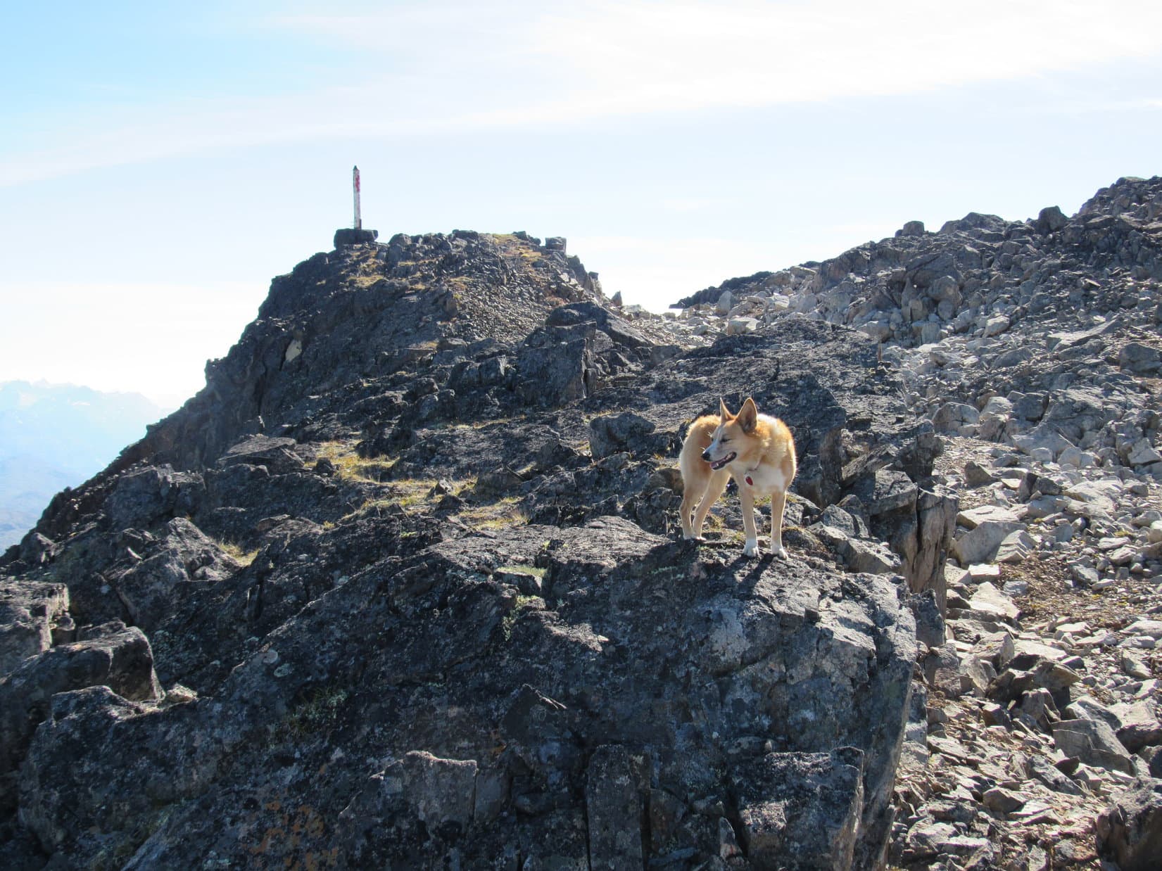
Once Lupe made it to the highest of the N high points, the one marked “Mt. Harvey” on the topo map, all that remained was an easy trek across an undulating summit plateau to the true summit.  Loop could see her destination from here.

Lupe at the N high point. The true summit is in the distance at Center. Photo looks SSE.
Another view from the N high point showing more of Harvey Mountain’s summit plateau. The true summit is on the L. Clearly there’s another spot on the mountain higher than where Lupe is on the R. Call it the S Central high point. Photo looks S.

The weather made the otherwise simple trek to the summit far more dramatic than it otherwise would have been.  Fog repeatedly streamed by out of the SW producing temporary whiteouts, or giving the summit plateau a ghostly aura.  Big patches of blue sky also appeared, suddenly bathing the American Dingo in brilliant sunshine.

Lupe nearing the S Central high point (R). She did not climb it on the way to the true summit (L). Photo looks SE.
Another look at the true summit from the same spot. Photo looks SE with help from the telephoto lens.
Getting closer! Photo looks SE.
Nearly there! Photo looks SE.

The true summit of Harvey Mountain was up on a small ridge of dark colored rock.  This ridge was 25 to 30 feet long, 5 to 10 feet wide, and sat 25 to 30 feet above the immediately surrounding terrain.  Looper easily scrambled to the top from the W end.  Except for doubt caused by the weather, Harvey Mountain (6,083 ft.) had been cake!

Loopster claims another peakbagging success at the summit of Harvey Mountain. Photo looks E.
On a clear day, Lupe would have had some spectacular views of the Babine Mountains from Harvey Mountain. No such luck today!
With the weather as dicey as it was, Lupe only got to spend 10 minutes at the summit before SPHP thought it best to start the descent. Reaching Harvey Mountain’s summit was still an accomplishment, even if Lupe didn’t have long to relish her success.
More rain showers in the distance. Photo looks SW.
Looking NNW back across the summit plateau. Lupe came here from this direction. The S Central high point is on the L. The N high point is the dark bump R of Center.
Sunshine in the distance. The S Central high point is on the R. Photo looks W.
Fog sweeps in again. Photo looks SW.

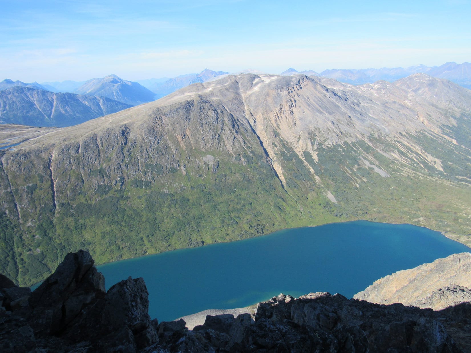
SE of the summit, Harvey Mountain dropped very steeply away into a deep canyon.  Lupe could see clear to the bottom.  Clouds continually hid Pyramid Mountain on the other side.  The topo map suggested it might be possible to journey over to Pyramid Mountain and an even higher peak to the E traversing a saddle farther N, but the weather squelched all ideas of giving that a try.

In fact, after only 10 or 12 minutes at the summit, with another line of showers approaching from the SW, Lupe had spent long enough up here.  The American Dingo would have had tremendous views of the Babine Mountains on a clear day, but that didn’t seem to be in the cards.  Loop had better start her descent in case the situation decided to take a turn for the worse.

So Lupe left the summit of Harvey Mountain.  She proceeded NW toward the S Central high point.

On the way to the S Central high point (L) after leaving the summit. Photo looks NW.

This time, Lupe did go to the top of the S Central high point.  By the time she got there, though, the next squall had arrived.  This one was mostly a dense fog.  Once again, everything disappeared from view.  Raindrops fell at first, quickly followed by snow granules.

Lupe was stuck here.  The snow granules, which stung a little driven by the wind, weren’t the problem.  With no trail and no visibility, it would be way too easy to get turned around.

Another wait doing nothing.  The wind and snow made it cold.  SPHP started getting nervous when the fog didn’t show any sign of breaking up quickly.  20 minutes went by.  Finally, the outline of another hill not far to the N could be seen.  Lupe headed for it, and the fog thinned some more.  Enough so Loop could keep going.

After waiting more than 20 minutes up on the S Central high point, the outline of another hill to the N could be seen. Lupe headed for it. Photo looks N.

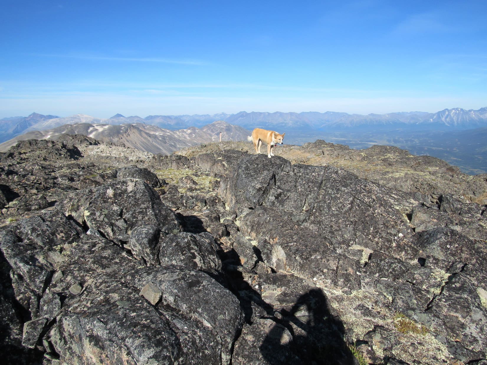
By the time Loop was near the N end of the mountain again, the fog was only wispy.  She turned and started down the broad NW ridge.  Blue sky appeared!  Oh, yeah!  Nearby, though, clouds still prevailed.

Looper back near the N end of Harvey Mountain again as wisps of fog continue to sweep by. The summit she’d left behind is on the L, the S Central high point on the R. Photo looks S.
Blue sky returns! Summit on the L. Photo looks S.
Improvements in the weather looked potentially temporary. Photo looks W.

By the time Lupe reached the last big rock formations on the NW ridge, she was in sunshine.  She had it made now.  The trail was just down the big alpine slope from here.  Once she reached the trail, it wouldn’t matter how foggy it got.

In sunshine on the last big rock formation on the NW ridge. Photo looks SSW.
Looking W from the same spot. Lupe would pick up the trail again down toward the L.
A peek back to the NE before continuing the descent.
Beautiful W slope of Harvey Mountain. Photo looks S.

Of course, Lupe did reach the trail.  The return was super simple the rest of the way.  Gravity helped to make it all so easy compared to SPHP’s huffing and puffing ascent.  The weather steadily improved (naturally!).  Looper even saw the glacier on Hudson Bay Mountain (8,494 ft.) off to the WSW, although the summit remained shrouded.

Hudson Bay Mountain W of Smithers is an ultra prominent peak (more than 5,000 ft. of prominence). Photo looks WSW.
Zoomed in on Hudson Bay Mountain.

After glimpsing Hudson Bay Mountain, it was down the winding trail through the forest all the way back to the trailhead.  (3:46 PM, 59°F)

On the pleasant, now sunlit, journey back to the trailhead.
Back for another taste of refreshing Driftwood Creek.
Delicious! Why don’t you ever have any, SPHP?
Mossy banked Driftwood Creek.

Harvey Mountain was destined to be the last peak Lupe climbed in Canada in 2017.  After another round of refreshment in Driftwood Creek, the Carolina Dog left the Babine Mountains returning to Highway 16.  The rest of the day was spent on the road, traveling SE through gorgeous British Columbia toward Prince George.

Loop didn’t make it all the way to Prince George.  Toward evening she stopped for another adventure.  This adventure wasn’t about climbing mountains, instead it was an adventure in beauty.   In 2016, when Lupe had been on her way NW on Hwy 16, she had stopped at the prettiest city park, Steelhead Park, in the little town of Houston.

Steelhead Park is right along the highway.  It isn’t very large, but walkways lead across a beautifully manicured lawn past shady trees and carefully cultivated flower beds.  There is even a fountain.  A stop to stretch those legs and enjoy Steelhead Park again was a must!

Lupe sets out on an adventure in beauty at Steelhead Park.
Steelhead Park features beautifully manicured lawns and carefully cultivated flower beds.
Whatcha think, SPHP? Do I look good in pink? …. Oh, yes! You’re so beautiful, Looper!
See any tall, dark, and handsome Dingoes around, SPHP? This is my sweet come hither look. …… Oh my, deadly!
By the fountain featuring leaping Steelheads.
Harvey Mountain was the last mountain I’m going to get to climb in Canada this year? That’s a sad thought!
Purple and gold! Think the Minnesota Vikings need an American Dingo mascot? I’d be pretty scary with horns, you know. Give me the ball, and I’m fast enough to score touchdowns, too!
No, on second thought, maybe I’ll just stick with beautiful things like mountains and flowers. Hard to win when they out weigh you 10 to 1. One good hit in the NFL, and I would be a Dingo pancake!
Yes, beautiful things are the way to go. I fit right in, don’t I?
Steelhead Park really is wonderful. So glad we stopped to enjoy it again! There’s mountains near Houston, too, SPHP! Maybe we could come back and climb one or two around here some day?

After visiting Steelhead Park, Lupe continued on.  Near Cluculz Lake SE of Vanderhoof, it got dark.  Lupe and SPHP stopped for the night.  No sense missing any scenery!  Tomorrow was another day.

Harvey Mountain trailhead directions: From Smithers, British Columbia head SE on Hwy 16.  After crossing the Bulkley River bridge, watch for Old Babine Lake Road, which soon appears on the L.  Follow Old Babine Lake Road approximately 4 miles to another L turn onto Telkwa High Road.  Go 1 mile to a R turn onto Driftwood Canyon Road.  Follow signs to Driftwood Canyon Provincial Park.  Keep going 6 km up Driftwood Canyon.  After crossing a series of single lane bridges over Driftwood Creek, the Harvey Mountain trailhead appears on the R.  Parking is limited.  Additional parking is available 1 km farther on at the Silver King trailhead.  Total elevation gain to the summit is 2,943 feet.

Links:

Next Adventure                       Prior Adventure

Babine Mountains Provincial Park Map

Babine Mountains Provincial Park Brochure

The Little Onion, Astlais Mountain & The Big Onion, Babine Mountains, British Columbia, Canada (8-8-18)

Want more Lupe adventures?  Choose from Lupe’s 2017 Dingo Vacation to the Yukon & Alaska Adventure IndexDingo Vacations Adventure Index or Master Adventure Index.  Or subscribe free to new Lupe adventures.

Fraser Peak, British Columbia, Canada (8-9-17)

Day 10 of Lupe’s 2017 Dingo Vacation to the Yukon & Alaska!

Something was still wrong.  The road Lupe had been following from the gravel pit went only a short distance before ending at a shack in an impenetrably dense forest.  This couldn’t possibly be right.  If it was, the forest had grown up to such an extent that the Carolina Dog was never going to get to Fraser Peak (5,978 ft).  After a quick glance around to make sure no sign of a road or trail was being missed, Loop and SPHP went back the way they’d come.

The instructions SPHP had taken off the internet before Lupe left on this Dingo Vacation seemed clear enough, and the morning had begun well.  It was a beautiful, cloudless day.  After leaving the International Falls trailhead, Lupe and SPHP had headed N on South Klondike Highway No. 2, stopping at a few pullouts along the way for a look at small sparkling lakes in the scenic, heavily glaciated Tormented Valley.

Lupe checks out views in the Tormented Valley near South Klondike Highway No. 2. Photo looks S.

Fraser Peak was only 5 miles N of International Falls, and easily spotted from the South Klondike Highway.  There was supposed to be a pullout that serves as a trailhead on the E side of the highway about 1 km (0.6 mile) S of Canadian Customs.  SPHP also watched for a side road going W or NW into the forest on the opposite side of the highway 100 meters (330 ft.) N of the pullout toward customs.

As it turned out, there were two large gravel parking areas on the E side of the South Klondike Highway.  Between them SPHP did see a side road going NW from the highway.  This side road was nearest to the pullout closest to Canadian Customs.  It was blocked by two cement barriers, and disappeared into tall bushes and forest beyond them.

The side road was not 100 meters N from either of the pullouts.  It was the wrong direction from the pullout closest to customs, and more than twice as far N as it should have been from the pullout farther S.  There was no doubt Lupe was in the correct area, however.  Fraser Peak was right where it should be, and so was Canadian Customs.  Maybe the online directions were just a bit sloppy?

SPHP turned the G6 around and drove back to the pullout farther away from customs.  Lupe would start for Fraser Peak (5,978 ft.) from here.  (11:05 AM, 66°F)

Fraser Peak from the gravel pullout on the E side of South Klondike Highway No. 2 roughly 1 km S of Canadian Customs. Photo looks WSW.
Another look with some help from the telephoto lens. Photo looks WSW.

Loop crossed over to the W side of South Klondike Highway No. 2.  It still bothered SPHP that the side road was so far from the pullout.  As the Carolina Dog followed the highway N, SPHP kept an eye out for signs of another road, but saw nothing.  Lupe reached the side road with its concrete barriers perhaps 250 meters from where the G6 was parked.

The side road headed W or NW into the forest, as expected.  This road was supposed to go 0.6 km before reaching a junction with another road near a gate.  Lupe would take the second road SW to Fraser Peak.

Fine and dandy, but that wasn’t how it worked out.  After entering the forest, the side road soon curved N away from Fraser Peak.  Unexpected.  Finding no sign of any trail continuing NW, Lupe and SPHP stuck with the road.  Before long Looper arrived at a gravel pit.

So, we’ve come all the way to NW British Columbia to tour a gravel pit, aye, SPHP? Better take another look at those directions! Photo looks N.

The Most High Exalted Dingo of the Arctic Sisterhood was right.  Better check those directions again.  The directions did mention this gravel pit and a highway maintenance garage as an alternate starting point for Fraser Peak.  For those coming from the N who don’t want to have to go through Canadian Customs, a road to the gravel pit leaves the W side of South Klondike Highway No. 2 shortly before reaching customs.

Not sure why we wound up here starting from where we did Loop, but it’s fine.  There’s supposed to be an old road going SW from the NW portion of this gravel pit.  It will take us to the gate we are supposed to be looking for, although it’s now 0.9 km away instead of only 0.6 km.

So follow the SW edge of this gravel pit NW looking for an old road?

Yep.  That ought to do it.

Except it didn’t.  Instead, when Lupe found an old road, it ended at this dilapidated shack in impenetrable forest.  Hmmm.  Back to the gravel pit.  Maybe there was another road even farther NW?  Sure enough, the American Dingo found one.  Yeah, this was it alright.  All systems go!

Lupe at the start of one of the two roads going SW (toward the camera) from the gravel pit. If only SPHP remembered if this was the right road, or the one going to the shack! If you take this one and arrive at a shack, come back and turn L (NW) here. The correct road isn’t far off. Photo looks NE.
What’cha think of this road, SPHP? Looking better? ….. Oh yeah, Looper. No doubt about it. All systems go! Carry on, sweet Dingo.

The correct road was nearly level and went through the forest heading straight toward the lower end of Fraser Peak’s NE ridge.  The whole mountain was soon in view.

Heading for Fraser Peak from the gravel pit and highway maintenance yard. Photo looks SW.

Loop reached the gate mentioned in the directions.  30 feet before the gate, a trail or faint road intersected with the road Lupe was on.  It came out of the forest from the SE (L).  SPHP was certain that was the route Lupe was supposed to have taken to get here from the highway.  Oh, well.  This had been a roundabout way, but so what?  It worked.

Lupe reaches the gate mentioned in the directions. 30 feet from the gate toward the camera, a trail or faint side road intersected with the road Lupe was following. It went E or SE and had to be the shortest route back to the highway. No doubt it was the route SPHP had intended Loop to use to get here. Eh, whatever works! Photo looks SW.

Beyond the gate, the road started gaining elevation.  Already near noon, it was sunny and getting hot out.  There wasn’t much shade on the road.  Lupe and SPHP would have liked to stop in the shade when there was some, but biting flies and mosquitoes made that not such a great idea.

The road had steepened quite a bit by the time it began curving W up a ravine.  A creek in the ravine was too large and swift to cross easily.  The directions said to continue following the road, anyway.  The road would lead to a better place higher up to ford the creek.

Lupe near the big stream rushing down from Bryant Lake. Photo looks W.
Getting closer to Fraser Peak. Photo looks SW.

The road briefly leveled out as Loop approached the ford.  An elevated pipeline in a wooden housing also went over the stream.  The wooden housing was clearly marked “Keep Off – Fall Hazard”, yet a distinct trail led right up to it.  Clearly this warning is not always heeded.

Lupe arrives at the ford. Bryant Lake, where the stream comes from, isn’t too far away beyond the ridge ahead. Photo looks W.

The ford didn’t look bad.  The water was swift and knee deep on SPHP, but the creek bottom wasn’t as full of big rocks where the road crossed it as elsewhere.  SPHP waded in.  Looper followed, but the fast water was deep enough to scare her.  She retreated to the bank.

SPHP made it across just fine.  Once on the far side, SPHP turned around to begin the process of coaxing Lupe to follow.  The Carolina Dog had vanished!  Looking up, there she stood, feeling foxy and quite pleased with herself on the Dingo bridge.

Warning sign? What warning sign? Mighty nice of these Canadians to provide this nifty Dingo bridge!

Now that the stream had been crossed, Lupe and SPHP left the road climbing a steep hillside to the SW.  In retrospect, it might have been better to stay on the road all the way to Bryant Lake, which wasn’t all that much farther away.  The lake would have been worth seeing.  However, climbing the hillside was a more direct route to Fraser Peak.

Looper on her way up the steep hillside after crossing the creek and leaving the road. Photo looks E.

The steep hillside wasn’t terribly high.  Loopster was soon up where the terrain leveled out to some extent.  Loop and SPHP now headed S or SE toward the lower end of the big E ridge coming down from the N end of Fraser Peak.

Lupe was already near tree line.  She traveled across open ground where little streams trickled down gentle slopes to shallow ponds.  Yet it must have been quite dry recently.  The tundra crunched beneath SPHP’s boots.  Loop had a good view of the big ridge she needed to get up on ahead.  A rocky ravine with a snow bank in it looked like a good place to begin the ascent.

Lupe reaches a flat area full of little streams and shallow ponds. Fraser Peak’s NE ridge is straight ahead. Lupe would try going up the ravine with the snow bank in it at Center. Photo looks SE.

Lupe and SPHP weren’t entirely alone.  As the American Dingo headed for the big ridge, several grouse or ptarmigans got her all excited.  They ran along the ground a short distance before flying off.

Lupe saw several of these grouse or ptarmigans on the tundra.
Approaching Fraser Peak’s NE ridge. Lupe began her ascent heading for the snow bank seen on the L. Photo looks WSW.

The route up the ravine with the snow bank was steeper than expected, and the upper reaches were very rocky.  Lupe had to wait around quite a bit for SPHP.  She was already getting some great views of the Tormented Valley off to the E and NE.

Lupe reaches the snow bank. This upper end of the ravine she’d come up was very rocky. Photo looks SW.
Lupe had plenty of time to relax while waiting for SPHP. She has a great view of a large portion of the Tormented Valley from here. Canadian Customs along South Klondike Highway No. 2 is in view on the near side of Bernard Lake. The gravel pit near customs and the road Lupe followed through the forest are also visible on the L. Photo looks NE.

When Lupe reached the ridgeline, she still had a very long climb ahead of her.  Fraser Peak’s long NE ridge had a series of large gaps or gashes running across it like the one she’d come up.  Just like at AB Mountain (5,036 ft.) and International Falls, these ravines were oriented SW/NE.  Lupe and SPHP found it easiest to stay well S of the steeper N edge of the ridgeline when trying to get past the gaps.

Between the gaps, Lupe had to climb up and over a series of steep ridges.  There was a lot of exposed rock, but for a long way there was also a fair amount of alpine vegetation.  Loop was often able to follow natural vegetated ramps zig-zagging up the rock formations on the ridges.

The gaps were sometimes full of broken rock.  Often there were large snow banks or hidden tarns.  Lupe almost always lost some elevation crossing these ravines.  The gashes made the climb significantly harder and more time consuming than going up a smoother, more even ridge would have been.

Whenever Loopster was on or climbing the ridges between the gashes, the views were tremendous.  She enjoyed a splendid panorama of a vast territory to the E.

Even on the lower portions of Fraser Peak’s long, rough NE ridge Lupe had fabulous panoramic views. Long, skinny Summit Lake in the Tormented Valley is seen below. White Pass is at the far end of Summit Lake on the R. Photo looks S.
Bernard Lake (Foreground) and Shallow Lake (L) form a continuous crescent down in the Tormented Valley, a great deal of which is seen here. The South Klondike Highway, Canadian Customs and gravel pit are all on the L. Photo looks NE.
Miss Giant Pink Tongue enjoying the day on the way up Fraser Peak.
Fraser Peak’s NE ridge was rough ground, but nothing too difficult or scary until much higher up. Photo looks W.
Lupe occasionally saw more grouse or ptarmigan. Photo looks S.
This grouse or ptarmigan didn’t seem worried about Lupe and SPHP passing by.
Looper on one of the ridges with a grand view of Summit Lake, White Pass (R), and many beautiful peaks beyond. Photo looks SSE.

After a long, winding climb over ridges and gashes, Lupe came to the last big gash in Fraser Peak’s main NE ridge.  She was above nearly all of the alpine vegetation now.  The gash was full of broken rock and snow.

Looking over the last big gash Loop had to get past. Photo looks WSW.
A certain Dingo was rather pleased to reach the huge snowdrift in the last big gash.
In addition to the big snowdrift, the last big gash contained a lot of broken rock. Mount Carmack (6,808 ft.) is the highest peak at Center in the distance. Photo looks SSW.

Once past the final gash, the toughest part of the climb up Fraser Peak was directly ahead.  This was the steepest part of the mountain.  Lupe and SPHP were now much closer to the cliffy N side of the ridge.  The ridge narrowed considerably as the Carolina Dog scrambled ever higher.

Lupe stands above the last gash. The hardest, steepest part of the climb up Fraser Peak was directly ahead. Photo looks WSW.
Fraser Peak is turning into quite a feat for my second Arctic Sisterhood adventure! Wonder what we’ll see from the top, SPHP?

American Dingoes are great scramblers.  SPHP frequently had to use hands for support.  A few super steep spots where there was a lot of loose rock and dirt were the worst.  The upper portion of the ridge narrowed so much that for the first time it was possible to see a path worn by other climbers.

SPHP proceeded cautiously, slowly.  A mistake up here would not be good.  Lupe was very patient.  Finally the steepest part of the climb was over.  The terrain remained very rough, but was rapidly leveling out.  Awesome cliffs were close at hand.

Getting close, but that’s not the summit yet. The rough terrain has already leveled out quite a bit. Photo looks SW.

Oddly enough, the scariest part of the whole climb was a short stretch of level ground.  Lupe was very high on the NE ridge when she came to a section that narrowed down to as little as 3 or 4 feet wide.  Only a 20 or 30 foot long stretch was this narrow, but the steep drops to the abyss on both sides were essentially cliffs.  This part of the ridge was flat overall, but covered with tilted rocks.  Fortunately, the rocks were small.

No significant obstacle rested upon this rock bridge in the sky, but the fearsome dizzying drops on either side gave SPHP pause.  Lupe waited calmly while SPHP tried to summon an ounce or two of courage.  Walking across that bridge of rock really wasn’t anything physically difficult at all.  Nothing to it actually.  It would take only a few seconds.  On the other side, the way to the summit was open.  This was it, the final test.  Several minutes passed.

SPHP patted Lupe and felt better.  Let’s do it!  Over in a flash.  Made it!  So pathetically easy, yet psychologically difficult.  Apparently the Most High Exalted Dingo of the Arctic Sisterhood suffered no qualms.  She had trotted across like it was nothing.

At any rate, it was done.  The route to Fraser Peak’s summit was wide open.  Fear turned to joy!  Lupe was going to make it!

Lupe safely beyond the narrow spot (not pictured). The route to the summit is all cake from here! Photo looks SW.

In only a few more minutes, Lupe was approaching the summit area.  The top of Fraser Peak (5,978 ft.) was divided into two minor ridges by yet another gash of moderate size.  Lupe and SPHP were closest to the lower NE section of the summit region.  Here, a large pole stuck up at the edge of a cliff to the E.  It had been visible for a long way from below, but SPHP had mistakenly taken it for an antenna or tower of some sort.

Lupe reaches the summit region. It was divided into two unequal parts by the gash seen at Center and R. The lower, smaller NE portion is ahead on the L. Some sort of large pole stood there at the edge of a cliff. Fraser Peak’s true summit is still farther ahead on the R. Photo looks SW.

Before continuing to the true summit, Lupe headed over to the curious pole to investigate.  The pole was at least 2 feet thick and perhaps 20 feet tall.  It was all bare wood except for a red painted figure resembling an odd Santa Claus carved into the upper end of the pole.  The figure faced NE gazing out beyond the cliff over the Tormented Valley.

Lupe arrives to inspect the odd totem pole on Fraser Peak. Photo looks S.

The significance of this strange totem pole wasn’t at all clear.  Lupe had seen similar native artwork in Carcross a few days ago.  The red figure almost assuredly was not Santa Claus, but no plaque or anything else was around to explain who or what he represented.

Lupe found nothing to explain the presence of this totem pole or the strange figure carved into it. Photo looks S.
Whoever the red figure represents, he has a tremendous view of the Tormented Valley. Photo looks NE.
If the strange character at the top of the pole would have been able to turn to face S, he would have had this incredible view of Summit Lake and the South Klondike Highway. White Pass is at far R. Photo looks S.

Having inspected the totem pole without learning much, it was time to go in search of Fraser Peak’s true summit, which had to be very close now.  Lupe went down into the gash separating the summit area into two sections.  The terrain was still rising as she headed SW up onto the larger, higher ridge.

A look at the gully or gash that separates Fraser Peak’s summit area into two separate ridges. The lower, smaller NE ridge is on the L. From the totem pole, Loop headed SW up onto the bigger, higher ridge on the R in search of the true summit. Photo looks SW.

The higher SW portion of Fraser Peak’s summit area encompassed 2 acres of rocky ground almost entirely devoid of vegetation.  The surface was uneven, but not steep.  Near the SW end, 4 minor high points were in contention for the title of true summit.  The two highest were a couple of large boulders separated by only 5 to 10 feet.  The W boulder seemed an inch or two higher than the E one.

Lupe hopped up on the W boulder to claim Fraser Peak (5,978 ft.) as her first peakbagging success since becoming the Most High Exalted Dingo of the Arctic Sisterhood after climbing AB Mountain (5,036 ft.) two days ago.  Loop had an eye-popping view of Taiya Peak (6,844 ft.) (2,086 m) a couple of miles away to the SW.

Success! The Most High Exalted Dingo of the Arctic Sisterhood stands atop the highest boulder on Fraser Peak. Beyond her is gorgeous snow and glacier clad Taiya Peak. Photo looks SW.

As impressive and beautiful as Taiya Peak was, it was only part of a vast snow white panorama of dramatic mountains partially buried beneath massive glaciers extending to the W horizon.

SPHP recognized at least one of those high distant peaks.  Lupe had seen it only yesterday from another angle at the far W end of her explorations off the International Falls trail.  She was seeing it again here on Fraser Peak from a much higher vantage point.  Not until many months later while looking at maps did SPHP begin to suspect that peak might have been the Skagway High Point (8,239 ft.).

Wowee, SPHP! What a fantastic view! I’m sure glad we came to Fraser Peak. This is a spectacular peak for my second ever Arctic Sisterhood expedition. Simply amazing!
Another look toward the heart of the most glorious scene. Lupe had seen the high distant peak at far L only yesterday from the International Falls area, too. SPHP wonders if it isn’t the Skagway High Point (8,239)? Photo looks W with help from the telephoto lens.
Lupe gives a one ear salute. The dark peak at the far R may be Mount Van Wagenen (7,041 ft.) on the Alaska/British Columbia border. Photo looks W.

After a stint at the true summit, Lupe moved to the next highest boulder only 5 or 10 feet away.  It appeared to be only an inch or two lower than the true summit.  From this E boulder Loop could see part of Summit Lake and the jagged snowy mountains beyond it to the SE.

Loopster on the 2nd highest E boulder on Fraser Peak. Part of Summit Lake is in view more than 3,000 feet lower. White Pass is at the far end of the lake on the R. Photo looks SSE.

The third highest rock on Fraser Peak was another large boulder 20 feet NNW of the two highest ones, but was clearly a little lower.  Another 30 feet beyond it to the NW was yet another high point on a small ridge.  This fourth high point was easily at least a couple of feet lower than the true summit, but was near the W edge of the summit area, making it perhaps the best seat in the house as far as views were concerned.

Lupe and SPHP headed over to the ridge where the fourth high point was located to take a look and have a break.  The Carolina Dog rested comfortably on a small cushion of vegetation next to the rocks.  Looper eagerly accepted water and Taste of the Wild.  Meanwhile, SPHP gazed out upon the splendid scenes in all directions.

The awesome panorama to the W. Taiya Peak is on the L. The valley on the R drains into Bryant Lake (not pictured). Photo looks W.
Taiya Peak (6,844 ft.) (2,086 m) (L). Photo looks WSW.
Possibly the Skagway High Point (8,329 ft.) (far L) and Mount Van Wagenen (7,041 ft.) (far R). Photo looks W.
Skagway High Point (far L)? The rounded glacier in the foreground is on the NW slopes of Taiya Peak. Photo looks W with lots of help from the telephoto lens.
Loopster fuels up on Taste of the Wild while relaxing next to some of the highest rocks along the W side of Fraser Peak’s summit.
A spectacular look at the mountains S of the International Falls trail (which is below the far side of the big ridge in the foreground) where Lupe had been only yesterday. The higher L peak of the two closest sharp peaks at Center is Feather Peak (5,889 ft.). The highest peak on the L is Mount Carmack (6,808 ft.). The high point on the R is Mount Cleveland (6,362 ft.). All of these mountains are across the border in Alaska. Photo looks SW.

It had taken a long time to climb Fraser Peak.  Lupe and SPHP lingered at the summit for over an hour.  Loop appreciated both the extended break and the views.  She was quite content taking it easy, or following SPHP around the summit looking first one direction then another.

The mountains N of Fraser Peak all had far less snow on them than the ones to the S, which were closer to the ocean. The S end of Bennett Lake is seen in the distance. The high peak next to it on the R is likely Paddy Peak (7,238 ft.). Photo looks NNE.
The very S end of Summit Lake and White Pass are seen below on the R. Photo looks S with help from the telephoto lens.
Looking SSE with help from the telephoto lens.

Precious minutes flew by.  Sadly, the moment arrived when the sun said Lupe needed to move on.  One last look at that glorious view to the W.

Looking W from Fraser Peak. Taiya Peak on the L.

It was too grand to simply depart.  Would Loop like to go back to the true summit again?  She would!  A delaying tactic, but it still led to a sublime moment.

Conditions had been perfect.  This had been a truly glorious day and mountain.  And now, for the last time, Lupe stood perched high at the true summit of Fraser Peak.  Mighty, frozen treasures of the Canadian and Alaskan wilderness were on display beyond her.

Once again at the true summit of wonderful Fraser Peak.
A sublime moment.

Done.  Puppy, ho!  Onward.

The Most High Exalted Dingo of the Arctic Sisterhood leapt down off the summit rock.  Better get a move on.  It would take SPHP forever and a day to carefully scramble back down that steep upper NE ridge.

Still on top of Fraser Peak, but starting back. A fair amount of the summit area is in view here. The totem pole can be seen at Center to the L of Lupe’s tail. Photo looks NE.

At the lowest end of the summit area at the top of the NE ridge, Lupe paused.  Looking back, she could see that odd Santa Claus at the top of the totem pole.  SPHP looked down the dizzying NE ridge.  Yowser!  If it had seemed steep on the way up, it looked incredible staring down upon it from way up here.

Lupe pauses at the top of the steep NE ridge. Part of Bryant Lake is seen below. Photo looks NE.
Lupe bid farewell to the odd Santa Claus at the top of the totem pole on Fraser Peak.

Of course, Lupe had hardly started down, when SPHP had to face the narrow rock bridge for a second time.  Having done it once already, it now seemed less intimidating.  Still a place for caution, but SPHP barely hesitated before quickly striding across.  Loop was over it in a flash, too.  The long, slow descent of the upper NE ridge began.

Lupe hadn’t paid much attention to Bryant Lake on the way up.  It had been out of sight until she was climbing the upper NE ridge, and then she had been facing the wrong direction.  On the way down, though, she was facing it.  Loop had plenty of time to study the lake while SPHP ever so slowly, bit by bit, carefully worked down the ridge.

Bryant Lake partially in view on the way down the NE ridge. Photo looks NNE.
A less obstructed look from farther down the ridge.

An awful lot of time had gone by when Lupe and SPHP finally reached the start of the gashes along the ridgeline.  The sun would still be up for a little while longer, but Loop was now in the shadow of the mountain.  Even this far down, the middle part of the long ridge seemed much steeper and the gashes much deeper than SPHP remembered.

Lupe was now having a grand time, though.  She was back where there was some vegetation.  She raced up and down, all around, sniffing here, there, everywhere, among rocks and ridges, tarns and snow banks.  She was often far, far ahead of SPHP.  Lost from sight, she would suddenly reappear in another direction, still running and sniffing.  From time to time, she returned happy and breathless to SPHP.

The terrain looked different going down.  SPHP had a hard time recognizing which gash Lupe needed to go down to get off the ridge.  The sun had set and light was beginning to fade by the time SPHP guessed and committed to a long gash full of rock and boulder fields.

By now, the Most High Exalted Dingo of the Arctic Sisterhood was out of gas.  Three long days of adventures in a row and the Carolina Dog had shot her wad.  Loopster begged SPHP to stop and rest.  SPHP complied, but never for more than a minute or two.  It was going to be dark soon.  Being stuck way up here among steep boulder fields was not in the plan.

Happily, the chosen gash was the correct one.  There was that snow bank again.  Lupe finally made it off Fraser Peak’s NE ridge.  She got soaking wet and cold fording the creek instead of using her Dingo bridge.  On the road passing through the forest in near darkness, SPHP sang badly (a special talent) to ward off bears.  No bear dared take on that racket.  After reaching the gate, Loop took the side trail which SPHP believed was a shortcut back to the highway.

It was!  The side trail became a road.  Sure enough, it led Lupe back to the highway only 100 meters N of the pullout where the G6 sat all alone waiting for her return.  (11:12 PM)

Alpo, water, dinner, lights out.  Fraser Peak (5,978 ft.) had been such a fabulous day!

On Fraser Peak, British Columbia, Canada 8-9-17

Trailhead Notes: The trailhead for Fraser Peak is the second big pullout 1 km (0.6 mile) S of Canadian Customs on the E side of South Klondike Highway No. 2.  (The highway from Carcross to Skagway)  There are no signs, information or facilities on site.

The most direct 0.6 km (0.4 mile) long road to the gate at the connecting road leading to Fraser Peak is only 100 meters N of this pullout back toward Canadian Customs on the opposite side of the highway.  Look carefully and it’s not hard to find.  Loop and SPHP missed it, because trees and bushes have grown up sufficiently to hide this road from the highway.  Vehicle traffic is blocked at the start by several large boulders.

Want more Lupe adventures?  Choose from Lupe’s 2017 Dingo Vacation to the Yukon & Alaska Adventure IndexDingo Vacations Adventure Index or Master Adventure Index.  Or subscribe free to new Lupe adventures.