Mount Ripinsky, Haines, Alaska (8-11-17)

Days 11 & 12 of Lupe’s 2017 Dingo Vacation to the Yukon & Alaska!

Day 11, 8-10-17 –  After 3 big days of adventure in a row, Loop and SPHP were both looking forward to taking it easy.  Even a rest day would be packed with awesome scenery.  Lupe could relax riding in style with splendid views as SPHP made the long drive to Haines, Alaska.

The morning began sunny and bright.  Shortly after 8:00 AM, a steady stream of cars, trucks, and buses commenced on South Klondike Highway No. 2.  Canadian Customs must have opened.  SPHP fired up the G6, and Lupe was underway.  Loop had no problem getting through customs – she never does.  For the first time ever, though, the customs officer asked to see her current rabies certificate.  Everything was in order, and Loopster was northward bound.

With a whole day to get to Haines, Loop had plenty of time for short stops at points of interest along the way.  Tutshi Lake was first in line.  The Carolina Dog stopped by several viewpoints along the lake’s W shore.

Tutshi Lake was the first point of interest Lupe stopped at along the South Klondike Highway N of Canadian Customs. Photo looks NNE.
Tutshi Lake is in far NW British Columbia S of Carcross in the Yukon and N of Skagway, Alaska. Photo looks S.
The N end of Tutshi Lake bends E away from the South Klondike Highway, extending for miles through the Canadian wilderness. Photo looks NE.

Whitehorse, capitol city of the Yukon, was the first big town Lupe and SPHP had been in for a week since leaving Prince George.  Boring stops for supplies and fuel were mandatory.  Lupe did enjoy a visit to the S.S. Klondike, a sternwheeler steamship which used to ply the upper Yukon River between Whitehorse and Dawson City.

In Whitehorse, Lupe got to drop by the S.S. Klondike, which used to ply the upper Yukon River between Whitehorse and Dawson City.

NW of Whitehorse, SPHP stopped by Takhini Hot Pools, a relatively short detour (6 miles or 10 km) off the North Klondike Highway at the end of Hot Springs Road.  The day was sunny and warm (75°F).  SPHP had to leave the windows down on the G6 so Loop wouldn’t roast.  SPHP spent an hour or more relaxing in the hot springs.  Lupe spent it warily eyeing numerous bees buzzing about.

So how was it, SPHP?

The Takhini Hot Pools were great, Looper!  Needed that.  Not nearly so awesome a setting as Liard Hot Springs and twice the price, but I did enjoy the hot pools and it sure feels wonderful to be clean again!

You sniff better too now, SPHP, so that’s a good thing.  Now can we get out of here?  I’m lucky I haven’t gotten stung.  The G6 has been humming ever since you left.  These hot springs stops may be grand for you, but I’m not gettin’ a whole lot out of them.

Yeah, let’s head out.  Sorry about the bees and the wait.  We’ll keep the windows down for a ways and hopefully lose this swarm pretty quickly.  Glad you’re OK.

The bees had thankfully all flown out the windows by the time Looper was back on the Alaska Highway.  Finally able to relax again, she enjoyed a long, pleasant cruise W.  At Haines Junction, SPHP turned S on Highway No. 3.  20 minutes later, Lupe was at beautiful Kathleen Lake with a view of King’s Throne (6,529 ft.) in Kluane National Park.

Only a little over a year ago, Lupe had climbed King’s Throne on a windy day.  It had been a marvelous, though difficult, adventure.  Loop and SPHP were the last of the few that had persevered all the way to the summit.  The views of Kathleen Lake and the wild mountains to the W had been spectacular!

The Carolina Dog wasn’t going to climb King’s Throne again today, but it was fun to gaze up and remember what a day that had been!  Lupe and SPHP took a stroll along the shore of Kathleen Lake, then returned to the G6 to devour a roasted chicken purchased in Whitehorse with a fabulous view of the mountain.

King’s Throne Peak from the shore of Kathleen Lake. A little over a year ago, Lupe had climbed King’s Throne Peak during her 2016 Dingo Vacation to the Canadian Rockies, Yukon & Alaska. Photo looks SSW.

Highway No. 3 S of King’s Throne was a gorgeous drive!  Lupe and SPHP had never been here before.  The highway was in great condition, like new really, and traffic was sparse.  Lupe saw Dezadeash Lake followed by many miles of unspoiled tundra and magnificent mountains.  The farther S Lupe and SPHP went, the more snow and ice was seen clinging to these remote and increasingly rugged peaks.

Lupe made quite a few stops to sniff the air.  Sometimes she took short walks out onto the vast tundra.

The drive S on Highway No. 3 to Haines was absolutely gorgeous! Lupe made many short stops to admire the tundra and magnificent remote peaks.
Loop and SPHP were always checking out the mountains to see if they might be something she could climb. Even when they looked like possibilities, it was often hard to tell if there might be intervening large streams or rivers that she couldn’t get across.
Of course, the most awesome peaks were far beyond Lupe and SPHP’s capabilities.

Highway No. 3 eventually went over a pass.  On the other side, it was clear the road was about to lose a ton of elevation on the way down into a vast canyon.  Before making the descent, SPHP found a place to park.  Loop was ready to blow off some steam exploring the pass.  The day had been clouding up, making the mountains appear solemn and remote, but the American Dingo had a good time.

After Highway No. 3 went over a pass, it was clear Lupe was about to lose a ton of elevation descending into the canyon ahead on the L. SPHP parked the G6, so Lupe could run off some energy exploring the area near the pass. Photo looks SW.
From another angle, this mountain E of the pass had looked like a peak Lupe could climb. Heh, guess not, although she could have made it up to the high point on the R.
Impressive peaks and glaciers formed the towering W side of the canyon Lupe was approaching. All that snow meant Loop was getting closer to the ocean.
Lupe enjoys half an hour out of the G6. Looks like she is going to be ready for her next big adventure coming up tomorrow!
Wow! What beautiful mountains! Under blue skies they must really be incredible.

After Lupe’s short break from the G6, SPHP drove on down into the canyon.  By the time the Carolina Dog reached the bottom, she couldn’t have been much above sea level.  Highway No. 3 became No. 7 at the Alaska border.  The highway followed the N bank of the braided Klehini River.

After leaving the Yukon and crossing the border into Alaska, Lupe stands on the N bank of the braided Klehini River.

The Klehini River proved to be a tributary of the Chilkat River, which flowed SE the rest of the way to Haines.  The Chilkat River is known for the Alaska Chilkat Bald Eagle Preserve, created to protect the world’s largest concentration of bald eagles.  The eagles tend to congregate here in fall and winter.  Lupe didn’t see any bald eagles today.

The Klehini River flows into the Chilkat River, which in turn flows SE toward the Chilkat Inlet of the Lynn Canal near Haines. The Chilkat River is known for the world’s largest concentration of bald eagles.

Lupe reached Haines near sundown at the end of what had become an overcast day.  Haines was in a fantastic setting on Portage Cove.  Towering snow and ice-capped peaks were in view across Chilkoot Inlet.  This dark evening, the town itself seemed quiet and small beneath the gray sky.  Haines did not look nearly so much like a tourist town as Skagway had.  No cruise ships could be seen in port.

Remaining daylight was quickly fading away.  A place to park was found along the Chilkoot Inlet.  Soon Lupe and SPHP were fading away, too.

Day 12, 8-11-17 –  Lupe was up bright and early.  Well, sort of.  The sky was still thinly overcast, so the morning wasn’t quite as bright as it might have been.  Lupe started her day checking out the view of the Chilkoot Inlet.  Although it had taken a full day to drive to Haines (at an admittedly leisurely pace), it was odd to think that the Carolina Dog really wasn’t all that far from where she’d started out yesterday morning.  Skagway was just up Taiya Inlet, which Lupe could see from here.

Up early, Lupe checks out the view of the Chilkoot Inlet. Photo looks SE.

The first couple hours of the morning were spent at a pullout along Portage Cove with a view of Haines.  This pullout would soon become a favorite spot while in the Haines area.

Haines, Alaska from Lupe’s favorite pullout overlooking Portage Cove. Photo looks SW.

Lupe had a big adventure planned for today.  She was going to climb both Mount Ripinsky (3,675 ft.) and Shakuseyi Peak (3,917 ft.)!  It was an ambitious plan, so the American Dingo would need to get a fairly early start.

She couldn’t start too early, though.  SPHP had to go shopping first.  Not the usual window shopping, but real shopping.  With money.  After Fraser Peak (5,978 ft.) two days ago, SPHP’s R boot was threatening to disintegrate.  Haines didn’t seem to have much of a business district, but SPHP did find a store that was half grocery store, half general store.

So did you get new boots in there, SPHP?  You weren’t gone very long.

Nope, not boots, Looper.  Did find some new shoes, though.  Some sort of running shoes, I think.

Running shoes!  Don’t ever remember you doing much in the way of running, SPHP.  That’s my specialty.

Well, maybe I’ll take it up.  Have a look.  Kind of sweet aren’t they?

Why, they are the prettiest little shoes you’ve ever had, SPHP!  They could be dancing slippers they look so light.  The bright blue and grey look good together.  I hope you actually can run in them.  We’ll be able to climb ever so many more mountains, if you can pick up the pace!

Hah, we’ll have to see about that!  They are rather pretty aren’t they?  Merrells, too!  Regularly $90 marked down to $54.

Oh, a bargain!  I’m still surprised you didn’t get any boots.  They look great for racing around, but not so rugged for climbing mountains.  Think they’ll last?

Eh, maybe for a while.  They did have one great advantage over everything else in there.

What’s that?

They were the only pair of anything in my size.  Made for an easy decision.  This store had a “no dithering required” selection.

And with that, Lupe was on her way to the Mount Ripinsky trailhead.  SPHP found it at the end of Young Street, parking the G6 beneath the shade of some trees nearby instead of in the sandy, exposed parking lot.  (9:49 AM, 54°F)

Lupe wasn’t off to much of an early start at all, but at least she was on her way.  The first part of the trail followed a level ATV road.

Lupe at the start of the Mount Ripinsky trail. She followed this ATV road only a couple hundred yards before another sign pointed L up into the forest where a wide foot trail left the road.

After only a couple hundred yards, the Mount Ripinsky trail left the ATV road going L up into the forest.  Here the trail was a wide, well-worn path, which in 150 feet brought Loop to a trailhead kiosk with maps and information.

North Summit is the top of Mount Ripinsky. Peak 3920 is Shakuseyi Peak. Lupe hoped to get to both of them.
Lupe reaches the trailhead kiosk.
According to this map, Lupe was actually starting out at the Skyline Trailhead. (Seen at far R) Several other routes up Mount Ripinsky are possible from other trailheads. Lupe and SPHP were taking the longest, but easiest approach.

Beyond the kiosk, the trail soon began to climb and quickly narrowed down to a good single track.  Lupe was in an open forest of very tall trees.  The forest floor contained some strange plants with huge dark green leaves 2 or 3 feet long and nearly 1.5 feet wide.  Devil’s club and other plants were present, too.

Lupe did not run around exploring this forest.  She stayed right on the trail, which was probably best, anyway.  Early on, there were sometimes wooden stairs or ramps with a sort of shingle-like material fastened to them for better traction.  Loop enjoyed running up and down these wooden pathways.  The whole forest was quite reminiscent of Lupe’s adventure in the Ancient Forest SE of Prince George, except that the trees here were not nearly as large in circumference as the redcedars of the Ancient Forest had been.

Lupe did not explore this coastal rainforest, but enjoyed running up and down the wooden stairways present on some early sections of the Mount Ripinsky trail.

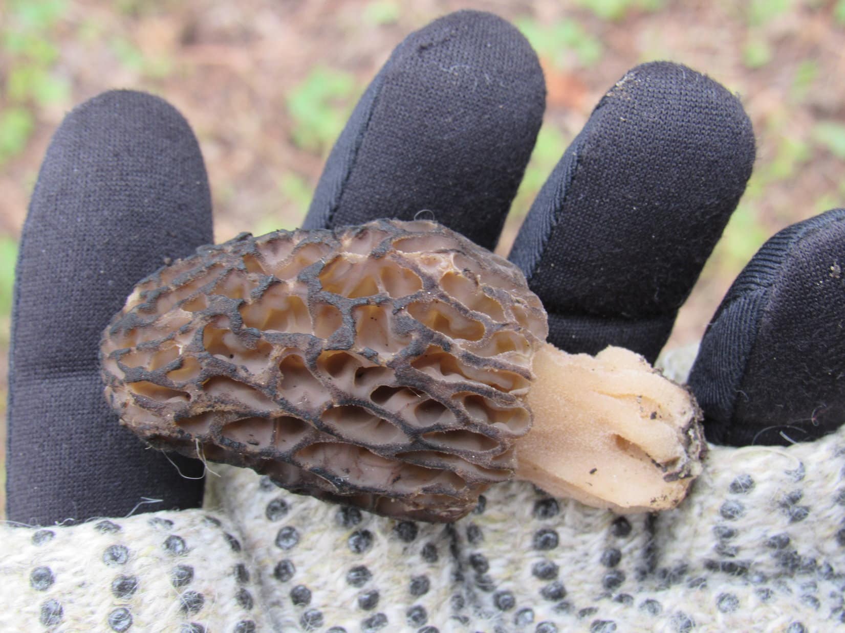
The Mount Ripinsky trail gained elevation steadily for a long way.  Loop was soon past the last of the wooden stairs and ramps.  The vegetation changed.  The strange plants with the huge leaves and Devil’s club gave way to blueberry bushes, a delightful development in SPHP’s opinion.

These blueberry bushes were several feet tall.  While walking the trail, SPHP could easily snag delicious, fresh blueberries without even having to stoop over.  There were two distinct varieties, the usual purplish blue blueberries and a shinier, dark, nearly black version.  Both were sweet and wonderful, with a bit of tartness.

The blueberries slowed progress down quite a bit, as SPHP dilly-dallied at particularly abundant bushes.  Lupe kept a watchful eye out for any developments in the forest of interest to Dingoes, but she didn’t even see a squirrel, much less anything as exciting as a bear.

Lupe kept a watchful eye on the forest while SPHP enjoyed blueberry feasts, but she never even saw so much as a squirrel.

The trail went on and on through the forest.  Although the sky remained overcast, the sun managed to shine through to a degree.  A cool, muggy atmosphere prevailed.  It was hardly warm, but even in only a T-shirt, SPHP was sweating.  The humidity was getting to Lupe, too.  She became listless and plodded along at SPHP’s heels.

A series of steep climbs were followed by nearly flat sections.  Lupe passed by several junctions with trails coming in from the S.  She always stayed R at these intersections continuing NW on the Main or North Summit trail, as signs alternatively called it.  The Ridge trail intersection came first, followed by junctions with the E and W Piedad trails.

By the time Loopster reached the W Piedad trail intersection she was at close to 2,000 feet elevation and halfway to Mount Ripinsky.  So far she hadn’t had views of anything except forest and SPHP greedily devouring blueberries.  Nothing much changed for a while longer, but eventually things finally began to open up.  Lupe could see two high hills ahead.  The more distant one appeared to be above tree line.

Lupe was well beyond the junction with the West Piedad trail when she finally came to this opening in the forest. She could see two high hills ahead. Photo looks NW.

The trail returned to the forest as Lupe started up the first hill.  Back at the beginning of the Mount Ripinsky trail, the trees had been very tall.  Up here, they were all short, apparently stunted by a much harsher climate at this elevation.  Approaching the top of the first hill, the stunted forest gave way to steep alpine meadows.

Lupe was finally getting some pretty impressive views.

Looking down on Haines, Alaska from the upper slopes of the first hill. Chilkat Inlet is on the R. Chilkoot Inlet on the L. They both meet in the distance to form the Lynn Canal. Photo looks SE.
Looper in the alpine meadows on her way up the first hill. Photo looks NW.
Heading up the first hill. Mount Emmerich (6,800 ft.) is on the R. Photo looks SW.
Loop with a fabulous view of Chilkat Inlet. Photo looks SSE.

From the top of the first steep hill, the second one was in view a short distance ahead.  Lupe would actually lose a bit of elevation getting to its base, but another steep climb would then ensue.

From the first hill, Lupe has a clear view of the second one ahead. It would be another steep climb, but fortunately not a long one. This second bare hill is actually Mount Ripinsky’s lower S summit. Photo looks NW.

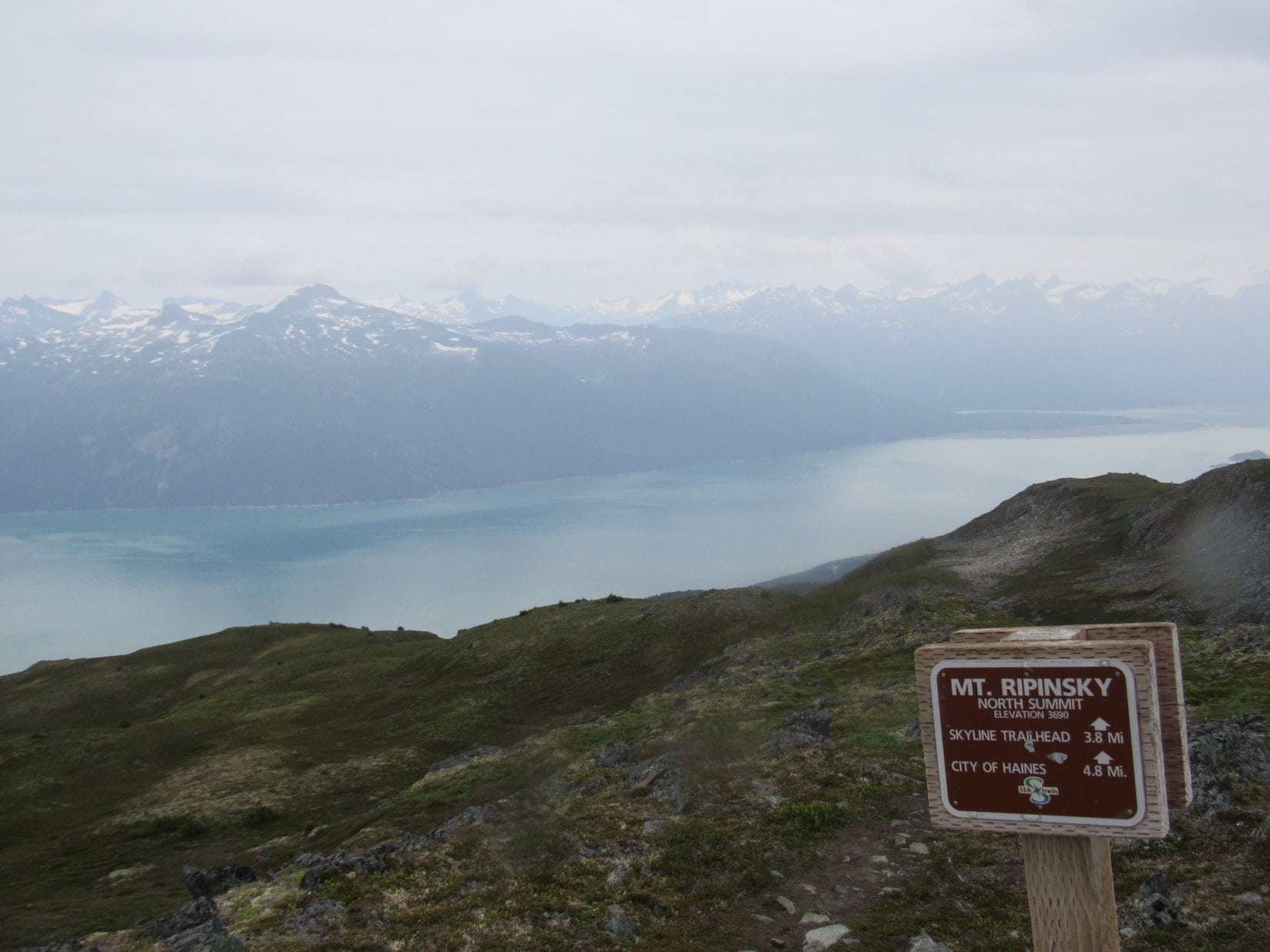
Near the top of the second hill, the trail was badly eroded.  Lupe had no trouble with it, but SPHP struggled to some degree.  Nevertheless, both Loop and SPHP were soon on top.  This second hill was actually Mount Ripinsky’s lower S summit.  The N summit, which was the true summit, was now in view directly ahead.

From the second hill, which is actually Mount Ripinsky’s lower S summit, Lupe has a clear view of the true N summit ahead. It’s not far off now! Photo looks NW.

Mount Ripinsky’s true summit wasn’t much farther now.  However, a chilly SW breeze had come up.  The clouds were thicker, and the sky was noticeably darker than before.  A glance toward the S looked like matters were about to deteriorate further.  Rain was coming.

The views might easily disappear completely before Lupe could reach the true summit.  Better take a few photos from here, just in case.  This open alpine tundra was much more to Lupe’s liking than the forest had been.  She was having fun running around, but agreed to cut her romp short to give SPHP a paw.

Lupe on Mount Ripinsky’s S summit. The Chilkat Inlet is on the R, with the Lynn Canal beyond it in the distance. Tomorrow Lupe was going to climb the lower dark hill on the L, which is Mount Riley (1,759 ft.). Photo looks SSE.
Rugged icy peaks of the Chilkat Range are in view on the far side of the Chilkat River valley from Mount Ripinsky’s lower S summit. Photo looks S.
Mount Emmerich (6,800 ft.) (L) from Mount Ripinsky’s S summit. Photo looks SW.
Chilkoot Inlet is on the R. In the foreground on the L is the SE end of Lutak Inlet. The dirty gray water at far L is the S end of Taiyasanka Harbor. The S end of Taiya Inlet, which leads to Skagway, is in the distance on the L. Photo looks NE.
High peaks of the Chilkat Range. Photo looks S with help from the telephoto lens.
Mount Emmerich (6,800 ft.) with help from the telephoto lens. Photo looks SW.

Much to Lupe’s delight, the saddle leading to Mount Ripinsky’s N summit contained several large snowbanks.  A small tarn was present, too.  SPHP had gotten to dilly-dally among the blueberry bushes, so Lupe figured she ought to be able to goof around frolicking on the snow for a bit.

Lupe goofs around frolicking on a big snowbank in the saddle between the S and true summits of Mount Ripinsky. The area where the Taiya Inlet and Chilkat Inlet meet is seen on the L. Mount Villard (4,990 ft.) is the highest peak in the foreground on the R.
Mount Emmerich (L) and the Chilkat River valley from the saddle. Photo looks W.
Mount Villard (4,990 ft.) (L of Center) from the saddle between Mount Ripinsky’s S & N summits. Photo looks E.

Minutes before Lupe reached the true N summit of Mount Ripinsky, a light rain started in.  The wind kept blowing more strongly as conditions continued to deteriorate.  SPHP resorted to putting on a thermal layer and a rain poncho.  Looper just had to endure getting cold and wet.

In wind and light rain, Lupe reaches the sign at Mount Ripinsky’s N summit. Photo looks NW.
Lupe poses in the strengthening wind on Mount Ripinsky. Shakuseyi Peak (3,920 ft.), her next peakbagging goal, is ahead at far L. Photo looks NNW.
Lupe perches somewhat reluctantly in wind and light rain at the true summit of Mount Ripinsky. Chilkoot Inlet (L) and Chilkat Inlet (R) are in still in sight despite the deteriorating weather. Mount Riley (1,759 ft.) is much lower at Center. Photo looks SE.
On top of Mount Ripinsky! Chilkat Inlet on the R. Photo looks SE.
Mount Ripinsky (3,675 ft.) summit.
A fair look at the Chilkat Peninsula given the conditions. The hill on the R is the site of the Kal Benchmark (1,450 ft.).
Looking down on the convergence of the Lutak (L), Taiya (Center beyond the point), and Chilkoot (R) inlets. Photo looks E.
Chilkat River valley. Photo looks WSW.

Making it to the summit of Mount Ripinsky was only half of the plan for the day.  Lupe was still supposed to go on to Shakuseyi Peak (3,920 ft.), which was in sight to the NW.  SPHP had seen a metal container chained to the top rocks on Mount Ripinsky.  No doubt it contained a registry, but between the deteriorating weather and pondering whether it made any sense to continue on to Shakuseyi Peak, SPHP failed to sign it for Looper before she left the summit.

Loop and SPHP made a start for Shakuseyi Peak, but didn’t get far at all before it was pretty clear that an unavoidable loss of hundreds of feet of elevation would be involved.  The trail ahead wound along a narrow ridgeline that looked like fun.  However, it was still another 2.8 miles to Shakuseyi Peak, and the weather was only getting worse.  Lupe would have to retrace every step on the return trip.

Mount Shakuseyi, the pointy hill at Center, was Lupe’s next peakbagging goal. Unfortunately, the weather continued to deteriorate. Photo looks NW.

The wind started to gust.  Rain fell harder.  The world was turning gray as more distant high peaks faded from view.  It was getting just plain raw and miserable out.  Conditions weren’t awful, but they weren’t much fun either.  Did Lupe want to go back to the G6?

Finally!  I thought you would never ask!

At the mere suggestion, Lupe barked like a nutcase, she leapt at SPHP, she ran in circles.

Already sick of being cold and wet, aye?  I’ll take that as a yes.

It was too bad that Shakuseyi Peak had to be abandoned, but under the circumstances, it seemed the only reasonable thing to do.  Who knew what was in store?  Lupe returned to the summit of Mount Ripinsky, then started back down the trail toward the lower S summit.

After giving up on Shakuseyi Peak, Lupe returned briefly to the summit of Mount Ripinsky. It’s a misty view, but the Katzehin River delta is seen at R where the river empties into the Chilkoot Inlet. Photo looks SE.
Heading down into the saddle leading to the S summit. Photo looks SE.

Of course, life being what it is, the weather began improving almost as soon as Loop lost appreciable elevation.  However, it was hard to know how it would all turn out.  This might easily be nothing more than a temporary respite.  Other than a dull sense of remorse over not persevering, no further thoughts were devoted to Shakuseyi Peak.

Lupe continued back toward Haines and the trailhead.  At least the views hadn’t been totally devoured by fog and rain.

Starting down from the lower S summit. Haines, Alaska is in view. Portage Cove, a bay off Chilkoot Inlet, is on the L.
The Chilkat Peninsula extends SSE from Haines. It includes both Mount Riley (L) and lower Kal Benchmark (R), which is not an island. At the far end Chilkoot (L) and Chilkat (R) Inlets meet at Seduction Point to form the Lynn Canal. The N end of Sullivan Island is seen in distance on the R. Photo looks SSE.
Taiya Point at the far S end of Halutu Ridge is on the L. On the near side is the SE end of Lutak Inlet. On the far side of Taiya Point is the S end of Taiya Inlet, which goes N to Skagway. Chilkoot Inlet is on the R. Photo looks ENE.
Getting down close to tree line again. Mount Riley (L), Kal Benchmark (Center), and Sullivan Island (R). Photo looks SSE.
Kal Benchmark (1,450 ft.) (Center) with help from the telephoto lens. Photo looks SSE.
Lupe takes a final look before descending into the forest.

By the time Lupe was back in the forest, the rain had quit.  The wind wasn’t blowing down here, either.  It warmed up enough so that even going downhill SPHP had to peel off the thermal layer.  Oh, well.  Lupe made it back to the G6.  (5:52 PM, 62°F)

The evening was spent at the now favorite pullout on the N side of Portage Cove with a view of Haines.  The rain started in again almost as soon as Lupe and SPHP arrived.  Maybe not going on to Shakuseyi Peak hadn’t been a bad decision after all?

The rain continued off and on all evening.  Whenever it abated, Loop and SPHP went out for short strolls along the beach.  Most of the time, Lupe relaxed in the G6.  SPHP made ham and cheese sandwiches.  Later on it was cheese and crackers.  The American Dingo deemed both sheer brilliance, and eagerly participated.

Beneath gray skies and light rain, a couple of paddleboarders rounded a point and paddled for Haines.  The cruise ship Norwegian Sun appeared sailing down Chilkoot Inlet on its way S from Skagway.  It did not stop at Haines.

Loop and SPHP took a long snooze, awaking to find that the sun must have set some time ago.  Dark clouds hung low in a dim late November sky.  The mountains were hidden from view.  Another cruise ship sailed S in mist and fog.  Brightly lit, it was a bastion of cheer amid the gloom.  It also bypassed Haines and was lost from sight.  (11:11 PM)

Mount Riley from the Mount Ripinsky trail. Weather permitting, Loopster would climb it tomorrow.

Mount Ripinsky Trailhead Notes

Skyline Trailhead: From Main Street in Haines, take 2nd Avenue N to where Lutak Road veers off to the R.  Do not take Lutak Road.  Stay straight going uphill on Young Road.  Young Road turns to gravel and winds around to the NE ending at a sandy parking lot about 1.7 miles from Main Street next to the ATV road where Lupe started for Mount Ripinsky.

Piedad Trailhead: Main Street becomes Haines Highway No. 7 on the way W out of town.  Piedad Road soon appears on the N side of the highway within walking distance of downtown.  The Piedad trailhead is at the end of Piedad Road.  This is a steeper, shorter route to Mount Ripinsky than the Skyline trail.  Higher up, it splits into separate E and W routes before intersecting the main trail.  West Piedad trail is the most direct.

Sevenmile Saddle Trailhead: This trailhead is seven miles NW of Haines on the N side of Haines Highway No. 7.  This is a steep route which first climbs Shakuseyi Peak (Peak 3920) before continuing on to Mount Ripinsky.

Want more Lupe adventures?  Choose from Lupe’s 2017 Dingo Vacation to the Yukon & Alaska Adventure IndexDingo Vacations Adventure Index or Master Adventure Index.  Or subscribe free to new Lupe adventures.

Black Hills, SD Expedition No. 230 – Ward Draw & 2K Peak with Rizzo, Buddy & Josh Hilpert (5-19-18)

Start – 7:00 AM, 35°F, at a pond along Long Draw Road (USFS Road No. 209) 0.25 mile SW of the junction with USFS Road No. 196 S of Hanna

Heh, so much for a bright, cheerful morning in May!  Yesterday evening thunderstorms severe enough to prompt temporary flash flood warnings had swept through the Black Hills region.  A chilly fog now hung in the mountain air at the appointed meeting place.

Lupe’s spirits weren’t dampened at all.  She was looking forward to a romp in the hills with Rizzo, Buddy and Josh Hilpert again.  Perhaps this weather was only par for the course?  The only other time Lupe had gone on an expedition with the Hilperts was on an unseasonably cold early November morning more than six months ago.  Not only had there been snow on the ground, but a confusing dense fog to contend with then, too.

By the pond near the start of USFS Road No. 209 (Long Draw Road). Photo looks SW.
Fog hung in the mountain air on this chilly May morning. Photo looks N.

Lupe and SPHP had arrived first, but scarcely a minute went by before the roar of an engine could be heard.  Rizzo, Buddy & Josh pulled up in their red Nissan pickup.  Lupe barked an excited greeting.  Rizzo and Buddy piled out and ran around sniffing eagerly.  They were excited, too!

Josh said it had been raining hard earlier in Sturgis.  He had almost called SPHP to confer about the situation.  Wasn’t raining here, though.  Everyone agreed this should be a good day.  The fog would just lend an air of mystery to today’s explorations.  Chilly as it was, this was nothing compared to how cold it had been back in November.

Josh and his two dogs Rizzo and Buddy arrived within only a minute or two.

After brief preparations, Expedition No. 230 was underway!  Everyone headed SSW on Long Draw Road.  Buddy and Rizzo led the way, running and sniffing as they pleased.  Lupe stuck closer to Josh and SPHP, apparently listening in on the conversation.

The plan was to explore SW up Ward Draw.  A branch of the canyon would eventually turn SE, ultimately leading to a line of ridges and hills that could be followed to the day’s ultimate goal, Peak 6701, or as Lupe knew it, 2K Peak.

Lupe had been to 2K Peak once before, more than 5 years ago.  That time she had approached it from the Custer Peak (6,804 ft.) area, an entirely different direction.  Orange “2K” markers along a nearby USFS road had caused SPHP to nickname the mountain 2K Peak.  Hearing this story, Josh thought the orange markers likely designate a snowmobile route, which might well be the case.  Didn’t matter, though.  As far as Lupe and SPHP were concerned, Peak 6701 was still 2K Peak.

Long Draw Road is a good gravel road.  A mile went by quickly, and led to a fork.  The expedition left Long Draw Road here, taking much more primitive USFS Road No. 209.1A instead.

At the start of USFS Road No. 209.1A leading farther into Ward Draw. Photo looks S.

A short trek on USFS Road No. 209.1A led to a couple of ponds.  Perhaps they were old beaver ponds?  No beavers seemed to be around now.

Old beaver ponds near the start of USFS Road No. 209.1A. Photo looks NE.

Farther on, a large gash appeared on a mountainside to the E.  A huge, ugly jumble of deadfall timber covered the area below this gash.  Josh speculated that the gash may have been the result of old mining or quarry work?

A tributary of East Spearfish Creek flowing down Ward Draw was more scenic.  No. 209.1A was sometimes quite close to it.  Lupe stopped briefly at some of the nicer spots along the stream.  An 8 foot waterfall was found at one spot, but was rather inaccessible due to the forest.

Lupe and Rizzo in Ward Draw along a tributary of East Spearfish Creek.
An 8 foot waterfall immediately downstream of this spot wasn’t easily accessible.
Buddy strolls past Lupe while Josh contemplates something near the stream.

Josh told several interesting tales.  One was about seeing a rare snowy owl near Green Mountain (7,164 ft.).  Another was about a girl he knew who had recently been snake bit after stepping on a rattlesnake while descending Bear Butte (4,422 ft.).  Only a week before, Rizzo and Buddy had each had their own close encounters with a different rattler.

Going up Ward Draw the expedition was gradually gaining elevation.  Lingering in dark recesses of the forest, patches of hail from last night’s storm were becoming increasingly common.  The hailstones were all marble-sized or less.

Lupe by patches of hail remaining from last night’s storm.

After a little while, a dilapidated shack appeared L (SE) of the road.  A mostly downed barbed wire fence surrounded the general area.  Josh, Rizzo and Buddy went over to check out the shack, but Lupe and SPHP were leery of the barbed wire.  Josh reported back that the shack’s floor was rotted out.  The stream could be seen flowing right beneath it.

Meanwhile Lupe and SPHP had spotted a horizontal red wheel about 50 feet downstream.  The red wheel appeared to control flow from a culvert below it.  Water gushed from the culvert, but no surface stream was seen between the shack and the culvert.  The stream was being diverted from beneath the shack to the culvert.  The reason for such an arrangement was a mystery.

Buddy (L) and Rizzo (R) explore the mystery of the dilapidated shack.
Buddy (L) and Rizzo (R) didn’t volunteer any conclusions from their investigation.

As the expedition continued up Ward Draw, the canyon floor gradually narrowed.  A barbed wire fence in poor condition appeared between the road and the creek.

The canyon narrows on the way up Ward Draw. USFS Road No. 209.1A is still present on the R. Fence posts for a barbed wire fence in poor condition are seen beyond Josh. Photo looks SW.

The barbed wire fence went on and on.  USFS Road No. 209.1A began to deteriorate rapidly.  Eventually there were two barbed wire fences, one on each side of the stream.  By then the road had vanished.

Eventually the road vanished. Here there were two barbed wire fences, one on each side of the stream. Photo looks SW.

The double fenced area didn’t extend any great distance.  The fences met and ended near a pile of debris.  Springs immediately beyond the fences were the source of the stream.  Past this area Ward Draw was dry.

Rizzo (R) and Buddy (Center) where the stream begins. Farther up the rest of the canyon was dry. Photo looks SW.

Ward Draw remained quite narrow for some distance.  Fortunately, the canyon did not end abruptly, nor was it choked with deadfall.  A game trail provided a convenient path forward.  Less fortunately, forest hid details of the canyon’s structure.  An expected “T” where Ward Draw splits did not materialize.  Had it been missed?  Between the forest and the fog, it was hard to tell.

Josh consulted a couple of compasses without learning much.  The NW side of the canyon wasn’t nearly as high as before.  It would have been easy enough to climb up and out of Ward Draw, but it seemed best to stay in the canyon as long as a route through was open.

The expected “T” in the canyon finally did appear.  A second one was reached shortly thereafter.  Lupe chose the L branch both times.  Ward Draw was taking the expedition SE now, and beginning to widen out again.  However, the very bottom of the canyon had become a narrow notch full of deadfall timber.  Another path discovered on the L side of the valley stayed higher and avoided most obstacles.

Ward Draw faded away as a canyon, becoming more of a shallow, broad valley.  Meadows appeared.

At a meadow in the upper reaches of Ward Draw. Photo looks SE.

The maps showed a big power line ahead.  It couldn’t be much farther.  Sure enough, Lupe did come to it.  Just before reaching the power line, a dirt road cut across the upper end of Ward Draw.  A map check revealed that this had to be USFS Road No. 206.1A.

Some discussion ensued over whether it would be better to follow No. 206.1A and the power line L (NE) to the top of a nearby ridge now, or to keep going straight SE up the rest of Ward Draw before making the turn.  It was decided to keep going SE.  After making some progress, a barbed wire fence blocked further advance.  Instead of going through the fence, the expedition turned NE.

Another game trail was discovered.  0.25 mile on the faint trail brought everyone up to the top of a broad flat ridge at 6,600 feet elevation.  While it seemed like Lupe was on the right track to get to 2K Peak, the fog was denser than ever up here.  Visual confirmation was impossible.

Josh and Lupe up on the foggy 6,600 foot elevation ridge. Lupe is right on the faint game trail. Photo looks SE.

The game trail turned SE, which was the right direction.  Few obstacles were encountered in the open forest, so progress was rapid.  Before long, though, the trail disappeared.  So did the ridge.  The expedition arrived an edge.  The edge wasn’t particularly sharp, but the terrain dropped away steeply enough.

Which way?  Hard to tell.  There should have been a view here, but nope – nada.  The fog was pea soup.  This gloomy, confusing spot was quickly dubbed Perplextion Point.

Expedition No. 230 arrives at Perplextion Point. Photo looks S?

The air seemed colder than ever.  Lupe, Rizzo and Buddy were all wet from roaming in the tall grass.  Happily none of them seemed to mind.  Both of Buddy’s rear legs were quaking as though he was shivering, but Josh said that was a normal peculiarity for him.  Buddy’s rear legs quake even in July.

The faint ghostly outline of a few trees appeared a little to the R (SSW).  Those trees appeared to be on slightly higher ground.  If Lupe was on the correct ridge, that must be the way to go.

Deadfall timber was abundant as the party progressed along the rim of the high ground.  Juniper bushes covered the forest floor.  A woven wire fence in poor condition was encountered and crossed.  Progress was slow, but there wasn’t much reason to hurry.  What good would it do to reach 2K Peak in this fog anyway?

After a 10 or 15 minute march, a halt was called at a large log.  May as well stop for lunch!  Lupe had been to Grandma’s house yesterday, and Grandma had provided her with a supply of fried chicken and chocolate chip cookies from Safeway.  Loop had enough to share with Rizzo, Buddy and Josh.  Everyone agreed that fried chicken and chocolate chip cookies hit the spot.  The large log was dubbed “the cafeteria”.

Josh, Rizzo and Loop at “the cafeteria” log. Photo looks S.

The trek SE through the forest resumed.  Maybe stopping for lunch had been a good idea.  After going down one slope and up another, suddenly the day seemed brighter.  The fog wasn’t as dense as a little while ago.

Oh, don’t worry! We’ll find 2K Peak. Doesn’t seem as foggy out now. Maybe we’ll be able to see something soon?

Suddenly it became clear the fog really was dissipating.  It all happened very quickly.  Although the sky remained overcast, a ridge could be seen back to the N.  Within minutes, Custer Peak (6,804 ft.) was in sight!

A little after lunch, the fog suddenly dissipated. Within minutes, Custer Peak (L) was in sight! Photo looks NE.

Two hills could now be seen ahead.  One of them was probably 2K Peak.  The whole expedition hurried on toward the closest hill.  When rock outcroppings began appearing in the forest, SPHP took it as an encouraging sign.  However, the rocks soon played out.  The hill flattened.  No, this wasn’t 2K Peak.

Toward the SE end of the first hill, Lupe started losing elevation.  The shattered remains of a forest were seen on even lower ground ahead.

At the SE end of the first hill. Photo looks S.

Two nearby hills could be seen from here.  One was to the ENE, the other to the ESE.  The ESE hill was highest and a bit farther away.  This was the same more distant hill everyone had seen not too long ago.  Lupe and SPHP were virtually certain it had to be 2K Peak.

A valley had to be crossed to get there.  Heading straight toward the mountain proved to be a mistake.  The deadfall was terrible!  Josh had purchased new hiking poles recently, and found them to be extremely useful.  SPHP was glad to have the hiking poles gifted by Jobe Wymore last summer.  Lupe and Buddy navigated the deadfall fairly easily, but an old leg injury made getting over all the dead trees difficult for Rizzo.

Once past the deadfall, only an easy climb to the summit remained.

Beyond the deadfall, Josh and Buddy pause on the way up the next hill to examine a rock for fossils. Lupe had followed the forested ridge seen on the L on the way here. Photo looks NW.

Yes!  This was it!  2K Peak!  Even though Lupe hadn’t been here in more than 5 years, there was no doubt about it.

The whole party arrived at the top of 2K Peak at the brightest part of the afternoon.  While many Black Hills peaks, even some of the highest ones, have little to offer in the way of views due to dense forests, Lupe knew all along that 2K Peak wouldn’t disappoint.  Josh was impressed with the sweeping panoramas in most directions.

Josh, Rizzo, Buddy and Lupe arrive at the summit of mighty 2K peak! Photo looks S.
Rizzo take a break while Josh & Lupe pose at the summit. Photo looks S.

2K Peak’s gently rounded summit ridge was about 150 feet long.  The top was mostly open ground covered with small rocks interspersed with short vegetation. A depression in the limestone existed near the NE end.  The NW side of the ridge was forested, but the views were great in every other direction.

Buddy explores the depression in the limestone at the NE end of the summit ridge while Loop looks on. Josh and Rizzo are in the background close to the true summit. Photo looks SW.
Custer Peak (L) from the NE end of 2K Peak‘s summit ridge. Photo looks NE.
Terry Peak (7,064 ft.) (Center) from 2K Peak. Photo looks N.
Josh joins Lupe for a look at Custer Peak (R). Photo looks NE.
Rizzo relaxing on 2K Peak. Getting through all that deadfall timber had been tough!

Five years ago Lupe had climbed 2K Peak from the S.  The Carolina Dog had come upon some interesting limestone formations at the upper SW end of the mountain.  These formations were somewhat lower than the summit ridge, but Rizzo, Buddy and Josh ought to get to see them.  Loop led the way over there.

Lupe and Rizzo at the highest of the limestone outcroppings SW of 2K Peak’s summit. White Tail Peak (6,962 ft.) is the distant ridge R of Center. Photo looks SSW.
Josh, Buddy and Rizzo at the SW high point. White Tail Peak is now on the L. Photo looks SW with a little help from the telephoto lens.
Josh and White Tail Peak (L). Photo looks SW.
Looper and Josh strike dramatic poses. Photo looks E.
Buddy (Center) and Rizzo (L) were feeling more sleepy than dramatic. Photo looks NE.
The Carolina Dog was actually ready for a break, too. The forested ridge on the horizon beyond her is Peak 6820. Photo looks SW.

A separate limestone platform stood alone below the highest limestone formations.  It was only 8 or 10 feet high, but was another great vantage point.  Lupe and SPHP went down to the lower platform.  Josh looked even more dramatic now up at the crest of the upper formations.

Josh still at the crest of the upper formation. Photo looks N.
Josh might make quite a mountaineering name for himself among those who confuse 2K (6,701 ft.) with K2 (28,261 ft.), the world’s 2nd highest mountain!
Loopster on the lower limestone platform. Black Elk Peak (7,231 ft.) (Center) is on the horizon.
Another look with help from the telephoto lens. Black Elk Peak is now on the R. Photo looks SE.

Josh, Buddy and Rizzo decided to try out the lower limestone platform, too.  Buddy got partway up, and Josh made it to the top.  Rizzo couldn’t climb it at all.  Poor dejected Rizzo stood at the base of the formation whimpering for Josh to come back down.

Josh, Buddy & Rizzo try climbing the lower limestone platform with varying degrees of success. Photo looks SE.
Buddy might have been able to get to the top, but maybe didn’t feel as comfortable as Josh way up there? Rizzo wasn’t thrilled with the experience at all, though Josh seemed to enjoy it.

Two hours had gone by since leaving the cafeteria log.  A second rest break was in order.  This time Josh doled out genuine beef jerky and Cliff Bars.  Everyone enjoyed relaxing on the hillside.

Eventually the time arrived to bid farewell to 2K Peak.  The entire party returned to the summit for a final appreciative look around.

Yes, we all made it to the top of 2K Peak! Good thing the fog vanished permitting us to enjoy these splendid views! Lupe by what passed for a summit cairn. Photo looks SSE.
Rizzo, Buddy & Josh back at the summit. Photo looks SW.

The return trip was one of discoveries!  First, Josh promptly discovered an ant metropolis high up on 2K Peak’s N slope.

A tiny portion of the vast ant metropolis Josh discovered on 2K Peak’s upper N slope.

Next, a much easier route was discovered back to the ridge leading to the power line and Ward Draw.  The terrible deadfall timber could be avoided by staying higher up and farther E on the way N, before finally turning W and crossing a saddle.

Rizzo and Josh on the easier deadfall free route. Photo looks SE back at 2K Peak.

Josh made the third discovery, too – a Morel mushroom!  SPHP doesn’t know a thing about mushrooms, but Josh said Morel mushrooms were a delicacy.  He only found the one, though, and its stem had been broken before he found it, so this one was no longer fresh.

Josh discovered this Morel mushroom on the return trip. He recognized it as a delicacy, though unfortunately this one wasn’t fresh.

The fourth and most significant discovery was made a little later while traveling the ridge NW.  Rizzo was tired and lagging behind.  Buddy and Lupe were out front leading the way through the junipers on the forest floor.  They made the discovery.  SPHP started yelling at them to come back as soon as SPHP saw what it was.  Josh began yelling, too.

Lupe returned, but Buddy didn’t at first.  Unfortunately, Rizzo charged forward to see what the commotion was all about.  What Buddy and Loop had discovered was a skunk.  All 3 dogs got sprayed, but Buddy’s situation was by far the worst.  For a few minutes, a thick drool dripped from both Buddy’s and Lupe’s mouths.  Lupe felt sick.  She hid beneath a juniper bush looking perplexed and miserable.  Buddy couldn’t have felt any better.

Lupe hides in a juniper bush feeling sick after being sprayed by a skunk.

The fragrant dogs all recovered from the initial shock amazingly fast.  Soon everyone was underway again, but the skunk episode had put a real damper on the mood.  Josh, especially, was depressed by the notion that he was going to have to spend Saturday night dealing with 2 stinky dogs.  No way around it, though.  Buddy was just too bad.

All former thoughts of possibly making a loop back exploring the ridge SE of Ward Draw were now rejected.  Best to just return to the vehicles as soon as possible along the known route down Ward Draw.

Rizzo again stuck close to Josh, but Buddy and Lupe resumed their joint explorations leading the way.  The whole world must have stunk for them now, but surprisingly these partners in putrid both seemed to be having fun again.  Maybe they figured the best time to go skunk hunting was when the worst that could happen already had?  Thankfully, they didn’t find another one.

6:52 PM, 40°F – Well, it was over.  The Expedition No. 230 adventures up Ward Draw to 2K Peak and back would be remembered for some time to come.  Certainly wouldn’t be possible to forget them before that odor subsides.  After exchanging good-byes with Rizzo, Buddy and Josh, Loop and SPHP headed for home.

At home, SPHP was busy unloading the G6 and turned around to see a sly, innocent-looking Carolina Dog begging for a treat from the neighbors at Dog Heaven.  SPHP yelled not to let her in, but it was too late.  The stinky Dingo had already dashed inside to claim a prize.  She was promptly ejected, but got to keep the treat.

Loop really hadn’t gotten skunked too badly.  Buddy had shielded her from the worst of it.  SPHP did nothing about it.  Loop didn’t even get a bath.  For a day, the Carolina Dog slunk around, ears drooping, looking guilty and depressed.  She knew her new perfume wasn’t fashionable.  By the second day, though, the odor had greatly diminished.  By the third day, it was virtually undetectable.

As for how things turned out at the Hilpert household, SPHP hasn’t yet had the courage to inquire.  There had been talk of a joint expedition to the Cave Hills in NW South Dakota sometime in the fall.  Maybe by then the whole ordeal will all be hilarious?  Or maybe not.  Interested in how Buddy, Rizzo and Josh fared?  A certain American Dingo invites you to tune in again in 6 months!

As a result of my fabulous adventures in Ward Draw to 2K Peak and back, SPHP says I get to join Skunk Hunters Anonymous now! We Dingoes get to do all the fun stuff! Lupe and Rizzo in Ward Draw on the return.

Lupe treasures collected – 6 aluminum cans, 1 plastic bottle, and several miscellaneous items.

Related Links:

Next Black Hills Expedition                   Prior Black Hills Expedition

Black Hills, SD Expedition No. 214 – The Search for Elk Mountain with Rizzo, Buddy & Josh Hilpert (11-4-17)

Want more Lupe adventures?  Check out her Black Hills, SD & WY Expeditions Adventure Index, Master Adventure Index, or subscribe free to new Lupe adventures!