
Lupe was beside herself with joy! SPHP had just informed her that Cousin Dusty and Uncle Joe were in town. That could mean only one thing – an adventure in the mountains! The Carolina Dog couldn’t wait. She insisted that SPHP take her to Grandma’s house to pick them up right away. Sure enough, it was true! Dusty and Joe were there, ready and waiting to go.
Hat Mountain (6,779 ft.) in the W central Black Hills was the day’s peakbagging objective. Although Dusty and Joe have visited South Dakota many times, they had never been to this part of the hills before. Maybe they would enjoy seeing nearby Deerfield Reservoir before heading for the mountain? A quick stop was a success. Dusty and Lupe both had a fun time cooling off in the lake. Dusty loves fetching! Joe threw a stick into the water for her several times.


Once Dusty and Lupe were done cooling off, it was time to head for Hat Mountain. The trek started 0.5 mile S of the lake at the junction of Deerfield Road and USFS Road No. 691. For the first mile, everyone followed No. 691 going SSW toward the mountain. The last 0.25 mile was an easy off-road hike up Hat Mountain’s N slope. Dusty led the way.


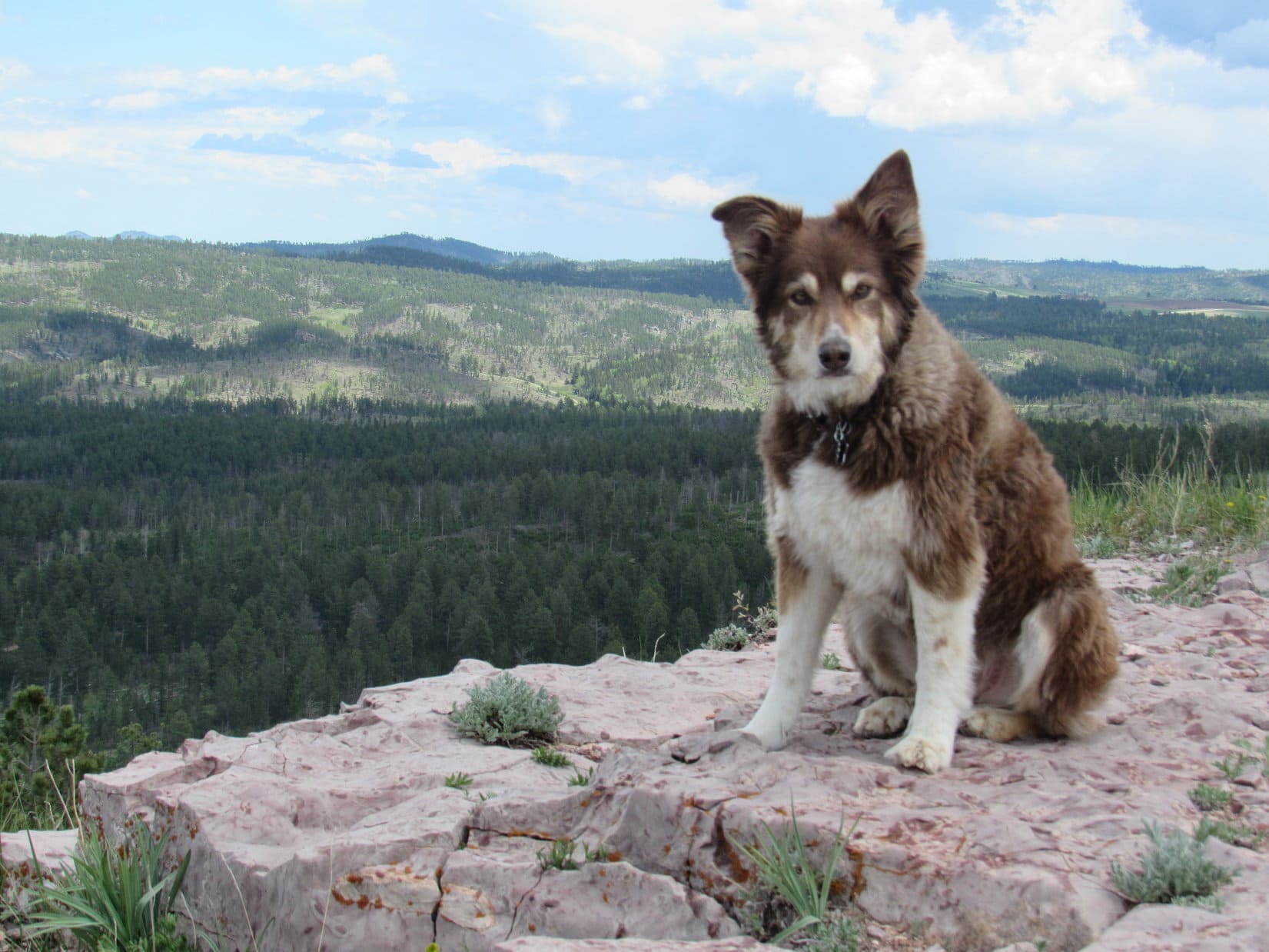
The top of Hat Mountain (6,779 ft.) is a flat oblong close to 80 feet long and half that wide. Bushes grow in a small depression toward the S end, but no trees are found on the summit. Joe and Dusty were impressed with the 360° panoramic views.


While Dusty and Joe pondered the views, Lupe and SPHP went over to get a photo of the old Hat survey benchmark. Set in 1950, it’s looking rather worse for the wear now. The “A” in “Hat” has been completely obliterated, though parts of the “H” and “T” are still visible.


A week ago on Expedition No. 230, Lupe had gone with Rizzo, Buddy & Josh Hilpert to Ward Draw and K2 Peak. Josh had told SPHP about a friend of his who had seen lots of pieces of old Indian artifacts up on Hat Mountain. Although Lupe and SPHP had been on Hat Mountain 3 times before, SPHP had never noticed anything like that up here. Still, it was an intriguing tale, and one of the main reasons Joe had been interested in coming to Hat Mountain today.
An initial scan of the small rocks scattered across the summit area proved disappointing. Joe found a few pieces of rock that looked like they might possibly have been chipped as part of a tool making process, but none even faintly resembled a finished product. SPHP didn’t see anything unusual, and the few poorly chipped rocks Joe came up with didn’t interest Lupe or Dusty at all.
Despite the discouraging results on the summit, Joe wasn’t ready to completely give up on the idea that there might be something of interest here. Joe decided to make an exploratory circle a little below the top of the mountain to see if might be possible to run across something down there. Dusty went with Joe, while Lupe and SPHP hung around up top just enjoying the views.


The stroll below the summit was scenic, but unproductive. Joe found even less of interest down below than up on top. The whole artifact deal was basically a bust.
Oh, well. Just looking had been sort of fun. Joe and Dusty returned to the summit for a group photo with Lupe.

Then it was time to head back down to the G6.

Upon reaching the G6, Dusty and Lupe were both very much in favor of another refreshing short side trip to cool off in Deerfield Reservoir.


Then it was back to Grandma’s house for dinner on the deck, fun chasing tennis balls on the front lawn, and the traditional walk up the hill and around the bend to the cul-de-sac.
Links:
Next Black Hills Expedition Prior Black Hills Expedition
Want more Lupe adventures? Check out her Black Hills, SD & WY Expeditions Adventure Index, Master Adventure Index, or subscribe free to new Lupe adventures!
I’m sorry to hear that the search for lithics proved elusive. When we hiked Hat Mountain a month or so before your excursion, my archaeologist friend pointed out a number of stone chips he reasoned were the result of toolmaking. Had he not been present that day, I would have missed every example like I did on my first ascent the year before!
Regardless, Hat Mountain is a special place with fantastic views in all directions, and it looks like your party was blessed with a beautiful day on which to enjoy it. Thanks for sharing!