Bomber Mountain, Bighorn Mountains, Wyoming – Part 1: The Solitude Trail to Gunboat Lake (7-14-18)

Days 1 & 2 of Lupe’s 2018 Dingo Vacation to the Bighorn Mountains & Wind River Range in Wyoming!

7-13-18, morning – No doubt about it.  Something was in the works – something big!  All the signs were there.  SPHP scurried endlessly about.  As hours ticked by, Lupe gave up on following SPHP around.  Apparently whatever was going on wasn’t happening imminently.

SPHP had a present for Lupe!  A bag on the front step said a marmot was inside, a dandy gift certain to be well received by an American Dingo.  However, SPHP said there wasn’t actually a marmot in it.  Disappointing, to say the least.  A new tiny house was inside.  Lupe’s old one had lacked a rain cover all these years, and was showing signs of wear and tear.

Lupe with her gift from SPHP.

7-13-18, 3:00 PM – Finally!  It was on now!  Lupe was in the G6 on her pile of pillows and blankets.  SPHP turned onto I-90.  The Carolina Dog was bound for Wyoming!  A bright, shiny, brand new Dingo Vacation was underway!

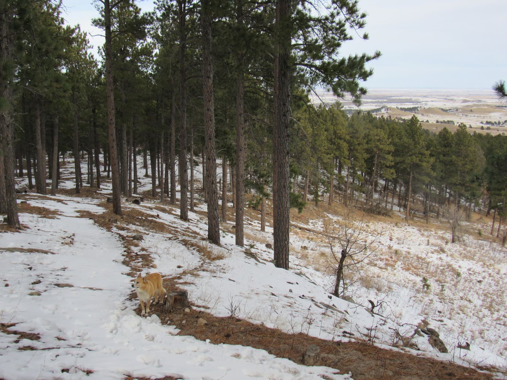
7-13-18, 6:30 PM – Less than a month after her last Dingo Vacation to the Bighorn Mountains had ended abruptly due to rainy weather, Lupe was back!  This time she was in the southern Bighorns at Powder River Pass (9,677 ft.).  During a short break from the G6, Loop ventured up to a small rock outcropping S of the pass.

Peak 10215 from Powder River Pass. Photo looks NE.

The views were gorgeous!  Lupe was inspired to go mountain climbing right this very minute!  However, she would have to wait.  Getting into position to start for Bomber Mountain (12,840 ft.) tomorrow was all that was on the agenda this evening.

SPHP drove W on Hwy 16.  2 miles past Meadowlark Lake was a R (W) turn onto USFS Road No. 27 at Deer Haven Lodge.  No. 27 promptly turned N.  1.5 miles from Hwy 16, Lupe reached a junction where USFS Road No. 24 curved away to the L (W).  A sign indicated it was 15 miles to Battle Park.  Another sign said No. 24 was NOT an all-weather road.

After Lupe’s escape from Big Pryor Mountain at the end of her last Dingo Vacation, the sign gave SPHP pause.  Even so, the die was cast.  Looper was at least going to try to get to the Bucking Mule Trailhead at Battle Park.  Fortunately, other approaches to Bomber Mountain existed, if this one didn’t pan out.

No. 24 to Battle Park wasn’t so bad, nowhere near as worrisome as the road to Big Pryor Mountain had been.  Plenty of potholes and stones, but there were always ways around them.  SPHP drove slowly.  Lupe rode with her head out the window having a blast looking for squirrels and deer.

After 14 miles in 45 minutes, Lupe reached the Middle Fork of Paint Rock Creek.  A small trailhead was on the R 0.25 mile farther on.  This was the Middle Fork trailhead from which Trail No. 066 provides access to Lily Lake.  A sign said registration was required to enter the wilderness.  The station was 0.25 mile away at Battle Park.

SPHP parked the G6.  Lupe and SPHP walked to Battle Park.  0.25 mile was more like 0.75 mile.  When Lupe finally did reach Battle Park, SPHP was amazed.  Expecting solitude, the place was packed with pickup trucks, trailers, people, horses and dogs!

Battle Park wasn’t exactly deserted when Lupe arrived. Photo looks NW.

Posted information at the entrance to Battle Park made no mention of any registration station.  SPHP finally asked a group of people sitting around a bonfire about it.  Oh, the registration station was still farther up the road at the opposite end of Battle Park.

SPHP registered.  Lupe visited the Bucking Mule trailhead at the end of the road.  Upon returning to the G6, she found a squirrel right away at the Middle Fork trailhead, and watched it until dark.

Although it was only 59°F out, the G6 was warm.  Lupe lapped up lots of water, but spent hours panting atop her blankets.  The Carolina Dog was tremendously excited, and too wound up to sleep.

It’s all so exciting! I wonder what’s going to happen tomorrow?

7-14-18, early – Despite having spent half the night awake, Lupe was up before the sun.  She picked up right where she had left off yesterday evening.  The forest rang with shrill, happy barking as the American Dingo rediscovered the same poor, bleary-eyed squirrel.  Meanwhile, SPHP was getting ready.

At the Middle Fork trailhead 0.75 mile (NOT 0.25 mile!) from Battle Park.

7-14-18, 7:04 AM – The squirrel was going to have a fine day, after all.  SPHP had granted it relief.  Lupe and the G6 were now at the Bucking Mule trailhead just past Battle Park at the end of USFS Road No. 24.  All was ready.  The backpack was annoyingly heavy as backpacks are wont to be.  This was it!  Lupe and SPHP set off into the forest on Trail No. 164.

While Bomber Mountain was Lupe’s ultimate peakbagging objective, the goal today was simply to get to Gunboat Lake near Florence Pass.  Lupe had been to Gunboat Lake once before.  A nice grassy ridge overlooking the lake had looked like a great place to set up base camp.  So that was the plan.  SPHP hoped it wasn’t overly ambitious.  The weight of the dang backpack was the leading cause of doubt.  It was 5 miles on Trail No. 164 just to get to the Solitude Trail (No. 038), and maybe another 6 miles on the Solitude Trail to get to Gunboat Lake.

Looper wasn’t thinking about any of that as she trotted N through the forest.  Why, planning things out and carting all that gear around was what she had SPHP for!  Her job was just to sniff, run, play and explore.  The American Dingo had no intention of neglecting her duties.  She gave them her undivided attention.

Trail No. 164 lost a bit of elevation in the first 0.25 mile to a ford at Battle Creek.  The water was low.  Crossing the creek was a trivial matter.

At Battle Creek 0.25 mile N of Bucking Mule trailhead. Photo looks NE.

Easy is good!  Always nice when a potential obstacle turns out not to be one.  Beyond the creek Lupe started gaining elevation.  No. 164 wound NE through forest, occasionally passing near small glades.  About a mile from the trailhead, Lupe reached the S end of Long Park, a vast meadow extending more than 1.5 miles N.  Elk Mountain (11,321 ft.) was in sight off to the NE.

Lupe reaches the S end of Long Park. Elk Mountain is on the R. Photo looks NNE.

Trail No. 164 went N through Long Park staying close to the W side near the forest.  After only 0.25 mile, Lupe reached the top of a minor rise. The trail ahead curved W down into a drainage.  The topo map showed No. 164 would lose 150 feet of elevation before crossing Long Park Creek, ultimately regaining all the loss on the way back E to Long Park.

Maybe there was a bridge where No. 164 crossed the creek, but the creek was divided into two streams up here in Long Park.  If both were fordable, Lupe could save the detour W and avoid unnecessary elevation loss.  Loop left the trail continuing straight N.  Both branches of Long Park Creek proved to be simple rock hops.

Fording Long Park Creek. Photo looks ENE.

N of the streams, Lupe picked up Trail No. 164 again.  She came to no further obstacles traveling N through Long Park.  SPHP tried to keep an eye out for Trail No. 120 going SE to Lily Lake, but saw no sign of it.

Long Park from the N. Photo looks S.
Getting close to the N end of Long Park. Cloud Peak (13,167 ft.) (L) has come into view. Elk Mountain is on the R. Photo looks NE.

As Lupe got closer to the N end of Long Park, No. 164 made a jog to the W before turning N again.  Lupe had been gaining elevation slowly.  The pace picked up when the trail entered the forest.  Several people on horseback were coming the opposite direction as the Carolina Dog reached High Point 9810.

Adventures on horseback near High Point 9810! Photo looks W.

Reaching High Point 9810 was significant.  Lupe had gained 680 feet of elevation since fording Battle Creek.  This was the highest point along Trail No. 164.  Lupe had a look around.  The terrain was pretty flat, but she found a rock that looked like it might be the summit.

At the top of High Point 9810, highest point along Trail No. 164. Photo looks N.

In the middle of a flat area, the highest rock at High Point 9810 didn’t have the best view.  The best view was from a boulder near the N edge.

Looking NNE from High Point 9810‘s best viewpoint.

High Point 9810 was 3 miles from the trailhead.  Still 2 miles to go to reach the junction with the Solitude Trail.  Loop and SPHP pressed on.

The Carolina Dog was now about to lose all of the elevation she had gained.  During a steady descent through the forest, Trail No. 164 wound generally NE.  Occasionally there were clearings off in one direction or another.  Looper came to a muddy stream where she took the liberty of helping herself to a drink and cooling off.

Cooling off in a muddy stream. What could be more fun? Photo looks E.

The map showed one interesting highlight more than halfway from High Point 9810 to the junction with the Solitude Trail.  That was Grace Lake.  Trail No. 164 would go right by it.

Grace Lake was pretty!  Lily pads grew near the W shore.  Forested rocky slopes came down to the E shore.  If SPHP wanted a respite from the heavy backpack, Lupe was perfectly content to lay in the shade with a view of the tranquil lake.

Oh, SPHP! Isn’t Grace Lake pretty! Photo looks NE.
Grace Lake. Photo looks E.
Taking a break in the shade by Grace Lake.
Elk Mountain (11,321 ft.) from Grace Lake. Photo looks SE.

With a long way to go, the rest break at Grace Lake wasn’t nearly as long as SPHP would have liked.  Lupe had to move on.  Crossing the outlet stream, Loop was surprised to meet Jefe and Bailey Cleland.

Jefe and Bailey were from Sturgis, South Dakota, so they were from the Black Hills, too!  They were on their way back from a 4 day excursion up to Middle Cloud Peak Lake where Bailey had caught a golden trout.

Jefe was 8 years old, part Labrador, Golden Retriever, and Rottweiler.  The story of how Jefe and Bailey came to be together was both sad and heart-warming.  Bailey had acquired Jefe after a friend had asked him to take care of Jefe for a month as a favor.  The friend never returned for Jefe.  Bailey hadn’t had the heart to take him to the pound.

That was many years ago.  The day Jefe had been abandoned with Bailey turned out to be his luckiest day ever!  Here they were, living the dream together enjoying the Bighorn Mountains wilderness.  They were as happy as Lupe and SPHP!

Lupe with Bailey and Jefe at the Grace Lake outlet stream.

After a nice chat with Bailey and Jefe, Lupe and SPHP wished them well and carried on.  N of Grace Lake, Trail No. 164 headed NE to a minor pass before dropping down into Paint Rock Creek canyon.  A mile from Grace Lake, Lupe reached Solitude Trail (No. 038).

Loop was now 5 miles from the Bucking Mule trailhead where she had started out. The Carolina Dog still wasn’t any higher than she had been there, having lost all the elevation she’d gained on the way to High Point 9810.  There was nothing much to see here.  Without hesitation, Lupe headed E up Paint Rock Creek canyon.

The Solitude Trail immediately began to climb.  The pace wasn’t difficult, though the backpack made it seem that way to SPHP.  The trail stayed up in the forest along the S side of the valley, and never got close to Paint Rock Creek.  The trail soon leveled out, and at one point reached a big clearing from which the creek could be seen.  That didn’t last long.  Lupe was soon right back in the forest.

After more than 0.5 mile on the Solitude Trail, Lupe reaches a big clearing. Paint Rock Creek is barely visible on the L. Photo looks NE.

A mile on the Solitude Trail brought Lupe to a clearing at the top of a small rise.  Filling Paint Rock Creek canyon, beautiful Lake Solitude was dead ahead!

After heading E for a mile on the Solitude Trail, beautiful Lake Solitude came into view. Photo looks E.

Nearly a mile long, Lake Solitude was the largest lake Lupe would come to on this trip.  Upon leaving the clearing W of the lake, the Solitude Trail returned to the forest.  The lake was seldom visible again until Lupe was more than halfway along the S side.  At the start of a large rock slide, a creek plunged down a steep slope S of the trail.

Lupe climbed up on some of the rocks for a better look.

More than halfway along Lake Solitude, a creek came plunging down to cross the trail from the S. This was at the start of a huge rock slide where Lake Solitude was coming into view again. Photo looks NE.
Lupe up on the rocks by the creek. Photo looks SE.

Quite an impressive waterfall was in sight higher up.

By scrambling only a little way up the rocks next to the trail, Lupe got to see this cool waterfall. Photo looks S.

Immediately beyond the creek, the views of Lake Solitude really opened up.  The rock slide had wiped out all the trees long ago.  Crossing the rock slide was no trouble.  The Solitude Trail was a well constructed path.  No rock hopping or trackless boulder fields to transit at all.

So easy, and the views are fantastic! Photo looks NE.
Approaching the E end of Lake Solitude. Photo looks NE.

Near the E end of the lake, the Solitude Trail went right along the shore barely above lake level.  Once Lupe got past the rock slide and huge rock formations, she was ready for another break at a grassy point next to the lake.  Sticking around to enjoy Lake Solitude for a while seemed like a great idea to SPHP, too.

Near the E end of Lake Solitude the trail was right down by the shore. Photo looks NE.
Once beyond all the big rocks, Lupe took a break at this grassy point. Photo looks WNW.
Relaxing by Lake Solitude.

20 pleasant minutes shot by.  Better get going.

E of Lake Solitude it wasn’t entirely clear where the trail went.  Lupe kept toward the R (S) of a large flat region.  Several campsites were tucked back against the pines.  None were occupied.  From the campsites, Loop followed a fairly decent trail E.  It quickly led to a ford of a rushing stream.

E of Lake Solitude, Lupe comes to a ford of a rushing creek. This stream was far larger than any of the others she had come to.

Lupe had reached Paint Rock Creek.  The water was fast and deep enough to make SPHP leery.  The Carolina Dog explored upstream until she came to a place where big rocks made it easier to cross.

Fording Paint Rock Creek.

Once across Paint Rock Creek, Lupe returned to the trail.  After a steep climb, the Carolina Dog arrived at a junction with a better trail.  This had to be the Solitude Trail, didn’t it?  Somewhere E of the lake, Loop must have gotten off the main track.

The better trail went either gradually downhill to the NE or more steeply uphill to the SW.  A brief foray going downhill revealed a footbridge over another big stream by a waterfall.

Looking down toward the Solitude Trail footbridge over the stream from Middle Cloud Peak Lake. Photo looks NE.

Lupe was going the wrong way.  The stream the footbridge went over had to be the major tributary of Paint Rock Creek which comes down from Middle Cloud Peak Lake.  If Looper continued down to it, the trail would take her back to Lake Solitude.  At least there was no question now which way she needed to go.  Lupe and SPHP turned around and headed back up.

The longest, steepest climb of the day now began.  The Solitude Trail turned E going up the N side of Paint Rock Creek canyon.  Lupe was soon way above Paint Rock Creek.  SPHP’s heavy pack meant the American Dingo had plenty of chances to relax and enjoy the scenery.

On the way up Paint Rock Creek canyon. Photo looks SE.
Looking back toward Lake Solitude. Photo looks WNW.
View to the SE.
Whad’ya think, SPHP? Do these flowers make me look fat? …. Not in the least, Loopster. You’re gorgeous!
Indian Paintbrush
Loopster living the dream along the Solitude Trail.

As long as the trail remained steep, the views of Lake Solitude back to the W became ever more spectacular.  Eventually, though, the trail wasn’t as steep.  As it began to level out, Paint Rock Creek was catching up.  First, the stream came into view not terribly far below the Solitude Trail.  A little farther on, Lupe came to another ford.

No doubt there was somewhat less flow way up here.  The water was also spread out much more.  The stream wasn’t nearly as deep or fast.  Lupe had no problem at all crossing Paint Rock Creek this time around.

That’s quite a view, isn’t it? Looking back at Lake Solitude. Photo looks W.
As the Solitude Trail began to level out, Paint Rock Creek could be seen S of the trail. Photo looks ESE.
Loop reaches a 2nd ford of Paint Rock Creek. The water was spread out and shallower here making this crossing a much simpler task.

Now on the S side of Paint Rock Creek, Lupe continued E on the Solitude Trail.  The American Dingo was gaining elevation again, heading for an area she had been to before.  Nearly 2 years ago she had climbed Cloud Peak, the highest mountain in the Bighorn Range.  Another 0.5 mile would bring Lupe to views of Cloud Peak and Paint Rock Creek Falls.

That 0.5 mile took longer than it should have.  Fatigue was setting in.  SPHP was pausing frequently.  Lupe was still making progress, though.  She reached a high point along the trail.  Good news!  Both Cloud Peak (13,167 ft.) and Bomber Mountain (12,840 ft.) were in view.  Getting there!

Reaching this high spot brought good news. Both Cloud Peak (L) and Bomber Mountain (Center) were now in view off in the distance. Photo looks ENE.
Paint Rock Creek and Cloud Peak (R). Photo looks NE with help from the telephoto lens.

A little farther on, Paint Rock Creek Falls came into view.  Lupe could see the grassy ridge slightly above and to the W of the falls where her old tiny house (tent) had been set up as a base camp.

Paint Rock Creek Falls is in sight across the valley beyond Lupe. Her old base camp prior to climbing Cloud Peak in 2016 had been on the slightly higher grassy bench L of the falls. Photo looks N.
Paint Rock Creek Falls with lots of help from the telephoto lens. Photo looks NNE.

It was fun to see the area again!  The pass leading to Mistymoon Lake wasn’t much farther.  The 2 mile long climb from Lake Solitude would be over when the Carolina Dog got to the pass.  In the meantime, the view of Lupe’s old base camp for her successful ascent of Cloud Peak served as inspiration.

Onward!  Puppy, ho!

Puppy, ho? I’m waiting on you, SPHP! Lupe rests by the Solitude Trail on the way to the pass to Mistymoon Lake. The big ridge ahead is the SW end of Bomber Mountain. Photo looks E.
Looking back toward Paint Rock Creek canyon (Center) before leaving the area. Photo looks W.

Nearing the pass to Mistymoon Lake, Lupe found a snowbank to frolic on.  The delightful experience seemed to give her a burst of new energy.  Even so, SPHP wasn’t tempted to duplicate her chilly romp.  Simply getting over the pass would be good enough.  Almost there!

Lupe absorbs new energy from a snowbank near the pass to Mistymoon Lake. She had been hot earlier in the day. This romp in the snow took care of that. Photo looks SSE.

Suddenly, Lupe was there.  The top of the pass!  Ahead was an easy 0.5 mile long downhill section that would get the Carolina Dog all the way to Mistymoon Lake.  Pausing to look back, Cloud Peak loomed off to the NE.  Much of the route Lupe had taken to the summit was in view.

Would Looper find a similar route up Bomber Mountain tomorrow?  Who knew?  Hopefully.  From Gunboat Lake 2 years ago, it had at least looked feasible.  Either way, the American Dingo was going to find out.  Lupe and SPHP headed for Mistymoon Lake.

Cloud Peak from the Solitude Trail pass N of Mistymoon Lake. Photo looks NE.
The Solitude Trail heads S from the pass N of Mistymoon Lake. The lake is just beyond the hill on the L. Photo looks SW.

Lupe really was re-energized!  She loves this kind of open country, and roamed well ahead of SPHP.  The day had been sunny and warm.  Now that evening was coming on the sky had clouded up, and it was comfortably cool.  Going downhill, even SPHP picked up the pace.  Soon Lupe was on a slope overlooking Mistymoon Lake.

Lupe reaches Mistymoon Lake. The Solitude Trail would take her around the W (R) side of the lake, then all the way back to the E (L) on the far shore. Photo looks S.

The Solitude Trail passes along the W and S sides of Mistymoon Lake.  Near the SW shore Lupe reached a junction with the Mistymoon Trail (No. 063) coming up from the West Tensleep trailhead.  Lupe could see part of Lake Marion to the S.

Looking SE across Mistymoon Lake. The Solitude Trail heads up the draw (R of Center) on the opposite shore on the way to the Fortress Lakes. The big ridge in the distance leads to Mather Peaks (12,400 ft.).
Lupe relaxes near the junction of the Mistymoon and Solitude trails. Part of Lake Marion is in view. Photo looks S.
Cloud Peak (R in the distance) from Mistymoon Lake. Photo looks NE.

Lupe stuck with the Solitude Trail as it headed E along the S shore of Mistymoon Lake.  After a rock hop over the outlet stream, Loop gained 200 feet of elevation on the way up a draw leading to the Fortress Lakes.  This was the last significant elevation rise of the day.

S shore of Mistymoon Lake after crossing the outlet stream. From here the Solitude Trail heads for the gap on the R which leads to the Fortress Lakes. Photo looks ENE.
Looking back at Mistymoon Lake as Lupe departs for the Fortress Lakes. Elk Mountain is on the L. Photo looks WNW.

The Fortress Lakes were a welcome sight.  Lupe was within 0.5 mile of Gunboat Lake!

Approaching the Fortress Lakes near the end of the day. Photo looks E.
On the Solitude Trail by the largest Fortress Lake. Elk Mountain (L) in the distance. Photo looks W.

At last, Lupe was resting on the grassy ridge N of Gunboat Lake!  SPHP wearily assembled her new Marmot tiny house.  The old tiny house was shaped better.  This one was longer than it needed to be, but not wide enough.  It would have to do.  At least it had a rain cover.  Might need it, too!  The sky was overcast, though not threatening at the moment.

Made it! Loop rests on the grassy ridge N of Gunboat Lake. Base camp was about to be established here. Photo looks SSW.
Base camp! Lupe by her brand new Marmot tiny house. One of the smaller Fortress Lakes is in sight. Bomber Mountain in the distance on the L. Photo looks NE.

The tiny house was up!  Base camp was established!  Lupe had a great view of Gunboat Lake, one of the smaller Fortress Lakes, and the huge ridges leading to the possibly unseen summit of Bomber Mountain.  The Solitude Trail could be seen heading NE for Florence Pass.  Tomorrow Lupe would be making that trek!

This was a great spot!  It had been a long day, though.  More than an hour before sunset, Lupe and SPHP crawled into the overly cozy Marmot tiny house to hit the hay.  No sunset to miss, anyway.  A while back the sun had already sunk into a gloomy, murky haze.

It’s nice enough, I suppose. A real marmot would have been better, though! Base camp, Gunboat Lake, Bighorn Mountains of Wyoming 7-14-18

Links:

Next Adventure

      Bomber Mountain, Bighorn Mountains, Wyoming – Part 2: Gunboat Lake to Florence Pass & the Summit (7-15-18)

Want more Lupe adventures?  Choose from Lupe’s 2018 Dingo Vacation to the Bighorn Mountains & Wind River Range in Wyoming Adventure IndexDingo Vacations Adventure Index or Master Adventure Index.  Or subscribe free to new Lupe adventures.

Black Hills, SD Expedition No. 241 – Centennial Trail No. 89: Alkali Creek to Fort Meade (12-10-18)

10:11 AM, 35°F – Gates close at dusk?  Ridiculous!  That’s what the sign said, though.  The Alkali Creek trailhead for Centennial Trail No. 89 was huge and totally empty, but days are really short in December.  SPHP wasn’t at all certain Lupe would be back before dusk, rendering the trailhead useless.

SPHP found a place to park along Horse Soldier Road.  Lupe trotted back to the trailhead.  Alkali Creek was the official starting point for today’s Black Hills expedition.  Lupe was going to explore Centennial Trail No. 89 all the way N to the Fort Meade trailhead.  At only 4.0 miles one way, this is one of the shortest segments between trailheads of the entire 111 mile long Centennial Trail.

Gates close at dusk? Lupe near the entrance to the useless Alkali Creek trailhead. She might or might not be back by dusk! Photo looks E.
Loop at the official starting point for Black Hills, SD Expedition No. 241. Photo looks NW.

Lupe was anxious to get going!  SPHP took only a quick peek at the posted trail map.  It showed a surprisingly complex trail system in the area.  Loop had no patience for it.  Leaving the trailhead, the Carolina Dog crossed Horse Soldier Road.  She picked up Centennial Trail No. 89 in a field on the other side.

Loop gets underway N of the Alkali Creek trailhead. Photo looks NE.

As Lupe sniffed along, the trail gradually curved N.  Soon Bear Butte came into view.  The summit of Bear Butte (4,422 ft.) is the official N end of Centennial Trail No. 89.  Lupe wasn’t going that far today.

Bear Butte (L) starts coming into view as the trail curves N. Photo looks NNE.

0.33 mile from the trailhead, Looper reached a junction at the top of a small rise.  Centennial Trail No. 89 went W (L) here passing through a barbed wire fence.  The other trail continued N through a long field.

Centennial Trail No. 89 goes W (L) here. Another route continues N through the long field seen ahead. Photo looks N.
From this gate Centennial Trail No. 89 heads W into the forest. Photo looks W.

Beyond the fence, Centennial Trail No. 89 headed W toward a forested ridge Lupe had seen from the trailhead.  Before reaching the trees, the Carolina Dog paused for the best view of Bear Butte yet.

Bear Butte. Photo looks NNE with help from the telephoto lens.

Once in the forest, Centennial Trail No. 89 wound NW up the E side of the ridge.  The steepest part came near the beginning.  Even here, the trail wasn’t bad at all.  Lupe climbed through a forest of scrub oak and Ponderosa pines.

Loop rounds a bend early on the way up the ridge. Photo looks SE.
Even along the steepest part of the ridge, the trail was quite easy. Photo looks N.
Lupe had a good view from this rock. Photo looks SE.
Heading W up a minor ravine.

Higher up, the slope of the terrain was more gradual.  The trail trended SW for a while.

Higher up the terrain sloped more gradually. Photo looks SW.
Getting close to the top of the ridge. Photo looks SW.

The ridge the trail was climbing is 0.75 mile long N/S.  The W face of the ridge is much steeper than the E slope.  Nearing the top of the ridge line, Centennial Trail No. 89 brought Loop very close to the S end of the ridge.  Naturally, she stopped to check out the view.  To the S, she could see I-90 and the Black Hills National Cemetery.

Loop at the S end of the ridgeline. Photo looks S.
Looking S along I-90 with help from the telephoto lens.
Zoomed in on part of the Black Hills National Cemetery.

Peak 4027 is the high point of the entire ridge Lupe was on.  It was only 200 yards N of the extreme S end.  Centennial Trail No. 89 headed right for it.  The summit proved to be spacious and gently rounded.  Flanked by pines to the W and N, the whole area was grassy and open.

Approaching Peak 4027, summit of the entire ridge Lupe had climbed. Photo looks N.

Centennial Trail No. 89 didn’t go quite all the way up Peak 4027.  Instead it swept around the E side of the spacious summit.  Lupe had a great view of the prairies of western South Dakota.

Looking E over the prairies from Peak 4027.

Loopster wasn’t about to bypass the true summit of Peak 4027!  She left Centennial Trail No. 89 to tramp through the snow looking for it.  There wasn’t any definite absolute high point, but she explored enough ground to be satisfied with her ascent.

On Peak 4027. This high ground near a small stand of big pines seemed to be the true summit as far as it could be determined. Photo looks NE.

The scenic highlight from Peak 4027 was Bear Butte rising dramatically like a miniature volcano from the surrounding prairie.  Trees blocked any views of the main body of the Black Hills to the W.

Bear Butte is the scenic highlight from Peak 4027. Lupe is standing on a stump. Photo looks NNE.

Lupe returned to Centennial Trail No. 89.  The trail continued N along Peak 4027’s long N ridge.  Most of the ridge was forested.  What it lacked in views, it made up in squirrels.  Looper had a grand time barking and searching for them.

Back on Centennial Trail No. 89, still close to Peak 4027. Photo looks NW.
Forest hid the views, but provided a home for squirrels and deer as Lupe continued N. Photo looks N.

Nearly 0.5 mile N of Peak 4027, Lupe came to another grassy area.  She was approaching High Point 3983 on the topo map.

Approaching High Point 3983. Photo looks N.

At High Point 3983 Lupe reached a fork in the trail.  A large post stood next to the fork.  Centennial Trail No. 89 stayed to the L.

Lupe at the fork in the trail near High Point 3983. Centennial Trail No. 89 continues N passing L of the high ground. Photo looks N.

Beyond High Point 3983 the trail went NNW still following the ridgeline.

Back in the forest NNW of High Point 3983. Photo looks N.

0.25 mile from High Point 3983, Lupe finally reached the N end of the ridge.  From rock outcroppings along the edge, the Carolina Dog could see Sturgis, SD to the NW.  Peak 3950 and Crook Mountain (4,930 ft.) were in view, too.

At the N end of the 0.75 mile long ridge. Peak 3950 (Center) is the hill beyond Lupe. Photo looks NNW.
Sturgis, SD from the N end of the ridge. Crook Mountain is in the distance on the L. Photo looks NW.

Leaving the mountain’s main ridgeline, Centennial Trail No. 89 began a long gradual descent.  After a switchback or two, Lupe found herself traveling NNE.

On the descent. Photo looks NE.

The trail curled clear around to the SW as it entered a large draw.

Lupe spots a squirrel as Centennial Trail No. 89 enters a large draw. Photo looks SW.

The draw drained NE.  The trail turned NE again, too.  More snow was down here.  The draw brought Lupe back to Horse Soldier Road.

Down in the snowy draw. Photo looks ENE.
Lupe reaches Horse Soldier Road again. Photo looks NE.

Centennial Trail No. 89 crossed Horse Soldier Road, but where it went on the other side wasn’t completely clear.  Lupe searched for a marker.  She found an icy pond off to the NW, but no markers.  SPHP finally realized the correct route was the obvious one.  Lupe followed a frozen road NE.

Heading NE after crossing Horse Soldier Road.

Having crossed Horse Soldier Road, the first part of Lupe’s journey to the Fort Meade trailhead was over.  Until now, she had been up in the forest on the long ridge that was all part of Peak 4027.  The remaining trek was lower territory.  The trail was about to make several forays E toward the prairie, each time turning W again to re-enter the forest.

Following the frozen road, the American Dingo headed NE out into the grasslands.  Centennial Trail No. 89 left the road near the end of a bare ridge, and climbed up onto it.  Although this ridge was much lower than the forested ridge where Peak 4027 and High Point 3963 were, Loopster enjoyed unbroken panoramas.

Going up the first low ridge. The much higher forested ridge Lupe had just left is in the background. Photo looks SW.
Bear Butte from the first low ridge. Photo looks NNE.
View to the SE.
Looking back. The Alkali Creek trailhead (Center) is way over at the base of the forested hills beyond the snowy grasslands. Photo looks S.

Fort Meade was already in sight only 0.5 mile to the N.  The way the trail was going to wind around, Lupe still had a lot farther than that to go to get to the Fort Meade trailhead.

There’s Fort Meade! Photo looks NNW with help from the telephoto lens.

Now that Lupe was up on the ridge, the trail turned back to the WSW.

Having made it up onto the ridge, the trail heads back toward the Black Hills. Photo looks WSW.

The single track became a dirt road as Lupe drew near the forest again.  For at least a little way, this was still Centennial Trail No. 89.  However, when no more markers appeared, SPHP began to suspect the trail had disappeared somewhere into the forest on the N side of the ridge.

As Lupe got close to the forest again, the single track was evolving into a dirt road. Photo looks W.
For at least some distance, Centennial Trail No. 89 followed the road. Photo looks W.

Lupe wasn’t far from Horse Soldier Road again when she spotted some still green pine slash snaking through the grass N of the snowy road.  Upon inspection, it was evident this slash had been deliberately placed on a trail.  Maybe Centennial Trail No. 89 had been re-routed?  Perhaps this was an officially discouraged shortcut?

See the green slash? Maybe this is the way back to Centennial Trail No. 89? Photo looks N.

Lupe and SPHP followed the slash N down a snowy slope.  Before long the slash led to another trail that was unobstructed.  Continuing N, Lupe spotted a Centennial Trail No. 89 marker on a tree.  Exactly where she’d lost the trail in the first place still wasn’t clear, but at least she was back on it again.

Back on Centennial Trail No. 89 again! See the marker on the tree on the L? Photo looks N.

The single track went virtually all the way back to Horse Soldier Road, but did not connect to it.  Instead, right next to the road and a bit below it, the trail skirted around the W end of a forested ravine.

Heading NW on the S side of a ravine.

Once N of the ravine, the trail turned E again.  Lupe was on the side of a fairly steep slope.

On the N side of the ravine now. Photo looks W.

The trail left the ravine going N along the E side of a hill.  Lupe could see white headstones.  Fort Meade National Cemetery was up on the hill.  This small cemetery was established in 1878 by surviving members of General Custer’s 7th cavalry.

Fort Meade National Cemetery came into view. Photo looks NW.

After skirting the E and N sides of the cemetery, Centennial Trail No. 89 went around the W end of a much larger ravine.  Again the trail turned NE following another ridge out toward the prairie.

Heading for the next ridge N of the cemetery. Photo looks N.
Looking ENE along the ridge N of Fort Meade National Cemetery.

The trail went partway down the NE end of the ridge.  Lupe enjoyed some nice views along in here.

Nearing the E end of the last ridge. Photo looks ENE.

Once more, the trail looped back around to the W and returned to the forest.  Lupe climbed a little, then descended into a valley filled with snow.  All these winding loops the trail had made had chewed up a lot of time.  Never high in December, the sun was sinking toward the horizon.

The sun was already sinking when Lupe reached this snowy valley. Photo looks SW.

The valley floor was flat and fairly wide.  A private home sat a little N of the trail.  As Lupe went past it, the trail turned SW.  There were tons of footprints in the snow, but Loop hadn’t seen anyone all day.

The far SW end of the valley was narrower.  An odd stone building stood near the trail.  Beyond it, Lupe could see Horse Soldier Road again.  She dropped by the building to sniff around a bit, but discovered nothing of interest.  The building looked like it had been abandoned for a long time.

Approaching the stone building. Photo looks W.
Checking out the strange stone building.

The Carolina Dog pressed on.  The trail headed N climbing a small hill.  Lupe reached a minor pass.  At the end of a short spur trail sat another oddity – a large stone fireplace.

This stone fireplace stood at the end of a short spur trail. Photo looks N.

A wooden fence enclosed the ground around the fireplace.  No signs or plaques explained how or why the fireplace came to be here.  Lupe left it just as mystified as she’d arrived.

Beyond the minor pass, Centennial Trail No. 89 made a long sweeping curve SW down into a snowy field.  By the time the trail straightened out again, Looper was heading N.  This was the final stretch.  The Fort Meade trailhead was just ahead.

On the big curve leading to the final stretch. Photo looks NW.
Almost there! Bear Butte (R) comes into view again. Photo looks NNE.
Made it! Looper stands at the entrance to the Fort Meade trailhead. Photo looks N.
At the information display. Photo looks W.

Lupe had made it!  She had traveled the entire length of Centennial Trail No. 89 between the Alkali Creek and Fort Meade trailheads.  It had been a pleasant, mostly easy trek offering a variety of terrain, scenes, and complete solitude.

SPHP had hoped Lupe would have time to climb Peak 3950 on the way back to the G6, but the sun was already way too low for that.  Even just retracing her entire route would take longer than desired.  Time for a shortcut!  Lupe and SPHP left the Fort Meade trailhead heading S on Horse Soldier Road.

The road was icy.  After getting past the Fort Meade National Cemetery, a trail left the road heading S.  A post said this was Trail No. 10.  The trail looked like a shortcut that might lead down to the icy pond Lupe had seen earlier.  Why not explore it?

About to leave Horse Soldier Road to venture down Trail No. 10. The end of Peak 4027’s long N ridge is seen on the R. Photo looks S.

Trail No. 10 went E along a steep slope with southern exposure.  Sure enough, after 0.5 mile the American Dingo came to the frozen pond.

Looking down on the frozen pond from Trail No. 10. Photo looks SE.
By the frozen pond. Photo looks SW.

Horse Soldier Road and Centennial Trail No. 89 were close to the pond.  Lupe crossed the road.  Enough daylight remained to retrace the rest of the trail.  Lupe completed a second ascent of Peak 4027 before dark.

Bear Butte from the same stump on Peak 4027 that Lupe had been on before. Photo looks NNE.

Light was fading by the time Lupe made it down off Peak 4027.  It was dusk when she went past the Alkali Creek trailhead.

Gates still open!  Could have parked there!  Oh, well.  A cold N breeze blew as Lupe and SPHP trudged along Horse Creek Road in silence.  Didn’t matter.  Not much farther to the G6 anyway.  (4:49 PM, 33°F)

Bear Butte from Centennial Trail No. 89, 12-10-18

Notes – Horse Soldier Road goes from I-90 Exit 34 near the Alkali Creek trailhead to Hwy 34/79 a mile E of Sturgis near the Fort Meade trailhead.  This road is also known as the National Back Country Byway or Cemetery Drive (N part) or Old Stone Road (S part).

Links:

Next Black Hills Expedition                  Prior Black Hills Expedition

Next Trail Section North:

Black Hills, SD Expedition No. 149 – Centennial Trail No. 89: Fort Meade to Bear Butte Lake (12-19-15)

Next Trail Section South:

Black Hills, SD Expedition No. 274 – Centennial Trail No. 89: Elk Creek to Alkali Creek (4-10-21)

Centennial Trail Map & Brochure

Fort Meade Recreation Area

Bear Butte State Park

Want more Lupe adventures?  Check out Lupe’s Black Hills, SD & WY Expeditions Adventure Index, Master Adventure Index, or subscribe free to new Lupe adventures!