
Days 9 & 10 of Lupe’s 1st Summer of 2021 Dingo Vacation to New Mexico!
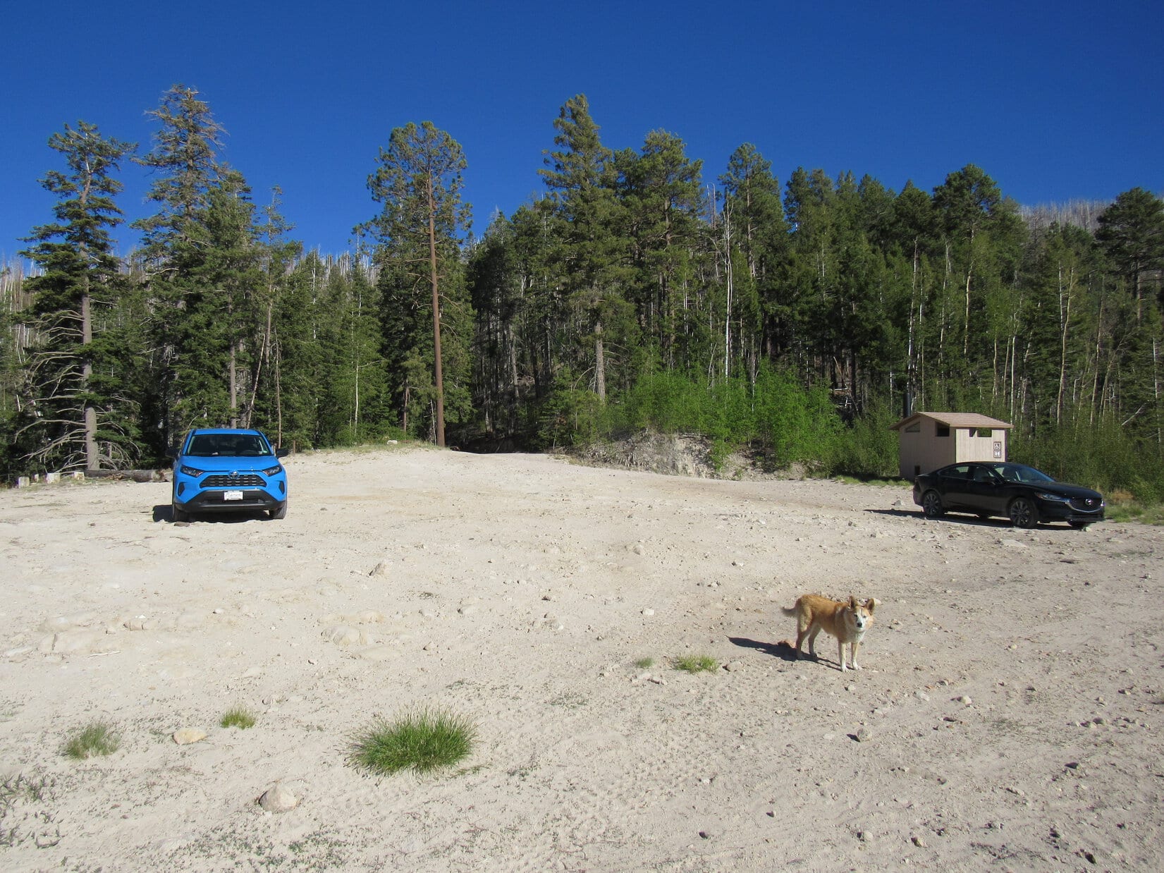
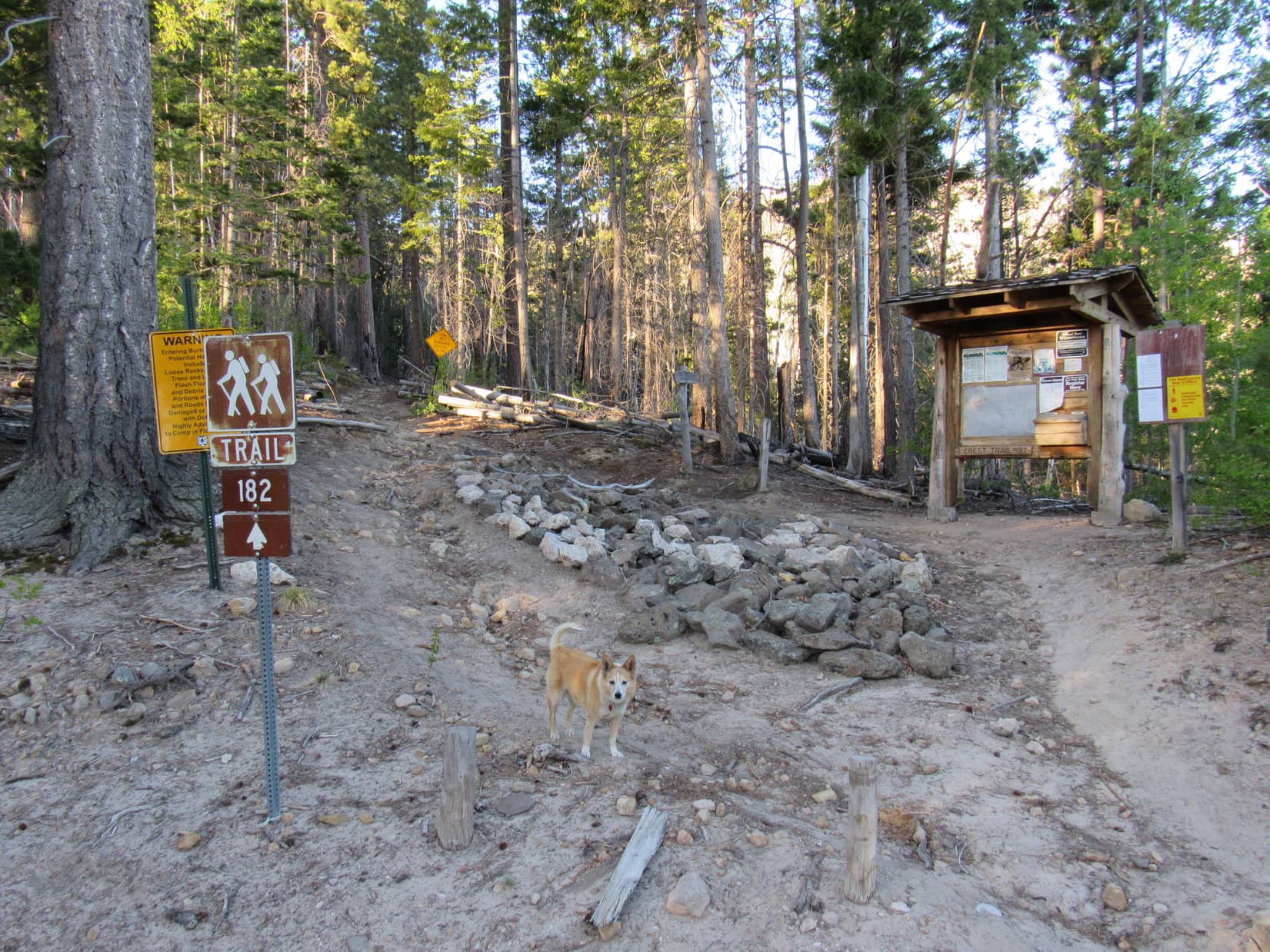
5-16-21, 5:28 PM, Sandy Point, 8 miles E of Mogollon on Bursum Road – Backpacks ready, the 3 young men hoisted them up, buckled in, and headed into the forest. Lupe watched them go. Sandy Point was quiet again. Their black Mazda 6 was the only other vehicle at the spacious trailhead. A breeze kicked up a little sand, which whirled away.
Are they going to Whitewater Baldy (10895 ft.), too, SPHP?
No, they’re doing some big trail loop that will take a few days. Not going to climb the peak.
What did they think of the road?
Scraped bottom once, but they got here. I guess our old G6 would have, too, Looper.
Nice to have the RAV4’s clearance, though, isn’t it, SPHP?
Oh, yeah! Didn’t really have to worry at all.
1.5 miles S of Alma, the turn E off Hwy 180 onto Bursum Road (Hwy 59) had been easy to find. Within a few miles Bursum Road had climbed up onto Whitewater Mesa, a pancake flat region at the base of the Mogollon Mountains.
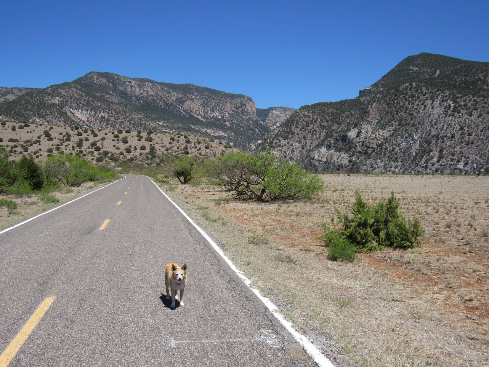
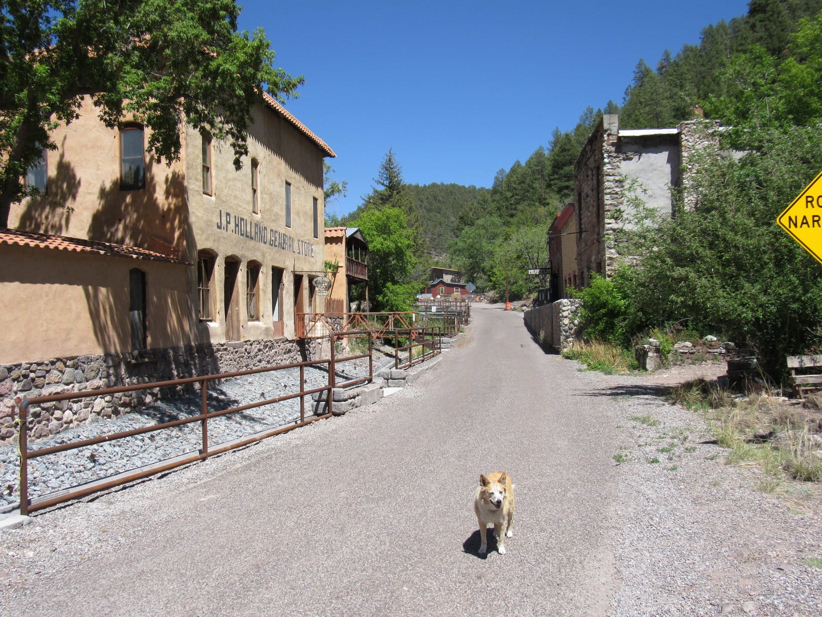
After crossing the mesa, Bursum Road had narrowed down to little more than a single lane with occasional pullouts, climbing steeply as it wound along precipitous mountainsides providing spectacular views before dropping even more steeply into the old mining town of Mogollon.
The pavement ended just past Mogollon. Bursum Road forded Silver Creek several times within a few miles. In arid New Mexico, Silver Creek didn’t amount to much, even in May. The road eventually climbed way above Silver Creek, becoming narrow and rocky before finally topping out at Silver Creek Divide where it flattened and widened the last couple of miles to Sandy Point.
Sandy Point had a great view of Spring Mountain (9,683 ft.) off to the W. Lupe would be spending the night here, but as the evening wore on hopes for a colorful sunset were dashed by a nearly cloudless sky.
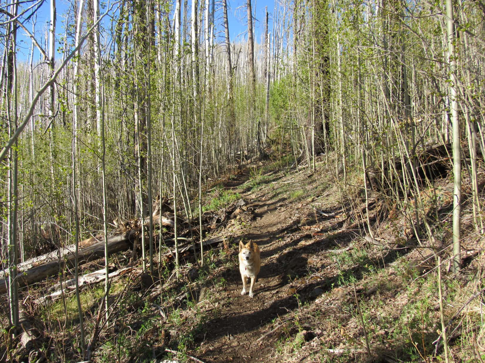
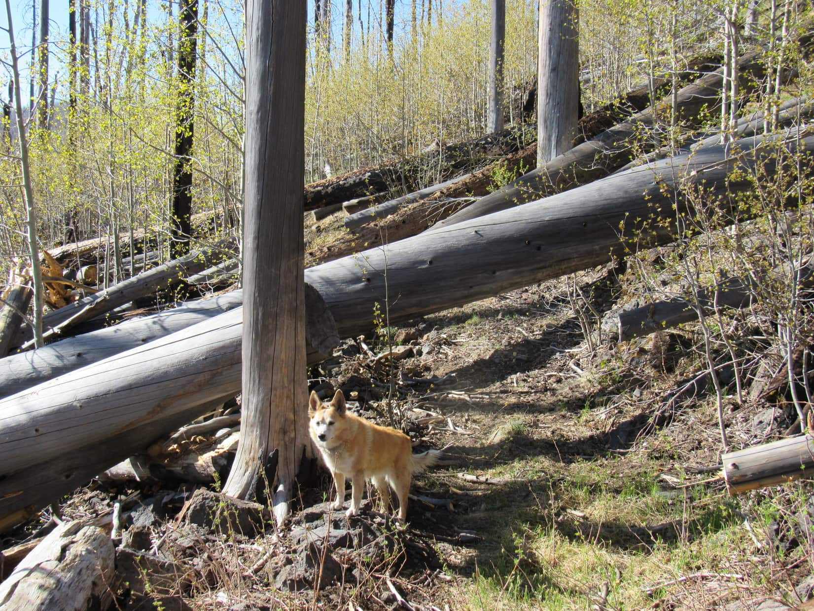
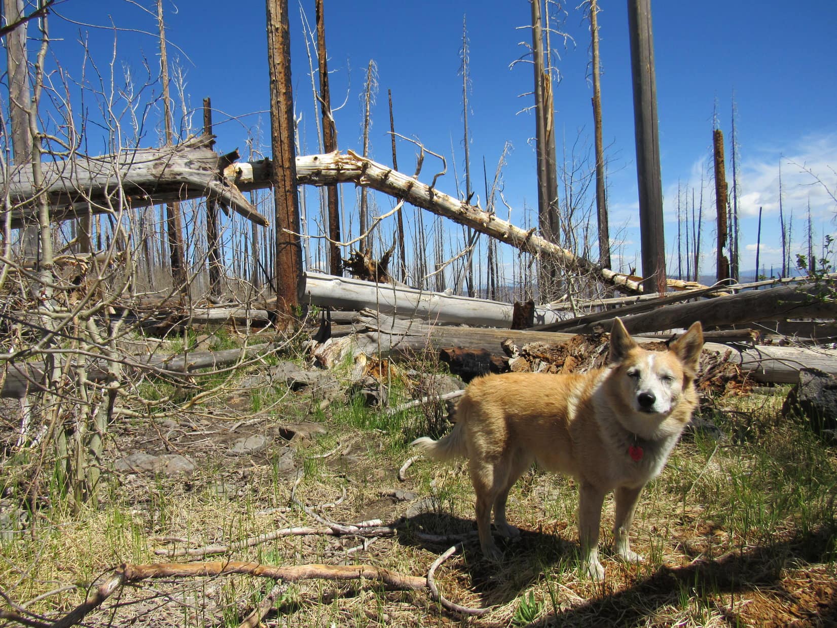
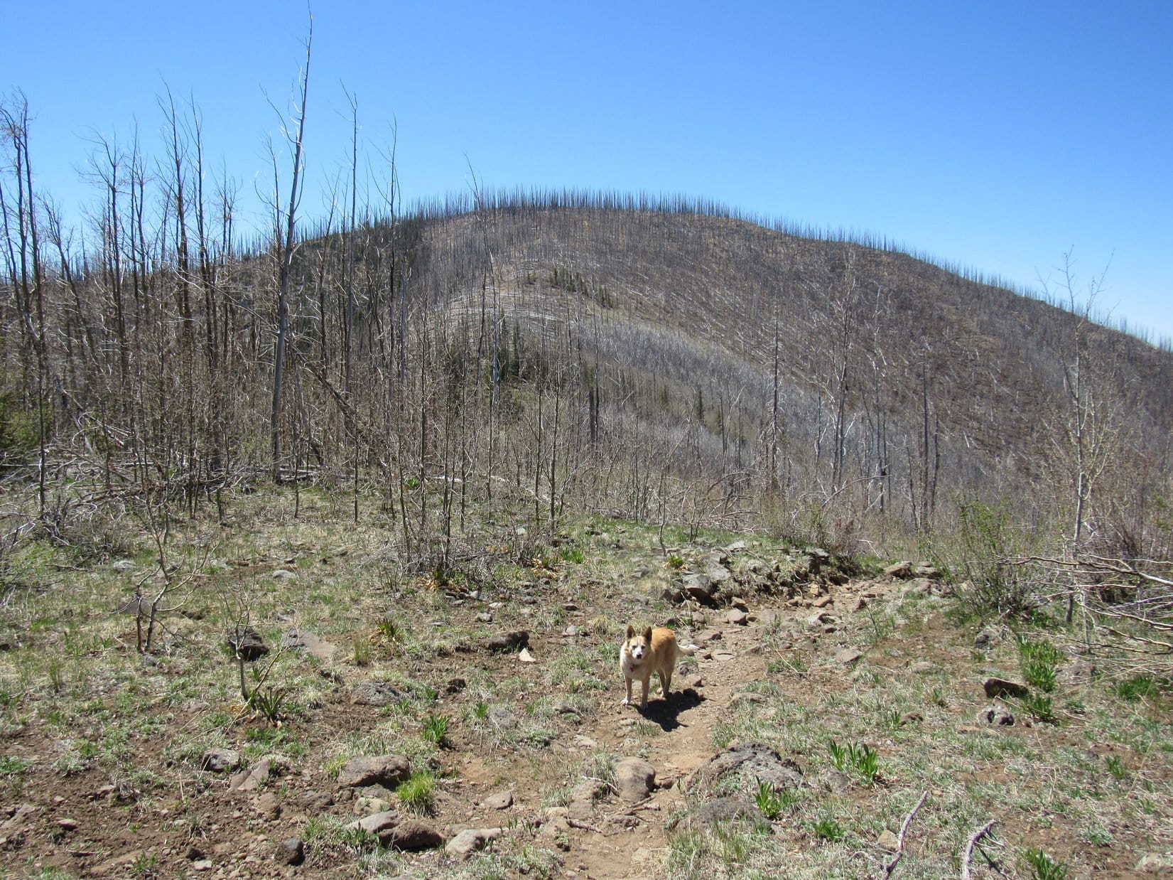
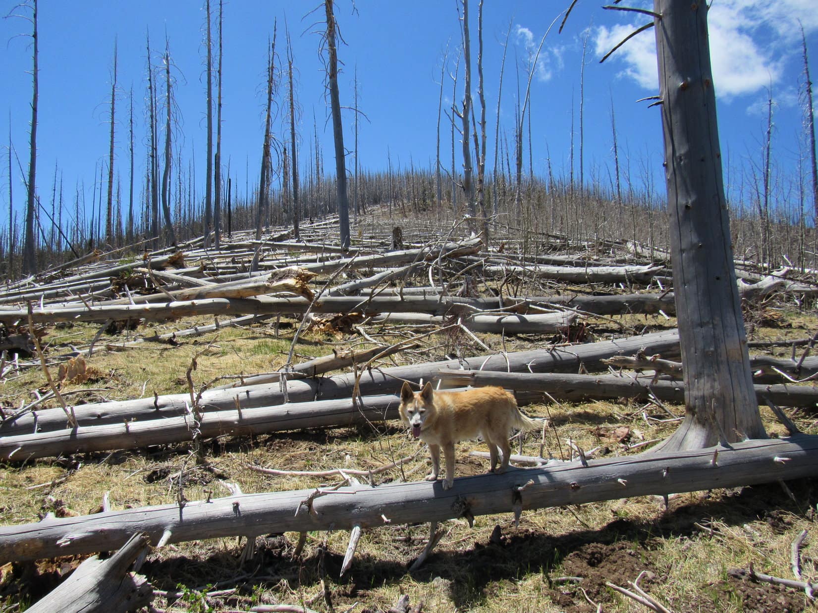
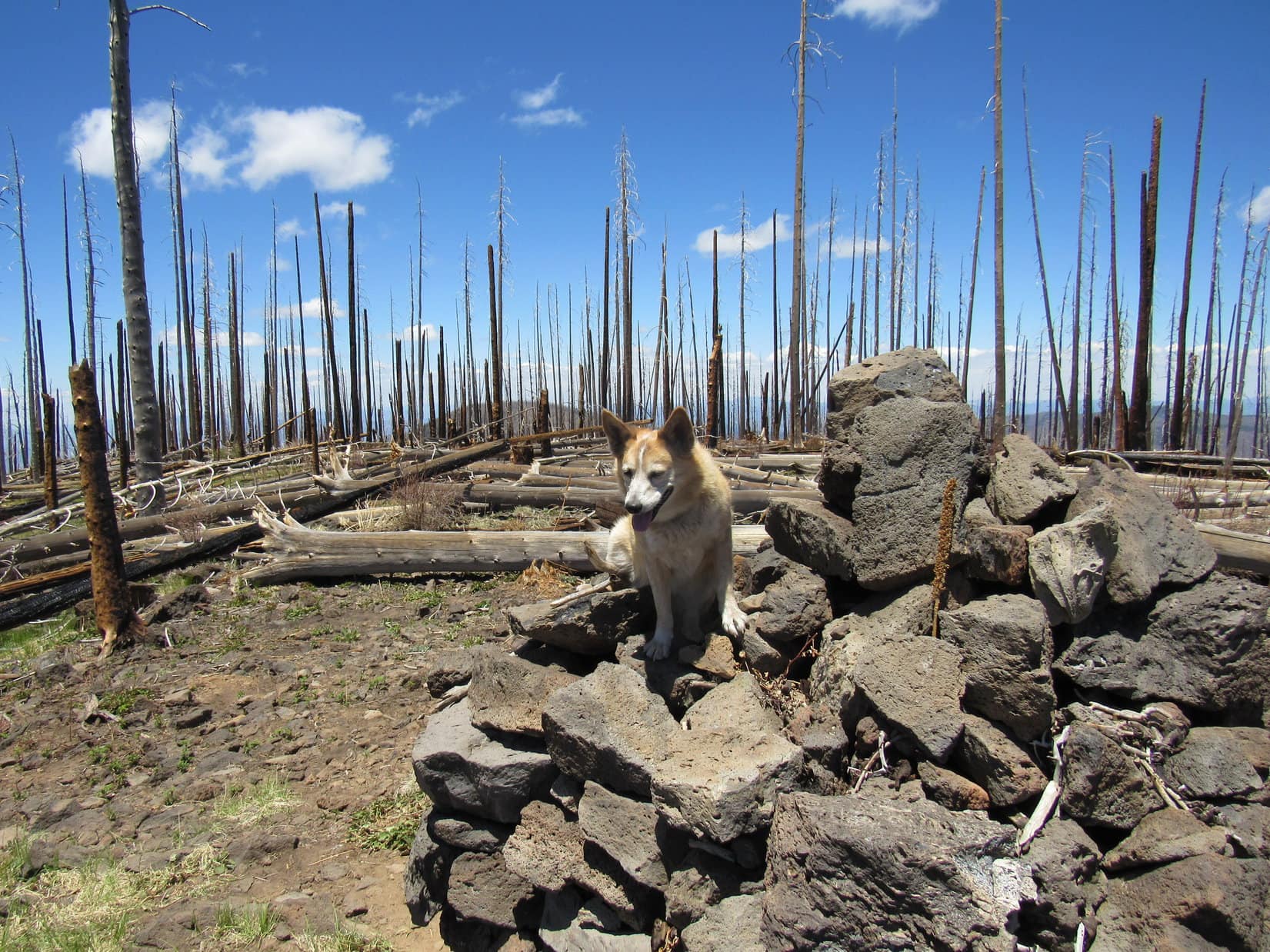
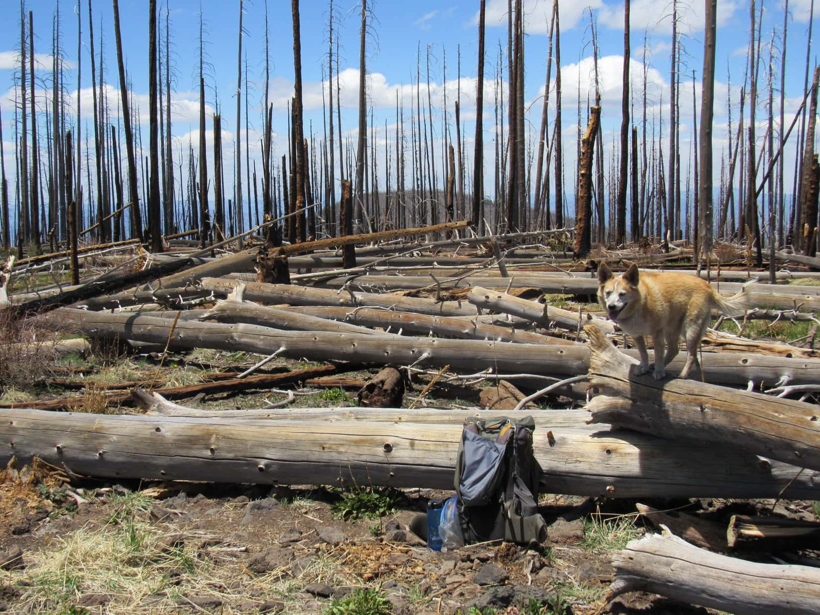
5-17-21, 6:55 AM, 39ºF – Lupe left Sandy Point heading S on Crest Trail No. 182, the same one the 3 young men had taken yesterday afternoon. The trail climbed steadily through a forest of young aspens sprouting new leaves. The aspens grew among the charred trunks of countless large pines killed by fire years ago. For the pines, the wildfire had been devastating – they didn’t seem to be regenerating at all.
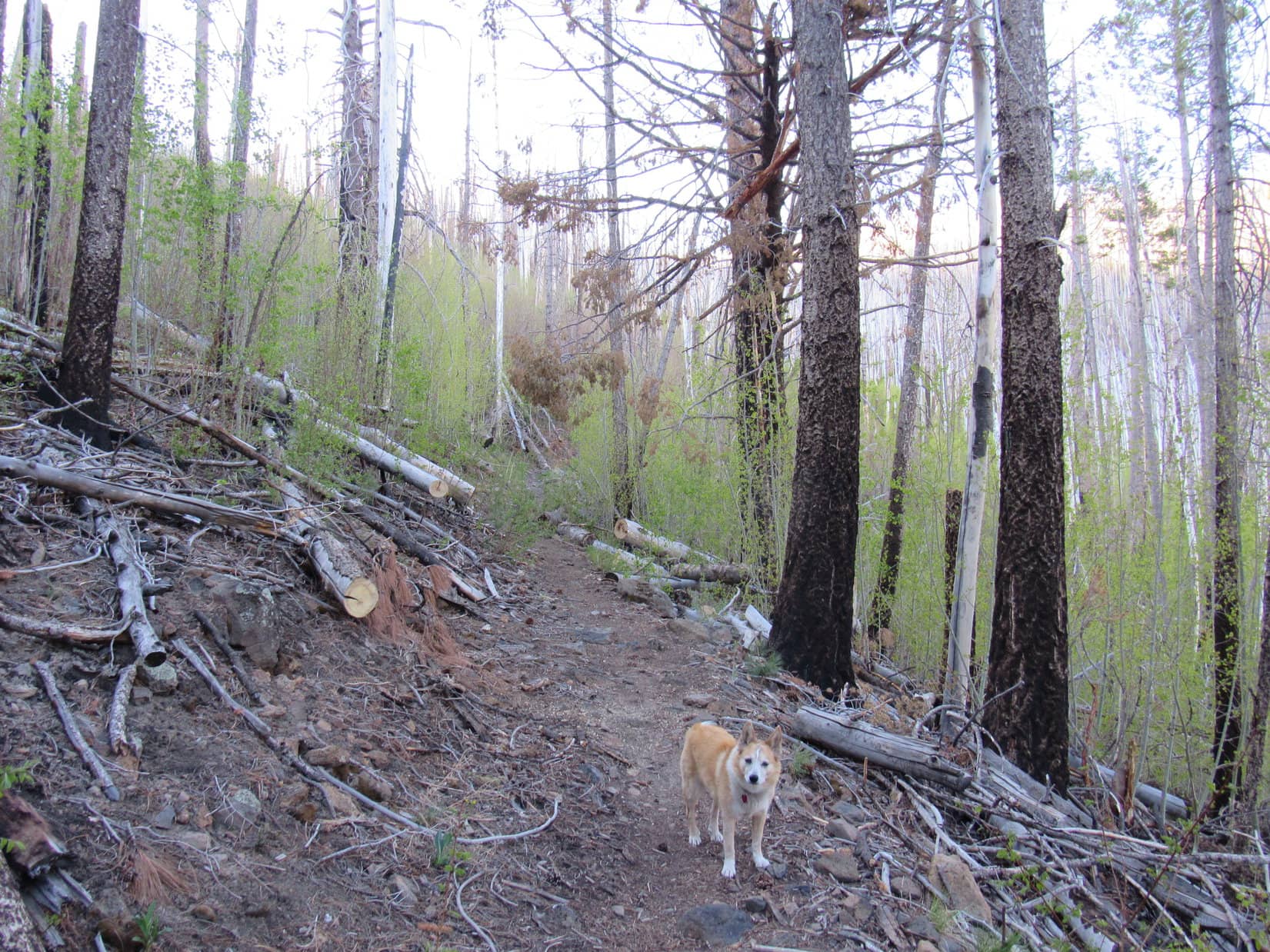

The trail soon reversed course, sweeping gradually back around to the N before trending SE along the E slopes of Willow Mountain (10,785 ft.). Lupe enjoyed views of a vast expanse of lower hills and ridges to the NE, views partially obstructed by the trunks of the burnt forest. There was a stretch of live pines, but nearly all of Willow Mountain had burned. The Carolina Dog was soon back among the burnt trees and young aspens.
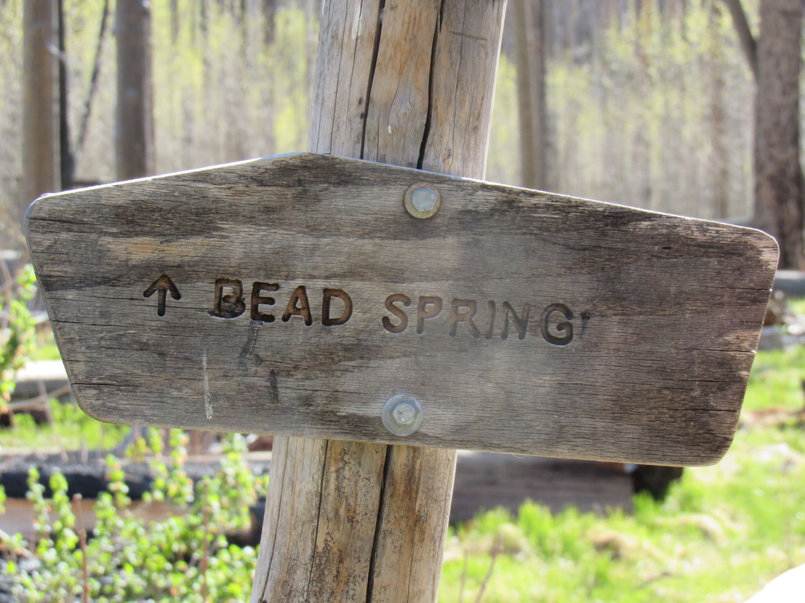
Crest Trail No. 182 leveled out after crossing a broad ridge that extended off to the NE. Many of the larger dead trees had blown over in this area, providing somewhat clearer views of the Willow Creek drainage to the E. Lupe came to a sign for Bead Spring, but was disappointed that there didn’t seem to be any water.
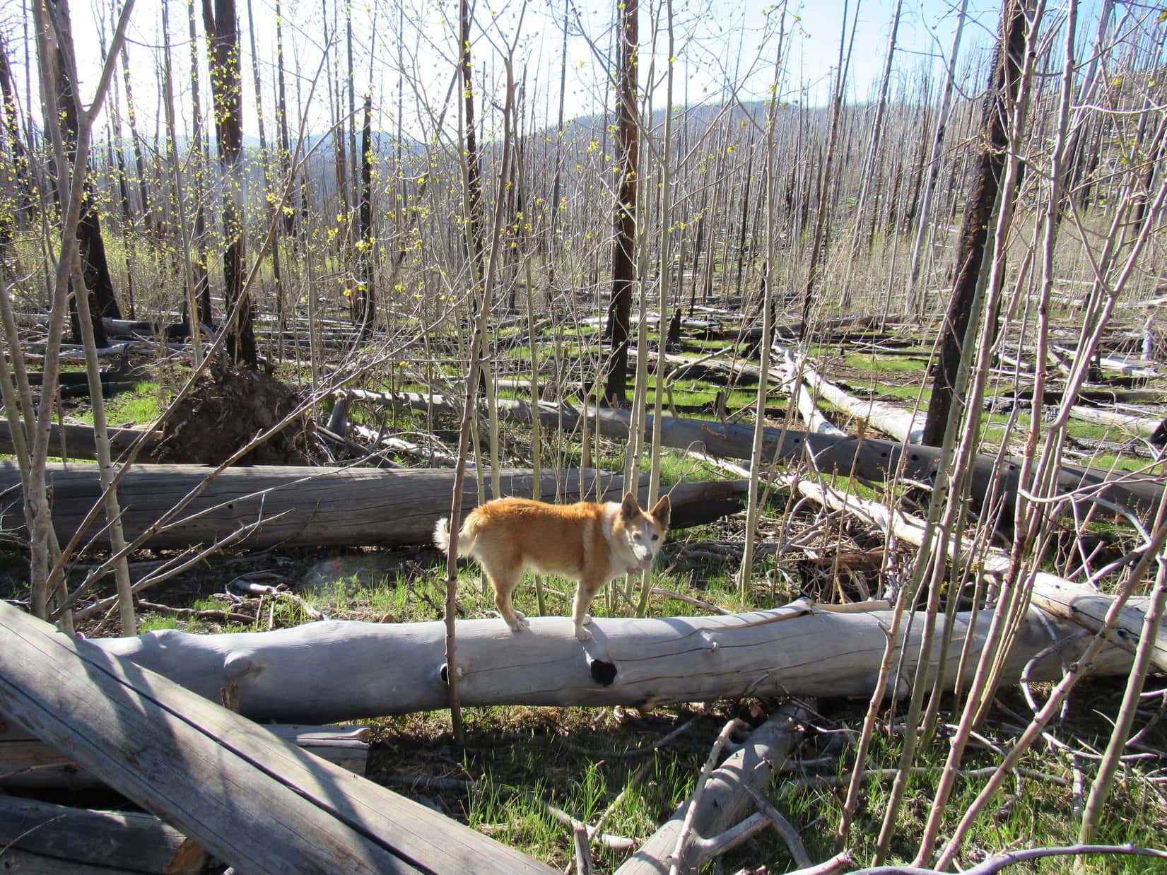

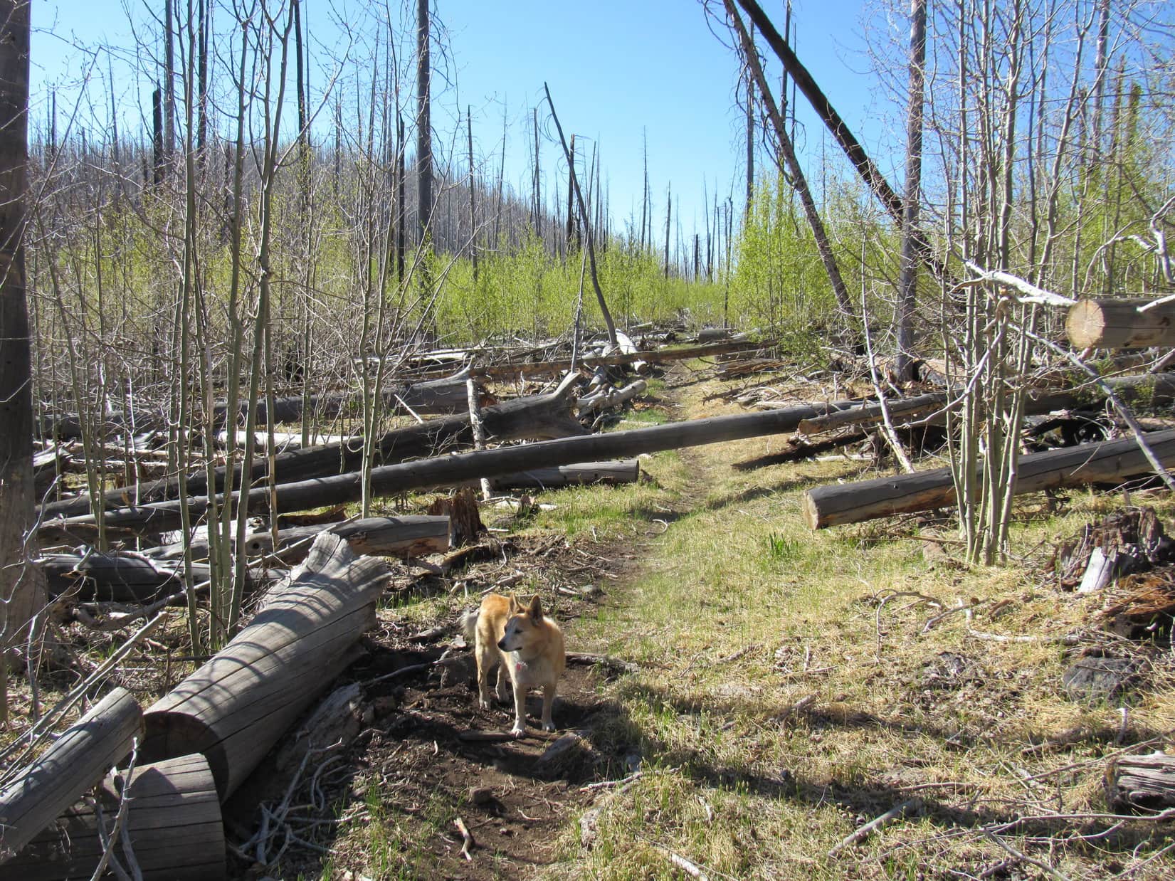
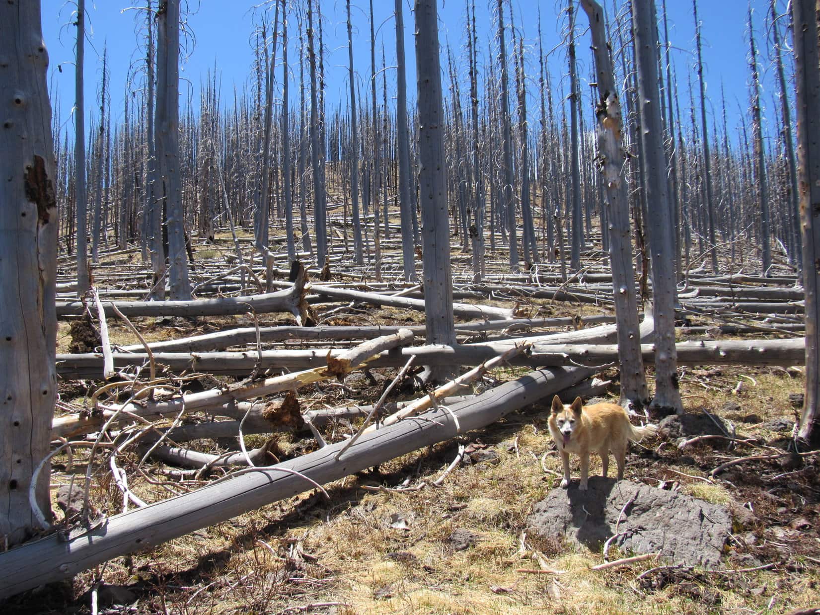
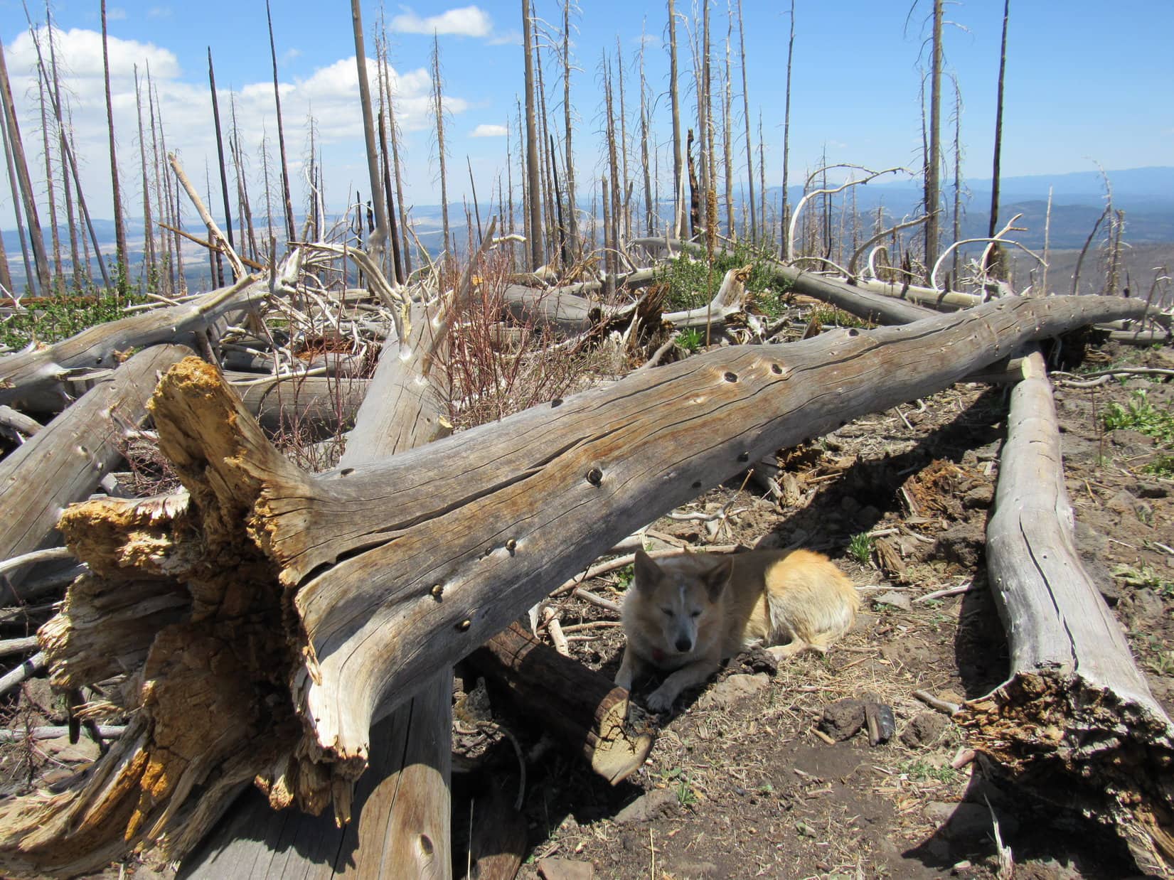
Progress had been rapid all the way to the Bead Spring sign. However, the situation changed shortly after passing it. Up to this point the trail had been clear, but the Carolina Dog now began to encounter substantial quantities of deadfall. Some of it was quite large.
Slowed by SPHP’s travails dealing with all the deadfall, Lupe finally made it to the first saddle along the ridge SE of Willow Mountain. The original plan for the day had included an off-trail jaunt up to the top of Willow Mountain (10,785 ft.) before pressing on to Whitewater Baldy. However, one look at the atrocious situation toward Willow was enough to put an end to any such notion, at least for now.
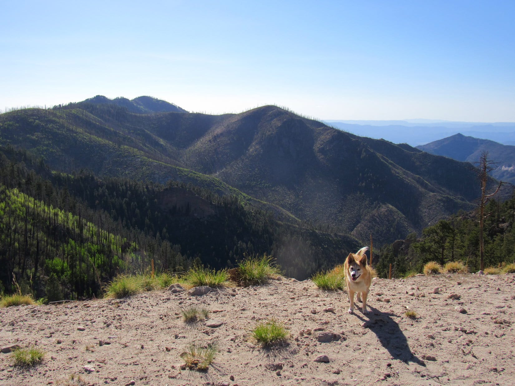
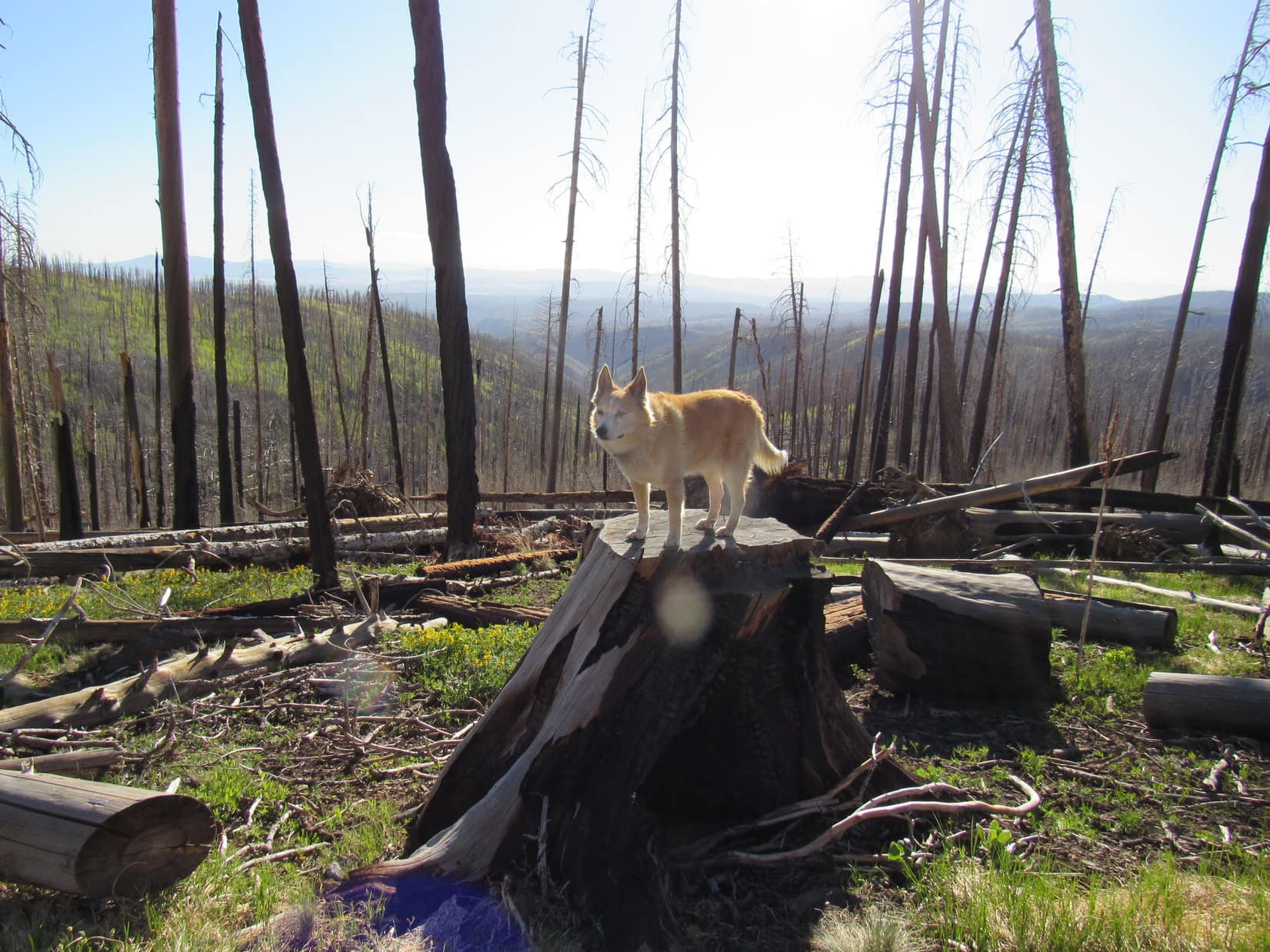
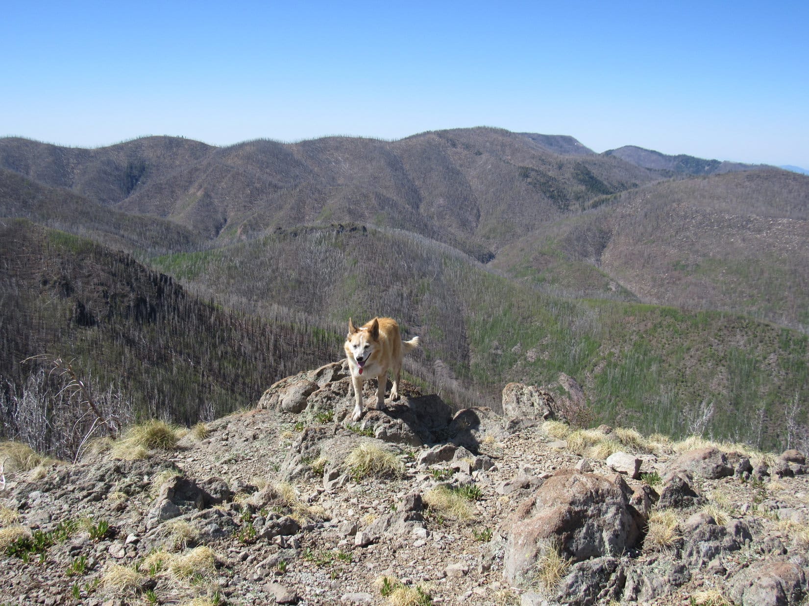
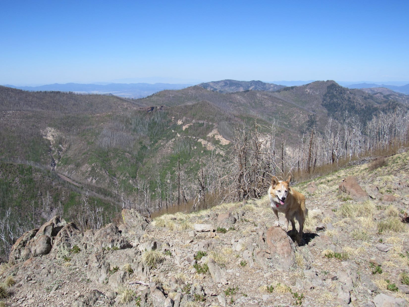
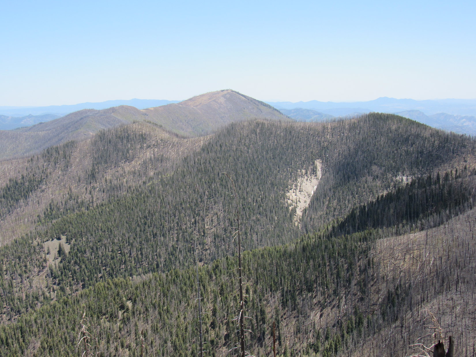
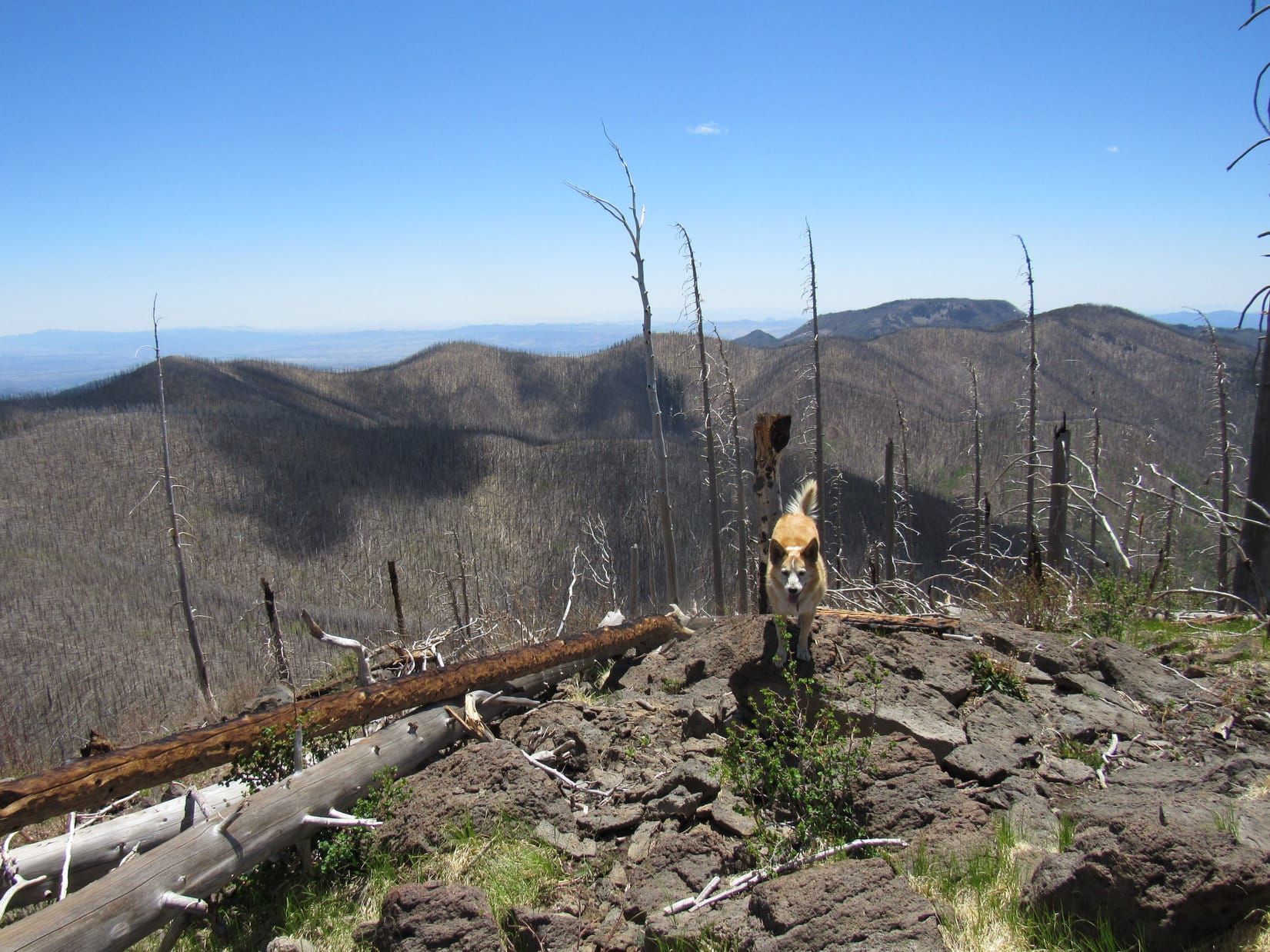
Eh, maybe later? Whitewater Baldy first! Lupe continued SE. The topo map showed Crest Trail No. 182 staying NE of the first long hill topping the ridgeline, but it actually traversed the steeper SW slope. At the far SE end of the long hill, Loop came to a clearing where several small rock outcroppings provided the first unobstructed views of the day.
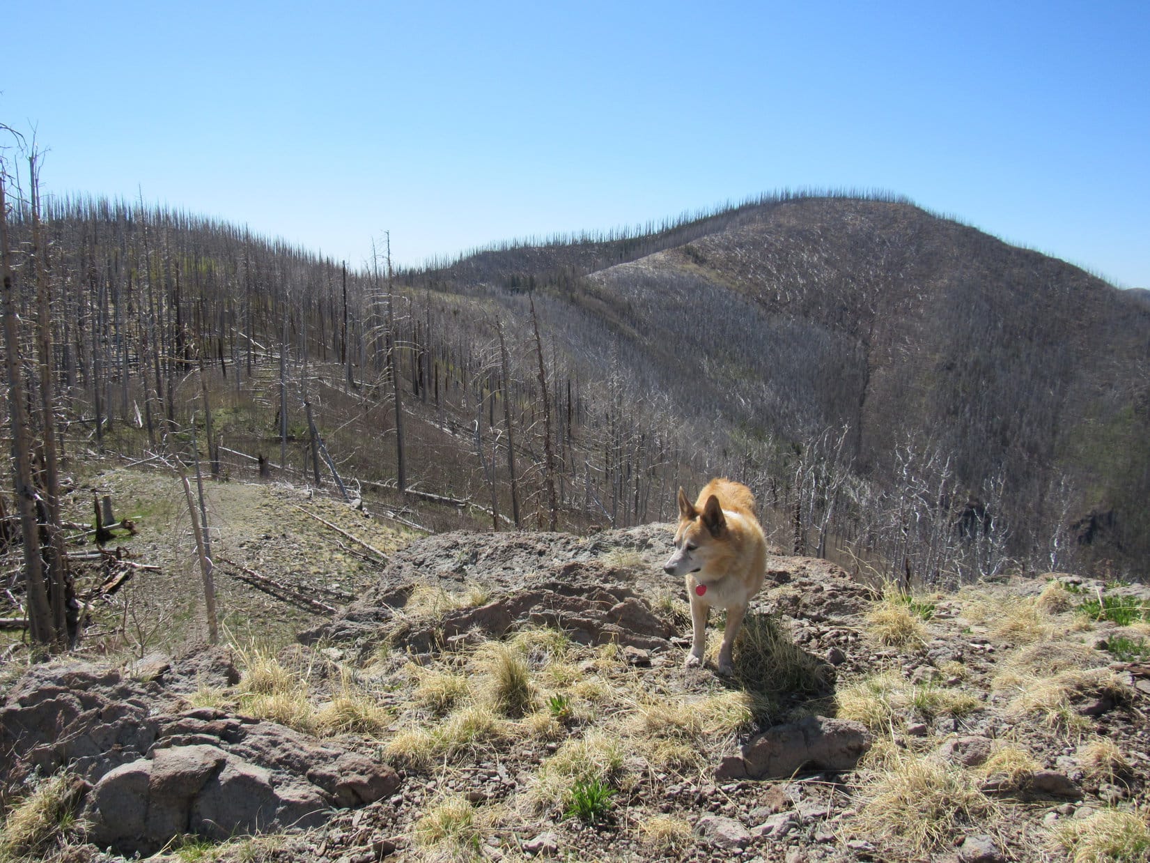
HP10510, the next hill along the SE ridge, was directly ahead. Beyond it, Hummingbird Saddle connected to Whitewater Baldy (10,895 ft.). Off to the W, Lupe had her first view ever of Arizona, less than 25 miles away. Closer by, Grouse Mountain (10,135 ft.), Indian Peak (10,115 ft.) and Black Mountain (10,643 ft.) were all in sight.
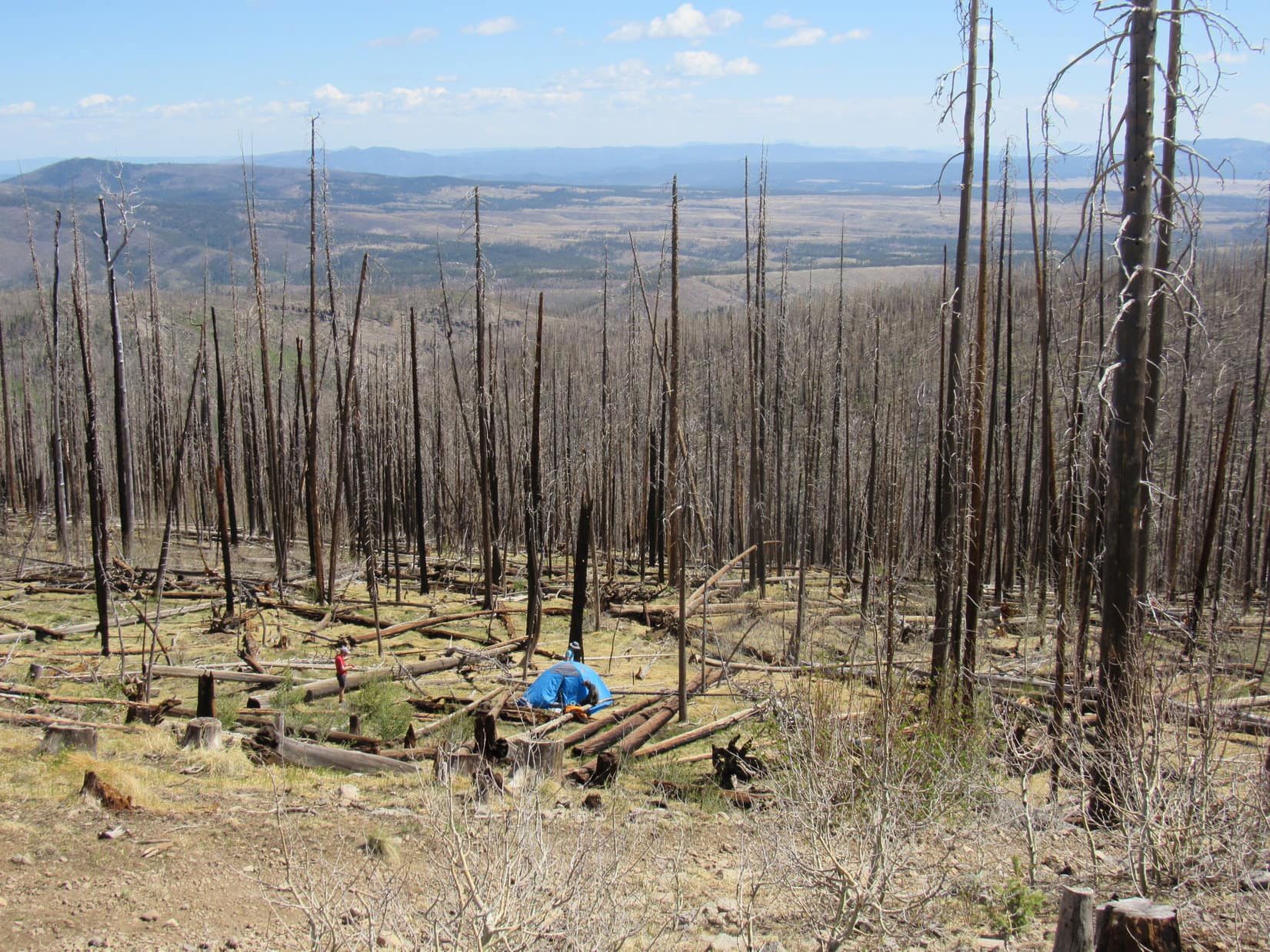
In addition to views, there were voices, too! Down the slope to the N, the 3 young men were dismantling a blue tent. Seeing Lupe, they shouted greetings. However, their backpacking trip was over. The wearying deadfall and an eerie night in the dead forest had convinced them to head back to their Mazda 6. Next stop – some hot springs. Was the Carolina Dog still going to Whitewater Baldy?
Darn tootin’! She was!
Whitewater Baldy was only 1.5 miles away, but getting there was still no easy task. Took a while just to get to Hummingbird Saddle. The deadfall was so bad that it was sometimes better venturing off-trail. Crest Trail No. 182 never did go to the top of HP10510, instead traversing its SW slope. It wasn’t until the descent to Hummingbird Saddle began that the deadfall began to ease up.

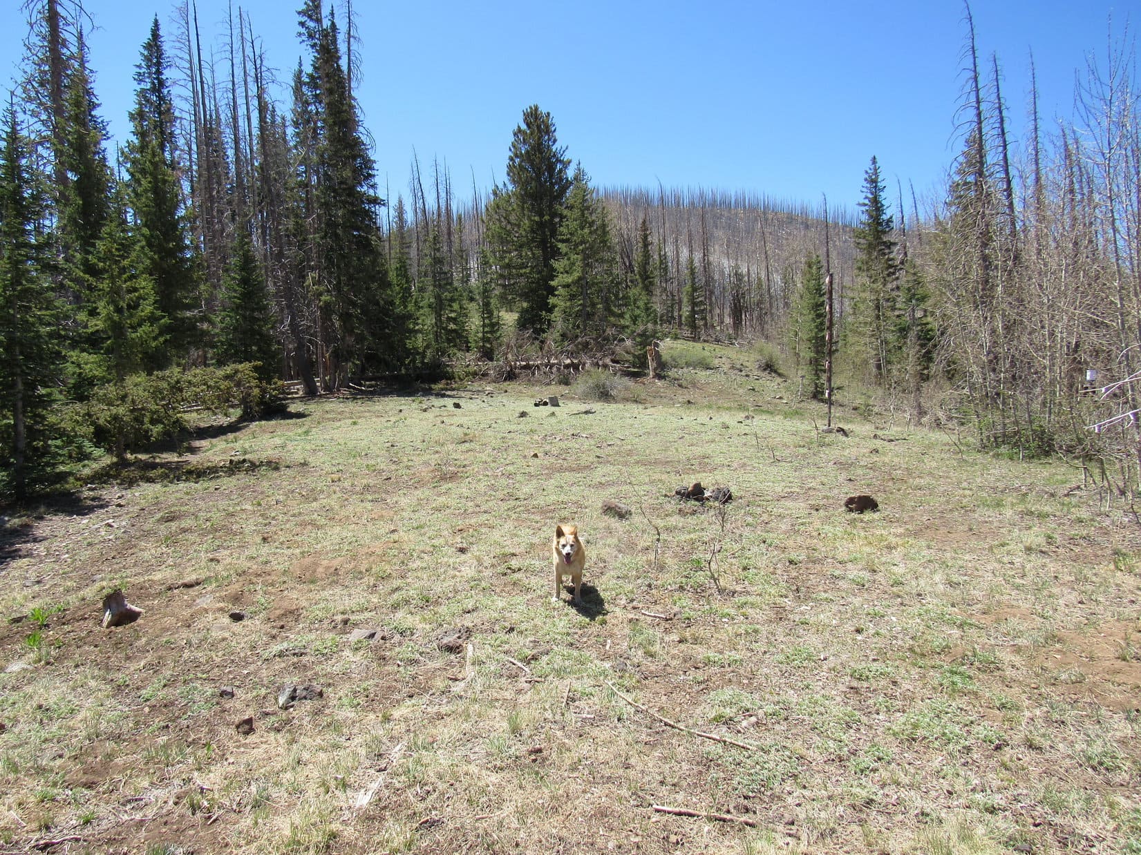
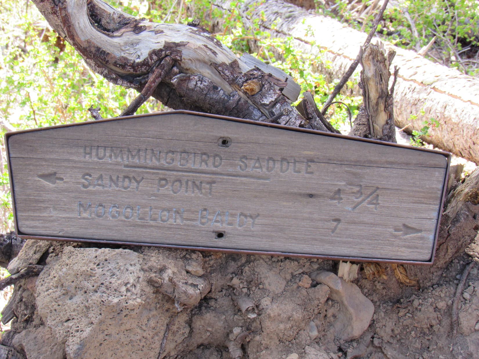
Hummingbird Saddle hadn’t burned. Live conifers provided shade along the edges of a grassy clearing. Toward the W stood a big Z sign. Since Hummingbird Saddle was a trail junction, there was some trail signage, too. Lupe found the shade most enticing, so a rest break was taken here.
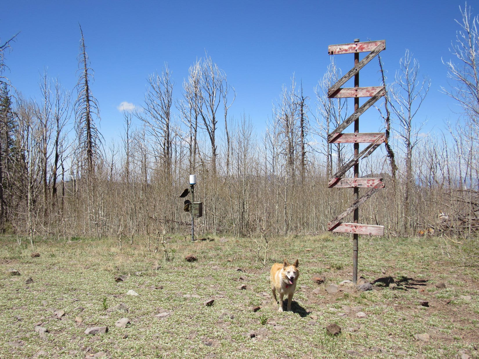
Rest break over, Loop started up Whitewater Baldy’s N slope. Would have been a cake walk minus the deadfall, but it really wasn’t too bad. Parts of the trail had been worse. The Z sign more or less described the route – back and forth searching for the easiest way up.
The slope steepened for a while, then finally began to diminish. One last rise appeared ahead. The top of the mountain wasn’t much farther!
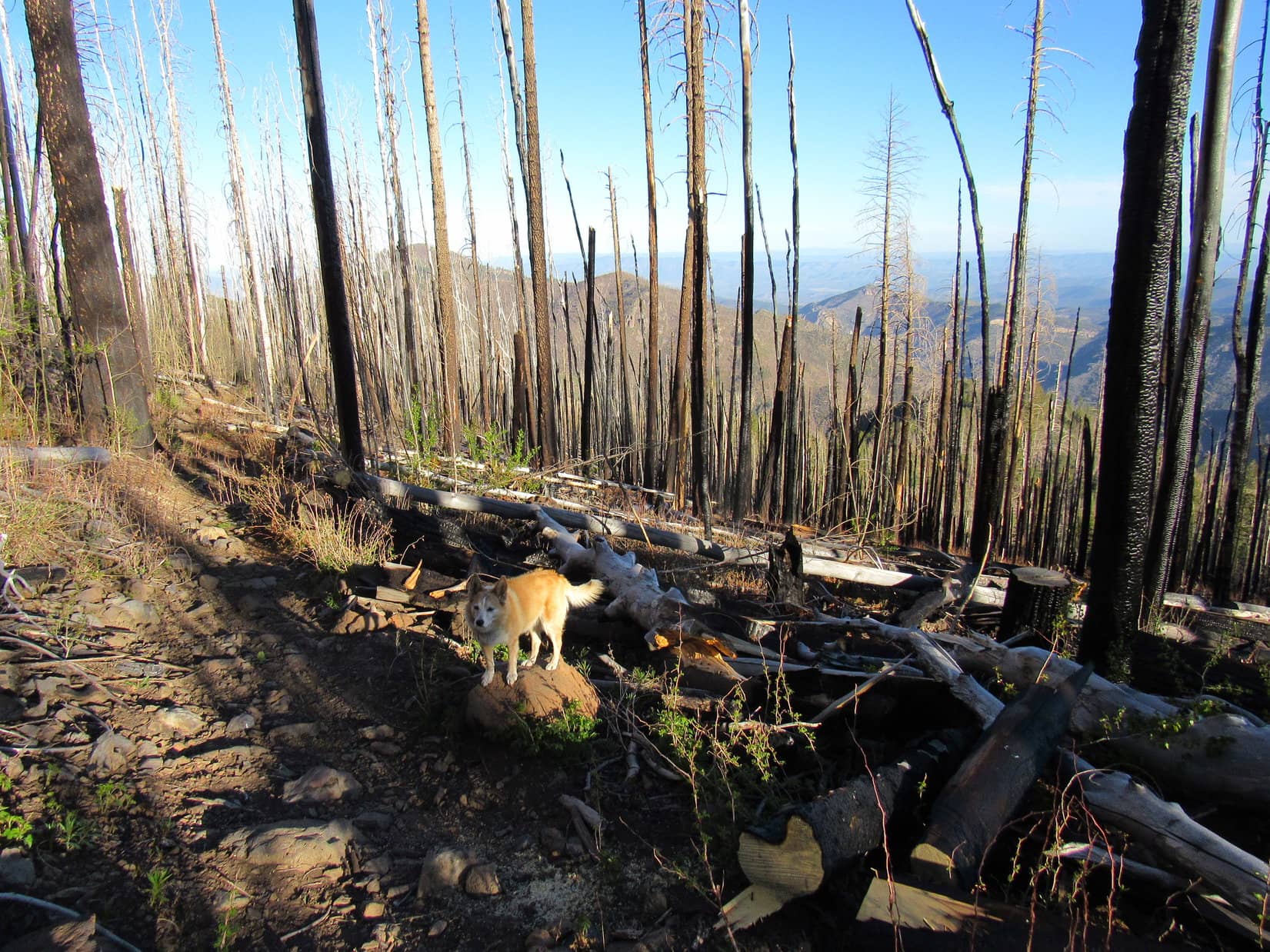
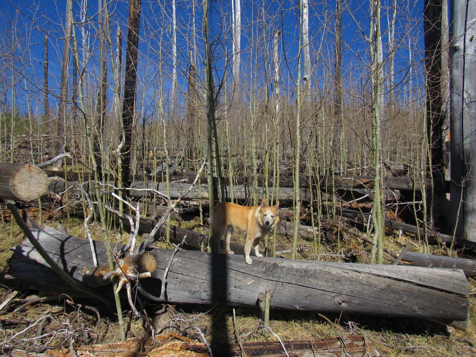
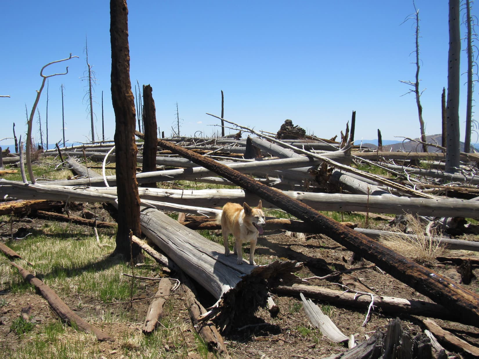
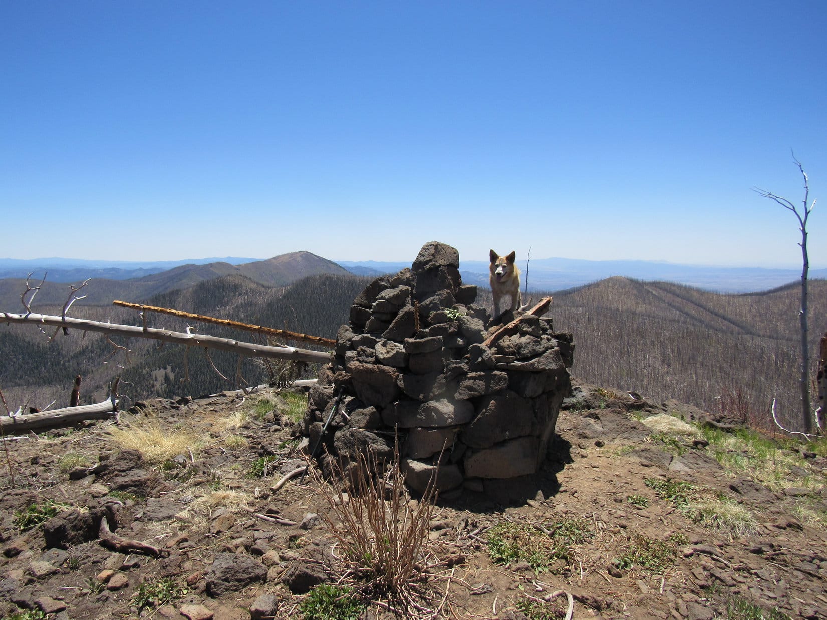
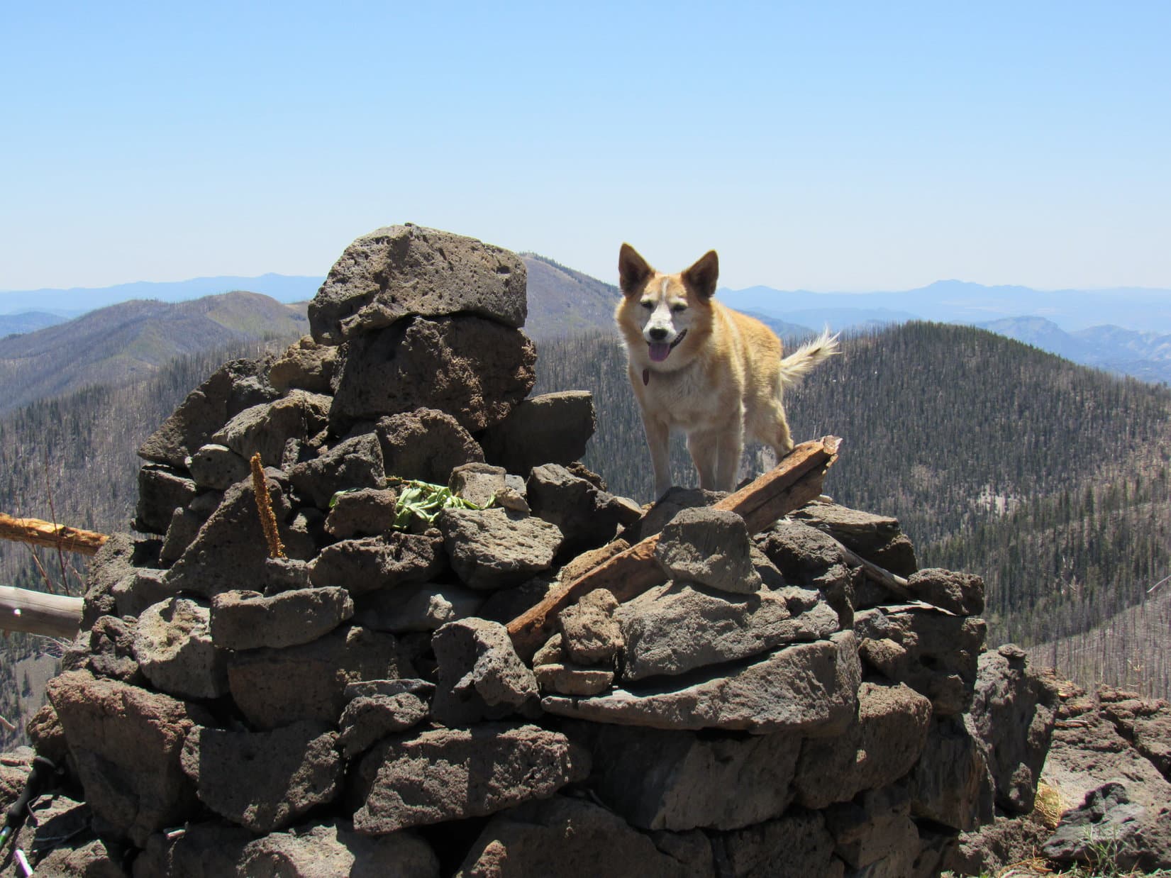
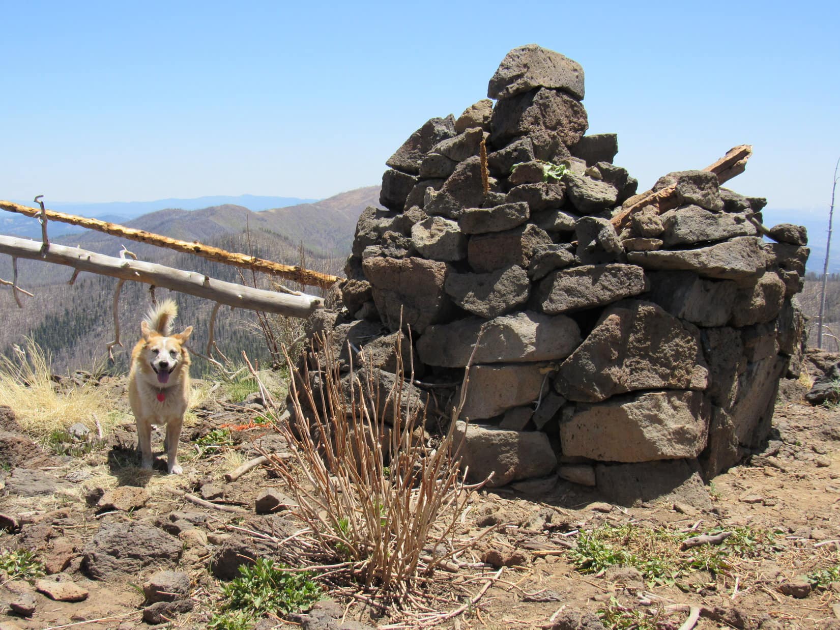
Upon reaching the upper edge of the rise, Lupe discovered a small cairn. However, this wasn’t the high point. Whitewater Baldy’s summit region was big, maybe 20 acres, and it all sloped gradually up toward the S. The entire summit had burned and was choked with deadfall. Leaping her way through it all, a massive 6 foot high cairn appeared ahead at the far S edge of the mountain.
An almost dead calm had prevailed all day, but as Lupe approached the true summit cairn, a strong breeze suddenly sprang up out of the W. A general shrieking and moaning commenced. A minute or two later it all died away with the wind. Spooky!
Reaching the cairn, Lupe scrambled up.
Time for a nice long break! SPHP cleared a spot under a log where Lupe could relax in a bit of shade. Water and the last of 3 chocolate coconut bars got shared. SPHP then munched an apple while Loop got up to sniff around. There were views in all directions, but the only unobstructed views were to the S and W. Meanwhile, the strange gusty wind returned at regular intervals, bringing with it the forlorn wailing.
No wonder those guys said they’d spent an eerie night! Must have been a little unnerving listening to this in the dark!
The trees aren’t happy, SPHP!
Burning to death has that effect on most anyone, Loop.
Oh, that happened years ago, SPHP. They don’t feel pain any more, but they’re terrified.
Terrified? Of what?
Of dying.
Don’t be silly, Loopster! They’re already dead!
Their spirits don’t know that, SPHP.
You mean the trees’ spirits are still here?
Yes, their ghosts.
The trees’ ghosts are afraid of dying? That doesn’t make any sense.
Sure it does, SPHP! I’ll explain in a moment. There’s something in this cairn!
As the conversation had gone on, Lupe had begun circling Whitewater Baldy’s summit cairn, sniffing more and more intently. Apparently the Carolina Dog detected some animal ensconced inside this stone fortress.
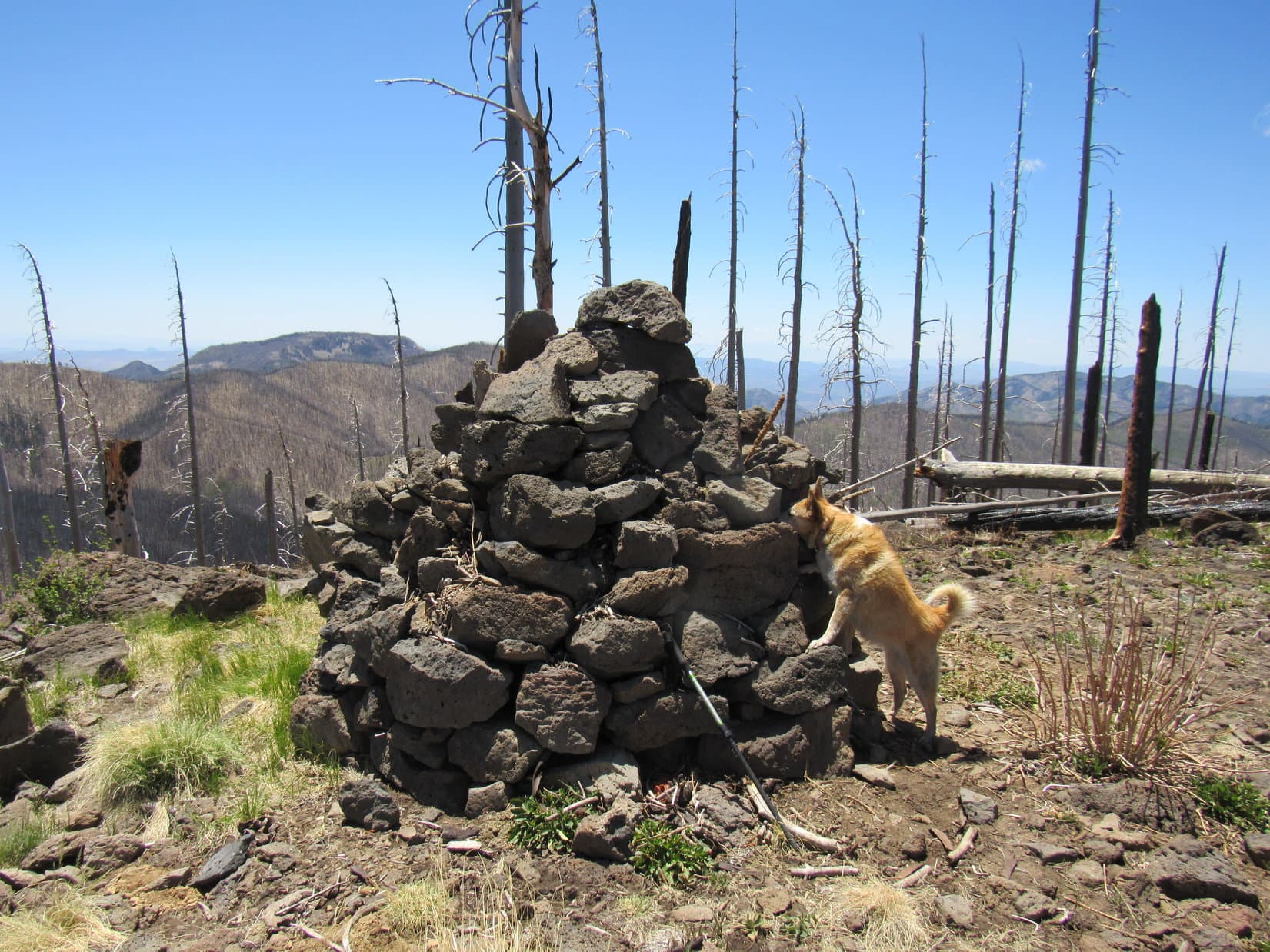
Repeated efforts to get at whatever it was all failed, but that didn’t keep the American Dingo from trying. Again and again Lupe circled the cairn, sometimes barking furiously in frustration. All to no discernable effect.
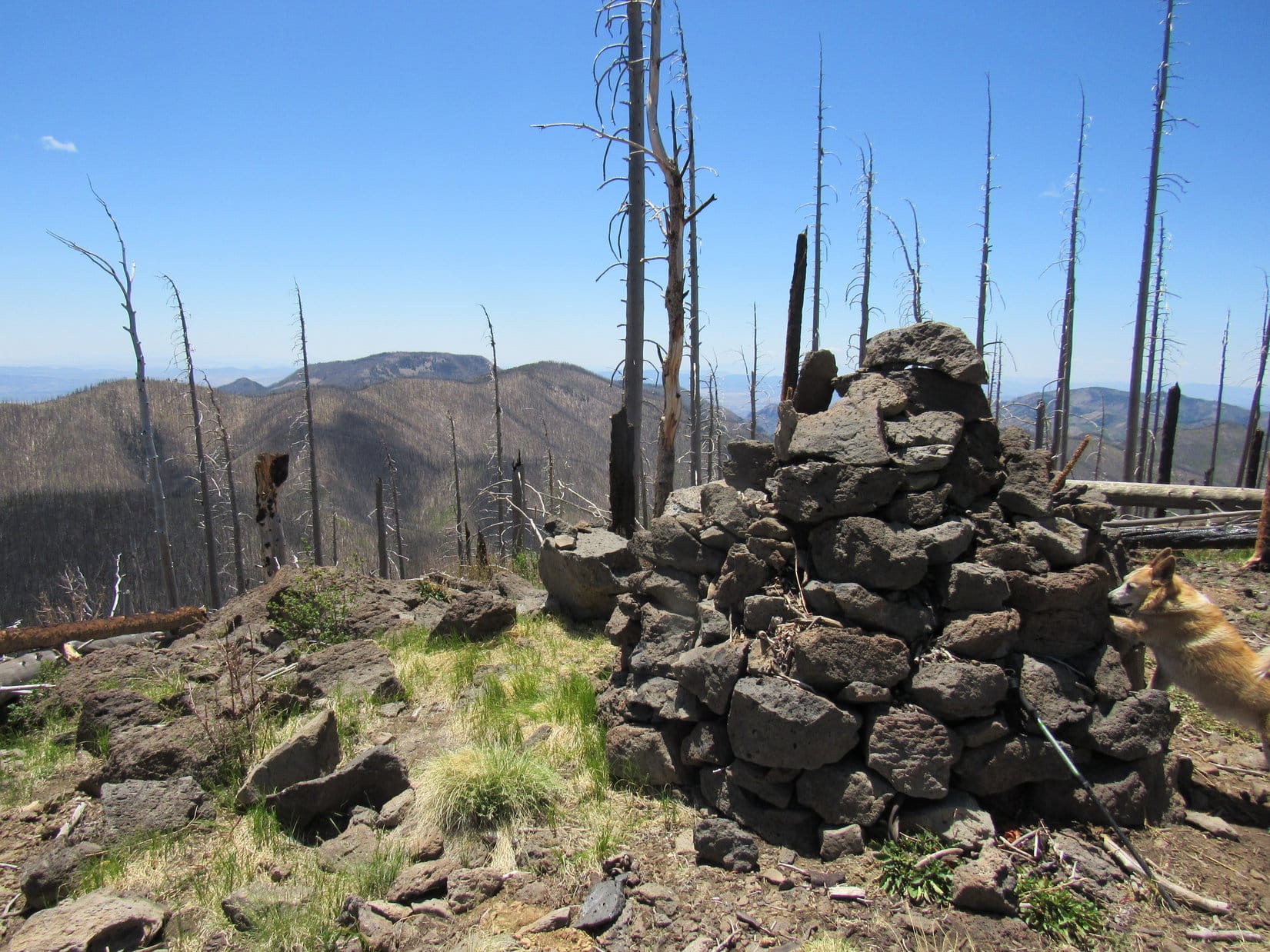
Dead trees shrieked and groaned. Looper stayed busy probing the cairn. For a long while, SPHP gazed into the unfamiliar distances of New Mexico.
Finally, enough was enough.
Give it up, Loopster! What about the trees’ ghosts? Why do they think they’re still alive, and worry about dying?
Panting from her efforts, Lupe paused and laid down near the cairn.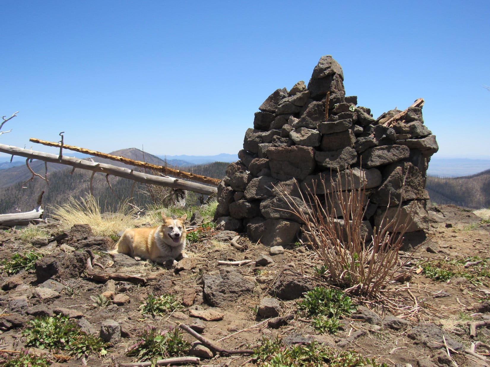
You hear them, SPHP! They still have voices! That’s why they believe they are still alive. But the wind that enables them to speak is terrifying, since it threatens to blow them over. If they fall, they’ll be dead, unable to ever speak again. That’s why they’re screaming!
Must be terrible for them, Loop. They can only talk when they’re in danger!
Oh, that’s not true, SPHP. They aren’t always afraid.
They’re not?
No. They still have happy times. When the breeze is gentle, they whisper of their days of glory.
Glory?
Yes, they remember the green living forest that once was here. Whitewater Baldy is the highest peak in the Mogollon Mountains. These trees were the loftiest – rulers of the vast domain you see all around us.
Hmm. Well, that’s quite the tale, Loop. I suppose you’re right. Guess I never realized how attuned Carolina Dogs are to the nature of things.
We Dingoes know many secrets hidden from you humans, SPHP.
No doubt, Loopster. Well, we’ve been here a while. Spooky Whitewater Baldy has been interesting to say the least, but are you ready to head back? Maybe there’s still time to climb Willow Mountain?
I thought you’d given up on that, SPHP?
Oh, I don’t know. Maybe its worth a shot? We made it up here.
Lupe took a final look at the views from the S edge of the mountain. She posed by the cairn still harboring its intriguing unidentified resident. An hour after arriving, the Carolina Dog left Whitewater Baldy (10,895 ft.), this time staying close to the W edge of the summit region as she circled back to the N slope leading down to Hummingbird Saddle.
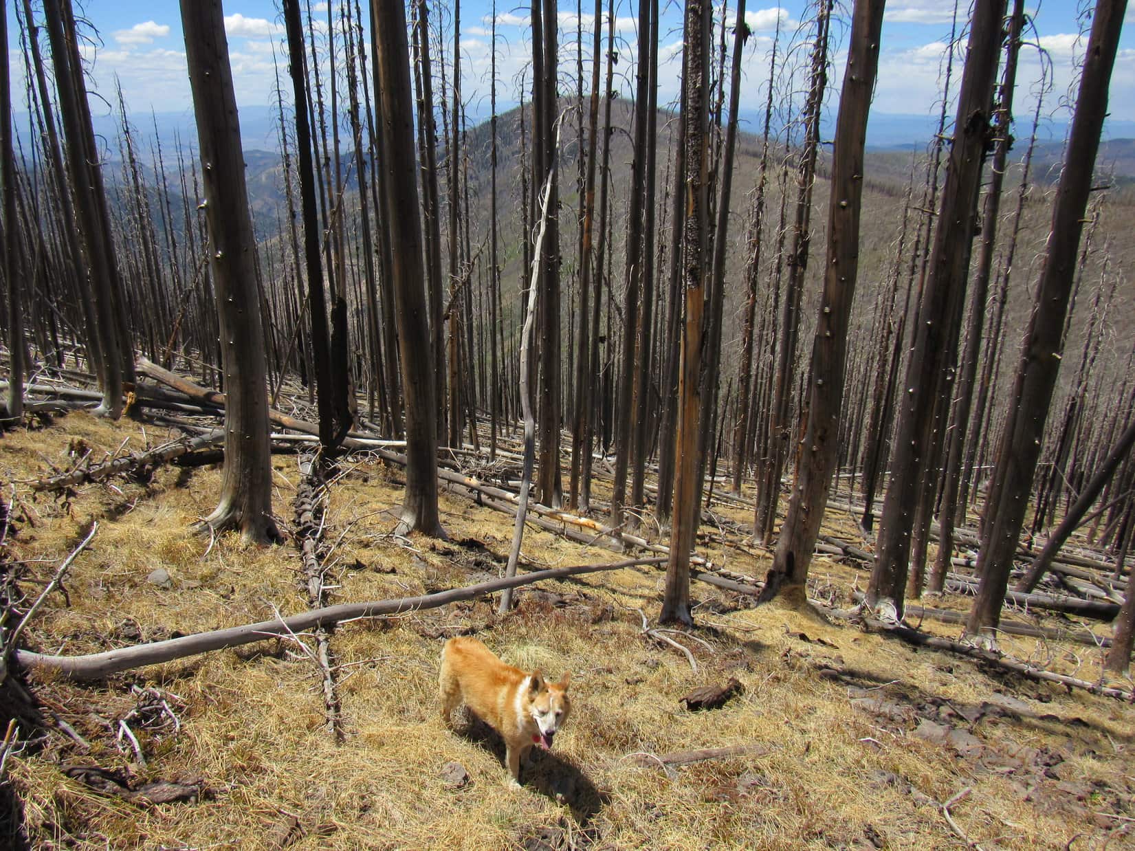
On the way down Whitewater Baldy’s N slope, the gusty wind died away for the last time. Silence reigned once more. Somehow the journey back seemed easier. Lupe arrived SE of Willow Mountain (10,785 ft.) with what appeared to be plenty of daylight to justify an attempt.
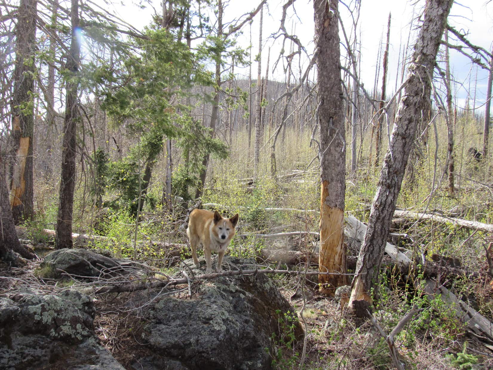
The American Dingo made a valiant effort and considerable progress, but the deadfall was horrendous, far worse than anything encountered at Whitewater Baldy. A few small grassy spots, but the rest of the region was a thicket of young aspens amid stacks of blowdown. Loop reached rock formations along the SW edge of the long slope leading toward Willow Mountain’s summit, but more than an hour had already slipped by. She kept going a while longer, but SPHP finally called a halt.
Not happening, Looper!
You sure, SPHP? It’s not that much farther!
Yeah, but this is taking forever. Probably farther than it looks, too. We might get there before our daylight’s gone, but I don’t want to spend hours scrambling through this mess in the dark trying to get back to Crest Trail No. 182. Not worth it!
Even from here, getting back to Crest Trail No. 182 was an ordeal. At one point Lupe got separated from SPHP by a continuous wall of deadfall hundreds of feet long and more than 10 feet high. The American Dingo ran along, hopping from log to log searching for an opening, unable to find one. In the end, SPHP had to climb over the wall to rejoin her.
What’s that, SPHP?
Something blue, shiny, and unnatural had caught Lupe’s attention.
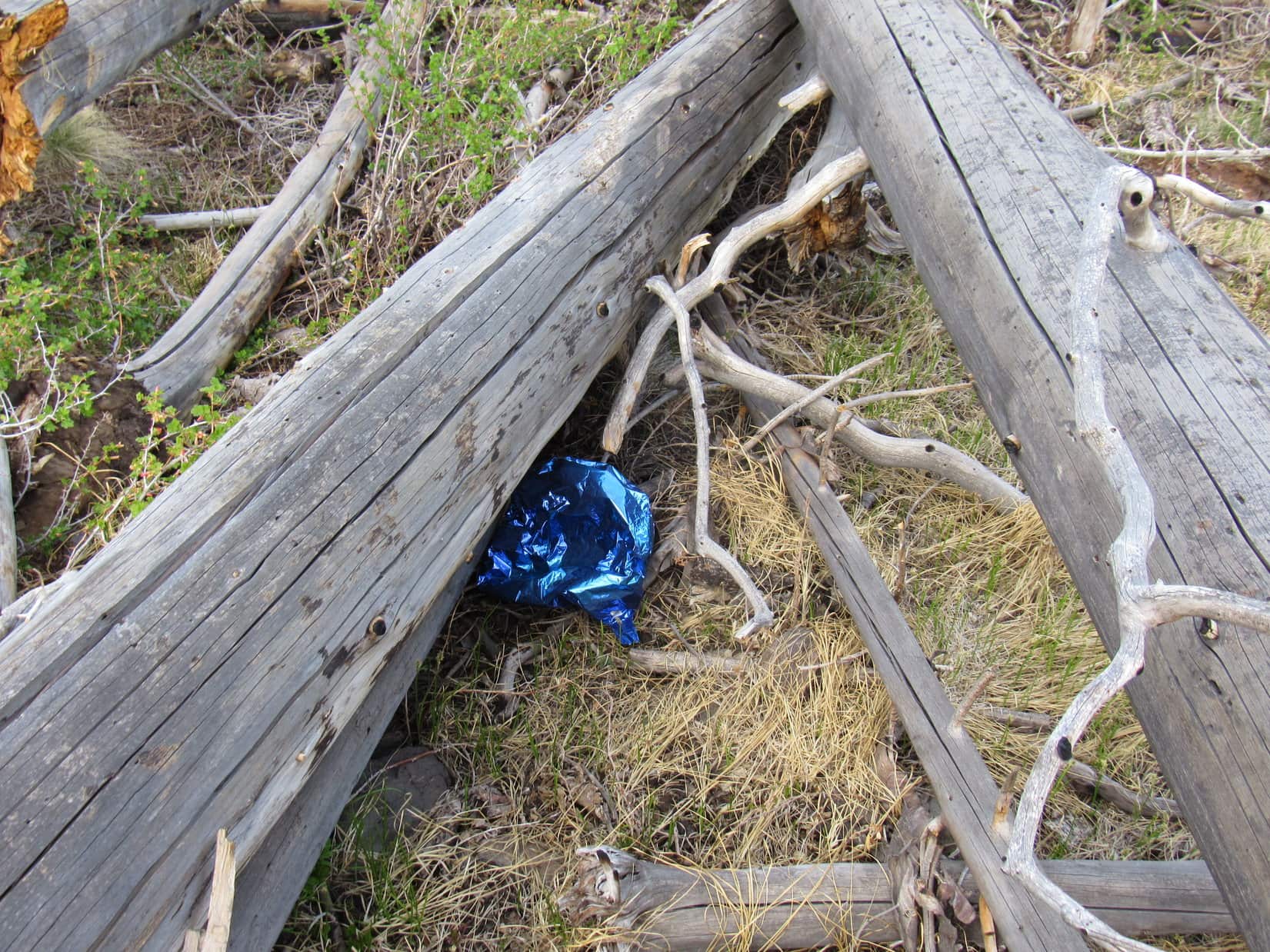
That’s a balloon, Loop!
Well, what does that tell you, SPHP? Guess it’s a good thing we gave up. Even a balloon can’t get to the top of Willow Mountain!
(End – 8:43 PM, 46ºF)
Links:
Next Adventure Prior Adventure
Want more Lupe adventures? Choose from Lupe’s Summer of 2021 Dingo Vacations to New Mexico, Wyoming & the West Coast Adventure Index, Dingo Vacations Adventure Index or Master Adventure Index. Or subscribe free to new Lupe adventures.