
Day 13 of Lupe’s 2017 Dingo Vacation to the Yukon & Alaska!
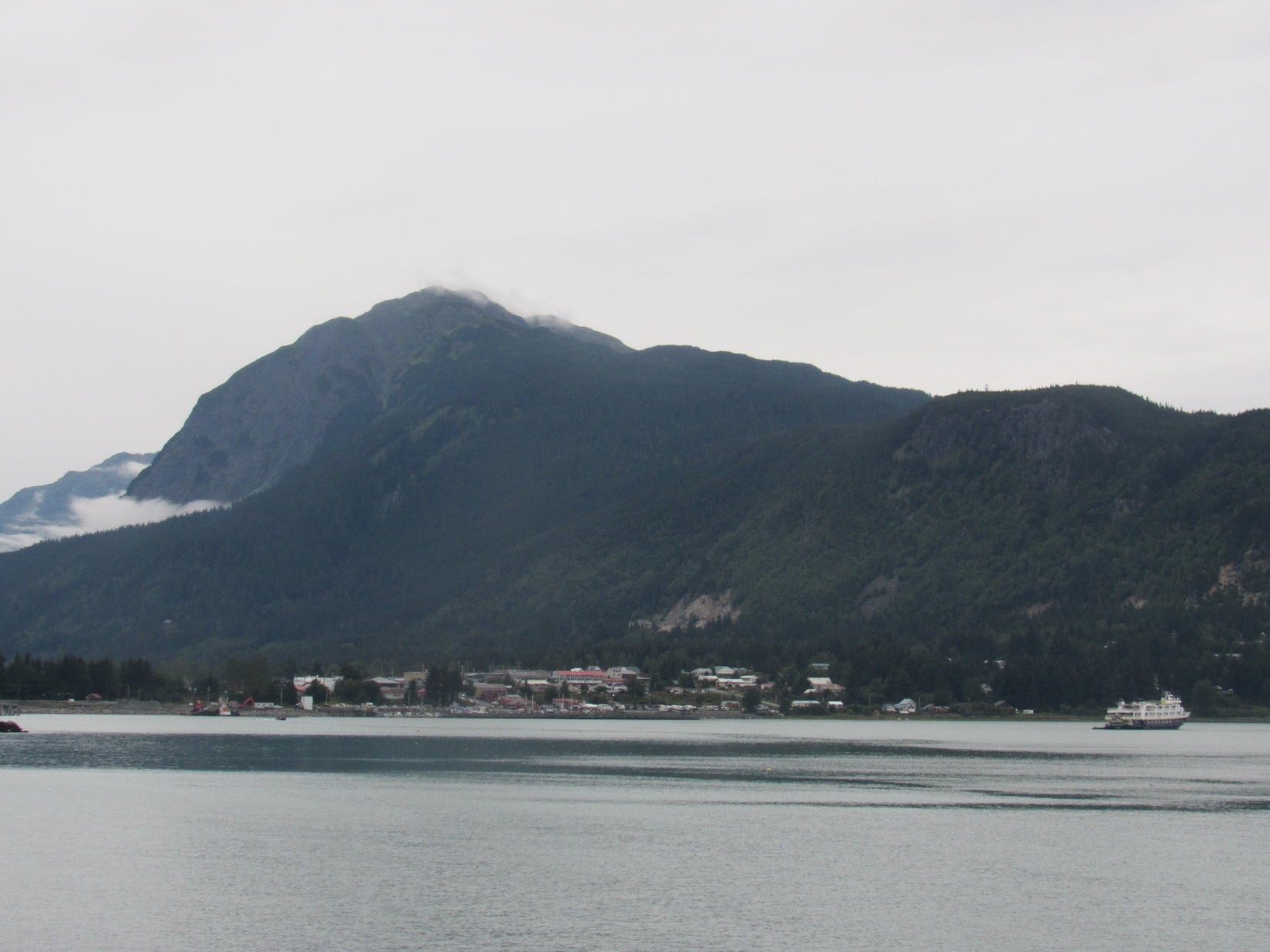
Cloudy. Not too bad, though. The sun couldn’t be seen, but a bright spot revealed its position. The clouds must not be too thick. For the second day in a row, Lupe started her morning off with a look at beautiful Chilkoot Inlet.

Maybe the sky would clear later in the day? Perhaps not. It might not even matter.
Lupe had seen Mount Riley (1,759 ft.), the high point of the Chilkat Peninsula, from Mount Ripinsky (3,675 ft.) yesterday afternoon. Mount Riley wasn’t high enough to get above tree line, even here in Alaska. The whole mountain appeared heavily forested. Maybe Mount Riley wasn’t going to amount to anything more than a peakbagging goal. Trees might be all Loop would get to see. On the other paw, if the sun did make an appearance, and mountain and ocean views were available from Mount Riley, they ought to be spectacular!
In any case, since it wasn’t raining, Lupe was going to find out what Mount Riley had to offer. After a few morning chores, SPHP drove to Chilkat State Park only a mile or two SE of Haines. Loop would set out for Mount Riley from the Battery Point trailhead at the end of Beach Road. (9:00 AM, 57°F)

Setting out, Lupe followed the Battery Point trail, a wide, smooth path leading SE through tall open forest. The Battery Point trail was mostly flat, gaining little, if any, net elevation. Chilkoot Inlet wasn’t far from the trail, but was never in view. The forest hid everything, which might well be par for the course today.

After 0.9 mile, Lupe came to an intersection. A trail to Mount Riley branched off curving W farther up into the forest. The Battery Point trail went down to Chilkoot Inlet from here. Although it was a mile to Battery Point, Kelgaya Point was only 0.3 mile away.
Loop and SPHP both agreed it might be fun to go to Kelgaya Point. Such a short side trip wouldn’t take long, and beat spending the whole day in the forest.

The Battery Point trail went right on down to Chilkoot Inlet. The tide was out. Lupe and SPHP headed E for Kelgaya Point across a rocky beach. At Kelgaya Point, a rock formation rose at the edge of the water.

Naturally, Lupe climbed up on the rocks for a look around.


SPHP joined Lupe up on Kelgaya Point. If anything, the day was even cloudier than earlier on, but the views of Chilkoot Inlet and surrounding mountains were still beautiful. Back toward Haines, Lupe could see Mount Ripinsky (3,675 ft.), which she had climbed yesterday.


Near the E end of Kelgaya Point a more prominent rock outcropping formed a crude miniature spire. Lupe scrambled up. From the spire, she had the best vantage point of all.


It was possible to go beyond Kelgaya Point all the way to Battery Point, but Lupe and SPHP didn’t do that. Mount Riley was the main goal for the day, so maybe it was best to be underway again.

Loop and SPHP returned to the trail intersection to take the trail to Mount Riley. It curved W deeper into the Chilkat Peninsula climbing steadily. Near the end of this climb, a short section of switchbacks wound up the steepest part of the slope. Before reaching the top, the trail leveled out and turned SE again.

The Mount Riley trail bounced up and down on the side of a fairly steep slope. There was nothing to see except the forest. The trail here was much narrower and looked far less traveled than the Battery Point trail. Red ribbons and small wooden boards with fading red arrows painted on them were attached to the trees, helping to point the way. The trail was obvious enough so these assists were seldom needed.

Lupe was passing through a coastal rainforest. Ferns and moss were common on the forest floor.


After traveling along the steep hillside, the trail finally turned S and started up a ravine. Lupe passed near big mossy rock outcroppings in this area.

The mossy rock formations were confined to a small area along the ravine. Near the end of this section, the trail snuck up between two big rocks climbing fairly steeply. Above the rocks, the trail began to level out. Lupe was still gaining elevation, but at a reduced pace. For the first time, Looper got a glimpse of what was ahead. The view wasn’t terribly encouraging or inspiring.

All that was ahead was a higher forested hill. Nothing one might call a mountain peak. Until now, Lupe hadn’t even been able to get a good look at the sky. The news there wasn’t great, either. If anything, the sky was grayer and more densely overcast than before. Despite uninspiring prospects, Loop and SPHP pressed on.
Lower down there had been some blueberry bushes along the trail, but no blueberries on them. Up here, there were blueberry bushes galore! Even better, they were packed with sweet blueberries. SPHP soon had purple fingers. The pace of advance slowed markedly. Blueberries were everywhere! Blueberry bushes lined the trail and even overhung it.
The blueberries were delicious, but the blueberry bushes were all wet from overnight rains. SPHP was soon soaking wet nearly waist high. The Carolina Dog was getting nothing out of this experience. The trail amounted to a sopping wet blueberry bush tunnel to her. Poor Loopster couldn’t see a thing, and was soon as soaked as if she’d been swimming. She looked miserable.
Things stayed that way for a while. Then it started to rain. Lightly, but still rain. No matter. Conditions weren’t that bad. At least it wasn’t cold and windy like the summit of Mount Ripinsky had been yesterday. Lupe was going to make it to the top of Mount Riley. She had come too far to turn around now.
After a level muddy stretch, the trail steepened again. Blueberry bushes no longer crowded the trail as much. Lupe perked up. What really snapped her out of the doldrums, though, was a sudden, loud crashing in the forest. SPHP whirled around in time to see a moose run off.
Lupe couldn’t see the moose, but she knew something big was out there! She bounded around trying to see above the vegetation blocking her view, but was disappointed. The moose was gone.
Too much time had been spent devouring blueberries. Getting to Mount Riley was taking forever. After a steady climb, the trail finally leveled out at a meadow, the first real opening in the forest Lupe had come to.

The trail crossed the meadow. On the far side, Lupe reached a sign. She had made it to the junction with the trail from Mud Bay. The summit of Mount Riley wasn’t much further! That forested ridge ahead must be it.


Loopster soon arrived at the summit of Mount Riley (1,759 ft.). At the top of the mountain, she found an unimposing ridge of gray rock. The ridge barely stuck up above a stunted forest enough to provide what should have been a spectacular view of the Chilkat and Chilkoot Inlets ringed by snow and glacier clad peaks.
The American Dingo could claim Mount Riley as a peakbagging success, but the views were far from what they might have been. A light rain fell intermittently. Mist and fog were all around, but not to the point where Lupe couldn’t get an idea of what she was missing out there.


Oh, for a rare sunny day! Rain, mist and fog are no doubt very common in the Haines area. Lupe certainly wasn’t getting much out of these views at the moment. When she heard distant gunfire, she was done looking around. Somewhere far off, someone was doing some target practice.
Why stand out in the rain at the top of the mountain offering the best, and likely only, possible target? The American Dingo retreated to the safety of a stunted conifer offering protection from both rain and bullets.


While the American Dingo hid out a few feet away, SPHP stood on Mount Riley’s diminutive summit ridge. Conditions were gradually getting damper, darker and drearier. The weather seemed to be moving up from the Lynn Canal to the S.

Things weren’t that bad, but with the weather deteriorating instead of improving, there didn’t seem to be much reason to hang around either. Half an hour after she’d arrived, Lupe was ready to start back. She returned to Mount Riley’s summit rocks briefly before departing.


A few little birds and a couple of squirrels were all the wildlife Lupe could conjure up on the long return trip through the forest. The moose crashing around that she hadn’t even gotten to see on the way up was the highlight of the whole day as far as excitement was concerned.
SPHP gorged on blueberries again until the trail dropped below the short section of mossy rock formations. Despite the red ribbons and arrows, SPHP then cleverly managed to miss a turn on the trail, resulting in an unnecessary descent of 100 plus feet of elevation before the mistake was realized and corrected.


Of course, after leaving the summit, the weather gradually improved. The rain ceased, but the sky remained gray. Lupe made it back to the G6 (4:29 PM, 61°F). There wasn’t much of a plan for the rest of the day.
On the way back to town, Loop and SPHP stopped at a viewpoint where Mount Ripinsky could be seen towering over Haines.
Then it was on to Lupe’s favorite pullout on Lutak Road with a view of Portage Cove, Haines and the Chilkoot Inlet. Lupe dined on Alpo and Ritz crackers. SPHP caught up the trip journal. More than an hour went by. The sky looked like it would be gray forever, but it was still light out.
If the weather had been better, Lupe had more to do in the Haines area, but it wasn’t. Looking out over Portage Cove, it was sad to think about leaving Haines, but the Carolina Dog had more adventures awaiting where the skies might be blue. Maybe it was time?
Despite the cloudy skies, the evening’s drive was beautiful. By nightfall, Lupe reached Dezadeash Lake.

Mount Riley Trailhead Notes:
Battery Point Trailhead: From the E end of Main Street in Haines next to Portage Cove, take Front Street S to Beach Road. After a mile, Beach Road angles R and turns to dirt. The Chilkat State Park Battery Point trailhead is at the SE end of Beach Road about a mile farther on. The summit of Mount Riley is 4.6 miles from the trailhead.
Mud Bay Trailhead: From Main Street in Haines, take 3rd Avenue going S. 3rd Avenue becomes Mud Bay Road. Watch for signs for Chilkat State Park. Parking is on the R (W) at the top of a hill roughly 3 miles from downtown. The Mud Bay trail starts on the other side of the road. It’s 2.8 miles to the intersection with the trail from Battery Point, and another 0.5 mile to Mt. Riley’s summit.
Want more Lupe adventures? Choose from Lupe’s 2017 Dingo Vacation to the Yukon & Alaska Adventure Index, Dingo Vacations Adventure Index or Master Adventure Index. Or subscribe free to new Lupe adventures.
Very well documented and love the dog’s point of view. I went up Mt Riley with a friend from Haines 3 yrs ago and my little dog, Alika. Let my friend get to the top. I waited with Alika. Weather is everything he had said and we had a beautiful clear day but I just wasn’t in shape or have the same desire. So good to see the pictures you took at the top. Thanks so much. Are you male or female? Good writer. I will do more of my stories from the dog’s focus. I love it and dont feel so bad now that I didnt make it to the top. Hope to go again when there are blueberries, though!
Shannon
Shannon:
Sorry for the late response! I am only recently (and temporarily) back from summer adventures.
Mount Riley was a fun trek, but the big views don’t appear until you are nearly at the top. Unfortunately, it was mighty cloudy by the time we got that far. Mount Ripinsky is another fun peak in the Haines area with even better views, but is a bigger climb, too.
If you take on Mount Riley again during blueberry season, there’s some danger poor Alika never will get to the top! SPHP tends to fall into blueberry traps. I sometimes wonder if we ever will get to where we’re supposed to be going!