Black Hills, SD Expedition No. 3 – Lupe’s Search for Old Bald Peak (1-29-12)

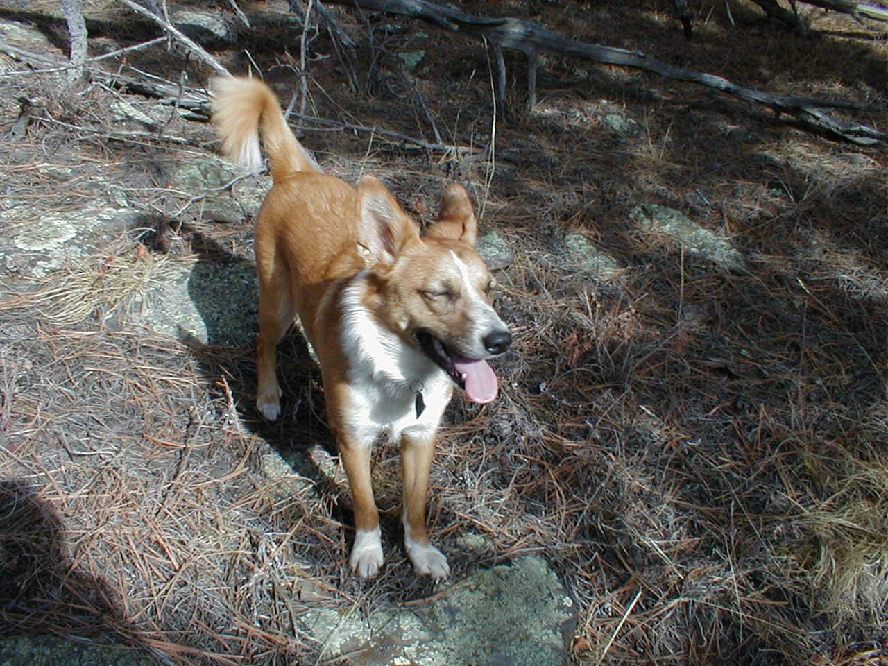
11:30 AM, start of USFS Road No. 257 off Horse Creek Road (No. 243) – Lupe’s first 2 Black Hills Expeditions had both been to the same place, an easy scenic trip up Rapid Creek on Deerfield Trail No. 40 from Silver City to Canyon City.  Today, the plan was for something new.  The Carolina Dog was going to climb a mountain!  Old Bald Peak (6,130 ft.) in the central Black Hills was the chosen destination, one neither Lupe nor SPHP had ever been to before.

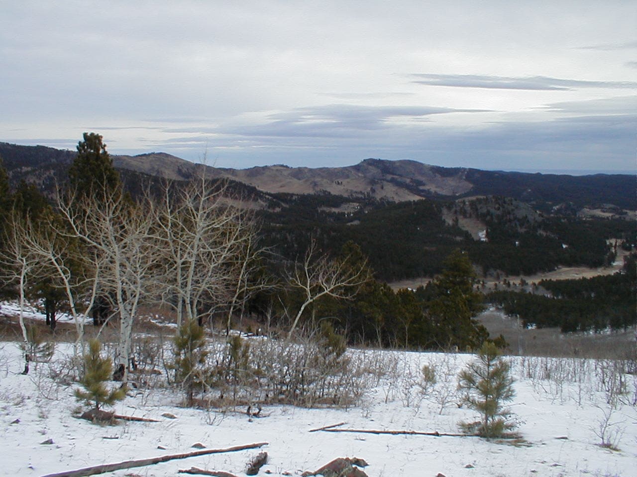
Sunny and not too cold, but very windy as Lupe set out heading NNW on USFS Road No. 257.  Low pine-covered hills were to the L, and a big open field was to the R.  Lupe had only gone 0.33 mile when an exposed rocky high point appeared ahead on the L.

The high point was out in the open beyond the pines.  Lupe did not care for how strong the chilly wind was when she reached the top.  However, this high point did provide some good preliminary views.  Old Bald Peak was somewhere 3 or 4 miles NW of here, and Lupe could see some of the terrain she would be exploring on the way there.

To the NE, Lupe could also see a line of scenic barren hills, most of which had burned in a forest fire years ago.  Those hills looked like they would be fun to explore someday, too!

Lupe among the rocks of her first high point.
Looking WNW toward the region Lupe was about to explore.
The barren hills to the NE.

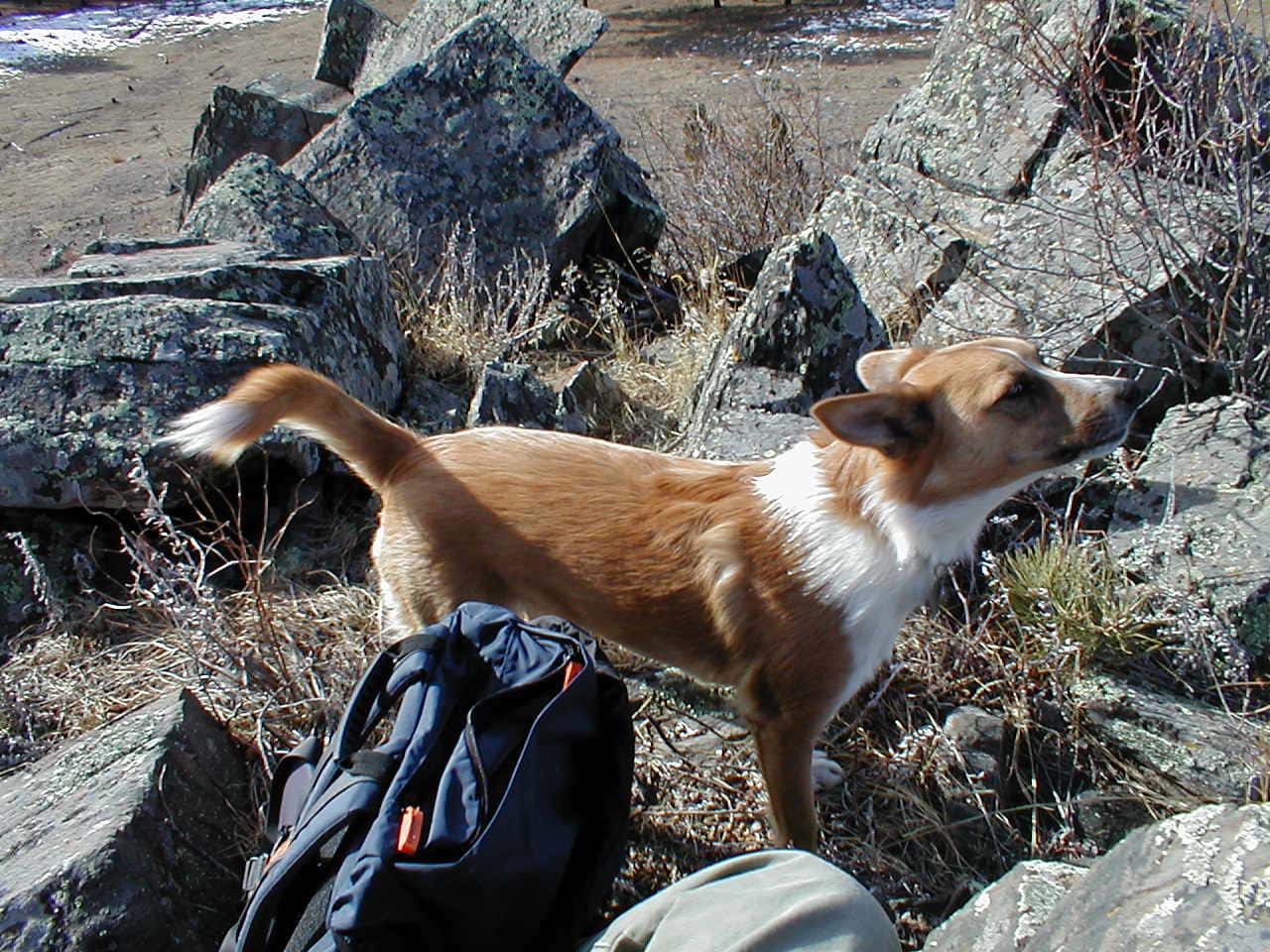
Eager to get out of the wind, the American Dingo quickly abandoned this first high point.  USFS Road No. 257.1A split off to the L from No. 257 just ahead.  Taking No. 257.1A, Lupe was glad to enter the forest as the road headed NW up a sheltered valley.

USFS Road No. 257.1A. Photo looks NW.

After 0.50 mile, the road curved W, and in another 0.25 mile, turned N.  Lupe left No. 257.1A here, continuing W through the forest.  Climbing to the top of a ridge, she saw the snowy NE face of a much higher ridge to the SW.  The higher ridge looked like a good place to get a better feel for the lay of the land.  The Carolina Dog might even be able to spot Old Bald Peak from up there!

However, to get over to that next ridge, Lupe would first have to cross the Horse Creek valley.  SPHP paused for a sandwich while thinking it over.  Lupe must not have been hungry yet, because she immediately buried the piece of sandwich SPHP shared with her, no doubt intending to save it for a rainy day.

Taking a break in the forest.
The next ridge (Center) beyond the Horse Creek valley. Photo looks SW.

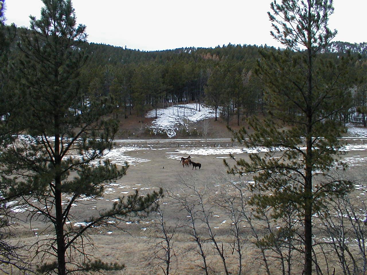
The sandwich disposed of, Lupe continued W, beginning a descent into the Horse Creek valley.  Arriving at the edge of the forest, the valley floor was visible from here.  A dachshund was barking and chasing several horses around a field, a sight that Lupe found fascinating.

Horses down in the Horse Creek valley. Photo looks W.

Hmm.  Must be some private property down there.  Checking an old Black Hills National Forest map confirmed that a long, narrow strip of private property ran up the E side of the Horse Creek valley.  Lupe needed to get across it to continue W to the next ridge.

Although Lupe was reluctant to leave her view of the dachshund and horses, SPHP led her NW down to the fence line, then N along it to where a cross fence marked the boundary between properties.  Figuring Lupe could be across the private property in only a few minutes with no harm done, SPHP hopped the fence and headed W.

As Lupe crossed the skinny N end of their field, the horses were still in sight well to the S.  No worries on their account, they scarcely seemed aware of the Carolina Dog’s presence.  However, as soon as Lupe entered the field, several big dogs came running this way from the neighbor’s house N of the fence.

This promptly summoned their owner, who hopped in a truck and was waiting for SPHP a couple of minutes later as Lupe reached Horse Creek Road after crossing the field.  Questioning SPHP, he finally left with a warning not to approach his place.  His dogs were not friendly.

A disposition evidently shared by their owner!  Don’t worry, Lupe!  We’ll return by some other route.

Unfazed, Lupe crossed Horse Creek Road and began climbing.

View on the way up the ridge W of Horse Creek Road. Photo looks SE.

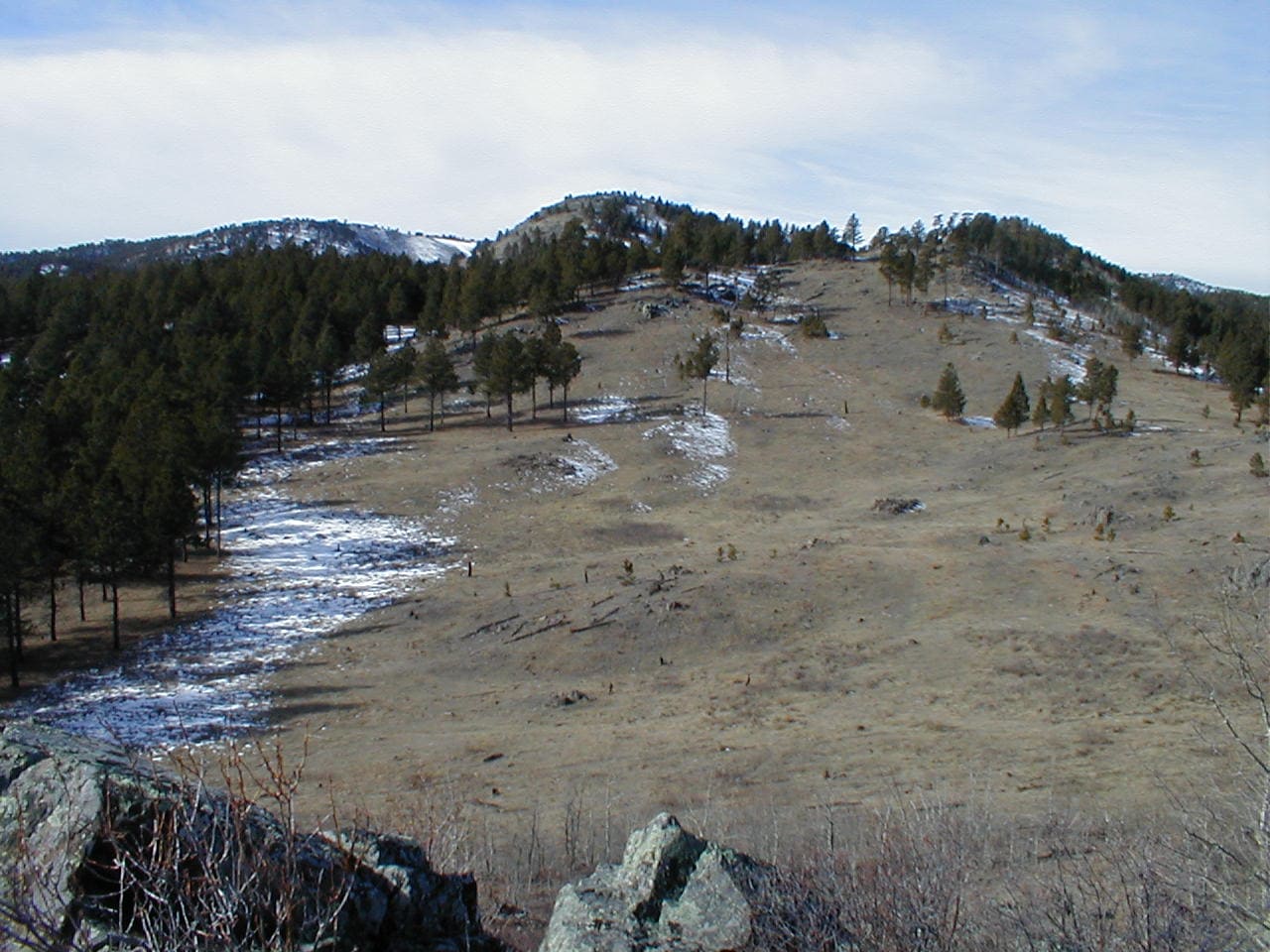
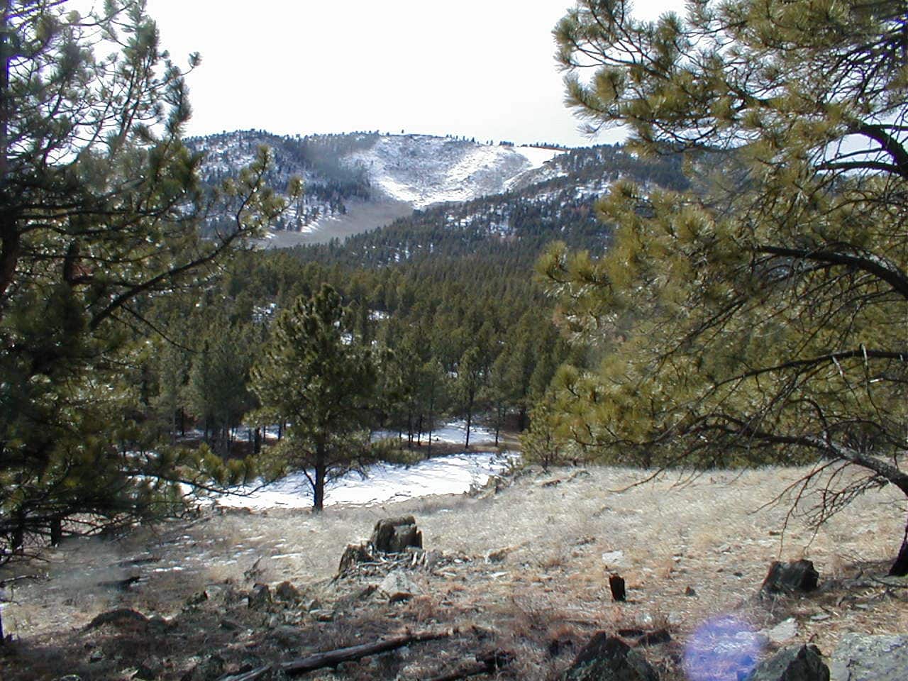
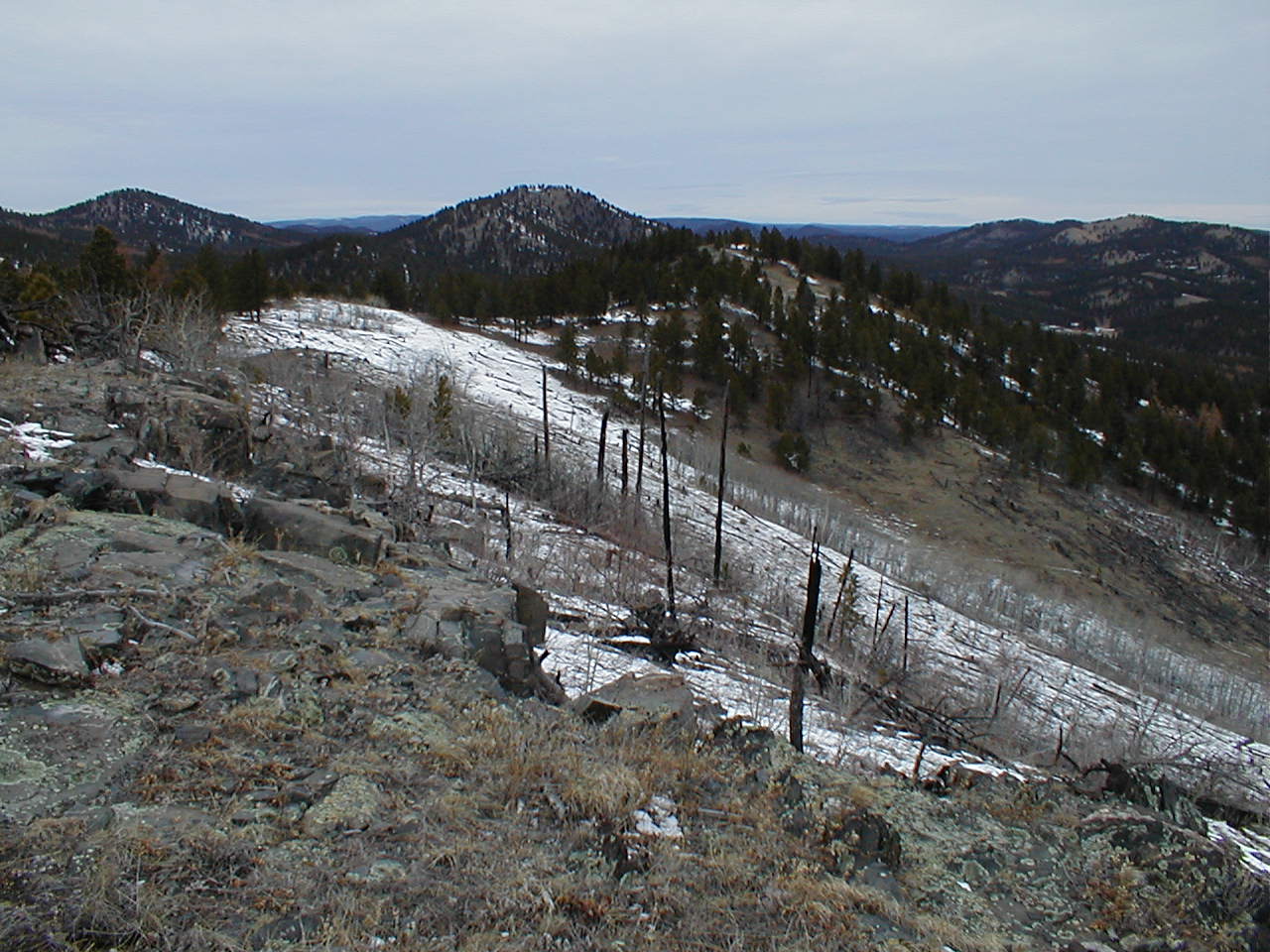
A trek up the forested slope just N of the snowy steep face eventually got Lupe up to the top of the next ridge.  Surprisingly open terrain provided excellent views in most directions.  While it was still somewhat windy, the breeze was no longer as powerful as it had been earlier.

Back in the direction Lupe had come from, Peak 5800 was visible about as high as where the Carolina Dog was now along the line of barren hills.

Peak 5800 (R of Center) beyond the Horse Creek valley (lower R). Photo looks NE.

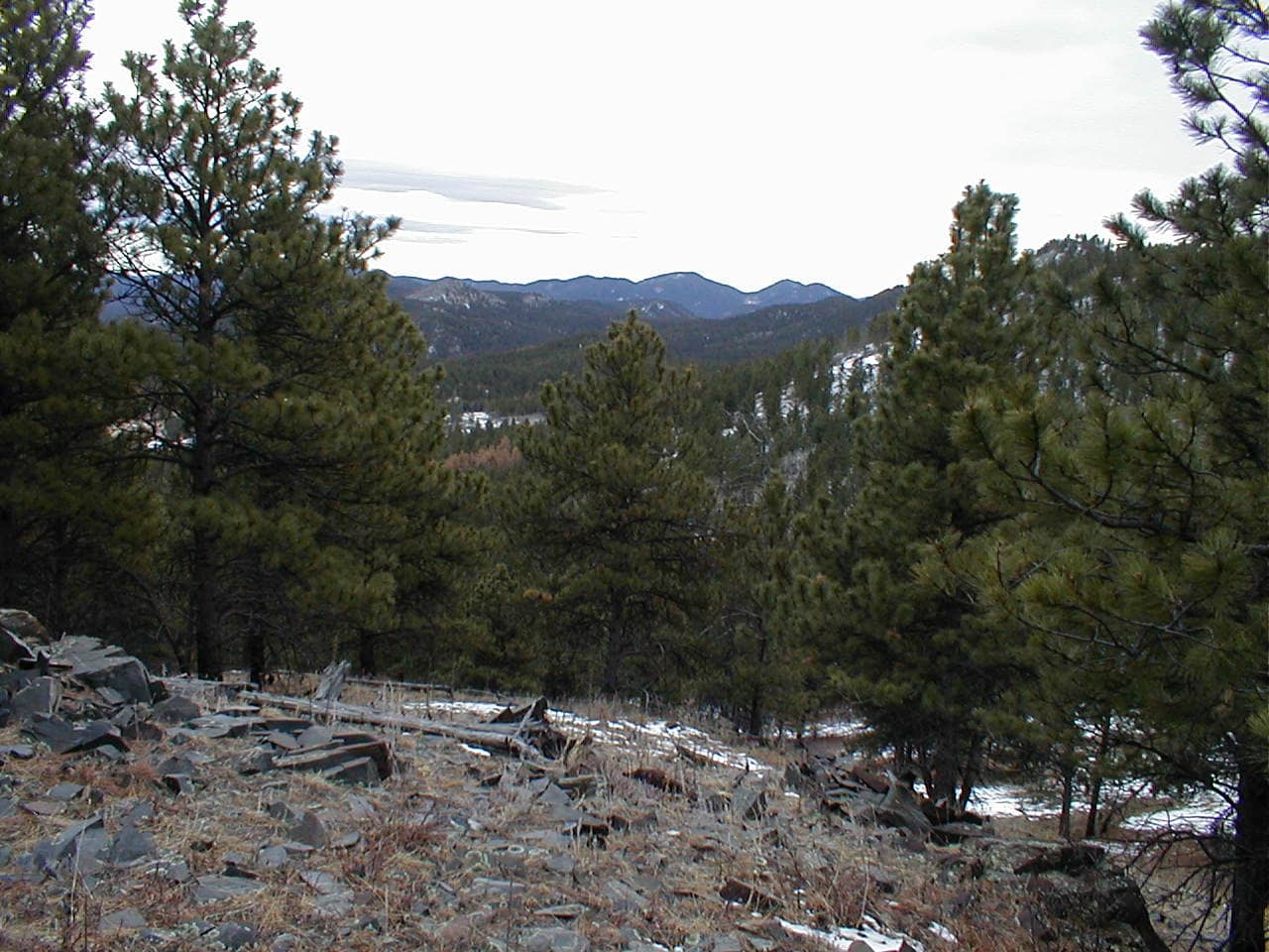
The highest ground on this ridge was some clear terrain toward the SE.  Even though Lupe didn’t need to go that way, she went over there to check out the view.  A patchwork of brown trees among the dark pines indicated the presence of a pine bark beetle infestation between here and False North Point (6,130 ft.) and Five Points (6,221 ft.).

Five Points (L) and False North Point (Center). Photo looks S.

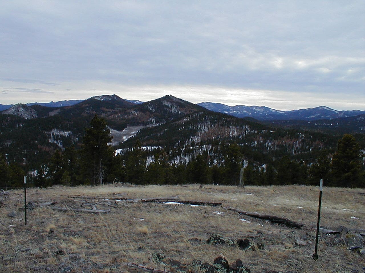
Other than the pine bark beetle damage, the view of False North Point and Five Points with higher hills in the distance was quite impressive.  Despite the wind, another rest break was taken here before heading NW back to where Lupe had originally come up.

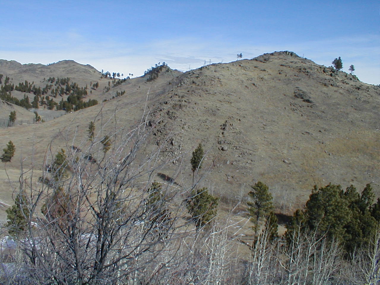
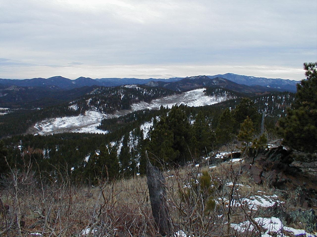
A fairly deep valley filled with snow and aspens was immediately to the W.  On the other side of this valley was another ridge about as high as the ridge Lupe was on.  Looking NW, a mountain was visible not too far away, with slightly higher peaks beyond it.

The next ridge beyond the snow and aspen-filled valley. Photo looks W.

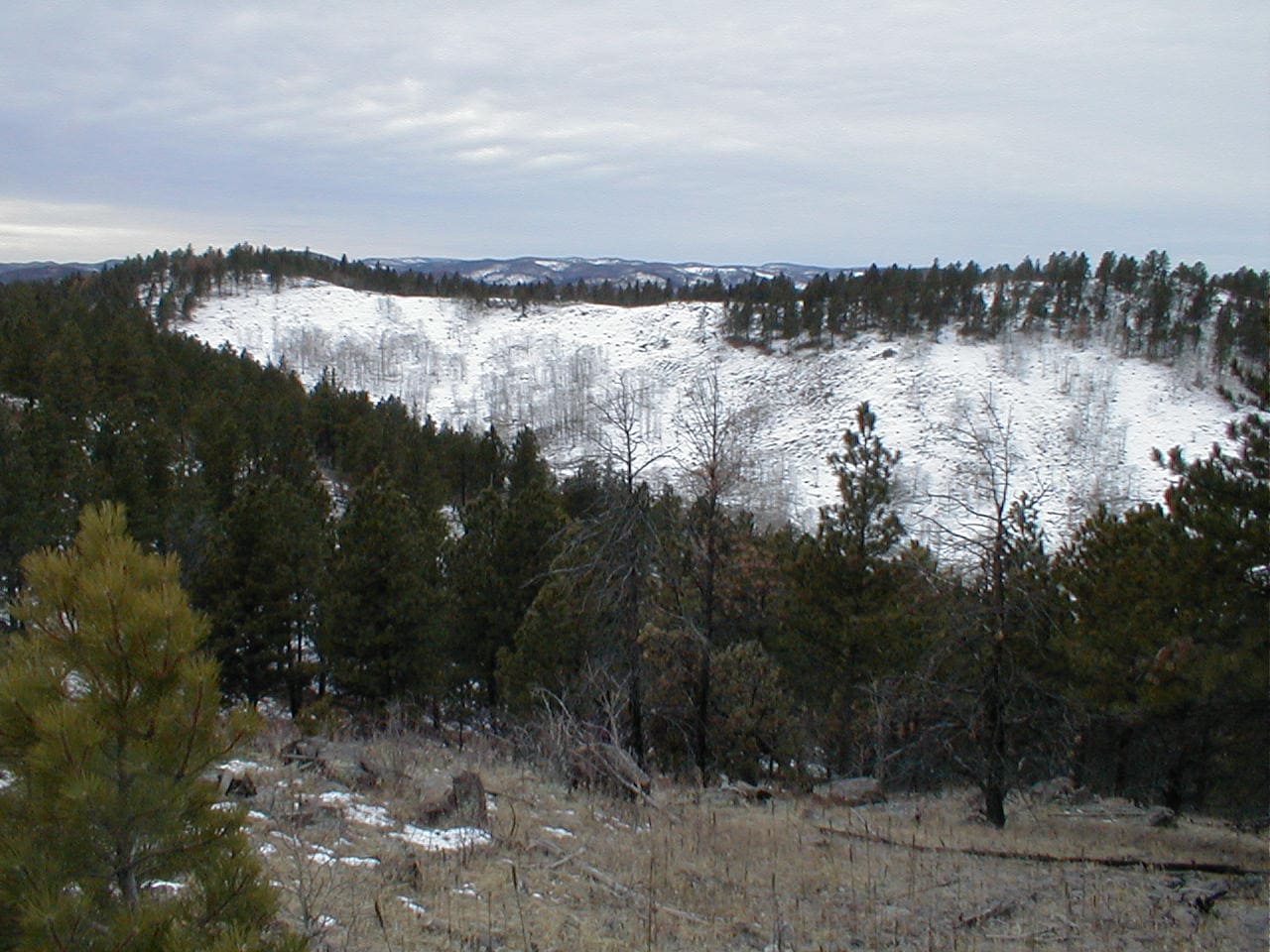
SPHP had only an old Black Hills USFS map along, which contained no topographical information at all.  One of those peaks to the NW had to be Old Bald Peak, but which one?  On the other paw, maybe not.  Was Old Bald Peak even in view yet?  SPHP wasn’t sure.  None of the hills Lupe could see from here looked like a “bald” peak at all.

The ridge Lupe was on was connected to the ridge beyond the snowy valley by a saddle at the upper S end of the valley.  Might as well head over to the far ridge to see what the situation looked like from there.

The snowy valley from the saddle leading to the next ridge. Photo looks N.

After getting around the S end of the snowy valley, Lupe turned NNW upon reaching the far ridge.  Without a topo map, SPHP still couldn’t tell which of the hills in sight might actually be Old Bald Peak (6,130 ft.).  Undaunted, the Carolina Dog followed the ridgeline, determined to at least make it to the closest significant peak.

At the S end of the ridge W of the snowy valley. From here, Lupe headed for the peak slightly L of Center. Photo looks NNW.

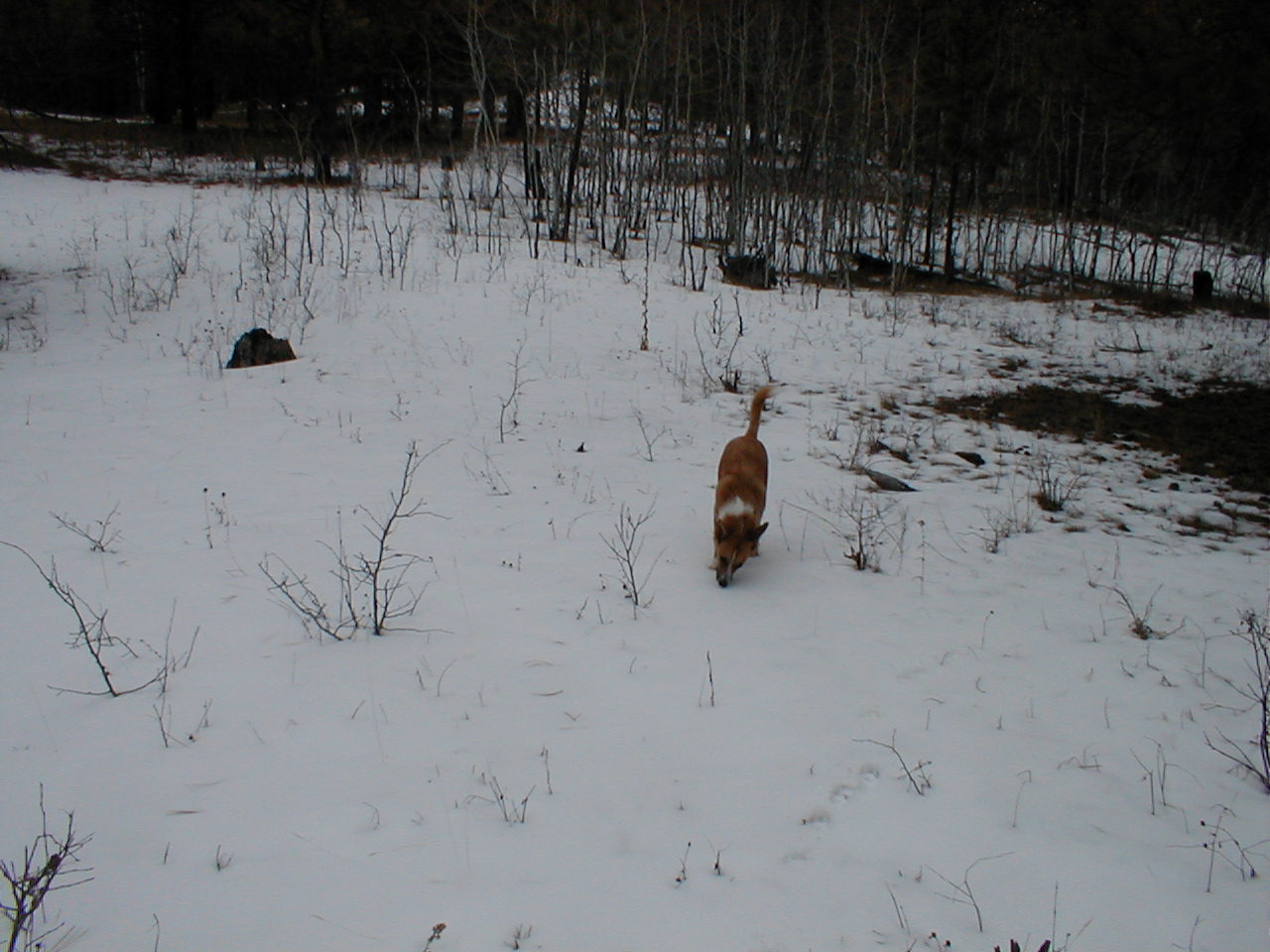
Reaching the far N end of the ridge, Lupe tried to stay on the highest ground possible as she continued NNW.  Most of the time she traveled through pine forests, sometimes orange forests where the pine needles were all dead, the trees having recently been devastated by pine bark beetles.  At other times, she worked her way through dense stands of young aspens.

Although the Carolina Dog visited a series of minor high points along the way, nothing was visible from any of them that made SPHP think Lupe was on, or necessarily even close to, Old Bald Peak.

Exploring a snowy clearing on the way to the mountain to the NNW.
Among the young aspens.

The American Dingo eventually did make it to the top of the mountain to the NNW.  The views from here were much the same.  Had Lupe reached the summit of Old Bald Peak?  Had she even seen it today?  Maybe.  Who knew?  SPHP wasn’t sure, but suspected that Old Bald Peak might still lie farther NW.

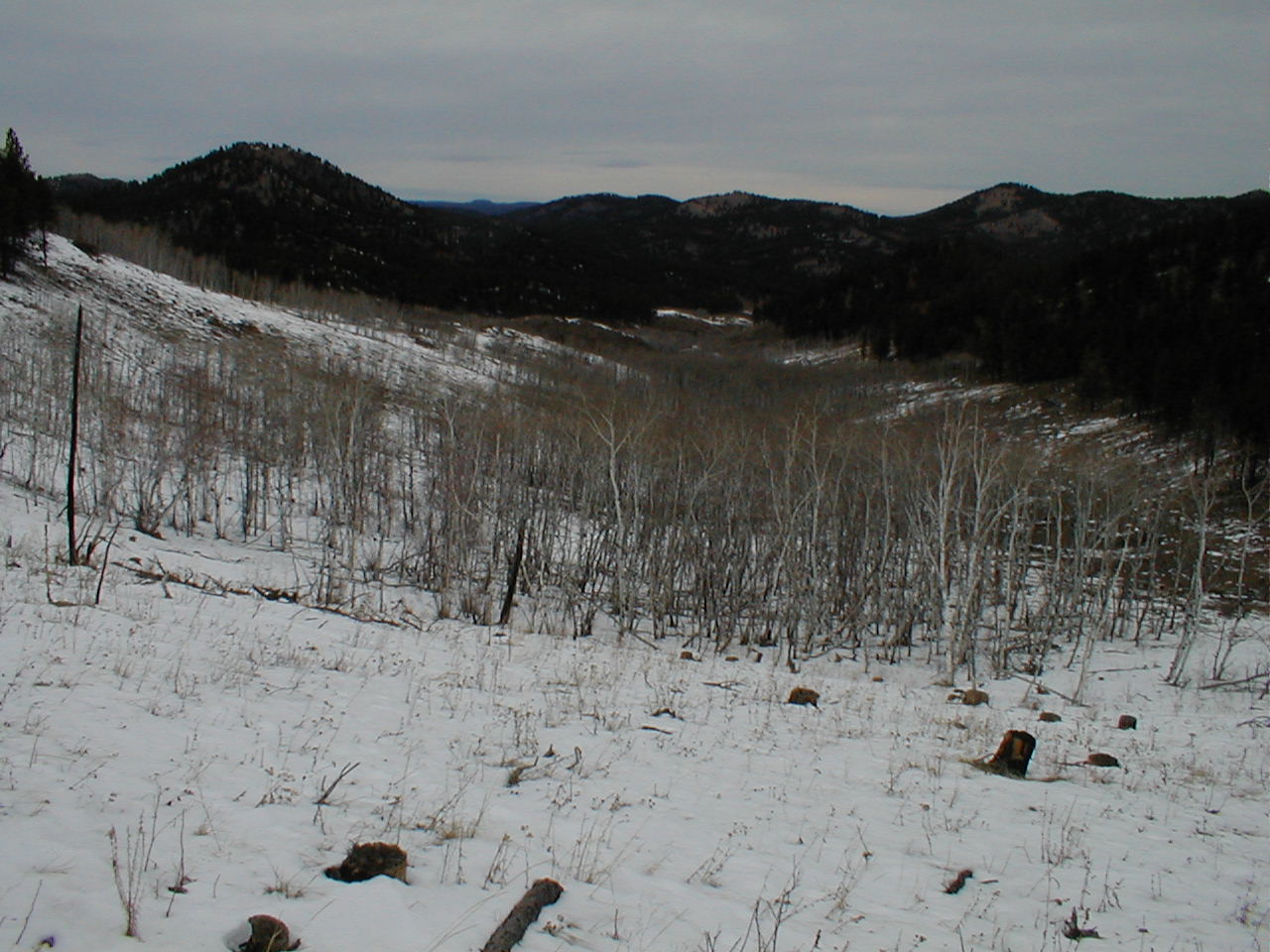
Another deep valley separated the Carolina Dog from a couple of slightly higher peaks in that direction.  Unfortunately, Lupe had gotten a late start this morning.  The formerly annoying wind was now just a breeze, but the sky had clouded up, darkening as the day wore on.  Completely overcast now.

Starting to feel like what it was, chilly and late on a quietly dying winter afternoon.  The light would soon fade.  Lupe couldn’t go any farther.

Back to the SSE, 13.5 month old Lupe saw the snowy valley.  Far beyond were peaks she would eventually climb on expeditions yet to come – Mount Warner (5,889 ft.), Samelias Peak (5,856 ft.), Five Points (6,221 ft.), False North Point (6,130 ft.), Harney Peak (7,242 ft.), South Dakota’s highest mountain, and others.

Today, though, they were all mysterious places, part of an unsuspected and unknowable future.

Mount Warner (L) and Harney Peak (R). Photo looks SSE.

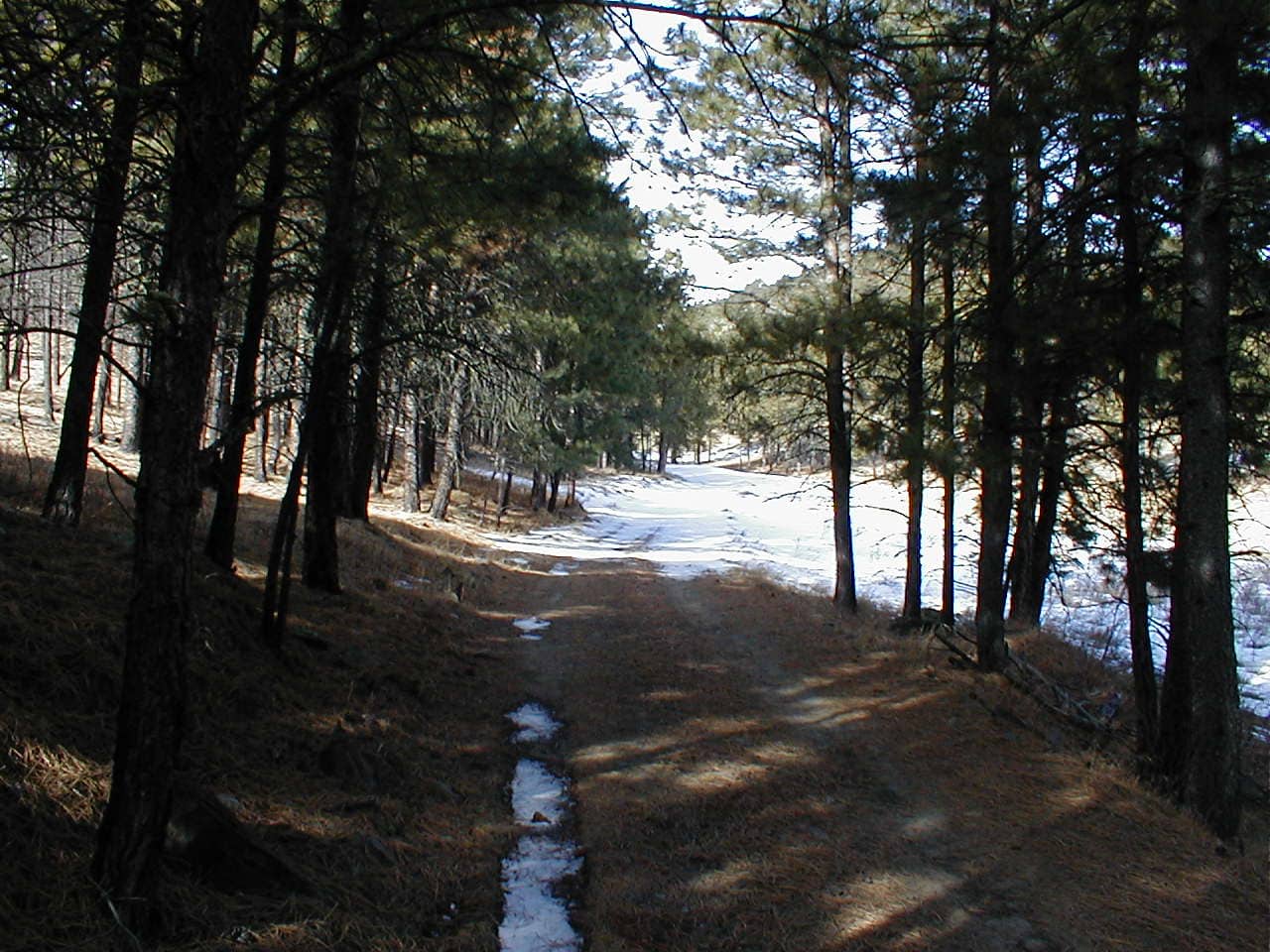
Lupe left the first mountain she had ever climbed wandering the forest on a long NNE slope.  Losing more than 500 feet of elevation, she finally came to a USFS road.  Turning SE, she followed it down a valley SPHP suspected would take her back to Horse Creek Road.

A surprise was in store!  Lupe hadn’t gone too far, when she came to an elk carcass laying in a field near a junction with a side road.  That called for some serious sniffing!  Lupe was enthralled!

By the fascinating giant deer carcass.

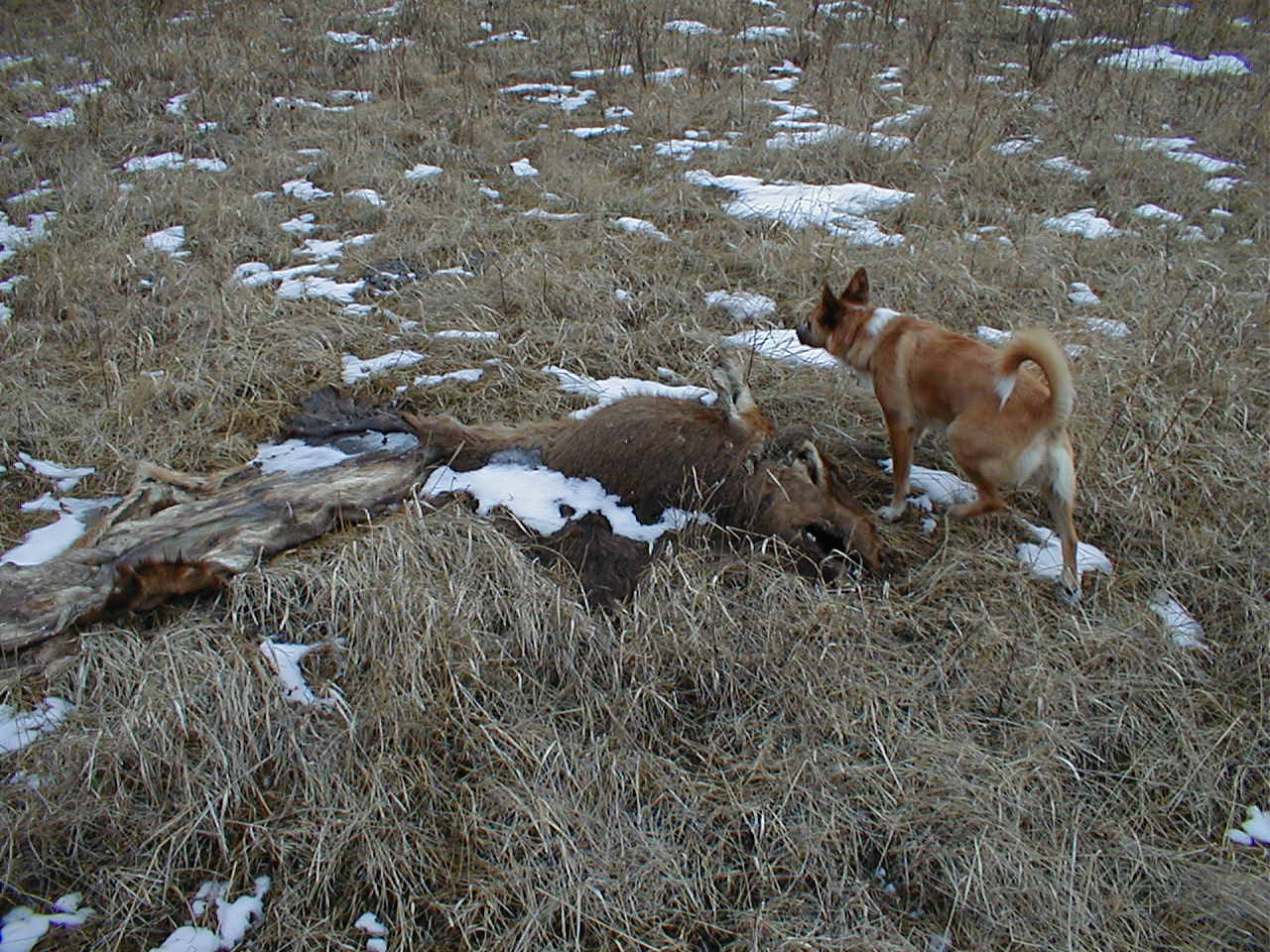
Once Lupe was able to pry herself away from the unfortunate elk, the road trek continued.

In short order, this road did lead back into Horse Creek Road.  The first sign of civilization, a generous description to be sure, was a collection of ancient battered vehicles and large quantities of other metallic junk rusting away in a field.  Nearby was a small, dilapidated wood-sided home, surrounded by more trash.  Amazingly, someone still lived there.  Smoke was coming out of the chimney.

Still more than 2 miles back to the G6.  All an easy road hike, though!  When she got close to the joint where the unfriendly dogs lived, Lupe gave it a wide berth, slinking through the forest on the opposite W side of Horse Creek Road.  A little farther on, she got to sniff and play for a minute with a nice dog named Mollie at another property.

6:00 PM, start of USFS Road No. 257 – Pitch dark when Lupe reached the G6 again.  What a day!  Lupe had climbed her very first mountain, and wandered not only off-road, but off-trail, for the first time ever.  Except for the strong wind at the start, it had all been grand.  A real adventure, even if Lupe never did find or climb Old Bald Peak (6,130 ft.)!

Lupe, 13.5 months old, during her search for Old Bald Peak, Black Hills of South Dakota 1-29-12

Note: More than 9 years later, while writing this post in February, 2021, SPHP carefully evaluated written notes, topo maps, and these photos, and determined that Lupe had actually climbed Peak 6043, 0.75 mile ESE of Old Bald Peak, on Expedition No. 3.  She had definitely seen Old Bald Peak, though, and at the time of this writing, has climbed it on 3 occasions since then, the first being during Expedition No. 33 on 11-4-12.  No photos exist of that first ascent.

Links:

Next Black Hills Expedition                  Prior Black Hills Expedition

Black Hills, SD Expedition No. 147 – Silver Peak & Old Bald Peak (11-24-15)

Black Hills, SD Expedition No. 242 – New Year’s Eve Peak, Peak 6070 & Peak 6043 (12-17-18)

Want more Lupe adventures?  Check out Lupe’s Black Hills, SD & WY Expeditions Adventure Index, Master Adventure Index, or subscribe free to new Lupe adventures!

Black Hills, SD Expedition No. 242 – New Year’s Eve Peak, Peak 6070 & Peak 6043 (12-17-18)

Start – 8:43 AM, 31°F at the junction of Horse Creek Road (USFS Road No. 243) & USFS Road No. 257

Not a cloud in the sky on this beautiful, crisp December morning!  Lupe set out from Horse Creek Road heading N on USFS Road No. 257.  Snow was on the road and in the fields, but not on the hills with a S exposure up ahead.

At the start of USFS Road No. 257 just off Horse Creek Road. Photo looks N.

Several central Black Hills peaks were on Lupe’s agenda today, each one for a different reason.  No. 257 would bring the Carolina Dog practically right to the first one.  A saddle W of Peak 6046 was a little less than 2 miles away.

Lupe kept a sharp lookout for squirrels, as SPHP trudged along the road.  Now and then she dashed off into the forest to check out particularly promising trees, but she wasn’t having much luck.  No. 257 curved around High Point 5284.

Approaching High Point 5284. Photo looks N.

W of High Point 5284, the road forked.  No. 257 was unmarked, but all Lupe had to do was stay to the R.  The road went E of a minor hill, then straightened out heading NNW.  Soon the Carolina Dog was approaching the saddle W of Peak 6046.  The rate of climb increased as Loop got close to the pass.

On the way around High Point 5284 (out of sight to the R). Up ahead is a junction where Lupe stayed R. Photo looks NW.
Heading toward High Point 5669 after taking the R fork. Photo looks N.
The saddle W of Peak 6046 comes into view. Photo looks N.

The saddle was forested, but the valley leading to it was grassy.  As Lupe neared the trees, she left the road to start climbing toward Peak 6046.  From the upper end of the grasslands, she paused for a look back to the S.  Black Elk Peak (7,231 ft.) and Five Points (6,221 ft.) were in view.

Looking back down the long valley Lupe had just come up on USFS Road No. 257. Black Elk Peak (Center) and Five Points (R) are in view. Photo looks SSE.

Lupe still had more than 250 feet of elevation to gain to reach the summit of Peak 6046.  She headed E up a steep slope to Peak 6046’s S ridge.  By the time Loop reached it, she wasn’t far from the top.  She turned N, and soon came to a rock formation where she had a clear view of her next objective, Peak 6070, off to the NW.

Hey, there’s Peak 6070 (Center)! We’ll be going over there next when we’re done here. Photo looks NW.

Lupe reached the summit of Peak 6046 early – two whole weeks early!  For Peak 6046 is none other than New Year’s Eve Peak!

This was Lupe’s 7th ascent of New Year’s Eve Peak.  Her first was on the last day of 2012 on Black Hills, SD Expedition No. 41, when she had come here by essentially the same route.  That was the day when Peak 6046 became New Year’s Eve Peak.  Loopster had been here in late December or early January on an annual basis almost every year since.

At the summit of New Year’s Eve Peak for the 7th time. Photo looks W.

It was the middle of December.  Christmas was coming!  Being here now didn’t feel the same as being here right on New Year’s Eve.  After all, 2018 still had a couple of weeks to go!  There wasn’t that same sense of finality or of a new beginning.  Yet it was good to be here.  New Year’s Eve Peak has become both a tradition and a favorite place.

Lupe and SPHP lingered a while.  SPHP managed to pick out Peak 6043 off to the W.  Peak 6043 was going to be the American Dingo’s third and final peakbagging objective of the day.  Peak 6167 was right behind it.  Old Bald Peak (6,130 ft.) was in the vicinity a bit to the N, too.

Peak 6043 (Center in the distance) with Peak 6167 (Center) right behind it. Old Bald Peak is off to the R. Photo looks W with help from the telephoto lens.

Satisfied with her traditional winter visit to New Year’s Eve Peak, Lupe moved on.  Her next objective, Peak 6070, has 2 summits separated by 0.33 mile.  The SE summit was the closest, only a little more than 0.5 mile WNW of New Year’s Eve Peak.

Lupe headed straight on down New Year’s Eve Peak’s steep W slope to the saddle leading to Peak 6070.  She arrived to find 6″ of snow.

At the snowy saddle W of New Year’s Eve Peak leading to Peak 6070. Photo looks SW.

Loop crossed the saddle, then continued W up a snowy, forested slope.  She was looking for a ridge that would lead her to a power line.  The SE summit of Peak 6070 would be only a short distance beyond it.  As much as possible, the Carolina Dog tried to avoid the steeper slopes with the deepest snow.

On the way to Peak 6070. Photo looks S.

When Lupe reached the ridge, the power line was in sight.  A short trek NW along the rocky spine of the ridge got her to the power line, where she crossed beneath it.

A bare spot on a hill just beyond the power line provided some nifty views to the NE and E.  Lupe could see quite a few peaks she had been to before including Scruton Mountain (5,922 ft.), Norris Peak (4,982 ft.), and, of course, New Year’s Eve Peak (6046).

Upon reaching the first ridge W of New Year’s Eve Peak, Lupe could see the power line ahead. Photo looks W.
Looking back at New Year’s Eve Peak (Center). Photo looks E.
Scruton Mountain (L) is the site of the Seth Bullock lookout tower. Norris Peak (R) is the slanty ridge in the distance. Photo looks NE.

Lupe had been to the SE summit of Peak 6070 once before on Black Hills, SD Expedition No. 81.  That was nearly 5 years ago now.  The topo map would lead one to believe that the SE summit is lower, but not by much.  Even if it was lower, Lupe remembered some excellent views.  Time to go find the high point, then have another look at those splendid views!

The SE summit was only a little SW of where the Carolina Dog was now.  She followed a relatively narrow rocky ridge offering many viewpoints, and soon came to the highest rock.  The NW summit was in view.  If it was higher, it couldn’t have been by much.

Looking for the highest rock along the narrow rocky ridge at Peak 6070’s SE summit. Black Elk Peak (Center) in the distance. Photo looks S.
Another look from the same spot. Black Elk Peak is beyond Lupe’s rump. Five Points is just R of her head. Sylvan Hill (7,000 ft.) is in the distance at far R. Photo looks SSE.
New Year’s Eve Peak (Center) again. Photo looks ESE.
Loop on the highest rock of Peak 6070’s SE summit. The NW summit is on the R. Photo looks NW.

The best views were from SW of the summit out on a point where there were reasonably level rocks to hang out on.  Loopster had panoramic views here.  Unfortunately, what had been a tolerable 10 mph SW breeze up on New Year’s Eve Peak, was now more like 15 to 20 mph.  It was warm out for December, close to 50°F, but the Carolina Dog didn’t care for the wind.

Lupe on rocks SW of Peak 6070’s SE summit. Peak 6043, Peak 6167, and Old Bald Peak are all in the distance L to R on the R. Photo looks SW.
Loop at one of the SW viewpoints. Five Points (Far L) and False North Point (6,130 ft.) (L) in sight. Photo looks SW.
Out in the wind. NW summit of Peak 6070 on the R. Photo looks NW.
Nugget Gulch Peak (6,000 ft.) is in the foreground on the L. Photo looks NW with help from the telephoto lens.
Panorama from the SW viewpoint. Five Points and False North Point on the L. Photo looks SSW.
Looking SW now from the same point. Peak 6043 and Peak 6167 on the R.

After a good look around, Lupe and SPHP retreated SE a bit below the ridgeline to escape the breeze.  The day was quite comfortable out of the wind.  SPHP ate an apple.  Lupe was content to curl up in the sun.  Part of Sheridan Lake could be seen off to the SE.

Part of Sheridan Lake was in view, along with Silver Mountain (5,405 ft.) (L in the distance), and Calumet Ridge (5,601 ft.) (beyond the lake). Photo looks SE with help from the telephoto lens.

After the demise of the apple, it was time to think about tagging Peak 6070’s NW summit.  Lupe liked it right here, but was willing to move on.

Guess, it’s time to go, huh? …. Yes, Looper – it’s on to the NW summit of Peak 6070! Photo looks S.

Lupe left Peak 6070’s SE summit heading W down a steep slope.  She lost 100 feet of elevation before the terrain flattened out.  She found herself at a snowy open area rimmed with pines.

A road went through this area heading NW, the direction Loop needed to go.  She followed it, but it soon curved away to the SW, so the road had to be abandoned.  The American Dingo plunged on ahead through a snowy forest.  Significant amounts of deadfall timber slowed progress down considerably.  Fortunately, Peak 6070’s NW summit wasn’t far away.

After losing 100 feet of elevation, Lupe arrived at this snowy open area. A road went NW (R) from here, the direction she needed to go. Photo looks W.
Looking over a shallow snow and deadfall filled valley on the way to Peak 6070’s NW summit (R). Photo looks NW.

Shortly before reaching the NW summit, Lupe came to a sunny open slope.  Here she had a grand view of Peak 6043, Peak 6167, and Old Bald Peak (6,130 ft.) all nicely spread out off to the SW.

From L to R: Power line (white strip), Peak 6043, Peak 6167, and Old Bald Peak. Photo looks SW.

The NW summit featured a clearing which extended a little toward the SE.  Minor rock outcroppings rimmed a small patch of snowy ground at the highest point.  If the topo map was correct, this was the true summit of Peak 6070.  Enough trees surrounded the area to block the views, but Lupe was happy!  She had now visited both of Peak 6070’s summits.

Lupe poses dramatically atop the NW summit of Peak 6070. If what the topo map seemed to indicate was right, this was the true summit. Photo looks NW.
This is my “gallant” pose!
So now we’ve done it! Visited both summits of Peak 6070. Can definitely claim a peakbagging success now! Loopster on the Peak 6070 NW summit.
Looking back to the SE from the highest ground.

Lupe had climbed New Year’s Eve Peak because it was tradition to visit it near the end of each year or early in the next one.  She had come to Peak 6070 to visit both summits, but mainly to see those great views she hadn’t seen for 4.75 years now from the viewpoint SW of the SE summit.

Peak 6043 was next.  Lupe had never been there before.  She’d intended to get there on Expedition No. 239 nearly 1.5 months ago, but had only made it as far as Nugget Gulch Peak.  Peak 6043’s claim to fame was that it had 343 feet of prominence.  It was the only peak in this general vicinity with over 300 feet of prominence that Lupe had never visited.

Days are short in December!  If Loop was going to visit Peak 6043 today, she had best get on with it.  Lupe and SPHP headed down Peak 6070’s steep SW slope.

Looking SSW on the way down from Peak 6070.
Nugget Gulch Peak (Center) is beyond the nearest ridge. Photo looks NW with help from the telephoto lens.
Descending Peak 6070’s SW slope. Peak 6043, Lupe’s next objective, is on the L. Photo looks SW.

Peak 6043 is 1.5 miles SW of Peak 6070.  To get over to it, Lupe had to lose 675 feet of elevation.  She lost most of it just descending to the valley W of Peak 6070.  The valley floor was littered with deadfall timber.

Lupe reaches the valley SW of Peak 6070 to find a lot of deadfall ahead. Photo looks SW.
Another look at the deadfall with Peak 6043 (R) in the background. Photo looks SW.

Fortunately, Lupe did not have to fight her way through deadfall all the way down the valley.  USFS Road No. 244 runs N/S along the W side of this valley.  Lupe only had to make it over to the road.

Usually I like to roam the forest, but USFS Road No. 244 is way better than roaming a dead forest!

No. 244 brought Lupe down to a junction with No. 675.2 by a large meadow.  This was familiar territory.  (Point 5396 on the topo map)  Lupe had been here on a number of prior expeditions, some long ago.  The lower slopes of Peak 6043 were just beyond the meadow.  Lupe crossed the meadow and No. 675.2 to get to them.

USFS Road No. 244 brought Lupe to this big meadow at Point 5396. Peak 6043 (Center) lies just ahead. Photo looks SW.

Beyond the road, forested terrain led the Carolina Dog up toward the W.  She eventually reached a saddle N of Peak 6043.  A big snowy field was on the other side of the pass.  Lupe turned SSW here and began a steeper climb.

Once in the forest again, Lupe traveled W up this broad, gently sloping terrain. Photo looks W.
Getting higher. Photo looks NW.
Old Bald Peak (L) from a minor saddle N of Peak 6043. Photo looks W.

Nearly 400 feet of elevation gain from the saddle to the top!  Peak 6043’s N slope was snowy.  Lupe swung over toward the NW where the snow wasn’t quite as deep.

The true summit of Peak 6043 proved to a little ridge of angular rocks.  To the SSE, a good-sized area of slightly lower open ground was buried beneath a foot of snow.  Lupe hopped up on the highest rocks of the tiny ridge to claim her final peakbagging success of the day!

Loop at the top of Peak 6043. Peak 6167 (L) and Old Bald Peak (R) are in the background. Photo looks W.
Peak 6043’s summit was actually quite roomy, though much of it was under a foot of snow at the moment. Photo looks N.

Plenty of daylight remained.  Not enough to go chasing after more peaks, but enough to hang around up on Peak 6043 for a while.  Lupe and SPHP took a break where there was a big view to the S and SE.

Mount Warner (5,889 ft.) (far L), Samelius Peak (5,856 ft.) (L). On the R from L to R are Five Points, False North Point & Black Elk Peak. Photo looks SSE.

Peak 6043 actually had a second high point S of the true summit.  Lupe visited it, too.

Peak 6167 (L) and Old Bald Peak (R) from the short ridge between Peak 6043’s two high points. Photo looks W.
Looper at Peak 6043’s S high point. She was definitely a bit lower here than at the N summit where she first came up. Photo looks S.

After more than half an hour on Peak 6043, Lupe returned briefly to the true summit where she’d originally come up.  A final look around, and it was time to depart.  The Carolina Dog went back to the S summit, then continued on down the S ridge.  Before long, Looper reached the same power line she had passed under near Peak 6070.

Starting down Peak 6043’s S ridge. Photo looks SW.
Looking NE from Peak 6043’s S ridge. The NW summit of Peak 6070 is on the L, and the SE summit is at Center. New Year’s Eve Peak is on the R.
Peak 6167 (R) from the power line. Photo looks W.

After a brief pause at the power line, Loopster continued S.  When the terrain became favorable for a turn to the E, a steep descent began.

Heading down. Photo looks S.

Lupe reached USFS Road No. 243 again SW of Point 5329.  The rest was easy – a 2.5 mile march back to the G6 on Horse Creek Road.  The road was snow-packed and slippery.  The Carolina Dog barely noticed, trotting happily along ever watchful for squirrels and deer.  (4:10 PM, 38°F)

About to reach USFS Road No. 243 again near the end of the day. Photo looks NE.

Links:

Next Black Hills Expedition                 Prior Black Hills Expedition

Expedition No. 221 – Peak 5800 & New Year’s Eve Peak (1-7-18)

Expedition No. 261 – Peak 5800 & New Year’s Eve Peak (12-31-20)

Want more Lupe adventures?  Check out Lupe’s Black Hills, SD & WY Expeditions Adventure Index, Master Adventure Index, or subscribe free to new Lupe adventures!