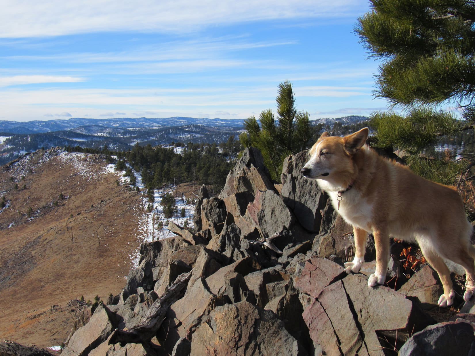
12-29-24, 11:41 AM, 41ºF, junction of Hwy 385 & USFS Road No. 710 – A close call, but the American Dingo was here.

Looks familiar, SPHP. Already time for New Year’s Eve Peak (6,048 ft.)?
Not quite, Loop. We’re actually a couple of days early since it’s supposed to snow tomorrow.
Nothing wrong with that, SPHP. I like the snow! Besides, there’s supposed to be snow when we visit New Year’s Eve Peak. Tis the season, you know, and the snow makes everything so beautifully pristine and wintery white.
Oh, I agree! I like the snow, too, Loopster. Doesn’t seem right without any at all, but this is the last warm day. It’s supposed to turn quite a bit colder when the snow arrives, and stay that way well into January. Didn’t want you to suffer, so here we are, ready or not.
Lupe was always ready for adventure! Even if the timing was a bit off for New Year’s Eve Peak, that really wasn’t so unusual. The weather was often persnickety this time of year. In fact, in all the pilgrimages she’d made to New Year’s Eve Peak, she’d only managed to get there right on New Year’s Eve 4 times.
Even so, as the Carolina Dog set off along USFS Road No. 710, it did seem totally wrong that there wasn’t any snow at all. Hadn’t ever happened before. Felt more like fall than winter.

No. 710 was pretty flat at first, but soon began a gradual climb. After 0.5 mile, Lupe reached the overgrown junction with No. 710.1A.

Gosh, Loop. Seems like forever since we’ve taken No. 710.1A. Want to go that way just to mix things up a bit?
I don’t remember ever going to New Year’s Eve Peak that way, SPHP. Will it work?
That’s because we’ve only been that way once before, more than 10 years ago, Loopster, and we didn’t go to New Year’s Eve Peak then. We went to Peak 6070 and Nugget Gulch Peak (5,991 ft.) instead. But, yeah, we can take No. 710.1A to New Year’s Eve Peak, if you’re willing to do a bit of exploring.
Very funny, SPHP! You know I love exploring!
Nearly level, No. 710.1A started out by wrapping around the E end of the big ridge to the N before turning back toward the NW.

On the N side of the ridge, Lupe was delighted to find that there actually was a bit of snow. Not much, hardly any, in fact, but enough for her to take small bites of whenever she came to some.

At first, several homes and a road were in sight not too far off toward the N, but No. 710.1A eventually led to a gradual descent into a valley that felt much more remote.

Although Lupe had been here once before, it had been so long ago that nothing seemed more than vaguely familiar as she followed No. 710.1A up the seldom-visited valley. Coming to grassy clearings, long lanes full of dead leaves bordered by aspens, and even part of a deer hide, it was almost like exploring an entirely new region.


The road went on, gaining elevation more rapidly as Lupe continued WNW. When No. 710.1A suddenly curved SSW, it was decision time.


Hold on, Loopster. We’ve got a couple of options here.
The road keeps going, SPHP. Aren’t we going to follow it?
That’s one option, Loop. If we stick with the road, it will end somewhere NW of Peak 5917. Continuing up that valley, we can swing around to the W, then climb New Year’s Eve Peak from the SSE.
Sounds easy enough, SPHP. What’s the other choice?
We can leave the road here, Looper, continuing NW to a powerline, then follow New Year’s Eve Peak’s N ridge.
We’ve never climbed New Year’s Eve Peak from the N before, have we, SPHP? Let’s do that!

Exploring at will after leaving USFS Road No. 710.1A was definitely more interesting. Climbing steadily at a moderate pace, the American Dingo soon came to some sickly looking bushes. Beyond them she reached a forest of tall pines where there was quite a bit of deadfall. Once through the tall pines, Lupe entered a steeper part of the valley featuring some rock formations and so much deadfall that it was becoming a problem.


The deadfall was such a mess that SPHP was eager to get out of it. A ridge where the situation might be different was visible just ahead, but angling W while crossing a shallow valley seemed like the quickest way to make an escape.
Crossing the valley worked great! Once on the other side, the Carolina Dog quickly left the worst of the deadfall behind. Climbing gradually through an open forest, Lupe came to an abandoned road not shown on the maps. Following it, glimpses of the powerline soon began appearing between the trees off to the NW.


Rather than going all the way to the powerline, Lupe turned S before reaching it, leaving the road and beginning a steeper climb in search of New Year’s Eve Peak’s N ridge. At the top of the first rise, she came to a region of kinnikinnick, still somewhat green among several boulders.

Turning SW, an easy flat stretch led to an even steeper climb. Exploring hidden paths and narrow lanes among the trees, the American Dingo’s ascent began in earnest. Early on, a view of the Seth Bullock Lookout Tower on Scruton Mountain (5,923 ft.) appeared back to the N.

The intent was to go right on up New Year’s Eve Peak’s N ridge, but with another 250 feet yet to go, Lupe ran into a road at the 5,800 foot level. Almost perfectly flat, and so long abandoned that trees were growing on it, both where this road came from and where it went were a mystery.
SPHP had been huffing and puffing during the steep climb.
Huh. Want to explore this road a bit, Looper? We’ve got time, and it’s flat enough to almost be like taking a break.
Sure, SPHP! But which way, L or R?
How about L, Loopster? Maybe it will take us over to the NE ridge? If it does, we can complete our ascent from there.
Turning L on the road, it immediately curved SSE. In all the times Lupe had been to New Year’s Eve Peak, she’d never explored this side of the mountain before. Seemed strange to think that this road had been here all these years, and she’d never even known of its existence.

The old road was an easy stroll. Sure enough, it eventually hooked around to the NE, crossing New Year’s Eve Peak’s NE ridge at a spacious flat region. Starting downhill, the road continued SE toward Peak 5917, which could be seen through the forest.


Hmm. Wonder if this road is actually a continuation of USFS Road No. 710.1A, Loopster? Might head right down to it, if we keep going.
That may be, SPHP, but we’ve got a mountain to climb! If you want, we can check it out on the way back.
Leaving the road, Lupe headed SW up New Year’s Eve Peak’s NE ridge. Although plenty wide, it was narrower than the N ridge, which had been more like a broad slope than a ridge. Strewn with rocks, as the Carolina Dog climbed, big rock formations began to appear along the NE ridge. Fortunately, they were easily avoided or navigated. Some of the rocks provided nice views of Peak 5917.


Once above the most massive rock formations, Lupe came to another, more extensive region of pale yellow-green kinnikinnick. This area was just below a smaller rock formation at New Year’s Eve Peak’s E high point. Naturally, Lupe made the tiny scramble to the top.


Have we ever been here before, SPHP?
I think so, Loop. Seems like we came down here from the summit once upon a time, but this was as far as we went before going back.
The true summit was now only a mere 50 feet higher and 0.15 mile W. It wouldn’t take long to get there.

1:59 PM, 38°F, New Year’s Eve Peak (6,048 ft.) – Beneath the overcast sky, snow granules created an oddly festive air as the American Dingo bounded onto the familiar true summit rock.
Oh, it’s good to be back on New Year’s Eve Peak, isn’t it, SPHP?
Always, Loopster. More than anywhere else, this has been our special place in the Black Hills.
It was good to be back. Wonderful, in fact, but sobering, too. This was where Lupe came either near the very end or very start of each year. New Year’s Eve Peak was a place to contemplate the cherished memories and events of a dying year, and whatever hopes and dreams existed for what was yet to come.
Facing the imminent demise of what has been is always hard. Yet time waits for no Dingo, however beloved.
SPHP shook Lupe’s proffered paw.
Congratulations on returning to New Year’s Eve Peak, Loopster! Hard to believe 2024 is nearly over isn’t it? When we were last here on January 1st, we had the entire year ahead of us, and now it’s gone.
2024 was a terrific year, SPHP! Don’t rush it, we still have 2 more days! By the way, what’s the chocolate coconut bar situation? Excellent, I hope!
For the first time, other than near the far horizon, the hills to the W had virtually no snow on them. Instead of facing that way as usual during a long break, today the panorama toward the SE seemed more attractive. Boulder Hill (5,336 ft.), Silver Mountain (5,418 ft.), and Calumet Ridge (5,615 ft.) were all in sight beyond Sheridan Lake.
SPHP split the expected and much coveted chocolate coconut bar with Lupe, then provided her with water, Taste of the Wild, and eventually a duck jerky, as well. Meanwhile, SPHP drank a vanilla Equate, then chomped on an apple.


Much like 2024 itself, Lupe’s traditional summit hour was soon rapidly slipping away. Done with the apple, SPHP paced between familiar views.
Guess we should take a few more photos, Looper.
Black Elk Peak (7,231 ft.) was the big attraction to the S, but SPHP also drove the American Dingo nuts with repeated requests to return to the summit rock and the region just W of it.


3:01 PM, New Year’s Eve Peak (6,048 ft.) – Patiently waiting, Lupe was back on the summit rock for the umpteenth time.

That’s good. Thank you, Loopster! Summit hour is over. Suppose we may as well head out.
Lupe leapt down off the boulder.
Are we going back down the NE ridge to finish checking out where that old road goes, SPHP?
No, maybe another time. Our usual route is more scenic, Loop. I’d rather see it again.
To Pistol Point then, SPHP?
Yup. Onward! Puppy, ho!
Bidding a fond farewell to New Year’s Eve Peak for another year, the Carolina Dog started down the mountain’s S slope. It led to a narrow, kind of rocky, S ridge that ultimately swept around to the E.
The late afternoon gloom seemed to bring out the wildlife. Swirling in the gray sky, a bald eagle made several passes, soon followed by a couple of turkey vultures. Several deer instantly vanished into the forest as Lupe approached Pistol Point.

3:33 PM – On the edge of a much more open region offering panoramic views, Pistol Point had long been a favorite spot. Looking S, Black Elk Peak (7,231 ft.), Sylvan Hill (6,998 ft.), Five Points (6,228 ft.), and False North Point (6,134 ft.) all stood out.

Peak 5800, which Lupe had climbed on a number of occasions during her annual jaunts to New Year’s Eve Peak, was ESE. An uncharacteristic drab brown this year, the rolling territory dotted with pines leading to Peak 5800 was always fun to explore.

Unfortunately, it was already so late that by the time the American Dingo could get to Peak 5800, it would already be dark.
If Peak 5800 is too far, why don’t we climb Peak 5917 instead, SPHP?

An excellent alternative, Looper! Let’s do it!
Peak 5917 was only 0.5 mile from Pistol Point. On the way over there, Lupe once again spotted wildlife, this time a herd of 5 whitetail deer. Already aware of the Carolina Dog’s approach, they disappeared over Peak 5917’s lower S ridge.
4:15 PM, 37°F, Peak 5917 – The clouds which had blanketed the entire sky all day were suddenly showing signs of breaking up, an unexpected development with snow in the forecast tomorrow.


A prolonged stay wasn’t in the cards at this hour on a late December day, but Lupe hadn’t been on Peak 5917’s summit even 10 minutes when she noticed something.
Look, SPHP! There’s a colorful sunset going on.
Sure enough, on the far horizon beyond Pistol Point, a small section of sky was ablaze with orange and gold.

Awesome, Loopster! Never dreamed we would get to see one today.
The sunset was a rare, if fleeting, treat. In all the times Lupe had been to New Year’s Eve Peak, SPHP could remember only a couple of other times when the day ended with a beautiful sunset. In 2016, there had been a spectacular one, but most years had been a dud, the hoped for display of year end glory disappointing with little or nothing worth mentioning.
Hurry, SPHP! Let’s get the best picture we can before it’s gone!
A cluster of rocks 100 feet S of the summit provided the best view.

4:30 PM, Peak 5917 – Another 2 minutes, and the show was already over and done with. Lupe now stood on another rock with Peak 5800 in sight, along with the familiar territory N of that mountain where she would soon rejoin USFS Road No. 710 on the way back to the RAV4.

2 minutes was all it had taken for the colorful sunset to fade away. 2 more days, and 2024 itself would vanish into history. It all suddenly seemed so shockingly fast. As Lupe led the way down Peak 5917’s E slope, a pervasive sense that the American Dingo was not only leading the way back to the RAV4, but into the future itself swept over SPHP.
The mood had something of premonition about it. You can return to a place, but never to a time. Each moment is a unique, irretrievable point on the short journey of life.
With the light beginning to fade, the scene ahead seemed more beautiful than ever. Suddenly, Lupe turned and looked back.
Are you still coming, SPHP?

Always, Sweet Puppy! Right behind you! (End 5:11 PM, 37ºF)

Links:
Next Black Hills Expedition Prior Black Hills Expedition
Black Hills, SD Expedition No. 351 – Scruton Mountain, Peak 6072 & New Year’s Eve Peak (12-31-25)
Black Hills, SD Expedition No. 322 – Peak 6070 & New Year’s Eve Peak (1-1-24)
Want more Lupe adventures? Check out Lupe’s Black Hills, SD & WY Expeditions Adventure Index, Master Adventure Index, or subscribe free to new Lupe adventures!