Black Hills, SD Expedition No. 282 – Centennial Trail No. 89: Elk Creek to Peak 5261 (10-30-21)

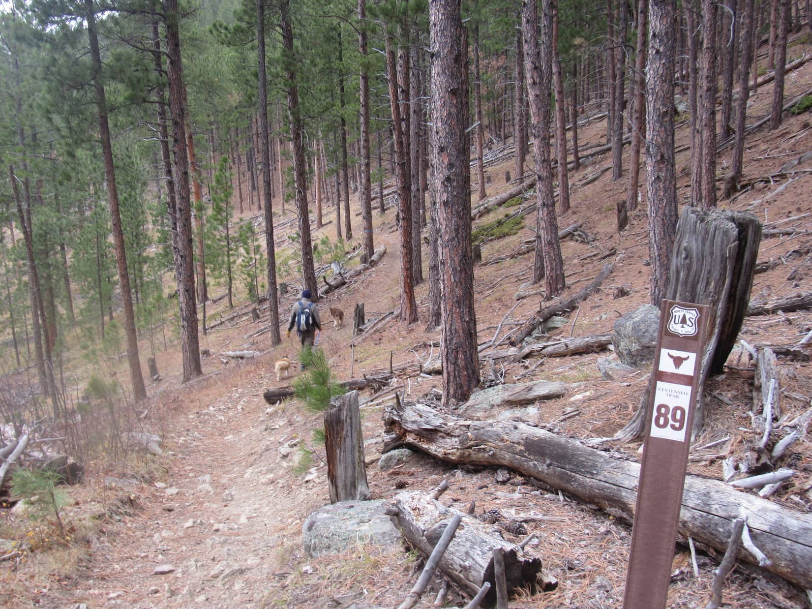
The “Ponderosa Hike” along Centennial Trail No. 89 had worked out so well for new Cousin Laddie and Cousin Dusty yesterday, that SPHP had proposed another jaunt along the Centennial Trail this morning.

What a difference a day made, though!  Yesterday had been sunny and warm, almost summer.  On the way to the Elk Creek trailhead, Uncle Joe drove under a dark cloud hanging over the hills.  Late fall, maybe even early winter, greeted Lupe as she leapt out of the RAV4.  Definitely on the chilly side!

In fact, it was so chilly that the American Dingo soon leapt right back into the warm comfort of the RAV4, staying there until Uncle Joe and SPHP were ready to hit the trail.

A chilly start at Centennial Trail No. 89’s Elk Creek trailhead.

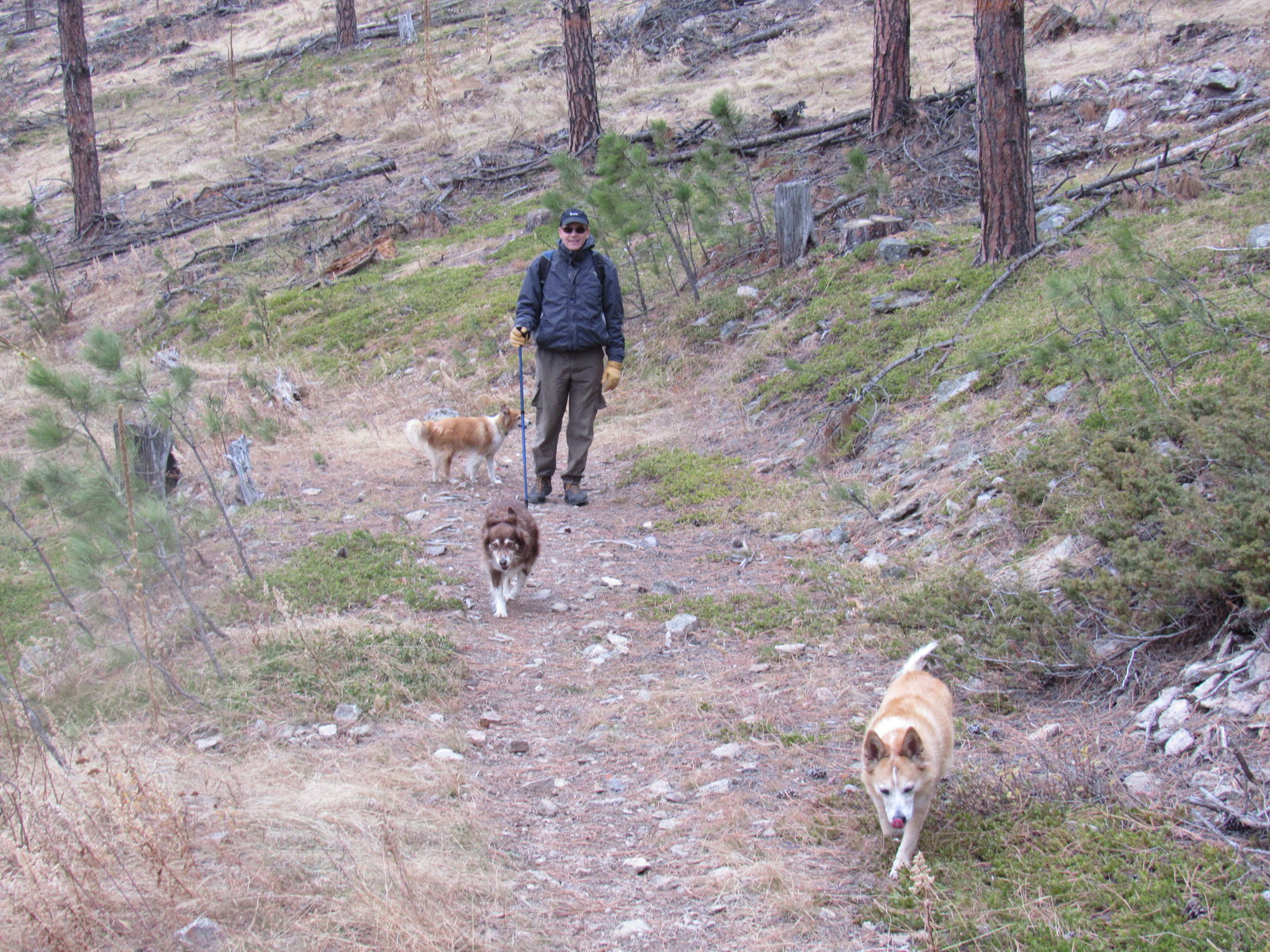
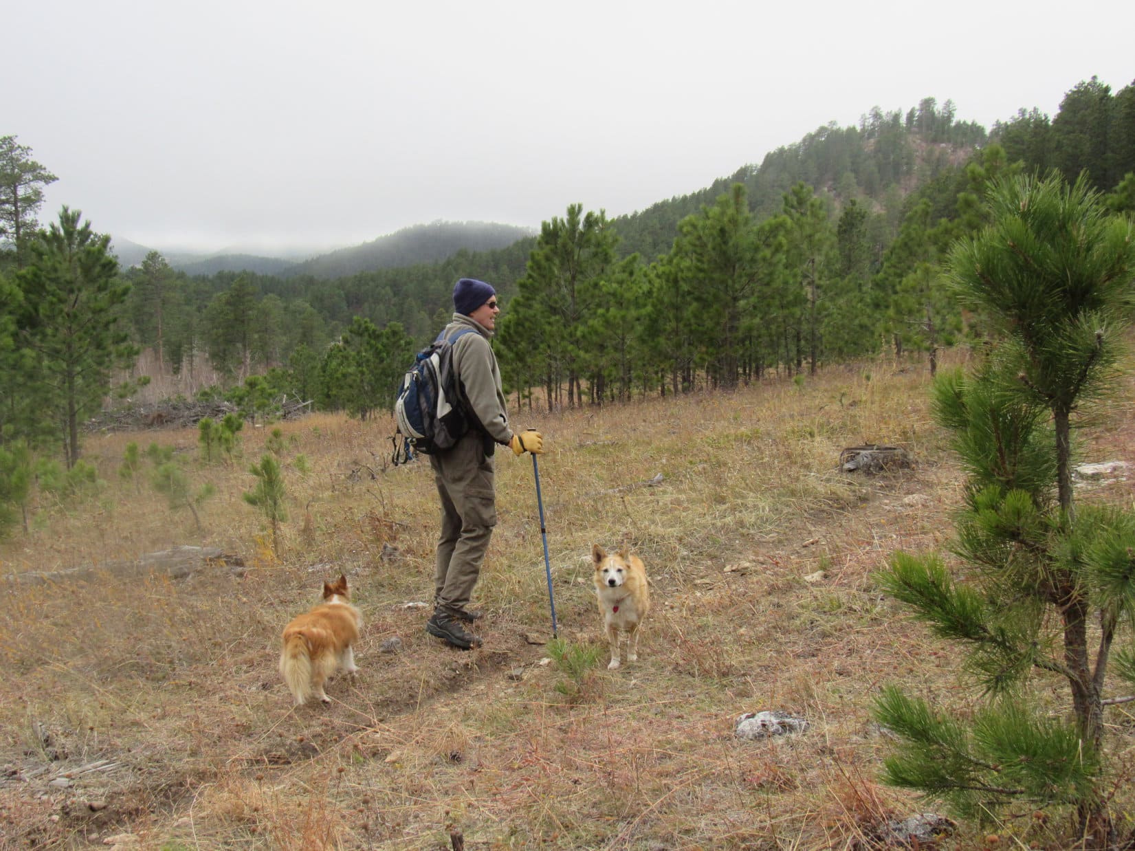
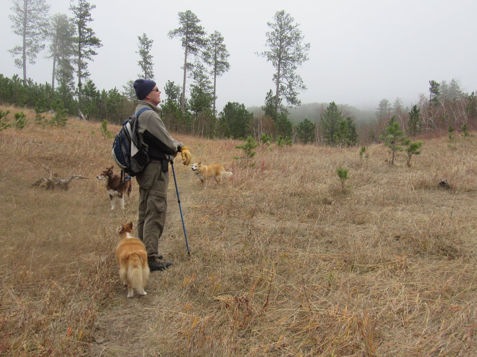
Despite the temperature plunge, everyone was in good spirits!  Soon Loop and Cousin Dusty were leading the way as Centennial Trail No. 89 started NNE up a wooded ravine.  Before long the trail left the ravine, climbing to a flatter region of open pine forest toward the NW.  This flat stretch didn’t last long, either.  The trail began climbing again as it curved up a hillside.

In the open forest, starting to climb again.

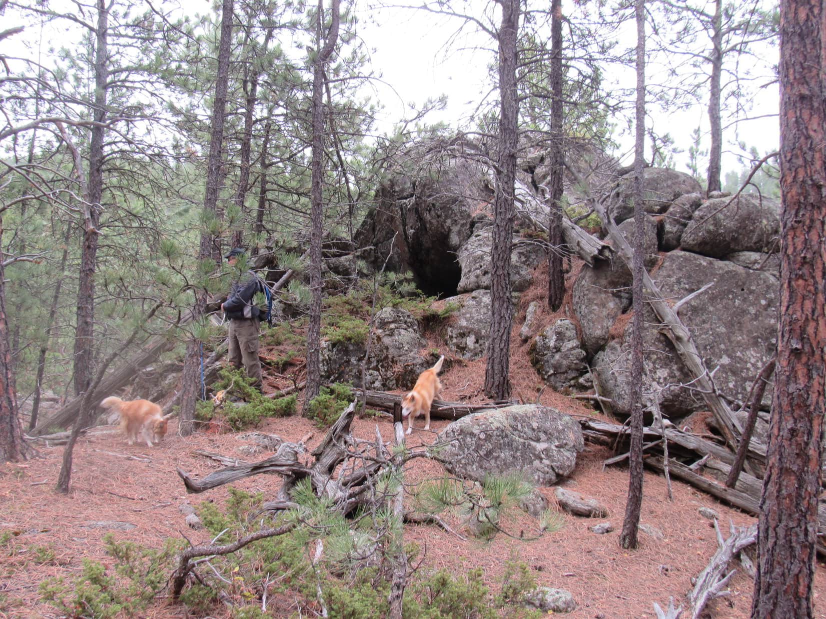
Rounding a sharp bend, the trail resumed a NE course, climbing more steeply.  This turn had scarcely been left behind when Uncle Joe spotted a curious rock formation 200 feet off toward the SE.  Looked like there was a cave over there!  The whole gang ventured over to investigate.

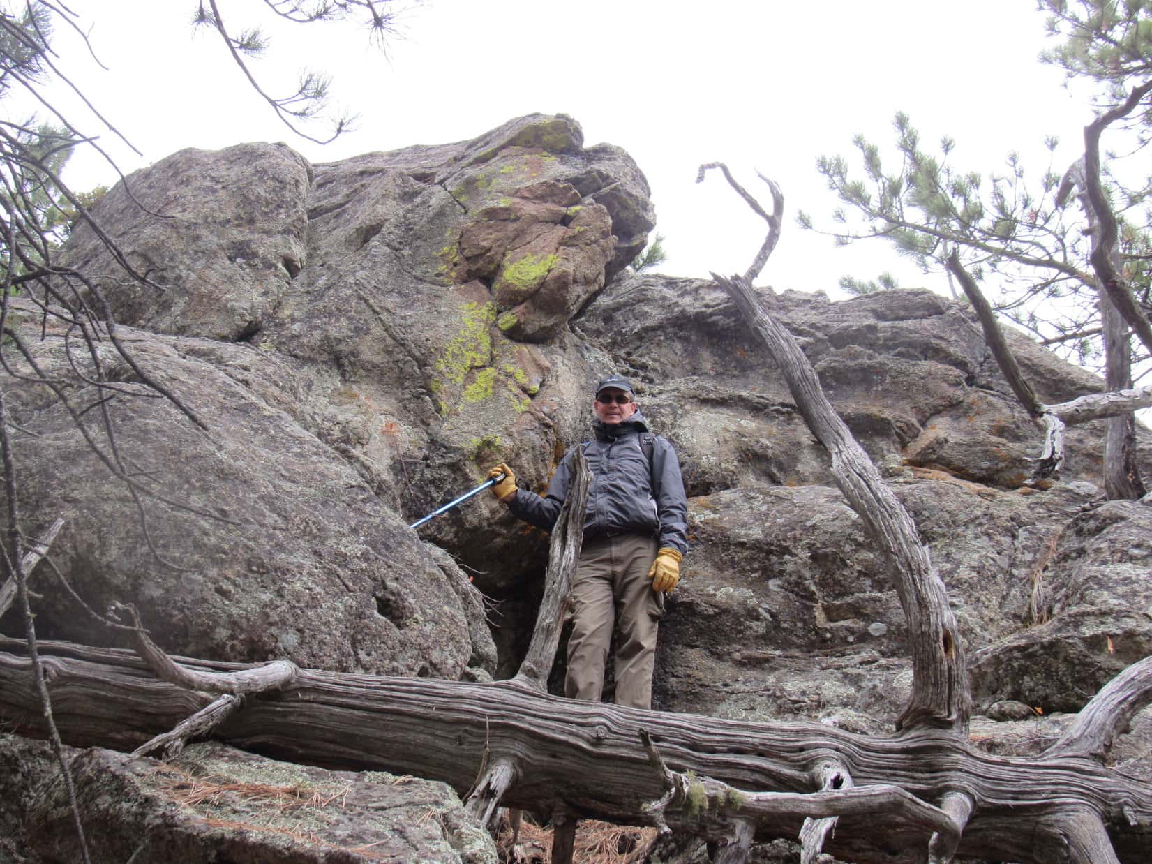
The rock formation proved to be a high point at the end of a small flat region overlooking a forested ravine.  Sure enough, there was a dark opening into the rocks!  While caves aren’t all that unusual in the Black Hills, nearly all of them are found in limestone formations.  These rocks clearly weren’t limestone, so Uncle Joe’s discovery was a rare find.

By the mysterious cave.

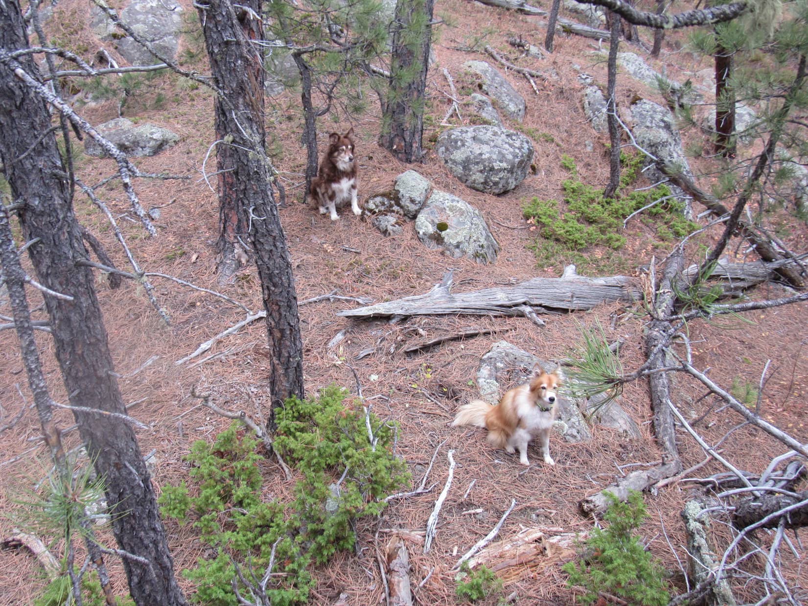
Cousins Dusty and Laddie weren’t inclined to investigate any further.  What if a mountain lion lived there?  Lupe, however, wasn’t worried at all.  Without hesitating in the least, the Carolina Dog went up to peer into the black opening.

Cousins Dusty and Laddie look on, ready to run for it, if Lupe gets eaten by a lion.

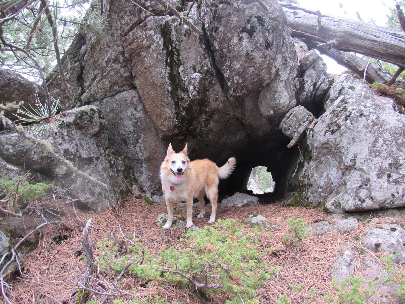
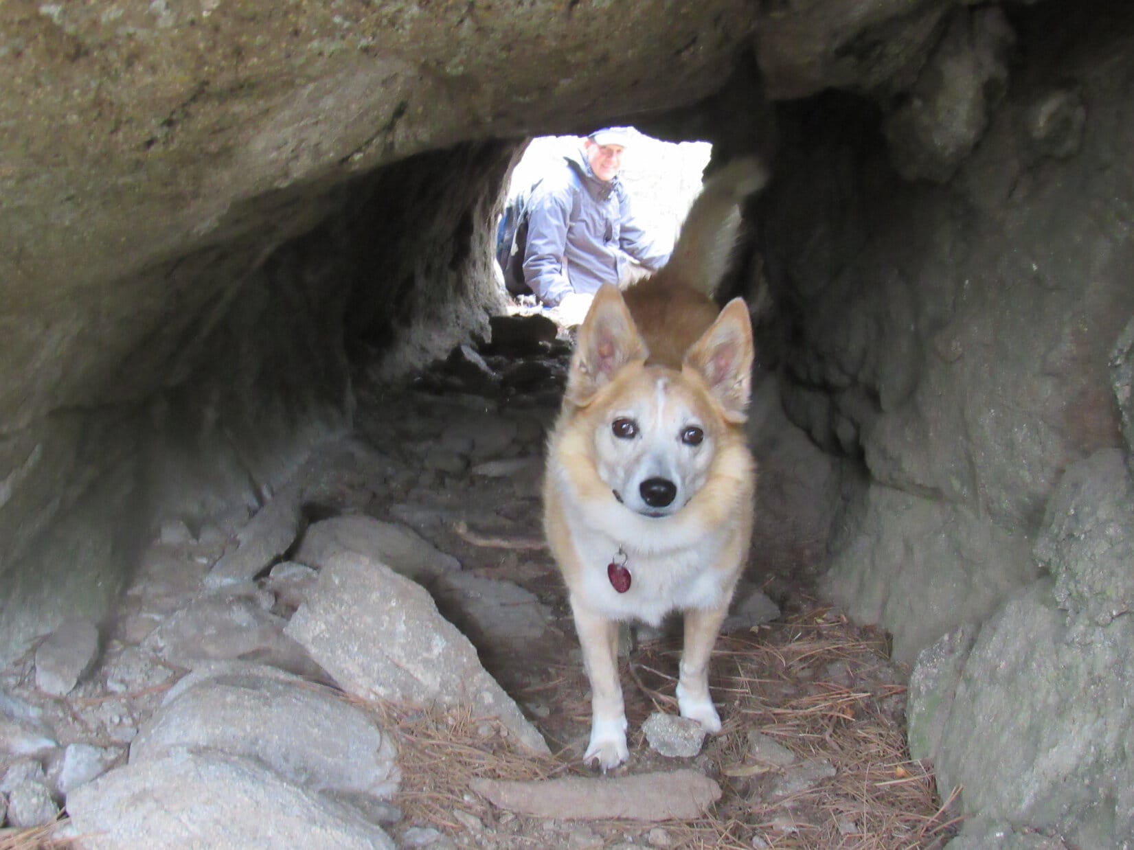
No need to worry about any mountain lions!  If there was one, it’s already escaped out the back.  This isn’t a cave, it’s a tunnel!

Loopster was right!

At the tunnel’s entrance.

A tunnel!  That was really strange.  Uncle Joe and SPHP both took a look.  The tunnel was about 20 feet long, perfectly straight, uniform diameter, and slanted somewhat down toward the S.  Other than a few loose rocks, the bottom was fairly smooth.

The rock formation the tunnel went through looked completely natural, but neither Joe nor SPHP could decide if this tunnel was natural, or not.  If human-made, what purpose had it served?  Dingo-sized, Lupe could have trotted through it with ease, but the tunnel seemed too small for most human projects.  No signs of any other construction were round about.  Odd, very odd.

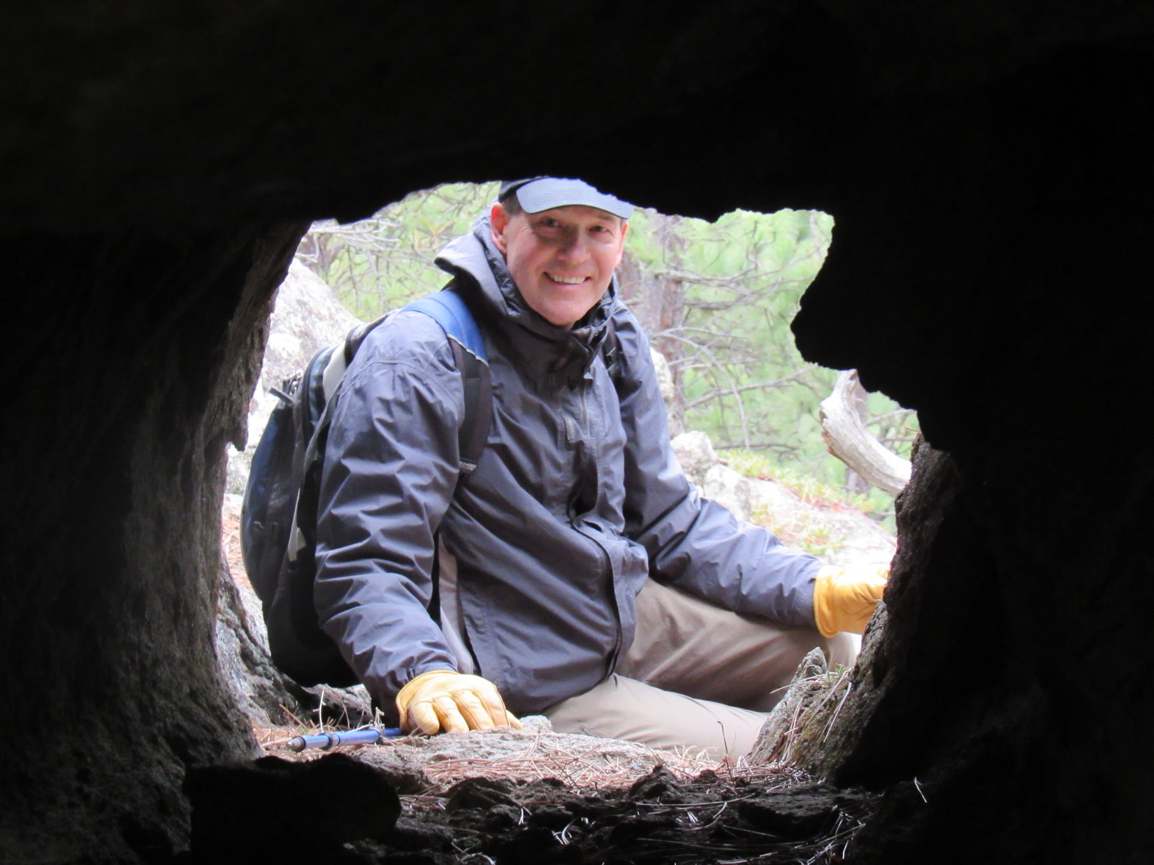
Uncle Joe scrambled around to the back side of the tunnel, which exited the rock formation next to a drop-off.  He then tried to entice Lupe to go through the tunnel to join him.

Maybe even Lupe was starting to get the willies?   The American Dingo entered the tunnel, but even though she could see Joe at the far end, she refused to go all the way through.

Uncle Joe by the tunnel’s exit above the drop-off.
Loop partway in, getting spooked despite Joe’s encouragement to come on through!
Joe framed by the tunnel’s exit.

Whether human-made or natural, the tunnel was so unusual that there seemed to be no explanation for its existence.  Finding no clues, and in case a mountain lion might be on its way back home, everyone returned to Centennial Trail No. 89 leaving the mystery unsolved.

Continuing on, the trail climbed a bit steeply, but soon the slope became much more gradual.  Eventually the trail began curving N.  Abandoning it, everyone headed for a minor ridge to the E for a look around.  Not much to be seen up here, so a shortcut was taken down a slope to the N to rejoin Centennial Trail No. 89 at a saddle where it crossed unmarked USFS Road No. 169.

Up on the minor ridge. HP5141 (R). Photo looks N.

After crossing the road, the trail began angling WNW along the SW slopes of HP5141.  Before Centennial Trail No. 89 headed back into the forest, there was a bit of a view of hills to the NW, their tops softened and blurred by the low hanging clouds.

N of USFS Road No. 169. Photo looks WNW.

0.25 mile beyond USFS Road No. 169, a small clearing was reached at a second pass between HP5141 and HP5212.  A sign indicated that it was a mile back to the Elk Creek trailhead.  The trail continued W from here traversing a steep slope, but remained fairly level.

Once past the S end of HP5212, Centennial Trail No. 89 gradually began to curve N.  The trail first lost, then regained some elevation, eventually going over another minor pass.  Meanwhile, the sky was darkening as the gray clouds blanketing the region slowly crept down the hillsides.

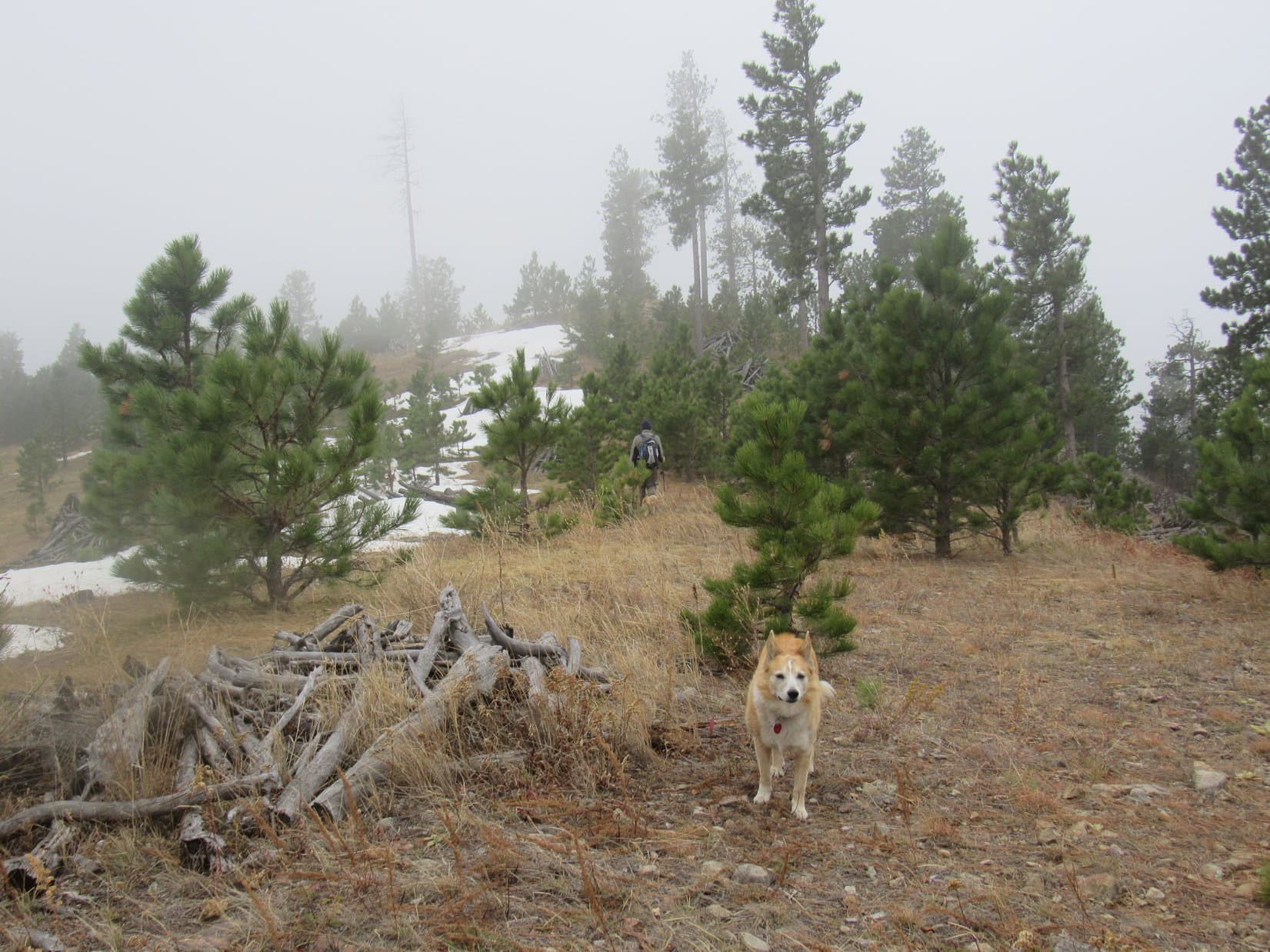
Dusty, Joe, and Laddie leading the way SW of HP5212. Photo looks NW.

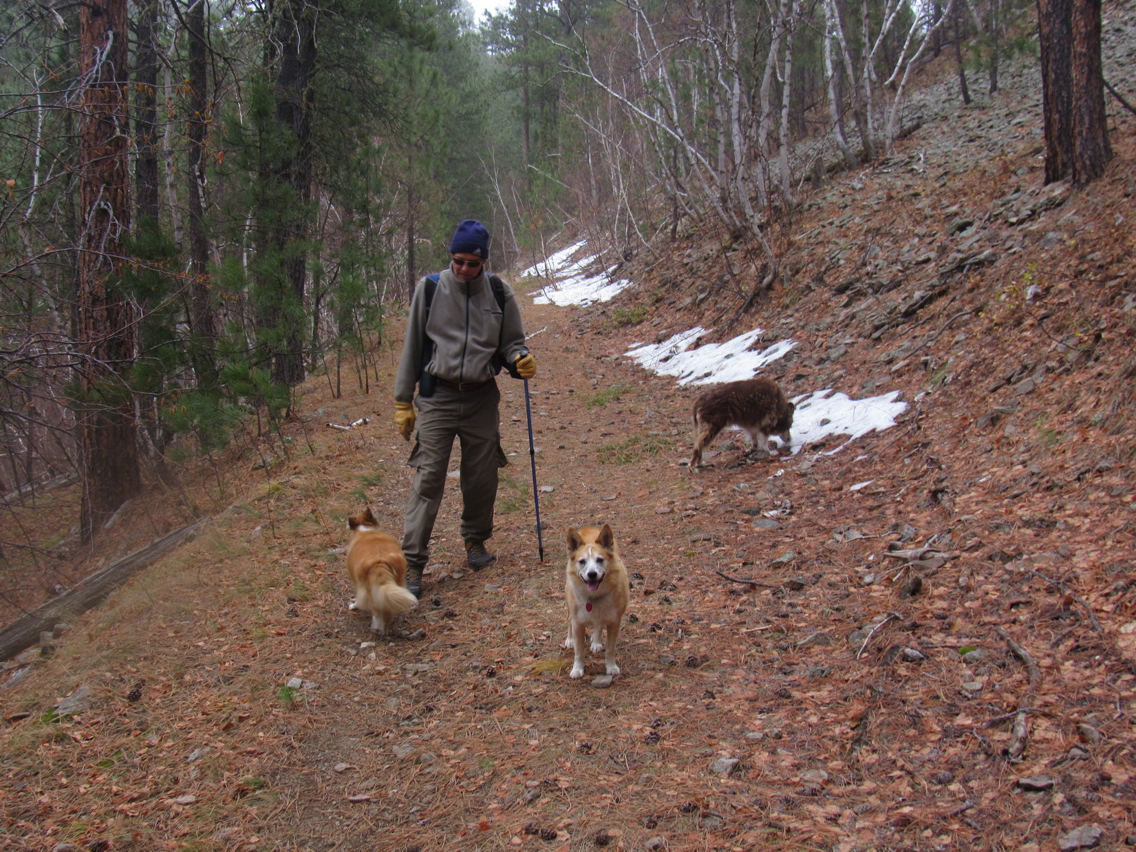
Getting colder out!  A barely detectable mist began.  The trail widened as it reached an old roadbed.  Patches of snow left over from a prior storm added to an increasingly wintery feel.

Patches of snow added to a wintery atmosphere as the sky darkened and a light mist began.

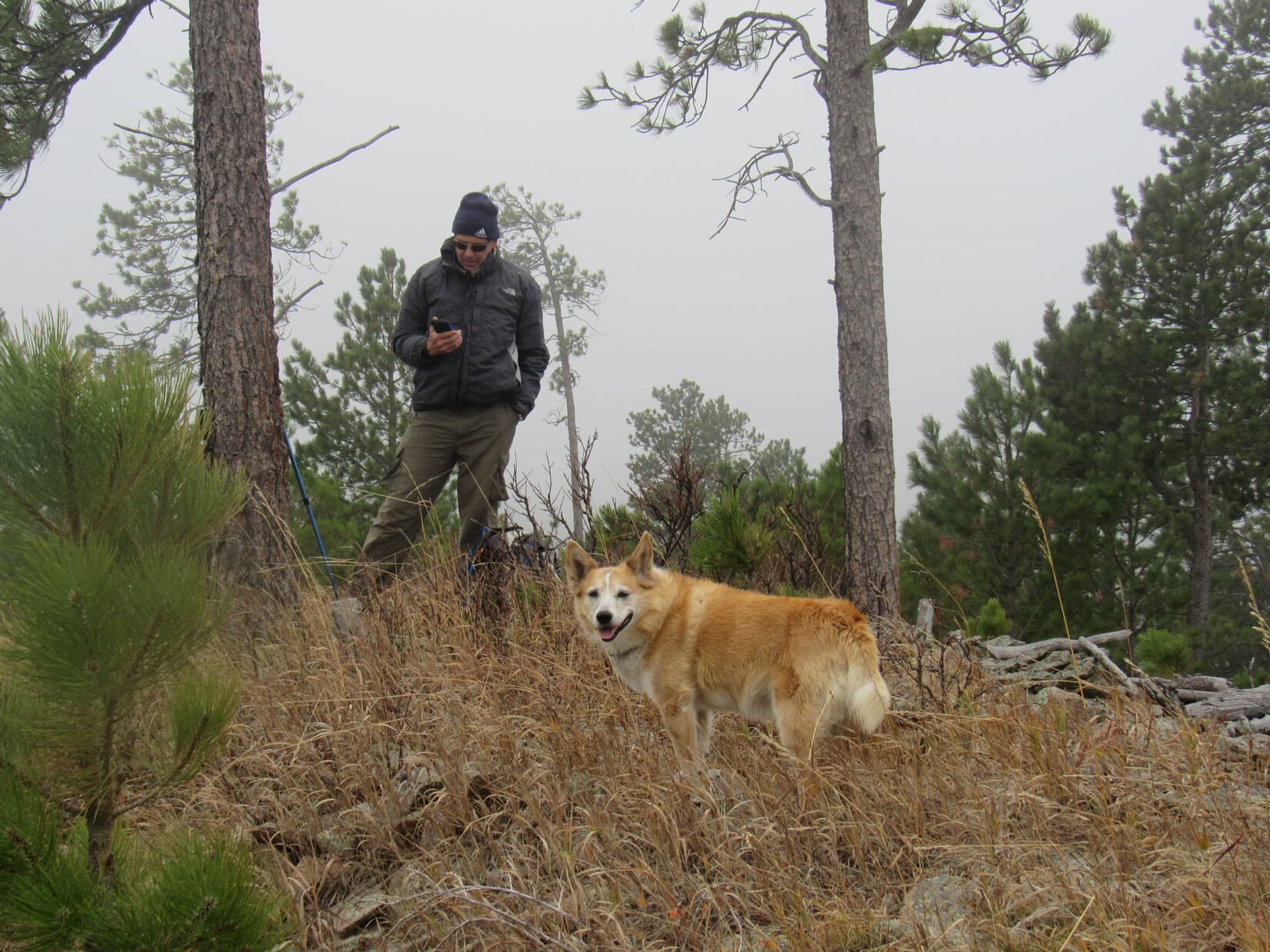
Winding along the mountainside, the trail continued N.  Uncle Joe began to wonder if maybe it wasn’t getting to be time to turn back?  However, Lupe had been here before.  SPHP was convinced that it wasn’t much farther to a junction with a trail that went to the Sturgis Reservoirs, and that junction was very close to Peak 5261, today’s peakbagging objective.

The chilly march went on and on.  The trail junction was farther than SPHP remembered, but it finally appeared.  From here, Centennial Trail No. 89 curved E, climbing 60 feet up to a broad grassy pass.

At the junction with the trail to the Sturgis Reservoirs. Centennial Trail No. 89 continued up to the R (E) from here. Photo looks NE.
Up at the pass N of Peak 5261. Photo looks SE.

Peak 5261 was only 0.2 mile S of this pass.  The trail didn’t go up there, but the N slope was only moderately steep.  Cousins Dusty and Laddie couldn’t get this close and not go to the top to claim their Peak 5261 peakbagging success, could they?  That would be a shame!

Peak 5261 from the pass. Nothing to it! Photo looks S.

Following a long snowbank, Lupe started up first, leading the way.

Heading up Peak 5261. Photo looks S.

Peak 5261’s summit was only 120 feet higher than the pass.  Soon the N slope was leveling out.  The top of the mountain could be seen a short distance ahead.

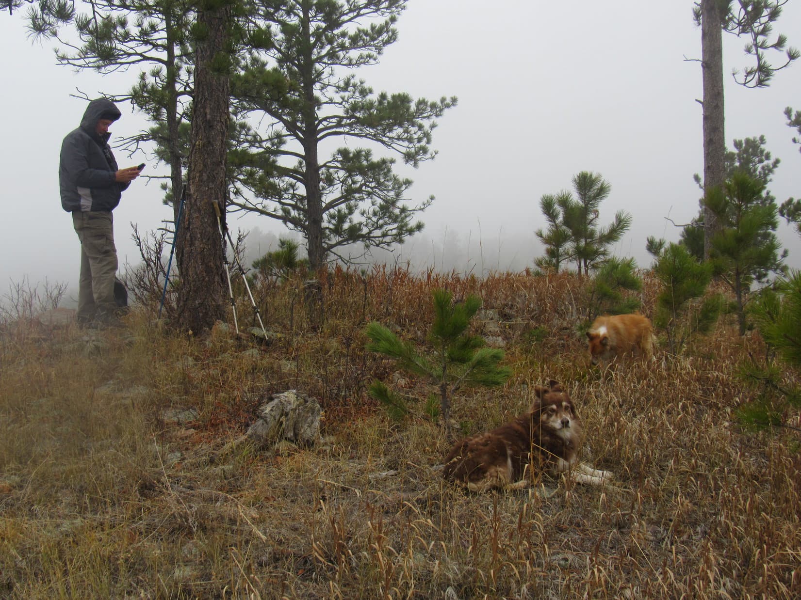
Peak 5261’s summit region. Joe heading for the true summit. Photo looks S.

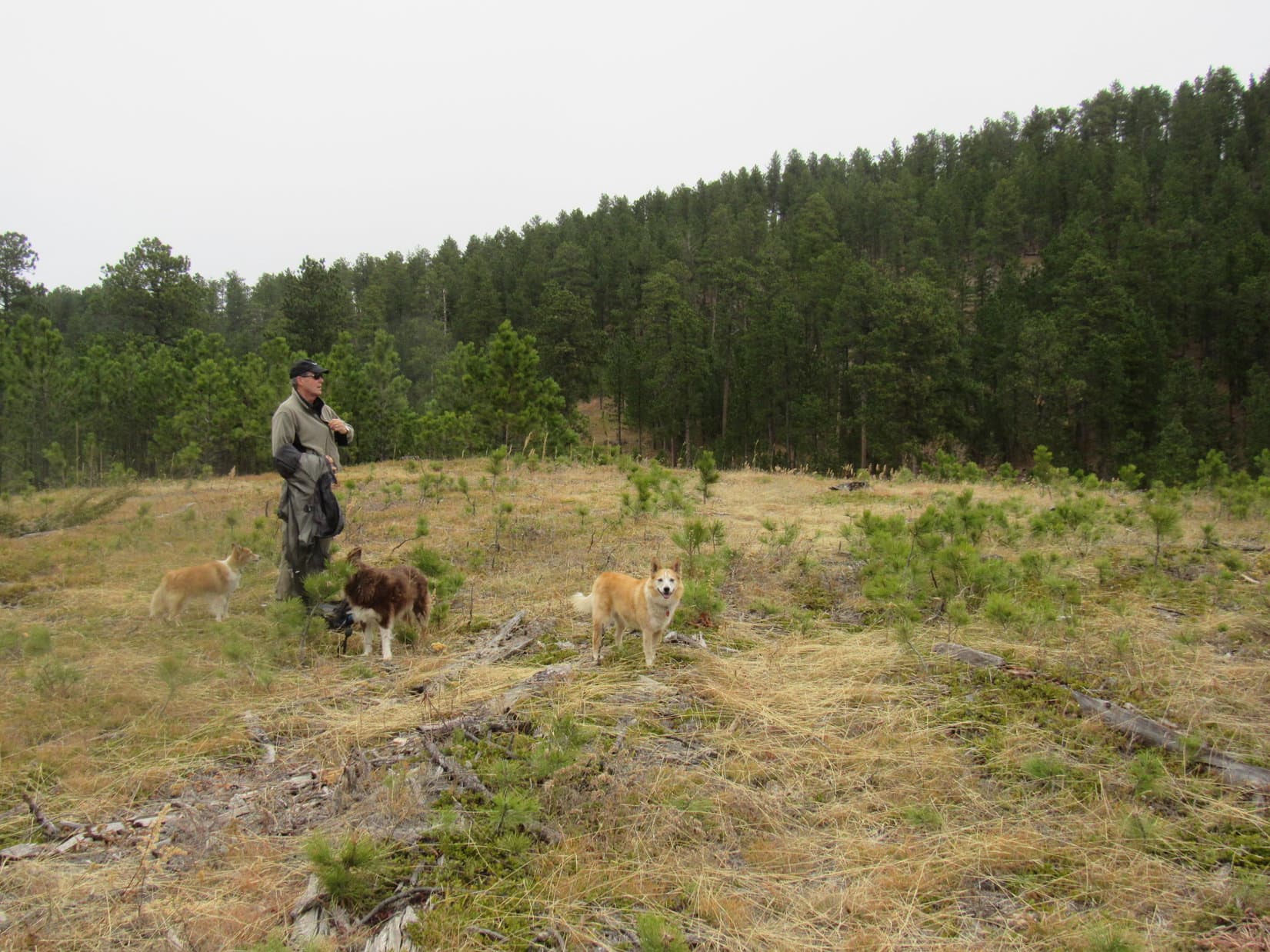
Of course, everyone got there.  Cousins Dusty and Laddie secured their second Black Hills peakbagging success in two days.  Unfortunately, this ascent wasn’t as successful in other respects.  Cold and foggy with a chill, damp breeze, conditions were none too pleasant.

Back at home this morning, the day had been sunny and bright.  SPHP had chosen this destination partly because getting here wouldn’t be too hard for Cousin Dusty, who was now 15, but also in part for the views of Custer Peak (6,804 ft.) and Bear Butte (4,422 ft.).  Cousin Dusty had made it, but the views were a disappointing no show.

We made it, but the views didn’t! Sorry about that! Joe and Lupe at Peak 5261’s summit.
Joe strikes a dramatic pose pointing out the fabulous display of nothing but fog while Lupe and Laddie gather round.

Too miserable out to linger!  Plans for a summit celebration involving chocolate coconut bars, Kinkaid bars, and apples were cancelled.  A few minutes at the top, and the whole pack headed back down Peak 5261’s N slope to pick up Centennial Trail No. 89 again.

Merely a postponement!  The Peak 5261 ascent celebration actually did come off due to popular demand a mile later at a more sheltered spot.  Not to be denied, Lupe, Dusty and Laddie all got their chocolate coconut bar rewards.

Then it was back through the wintery fog, all the way past the Tunnel of Mystery to the Elk Creek trailhead.

Tomorrow was Halloween!  Sadly, Uncle Joe, Dusty and Laddie would all be heading back home to Colorado.  Meeting cousin Laddie and getting to introduce him to the Black Hills had been fun, and it had been terrific to hit the trail with Joe and Dusty again.

Joe, Dusty, and new cousin Laddie on Peak 5261, Black Hills of South Dakota 10-30-21

Links:

Next Black Hills Expedition                       Prior Black Hills Expedition

Black Hills, SD Expedition No. 274 – Centennial Trail No. 89: Elk Creek to Alkali Creek (4-10-21)

Centennial Trail No. 89 Brochure & Map

Want more Lupe adventures?  Check out Lupe’s Black Hills, SD & WY Expeditions Adventure Index, Master Adventure Index, or subscribe free to new Lupe adventures!

Black Hills, SD Expedition No. 274 – Centennial Trail No. 89: Elk Creek to Alkali Creek (4-10-21)

7:19 AM, 26ºF, Centennial Trail No. 89, Elk Creek trailhead – SPHP opened the door, and Lupe hopped back into the G6.

What’s wrong, Looper?  Did you hear gunfire?

No!  It’s freezing out there!  What happened, SPHP?  Last time we were here, it was so nice out!  I’m staying in where it’s warm until you’re ready.

Maybe you shouldn’t have rolled in the snow?  Anyway, suit yourself.  I’ll be ready in a few minutes.  Supposed to warm up into the 60’s ºF later on.  That’ll take the chill off!

Back at the Elk Creek trailhead for the 1st time since Expedition No. 273 – 5 days ago!

What was wrong with the Carolina Dog?  A frolic in the snow wouldn’t ordinarily bother Lupe at all, but now she sat alone shivering in the G6.  Was Looper getting sick?  SPHP hoped not.

Only 5 days ago, Lupe had made it here from Dalton Lake on a lovely warm afternoon in advance of a spring snowstorm that hit the Black Hills the next day.  Although a lot of snow had melted since then, this morning was admittedly off to a crispy start.  The plan was to continue Loopster’s Centennial Trail No. 89 explorations all the way to the Alkali Creek trailhead – 11.5 long, winding miles away.

If she felt up to it, that is.

Relevant portion of the posted trail map.

Alrighty, Loop!  I’m ready!  Are you feeling OK?  You up for this?

Without the slightest hesitation, the American Dingo left the warmth of the G6.  No sign of shivering or shaking now.

Of course!  Which way?  N?

Yes, indeed!  Onward!  Puppy ho!

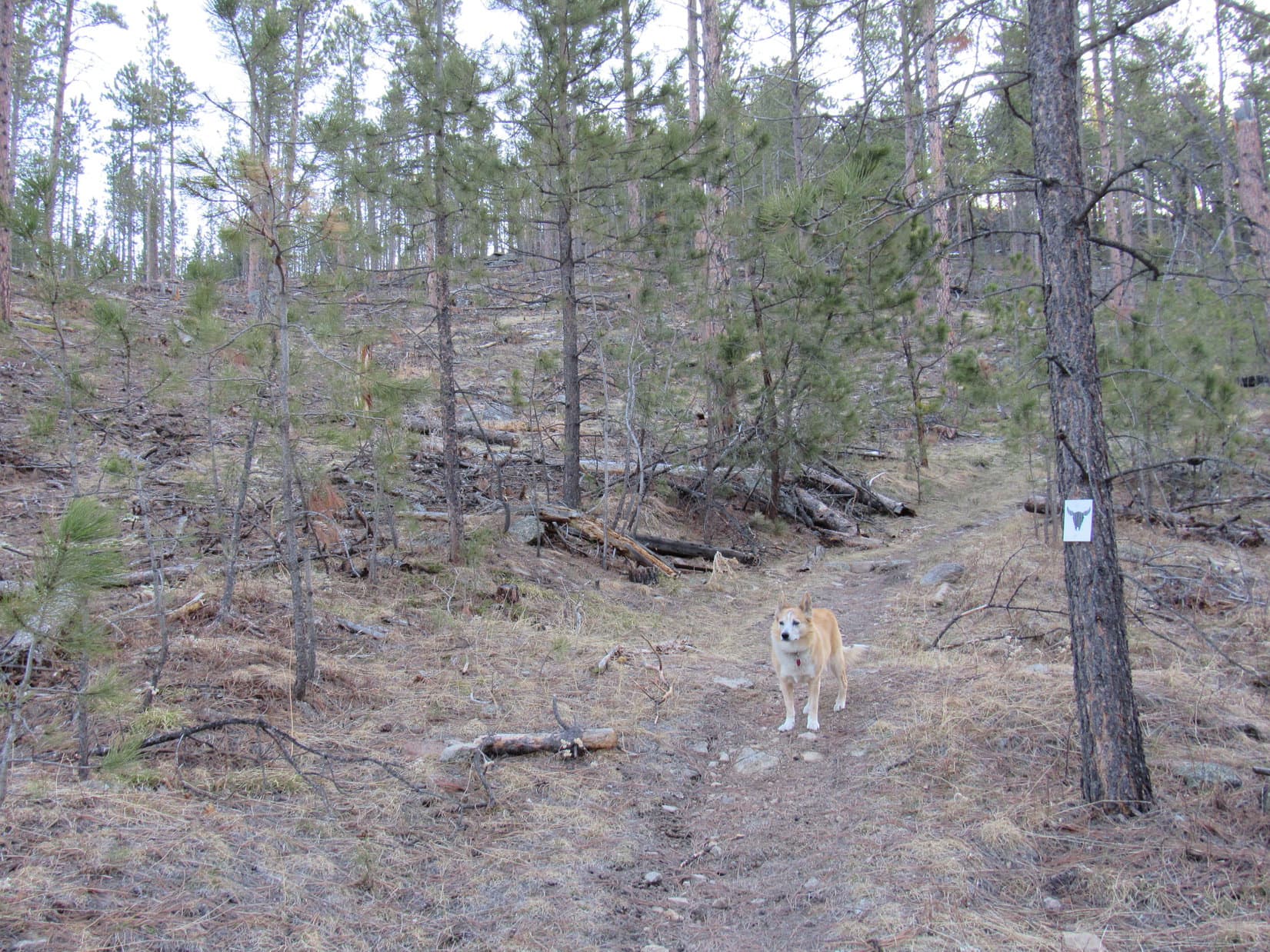
Crossing USFS Road No. 168, Lupe left the Elk Creek trailhead.

Setting out for Alkali Creek. Photo looks NNE.

Crusty snow supported Lupe’s weight, but crumbled under SPHP’s, as Centennial Trail No. 89 headed NNE up a cold ravine still in shadow.  The trail soon climbed out of the ravine to a flatter region to the NW where the forest had been thinned recently.  The fresh openness revealed only a general ugliness in the wake of recent destruction.

Heading up the ravine. Photo looks NNE.
On the visually unappealing loop to the NW. Photo looks NE.

This jaunt to the NW was short-lived.  Climbing again, the trail looped back to the E before resuming a NE course.  Sunlight streamed through the trees, promising relief from the lingering chill.

Sunshine ahead! Photo looks NE.

A moderately steep rate of ascent soon diminished.  Centennial Trail No. 89 flattened again, as Loop reached another region where the forest had been thinned.  She was almost to the top of a rise when the trail curved N, avoiding it.  Curious about what might be on the other side, Lupe left the trail continuing to the high ground.

In the upper thinned region. From here, Lupe ventured over to the high ground on the R. Photo looks NNE.

The rise provided a glimpse of distant prairies beyond the Black Hills, but nothing stood out as being of particular interest.

Turning NW, Lupe went down a snowy slope to rejoin Centennial Trail No. 89 where it crossed USFS Road No. 169 S of HP5141.  From here, the trail went WNW maintaining elevation along a slope providing a more interesting view to the W.

About to head down to cross USFS Road No. 169 (R). Photo looks NW.
Looking WSW from the S slopes of HP5141.

Upon reaching a saddle between HP5141 and HP5212 (topo map), Loop passed a sign indicating she had left the Elk Creek trailhead a mile ago.  Crossing the saddle, Centennial Trail No. 89 continued W traversing the slope at the S end of the HP5212 ridge.

Skirting the S end of the HP5212 ridge. Photo looks WSW.

After rounding the S end, the trail wound along the W side of the ridge.  Elevation changes were gradual, down slightly at first, then higher as Lupe continued on.  Views were pleasant, but always tree-broken.

Easy going on the SW side of the ridge.
A pleasant, if unspectacular view. Photo looks S.
On a short snowy stretch. Photo looks ENE.
Heading N.

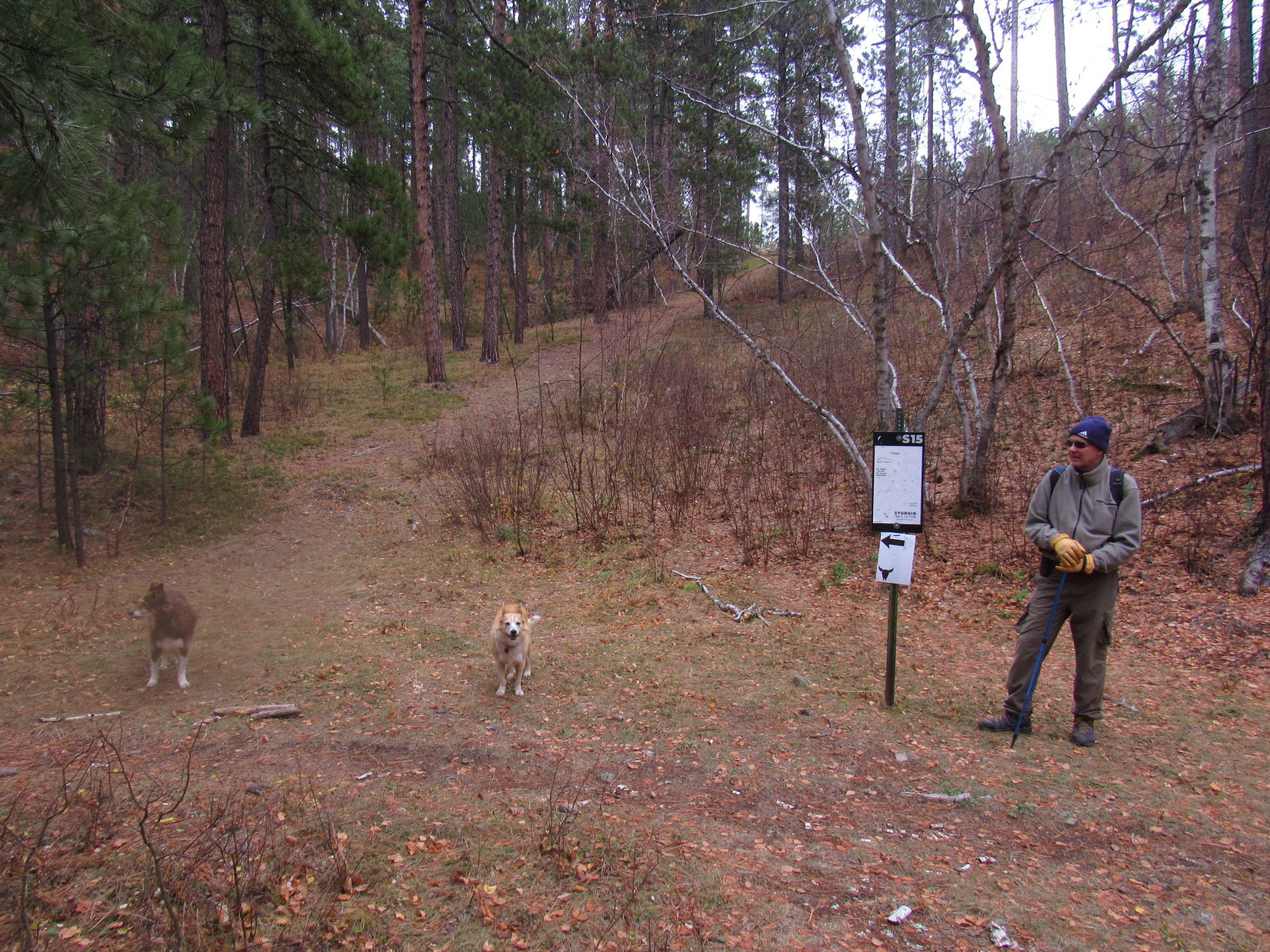
Close to the N end of the ridge, Lupe reached a wide spot at the bottom of a switchback.  According to a sign, this was point S15 of the Sturgis area trails system.  Another trail destined for the Sturgis City Dams veered off to the SW.

At point S15. Photo looks SE.

Any interest in the Sturgis City Dams, SPHP?

Not today, Loop.  Got a different side trip in mind.  We’re almost to it.

Sticking with Centennial Trail No. 89, Lupe headed up the switchback, which made a jog to the W before turning NE.  Pass 5140 was just ahead.

Closing in on Pass 5140. Photo looks ESE.

Arriving at Pass 5140, Lupe found herself in a field.  The S half of this field was snow-covered and sloped up the N end of the HP5212 ridge.  Peak 5261, the actual high point of the ridge, was somewhere up among the pines, not too far away.

At Pass 5140. Photo looks S.

Peakbagging time!  Leaving Centennial Trail No. 89, Lupe headed up the snowy slope.  Didn’t take long to reach a first high spot where the terrain leveled out.  A slightly higher point was only a few hundred feet away.  Going over there, Lupe arrived at Peak 5261’s true summit.

Approaching Peak 5261’s true summit (Center). Photo looks S.
Peak 5261 summit. Custer Peak (Center) and Terry Peak (R) on the horizon. Photo looks SW.

9:16 AM, 47ºF, Peak 5261 –

That was easy, SPHP!  Glad we came up here, too!  These views are way better than what we’ve been seeing from the trail!  Can we stay a while?

Sure thing, Loop!  A little early for a break, but so what?  Peak 5261 is the highest point anywhere close to this segment of Centennial Trail No. 89.  Might as well enjoy it!  Only peak we’ll be climbing today.

The highest ground consisted of a line of smallish loose rocks.  SPHP found a spot to sit down.  Lupe tried laying on the rocks, but SPHP’s lap was a comfier vantage point.  Facing WSW, both Custer Peak (6,804 ft.) and Terry Peak (7,064 ft.) were easily recognizable on the horizon.

Custer Peak (Center) from Peak 5261. Photo looks SW.
Custer Peak. Photo looks SW with lots of help from the telephoto lens.
At the summit rest spot. Custer Peak (L) and Terry Peak (R). Photo looks WSW.
Terry Peak (Center) and Bald Mountain (6,617 ft.) (R). Photo looks W with lots of help from the telephoto lens.

A pleasant time was spent gazing at the views, during which a chocolate coconut bar met its match.  Lupe turned down part of a fried chicken breast, but SPHP wasn’t so picky.  Water wasn’t in demand, either, since the Carolina Dog had been eating snow.  Near the end of Looper’s stay, SPHP realized there was a fairly decent view of Bear Butte (4,422 ft.) from here, too.

Bear Butte (R of Center). Photo looks NNE.
Bear Butte (L). Photo looks NNE with lots of help from the telephoto lens.

40 minutes shot by.  A final look around, and Lupe was on her way back down Peak 5261’s N slope.  Upon reaching Centennial Trail No. 89 again, she headed down the SE side of Pass 5140.

Final moments on Peak 5261. Photo looks SSW.
Back at Pass 5140. Photo looks SE.

Still more than 9 miles to the Alkali Creek trailhead!  Looper would lose elevation most of the way, but that didn’t start in earnest quite yet.  A short descent from Pass 5140 led to an easy uphill section heading NNE along the edge of the forest.  Last chance for a glance back at Peak 5261.

Heading up the next hill NE of Peak 5261. Photo looks NE.
Peak 5261 (L). Photo looks SW.

Although the topo map (switch to CalTopo USFS to see route) showed Centennial Trail No. 89 following USFS Road No. 139 in the region ahead, the trail actually remained a single track, staying E and somewhat lower than the road, as it wound N along the upper W end of Beaver Gulch.

USFS Road No. 139 is on the hillside ahead, but the trail never went all the way up to it. Photo looks N.
Easy going on a flat section overlooking Beaver Gulch (R). Photo looks NNE.
On a slow descent. Photo looks N.

A good mile beyond Peak 5261, Centennial Trail No. 89 veered farther from USFS Road No. 139 and went over a little rise.  Lupe hadn’t lost all that much elevation yet, a bit over 200 feet.  Now, however, a somewhat steeper descent began as the trail turned NW down into Bulldog Gulch.  A sense of remoteness grew as Loopster entered the shade of a denser forest.  Snow was deep on a long switchback to the ESE, but turning soft as the day warmed up.

Starting down into Bulldog Gulch. Photo looks N.
On the snowy switchback. Photo looks SE.
A little farther on. Photo looks ESE.

The long switchback wasn’t steep at all, but once the Carolina Dog got past it, the trail steepened considerably.  Lupe soon reached the bottom of Bulldog Gulch.  The trail crossed the drainage several times.  Except for the snow, it was dry this high up.

In Bulldog Gulch where Centennial Trail No. 89 first crosses the drainage.
Continuing the descent. Photo looks NE.

Bulldog Gulch was just beginning to widen out when the trail flattened and veered away to the E.  A short incline brought Lupe to a minor pass beyond which she entered a different part of the drainage.  For 0.5 mile, Centennial Trail No. 89 wound NE through a sunnier, more open forest, steadily losing elevation.

Eventually, it all led right back to the main course of Bulldog Gulch.  Down here, a little water trickled along in Bulldog Creek.

In the sunny forest. Photo looks NE.
Returning to the main course of Bulldog Gulch (L). Photo looks NE.
Scenic Bulldog Creek! Photo looks SW.

Right after crossing Bulldog Creek, Lupe came to an unusual structure.

Look, SPHP!  A ticket booth!

Seems we’re a bit late for the show, Loopster.

A slow day at the Bulldog Gulch ticket booth.

Maybe the strange structure was a toll booth and not a ticket booth?  The attendant didn’t seem to be around, in any case.  Odd, but nothing to be done about it, so Lupe continued on.

The trail crossed Bulldog Creek a couple more times before leaving it for good.  Winding N up over a minor ridge, it then descended to a low point where USFS Road No. 139 suddenly reappeared.  After crossing the road, Lupe began a more sustained climb out of Bulldog Gulch.

At the second Bulldog Creek crossing. Photo looks SSW.
Beginning to climb out of Bulldog Gulch. Photo looks W.
An amazing dense forest. Photo looks SE.

Lupe gained 200 feet of elevation before reaching a ridgeline.  On the other side was a sunny meadow, and a view of the prairies beyond the Black Hills.  The trail wound NW a bit higher up the ridge before coming to another junction with the Sturgis area trails system, where a side trail continuing up the ridge promised another route to the Sturgis City Dams.

Still a few miles to go, but Lupe had come a long way since Peak 5261.  Break time!  Loop laid down next to SPHP near a lone little group of Pasque flowers.

Can see the prairie now! On the ridgeline after exiting Bulldog Gulch. Photo looks E.
Pasques, the South Dakota state flower.

Another chocolate coconut bar bit the dust.  Just an appetizer this time!  Lupe was ready for some Taste of the Wild, too.  For some reason, the finicky Carolina Dog still declined fried chicken.  SPHP had some, then munched an apple while consulting the map.

So, how are we doing, SPHP?

Great, Loop!  Near as I can tell, we’re right at the junction with USFS Road No. 139.1E.  Pretty much all downhill the rest of the way.

Road!  What road?  Do you have that map upside down, SPHP?

Think it’s been abandoned long ago.  This side trail to the Sturgis City Dams might be all that’s left of it.

The trek resumed.  Centennial Trail No. 89 left the ridgeline continuing NW.  Lupe lost elevation slowly at first, but the pace then quickened.  Reaching the “Twisted Trunk”, a small opening provided a glimpse of Deadman Mountain (4,943 ft.) off to the W.

Resuming the trek. Photo looks NW.
At the Twisted Trunk. Deadman Mountain (L) in the distance. Photo looks W.

The trail made a series of long switchbacks, gradually working its way N.  For a long way there was nothing to see except forest.  However, Loop made great progress, and the trail eventually reached a wooden fence.  A sign posted on a tree next to the fence warned about a friendly dog named Poett that liked to go on long walks with strangers.

In the beautiful forest.
Apparently Poett’s days of wandering off with strangers were over.

No sign of Poett today, so Lupe kept going.  The trail turned away from the fence without crossing it, once again heading NW.  A thick band of limestone capped a minor ridge up the slope to the R.  Centennial Trail No. 89 ran below this cap for 0.25 mile until it angled off to the N.

After a couple of short switchbacks, the trail curved NE, bringing Loop right back to the limestone.

Not far from Poett’s wanted poster, near the start of the limestone cap. Photo looks N.
N end of the limestone. Photo looks ENE.

The limestone ended at a gap created by Alkali Creek.  As Centennial Trail No. 89 continued NE past a wall of rock, the whole formation sank below the surface.  The trail promptly curved E.  Now on top of the sunken limestone, Lupe entered a clearing amid a more open forest.

Up on the limestone. Photo looks E.

One more switchback, and the long, forested descent was over.  Ahead, a vast field stretched toward the roar of traffic on I-90.  Prairies beyond the Black Hills were visible through a break in a line of ridges to the E.

At the start of the big field. Photo looks E.
On a Dingo access ramp. Photo looks E.
Looking back at the Black Hills, now being left behind. Photo looks W.

Not much farther to go!  Lupe headed straight for I-90, passing under a railroad bridge just before reaching it.  Two concrete tunnels provided a choice of safe passage below I-90.  Once through, Centennial Trail No. 89 turned ESE straight for the still unseen Alkali Creek trailhead.  Trotting by a line of scrub oaks down in the creek bottom, Lupe went over a rise, and there it was, dead ahead.

Approaching the railroad bridge. Photo looks N.
Choice of tunnels beneath I-90. Photo looks NE.
Under I-90. Photo looks NE.
On the final stretch. Photo looks E.
Alkali Creek trailhead dead ahead! Photo looks E.

2:31 PM, 64ºF, Centennial Trail No. 89, Alkali Creek trailhead – The S end of Peak 4027 rose beyond the trailhead display.  Lupe had been up there before, but wouldn’t be making another ascent today.  Her 11.5 mile long Centennial Trail No. 89 trek from the Elk Creek trailhead was over, but the Carolina Dog would soon have to turn right back around and repeat it.  Going back was the hard way, too, uphill much of the way!

At the Alkali Creek trailhead. Peak 4027 (Center). Photo looks NW.

Lupe sauntered down to Alkali Creek for a drink.  The afternoon was sunny and warm down here, and snow didn’t exist.  Then it was up the bank to rest by the vacant picnic tables amid the leafless oaks.

In Alkali Creek.
We’ll rest here! Alkali Creek picnic ground.

Lupe wasn’t hungry.  While SPHP polished off what was left of the fried chicken, she laid in the shade beneath the picnic table.  So nice out!  Several vehicles were parked at the trailhead, but no one came around.

3:08 PM, Centennial Trail No. 89 – 30 peaceful minutes had flown.  With the Alkali Creek trailhead behind her now, Lupe stood on a little rise looking W.  Back to the Black Hills!  The Elk Creek trailhead seemed unimaginably far away.

Starting back. Photo looks W.

7:16 PM, 44ºF, Peak 5261 – Just in time!  Lupe stood bathed in horizontal rays of sunlight, the sun hanging barely above the hills.  With few clouds to speak of, sunset wasn’t going to amount to much.  Even so, a respite way up here on Peak 5261 from the finally concluded endless uphill march was reward in itself.

Sunset on Peak 5261. Photo looks S.

Absolutely famished, the American Dingo devoured the remaining Taste of the Wild supply before curling up on SPHP’s lap to watch the show.  10 minutes of glory, and the golden orb fell as if mortally wounded.  Sinking N of Terry Peak, it was gone.

In a chilly S breeze, Lupe and SPHP sat watching while a faint rosy blush in the clouds above rallied, then sickened, turning old and gray before its time.  Dusk.  Oh, well.  Still more than 2.5 miles to go.  Better make use of what light remained.

Onward!  Puppy, ho!

Leaving rarely visited new friend Peak 5261 for the second time today, Lupe headed back to Centennial Trail No. 89.  (End 9:00 PM, 36ºF)

Custer Peak from Peak 5269, Black Hills of South Dakota, 4-10-21

Links:

Next Black Hills Expedition                    Prior Black Hills Expedition

Next Trail Section North

Black Hills, SD Expedition No. 241 – Centennial Trail No. 89: Alkali Creek to Fort Meade (12-10-18)

Next Trail Section South

Black Hills, SD Expedition No. 273 – Centennial Trial No. 89: Dalton Lake to Elk Creek (4-5-21)

Centennial Trail No 89 Brochure & Map

Want more Lupe adventures?  Check out Lupe’s Black Hills, SD & WY Expeditions Adventure Index, Master Adventure Index, or subscribe free to new Lupe adventures!

Black Hills, SD Expedition No. 273 – Centennial Trail No. 89: Dalton Lake to Elk Creek (4-5-21)

7:57 AM, 35ºF, Centennial Trail No. 89, Dalton Lake trailhead –  Not a cloud in the sky.  Supposed to warm up, too – highs in the upper 60’s ºF expected.  A perfect day for taking this monster on!

Oooooh!  Centennial Trail again today, SPHP?

You know it!  This is it!  King Kong of the Centennial Trail system – Dalton Lake to Elk Creek.  12.8 miles one way between trailheads, 25.6 miles round trip!  Think you’re up to it, Looper?

Just point me at the trail, SPHP, and try not to fall too far behind!

The Dalton Lake trailhead is only 500 feet from the campground.
Kiosk at the Dalton Lake trailhead.

The trailhead was just a short distance below the Dalton Lake dam.  Lupe set out on Centennial Trail No. 89 heading NW across a field of dry grass to a wooden footbridge over Little Elk Creek.  Beyond the bridge, the trail turned W and began to climb.  In nothing flat, Lupe was up on the dam with a view of Dalton Lake.  The little lake was still icy, but the ice didn’t look very thick.

On the footbridge over Little Elk Creek. Photo looks SW.
Near the Dalton Lake dam spillway. Photo looks SW.
Dalton Lake. Photo looks SW.

0.1 mile done, 25.5 miles to go!  As lovely as Dalton Lake was, Lupe didn’t have time to dilly-dally.  A brief look, and the Carolina Dog was on her way.  Centennial Trail No. 89 continued W gradually climbing into the forest.  Loop came to a bike access ramp, the 2nd one so far.

Leaving Dalton Lake. Photo looks ESE.
On the Dingo access ramp.

The trail went W beyond Dalton Lake before doubling back to the ENE.  Lupe was already too high to see Dalton Lake again through all the trees.

Doubling back to the ENE.

The Elk Creek trailhead was nowhere near 12.8 miles away as the crow flies, not even half of that.  However, Centennial Trail No. 89 was going to do an awful lot of winding around before getting there, and started out true to form.  Although bound for the ridge N of Dalton Lake, the trail didn’t switchback directly up to it.  Instead, climbing at a gradual to moderate pace, it went clear around the E end before curling up into a valley N of the ridge.

Glancing back as the trail climbs out of Little Elk Canyon where Dalton Lake is located. Photo looks SW.
Going around the E end. Photo looks NNW.
Entering the valley N of the ridge. Photo looks NW.

Climbing all the way, Centennial Trail No. 89 swooped around the upper W end of the valley N of the ridge, then straightened out as it turned SE.  Lupe reached the much flatter region on top of the ridge along the NE edge.  The trail turned sharply W here, following an abandoned road.

Up on top where the trail turns W. Photo looks NW.

The grassy road soon led into USFS Road No. 704.1B, which continued WNW, a very easy trek since Lupe was barely gaining any elevation at all now.  Before long, No. 704.1B made a big gentle curve around the W end of the valley Loop had just climbed out of.

Another higher ridge was to the N, and Centennial Trail No. 89 made the same basic maneuver as before.  No. 704.1B turned E, and started losing elevation.  Approaching the E end of the ridge, the trail left the road, veering off to the NE at a point where several big rocks were visible.

A nice single track again, Centennial Trail No. 89 proceeded around the E end of the second ridge past a number of huge rocks.  It then turned NW, climbing steadily through a fairly open region with views of lower forested hills and ridges off to the NE.

USFS Road No. 704.1B where it starts curving back around to the E. Photo looks N.
Going downhill on No. 704.1B. Photo looks ENE.
By the first big rocks where Centennial Trail No. 89 leaves USFS Road No. 704.1B. These rocks are visible from the road at the turn. Photo looks ENE.
Heading NW after rounding the E end of the second ridge. Photo looks NW.

What a difference a few days had made!  4 days ago, Lupe had been much farther S exploring a different section of the Centennial Trail.  Patches of snow and ice hadn’t been hard to come by then, but today was different.  Hardly any around.

April had started off unseasonably warm, and things were warming up rapidly today, too.  SPHP had already shed all extra layers.  Loopster was greatly cheered when she finally came to a spot to cool off.  Laying right down on the ice, she chomped away at a small patch of crusty snow.

Happy Dingo on Ice. Photo looks NW.

All these ridges Centennial Trail No. 89 wound about were connected.  Lupe was already close to a saddle leading to HP5173, the high point of the next ridge to the N.  The trail reached the saddle very efficiently, without having to downclimb at all.  At the saddle, the trail turned N, starting a steeper ascent.  Loop passed a first minor rock formation.

Below the first rock formation on the way to HP5713. Photo looks NNW.

The trail wound around in the forest a bit before arriving along the SW edge of the ridge.  For the first time, Lupe had tree-broken views to the W.  Staying near the edge on much flatter terrain, the trail turned NW.  SPHP soon called a halt.

Time for a break.  With so little snow around, Lupe needed water, and SPHP wanted to have a look at the topo map(Note: Switch to CalTopo USFS for a map showing Centennial Trail No. 89)

Getting close to the SW edge of the ridge. Photo looks NW.
At the first break spot, a little SE of HP5173. Photo looks SSW.

This is a nice spot, SPHP!  Where are we anyway?

We’re off to a good start, Loop, but that’s about it.  Looks like we’re 0.25 mile SE of HP5173.  Appears the trail will go just about right over HP5173, but the terrain might be so flat we may not even notice it.  Hardly matters.  The highest point along this segment of Centennial Trail No. 89, or close to it, is Peak 5181, which is another 1.5 miles past HP5173.

Does the trail go over Peak 5181, too?

No, not quite.  Appears to be a little E of the trail.

Are we going to visit Peak 5181, then?  Seems like we ought to, if it’s the highest point along the way.

Oh, yes!  We will.  The map even shows a survey benchmark there.  We’ll have a look around to see if we can find it.

With the Carolina Dog hydrated again, the trek resumed.  Loop headed NW along the SW rim of the ridge above a line of small limestone cliffs, an exceptionally easy march since the ground was nearly flat.

The trail probably didn’t go exactly over HP5173, but must have passed very close to it.  Neither Loop nor SPHP paid much attention.  Occasional views to the SW were more interesting.  Nothing too spectacular, mostly long forested ridges, but Peak 5300 and White Mansion (5,340 ft.) were identifiable.

Peak 5300 (Center) and White Mansion (R). Photo looks SW.

Beyond HP5173, the trail turned N, beginning to lose elevation.  Far to the NW, Lupe caught a narrow glimpse of distant Terry Peak (7,064 ft.) with its still snowy ski runs.  The trail then turned NE away from the cliffs and into the forest, start of a longer descent to Pass 5031, which was on the way to Peak 5181.

Terry Peak (Center). Photo looks NW with lots of help from the telephoto lens.
N of HP5173 starting down to Pass 5031. Photo looks NE.

By the time Lupe made it down to Pass 5031, she was heading NW again.  Instead of immediately climbing up onto the ridge leading to Peak 5181, Centennial Trail No. 89 stayed low continuing to the W side of the ridge.  It soon turned N, bouncing along maintaining elevation a good 80 to 100 feet below the top.

Notice anything different about the forest around here, SPHP?

Not especially.  What are you seeing, Loop?

It’s not what I’m seeing, but what I’m not seeing that’s different, SPHP.  Where is all the deadfall?  Hardly any at all!

Now that you mention it, you’re right, Loopster!  Kind of looks the way the Black Hills used to look.  Used to be that you hardly ever saw a dead tree.  That was a long time ago now, back before the pine bark beetle infestation started getting so bad 10 years ago.

Well, I like it a lot better this way, SPHP!  Can run around without having to worry about breaking my neck at every step!

Deadfall free! The way I like it! Photo looks SW.

The trail stayed low for a while.  In some places, the forest thinned out up on the slope below the ridgeline.  Lupe started seeing large limestone formations along the top of the ridge.  Several big platforms looked high enough to get an unobstructed view.

Can’t be too hard to get up there, SPHP!  Want to go check out the views?

Yes, but maybe we should wait on that, Loop.  We still have a very long way to go.  If we get back soon enough, maybe we can go up there for a sunset panorama?  What do you think?

Deal, but if we don’t get back in time, we’re going to miss out!

I know it’s taking a chance, but on the other paw, maybe we’ll come to other even more readily accessible viewpoints?

Gotta be some views up this way! Photo looks NE.

Sunset Heights got skipped for the time being, even though some of the lofty platforms seen only a little farther on looked very tempting, almost surefire winners.  The really big rocks were all way up high, but the trail passed some lesser samples.  Lupe was beyond the most impressive ones when the trail suddenly made a short switchback higher.

These rocks are midgets compared to the ones higher up! Photo looks NNE.

The switchback didn’t get the American Dingo up on top of the ridge right away, but was the start of a gradual climb higher again.  Lupe was soon above another line of limestone cliffs where there was some open ground.  Perhaps not quite as spectacular as Sunset Heights would have been, but the views had to be almost as good.

A lot of territory could be seen from here.  Peak 5300 was still visible to the SW.  Custer Peak (6,804) was way off to the W.

Past the little switchback, staring to climb again. Photo looks N.
Not quite Sunset Heights, but a great view nonetheless! Peak 5300 (L). Photo looks SW.
Custer Peak (Center). Photo looks W with lots of help from the telephoto lens.

Don’t think we’re far from Peak 5181 now, Loop.  Shall we go look for it?  Should be just up the hill from here.

On it, SPHP!  Follow me!

Leaving the trail, Lupe headed NE up a gentle, forested slope.  She didn’t have to go far before the terrain leveled out.  Pretty flat up here, but the highest region didn’t seem too hard to pick out.  A few scattered rocks and some old wood that might have signified something were in a spot that looked like a true summit candidate.

Disappointingly, a quick check failed to reveal any survey benchmarks.

Hmm.  Well, I’m not finding anything, Loop.  This is probably Peak 5181, though.  Want to take a break?

Any chance water and a chocolate coconut bar would be involved, SPHP?

100% likely, sweet Dingo!

At the old wood high point. Photo looks NE.
I break for chocolate coconut bars, water, and Taste of the Wild! Photo looks SSE.

The chocolate coconut bar and water break was augmented with a little Taste of the Wild.  A comfortably warm and beautiful day, but there didn’t seem to be much point in lingering on Peak 5181.  Spotting a rock 150 feet farther E, SPHP led Loop over to it on the chance that the survey marker might be there.

No luck.  Oh, well!  Nothing higher here than where the American Dingo had taken her break, anyway.  That settled, Lupe took a shortcut NW back to Centennial Trail No. 89.  The trail went NE a little way before curving back to the NW.  To the R, the land sloped higher.

Hang on just a minute, Loop!  Let me check the map again.

It all made sense now!  Lupe hadn’t been to Peak 5181 yet.  It was just up this next slope.  Another short off-trail exploration was in order.

Too funny, SPHP!  The mighty mountain we’ve been trying to climb turns out to be nothing more than an anthill!

Yeah, well, as anthills go, this one’s humongous!

All those creepy-crawlies give me the heebie-jeebies!  Say what you will, I’m not going near it!

Towering more than a foot higher than the rest of flat-topped Peak 5181, an anthill composed of pine needles was the apparent true summit.  100,000 ants swarmed over the top of it, with probably 1,000,000 more hidden within.  For some reason, Loopster didn’t want to go anywhere near the anthill.  When SPHP’s powers of persuasion failed, the reluctant Carolina Dog got physically carried close to it.

You’ve got 2 seconds, SPHP!  Say “chocolate coconut bar!”, I’ll smile, and then I’m outta here!

OK, Loop! … “Squirrel!”

Close enough.  Lupe smiled, and ran 20 feet away.

You can have Peak 5181, SPHP!  I’m hitting the trail.

By the dreaded anthill, Peak 5181’s true summit. Photo looks NE.
Ants. More than one!

Heading down the W slope, a sort of lumpy rock platform was just 20 feet past Centennial Trail No. 89.  Looked like there might be some views, but as it turned out, there were too many trees to see all that much.

On the lumpy platform due W of Peak 5181’s ant-infested summit. Photo looks NW.

However, returning to the trail, Loop didn’t have to go too much farther N before discovering some really great viewpoints along the cliff edge.  Best of the day!

Rounded Peak 5300 (L), starting to look far away now. Photo looks SSW.
Now this is what I call a viewpoint! Custer Peak (L) and Terry Peak (Center) discernable on the horizon. Photo looks WNW.
Along the cliff line, just W of the trail. Photo looks NW.
Don’t you just love getting high?

By now, Lupe was close to the N end of the huge ridge encompassing both HP5173 and Peak 5181.  For 2 miles she had been traveling on or near the highest territory of this segment of Centennial Trail No. 89.  A drastic change was ahead.

Just beyond the super viewpoints, the trail slanted downward as it began curling E around the N end of the ridge.  A long descent NE ensued, as the trail switchbacked lower through shady forest.  It was all easy, never getting very steep, with occasional level stretches along the way.

The American Dingo must have lost 400 or 500 feet of elevation by the time she came to a sunny open spot on the NW rim of a big ravine.  From here she could see most of the heavily forested slope she had just come down.  Off to the E was a glimpse of the line of low ridges separating the Black Hills from the vast prairies of western South Dakota.

At the edge of the ravine. Peak 5181 (L). Photo looks SW.
Edge of the Black Hills. Photo looks E.

The descent still wasn’t over with.  Centennial Trail No. 89 continued to loop back and forth as it dropped another 250 feet.  The forest was more open down here.  Lupe passed occasional clearings.  Shortly before the trail finally leveled out, she crossed unmarked USFS Road No. 703.

In the open forest. Photo looks NW.

A new phase was about to begin.  Centennial Trail No. 89 began trending NW on a long winding route through denser forest.  Near the start of a short jog to the WSW, Lupe came to the Widow-Maker.

Right next to the trail, the Widow-Maker was a giant Ponderosa pine, dead like some others scattered about the forest, but was practically a miracle, a death trap waiting to happen!  The ancient tree had been dead so long that half of its lower trunk had already rotted away.  What was left looked like it could crumble at any moment.  Although only a slight breeze was heard in the treetops, huge gnarled branches way up at the top of the Widow-Maker swayed ominously.

Wow!  How is this even possible, Loop?  Watch yourself!  I’ve never seen a tree so rotten to the core that was still standing!

Don’t worry about me, SPHP!  I’ll scoot away fast enough if it begins to topple.  You’re the slow one!  Don’t let those ugly old branches reach out and grab you!  Might I suggest a speedy passage, instead of standing around gawking in the path of destruction?

Seemed like good advice.  Hot on Loopster’s heels, SPHP blew by, but the Widow-Maker would get another shot during the return.

Tempting fate next to the Widow-Maker. Photo looks WSW.

The jog WSW soon ended, as the trail crossed a ravine and turned back to the NE.  This phenomena was destined to be repeated 3 more times, but on a larger scale.  A double-decker boulder marked the start of the first of the larger forays SW.

At the turn across the far end of the first little ravine. Photo looks W.
On the double-decker boulder. Photo looks N.

The SW end of the first large ravine was a low point.  Looper was happy to see some snow and ice still lingering in this sheltered spot, and took advantage of it to cool off again and wet her barker.  After crossing the ravine, the trail turned NE as before.  By the time it turned NW again, the American Dingo was well up on the SW side of Elk Creek Canyon.

No stream here, but at least there’s still some snow! At the SW end of the first big ravine. Photo looks WSW.
Along the edge of Elk Creek Canyon. Photo looks N.
Elk Creek Canyon. Photo looks ENE.

The trail kept winding higher.  Lupe gained nearly 250 feet of elevation from the low point where the snow and ice had been.  From now on, she had tree-broken views of Elk Creek Canyon, except during the forays SW.  The second big ravine wasn’t as long as first one, and featured much less elevation change.

Starting into the second side ravine. Photo looks SW.

Dry Elk Gulch was the last, and biggest of the 3 side ravines, essentially a canyon.  As Centennial Trail No. 89 turned into it, Lupe came upon the Scoliosis Tree, a snaky, skinny pine in desperate need of a chiropractor.

At the Scoliosis Tree (L). Photo looks W.

The trail went a long way back into Dry Elk Gulch, eventually dropping clear down to the canyon floor.  The trail wasn’t even visible up on the other side, which looked dauntingly steep, but it was there.  As the trail headed back to the main canyon, Lupe regained 80 feet of elevation she had just lost.

In Dry Elk Gulch close to where the trail finally turned back toward Elk Creek Canyon. Photo looks NW.
Regaining elevation on the way out of Dry Elk Gulch. Photo looks ESE.

As Lupe put Dry Elk Gulch behind her, Centennial Trail No. 89 swung around to the NW again.  Looper was still well above the bottom of Elk Creek Canyon, and began getting glimpses of Bethlehem Cave up on the opposite side.

Entrance to Bethlehem Cave (L). Photo looks ENE.

Centennial Trail No. 89 continued NW beyond the view of Bethlehem Cave, but another change was imminent.  Switchbacks led down to the floor of Elk Creek Canyon.

Near the bottom of the last switchback. Photo looks ESE.

Upon reaching the bottom, Centennial Trail No. 89 curved NW again, now heading upstream next to Elk Creek.  The creek was completely dry, apparently the normal state of affairs, although clearly susceptible to flash flooding under the right circumstances.

Vegetation was thick, but hadn’t begun to leaf out yet.  Looper enjoyed relatively unobstructed views of the vertical limestone walls of the lower canyon, which would have scarcely been visible later in the season.

The trail followed an old roadbed, or perhaps the course of a railroad which once ran through the canyon.  Nearly level for a long way, it was an easy scenic trek.

Down in Elk Creek Canyon. Photo looks NNW.
About as easy as a trail gets, and so beautiful! Photo looks NW.

Centennial Trail No. 89 crossed Elk Creek 5 or 6 times over the course of more than a mile down on the canyon floor.  Nylon ropes were generally strung between the trees on the downstream side, presumably to lend support when the stream was actually flowing.

At the first stream crossing. No ropes required today! Photo looks NW.

Even without any water in Elk Creek, the stream crossings were some of the most scenic spots, often providing clearer, more dramatic views of the canyon walls.

Orange lichens add a splash of color. Photo looks NNW.
Elk Creek Canyon.
Glad you brought plenty of water, SPHP!

The end of the canyon trek couldn’t be much farther.  Lupe came to a long straightaway in a sort of a ditch away from the creek.  Beyond the ditch was one last stream crossing.  On the other side, Centennial Trail No. 89 wound up a steep embankment, then proceeded NNE, steadily gaining elevation as it headed up a side valley.

On the straightaway. Photo looks W.
At the last stream crossing.
Out of the canyon again. Photo looks W.

0.5 mile up the valley, Lupe reached USFS Road No. 168, and the sign she’d come so far to see.

Made it! At the Elk Creek trailhead!
Relevant portion of the posted Centennial Trail map.

3:07 PM, 58ºF, Centennial Trail No. 89, Elk Creek trailhead –  Not a soul around.  Lupe hadn’t seen anyone along the trail, either.  The Carolina Dog rested on the ground next to SPHP.

Quite the trek wasn’t it, SPHP?  A little bit of everything!  Uphill, downhill, flat stuff, curves, wiggles, straight stretches, views from on high, along canyon rims, steep slopes, and from down below.

A little bit of everything?  More like a lot!  Otherwise, yeah, you’re right.

One disappointing thing, though, SPHP!

What was that, Loop?  No water in the creek?

No water anywhere!  But I was thinking more of the insanely incredible distance between chocolate coconut bars.  How about doing something about that?

Of course!  Just give me a moment.  Need to kick these boots off for a while.  We even have a baked chicken breast, if you’d care for some.

40 minutes later, boots were back on.  Chocolate coconut bar, baked chicken, apple, water, and Taste of the Wild supplies had all taken a hit.

12.8 miles down, 12.8 miles to go!  Ready, Loop?

She was.

About to head back.

7:04 PM, 50ºF, viewpoint NNW of Peak 5181 – Not quite going to make it to Sunset Heights in time, but this was good enough.  Lupe had gotten to see most of this segment of Centennial Trail No. 89 again, and now stood enjoying a final distant view toward the golden W.

A last look near day’s end.

Only a quick stop, and the American Dingo continued S.  The sun broke through a distant cloudbank shortly before reaching the lumpy platform directly W of Peak 5181.  Kind of a sweet moment!

Sunset from the platform W of Peak 5181. Photo looks W.

Without any great enthusiasm for visiting a giant anthill, Lupe humored SPHP, returning briefly to Peak 5181’s summit.  Then it was back to the trail to hurry S.

Light faded.  Stars glittered.  A breeze whispered night tales.  Miles back, the Widow-Maker groaned restlessly under its own rotten weight.  Stars winked out.  Getting cloudy.  Darkness deepened.  So quiet!  So black!

Profound weariness setting in, but downhill practically all the way now.  The little flashlight came out, throwing the sinister prowling shadow of a Carolina Dog on the long winding path of Centennial Trail No. 89 ahead.  (End 9:42 PM, 42ºF, Dalton Lake)

Sunset on Peak 5181, Centennial Trail No. 89, Black Hills of South Dakota 4-5-21

Links:

Next Black Hills Expedition                     Prior Black Hills Expedition

Next Trail Section North

Black Hills, SD Expedition No. 274: Centennial Trail No. 89: Elk Creek to Alkali Creek (4-10-21)

Next Trail Section South

Black Hills, SD Expedition No. 238 – Centennial Trail No. 89: South Boxelder Creek to Dalton Lake (10-28-18)

Centennial Trail No 89 Brochure & Map

Want more Lupe adventures?  Check out Lupe’s Black Hills, SD & WY Expeditions Adventure Index, Master Adventure Index, or subscribe free to new Lupe adventures!