Black Hills, SD Expedition No. 279 – Devils Bathtub, Spearfish Falls, Roughlock Falls & Roubaix Lake (10-11-21)

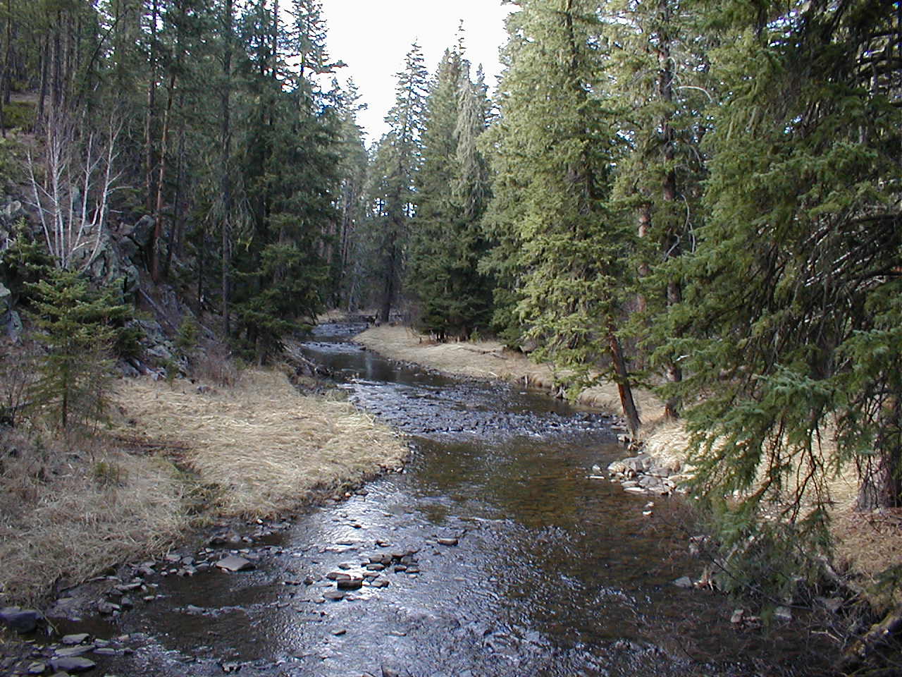
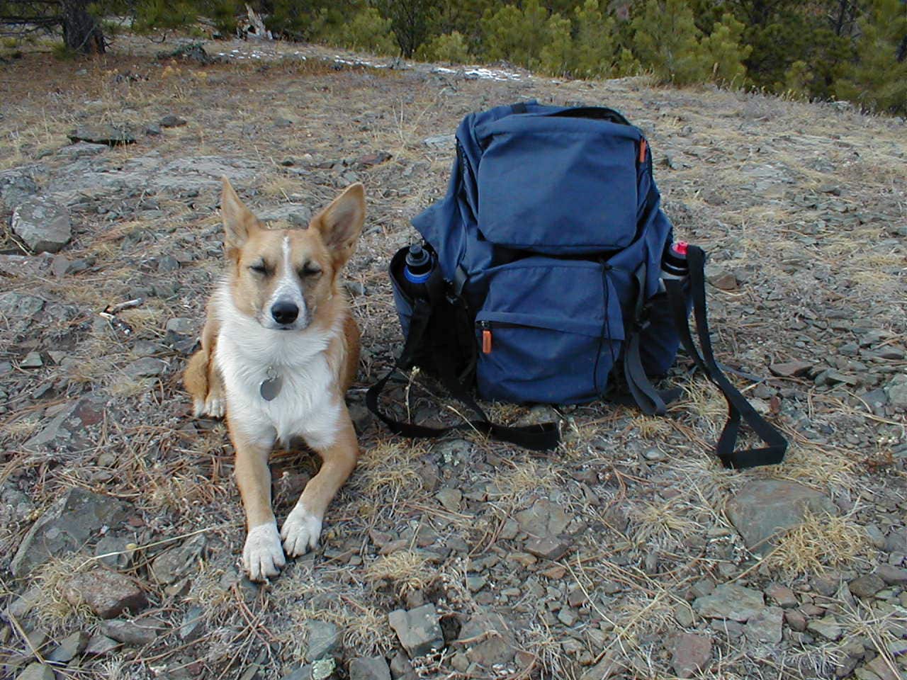
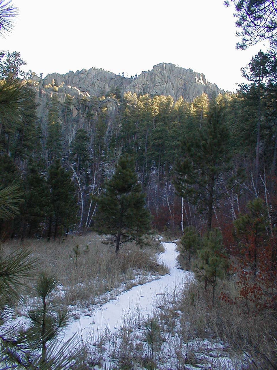
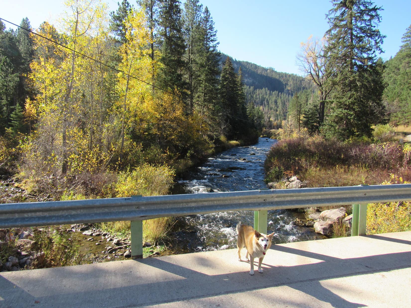
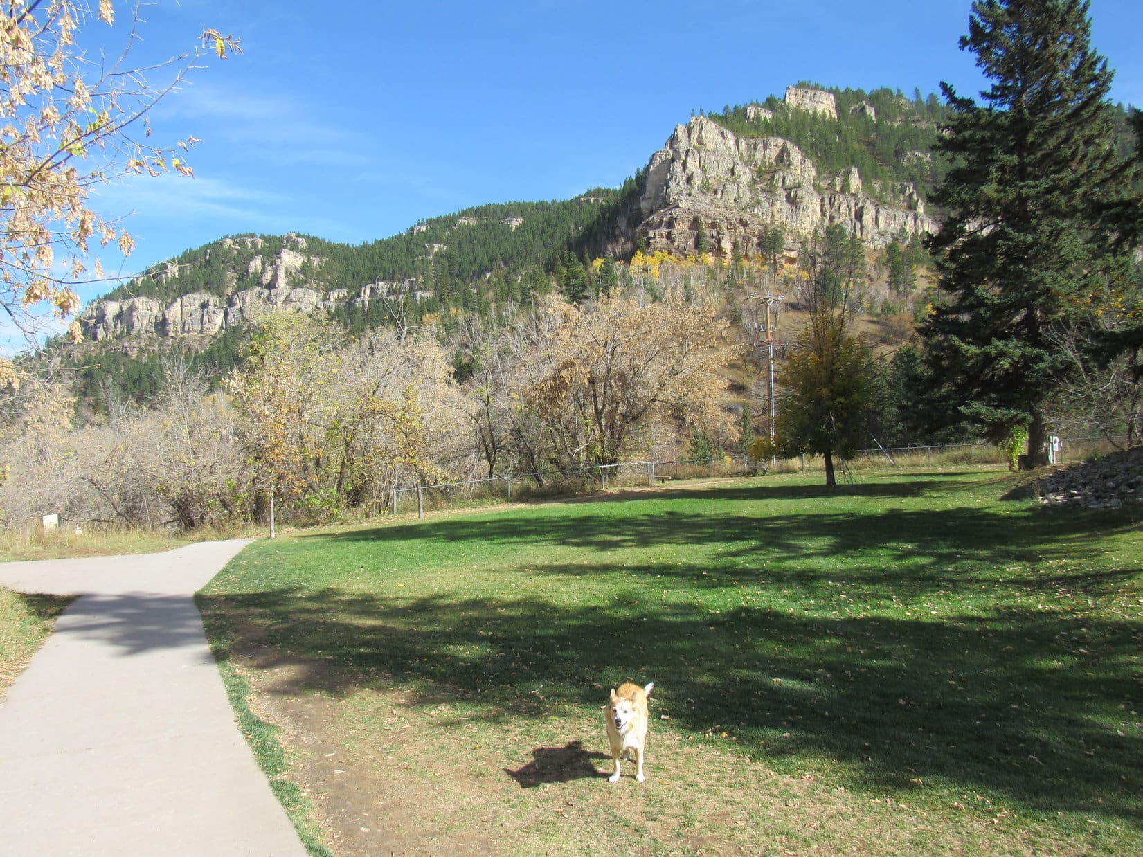
10:13 AM, 56ºF – A gorgeous morning, comfortably cool and clear as a bell!  Lupe paused on the Cleopatra Place bridge for a look at Spearfish Creek.  SPHP was surprised by how much water there was even after a summer of drought.  Squaw Creek, a tributary joining in immediately upstream of the bridge, was another matter.  Squaw Creek did look low.  Not a bad thing, since it would have to be rock-hopped a bunch of times on the way to the Devils Bathtub.

Spearfish Creek from the Cleopatra Place bridge. Squaw Creek visible at lower L.

The Carolina Dog had attempted to visit the Devils Bathtub a couple of times in recent years, but had never made it all the way there.  The first time, SPHP thought she had, and didn’t figure out until later that the Devils Bathtub actually must have been farther up Squaw Creek.  The second time, ice and snow had made the rock-hopping so treacherous that SPHP had given up on it.  Lupe wound up climbing Spearfish Peak (5,800 ft.) and Little Crow Peak (5,885 ft.) instead.

Third time a charm?  Hopefully!  Lupe continued on across the Cleopatra Place bridge.  The Devils Bathtub trail, which goes up the Squaw Creek canyon, started just off to the R.  The Carolina Dog quickly arrived at the first and only bridge over the little creek.

On the first (and last) bridge over Squaw Creek.

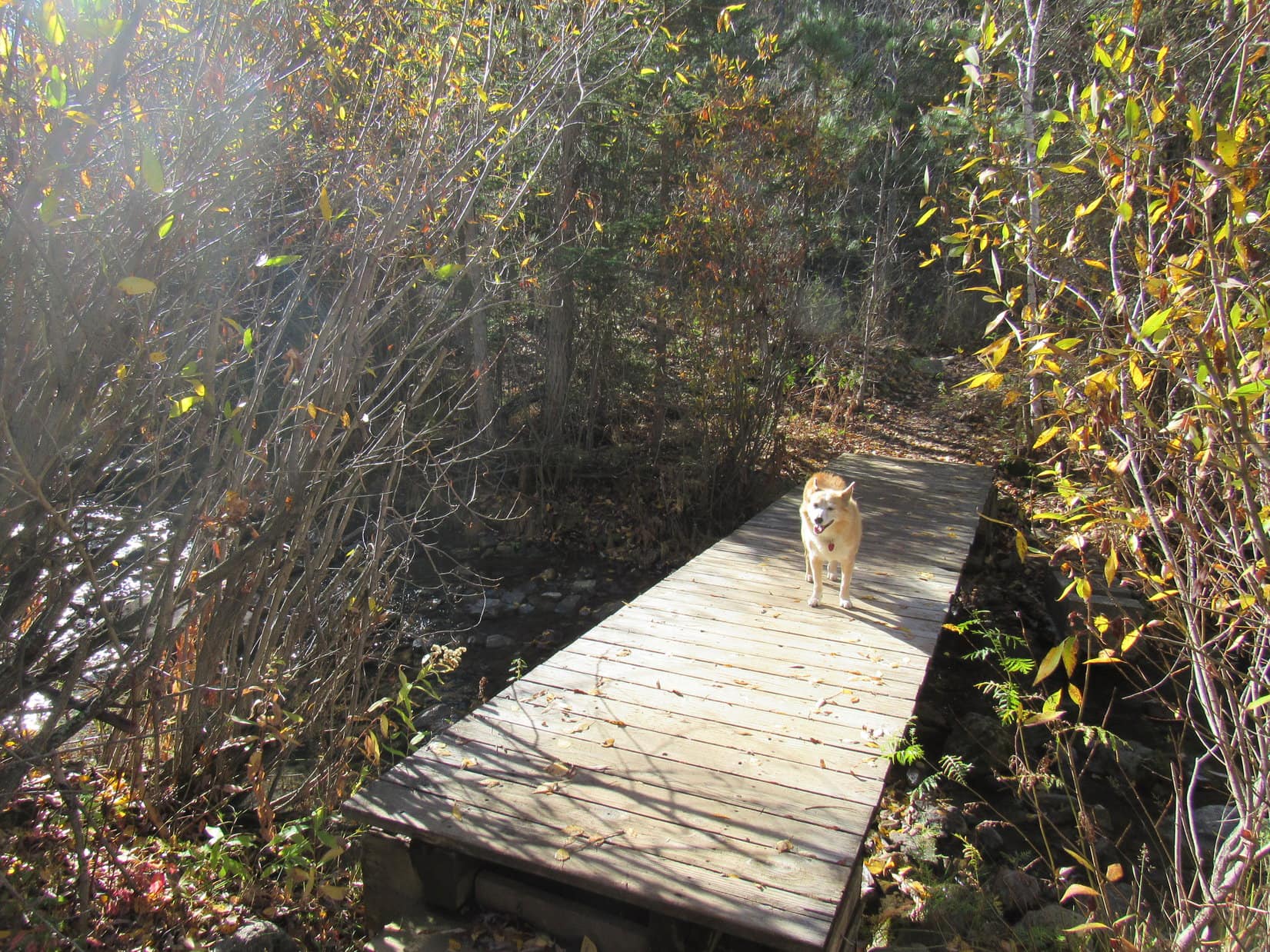
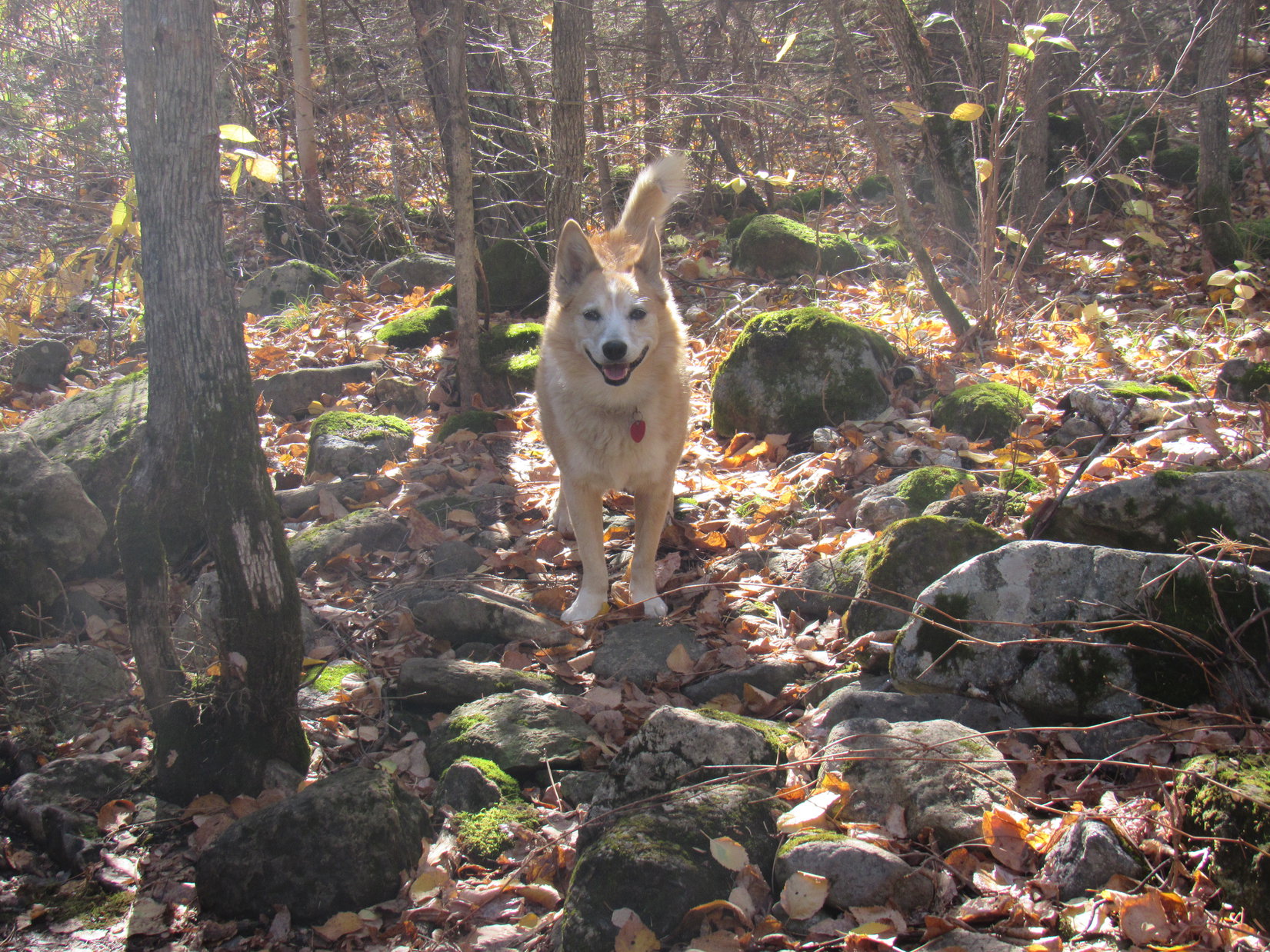
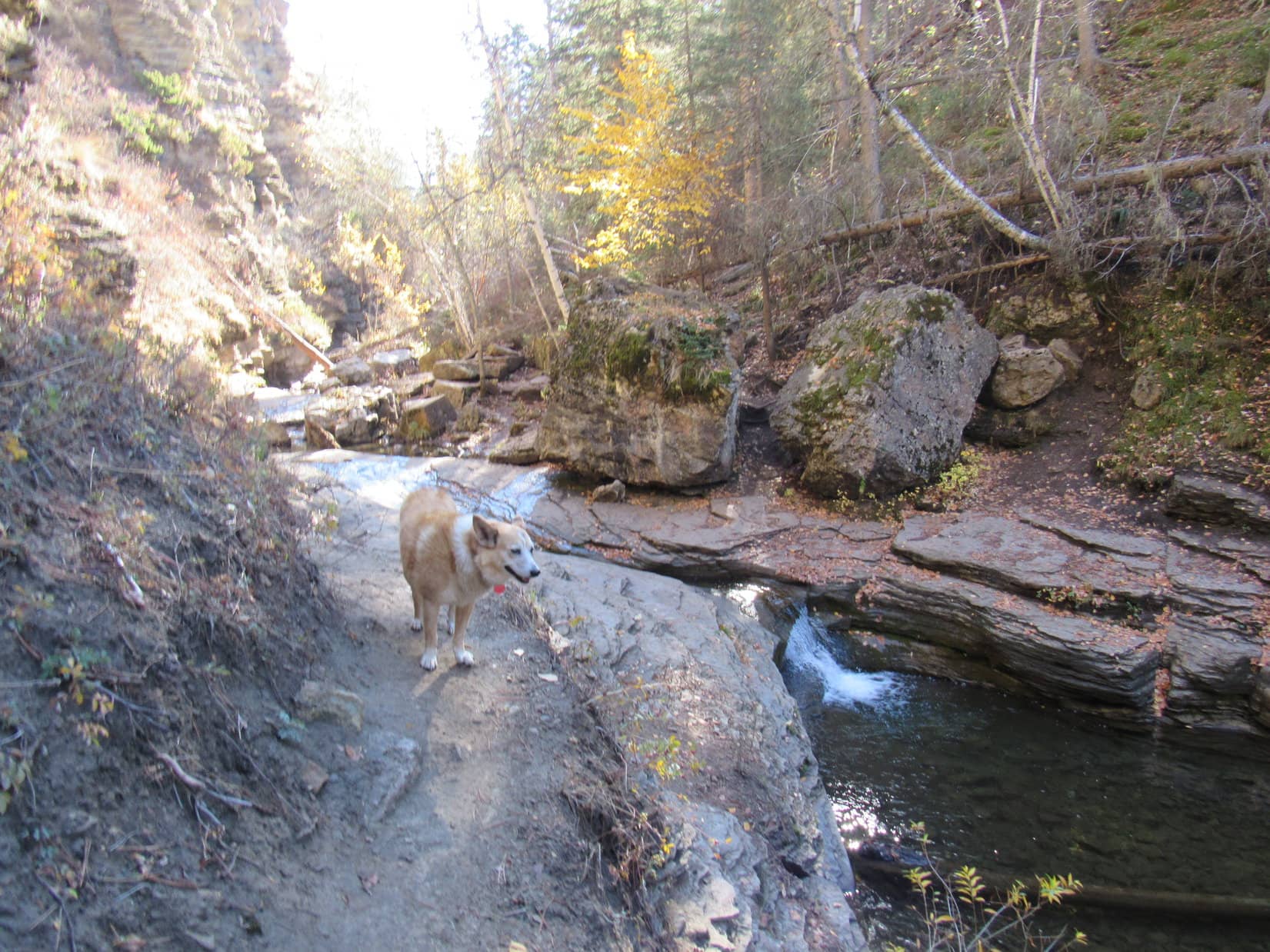
Although the Devils Bathtub trail would cross Squaw Creek numerous times, right after the bridge it stayed on the SW side of the creek for a while.  Even here near the start, the canyon Lupe was venturing into was fairly narrow and steep-sided.  The entire canyon was full of trees and bushes sporting fall colors.  Loop enjoyed prowling among dead leaves and mossy stones looking for squirrels.

Among the leaves and mossy stones.

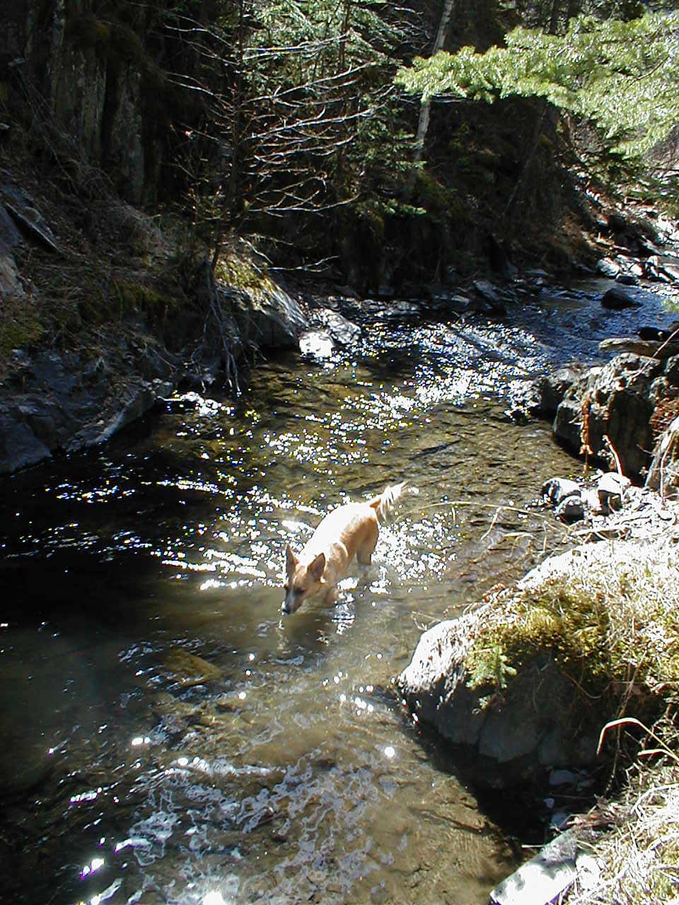
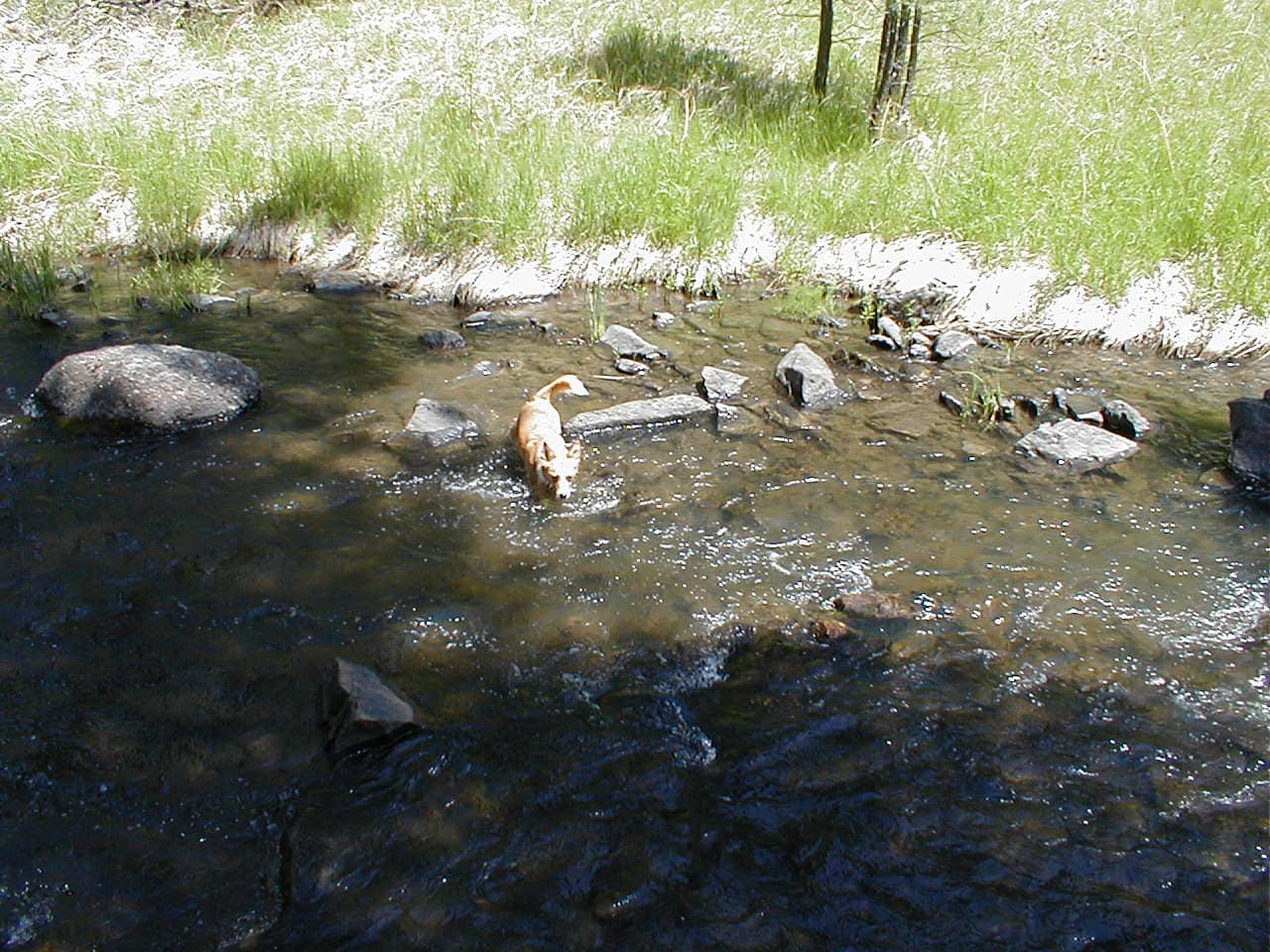
It didn’t take too long to get to the first stream ford, a crossing forced by a pinch point where Squaw Creek flowed right next to a wall of rock.  With the water so low this time of year, the ford was an easy rock-hop for SPHP.  Lupe didn’t bother rock-hopping, she just waded on through.

At the first ford.

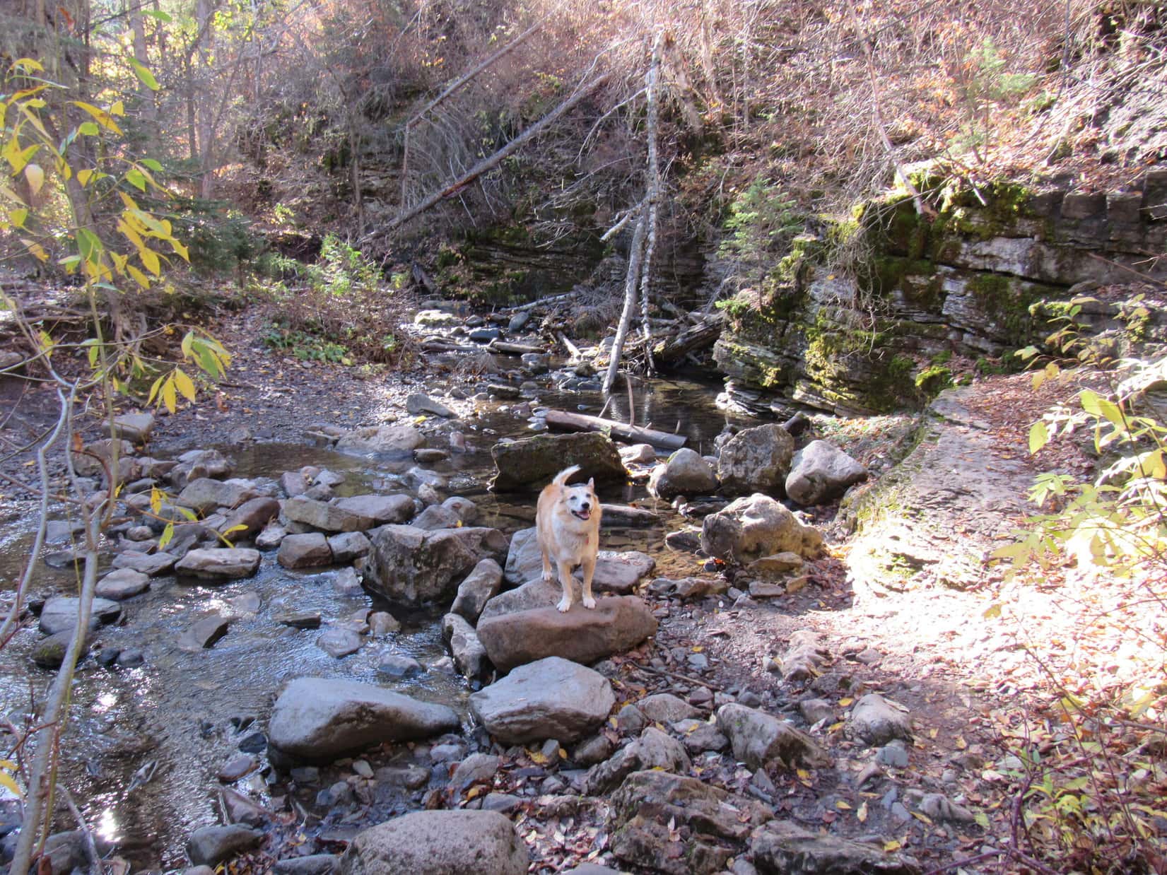
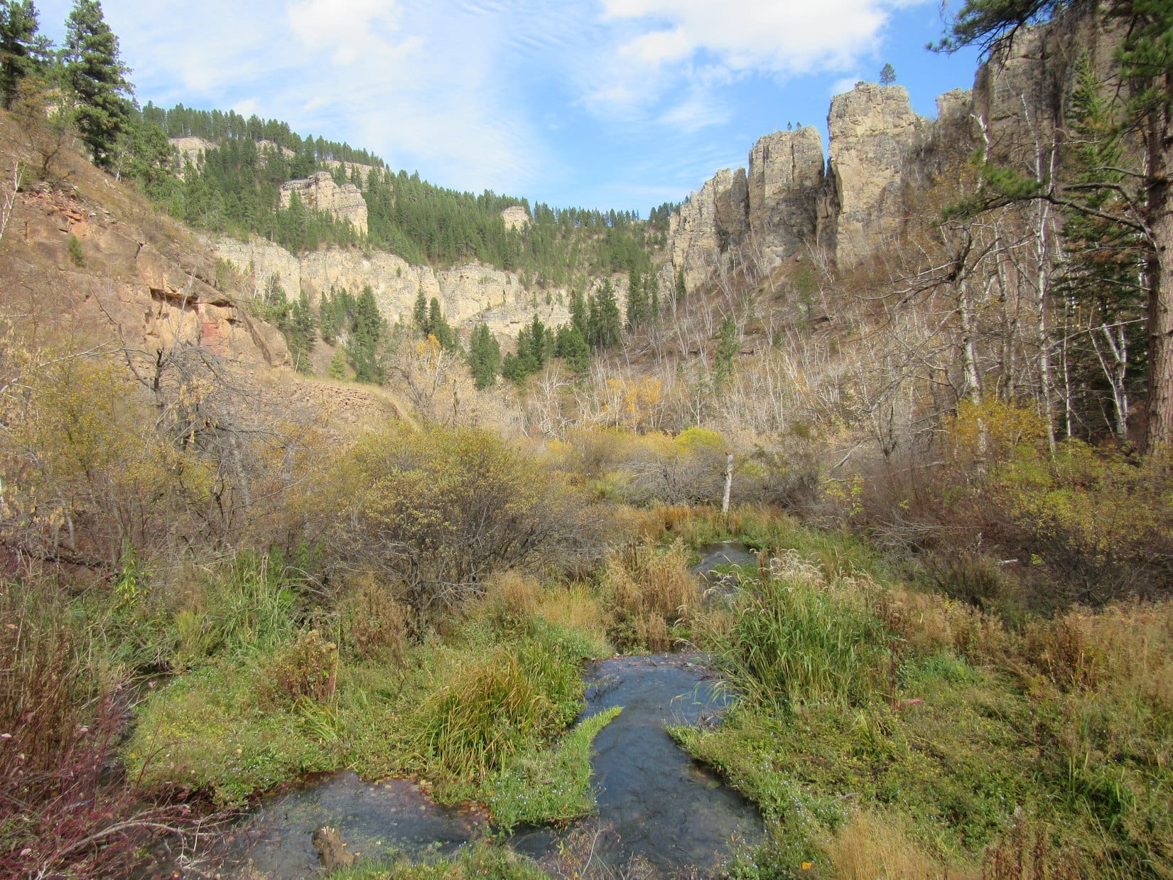
As Loop continued up the canyon, the cliffs forcing many of the stream crossings became taller and more impressive.  In some places the trail was braided, with viable paths on both sides of Squaw Creek.  None of the frequent fords presented any real difficulties.  Slick, damp stones were the biggest worry for SPHP.  Lupe didn’t worry at all.

The rock walls forcing the stream crossings kept getting taller.
Father upstream at another ford. One of many.

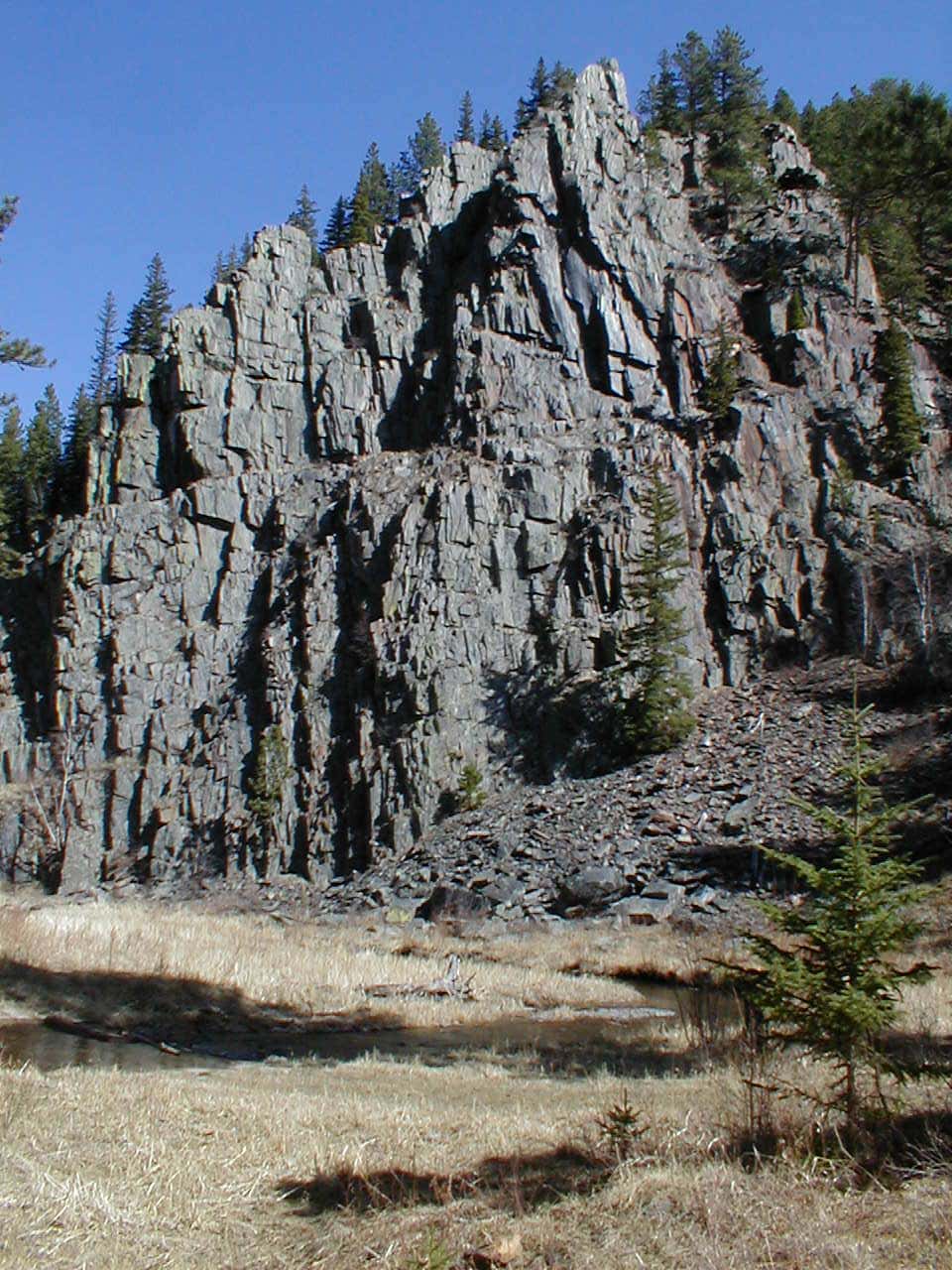
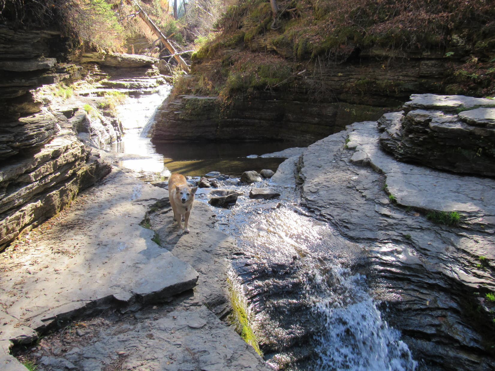
Less than a mile from the start, the canyon narrowed some more.  Lupe reached a spot where Squaw Creek flowed over bedrock at the base of a long cliff.  Hugging the cliff, the Devils Bathtub trail went over shelves of solid rock right next to the stream.

Approaching the start of the continuous rock wall on the NE side of Squaw Creek.
The Devils Bathtub trail goes over these shelves of bedrock along the base of the cliff.

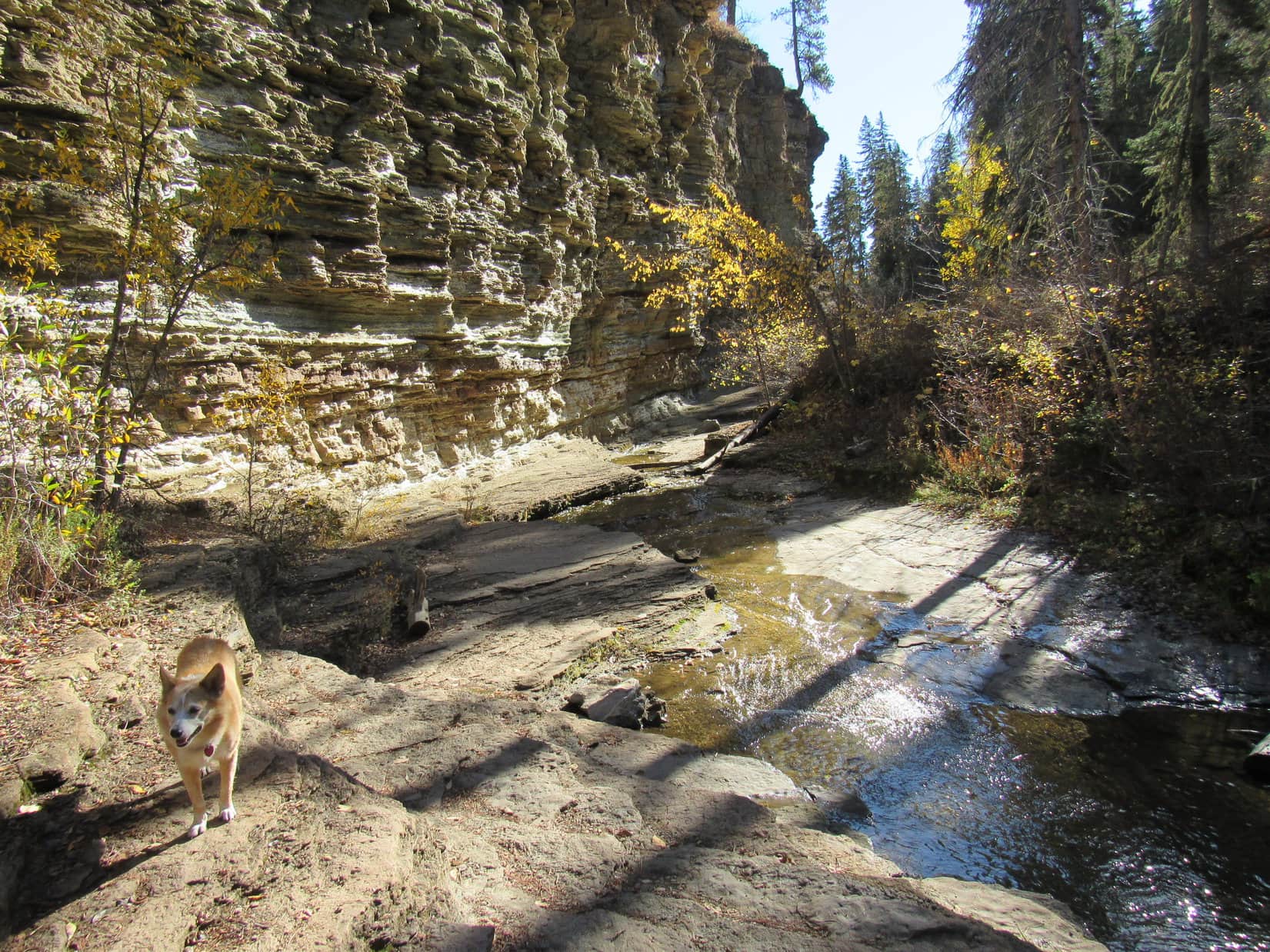
Lupe soon came to a series of waterfalls plunging into pools several feet deep.  Between these pools Squaw Creek raced through narrow chutes carved into the bedrock.  The overall effect was very beautiful.  In lots of places Lupe could leap over Squaw Creek in a single bound.  Even SPHP could just step across.

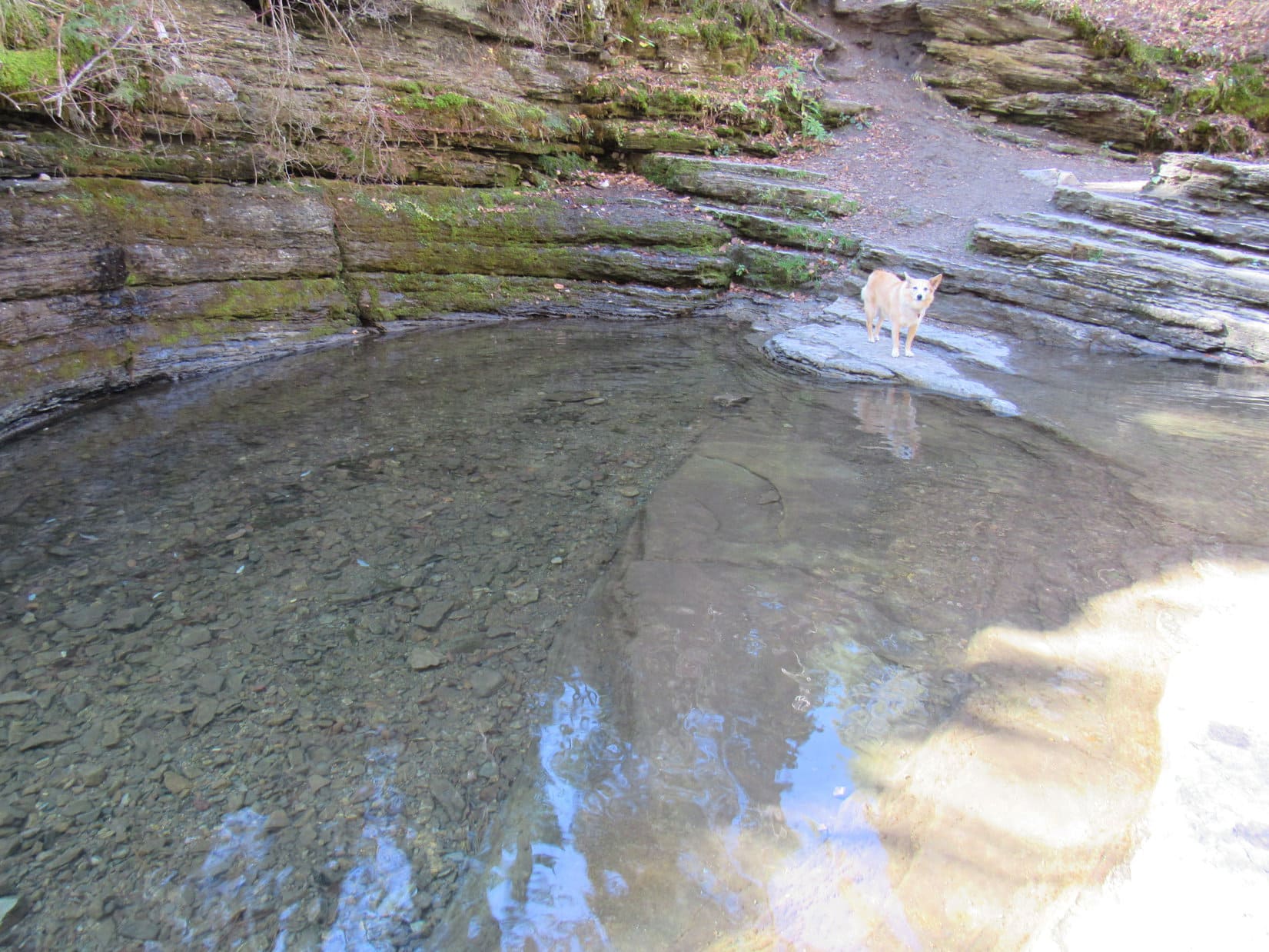
It didn’t take long to reach the large pool SPHP had mistakenly taken for the Devils Bathtub during Lupe’s first attempt to find it 2 years ago.

Continuing upstream along the cliffs.
On a midstream rock.
Looking downstream.
As far as Lupe had made it on her first attempt to find the Devils Bathtub back in 2019. She’d turned around here when SPHP mistook this pool for the real deal.

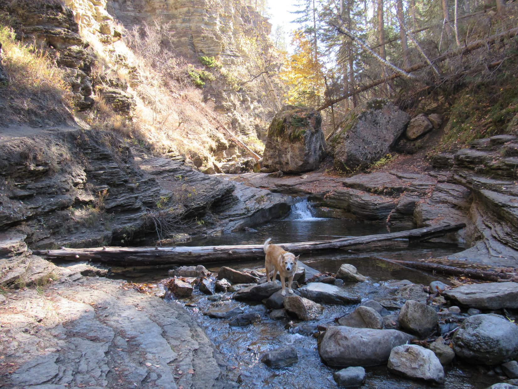
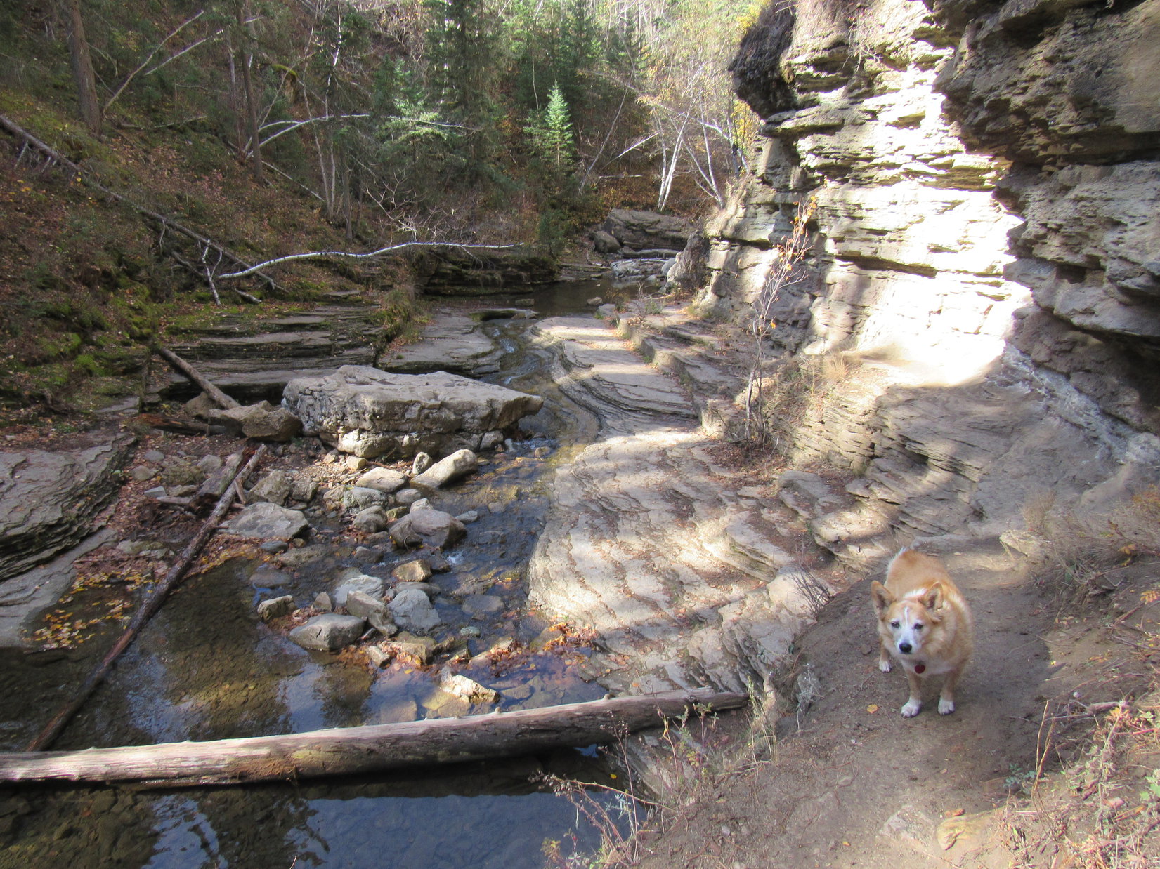
A little bit of scrambling around on the rocks had been required shortly before reaching this point.  Somewhat more challenging scrambling was required to go any further.  Nothing too daunting, but Lupe did have to traverse short stretches on narrow ledges 15 or 20 feet above the creek.

Up on a ledge above the Fake Devils Bathtub (L). Photo looks downstream.
Continuing past Fake Devils Bathtub (R).
Just past the Fake Devils Bathtub near the small waterfall that pours into it.

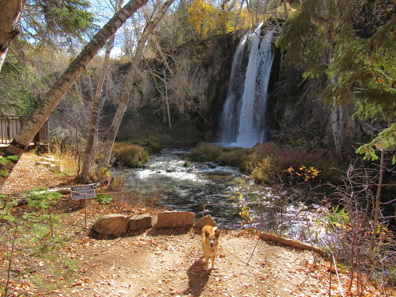
As it turned out, Lupe had almost made it to the real Devils Bathtub two years ago.  Only a few hundred feet upstream of the Fake Devils Bathtub, there it was!

On the ledges approaching the real Devils Bathtub, the upper pool seen here.

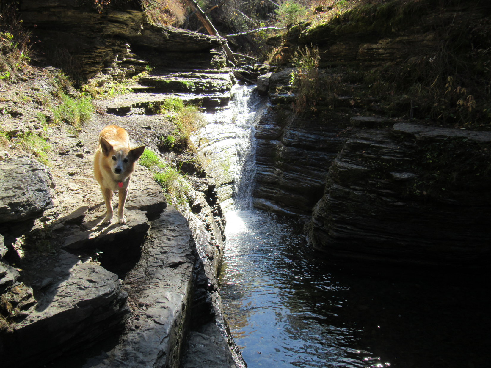
Trotting along narrow ledges with complete confidence, Lupe arrived in jig time.  SPHP, on the other paw, crept cautiously along the skinniest parts, but even that delayed arrival only momentarily.

At the Devils Bathtub. The official one!

Congratulations, Loopster, you made it!

So this is the Devils Bathtub, SPHP?  The real one?

Yes, the official one!  No doubt about it this time.

I’m not seeing any devils.  Can’t sniff them, either.  Are they invisible?

Hmm.  Well, I’m not sure, maybe so?  Or maybe it isn’t bath time?  I hear they like to play dirty tricks, so they probably don’t bathe very often.  Maybe just on Saturday nights?

Saturday night doesn’t make much sense to me, SPHP.  I doubt the devils dress up and go to church on Sunday morning!

Good point, Looper.  I really don’t know.  Anyway, this is a beautiful spot, isn’t it?  Let’s have a look around.

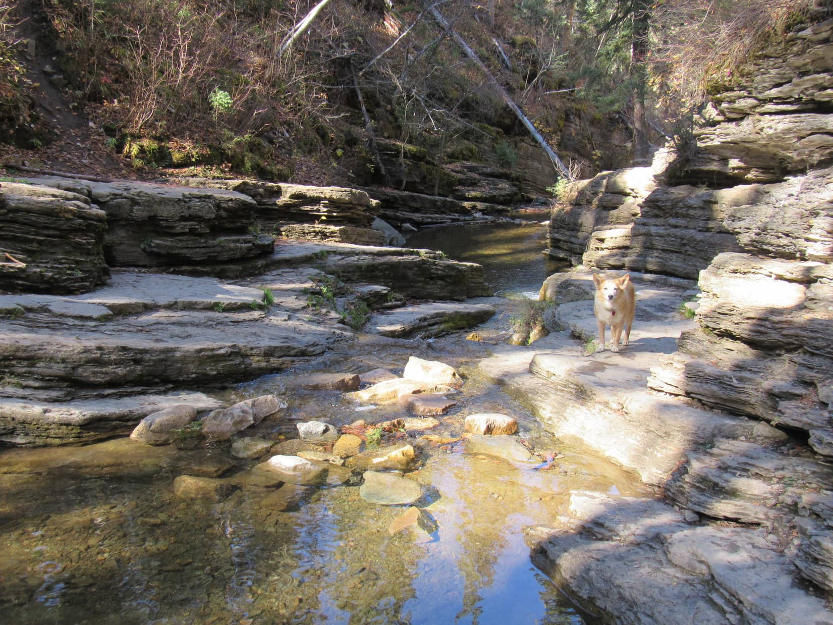
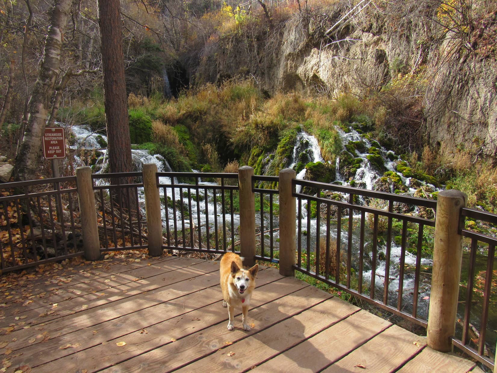
The Devils Bathtub wasn’t very big, so the “tour” didn’t take long at all.

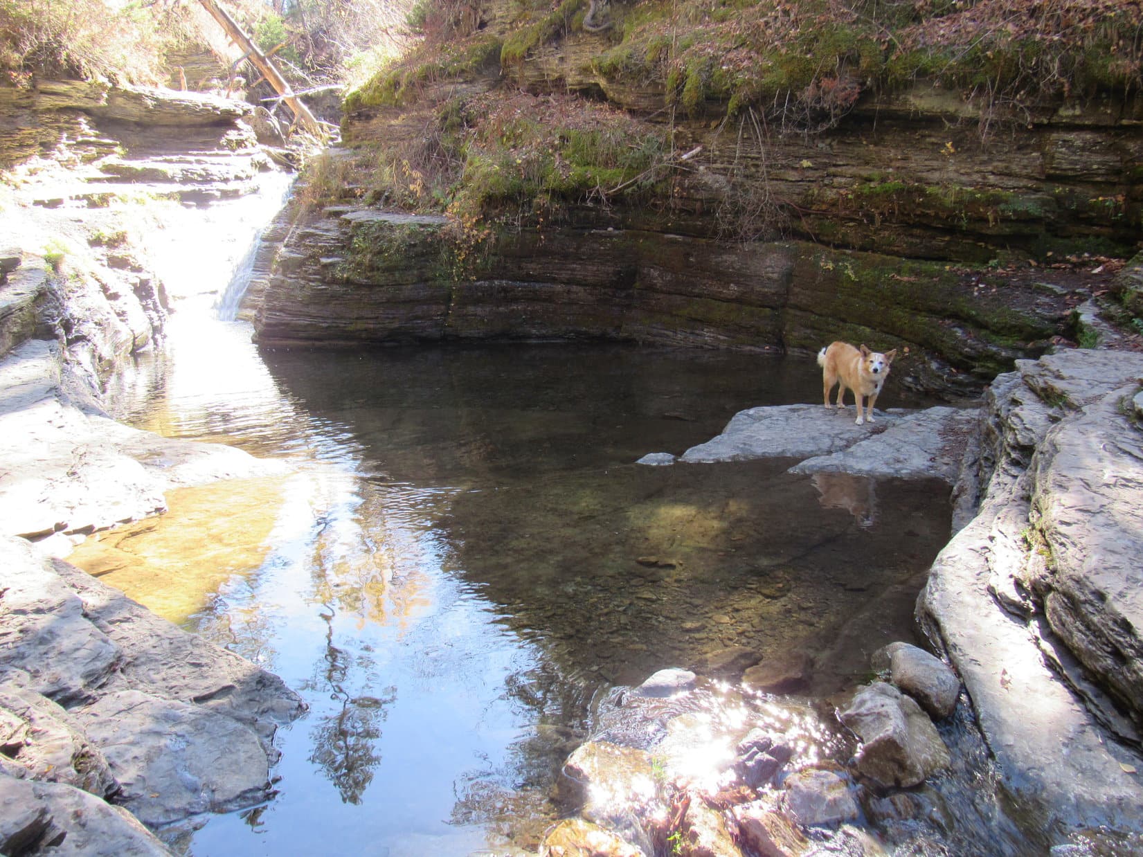
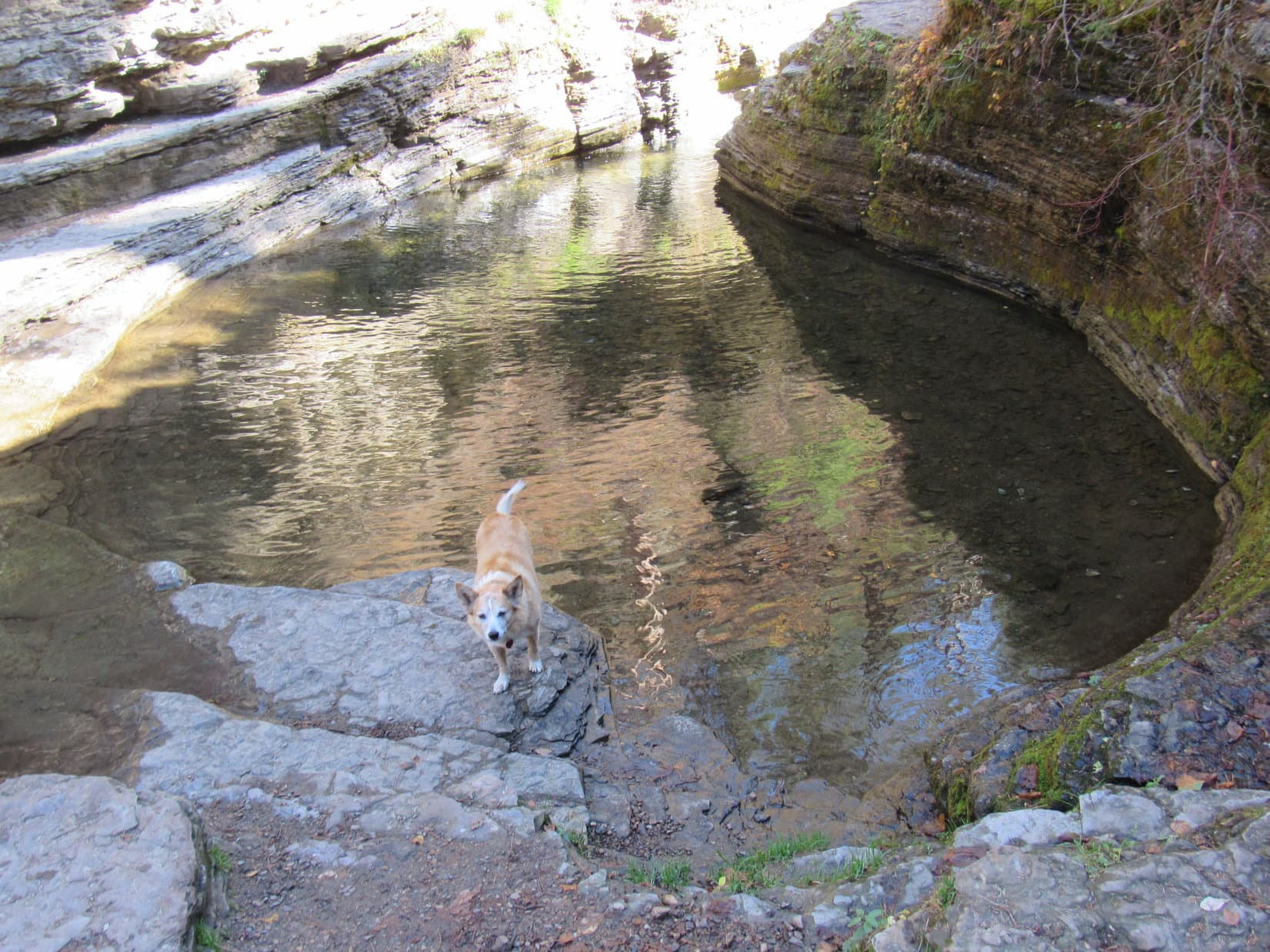
Except close to the waterfall that raced down a slippery chute shaped like a waterslide into the Devils Bathtub, most of the pool wasn’t all that deep, just a few feet.  That was plenty deep for a Carolina Dog, though.  Lupe was not inclined to take a bath.  She waded along the edge of the shallow downstream outlet getting her paws wet, but otherwise did not go in.  SPHP avoided the water completely.  July or August was really the time to be here.

The water was cold and clear.  SPHP looked for fish, but they seemed to be just as scarce as devils.

Not all that much to the Devils Bathtub, is there, SPHP?

No, but it’s a scenic spot at the end of a nice hike, and quite a popular place to cool off in the summer.

I suppose its more exciting when the dirty devils show up.  Want to go up by the waterfall, SPHP?

Sure!

To get to the waterfall meant scrambling up on another narrow ledge, but it was no big deal and gave a different perspective.

On the ledge leading to the waterfall that feeds the Devils Bathtub.
Looking down the waterslide chute.

Neither Lupe nor SPHP was inclined to test the waterslide concept.  Might not be as smooth and as slippery a ride as it looked, and it was October, after all.  Would have been an exceedingly brisk experience.

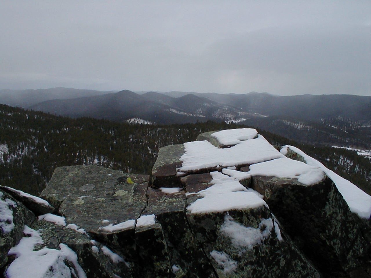
Are we going any farther up the canyon, SPHP?  Looks like we could!

No, think this is it, Loop.  I went up there once a long time ago, before you were even around.  Don’t really remember too much about it.  There was a big old mine high on a steep hillside, the Cleopatra Mine, if memory serves, but the structure was crumbling away and dangerous even back then.  From what I can remember, the Devils Bathtub is the last of these scenic larger pools along Squaw Creek.

If we aren’t going any farther then, SPHP, why don’t we relax right here for a while?  Maybe we’ll get to see a devil!

Fine with me, but do you actually want to see a devil?  They’re evil you know.  Might be pretty dangerous if one comes along.

Oh, don’t worry about that, SPHP!  I’ll bite any devils that try to give us a hard time.

That’s why I always travel with a Carolina Dog!  You’re the best, Loopster!

A chocolate coconut bar, the American Dingo’s portion instantly inhaled, was shared at a sunny spot overlooking the Devils Bathtub.  Sadly, not a single devil turned up for Lupe to do battle with before it was time to start back down the canyon.

At the outlet from the Devils Bathtub, ready to head back to the RAV4.

12:10 PM, 61ºF, Devils Bathtub trailhead along Hwy 14A, Spearfish Canyon –  The return trek was just as gorgeous as the journey to the Devils Bathtub had been, but seemed to go even faster.  It was barely even lunchtime when Lupe arrived back at the RAV4.

What now, SPHP?  We aren’t done for the day already are we?

Oh, no!  Want to visit Spearfish Falls and Roughlock Falls while we’re in the area?  The trailheads aren’t that far away, just a few miles up Spearfish Canyon at Savoy.

The American Dingo was fine with that.  SPHP was soon parking the RAV4 at the Latchstring Restaurant.  The restaurant grounds bordered Spearfish Falls, but to actually get a good look, it was necessary to take a short trail down to the bottom of Spearfish Canyon.

A huge bald eagle was sitting on a stump out in front of the restaurant.  Before hitting the trail, Lupe went over to take a look at it.

Checking out the bald eagle in front of the Latchstring Restaurant in Spearfish Canyon.

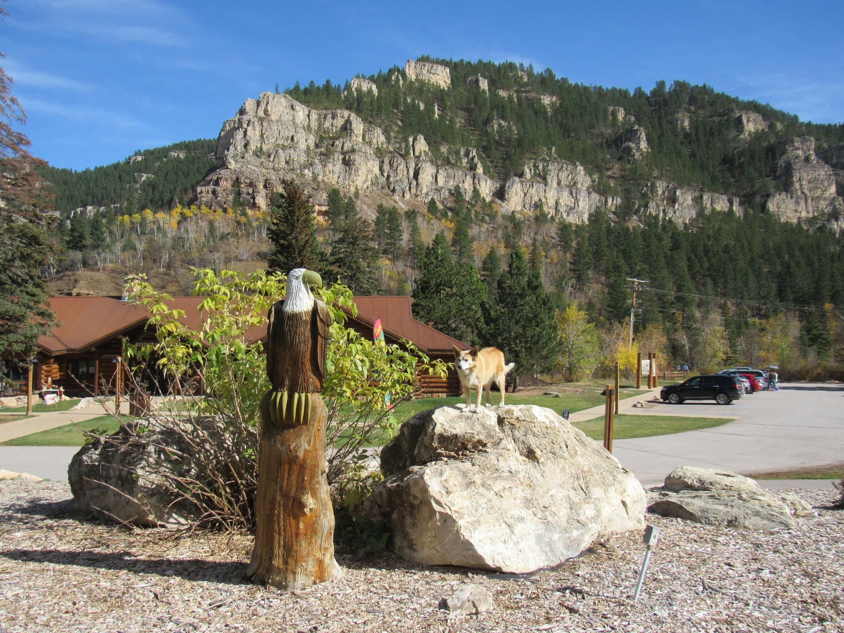
Although a handsome specimen, the eagle proved none too lively, sitting completely motionless on its stump.  The action-oriented Carolina Dog quickly lost interest.  Heading over to the Spearfish Falls trail, she started the short journey down to the canyon floor.

The Spearfish Falls trail leaves the Latchstring Restaurant grounds just ahead on the L.
Sign at the trailhead.
View from a bench along the descent to the canyon floor.

The sign posted at the trailhead claimed that the Spearfish Falls trail was moderate difficulty and 1.5 miles round trip.  Both were exaggerations.  The wide, well-beaten path was mighty easy for Lupe, and it hardly seemed possible that it could have been 0.75 mile one way to the falls.  Once down to the canyon floor, a short trek brought Lupe to a bridge over Spearfish Creek.  The falls were only a little farther.

Spearfish Falls.
Spearfish Falls is on Little Spearfish Creek, which joins Spearfish Creek at the base of the falls. Got that?

Spearfish Falls may well be the tallest and most impressive waterfall in the entire Black Hills region.  Certainly worth the minor effort required to go see it!  Even at SPHP’s relaxed pace, the round trip took just a half an hour.

Next up was Roughlock Falls, only a mile away on USFS Road No. 222, which took off from Hwy 14A over by the Latchstring Inn across from the restaurant.  The Carolina Dog still had plenty of time left in the day, though.  Instead of driving all the way, SPHP merely moved the RAV4 over to the Roughlock Falls trailhead just past the inn.

The Roughlock Falls trail was broad and smooth.  Most of it was flat, or nearly so.  Super easy!  It went up the scenic side canyon carved by Little Spearfish Creek.  The trail generally wasn’t all that close to the creek, but shortly after Lupe set out, there was an opportunity to head down to it.

Little Spearfish Creek was cold, clear, and several feet deep.  Below the surface, dark green plants swayed in a swift current.  Small trout darted from one hiding spot to the next.

By Little Spearfish Creek. Photo looks upstream.
Same spot, looking toward the limestone cliffs across the creek. Photo looks N.

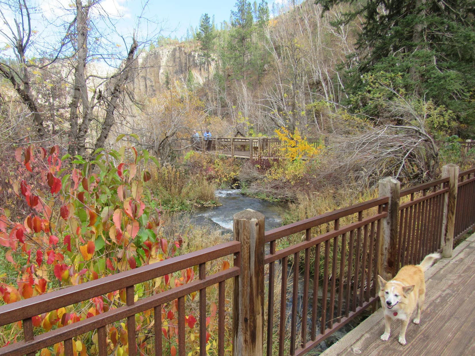
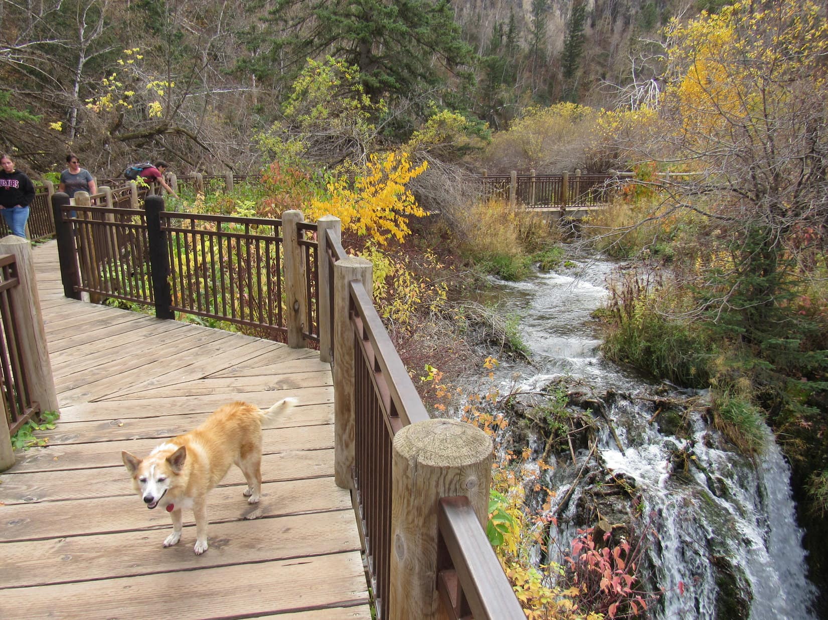
A mile went by fast.  Loop was soon standing on the boardwalk next to the cascades below Roughlock Falls.  From down here there was a great view of the cascades, but only a glimpse of the main waterfall could be seen at the far end of a narrow gorge.

On the lower boardwalk with a view of the cascades below Roughlock Falls.

For the best views of Roughlock Falls itself, Looper needed to get to the upper viewing platforms.  Crossing a nice bridge over Little Spearfish Creek, a short stroll along a sidewalk quickly brought her to the first of the upper viewpoints.

Looking downstream from the bridge over Little Spearfish Creek.
Roughlock Falls from the first upper viewpoint.

To get to the final viewpoint, Lupe crossed another bridge just upstream of the falls.  This viewpoint overlooked the brink of the falls.

Crossing Little Spearfish Creek again, this time just upstream of the falls.
Near the brink.

After enjoying Roughlock Falls from all these different vantage points, Loopster completed her tour by wandering through the picnic ground immediately upstream.

Little Spearfish Creek from the Roughlock Falls picnic area.

It was mid-afternoon when Lupe got back to the RAV4.  The sky had been clouding up on the way to Roughlock Falls, but it was getting sunnier again now.  The Carolina Dog had completed everything planned in the Spearfish Canyon area for today, so what now?  Tomorrow snow was in the forecast.  It would be a shame to just go home instead of enjoying what remained of this beautiful day.

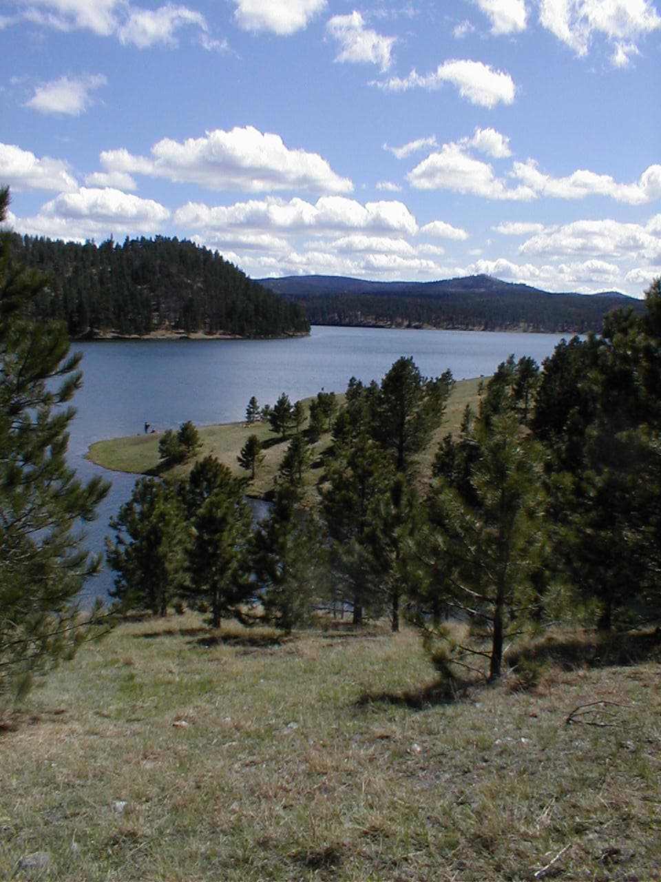
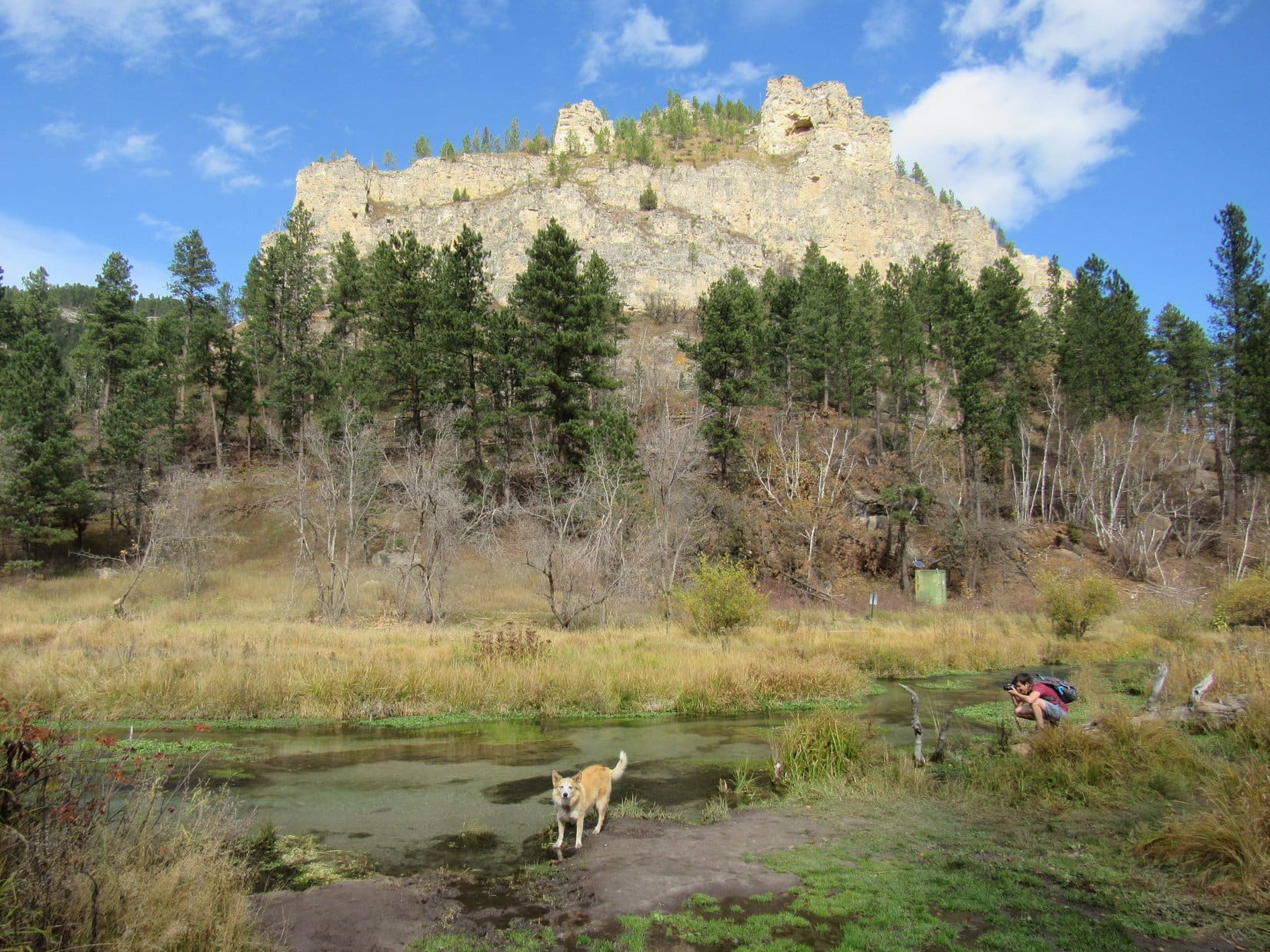
This Black Hills Expedition seemed to be all about water.  Since Lupe had never been to Roubaix Lake before, SPHP decided a relaxing drive through the central hills to go see it might be just the ticket.

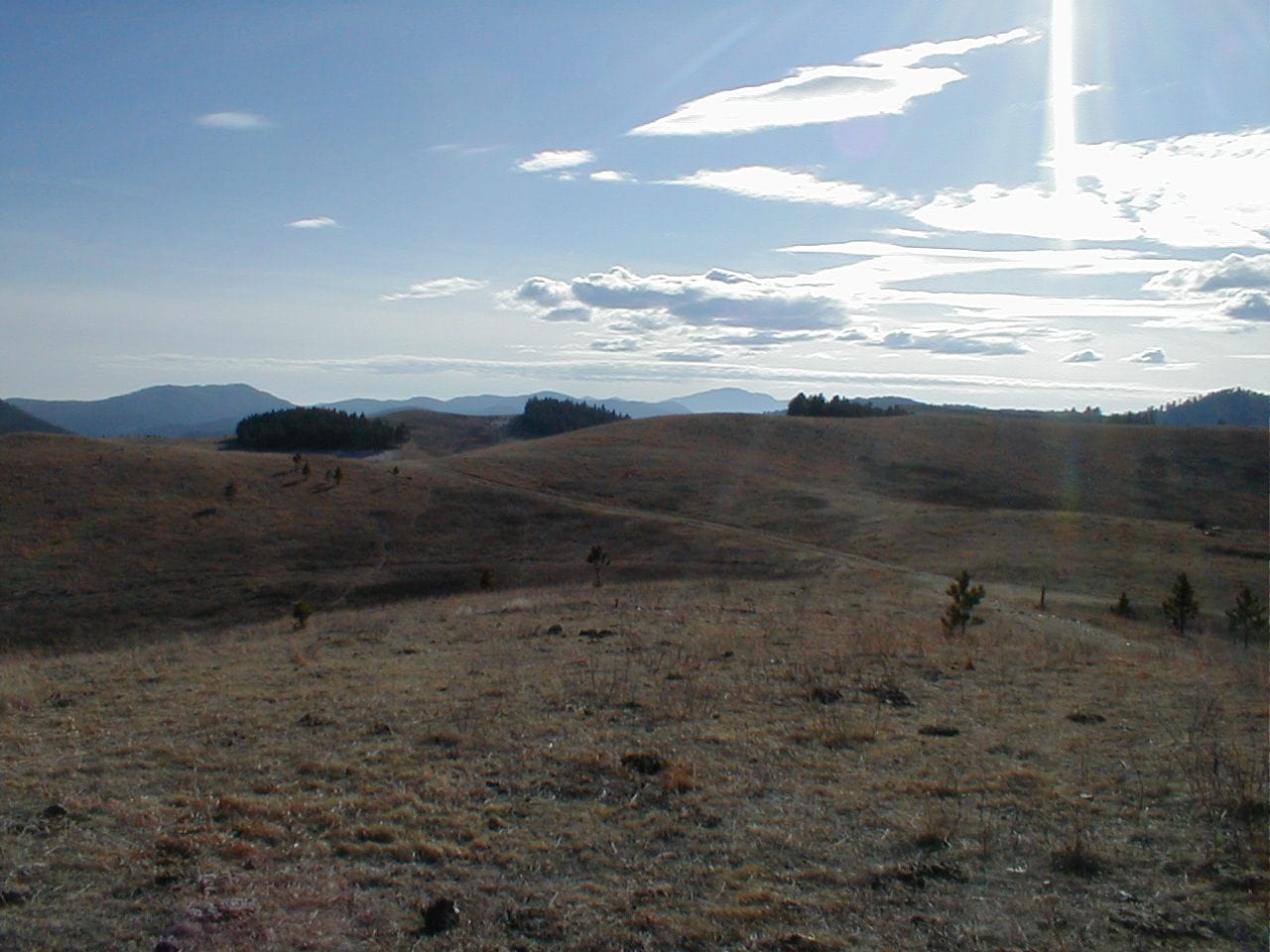
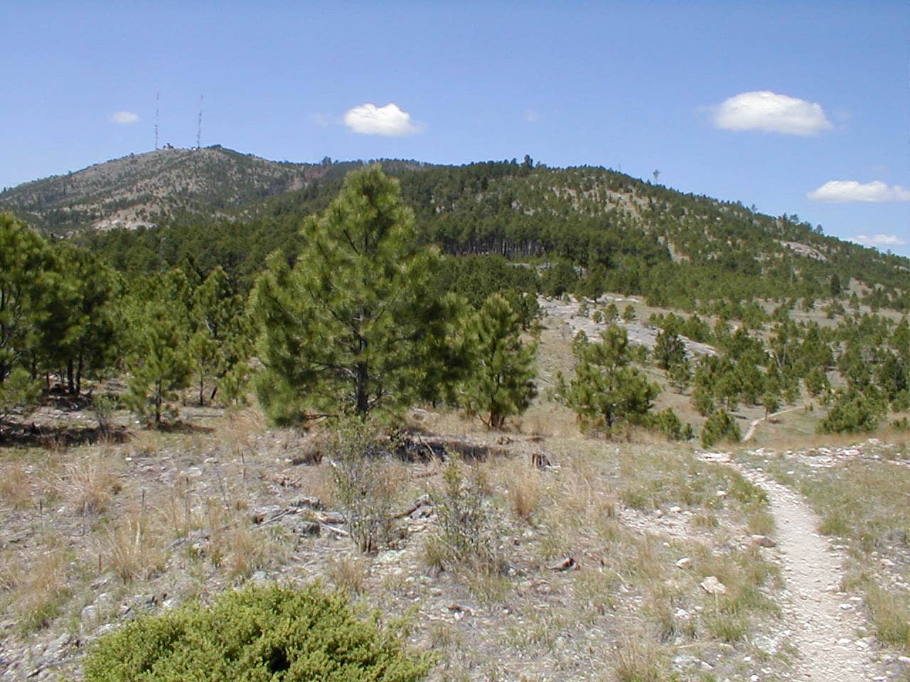
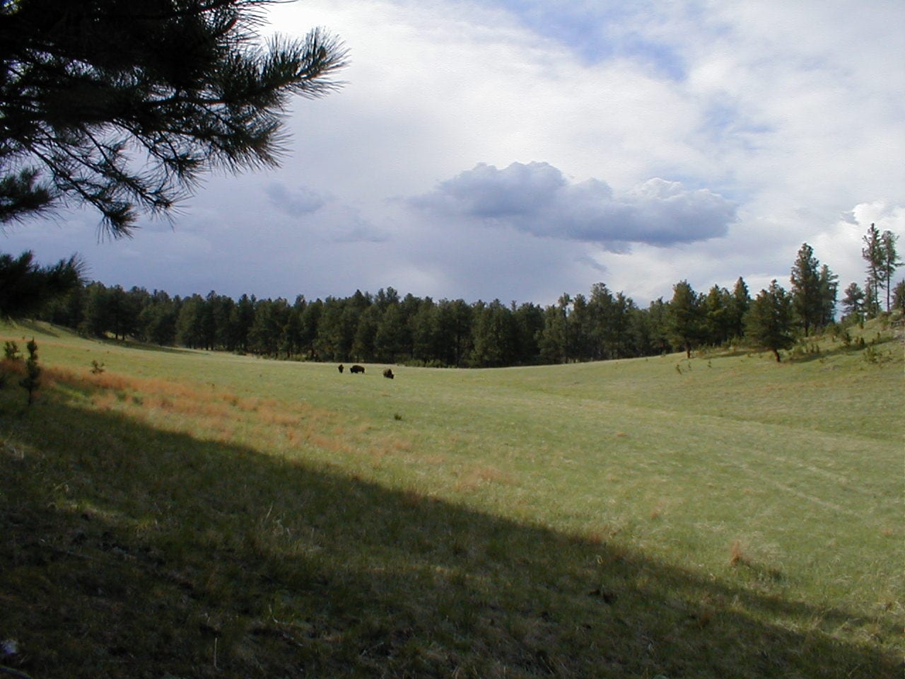
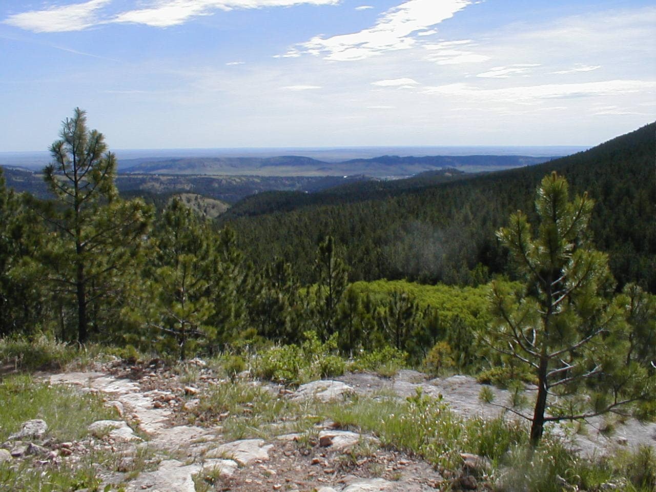
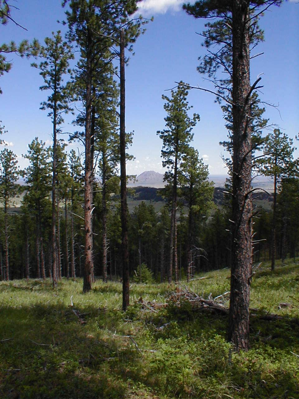
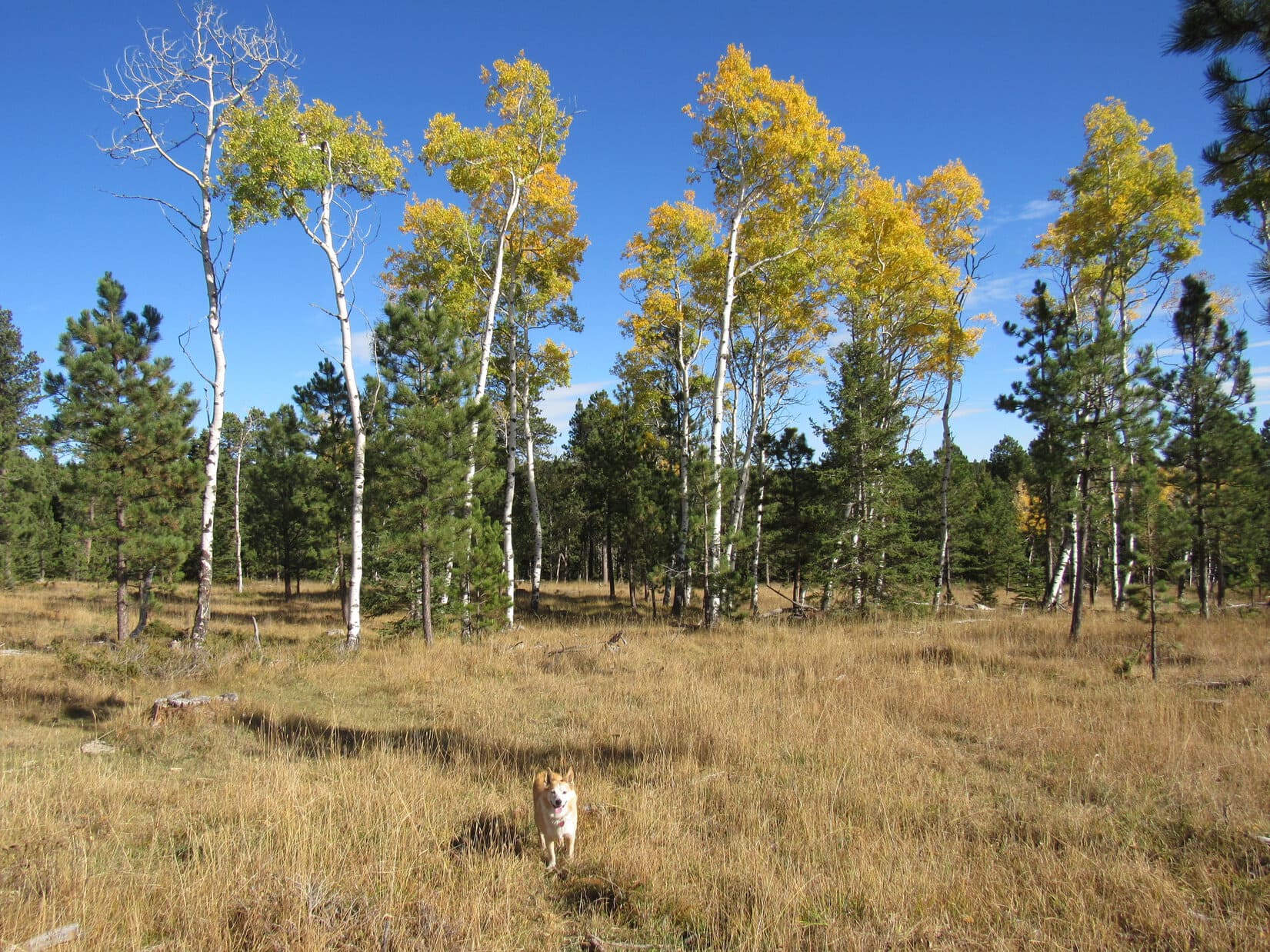
On the way, a stop was made up on Minnesota Ridge (6,240 ft.).  Lupe enjoyed a short romp looking for squirrels while SPHP had a look at the fall colors.

Enjoying a romp on Minnesota Ridge.
Fall colors.

Then it was on to Roubaix Lake!

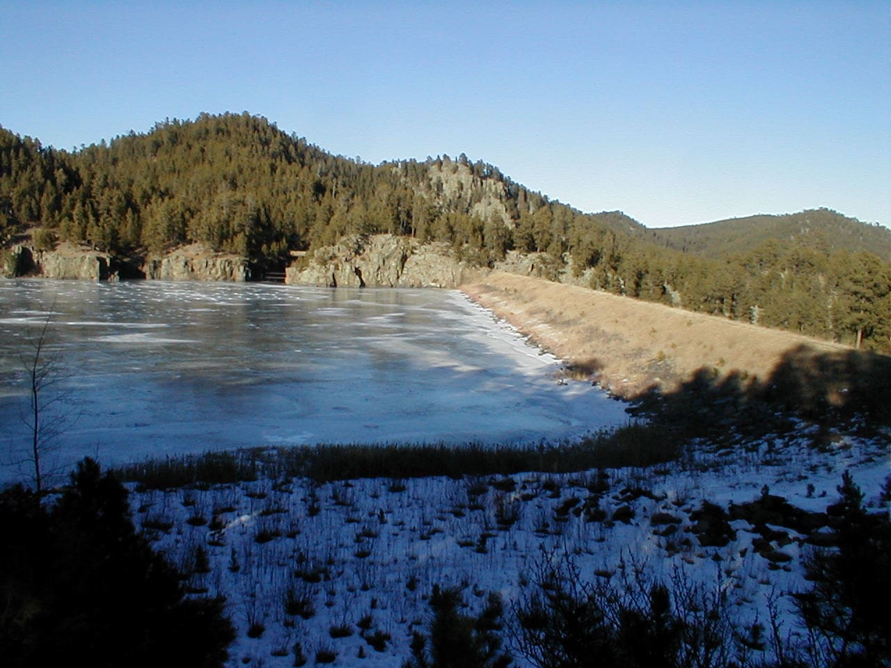
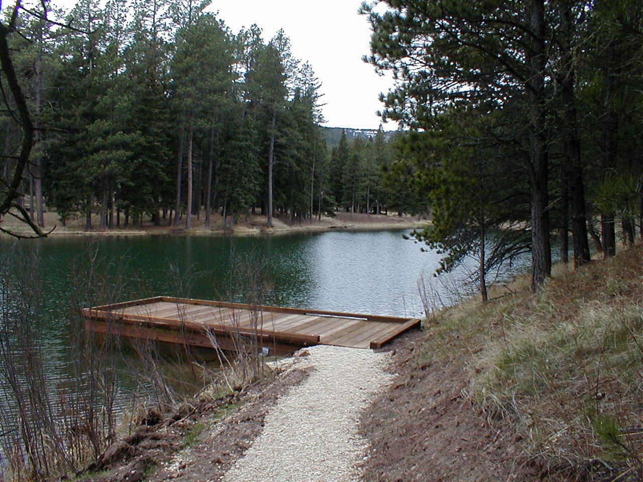
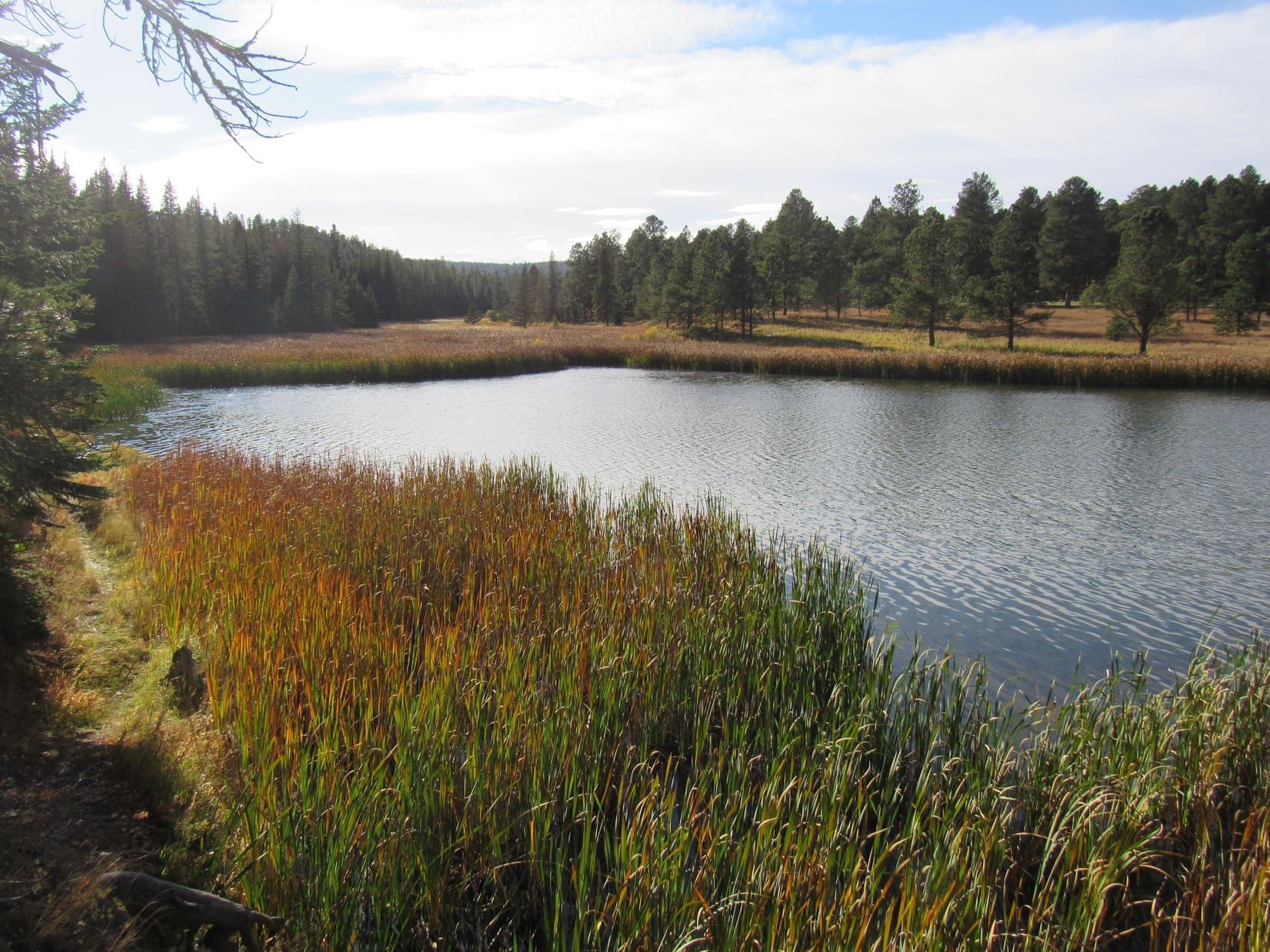
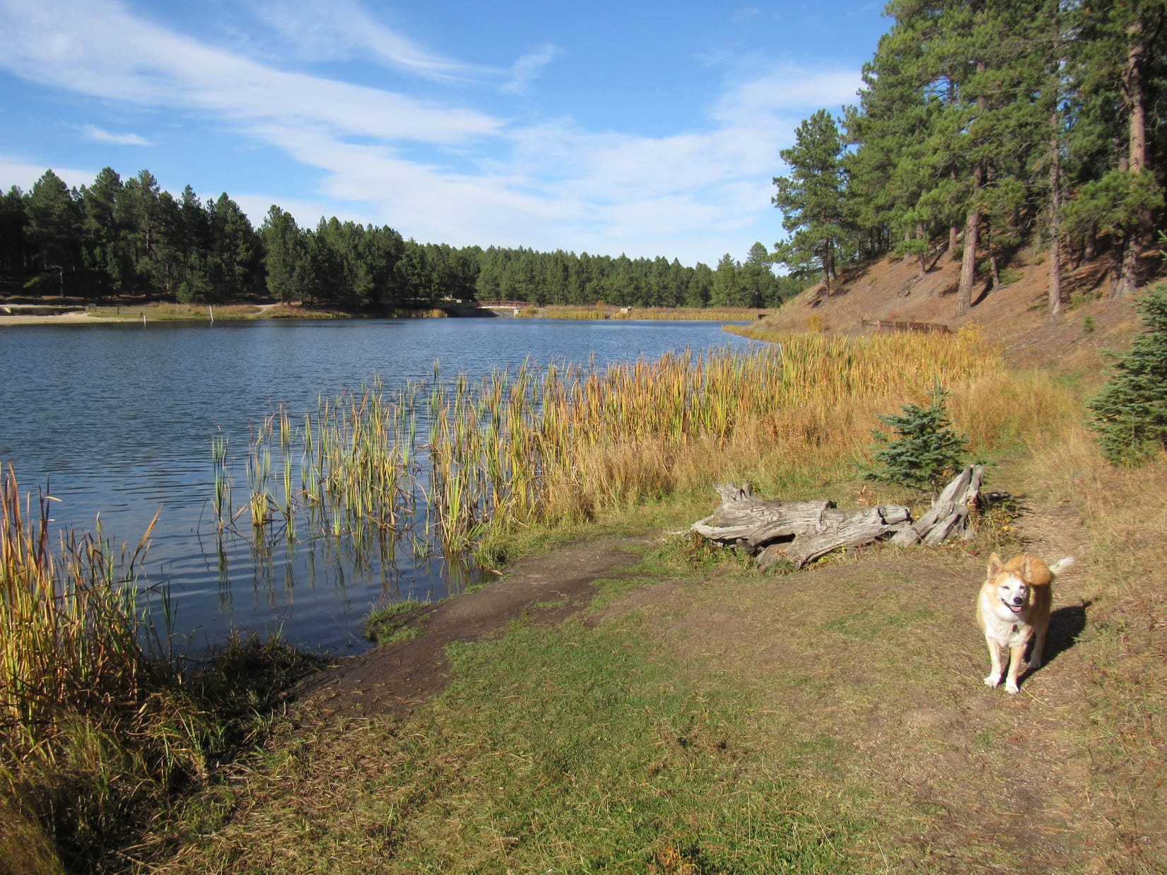
Roubaix Lake wasn’t very big, sort of a glorified pond, but it did feature a campground with a sandy beach, plus a trail that went about halfway around the lake.

Arriving at Roubaix Lake, which is just a mile off Hwy 385 in the central Black Hills.

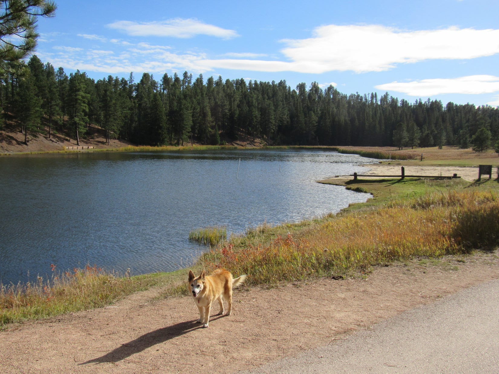
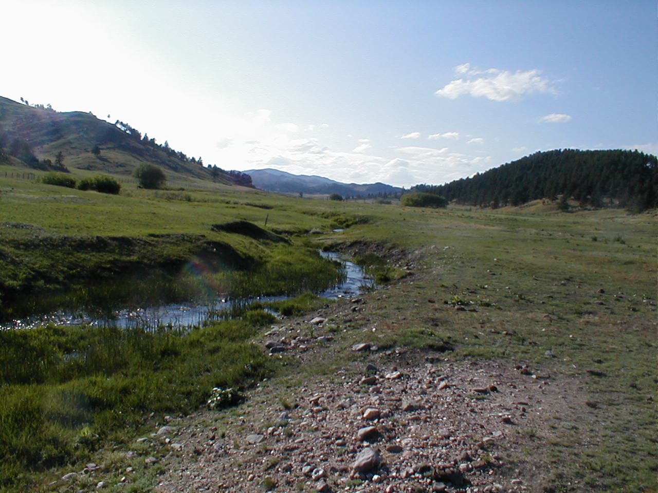
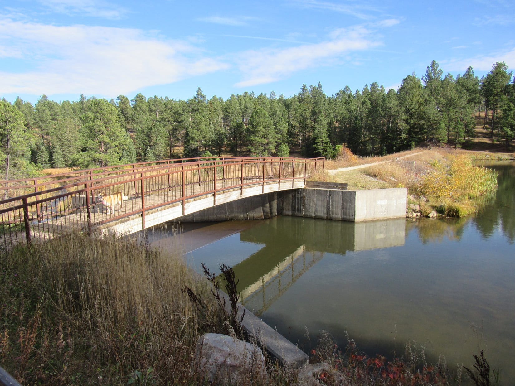
The trail started at a bridge over the outlet for Middle Box Elder Creek.  After crossing both the bridge and the dam, the trail headed SW right along the shoreline.

On the bridge over the outlet for Middle Box Elder Creek. Photo looks SE.
Along the SE shore after crossing the dam. Photo looks W.
Getting a drink not far from the dam. Photo looks N.

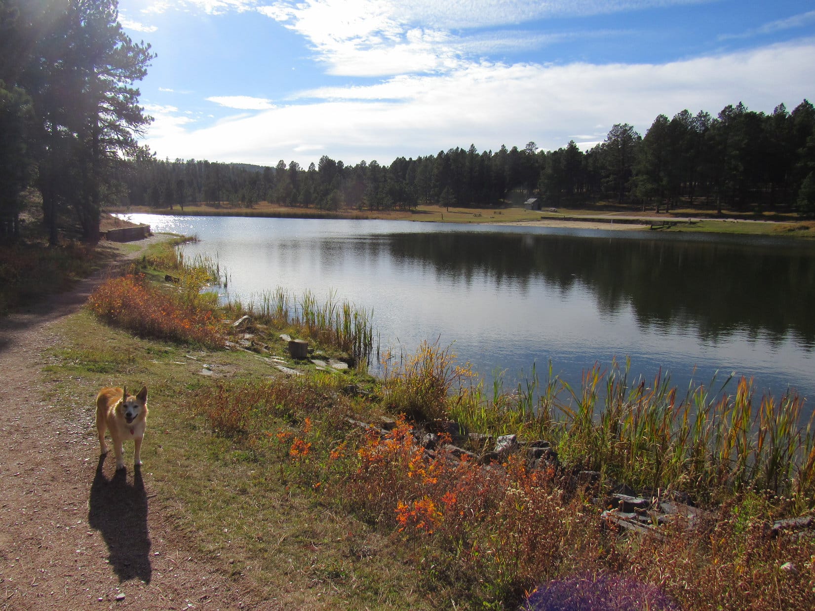
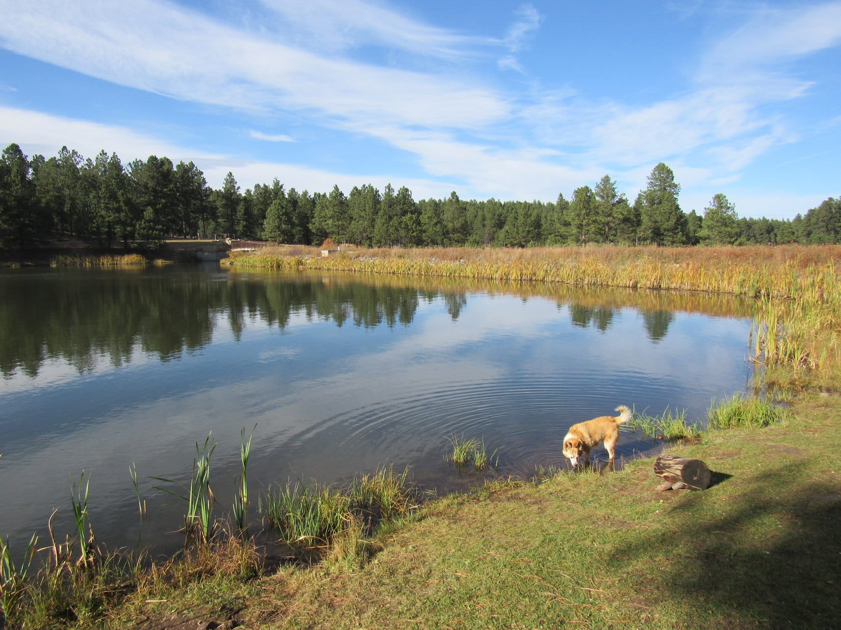
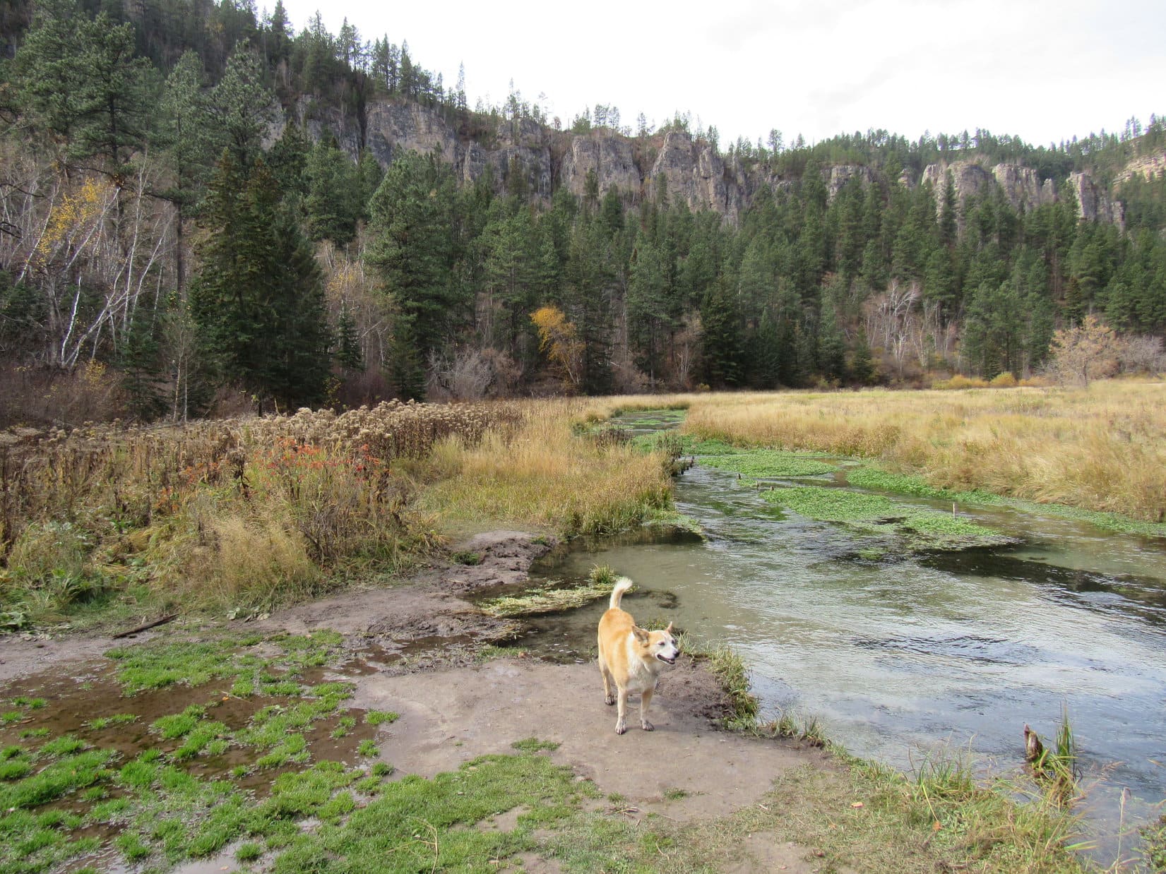
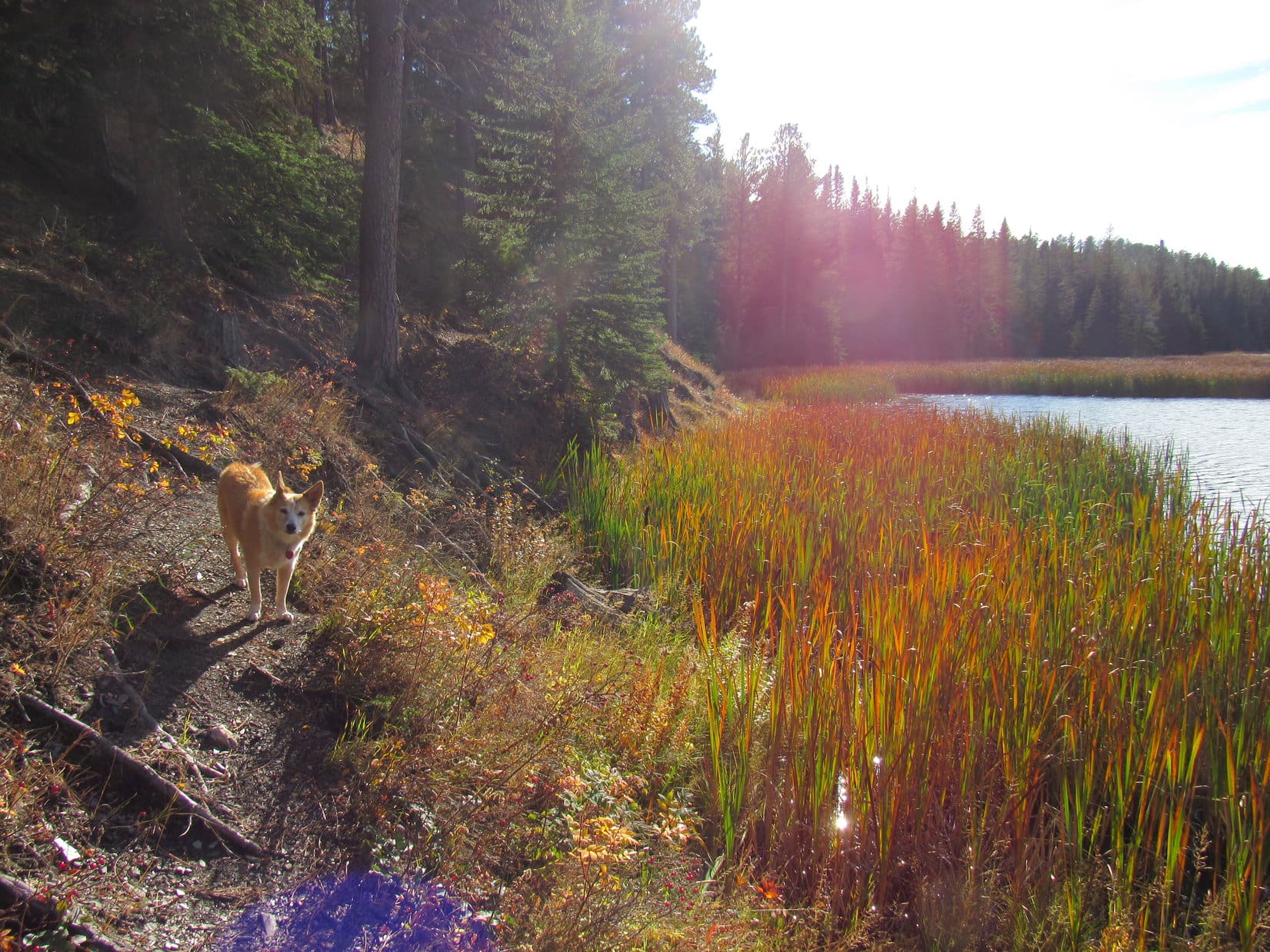
Middle Box Elder Creek enters Roubaix Lake over at the far SW end.  The trail began to fade away as Lupe drew near.  This part of the lake looked very shallow, full of mud and thick stands of tall reeds.  Late afternoon sunlight highlighted the reeds’ colors, making them glow.

By the colorful, glowing reeds. Photo looks SW.
SW end of Roubaix Lake. Photo looks W.

The trail went on, but appeared destined to disappear entirely.  Probably about time to call it a day by now, anyway.  A squirrel provided several minutes of excitement on the way back to the RAV4.

Black Hills, SD Expedition No. 279 had been a success!  Getting all the way to the Devils Bathtub for time ever had been the main objective, and Lupe had made it.  Third time had been a charm!  Really hadn’t been hard at all.  Spearfish Falls, Roughlock Falls, and Roubaix Lake were all just icing on the cake.

A lovely Black Hills autumn day, but tomorrow, a first taste of winter!

Roubaix Lake, Black Hills, SD 10-11-21

Links:

Next Black Hills Expedition                  Prior Black Hills Expedition

Black Hills, SD Expedition No. 251 – Bridal Veil Falls, the Devils Bathtub trail, Spearfish Falls & Roughlock Falls (10-17-19)

Want more Lupe adventures?  Check out Lupe’s Black Hills, SD & WY Expeditions Adventure Index, Master Adventure Index, or subscribe free to new Lupe adventures!

Black Hills, SD & WY Expeditions – The Early Years: 2012

Oh, it’s long ago!  So very long, long ago now since Lupe started her life of adventure!  It all began more or less by chance on January 15, 2012 when SPHP took the Carolina Dog to Silver City for a stroll along Rapid Creek on Deerfield Trail No. 40.  Lupe had never been roaming up in the Black Hills before.  The American Dingo was clearly so amazed by it all, so joyful and enthusiastic, that SPHP not only took her back to the very same spot a week later, but took notes on both adventures afterward.  The True Adventures of Lupe were born, and those first trips became Black Hills, SD Expeditions No. 1 & No. 2.

And Lupe went on from there, having a blast exploring the Black Hills whenever she could.  For more than 3 years, SPHP kept notes, writing about The True Adventures of Lupe, but all those notes were only files on a computer.  One thing led to another, however, and on February 22, 2015, The (Mostly) True Adventures of Lupe launched as a blog on the internet.

By that time, Lupe had already completed 120 Black Hills Expeditions!  She’d also been on 3 Dingo Vacations – the first one in 2012 to the West Coast, and the other two in 2013 and 2014, both to the Canadian Rockies.  So, The (Mostly) True Adventures of Lupe featured not only all of Lupe’s new adventures, but occasionally older ones, too.

Creating posts on old adventures was only possible, though, when both written records and photos existed.  SPHP’s detailed notes contained in The True Adventures of Lupe were available in every case, but a lack of sufficient photos to help bring the story to life was often an issue.

The Dingo Vacations weren’t much of a problem.  SPHP had naturally taken pictures to remember those exotic journeys far from home.  Lupe’s Black Hills Expeditions were another matter entirely.  SPHP had never dreamed of starting a blog for Lupe until late in 2014.  Consequently, no systematic attempt had been made to visually document her early Black Hills Expeditions.

SPHP didn’t even think to bring a camera until Expedition No. 3, and for several years failed to do so consistently.  The camera was often simply forgotten at home, or the battery turned out to be dead.  As a result, not a single photo exists in quite a few cases, only the written record.

Even when SPHP remembered to bring a camera, it was often sparingly used.  In some instances, only a pawful of pictures were taken during an entire expedition.  Many didn’t turn out that great, and sometimes they were all taken from the same 1 or 2 spots, rendering them insufficient to illustrate the overall experience.  Once in a while (gasp!) Lupe wasn’t even in any of them.

SPHP eventually got better.  Yet in the end, only 2 of 41 expeditions in 2012 had enough photos to support a post, and only 5 of 32 expeditions in 2013 did.  Fortunately, by 2014, the situation was much improved, with 26 of 37 expeditions supported.

In 2021, 6 years after The (Mostly) True Adventures of Lupe launched, SPHP finally completed the last posts possible dedicated to single, older Black Hills Expeditions.  All have now been published and added to Lupe’s Black Hills Expeditions Adventure Index.

Sadly, that still leaves many fabulous early Lupe adventures for which there will never be individual posts.  Perhaps an opportunity remains, though, to share bits and pieces of those glory days of long ago.

We’ll start with 2012, when young Lupe first wandered the beautiful Black Hills of South Dakota and Wyoming – those halcyon days when world was brand new, full of wonders and mysteries to explore!

Expedition No. 1 – Deerfield Trail No. 40: Silver City to Canyon City & past the confluence of Rapid Creek & Slate Creek (1-15-12)  No photos.  An easy winter trek, and the one that started it all!  Lupe was 13 months and a day old.

Expedition No. 2 – Deerfield Trail No. 40: Silver City to Canyon City & the confluence of Rapid Creek & Slate Creek (1-22-12)  No photos.

Expedition No. 3 – Lupe’s Search for Old Bald Peak (1-29-12)  Full post!

Expedition No. 4 – Centennial Trail No. 89: Samelius to Sheridan Lake (2-5-12)

Sheridan Lake Dam. Expedition No. 4’s objective.

In 2012, Lupe concentrated her efforts on exploring both the 111 mile long Centennial Trail No. 89 and Deerfield Trails No. 40 & 40L in their entirety.  On Expedition No. 4, she completed her first full segment of Centennial Trail No. 89, starting from the Samelius trailhead and going over Mount Warner (5,889 ft.) on the way to Sheridan Lake.

Expedition No. 5 – Centennial Trail No. 89: Sheridan Lake Road to Brush Creek (2-12-12)

Bald Hills on the way back from Brush Creek.

An easy romp with forested stretches at the start and end, and decent views from the open terrain of the Bald Hills in between.  Much of this route was along old USFS or logging roads.  In the Bald Hills, the trail went right by the Twin Sisters (5,244 ft.).  Lupe left the trail briefly to climb the highest one.

Expedition No. 6 – Centennial Trail No. 89: Brush Creek to Rapid Creek (2-19-12)

With a new friend.

On Expedition No. 6, Lupe found a friend near Centennial Trail No. 89’s Tamarack trailhead.  He joined Lupe on her way to Rapid Creek and the Pactola Lake dam and back.  Lupe wasn’t entirely pleased when SPHP gave her new friend a share of her Taste of the Wild.

Expedition No. 7 – Centennial Trail No. 89: Sheridan Lake Road to Sheridan Lake dam (2-25-12)  No photos.

Expedition No. 8 – Centennial Trail No. 89: Rapid Creek to Silver City Road (2-26-12)

Pactola Lake.

Starting from Centennial Trail No. 89’s Rapid Creek trailhead just below the Pactola Lake dam, Lupe reached Silver City Road.  Shortly before she got there, she passed the Centennial Trail’s junction with Deerfield Trail No. 40 for the first time.

The photo is a look at Pactola Lake taken on the way to the Rapid Creek trailhead.  Although the lake could be seen from a couple of places along the trail, such a large expanse was never in sight.

Expedition No. 9 – Centennial Trail No. 89: Samelius to Big Pine & Horsethief Lake (3-4-12)

A late return on Expedition No. 9.

An easy section of Centennial Trail No. 89.  So easy, that once Lupe got to the Big Pine trailhead, she continued on to nearby Horsethief Lake and another 0.75 mile up Horsethief Trail No. 14 to where it intersects the Centennial Trail again in the Black Elk Wilderness.  This extension of the outing resulted in a late return.

Perhaps the most memorable part of the experience for Lupe was the long spooky tunnel under Hwy 16 that the Centennial Trail went through not far from the Samelius trailhead.  The American Dingo was terrified of it!  SPHP had to carry her through both ways.

Expedition No. 10 – Black Elk Wilderness (3-11-12)

Miss Big Pink Tongue early in the day, Expedition No. 10, 3-11-12

Miss Big Pink Tongue made a giant loop in the Black Elk Wilderness taking Trail No. 14 from Horsethief Lake to Centennial Trail No. 89 all the way to the Iron Creek Horse Camp.  From there she explored all of Norbeck Trail No. 3 getting to within 100 feet of the summit of Harney Peak (7,242 ft.) before retreating due to deep snow and approaching darkness.

During the return, Lupe took Grizzly Creek Trail No. 7, and finished her exploration of Trail No. 14.  It was 10:30 PM by the time Lupe reached Horsethief Lake again after more than 12 hours.  The Carolina Dog’s most exhausting Black Hills Expedition so far!

Expedition No. 11 – Deerfield Trail No. 40: Deer Creek to Silver City (3-16-12)

By a marshy area along Rapid Creek near Silver City.

Up a big forested hill, then SPHP missed a turn, taking Lupe way down a jeep trail on the other side.  Mistake realized, Lupe returned to look for the actual trail, which turned out to be a lovely single track that wound even farther down to a valley.  An easy trek across a field and through some woods led to a view of Rapid Creek and meadows near Silver City.

Seeing a few ducks in a marsh near Rapid Creek, Lupe dashed in after them.  The ducks flew off, and the Carolina Dog emerged with a smile on her face, her lower half a stinking, filthy mess.

Expedition No. 12 – Centennial Trail No. 89: Deer Creek to Pilot Knob (3-18-12)

Cooling off in Jim Creek.

One of the shortest and easiest segments of Centennial Trail No. 89.  Other than deer and squirrels, the big highlight was a dip in Jim Creek near the Pilot Knob trailhead.

Expedition No. 13 – Centennial Trail No. 89: Iron Creek Horse Camp to Mount Coolidge (3-22-12)

Fire lookout tower on Mount Coolidge.

A long, confusing day!  SPHP lost Centennial Trail No. 89 several times.  Lupe ended up taking a side trek to climb Mount Coolidge (6,023 ft.), and did get to the top.  During the return, the American Dingo somehow wound up visiting Legion Lake and mistakenly exploring the Legion Lake Trail.  Fortunately, it all worked out in the end.

Expedition No. 14 – Deerfield Trail No. 40: Silver City to Daugherty Gulch (4-1-12)

Slate Creek, Expedition No. 14, 4-1-12

Most beautiful segment of Deerfield Trail No. 40!  One significant ford.

An impressive rock wall overlooking Slate Creek.
Tunnel near the Daugherty Gulch trailhead.

Expedition No. 15 – Centennial Trail No. 89: Pilot Knob to Box Elder Creek (4-8-12)

Box Elder Creek near the Centennial Trail No. 89 trailhead.

Box Elder Creek was a lovely destination, and Lupe was in her usual fine form!

Expedition No. 15, 4-8-12

Expedition No. 16 – Centennial Trail No. 89: Box Elder Creek to Dalton Lake (4-16-12)

Dalton Lake.
Looking good on Expedition No. 16!

A mucky day due to melting snow.

Expedition No. 17 – Deerfield Trail No. 40: Daugherty Gulch to Deerfield Lake (4-22-12)

Bandaged Lupe after her first injury, sustained during Expedition No. 17.

Adventuring isn’t all fun and games.  An element of danger exists, too!  Of all the places Lupe has been during her many adventures, the most dangerous by far has been right here close to home in the Black Hills.  Her first serious injury was a gash on her R front leg sustained during Expedition No. 17.  SPHP never saw what happened, but believes Lupe got slashed by hidden barbed wire while wading in Slate Creek near Deerfield Reservoir.

With no way for SPHP to bandage her, Lupe ran and explored with a bleeding open wound for 7 miles all the way back to the Daugherty Gulch trailhead, stopping frequently to lick her poor, painful leg.  She never whined or whimpered.  First thing the next morning, SPHP took her to a vet for stitches.

Lupe has been injured severely enough to require stitches several times in the Black Hills.  The culprit has always been downed barbed wire or deadfall timber with sharp broken branches.

Expedition No. 17 brought a painful conclusion to the American Dingo’s explorations of the entire 23 mile long Deerfield Trail No. 40.

Expedition No. 18 – Deerfield Reservoir Loop Trail No. 40L (5-6-12)

Deerfield Lake.

With her wounded leg healed up, and stitches out the previous day, Lupe returned to the Deerfield Lake area on Expedition No. 18 to explore the 11 mile Deerfield Lake Loop Trail No. 40L, which circumnavigates the reservoir.  By doing so, Lupe completed the entire Deerfield Trail No. 40 & 40L trail system.  Fortunately, no mishaps today!

Expedition No. 19 – Flume Trail No. 50: Spring Creek to Boulder Hill (5-13-12)

Entering the first of 2 short tunnels along Flume Trail No. 50.

Expedition No. 19 was a pleasant romp along the W half of Flume Trail No. 50.  Starting at the Spring Creek trailhead, Lupe traveled up scenic Spring Creek to the Sheridan Lake dam, where she picked up the Flume Trail.  The mostly flat trail wound E along steep hillsides passing through 2 short tunnels.  Lupe climbed Boulder Hill (5,331 ft.) for the first time before turning back.

Boulder Hill (Center).

Expedition No. 20 – Centennial Trail No. 89: Badger Hole to Highland Creek (5-20-12)

Mount Coolidge (L) from Centennial Trail No. 89.

A late morning start proved to be trouble as Lupe took on 2 sections of Centennial Trail No. 89 at once totaling 14.5 miles one way, all of which had to be repeated during the return.  Naturally, SPHP’s usual slow pace prevented the Carolina Dog from getting back before dark.

Nightfall was when the fun and games began.  SPHP lost the trail where it divided N of French Creek.  Lupe wound up bushwhacking around a fenced state correctional facility for girls, cutting a pad on her paw while climbing some unknown peak near Mount Coolidge, and got chased by a buffalo that SPHP initially thought was just a rock!

Fording French Creek.

Expedition No. 20 turned into Lupe’s longest Black Hills, SD Expedition ever.  17 hours!  Dawn had arrived by the time the Carolina Dog reached Hwy 36.  SPHP managed to catch a ride for her the last mile or two back to the G6.  The cut paw pad eventually healed on its own.

Highland Creek, the turnaround point on Expedition No. 20.

Expedition No. 21 – Centennial Trail No. 89: Highland Creek to Norbeck (5-27-12)

Scenic Wind Cave National Park.

On a late spring day, Lupe reached the S end of Centennial Trail No. 89 in Wind Cave National Park.  She saw more wildlife along this segment than anywhere else, including bison, pronghorn antelope, coyote, deer, elk, and prairie dogs.

Several bison from a safe distance.

Expedition No. 22 – Centennial Trail No. 89: Dalton Lake to Elk Creek (6-3-12)

Looking E toward the prairie.

Snakes alive!  Lupe saw 2 of them.  Fortunately no rattlers, just a little green grass snake and a bull snake.  After leaving Dalton Lake, Lupe came to no water anywhere along this 10.9 mile section of Centennial Trail No. 89.  The day turned warm, and it soon became clear that SPHP hadn’t brought enough, forcing rationing on the long, parched return.

This segment of Centennial Trail No. 89 close to the E edge of the Black Hills featured views both E toward the prairie and W toward higher peaks in the N central hills.  Near the N end, the trail descended into the Elk Creek canyon where SPHP expected Lupe would find water, but Elk Creek turned out to be a jumble of bone-dry boulders.

Taking a break on the way back.

Expedition No. 23 – Centennial Trail No. 89: Elk Creek to Alkali Creek (6-10-12)

First view of Bear Butte while heading N on Centennial Trail No. 89.

At 9.2 miles one way, this segment of Centennial Trail No. 89 wasn’t quite as long.  Lupe found a little water at Bulldog Creek, and plenty at Alkali Creek.  SPHP had come better prepared, too.  Bear Butte (4,422 ft.), the N end of Centennial Trail No. 89, came into sight for the first time on the way down to the Alkali Creek trailhead at the edge of the prairie.

Expedition No. 24 – Western Black Hills Exploration (6-17-12)

Young Lupe, Expedition No. 24 on 6-17-12

Above is one of SPHP’s favorite photos of young Lupe.  She was near the Rhoads Fork of Rapid Creek upstream from the Black Fox campground at the time this was taken.  Expedition No. 24 was an unusual one, in that it involved plenty of driving to various stops in the western Black Hills.

On one of these stops, Lupe had just entered Wyoming for the first time in the Beaver Creek area.  Leaping about trying to get a better view of a squirrel in a tree, the Carolina Dog impaled herself on a sharp broken branch sticking up from a fallen dead tree, sustaining a chest wound.

SPHP didn’t even realize Lupe was hurt until the next day.  She’d been laying around licking her paws and front legs and behaving strangely, prompting SPHP to examine her, when the wound was discovered.  An immediate trip to the vet was required for stitches.

Expedition No. 25 – Deerfield Trail No. 40: Silver City to the confluence of Rapid Creek & Slate Creek (9-9-12)  No photos.

Expedition No. 26 – Castle Creek Road (9-16-12)  No photos.  Lupe met an old man with few teeth who was trying to eek out a living panning gold from Castle Creek.  He claimed to have found some, but was looking none too prosperous.

Expedition No. 27 – Boy Scout Scenic Overlook & the Dragon Caves (9-23-12)

Fall colors.

Fall colors on the way to see the view from the Boy Scout Overlook along the E edge of the limestone plateau country were among the highlights of Lupe’s first officially autumn Black Hills expedition.

Lupe also got to visit the Dragon Caves for the first time ever, and did a little exploring along the South Fork of Castle Creek, an area intriguing enough to return to on the Carolina Dog’s next outing!

Expedition No. 28 – South Fork of Castle Creek (9-30-12)

High ground beyond the source of the South Fork of Castle Creek.

Returning to start from the Dragon Caves, Lupe explored up the South Fork of Castle Creek to its source.  Continuing beyond it, she roamed big meadows and forested hills of the limestone plateau country until it got dark.  An owl hooted on the way back under starry skies.

Expedition No. 29 – Pole Creek (10-7-12)

Pole Creek valley.

Enjoying the first snow of the season, Lupe traveled up Pole Creek, then made a long loop W through the limestone plateau country, ultimately returning via the South Fork of Castle Creek again.

Enjoying the snow.
A big meadow up on the limestone plateau.

Expedition No. 30 – Redbank Spring to Moon (10-14-12)  No photos.

Expedition No. 31 – Centennial Trail No. 89: Alkali Creek to Bear Butte (10-21-12)

Bridge over Butte Creek N of Hwy 34/79 and Fort Meade.

Lupe completed her exploration of the entire 111 mile long Centennial Trail on this expedition!

On the way to Bear Butte, the N end of Centennial Trail No. 89.

Expedition No. 32 – Horsethief Lake to Harney Peak (10-28-12)  No photos.  Finally done with both Centennial Trail No. 89 and Deerfield Trails No. 40 & 40 L, Lupe turning to peakbagging some of the Black Hills most notable peaks.  On Expedition No. 32 she made her first ascent of Harney Peak (7,242 ft.), South Dakota’s highest mountain, coming from Horsethief Lake on Horsethief Trail No. 14 and Grizzly Creek Trail No. 7.

Expedition No. 33 – The Search for Old Bald Peak – Part 2 (11-4-12)  No photos.  Lupe finally made it to Old Bald Peak (6,130 ft.), which she had first tried to find way back on Expedition No. 3.

Expedition No. 34 – Custer Crossing to Custer Peak (11-13-12)

On the trail to the Custer Peak fire lookout tower.

Lupe’s first ascent of Custer Peak (6,804 ft.)!

View from Custer Peak.

Expedition No. 35 – Crooks Tower (11-18-12)  No decent photos.  Lupe’s first ascent of Crooks Tower (7,137 ft.).

Expedition No. 36 – Pony Gulch to Castle Peak (11-24-12)

Relaxing on Castle Peak.

The American Dingo’s first ascent of Castle Peak (6,358 ft.)!

Expedition No. 37 – The Roaring Forest & Return to Crooks Tower (12-2-12)

A ridge near The Roaring Forest.

This was mostly a wandering expedition among the high country SW of Crooks Tower.  An exceptionally windy day.  Every now and then, dead trees killed by pine bark beetles could be heard collapsing in the gale.  A bow hunter who had shot a buck came along.  He had been following a trail of blood for 3 hours, but still hadn’t tracked the poor wounded buck down.  SPHP hadn’t seen it.

Lupe climbed Crooks Tower (7,137 ft.) again, and SPHP turned poet:

The Roaring Forest

High in the roaring forest,

among the swaying trees,

a Dingo dog lifts her nose to the air

and calmly sniffs the breeze.

It seemed like a grand start, but writer’s block set in.  Feel free to finish this epic poetic ballad!

Expedition No. 38 – Thrall Mountain (12-8-12)

Thrall Mountain.

A cold, solemn ascent of Thrall Mountain (5,091 ft.).

Summit cairn.
A wintry view to the NW from close to the summit of Thrall Mountain.
On Thrall Mountain 8 days before Lupe’s 2nd birthday, Expedition No. 38, 12-8-12

Expedition No. 39 – Norris Peak & Prehistoric Ridge (12-14-12)

The birthday girl relaxing on Turkey Ridge.

A special outing on Lupe’s 2nd birthday.  The birthday girl visited Turkey Ridge, Prehistoric Ridge and Norris Peak (4,982 ft.).

Prehistoric Ridge.
Looking NW from Norris Peak.

Expedition No. 40 – Iron Mountain & Lakota Lake (12-21-12)

Harney Peak from Iron Mountain.

A winter solstice expedition originally meant to start at Lakota Lake with Iron Mountain (5,446 ft.) as a destination, but done in reverse since the road to Lakota Lake turned out to be closed.

Along the Iron Mountain trail.
Lakota Lake.

Expedition No. 41 – New Year’s Eve Peak (12-31-12)  Full post!

And so 2012, the year Lupe started her Black Hills Expeditions, came and went.  She’d completed both Centennial Trail No. 89, and Deerfield Trails No. 40 & 40L, then turned to climbing some of the higher Black Hills peaks, but had also sometimes simply wandered remote areas.

Lupe’s 41 Black Hills Expeditions in 2012 remain a record for the most she’s ever done a single year, but the American Dingo was just getting started.

Links:

Black Hills, SD & WY Expeditions – The Early Years: 2013

Black Hills, SD & WY Expeditions – The Early Years: 2014 & 2015

Want more Lupe adventures?  Check out Lupe’s Black Hills, SD & WY Expeditions Adventure Index, Master Adventure Index, or subscribe free to new Lupe adventures!