Black Hills, SD Expedition No. 186 – Iron Mountain & Peak 5440 (12-23-16)

The cold came first.  Single and low double digit highs.  Subzero nights.  Ten days later, the snow arrived.  Lupe was in for a white Christmas.

Yes, Christmas was coming, and what Lupe wanted most for Christmas was action!  All these days laying around waiting for the weather to improve were excruciatingly dull for the Carolina Dog.  Three weeks into December, a break in the weather came.  Three days with highs in the 40’s.  A little snow melted the first two days.  Only one day remained before things turned cold again.

Lupe’s Christmas wish was going to be granted a little early.  When she saw SPHP starting to get the pack ready, Loop was as excited as if she had caught Santa Claus himself coming down the chimney.  Leaping!  Barking!  Hurry!  Hurry!  Lupe was anxious to go.

SPHP did a poor job of hurrying.  Much of the morning got chewed up by pre-Christmas errands.  Two days after winter solstice, this wasn’t going to be a very long expedition.  Lupe didn’t care.  She was taking what she could get.

Iron Mountain (5,446 ft.) was once again on the way to Lupe’s peakbagging objective.  Since Iron Mountain Road essentially winds all the way up to the top of Iron Mountain, Lupe stopped briefly to check out the view from the summit (11:42 AM, 41°F).  Maybe the Black Hills looked more like Christmas now that there was some snow around?

Lupe arrives up on Iron Mountain on her first Black Hills expedition in 19 dreadfully long days!

Mount Rushmore (5,725 ft.) from Iron Mountain. Lupe saw some snow around, but there wasn’t any up in the trees to make the views look Christmas white.  Photo looks NW.
Harney Peak (7,242 ft.) from Iron Mountain. Photo looks W.

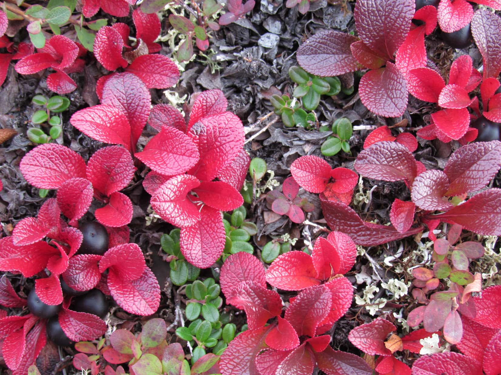
From Iron Mountain, Lupe saw some snow around, but the scene wasn’t exactly a winter wonderland.  There wasn’t any snow up in the trees to make things really look Christmas white.  Lupe and SPHP returned to the G6 and continued on.

Lupe’s peakbagging objective for the day was Peak 5440.  Although the mountain is only 0.25 mile E of the Needles Highway (Hwy 87), Lupe would start for it from Center Lake (12:04 PM, 45°F), 2 miles to the NE.  Her actual route would be longer than that.  After all, Lupe was here to enjoy the day, not to be done with it all as soon as possible!

Lupe started for Peak 5440 here at Center Lake. Center Lake looked plenty white enough, with a good 6″ of snow or more. Photo looks SE.

From Center Lake, Lupe climbed an embankment to reach a road W of the lake.  The map showed this road would lead to some kind of trail following Grace Coolidge Creek to the SSE.  The road climbed a little to the SW, then turned S and dropped down to creek level.

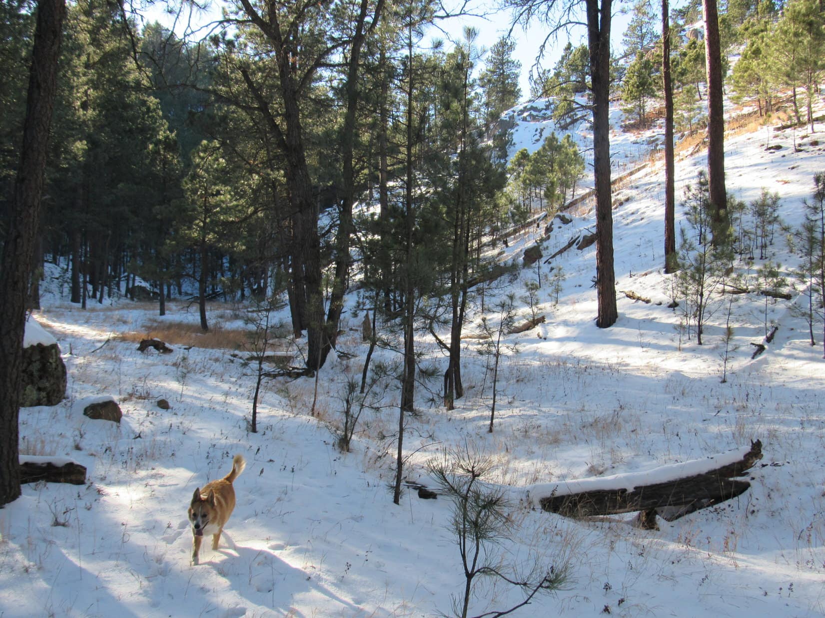
It turned out the trail along Grace Coolidge Creek was actually an abandoned dirt road.  That made it easy to follow, even with half a foot of snow on the ground.  Lupe had a great time looking for squirrels in the forest, while SPHP plodded along.  She found several to bark at that had emerged to enjoy the relatively warm, sunny afternoon.

On the abandoned road that serves as a trail near Grace Coolidge Creek.

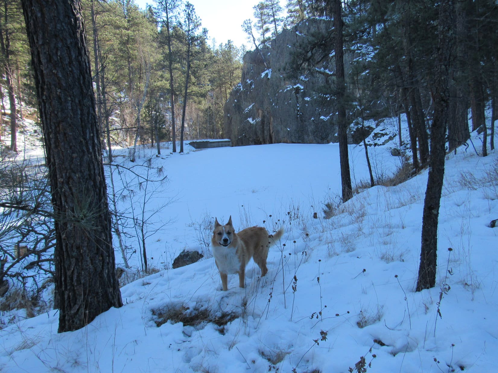
Despite the recent long cold snap, Grace Coolidge Creek wasn’t entirely frozen.  In places there was still open flowing water.  Even where there wasn’t, the ice couldn’t be trusted.  The trail crossed the creek a number of times.  It wasn’t a problem, since a single, long sturdy plank provided a footbridge at each crossing.

Lupe pauses on the snowy trail to listen and look for squirrels. She had some success finding squirrels that had emerged to bask in the sunshine on this relatively warm afternoon.

While the mighty squirrel hunter was busily occupied, SPHP was looking for the turn where Lupe needed to leave the creek to start climbing.  The plan was to follow a side trail up a canyon to the W passing N of High Point 4924.  There was no telling what that side trail or canyon might look like.  SPHP rejected a couple of possibilities after comparing actual terrain to the topo map.

The turn couldn’t be much farther.  Lupe came to a place where the trail was about to cross to the E side of the creek again.  Ahead was a small concrete dam next to the base of a natural solid rock wall.  A narrow side canyon full of trees veered off to the NW.

The terrain seemed right, but at first there didn’t appear to be any trail going up the canyon.  That would be bad news.  Lupe and SPHP left the trail by the creek to investigate further.

Yes!  Lupe came across a faint, remnant of a road.  Clearly, it had been a long time since any vehicle had come this way.  The old road was impassable for vehicles now, but looked easy enough to follow on foot and paw.

Lupe looks for the turn to the W. A little concrete dam on Grace Coolidge Creek next to a natural wall of rock is seen beyond Lupe. This was where Lupe needed to leave the creek and start following a narrow side canyon leading NW. Photo looks S.

Lupe left Grace Coolidge Creek behind, following what remained of the ancient road going NW up the narrow side canyon.  The canyon eventually broadened out becoming a wider valley, which wound around toward the W.  SPHP wasn’t entirely certain Lupe had taken the correct route, but things seemed to be matching up pretty well with the topo map.  Lupe passed to the N of a hill which was likely High Point 4924.

This valley was a beautiful and obviously seldom visited place.  Lupe gained elevation steadily, but so did the sides of the valley.  There was lots of snow, but it wasn’t too deep for Lupe to get through.  The big disappointment was that there weren’t nearly as many squirrels here as back along the creek.

For a mile or so, everything seemed fine, but then the valley narrowed sharply, becoming a canyon again.  What was left of the old road had completely vanished.  The canyon floor became increasingly rocky and steep.  This didn’t seem right.  The topo map had shown this route climbing gradually toward Pass 5111.  SPHP halted for another look at the map.

Lupe having a good time in a seldom visited valley W of Grace Coolidge Creek. She is already more than a mile from the creek, near the start of a side valley SPHP took by mistake. Photo looks W.

The map showed Lupe was likely in a minor side canyon SPHP mistook for the main route to Pass 5111.  Lupe was probably N of High Point 5196.  If so, she wasn’t off track by much at all.  Lupe could easily backtrack a short distance back to the main route, or she could climb up the ridge to the N, then follow it W to Pass 5111.

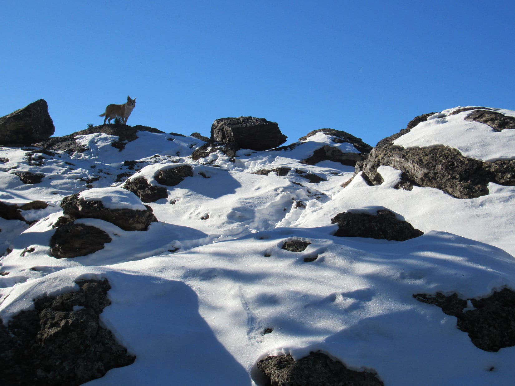
Lupe continued up the narrow canyon.  She left it as soon as an opportunity arose to climb up onto the ridge to the N.  It wasn’t hard to reach a high point along the ridgeline.  From here, Lupe could see a big hill to the N.  SPHP tried to place it on the map.  It seemed to be a hill 0.25 mile NE of Pass 5111.

Lupe reaches the ridgeline N of High Point 5196. She could see this hill off to the N. After consulting the topo map, SPHP concluded this hill was 0.25 mile NE of Pass 5111.

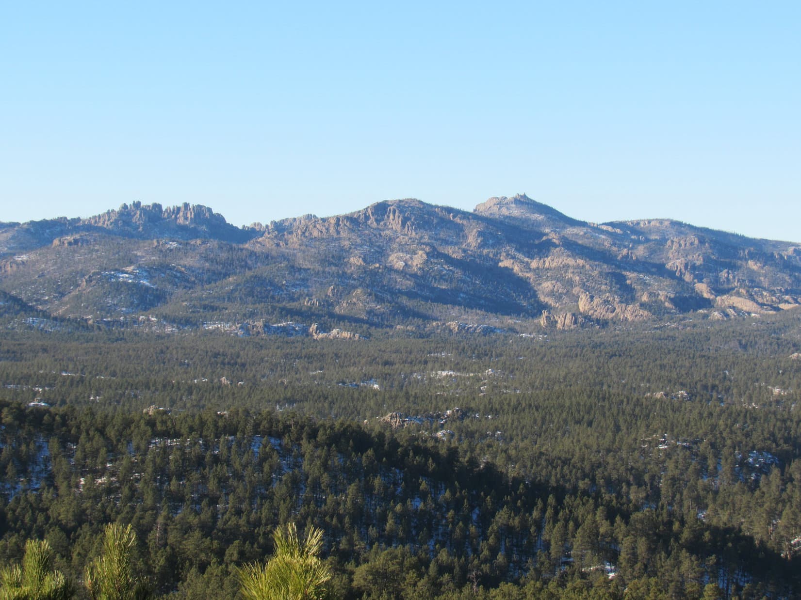
Off to the SW, barely in view due to the forest, was an even higher hill that might well be Peak 5440.  At least everything seemed to make sense again.  Lupe headed W along the ridgeline, climbing steadily.  She soon came to a road that led her right to Pass 5111.  Lupe could see Harney Peak to the NW on the other side of the pass.

At Pass 5111. Harney Peak (Center) is in view. From here, Lupe only needed to follow a ridgeline S to reach Peak 5440. Photo looks NW.

From Pass 5111, Lupe only had to follow one more ridge SSW to Peak 5440.  This ridge has a couple of high spots along the way.  Although the topo map didn’t show any trail leading toward Peak 5440, Lupe found a side road that took her SW partway up onto this next ridge.

Lupe on a snowy side road that went SW from Pass 5111 partway up onto the ridge that would take Lupe to Peak 5440. Photo looks SW.

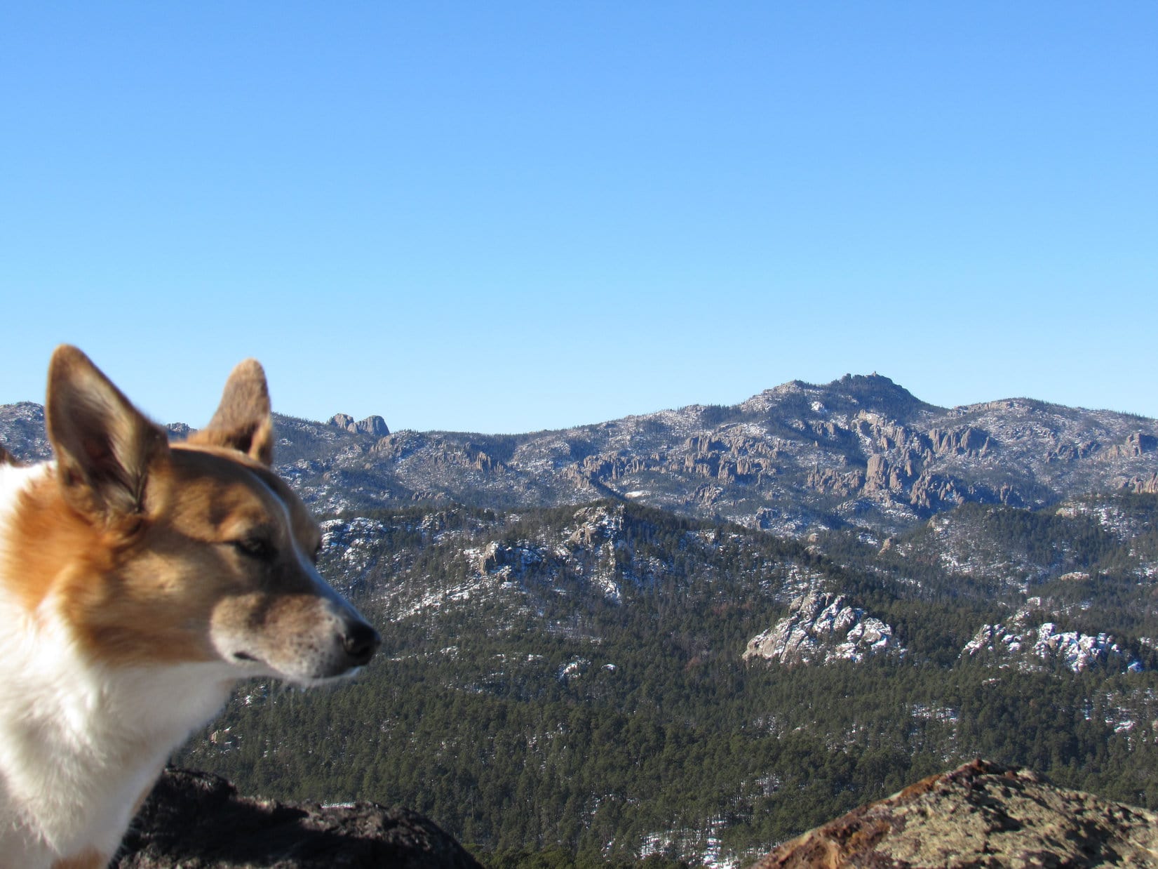
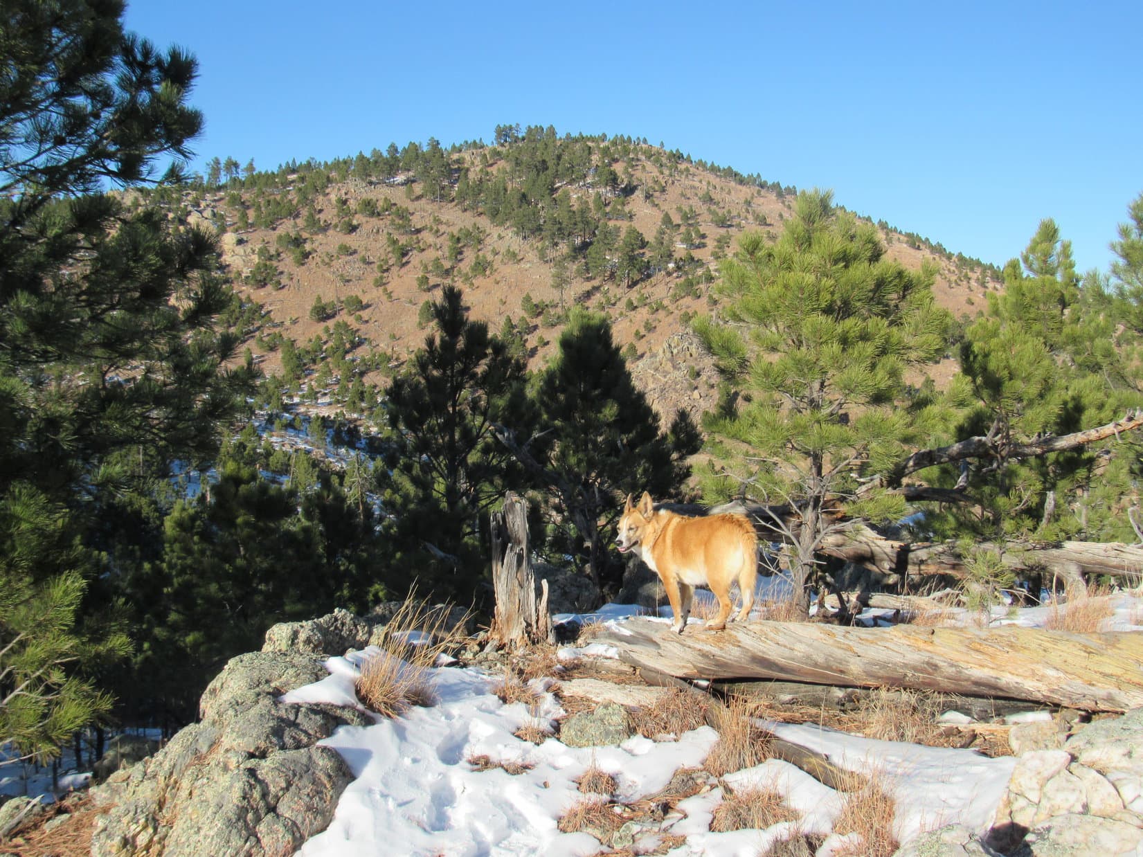
Lupe reached the ridgeline.  She followed it SSW, still climbing, until she reached the first of the two high points along the way.  This first high point was the highest, and open enough so Lupe had some great views from here.

Cathedral Spires (6,840 ft.)(L) and Harney Peak (7,242 ft.)(R of Center) from the first high point Lupe came to on the ridge leading to Peak 5440. Photo looks NW.
From here, Lupe had her first good look at her peakbagging objective, Peak 5440(L of Center). It was less than 0.5 mile away. Photo looks SSW.
Looking NNW. Cathedral Spires(L), Harney Peak(L of Center) and Peak 5688(far R). Lupe recently visited Peak 5688 for the first time on a windy day in November on Expedition No. 184.
Looking E.

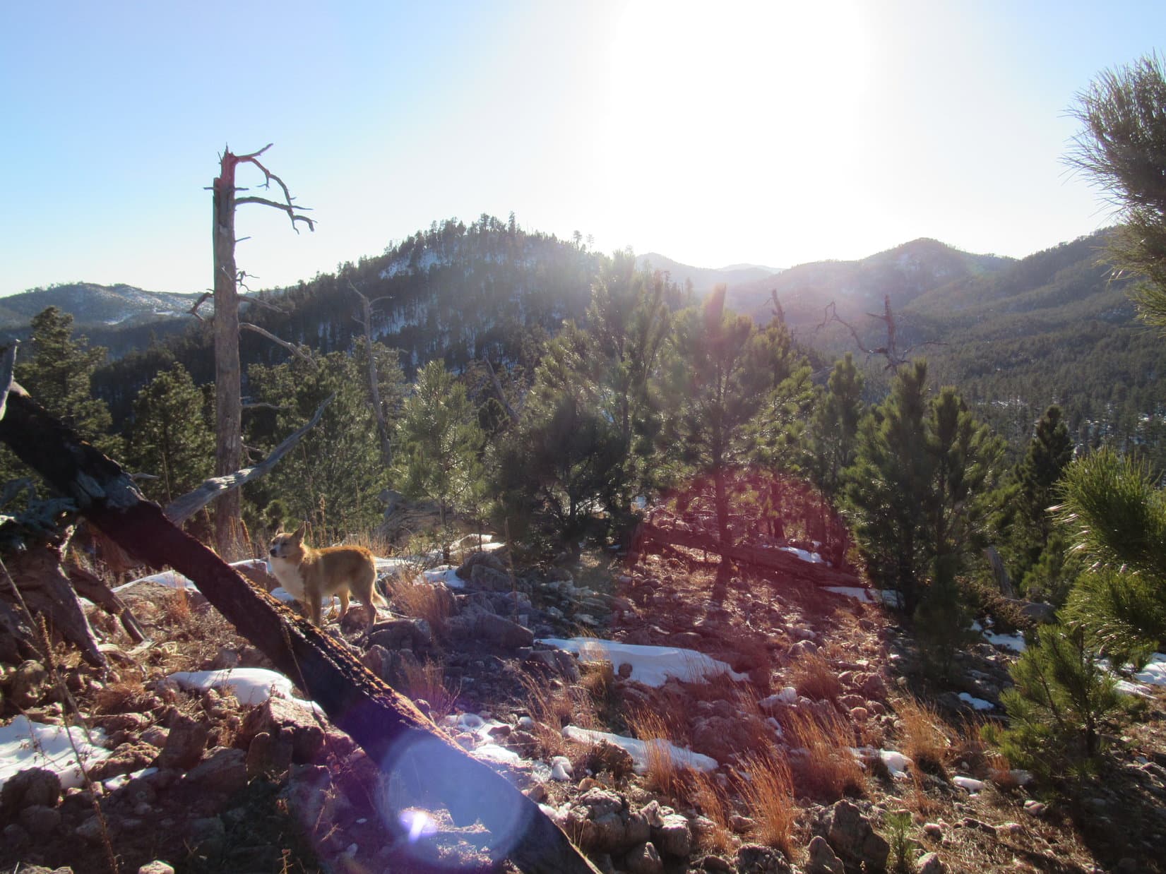
Lupe continued S along the ridge.  She lost some elevation coming off the first high point, crossed over the second lower high spot, and began a fairly steep climb up the forested N face of Peak 5440.  Soon she reached the top of the mountain.  A small rock outcropping only a few feet high toward the NW was the true summit.

Success! Lupe on the true summit of Peak 5440. Harney Peak is in view beyond her. Photo looks NW.

Lupe had her peakbagging success for the day!  Time for a break.  SPHP sat on a rock near the true summit munching an apple.  Lupe wasn’t hungry or thirsty.

At least this expedition had accomplished something!  Lupe was tired enough to want to curl up and lay down next to SPHP for a little bit.  The temperature had been dropping.  It was now close to freezing, yet Lupe insisted upon laying on a patch of snow.

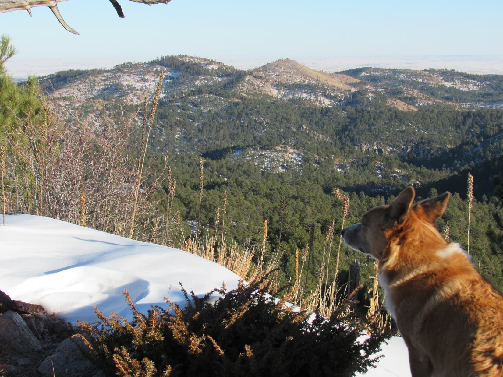
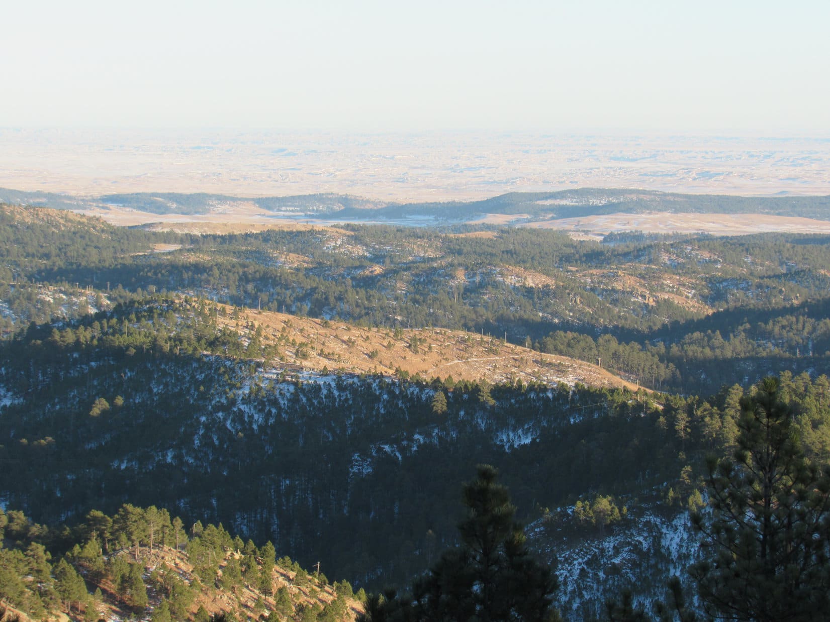
Break time lasted only until the apple was gone.  The sun was getting low.  Lupe and SPHP explored the summit area, which was of modest size.  Most of the summit area was SE of the true summit.  There were good views in most directions, although forest screened everything to the NE.

Looking SE from the true summit.
Cathedral Spires through the telephoto lens. Photo looks NW.
Looking up toward the top of Peak 5440 from the S.
Looking S from the top.
Mount Coolidge (6,023 ft.)(L of Center). Lupe hasn’t been to Mount Coolidge since Black Hills, SD Expedition No. 13, way back on 3-22-12. Photo looks SW.
Looking SE using the telephoto lens.

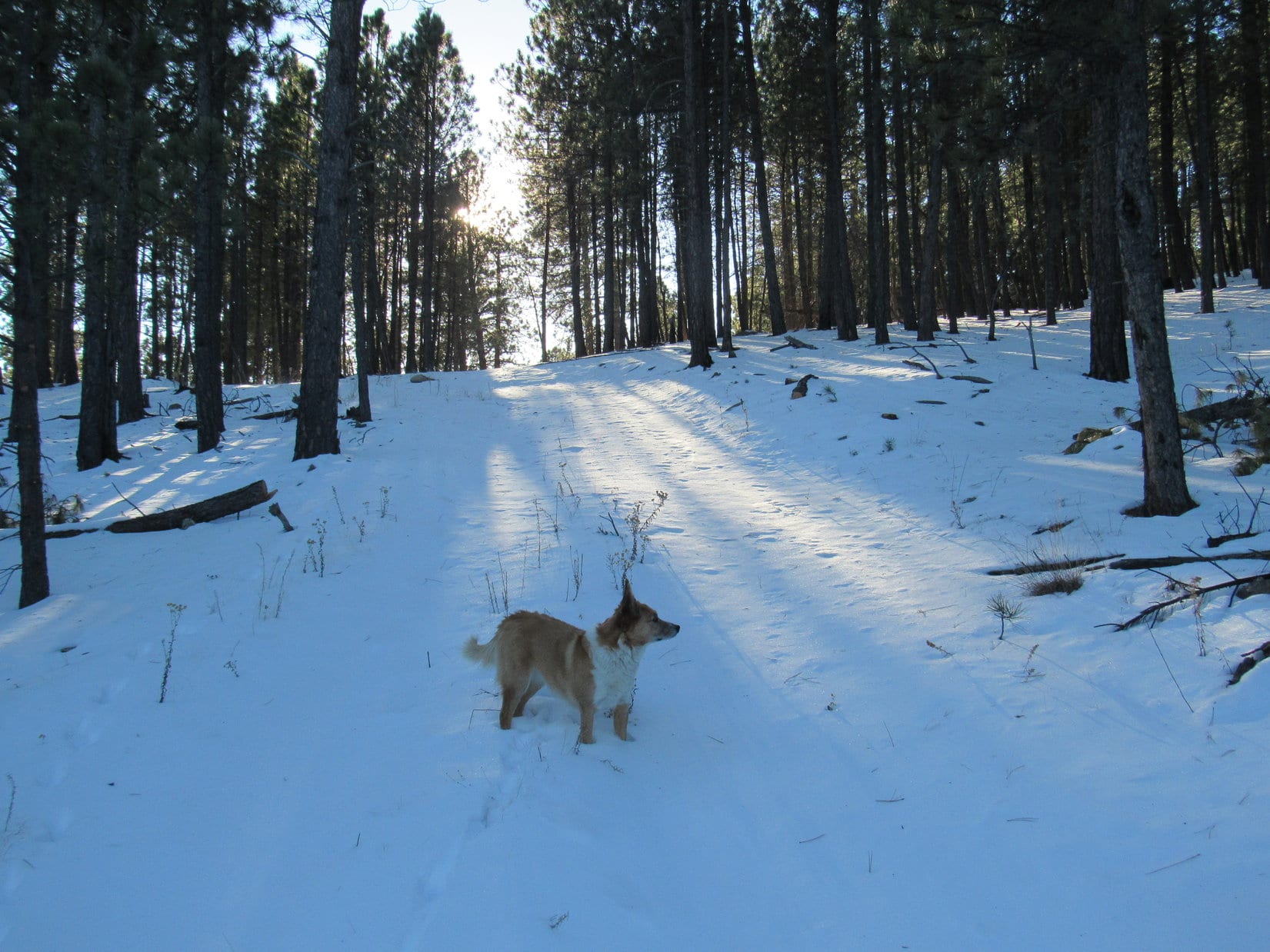
Time to be heading back, or it would get pitch black out before Lupe would reach the G6.  Lupe and SPHP left Peak 5440 heading down the N slope.  Lupe would retrace her route up back to Pass 5111.  There, a decision would have to be made on which way to go.

Lupe sniffs around in the forest on her way back down the N slope of Peak 5440.
Looking back at Peak 5440 from the N ridge. Sunlight illuminates some of the pine trees for a little while longer. Soon the sun would be down. Photo looks S.

The sun was down by the time Lupe reached Pass 5111 again.  Which way?  Taking the road going NNW would quickly bring Lupe down to the Needles Highway only 0.25 mile away.  It was the safest choice.  Lupe could then take known roads back to the G6.

The other option was the road going SE from the pass.  The topo map showed it going down to the canyon leading to Grace Coolidge Creek.  Once at the creek, Lupe could easily follow the trail back to Center Lake.  This route was more remote, and a little chancy.  Twilight would fade.  However, Lupe should reach the canyon in plenty of time to verify she was on the right track before it got dark.

Lupe took the remote route instead of going to the highway.

Soon there was a problem.  The road didn’t go SE as expected.  Instead, it went NE, staying high on a ridge.  Lupe pressed onward.  As long as the road didn’t play out, NE was actually the shortest route back.

The luck of the Dingo held.  The road didn’t play out.  It remained high on the ridge until finally descending to come out at the Black Hills Playhouse.  Lupe had taken a shortcut on a road not shown on the map.  All was well.  White Dingo magic again!  (5:06 PM, 28°F)

A last look back at Peak 5440 from the high point SW of Pass 5111.

Links:

Next Black Hills Expedition                      Prior Black Hills Expedition

Want more Lupe adventures?  Choose from Lupe’s Black Hills Expeditions Adventure Index or Master Adventure Index.  Or subscribe free to new Lupe Adventures.

Dingo of the Midnight Sun – Crossing the Yukon River, Finger Mountain & The Arctic Circle (8-13-16)

Day 14 & Day 15 (Part 1) of Lupe’s Summer of 2016 Dingo Vacation to the Canadian Rockies, Yukon & Alaska.

Rain, rain, rain!  It had been raining most of the night, and it was raining now, harder than at any time yesterday.  It was so early, Lupe was still conked out.  Dark clouds hid the mountains and the Worthington Glacier, where Lupe had such a great adventure yesterday.

Clearly, the Carolina Dog’s luck at the Worthington Glacier wasn’t going to be repeated again today anywhere near the S Alaskan coast.  A week of rain was in the forecast.  Time to head inland.  Maybe it wasn’t so wet there?  As soon as the G6 was ready, Lupe and SPHP drove N on the Richardson Highway, hoping to drive out of the weather before reaching Glennallen.

About 10 miles before even reaching Glennallen, SPHP pulled into the parking lot for the Wrangell – St. Elias National Park & Preserve visitor center.  It was still raining, but not as hard as before.  The clouds weren’t as dark, either, although they still blanketed the entire sky.  Lupe waited in the G6, while SPHP went into the visitor center to see if they had a near term weather forecast for this part of Alaska.

SPHP interrupted three idle rangers chatting among themselves behind the information desk.  Did they have a weather forecast?  Rain for the next 10 days, and more after that, responded a bored female ranger.  Alaska’s best days of the summer of 2016 were history now.  It was just going to get colder and darker, she said.  What about farther N, did they have a forecast for Fairbanks?  Even colder and darker, there she replied.

SPHP returned to Lupe in the G6.  Sorry about the wait, Loop!  That was a complete waste of time.  No specifics, other than more rain is expected.  The ranger didn’t care, and knew next to nothing.  Any lame brain would know that it would get colder and darker as summer fades to autumn in Alaska.  Maybe we will find out something in Glennallen.

Hah, fat chance!  At the Glennallen visitor center at the intersection of the Richardson and Glenn Highways, the story was almost the same.  At least the lady at the information desk exhibited some energy and interest, but all she said was that it was raining in the entire state of Alaska, and had been rainy for weeks.  She too, expected more rain, but had zero specifics.  What about the weather in Fairbanks?  Yup, raining there too, she insisted.

Gah, she had no clue either!  Alaska is a vast territory.  It was hardly possible it was raining in the whole state.  Still, it left SPHP wondering what to do.  Should Lupe go farther N hoping to find better weather, hang around here for who knew how many days waiting for the rain to stop, or just give up on Alaska all together, and go back to Canada and the Yukon?

Leaving Alaska now would be a shame!  Lupe had come all this way, and had so many Alaskan adventures on her list of possibilities!  SPHP left the building pondering the situation.  A man followed SPHP outside.

The man introduced himself as the owner of Alaskan Quest, based in Fairbanks.  His name was Kent Kaiser.  He had overheard the conversation.  Kent said he had just come from Fairbanks.  Although it had been unusually rainy this summer there, it was sunny when he left Fairbanks this morning.  Better yet, 10 more days of sun were in the forecast!  SPHP thanked Kent for the tip.

It was all SPHP needed to hear.  Loopster, good news!  You’re heading N!  After gassing up the G6, Lupe and SPHP continued N on the Richardson Highway.

The weather didn’t improve.  The farther N Lupe got, the harder it rained, and the darker the clouds became.  Not a speck of blue sky appeared anywhere.  Lupe went past high mountains, a forlorn, dreary-looking Summit Lake, and big rivers.  Some of the creeks were out of their banks.  SPHP began to wonder.

Looking W from the Richardson Highway N of Glennallen.

Eventually, though, conditions did improve.  The rain slackened, then quit.  A tiny speck of blue appeared in the sky to the N.  The blue spread, as Lupe and SPHP neared Delta Junction.  By the time Lupe and SPHP stopped at a McDonald’s in North Pole to share a couple of cheeseburgers, a glorious pale blue sky stretched from horizon to horizon.

Lupe and SPHP reached Fairbanks, which turned out to be an attractive city.  Fairbanks wasn’t Lupe’s actual destination, however.  The decision to come N meant she was going all the way to her most northern peakbagging objectives.  As far N as Lupe was already, she wasn’t even close to them yet.

It was already evening, as Lupe left Fairbanks heading NE on the Steese Highway.  Less than 15 minutes later, at Fox, SPHP turned N on the Elliot Highway.  Traffic faded away to almost nothing.  The Elliot Highway was paved and in great shape.  It went through densely forested territory, repeatedly climbing high ridges only to descend into successive big valleys farther N.

By the time the sun went down, there were clouds in the sky again, but they were thin and non-threatening.  Lupe was almost to a much anticipated turn.  A little beyond Livengood, there it was!  SPHP made the R turn.  Almost immediately, this new road turned to gravel.  SPHP wondered what Lupe was getting into.  The road went up a hill.  At the top was a sign next to a long gravel pullout.  Lupe had made it to the start of the Dalton Highway!

Sunset from the Elliot Highway, 8-12-16.
Lupe reaches the start of the Dalton Highway near Livengood. 414 miles away, the Dalton Highway ends at Deadhorse, near the Prudhoe Bay oil fields and the Arctic Ocean.

While Lupe was at the Dalton Highway sign, a semi-truck appeared from the N.  The driver stopped the long truck at the pullout.  The truck was absolutely filthy, caked with dirt and dust.  The driver got out.  With the truck still idling, he used a wire brush to scrap the dirt off all the lights on the truck.  The driver checked on a few other things, then drove away.  Five minutes later, another semi-truck came out of the N.  The same thing happened.

Good grief!  Would the G6 be able to stand up to the Dalton Highway?  Was Lupe going to be able to get anywhere close to her peakbagging objectives?  Tomorrow would tell.  It would be here soon enough.

The next morning, SPHP was concerned.  The sky was cloudy, not clear.  The Dalton Highway was dry, though, so Lupe fearlessly, and SPHP wonderingly, started N in the G6.

Lupe on the Dalton Highway early on 8-13-16, Day 15 of her Summer of 2016 Dingo Vacation. The sky was overcast, and fog hung in some of the valleys.
Dawn from the Dalton Highway, 8-13-16.

SPHP drove slowly, even though the Dalton Highway was in better shape than feared.  No sense on taking any chance of damaging the G6 way up here in northern Alaska!  Up and down.  Lupe crossed many hills, valleys and ridges.  Sometimes the Alaska oil pipeline was in view.  Several sections of the road were paved, which was encouraging.  Lupe was making progress.

At mile 55, Lupe reached her first objective along the Dalton Highway.  It wasn’t a peakbagging goal.  Lupe was about to cross the famous Yukon River!

Crossing the Yukon River on the Dalton Highway. Photo looks NNE.

Crossing the bridge only took a minute or two.  Lupe was N of the mighty Yukon River!  On the E side of the Dalton Highway was the Alaska oil pipeline, and a little visitor center.  Time to get out of the G6 to see what there was to see, and celebrate Lupe’s crossing of the Yukon River.

At the Alaska oil pipeline, N of the Yukon River! Photo looks NNE.
Information display near the visitor center E of the pipeline.
Lupe on the N bank of the Yukon River. Photo looks downstream (W) toward the Dalton Highway bridge Lupe had just crossed.

The visitor center wasn’t open yet.  SPHP looked at a few of the displays outside.  Lupe went down to see the Yukon River.  She saw the bridge on the Dalton Highway she had just crossed to get N of the river.  Interestingly, the Alaska oil pipeline is attached to the underside of the bridge.

A gas station with a single pump was on the W side of the Dalton Highway.  $5.50 per gallon.  SPHP didn’t buy any.  The G6 had plenty.  Still, it was taking a chance.  No matter what the price at Coldfoot, SPHP would have to buy some there.

Lupe and SPHP went down to the Yukon River again, this time W of the bridge.

Lupe at the Yukon River W of the Dalton highway. The river was murky and gray, not exactly what SPHP had expected. Photo looks downstream (WSW).
The Dalton Highway bridge over the Yukon River from the NNW.

Almost as soon as Lupe left the Yukon River heading N, the Dalton Highway became damp, soft, and a little muddy.  Once again, SPHP became concerned, but before long the road improved.

Slow and easy, 30 to 35 mph, Lupe and SPHP continued N.  The Dalton Highway wound around, going up and down big hills and ridges.  Often it was possible to see many miles toward distant mountains seemingly far beyond the reach of civilization.  The scenery was vast and remote.  The truck traffic on the Dalton Highway became almost the only source of reassurance that it wasn’t crazy for Lupe to be way out here.

About an hour N of the Yukon River, the highway passed very close to the summit of Finger Mountain (2,202 ft.).  This was just too tempting.  With only 30 feet of elevation gained required to claim a peakbagging success way up in N Alaska, Lupe had to stop!

A short nature trail went up Finger Mountain.  Lupe followed it.  The top of the mountain was a collection of rounded boulders.  Lupe got up on some of them for a look around.

The summit of Finger Mountain from the Dalton Highway. Too close and easy for Lupe to resist! Photo looks NE.
Lupe up on the boulders at the top of Finger Mountain.
Looking NW at the vast Alaskan landscape from Finger Mountain. Olsons Lake is the largest pond seen on the R.
Loopster up on Finger Mountain, Alaska! Photo looks N.

Lupe on Finger Mountain, Alaska 8-13-16

One of the things SPHP found amazing everywhere Lupe went in Alaska was how strikingly colorful the little tundra plants were.

N of Finger Mountain, there was a long stretch of paved road.  Instead of deteriorating as it went N, as SPHP had feared, the Dalton Highway was getting better!  Overall, the Dalton Highway wasn’t nearly as bad as some of the descriptions SPHP had read online implied.  On the other hand, maybe that was just because the gravel sections weren’t muddy right now.

Lupe along the Dalton Highway a little N of Finger Mountain. The Alaska oil pipeline snakes N on the W side of the highway. More importantly, notice the lovely stripe on the road. Yes, it was paved here! Photo looks N.

Half an hour N of Finger Mountain, Lupe came to one of the most important non-peakbagging objectives of her entire Summer of 2016 Dingo Vacation.  At mile 115 of the Dalton Highway, intrepid explorer and adventurer Lupe reached the Arctic Circle!

Intrepid American Dingo Lupe at the Arctic Circle!

Lupe’s adventures in the Arctic were about to begin!  Back on the Dalton Highway again, Lupe and SPHP continued N another 60 miles to Coldfoot.  SPHP’s gamble paid off when gasoline for the G6 was a measly $4.59 per gallon, a significant savings over the $5.50 per gallon they wanted at the Yukon River.

At the Coldfoot gas station, Lupe made friends with a couple of motorcyclists from Huntington Beach, California.  Alfredo Gonzalez, a riding academy instructor for Harley-Davidson Motorcycles, and his friend, Sam, both showed an interest in Lupe.  They were riding BMW motorcycles, and were on their way back S after having gone all the way to Prudhoe Bay.

Sam (L) and Alfredo Gonzalez (R) from Huntington Beach, California with Lupe at the Coldfoot, Alaska gas station. Sam and Alfredo were on their way back S from Prudhoe Bay on their BMW motorcycles.

It turned out that Sam and Alfredo were talking about possibly taking another motorcycle trip going through the Dakotas in 2017, so SPHP invited them to stop by and visit Lupe at home in the Black Hills.  Maybe Lupe will get to see Sam and Alfredo again!

Sam and Alfredo said good-bye to Lupe and SPHP.  They were ready to head S.  Lupe was going the other direction.  Excitement was mounting – it wouldn’t be long now!  Another 25+ miles N of Coldfoot, Lupe would see the most famous mountain along the entire Dalton Highway.  90 miles into the Arctic, Lupe was here to climb it today!

Lupe 200 miles N of the start of the Dalton Highway, and 90 miles N of the Arctic Circle, approaching famed Sukakpak Mountain in the Brooks Range. Photo looks NE.

Links:

Next Adventure                           Prior Adventure

Want more Lupe adventures?  Choose from Lupe’s 2016 Canadian Rockies, Yukon & Alaska Adventure Index, Dingo Vacations Adventure Index or Master Adventure Index.  Or subscribe free to new Lupe adventures.