To the Clark’s Fork of the Yellowstone River (8-10-12)

Day 3 of Lupe’s 2012 Dingo Vacation to the West Coast.

Lupe was somersaulting again against the door of her “tiny house”.  She still hadn’t figured out that she couldn’t go through the tent door when it was zipped shut, but it had only been her second night ever in a tent.  A squirrel was chattering away in a tree outside.  Lupe wanted to go bark at it, but it was very early.  Lanis was still asleep in the Honda Element, after his gear got soaked in a sudden downpour the previous evening.

Lanis isn’t much of a morning person.  SPHP figured he would sleep for several more hours.  This was an opportunity for Lupe to return to Bald Mountain (10,042 ft.).  Lupe, Lanis and SPHP had climbed Bald Mountain the evening before, only to be almost immediately chased off of it by a brief intense rain shower.  It wasn’t going to rain now, though.  Lupe and SPHP left the squirrel and the campground in peace, and climbed Bald Mountain again.

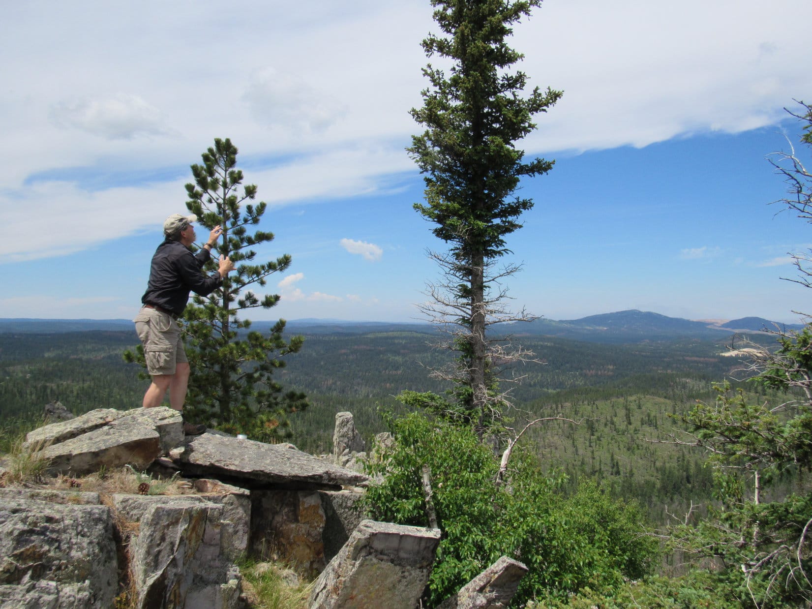
After searching around on top of the mountain, SPHP had almost given up.  Then, suddenly, there they were.  Lupe had found the names that had been up there for a quarter century or more now.  The names were just made out of loose rocks, but they were still easily recognizable.  SPHP spent a little time repairing them.

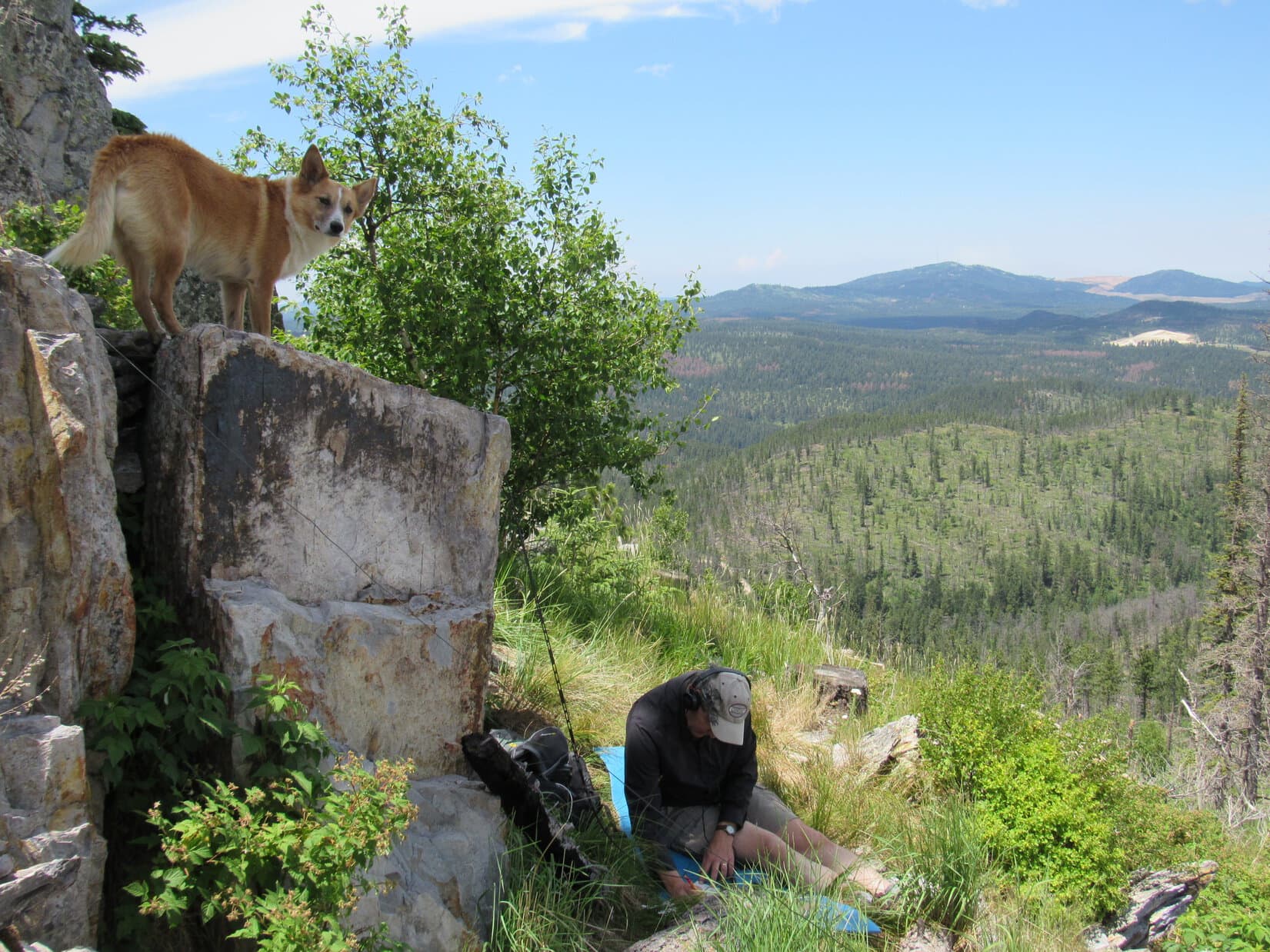
SPHP wanted to add Lupe’s name to the mountain, but so much time had been lost looking around, it was probably best to get back down to the campground before Lanis awoke to find himself alone.  It would take too much time to search around for some rocks to use.  So Lupe and SPHP went down Bald Mountain enjoying the panoramic views, sunshine and fresh air.

(Just 11 months later, Lupe returned to spend a night on Bald Mountain and SPHP added her name then.)

SPHP needn’t have worried.  Lanis was still sound asleep when Lupe returned.  After having been responsible for getting Lanis’ gear wet the night before, SPHP wasn’t eager to further aggravate him by waking him up.  Lupe and SPHP stayed busy in camp.  Lanis eventually came to on his own.  He was in a better mood than when he’d gone to sleep in the Element.

It was time for Lupe to leave the Bighorn Mountains of Wyoming and head farther W.  The sun was much higher now.  Lanis and SPHP dried things out while Lupe sniffed around.  Pretty soon things were dry enough to pack them back in the Honda Element, and Lupe, Lanis and SPHP were underway.

Lanis drove W out of the Bighorns on steep, windy Hwy 14A.  The route continued through Lovell, Powell and Cody, WY.  From Cody, Lupe went N on Hwy 120 to Hwy 296, the Chief Joseph Scenic Byway.  The Chief Joseph Scenic Byway lived up to its name.  The road wound high up over a lofty pass.  At a pullout on the W side of the pass, Lupe, Lanis and SPHP got out for a look.

View from the Chief Joseph Scenic Byway. Photo looks W from the pullout near the pass.

The view was most impressive, but there was a chilly wind.  It looked rather stormy on the W side of the pass.  Lupe hadn’t been at the pullout long when a cold rain began to fall.  American Dingoes do have the good sense to come in out of the rain.  Lanis and SPHP quickly joined Lupe in the Honda Element.  Lupe’s journey continued down the winding highway on the W side of the pass.

The rain eventually stopped, but it was still pretty cloudy out.  The St. Joseph Scenic Byway led to the Beartooth Hwy (No. 212).  The Beartooth Highway goes NE over spectacular Beartooth Pass on its way to Red Lodge, MT, but Lupe wasn’t going that way yet.  Instead Lupe, Lanis and SPHP headed W on the Beartooth Highway toward Cooke City, MT.

A side road off the St. Joseph Scenic Byway. The rain had stopped, but it was still pretty cloudy out.

Lanis and SPHP were looking for a campsite along the way.  There were some campgrounds, but SPHP was picky and found nothing that looked quite right before reaching Cooke City, MT.  Along the way, Montana became the 3rd U.S. Lupe state!

Cooke City, MT is basically a one street tourist town strategically situated 5 miles from the NE entrance to Yellowstone National Park.  After looking around town just a little bit, it was time to get more serious about finding a campsite.  Lupe, Lanis and SPHP headed back E on the Beartooth Hwy.  This time Lanis was driving slower to allow for a more complete reconnaissance of the possibilities.

Not long after entering Wyoming again, Lanis and SPHP saw a turn to a little parking lot just N of the highway.  A pickup truck with a camper was parked there close to a bend in a very beautiful river just 200 feet from the highway.   It looked like a great dispersed camping site.  Lanis pulled in off the highway.  Everyone piled out of the Element to check things out.

This bend in the Clark's Fork of the Yellowstone River, became home base for Lupe, Lanis & SPHP during Lupe's stay in the Beartooths on her 2012 Dingo Vacation. Photo looks NW toward Pilot Peak (L) and Index Peak (R).
This bend in the Clarks Fork of the Yellowstone River, became home base for Lupe, Lanis & SPHP during Lupe’s stay in the Beartooths on her 2012 Dingo Vacation. Photo looks NW toward Pilot Peak (L) and Index Peak (R).
This small waterfall or rapid was just downstream of the bend in the river.
Lanis is liking what he sees.

Unknown to Lupe, Lanis and SPHP at the time, the river was the Clarks Fork of the Yellowstone.  This gorgeous site would become home base for the entire time Lupe spent in the Beartooths on her 2012 Dingo Vacation.  The bend in the river offered a terrific view of the dramatic spire of Pilot Peak (11,699 ft.) and its neighbor Index Peak (11,240 ft.) to the NW.  Just downstream of the bend, was a small waterfall or rapid with a nice pool of clear, cold water below it.

The reconnaissance downstream quickly met with the approval of Lupe, Lanis and SPHP.  A walk upstream through a wooded area to a field next to the river followed.  After being cooped up in the Honda Element a good part of the day, Lupe was so stirred up by the wild river and glorious surroundings, she got a crazed look in her eye.  She pranced and growled and demonstrated just how ferociously prepared American Dingoes are for life in the wilderness.

Lanis has an eye for detail and took this shot of some mossy lichens growing on a rotting log near the river.
Squirrels, schmirrels! Lupe feeling ready to take on elk, moose, grizzly bears and anything else the Beartooths can throw at her!
And then I'll crack their bones like this!
And then I’ll crack their bones like this!

Returning to the bend in the river, SPHP had a chat with the other campers there, who already occupied the best site right next to the river.  They told SPHP about a waterfall worth seeing just a mile or two to the E.  The falls were up a short trail on the N side of the Beartooth Hwy.  Why not check that out, too?  Lupe, Lanis and SPHP hopped back in the Element to go find the waterfall.

As promised, a short, but steep hike up a trail led to a roaring torrent on Crazy Creek.  The stream was strewn with logs.  The falls were large, but this wasn’t really a classic straight down over an edge type of waterfall.  It was too steep to be just rapids either.  A better name is Crazy Creek Cascade.  Lupe,  Lanis and SPHP followed the trail all the way up to the top of the falls.


Crazy Creek Cascade. This waterfall was up a short, but steep climb N of the Beartooth Hwy.
Lupe at Crazy Creek just above the big cascade.
Lanis at Crazy Creek.

Lupe, Lanis and SPHP played around on the rocks next to Crazy Creek just above the cascade until it started getting dark.  Time to head back to the Element, and the great campsite on the Clarks Fork of the Yellowstone.

When Lupe returned, the sky was still overcast.  In fact, the clouds were darker and denser than before.  It looked like it would almost certainly rain overnight.  It didn’t seem to make any sense to set up the tent, which would surely leak if it rained hard enough.  Lanis was going to have company in the Element tonight.  Outside the rain began.

Links:

Next Adventure                      Prior Adventure

Want more Lupe adventures?  Choose from Lupe’s 2012 West Coast Adventure IndexDingo Vacations Adventure Index or Master Adventure Index.  Or subscribe free to new Lupe adventures.

Black Hills, SD Expedition No. 174(a) – Summits on the Air! (Custer Peak, 7-2-16)

Lupe returned from her grand adventures in the Laramie Mountains of Wyoming on June 1, 2016.  Naturally, she expected to resume her explorations of the Black Hills in short order, but it didn’t happen.

May and June are normally the wettest months of the year in the Black Hills, but May had been very dry with temperatures running much above normal.  By early June, the sun was blazing day after day in cloudless skies.  Temperatures frequently soared to near record-breaking levels.  Almost no rain fell.  SPHP may as well have planted saguaros in the garden.  For Lupe, climbing mountains in a fur coat would have been miserable.  The Black Hills just aren’t high enough.

So Lupe’s adventures in June were mostly along the line of adventures in watering the lawn.  She fought with the old garden hose, converting it into a sprinkler hose in the process.  She chewed foot-long pieces off the end.  She played tug-of-war with SPHP, won most of the time, and became a very soggy (and cool!) doggie in the process, as the leaky hose sprayed water in every direction.

When she wasn’t a soggy doggie, Lupe licked ice cream from the freezer and consumed cold Alpo from the refrigerator.  A whole lot of panting and dozing went on the rest of the time.  Whenever the temperature got close to 100°F, SPHP would finally break down and turn on the AC in the bedroom, so Lupe could hide from the heat.

Nothing really changed until July 1st.  That morning, Lupe and SPHP woke up to rain!  It wasn’t raining hard, but at least the air was much cooler and clouds covered the sky.  Within a couple of hours, Lupe had another surprise.  Andrea called!  She was in town with Joe and Dusty!  Did Lupe want to come over to grandma’s house and play?

When she heard the news, Lupe was ecstatic!  She barked and leaped to hurry SPHP along.  Soon she was racing up the steps into grandma’s house to welcome everyone to South Dakota in her most enthusiastic Carolina Dog style.  Grandma had Beggin’ Strips for Lupe and Dusty.  The two dogs got to play ball and Frisbee with Joe and SPHP in the yard, go for walks, and lay on the deck with a view of the canyon.  There was ice cream, too.  July was off to a good start!

Joe is a ham radio operator.  He started telling SPHP about Summits on the Air, “an awards scheme for radio amateurs that encourages portable operation in mountainous areas”.  Peaks are assigned a point value.  Ham radio operators can earn points toward the SOTA “Mountain Goat” award by meeting certain criteria while operating from a peak, or points toward the “Shack Sloth” award for contacting those operating on a peak from home.

The home page for Summits on the Air (SOTA).

Joe had never tried the SOTA system before, but wondered if Lupe and SPHP would like to serve as guides to a suitable peak in the Black Hills?  Since Summits on the Air combines Lupe’s peakbagging interests with Joe’s amateur radio hobby, it sounded like fun!  Following the rain, the next day’s weather was supposed to be good, too, with highs only in the 70’s.  The question was, where to go?

Joe and SPHP looked over the SOTA website.  All of the Black Hills in South Dakota is included in two SOTA regions with a total of 181 listed peaks.  Most of these peaks have never been officially “activated” in the Summits on the Air system by anyone operating a portable radio from the peak.  After considerable discussion, Joe and SPHP selected Custer Peak (6,804 ft.) for Joe’s first SOTA attempt.  Joe created a free Summits on the Air account for himself.

The next morning, Joe posted a notification (called an “alert”) on the SOTA website that Joe (call sign AA0Q) would be operating his portable radio from Custer Peak.  The alert included the frequencies he would be using, and an estimated start time.  Once the alert was posted, Lupe, Dusty, Joe and SPHP dashed off to Custer Peak!

At 10:58 AM (72°F), Joe parked the G6 at Lupe’s usual starting point at the junction of USFS Road No. 216 (Custer Peak Road) and USFS Road No. 216.2A.  Although Lupe was only a little over 0.5 mile SE of the summit, the road to Custer Peak was nearly 2 miles long.  Lupe, Dusty, Joe and SPHP started the trek to the top along No. 216.2A.

Looking S from No. 216.2A near the start of the trek up Custer Peak (not shown).

Although Joe and Dusty had never been to Custer Peak before, this was Lupe’s 6th ascent.  Based on prior experience, SPHP had been telling Joe not to expect to see anyone at all on Custer Peak.  SPHP couldn’t have been more wrong!  SPHP’s pronouncement quickly became a joke.  First, Lupe and Dusty started coming to vehicles parked along the road.  Then dozens of people began to appear, most of them arriving in caravans of 4 or 5 ATV’s.

ATV’s roared up and down the dusty road.  As Lupe, Dusty, Joe and SPHP got higher on the mountain, Lupe also encountered groups of people coming down on foot.  SPHP was totally amazed!  What SPHP had failed to consider was that Lupe normally goes on very few expeditions in the Black Hills during the hot summer months, when everyone else is out and about.  Apparently, Custer Peak is a far more popular summer destination than SPHP ever realized.

Another surprise was in store at the top of the mountain.  The ranger station was manned!  The hatch door to the balcony around the station was unlocked and open.  Lupe, Dusty, Joe and SPHP went up on the balcony for a look around.

Lupe and Dusty on the ranger station's balcony. Although this was Lupe's 6th ascent of Custer Peak, she'd never been up on the balcony before.
Lupe and Dusty on the ranger station’s balcony. Although this was Lupe’s 6th ascent of Custer Peak, she’d never been up on the balcony before.

Joe found the ranger on duty to tell him that he would be operating a portable ham radio using 4 watts from the summit for an hour or so.  He just wanted to make certain it wouldn’t interfere with the ranger’s equipment.

The ranger didn’t think there was any equipment the radio would interfere with.  However, that didn’t mean there wasn’t a problem.  The American people declared independence and proclaimed freedom nearly 240 years ago, but times have changed.  The Land of the Free and Home of the Brave is now the Land of the Over-Regulated and Home of the Bureaucracy.  The ranger was cordial, but insisted that Joe contact the headquarters of the Spearfish district of the Black Hills National Forest to get official permission to operate the ham radio.

Neither Joe nor SPHP had a phone along, but the ranger allowed Joe to use his phone.  Naturally, since it was Saturday on the 4th of July holiday weekend, all Joe got was a recording.  The headquarters of the Spearfish district of the Black Hills National Forest wouldn’t be open until Tuesday.  Joe reasoned with the ranger inside the station.  Meanwhile, SPHP stayed out of it with Lupe and Dusty on the balcony.

It turned out the ranger’s concerns had to do with the ranger station being part of a designated historical site of some sort.  The ranger thought operating a ham radio might somehow break the historical site regulations.  Fortunately, the ranger had a map of the historical site area.  It covered only a relatively small part of the summit area surrounding the ranger station.

Joe and the ranger finally agreed that the NE side of a jagged rock outcropping a little way NW of the ranger station was outside the boundary of the historical site delineated on the map.  The ranger was OK with Joe setting up the ham radio operation over there.  That was a relief!  Lupe, Dusty, Joe and SPHP left the ranger station to go set up the antenna and other equipment.

Joe made a perfect toss of a large metal nut tied to fishing line up over the very top of a tall tree situated near the spine of the jagged rock outcropping.  The fishing line was then used to pull up a thin antenna wire.  Joe instructed SPHP on how to help deploy 4 lateral wires at the base of the antenna.

The ground on the NE side of the ridge was quite steep and rocky, so it took a little time to maneuver around and get set up.  Lupe and Dusty supervised operations from the most comfortable vantage points they could find.

Joe makes a perfect toss of a metal nut tied to fishing line over the top of the tall thin tree near the ridgeline. The fishing line was then tied to a very thin antenna wire, and pulled up to the top of the tree. Photo looks NW.
Lupe supervises from the shade while Joe sets up his portable ham radio NE of a jagged rock outcropping NW of the ranger station.
Joe and Lupe continue working on the portable ham radio setup. Dusty sneaks off to check out SPHP's backpack on the chance there might be something good in it. One of the lateral wires can be seen in front of Dusty. Photo looks SW.
Joe and Lupe continue working on the portable ham radio setup. Dusty sneaks off to check out SPHP’s backpack on the chance there might be something good in it. One of the lateral wires can be seen in front of Dusty. Photo looks S.
Joe nearing completion of the portable ham radio setup. Joe's call sign is AA0Q.
Joe nearing completion of the portable ham radio setup. Joe’s call sign is AA0Q.
Dusty finds a shady spot to rest near some of the lateral wires. Photo looks E.

The ranger’s concerns, and the rough ground where Joe was forced to set up the radio, slowed things down.  By the time Joe was ready to try his very first Summits on the Air peak activation, it was more than half an hour after the time Joe had posted on the SOTA website.  Would any other ham radio operators still be listening for AA0Q on Custer Peak?  Joe had no idea what to expect.

Joe turned on his radio.  AA0Q was on the air on Custer Peak!  Almost immediately, another ham radio operator made contact with Joe.  (A contact is apparently referred to as a QSO.)  The contact told Joe that he would “Spot” him on the SOTA website.  Although Joe has many years of experience with ham radio, he wasn’t prepared for what happened next.

Almost instantly, there was a “pileup”.  Joe shouted out to SPHP that it sounded like 20 people were trying to contact him all at once!

While Lupe looks on, Joe is instantly swamped by the response to his Summits on the Air activation of Custer Peak! Terry Peak (7,064 ft.) (R of Center) is the highest mountain in the distance. Photo looks NW.
Dusty, surrounded by wires, looks happy with all the success Joe is having with his very first ever activation of a peak using Summits on the Air.
AA0Q's portable ham radio during use on Custer Peak.
AA0Q’s portable ham radio during use on Custer Peak.

Joe had a frantic time trying to respond to the enormous demand.  Mostly he was quiet, busy listening intently through the headphones while using Morse Code to reply to as many of the radio operators seeking him as possible.  At the same time, he was trying to log the call signs, time of contact, location and a few other details of each successful contact.  Just to keep Lupe, Dusty and SPHP informed, now and then he called out where the operators he was “working” were from.

The pileup eventually ended as those trying to contact Joe either got through, or gave up on reaching him.  After half an hour, new contacts were sporadic.  Joe kept his radio active another 15 minutes, switching to a voice frequency toward the end.  After one or two voice contacts, Joe was satisfied.  He’d managed to make and log 15 different QSO’s (contacts) from ham radio operators scattered all over the USA.

Joe was pretty happy with his first SOTA experience.  AA0Q had never been so popular and in demand before!  He’d made mistakes that kept him from “working” many of those who had tried to contact him, but Joe had learned a lot.  In the future, it would be easy to correct the worst errors.  Keeping the contacts short was vitally important.  People wanted their “Shack Sloth” points awarded for a successful QSO fast!  No dilly-dallying around allowed in this business.  Next time, Joe would have SPHP do the logging.

After taking down the antenna and putting the radio equipment away, it was time to return to the summit for a few pictures.  Joe also wanted to chat with the ranger to let him know his SOTA radio operation was over.

Up on the jagged ridge before returning to the summit. Photo looks SE from a point not too far from Joe’s SOTA activation of Custer Peak.
Joe, Dusty & Lupe below the ranger station. Photo looks SE.
At the summit.
AA0Q was the first to ever use Lupe's "Radio-Active" American Dingo guide services to a Black Hills peak for a Summits on the Air purpose. Joe earned 8 points toward SOTA's Mountain Goat designation for "activating" Custer Peak (6,804 ft.)! Photo looks NW toward Terry Peak.
AA0Q was the first to ever use Lupe’s “Radio-Active” American Dingo guide services in the Black Hills for a Summits on the Air peak activation. AA0Q earned 8 points toward SOTA’s Mountain Goat designation for “activating” Custer Peak (6,804 ft.)! Photo looks NW toward Terry Peak.
Looking NE.
Looking SSW.

Joe’s operating point on the NE side of the jagged NW ridge hadn’t been the easiest place to work from (or the most comfortable), but it did have a couple things going for it.  The NE side of the ridge was hidden from the trail to the ranger station, so Joe hadn’t been bothered by all the people coming and going.  The site had also been close enough to the top of the mountain to meet SOTA’s standards for a “peak activation”.

Joe and Dusty start down the trail. Joe had conducted his SOTA activation of Custer Peak from the opposite side of the jagged NW ridge seen here. Photo looks N.
Lupe on the jagged NW ridge. Photo looks N.

When Joe, Dusty, Lupe and SPHP got back to grandma’s house, Joe logged all 15 contacts (QSO’s) he’d made into the Summits on the Air website.  Joe was awarded his first 8 of 1,000 points required to earn the “Mountain Goat” designation.  The 15 QSO’s each earned points toward the 1,000 points required for the “Shack Sloth” designation.

The SOTA map showing the activation of Custer Peak by AA0Q earlier in the day.

Joe was happy.  Lupe and Dusty were happy, too.  They had earned extra ice cream and Beggin’ Strips for becoming “Radio-Active”!

Links:

Next Black Hills Expedition                Prior Black Hills Expedition

Want more Lupe adventures?  Choose from Lupe’s Black Hills Expeditions Adventure Index or Master Adventure Index.  Or subscribe free to new Lupe adventures.