Black Hills, SD Expedition No. 265 – Custer Peak & Peak 6600 (2-3-21)

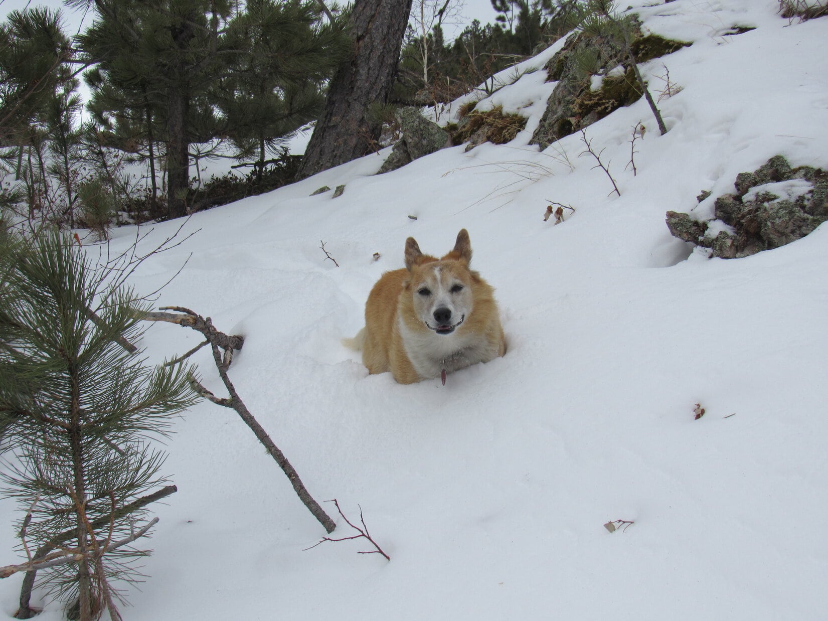
8:28 AM, 41ºF, start of USFS Road No. 216.1, 0.5 mile SE of Custer Peak – Bright and breezy when Lupe hopped out of the G6.  Such a long time since she’d been here!  Snow!  Only yesterday, deadfall had been her bane on the way to Peak 5316 in the southern Black Hills.  Snow was much more to the American Dingo’s liking.

Cool, clear, and breezy at the start of USFS Road No. 216.1. Photo looks WSW.

To what do I owe this great honor, SPHP?

What honor is that, Loop?

2 Black Hills Expeditions in a row.  Been forever since we’ve done that!

Ahh!  Easily explained.  This is the last warm day before a long cold snap moves in.  We’ve been spoiled!  Real winter is on the way.  Subzero every night!  A few more days until it gets that bad, but the deterioration is supposed to start this evening with a chilly wind out of the NW.  Sort of surprised at how breezy it is already.

Well, whatever the reason, I’m glad we’re here!  C’mon, SPHP, I’ll race you to the top!

Heh.  Might as well chalk another one up for the Carolina Dog right now.  SPHP started the trudge WNW, snow crunching underpaw.

C’mon, slowpoke! Loopster with her usual early lead. Photo looks WNW.

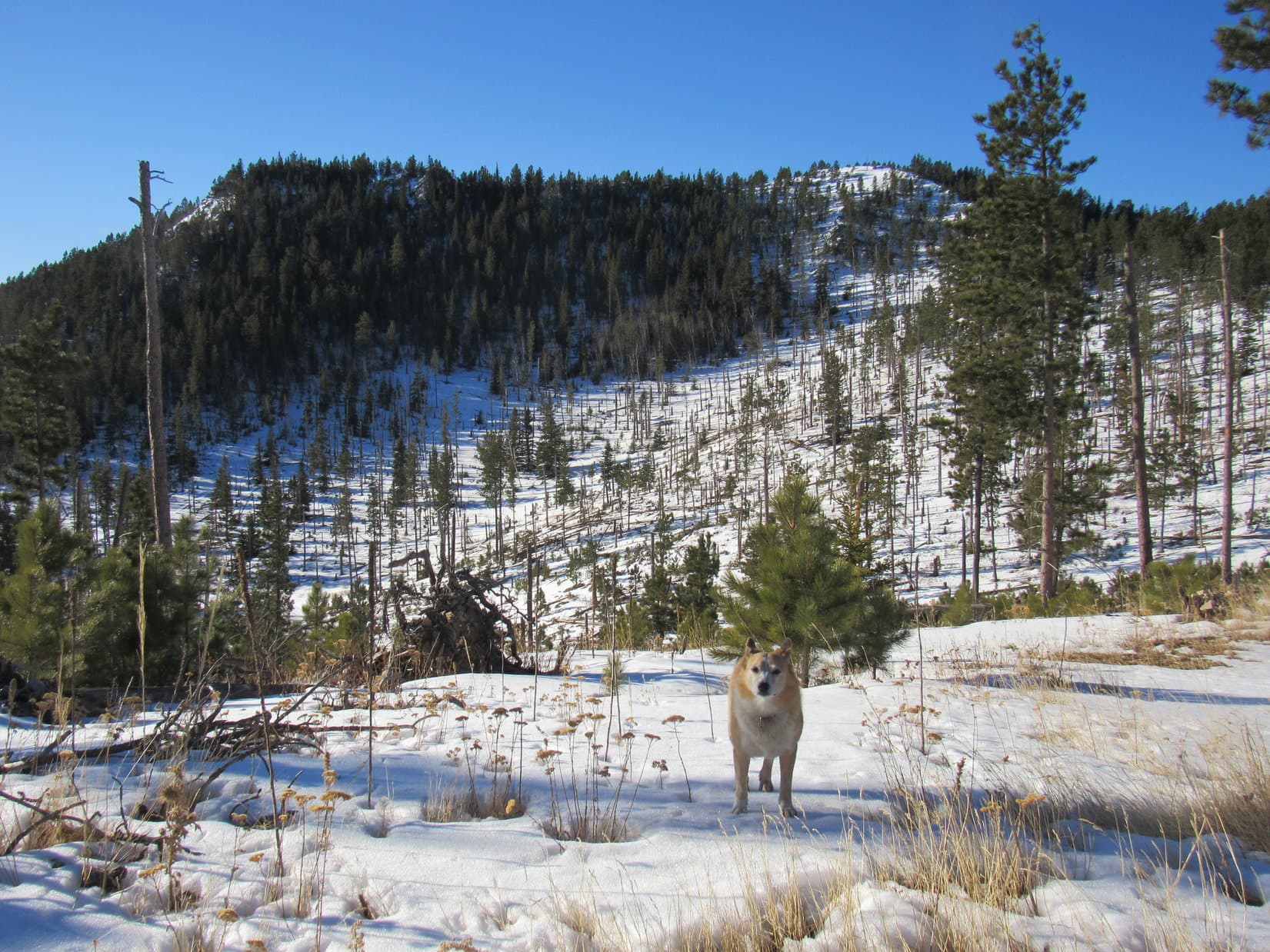
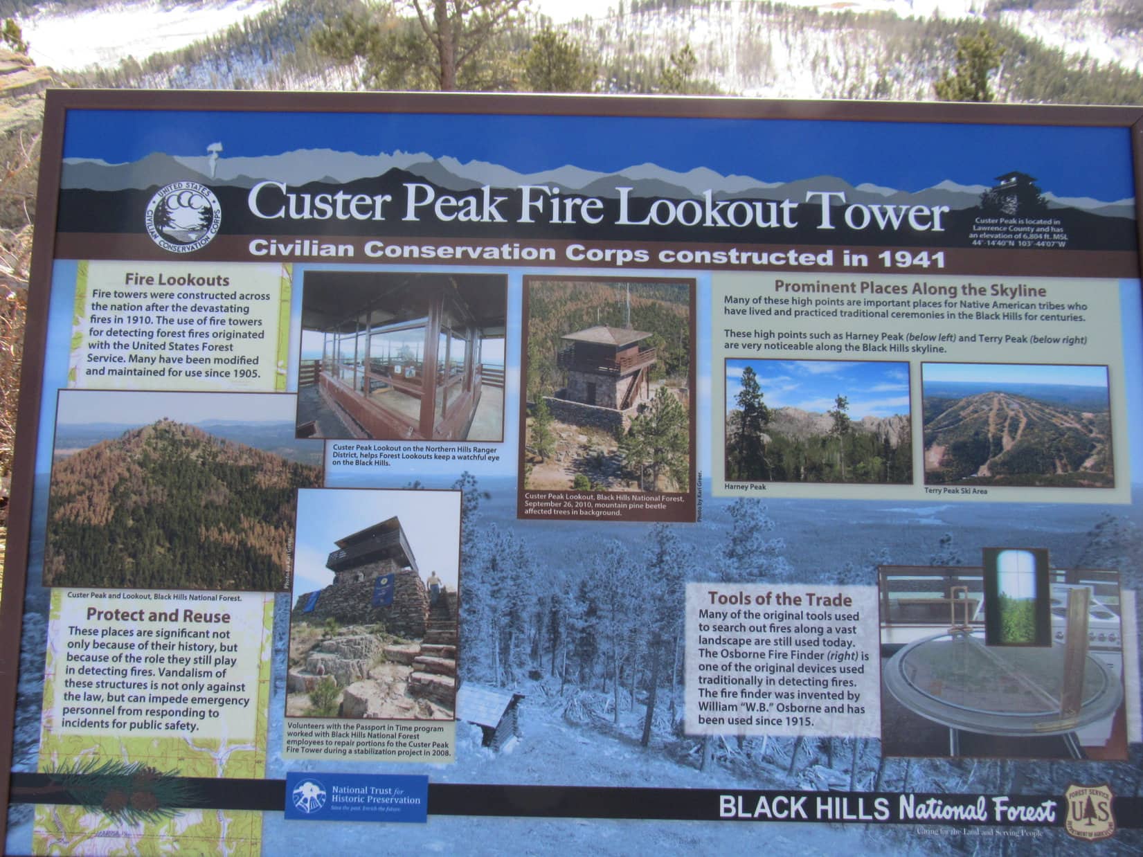
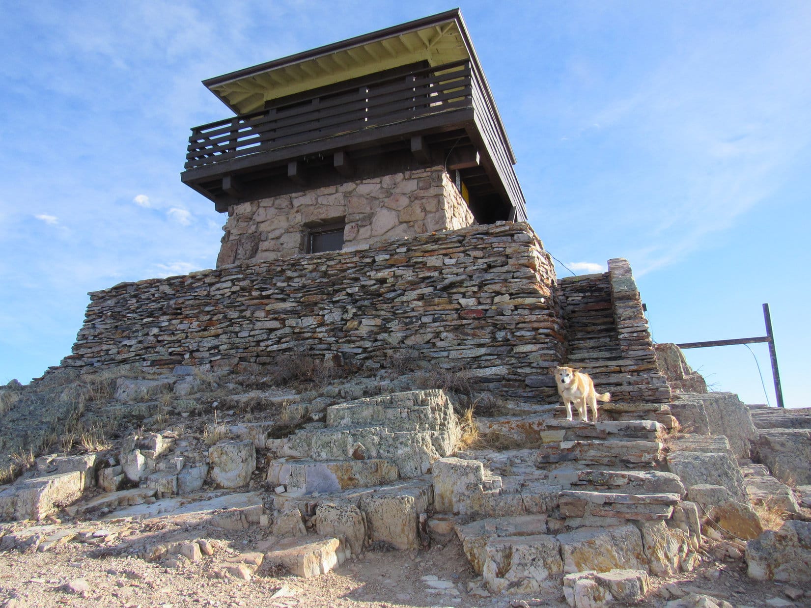
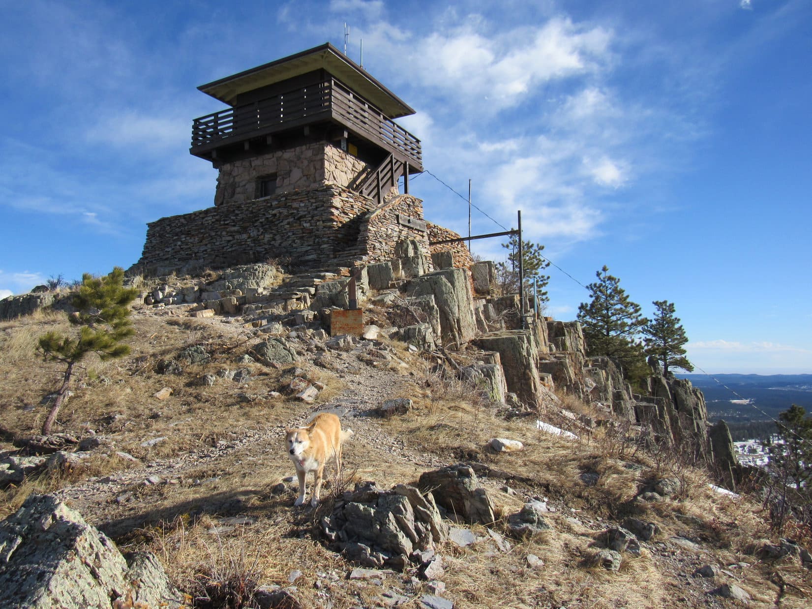
This was familiar territory.  Looper’s 7th ascent of Custer Peak, in fact.  Want the best views in the N central Black Hills?  The under 2 mile road trek up to the fire lookout tower on Custer Peak (6,804 ft.) is where to go.  Dominant views of the entire region!  Judging by how breezy it was down here, though, might be a gale up there today.

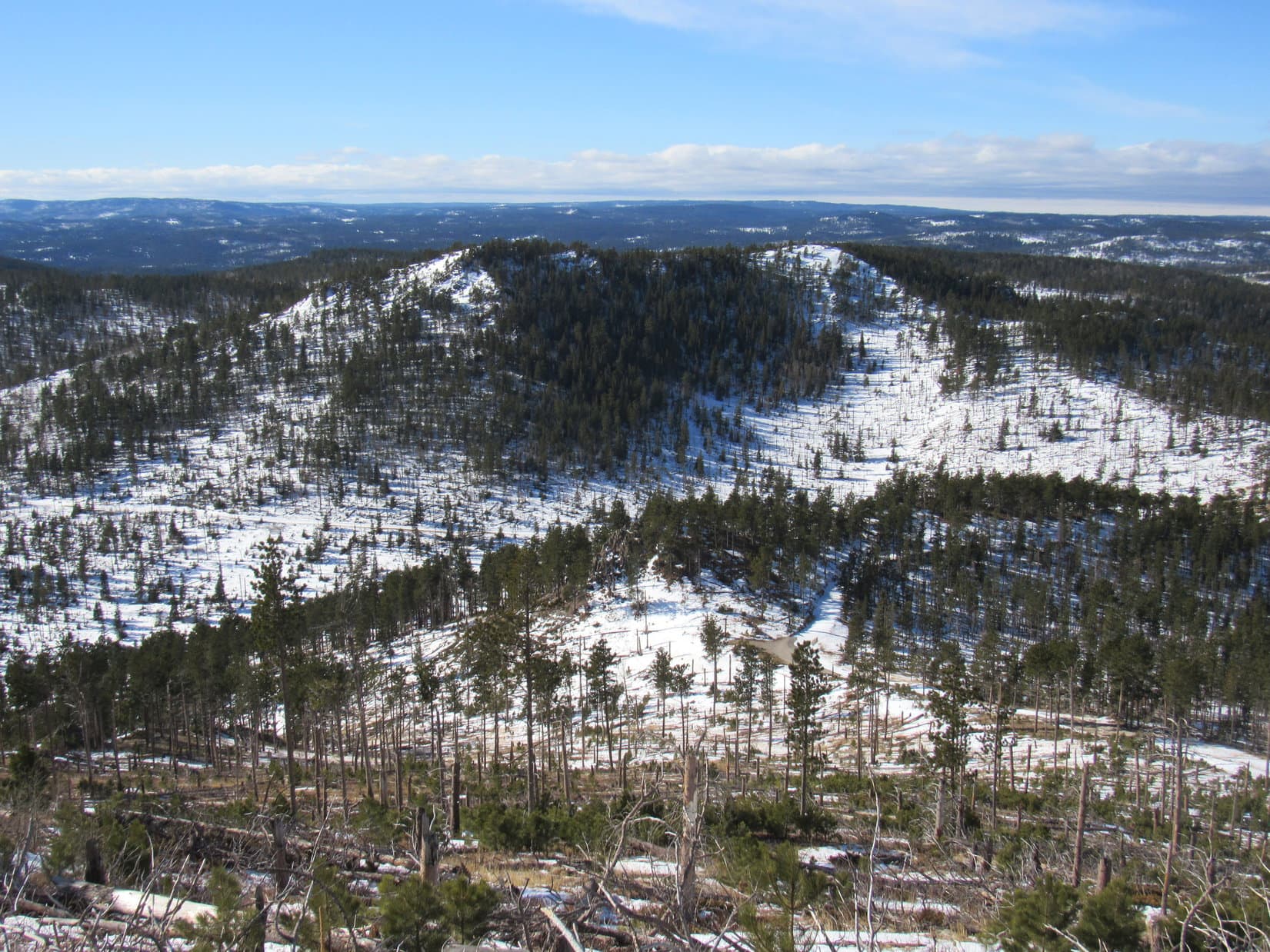
For nearly a mile, USFS Road No. 216.1 gradually steepened as it curved NW on the way to the saddle between Peak 6600 and Custer Peak.  The E face of Peak 6600 came into sight less than halfway there.  It wasn’t until Lupe got to the saddle region that she had her first really good look at Custer Peak.

Peak 6600 comes into view early on. Photo looks WNW.
Custer Peak from a knoll near the saddle leading to Peak 6600. Photo looks ENE.

USFS Road No. 216.1 curved sharply SSE shortly before Lupe got to the saddle.  However, No. 216.2A continued right on up to the saddle, where SPHP was surprised to see a new outhouse.  New in the 4.5 years since Lupe had last been here, that is.  At the saddle, No. 216.2A turned toward Custer Peak.  The road would go nearly all the way to the top.

At SPHP’s insistence, Lupe paused early on the No. 216.2A trek for a good look at the NE face of Peak 6600.

Peak 6600 from USFS Road No. 216.2A. Photo looks SW.

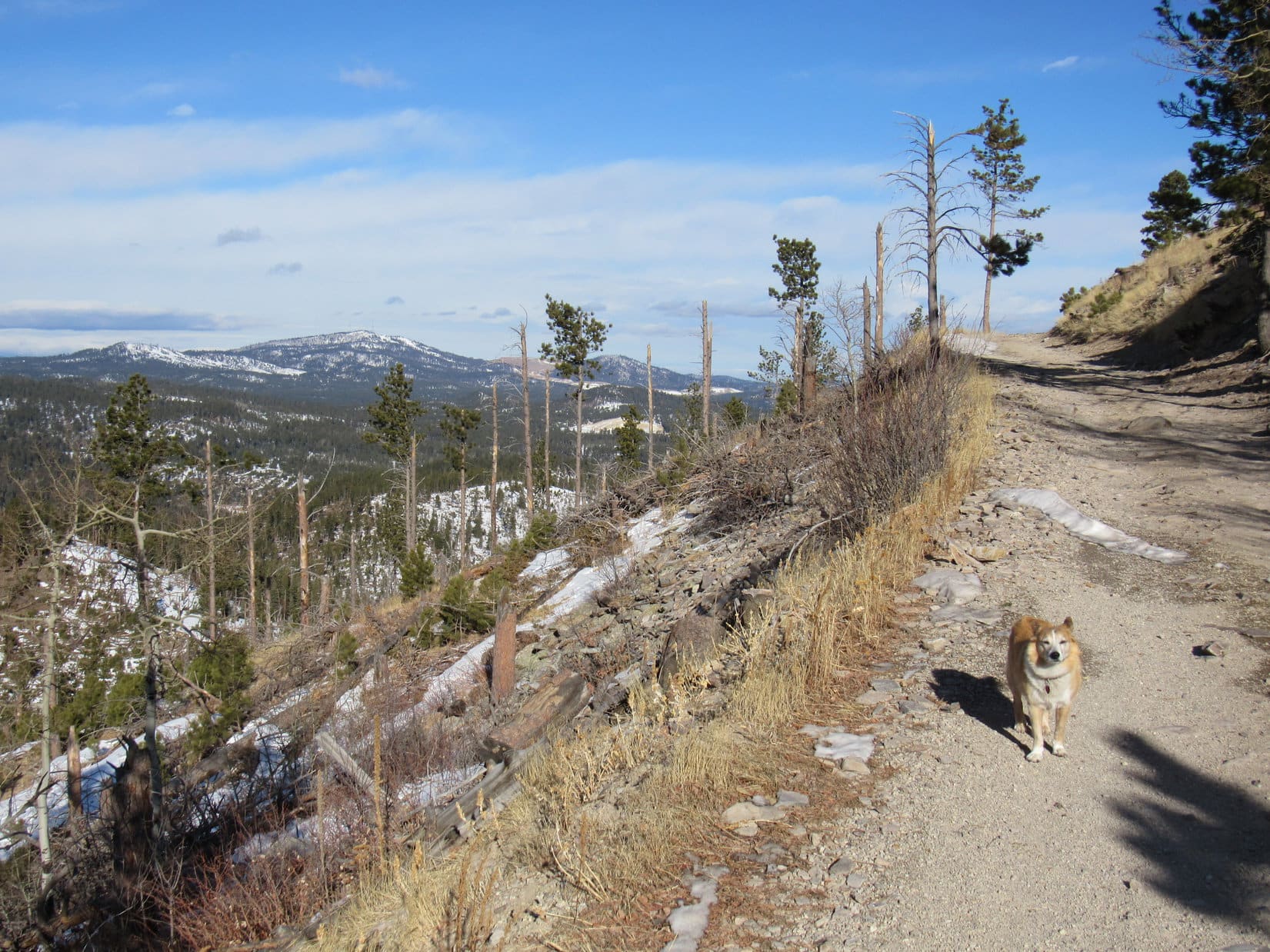
Didn’t take Loopster long to get to where No. 216.2A approached the base of Custer Peak.  From here, the road climbed steadily, ultimately completing a clockwise circuit of the entire mountain.  The views were fabulous where unobstructed, as they were most of the way up.

Terry Peak (7,064 ft.) to the NW was the most impressive sight, but the Carolina Dog was happier on the E and S sides of the mountain, where she was protected from the gusty wind which continually strengthened as she gained elevation.

Approaching Custer Peak on USFS Road No. 216.2A. Photo looks NE.
On the much calmer E side of the mountain. Photo looks N.
Getting close to the end of the road. Terry Peak (L). Photo looks NW.

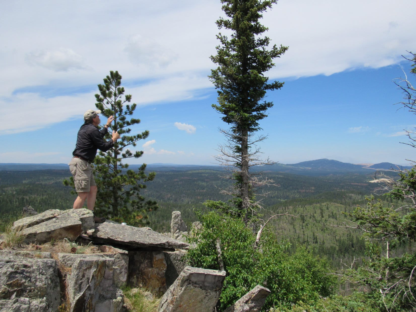
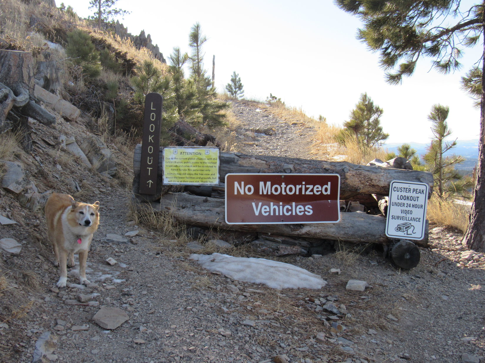
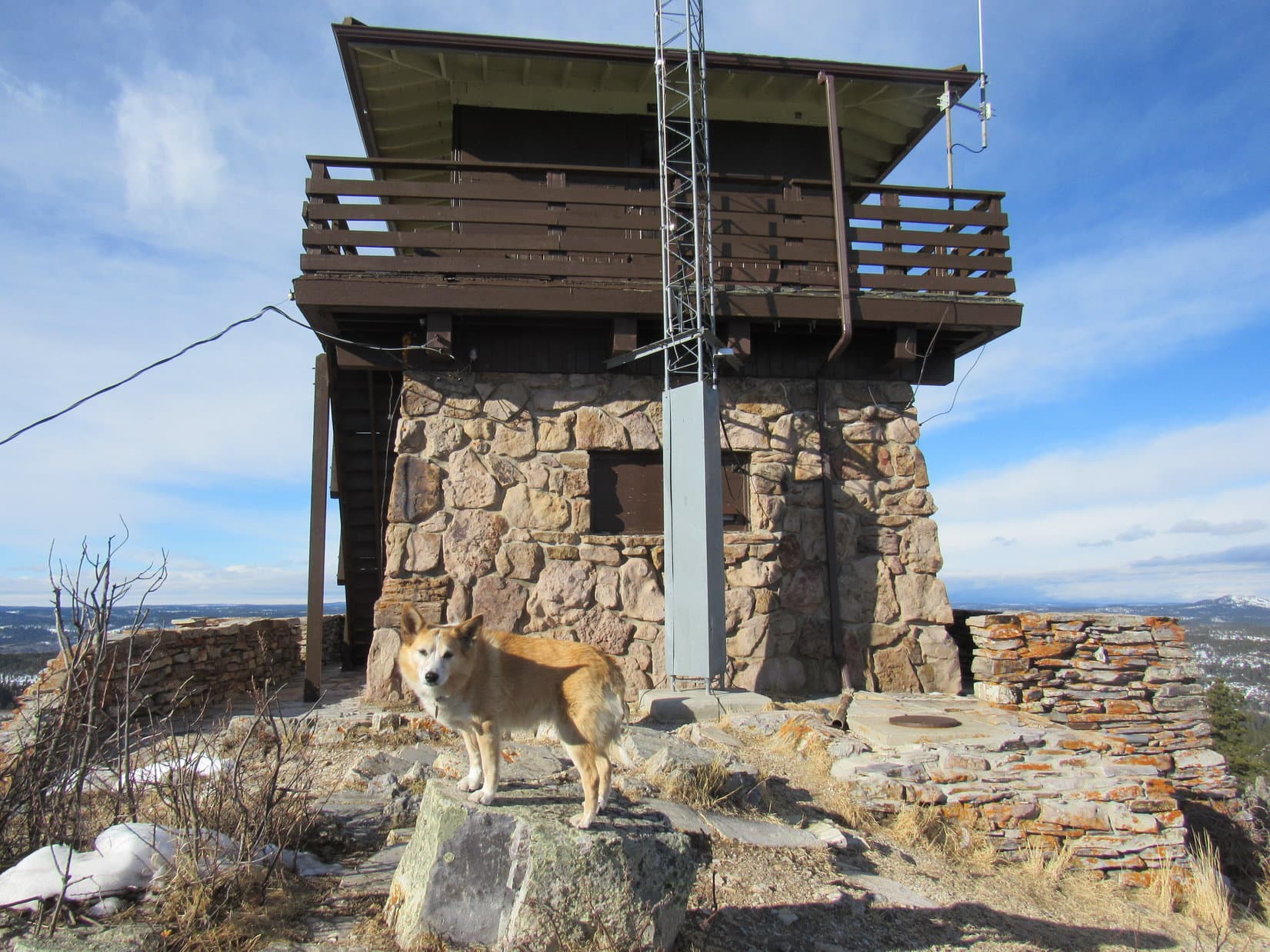
No. 216.2A dead-ended 100 feet below the summit.  Exposed to the wind, Lupe did not enjoy the path that switchbacked the rest of the way to the top.  SPHP paused to examine a new plaque near the fire lookout tower, but the Carolina Dog was anxious to get out of the breeze.

Start of the short path that switchbacks to the summit. Photo looks SSW.
The new information plaque near the lookout tower.
Come on, SPHP! Let’s get out of the wind!

The wind wasn’t all that terrible, but SPHP had to agree that life was more pleasant on the sunny E side of the lookout tower.  To Loopster’s joy, this time SPHP hadn’t forgotten to bring the chocolate coconut bars.  She curled up on SPHP’s lap, inhaling her share, then munched some Taste of the Wild.

After a pleasant 10 or 15 minutes peacefully enjoying the views, it was time to brave the wind and take a few photos between major gusts.

The sunny E side of the lookout tower, where Loop and SPHP hung out for a bit. Photo looks W.
Peak 6380 (L) in the foreground, and Bear Butte (4,422 ft.) (far L) in the distance. Photo looks ENE.

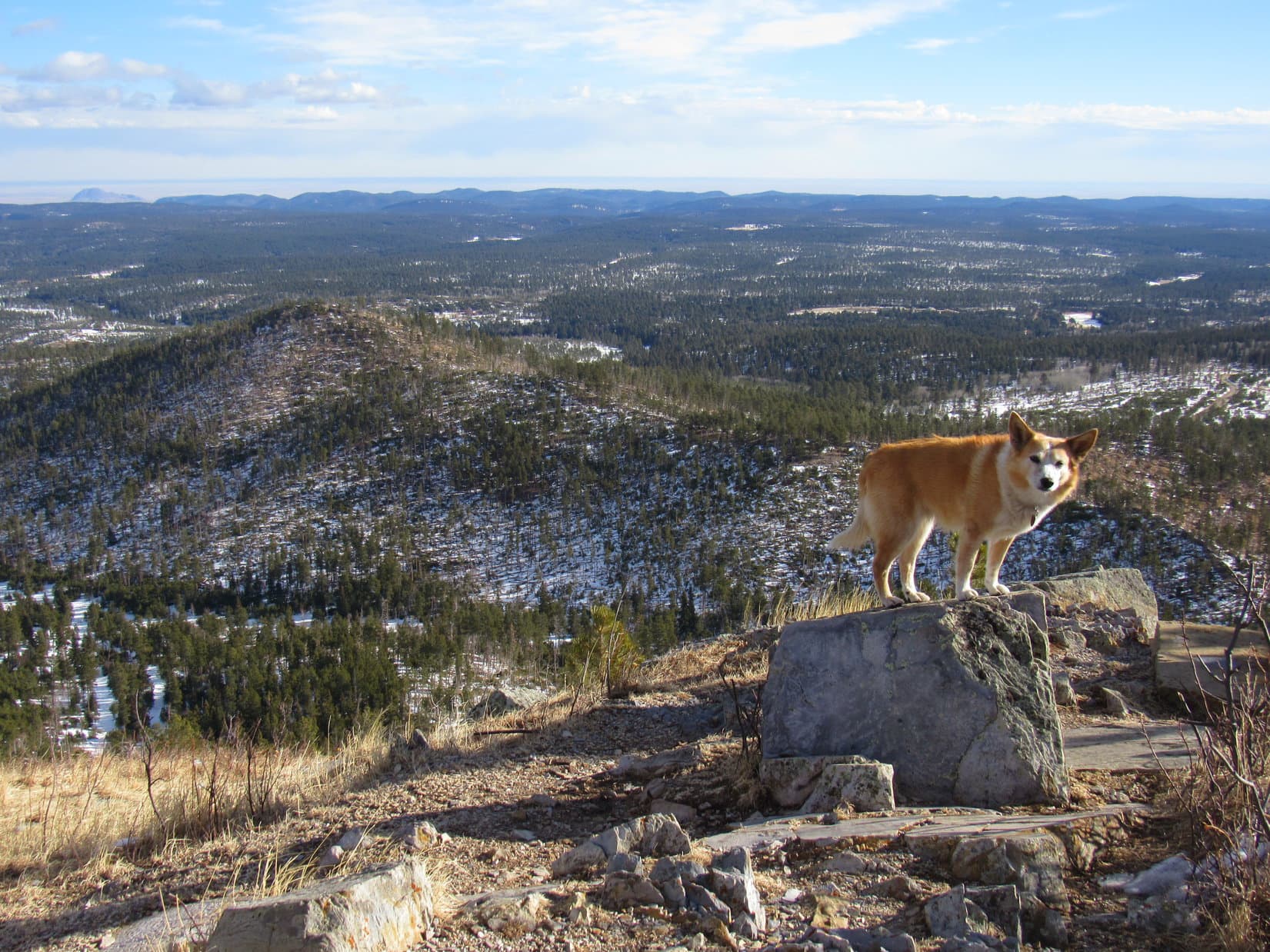
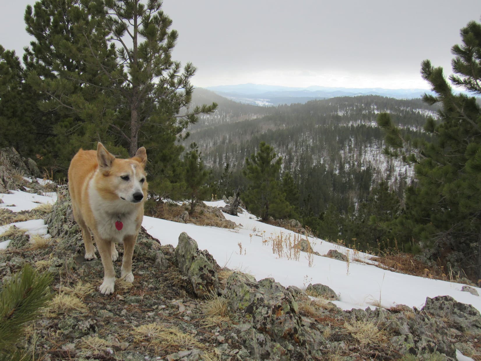
Terry Peak (7,064 ft.), framed between Deer Mountain (6,652 ft.) and Bald Mountain (6,617 ft.), was the big view, but Lupe could also see all the way S to Black Elk Peak (7,231 ft.), and W to the limestone plateau country.

Deer Mountain (L), Terry Peak (Center), and Bald Mountain (R). Photo looks NW.
Peak 6600 (L of Center) in the foreground. Photo looks SW.

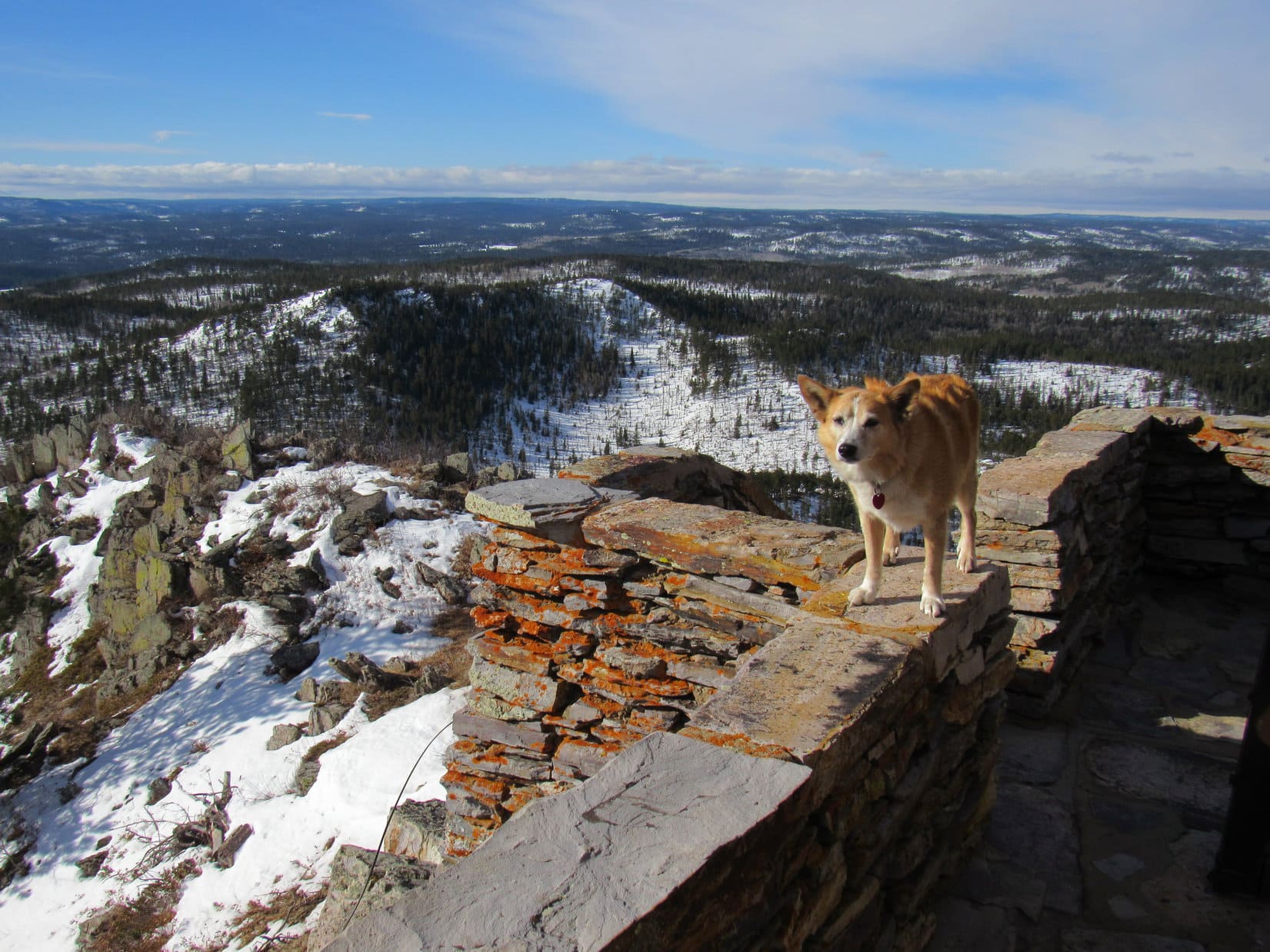
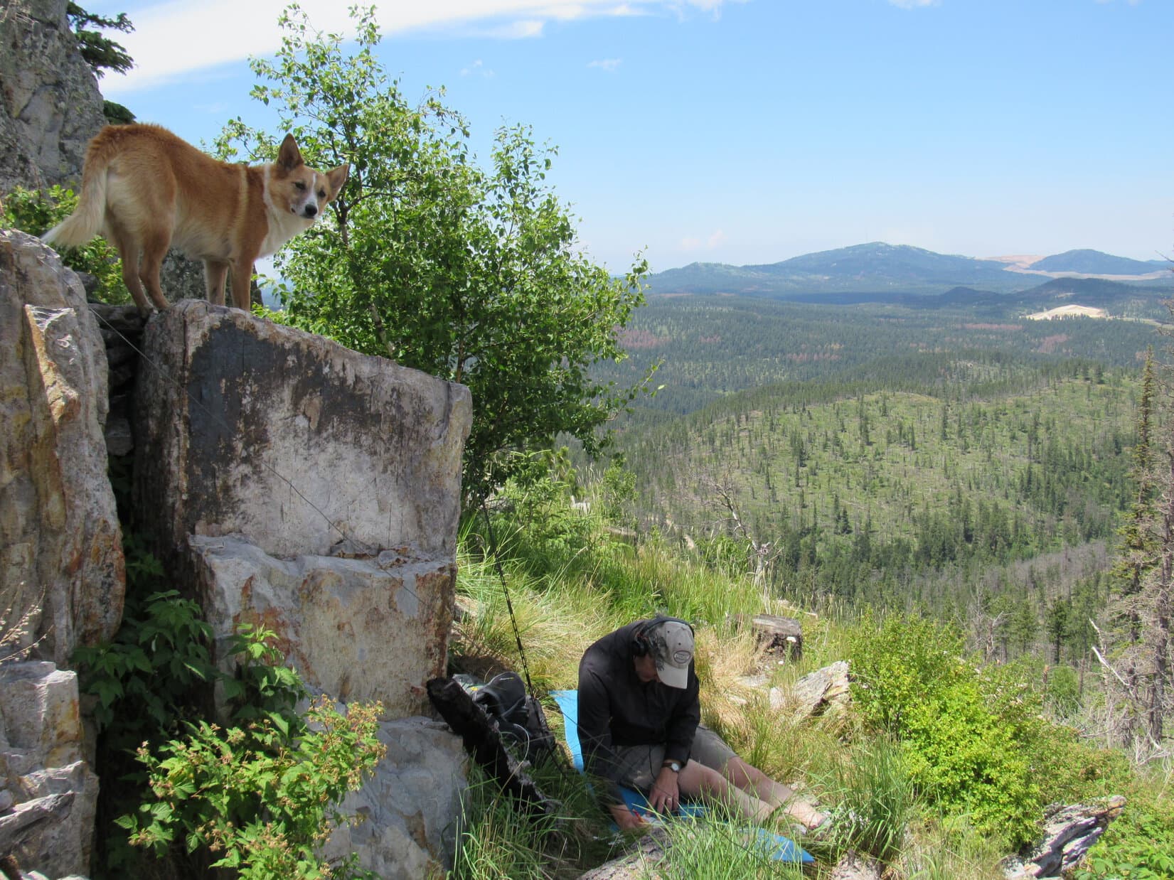
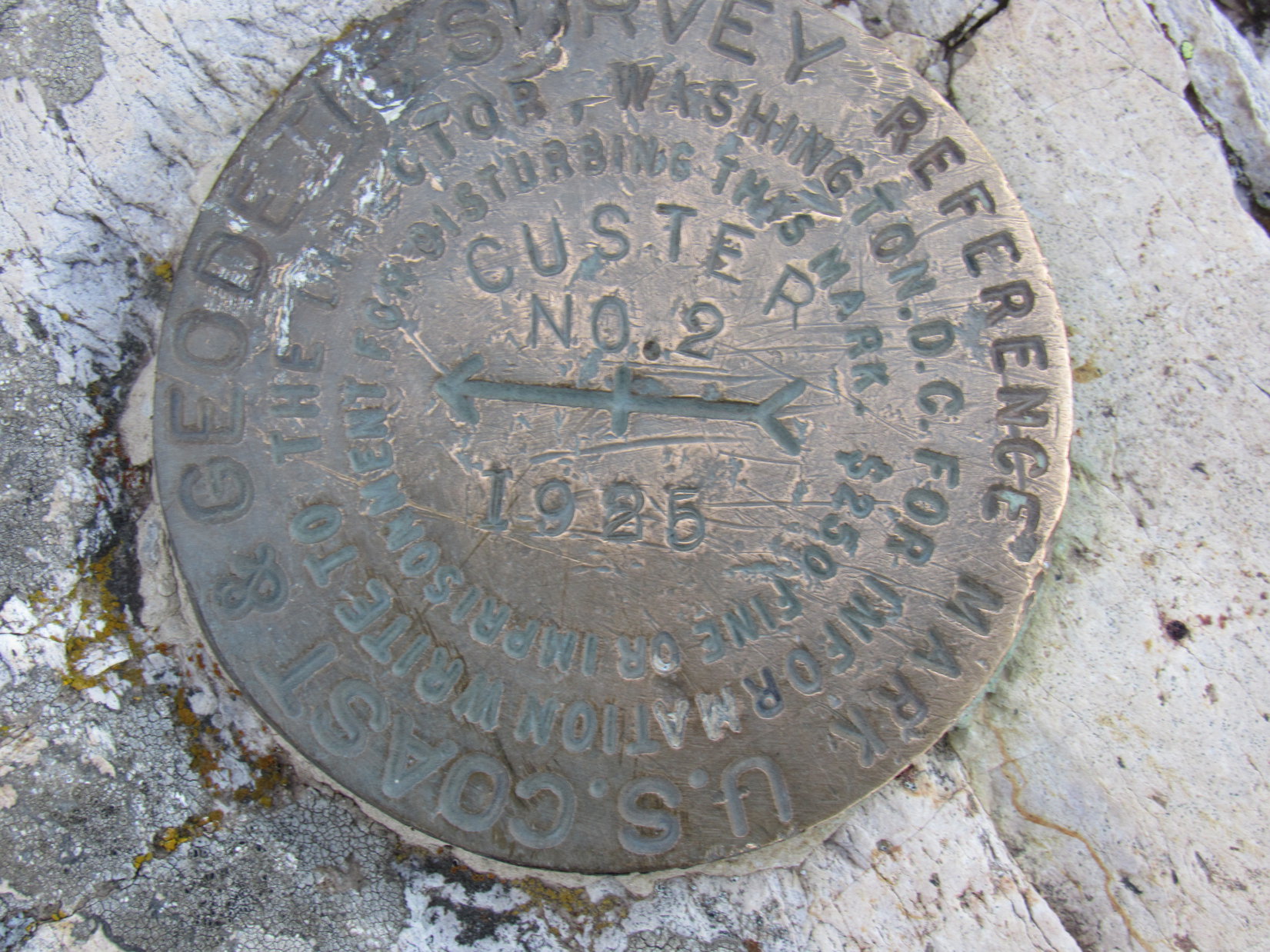
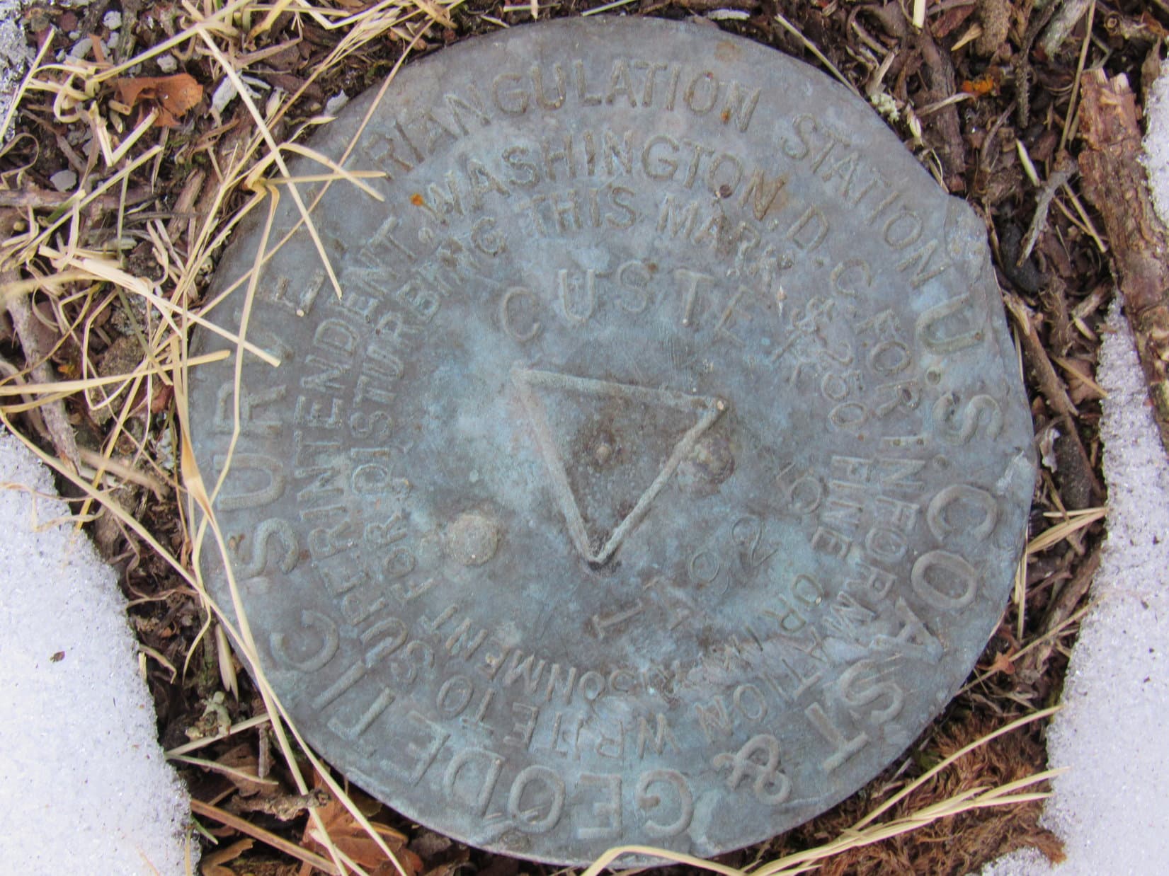
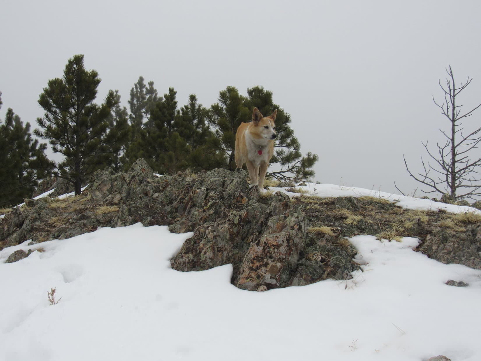
One or two laps around the lookout tower was about all the American Dingo was willing to put up with.  She didn’t get any respite from the wind yet, though.  After descending the tower steps, SPHP searched for the Custer survey benchmarks near the N side of the foundation.

Benchmark No. 2 near the NW corner of the lookout tower points E toward another marker 10 feet away.
“Custer” survey benchmark dated 1925.

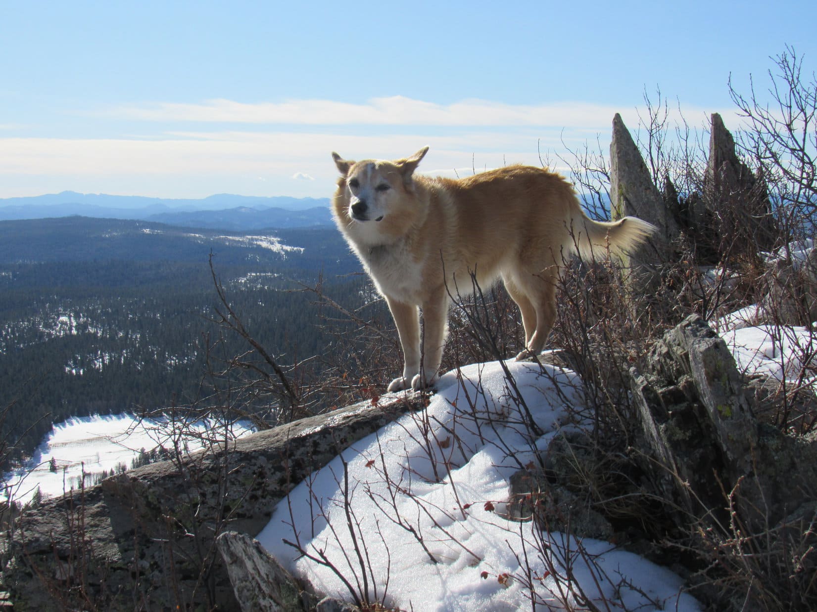
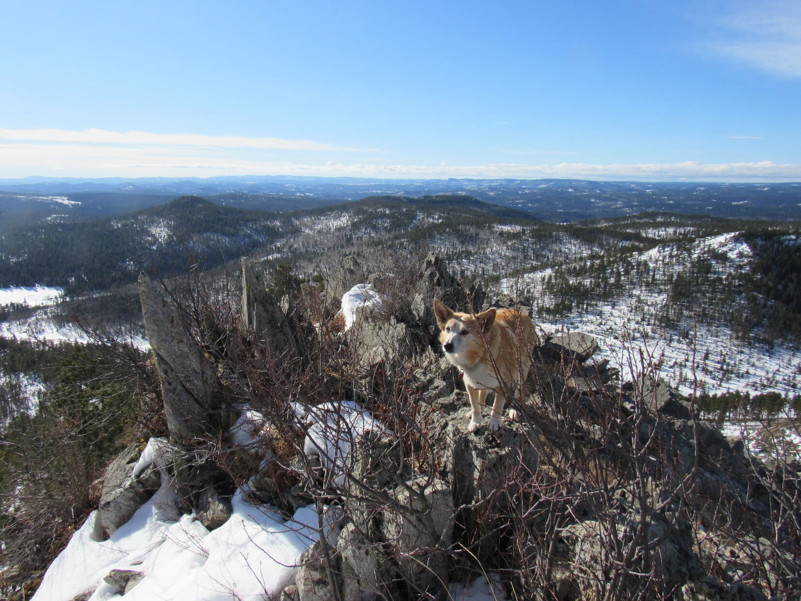
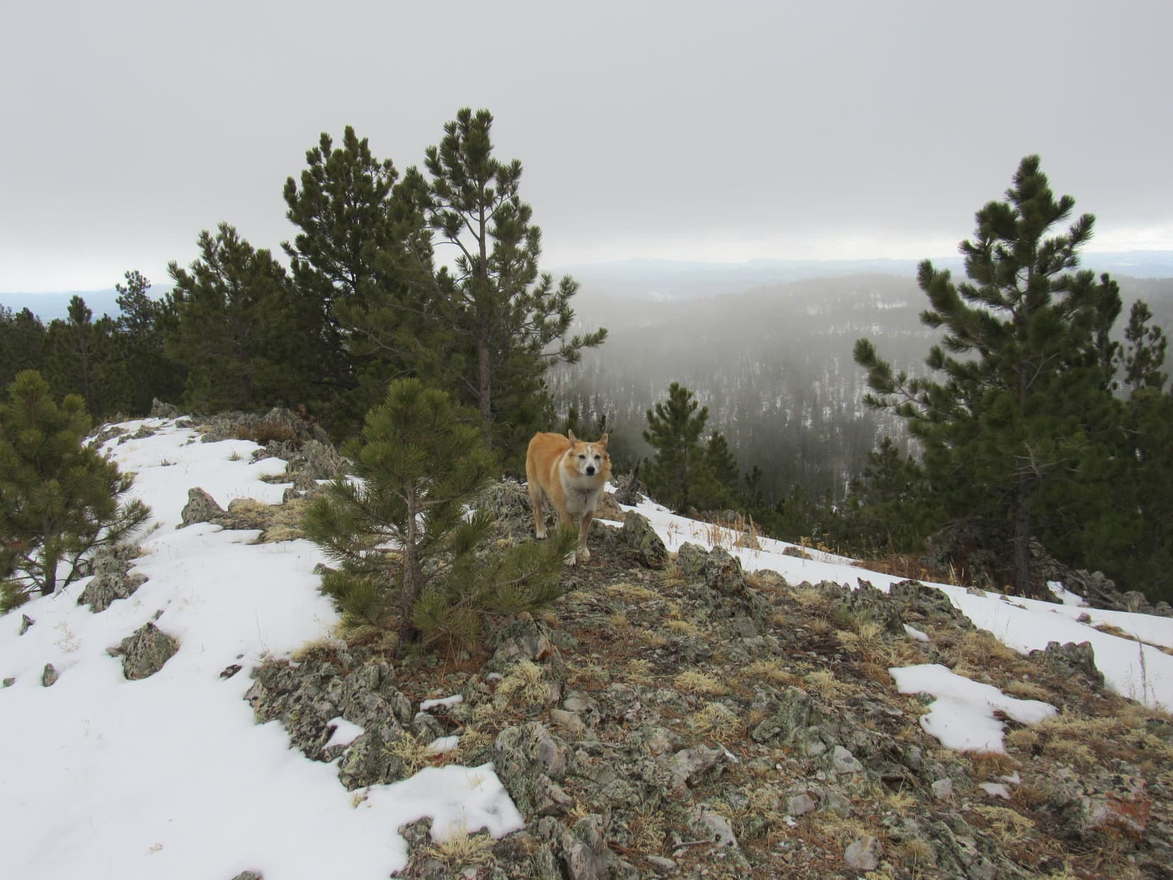
Lupe’s Custer Peak tour concluded with a look at the views from a short ridge SW of the tower.

Black Elk Peak (far L) on the horizon. Photo looks S.
Looking SSW.
Peak 6600 (Center) in the foreground. Photo looks SW.

40 minutes!  After a 4.5+ year absence, hardly seemed enough to do justice to Custer Peak, but the wind wouldn’t let up, and the Carolina Dog was anxious to go.  Plenty more to do today, anyway, down where the breeze wouldn’t be so stiff.  Lupe started her descent leaving the summit as she’d found it, bathed in sunshine and battered by the wind.

About to head down. Photo looks NE.

Once back to the road, SPHP paused briefly for another look at Peak 6600, then it was on down around to the leeward side of the mountain.

Peak 6600 (Center) in the foreground. Photo looks SW.

You sure seem interested in Peak 6600 today, SPHP!

That’s because that’s where we’re going next!

We are?  I thought we might be done with the wind and all.

The wind’s not that bad, Loop, especially down below.  More adventures in store!  We’re going to climb Peak 6600, since it’s got such a fabulous view of Custer Peak, then head NW a few miles to climb Peak 6480.

Peak 6480?

Yes, another 300+ foot prominence peak from Lists of John.  Sort of been thinking maybe we ought to start working the 300+ foot prominence lists this year, since you’ve been to just about every named peak in the Black Hills that we can legally climb.  Quite a few of them more than once.  Gives us new places to explore!

I’m all for exploring, SPHP!  Sounds good!

By the time Lupe got back around to the windy N side of Custer Peak, a line of gray clouds could be seen approaching from the NW.

Wonder if that’s the lead edge of the front coming in, Loop?  Didn’t think it was supposed to get here until this evening.  Hope the wind doesn’t get too much stronger.

Started out OK, but sure hasn’t warmed up any today, either, SPHP.

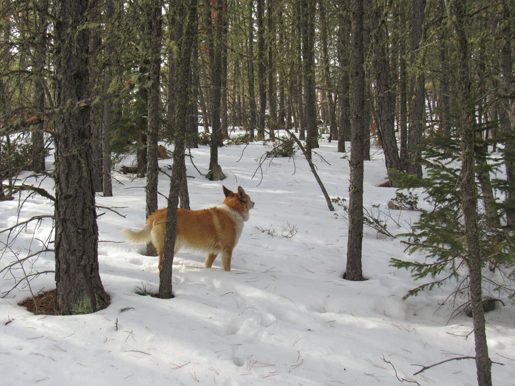
Reaching the saddle leading to Peak 6600, Lupe left the road, plunging right into the dense, snowy forest.  A 260 foot climb almost due S would get her up to the 6600 foot contour at the NW end of the summit ridge.

In the snowy forest, beginning the trek up Peak 6600.

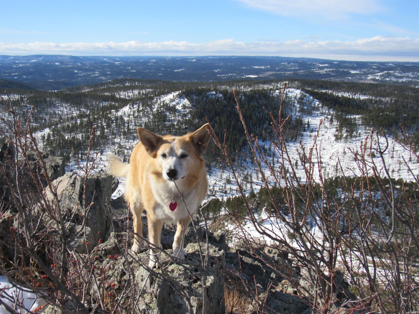
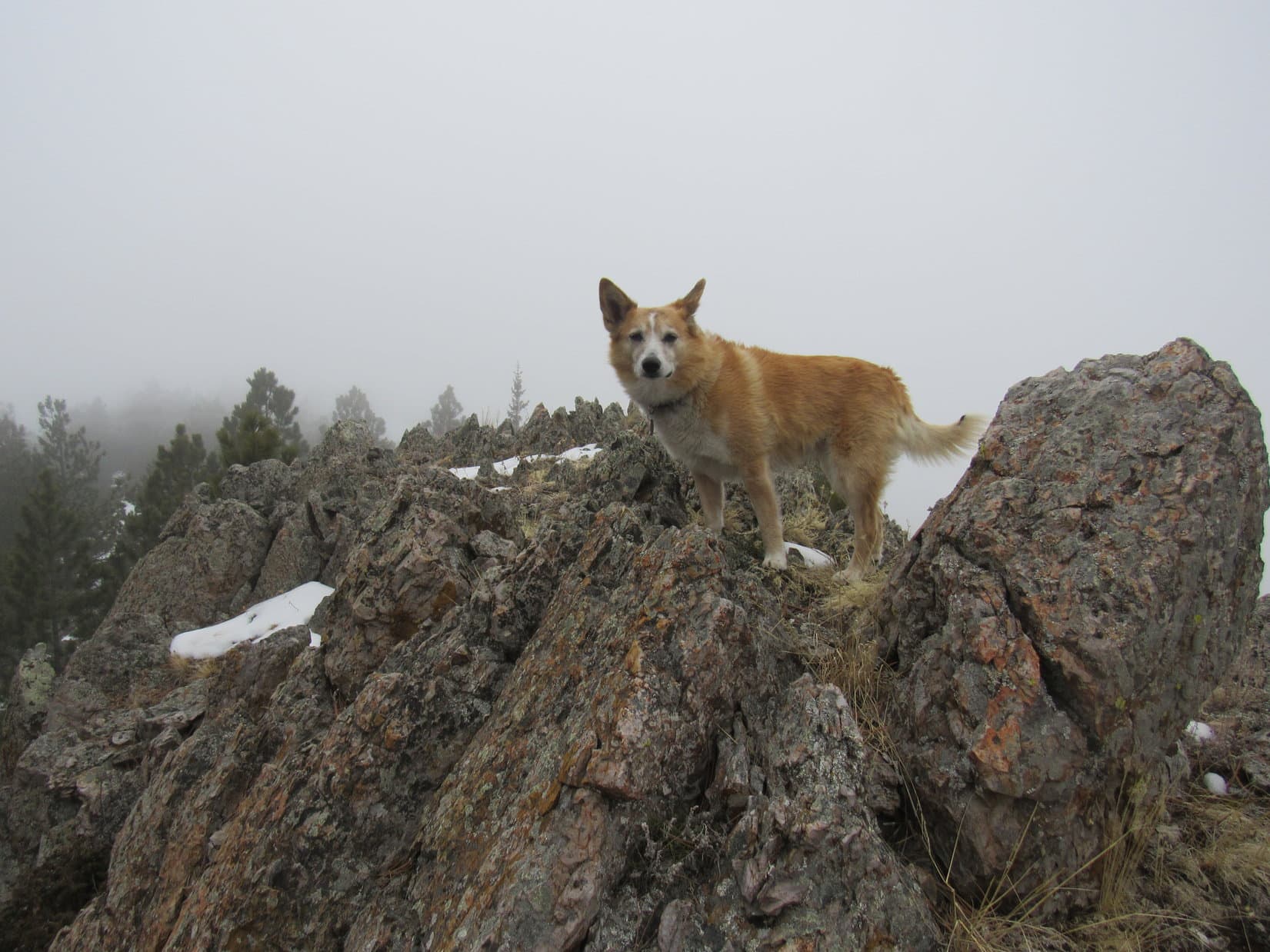
As expected, the route steadily steepened.  Some rocks, some deadfall, but mostly just trees and snow.  Lupe had done this once before, nearly 6 years ago, and been rewarded with a fantastic view of Custer Peak.  Best one possible, in fact, since Peak 6600 was the easily the highest point anywhere close to Custer Peak, and the summit ridge had a nice rocky spot where an unobstructed view could be obtained.

Any idea how much deeper this snow is going to get, SPHP?

Lupe wasn’t far from the top when the forest darkened.  Overhead, the sky was now a soft gray.  What happened to all the sunshine?  Loop was right!  Felt colder out, too.

C’mon, Looper!  The front must be here early!  Let’s get up to where we can get a couple of nice shots of Custer Peak before the weather deteriorates any further.

Didn’t take long.  A few more minutes, and Loopster was there, standing in the cold wind on the rocky viewpoint at the NW end of Peak 6600.

An hour had gone by since Lupe had left Custer Peak.  What a change!  Not only had all hint of sunshine utterly vanished, but a massive soft gray cloud hung low over everything.  Only on the far horizon did a brighter line indicate the already distant edge of the monstrous cloud.

The rocky viewpoint at the NW end of Peak 6600’s summit ridge. Photo looks S.

Custer Peak was still in view, except for the top 50 or 100 feet, where fog was now streaming by.  All in shadow now, instead of lovely sunshine, but nothing to be done about that.

Be ready, Loopster!  As soon as the fog clears from the summit, we’ll grab a quick photo of Custer Peak before things get any worse.

Bad decision!  Should have snapped one right away.  The Carolina Dog was ready, but the summit didn’t clear even for an instant.  Instead, the cloud suddenly swallowed the entire mountain.  Moments later, even Black Elk Peak (7,231 ft.), far to the S, was gone.

Black Elk Peak (Center) dimly on the horizon, moments before it vanished, too. Photo looks SSE.

Oh, come on!  Really?  It’ll clear, if we have a bit of patience, Loop.  Got to be a little break before too long.

Lupe seemed unconvinced, but was willing to curl up on SPHP’s lap for the warmth, if nothing else.  Another chocolate coconut bar didn’t hurt a thing, either.

No break in the cloud.  Peak 6600 became an island in a gray oblivion, the only place left standing in the whole world.  15 minutes ticked away.  Tiny snowflakes filled the air.

OooooK!  Even I can take a hint, if ya knock me over the head with a 2 x 4!  Custer Peak photo isn’t happening, Loop.  Wha’dya say we go in search of the true summit of Peak 6600?  After that we can see about Peak 6480.

Best idea you’ve had in the last hour, SPHP!  Let’s do it!

Final moments at the NW high point of Peak 6600. Photo looks N.

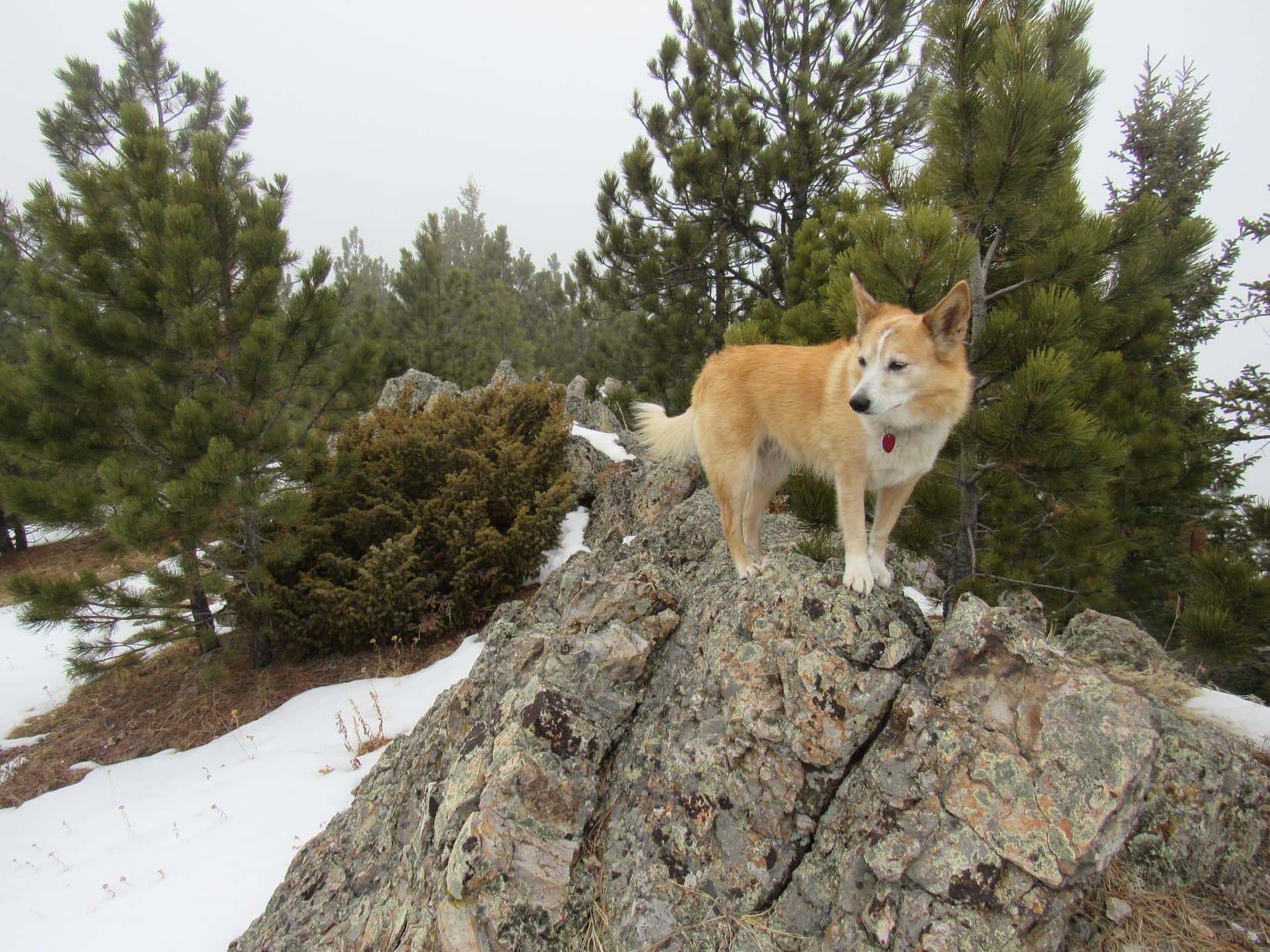
The summit ridge dipped a bit as Lupe traveled SE along it.  Pines and fog hid whatever was ahead until she was almost upon it.  After going several hundred feet or more, a sizable rock formation appeared.  Possibly the true summit, although no telling in this fog.

Circling around to the SE, Loop found a spot where she could scramble to the top, which proved to be kind of a weird jagged area.

At the jagged-topped true summit candidate. Photo looks N.

Nope!  Not the true summit.  Continuing SE only a little farther, Lupe went up a slope to definitely higher terrain.  The American Dingo was almost at the SE end of the summit ridge.  Congratulations were in order!  SPHP was almost certain the elevated line of rock Lupe had reached was the true summit of Peak 6600.

True summit of Peak 6600. Photo looks N.

There didn’t seem to be any reason to linger on Peak 6600, especially if Loop still hoped to get to Peak 6480 when the forecast was for steadily deteriorating conditions.  A couple of minutes at the top, and Lupe was on her way down the S ridge.

Starting down Peak 6600’s S ridge. Photo looks S.

Not too far to USFS Road No. 216.1!  The descent went well, and in less than 0.25 mile, Lupe picked the road up again a little SE of a high point.  (Point 6427 on the topo map)  Looper headed for it, reaching an open gate at the top in a thin fog and light snow.

At Point 6427 on USFS Road No. 216.1. Photo looks NW.

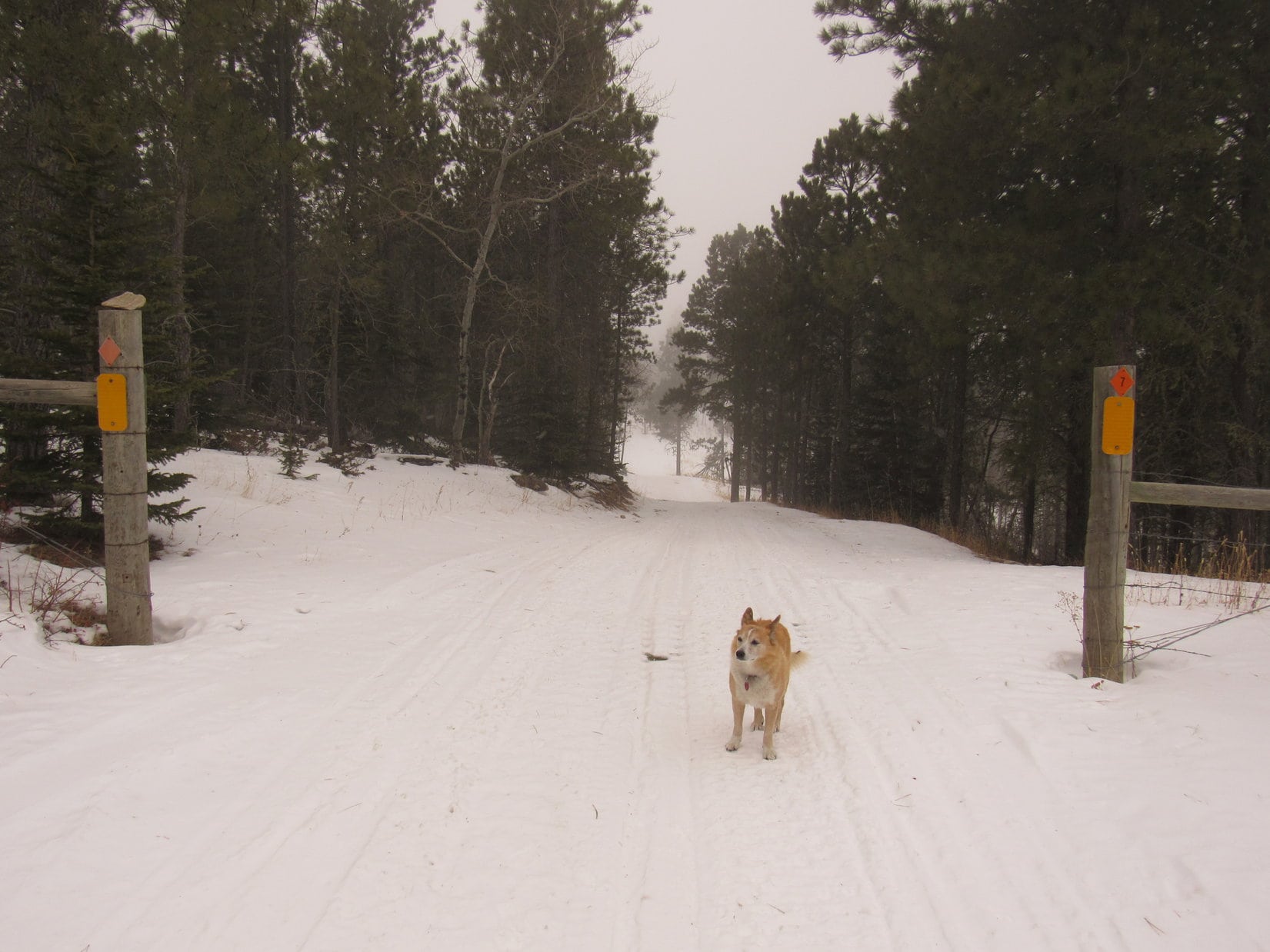
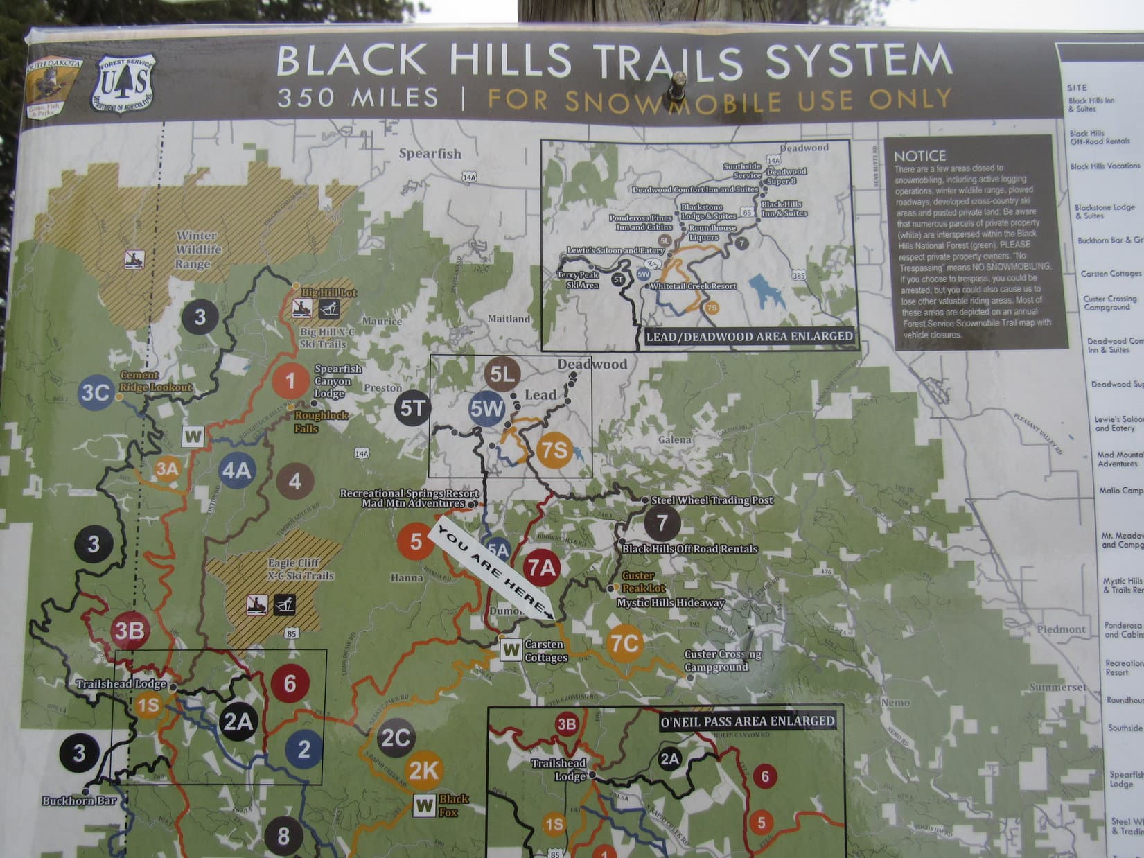
Continuing NW on the snowy road, Lupe soon came to an intersection at a low spot.  A map was posted here.  SPHP took a look.

Snowmobile trail map posted along USFS Road No. 216.1.

What’s it say, SPHP?

Nothing helpful to us, Looper.  It’s a large scale snowmobile trail map.

The way things are going, we’ll be needing a snowmobile before this is over.

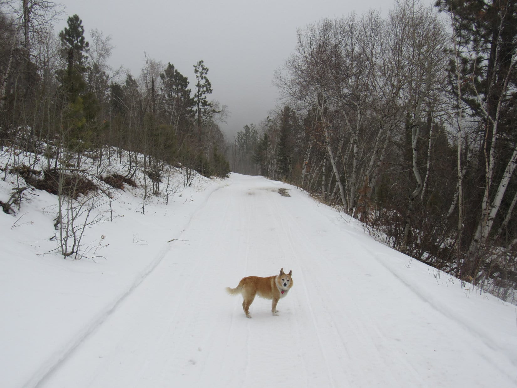
That had a ring of truth to it.  SPHP looked down at the American Dingo standing patiently on the snowy road, earnestly returning SPHP’s gaze.  All around, the forest was a mystery of fog and tiny swirling flakes.  Treetops swayed in the wind, releasing occasional cascades of fresh accumulations.  Snowing harder.  Even Loop was starting to turn white.

Not really that bad out.  Barely cold enough for snow, but the temp was supposed to drop, the winds increase.  Would it even be possible to find Peak 6480 in the fog?  Suppose Lupe did, what then?  Not going to see a thing.

What do you think, Loop?

About?

Call it, or go on?  We can come back, and do Peak 6480 another time.

Awesome out here in the snowy woods, isn’t it, SPHP?

Absolutely!  But possibly pointless, too.  Not sure it’s worth trying to go all the way to Peak 6480.  Might not recognize it, even if we find it.

Whatever you want to do, SPHP!  You know I’ll be there!

Truer words never spoken.  Not spoken now either, only conveyed by those completely trusting eyes.  No sense in letting a friend like that catch pneumonia!

So, Expedition No. 265 came to an early end.  Part success, part failure.  1.5 miles back to the G6.  A beautiful time in fog and snow, enjoying winter’s silence and solitude together.  (End 1:07 PM, 31ºF)

USFS Road No. 216.1A near Peak 6600, Black Hills of South Dakota 2-3-21

Links:

Next Black Hills Expedition                        Prior Black Hills Expedition

Want more Lupe adventures?  Check out Lupe’s Black Hills, SD & WY Expeditions Adventure Index, Master Adventure Index, or subscribe free to new Lupe adventures!

Black Hills, SD Expedition No. 174(a) – Summits on the Air! (Custer Peak, 7-2-16)

Lupe returned from her grand adventures in the Laramie Mountains of Wyoming on June 1, 2016.  Naturally, she expected to resume her explorations of the Black Hills in short order, but it didn’t happen.

May and June are normally the wettest months of the year in the Black Hills, but May had been very dry with temperatures running much above normal.  By early June, the sun was blazing day after day in cloudless skies.  Temperatures frequently soared to near record-breaking levels.  Almost no rain fell.  SPHP may as well have planted saguaros in the garden.  For Lupe, climbing mountains in a fur coat would have been miserable.  The Black Hills just aren’t high enough.

So Lupe’s adventures in June were mostly along the line of adventures in watering the lawn.  She fought with the old garden hose, converting it into a sprinkler hose in the process.  She chewed foot-long pieces off the end.  She played tug-of-war with SPHP, won most of the time, and became a very soggy (and cool!) doggie in the process, as the leaky hose sprayed water in every direction.

When she wasn’t a soggy doggie, Lupe licked ice cream from the freezer and consumed cold Alpo from the refrigerator.  A whole lot of panting and dozing went on the rest of the time.  Whenever the temperature got close to 100°F, SPHP would finally break down and turn on the AC in the bedroom, so Lupe could hide from the heat.

Nothing really changed until July 1st.  That morning, Lupe and SPHP woke up to rain!  It wasn’t raining hard, but at least the air was much cooler and clouds covered the sky.  Within a couple of hours, Lupe had another surprise.  Andrea called!  She was in town with Joe and Dusty!  Did Lupe want to come over to grandma’s house and play?

When she heard the news, Lupe was ecstatic!  She barked and leaped to hurry SPHP along.  Soon she was racing up the steps into grandma’s house to welcome everyone to South Dakota in her most enthusiastic Carolina Dog style.  Grandma had Beggin’ Strips for Lupe and Dusty.  The two dogs got to play ball and Frisbee with Joe and SPHP in the yard, go for walks, and lay on the deck with a view of the canyon.  There was ice cream, too.  July was off to a good start!

Joe is a ham radio operator.  He started telling SPHP about Summits on the Air, “an awards scheme for radio amateurs that encourages portable operation in mountainous areas”.  Peaks are assigned a point value.  Ham radio operators can earn points toward the SOTA “Mountain Goat” award by meeting certain criteria while operating from a peak, or points toward the “Shack Sloth” award for contacting those operating on a peak from home.

The home page for Summits on the Air (SOTA).

Joe had never tried the SOTA system before, but wondered if Lupe and SPHP would like to serve as guides to a suitable peak in the Black Hills?  Since Summits on the Air combines Lupe’s peakbagging interests with Joe’s amateur radio hobby, it sounded like fun!  Following the rain, the next day’s weather was supposed to be good, too, with highs only in the 70’s.  The question was, where to go?

Joe and SPHP looked over the SOTA website.  All of the Black Hills in South Dakota is included in two SOTA regions with a total of 181 listed peaks.  Most of these peaks have never been officially “activated” in the Summits on the Air system by anyone operating a portable radio from the peak.  After considerable discussion, Joe and SPHP selected Custer Peak (6,804 ft.) for Joe’s first SOTA attempt.  Joe created a free Summits on the Air account for himself.

The next morning, Joe posted a notification (called an “alert”) on the SOTA website that Joe (call sign AA0Q) would be operating his portable radio from Custer Peak.  The alert included the frequencies he would be using, and an estimated start time.  Once the alert was posted, Lupe, Dusty, Joe and SPHP dashed off to Custer Peak!

At 10:58 AM (72°F), Joe parked the G6 at Lupe’s usual starting point at the junction of USFS Road No. 216 (Custer Peak Road) and USFS Road No. 216.2A.  Although Lupe was only a little over 0.5 mile SE of the summit, the road to Custer Peak was nearly 2 miles long.  Lupe, Dusty, Joe and SPHP started the trek to the top along No. 216.2A.

Looking S from No. 216.2A near the start of the trek up Custer Peak (not shown).

Although Joe and Dusty had never been to Custer Peak before, this was Lupe’s 6th ascent.  Based on prior experience, SPHP had been telling Joe not to expect to see anyone at all on Custer Peak.  SPHP couldn’t have been more wrong!  SPHP’s pronouncement quickly became a joke.  First, Lupe and Dusty started coming to vehicles parked along the road.  Then dozens of people began to appear, most of them arriving in caravans of 4 or 5 ATV’s.

ATV’s roared up and down the dusty road.  As Lupe, Dusty, Joe and SPHP got higher on the mountain, Lupe also encountered groups of people coming down on foot.  SPHP was totally amazed!  What SPHP had failed to consider was that Lupe normally goes on very few expeditions in the Black Hills during the hot summer months, when everyone else is out and about.  Apparently, Custer Peak is a far more popular summer destination than SPHP ever realized.

Another surprise was in store at the top of the mountain.  The ranger station was manned!  The hatch door to the balcony around the station was unlocked and open.  Lupe, Dusty, Joe and SPHP went up on the balcony for a look around.

Lupe and Dusty on the ranger station's balcony. Although this was Lupe's 6th ascent of Custer Peak, she'd never been up on the balcony before.
Lupe and Dusty on the ranger station’s balcony. Although this was Lupe’s 6th ascent of Custer Peak, she’d never been up on the balcony before.

Joe found the ranger on duty to tell him that he would be operating a portable ham radio using 4 watts from the summit for an hour or so.  He just wanted to make certain it wouldn’t interfere with the ranger’s equipment.

The ranger didn’t think there was any equipment the radio would interfere with.  However, that didn’t mean there wasn’t a problem.  The American people declared independence and proclaimed freedom nearly 240 years ago, but times have changed.  The Land of the Free and Home of the Brave is now the Land of the Over-Regulated and Home of the Bureaucracy.  The ranger was cordial, but insisted that Joe contact the headquarters of the Spearfish district of the Black Hills National Forest to get official permission to operate the ham radio.

Neither Joe nor SPHP had a phone along, but the ranger allowed Joe to use his phone.  Naturally, since it was Saturday on the 4th of July holiday weekend, all Joe got was a recording.  The headquarters of the Spearfish district of the Black Hills National Forest wouldn’t be open until Tuesday.  Joe reasoned with the ranger inside the station.  Meanwhile, SPHP stayed out of it with Lupe and Dusty on the balcony.

It turned out the ranger’s concerns had to do with the ranger station being part of a designated historical site of some sort.  The ranger thought operating a ham radio might somehow break the historical site regulations.  Fortunately, the ranger had a map of the historical site area.  It covered only a relatively small part of the summit area surrounding the ranger station.

Joe and the ranger finally agreed that the NE side of a jagged rock outcropping a little way NW of the ranger station was outside the boundary of the historical site delineated on the map.  The ranger was OK with Joe setting up the ham radio operation over there.  That was a relief!  Lupe, Dusty, Joe and SPHP left the ranger station to go set up the antenna and other equipment.

Joe made a perfect toss of a large metal nut tied to fishing line up over the very top of a tall tree situated near the spine of the jagged rock outcropping.  The fishing line was then used to pull up a thin antenna wire.  Joe instructed SPHP on how to help deploy 4 lateral wires at the base of the antenna.

The ground on the NE side of the ridge was quite steep and rocky, so it took a little time to maneuver around and get set up.  Lupe and Dusty supervised operations from the most comfortable vantage points they could find.

Joe makes a perfect toss of a metal nut tied to fishing line over the top of the tall thin tree near the ridgeline. The fishing line was then tied to a very thin antenna wire, and pulled up to the top of the tree. Photo looks NW.
Lupe supervises from the shade while Joe sets up his portable ham radio NE of a jagged rock outcropping NW of the ranger station.
Joe and Lupe continue working on the portable ham radio setup. Dusty sneaks off to check out SPHP's backpack on the chance there might be something good in it. One of the lateral wires can be seen in front of Dusty. Photo looks SW.
Joe and Lupe continue working on the portable ham radio setup. Dusty sneaks off to check out SPHP’s backpack on the chance there might be something good in it. One of the lateral wires can be seen in front of Dusty. Photo looks S.
Joe nearing completion of the portable ham radio setup. Joe's call sign is AA0Q.
Joe nearing completion of the portable ham radio setup. Joe’s call sign is AA0Q.
Dusty finds a shady spot to rest near some of the lateral wires. Photo looks E.

The ranger’s concerns, and the rough ground where Joe was forced to set up the radio, slowed things down.  By the time Joe was ready to try his very first Summits on the Air peak activation, it was more than half an hour after the time Joe had posted on the SOTA website.  Would any other ham radio operators still be listening for AA0Q on Custer Peak?  Joe had no idea what to expect.

Joe turned on his radio.  AA0Q was on the air on Custer Peak!  Almost immediately, another ham radio operator made contact with Joe.  (A contact is apparently referred to as a QSO.)  The contact told Joe that he would “Spot” him on the SOTA website.  Although Joe has many years of experience with ham radio, he wasn’t prepared for what happened next.

Almost instantly, there was a “pileup”.  Joe shouted out to SPHP that it sounded like 20 people were trying to contact him all at once!

While Lupe looks on, Joe is instantly swamped by the response to his Summits on the Air activation of Custer Peak! Terry Peak (7,064 ft.) (R of Center) is the highest mountain in the distance. Photo looks NW.
Dusty, surrounded by wires, looks happy with all the success Joe is having with his very first ever activation of a peak using Summits on the Air.
AA0Q's portable ham radio during use on Custer Peak.
AA0Q’s portable ham radio during use on Custer Peak.

Joe had a frantic time trying to respond to the enormous demand.  Mostly he was quiet, busy listening intently through the headphones while using Morse Code to reply to as many of the radio operators seeking him as possible.  At the same time, he was trying to log the call signs, time of contact, location and a few other details of each successful contact.  Just to keep Lupe, Dusty and SPHP informed, now and then he called out where the operators he was “working” were from.

The pileup eventually ended as those trying to contact Joe either got through, or gave up on reaching him.  After half an hour, new contacts were sporadic.  Joe kept his radio active another 15 minutes, switching to a voice frequency toward the end.  After one or two voice contacts, Joe was satisfied.  He’d managed to make and log 15 different QSO’s (contacts) from ham radio operators scattered all over the USA.

Joe was pretty happy with his first SOTA experience.  AA0Q had never been so popular and in demand before!  He’d made mistakes that kept him from “working” many of those who had tried to contact him, but Joe had learned a lot.  In the future, it would be easy to correct the worst errors.  Keeping the contacts short was vitally important.  People wanted their “Shack Sloth” points awarded for a successful QSO fast!  No dilly-dallying around allowed in this business.  Next time, Joe would have SPHP do the logging.

After taking down the antenna and putting the radio equipment away, it was time to return to the summit for a few pictures.  Joe also wanted to chat with the ranger to let him know his SOTA radio operation was over.

Up on the jagged ridge before returning to the summit. Photo looks SE from a point not too far from Joe’s SOTA activation of Custer Peak.
Joe, Dusty & Lupe below the ranger station. Photo looks SE.
At the summit.
AA0Q was the first to ever use Lupe's "Radio-Active" American Dingo guide services to a Black Hills peak for a Summits on the Air purpose. Joe earned 8 points toward SOTA's Mountain Goat designation for "activating" Custer Peak (6,804 ft.)! Photo looks NW toward Terry Peak.
AA0Q was the first to ever use Lupe’s “Radio-Active” American Dingo guide services in the Black Hills for a Summits on the Air peak activation. AA0Q earned 8 points toward SOTA’s Mountain Goat designation for “activating” Custer Peak (6,804 ft.)! Photo looks NW toward Terry Peak.
Looking NE.
Looking SSW.

Joe’s operating point on the NE side of the jagged NW ridge hadn’t been the easiest place to work from (or the most comfortable), but it did have a couple things going for it.  The NE side of the ridge was hidden from the trail to the ranger station, so Joe hadn’t been bothered by all the people coming and going.  The site had also been close enough to the top of the mountain to meet SOTA’s standards for a “peak activation”.

Joe and Dusty start down the trail. Joe had conducted his SOTA activation of Custer Peak from the opposite side of the jagged NW ridge seen here. Photo looks N.
Lupe on the jagged NW ridge. Photo looks N.

When Joe, Dusty, Lupe and SPHP got back to grandma’s house, Joe logged all 15 contacts (QSO’s) he’d made into the Summits on the Air website.  Joe was awarded his first 8 of 1,000 points required to earn the “Mountain Goat” designation.  The 15 QSO’s each earned points toward the 1,000 points required for the “Shack Sloth” designation.

The SOTA map showing the activation of Custer Peak by AA0Q earlier in the day.

Joe was happy.  Lupe and Dusty were happy, too.  They had earned extra ice cream and Beggin’ Strips for becoming “Radio-Active”!

Links:

Next Black Hills Expedition                Prior Black Hills Expedition

Want more Lupe adventures?  Choose from Lupe’s Black Hills Expeditions Adventure Index or Master Adventure Index.  Or subscribe free to new Lupe adventures.

Black Hills, SD Expedition No. 170 – Kirk Hill, Tetro Rock & Custer Peak (5-1-16)

April in the Black Hills ended with 5 straight days when Lupe never saw the sun.  Sometimes it rained, sometimes it snowed, sometimes it didn’t do anything except blow.  The one thing that didn’t change was the unrelenting gloom.  Lupe stared out the window for hours.  She dozed when the boredom got to be too much to bear.

The clouds were breaking up and the sun was shining, though, on the first morning of May.  Was Lupe ready for a Black Hills expedition?  Was she ever!  Impatiently she urged SPHP to action.  Let’s go this very second!  That didn’t happen, but as soon as the usual preparations were complete, the Carolina Dog got her wish.

Within moments of when SPHP parked the G6 near the intersection of USFS Roads No. 180 and No. 541.1, Lupe was even happier!  After spending all of her April expeditions in cactus country in the southern or SW Black Hills, she was now much farther N.  Lupe instantly seemed to realize there was no danger of encountering any of the hated cactus here.  She ran with abandon through the fields and pine forests.  This was more like it, as far as the American Dingo was concerned!

Lupe near the start of USFS Road No. 541.1. She was very happy to be up in the hills again, and even happier to be out of cactus country! Photo looks S.

Lupe’s first peakbagging goal, Kirk Hill (5,345 ft.), was only a little more than a mile SSE of the G6.  Lupe and SPHP started out following USFS Road No. 541.1, which gained elevation steadily as it headed SE up a small valley.  A tiny stream soon appeared just W of the road, but Lupe was more interested in the delightful patches of cool, wet snow in the forest.

On USFS Road No. 541.1. Photo looks SE.

After following No. 541.1 uphill for a mile, Lupe arrived at a flat stretch of road at a pass just E of Kirk Hill.  Lupe had already gained hundreds of feet of elevation.  Here the forest had several inches of heavy wet snow, not just scattered patches.  That didn’t bother Lupe in the slightest.  She left the road heading W up the mountain.

Lupe left USFS Road No. 541.1 here to climb Kirk Hill from the E. Photo looks W at her way up.

Lupe didn’t have to go very far through the snowy forest before she found another road.  That made things real easy.  Lupe and SPHP followed this new road N.  As SPHP hoped, it soon curved W and took Lupe all the way to the summit near the SW end of Kirk Hill.

Lupe arrives at the summit of Kirk Hill. The summit area was broad, flat and mostly forested. Photo looks W.

The very highest rocks were in a sunny little meadow, but the much larger summit area was broad, nearly flat and mostly forested.  Some of the forest had been thinned, but although Lupe and SPHP wandered around the mountaintop quite a bit, it was hard to find any really good viewpoints.  The very best view was of Custer Peak (6,804 ft.) to the SW, which looked quite snowy and rather dramatic.

The best view Lupe could find from Kirk Hill was this look at Custer Peak (6,804 ft.). Photo looks SW. Taken with the telephoto lens.
Lupe sniffing around on Kirk Hill. Photo looks NW.

After exploring much of the W end of Kirk Hill, Lupe returned briefly to the highest rocks at the summit one more time.  Then she and SPHP started back E on the road.

After exploring the W end of the mountain, Lupe returns to the summit for the last time. Photo looks NE.

Toward the middle of the mountain, Lupe and SPHP left the road to scout out the S rim.  It was thinly forested, snowy, and sunny.  The forest still interfered with the views to a significant degree, but it didn’t matter.  The area to the S was pretty, but not dramatic.  Lupe and SPHP returned to the road.

Just to find out if this road was marked in any way, Lupe and SPHP stayed on it all the way until it reached No. 541.1 again.  There was a marker at the intersection.  The road to the top of Kirk Hill was No. 541.1G.  If Lupe and SPHP had stayed on No. 541.1 just a little longer on the way up, Lupe would have reached this junction within a few minutes.

Lupe and SPHP returned to the G6 on No. 541.1, this time following it downhill to the NW (12:04 PM, 50°F).  Before leaving the area, Lupe went to get a drink out of the tiny stream nearby.  The little stream has no name on the maps, but is a seasonal tributary of Park Creek.

Looking down USFS Road No. 541.1 on the way back to the G6. Photo looks N.
Lupe got a drink out of this little seasonal tributary of Park Creek before leaving the Kirk Hill area. It was nice to be in a place where there was a stream of any size after spending all her April expeditions in parched cactus country!

Lupe’s journey to Kirk Hill had been a success, but her next peakbagging mission was quite some distance away.  She was going to climb Tetro Rock (5,562 ft.) located 6 miles SSE of Spearfish, SD.  Lupe took a rest break while SPHP drove.

Tetro Rock was only 1.5 miles SSE as the crow flies from where SPHP parked the G6 at the intersection of Maitland Road and USFS Road No. 195.2A (12:53 PM, 52°F).  Before heading out to Tetro Rock, however, Lupe and SPHP went to take a quick look at False Bottom Creek.

False Bottom Creek was flowing along quite nicely due to runoff from melting snow. False Bottom Creek tends to dry up to a large extent in late summer.

With snow melting up in the nearby hills, False Bottom Creek was looking good.  What wasn’t looking so good were some Lupe Treasures scattered around both banks.  SPHP collected some of them before Lupe left for Tetro Rock following USFS Road No. 195.2A.

No. 195.2A started off heading NNE away from Tetro Rock.  It gained a little elevation heading out of the Black Hills National Forest and then leveled out as it turned E, passing by a couple of large homes up in the forest S of the road.  The road soon jogged to the S a bit, turned E again, and then went SE back into the National Forest.

The original plan had been to follow No. 195.2A as it wound around crazily for well over a mile.  At a point about 2 miles NNE of Tetro Rock, the Peakbagger.com topo map showed some kind of faint road leaving No. 195.2A a little to the W of Tetro Creek.  This road snaked S up a ridge about halfway to Tetro Rock.  Lupe would then have to bushwhack the rest of the way trying to follow the high ground to the summit.

The original plan might have worked just fine, but shortly after No. 195.2A entered Section 6, an unmarked side road appeared on the SE side of 195.2A.  It was just the sort of private, secluded little road that Lupe and SPHP love.  A hump of dirt near its start looked likely to discourage any low-clearance vehicles.  Lupe and SPHP went up onto the hump to get a better look at where this side road was going.

Lupe up on the hump of dirt near the start of the side road off USFS Road No. 195.2A. Photo looks SSW.

Past the hump of dirt, the little side road turned W gaining elevation gradually.  The grassy road looked inviting.  SPHP checked the topo map again.  This road wasn’t shown, but if it were to turn S, it might actually be a shortcut to Tetro Rock.  The terrain seemed to favor the notion that it would at least turn and head SW for a little while.

Well, so much for the original plan!  Lupe and SPHP abandoned No. 195.2A to follow the side road.  It went W for a little way, but as anticipated, gradually bent around to the S.  SPHP became quite enthused with the way things were working out.  The side road was staying on the E side of a drainage near the E side of Section 1.  Although it wasn’t in view yet, Lupe and SPHP were heading almost directly toward Tetro Rock.

Lupe and SPHP made great progress for a little while on the grassy road.  That is, until it ended.  Suddenly, that was it.  No more road.  It really wasn’t surprising, but still a little disappointing that it hadn’t gone further.  Lupe was still at least a mile N of Tetro Rock.  The snow covered slopes of the mountain ahead looked fairly steep.

The choice was either to bushwhack on up the mountain and try to follow the high ground to Tetro Rock, or double back to No. 195.2A and go back to the original plan.  SPHP checked the topo map again.  It looked like Lupe ought to be able to continue following the high ground easily enough, if the way didn’t get too steep.  Yeah, Lupe could do this!

The first part of the climb up the snowy slope was filled with a tangle of the branches of small trees and large, slender bushes.  It didn’t take very long to get up above the worst of it.  The rest of the climb was steep, but not steep enough to prevent Lupe from continuing onward.  Lupe had fun exploring, while SPHP plodded slowly upward.  Lupe reached a rock outcropping at the top of this first big climb.

Lupe on the rocks at the top of the first steep climb up from where the grassy road dead-ended.

SPHP paused for a breather and another map check.  The worst was over.  It looked like the way S from here had to be less steep.  Lupe should be able to stay toward the W side of a ridgeline and just keep climbing.  There would be a couple of minor high points along the way, but it ought to be possible to find and climb Tetro Rock.

So Lupe and SPHP continued on S through the trackless forest.  As Lupe gained elevation, there was even more snow in the woods.  Happily, as the topo map showed, the way forward wasn’t as steep as what Lupe had just come through.  After climbing for a while longer, Lupe and SPHP took a break near another rock outcropping.  SPHP ate an apple.  Lupe had some Taste of the Wild.

Off to the WNW, the top of Spearfish Peak (5,800 ft.) could be seen between the trees.  Across the valley to the W was a ridge at least as high as where Lupe was.  SPHP checked the topo map again.  Yes, it looked like Lupe was on the right track, but Tetro Rock was still 0.75 mile farther S.

Lupe at the break area near more rocks. Another high ridge can be seen between the trees. It helped confirm Lupe's position on the topo map, but Lupe didn't have to go over there. Photo looks W.
Lupe at the break area near more rocks. Another high ridge can be seen between the trees. It helped confirm Lupe’s position on the topo map, but Lupe didn’t have to go over there. Photo looks W.

Suddenly, Lupe growled.  Her hackles raised up.  She stood at attention looking W at the nearby rocks.  Lupe growled several low threatening growls over the span of a few minutes.  She detected something out there.  SPHP stared W wondering what was approaching.  SPHP detected nothing unusual.

Whatever it was never appeared.  Lupe relaxed.  So did SPHP.  SPHP wondered what Lupe had sensed.  Maybe it was better not knowing.

What was out there? Only Lupe knew.

It was time to get going again.  A little farther S, Lupe should come to the first, and highest, of a couple of minor high points near the SW corner of Section 6.  Maybe Lupe would be able to see Tetro Rock from there?

Lupe and SPHP continued a gradual climb to the SE through the snowy woods.  Sure enough, Lupe came to a high point.  There were a number of nice rock formations here, but the biggest one with the best view was toward the SW end of the high ground.

Lupe on the rock formation at the SW end of the high point N of Tetro Rock. Photo looks SW.

Ahead to the S was a higher forested hill where Tetro Rock was supposed to be.  SPHP shouldn’t have been disappointed, but this first view of Tetro Rock was a bit of a letdown.  Of course, the topo map showed that Tetro Rock was not steep when viewed from the N.  The SW slope is much steeper and probably far craggier and more impressive, but the SW slope wasn’t in view from this angle.

Tetro Rock, the high forested hill on the L, as seen from the minor high point. SPHP wasn't too impressed from this angle. Photo looks SW.
Tetro Rock, the high forested hill on the L, as seen from the minor high point. SPHP wasn’t too impressed from this angle. Photo looks SW.
Lupe among the interesting rock formations at the SW end of the highest minor high point N of Tetro Rock. Photo looks NW.
This chipmunk was curious about Lupe and SPHP. Lupe was interested in it, too! The chipmunk wisely hung out at the very edge of the rock formations where Lupe couldn't get close, as much as she would have liked to.
This chipmunk was curious about Lupe and SPHP. Lupe was interested in it, too! The chipmunk wisely hung out at the very edge of the rock formations where Lupe couldn’t get close, as much as she would have liked to.

Tetro Rock was still 0.5 mile away.  Lupe and SPHP left the minor highpoint continuing S.  Now Lupe was losing elevation.  She soon came to another lower high point.  It featured less impressive rock formations and no views.  The forest was too dense.

S of the second high point, Lupe entered a small meadow created by heavy logging.  Slash was on the ground everywhere, along with numerous big long tree trunks that had been cut into 2.5 foot long pieces left to rot on the ground.  Lupe and SPHP had come to lots of similar areas where loggers had been busy along the way, but none as big as this one.  It was slow going picking a route through all the debris.

At the bottom of the saddle between the last minor high point and the start of the climb to Tetro Rock, Lupe found a logging road.  It was pretty snowy, but it helped speed things up considerably.  The road took Lupe S to a point 0.25 mile E of the summit of Tetro Rock.  At the high ground there, another logging road branched off to the W.  SPHP suspected it would take Lupe right to the top of Tetro Rock.

The logging road going W was blocked in quite a few places by dead trees, but it did go to the summit area on Tetro Rock.  The road ended in a snowy clearing surrounded by forest.  Gah!  No views at all.  With a name like Tetro Rock, SPHP had been expecting, or at least hoping for something more exotic.  Well, viewed from the SW it probably was, as the topo map indicated.  Coming from the N or E, it was just another high spot in the forest.

Lupe at the edge of the snowy clearing on Tetro Rock where the logging road ended. Photo looks WSW.

The snowy clearing was nearly level.  There was no obvious high point or summit.  It looked like there might be higher ground off to the N, and maybe some places scattered in the nearby forest that were a little higher than the snowy clearing.  Nothing looked like it was more than a few feet higher, though.  Lupe was basically at the top of the mountain.

Before going to check out the possible rise to the N, Lupe and SPHP headed SW to see what the steep SW face of Tetro Rock looked like from above.  From the edge of the level ground, the mountain sloped off increasingly steeply.  There were too many trees to see the views from the high ground, although it looked like it might be possible to see something from some of the rock formations below.

Someone had dumped this red pickup truck bed over the SW edge of the flat summit area on Tetro Rock. The pickup bed wasn't very far down the slope. It would have made a stupendous Lupe Treasure, but SPHP wasn't up to the task.
Someone had dumped this red pickup truck bed over the SW edge of the flat summit area on Tetro Rock. The pickup bed wasn’t very far down the slope. It would have made a stupendous Lupe Treasure, but SPHP wasn’t up to the task.

A little cautiously, Lupe and SPHP went over the SW edge of Tetro Rock.  The slope wasn’t bad, but looked like it was going to get steeper.  In fact, this looked like the kind of place that might easily end in some dramatic cliffs.  Not too far below, there were rock formations that looked like the tops of cliffs.

Lupe and SPHP went down to check out the view from the most promising one nearby.  Lupe was treated to a beautiful view of Terry Peak (7,064 ft.) to the SSW.

Terry Peak (7,064 ft.) (Center) from the top of cliffs on the SW slope of Tetro Rock. The ski runs on Terry Peak were plainly visible. Photo looks SSW.
Terry Peak using the telephoto lens.

Lupe and SPHP were satisfied.  At least Tetro Rock had yielded a lovely view of Terry Peak.  Lupe and SPHP climbed back up to the rim of the flat ground.  It was time to go check out the possible higher ground N of the snowy clearing.  Lupe passed through the snowy clearing again on the way.

It wasn’t too far to the high ground to the N.  It took longer than it should have to get there.  The loggers had been busy here, too.  There were lots of big tree trunks cut into sections on the ground.  Slash was everywhere.  As Lupe drew near the highest rocks, it was possible to see a long way off to the NE.  Unfortunately, there were still enough standing trees to mar the view for the camera.

A collection of fairly big rocks among all the debris of the logged trees seemed to be the highest point on Tetro Rock.  This was probably the true summit.  It did seem a little higher than the snowy clearing had been, though SPHP wouldn’t swear to it.  Several rocks looked about equally high.  SPHP encouraged Lupe to get up on the most impressive looking of these rocks for her Tetro Rock summit photo.

Lupe on the rock SPHP designated the true summit of Tetro Rock. Photo looks NE.

It didn’t look like there was any higher ground farther N, but it did look like there were some bigger rock formations not too far away in that direction.  Lupe and SPHP went over to check them out.  The true summit definitely wasn’t over here, but the rock formations were certainly more impressive than those at the actual summit.

Up on rock formations near the NW end of Tetro Rock. Photo looks N.

By now Lupe and SPHP were near the NW end of Tetro Rock.  Lupe’s explorations of the summit area were complete.  The sensible thing to have done would have been to just go back S to the snowy clearing and take the logging roads back to the saddle S of the minor high points N of Tetro Rock.

However, it seemed more enticing to explore a shortcut by simply heading NE down the mountain.  This route might not be any faster than taking the logging roads, but it went through still unexplored territory.  The topo map indicated it should work.  So off Lupe and SPHP went, heading NE down off Tetro Rock.  At first it was kind of steep, and Lupe passed by more big rocks.

Lupe on rocks encountering coming down the N slope of Tetro Rock. The area E of Spearfish, SD can be seen in the distance. Photo looks N.

The shortcut worked!  It was slow going over the snowy rough ground, and Lupe eventually had to turn more to the E to maintain elevation, but Lupe found the same logging road again a little S of the two minor high points.

From here, the trek back was easy.  Lupe and SPHP just followed their tracks in the snow.  SPHP was happy that Lupe had made it to Tetro Rock.  Lupe enjoyed exploring the woods.  Once Lupe reached the dead-end of the grassy side road again, the rest of the way back to the G6 was just a pleasant late afternoon road hike.  Lupe and SPHP spent a little time collecting more Lupe Treasures at False Bottom Creek before leaving the area (5:56 PM, 55°F).

What now?  Lupe already had a successful peakbagging day behind her.  She could have gone straight home.  The American Dingo didn’t seem at all tired, though.  SPHP still had some energy reserves left, too.  There were still a couple of hours of daylight left.

Custer Peak (6,804 ft.) had looked snowy and impressive from Kirk Hill earlier in the day.  Why not go there?  It was an easy road hike.  Lupe could reach the top before sunset.  The dominant peak of the N central Black Hills would provide impressive views in every direction.  Lupe had been there before, but it sounded like a good way to end the day.

About 0.5 mile SE of Custer Peak, SPHP parked the G6 at an intersection along USFS Road No. 216 (6:41 PM, 42°F).  It was chillier up here.  There was a N breeze blowing.  Lupe and SPHP started the familiar road hike to the top.

Custer Peak from the road to the top. Photo looks ENE using the telephoto lens.

A lot of snow must have melted during the day.  There wasn’t nearly as much around as SPHP expected.  It was an easy trek, but the N breeze felt quite cool as Lupe and SPHP neared the summit.  The road up the mountain ends a little short of the summit.  From there, a trail goes up to the lookout tower.  Lupe was already beyond the end of the road and on the trail’s switchbacks, when SPHP was very surprised to see a vehicle driving up the road.

Lupe on the trail just below the top of Custer Peak. The sun was getting close to the horizon.
Lupe on the rock wall around the lookout tower. This was Lupe's 5th ascent of Custer Peak! Photo looks E.
Lupe on the rock wall around the lookout tower. This was Lupe’s 5th ascent of Custer Peak! Photo looks E.

Lupe reached the lookout tower to complete her 5th ascent of Custer Peak.  The sun wouldn’t set for another 15 minutes or so.  SPHP expected people from the vehicle that had driven up the mountain would be coming up to see the sunset, but no one came.  Lupe and SPHP wandered around the lookout tower and the surrounding area while waiting for sunset.

The E side of Custer Peak was still snowy, but the afternoon sun had melted nearly all the snow on the W side. These trees near the lookout tower still had snow and ice clinging to their NE branches.
Looking SW.
Looking SW.
Lupe waits for the sun to set on Black Hills, SD Expedition No. 170 at the top of Custer Peak.

The sky was almost completely clear.  There were no clouds in the W to make the sunset glorious.  Lupe and SPHP watched a golden-orange fireball sink below the horizon.  Except for the trek back to the G6, Lupe’s Black Hills, SD Expedition No. 170 was over.

On the way down the switchbacks, suddenly there were two dogs!  Two people appeared right behind them.  Lupe sniffed with Ansel and Fern.  SPHP chatted briefly in the cool breeze with Aaron Ploog and his girlfriend, Kelsey.  It was already near freezing out, but Aaron, Kelsey and 3 dogs (there was a husky still in the car) were going to car camp on Custer Peak!  They were on their way up to the top, so Aaron could decide what to shoot.

Ansel (L) and Fern (R).

Aaron said he was with Awake At Night and lived in Spearfish.  Later on at home, SPHP looked up Awake At Night Photography on the internet.  Aaron is a Noctographer, taking photos after dark and selling them.  Pretty cool stuff!

Lupe seldom meets anyone on most of her adventures.  Every now and then, though, Lupe meets some very interesting people (and dogs) out on adventures of their own!  (8:54 PM, 33°F)

The sun sets on Black Hills, SD Expedition No. 170.

Lupe Treasures collected: 6 glass bottles, 3 plastic bottles, 8 aluminum cans.

Links:

Next Black Hills Expedition                     Prior Black Hills Expedition

Want more Lupe adventures?  Choose from Lupe’s Black Hills Expeditions Adventure Index or Master Adventure Index.  Or subscribe free to new Lupe adventures.