The Salmon Glacier near Hyder, Alaska (8-5-16)

Day 7 of Lupe’s Summer of 2016 Dingo Vacation to the Canadian Rockies, Yukon & Alaska.

Lupe and SPHP hit the road again early (6:20 AM), still heading NW on Yellowhead Hwy No. 16.  A cool, light rain fell under overcast skies.  Lupe was happy.  Vast forests continued to dominate, but every now and then the Carolina Dog had an opportunity to bark at cows or horses in fields near the road.  The miles flew by.

The day seemed to be getting darker, instead of brighter, when Lupe passed through Smithers in rain and fog.  High mountains were close to Smithers, the first high mountains Lupe had seen since before reaching Prince George yesterday.  Lupe was approaching adventure territory once again!

On the way to New Hazelton, the rain stopped.  The skies started clearing.  It was going to be a bright day after all!  After passing through New Hazelton, Yellowhead Highway No. 16 turned SW for a while.  Lupe and SPHP stopped for a short break at Sealy Lake.  A sign told of an ancient water-grizzly named Medeek.

This plaque at Sealy Lake tells of the ancient water-grizzly Medeek.

Lupe went down to Sealy Lake.  The lake was a small one with reeds near the shore.  Impressive mountains were near Sealy Lake to the SE, but they weren’t what held SPHP’s interest.  Across Sealy Lake, mountains with large snowfields on them were seen in the distance to the W.  Before Lupe reached those mountains, she would turn N on the Cassiar Highway No. 37.

Lupe at Sealy Lake. Before she reached the mountains seen in the distance beyond the lake, Lupe would turn N on the Cassiar Highway No. 37. Photo looks W.

A little later on, Lupe was there, at the junction.  Getting to the Cassiar Highway No. 37 was kind of a big deal.  The Cassiar was going to be Lupe’s road to adventure!

Lupe at a sign near the junction of Yellowhead Highway No. 16, which she had been following ever since leaving Jasper in Alberta, and the Cassiar Highway No. 37.
Lupe about to head N on the Cassiar Highway No. 37.

As Lupe and SPHP traveled N on Cassiar Highway No. 37, mountains and forests soon took over completely.  Gone were the fields of haystacks, cows and horses.  The highway went by beautiful lakes and rivers.  Lupe missed the cows and horses, and eventually fell asleep.

At Meziadin Junction, SPHP turned W on Hwy 37A, a 61 km spur road to Stewart, British Columbia.  Along the way, Lupe got to see the Bear Glacier.

Lupe got to see the Bear Glacier across Strohn Lake from Hwy 37A on the way to Stewart. Photo looks SW.
The Bear Glacier with a little help from the telephoto lens.

Farther on, Hwy 37A crossed a bridge over the Bear River just before entering the small border town of Stewart, British Columbia.  The Bear River valley was impressive.  Lupe and SPHP got out of the G6 to take a look.

Lupe near Stewart, British Columbia. Photo looks N up the impressive Bear River valley.

Stewart is a small town at the end of the Portland Canal, a long narrow arm (a fjord, essentially) of the Pacific Ocean.  Only 3 km from Stewart, Lupe entered the even smaller town of Hyder, Alaska.  Alaska became Lupe’s 12th US Dingo State!

Hyder, Alaska has two main attractions, other than being on the Portland Canal.  A few miles N of Hyder is the Fish Creek Wildlife Observation Site.  For $5 per day, visitors can view wildlife from a raised wooden observation platform along Fish Creek.  Wild bears feeding on salmon in Fish Creek are the big draw.

Although Lupe would have loved barking ferociously at grizzly bears from the safety of a raised platform, this would no doubt have been frowned upon by the park service and every other site visitor.  Nevertheless, SPHP stopped briefly at the Fish Creek Wildlife Observation Site to ask directions to Hyder’s other main attraction, the Salmon Glacier.

The directions were easy.  Just keep following the road past the Fish Creek Wildlife Observation Site.  About 16 miles from Hyder, the road reaches an observation point with a tremendous view overlooking the Salmon Glacier.  Interestingly, although the road through Hyder, Alaska and past Fish Creek provides the only access to the Salmon Glacier, the glacier itself is actually a short distance over the Canadian border in British Columbia.

The sky was crystal clear blue as Lupe and SPHP drove up the gravel road.  The road went N following the Salmon River valley, climbing ever higher up on the mountain slopes on the E side of the valley.  Traffic was surprisingly heavy, and raised long-lingering clouds of dust.  There were numerous small pullouts at viewpoints along the way.  Finally, the Salmon Glacier came into view.

The Salmon Glacier comes into view from the road to the main viewpoint. A helicopter is seen flying up the valley. Photo looks N.
Impressive as it is, this first part of the glacier to come into view is only a small part of the whole Salmon Glacier.

The S tongue of the Salmon Glacier which came into view first was impressive, but is only a small part of the entire glacier.  The scene became more and more amazing as Lupe neared the main Salmon Glacier viewpoint.

The main viewpoint was crowded when Lupe arrived.  A dozen vehicles were parked along the road and in a small parking area.  Two dozen or more people were milling around checking out the view.  Lupe and SPHP ignored the dust and commotion, as much as possible.  Lupe waited for a turn up on a small rise with a panoramic glacier view.

Wow!  The Salmon Glacier was absolutely stunning!  The huge white glacier, streaked with dark gray rock and tinges of blue, flows down a high wide valley surrounded by mountains straight toward the viewpoint.  Hundreds of feet below, the giant glacier splits into a forked tongue.  The larger end flows S (L) down the Salmon River valley.  The smaller N (R) end flows into a depression filled earlier in the year by Summit Lake.

Lupe at the main Salmon Glacier viewpoint near the highest point on the access road. Photo looks W.
The Salmon Glacier is in British Columbia, Canada, although the only access road to this amazing viewpoint goes through Hyder, Alaska.

The Salmon Glacier was a glorious sight!  What wasn’t glorious was how busy the main viewpoint was.  Vehicles kept coming and going raising all kinds of dust.  A road which goes 10 miles farther past the main viewpoint, was closed for construction.  Construction equipment made more dust and noise as it rumbled by.  Several helicopters flew back and forth, apparently in connection with the construction.

A two year old tyrant among the throng of tourists had learned to screech commands every 20 or 30 seconds at his willingly subservient parents.  A grandma in the same family pleaded with 2 older girls to please come and stand by her for a photo.  After all, grandma had bought them lots of nice things, hadn’t she?  With nothing new in it for them, the girls pouted and declined to have anything to do with grandma.

Lupe loved one part of all these goings on – the helicopters!  Lupe loves helicopters.  In particular, she loves to run below them barking furiously to chase them away.  With all the helicopters buzzing around, Lupe was only adding to the general tumult.

Several helicopters kept flying around near the main Salmon Glacier viewpoint, apparently in connection with road construction. Lupe loves barking at helicopters! The American Dingo’s frantic yelping only added to the annoying din at the main viewpoint.

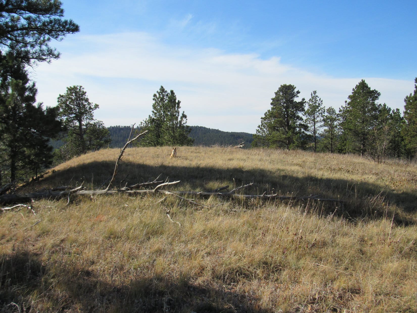
Fortunately, SPHP remembered reading online that there is an unmaintained trail going up the mountainside to the E of the Salmon Glacier viewpoint.  The views would be even more spectacular up there!  Lupe could bark at helicopters all she wanted to, far from the crowd.  Lupe and SPHP left the little parking lot (1:51 PM, 66°F), quickly finding several informal trails winding up the mountainside.

Making the climb above the parking lot was a great decision.  As Lupe and SPHP gained hundreds of feet of elevation, the noise, dust, brats and general commotion at the main viewpoint faded away.  Helicopters still flew by, even closer than down below, greatly entertaining Lupe.  She raced around barking for all she was worth, not bothering anyone.

Lupe and SPHP stopped for short breaks on a couple of hills hundreds feet above the road.  Peace and tranquility reigned.  Missing these incredible views from on high would have been a shame!

Lupe takes a break from chasing helicopters on a small hill hundreds of feet above the main Salmon Glacier viewpoint down by the road (seen near Lupe's tongue). Up here, the magnificent Salmon Glacier could be enjoyed in solitude and tranquility (at least when the helicopters weren't around). Much, much better! Photo looks W.
Lupe takes a break from chasing helicopters on a small hill hundreds of feet above the main Salmon Glacier viewpoint down by the road (seen near Lupe’s tongue). Up here, the magnificent Salmon Glacier could be enjoyed in solitude and tranquility (at least when the helicopters weren’t around). Much, much better! Photo looks W.
The upper end of the Salmon Glacier. Photo looks W using the telephoto lens.
Lupe atop one of the two hills where she took her first short breaks. Photo looks SW.
Looking NW now. Part of the N tongue of the Salmon Glacier is seen below.

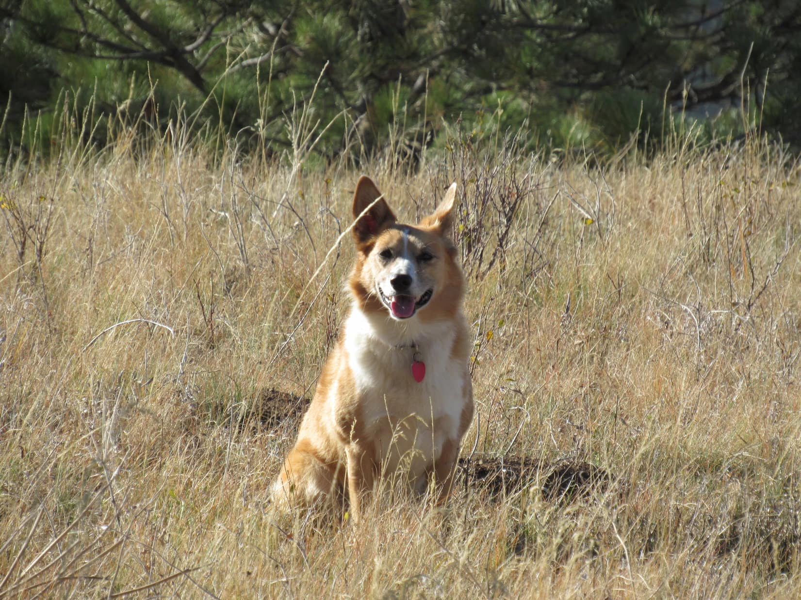
Fields of flowers watered by tiny streams and ponds were in view beyond the small hills where Lupe took her first short breaks.  When her breaks were done, Lupe went SSE exploring this vibrant, colorful territory.  She climbed even higher up to a massive knob of rock where she found a big cairn.  To the SE, Lupe could see the snow-capped summit of Mount Dilworth (5,446 ft.).

Lupe in the fields of flowers on her way to the knob of rock seen on the L. Photo looks SE.
Wildflowers on the slopes of Mount Dilworth.
Lupe on the rock knob. The snow-capped summit of Mount Dilworth is in view. Photo looks SE.
Lupe on the highest rock knob she visited on the slopes of Mount Dilworth. Photo looks N.
The Salmon Glacier as viewed from the highest rock knob Lupe reached on the slopes of Mount Dilworth. Lupe stands by the big cairn she found here. Photo looks W.
The upper end of the Salmon Glacier as seen from Lupe’s highest point of advance up Mount Dilworth. Photo looks W using the telephoto lens.
Salmon Glacier ice viewed through the telephoto lens.

From the rock knob, the views were amazing, not only toward the Salmon Glacier, but in every direction.  The day was very warm and sunny.  Conditions were ideal.  For a little while, SPHP toyed with the idea of climbing Mount Dilworth with Lupe.  It looked easy, but maybe the huge snowfield at the top was actually quite dangerous?  Falling into a crevasse would be the end.  Best to leave it alone.

So Lupe made no attempt to climb Mount Dilworth, despite how tempting it looked.  Instead, the Carolina Dog had fun among flowers, fields, and streams on the way back down to the main Salmon Glacier viewpoint along the road.  The return trip was a wonderful time full of beautiful sights.

Lupe on the way back down the slopes of Mount Dilworth. Photo looks NW.
Yes, this is what Dingo Vacations are all about!
Salmon Glacier from the slopes of Mount Dilworth. Photo looks W.

Flowers on Mount Dilworth, British Columbia, CanadaFlower on Mount Dilworth, British Columbia, Canada 8-5-16When Lupe reached the main Salmon Glacier viewpoint back at the road, a new bit of excitement was going on.  Someone had accidentally dropped their camera far down a steep slope, and attempting to retrieve it, managed to get themselves stuck in a precarious position.  A rescue operation was in progress.

While everyone else was gathered in one spot talking about the rescue, Lupe and SPHP walked over to a hill offering a better view of the N tongue of the glacier.  Every year, typically in mid-July, this part of the Salmon Glacier unleashes a major natural hazard.

In spring and early summer, Summit Lake forms from meltwaters backed up by an ice-dam at the N end of the glacier.  As temperatures warm, Summit Lake eventually breaks through the ice-dam.  The lake then drains to the S beneath the Salmon Glacier, flooding the Salmon River where water levels rise suddenly by 4 or 5 feet for several days.

Since it was August, Summit Lake had already broken through the ice-dam and drained away.  Lupe could still see where Summit Lake had been, though.  A small area of gray green water remained at the bottom of a depression surrounded by collapsed ice and snow.  The former high water level was easy to see on the side of the mountain above.

Lupe saw this view of the gray green waters surrounded by collapsed snow and ice remaining after the natural draining of Summit Lake under the Salmon Glacier in July. It’s easy to see the typical high water line of Summit Lake along the base of the mountain slope on the L. Photo looks NW.
Collapsed snow and ice around the remains of Summit Lake.

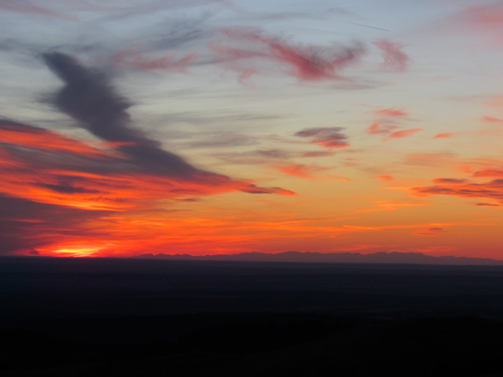
Lupe’s visit to the Salmon Glacier had been a most memorable occasion, but it was time to move on (4:07 PM, 76°F).  Lupe and SPHP made a few more stops at viewpoints on the way back to Hyder while the glorious Salmon Glacier was still in view.

Looking WNW at the huge sweeping curve of the Salmon Glacier for the last time.
S tongue of the Salmon Glacier. Photo looks N.

Salmon Glacier, British Columbia, Canada 8-5-16On the way back to Hyder, the G6 said the temperature hit an incredible 84°F outside.  SPHP fretted uselessly about the ultimate fate of the Salmon Glacier.  Things cooled off closer to Hyder, perhaps influenced by the nearby presence of the ocean.

Lupe hadn’t seen the ocean since visiting the Washington and Oregon coasts during her Summer of 2012 Dingo Vacation nearly 4 years ago.  So when Lupe got back to Hyder, Alaska, SPHP drove her over to the end of the wharf to see the Portland Canal.

Lupe stands on a bench at the end of the wharf in Hyder, Alaska. Beyond her is the Portland Canal, an arm of the North Pacific Ocean. This was the first time Lupe had seen the ocean since she was only 1.5 years old on her 2012 Dingo Vacation to the West Coast. Photo looks SW.
Looking NE from Hyder, Alaska toward Stewart, British Columbia at the end of the Portland Canal.

Lupe’s adventure to Hyder, Alaska and the Salmon Glacier was done.  Lupe and SPHP went back through Canadian customs returning to Stewart in British Columbia.  Although it was late afternoon already, the long Canadian summer days meant there were still hours of daylight left.

Lupe and SPHP left Stewart taking Hwy 37A back past the Bear Glacier to Meziadin Junction.  After gassing the G6 up, Lupe’s long journey N on Cassiar Highway No. 37 resumed.  Each mile took the Carolina Dog farther N than she had ever been before.

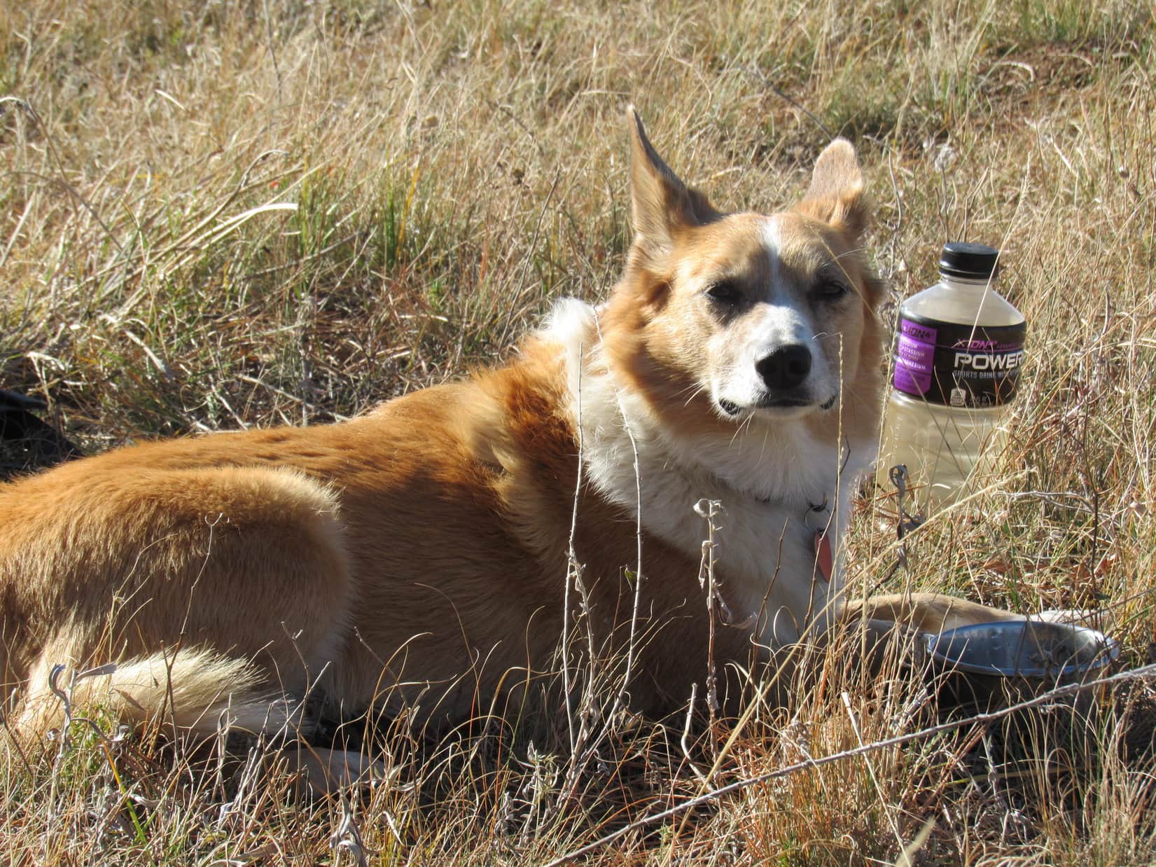
Daylight was fading by the time Lupe crossed a big bridge over a river that looked like it was running very low.  Beyond the bridge was the Bell 1 rest stop.  SPHP pulled in.  Time for a quick dinner before dark.  For some reason, Lupe wanted to stay in the G6.  Was she just tired, or was it true?

A guy from Dease Lake had been talking to SPHP.  He said his big brown dog sensed bears nearby, and claimed these woods were full of bears.  He also talked about how the weather was changing.  Last winter this area had received only 4 feet of snow.  Ten years ago, typical total winter snowfall used to be 15 meters (49 feet).  Another bad sign for the Salmon Glacier.

Well, that’s why we are here now, Looper!  To see it all while fate and fortune still smile upon us, and these fabulous natural wonders of the world remain.

The Salmon Glacier from the slopes of Mount Dilworth.

Links:

Next Adventure                       Prior Adventure

Want more Lupe adventures?  Choose from Lupe’s 2016 Canadian Rockies, Yukon & Alaska Adventure Index, Dingo Vacations Adventure Index or Master Adventure Index.  Or subscribe free to New Lupe Adventures.

Black Hills, WY Expedition No. 179 – Warren Peaks, Black Hills, Sherrard Hill & Cook Lake (10-23-16)

Hah!  How’s this for peakbagging the easy way, Loop?  SPHP turned off the engine.  The G6 was parked at the base of the Warren Peaks fire lookout tower (8:23 AM, 38°F).  Lupe was already at the top of the mountain.  Feels like cheating, doesn’t it?  We didn’t have to do a thing.  Come on, Looper, lets take a look around!  Lupe was out of the G6 like a shot.

Lupe arrives at the base of the Warren Peaks, WY fire lookout tower.
Lupe near the Warren Peaks fire lookout tower. Photo looks WNW.

A light S breeze was blowing.  Clear skies and another unseasonably warm October day.  The panoramic views were terrific.  The Warren Peaks (6,656 ft.) fire lookout tower is atop the highest point in the Bear Lodge Mountains in NE Wyoming.  Lupe gazed out over miles and miles of high prairie far beyond the mountains.

When the light is right and the air is clear, you can see all the way to the Bighorn Mountains from here Loop!  The light wasn’t right.  A bit of haze was in the air.  Oh, well.

Looking SSW from Warren Peaks, the highest mountain in the Bear Lodge Mountains. The tower on the L is on High Point 6532.

Although Lupe was back to continue her peakbagging adventures in the Bear Lodge Mountains, Warren Peaks (6,656 ft.) wasn’t really one of her prime peakbagging goals for Expedition No. 179.  Lupe had been here twice before.  Warren Peaks was just a great viewpoint from which to start the day, conveniently located on the way to other objectives she’d never been to before.

Before leaving this terrific vantage point, SPHP stared off to the N trying to pick out Vision Peak (4,812 ft.) or Bald Mountain (4,800 ft.), where Lupe had been adventuring a week ago.  Nothing really stood out that SPHP could positively identify.  Neither did any of today’s objectives.  Most of the Bear Lodge Mountains just aren’t that rugged.

The big rounded hill seen beyond Lupe is Bull Hill. Photo looks N.
Bull Hill with a little help from the telephoto lens. Studying this photo after the fact, SPHP is 98.43% certain that Bald Mountain, where Lupe had been a week ago, is at the far L end of the most distant dark ridge seen on the R. (Not the faint ridge on the horizon.) Photo looks N.

Lupe and SPHP left Warren Peaks headed N on USFS Road No. 838.  At 9:04 AM (39°F), Lupe was leaping out of the G6 again, this time at the junction of USFS Roads No. 849 and 849.1A.  Lupe had two peakbagging objectives nearby.  They were two summits called the Black Hills.  (Not to be confused with the entire Black Hills range, which is hard not to do, since the identical names make it plenty confusing.)

Lupe set off for the Black Hills (East) (5,229 ft.) summit first, climbing toward the S in territory W of the N ridge.  At first, she encountered thickets of brush and small trees in a forest of mixed pine and aspen.  As Lupe gained elevation, the pines prevailed and most of the smaller stuff disappeared.  The terrain was unusually lumpy.  Lupe went up a series of small rises separated by little ravines or low spots.  Deer seemed to like this area, and Lupe saw quite a few of them.

The Black Hills (East) summit ridge runs roughly NW/SE.  Lupe reached a lower part of the ridgeline a bit WNW of a protruding rock outcropping of yellowish tan limestone, or perhaps sandstone.  This rock formation proved to be quite level on top, and runs the entire length of the summit ridge, which was hundreds of feet long.  Toward the SW, the rocks form a line of small cliffs.

Lupe sits on the yellowish tan limestone or sandstone rock outcropping at the NW end of the Black Hills (East) summit ridge.

From the NW end of the Black Hills (East) summit ridge, Lupe could see Black Hills (West) (5,323 ft.).  Black Hills (West) is almost 100 feet higher than Black Hills (East).  Lupe would be going over there next, but not until she finished exploring Black Hills (East).

Looking W toward the Black Hills (West) summit from the NW end of the Black Hills (East) summit ridge.

Lupe and SPHP traveled SE along the entire length of the Black Hills (East) summit ridge, staying near the line of cliffs.  Forest effectively hid the views in every direction, other than SW from the cliffs.  Even looking SW, higher forested ridges only a mile or two away were as far as Lupe could see.

Lupe at another viewpoint along the cliffs. Black Hills (West) is in view on the R. The scene seen here is typical of the only semi-distant views available from Black Hills (East). Photo looks W.

Close to the SE end of the Black Hills E summit ridge, a small pine tree was perched near the edge of the cliffs.  Ponderosa pines can grow in some of the most amazing places.  The little tree looked like it was growing straight out of the rocks!

Lupe near the SE end of the Black Hills (East) summit ridge. A small pine tree was growing right out of the rocks at the edge of the cliffs. Photo looks S.

The Black Hills (East) summit ridge was long, on the order of 800 feet long.  Having traveled the entire length of the ridge near the cliffs, it was time for Lupe to look for the true summit.  Since the entire area was quite flat, there wasn’t going to be any one easily identifiable point.

The summit ridge of Black Hills (East) was quite level and all forested. Parts of it were quite park-like as seen here. Photo looks WSW.

Although there was only a slight elevation difference, the highest area Lupe could find on Black Hills (East) seemed to be back closer to the middle of the summit ridge.  A somewhat elevated area was 50 to 100 feet NE of the cliffs.  This high ground was covered by a dense thicket of scrub oak trees.  Lupe had no views at all from here!

Lupe in the scrub oak thicket at the true summit (as near as she could find one) of Black Hills (East).

Having achieved her first peakbagging success of the day at Black Hills (East), it was time for Lupe to head for Black Hills (West).  To get there, she first had to go back down to the G6.

Lupe roughly retraced the same route she had taken up.  The many deer held Lupe’s attention much of the time, but she also found an interesting column of rock out in the middle of the forest.  Strangely enough, someone had drawn an odd face on it.

Lupe at a big column of rock she discovered going back down Black Hills (East). Although the column of rock was in an unlikely spot for visitors out in the middle of the forest, someone had drawn an odd face on it (seen right above Lupe in white).

Lupe reached the G6 at 10:36 AM.  She was surprised and puzzled when SPHP went right on by it.  However, her next peakbagging goal, Black Hills (West) was not far away.

Lupe and SPHP crossed USFS Road No. 849 and went down to Blacktail Creek.  Lupe reached the tiny creek near a tiny waterfall.  Of course, she paused for a not-so-tiny drink from the creek as she crossed it, prior to beginning her climb up Black Hills (West).

Near the tiny waterfall on Blacktail Creek.

Lupe’s path up Black Hills (West) was very direct.  She simply followed the long NE ridge, staying on the ridgeline a little above the cliffs to the SE.  Lupe’s entire climb was steadily up at a moderate pace.  As Lupe neared the summit, she found a big grassy meadow at the top of the mountain.  SPHP hoped the views would be better here than from Black Hills (East).

Lupe on top of Black Hills (West). Photo looks SSW.
The summit of Black Hills (West) was a grassy meadow. Photo looks SSW.

Unfortunately, the views from Black Hills (West) were rather disappointing.  The mountain wasn’t quite high enough for a good look at the most interesting sight.  Off to the WNW, Lupe had only a partial view of the Missouri Buttes (5,374 ft.) and top of Devils Tower (5,112 ft.).

Black Hills (West) wasn’t quite high enough for a good look at Missouri Buttes and Devils Tower. Photo looks WNW.
Missouri Buttes (R) and the top of Devils Tower (L) from Black Hills (West). Photo looks WNW using the telephoto lens.

Lupe and SPHP wandered around the Black Hills (West) summit area for a little while, seeing what could be seen, before taking a break.  After the break, it was photo op time for Lupe before beginning the descent.

The Black Hills (West) summit as seen from the SW.
Lupe relaxes during her break time. She looks a bit serious here.
The Black Hills (West) summit. Photo looks SW.
A happy Carolina Dog on the summit of Black Hills (West) having a good time in the Bear Lodge Mountains of NE Wyoming.

Lupe and SPHP returned to the G6 (12:01 PM) going back down the NE ridge of Black Hills (West).  Lupe had one more peakbagging goal for Expedition No. 179, Sherrard Hill.  Sherrard Hill (5,385 ft.) is a little higher than Black Hills (West).  SPHP had hopes that Lupe might find better views from Sherrard Hill than either of the two Black Hills summits had on offer.

SPHP drove a couple miles NNW on USFS Road No. 849 to its junction with USFS Road No. 860.1, before parking the G6 (12:09 PM, 57°F).  Lupe would start her trek to Sherrard Hill from here.

Much of Lupe’s journey to Sherrard Hill followed USFS Roads.  She started out going S on No. 860.1, which soon crossed Blacktail Creek.  Lupe came to many forks in the road.  At the first one, Lupe stayed to the R, avoiding side road No. 860.1A.  At the next junction, where an unmarked road to the L went down to a bridge across Hershey Creek, she stayed to the R again on a road marked as Trail No. 1042.

A week ago when Lupe had been to the Bear Lodge Mountains on Expedition No. 178, there had still been some fall colors on display. By Expedition No. 179, however, nearly all of the trees were bare. There were a few exceptions, however. Lupe saw these red berries and yellow leaves while following USFS Road No. 860.1 on the way to Sherrard Hill.

At a third junction, Lupe stayed to the R again, now following USFS Road No. 860.1F.

Lupe reaches USFS Road No. 860.1F, which was closed to motor vehicles. Photo looks S.

While on No. 860.1F, Lupe and SPHP kept hearing geese.  Finally, a flock of them flew by almost right overhead.  The geese were so high, Lupe didn’t pay much attention to them.

Geese flew by almost right overhead. Photo looks, umm, up using the telephoto lens.

As Lupe got closer to Sherrard Hill, she kept coming to more forks in the road.  She avoided taking USFS Roads No. 860.1R (to the R) or No. 860.1J (to the L).  The road she was on eventually turned W going up a valley.  When Lupe reached a saddle at the upper end of the valley, SPHP was pretty certain Sherrard Hill was the wooded hill immediately to the S.

Lupe stuck with the road she was on as it circled around to the NW side of Sherrard Hill.  She passed by USFS Road No. 860.1G on the way.  By now, the road Lupe was following had leveled out.  Lupe and SPHP turned SE and started climbing.

The climb up Sherrard Hill (5,385 ft.) was along quite a gentle slope.  The hill was heavily forested all the way up.  The summit area was large, and all heavily forested, too.  Lupe and SPHP went all the way to the SE end of the summit area.  There was little to be seen, but forest anywhere.

The top of Sherrard Hill. There was little to be seen except for the forest. Photo looks N.

Well, that was it.  None of Lupe’s 3 main peakbagging objectives of the day had provided much in the way of views, and Sherrard Hill, the highest of them all, had no views at all.  Sometimes that’s just the way it is in the mountains.

Lupe and SPHP took a short break for chocolate coconut granola bars and water at the SE end of the summit area.  Then Lupe got to explore the Sherrard Hill summit looking for the highest point.  Just like on Black Hills (East), the top of the mountain was so flat, it was hard to pin down an exact location of the true summit.  Once again, it appeared to be in a thick grove of scrub oaks.

Lupe among the scrub oaks at the true summit of Sherrard Hill. Photo looks E.
Lupe exploring the summit area on Sherrard Hill. Photo looks NNE.

Before completely abandoning Sherrard Hill to return to the G6, Lupe and SPHP wandered over to a slightly lower part of the mountain protruding to the W from the N end of the summit area.  From here, Lupe did catch a couple of glimpses of Missouri Buttes, but never had a really good look.

Lupe and SPHP continued NW to High Point 5255, but other than a ranch house to the W, there was nothing to see there either.  OK, that was it.  Time to give up and go back to the G6.  Lupe had a great time on the way back.  She saw many deer, and several squirrels.

On the way back to the G6 from Sherrard Hill, Lupe saw many deer in the woods. This one was out in the open near Hershey Creek.

When Lupe arrived at the G6 again (3:43 PM, 57°F), it was only a little over 2 hours until sundown.  Time enough to do something, but not go off climbing another mountain.  Since Lupe had never seen Cook Lake before, why not go see the little lake?

The Cook Lake Recreation Area features a campground, picnic area, loop trail around the lake, and another loop trail N of the lake called the Cliff Swallow trail.  Lupe arrived at Cook Lake (4:16 PM, 53°F) too late to both spend time at the lake and take the Cliff Swallow trail.  Since the main purpose was to see Cook Lake, Lupe stuck to the lakeshore trail.

Lupe arrives at Cook Lake, the only lake in the Bear Lodge Mountains. Photo looks S.
Lupe on her way around Cook Lake. Photo looks SE.
Looking NE toward the dam.
Nearing the S end of the lake. Photo looks SE.
Cook Lake from the S shore. Photo looks N.
Looking NNW.
Lupe on the lakeshore trail. Photo looks NW.
On the dock.
On the dock.

Although there had been a few people around when Lupe first arrived at Cook Lake, by the time Lupe completed her investigations along the shore (5:09 PM, 51°F), things were pretty quiet.  The lakeshore trail had been a relaxing way to end the day.

Lupe’s Black Hills, WY Expedition No. 179 wasn’t quite over yet, though.  On the way back home, while still in the Bear Lodge Mountains, Lupe made two more quick stops.  First, Lupe and SPHP took a short stroll from USFS Road No. 838 to a high point NW of Warren Peaks.  SPHP wanted to find out if Lupe could see Devil’s Tower and Warren Peaks from here.

She could!  The sun was low in the sky, and the light was weak, but there they were!  What’s more, Lupe could also see the outline of the Bighorn Mountains far to the W!

From a high point NW of Warren Peaks, not far from USFS Road No. 838, Lupe could see the Missouri Buttes and Devils Tower in the fading light. Photo looks NW.
Lupe could also see the faint outline of the Bighorn Mountains on the far W horizon.

Lupe’s final stop was back up on Warren Peaks (6,650 ft.).  The sun had either just set, or was hidden by clouds near the horizon.  Lupe went over to the highest rocks on the mountain a few feet W of the fire lookout tower.

And so, Black Hills, WY Expedition No. 179 ended with Lupe standing atop the highest point in the Bear Lodge Mountains for the second time today, admiring the colorful sunset and distant outline of the lofty peaks of the glorious Bighorn Mountains.

Lupe at the highest point on Warren Peaks at sunset, her 2nd time here during Expedition No. 179. Photo looks WSW.
Bighorn Mountains from Warren Peaks.

Links:

Next Black Hills Adventure                    Prior Black Hills Adventure

Want more Lupe adventures?  Choose from Lupe’s Black Hills Expeditions Adventure Index or Master Adventure Index.  Or subscribe free to new Lupe adventures.