Black Hills, SD Expedition No. 184 – Iron Mountain & Peak 5688 (11-28-16)

Windy.  Not all that cold out, but not terribly warm, either.  SPHP dithered.  Lupe was due for another of her Black Hills expeditions, but what were conditions going to be like up in the hills?  Lupe was anxious to go.  SPHP checked the forecast again.  Not much of a change expected all day long.  It would probably be OK.  Lupe won out, Expedition No. 184 was a go!

After a bit of a late start, SPHP parked the G6 at the parking lot on top of Iron Mountain (10:38 AM, 34°F).  Lupe’s first peakbagging success of the day was going to be a super easy, trivial one.  A short paved path curved NW toward an official viewpoint at the NW edge of the large, forested summit area.

Expedition No. 184 started with Lupe already almost at the top of Iron Mountain. The rocky ridge seen between the trees is the true summit at the W end of the mountain. Photo looks W.

The big view from Iron Mountain (5,446 ft.) is off to the W toward Harney Peak (7,242 ft.), the highest mountain in South Dakota.  The main attraction for most people, however, is closer by to the NW.  Mount Rushmore (5,725 ft.) can be seen only 3 miles away.

Lupe didn’t go to the official, safely-fenced, tourist viewpoint.  She made the 20 foot climb up onto the short, scenic rock ridge where the true summit is to claim her pathetically easy Iron Mountain peakbagging success.  Once on top at the edge of the mountain, she had no interest in sticking around for the views.  Every blast of the N wind, gusting 30-35 mph, was hitting her full force.  Not Lupe’s idea of a good time!

Lupe, partially protected from the roaring N wind, at the base of the solid rock summit ridge on Iron Mountain. Photo looks SW.
Almost at the top. Photo looks SW.
Harney Peak from the summit of Iron Mountain. Photo looks W.

Of course, Iron Mountain wasn’t Lupe’s real peakbagging goal for Black Hills, SD Expedition No. 184.  Simply driving practically to the top of the mountain would have been a poor excuse for an expedition.

Eight days ago, on Expedition No. 183, Lupe had made it from Lakota Lake to nearby Woodpecker Ridge (5,680 ft.).  Her route traveling SW along the length of the ridge had been so difficult and taken so long, Lupe had run out of time to go on to Peak 5688.  Lupe was back to find and climb Peak 5688 on Expedition No. 184.

Lupe stayed on the windy summit of Iron Mountain for only a moment or two.  She wanted down out of that gale!  Lupe and SPHP left the Iron Mountain summit area heading first S, then W down to the Iron Mountain Picnic Ground along Iron Mountain Road (Hwy 16A).  From the picnic ground, Lupe took Centennial Bypass Trail No. 89B going SW into the Black Elk Wilderness.  The wind wasn’t much of a problem down here.

Image result for black elk wilderness trail systemBefore long, Lupe came to a sign along the trail.  SPHP intended for Lupe to take Iron Mountain Trail No. 16 going S to Iron Creek, but the sign didn’t mention that trail.  The sign was actually at the intersection, but deadfall timber hid Trail No. 16 from view.  SPHP failed to look carefully enough to find it, and missed the turn.

Lupe was a lot farther along Centennial Bypass Trail No. 89B before SPHP stopped to check the maps and realized the mistake.  No matter, Trail No. 89B was one of the few trails Lupe had never been on before in the Black Elk Wilderness.  She was having fun exploring it.  Soon Lupe would reach the junction with the main Centennial Trail No. 89.  She could turn S there.

Lupe near the junction of Centennial Bypass Trail No. 89B and Centennial Trail No. 89. Photo looks E back along the bypass trail she had just traveled.

Back in 2012, when Lupe first started her Black Hills, SD Expeditions, she explored virtually the entire length of the 111 mile long Centennial Trail No. 89 over the course of the year, one section at a time.  It seemed like a long time ago.  When Lupe turned S on Centennial Trail No. 89, at first SPHP didn’t recognize anything.

On Centennial Trail No. 89. Lupe had explored virtually the entire length of this 111 mile trail back in 2012, one section at a time. Even so, SPHP didn’t recognize this part of the trail. Photo looks S.

As Lupe headed S on Centennial Trail No. 89, she started seeing huge granite rock formations a little E of the trail.  Before long, Lupe arrived at an intersection that did look familiar.  SPHP remembered being confused back in 2012 as to which way to go from here.  The correct choice had been to turn E, so Lupe did so again.

On Centennial Trail No. 89 just after turning E at the intersection where SPHP had been confused back in 2012. Photo looks E.

Very shortly after turning E, the trail started curving S again, arriving almost immediately at yet another intersection.  Centennial Trail No. 89 went S staying to the W of the huge rock formations.  If Lupe went that way, she would arrive at the Iron Mountain Horse Camp near Iron Creek.

There was a faster way to get to Iron Creek, though.  Lupe left Centennial Trail No. 89 taking Grizzly Bear Creek Trail No. 7 (unmarked at the junction) instead.  Trail No. 7 went SE between towering walls of solid granite.  Lupe followed Grizzly Bear Creek Trail No. 7 all the way down to a trailhead at USFS Road No. 345 near Iron Creek.

In the Black Elk Wilderness on the way to Iron Creek via Grizzly Bear Creek Trail No. 7. Photo looks NNE.

From the trailhead along USFS Road No. 345, Peak 5688 was about 2 miles to the SSE as the crow flies.  It had taken Lupe quite a while to reach Iron Creek on the route she had taken, but there was still plenty of time to search for Peak 5688.  No road or trail led to it from here.  Lupe would have to make her way to Peak 5688 by exploring the forest, but she loves doing that!

The first task was to cross Iron Creek, which was S of the road.  Lupe crossed USFS Road No. 345, went to the creek, and quickly found a way over it.

Newly formed ice crystals on Iron Creek. 8 days ago, on Expedition No. 183, there had been an inch of snow down along Iron Creek. The snow had melted, but apparently it had been cold again recently.
About to cross Iron Creek. Photo looks upstream (W).

Beyond the creek, Lupe continued S, climbing up onto a small ridge.  She could see massive granite formations typical of this part of the Black Hills back to the N.

Looking N from the small ridge at massive granite rock outcroppings typical of this part of the Black Hills.

Lupe and SPHP wandered through the forest, trying to travel S in the general direction of Peak 5688.  For a while, it was hard to keep one’s bearings.  The rumpled terrain kept forcing Lupe in different directions.  There were no clear landmarks in view.  Lupe had never been here before.

Lupe wanders looking for Peak 5688. Photo looks S?

After wandering around for a while, Lupe finally saw a high hill ahead.  The high hill was part of Woodpecker Ridge, where Lupe had been 8 days ago on Expedition No. 183.

Still looking for Peak 5688, Lupe discovers the high hill in the background. SPHP correctly surmised it was part of Woodpecker Ridge, not too far from the summit where Lupe had been 8 days ago on Expedition No. 183. Photo looks SE?

Lupe continued her explorations, eventually entering an area of deadfall timber and thistles that looked vaguely familiar from Expedition No. 183.  She came across a primitive road that led up to some high ground.  Studying the topo map, SPHP became convinced this road was part of a route shown on the map a little W of Woodpecker Ridge.

Looking E at Woodpecker Ridge.

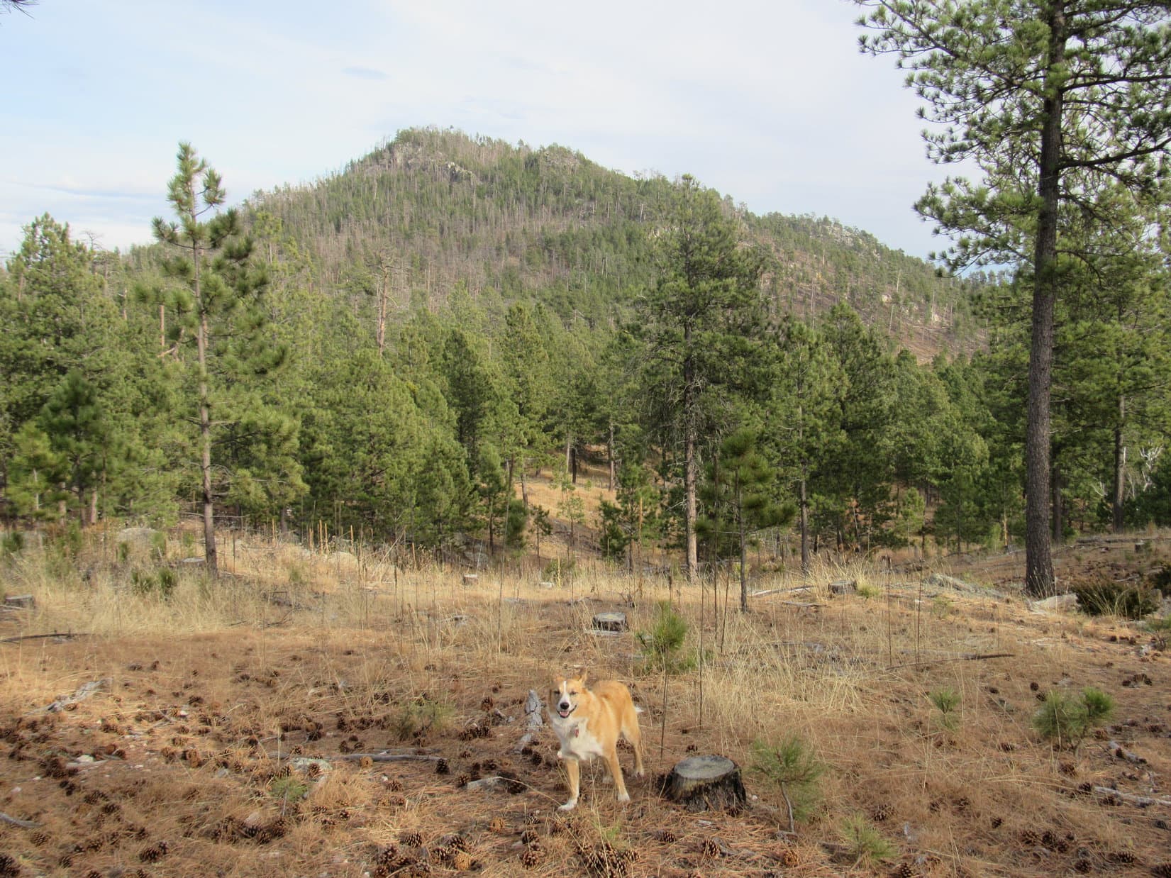
Lupe saw a long forested ridge off to the SSW.  That ridge almost certainly had to be Peak 5688.  Lupe was closest to it’s NNE end.  She headed S toward it, crossing High Point 5428 on the topo map along the way.

In the forest N of High Point 5428. Photo looks S.
Loop reaches the top of High Point 5428. Photo looks NE.

Lupe crossed a dirt road in the saddle between High Point 5428 and the NNE end of Peak 5688.  Instead of heading for the very end of the ridge, Lupe climbed up its NW slope to gain the ridgeline a little farther S.  This part of the ridge was narrow, forested, and strewn with boulders.

Lupe makes it up onto the Peak 5688 ridgeline a little S of its NNE end. This part of the ridge was relatively narrow, strewn with many boulders and some deadfall timber. Photo looks NNE.

Lupe was still about 0.5 mile from the summit of Peak 5688, which is near the SSW end of the ridgeline.  Lupe followed the ridge toward the summit, gaining elevation gradually along the way.  She started coming to places with big views again, especially toward the N and W.

Wherever there were openings in the forest, Lupe had views again from the Peak 5688 ridgeline. Photo looks NW toward the Cathedral Spires(L) and Harney Peak(R).

Although the wind hadn’t been a problem since leaving the summit of Iron Mountain, it was still blowing just as hard now as it had been earlier.  Up on the Peak 5688 ridgeline, Lupe was increasingly exposed to the wind again as she progressed toward the summit.  She often stayed a little E of the ridgeline to avoid the worst of it.

The strong wind was a problem again up on Peak 5688. It was very windy where Lupe is seen here up on the little wall of rocks, or anywhere to the R (NW). It was much less windy just a few feet to the L (SE). Photo looks SW.
The biggest rock outcropping on the horizon at center is Mt. Rushmore. The tall, thin dead tree to Lupe’s L is pointing almost straight up at George Washington’s head. The wind made it hard to hold the camera steady enough for a clear shot. Photo looks N.

Lupe came to a higher, broader, more open part of the ridge.  At first, SPHP thought this might be the summit.  There were great views from this area, but with only a few trees to slow it down here, the wind was exceptionally strong.

Looking NW from the open area. Harney Peak in view R of Center.
Lupe in the gale up on a rock that SPHP thought for a little while might be the true summit of Peak 5688. It turned out the summit was still a little farther S. Photo looks NE.

From the high open ground, a more heavily forested area was partially in view to the SSW.  Uncertain whether Lupe had already reached the top of Peak 5688 or not, Lupe and SPHP continued on to check it out.  In a few minutes, Lupe came across a small cairn on larger rocks.

Stuffed in a crack in the rocks right below the cairn was a small, torn, zip-lock plastic bag.  It contained a few crumpled pieces of aluminum foil, some damp rotten paper, and a plastic toy of two dogs water skiing.  There was also a piece of paper with the names William Wade & Charles Wade Johnson on it.  It was dated 8-13-12, and signed CWJ.

Another Carolina Dog peakbagging success! Lupe stands on the highest rocks of Peak 5688. Photo looks S.
Lupe discovered this plastic toy in a little plastic bag tucked into a crack in the rocks beneath the summit cairn. SPHP left the toy in the plastic bag along with a paper signed 8-13-12 by CWJ where Lupe had found it, but packed out the small amount of trash the bag contained.
Lupe takes a break at the summit of Peak 5688. Photo looks S.

After a short break near the cairn, Lupe and SPHP toured the general area to make absolutely certain Lupe had reached the true summit of Peak 5688.  She had!  Although the summit was mostly hidden by trees, there were nice views available close by.

Harney Peak from within a few feet of Peak 5688’s true summit. Photo looks NW.
Looking NNW using the telephoto lens.
View to the SE.
Looking N toward the true summit during a brief exploration Lupe made to the S.
Cathedral Spires using the telephoto lens. Photo looks NW.

The days are short near the end of November.  Even though it wasn’t all that late, the sun was low.  It would be down within the hour.  Lupe still had a long way to go to get back to the G6.  She at least needed to reach USFS Road No. 345 near Iron Creek before it got dark.  It was time to leave Peak 5688.  Lupe was tired of the wind, anyway.

Lupe in a nice little flat area next to the summit rocks. (The small cairn is visible on the L.) She would stay here on Peak 5688 only a few more minutes before leaving to head back to the G6. Photo looks N.

Lupe started back to the G6 going NNE along the Peak 5688 ridgeline.  She didn’t follow the ridge nearly as far back as she had originally come up along it.  As soon as she could, she headed NW down off the ridge.  Within 20 minutes of leaving the summit, Lupe was out of the wind in a beautiful grassy valley.

Lupe on her way down. Here she’s still in the high open area NNE of the summit. Woodpecker Ridge(R) can be seen in the distance between the trees. Photo looks NNE.
Lupe reaches the beautiful grassy valley NW of Peak 5688. Photo looks SW.

The sun sank down behind the hills.  Lupe found a fairly good dirt road on the other side of the beautiful valley which led N.  She followed it for a little way.  When it turned toward the W, she left the road.  Lupe and SPHP wandered N in the forest.  Well before twilight faded, Lupe reached Iron Creek again at a small frozen pond.

Lupe nears a frozen pond along Iron Creek. USFS Road No. 345 is in view beyond the pond. Photo looks NW.

Beyond Iron Creek and the frozen pond, Lupe returned to USFS Road No. 345.  She followed the road NE two miles to the Iron Mountain Trail No. 16 trailhead.  Along the way, she passed Camp Remington and the Grizzly Bear Creek Trail No. 7 trailhead.  She went by old cabins scattered along the road.  Everything was quiet and deserted.  Not a soul was around.

Lupe at Camp Remington. No one was around at any of the cabins here, or anywhere else along her route.

Twilight was almost gone by the time Lupe started up Iron Mountain Trail No. 16.  The flashlight had to be put to use.  Wind still blew in the trees.  Faint stars appeared in the sky.  It was that last quiet hour of darkness Lupe often experiences at the end of her Black Hills expeditions while traveling back to the G6.

Uncharacteristically, SPHP decided to try a few night time shots using the camera’s flash.  What would they show?

The first shot SPHP took in the dark using the flash was the best. It revealed a scary wide-eyed American Dingo on Iron Mountain Trail No. 16.
The spooky Dingo of the Night.

Lupe finally arrived at the intersection with Centennial Bypass Trail No. 89B.  No wonder SPHP had missed the intersection earlier in the day!  A huge amount of deadfall timber was strewn all over Iron Mountain Trail No. 16 in this area.

Lupe took Trail No. 89B back to the Iron Mountain Picnic Ground.  She crossed Iron Mountain Road.  Lupe returned to the summit of Iron Mountain.

The wind had died down only a little.  Tiny snowflakes whipped by in the gusty breeze.  SPHP fumbled around trying to get a photo of Lupe on top of Iron Mountain in the dark.  Success was limited.

Oh, well.  Lupe’s Black Hills, SD Expedition No. 184 to Iron Mountain & Peak 5688 was over.  At least, Lupe had been successful!  Time to go home.  (5:52 PM, 31°F)

An American Dingo loses patience, leaving the Iron Mountain summit a moment before the flash.
Carolina Dog on Iron Mountain – perhaps a little underexposed?
Overexposed rocks at the summit of Iron Mountain. The American Dingo is either cloaked, or has already grown disgusted and left.
Blurry Carolina Dog at the summit of Iron Mountain after dark. OK, we’re calling this one good as good as it gets! Let’s go home Loopster, its cold and windy here!

Links:

Next Black Hills Adventure                     Prior Black Hills Adventure

Want more Lupe adventures?  Choose from Lupe’s Black Hills Expeditions Adventure Index or Master Adventure Index.  Or subscribe free to new Lupe Adventures.

The Worthington Glacier, Alaska (8-11-16)

Days 12 & 13 of Lupe’s Summer of 2016 Dingo Vacation to the Canadian Rockies, Yukon & Alaska.

Lupe’s adventures in the Yukon were done for now.  Only yesterday, she’d enjoyed an epic day climbing Mount Decoeli (7,650 ft.) in Kluane National Park.  From afar, she had seen Canada’s highest mountain, Mount Logan (19,541 ft.).  Today was going to be a well-deserved day of rest for the Carolina Dog.  Lupe would spend much of it snoozing in the G6, while SPHP drove N.

Lupe was on her way to Alaska!

Lupe's morning on 8-10-16 started near Kluane Lake in Kluane National Park in the Yukon. Mount Decoeli, which Lupe had climbed the day before, is seen here on the far (L) across Kluane Lake. Photo looks SE.
Lupe’s morning on 8-10-16 started near Kluane Lake in Kluane National Park in the Yukon. Mount Decoeli, which Lupe had climbed the day before, is seen here on the far (L) across Kluane Lake. Photo looks SE.
 Lupe at Kluane Lake in the Yukon. Photo looks SSE.
Lupe at Kluane Lake in the Yukon. Photo looks SSE.

Lupe and SPHP made frequent stops along the way.  Sometimes Lupe stopped at scenic highlights.  More often, SPHP was forced to stop due to road construction.  The Alaska Highway had buckled and heaved in many places.  Lupe & SPHP spent a good deal of time following pilot cars across dusty, torn-up, sections of road.  All the way, fascinating Yukon scenery was right outside the window of the G6.

Mountains of the Saint Elias range. Not a bad bit of scenery to enjoy while waiting for the pilot car to appear! Photo looks SW.

When Lupe crossed the mighty Donjek River, SPHP was stuck following a pilot car and couldn’t stop.  Farther N, she did get to stop and see the White River.

The vast floodplain of the White River. Photo looks downstream toward the NE.

The frost-heaved road, and all the construction made driving slow, but there was no real hurry.  By early afternoon, Lupe reached the border crossing from Canada into Alaska.  SPHP was disappointed when there was no colorful “Welcome to Alaska!” sign Lupe could pose by, only a dull, wordy, official sign at U.S. customs.  Oh well, at least there were no problems crossing the border.

Just being in Alaska was exciting!  Lupe had technically already been to a tiny piece of Alaska at Hyder on her way to see the Salmon Glacier, but now she was about to travel hundreds of miles across America’s largest, wildest, and most remote state.  The feeling was almost spine-tingling.  Who knew what adventures awaited Lupe in the Last Frontier State?

At Tok, Lupe left the Alaska Highway when SPHP turned S on the Tok Cut-off.  Near the SW end of the Tok Cut-off, Lupe got to see the Copper River from a high bluff.  If there hadn’t been so many clouds, Lupe might also have seen some of the giant snow and ice-capped peaks in Wrangell – St. Elias National Park & Preserve.

Lupe at the Copper River in Alaska. Photo looks W or SW in the downstream direction.
The Copper River from a pullout along the Tok Cut-off. Clouds prevented Lupe from seeing giant snow-capped peaks to the S in Wrangell - St. Elias National Park & Preserve. Photo looks upstream.
The Copper River from a pullout along the Tok Cut-off. Clouds prevented Lupe from seeing giant snow-capped peaks to the S in Wrangell – St. Elias National Park & Preserve. Photo looks upstream.

Near Gulkana, Lupe reached the Richardson Highway (No. 4).  SPHP took it going S toward Valdez.  By late evening, Lupe was approaching the Worthington Glacier.  It was an impressive sight, even from the highway!

Upper reaches of the Worthington Glacier as seen from the Richardson Highway. Photo looks WSW.
Worthington Glacier. Photo looks WSW using the telephoto lens.

Lupe’s long day of rest traveling through the Yukon into Alaska was almost over.  Tomorrow she would have several options, among them the Worthington Glacier Ridge Trail.  Where she would go would be decided tomorrow morning.  Until then, Lupe and SPHP settled in for the night.

The next morning did not bring good news.  The sky was socked in with low clouds.  A light mist was falling.  Conditions did not seem conducive to a hike near the Worthington Glacier.  SPHP drove over Thompson Pass toward Valdez.  In Keystone Canyon, many amazing, beautiful waterfalls tumbled down the mountainsides.  Lupe stopped briefly for a closer look at Bridal Veil Falls and Horsetail Falls.

Bridal Veil Falls in Keystone Canyon.
Lupe at Horsetail Falls.
Lupe at the base of Horsetail Falls. Both Bridal Veil Falls and Horsetail Falls can be viewed from pullouts along the Richardson Highway in Keystone Canyon on the way to Valdez. They are no more than 0.5 mile apart, but on opposite sides of the highway.

By the time Lupe reached Valdez, it was raining harder.  The rain wasn’t heavy, but it was steady.  With the rain falling, there wasn’t any urgency to do anything outdoors.  SPHP dropped by the local Safeway store, and bought a roasted chicken to share with Lupe.  Oddly, she wasn’t hungry.  She refused any chicken.  That seemed strange, but OK.  Lupe and SPHP watched the rain fall, while SPHP consumed part of the chicken.

It was soon apparent why Lupe didn’t want any chicken.  Without warning, she threw up.  Poor, Loopster wasn’t feeling well!  SPHP cleaned up her soiled blanket, then took Lupe out for a short walk in the rain to let her get anything else bad out of her system.  She seemed to feel better.

There were a couple of awesome adventures near Valdez that SPHP was hoping Lupe might be able to do.  One was to take the trail to Shoup Bay to see the Shoup Glacier and Kittiwake rookery.  To do the whole trail was a long day hike, but maybe Lupe could do it tomorrow, if the weather cleared up.

The other adventure had been suggested by Richard Baker, whom Lupe had met on Mount Decoeli in the Yukon.  Richard had highly recommended taking a cruise on Prince William Sound aboard the Lu-Lu Belle to see the Columbia Glacier, the second largest tidewater glacier in North America.  Whales, eagles and other wildlife are sometimes seen from the Lu-Lu Belle, too.

Lupe had to wait in the G6, while SPHP went into the Lu-Lu Belle office to inquire about the Columbia Glacier tour.  The receptionist was very courteous and friendly.  She said the Lu-Lu Belle goes to the Columbia Glacier every day in season, pretty much regardless of the weather.  The cost was $125 per person for an approximately 7 hour long tour aboard the luxury yacht.

It all sounded wonderful!  Time for the big question.  What about Lupe?  Bad news.  Lupe couldn’t go.  They had dog-sitting services available, but the tour was a no-go for poor Looper.

No doubt it would have been a fantastic excursion, but if Lupe wasn’t going on the Lu-Lu Belle, neither was SPHP.  This isn’t The (Mostly) True Adventures of SPHP, you know!  So that was that, but before leaving the Lu-Lu Belle office, SPHP asked about the weather forecast.

The receptionist looked up the Valdez forecast on her computer.  100% chance of rain today and each of the next four days, then dropping to only 80%, 70%, and 40% for the three following days.  She then said it had already been raining in Valdez for 3 straight weeks.

Yikes!  That changed everything.  Lupe and SPHP were willing to wait out a day or two of poor weather, but sitting around for more than a whole week of rain made no sense.  SPHP returned to Lupe with the glum news.  No Lu-Lu Belle, no Shoup Glacier, no Worthington Glacier.  What to do?

If the Alaskan coast was going to be socked in with rain for another week or more, the only thing SPHP could think of doing was to head back inland.  It meant Lupe wouldn’t get to do any of the cool stuff near Valdez on this trip, but Alaska is a huge place.  There were other adventures in store for Lupe elsewhere.

Unfortunately, there was no point in hanging around Valdez.  Amid rain and mist, Lupe and SPHP left town to start the long drive inland again on the Richardson Highway.  Once again, Lupe traveled along the Lowe River, up Keystone Canyon, past Horsetail, Bridal Veil, and lots of other gorgeous waterfalls.  She crossed Thompson Pass, and took a last glance at the Worthington Glacier as SPHP drove on by.

Wait a minute!  The sky was still completely overcast, but only the tops of the mountains were in the clouds.  The Worthington Glacier was in view.  It was barely misting here.  SPHP turned the G6 around.  Lupe was going to get to see the Worthington Glacier after all!  If the rain would hold off for only a few hours, a little mist wouldn’t stop an American Dingo!

SPHP drove back to the Worthington Glacier State Recreation Site.  A dozen other vehicles were in the parking lot.  People were coming and going.  Nearly all of them were taking the short nature trail down to a viewpoint where the toe of the glacier could be seen.  Nice, but not what Lupe had come for.

Lupe was here to take the much longer Worthington Glacier Ridge Trail, which goes W for a mile and a half, or more, on a ridge S of the glacier.  Lupe and SPHP could see a couple hikers coming down the ridge trail.  When they got to the start of the trail at the parking lot, SPHP talked to them.  How were conditions up on the ridge?  How far had they gone?  Was anyone else up there right now?

Conditions were cloudy, a bit damp and rainy at times.  They had made it all the way to what they considered the end of the trail.  The glacier views were spectacular.  Not another soul was up on the trail now.  They were the last ones down.

Wonderful, that settled it!  Lupe and SPHP started up the ridge.

Lupe starts up the Worthington Glacier Ridge Trail. Photo looks W.

The Worthington Glacier Ridge Trail began climbing along the top of a very narrow ridge with steep sides.  To the S (L) was a very green valley of mixed alder and tundra.  To the N (R) was the valley the Worthington Glacier flows down.  The trail followed the ridgeline W.  As Lupe gained elevation, the views of the Worthington Glacier up ahead became progressively more impressive.

The very green mixed alder and tundra valley on the S (L) side of the trail is shown well here. Part of the trail leaves the ridge near unstable cliffs to travel safely through this valley a little way before returning to the ridge. Lupe loved the green valley, but there were mosquitoes down there. They weren't too bad. Up on the ridge, a breeze blew them away. Photo looks W.
The very green mixed alder and tundra valley on the S (L) side of the trail is shown well here. Part of the trail leaves the ridge near unstable cliffs to travel safely through this valley a little way before returning to the ridge. Lupe loved the green valley, but there were mosquitoes down there. They weren’t too bad. Up on the ridge, a breeze blew them away. Photo looks W.
As Lupe climbed, the views of the Worthington Glacier steadily improved. The big rounded hump seen ahead on the L looked like it might be the end of the trail. Photo looks WNW.
The Worthington Glacier has two arms, separated by the ridge of rock seen on the upper R. Near the lower end of the glacier, both arms drop steeply as seen here. A little farther up, the glacier is one big river of ice. Photo looks NW.
Gotta love that beautiful blue glacier ice!

The ridge trail left the ridge temporarily to bypass dangerous cliffs.  It entered the green valley of mixed alders and tundra.  There were a few mosquitoes down here to deal with, but they weren’t too bad.  They were pretty much limited to the valley on this day.  A breeze kept them from being much of a bother up on the ridge.

Lupe loved the green valley!  SPHP thought it was great, too.  The valley was full of wildflowers.  The tiny, delicate plants growing on the tundra were fascinating.  They were so incredibly varied and colorful!

Bright wildflowers in the lush green valley S of the ridge.
For Lupe, the beautiful green valley was one of her favorite parts of the whole Worthington Glacier Ridge Trail. The glacier isn't in view here, but it can be seen from virtually everywhere else on the ridge trail. Lupe was completely convinced the wildflowers and tundra were worth seeing, too! Photo looks E.
For Lupe, the beautiful green valley was one of her favorite parts of the whole Worthington Glacier Ridge Trail. The glacier isn’t in view here, but it can be seen from virtually everywhere else on the ridge trail. Lupe was completely convinced the wildflowers and tundra were worth seeing, too! Photo looks E.
Delicate, vibrant little plants of the tundra. They were only an inch or two high.

Before long, the trail left Lupe’s lush, green valley and returned to the ridge.  The Worthington Glacier was always in view from here on.  The trail headed up toward a high, barren, rounded mound of dark colored soil and rock.  It looked like that hill might be the end of the trail.  The climb up to the top was steep!

Back on the ridge again, the Worthington Glacier was always in view.
Lovely blue crevasses as seen with a little help from the telephoto lens.
As Lupe climbed the last high, barren, rounded hill, she had this view of the Worthington Glacier as a single river of ice above where the glacier split in two. Photo looks WNW.
Near the top of the last high, barren, rounded hill. From below, this hill looked like it might be the end of the trail. Maybe it is the end of the formal trail, but Lupe found out it was possible to go quite a long way farther. Cairns showed the way. Photo looks W.

Lupe reached the top of the high, barren, rounded hill.  The trail leveled out and went right on over it.  At first, SPHP wasn’t certain if the trail continued or not.  Lupe and SPHP left the ridgeline to explore farther W along the N side of a mountain.  Others had been this way, too.  The terrain was rocky and uneven.  There was no longer a distinct, continuous trail, but now and then Lupe came to cairns along the way.

Part of the time, Lupe was traveling over relatively level, wide, rock shelves.  Other times, she had to climb steep slopes.  Lupe passed by occasional bright patches of wildflowers.  Some places bright green moss clung to dark rocks next to trickling waterfalls.  To the S was the mountain.  To the N, Lupe looked down upon the Worthington Glacier.  And to the W, Lupe’s route rose toward a white, gray and black world of clouds, snow, ice, and dark earth.

As Lupe explored farther W above the Worthington Glacier, she sometimes came to colorful patches of wildflowers in an otherwise bleak world. Photo looks WNW.
Wildflowers bring a splash of color to the Worthington Glacier.
A mighty American Dingo explores the harsh environment of the Worthington Glacier! Actually, the worst Lupe had to face was some light rain and heavy mist that came and went. The temperature wasn't that bad, either - maybe in the upper 40's °F. Photo looks WNW.
A mighty American Dingo explores the harsh environment of the Worthington Glacier! Actually, the worst Lupe had to face was some light rain and heavy mist that came and went. The temperature wasn’t that bad, either – maybe in the upper 40’s °F. Photo looks WNW.
A glacial tsunami surges over the lip of a vast bowl of snow and ice above. Lupe had seen what was higher up from the Richardson Highway yesterday evening, but the upper part of the glacier wasn't visible now. Photo looks WNW.
A glacial tsunami surges over the lip of a vast bowl of snow and ice above. Lupe had seen what was higher up from the Richardson Highway yesterday evening, but the upper part of the glacier wasn’t visible now. Photo looks WNW.
A really big cairn beckons, showing the way ahead. Photo looks W.
Lupe reaches the really big cairn. She kept going for a considerable distance from here. Smaller cairns continued to confirm her route. Photo looks NW.

Lupe at the Worthington Glacier, Alaska 8-11-16After traveling a considerable distance along the mountainside, Lupe reached a really big cairn at a high point.  SPHP thought maybe the big cairn meant Lupe was getting close to the end of how far she was going to be able to go W.

This wasn’t the end yet, though.  Onward!  The slope of the terrain lessened.  Lupe still had to climb some, but gained elevation more slowly than before.  The bold, damp Carolina Dog went on and on.  Small cairns marked the route.  The farther Lupe went, the more streams of rain and meltwater she encountered pouring over the rocks.

At last, it could be seen that Lupe was nearing a point where she would be surrounded by snow and ice on 3 sides.

Through light rain and mist, Lupe presses on toward the end. Soon she would be surrounded by snow and ice on 3 sides. Photo looks W.

Lupe reached the end of how far she could go W.  The view was stupendous, even on a cloudy, drizzly day.  Beneath the misty clouds, the sense of grandeur, solitude, and isolation was supreme.  Snow, ice, mist, and dark rocks comprised the whole visible world.

To the SW, a big patch of pink snow was close at hand.  SPHP was chilly enough, but the hot-blooded Carolina Dog thought a frolic on the snow would be fun!

A hot-blooded Carolina Dog frolics on a patch of pink snow at the end of the line. The glacier, no doubt, melted a little more from this abuse.
Lupe at the end of the line. She was surrounded on 3 sides by snow and ice. Photo looks WSW.
Looking back down the Worthington Glacier from close to the W end of Lupe's advance. The Richardson Highway is seen far below. Photo looks ENE.
Looking back down the Worthington Glacier from close to the W end of Lupe’s advance. The Richardson Highway is seen far below. Photo looks ENE.
Lupe at the end of the line. The Worthington Glacier flows down from higher still, but this was as far as Lupe could go. Photo looks NW.

After the Carolina Dog had cooled down sufficiently, Lupe and SPHP stood at the final high point Lupe reached, contemplating the Worthington Glacier and enjoying this rare, exquisite moment.

As SPHP looked around, it looked like Lupe might be able to go back to the SE, and climb 200 feet higher on the mountainside above.  Any higher up than that, the mountain was buried beneath deep, pristine snow.  Lupe might have seen more from up on the mountainside, but SPHP decided against it.

On a clear, bright day, the additional climb would have been worth it, but everything was wet and slippery now.  A cold, light rain was falling.  Even if Lupe had climbed higher, clouds and fog might easily have negated any benefit.  In truth, Lupe was lucky the weather had cooperated enough to let her get this far.  She’d had an unexpectedly wonderful day.

Lupe and SPHP stayed for a while at the far W end of Lupe's advance contemplating this slow-moving river of ancient ice and snow known as the Worthington Glacier. Photo looks NW.
Lupe and SPHP stayed for a while at the far W end of Lupe’s advance contemplating this slow-moving river of ancient ice and snow known as the Worthington Glacier. Photo looks NW.
Lupe thinking deep thoughts at the end of the line – There hasn’t been a squirrel here in 25,000 years!
Looking NE.
Looking NE.
Lupe stands near the small cairn at the end of her Worthington Glacier exploration. Photo looks NE.

There was only one way back, which was to retrace Lupe’s entire route up here.  Of course, going in the reverse direction provided a different perspective.  One thing didn’t change.  Lupe continued sniffing and exploring.  Even SPHP stopped to examine a few details along the way.

Bright green moss grew near trickling waterfalls.

Moss near the Worthington Glacier, Alaska 8-11-16

The really big cairn is seen ahead, this time to the E.
Lupe explores near a patch of wildflowers. At least there was something worth sniffing! Photo looks E.
Don't jump, Loop! You forgot your SUPER DINGO cape!
Don’t jump, Loop! You forgot your SUPER DINGO cape!
Looking NE. The weather wasn't really improving on the return trip.
Looking NE. The weather wasn’t really improving on the return trip.
Lupe back on the Worthington Glacier Ridge Trail on top of the high, barren hill. Photo looks ENE.
Uh, Lupe did mention that the route up the high, barren, rounded hill was sort of steep, didn't she? Photo looks E.
Uh, Lupe did mention that the route up the high, barren, rounded hill was sort of steep, didn’t she? Photo looks E.
What makes that glacial blue so appealing, anyway?

Four or five hours after she’d left, Lupe was back at the G6.  Her adventure on the Worthington Glacier Ridge Trail had been a very worthwhile success!  SPHP was so glad she’d done it!

The long trek had cured any remaining queasiness from earlier in the day.  Lupe was famished!  She made up for having missed breakfast by doing more than her fair share helping SPHP devour every last bit of the leftover roasted chicken.  Once full of chicken, Lupe felt a tad sleepy.

Full of roasted chicken, Lupe passed out in the G6.

Digesting all that chicken took awhile.  Lupe had a nice long Dingo nap.  By the time she woke up, it was evening.  There was still time, though, to take the short nature trail to the viewpoint looking up at the S toe of the Worthington Glacier from below.

The trail to the viewpoint took only a few minutes.  There were, however, unofficial trails that people had made going closer to the glacier.  Naturally, Lupe and SPHP thought it a good idea to go find out what could be seen along them.

The unofficial trails were wet, muddy and slick.  They climbed an incredible jumble of rocks.  The terrain looked like an explosion had taken place.  Of course, there hadn’t been any explosion.  The rocks were just as they had been unceremoniously dumped at the not-too-long-ago terminal moraine of the Worthington Glacier.

Among the rocky debris left by the retreat of the Worthington Glacier. Photo looks W.
Lupe got close enough to see the toe of the glacier. Photo looks W.
Near the toe. Photo looks W.
S toe of the Worthington Glacier in Alaska.

After scrambling over the jumble of rock close enough to get a good look at the S toe of the glacier, there was one more thing to go see.  Earlier, on the way back to the G6, while Lupe was still way up high on the ridge trail, SPHP had noticed a very long stream of water cascading down the lower N side of the Worthington Glacier valley.

From above, the stream of water had presented a rather bizarre optical illusion.  It looked like the water cascaded up and over a ridge of solid rock!  Simply impossible, but that was how it had looked to SPHP.  Lupe wasn’t far now from the bottom of that stream.  Time to go take a closer look!

Lupe at the bottom of the anti-gravity waterfall. Everything was normal, the water fell down, not up. Photo looks N.

When Lupe got to the base of the falls, everything was normal.  The water fell down, not up.  Which is how it should be, and always will be.  The mystery wasn’t completely solved for SPHP, because the part of the long stream that had seemed to cascade uphill was out of sight much higher up.  Illusion that it no doubt was, this stream had earned the nickname “Anti-gravity Creek” as far as SPHP was concerned.

It had been quite a day at the Worthington Glacier for Loopster, but it was getting dark.  The rain was starting up again.  Almost back at the G6, SPHP thought of one more thing Lupe might want to check out.  When SPHP turned and headed toward the glacier once more, Lupe let out a single, no-nonsense woof!

She’d had enough!  Time to dry off and get some shut-eye!  Meekly, SPHP obeyed.  Back to the G6.  Sometimes Dingoes know best!

SPHP, you might want to have your eyes checked! Water falls down, got that? Down!

Links:

Next Adventure                                Prior Adventure

Want more Lupe adventures?  Choose from Lupe’s 2016 Canadian Rockies, Yukon & Alaska Adventure Index, Dingo Vacations Adventure Index or Master Adventure Index.  Or subscribe free to new Lupe adventures.