Skyscraper Mountain, Talkeetna Range, Alaska (8-22-16)

Days 22, 23 & 24 of Lupe’s Summer of 2016 Dingo Vacation to the Canadian Rockies, Yukon & Alaska

8-20-16, 8:00 AM.  Gray, gloomy, light rain.  Disappointing, but it didn’t matter too much.  Lupe was at Byers Lake in Denali State Park in Alaska.  She’d spent the last two days exploring fabulous K’esugi Ridge.  She’d had a wonderful time, but after dragging back in to the G6 after 3:30 AM last night, both Lupe and SPHP were in real need of a rest day.  Even if the skies had been crystal clear and blue, there wouldn’t have been much on the agenda today.

SPHP drove over to pay the $5.00 daily parking fee, as strongly suggested by the official pay envelope waiting on the G6’s windshield upon Lupe’s return last night.  Then it was back to the parking lot.  Lupe was going to get her $5.00 worth today.  Time for more shuteye.

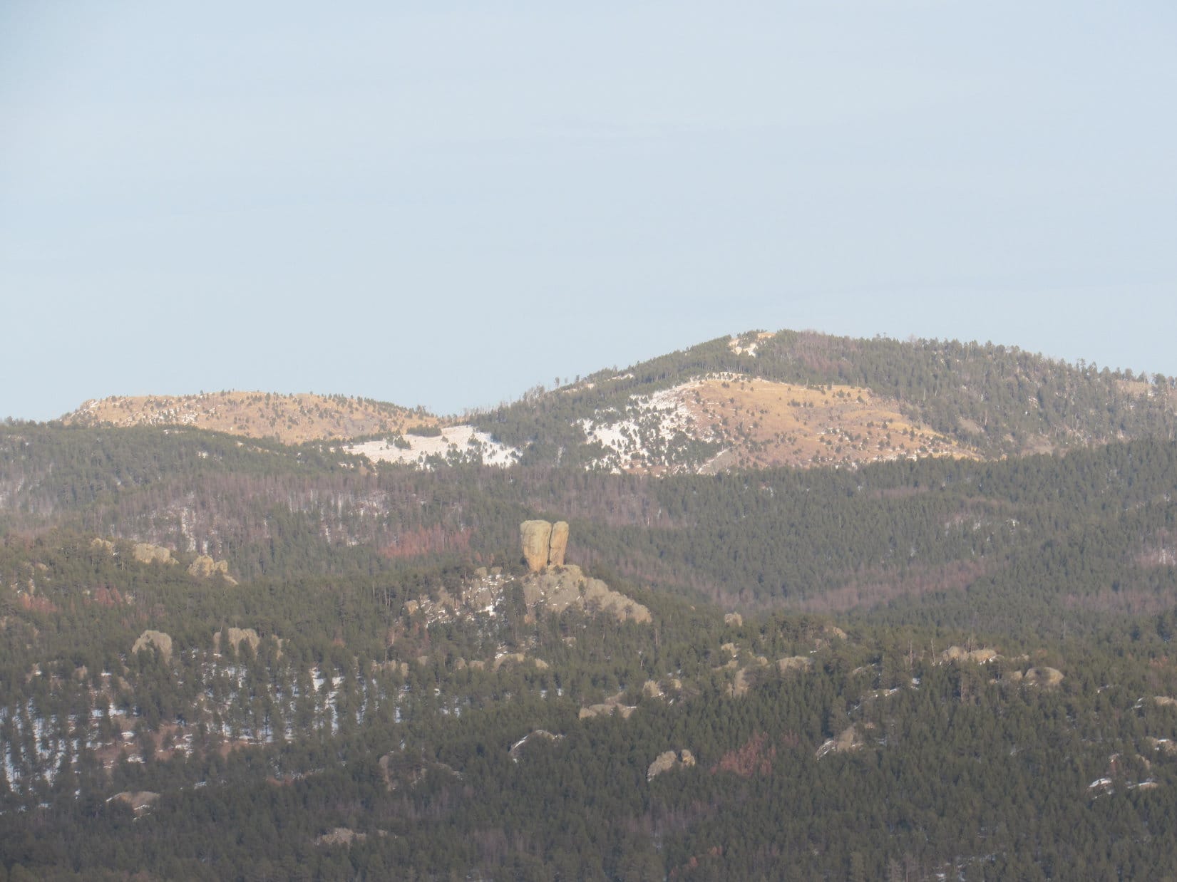
Of course, it would have been nice if the skies had cleared.  Although Lupe had been in the Denali State Park area for nearly 3 days now, she still hadn’t gotten a good, clear view of Denali (20,310 ft.).  She’d seen the incredibly massive white mountain from an enormous distance earlier, while still close to Fairbanks, but had only caught brief glimpses since.

Nature doesn’t care what might be nice.  The clouds did not part.  Not even the tiniest speck of blue sky appeared.  The dreary, light rain fell sporadically all day.  Lupe and SPHP mostly snoozed.  Maybe tomorrow Lupe would finally get that superb view of Denali?

8-21-16, morning.  See Denali?  Hah!  Not a chance!  The sky had wept all night.  Rain was still falling, steadily, and much harder than yesterday.  Time to give up on the Denali Dream.  Lupe was all rested up now.  She had other adventures to get to!  Good-bye Denali State Park.  Good-bye fabulous K’esugi Ridge!

Rain poured down, as SPHP drove S on the George Parks Highway (Alaska Route 3).  The truth was, nearly all of the Alaskan adventures left on Lupe’s list of possibilities were somewhere relatively close to the S coast.  The coast had been socked in with rain and fog for weeks.  Conditions weren’t likely to be any better along the coast than at Denali State Park.  Maybe Lupe’s time in Alaska was drawing to a close?

The sky remained overcast, but the rain ended before Lupe reached Wasilla.  Civilization!  Lupe and SPHP shared a box of ice cream bars and a couple of cheeseburgers.  SPHP killed some time at the laundromat, and taking care of a few other chores.  Already 5:00 PM.  This day was slipping by, too.

One adventure still seemed like a possibility.  If the rain would hold off, maybe Lupe could climb Skyscraper?  Less than 1,000 feet of elevation gain was required.  The mountain’s summit wasn’t even a mile from Hatcher Pass, a scenic 20 or 30 minute drive NW of Palmer.

Palmer wasn’t far from Wasilla.  At Fishhook Junction, a mile N of Palmer, SPHP turned W (L) off the Glenn Highway (Alaska Route 1) onto Fishhook Willow Road.  Fishhook Willow Road went W 2 miles then turned N following the Susitna River valley.  After a sharp L turn onto Willow Creek Road, SPHP figured Lupe must be getting close to Hatcher Pass.  SPHP parked the G6 at a pullout near the Fishhook Trailhead, right off Willow Creek Road.

Conditions weren’t so great.  Mist was falling here.  Low clouds draped over every mountain peak, threatening to unleash more serious moisture at any moment.  If Lupe did make it to the top of Skyscraper Mountain, she might not see anything except fog.

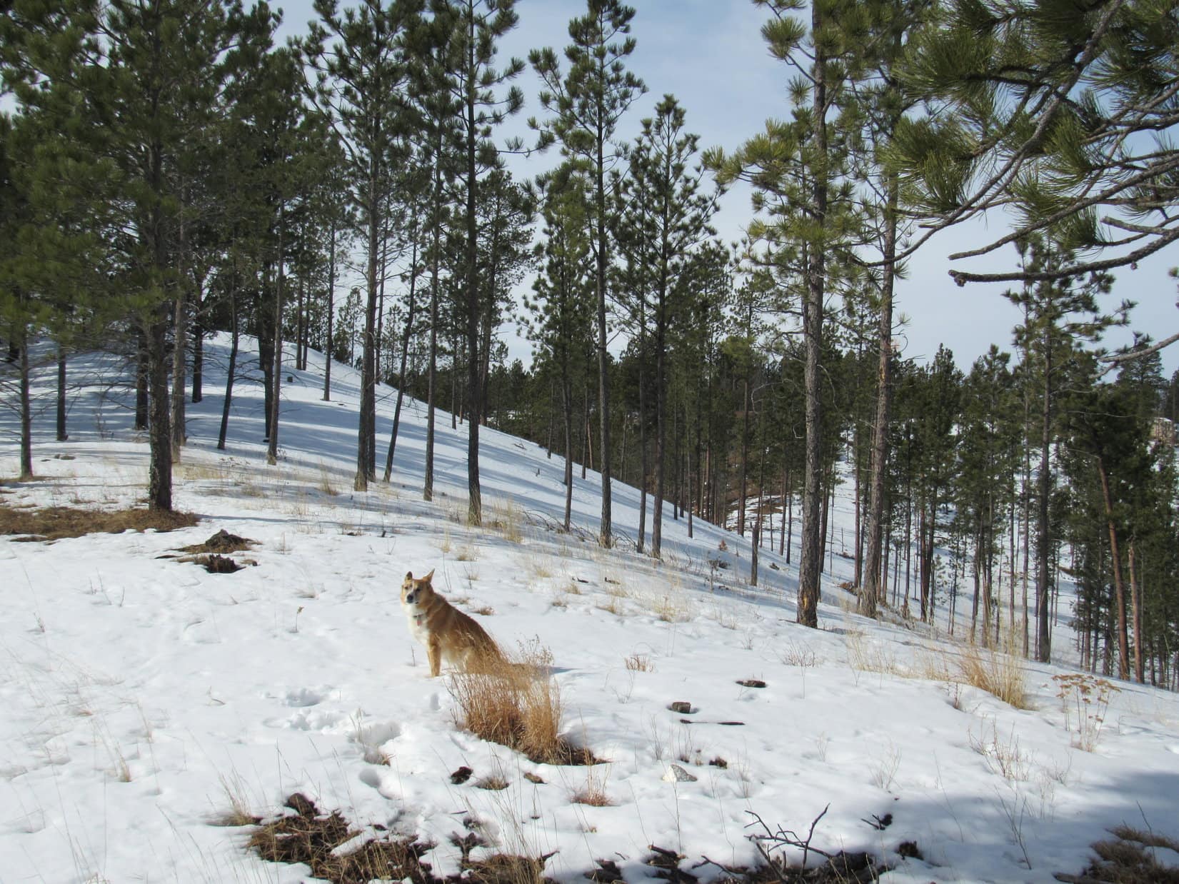
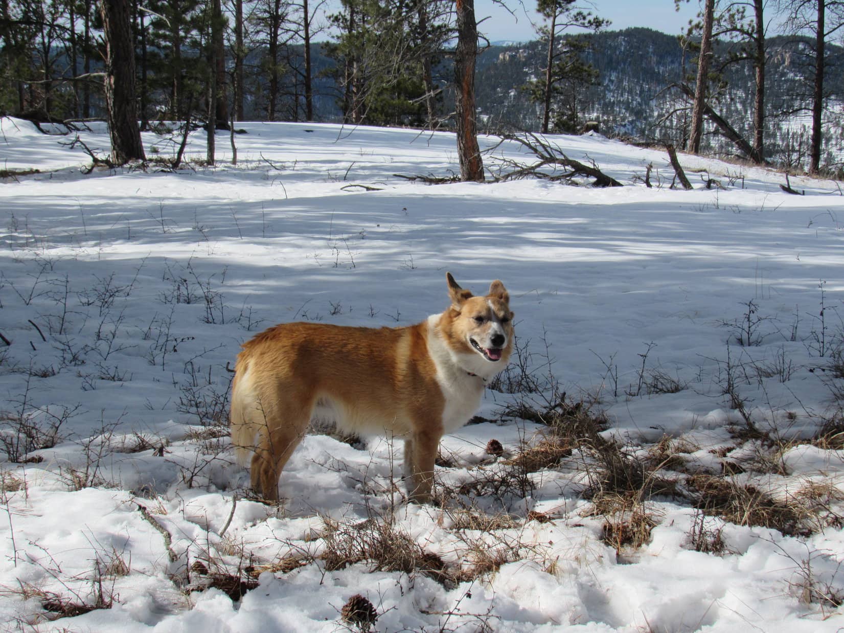
However, Lupe desperately wanted to go.  She’d been cooped up in the G6 for nearly 2 days now.  The mountain looked only moderately steep, and appeared to be an easy climb.  A maze of soft, damp trails wove among low, wet bushes toward the S spine of the mountain.  Lupe and SPHP started up.

Glad to finally get out of the G6, Lupe starts up the mountain. Photo looks N.

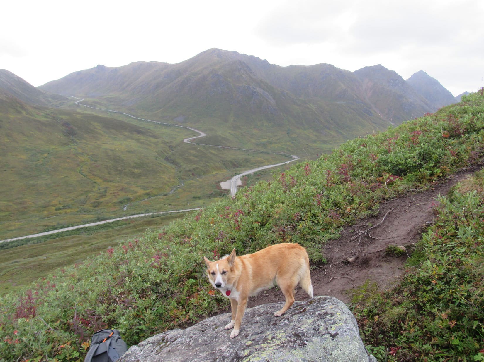
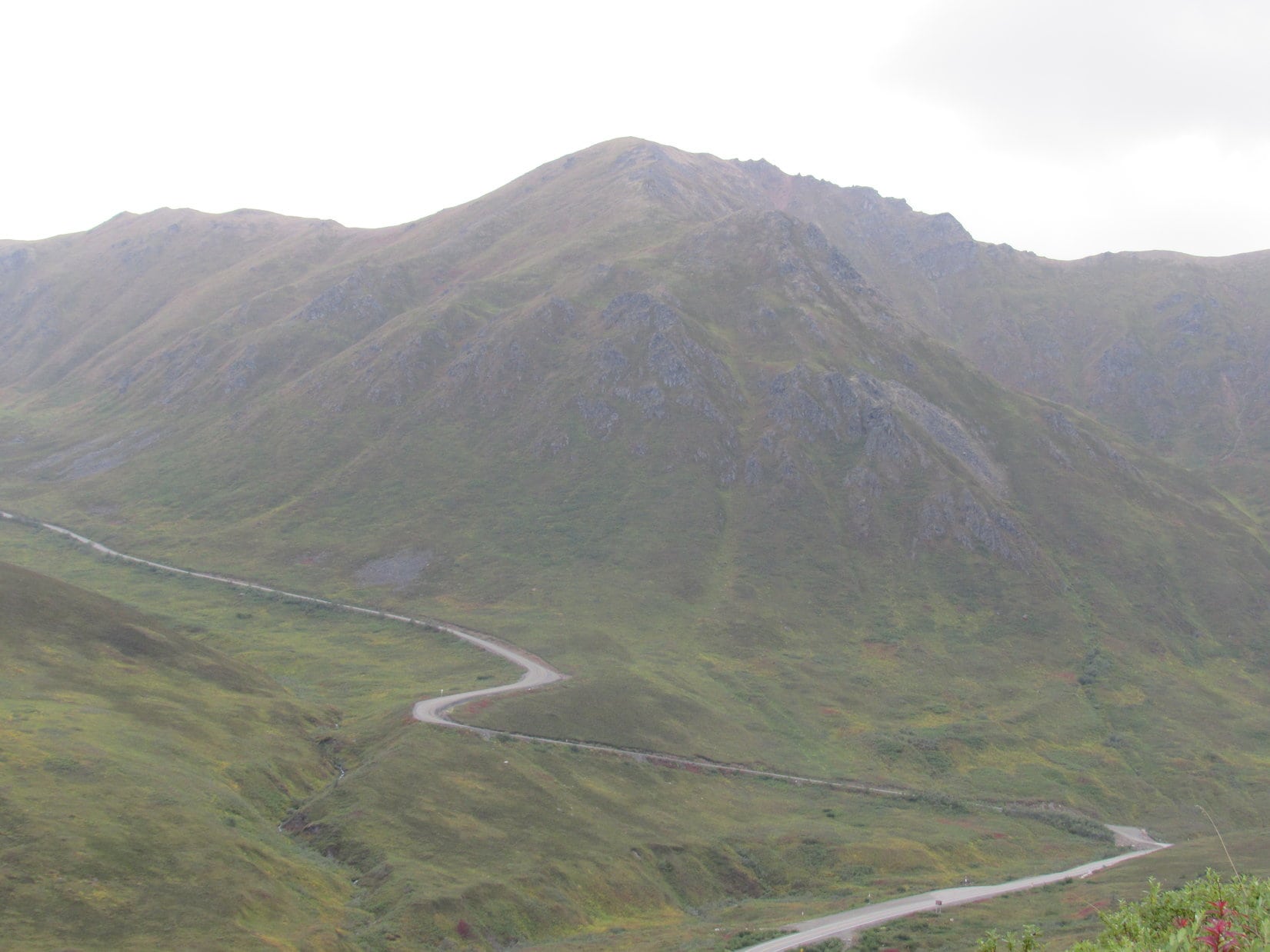
Everything was going fine.  Lupe was having a good time.  She’d already gained perhaps 250 feet of elevation, when SPHP paused for a quick breather.  So far, so good.  Except for that view to the W.  Something was wrong over there.  A road snaked up the main valley into a side valley, continuing on up to a big saddle even higher than where Lupe was now.  How could that be?

Mist turned to light rain, as it all sunk in.  That road was the Willow Creek Road going up to Hatcher Pass.  It had to be.  For pity’s sake!  Lupe wasn’t even climbing the right mountain.  Skyscraper Mountain (4,825 ft.) was over there!  No doubt about it.

Lupe at the highest point she reached on the trail up the wrong mountain. At least she had a good view of Skyscraper Mountain(Center) and Hatcher Pass(L) from here. Photo looks W.
Skyscraper Mountain (4,825 ft.) (Center) overlooks Willow Creek Road on its way up to Hatcher Pass. Lupe was supposed to have been climbing Skyscraper along the SW ridge seen on the L. Photo looks W.

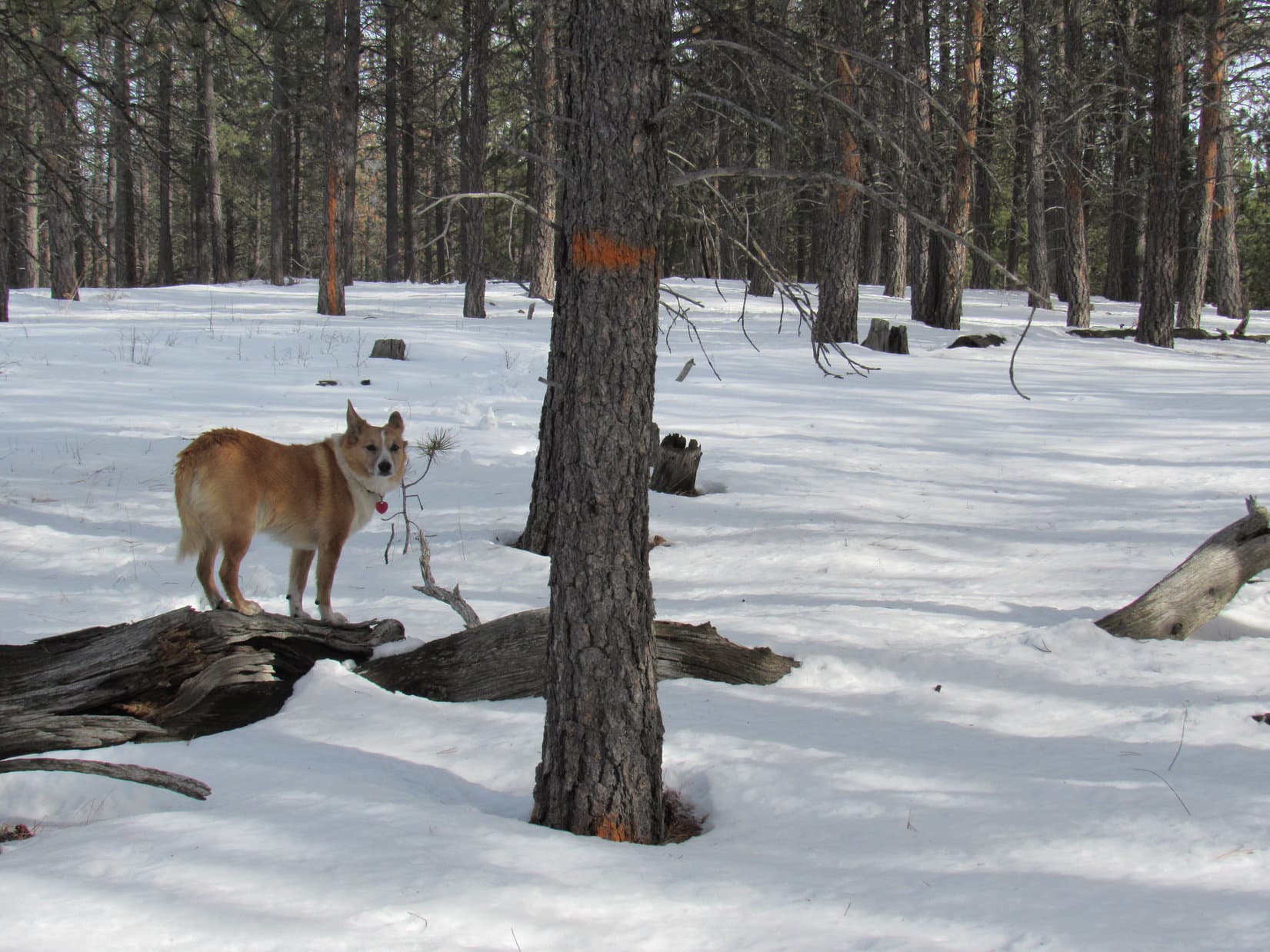
Sheesh!  SPHP had no idea where this trail Lupe was on went, how far it went, or what mountain Lupe was on.  (She was on the 1.2 mile long trail up Marmot Mountain.)

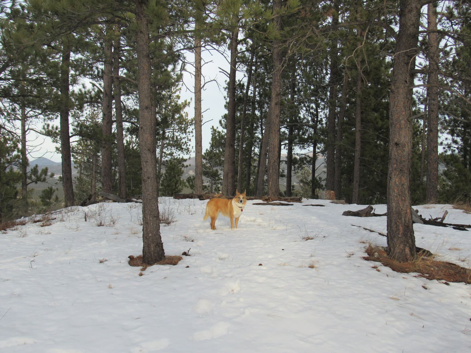
Oh, well.  Conditions were deteriorating anyway.  May as well call it.  Back to the G6!  At least Lupe had some exercise and fun.  As an added bonus, SPHP finally understood where Hatcher Pass and Skyscraper Mountain were.

Who knew?  With a little luck, tomorrow would be a better day.  Lupe might be glad her climb of Skyscraper had been postponed.

I’m on the wrong mountain? How can that be? You’re joking, right? SPHP, you come up with the craziest notions! Maybe I’m going to have to take a firmer paw in adventure planning from now on.

Dream on!  The G6’s radio said differently.  Rain continuing through tomorrow, extending into blah, blah.  Enough of that!  Outside the G6, the world continued dripping.

8-22-16, morning again.  Still heavily overcast, but not raining.  Maybe Lupe could climb Skyscraper right now, first thing?  SPHP drove up to Hatcher Pass.  The pass wasn’t far at all, but conditions were a lot different here.  Steady rain, 52°F, a chilly breeze, and fog.  Umm, no thank you!  When it comes to adventure, Lupe and SPHP are fair weather friends.  No need to star in a private episode of Survivor!

Civilization has its advantages.  Lupe and SPHP left Hatcher Pass and drove down to Palmer.  A roasted chicken was obtained and shared.  Lupe gnawed on a rawhide stick for a while, then snoozed.  SPHP read.  Palmer was overcast, of course, but it wasn’t raining.

Early afternoon.  Still no rain in Palmer.  Maybe things were better by now at Hatcher Pass?  Lupe and SPHP went back up there.  No rain until just before reaching the pass, where nothing had changed since this morning.  Aggravating.  Lupe would just stay here and wait it out.  Sooner or later, there had to be a break didn’t there?

Lupe poses near the Hatcher Pass monument during a brief lull in the rain. Photo looks W.

Despite the cold rain, a surprising number of people came and went.  Most were well equipped with umbrellas and rain gear.  Many took short walks on trails over the gently sloping tundra beyond the Hatcher Pass monument, but few remained in the area for long.

SPHP talked to a couple of guys getting back into their vehicle with Alaska plates.  Did they know anything about the long range weather forecast?  It was a rental car.  They were Germans, but they did know something about Alaskan weather.  They’d been in Alaska for 2 weeks and had been going to extremes to try to find a little sunshine.

The Germans said 3 more days of rain were in store here, then it was supposed to clear.  As soon as they left Hatcher Pass, they were headed for Anchorage to fly to Nome.  Nome was sunny.  In 3 days, they would fly back to Anchorage.  Now, there was an idea.  Lupe could fly to Nome!

Perhaps SPHP lacks imagination.  Flying Lupe to Nome on the spur of the moment seemed a bit extreme.  No doubt a spontaneous trip to Nome would have been a grand adventure, though!

There were brief lulls, but mostly the rain went on and on.  The afternoon ticked away.  Lupe had been snoozing, but during a lull in the rain, she finally woke up.  She just had to get out and run!  Off like a shot, the Carolina Dog flew across the heather until she was a distant speck.  SPHP stood in drizzle watching from afar, waiting for Lupe to tire of her big romp and return.

A couple of women walked by with 3 kids.  The older woman was telling the children to be careful not to slip on the muddy trail.  Moments later, the oldest child slipped and fell in the mud.  She started crying.  The older woman lost it, and started screaming at the girl.  She was glad Michelle was hurt!  It served her right for not listening and being careful.  Hadn’t she just been told to be careful?  Michelle wouldn’t get any help from her!

The obscenity-laden rant went on for several minutes while Michelle cried.  The other woman at least helped her back on her feet.  Michelle was what, maybe 9 – 11 years old?  SPHP was on the verge of going over to have a few choice words with Cruella de Vil, when she finally shut up.  The immediate crisis was over.  Even so, Michelle’s problems in life were far from over, not by a long shot, if that witch was her mother.

The glorious human race!  So capable of both the very best and very worst the planet has on offer.  Carolina Dogs are better company – active, friendly, sensible and loyal!  Speaking of which, where was Lupe?  Here she came, racing back from her romp.  She was eager for SPHP to join in the fun.  It had only been misting lightly during Michelle’s ordeal.  Might as well try Skyscraper now, before things changed.

SPHP drove down to a slightly lower pullout at the base of the informal trail up Skyscraper Mountain.  Lupe could hardly wait.  As soon as she was out of the G6, she took off again, racing hundreds of feet down the tundra on the other side of the road.  She came right back, panting hard, and was overjoyed to see SPHP getting the pack ready.

A volley of raindrops splattered SPHP, but didn’t last long.  Yes, raingear was in order.  SPHP dug it out of the pack, and put on a green plastic rain poncho.  Ready for another attempt.  How far Lupe would get was in serious doubt, but at least she would be on the right mountain this time around.  Lupe and SPHP started up the slope.  (6:20 PM, 48°F)

Start of the trail up Skyscraper Mountain from the pullout along Willow Creek Road near Hatcher Pass. Photo looks N.

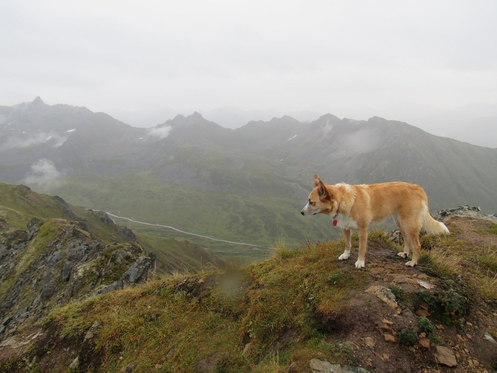
The longest, steepest part of the climb came right at the start.  Skyscraper is one of those mountains where the top always looks only another 50 feet higher.  By the time Lupe reached the first high point, she had already gained 2/3 of the total 950 feet of elevation gain required to reach the summit.

Lupe finally nears the first high point. Photo looks N.

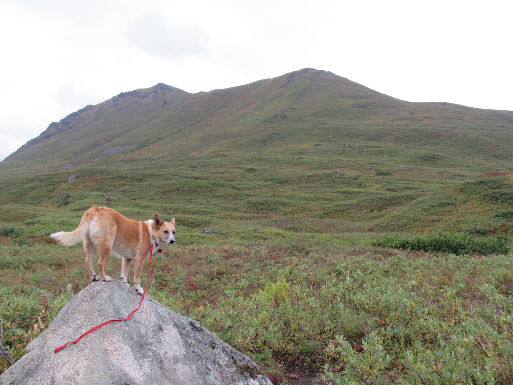
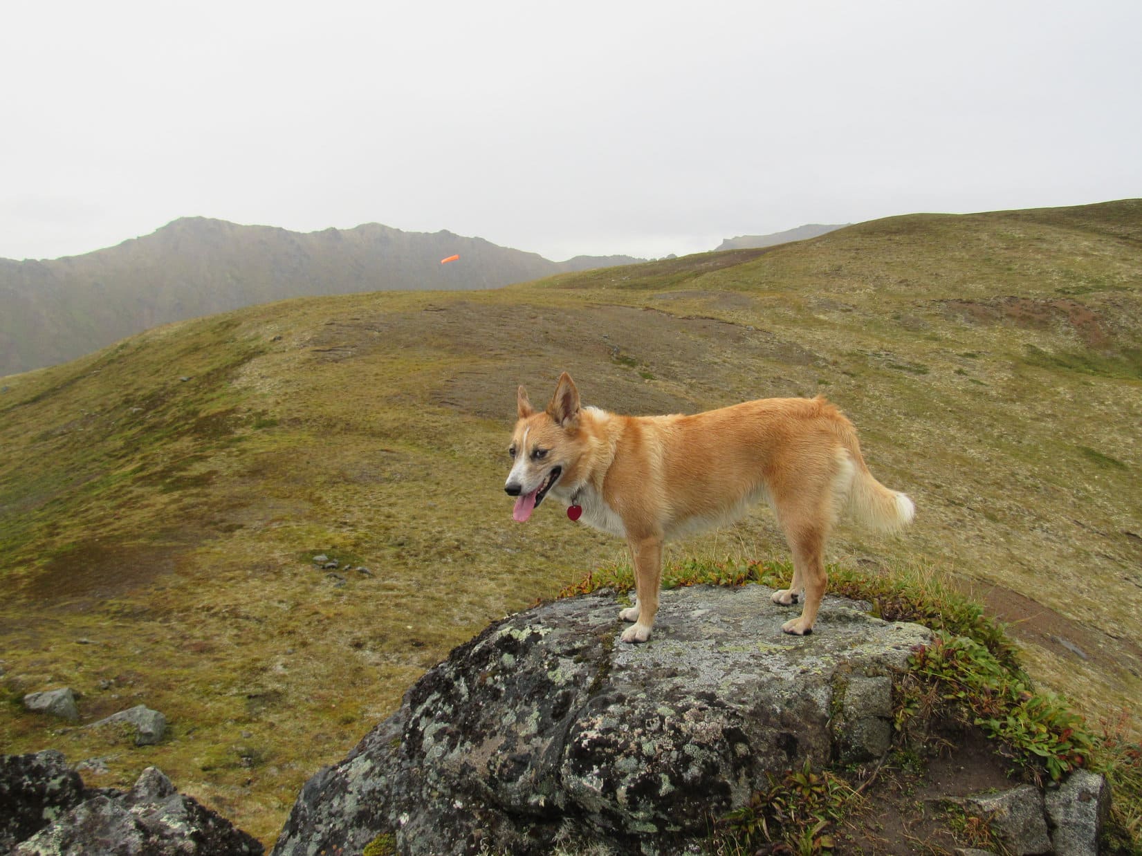
From a rock formation at the first high point, Lupe got her first view of what lay ahead.  Not far to the N, an orange windsock floated on the breeze above a broad, rounded ridge.  From the windsock, Lupe would have an easy time traveling over gently rising tundra toward a couple modestly higher points along the ridge.

From the rock formation at the first high point, Lupe saw an orange windsock floating in the breeze. The ridge ahead was broad and rounded. Lupe would have an easy time traveling over the tundra here. Photo looks NNW.
From the first high point, Lupe saw two modestly higher points ahead along Skyscraper’s SW ridge. Beyond them, she could already see the S end of the summit ridge. Photo looks NNE.

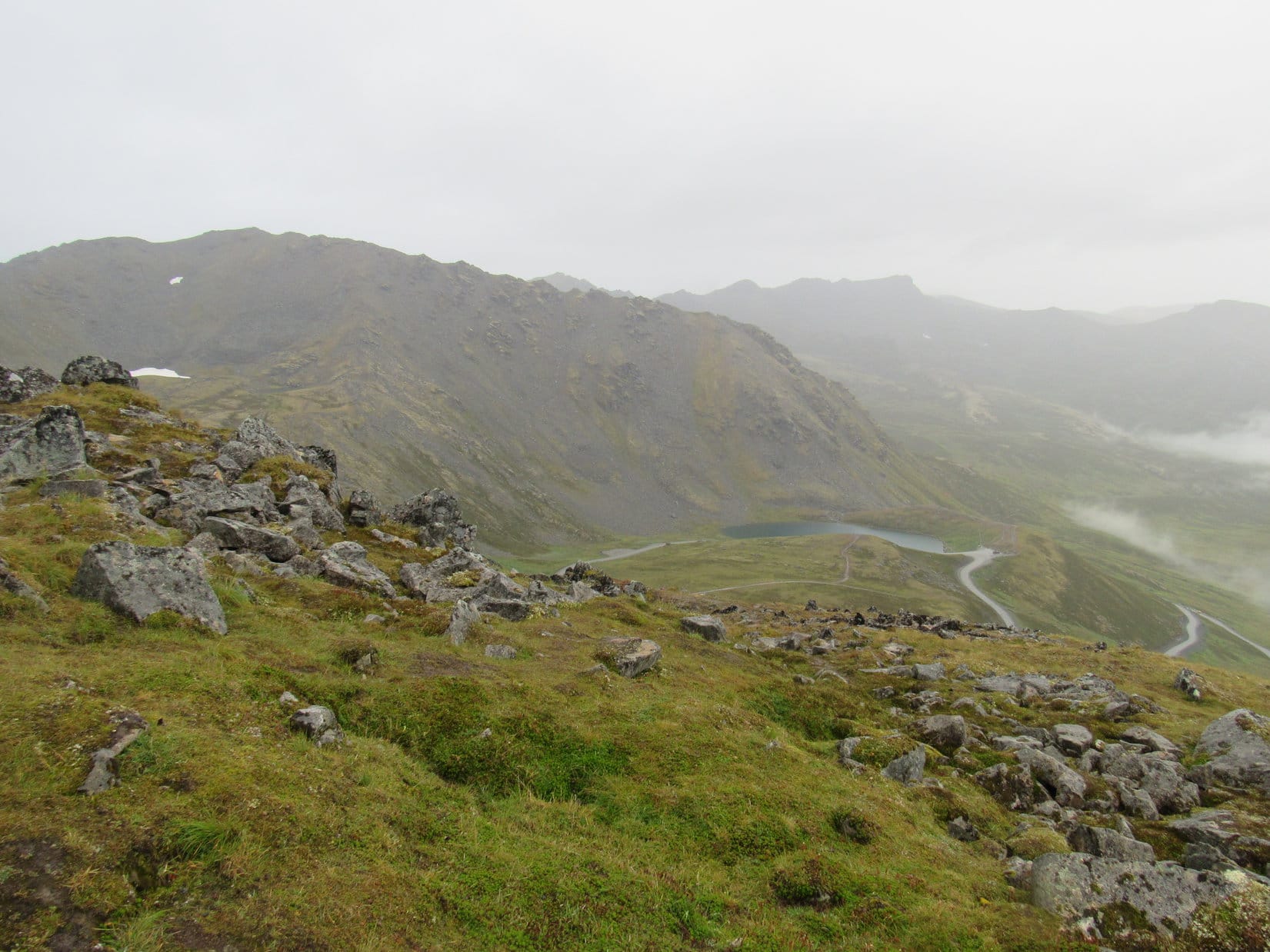
Looking back, Lupe could see Summit Lake on the W side of Hatcher Pass.  April Bowl and Hatch Peak (4,811 ft.) on the S side of the pass were in view, too.

Looking back the way Lupe had come, Summit Lake(R) was in view on the W side of Hatcher Pass. Hatch Peak(L) and April Bowl (where the snow is below the peak) were in view, too. Photo looks S.

Lupe checked out the orange windsock, before turning NE to start the easy stroll up toward the next couple of high points.  She had a blast running around sniffing and exploring the tundra.  By now, Skyscraper Mountain’s entire summit ridge was in view, including the little bump up at the N end where the true summit is located.

Lupe checks out the orange windsock. The first high point she reached is on the L. Hatch Peak(R) and April Bowl are seen in the background. Photo looks SSE.
The gentle path to the next modestly higher points. Skyscraper Mountain’s summit ridge is in view L of Center. Photo looks NE.

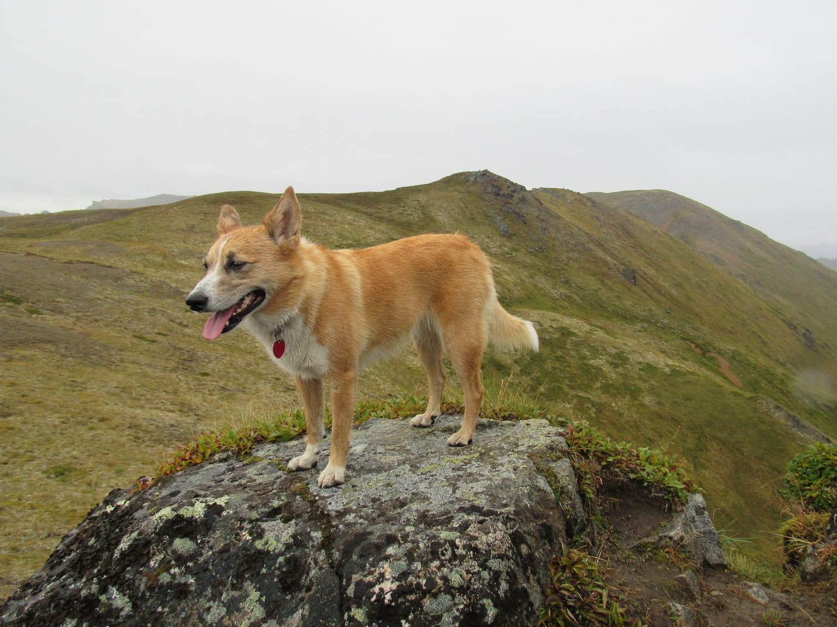
The path along the higher part of the SW ridge undulated from one minor high point to the next.  Through the light mist, Lupe could see mountains in every direction.  If it had been a clear day, the scene would have been really gorgeous.  Lupe had nothing to complain about, however.  She was lucky the rain was holding off for the time being.

Lupe on the undulating SW ridge. Skyscraper Mountain dead ahead! Photo looks NE.
The tundra features such amazingly brilliant little plants!

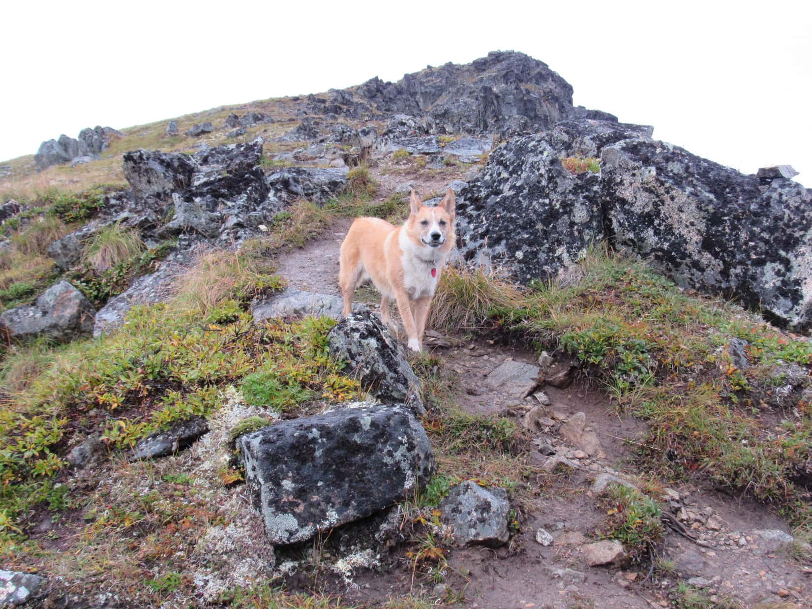
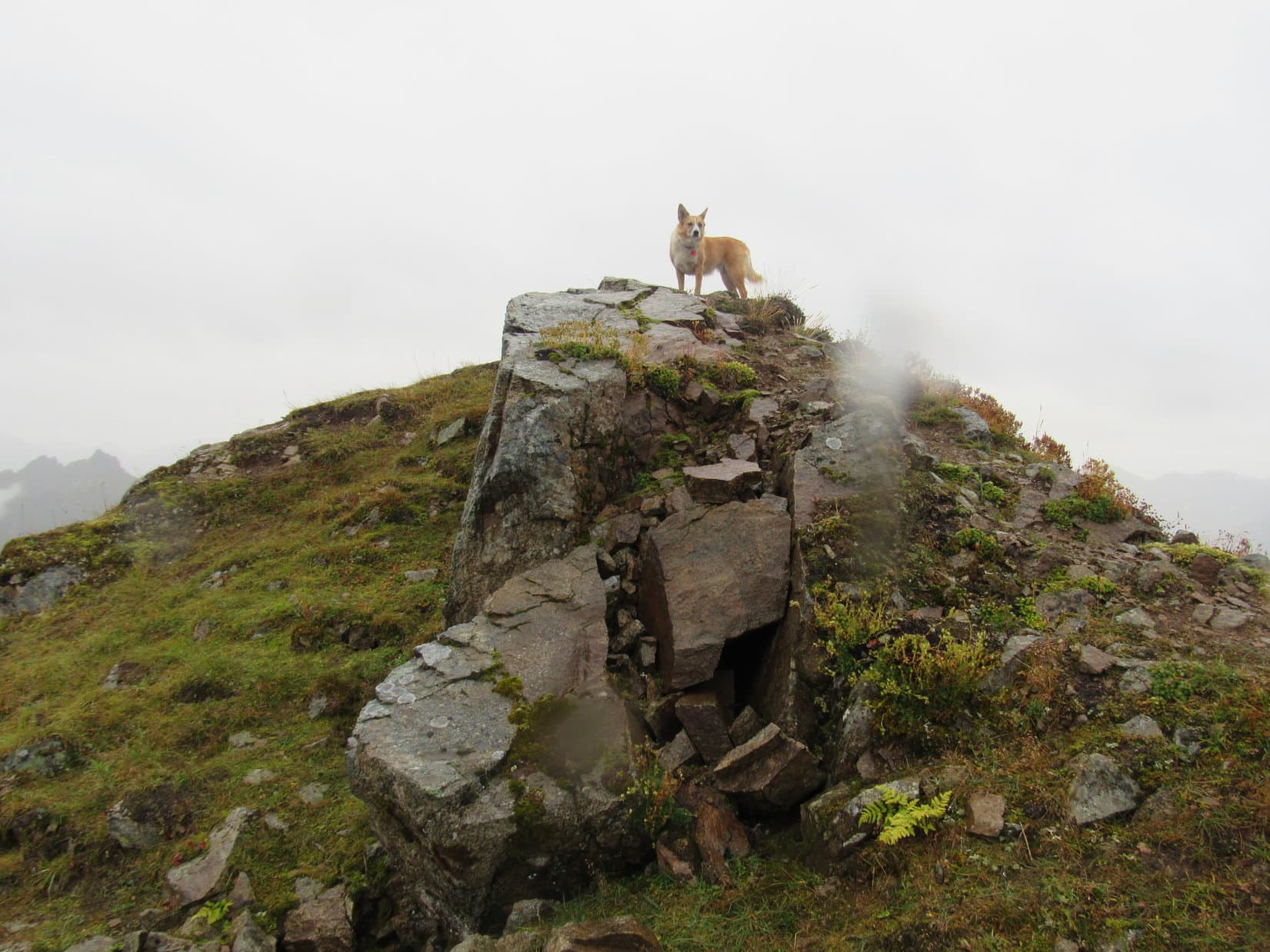
Beyond the minor high points of the SW ridge, the trail lost some elevation heading down to a saddle leading to Skyscraper’s summit ridge.  Another steep climb ensued from the saddle, but it was only half as long as the first big climb had been.  Soon Lupe was up at the S end of the summit ridge.  The Pass survey benchmark was right there.

The Pass survey benchmark was hard to miss at the S end of Skyscraper’s summit ridge. The “P”, “A” and part of the first “S” for Pass can still be made out to the L of the center triangle.

Skyscraper’s summit ridge is nearly level until it reaches a modest bump up at the N end where the true summit is located.  The ridge was much narrower than the SW ridge Lupe had come up, especially toward the N end.  The true summit was only 150 yards N of the Pass survey benchmark.

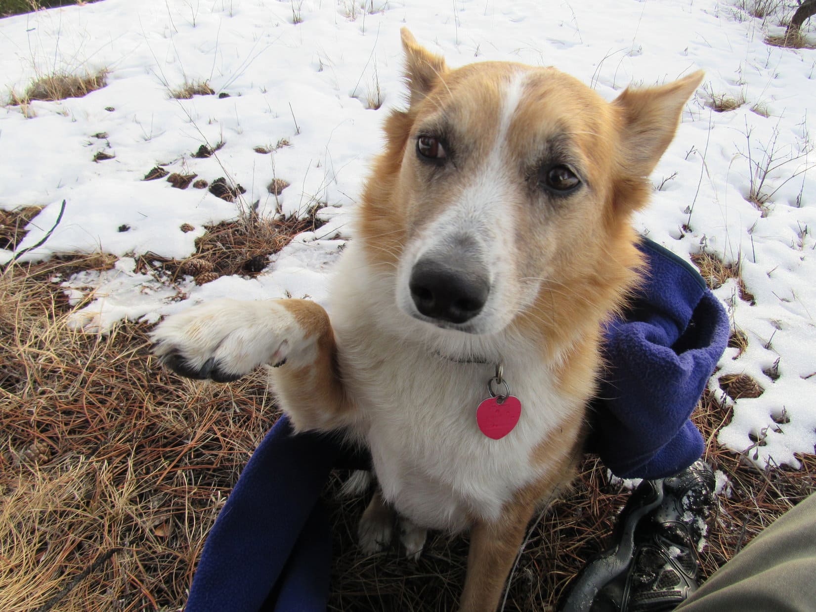
Lupe was there in practically no time at all.  After days of waiting, success rewarded patience!  Congratulations, and the usual paw-shaking ceremony ensued.

Lupe stands next to the Pass survey benchmark. The true summit of Skyscraper is only 150 yards away along the ridge. Beyond Skyscraper’s summit, Bullion Mountain (5,100 ft.) is seen in the distance. Photo looks N.
Lupe stands atop the true summit of Skyscraper Mountain! Marmot Mountain (4,770 ft.) is seen beyond Lupe. SPHP believes Microdot (4,900 ft.) is the high point L of Center, and The Pinnacle (5,500 ft.) is the highest point on the far L. Photo looks NE.
Lupe on top of Skyscraper. Photo looks ENE.
Carolina Dogs are rarely seen on Skyscraper Mountain, but it does happen! Microdot is visible on the L. Photo looks NE.

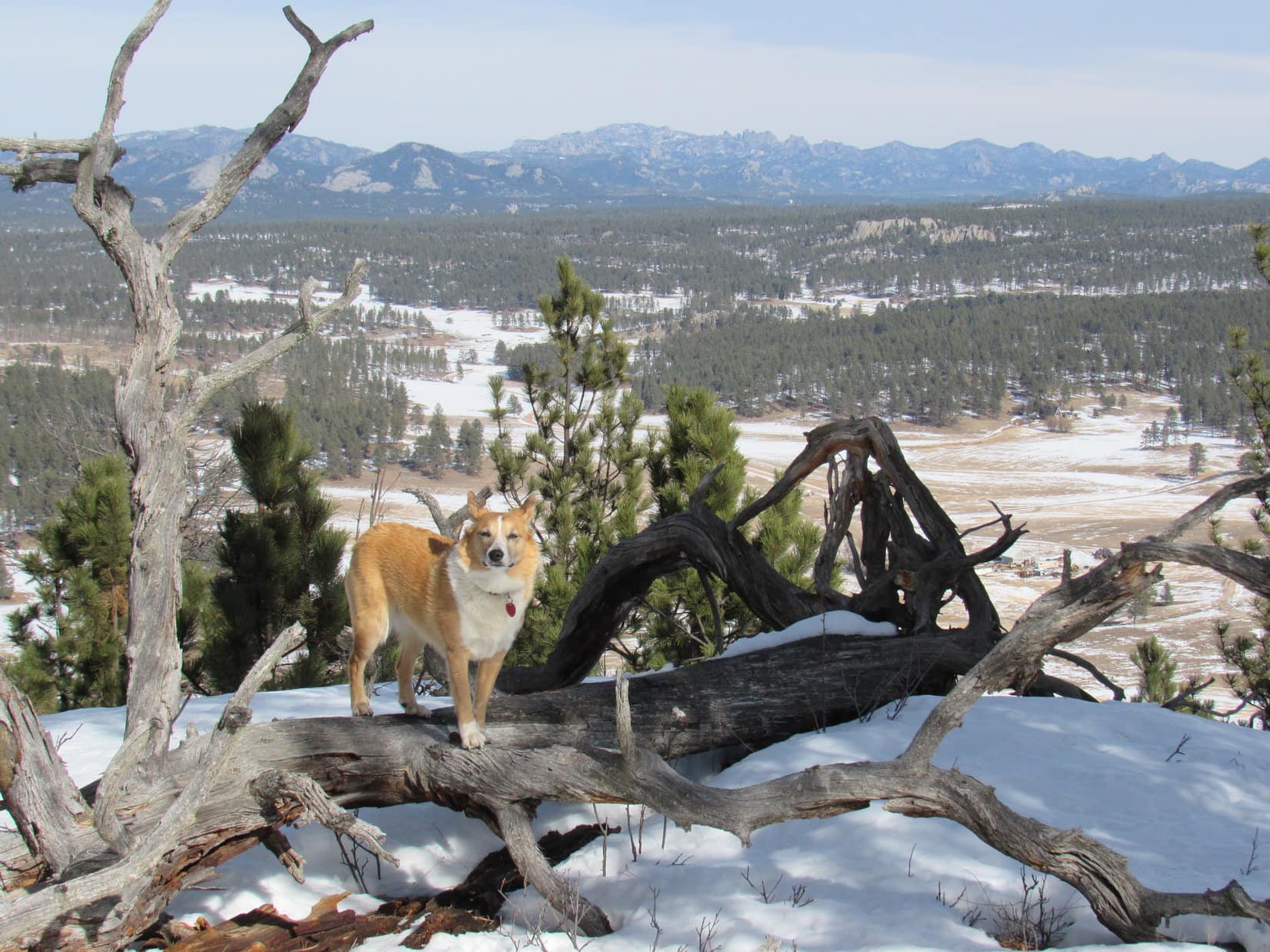
Mist and drizzle had occasionally given way to light rain on the way up.  Lupe was fortunate to have reached the summit of Skyscraper.  Conditions might worsen at any moment, so Lupe and SPHP didn’t stay at the summit too long.  There was time enough for some photos, and a good look around at what could be seen of the rugged surrounding peaks of the Talkeetna Range.

Lupe stands on a nearby high point while SPHP stands on the true summit. Skyscraper’s summit ridge extends off to the L. The SW ridge Lupe came up is visible to her R. Hatch Peak and April Bowl are in view R of Center. Photo looks S.
Looking NNE farther along the ridgeline from Skyscraper’s summit. Bullion Mountain is on the L. The Pinnacle is the highest point seen R of Center. Microdot is on the R.
Lupe once again on the summit. Photo looks SW back toward the easy SW ridge she came up.

Time to go.  Lupe and SPHP started back S along the summit ridge.  In the saddle between the summit ridge and the SW ridge, Lupe met two young guys from Wasilla on their way up Skyscraper.  They said the weather was typical of this time of year around here.

Out of curiosity, SPHP asked them what trails/peaks they recommended Lupe save for a sunny day in the area?  Reed Lakes was the immediate response.  It wasn’t far from here.  SPHP had heard of it.  Good information.  Never hurts to ask the local experts!

Looking S from the S end of Skyscraper’s summit ridge (near the Pass survey benchmark). Hatch Peak and April Bowl are on the L. Hatcher Pass is seen at Center. Skyscraper’s SW ridge leading back down to the G6 is on the R. Photo looks SSW.

A thick fog rolled in as Lupe descended the last little stretch of the steep final slope to the G6.  Rain came with it.  Back just in time (9:13 PM)!  Those poor guys from Wasilla hadn’t looked prepared for this.

Fifteen minutes later they appeared running across Willow Creek Road toward Hatcher Pass, where their vehicle must have been parked.  Had they made it to the summit of Skyscraper?  Probably, but they couldn’t have been there long enough to enjoy it.  Lupe would never know for sure.  At least they were back safely, though cold and soaking wet.

Lupe’s Skyscraper Mountain adventure had reached a successful conclusion, despite all the doubts of the last several days.  Time to celebrate!  SPHP drove down out of the soup back to Palmer.  All remaining roasted chicken was devoured, along with a second course of cheese and crackers.

Carolina Dogs love cheese!  Lupe always gobbled the cheese first before she would touch the cracker.  American Dingoes always go for the gusto, then mop up whatever remains later on.  But then, you probably knew that already.

On Skyscraper Mountain, Talkeetna Range, Alaska 8-22-16

Links:

Next Adventure                    Prior Adventure

Hatcher Pass East Management Area

Independence Mine State Historical Site

Hatcher Pass to April Bowl & Hatch Benchmark, Talkeetna Range, Alaska (8-27-17)

The Reed Lakes Trail to Lynx Peak & a View of the Bomber Glacier, Talkeetna Mountains, Alaska (8-28-17)

Want more Lupe adventures?  Choose from Lupe’s 2016 Canadian Rockies, Yukon & Alaska Adventure Index, Dingo Vacations Adventure Index or Master Adventure Index.  Or subscribe free to new Lupe Adventures.

Black Hills, SD Expedition No. 190 – Peak 5846, Peak 5880 & Peak 5840 (2-6-17)

Busy Carroll Creek Road (County Road No. 313) wasn’t a very good place to park, but would have to do.  SPHP pulled as far over on the W shoulder of the wide county road as possible.  With so much snow around, this was as good as it was going to get for the G6.  Lupe bounded out, eager to begin her day of fun in the Black Hills (9:59 AM, 49°F).

Only 100 feet back to the N, Lupe reached the intersection with Fox Ridge Road.  A short trek on Fox Ridge brought Lupe to her originally intended starting point at USFS Road No. 685.  The road was unmarked and snowy.  Fortunately, some vehicle with knobby tires had packed the snow down in a couple of tracks, making the hike along the road a lot easier than it otherwise would have been.

Lupe starts out on snowy USFS Road No. 685. Photo looks NW.

Lupe was about 5 miles SSW of Custer, SD.  Her mission on Expedition No. 190 was to climb 3 more Brian Kalet peaks.  Peaks 5846, 5880 & 5840 were all strung out along a line running roughly NW/SE.  None of them were in view yet.  Lupe would have to follow USFS Road No. 685 more than 2 miles, just to reach the pass between Peaks 5846 & 5880.

With so much snow around, Lupe couldn’t easily go running off exploring the forest like she usually does.  She tried a few times, but bounding through snow almost up to her neck was hard work.  Like SPHP, Lupe soon resigned herself to trudging along in the tire tracks on the road.  She alternated between leading and following, often pausing right in front of SPHP to sniff the air, thereby forcing a temporary halt.

SPHP tried switching tire tracks frequently to avoid trampling the Carolina Dog, but each time SPHP switched, Lupe switched, too.  She wanted to be in the exact same tire track as SPHP.  Sigh.  Good thing there wasn’t any big rush.  Between the snow and Dingo delays, Expedition No. 190 was off to a leisurely start.

After the first big bend in the road, Lupe was out of sight of any sign of civilization other than the snowy road going forward.  A S breeze was blowing.  The sky was blue with a few thin clouds.  Despite the snow, at close to 50°F, this was a warm day for early February.  The road hike was a nice one, winding mostly SW through the forest.

No. 685 gained elevation gradually for a while before leveling out.  Eventually it started a long, slow decline into a valley.  By now, Lupe could see part of the middle mountain, Peak 5880, ahead through the trees.

Peak 5880 was the first of Lupe’s objectives to come into view between the trees as she followed USFS Road No. 685. Photo looks WSW.

A little farther on, Lupe left the road briefly to climb up on a rock formation to the N.  SPHP thought she might have a good view of Peak 5846 from here.  She could see it, but the vantage point wasn’t as good as SPHP had hoped.

Lupe on the rock formation N of the road. She could see Peak 5846 ahead, but the view from this vantage point wasn’t as good as SPHP had hoped. Photo looks W.

As the road descended, Lupe lost all of the elevation she had gained, and then some.  At the lowest part of the valley, the road skirted the S side of a big field of private property.  When the road curved S away from the field, Lupe started seeing deer in the forest.  Deer aren’t quite as much fun as squirrels, but they do hold Lupe’s interest.

After leaving the big field behind, No. 685 gained elevation again.  Lupe eventually reached the pass between Peaks 5846 & 5880.  The pass wasn’t as snowy as the road had been.  Perhaps that was why a large herd of deer was hanging out here.  The deer promptly fled into the forest as Lupe approached.

Lupe reaches the pass between Peaks 5880 & 5846. Ahead USFS Road No. 685 descends into Ninemile Draw. Photo looks SW.

Only Peak 5846 was NW of the pass.  SPHP decided Lupe should climb it first.  Peak 5846 has two high areas.  Lupe climbed the closest S one first, coming up near the NE end of this area from the SSE.  The climb was steep, but only required Lupe to gain a few hundred feet of elevation.  When Lupe got up to where the terrain started leveling out again, she had a halfway decent view of Peak 5880 back to the SE.

Lupe reaches the NE end of the S high area of Peak 5846. She had a halfway decent view of Peak 5880 from here. The pass between the two peaks, which she had just climbed up from, is seen below. Photo looks SSE.

The highest part of the S high area is at the far S end of Peak 5846.  Lupe wasn’t anywhere near the S high point where she came up.  However, the true summit of the mountain was in the opposite direction at the N end of the N high area, anyway.

Lupe’s first task was to reach the true summit.  Off to the W, Lupe saw a thinly forested snowy hillside.  To the R of the hillside appeared to be a saddle leading over to the N high area.

To her W, Lupe saw this thinly forested snowy hillside(L). A saddle to the NW(R) appeared to lead over to the N high area where the true summit of Peak 5846 is located. Photo looks WNW.

Lupe went to the top of the snowy hillside, before crossing the saddle to the NW.  The NE side of the saddle was full of snow, but the ground to the SW was largely snow-free.  Unfortunately, a hazardous downed barbed wire fence was in the saddle.  SPHP lifted Lupe over it, but kept finding more barbed wire on the ground ahead.  The barbed wire made this a dangerous place for Lupe!  SPHP made her stay close.

The N high area of Peak 5846 is irregularly shaped.  The highest ground is near the NE edge of the mountain along a ridge leading NW.  Right away, Lupe came to a line of small cliffs along a narrow, rocky part of this ridge.

As soon as she had crossed the saddle, Lupe reached these small cliffs along a narrow part of the rocky ridgeline ahead. Photo looks N.

Although the ridgeline was quite narrow immediately N of the saddle, Lupe and SPHP had no problem following it NNW.  Lupe still had to be careful, though.  SPHP found one more section of downed barbed wire partially hidden in the snow.

After going a few hundred feet, the ridge broadened out greatly.  Lupe was now gaining very little additional elevation as she continued NW.  Right out in the open, she soon discovered a small cairn in the snow.

Lupe found this small cairn in the snow in an open area. At first, SPHP thought Lupe might have reached the true summit of Peak 5846 right here. Photo looks NE.

Was Lupe at the true summit of Peak 5846 already?  SPHP wasn’t sure.  The map showed the true summit at the far N end of the peak.  It looked like Lupe might still have farther to go.  Continuing onward, only 50 feet N of the little cairn, she came to a great open view to the NE.

50 feet N of the little cairn was this great open view to the NE toward Black Elk Peak (7,231 ft.) (Center).
Black Elk Peak(Center) and Cathedral Spires (6,840 ft.)(R). Photo looks NE using the telephoto lens.

Lupe entered the forest again, still going N.  Yes, there was higher ground ahead!  Lupe didn’t have much farther to go, though.  Soon she was up on a big snowy level area at the highest point on the mountain.  She had reached the true summit at the N end of Peak 5846!

Lupe reaches the true summit of Peak 5846! The summit area was very roomy. Here, Lupe is on the very highest ground was near the NE end. Photo looks W.
A broader view of Peak 5846’s summit. Photo looks W.
Lupe slightly NW of the highest point on Peak 5846. Photo shows the W end of the summit area. Lupe and SPHP took a break beyond the most distant snowy spot on the far right. Photo looks W.

The most dramatic view from Peak 5846 is toward Black Elk Peak off to the NE, but Lupe had already seen the best view of it from the viewpoint near the little cairn before she even reached the true summit.  Lupe and SPHP wandered over to the W end of the summit area, to see what Lupe could see over that way.

She had quite a nice view of Twin Sisters 2 miles to the NW.  Beyond Twin Sisters, Lupe could see higher hills in the distance.

From the W end of the summit area, Lupe had a good view of Twin Sisters (Center & R) about 2 miles to the NW.
Twin Sisters seen through the telephoto lens. Photo looks NW.

A little down the NW slope was a patch of snow-free ground.  Even though the wind had shifted to the W now, Lupe and SPHP took a break here.  SPHP ate an apple while enjoying the view.  Lupe wasn’t too hungry yet, but she had a little Taste of the Wild.

The W breeze wasn’t terribly strong, but still felt chilly.  The day wasn’t getting any warmer, that was for sure.  Lupe was happy when SPHP wrapped a spare purple Columbia pullover around her.

Lupe was happy to wear SPHP’s purple Columbia pullover in the cold W breeze during break time. Photo looks SE.
View to the W from Lupe’s break point at the NW end of Peak 5846’s summit.

Lupe still had two more mountains to climb.  Break time was limited to 15 minutes.  When it was over, the American Dingo returned briefly to the true summit of Peak 5846.  She then started S, retracing her route past the great NE viewpoint, the little cairn, along the narrow rocky ridge, and across the saddle leading back to the S high area.

However, Lupe did not turn E here to go back down the SE face of the mountain.  Instead, she continued S all the way to the S high point of Peak 5846, which she found at the top of a small forested knoll.  Lupe paused only briefly here before beginning her descent.  The S face of the mountain was steeper than where she’d come up, but had very little snow.

Peak 5880 from the S end of Peak 5846. Photo looks SE.
Lupe starts down the steep S face of Peak 5846. Photo looks E.

Lupe went all the way down to the pass where she’d left USFS Road No. 685 earlier.  She crossed the road a little SW of the high point of the pass, and began climbing from the NW up to the N ridge of Peak 5880.  The N face of the mountain was all forested, snowy, and fairly steep.  As Lupe reached the N ridgeline, the terrain started leveling out, although Lupe continued to gain some elevation.

Shortly after the slope of the terrain decreased, Lupe made a most interesting discovery.  Proceeding S along the ridgeline, the American Dingo found tracks – really big tracks – in the snow.  These weren’t the normal deer, wild turkey or rabbit tracks that Lupe usually comes across.  Not at all!  Lupe sniffed very carefully – mountain lion!

No doubt about it.  A very big kitty was around here somewhere!  The lion tracks looked fairly fresh, perhaps only 2 or 3 hours old.  The lion had been heading S along this same N ridge.  Lupe started following the mountain lion’s trail.

Fortunately, the N ridge was short.  To continue on to the summit of Peak 5880, Lupe soon needed to make a loop toward the E in order to stay on the high ground.  The lion hadn’t gone this way.  Lupe was disappointed when she had to quit following the lion, but SPHP thought perhaps it was best not to make a mountain lion’s acquaintance anyway.

Lupe was still gaining elevation as she followed the ridge ESE.  On her way, she came to a snowy clearing where she had a good view off to the N.  To the NW, she could see Twin Sisters again, poking up behind Peak 5846, where she had just been.

Mountain lion tracker Lupe on her way up Peak 5880. Off to the NW, she could see Twin Sisters(L)again poking up above Peak 5846 where she’d just come from. Photo looks NNW.
Bear Mountain (7,166 ft.) is the high distant ridge on the L. The smaller distant hill straight up from Lupe may be Medicine Mountain (6,878 ft.). The darker, closer hill on the R may be Atlantic Hill (6,393 ft.). Photo looks N.

The Peakbagger.com topo map showed 3 small areas on Peak 5880 enclosed by the 5,880 ft. contour.  Lupe was now approaching 2 of them midway along the ESE trending portion of the ridgeline.  Theoretically, any of these 3 areas might be the true summit of Peak 5880, although Brian Kalet had marked the 3rd, slightly larger area as the true summit.

Lupe came to only one high spot in the region where the topo map showed 2.  It was clearly the highest point around this part of the mountain.  This NE high point was located very close to a junction of ridges where Lupe needed to turn SW to reach Brian Kalet’s chosen summit.

This short, narrow stretch of the ridge was clearly the highest point Lupe came to NW of the contour Brian Kalet marked on Peakbagger.com as the true summit of Peak 5880. Photo looks S.

From the NE high point, Lupe followed a broad ridge going SW intending to find Brian Kalet’s true summit.  She lost a little elevation at first, but the terrain soon leveled out and began a gradual rise again.  Lupe came across another set of mountain lion tracks, but they were older than the tracks she had been following earlier.

After a 5 minute trek to the SW, a snowy hill became visible to the W through the forest ahead.  Climbing it from the E, SPHP was quickly convinced that Lupe was indeed about to reach the true summit of Peak 5880.  This hill was easily higher than where Lupe had been before.  Brian Kalet was right!

Lupe found the true summit of Peak 5880 in a large, flat, thickly forested area at the top of the hill.

Lupe reaches the true summit of Peak 5880! Photo looks WSW.
Lupe still at the true summit. There were no views here other than of the forest. Photo looks SE.

The snow was nearly a foot deep on the densely forested hill.  Lupe had no views of anything except more forest from the true summit.  She sniffed around the area for only 5 or 10 minutes.  The day was wearing on.  If Lupe was still going to try to climb Peak 5440, as well, she needed to get going.

Lupe retraced her route back to the NE high point, then turned ESE staying near the NE edge of the mountain.  An annoying barbed wire fence went this direction, too.  SPHP had to help Lupe across it several times.

Lupe was now gradually losing elevation.  She came to small cliffs at the ESE end of the ridge.  However, the way was open to turn S.  Lupe lost more elevation crossing a wide expanse of forest.  A fair amount of deadfall timber in this area forced lots of little detours.

By the time Lupe reached the last high point toward the S end of Peak 5880, she had seen 4 sets of mountain lion tracks, although only the first set had looked really fresh.  At the S high point, Lupe was ready for another break.  SPHP found a small snow-free spot among a stand of little pines.  Lupe had more Taste of the Wild.  SPHP wrapped her in the purple Columbia pullover again.  After 10 or 15 minutes, she was ready to continue onward.

Following a ridge that curved around to the SW, Lupe lost elevation steadily.  The topo map showed a minor road ahead, and Lupe reached it at a saddle.  This whole area was full of snow.  Lupe crossed the road going S.  The road was heading ESE and about to lose elevation.  Lupe plunged onward through the snowy forest, trying to maintain elevation up on the hillside.  The terrain forced her SE.

The topo map showed another lower pass a short distance ahead.  Lupe successfully maintained elevation until she reached the slope leading down to this second pass.  She found another road down here, and an intersection just to the E.  Lupe left the roads, and began her climb up the N ridge of Peak 5840.

At first, Lupe was climbing from the NW along a fairly steep snow-covered slope.  She gained a couple hundred feet of elevation before the slope became more gradual and the ridgeline turned S.  Higher up, Lupe came to a couple of halfway decent viewpoints along the way, but she didn’t linger long this late in the day.

Lupe reached the true summit of Peak 5840 at a junction of three ridges.  The summit area was much smaller than on Peaks 5846 & 5880, but had plenty of room to move around.  Once again, forest prevented Lupe from getting more than a glimpse of any distant views from the top of the mountain.

Lupe stands at the true summit of Peak 5840, completing her 3rd successful Brian Kalet peak ascent of the day! Photo looks E.
Lupe on Peak 5840.
Another view of the summit area. The W ridge of Peak 5840 can be seen heading off into the trees beyond Lupe. Photo looks W.
Lupe didn’t find any mountain lion tracks on Peak 5840, but she was still following in Brian Kalet’s footsteps.

Upon reaching the summit of Peak 5840, Lupe had successfully concluded her mission to climb 3 more Brian Kalet peaks today.  Even though the sun was getting quite low by now, she still had a little time to relax up on top of the mountain.  SPHP put the purple Columbia pullover back around her to keep her warm while she rested.

Lupe had a couple of requests.

Can I have some love, please?

First, she wanted love.  SPHP gave her a generous dose, and praised her for her 3 latest peakbagging successes earned despite having to spend so many hours in the cold, deep snow.

All the tender love made Lupe happy.  Next, she thought more Taste of the Wild would hit the spot.

Full of love, Lupe thought she’d tank up on Taste of the Wild, too.
That Taste of the Wild was good! How about a love chaser?

The Taste of the Wild disappeared.  Lupe begged for a little more loving, because, well, Carolina Dogs give away tons of love and enjoy receiving lots, too.  SPHP was most happy to comply with Lupe’s request.  Soon Lupe was feeling pretty good about the situation.

Soon Lupe was feeling good about the situation. She was toasty warm, full of nutritious Taste of the Wild, and dearly loved.

After a relaxing break on Peak 5840, it was time to get going again.  The sun would still be up for a little while, but the G6 was miles away.  Lupe posed for her final summit photo before heading down the mountain.

Lupe poses for a final photo at the top of Peak 5840. Photo looks S.

On the way down, Lupe and SPHP paused briefly at one of the viewpoints.

Medicine Mountain (6,878 ft.) is the distant peak at the far L. Atlantic Hill (6,393 ft.) is the closer, darker hill L of Center. Photo looks N from the N ridge of Peak 5840.
Northeast Cicero Peak (6,240 ft.) (R) and the rock Lupe knows as “Cracked Molar” (Center). Cracked Molar’s real name is Beecher Rock. Photo looks NE using the telephoto lens.

There wasn’t time enough left in the day for Lupe to retrace her original route to Peak 5840 back over Peak 5880, and then back along USFS Road No. 685.  When Lupe reached the pass N of Peak 5840, she turned NE following USFS Road No. 308.1F (Reservoir Road).

SPHP was surprised when No. 308.1F quickly led Lupe into a residential area.  The road eventually took Lupe N of these homes before winding NE through the forest again.

The light of day was fading, and so was No. 308.1F, by the time Lupe reached Carroll Creek Road.  SPHP was glad No. 308.1F hadn’t disappeared entirely in the dark forest.  The short cut back to Carroll Creek Road had worked!  Lupe had saved a lot of time and distance.

Lupe’s adventures on Black Hills, SD Expedition No. 190 were almost over.  Together, Lupe and SPHP started the 1.5 mile trek N along Carroll Creek Road back to the G6.  As stars began to appear overhead, Lupe and SPHP wondered if somewhere up on Peak 5880, a giant cat was beginning its nightly prowl?  (5:41 PM, 41°F)

On Carroll Creek Road.

Links:

Next Black Hills Expedition                 Prior Black Hills Expedition

Want more Lupe adventures?  Choose from Lupe’s Black Hills Expeditions Adventure Index or Master Adventure Index.  Or subscribe free to new Lupe Adventures.