Days 6 & 7 of Lupe’s 2017 Dingo Vacation to the Wind River Range, Wyoming & Select Peaks in Montana
The morning after Lupe’s return from her successful 4 day journey to Wind River Peak (13,192 ft.) was a lazy one. The Carolina Dog had certainly earned a rest day! SPHP picked up some fried chicken and a salad at Safeway in Lander. Lupe took a couple of easy walks down by the Middle Popo Agie River across from Lander City Park.
By 11:00 AM, it was plenty hot out. McDonald’s had ice cream cones on sale for 50 cents. Even cheapskate SPHP was willing to spring for that! Lupe got lessons in how to eat an ice cream cone. By watching SPHP’s example, she became quite proficient at it. It turns out Carolina Dogs are naturals at eating ice cream cones!

Lupe’s next peakbagging objective, Squaretop Mountain (11,695 ft.), was clear over on the other side of the Wind River Range at the far NW entrance to Green River Lakes. It would take all afternoon to drive over there, so right after the ice cream cones vanished, Lupe and SPHP left Lander and hit the road.
On her grand summer of 2015 Dingo Vacation, Lupe had spent a day reconnoitering Squaretop Mountain. SPHP has an old book called Wind River Trails by Finis Mitchell, who spent most of his life running a fishing camp in the Wind River Range near the Big Sandy entrance. In it, Mitchell describes a route up Squaretop Mountain from the E leaving the Highline Trail near Beaver Park.
Mitchell wrote that his route up Squaretop Mountain was “not difficult”. He had taken scouting groups, and even a 4 year old child up this way once, yet Lupe had arrived at Beaver Park in late August 2015 only to see towering cliffs. The topo map showed 3,500 feet of elevation gain in less than a mile. No doubt Mitchell knew what he was talking about, but Lupe’s reconnaissance left SPHP desiring a more detailed route description than Finis had provided in Wind River Trails.
On the way back to Green River Lakes, Lupe had met Chad, a friendly forest ranger. Did Chad know of a route up Squaretop? Chad said he’d been to the top of Squaretop himself. He said Mitchell’s route was hard to find since some of the landmarks in his route description (burnt areas) had changed. SPHP asked if there wasn’t a feasible route from the W via Porcupine Pass? Chad confirmed there was one, but it was longer, and he didn’t know the details.
Now, almost two years later, Lupe was on her way to Green River Lakes hoping to find that route from Porcupine Pass to Squaretop Mountain! Hopes were high, bolstered by her success in reaching the summit of Wind River Peak.
The last part of the road to Green River Lakes, which used to be rough, was greatly improved. It was still dusty and washboardy, but wasn’t nearly as stony as in 2015. Gophers were abundant, and frequently dashed across the road as the G6 approached. Lupe was enthusiastic about the gophers, and barked frantically at them as she sped by.
Lupe arrived at the trailhead near Lower Green River Lake at 5:00 PM. Loop and SPHP were both anxious to go down to the lake to get a good look at gorgeous Squaretop Mountain again.

Lower Green River Lake and Squaretop Mountain were every bit as lovely as Lupe and SPHP remembered. Of all the mountains in the Wind River Range, Finis Mitchell had chosen Squaretop for the cover of his book Wind River Trails.

Lupe and SPHP both went wading in Lower Green River Lake. The mosquitoes were bad, though, and eventually put an end to the fun. Lupe then went down to the Highline Trail bridge where the Green River exits the lake. A sign said that the bridge over Clear Creek (near the opposite end of Lower Green River Lake) was out due to flooding.

The Green River was running high, full of water from bank to bank. Having just seen how full the creeks were, and how much snow still existed in the high country near Wind River Peak, Lupe wasn’t surprised. With the bridge over Clear Creek out, Lupe wouldn’t be able to take the Highline Trail (No. 94) to Porcupine Pass tomorrow. Fortunately, an alternate route exists. Lupe could still take the Lakeside Trail (No. 144).
Even though Lower Green River Lake is at 7,961 feet elevation, the evening was hot. The mosquitoes were bad. Lupe and SPHP ended up staying in the G6, periodically running the AC to keep cool. While SPHP caught up the journal, Lupe watched gophers. Every now and then, she just had to be let out to bark at squirrels, or sniff at a gopher hole.
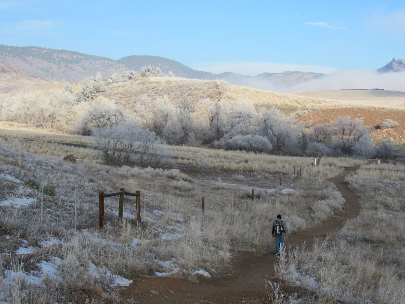
The next morning it was time for action! Lupe and SPHP went down to Lower Green River Lake again to admire Squaretop Mountain (11,695 ft.) before setting out for Porcupine Pass. (8:44 AM, 7-14-17, 66°F).


After a good look at her magnificent objective, Lupe followed the Lakeside Trail S along the W side of Lower Green River Lake. Despite it’s name, the Lakeside Trail is seldom down by the shore. Most of the time the trail stayed in the forest 50 to 150 feet above the lake. Only once in a while did Lupe come to an opening with a good view of the lake and mountains beyond.

Lupe was less than halfway along Lower Green River Lake, when a backpacker approached from the opposite direction. He turned out to be quite an interesting fellow. Radek Hecsko was 48 years old, and from the Czech Republic. He billed himself as “Czech Mix”.

Czech Mix was hiking the entire 3,100 mile Continental Divide Trail from Mexico to Canada! He had started on May 2 in New Mexico, and hoped to reach the Canadian border by mid-September. In 2015, he had previously hiked the entire 2,600 mile Pacific Crest Trail, which also goes all the way from Mexico to Canada.
Czech Mix jokingly called the Continental Divide Trail the “IPA Trail”. He said he typically hikes 30 miles per day, though not in the most rugged territory, and does take occasional rest days. Depending on the kindness of strangers, he hitchhikes to towns whenever possible to resupply. On the trail he often goes hungry, but in towns he packs in the calories feasting on hamburgers, coffee and IPA’s.
Czech Mix said he might eventually take on the 2,190 mile Appalachian Trail to complete the “Triple Crown”, a feat very few people have ever accomplished. He hadn’t really decided yet, though. It was another massive undertaking. For now he was staying concentrated on enjoying and completing the Continental Divide Trail. Completing the CDT would be a rare accomplishment in itself, since it was the longest of the 3 trails and by far the least traveled.
After petting Lupe, and a nice chat with SPHP, Czech Mix pressed on.
Well, that Czech Mix was mighty impressive, Loopster! Can you imagine tackling a 3,000+ mile long trail through high mountains like that? It’s just plain heroic!
Oh, are we gonna do that?
I’ve no doubt you could, Loop, but I’m not up for it. Completing any one of those trails is a gigantic endeavor! I’ll be happy, if we can just make it to Squaretop Mountain.
Oh, I’m sticking with you, SPHP. I’ll be happy if we can find some squirrels!

Lupe continued meeting people along the Lakeside Trail. They came strung out in small groups, but were all members of a youth group that had been camped at Twin Lakes. The group leaders were all concerned about an 18 year old, who had wandered off on his own and never showed up at camp last night. Their anxiety was only increased by the knowledge that his father was an attorney.
Two miles from where she’d started, Lupe reached the end of Lower Green River Lake. Another 0.25 mile brought her to a trail junction. Loop turned R on the Porcupine Trail (No. 137). She would be gaining elevation nearly all the way to Porcupine Pass, a good 6 or 7 miles away as the trail goes.


The Porcupine Trail didn’t begin climbing immediately, however. For almost another 0.25 mile it remained level until Loop reached Porcupine Creek. No bridge! Another ford. Lovely! Lupe had forded a lot of big streams on her way to Wind River Peak, but SPHP had been hoping for a bridge here. No such luck.

Actually, that wasn’t entirely true. Upstream of the ford, a log extended over the creek. A thin cable, which could be easily grabbed for support, was stretched high above it. The log’s circumference wasn’t all that large, however, especially toward the far end. Lupe couldn’t grab the cable, and might easily fall. It was a drop of several feet into Porcupine Creek. This makeshift bridge wasn’t going to do.
The near side of the ford was shallow, slow-moving water. The far side was deeper, and a great volume of water seemed to be racing by. What bothered SPHP far more than the ford itself, however, was what was right below it. Only 20 feet below the ford, Porcupine Creek made a sharp bend. This bend was clogged with sunken logs, branches and other debris. The water was over Lupe’s head. If she got swept downstream, she would be pinned with great force against the debris.
Czech Mix hadn’t come this way. The entire youth group had, however. No one had mentioned any problems crossing Porcupine Creek. SPHP didn’t like the setup, but decided to carry Lupe across.
The bottom where the creek was deepest was stony. Fortunately, perhaps due to traffic on the trail, the stones weren’t very slippery. Porcupine Creek turned out to be only knee deep, but SPHP still had a hard time maintaining balance on the uneven bottom against the force of the swift current. The Carolina Dog was glad to be let gently back down on solid ground again, when SPHP managed to struggle across safely.
The Porcupine Trail now began to climb aggressively, switchbacking SW up a steep forested slope. Partway up, Lupe could hear Porcupine Falls somewhere off in the woods to the N, but she never saw it. After gaining 800 feet of elevation, the trail gradually started leveling off. Eventually Porcupine Creek came back into view.

Shortly after leveling out, the trail turned NW and forded Porcupine Creek again. It could be seen continuing up a hillside beyond the far bank. Thinking that was just the way to Twin Lakes, SPHP skipped the turn, and led Lupe SW beyond a trail junction staying on the SE side of Porcupine Creek.
The trail Lupe was on soon disappeared in a bog. SPHP was puzzled when it couldn’t be found again on the other side. Where had it gone? No matter. Lupe and SPHP continued onward, bushwhacking through the forest up hilly terrain.
After more than 0.25 mile, Lupe did find the Porcupine Trail again! Belatedly, SPHP suddenly realized the trail to Twin Lakes hadn’t branched off until the Porcupine Trail had crossed over to the W side of the creek. To stay on the trail, Lupe should have taken the ford that SPHP had her skip.
Oh, well. No harm done. Lupe had managed to bushwhack her way through, and it was actually better this way when the creek was so high. The American Dingo’s bushwhacking had avoided 2 stream fords in the process. Puppy, ho! Onward!

The trail was in great condition where Lupe found it. It headed SW up a huge valley. Porcupine Creek was often in view flowing through wide green meadows. The trail almost always stayed out in the open, but gradually deteriorated, becoming muddy and passing through bogs in some places. Lupe had wonderful views of rugged mountains towering over the far side of the valley.

More than 0.5 mile from where Lupe had picked up the trail again, Porcupine Creek turned W to go around a small forested hill. This was an especially nice spot, and seemed like a good place to take a break. Lupe left the main trail to follow a short side spur down to the stream. Wildflowers grew in abundance. Lupe laid down for a rest. Mosquitoes were a nuisance for the first time today, but they weren’t too bad.


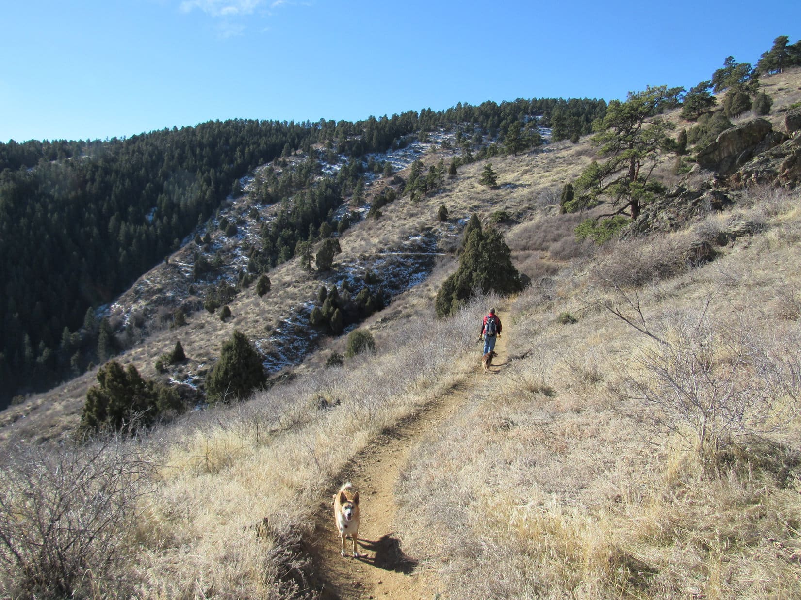
After a pleasant break, Lupe and SPHP continued on. The Porcupine Trail climbed the small forested hill, but soon exited the forest again. For a while the trail was wet and boggy. However, the valley eventually narrowed. The trail became rockier, steeper, and re-entered the forest. Up ahead were mountains with more snow on them than the scattered patches seen up to this point.


After a long march, the Porcupine Trail finally emerged from the forest again. It approached Porcupine Creek, closely following the E bank. As Lupe continued S, the trail disappeared straight into a huge snowbank. Efforts to pick up the trail on the far side of the snowbank failed. Sigh. What now?
Lupe had been making good progress toward the upper end of the long valley. Ahead was another stretch of forest, but it couldn’t be too much farther to open ground again. There seemed to be no choice, but to resume bushwhacking and see where it led. The American Dingo climbed back into the forest.
The forest was denser here than where Lupe had bushwhacked before. It wasn’t too hard to get around, though. Loopster soon came to two substantial tributaries of Porcupine Creek in quick succession. They were wild, whitewater streams that plunged W down from mountains on the E side of the valley.

Fortunately neither tributary was so large that Lupe couldn’t find a safe place to ford them in short order. Looper hadn’t gotten too far beyond the second stream when she reached the end of the forest. She started crossing a meadow, and came across the Porcupine Trail yet again.
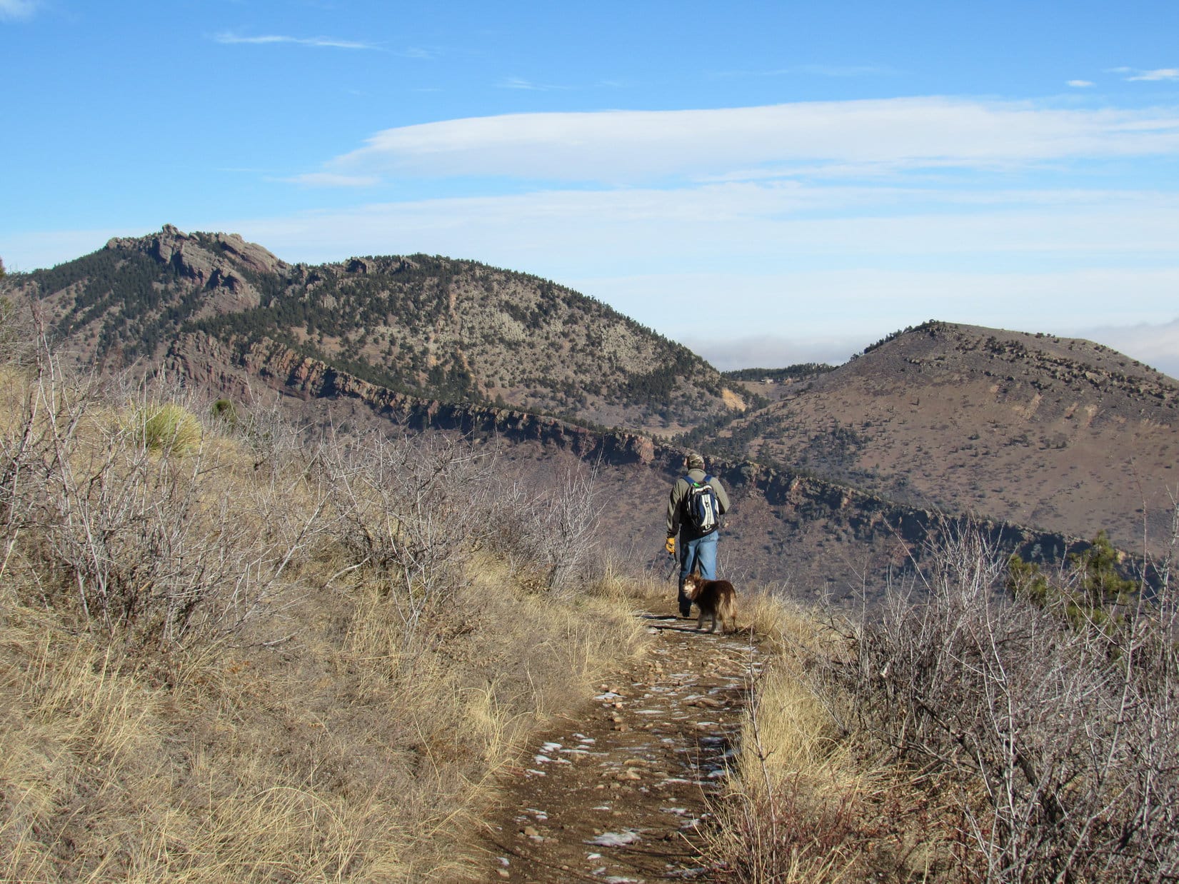
SPHP didn’t realize it at the time, but the trail had once again crossed over to the W side of Porcupine Creek for a short distance before returning to the E side. So what? Lupe’s bushwhacking had avoided another 2 fordings. She was close to the end of the valley now. Porcupine Pass was less than a mile away! The trail went SE, heading straight for it.

The trail became progressively steeper and steeper. Soon Lupe was on switchbacks. The forest began to thin out. The trees became stunted. When Lupe reached treeline, Porcupine Pass was in view. It was nothing like SPHP expected.
Porcupine Pass is at 10,700 feet elevation. Yet due solely to its name, SPHP had always thought of it as being forested. Thought of it as a place one might find porcupines – not that finding a porcupine was a good idea. An encounter with one might end very badly for Lupe.
No worries, though, on that score! Only scattered trees remained in view ahead. None at all were up on the high saddle which appeared to be Porcupine Pass. Lupe was still hundreds of feet below the pass. A very long, steep snowbank led up to the top. Egads!

Lupe continued up the trail, now hidden beneath snow, until she got close to the steep final slope leading up to Porcupine Pass. Here she left the trail, and traveled E climbing a rocky hill. She got up high enough for a good look around at the terrain in most directions.


The view to the E was the critical one. It was decision time. SPHP had originally planned for Lupe to go all the way on up to Porcupine Pass. From there she would head E tomorrow for New Benchmark (11,850 ft.) and Peak 11,820 on her way to Squaretop Mountain (11,625 ft.).
However, an alternate route skipping New Benchmark entirely might be possible by continuing E from here without ever going all the way up to Porcupine Pass. The topo map seemed to suggest this might be an easier route.
SPHP hesitated. The view to the E was not all that reassuring. Going E didn’t look clearly possible or impossible for Lupe. There was a lot of rough, rocky ground. Half a mile away or more was a wall of rock. From here, SPHP couldn’t see enough detail to tell for certain if Loop might be able to skirt it to the S, or not.


A significantly longer, but perhaps less rugged option was also in sight to the NE. That route all depended on whether Lupe could manage to get up on a big ridge at the end of a valley. She probably could, but she’d have to travel quite a distance to find out for sure.

Maybe all of the routes would work? Maybe none of them would. The decision on which way to go was an important one, perhaps critical if Lupe was going to have any success in reaching Squaretop Mountain. Yet the right thing to do wasn’t at all clear. Lupe could only try one approach. SPHP wasn’t carrying enough supplies for any more than that.
Only short sections of the trail switchbacking 400 feet up the steep slope to Porcupine Pass were visible. The vast majority of the trail was buried beneath a long steep snowfield. However, a lane of snow-free ground existed E of the trail. It was very steep, but Lupe could climb that slope easily enough. SPHP could probably manage it, too.
In the end, SPHP decided to stick with the original plan. Lupe began the climb up to Porcupine Pass.

It was a good thing the slope wasn’t any steeper, or SPHP wouldn’t have made it. There were places where there was nothing firm to hang onto. Traction wasn’t always good. Yet it wasn’t long before Loop and SPHP were safely up at Porcupine Pass. The views were impressive!


Porcupine Pass was beautiful, but barren. It felt cold, remote and forlorn. Lupe hadn’t seen anyone since leaving the Lakeside Trail many miles ago. It had been a long day. For hours during the afternoon there had been dark clouds off to the NW, but now that it was evening, the sky had partially cleared. There were still clouds around, but they didn’t look threatening.
Congratulations, Loopster! This is it. Porcupine Pass. You made it!
We’re staying here?
Yeah, for tonight. I’ll set up your tiny house in a minute. Want to climb that hill to the W for a look around, once it’s up? It’s Porcupine Pass Peak (10,890 ft.). Won’t take long.
Can we do it in the morning, SPHP? I’m hungry, and ready for a snooze. Mosquitoes are bugging me even up here. I’d sort of like to get in the tiny house, and call it a day.
Sure, we can do that. I’d wish for a breeze to blow the bloodsuckers away, but its probably not a good idea.
Why not?
I have a feeling Porcupine Pass would be an absolute hurricane if the wind came up. We’re lucky it’s a calm evening, even if we have to put up with some bad bugs. Anyway, you’re right. Tomorrow’s our big push for Squaretop Mountain. We may as well eat and rest up for it as much as possible. Just getting to New Benchmark (11,850 ft.) might be an ordeal, and Squaretop is miles beyond it.
Are we going to have problems?
Dunno. Maybe. New Benchmark looks far more challenging than I’d expected. However, once we’re beyond it, you’ll have gained all the elevation you need to, and the terrain ought to be a lot easier. It better be, if we’re ever going to make it to Squaretop. We’ll see, though. One thing is for certain, tomorrow will be another long day.
Whatever. What’s for dinner?
For you, Alpo and Cliff bar.
Oh, that doesn’t sound bad at all! Hurry up and get the tiny house assembled, would you? I’m famished!
On it!


Related Links:
Want more Lupe adventures? Choose from Lupe’s 2017 Wind River Range in Wyoming & Select Peaks in Montana Adventure Index, Dingo Vacations Adventure Index or Master Adventure Index. Or subscribe free to new Lupe adventures.