Wind River Peak, Wyoming – Part 1: Worthen Meadow to Tayo Park (7-8-17 & 7-9-17)

Days 1 & 2 of Lupe’s 2017 Dingo Vacation to the Wind River Range, Wyoming & Select Peaks in Montana

Wow!  Was that it?  SPHP suspected it was.  Although the G6 said it was 97°F outside, Lupe was riding in air-conditioned comfort.  She was still E of Shoshoni on Hwy 20/26 in central Wyoming.  Far to the SW, the SE end of the fabulous Wind River range had come into view.

The sight of a towering white peak looming above all the others was faintly unsettling even from here.  Shimmering through the desert heat, Wind River Peak (13,192 ft.) and the surrounding high mountains had far more snow on them than SPHP had expected.  So much snow up there more than a week into July?  Maybe Lupe didn’t stand a chance.

The day had started off well enough.  Right away the American Dingo knew something was up.  For hours she’d followed SPHP’s every footstep, yipping and prancing anxiously.  Finally, just as she was losing hope, everything was ready.  Into the G6!  Suddenly Lupe was setting off on her 2nd Dingo Vacation of the summer of 2017 (11:09 AM)!

Only 20 days ago, after the fiasco at Jack Squirrel Peak (8,942 ft.) in the Laramie Mountains at the end of her previous Dingo Vacation, SPHP had promised to take Lupe to even higher mountains where she would find plenty of squirrels.  Loop hadn’t dared to hope SPHP would keep that promise so soon.  Once she reached Wyoming, though, she knew good things were in store.  Happy days ahead!

On the way to Wyoming’s glorious Wind River Range.
Oh, yeah! I’m pumped! Bring on Wind River Peak!

By 6:00 PM, Lupe reached Lander at the foot of the Wind River Range.  At the S end of 3rd Street, Lupe found Lander’s sweet city park by the Middle Popo Agie River.  Saturday night, but even so, SPHP was astonished at how busy it was!  The place was packed with people, kids and dogs.  A DJ was playing music.  Free camping is allowed!  Tents and RV’s were all over the place.  The park felt like a festival was in progress.

Yeah, this was going to be fun!  Lupe would spend the night here, too.  Nearby, a bridge arched over the Middle Popo Agie River.  On the other side was another, less-developed park.  It would be quieter over there.  Loop and SPHP went over the bridge, then took a walk along a mowed path to the bank of the river.  It was still hot out.  The Carolina Dog promptly got in the Middle Popo Agie to cool off and get a drink.

Lupe promptly hopped into the Middle Popo Agie River to cool off and enjoy a fresh snow-melt drink.
At the beautiful Middle Popo Agie River in Lander, WY.
The town of Lander, WY has a great city park at the S end of 3rd Street. Green lawns, big shade trees, a couple of little streams, and free camping to boot! No wonder it’s so popular! Loop was going to spend the night here, too!

Lupe had never been to Lander before, so an evening tour of the town was in order.  Looper was particularly interested in a couple of statues that caught her imagination.

Lupe loves watching pronghorn antelope race across the high Wyoming prairies and deserts. Naturally, she thought this pronghorn statue in Lander was cool, too.

Being an Indian warrior on horseback looked like it would be a pretty adventurous life! This one was conveniently close to McDonald’s, too.

After seeing some of Lander’s sights, SPHP ran in to Safeway to buy some fried chicken for dinner.  Then it was back to the city park for the rest of the evening.  SPHP set up Lupe’s “tiny house” for her.  Loop feasted on chicken, then spent the rest of the evening exploring and playing.  When the sun went down, the music stopped and the party was over.  Lupe was still excited.  It took a while for SPHP to persuade her to hit the hay.

The next morning, the American Dingo rose bright and early.  Time for action!  Today Lupe would start for fabulous Wind River Peak!

Lupe next to her “tiny house” in Lander City Park the next morning. Today she would start for fabulous Wind River Peak!

At the S end of 5th Street, SPHP drove out of Lander on Hwy 131.  Lupe was soon approaching Sinks Canyon.  She had time to get out and take a look around Sinks Canyon State Park.  SPHP parked the G6 at a pullout near “The Rise”.

On the way up Sinks Canyon on Hwy 131, Lupe first came to “The Rise“, where the Middle Popo Agie River resurfaces after disappearing into a limestone cavern known as “The Sinks” 0.25 mile upstream.

Looper on the viewing platform at “The Rise“. She could see big trout swimming in the pool below.
Looking at “The Rise“, a large pool where the Middle Popo Agie River resurfaces from underground caverns. Water could be seen pouring into the pool from several points along the canyon wall. Photo looks downstream (NE).

If Lupe had been a bear, “The Rise” would have been quite a fascinating place!  The Middle Popo Agie River resurfaces from underground caverns here.  Lupe could see water pouring into a large pool from various points along the side of the canyon.  The pool was full of big trout which couldn’t swim any farther upstream.

American Dingoes don’t fish much, though, so Lupe and SPHP went on to see “The Sinks”.

The Sinks was only 0.25 mile upstream.  Here the Middle Popo Agie River disappears into a limestone cavern.  Ordinarily the entire river goes underground.  This morning the Middle Popo Agie was such a torrent that it entirely flooded the cavern.  Plentiful overflow continued down a surface channel.

The Sinks. The entire Middle Popo Agie River normally completely disappears into this limestone cavern. However, the Middle Popo Agie was a torrent this morning. The cavern was full and plenty of water continued downstream in a surface overflow channel.
Lupe cools her paws in the overflow channel. During normal water levels this spot is high and dry. Not today!
The Middle Fork of the Popo Agie River was a torrent this morning. Here it is shortly before taking the plunge down into The Sinks.

After visiting The Sinks & The Rise, Lupe and SPHP continued up Sinks Canyon on Hwy 131.  The highway eventually became Louis Lake Road, which wound very high up onto the upper SE side of the canyon.  The view looking back down the canyon was impressive.

Looking back down Sinks Canyon. Hwy 131 can be seen below. Photo looks NNE.

After a tremendous elevation gain, Louis Lake Road finally started to level out shortly before passing by Frye Lake.  A mile past Frye Lake was a R turn on USFS Road No. 302 to Worthen Meadow Reservoir.  Most of No. 302 was fine, but parts of it were very rough for the G6.  Nevertheless, the G6 made it through, and Lupe arrived at Worthen Meadow Reservoir.

Lupe at Worthen Meadow Reservoir. Photo looks E.

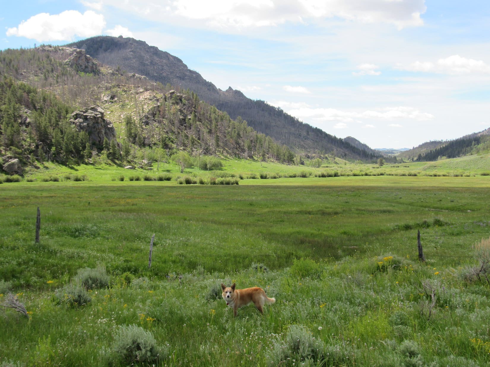
Well, this was it!  Lupe would start for Wind River Peak from here.  The Carolina Dog snapped at flies while SPHP got everything ready.  The trek should take three days and two nights.  Loop and SPHP shared some of the remaining fried chicken by the lake, then went in search of the TH on the W side of USFS Road No. 302.  Soon Lupe was on Stough Creek Lakes Trail No. 702 (10:45 AM, 71°F).

This first part of the trail was wide and very well worn.  Lupe traveled through an evergreen forest gradually gaining elevation.  After 0.67 mile, she reached her first objective, Roaring Fork Lake.

After only 0.67 mile on the Stough Creek Lakes trail, Lupe reaches her first objective, Roaring Fork Lake. Photo looks SW.

There were people and a few dogs at Roaring Fork Lake.  Most were hanging out at some big rocks along the N shore.  Lupe went out on the rocks, too.  The small lake was pretty.  Lupe could see high cliffs and peaks with snow in the distance beyond the lake.

Nearby, Roaring Fork Creek flowed N out of the lake.  The creek was deeper and much broader than SPHP expected, though the current looked gentle.  Where did the trail cross the creek?  SPHP had expected a bridge, but none was in sight.  Maybe it was a little downstream from here?

Lupe and SPHP followed what seemed to be a trail N through the forest near the E side of the stream.  The trail went a short distance, then vanished.  No trail and no sign of a bridge anywhere.  This couldn’t be right!  Lupe returned to Roaring Fork Lake.  SPHP talked to a few people.  None knew where the trail went, or where there was a bridge.  Roaring Fork Lake was as far as they intended to go.

When all else fails, consult the map!  The map showed the trail crossing Roaring Fork Creek right at the N end of the lake.  Hmm.  Lupe returned to the stream where it exited Roaring Fork Lake.  On the far shore, the trail was in plain sight.  No bridge!  That wasn’t good news at all.  The current didn’t look strong, but Lupe had never forded anything like this before.

SPHP waded into the stream.  Lupe followed.  Soon she was swimming.  A large rock protruded out of the water about 2/3 of the way across.  The water was mid-thigh deep by the time SPHP reached the downstream side of the rock.  Even though the current was gentle, Loop was having a hard time swimming against it.  She was in danger of being swept downstream.

SPHP grabbed Lupe and plucked her out of Roaring Fork Creek, placing her on the big rock.  SPHP continued on across, leaving the Carolina Dog stranded.

Stuck on the rock in Roaring Fork Creek where the stream leaves Roaring Fork Lake. Photo looks S.

Loop was safe on the rock, but she wasn’t sure what to do next.  SPHP encouraged her to jump back into the river and swim.  She hesitated.  Carolina Dogs aren’t water dogs.  Roaring Fork Creek was way over her head.

Lupe hesitates on the rock, uncertain if she wants to leap back into the river like SPHP was encouraging her to do, or not. Photo looks NE.

When Lupe made up her mind, she gave it her all.  With a mighty leap she launched herself into Roaring Fork Creek.  She sank below the surface, then popped up a moment later.  She’d leapt so far she only had to swim a few feet before she could touch bottom and scramble to shore.  Good girl!

Lupe shook herself off.  SPHP continued on the trail.  Soon Loop was leading the way.  The creek had been refreshing.

It had also been worrisome.  Lupe would have to cross other streams on the way to Wind River Peak.  Weren’t there going to be any bridges?  Eventually Loop would have to cross the Middle Popo Agie River.  She had seen what a torrent the Popo Agie was back at The Sinks.  How on earth could she get across that without a bridge?  The obvious answer was – she couldn’t.

The trail led SW through the forest gaining elevation more rapidly than before.  0.75 mile from Roaring Fork Lake, the trail leveled out as it emerged from the forest at the edge of a vast marsh.  A wooden walkway went all the way across the marsh.  That was reassuring.  Lupe trotted across.

Crossing the marsh 0.75 mile beyond Roaring Fork Lake. The trail on the far side of the marsh would lead Loop toward the saddle seen on the L. Photo looks WNW.

Beyond the marsh, Trail No. 702 went W up a valley, gaining elevation at an increasing pace.  Higher up, Lupe came to a long series of big switchbacks.  It was warm out now, and just plain hot going uphill.  Loop and SPHP stopped periodically for water and to catch breath.  Never for long, though.  Mosquitoes and flies were a constant bother.  SPHP slathered on Deet, but it was only partially effective.

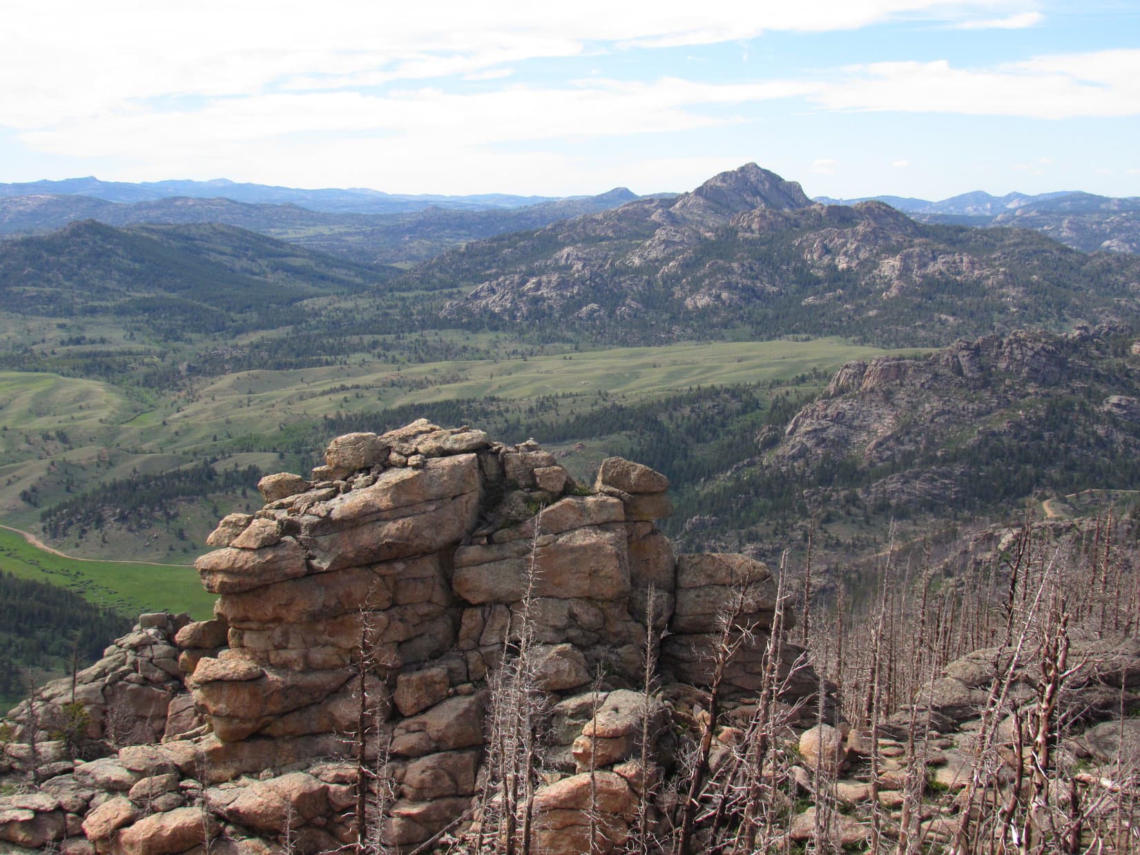
The trail became rockier.  For the first time, Lupe started getting views back down the valley.  She could see Frye Lake and Fossil Hill (9,089 ft.) beyond it.

Lupe by Stough Creek Lakes Trail No. 702. Frye Lake is in the distance on the L. Fossil Hill is beyond the lake. Photo looks ENE.

The long uphill grind seemed like it would never end.  After Lupe had gone 2 miles from the marsh and gained 1,000 feet of elevation, it finally did.  The American Dingo reached a saddle N of High Point 10,965.  For the first time since the marsh, Lupe was out of the forest.  The saddle was open meadow.  Lupe could see!

What the Carolina Dog saw was a massive mountain dominating other high peaks nearby.  Still 8 miles away as the crow flies, Wind River Peak (13,192 ft.) was unmistakable.

At the saddle N of High Point 10,965, Lupe came to a meadow where she could see again. What she saw was Wind River Peak, still 8 miles away. Photo looks W with considerable help from the telephoto lens.

The mountain still looked far away.  SPHP was already tired.  It began to dawn on SPHP that Lupe’s journey to Wind River Peak and back was likely to take more than 3 days and 2 nights.  Better go easy on the supplies, which were none too ample to begin with.

Still the view wasn’t entirely discouraging.  Although there was a lot of snow on the mountain, there were bare patches, too.  The terrain didn’t look bad either.  If Lupe could get to Wind River Peak, it looked like she stood a good chance of reaching the summit.

The view of Wind River Peak wasn’t entirely discouraging. Yes, there was a lot of snow on the mountain, but there were bare patches, too. The terrain didn’t look bad, either. If Lupe could get to the mountain, SPHP believed she could get to the top. Photo looks W with maximum assistance from the telephoto lens.

Lupe continued on.  Trail No. 702 started turning SW and headed back into the forest.  Lupe still got occasional glimpses of Wind River Peak, but none so good as she’d had back at the saddle.  She was now losing elevation.  Slowly at first, but eventually more rapidly as she reached some switchbacks.  The trail turned N and went around a hillside before dropping sharply.

More than a mile from the saddle, Lupe came to flatter terrain.  The ground was damp many places, and the trail muddy.  Orange colored ponds were scattered in the forest, and the mosquitoes were terrible.  The trail turned SW again and Lupe regained a little elevation.  The trail was increasingly muddy.  In some places it was just a stream.  SPHP kept expecting Lupe to come to an intersection, but none appeared.

Lupe cools off on the “trail”.

SPHP started to believe Lupe had somehow missed a turn onto Trail No. 704.  However, rushing water could be heard not too far ahead.  May as well check that out before turning back.  Lupe soon reached a rushing stream that poured out of a small lake nearby.

Stough Creek pours out of a small lake.

The stream was Stough Creek, though that wasn’t apparent at first.  A couple hundred feet downstream, Lupe did come to a trail intersection.  Good thing she hadn’t turned back!  A sign didn’t give any trail numbers, but the trail to the L led straight to a bridge over Stough Creek.  The sign said that trail went 3 miles to Stough Creek Lakes, so it had to be Trail No. 702 continuing onward.

The trail to the R was signed as leading in 2 miles to the Middle Fork Trail.  That had to be Stough Creek Basin Trail No. 704, the way Lupe needed to go.

Only a couple hundred feet after coming upon Stough Creek, Lupe reaches the intersection of Stough Creek Lakes Trail No. 702 (L) with Stough Creek Basin Trail No. 704 (R). Photo looks SW.
From this intersection, Lupe needed to take Stough Creek Basin Trail No. 704 (seen beyond her) 2 miles to the Middle Fork Trail. Photo looks W.

Lupe headed W on Stough Creek Basin Trail No. 704.  She was soon losing elevation steadily.  The trail was never far from Stough Creek, which could always be heard in the forest.  At one point the trail was right next to the creek.  The stream looked even bigger here, reinforced by some major tributary.

Lupe at Stough Creek near the upper end of Stough Creek Basin Trail No. 704. Photo looks S.

Only 0.25 mile from the trail intersection, the Stough Creek Basin Trail reached the bottom of a valley where Stough Creek flowed N.  The trail vanished straight into the stream!  No bridge!

Good grief!  Another ford, and a far more worrisome one.  The trail could be seen emerging from the stream on the far bank.  However, the water was high and moving swiftly, completely filling the channel.  It was hard to tell how deep it was.  Stough Creek was already much larger than it had been farther upstream.  It wasn’t as wide as Roaring Fork Creek had been, but looked much more dangerous.  60 or 70 feet downstream of the ford, Stough Creek roared over whitewater rapids.

The more SPHP stared at the ford, the more unnerving it appeared.  Yes, it looked possible, but the current was clearly strong.  One slip might bring disaster.  Lupe would have to be carried over.  If SPHP fell and dropped her, Loop would have only 5 or 10 seconds to escape before the current would sweep her into the whitewater to be battered mercilessly against the rocks.

SPHP thought of Edward Earl, drowned in the Jago River.  Absolutely not!  Lupe wasn’t going to attempt this ford with the water so high.  Either there was a better place to cross, or Wind River Peak wasn’t happening.

Lupe and SPHP looked around.  Immediately upstream, the valley widened out.  Stough Creek went around several sharp bends.  The water was still moving at a good clip, but the surface looked calmer, less threatening.  Maybe one of those bends would be a better spot to try?  Worth investigating.

Low bushes grew thickly on both sides of the creek.  The ground they were on was all wet and marshy.  Lupe and SPHP forced a way through to the edge of the stream.  No deeper than Roaring Fork Creek here.  The water moved fast, but wasn’t turbulent.  No rapids nearby.  If there was a slip, Lupe would have lots more time to escape the river.

Definitely a better situation.  Not great, but should be OK.  Maybe Lupe could even swim across?  SPHP put her leash on so she wouldn’t get separated.  SPHP waded into Stough Creek.  Thigh deep again, but no more.  Harder to move and maintain balance, though.  The current was faster here than back at Roaring Fork Creek.

Lupe came swimming after SPHP.  She was instantly swept downstream, but the leash held her.  It wasn’t that far across, but the leash was choking her and making it hard for Loop to hold her head above water.  SPHP was nearly across, but Loopster was struggling and needed help.  SPHP stopped, pulled her in with the leash, and picked the cold, drenched Dingo up.  A couple more steps, and Lupe leapt to safety.

SPHP waded out.  Lupe was fine and shaking herself off.  The crossing hadn’t been too bad.  The whole ordeal had taken only 30 seconds.  Still it was good to be across.  The experience was a little too intense for comfort.  SPHP vowed Lupe would find a better way across Stough Creek on the way back from Wind River Peak.

Lupe safely across Stough Creek. She crossed at this bend. Photo looks SE.
The Stough Creek ford. It was a straight shot 60 or 70 feet downstream from here to roaring whitewater rapids. Lupe has already crossed safely a little farther upstream. Photo looks E.

Just beyond the ford was another trail intersection.  A look at the map showed that the trail to the R (No. 703) would follow Stough Creek downstream for miles to Three Forks Park.  Lupe needed to stick with Stough Creek Basin Trail (No. 704), which went straight.

Another trail intersection was just beyond the Stough Creek ford. Lupe stayed to the L, continuing straight on Stough Creek Basin Trail (No. 704) seen beyond her.

The terrain was fairly flat for 0.25 mile as Lupe followed No. 704 W from the intersection.  The trail then turned NW and started a steady decent.  The forest here was full of snowdrifts 2-4 feet high.  The trail vanished beneath them.  Lupe and SPHP continued down the valley trying to guess where the trail had gone.

Lost among the snowdrifts trying to find the trail again.

After 15 minutes of wandering through the forest, Lupe had lost enough elevation so she was below most of the snow.  The Carolina Dog found the trail again E of where SPHP had been looking.  Back on track!

No. 704 continued losing elevation.  It was an easy stroll for SPHP, and Lupe was having a great time!  SPHP had promised to take her to higher mountains where there were squirrels, and there were squirrels aplenty in this forest.  The Carolina Dog sprinted from tree to tree.  The whole valley echoed with shrill Dingo barking.  A glorious fun time, for sure!

Back on track again! A pattern seemed to be developing. The smaller the creek, the more likely the trail would have a bridge over it. Lupe needn’t have gotten her paws wet at this roaring cataract. However, none of the serious creek or river crossings seemed to have bridges.

Shortly after finding the trail again, Lupe came to a small opening in the forest.  From a big rock, she saw Wind River Peak once more for the first time in a while.

Shortly after finding the trail again, Lupe came to this opening where she could see Wind River Peak for the first time in a while. Photo looks WNW.
Wind River Peak from a boulder close to Stough Creek Basin Trail No. 704 with help from the telephoto lens. Photo looks WNW.

Stough Creek Basin Trail No. 704 finally ended at another junction near the Middle Popo Agie River.  Lupe had lost 1,000 feet of elevation since leaving the saddle where she’d first seen Wind River Peak.  Now she would start regaining elevation going up the Middle Popo Agie River valley on Middle Fork Trail No. 700 to Tayo Park.  Before heading for Tayo Park, she went to take a look at the Middle Popo Agie River.

Loopster reaches Middle Fork Trail No. 700. From here, she would be going up the Middle Popo Agie River valley to Tayo Park (L).
Looking down the Middle Popo Agie River valley from near the junction of Trails No. 704 & No. 700. Photo looks NNE.
A look down the Middle Popo Agie River shortly after starting up Trail No. 700 to Tayo Park. Photo looks NNE.

The sign at the trail junction said it was only 1.5 miles to Tayo Park.  The moment of truth was coming.  Lupe would have to cross the Middle Popo Agie River to reach Tayo Park.  There had better be a bridge!  The river was simply too large and swift to consider fording.

Loop on her way up the Middle Popo Agie River valley. She would have to cross the river to get to Tayo Park. SPHP hoped there would be a bridge, or she wouldn’t be able to get across.
Following Trail No. 700 to Tayo Park.

After more than a mile on Trail No. 700, Lupe came to yet another trail intersection.  She took a right on Trail No. 707.  If No. 707 had a bridge across the Middle Popo Agie River, the American Dingo would arrive at Tayo Park in less than 0.33 mile.

After more than a mile following Trail No. 700 up the Middle Popo Agie River valley, Lupe reaches a R turn onto Trail No. 707, which would soon bring her to Tayo Park.

Once she was on Trail No. 707, Loopster didn’t have far to go to reach the point where the trail crossed the Middle Popo Agie.  She was soon there.  Lupe had come miles and miles from Worthen Meadow.  The view was most disheartening.

Trail No. 707 disappeared into a shallow lake that filled the river valley.  It was a good 80 feet through the water just to reach ripples that showed where the channel of the Middle Popo Agie River was.  No bridge.  No way forward.

Trail No. 707 to Tayo Park disappears into a shallow lake well before reaching the Middle Popo Agie River. The river was at flood stage and way out of its banks. No bridge. No way across. Photo looks WNW.

All this way, and no bridge!  The river was at flood stage, way out of its banks.  SPHP stared across the shallow lake toward the ford.  Wade 80 or 100 feet out there, just to reach the river channel?  No!  No telling how deep or fast the water was over there.  It may look fairly calm, but a tremendous volume of water was flowing by.  Lupe had seen that all the way up here.  The current would be plenty strong.

Lupe and SPHP scouted along the dry land a little farther upstream.  The American Dingo had a lovely view of a mountain beyond the valley, but the situation wasn’t really any different.  Despair set in.  Clearly it would be foolish to attempt this ford.  Had Lupe met with defeat?  Yeah, this was the picture of defeat alright.

The view farther up the Middle Popo Agie River valley. Lupe saw a lovely mountain, but the situation down in the flooded river valley was still the same. Photo looks SW.
Maybe the view of this mountain was as close as Lupe was going to get to Wind River Peak? Photo looks SW with help from the telephoto lens.

Farther upstream, a steady roar came from across the river valley.  Lupe could see Tayo Creek rushing down a hillside to join forces with the Middle Popo Agie River.  That started SPHP thinking.

Lupe near the end of the day in the Middle Popo Agie River valley. She wasn’t far from Tayo Park, but without a way to get there.

It was evening.  It had been a long, long day.  The mosquitoes were awful.  On a hillside near the river, there was a nice spot to pitch Lupe’s “tiny house” beneath some trees.  SPHP assembled it as rapidly as possible and threw everything inside.  Loop came in, too.  Peace, at last from those infernal bugs!

Loop had hardly eaten anything all day.  SPHP split the last of the fried chicken with her.  She got half a can of Alpo, and a large helping of Taste of the Wild, too.  Meanwhile, SPHP studied the Bridger-Teton national forest map.  It showed few details.  The original plan had called for Loop to either be at Tayo Lake or Deep Creek Lakes this evening.  Not going to happen.  Both were still a long way away.  To get to either, Lupe needed to get across the river to Tayo Park.

Slowly, though, an idea was growing.

I’m exhausted.  C’mon Loop, let’s get some sleep.  We’re staying here tonight.  No sense in doing anything rash.  At least, we’ve got a plan.  It’s a long, long shot, but might work.  We’ll see how feasible it is in the morning.

A plan? What do you mean by “we’ve got a plan“? You’ve seen the river SPHP! Now, I’m worried! Sheesh, what next? Can’t we just go back and bark at squirrels again?

Related Links:

Wind River Peak, Wyoming – Part 2: Divide & Conquer, Tayo Park to Tayo Lake (7-10-17)

Want more Lupe adventures?  Choose from Lupe’s 2017 Wind River Range in Wyoming & Select Peaks in Montana Adventure IndexDingo Vacations Adventure Index or Master Adventure Index.  Or subscribe free to new Lupe adventures.

Jack Squirrel Peak, Laramie Range, Wyoming (6-19-17)

Day 12 of Lupe’s 2017 Dingo Vacation to the Laramie Range in Wyoming & Beyond!

Lupe could hardly believe her big soft Dingo ears!  Her spine tingled with excitement.  She stared at SPHP in wide-eyed wonder and disbelief.  Was it true?  Was she really on her way to fabled Squirrel Mountain?  Oh, joy!

Not Squirrel Mountain, Loop – Jack Squirrel Peak.

Mountain, peak, what difference did it make?  Loop didn’t know and didn’t care.  She was certain Squirrel Peak would be every bit as fabulous as Squirrel Mountain.  How could it not be?  In fact, the notion that there might be both a Squirrel Mountain and a Squirrel Peak was an exciting idea she’d never even thought of before.

I’m not even certain what a jack squirrel is, Looper.  Maybe a jack squirrel is just larger than ordinary squirrels with a super long bushy tail?  Kind of like a jack rabbit is bigger than ordinary rabbits and has longer ears and legs.

The American Dingo’s eyes grew even bigger.  This was too good to be true!

Oh, I hope you’re right, SPHP!  This is going to be the best mountain ever!  I never should have doubted you.  Your the best friend a Dingo ever had!  This is going to make up for when you forgot the whiskey on Whiskey Peak, and then some.

Well, maybe it would, and maybe it wouldn’t.  SPHP parked the G6 on the S side of County Road No. 710 where it turned W near Silver Tip Creek (10:43 AM, 62°F)Jack Squirrel Peak (8,942 ft.) was only 1.5 miles SSE from here at the S end of the long Eagle Mountain ridge.

Several log and wooden structures were on the other (N) side of County Road No. 710 from where SPHP parked the G6. They all seemed to be abandoned. Photo looks N.

Most of the territory E of here, including Jack Squirrel Peak, was all national forest land.  However, by far the easiest way to the mountain was to head S across a big field N of the confluence of Silver Tip and Bear Creeks.  Though this field was private property, signs on the fence said this land was open to the public for hunting.

We’re hunting jack squirrels, right Loop?

Of course!  We’ll be back soon with passels of ’em!  We’re entirely legit.

I’m not even sure if it’s jack squirrel season.  You’ll vouch for me if anyone objects?

Don’t be ridiculous, SPHP!  It’s always squirrel season, jack or not.  We Dingoes are experts on the subject.  Carry on!  Just point me to Squirrel Peak!

Loop ready to depart for Jack Squirrel Peak (L). Photo looks S.

As excited as she could be, Lupe crossed the big field sniffing madly trying to pick up a scent.  Nearing Silver Tip Creek, she found a dirt road that got her over to the E side of the creek.  Once across, Loop followed the road S beyond Silver Tip’s confluence with Bear Creek.

Lupe heading for the promised land of Jack Squirrel Peak! She’s E of Bear Creek here, and will go up the L side of the low hill directly ahead to enter Hidden Gulch. Photo looks S.

A low hill was up ahead.  Loop left the road to climb it.  Reaching the top, she had a view of Hidden Gulch.

Hidden Gulch from the top of the low hill. High Point 8608 looms above the upper end of Hidden Gulch on the R. Photo looks E.

Hidden Gulch was part of the planned ascent route up Jack Squirrel Peak.  Lupe left the low hill heading E.  She stayed N of a tributary of Bear Creek flowing down the valley.  The intention was for Loop to go all the way up Hidden Gulch to the main N/S ridgeline at a saddle just S of High Point 8608.  At the saddle she would turn SW and follow the ridgeline to the summit.

Things started out OK, but Lupe soon came to a thick forest down by the stream.  The valley was already increasingly rocky, full of boulders and deadfall timber.  The forest appeared impenetrable.  It looked far easier to avoid the forest entirely.  Lupe and SPHP crossed over to the S side of the stream, and began climbing.

The forest had burned on the S side of the valley.  The slope was fairly steep and quite rocky, but the rocks were good-sized and mostly stable.  It wasn’t hard scrambling up among them.

A forest fire had burned the slope on the S side of Hidden Gulch. Though the area was very rocky, the rocks were mostly stable and easy enough to scramble up. Photo looks SE.

The new plan was to keep proceeding ESE up Hidden Gulch as Lupe gained elevation.  She might not have to go all the way to the main ridgeline S of High Point 8608.  Maybe she could manage a more direct route up Jack Squirrel Peak from the N or NW.

The American Dingo climbed and climbed.  The mountain kept getting steeper.  Despite what the topo map showed, the easiest way up always seemed to be more toward the W slope.  Lupe was already quite high by the time SPHP realized how far around to the W she’d gotten.

Lupe was already pretty high up by the time SPHP realized how far she’d drifted around onto Jack Squirrel Peak’s W slope. Huge rocks were everywhere, and the mountain was getting steeper with no relief in sight. Photo looks NW.
On Jack Squirrel Peak’s W slope. The Bear Creek valley is seen on the R. Photo looks S.
Looper looking in vain up Jack Squirrel Peak’s W slope for signs of any jack squirrels. Photo looks E.

Lupe started coming to massive rock formations separated by wide chutes of loose rock and boulders.  She went around the first one or two staying toward the SW.  However, the SW side of the mountain was becoming more intense.  Lupe was finally forced to climb NE up a long chute full of boulders.  Near the top she reached less difficult terrain.

Passing around the SW end of one of the massive rock formations, with another one directly ahead beyond a field of boulders. Photo looks ENE.
Near the upper end of the long chute, Lupe finally escapes the worst of the steep W slope. Photo looks NE.

Lupe was certainly getting up in the world!  Off to the NNE she now had a tremendous view of Eagle Peak (9,167 ft.) at the opposite end of the long Eagle Mountain ridge.  Only 10 days ago, Loop had nearly made it to the top of Eagle Peak, but had failed to find a route up onto a vertical rock wall at the top of the mountain.

Lupe was certainly getting up in the world! Off to the NNE she had a tremendous view of Eagle Peak.

Unfortunately, the American Dingo’s ability to get to the top of Jack Squirrel Peak was fast becoming a concern, too.  Although most of the terrain ahead was much easier than where Lupe had just been, a rock formation higher than anything else in sight sat perched high above the opposite side of the long chute she’d just come up.

Was that rock formation Jack Squirrel’s summit?  SPHP hoped not, but feared it might be.  The formation wasn’t all that large, but was at least 20 or 30 feet high.  The part of it in view from here had nearly vertical sides.  Unless the unseen side was a lot easier to climb, Lupe didn’t stand a chance of getting to the top.

On the opposite side of the long chute full of boulders Lupe had just come up, a knob of rock (L) sat perched higher than anything else around. Was that the summit? Failure loomed, if it was. Lupe wouldn’t be able to get to the top of that thing! Photo looks ENE.

Loop and SPHP headed for the rock formation.  When Loop got there, it turned out that the knob of rock was actually more like a narrow ridge.  It was long and skinny, not round.  The E side looked virtually the same as the W side Lupe had seen first.  Loop got up within 20 or 25 feet of the top, but that was as far as she could go.

When Lupe got there, the knob of rock turned out to be more like a narrow ridge. Lupe could get within 20 feet of the top, but no higher. Photo looks SW.

Fortunately, Looper didn’t need to get to the top of this rock formation.  It was only a false summit.  Beyond it, not too far away, was even higher ground.  The Carolina Dog could keep climbing!

Fortunately, the rock formation Lupe had reached was only a false summit. Higher ground was in view ahead. The Carolina Dog could keep climbing! Photo looks ENE.

The higher ground nearby was it!  Just like that, Lupe was at the summit of Jack Squirrel Peak (8,942 ft.).  It hadn’t been all that hard to get here after all.  The last part of the climb had been easy!

SPHP was ecstatic.  Loop seemed shocked by the news.  This was it?  The summit of Jack Squirrel Peak?  She got up on the highest rock for a photo as requested, but her heart didn’t seem to be in it.

Loopster at the top of Jack Squirrel Peak! Photo looks SSE.

The views were enormous, but the first to capture SPHP’s attention was an impressive wall of rock SSE of the summit.  It towered hundreds of feet above surrounding terrain, and looked virtually as high as the summit where Lupe stood.  In fact, parts of the wall appeared slightly higher.  Wasn’t Loop at the true summit of Jack Squirrel Peak?

The first view to capture SPHP’s attention was a towering wall of rock SSE of the summit where Lupe stood. It looked as high as where Lupe was, maybe even a little higher. Photo looks SSE.

SPHP checked the topo map.  Lupe was at the point where a site elevation of 8,942 ft. was shown within the larger of two 8,940 foot contours, the smaller contour being located along part of the rock wall to the SSE.  No site elevation was shown in that contour.

Well, Loop, I could convince myself there are parts of that gigantic rock wall that are higher than we are here, if I wanted to.  It kind of looks that way.  On the other hand, having terrain at some distance falsely appear higher is a pretty common optical illusion, too, as we’ve seen on other peaks.  The highest elevation shown on the topo map is right where you are now.

In any case, we’re claiming a peakbagging success for you!  If some purist wants to risk their neck to possibly gain 6″ or 2 feet more, or whatever it may actually be over on that rock wall, they are welcome to it.  It’s way too dangerous over there for us.  It may not be any higher anyway.  So this is it!  Good enough for Dingo work!  Congratulations, Looper on reaching the top of Jack Squirrel Peak!

SPHP shook Lupe’s freckled paw.  She smiled weakly, but said nothing.  She looked despondent.

Whether or not this giant rock wall was any higher than the 8,942 foot site elevation Lupe had reached was difficult to tell. In any case, it was way too dangerous for Lupe and SPHP to go over there. Loop was at the highest elevation actually indicated on the topo map. She was claiming a peakbagging success! Photo looks SSE.
Even after SPHP congratulated Loop on her Jack Squirrel Peak success, she looked a little down. The false summit Lupe had gone by on the way up is in view to the L of her head. The high peak in the distance seen straight up from her head is Windy Peak (9,080 ft.). Photo looks NW.
A closer look with help from the telephoto lens. The false summit Lupe went by is in the foreground on the L. Windy Peak is in the distance on the R. Photo looks NW.

Time for a break.  Lupe got down off the summit rock, and curled up near the backpack.  SPHP munched an apple, but Looper refused her Taste of the Wild.  She drank only a little water.

You OK, Loop?  What’s wrong?

Lupe stood up, gazed sadly at SPHP, then lowered her head.

Loop?

SPHP gave her a pat.

It’s terrible!  Simply awful, SPHP!  Just ….. sickening!

What is, Loop?

Lupe puked.  Three times.  It took her a moment to recover.

Jack Squirrel Peak!  Don’t you pay any attention, at all, SPHP?  Practically the whole mountain has burned.  The forest is ashes.  All the jack squirrels are dead and gone.  We haven’t seen a single one!  It’s horrible!  I thought we were coming to a squirrel paradise, but everything’s in ruins.  We’ve come all the way to the top, and it’s clear we aren’t ever going to see a jack squirrel.  My hopes are nothing but ashes now, too!

SPHP hugged Lupe, then sat with her stroking her soft fur.

Oh, Loop!  I’m sorry you feel so bad!  You’re right, the forest has all burned.  We haven’t seen any squirrels, jack or otherwise, at all.  It must be terribly disappointing to you.  You know what, though?  Since there weren’t any jack squirrels here, I’ll take you to some other mountains where there will be plenty of  squirrels.  They may not be jack squirrels, but you’ll still have fun!

Really?  I thought we were just going home after this.  Isn’t my Dingo Vacation almost over now?

Yes, we are going home after this.  Only for a little while, though.  Your Dingo Vacation to the Laramie Mountains is about done, but in July you’re going on another Dingo Vacation to even bigger mountains.  You’ll see lots of squirrels, and other animals, too!  Plus I’ll have a big surprise for you before it’s over!

Really?  Promise?

Promise!  You can count on it.  You’re going to be one busy, lucky Dingo this summer!  Say, you’re looking a little better.  Listen, now.  The forest and the jack squirrels may be gone, but Jack Squirrel Peak is still quite a mountain.  The views are stupendous here.  Let’s look around a bit, get some photos, then we can head down.  Whad’dya say?

OK, sure.  I do feel a little better.  Thanks, SPHP!

Lupe got up on several different high rocks for photos.  Then she curled up to rest a bit longer, while SPHP took a few more pictures.

Laramie Peak (10,272 ft.), the highest mountain in the Laramie Range from Jack Squirrel Peak. Photo looks NE.
Looking NNE at Eagle Peak. High Point 8608 is the massive block of rock seen straight up from Looper’s rump. Photo looks NNE.
Windy Peak is on the L. South Sawtooth Mountain (8,723 ft.) is the distant high point at Center. Photo looks NNW.
Eagle Peak and the long ridge leading to it from Jack Squirrel Mountain. Photo looks NNE with help from the telephoto lens.
Laramie Peak. Photo looks NE.
View to the SSW from the summit of Jack Squirrel Peak.
The Laramie Mountains, where Lupe had such a good time on her 1st Dingo Vacation of 2017. Photo looks WNW.

On the way back, Lupe took a much different route.  Instead of going down the W slope, she tried heading NNE to the saddle near High Point 8608, but it was tough going and Loop didn’t stay the course very long.  She ended up descending the N face of Jack Squirrel Peak.  It was steep with lots of rocks, deadfall timber, and some live trees as well.  For a while, SPHP was afraid the Carolina Dog might cliff out, but she didn’t.

It took a long time for Loop to work her way down to the upper reaches of Hidden Gulch.  The forest had all burned here, but the forest floor sported a grand profusion of green plants with showy yellow flowers.  Lupe was feeling better by now.

By the time Lupe made it down to the upper reaches of Hidden Gulch, she was feeling much better.
Exploring Hidden Gulch.

Lupe made her way to the tributary of Bear Creek.  Staying to the N, she followed it W down Hidden Gulch.  When Loop finally got out of Hidden Gulch, the rest was easy.  Soon she could see the G6 parked across the green meadow near County Road No. 710.  On the other side of the road, the old wooden barns and outbuildings sat quietly at the foot of Jaybird Peak.

This was it.  The final stroll of Lupe’s 2017 Dingo Vacation to the Laramie Range in Wyoming & Beyond lay before her.  She’d had a great time on this trip, and more Dingo Vacations and adventures would be coming soon, but they didn’t matter yet.  It was still June, and a gorgeous evening.

The Carolina Dog ran down to Silver Tip Creek for a drink of cold water, then trotted into the big green field.  Sniffing and exploring happily, she played a little longer in the evening’s glow before heading home (7:03 PM, 65°F).

Looking N toward Jaybird Peak, Laramie Mountains, Wyoming, 6-19-17

Related Links:

                Next Dingo Vacation                          Prior Adventure

This Dingo Vacation                                      Prior Dingo Vacation

Eagle Peak, Laramie Range, Wyoming (6-9-17)

Want more Lupe adventures?  Choose from Lupe’s 2017 Laramie Range, Wyoming & Beyond Adventure IndexDingo Vacations Adventure Index or Master Adventure Index.  Or subscribe free to new Lupe adventures.