Sierra Blanca, Sacramento Mountains, New Mexico (5-13-21)

Days 4-6 of Lupe’s 1st Summer of 2021 Dingo Vacation to New Mexico!

5-11-21, before noon, I-25 in Colorado – After leaving Hotel Dusty, SPHP found the drive S from Denver in heavy traffic rather nerve-wracking.  Not Lupe!  The American Dingo considered it a smashing bore.  Nothing but city – not a cow or horse to bark at anywhere!  Meanwhile, low dark clouds blanketed the plains, obscuring the Rockies.  The sun hadn’t put in an appearance in 3 days.

Well into May already, yet the temperature barely budged, remaining chilly in a tight range between 37-41ºF for many miles.  S of Colorado Springs, the traffic finally started to thin out as open country began to predominate.  Approaching Walsenburg, vapor rising from several inches of heavy, wet, new snow created a foggy winter wonderland.

Looks like we’re on our way to Canada, SPHP!  I thought we were going to the desert?  How much farther is it, anyway?

Yeah, kind of nuts, isn’t it, Loop?  Have to admit I didn’t expect to see any snow!  We’re less than an hour from the border now.  Just think!  Your first new state since Alaska way back in 2016!  Are you excited?

Actually, I’m not so sure about this, SPHP.  Are they going to shave me at the border?  I like my fur, and don’t want to lose it, especially if it’s going to be so cold!

Shave you at the border?  What on earth are you talking about?

I’m talking about Nude Mexico, SPHP!  That’s where we’re going, right?  I’ve heard about those Mexican Hairless dogs.  Not having any fur might be fine for them, but we Carolina Dogs like the way we are, fur and all!  You always told me that I look beautiful in my fur, and now you want me to let them shave it all off?  Are you going to let them confiscate all your removable fur, too?  Not so sure you’ll be such a grand spectacle, either, if they do!  Maybe we should go to some other state?

Nude Mexico!  I never said we were going to Nude Mexico.  You need to clean out your ears, Looper!  We’re going to New Mexico!  N-E-W … NEW!

Clean out my ears!  Nothing wrong with my ears, SPHP!  I hear all kinds of things you’re completely oblivious to.  Learn to enunciate!  You’ve been mumbling again.  Anyway, I’m glad it’s New Mexico.  So they’re not going to shave me, right?

Of course not, silly Dingo!  Not even if you’re dying of the heat.

The snow and fog were gone before Lupe even got to New Mexico.  After going over Raton Pass, two mountains were visible in the distance.  An expanse of lowlands before them glowed yellow in sunlight, although no blue sky could be seen from here.

The promised land, Loopster!  New Mexico, your 13th state!  We crossed the border a few miles back.

This is more like it, SPHP!  Is that the desert down there?

To be sure!  We’ll soon be crossing it.

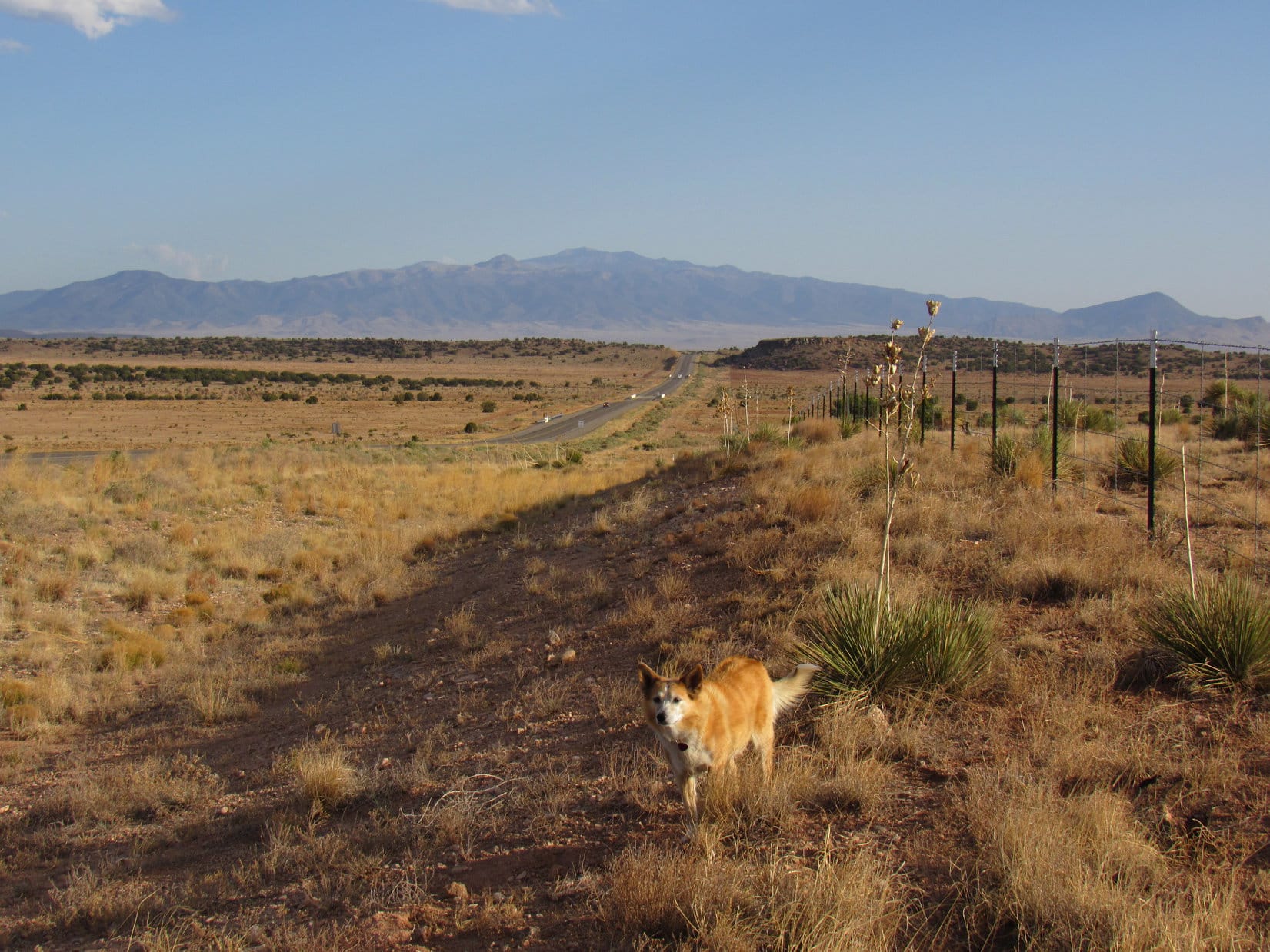
Down in the desert, vegetation was sparse as the RAV4 rolled S toward Las Vegas, NM, but every now and then Lupe saw a few horses to bark at.  Far to the W, thick clouds hung over deep blue ridges.  Stormy!  SPHP began to realize heading for the mountains of northern New Mexico wasn’t going to work, at least not yet.

Between Las Vegas and Santa Fe, SPHP left I-25, turning S on Hwy 3.  The drive was scenic, especially after crossing the Pecos River at Villanueva.  Skies cleared, and the temperature soared to 77ºF at one point as the miles clicked away.  By evening, Sierra Blanca (11,973 ft.) was in sight.

Sierra Blanca (Center) from Hwy 54 N of Carrizozo. Photo looks S.

5-12-21, 7:14 AM, 41ºF, Hwy 37 S of Nogal – Lupe stood on a little rise at the high point of a picnic ground.  The Carolina Dog was ready to climb mountains!  However, it had been windy all night and gotten much colder than expected.  Now, light mist rode a chill breeze.  A raw, gray day.  All the high peaks were lost in the clouds.

At the high point of the picnic ground.

What happened?  Can you believe this weather, Loop?  We’re in southern New Mexico for pity sake!  I thought it would be like summer!

We aren’t going to climb Sierra Blanca, SPHP?

Not in this soup!  No telling how cold and miserable it might be way up there!  Wouldn’t be able to see anything, anyway.

So, what’s Plan B?

Actually, Sierra Blanca was plan B.

Plan C, then!

Ya got me, Loopster.  Going to have to take a look at the map.

Light rain fell beneath sullen skies practically all the way to Roswell.  Plan C consisted of a couple of long shots.  Probably wouldn’t turn out to be much more than a long joy ride in the brand new RAV4, but being on the move seemed better than sitting around doing nothing all day.  At least Lupe would get to see a lot of new territory.

At the entrance to Carlsbad Caverns National Park.

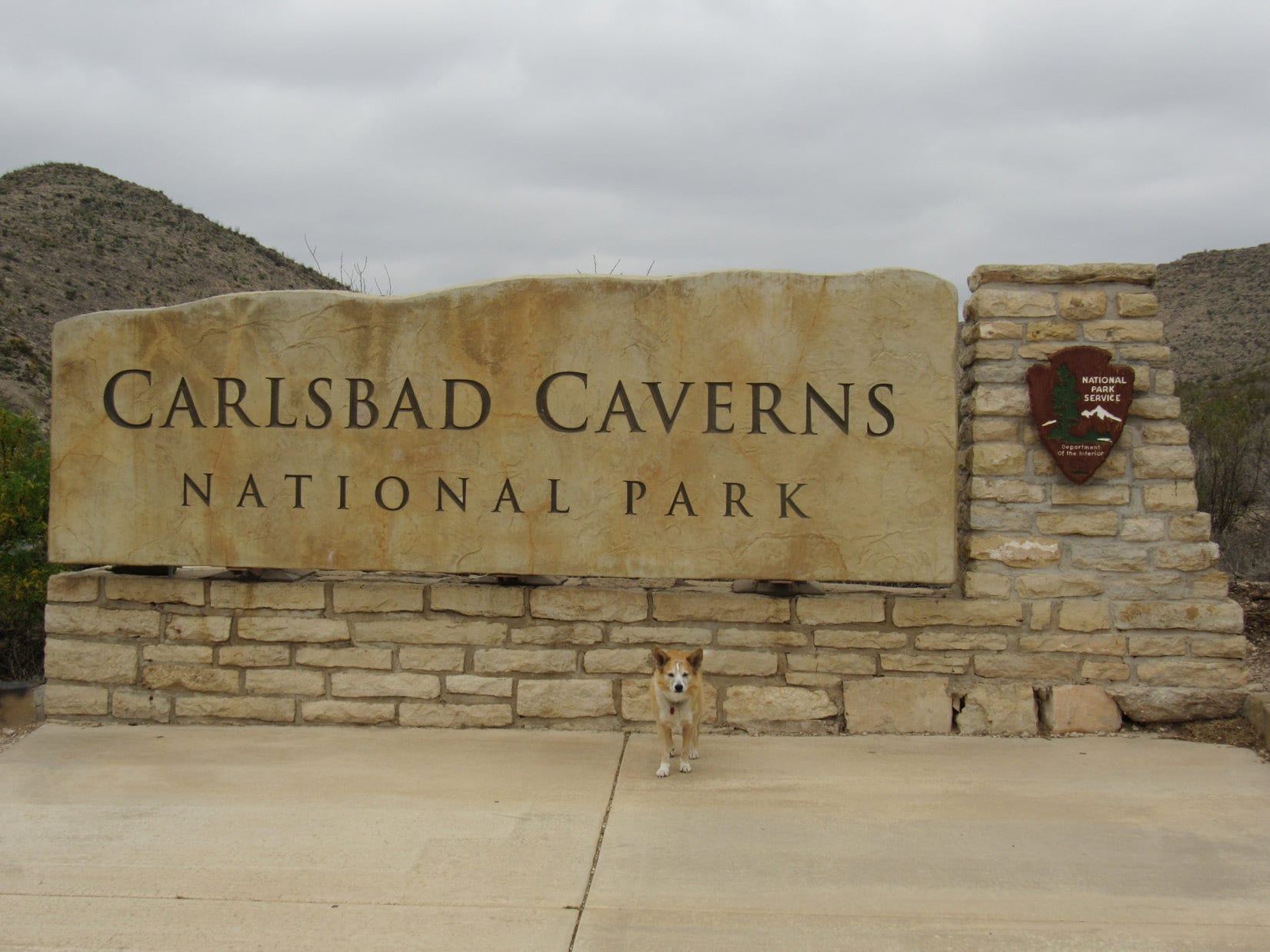
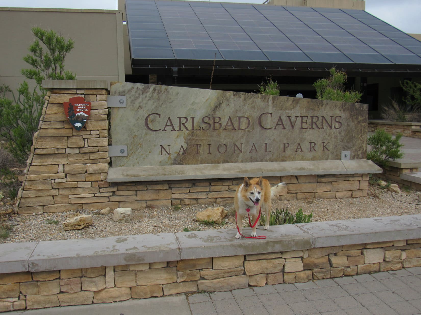
Even before entering Carlsbad Caverns National Park, SPHP knew Loop wouldn’t be allowed to tour the cave.

A 7 mile drive up a scenic desert canyon ended at a fancy visitor center way up on a high plateau.  The view would have been spectacular on a clear day, but was murky and indistinct today.  Since it was still quite cool and gray, the plan was to let Lupe snooze in the RAV4 for an hour with plenty of water available and the windows partially open while SPHP toured the cave.

Nope.  Signs forbid leaving Dingos in vehicles.  Not all that surprising.  Probably good policy considering how hot it might get much of the year.  Kennels were available, but SPHP wasn’t too keen on that idea.  Caged and alone in a strange place?  Lupe would hate that!

Turned out that proof of a current rabies vaccination was required, and SPHP hadn’t brought any such documentation along, anyway.

As holes in the ground go, this one is supposed to be fabulous! At the visitor center.

Dingos weren’t allowed on any surface trails, either, so that was that.

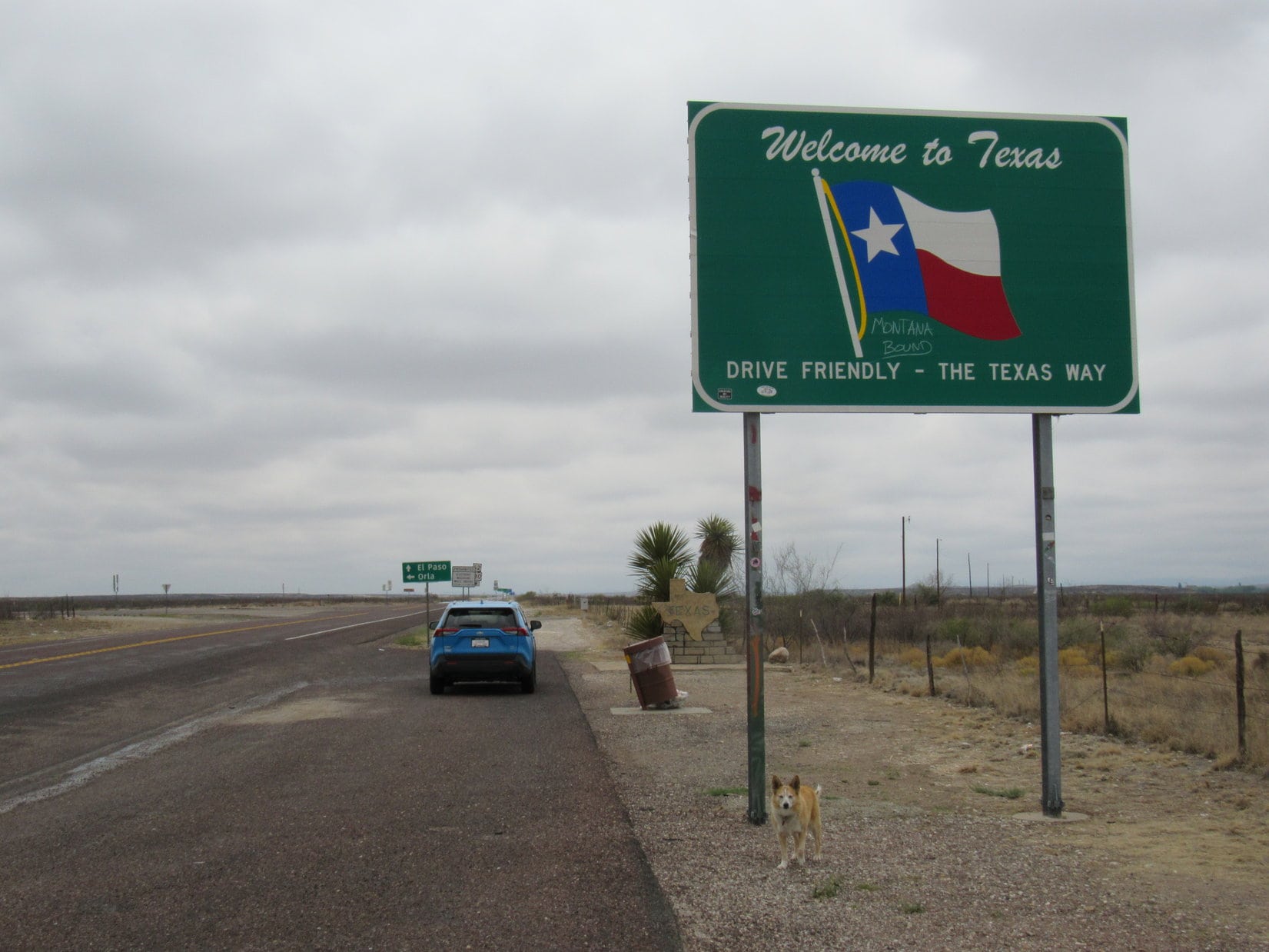
Returning to Hwy 62/180, it wasn’t far to the only certain highlight of the day.  One day after entering New Mexico, her 13th state, Lupe made it to her 14th, the great state of Texas!

Entering the Lone Star State for the first time.
Getting high on Texas!

Plan C’s real prize was just ahead, Guadalupe Peak (8,749 ft.), highest mountain in Texas!  Climbing Guadalupe Peak would be awesome!

Arriving at Guadalupe Mountains National Park.

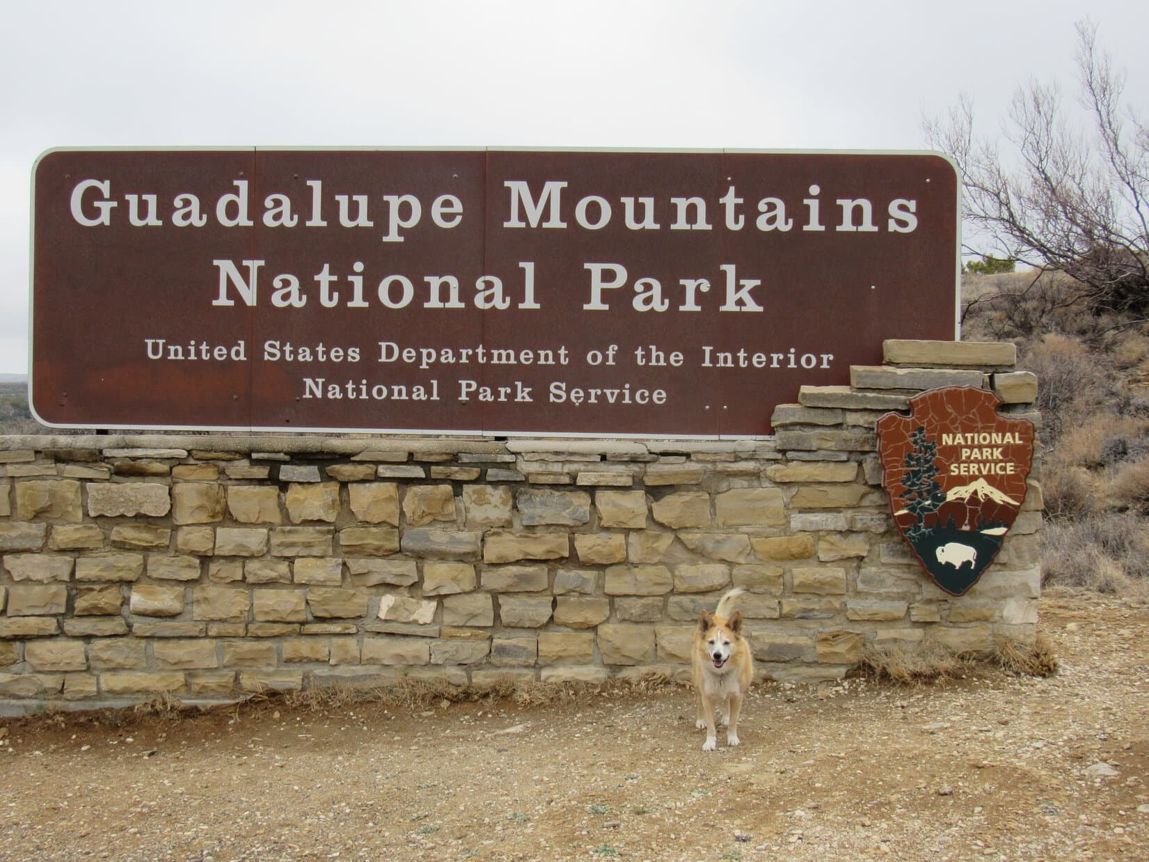
Hopes ran high entering Guadalupe Mountains National Park, but were quickly dashed.  A trail went 3,000 feet clear up to the top of the mountain, but no Dingos allowed!

Guadalupe Peak – so close, and yet so far! Frustrating!

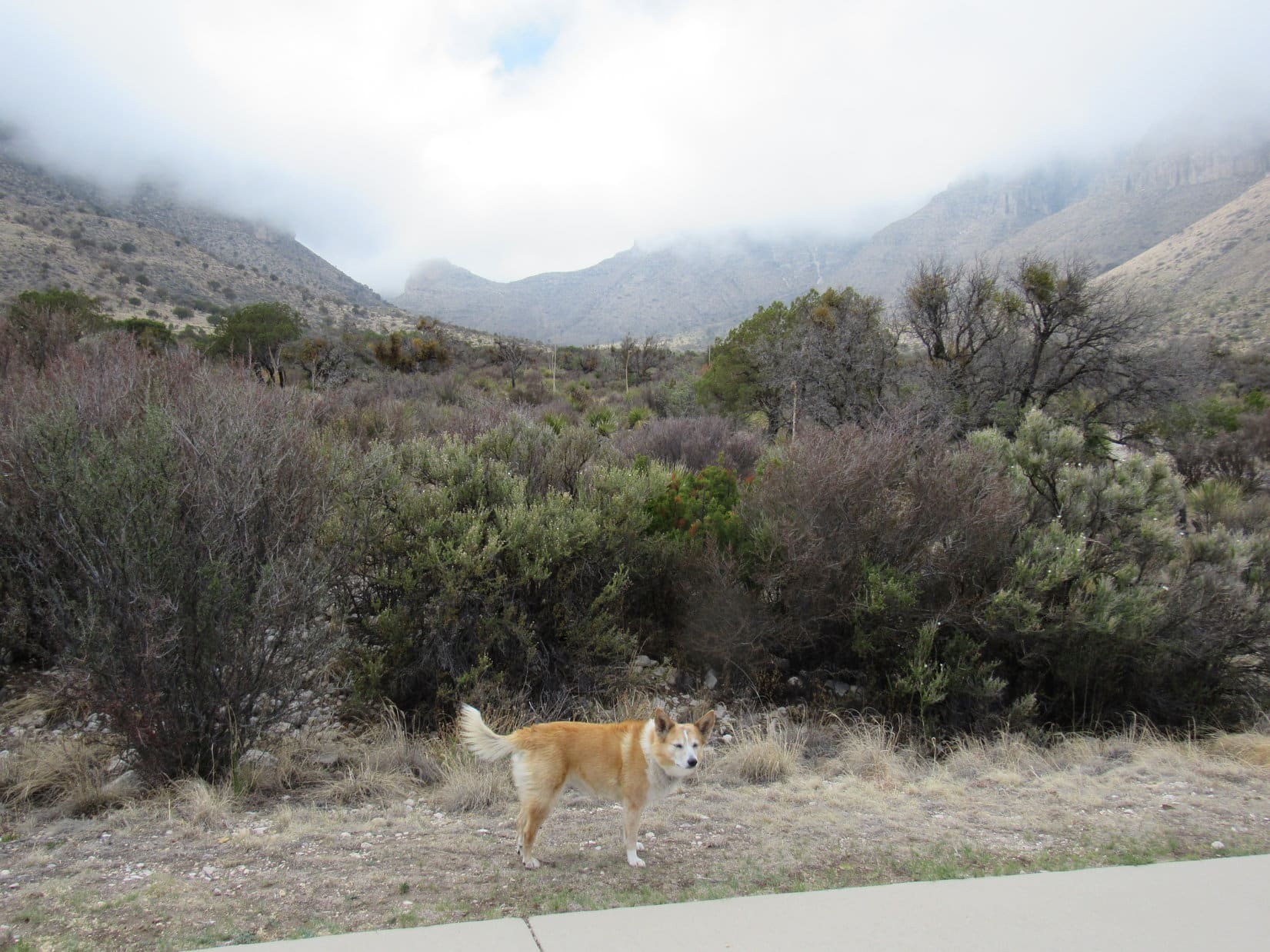
Abandoning the park, skies cleared on the way down to the Salt Basin desert.  Lupe might not have gotten to visit Guadalupe Peak, but she did get to see it.

Leaving Guadalupe Mountains National Park behind. Photo looks N.
Guadalupe Peak (L) from the Salt Basin. Photo looks NE.

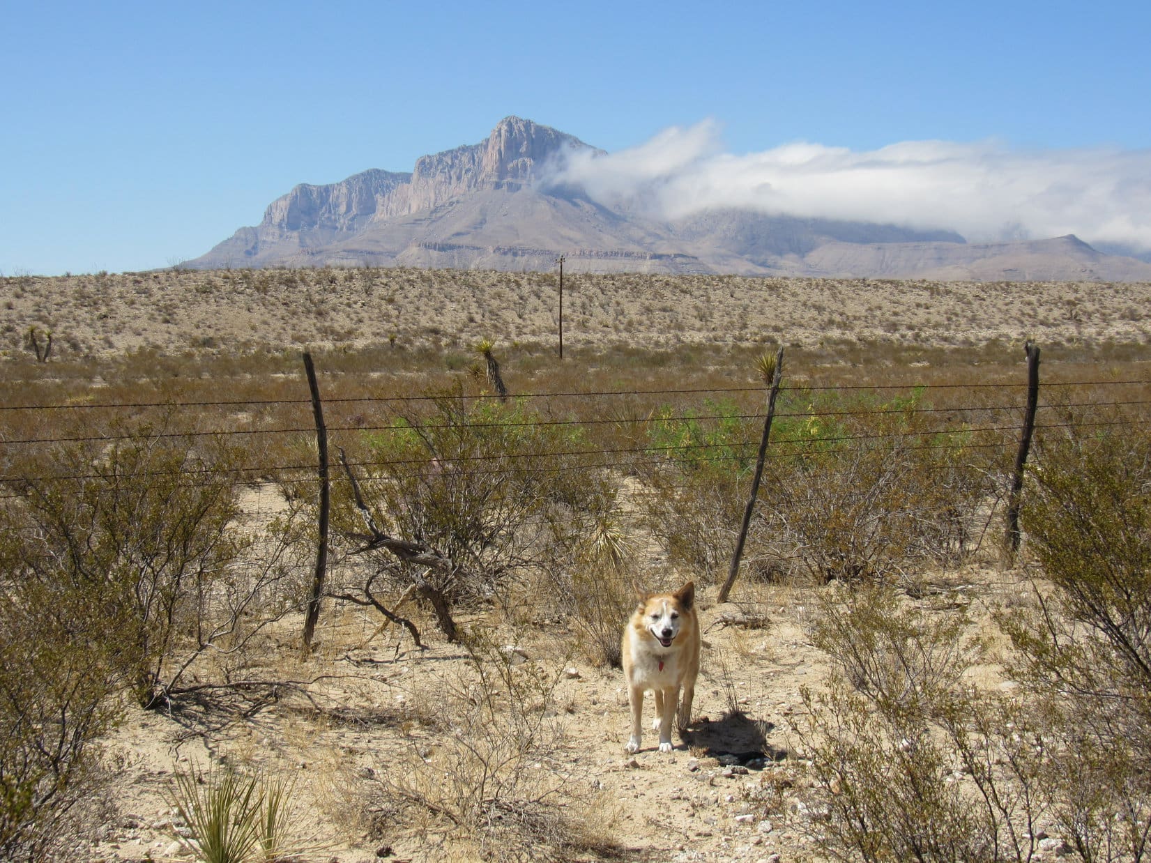
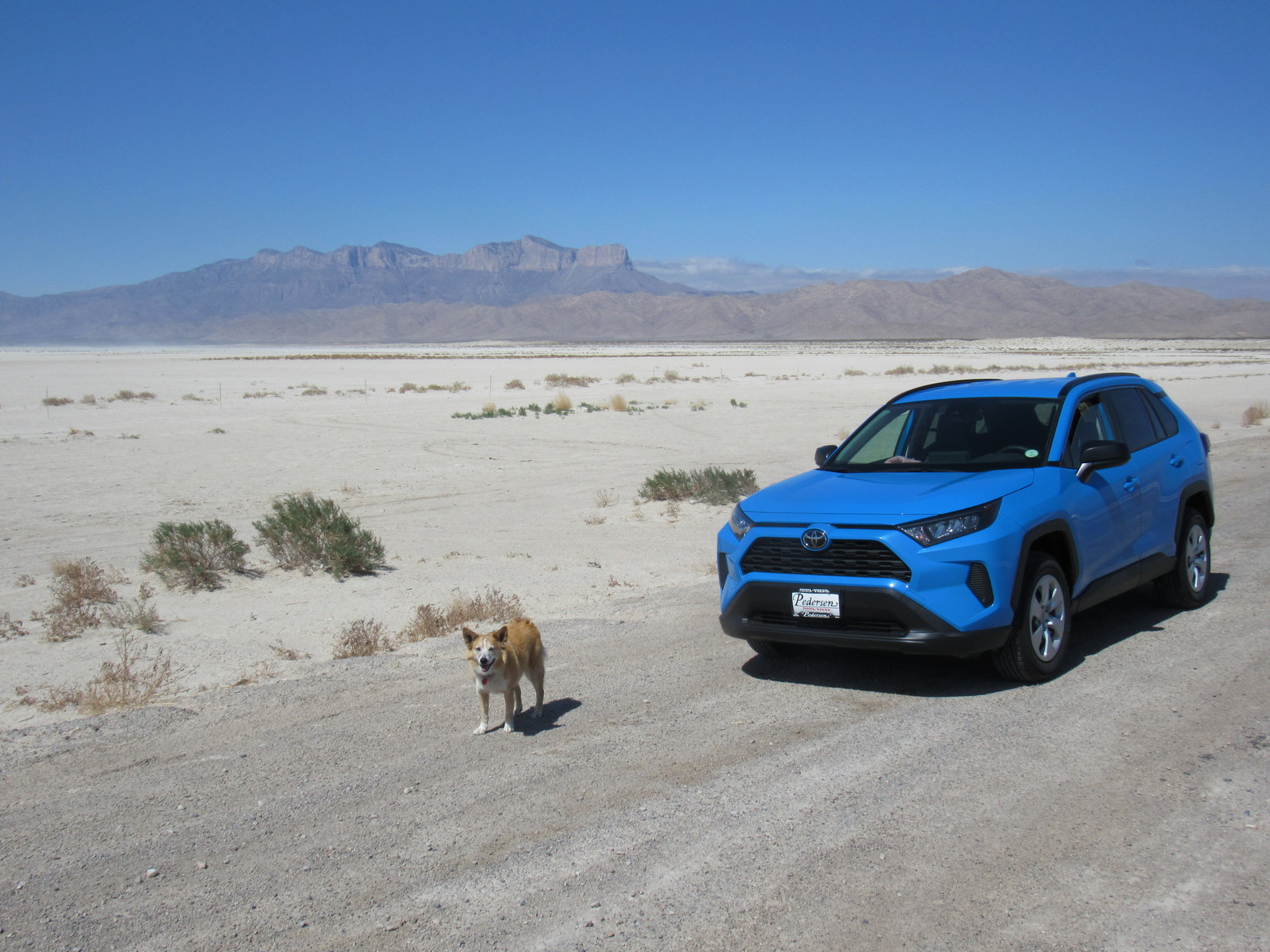
N of El Paso, Lupe returned to New Mexico.  As the evening sun sank in the W, Sierra Blanca was in sight again on the horizon.  The huge loop the American Dingo had traveled today had been scenic, but otherwise hadn’t accomplished much.  Maybe tomorrow would be a better day?

Sierra Blanca (L) in the distance. Photo looks NNE.

5-13-21, 8:38 AM, 50ºF – Cold, almost foggy, and in the low 40’s ºF again earlier this morning, but skies were blue now!  12 miles from Alto at the W end of Hwy 532, SPHP parked the RAV4 at a trailhead just before the entrance gate to Ski Apache.

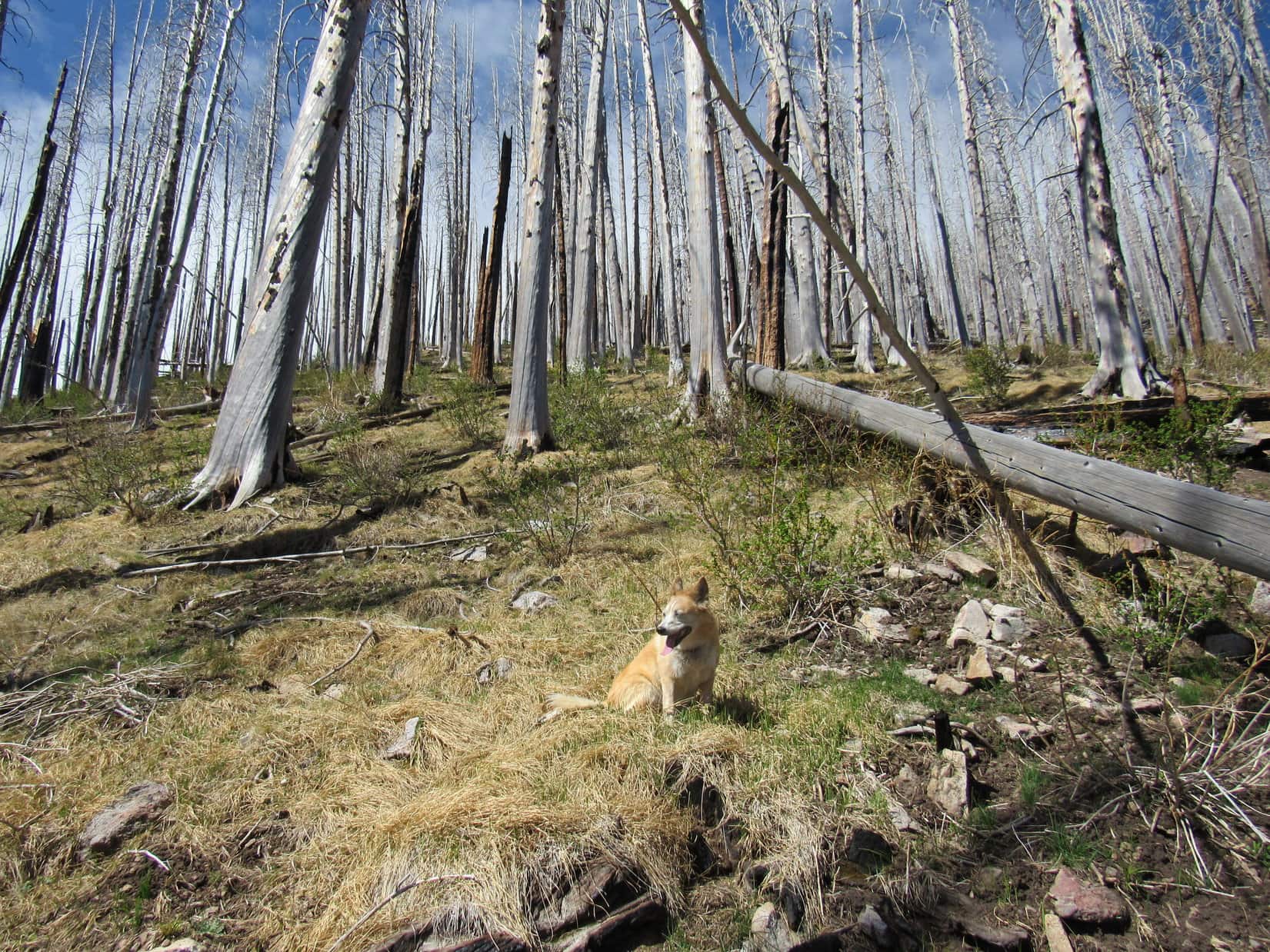
The last half of the drive in had been spectacular as the narrow highway, hemmed in by guard rails of dubious strength, wound ever higher up the steep-sided slopes of Buck Mountain (10,769 ft.).  Much of the old forest had burned, revealing a dizzying expanse of the Sacramento Mountains.

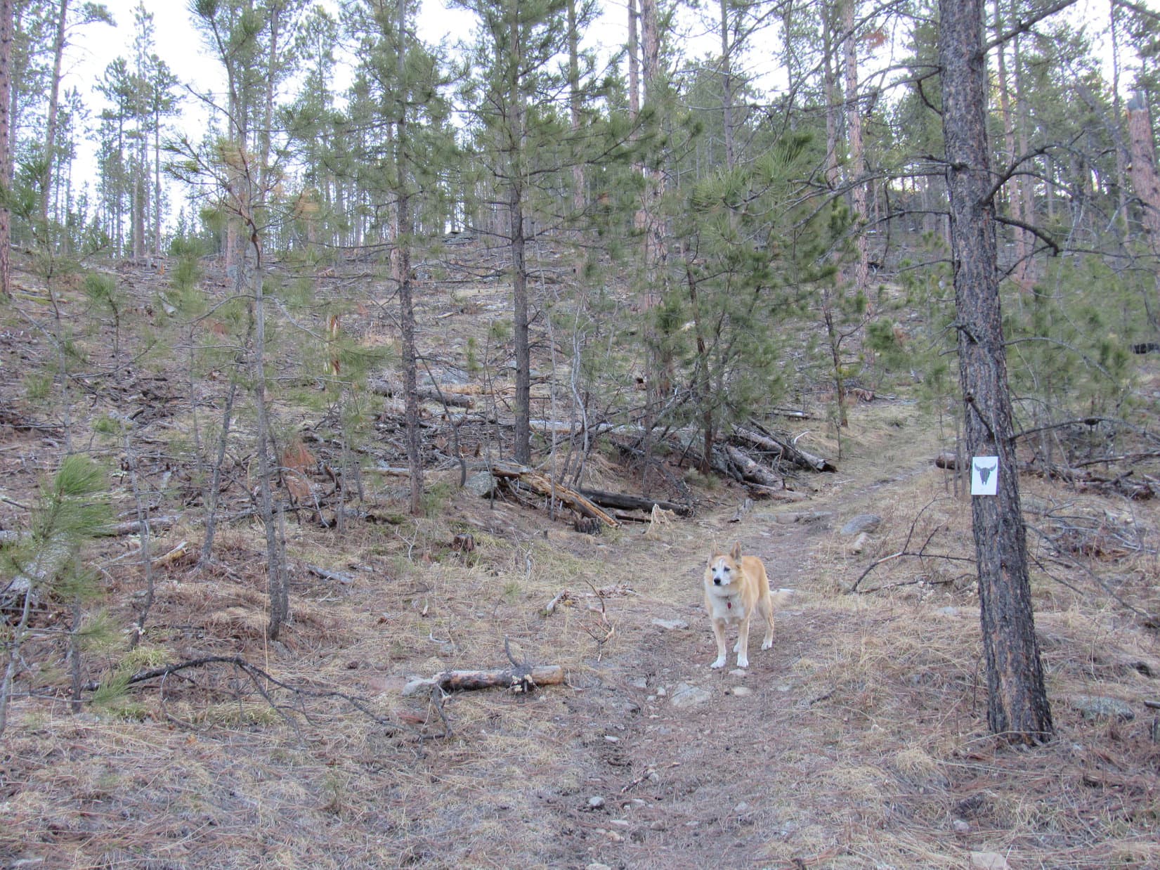
The trailhead itself was tucked down in a bowl, away from the views.  Several pickup trucks could be seen down at Ski Apache, but the RAV4 was the only vehicle at the trailhead.  Two signs warned of the dangers of entering the burn area.  A permanent metal sign painted yellow with black lettering said to proceed at your own risk.  Paperwork stapled to a plywood plaque seemed to indicate the area was closed.

Closed!  But we’ve come so far, SPHP!

Heh.  Yeah.  If anyone asks, Looper, we’re going by the yellow sign!

Great minds think alike, SPHP!  C’mon, let’s go!

Glancing back at the trailhead after starting up Trail No. 15. Photo looks SE.

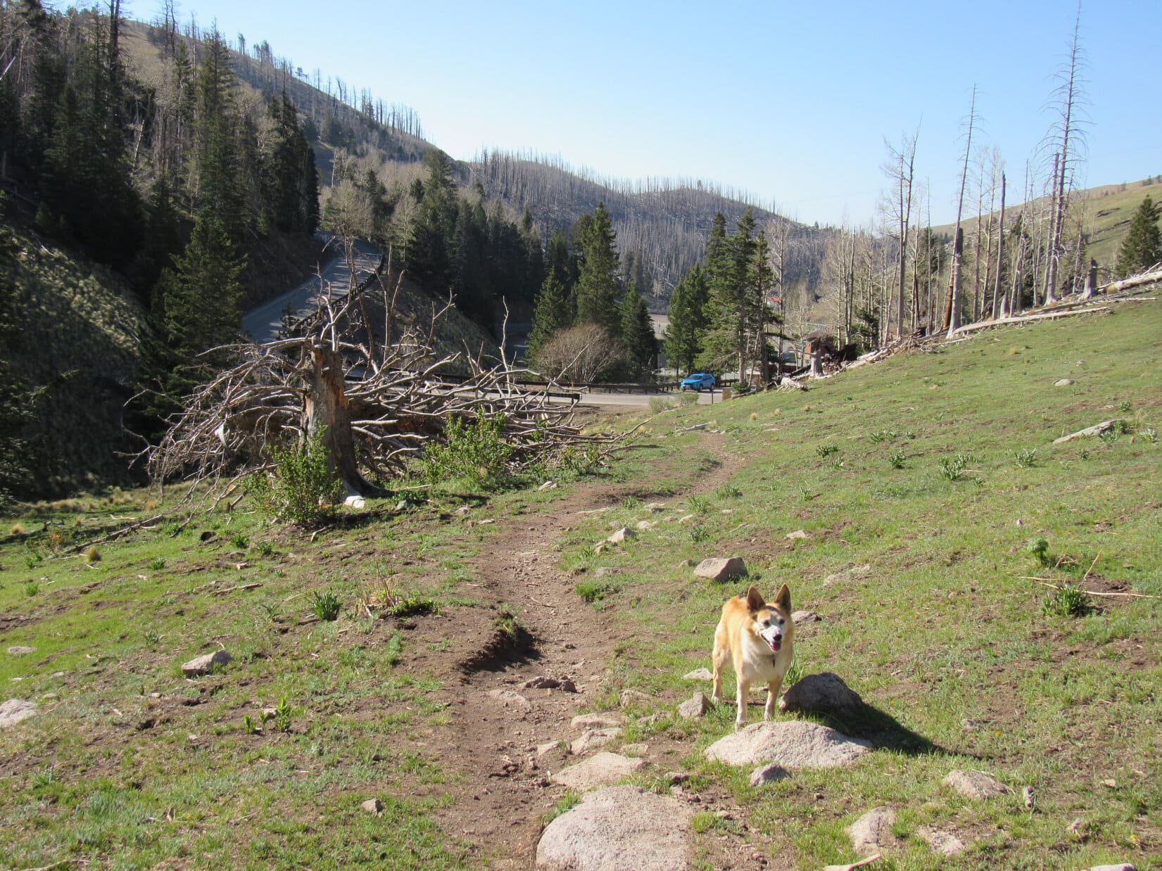
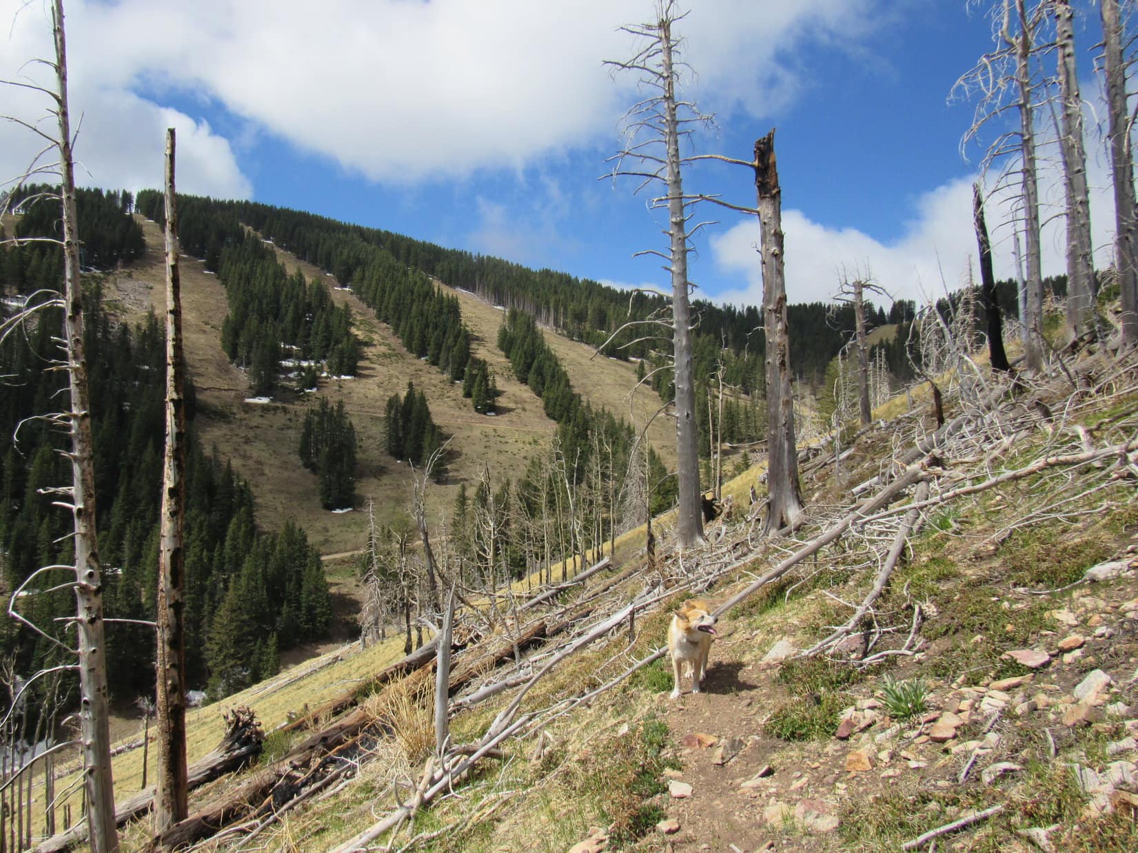
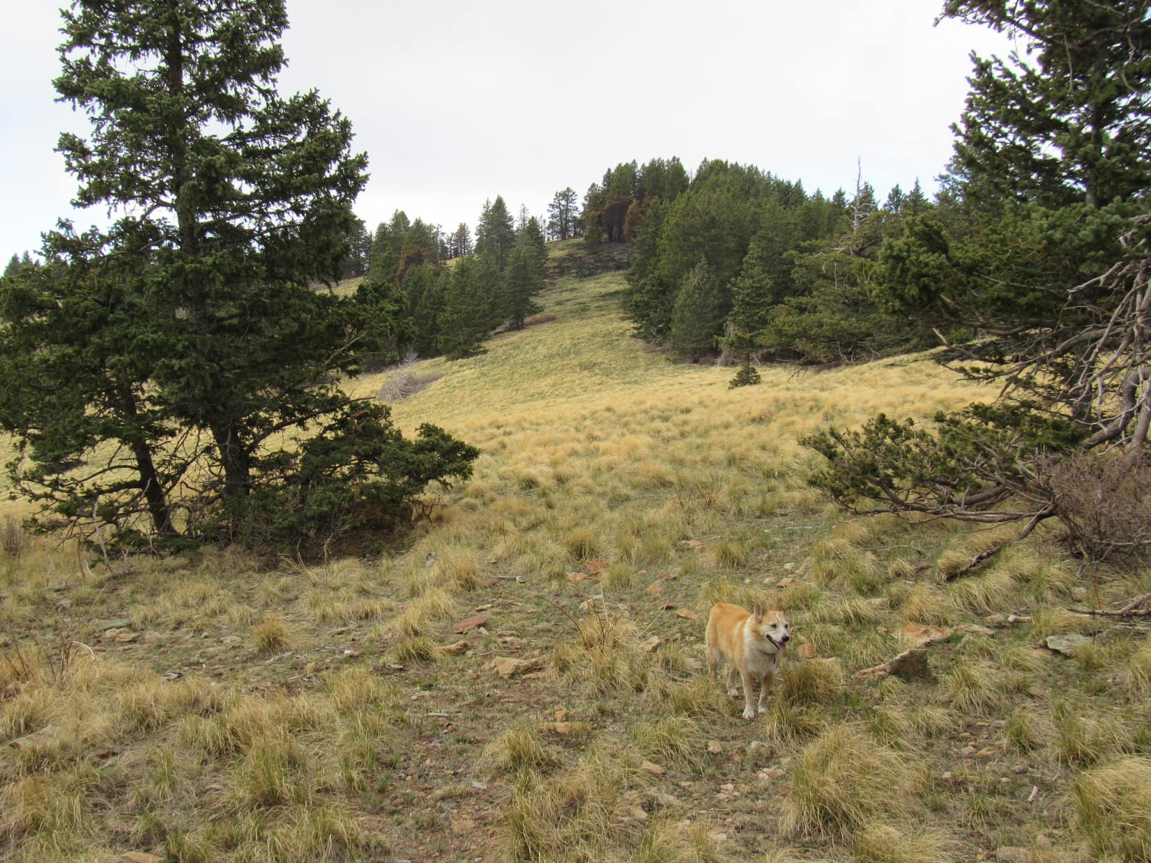
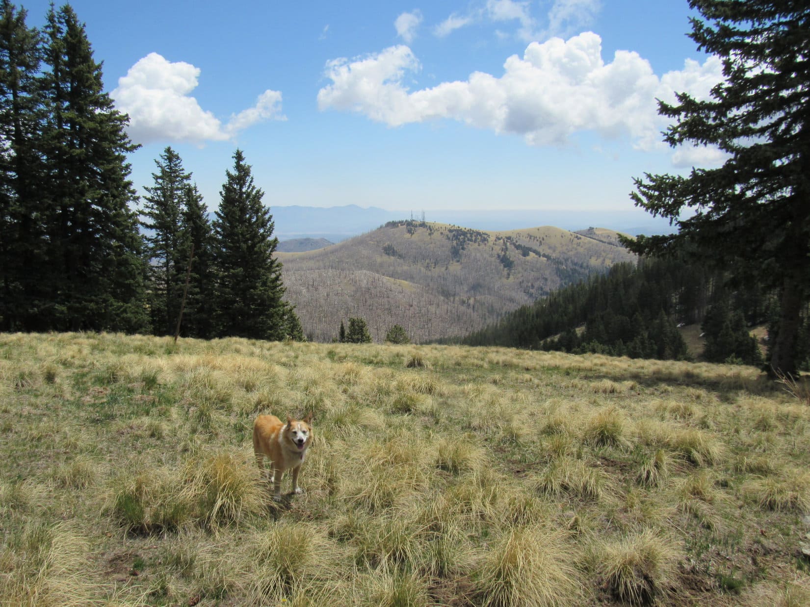
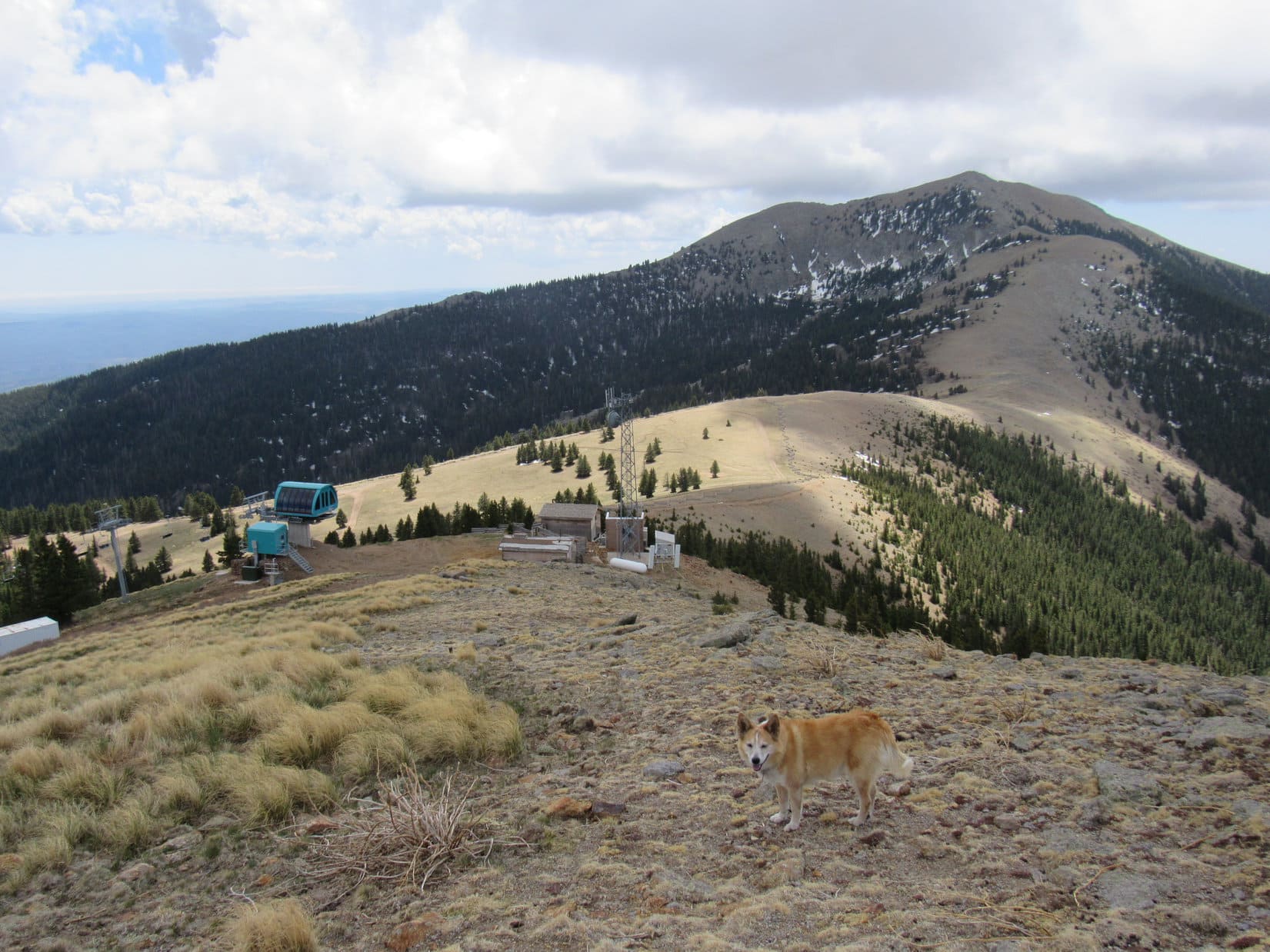
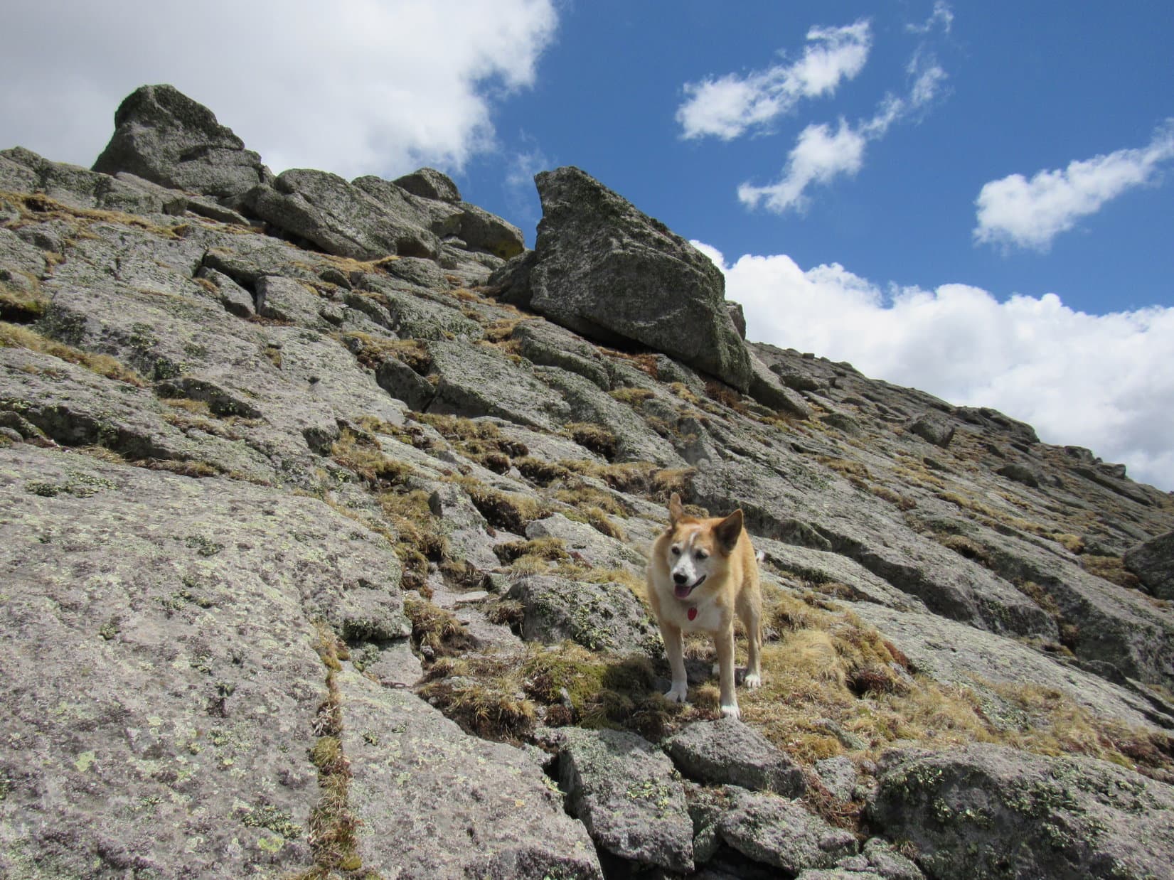
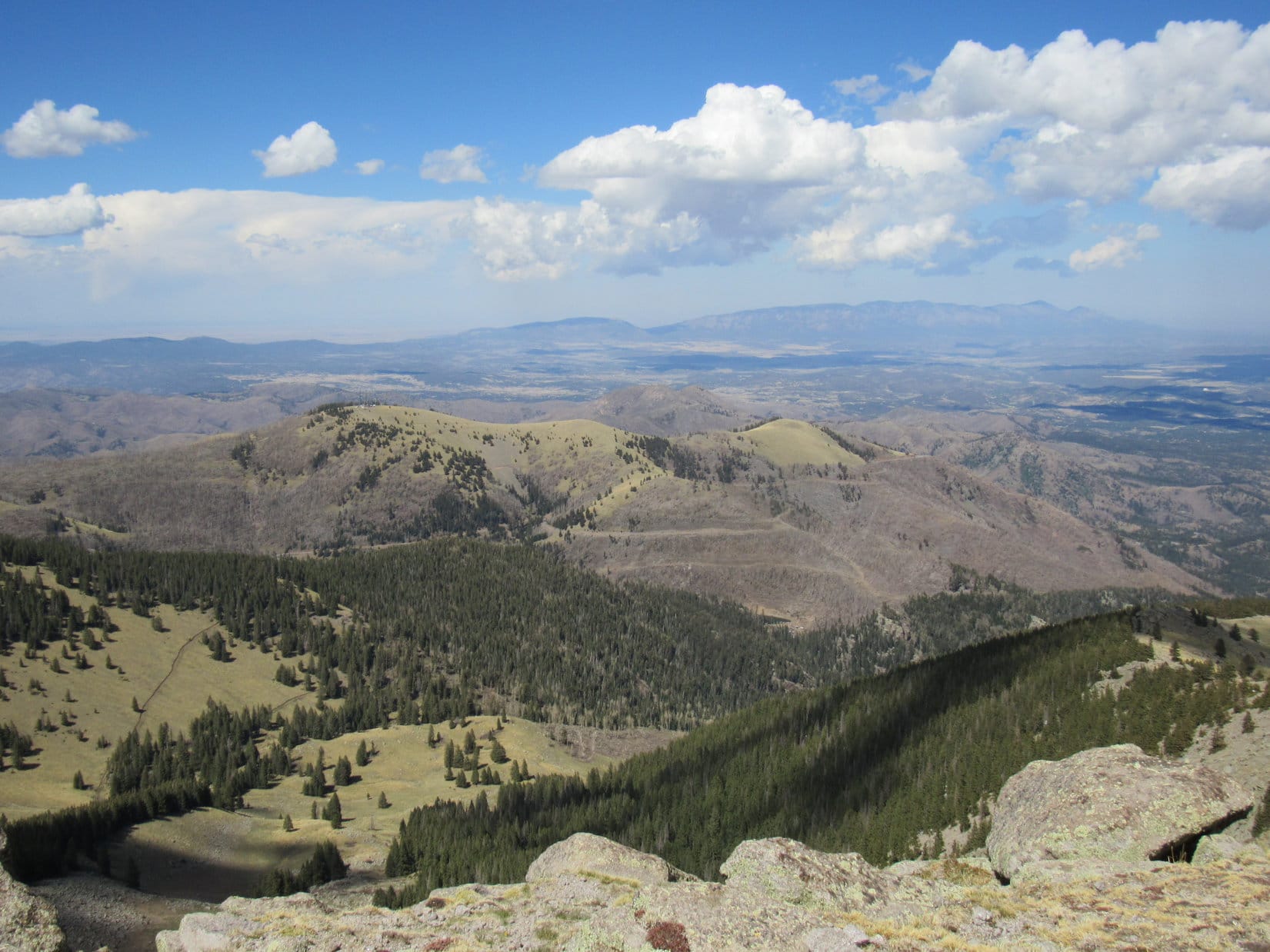
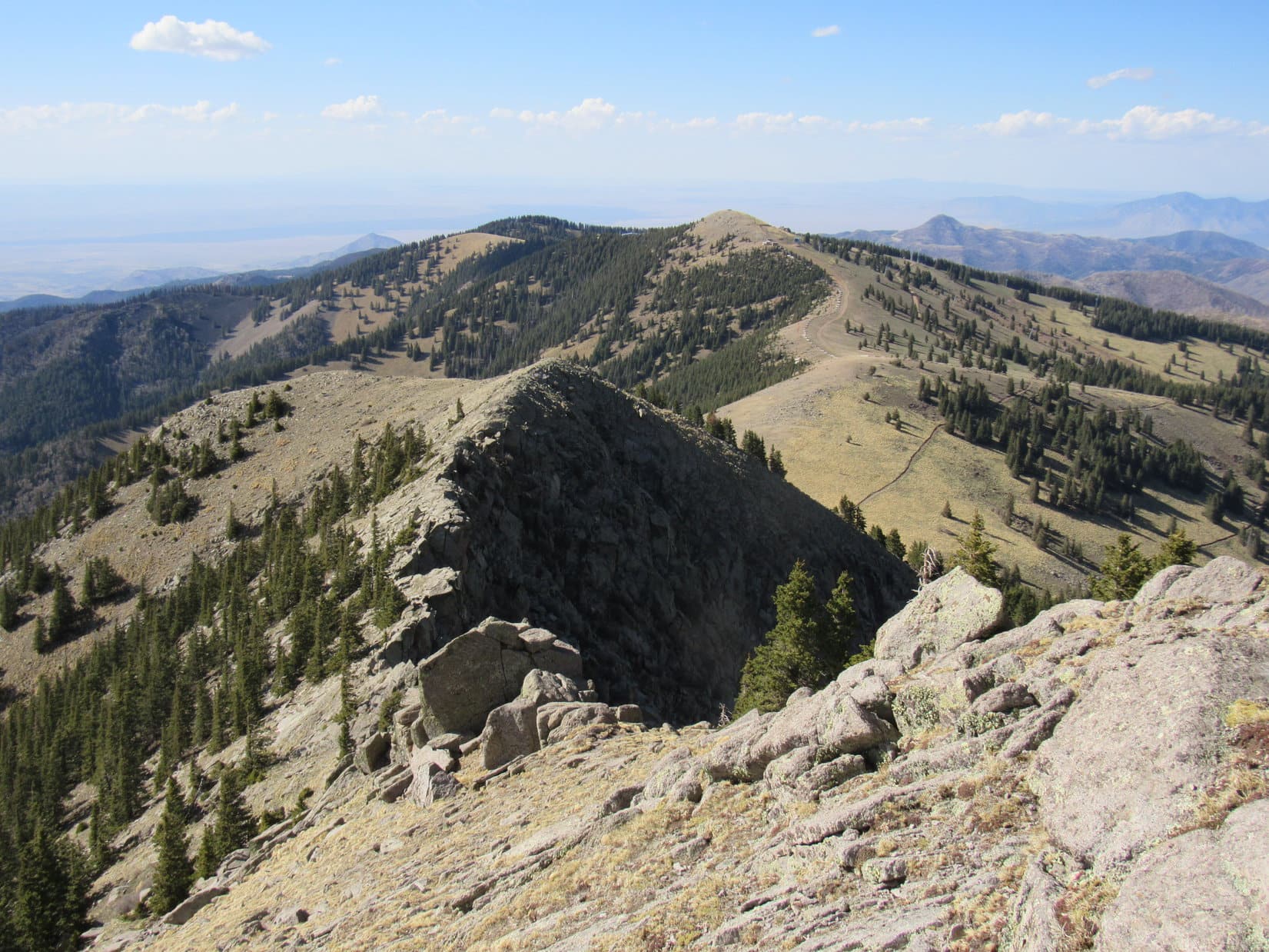
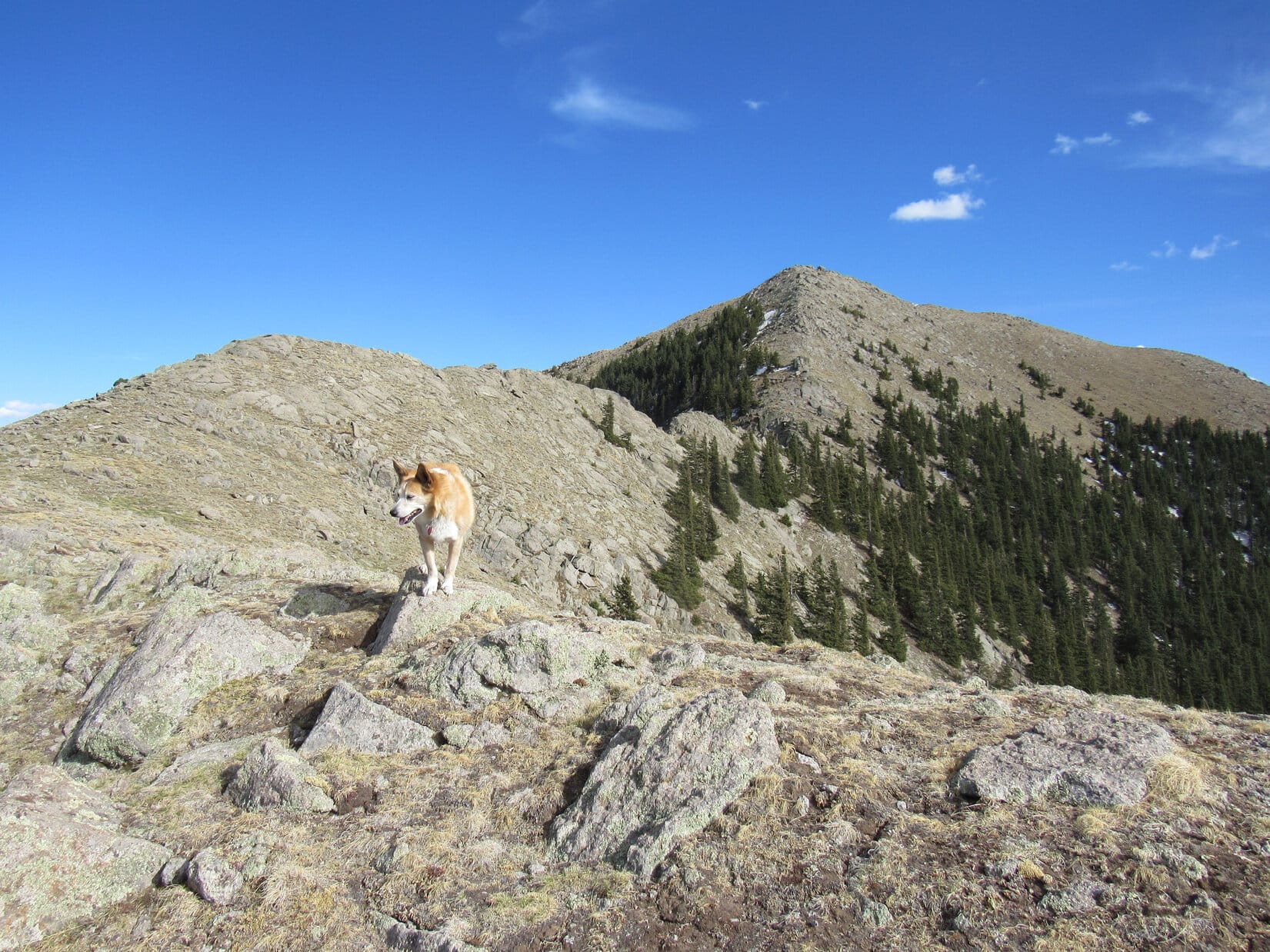
Trail No. 15 headed NW up the side of a ravine toward a short stretch of unburned forest.  Once past the trees, it continued through a meadow to a switchback that traversed a steeper grassy slope.  Upon reaching a flat spot, Lupe arrived a junction with Crest Trail No. 25.  From this junction, Sierra Blanca (11,973 ft.) was visible beyond Lookout Mountain (11,580 ft.).

Heading up the ravine toward the live trees. Photo looks NW.
Continuing higher. The saddle ahead leads to Buck Mountain, which is off to the R. Photo looks NW.
At the start of the switchback. Photo looks SSW.
Signage at the junction with Crest Trail No. 25. Photo looks NW.
Sierra Blanca (L) and Lookout Mountain (R) from the junction. Photo looks SW.

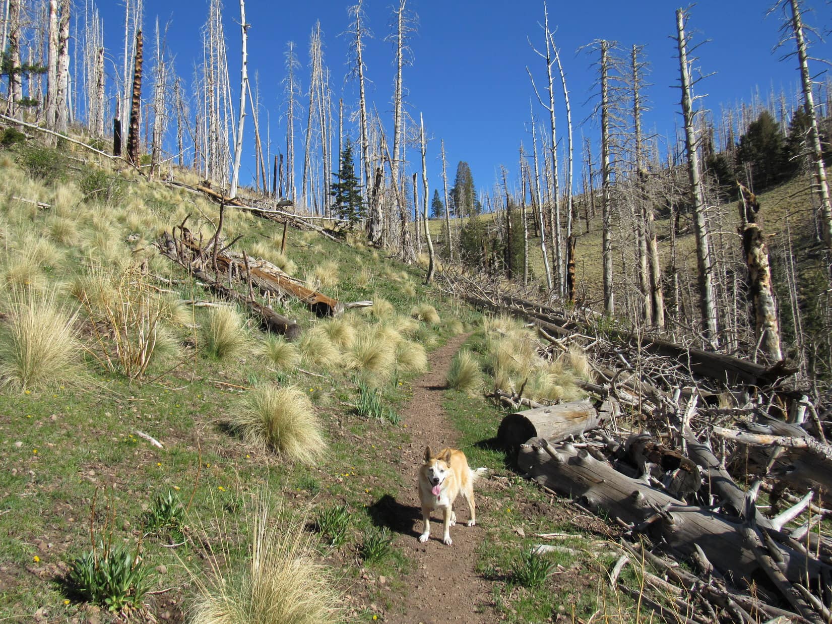
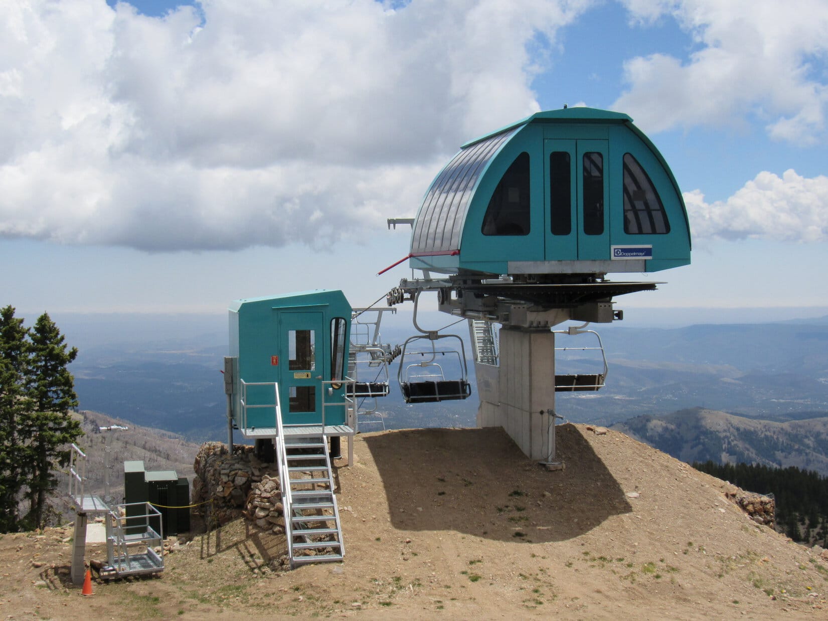
Proceeding W on Crest Trail No. 25, it slowly lost elevation traversing a slope. Lupe entered a forest of dead trees.  Many had fallen.  Fortunately, most had been cleared from the trail.  A chairlift and other Ski Apache facilities were visible down in the valley to the S.  Loopster didn’t see anyone, but the whine of a chainsaw filled the air.

In the burnt forest on Crest Trail No. 25. Photo looks WNW.
Ski Apache facilities down in the valley. Lookout Mountain (L). Photo looks SW.

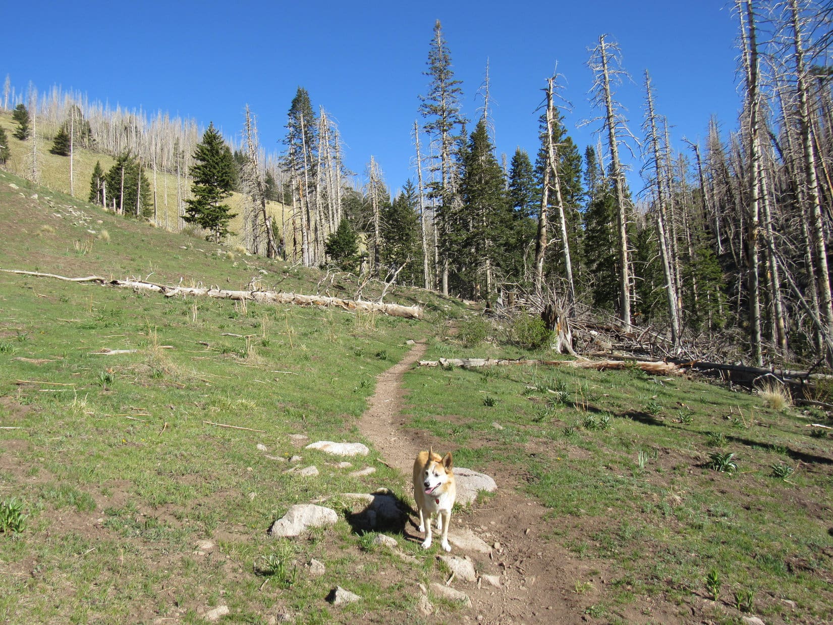
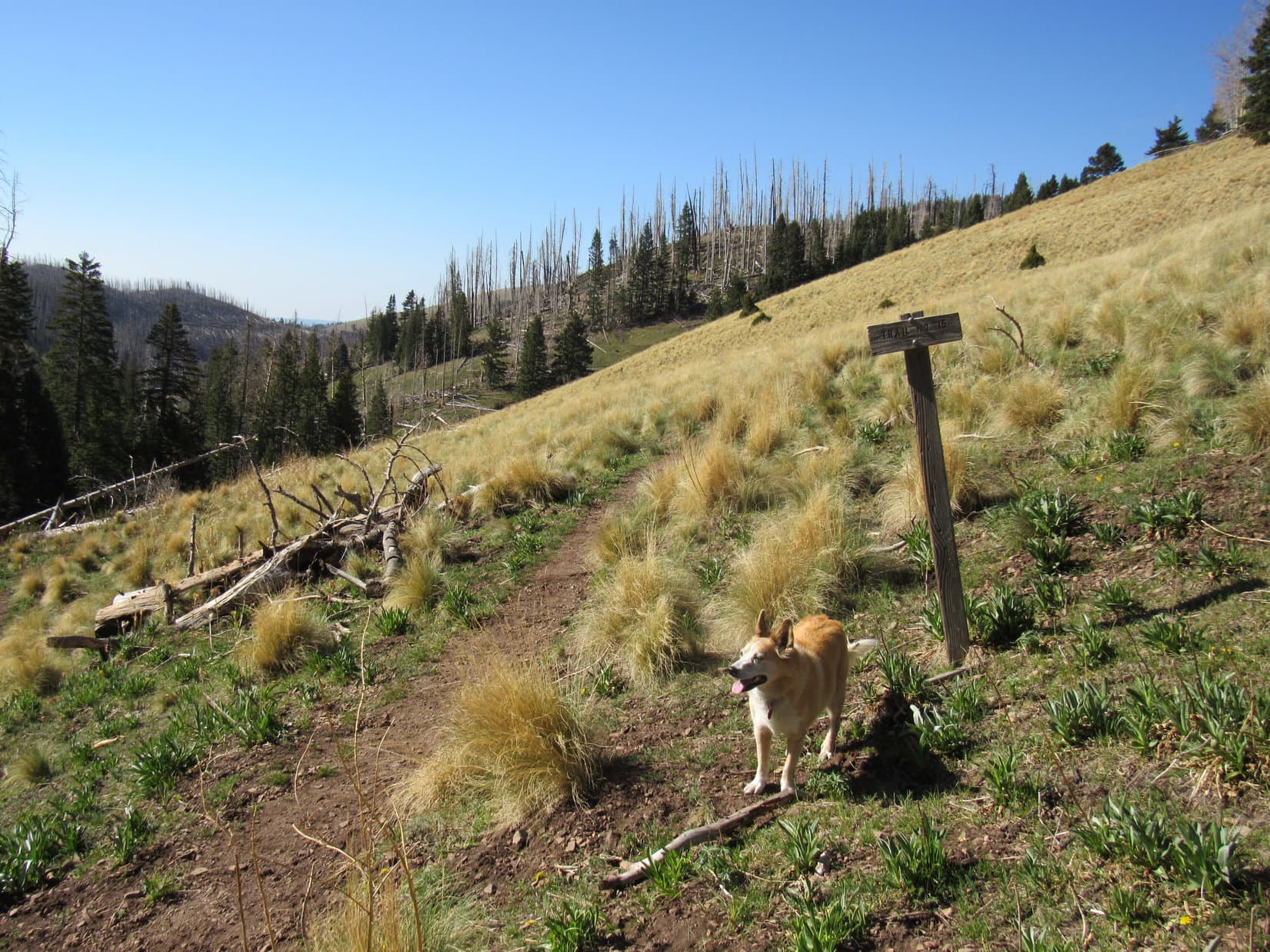
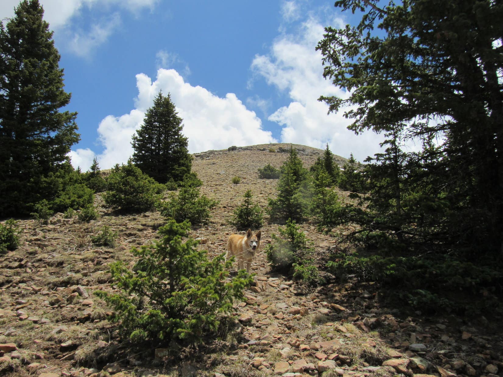
Crest Trail No. 25 curved NW.  Lupe entered a big meadow that swept up toward HP10595.  A Trail No. 25 sign stood over by the edge of another burnt forest on the opposite side of the meadow.  Scratched into the sign, an arrow pointed S (L), but the trail itself seemed to have vanished.

In the meadow where Trail No. 25 vanishes. HP 10595 (R). Photo looks NW.
An arrow scratched onto this Trail No. 25 sign pointed S (L), although no trail seemed to go that way.

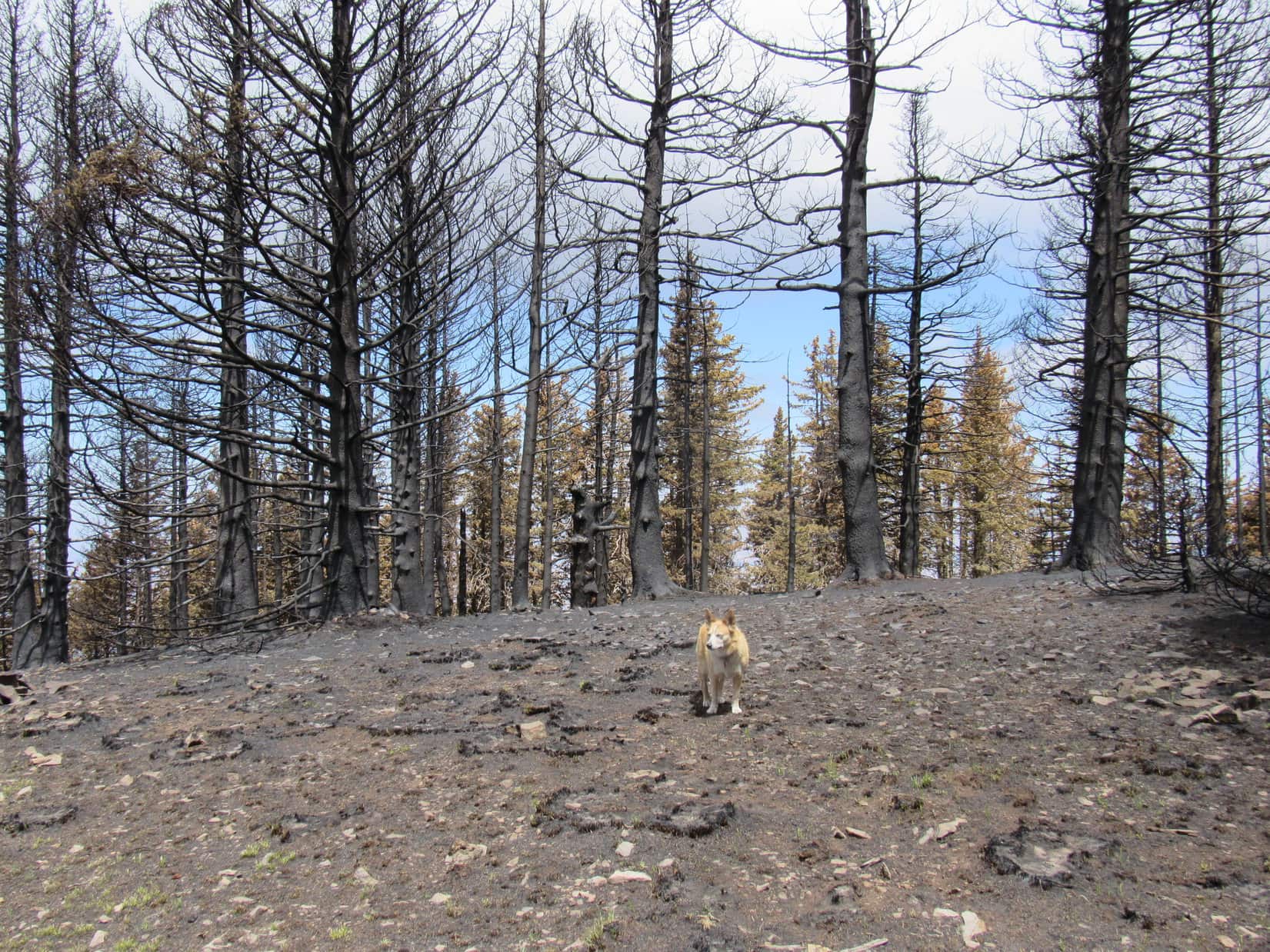
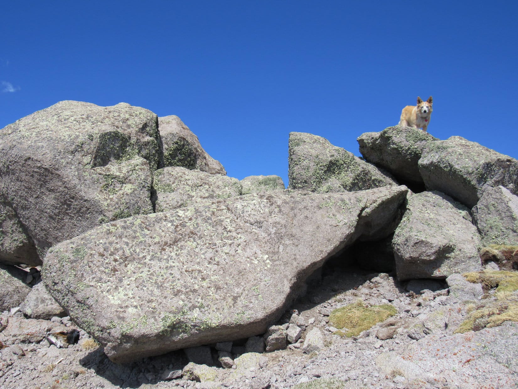
Starting up the slope to the S, Lupe found Crest Trail No. 25 again shortly after reaching the trees.  It switchbacked NW almost right away.  At first, the trail was easy to follow, but the deadfall hadn’t been cleared in this region.  Before long, so much blocked the trail that climbing directly up the steep slope to the W seemed easier than facing all the obstacles.

Enough of this! How about we just go right on up the slope? Photo looks NW.

This shortcut worked out well.  The forest was fairly open.  After gaining several hundred feet of elevation, Lupe came across Crest Trail No. 25 on its way back S.  The trail was in better shape up here.  Less deadfall!

Climbing through the open forest. Photo looks W.

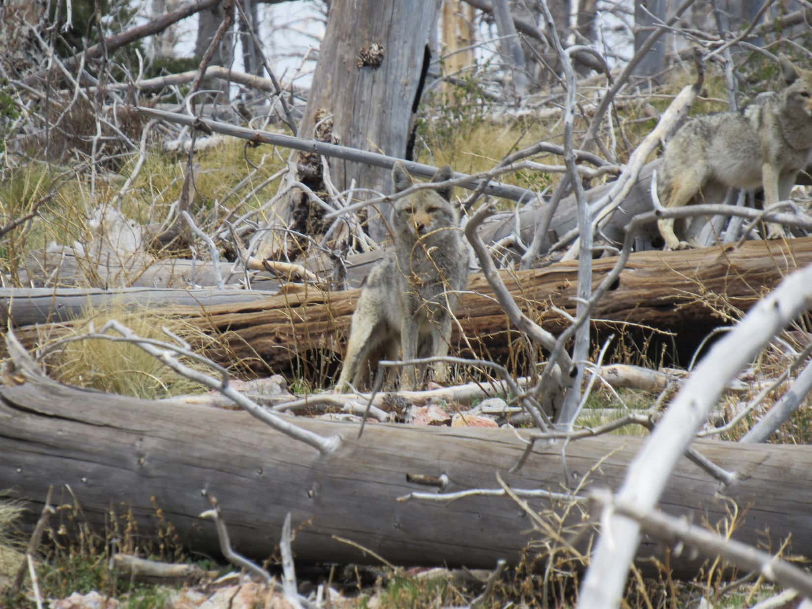
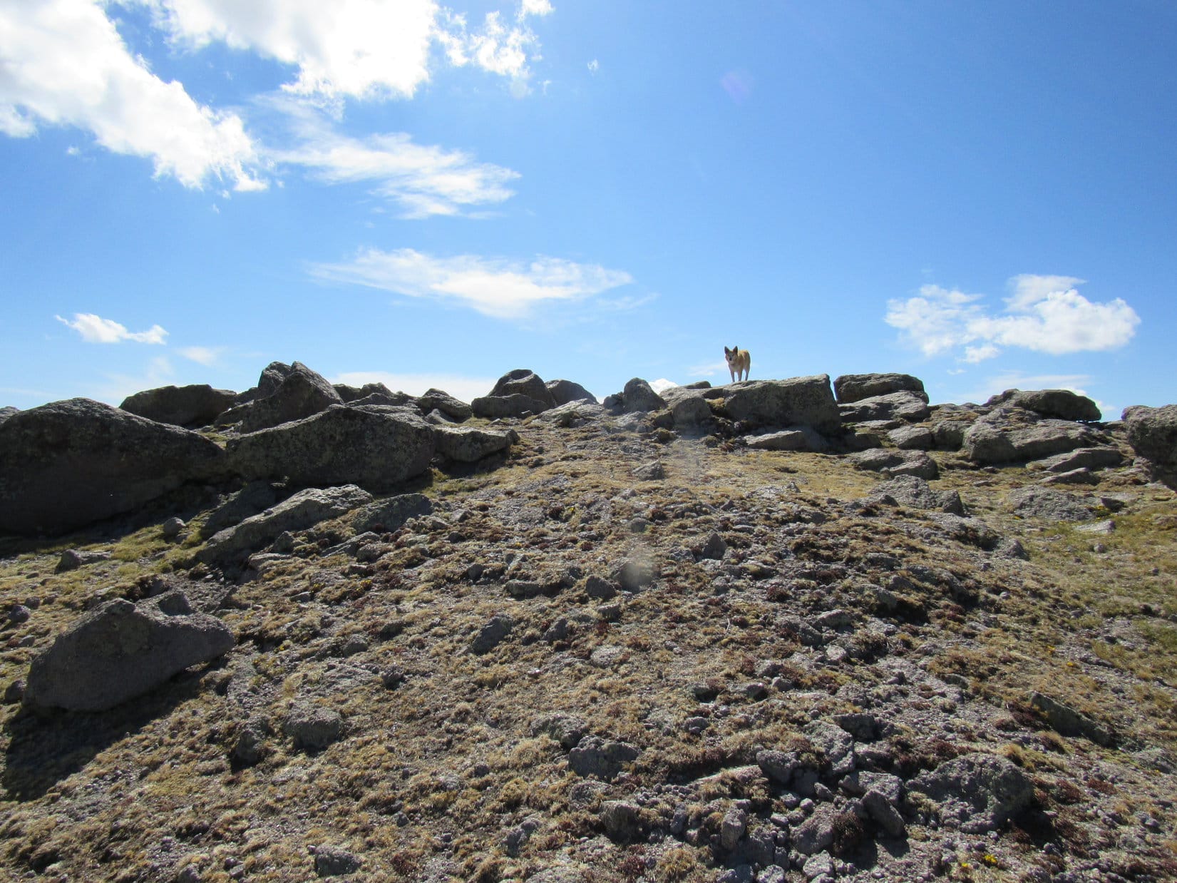
As Crest Trail No. 25 began curving W again, there was movement above.  Two wild dogs stared down on Lupe!

Coyotes!

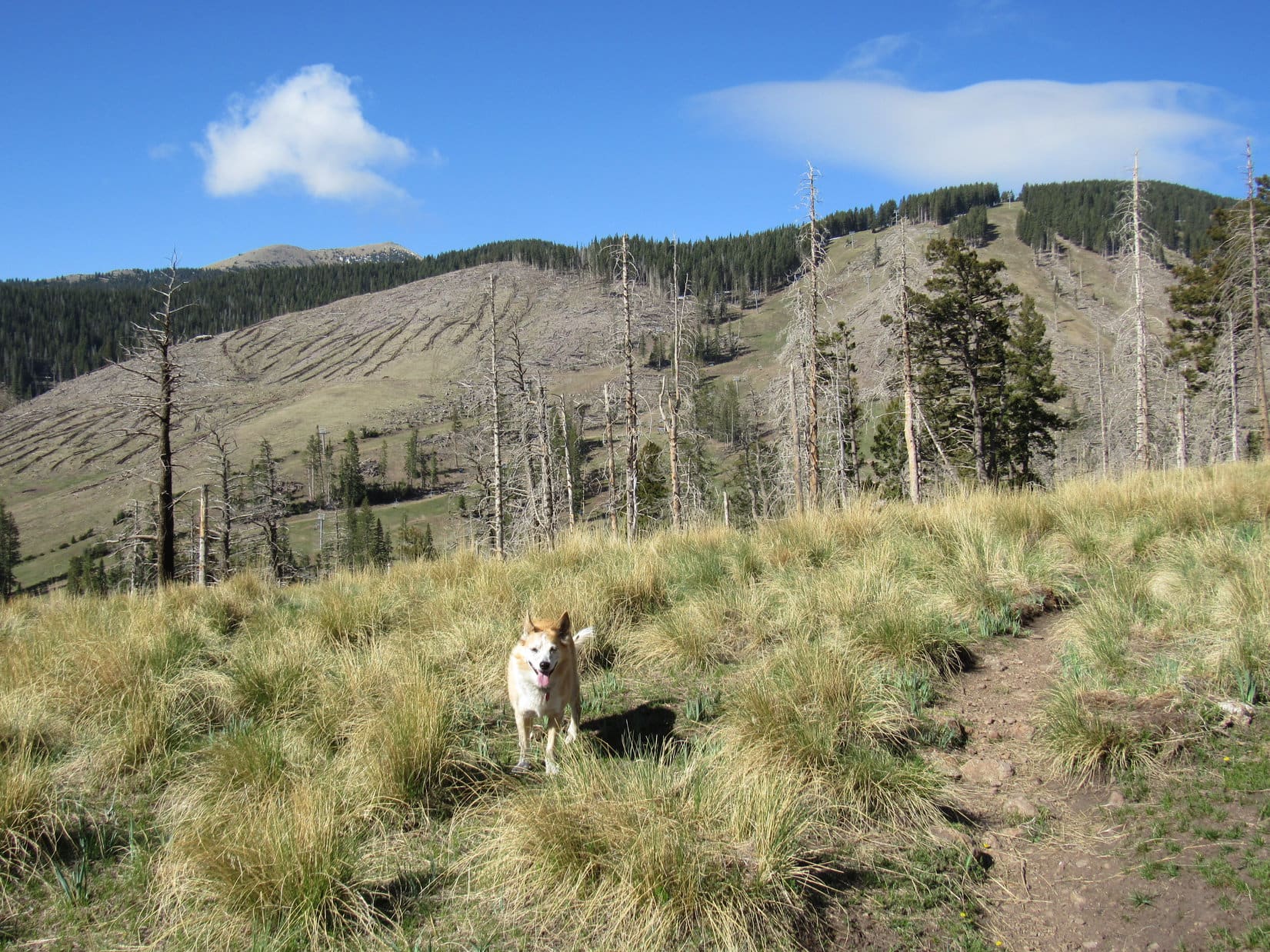
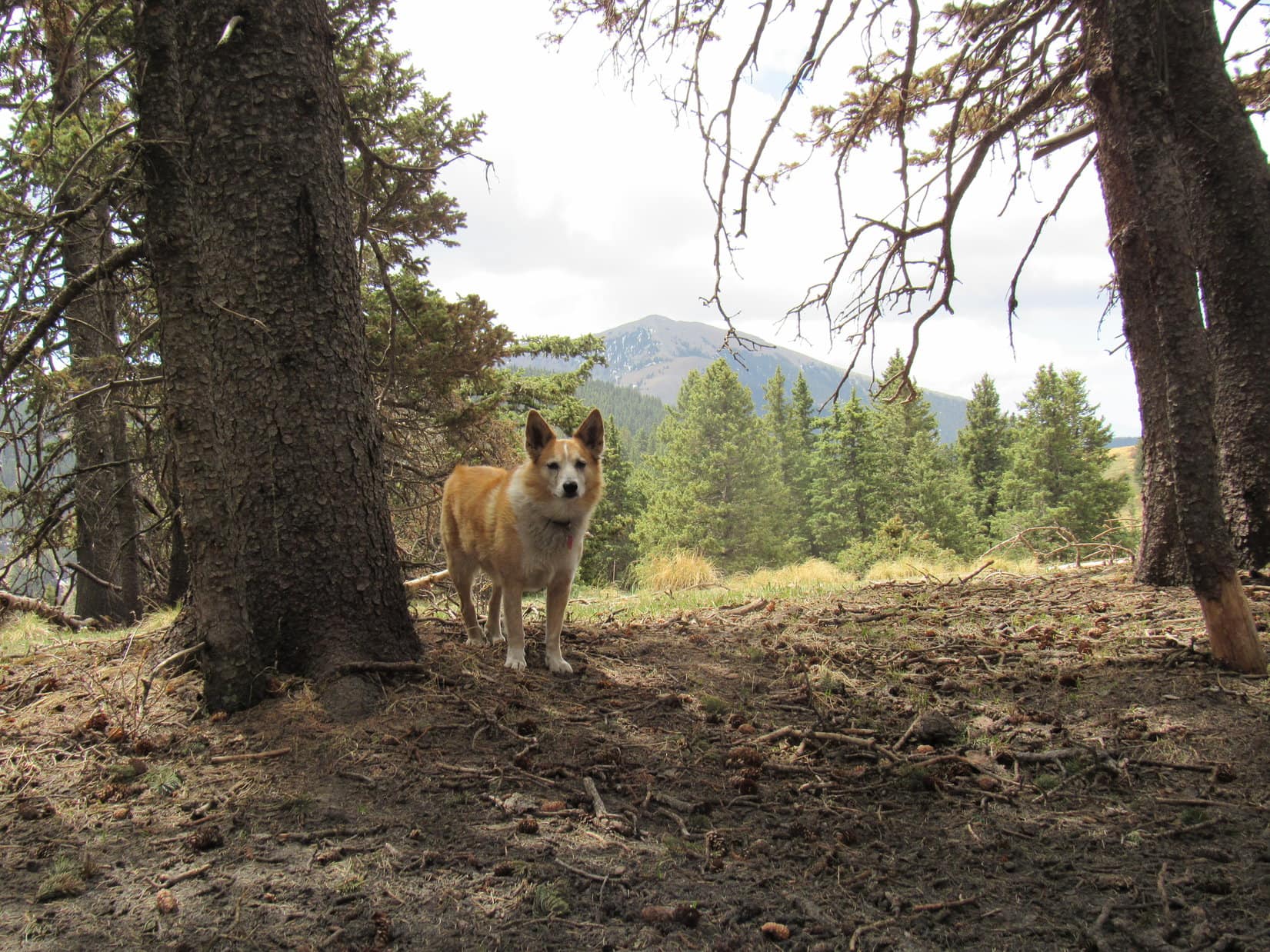
The trail climbed slowly as Lupe continued W.  Burnt forest gave way to more open slopes.  Ski runs were visible over on Lookout Mountain.  Part of the forest that hadn’t burned appeared ahead.  Shortly after Lupe entered the live forest, SPHP noticed a side trail taking off to the N (R).

Ski runs on Lookout Mountain (L). Photo looks W.
Approaching the live forest. Photo looks NW.

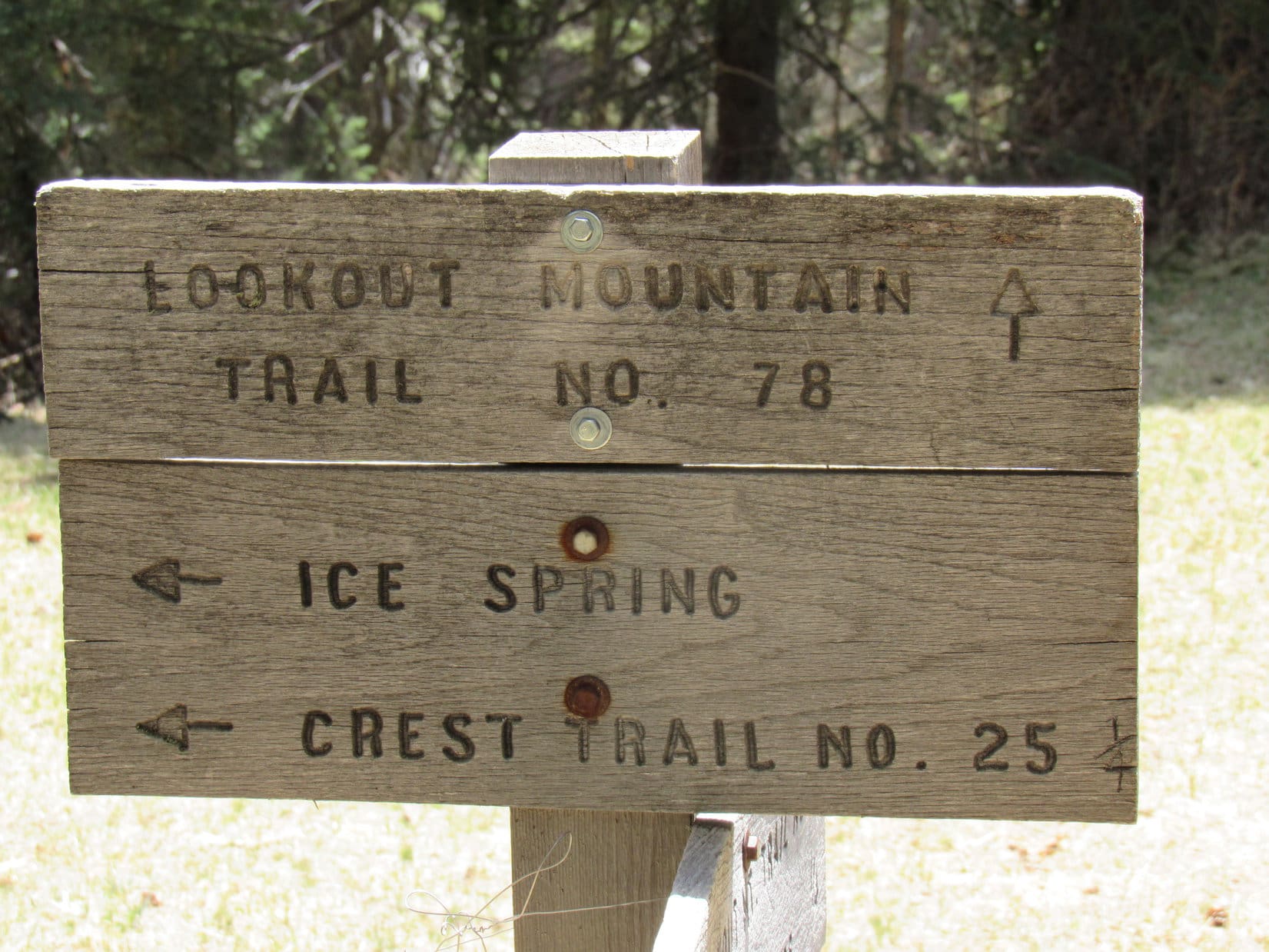
Looper hadn’t reached Ice Spring yet, but had to be getting close.  The White Mountain Wilderness High Point (11,300 ft.) was only 0.33 mile away.  A quick check of the topo map showed Crest Trail No. 25 veering off to the N at a junction with Lookout Trail No. 78A somewhere in this region.  No signage here, though.  Was this the junction?

The side trail looked much less used, but that might make sense.  Crest Trail No. 25 doesn’t go all the way to Sierra Blanca, instead passing S of the White Mountain Wilderness High Point before turning N to follow the crest of the ridge it’s named after to White Horse Hill (10,255 ft.) and points beyond.  Perhaps less popular destinations?

The plan all along was to visit both the White Mountain Wilderness High Point and Lookout Mountain, since they were more or less on the way to Sierra Blanca.  Maybe Buck Mountain, too, if there was time during the return.  Lupe took the side trail.

SPHP expected it to turn NW almost immediately, but it didn’t.  Instead Loop wandered among a maze of faint use trails that soon disappeared.  Apparently this wasn’t Crest Trail No. 25 after all.  Shucks!  Might as well keep climbing N, though!  200 feet higher and the Carolina Dog would be on the White Mountain Wilderness High Point’s E ridge.

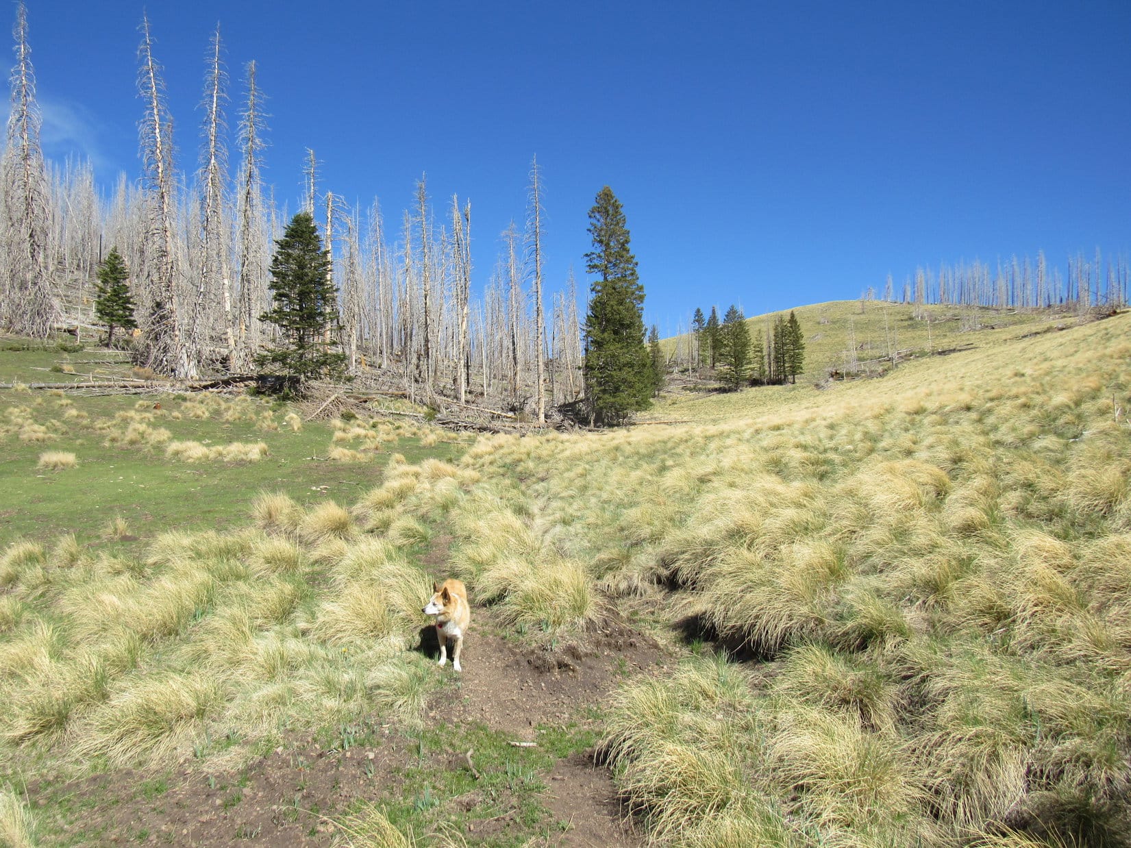
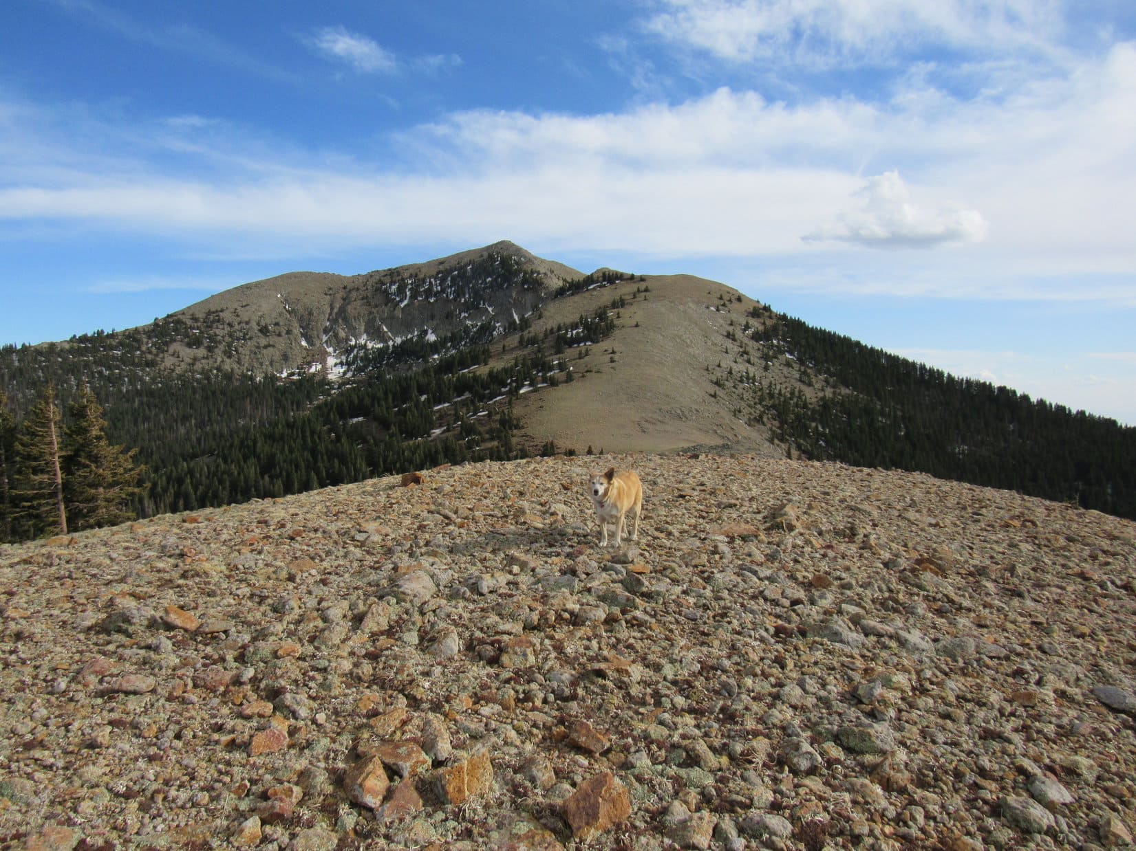
The top of the E ridge was broad, forested, and almost flat where Lupe reached it.  Not much to see except trees.  The American Dingo sniffed W in search of the summit.  Before long, she came to a meadow.  The high point was just ahead.

White Mountain Wilderness High Point (Peak 11300) dead ahead! Photo looks W.

Although there were good views of both Lookout Mountain and Sierra Blanca while crossing the meadow, the White Mountain Wilderness High Point summit was buried in trees, and views were much more limited.  The actual high point appeared to be at the base of a large spruce tree.  Immediately to the W was a blackened area which had apparently been involved in a very recent fire.  More could be seen from over there, but the views were still tree-broken.

Sierra Blanca (Center) from the White Mountains Wilderness High Point summit. Photo looks S.
In the recent burn area W of the true summit. Photo looks N.

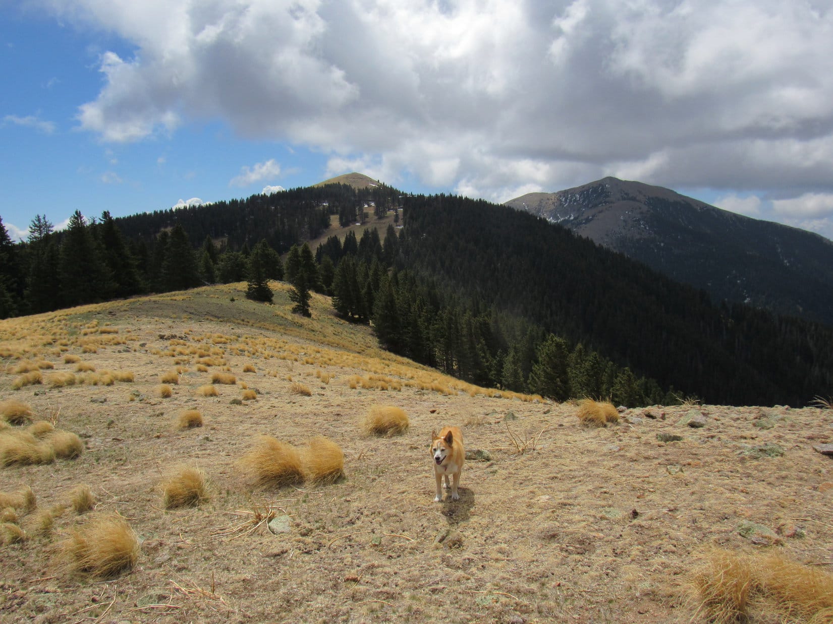
A 20 minute break was taken up on the White Mountains Wilderness High Point.  Lupe then traveled S through mostly open territory down to a saddle where she reached Crest Trail No. 25 again at an intersection with Lookout Trail No. 78.  Continuing S to a nearby gently sloped ridge, it proved to have a great view of Lookout Mountain and Sierra Blanca.

Signage at the Crest Trail No. 25 and Lookout Trail No. 78 intersection.
Lookout Mountain (Center) & Sierra Blanca (R) from the gentle ridge. Photo looks S.

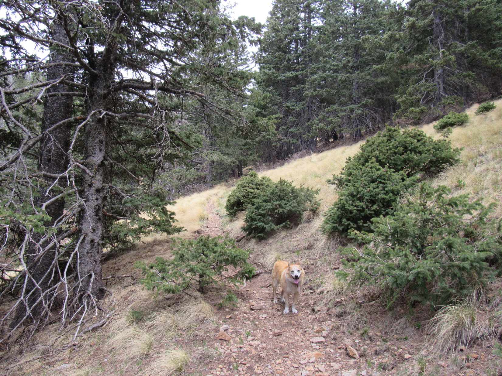
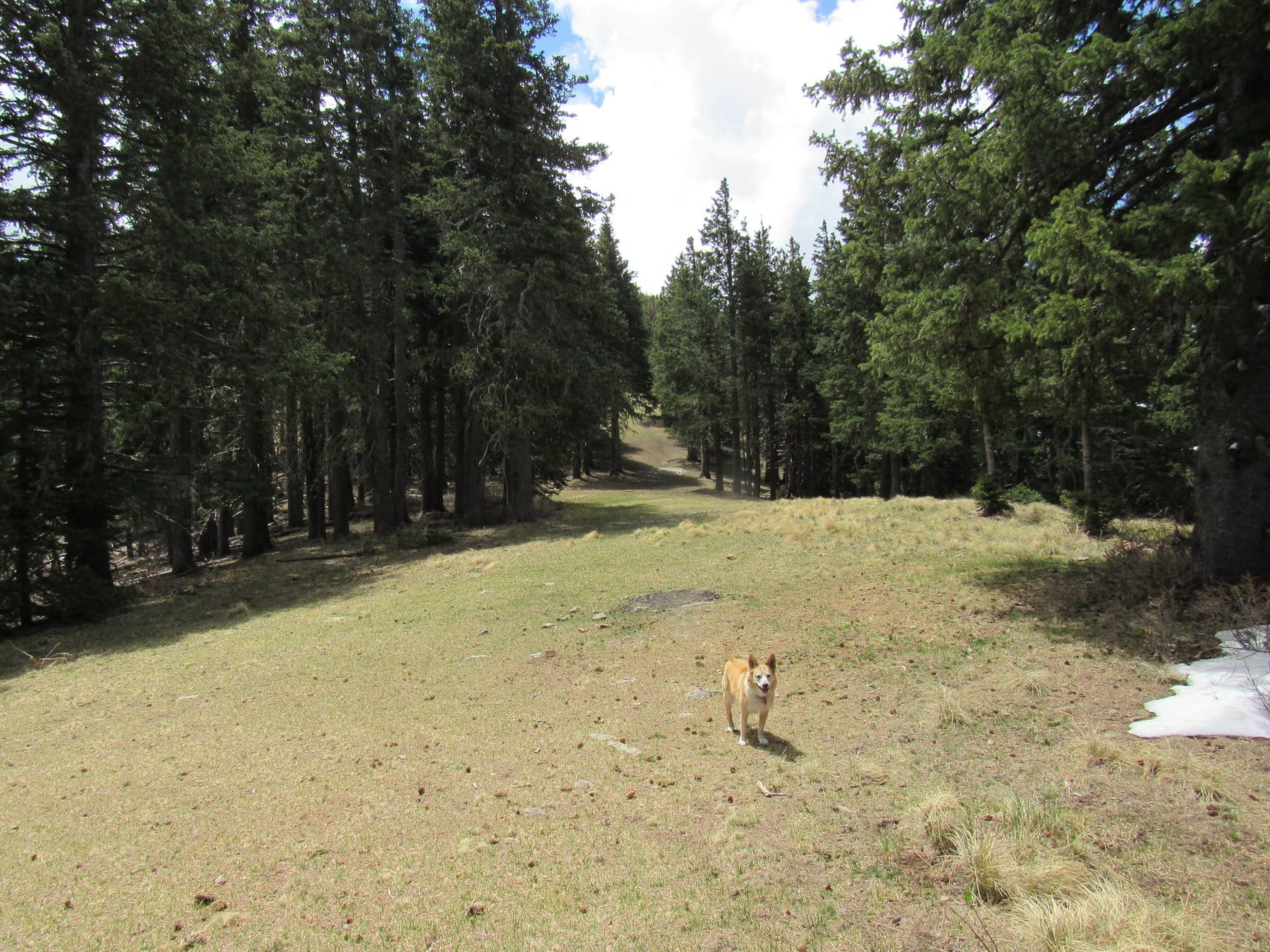
Following the rounded ridge toward Lookout Mountain, Lupe picked up Lookout Trail No. 78.  After taking her back into the forest, No. 78 led down to an opening where Trails No. 78 & 78A converged.  This opening provided a nice look at Buck Mountain (10,769 ft.) back to the ENE.

Buck Mountain (Center). Photo looks ENE.
Signage at the Trail No. 78 & 78A convergence. No. 78A goes to Ice Spring.

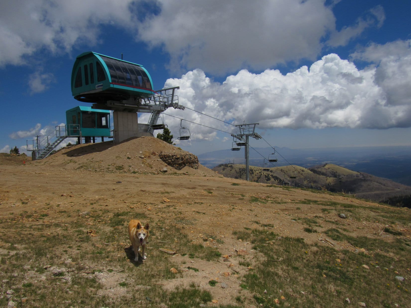
A wide grassy lane continued S to a saddle, where it linked up with the Ambush Run of Ski Apache.  Ascending along the edge of the run, Lupe soon reached the upper end of a chairlift next to a large metal building.  Staying W of these facilities, the American Dingo passed several picnic tables with big views to the W, and came to a broad path.

Looking S from the clearing down the lane that leads to the Ambush Run of Ski Apache.
Near the chairlift and metal building. Photo looks SSE.
On the broad path after passing the chairlift and picnic tables. Photo looks S.

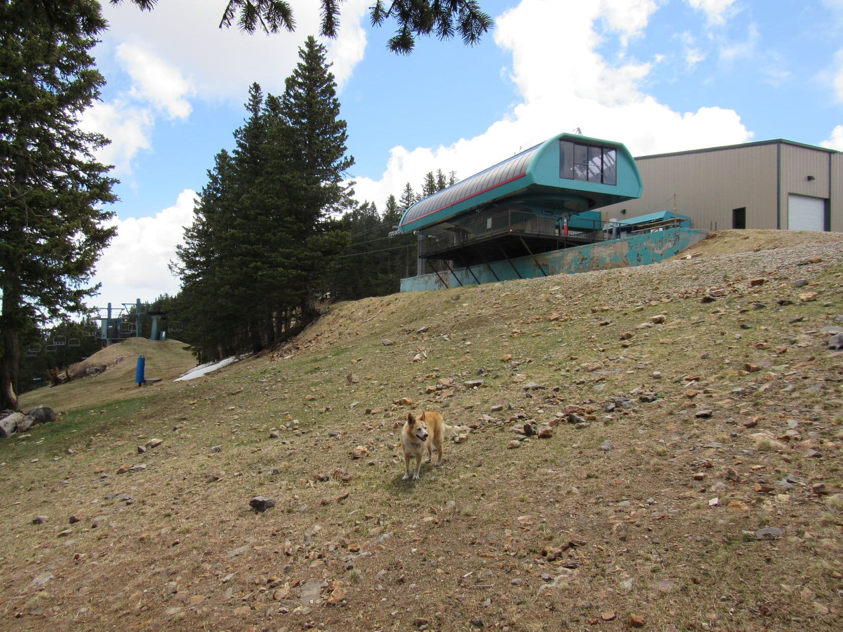
The top of Lookout Mountain (11,580 ft.) was just S of the ski facilities and about 150 feet higher.  Since it was quickly evident that the path was going to bypass the summit, Lupe left it.  Climbing a slope of small rocks and grass, she reached a thick circular concrete pad supporting a rock wall around most of the perimeter.

Approaching the summit of Lookout Mountain. Photo looks S.
On the concrete viewing platform at the top of Lookout Mountain. Photo looks W.

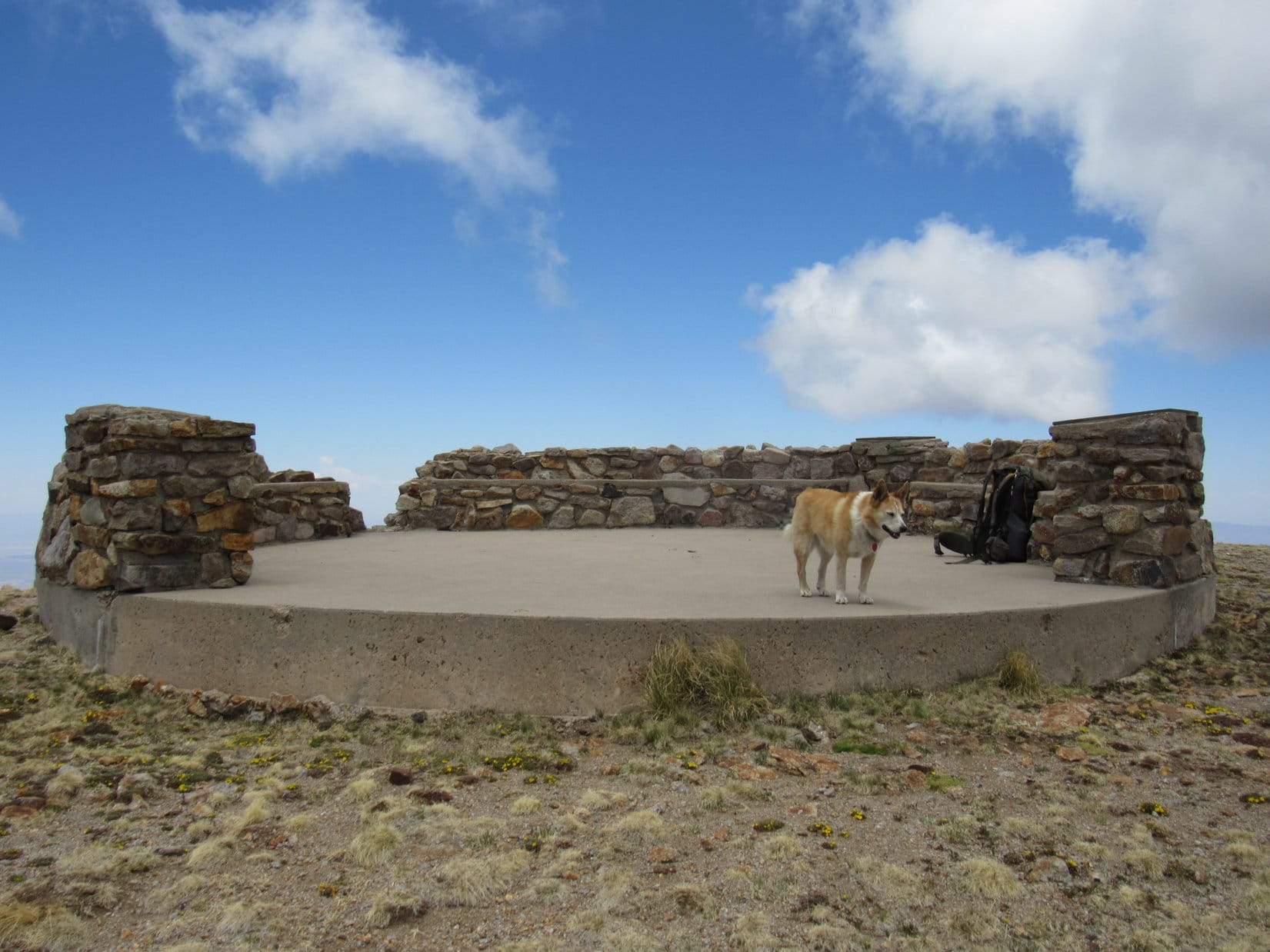
Concrete benches incorporated along the interior of the wall provided a nice spot to relax.  The panoramic views were impressive, but Lupe took only a short break.  Sierra Blanca was higher yet, and now beckoning from only a little more than a mile away!

View to the SW.
Sierra Blanca (Center) from Lookout Mountain. Photo looks S.

Another Ski Apache chairlift came into sight as soon as Lupe started for Sierra Blanca.  After passing it, Loop returned to the broad path.  When the path went through an opening in a zig-zaggy log fence, she deserted it again, following a use trail along the W side of a minor hill.

Another chairlift ahead! Sierra Blanca (R). Photo looks SSE.
Ski Apache chairlift on the S side of Lookout Mountain. Photo looks E.
Different angle. Photo looks NE.
Back at the broad path. Photo looks S.

The trek from Lookout Mountain to the saddle N of Sierra Blanca was easy.  However, Lupe now faced a fairly steep 500 foot climb up an open slope of grass and smallish rocks.  SPHP did a big bad wolf impression, huffing and puffing slowly higher while the Carolina Dog roamed at will.

Approaching the saddle N of Sierra Blanca. Photo looks S.

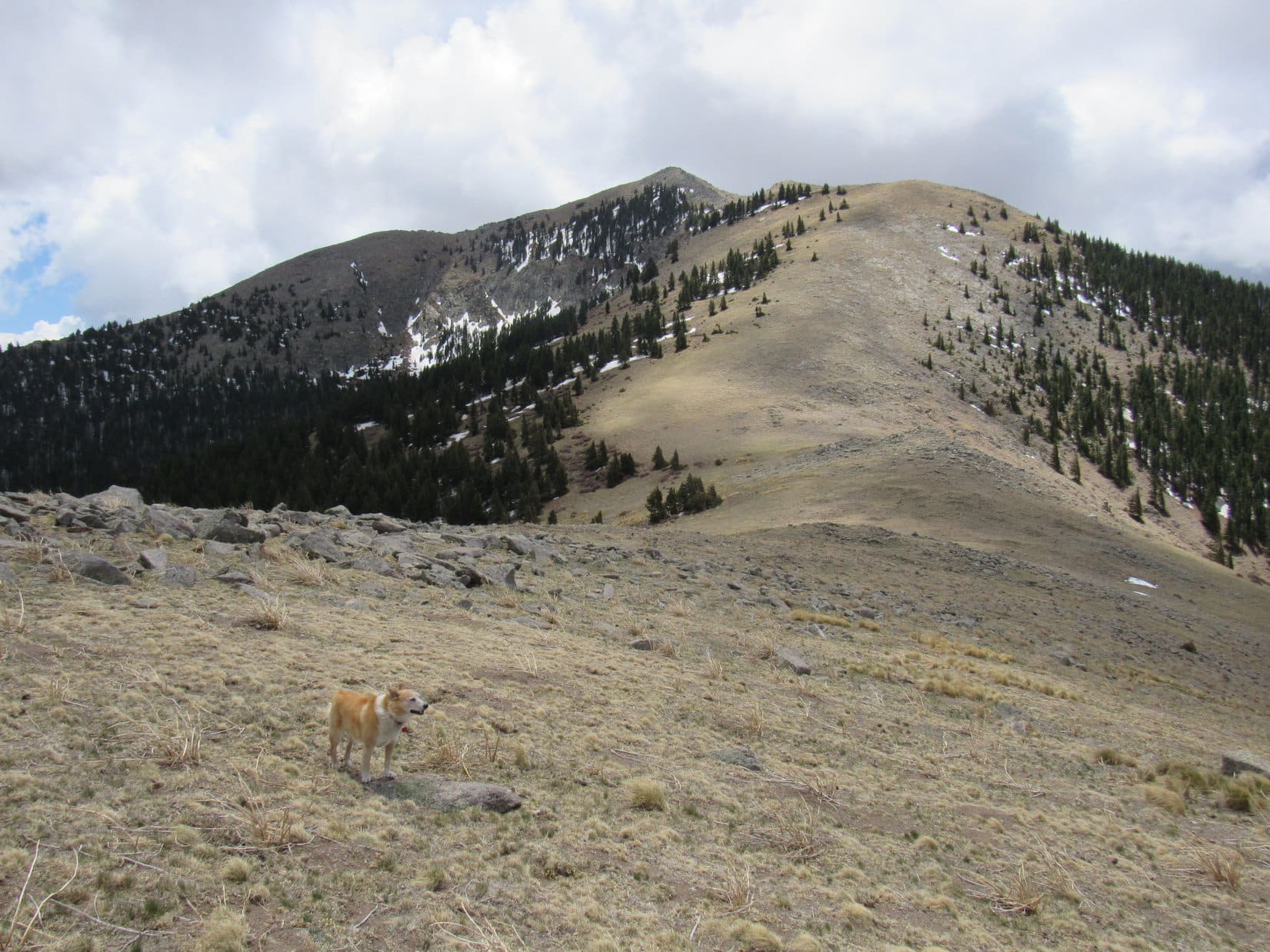
The 500 foot climb led to a short, level ridge that jutted out to the W.  SPHP insisted upon taking a somewhat extended breather here.  Ahead, a rockier and somewhat higher ridge led straight toward the summit.

Gazing back at Lookout Mountain (Center) from the first short ridge. Photo looks N.
Sierra Blanca from the first ridge. Photo looks S.

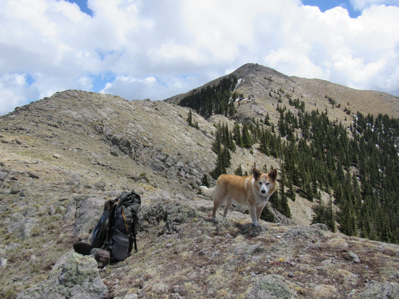
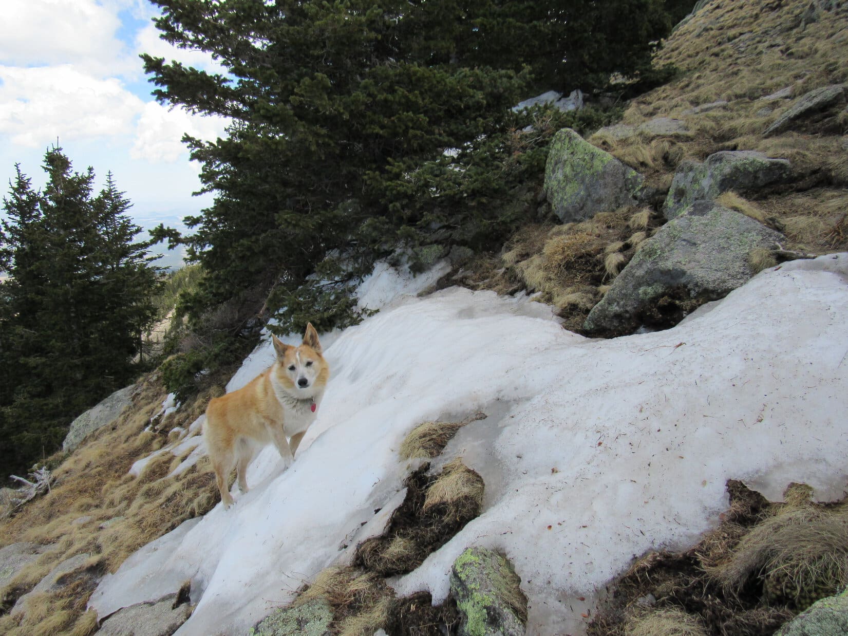
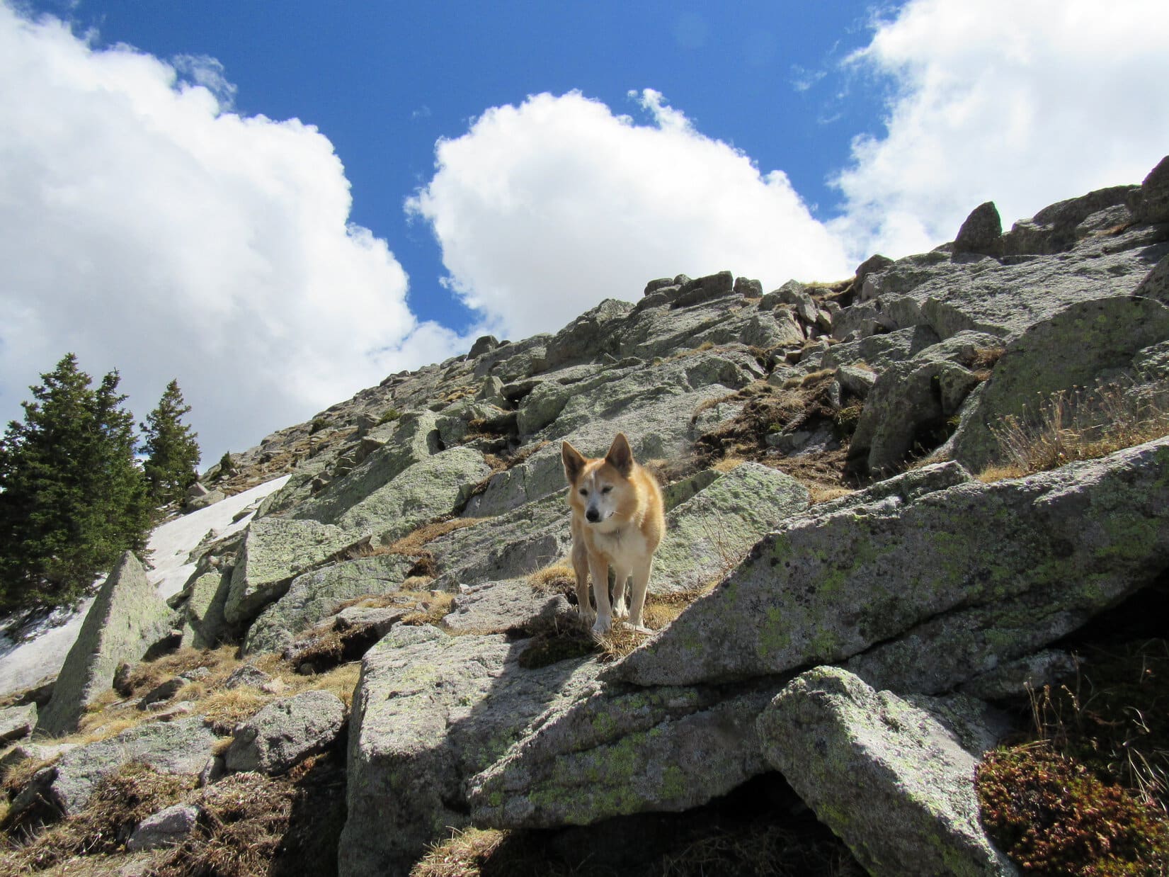
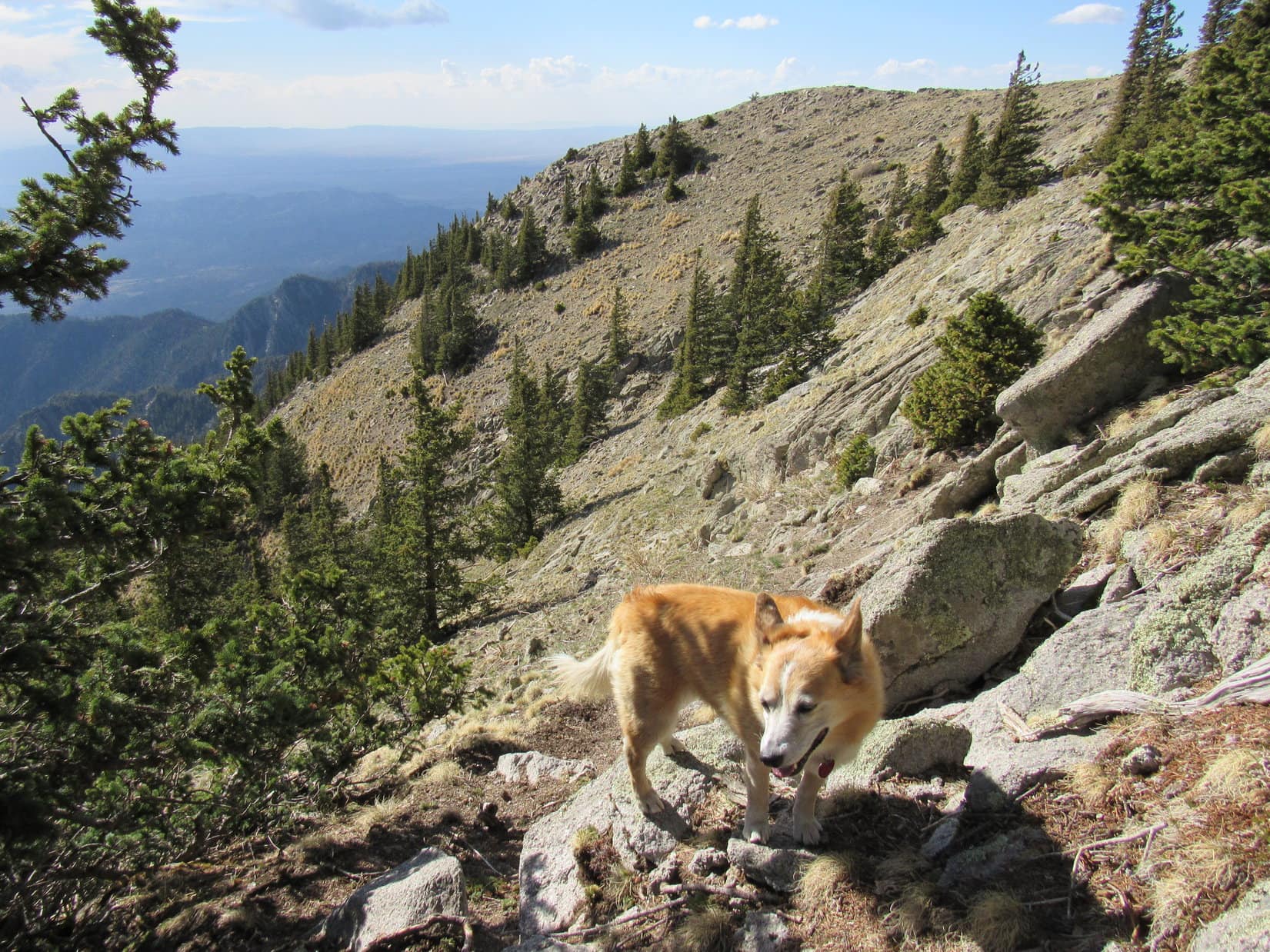
The E side of this next section was very steep, almost a cliff.  Continuing onward, Lupe stayed high on the W side, sometimes even right up on the ridgeline.  The terrain became rough, forcing her to downclimb a bit just before reaching a notch.

Approaching the still unseen notch. Photo looks S.

The notch provided a narrow opening to the E just past the cliffy region.  A use trail went through it, then turned S back up to the ridgeline, which soon became so bouldery Lupe had to abandon it.  Returning to the W side again, the Carolina Dog kept working her way higher.  This whole region was plenty steep.

Above and beyond the notch, enjoying a patch of melting snow. Photo looks E.
On the upper slopes.
Back over the W side, not far from the summit! Photo looks SSW.

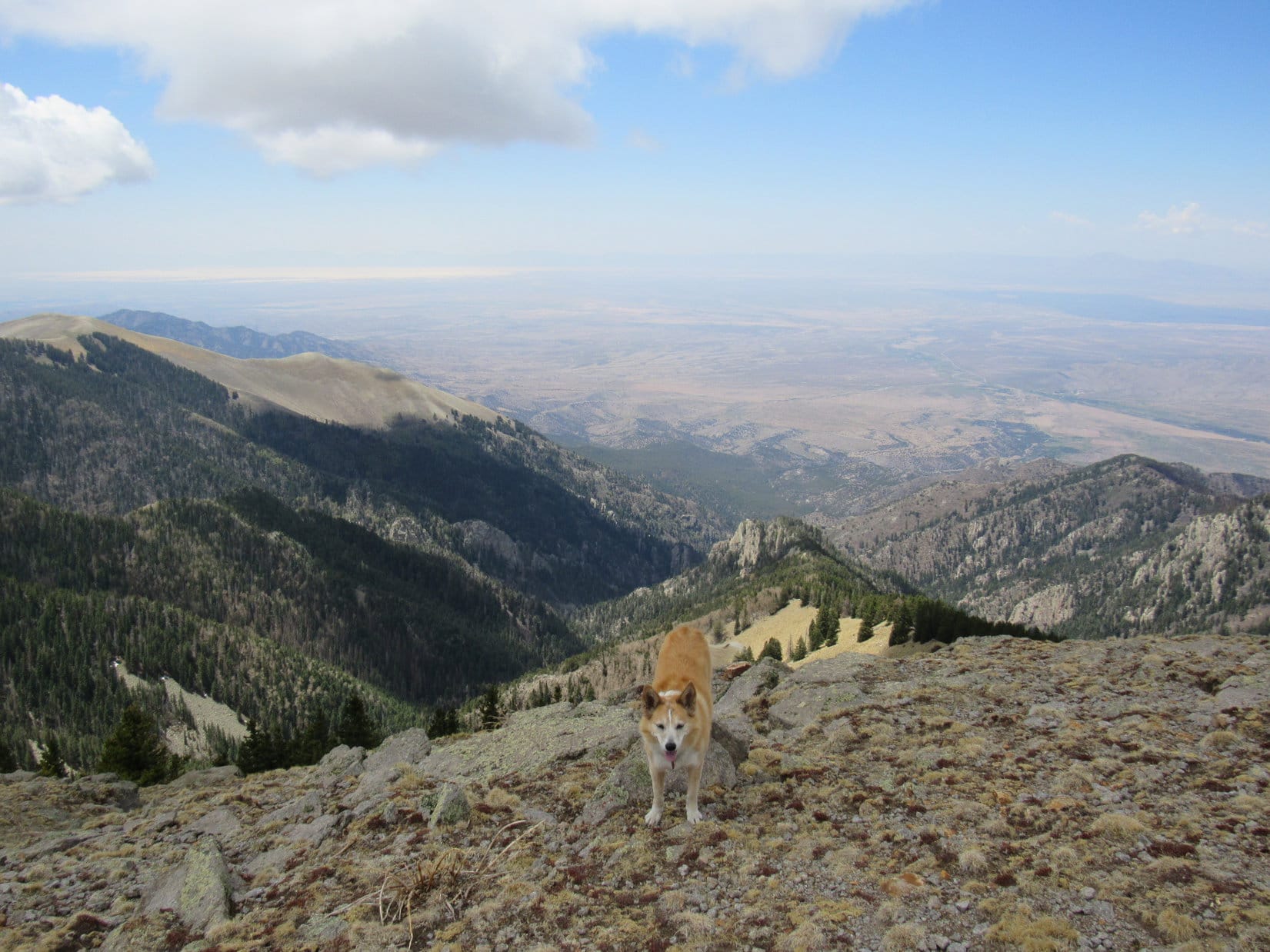
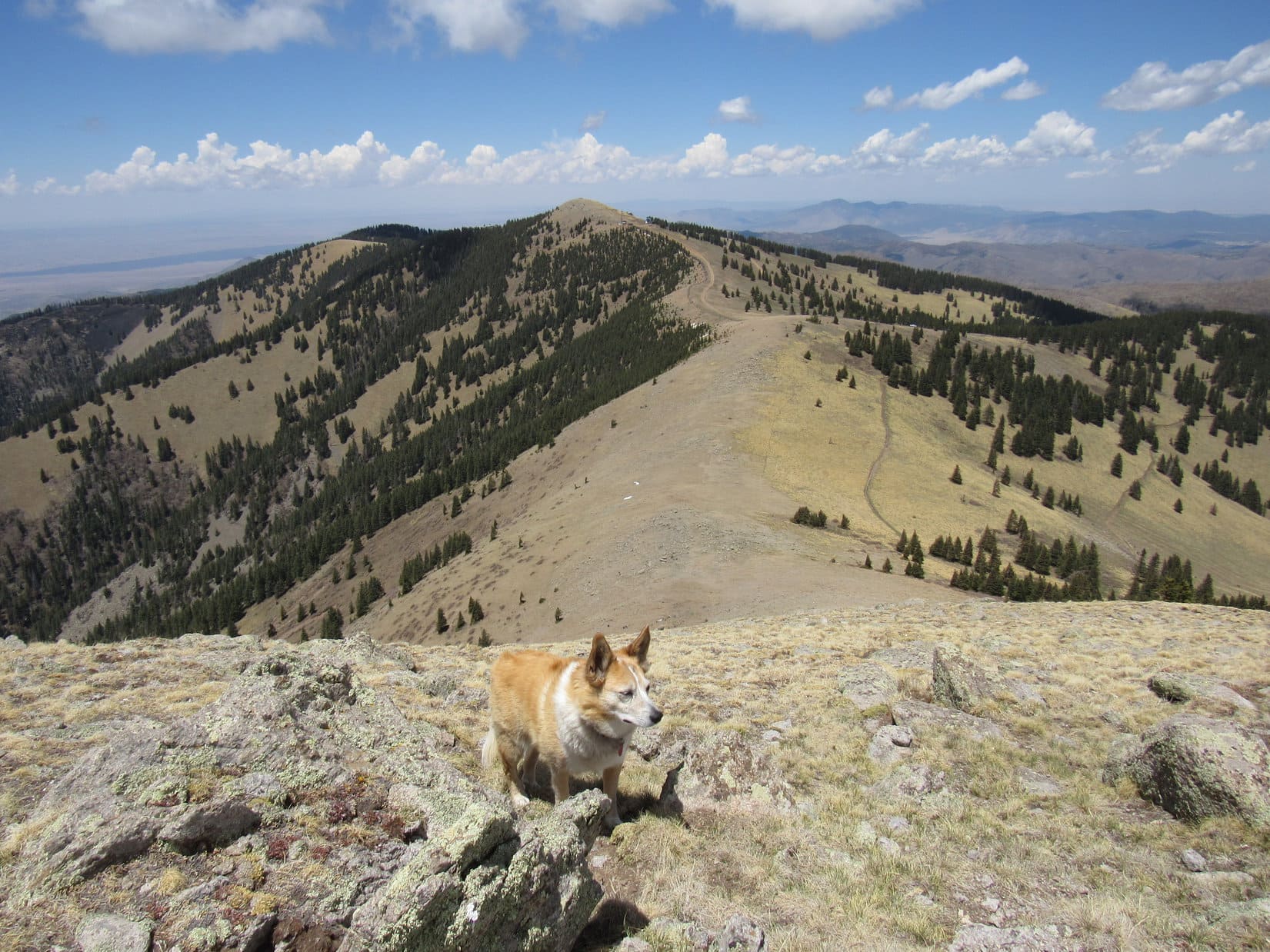
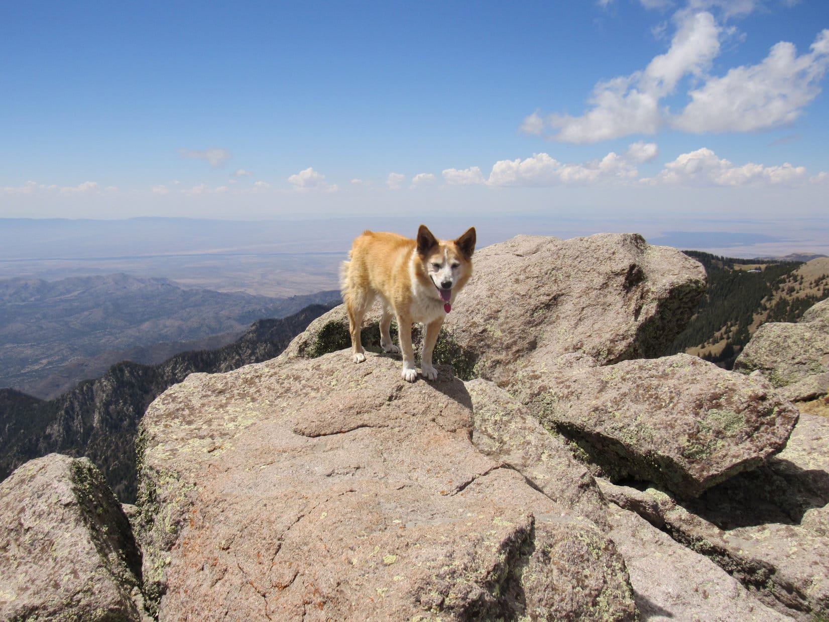
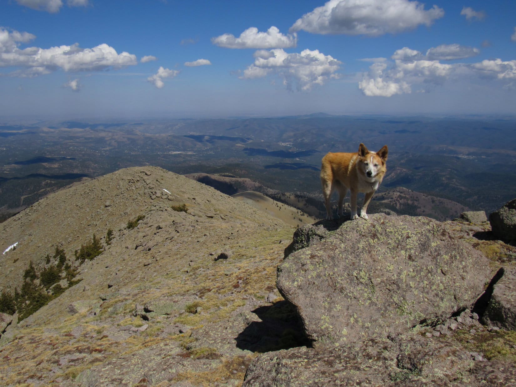
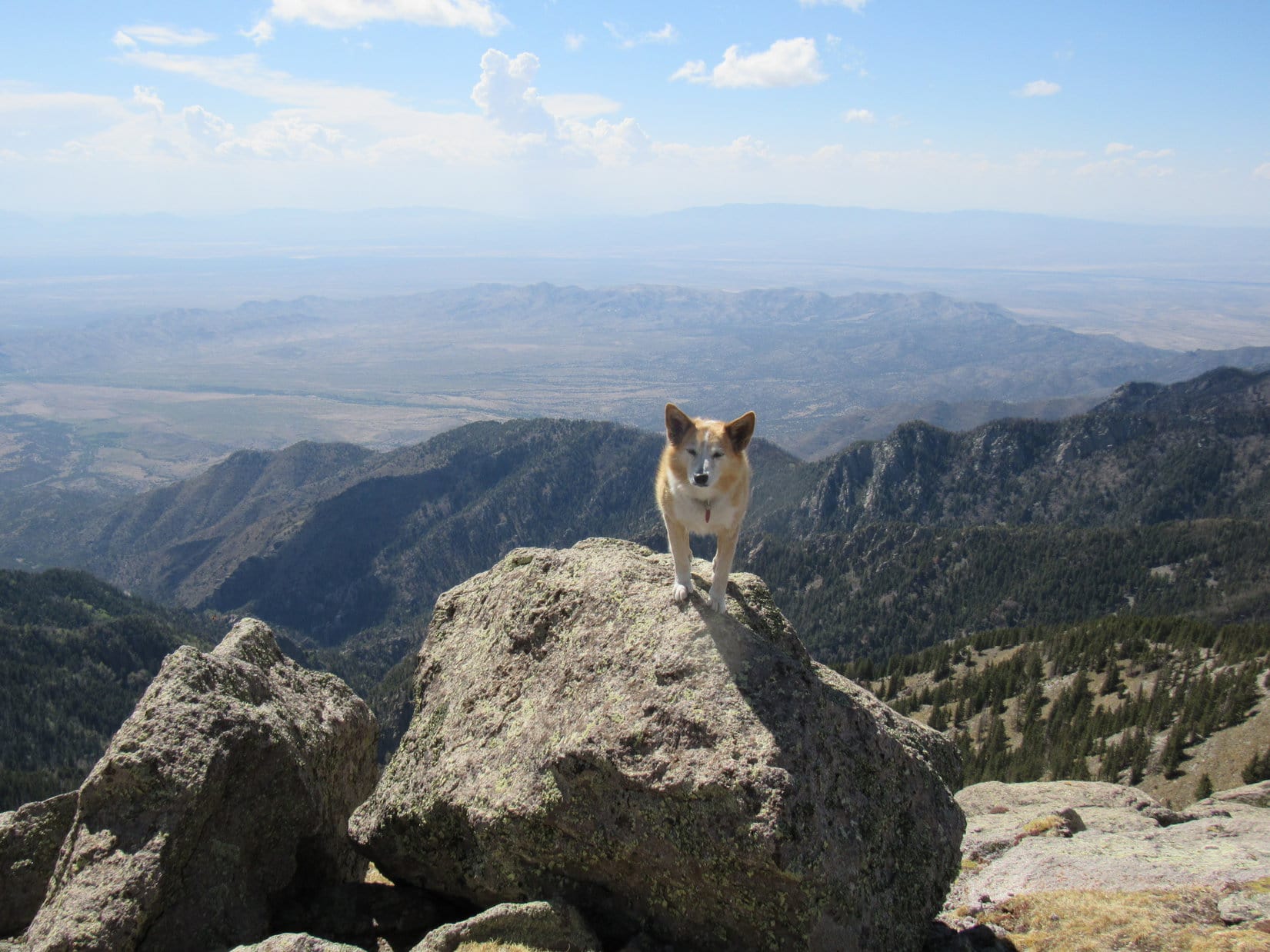
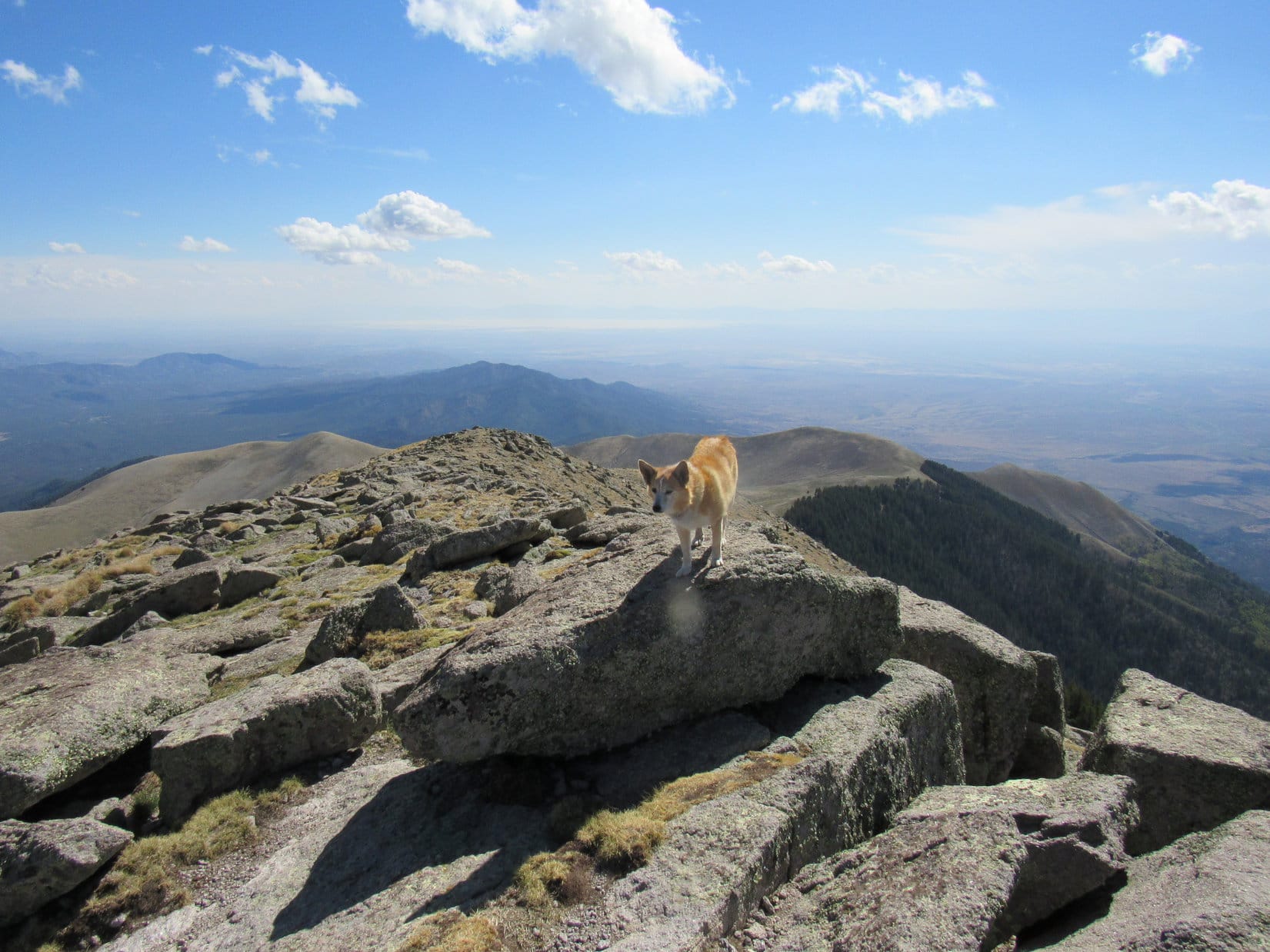
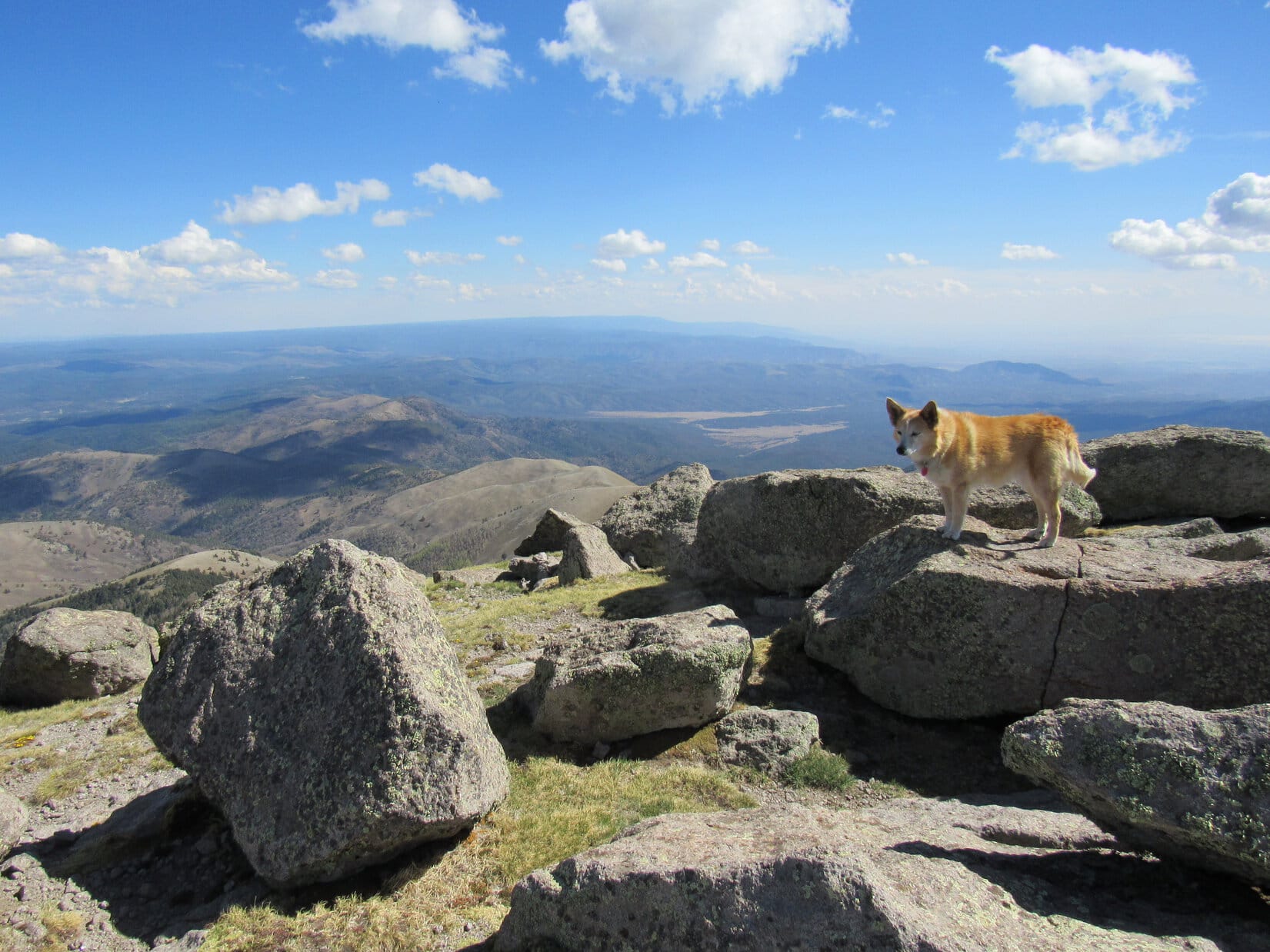
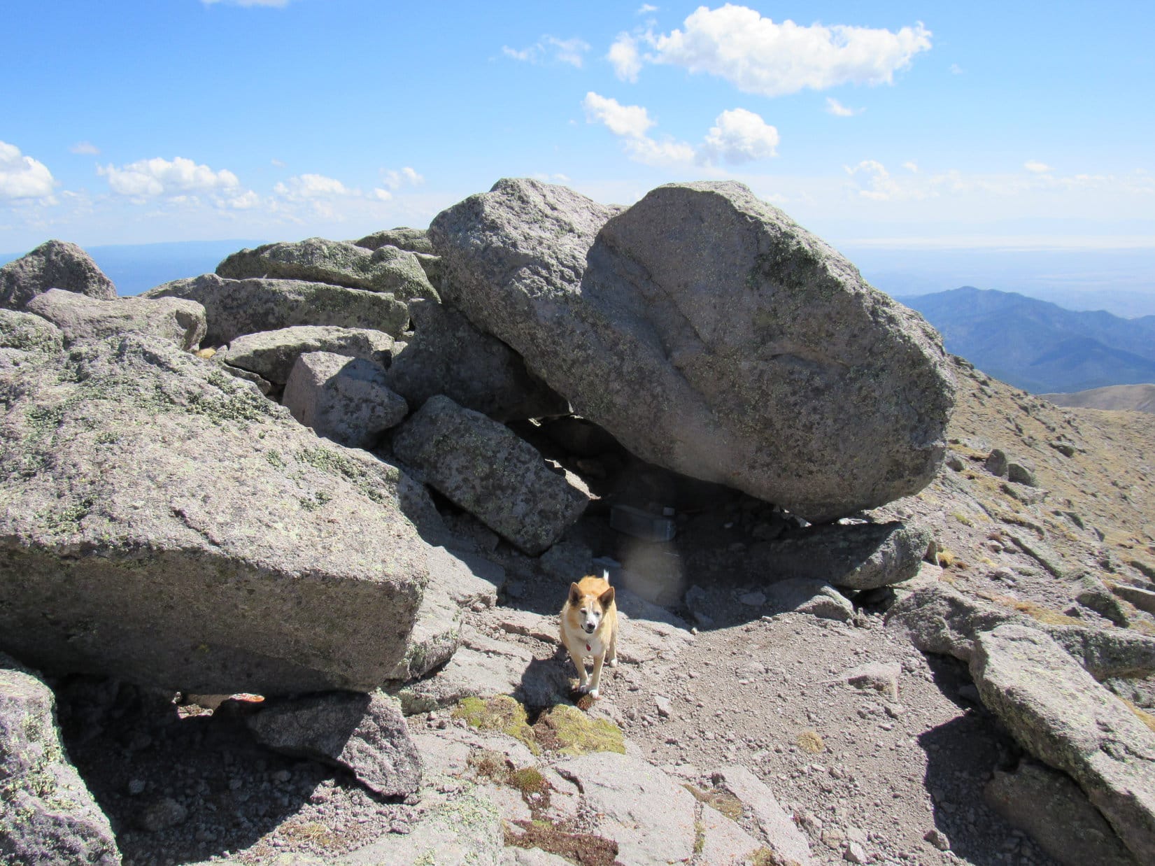
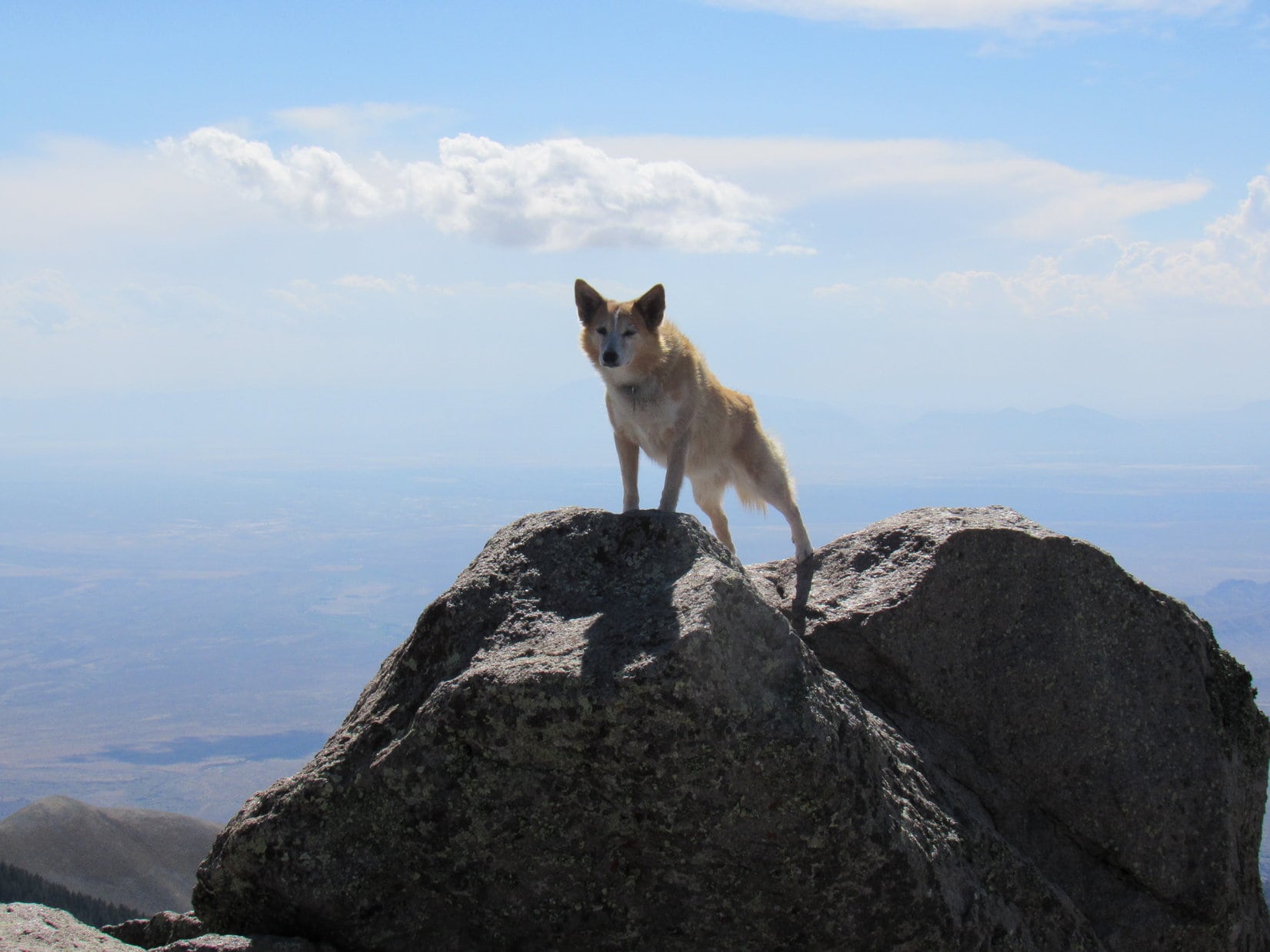
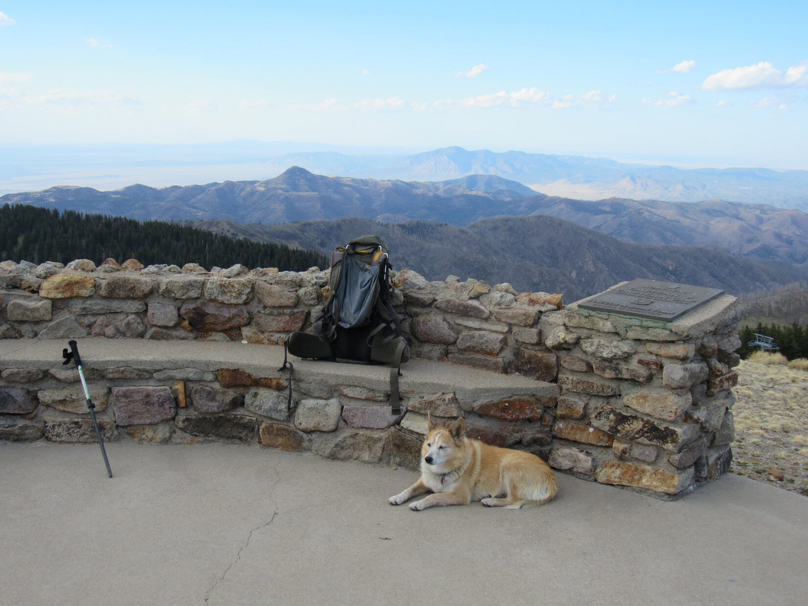
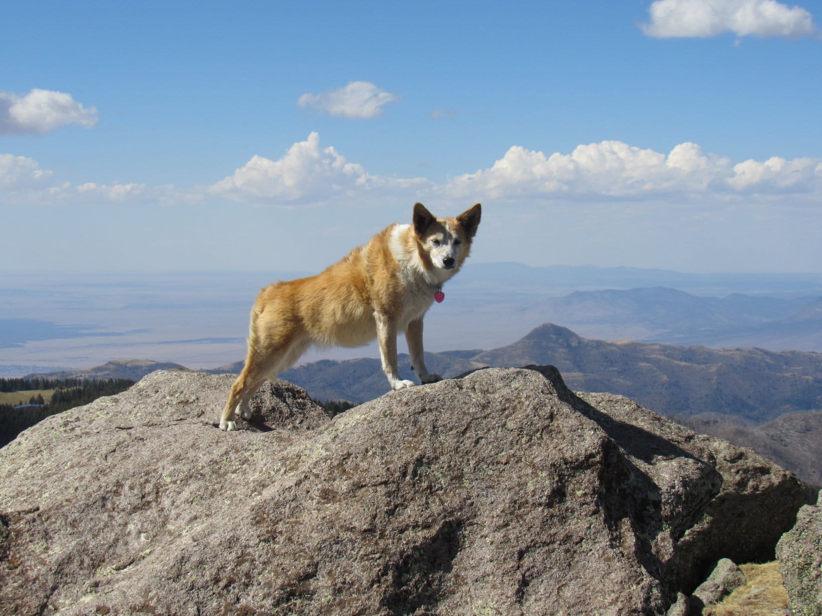
5-13-21, 2:43 PM, Sierra Blanca (11,793 ft.) – By the time Lupe reached the top, clouds that had been building earlier on had largely dissipated.  Loop came up just S of the true summit boulder, located along the W rim of a region roughly 75 feet long N/S and 25 feet wide E/W.  Only distant haziness obstructed otherwise commanding views in all directions.

Up on top! The true summit boulder (R) is the next one over. Photo looks NNW.

Ready for a prolonged rest break, Lupe headed to the N end first, where she could relax while contemplating the region she had just journeyed through to get here.

On the biggest boulder at the N end of the summit region. Photo looks N.
Peering down on the route taken. Lookout Mountain (Center). The White Mountain Wilderness High Point (L) is the forested hill beyond it. Photo looks N.
Buck Mountain (L) in the foreground, with the Capitan Mountains (R) on the horizon. Photo looks NE.

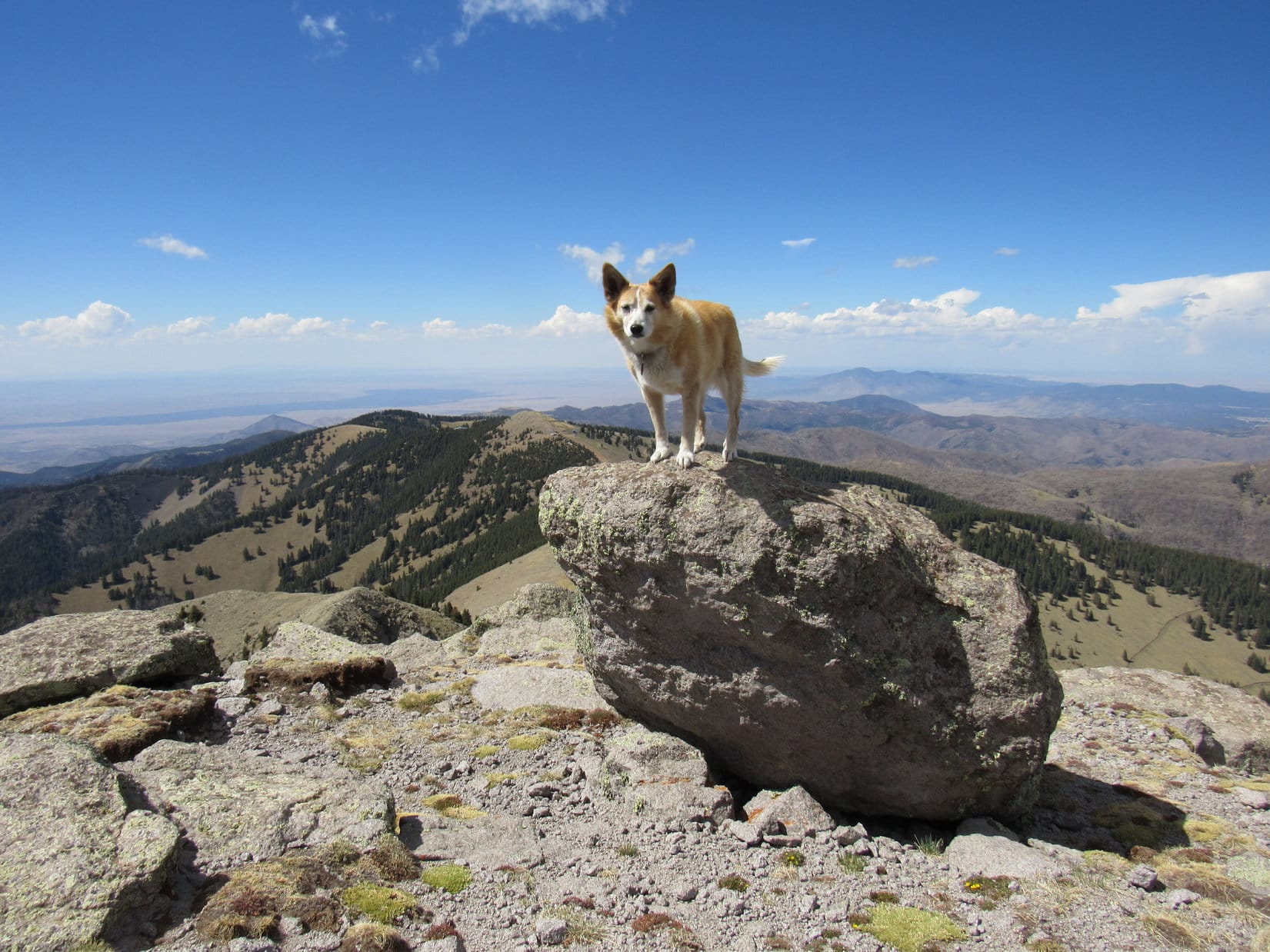
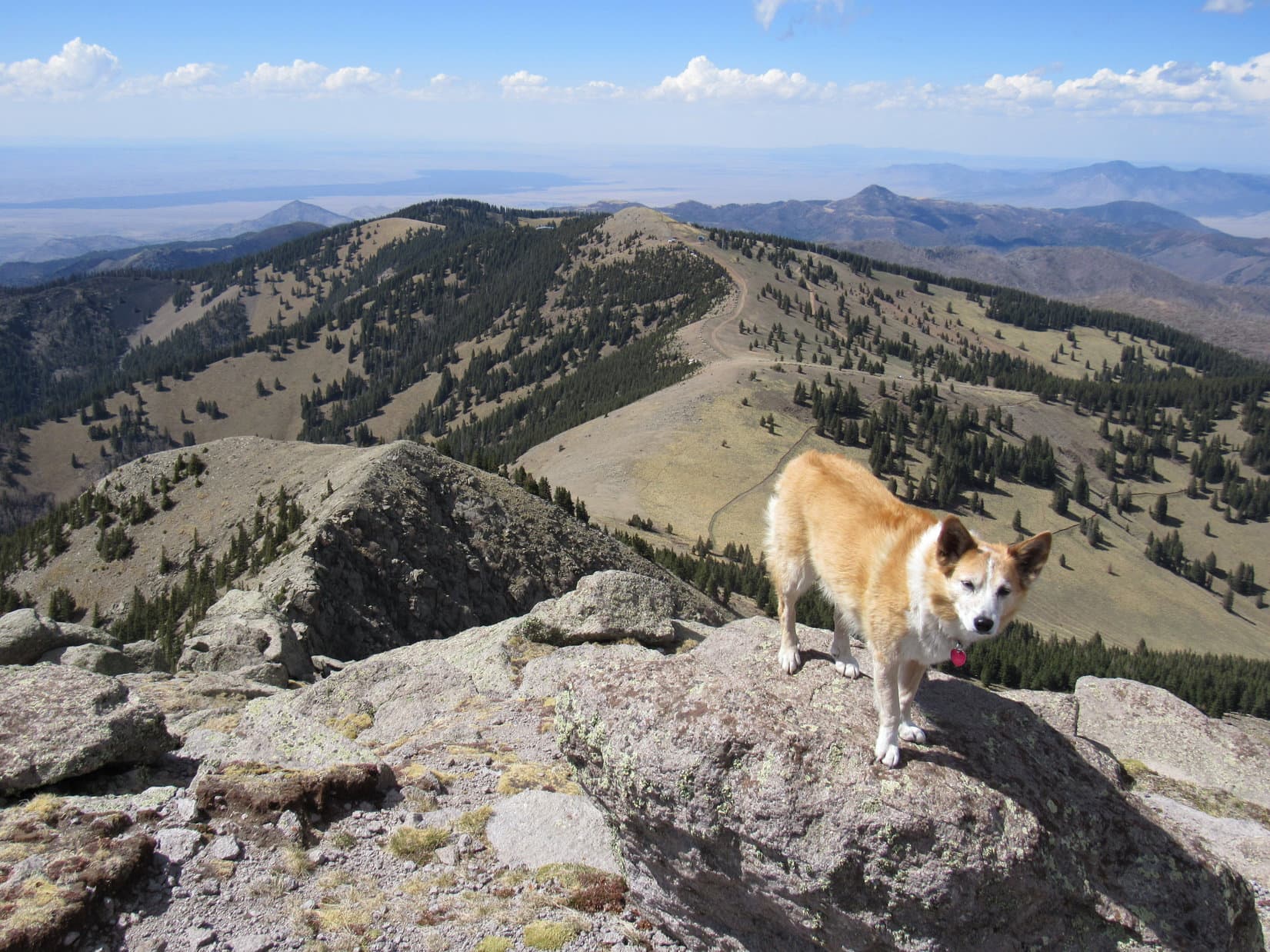
Nearly an hour shot by blissfully hanging out at the N end.  SPHP finally felt sufficiently recovered to explore the rest of the summit region.  Lupe took this opportunity to enjoy the views in other directions, too.

Having a look around. True summit (Center). Photo looks SW.
Sierra Blanca’s E ridge (L). Photo looks ESE.
View to the NW.
White Sands Missile Range (Center) discernable on the horizon. Photo looks SW.
Looking S.

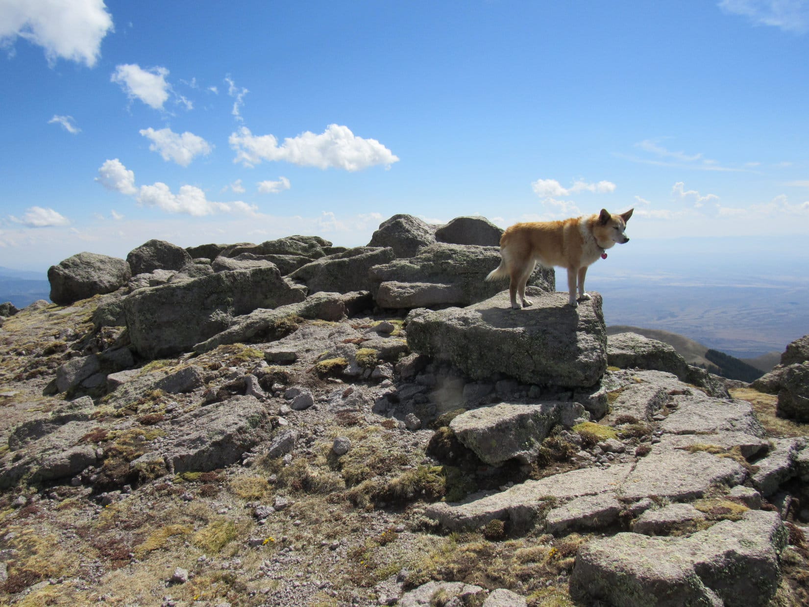
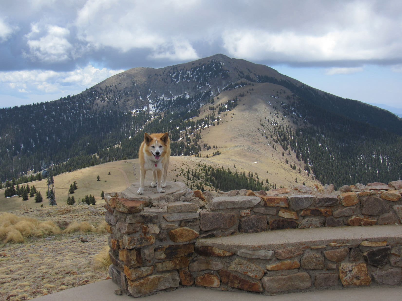
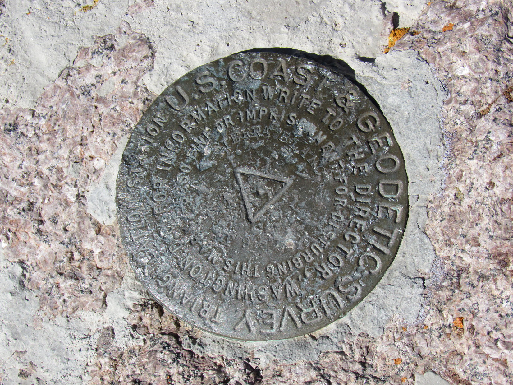
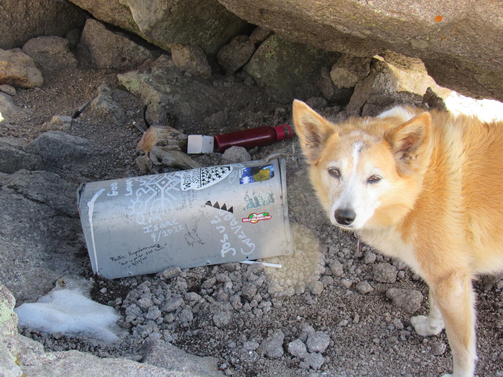
Two survey markers with arrows pointed toward a main “Sierra Blanca” benchmark located E of the true summit.  A spacious cavity below the true summit boulder harbored a mailbox.  It proved to be packed full of old registries.  SPHP added Lupe’s name to the most recent one, a red notebook that started with a 2020 entry.

Loop on the true summit boulder. The survey benchmark (lower L) is visible nearby. Photo looks SW.
The Sierra Blanca survey benchmark.
The mailbox containing the registries is stashed beneath the true summit (Center). Photo looks SSW.
A closer look.

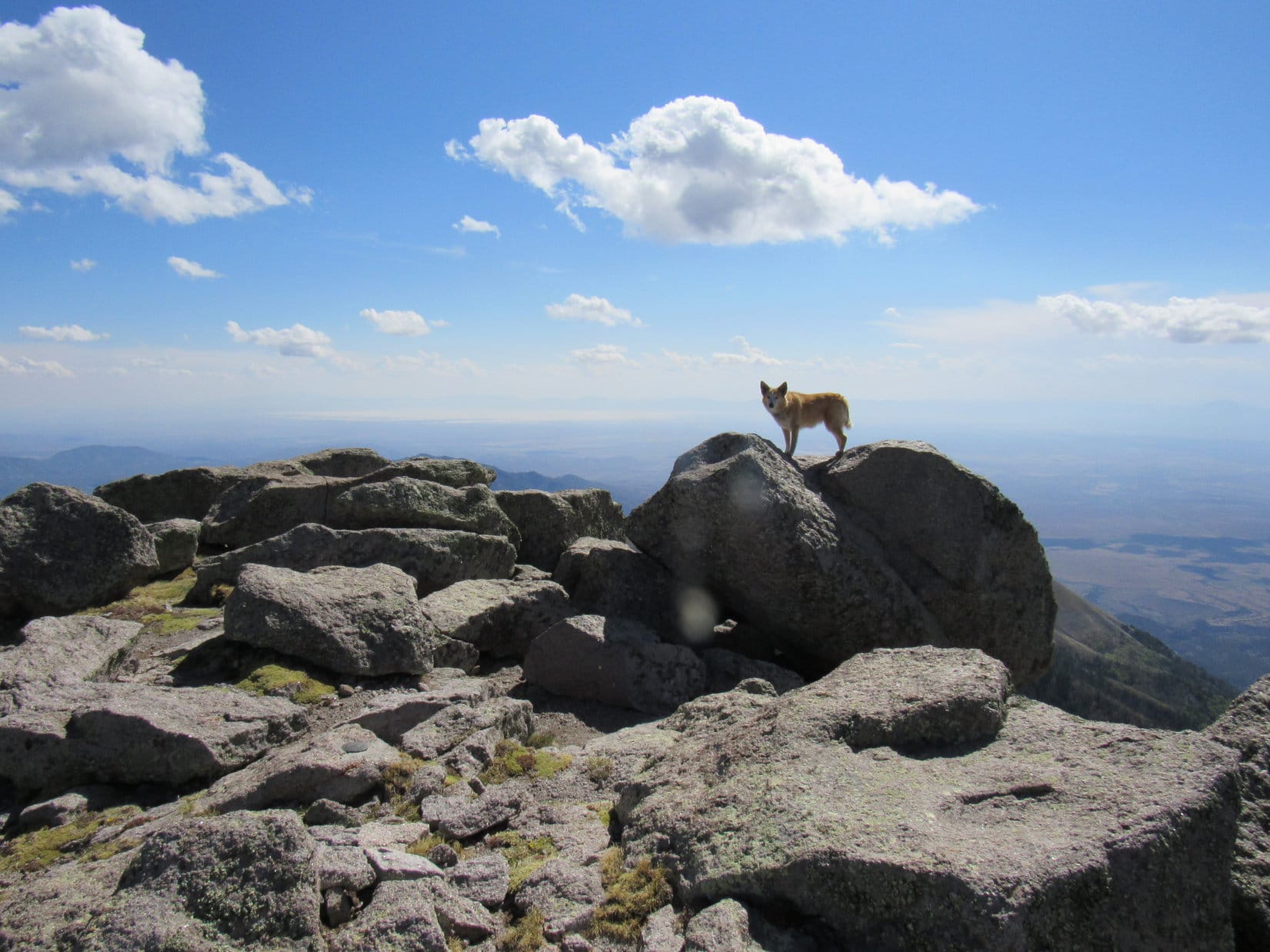
After SPHP signed her into the registry, Loopster got up on true summit, striking a dramatic pose.

Looking N.
Looking W.

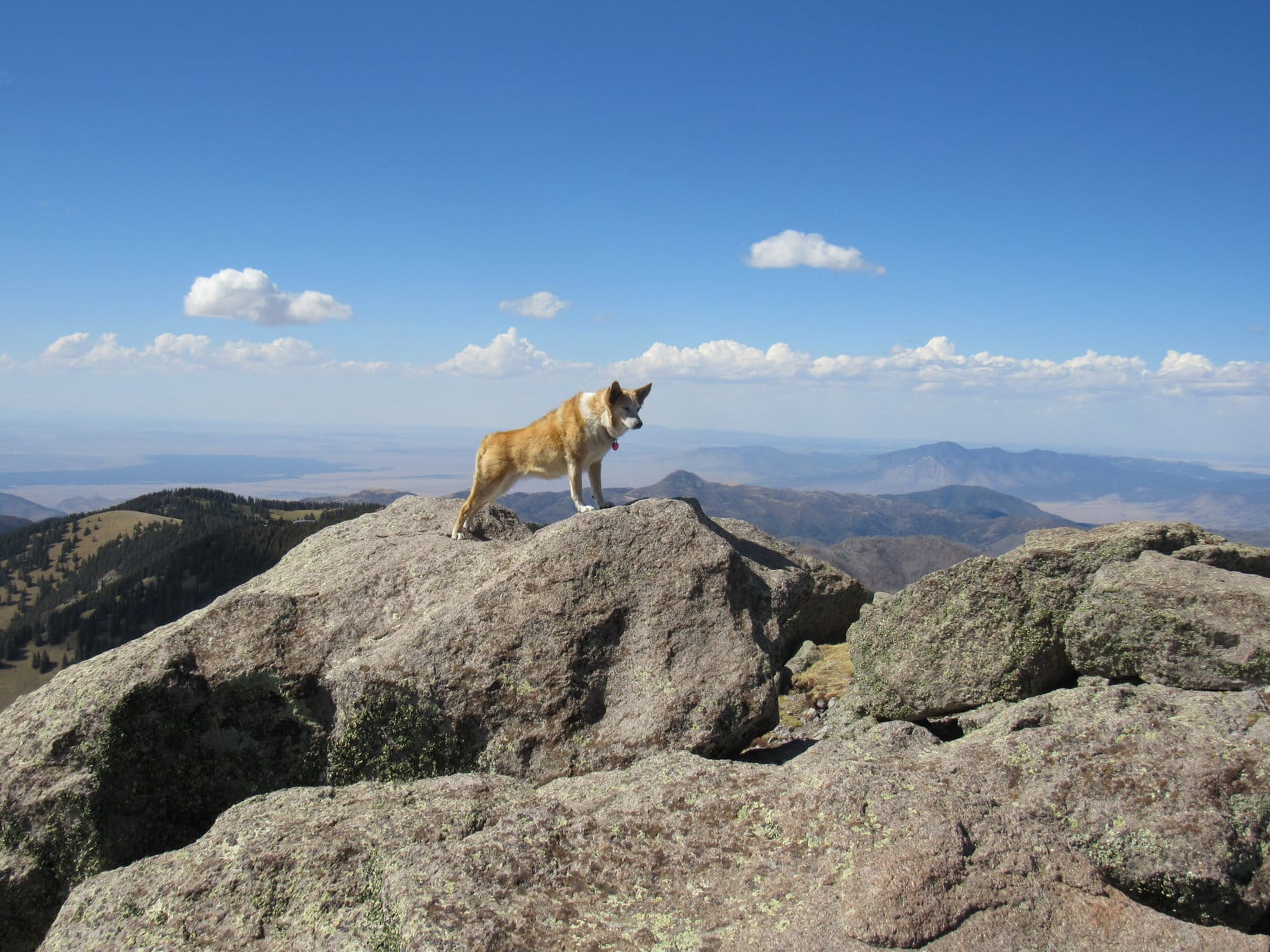
Sierra Blanca was awesome!  Hadn’t been hard to get here, either.  The Carolina Dog lingered an hour and 40 minutes, so long that she wasn’t going to have time to climb Buck Mountain on the way back.  Oh, well!  Time spent here was well worth it.  No regrets.

Lingering on Sierra Blanca. Photo looks W.

5-13-21, 4:22 PM – SPHP started down first.  The return, mostly along the same route, went well.  After passing through the notch again, Lupe took advantage of a use trail lower down on the W side of the rocky ridge that led back to the first ridge above the 500 foot grassy slope.  This use trail was easier than staying high, and definitely the way to go.

Final moments atop Sierra Blanca. Photo looks E.
Heading down to the notch. Photo looks N.
On the use trail leading back to the first ridge (R). Photo looks NNW.
Back at the first ridge. Sierra Blanca (R of Center). Photo looks SSE.

Lupe returned to Lookout Mountain (11,580 ft.), going over the hill she had skirted earlier.  During another short break, SPHP had a look at a couple of plaques attached to the rock wall.  The most interesting one pointed out the Carrizozo Malpais Lava Beds, site of the first atomic bomb explosion.

Sierra Blanca from the hill Lupe had skirted earlier in the day. Photo looks S.
Relaxing on Lookout Mountain, 2nd ascent. Photo looks N.
Atomic bomb explosion plaque. Not something you want too many of around!

Lupe did not revisit the White Mountain Wilderness High Point (11,300 ft.), instead taking the Lookout Trail No. 78A shortcut to Ice Spring (which she saw no sign of) and back to Crest Trail No. 25.

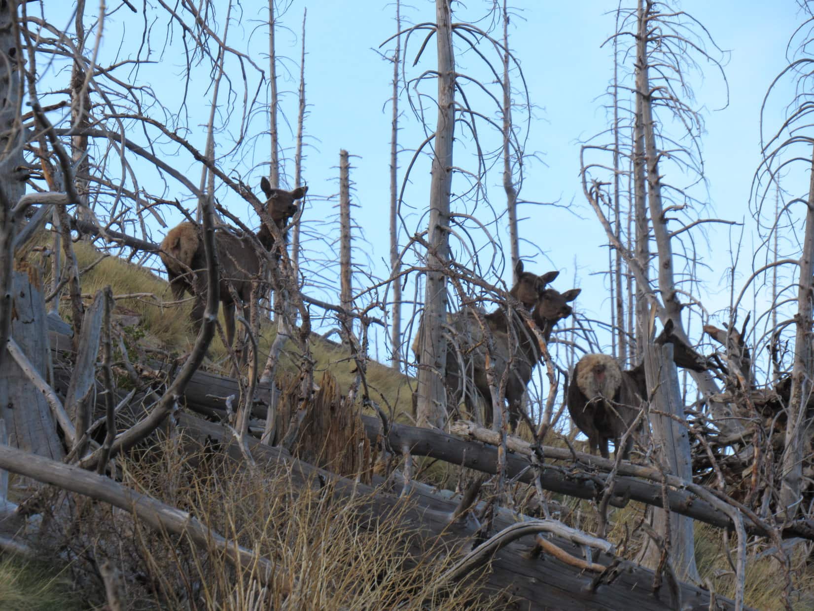
Now that it was about over, the most exciting part of the entire day was about to begin!  Lupe never saw the coyotes again, but the burned forest turned out to be full of giant deers emerging to graze!

Giant deers at day’s end.

Oh, it was a thrilling time on a great day, the day Lupe climbed her first peaks in New Mexico!  Reaching the RAV4 at dusk, the Carolina Dog was tired, famished, and perhaps more than a little sad that it was all over and done.  (5-13-21, 8:35 PM)

On Sierra Blanca, Sacramento Mountains, New Mexico 5-13-21

Links:

Next Adventure                         Prior Adventure

Want more Lupe adventures?  Choose from Lupe’s Summer of 2021 Dingo Vacations to New Mexico, Wyoming & the West Coast Adventure Index, Dingo Vacations Adventure Index or Master Adventure Index.  Or subscribe free to new Lupe adventures.

Black Hills, SD Expedition No. 274 – Centennial Trail No. 89: Elk Creek to Alkali Creek (4-10-21)

7:19 AM, 26ºF, Centennial Trail No. 89, Elk Creek trailhead – SPHP opened the door, and Lupe hopped back into the G6.

What’s wrong, Looper?  Did you hear gunfire?

No!  It’s freezing out there!  What happened, SPHP?  Last time we were here, it was so nice out!  I’m staying in where it’s warm until you’re ready.

Maybe you shouldn’t have rolled in the snow?  Anyway, suit yourself.  I’ll be ready in a few minutes.  Supposed to warm up into the 60’s ºF later on.  That’ll take the chill off!

Back at the Elk Creek trailhead for the 1st time since Expedition No. 273 – 5 days ago!

What was wrong with the Carolina Dog?  A frolic in the snow wouldn’t ordinarily bother Lupe at all, but now she sat alone shivering in the G6.  Was Looper getting sick?  SPHP hoped not.

Only 5 days ago, Lupe had made it here from Dalton Lake on a lovely warm afternoon in advance of a spring snowstorm that hit the Black Hills the next day.  Although a lot of snow had melted since then, this morning was admittedly off to a crispy start.  The plan was to continue Loopster’s Centennial Trail No. 89 explorations all the way to the Alkali Creek trailhead – 11.5 long, winding miles away.

If she felt up to it, that is.

Relevant portion of the posted trail map.

Alrighty, Loop!  I’m ready!  Are you feeling OK?  You up for this?

Without the slightest hesitation, the American Dingo left the warmth of the G6.  No sign of shivering or shaking now.

Of course!  Which way?  N?

Yes, indeed!  Onward!  Puppy ho!

Crossing USFS Road No. 168, Lupe left the Elk Creek trailhead.

Setting out for Alkali Creek. Photo looks NNE.

Crusty snow supported Lupe’s weight, but crumbled under SPHP’s, as Centennial Trail No. 89 headed NNE up a cold ravine still in shadow.  The trail soon climbed out of the ravine to a flatter region to the NW where the forest had been thinned recently.  The fresh openness revealed only a general ugliness in the wake of recent destruction.

Heading up the ravine. Photo looks NNE.
On the visually unappealing loop to the NW. Photo looks NE.

This jaunt to the NW was short-lived.  Climbing again, the trail looped back to the E before resuming a NE course.  Sunlight streamed through the trees, promising relief from the lingering chill.

Sunshine ahead! Photo looks NE.

A moderately steep rate of ascent soon diminished.  Centennial Trail No. 89 flattened again, as Loop reached another region where the forest had been thinned.  She was almost to the top of a rise when the trail curved N, avoiding it.  Curious about what might be on the other side, Lupe left the trail continuing to the high ground.

In the upper thinned region. From here, Lupe ventured over to the high ground on the R. Photo looks NNE.

The rise provided a glimpse of distant prairies beyond the Black Hills, but nothing stood out as being of particular interest.

Turning NW, Lupe went down a snowy slope to rejoin Centennial Trail No. 89 where it crossed USFS Road No. 169 S of HP5141.  From here, the trail went WNW maintaining elevation along a slope providing a more interesting view to the W.

About to head down to cross USFS Road No. 169 (R). Photo looks NW.
Looking WSW from the S slopes of HP5141.

Upon reaching a saddle between HP5141 and HP5212 (topo map), Loop passed a sign indicating she had left the Elk Creek trailhead a mile ago.  Crossing the saddle, Centennial Trail No. 89 continued W traversing the slope at the S end of the HP5212 ridge.

Skirting the S end of the HP5212 ridge. Photo looks WSW.

After rounding the S end, the trail wound along the W side of the ridge.  Elevation changes were gradual, down slightly at first, then higher as Lupe continued on.  Views were pleasant, but always tree-broken.

Easy going on the SW side of the ridge.
A pleasant, if unspectacular view. Photo looks S.
On a short snowy stretch. Photo looks ENE.
Heading N.

Close to the N end of the ridge, Lupe reached a wide spot at the bottom of a switchback.  According to a sign, this was point S15 of the Sturgis area trails system.  Another trail destined for the Sturgis City Dams veered off to the SW.

At point S15. Photo looks SE.

Any interest in the Sturgis City Dams, SPHP?

Not today, Loop.  Got a different side trip in mind.  We’re almost to it.

Sticking with Centennial Trail No. 89, Lupe headed up the switchback, which made a jog to the W before turning NE.  Pass 5140 was just ahead.

Closing in on Pass 5140. Photo looks ESE.

Arriving at Pass 5140, Lupe found herself in a field.  The S half of this field was snow-covered and sloped up the N end of the HP5212 ridge.  Peak 5261, the actual high point of the ridge, was somewhere up among the pines, not too far away.

At Pass 5140. Photo looks S.

Peakbagging time!  Leaving Centennial Trail No. 89, Lupe headed up the snowy slope.  Didn’t take long to reach a first high spot where the terrain leveled out.  A slightly higher point was only a few hundred feet away.  Going over there, Lupe arrived at Peak 5261’s true summit.

Approaching Peak 5261’s true summit (Center). Photo looks S.
Peak 5261 summit. Custer Peak (Center) and Terry Peak (R) on the horizon. Photo looks SW.

9:16 AM, 47ºF, Peak 5261 –

That was easy, SPHP!  Glad we came up here, too!  These views are way better than what we’ve been seeing from the trail!  Can we stay a while?

Sure thing, Loop!  A little early for a break, but so what?  Peak 5261 is the highest point anywhere close to this segment of Centennial Trail No. 89.  Might as well enjoy it!  Only peak we’ll be climbing today.

The highest ground consisted of a line of smallish loose rocks.  SPHP found a spot to sit down.  Lupe tried laying on the rocks, but SPHP’s lap was a comfier vantage point.  Facing WSW, both Custer Peak (6,804 ft.) and Terry Peak (7,064 ft.) were easily recognizable on the horizon.

Custer Peak (Center) from Peak 5261. Photo looks SW.
Custer Peak. Photo looks SW with lots of help from the telephoto lens.
At the summit rest spot. Custer Peak (L) and Terry Peak (R). Photo looks WSW.
Terry Peak (Center) and Bald Mountain (6,617 ft.) (R). Photo looks W with lots of help from the telephoto lens.

A pleasant time was spent gazing at the views, during which a chocolate coconut bar met its match.  Lupe turned down part of a fried chicken breast, but SPHP wasn’t so picky.  Water wasn’t in demand, either, since the Carolina Dog had been eating snow.  Near the end of Looper’s stay, SPHP realized there was a fairly decent view of Bear Butte (4,422 ft.) from here, too.

Bear Butte (R of Center). Photo looks NNE.
Bear Butte (L). Photo looks NNE with lots of help from the telephoto lens.

40 minutes shot by.  A final look around, and Lupe was on her way back down Peak 5261’s N slope.  Upon reaching Centennial Trail No. 89 again, she headed down the SE side of Pass 5140.

Final moments on Peak 5261. Photo looks SSW.
Back at Pass 5140. Photo looks SE.

Still more than 9 miles to the Alkali Creek trailhead!  Looper would lose elevation most of the way, but that didn’t start in earnest quite yet.  A short descent from Pass 5140 led to an easy uphill section heading NNE along the edge of the forest.  Last chance for a glance back at Peak 5261.

Heading up the next hill NE of Peak 5261. Photo looks NE.
Peak 5261 (L). Photo looks SW.

Although the topo map (switch to CalTopo USFS to see route) showed Centennial Trail No. 89 following USFS Road No. 139 in the region ahead, the trail actually remained a single track, staying E and somewhat lower than the road, as it wound N along the upper W end of Beaver Gulch.

USFS Road No. 139 is on the hillside ahead, but the trail never went all the way up to it. Photo looks N.
Easy going on a flat section overlooking Beaver Gulch (R). Photo looks NNE.
On a slow descent. Photo looks N.

A good mile beyond Peak 5261, Centennial Trail No. 89 veered farther from USFS Road No. 139 and went over a little rise.  Lupe hadn’t lost all that much elevation yet, a bit over 200 feet.  Now, however, a somewhat steeper descent began as the trail turned NW down into Bulldog Gulch.  A sense of remoteness grew as Loopster entered the shade of a denser forest.  Snow was deep on a long switchback to the ESE, but turning soft as the day warmed up.

Starting down into Bulldog Gulch. Photo looks N.
On the snowy switchback. Photo looks SE.
A little farther on. Photo looks ESE.

The long switchback wasn’t steep at all, but once the Carolina Dog got past it, the trail steepened considerably.  Lupe soon reached the bottom of Bulldog Gulch.  The trail crossed the drainage several times.  Except for the snow, it was dry this high up.

In Bulldog Gulch where Centennial Trail No. 89 first crosses the drainage.
Continuing the descent. Photo looks NE.

Bulldog Gulch was just beginning to widen out when the trail flattened and veered away to the E.  A short incline brought Lupe to a minor pass beyond which she entered a different part of the drainage.  For 0.5 mile, Centennial Trail No. 89 wound NE through a sunnier, more open forest, steadily losing elevation.

Eventually, it all led right back to the main course of Bulldog Gulch.  Down here, a little water trickled along in Bulldog Creek.

In the sunny forest. Photo looks NE.
Returning to the main course of Bulldog Gulch (L). Photo looks NE.
Scenic Bulldog Creek! Photo looks SW.

Right after crossing Bulldog Creek, Lupe came to an unusual structure.

Look, SPHP!  A ticket booth!

Seems we’re a bit late for the show, Loopster.

A slow day at the Bulldog Gulch ticket booth.

Maybe the strange structure was a toll booth and not a ticket booth?  The attendant didn’t seem to be around, in any case.  Odd, but nothing to be done about it, so Lupe continued on.

The trail crossed Bulldog Creek a couple more times before leaving it for good.  Winding N up over a minor ridge, it then descended to a low point where USFS Road No. 139 suddenly reappeared.  After crossing the road, Lupe began a more sustained climb out of Bulldog Gulch.

At the second Bulldog Creek crossing. Photo looks SSW.
Beginning to climb out of Bulldog Gulch. Photo looks W.
An amazing dense forest. Photo looks SE.

Lupe gained 200 feet of elevation before reaching a ridgeline.  On the other side was a sunny meadow, and a view of the prairies beyond the Black Hills.  The trail wound NW a bit higher up the ridge before coming to another junction with the Sturgis area trails system, where a side trail continuing up the ridge promised another route to the Sturgis City Dams.

Still a few miles to go, but Lupe had come a long way since Peak 5261.  Break time!  Loop laid down next to SPHP near a lone little group of Pasque flowers.

Can see the prairie now! On the ridgeline after exiting Bulldog Gulch. Photo looks E.
Pasques, the South Dakota state flower.

Another chocolate coconut bar bit the dust.  Just an appetizer this time!  Lupe was ready for some Taste of the Wild, too.  For some reason, the finicky Carolina Dog still declined fried chicken.  SPHP had some, then munched an apple while consulting the map.

So, how are we doing, SPHP?

Great, Loop!  Near as I can tell, we’re right at the junction with USFS Road No. 139.1E.  Pretty much all downhill the rest of the way.

Road!  What road?  Do you have that map upside down, SPHP?

Think it’s been abandoned long ago.  This side trail to the Sturgis City Dams might be all that’s left of it.

The trek resumed.  Centennial Trail No. 89 left the ridgeline continuing NW.  Lupe lost elevation slowly at first, but the pace then quickened.  Reaching the “Twisted Trunk”, a small opening provided a glimpse of Deadman Mountain (4,943 ft.) off to the W.

Resuming the trek. Photo looks NW.
At the Twisted Trunk. Deadman Mountain (L) in the distance. Photo looks W.

The trail made a series of long switchbacks, gradually working its way N.  For a long way there was nothing to see except forest.  However, Loop made great progress, and the trail eventually reached a wooden fence.  A sign posted on a tree next to the fence warned about a friendly dog named Poett that liked to go on long walks with strangers.

In the beautiful forest.
Apparently Poett’s days of wandering off with strangers were over.

No sign of Poett today, so Lupe kept going.  The trail turned away from the fence without crossing it, once again heading NW.  A thick band of limestone capped a minor ridge up the slope to the R.  Centennial Trail No. 89 ran below this cap for 0.25 mile until it angled off to the N.

After a couple of short switchbacks, the trail curved NE, bringing Loop right back to the limestone.

Not far from Poett’s wanted poster, near the start of the limestone cap. Photo looks N.
N end of the limestone. Photo looks ENE.

The limestone ended at a gap created by Alkali Creek.  As Centennial Trail No. 89 continued NE past a wall of rock, the whole formation sank below the surface.  The trail promptly curved E.  Now on top of the sunken limestone, Lupe entered a clearing amid a more open forest.

Up on the limestone. Photo looks E.

One more switchback, and the long, forested descent was over.  Ahead, a vast field stretched toward the roar of traffic on I-90.  Prairies beyond the Black Hills were visible through a break in a line of ridges to the E.

At the start of the big field. Photo looks E.
On a Dingo access ramp. Photo looks E.
Looking back at the Black Hills, now being left behind. Photo looks W.

Not much farther to go!  Lupe headed straight for I-90, passing under a railroad bridge just before reaching it.  Two concrete tunnels provided a choice of safe passage below I-90.  Once through, Centennial Trail No. 89 turned ESE straight for the still unseen Alkali Creek trailhead.  Trotting by a line of scrub oaks down in the creek bottom, Lupe went over a rise, and there it was, dead ahead.

Approaching the railroad bridge. Photo looks N.
Choice of tunnels beneath I-90. Photo looks NE.
Under I-90. Photo looks NE.
On the final stretch. Photo looks E.
Alkali Creek trailhead dead ahead! Photo looks E.

2:31 PM, 64ºF, Centennial Trail No. 89, Alkali Creek trailhead – The S end of Peak 4027 rose beyond the trailhead display.  Lupe had been up there before, but wouldn’t be making another ascent today.  Her 11.5 mile long Centennial Trail No. 89 trek from the Elk Creek trailhead was over, but the Carolina Dog would soon have to turn right back around and repeat it.  Going back was the hard way, too, uphill much of the way!

At the Alkali Creek trailhead. Peak 4027 (Center). Photo looks NW.

Lupe sauntered down to Alkali Creek for a drink.  The afternoon was sunny and warm down here, and snow didn’t exist.  Then it was up the bank to rest by the vacant picnic tables amid the leafless oaks.

In Alkali Creek.
We’ll rest here! Alkali Creek picnic ground.

Lupe wasn’t hungry.  While SPHP polished off what was left of the fried chicken, she laid in the shade beneath the picnic table.  So nice out!  Several vehicles were parked at the trailhead, but no one came around.

3:08 PM, Centennial Trail No. 89 – 30 peaceful minutes had flown.  With the Alkali Creek trailhead behind her now, Lupe stood on a little rise looking W.  Back to the Black Hills!  The Elk Creek trailhead seemed unimaginably far away.

Starting back. Photo looks W.

7:16 PM, 44ºF, Peak 5261 – Just in time!  Lupe stood bathed in horizontal rays of sunlight, the sun hanging barely above the hills.  With few clouds to speak of, sunset wasn’t going to amount to much.  Even so, a respite way up here on Peak 5261 from the finally concluded endless uphill march was reward in itself.

Sunset on Peak 5261. Photo looks S.

Absolutely famished, the American Dingo devoured the remaining Taste of the Wild supply before curling up on SPHP’s lap to watch the show.  10 minutes of glory, and the golden orb fell as if mortally wounded.  Sinking N of Terry Peak, it was gone.

In a chilly S breeze, Lupe and SPHP sat watching while a faint rosy blush in the clouds above rallied, then sickened, turning old and gray before its time.  Dusk.  Oh, well.  Still more than 2.5 miles to go.  Better make use of what light remained.

Onward!  Puppy, ho!

Leaving rarely visited new friend Peak 5261 for the second time today, Lupe headed back to Centennial Trail No. 89.  (End 9:00 PM, 36ºF)

Custer Peak from Peak 5269, Black Hills of South Dakota, 4-10-21

Links:

Next Black Hills Expedition                    Prior Black Hills Expedition

Next Trail Section North

Black Hills, SD Expedition No. 241 – Centennial Trail No. 89: Alkali Creek to Fort Meade (12-10-18)

Next Trail Section South

Black Hills, SD Expedition No. 273 – Centennial Trial No. 89: Dalton Lake to Elk Creek (4-5-21)

Centennial Trail No 89 Brochure & Map

Want more Lupe adventures?  Check out Lupe’s Black Hills, SD & WY Expeditions Adventure Index, Master Adventure Index, or subscribe free to new Lupe adventures!