9:10 AM, 44ºF, Spring Creek Road W (USFS Road No. 305) –
This is really cool, SPHP!
You can say that again, Loopster! Going to be downright frigid!
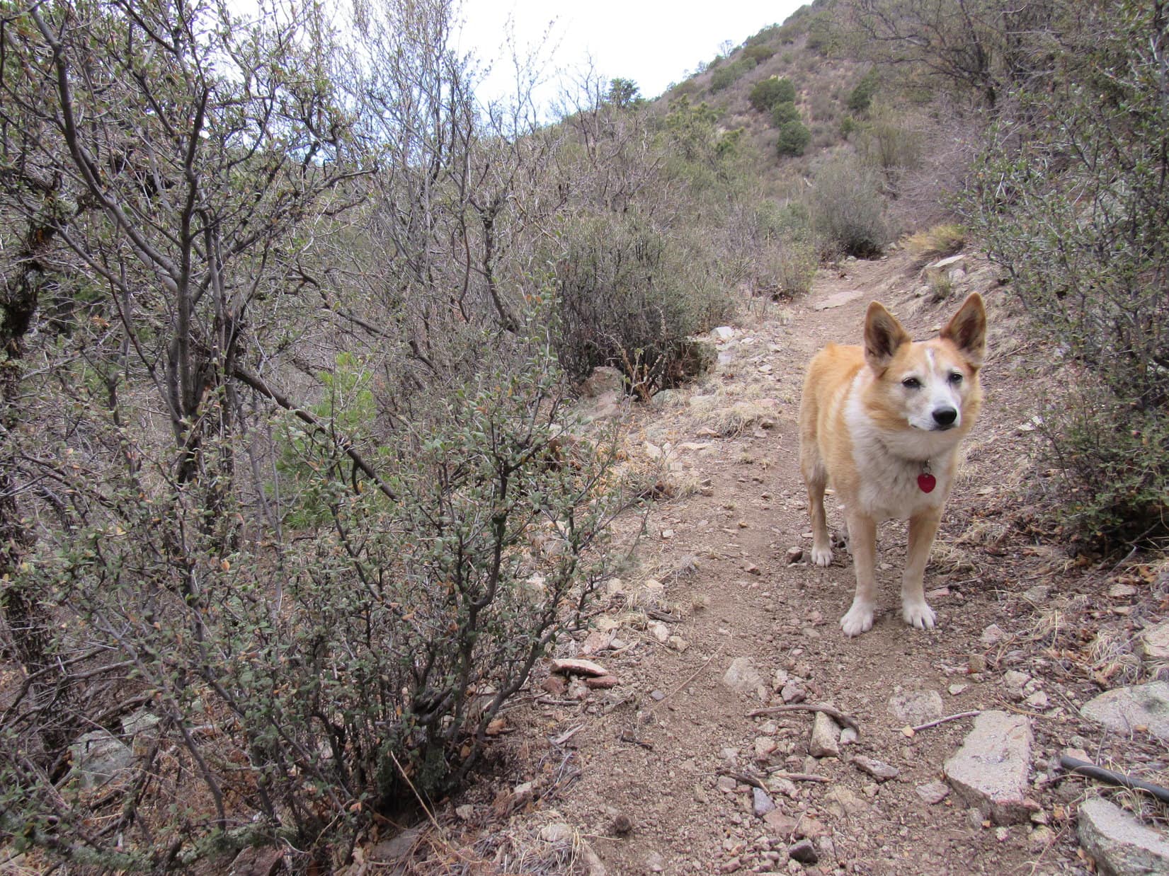
After parking the G6, Lupe and SPHP had taken a short walk up the road. A wall of rock on the other side of Spring Creek had inspired Lupe’s reaction. No bridge across the stream had inspired SPHP’s.
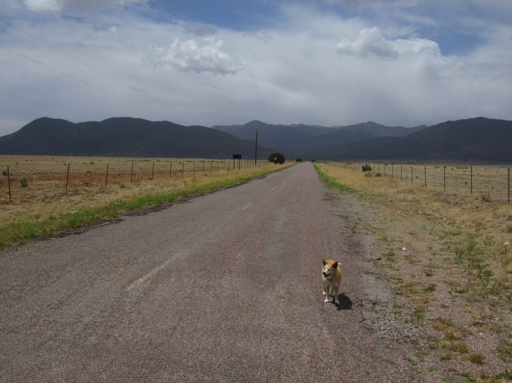
Parked just off USFS Road No. 305 near Spring Creek. Photo looks S.A gorgeous spot from which to start Expedition No. 276! Photo looks S.
SPHP took another look at the topo map. Yeah, this had to be the place, didn’t it? Did appear to be some sort of faint road on the other side of Spring Creek. Kicking boots off, SPHP waded across the stream. Not hard, not deep, but numbingly cold.
C’mon over, Loop!
Lupe ran anxiously back and forth along the bank, but refused to brave little ole Spring Creek. No amount of encouragement could persuade her to make the plunge. SPHP sat down, and started putting boots back on. Suddenly, Loop was right here! A tree trunk formed a partial bridge a little upstream, maybe she had run across it? Whatever she’d done, the Carolina Dog looked pretty pleased with herself.
Oh, aren’t you the foxy one, Miss Dry Paws?
Miss Dry Paws, safely across Spring Creek.
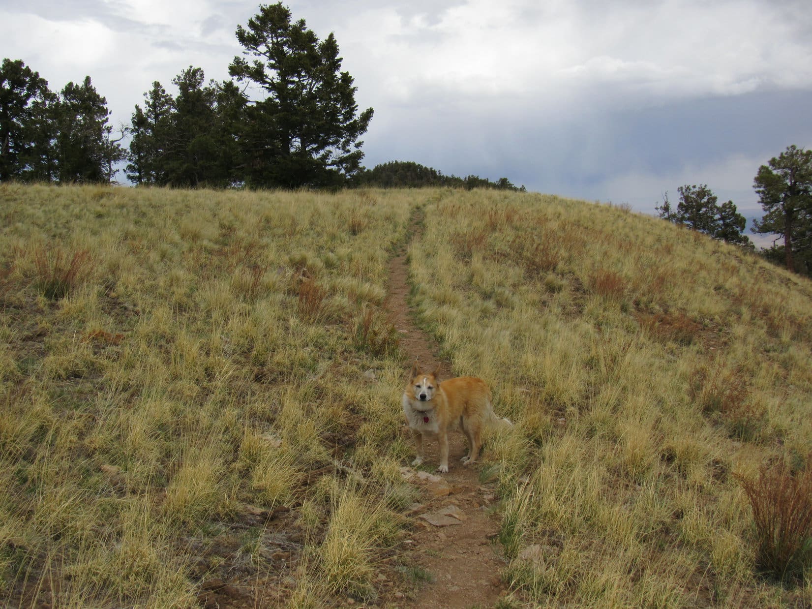
An adventure right off the bat! Ready, Looper? Let’s find out what else Peak6360 has in store for us!
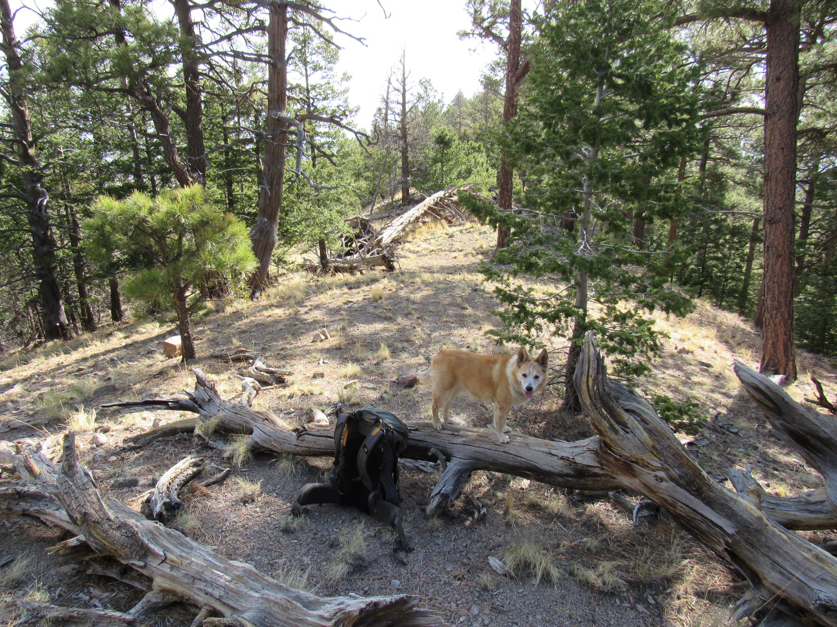
Loopster turned and trotted up what SPHP hoped was what remained of USFS Road No. 305.1H.
By Spring Creek, about to set off for Peak 6360! Photo looks S.
Up a little rise, and the road leveled out in a meadow. For a moment it seemed the road had already vanished, but Lupe quickly found it again heading WNW up a little valley past a stand of naked aspens. No. 305.1H must have been abandoned a long time ago. Among the aspens stood the remains of an ancient cabin that had been, too.
In the meadow. Photo looks W.Wow! This cabin has been here a while! Photo looks WNW.
Just past the cabin, the road made a big snowy curve S, starting to climb out of the valley along a forested hillside. Matched up perfectly with the map. This was USFS Road No. 305.1H, alright!
Leaving the valley. Photo looks SSE.
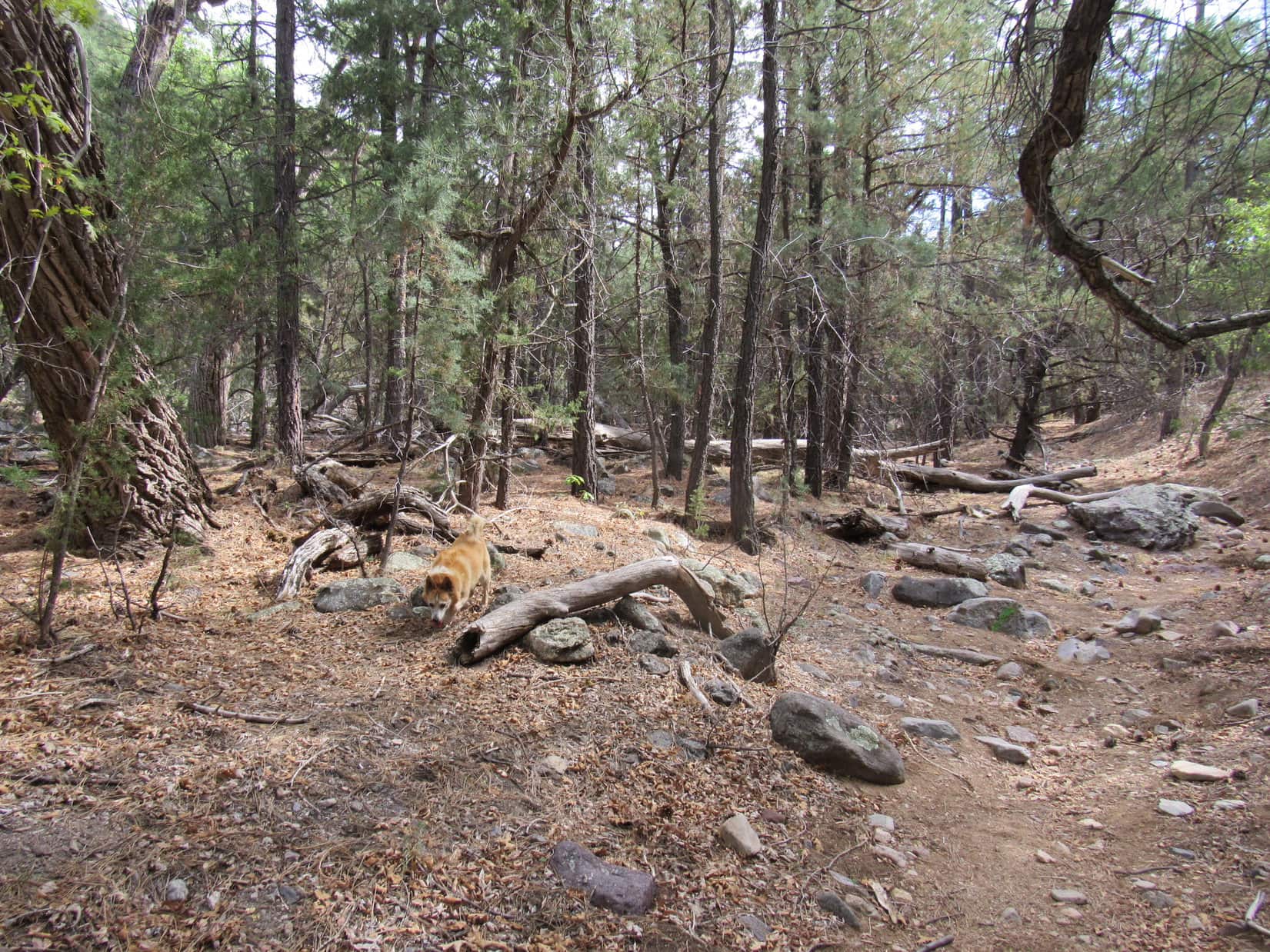
Passing tall pines and spruce, the air was comfortably warm, but a light breeze sometimes carried a fresh coolness aloft. Still snow-covered, the road soon turned E. Lupe trotted ahead without ever breaking through the crust, while SPHP plodded along behind.
Wonder how long it’s been since anyone’s been back here, SPHP?
No telling, Loop. Seems super secluded, doesn’t it?
Rounding the E end of a ridge, USFS Road No. 305.1H curved WSW along the N edge of a hidden valley. Scattered pines and a stand of tall aspens decorated a grassy lowland enclosed by forested ridges. Snow clung to the N slopes. Large rock formations could be seen at several high points way up on the ridgelines. Peak6360 was somewhere up there!
What an awesome place, SPHP! This is amazing!
I’ll say! No one ever sees this, Loop. We are so lucky!
Entering the hidden valley. Photo looks SW.Isn’t this magnificent? I’m loving it! Photo looks SSE.
No. 305.1H wound along the N, then W edge of the valley. A junction where USFS Road No. 305.1K continued S, and No. 305.1H curved away to the W, was barely recognizable. Lupe got on No. 305.1K, following the road until it faded away near the S end of the wonderful valley.
Skirting the valley on USFS Road No. 305.1H. Photo looks SW.Rounding a snowy curve on USFS Road No. 305.1K. Photo looks SSE.Heading for the S end of the valley. Photo looks SSE.
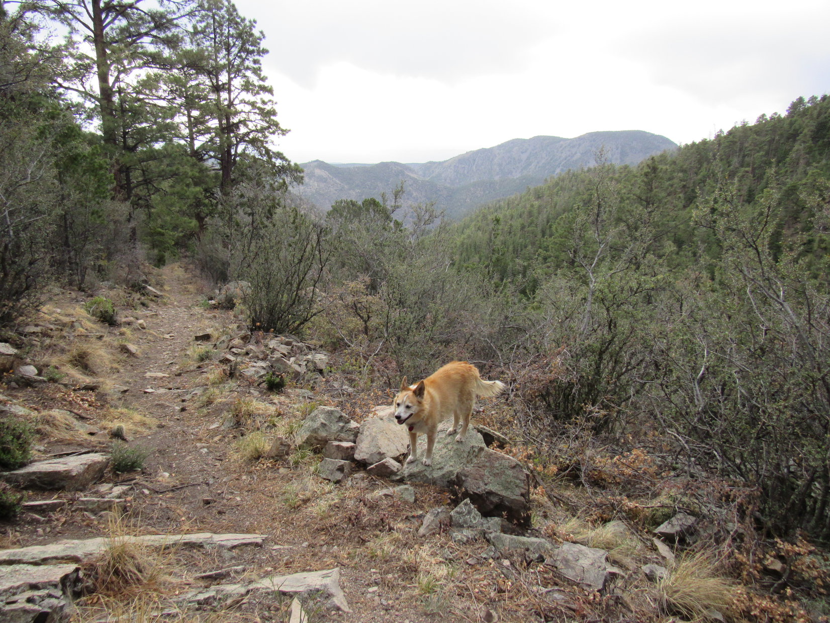
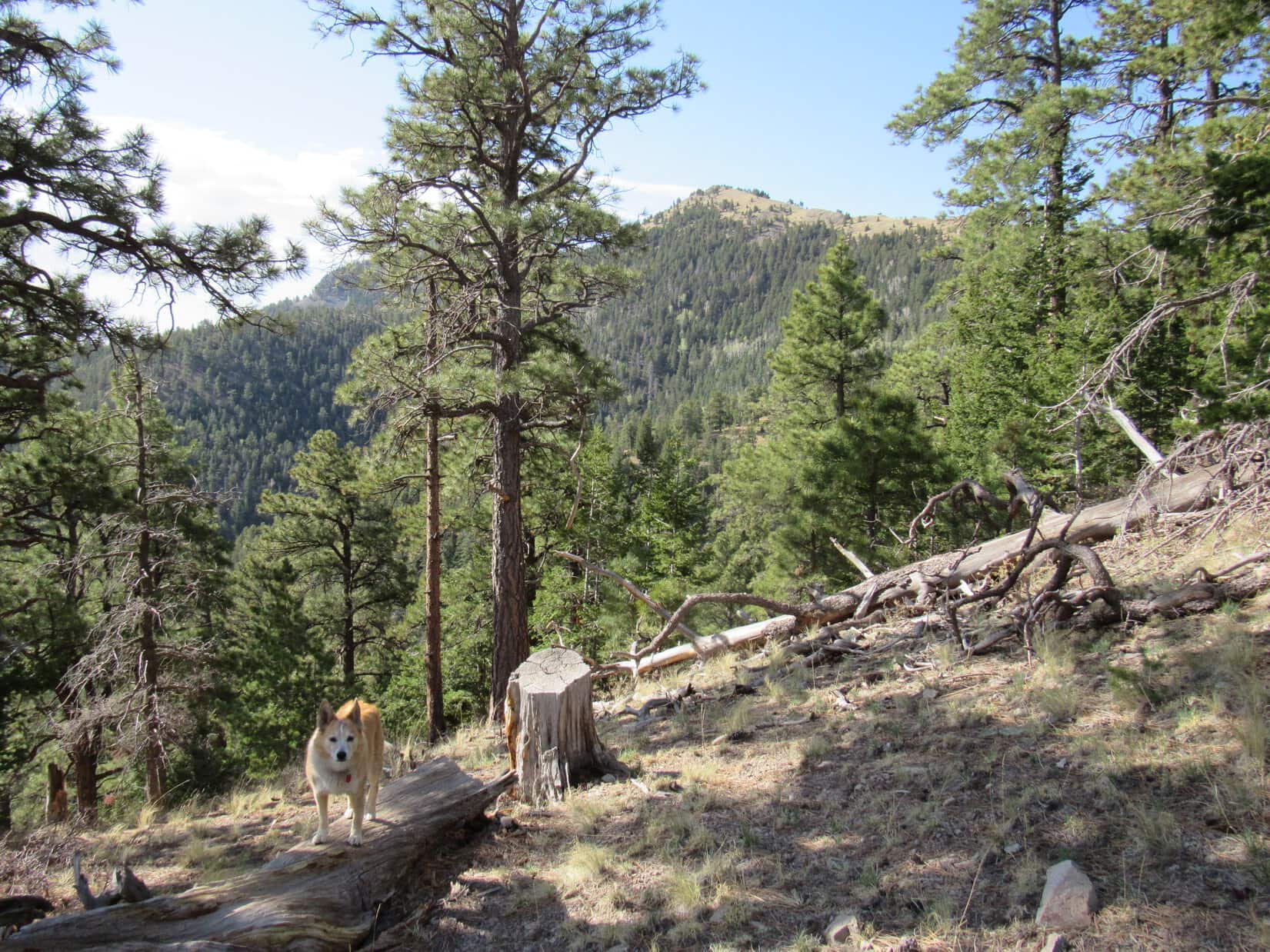
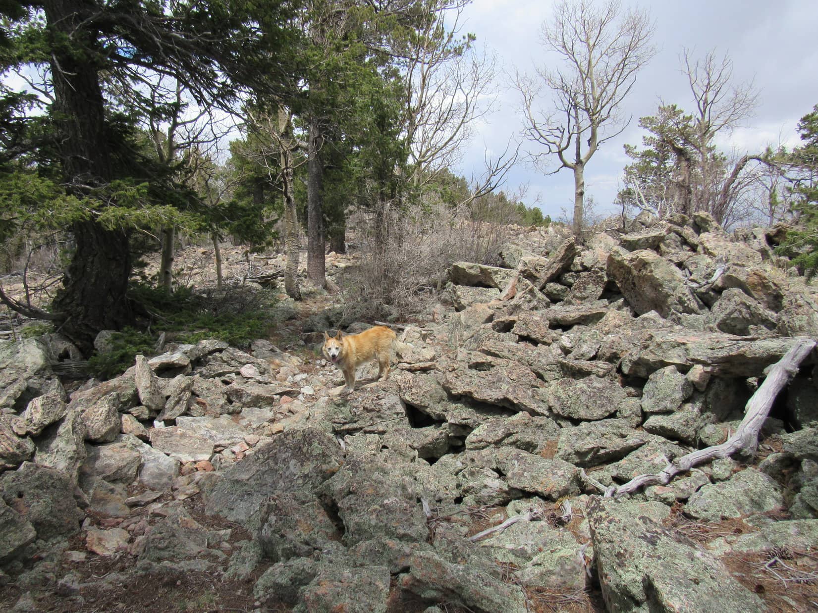
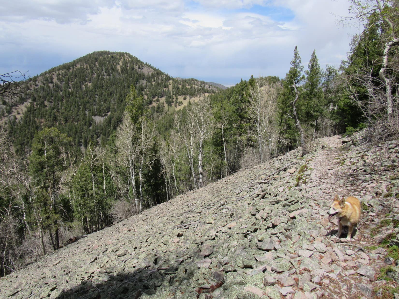
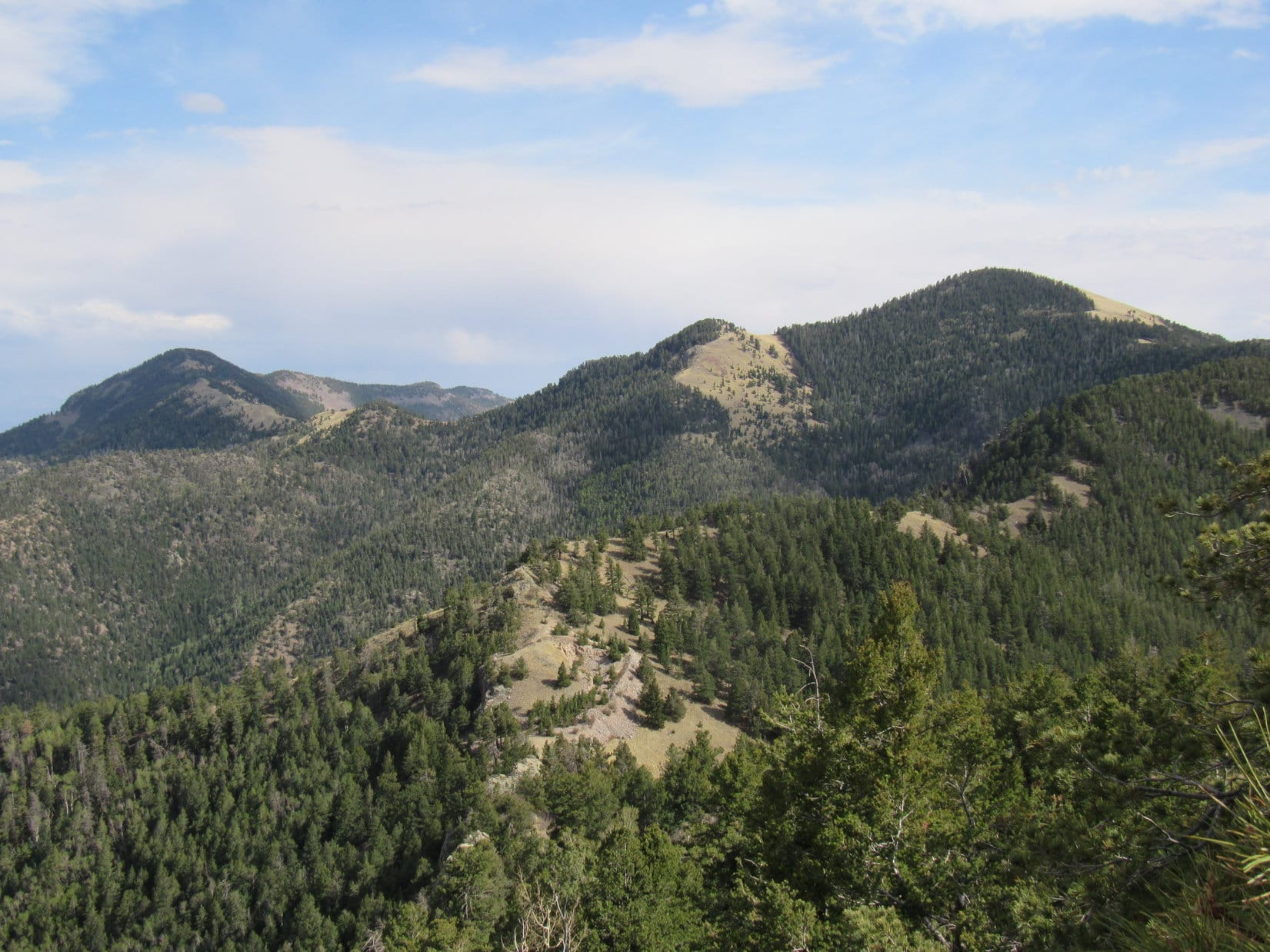
No. 305.1K was on the E side of the valley, just starting to climb, when it finally disappeared completely. A huge rock formation way up on the ridge looked like it might be a problem to get around, so Lupe began her ascent of Peak 6360 aiming S of it. A modest amount of deadfall during the initial part of the climb soon became a wretched relentless jumble.
Enthusiasm was not dimmed. SPHP toiled after her, as Lupe leapt over one obstacle after another. Views kept improving. The sense that Peak 6360 might prove to be a spectacular summit by Black Hills standards kept growing.
Starting to climb as USFS Road No. 305.1K vanishes. Photo looks SSE.Making progress! Photo looks SW.The indomitable Dingo! Photo looks NE.
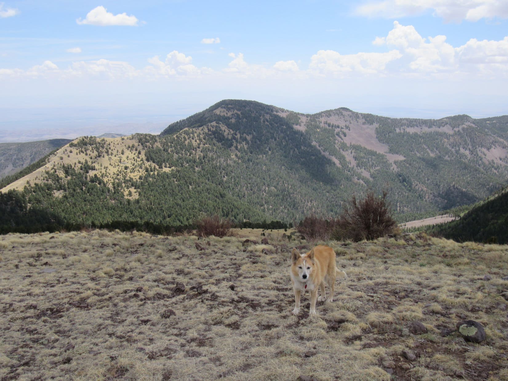
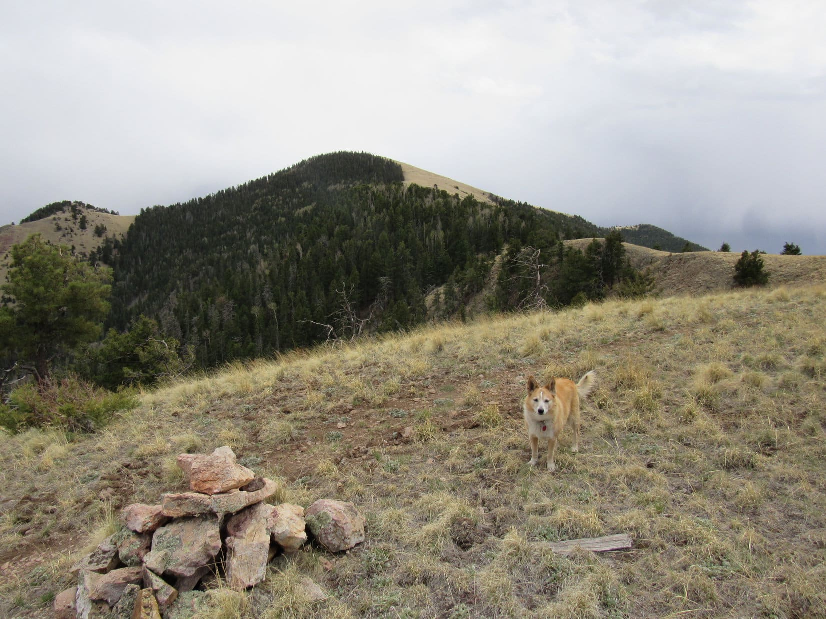
The climb took an inordinate amount of time for the amount of distance covered, but the steepness eventually began to diminish. Lupe reached the ridgeline right where she’d been aiming, a little S of the big rock formation.
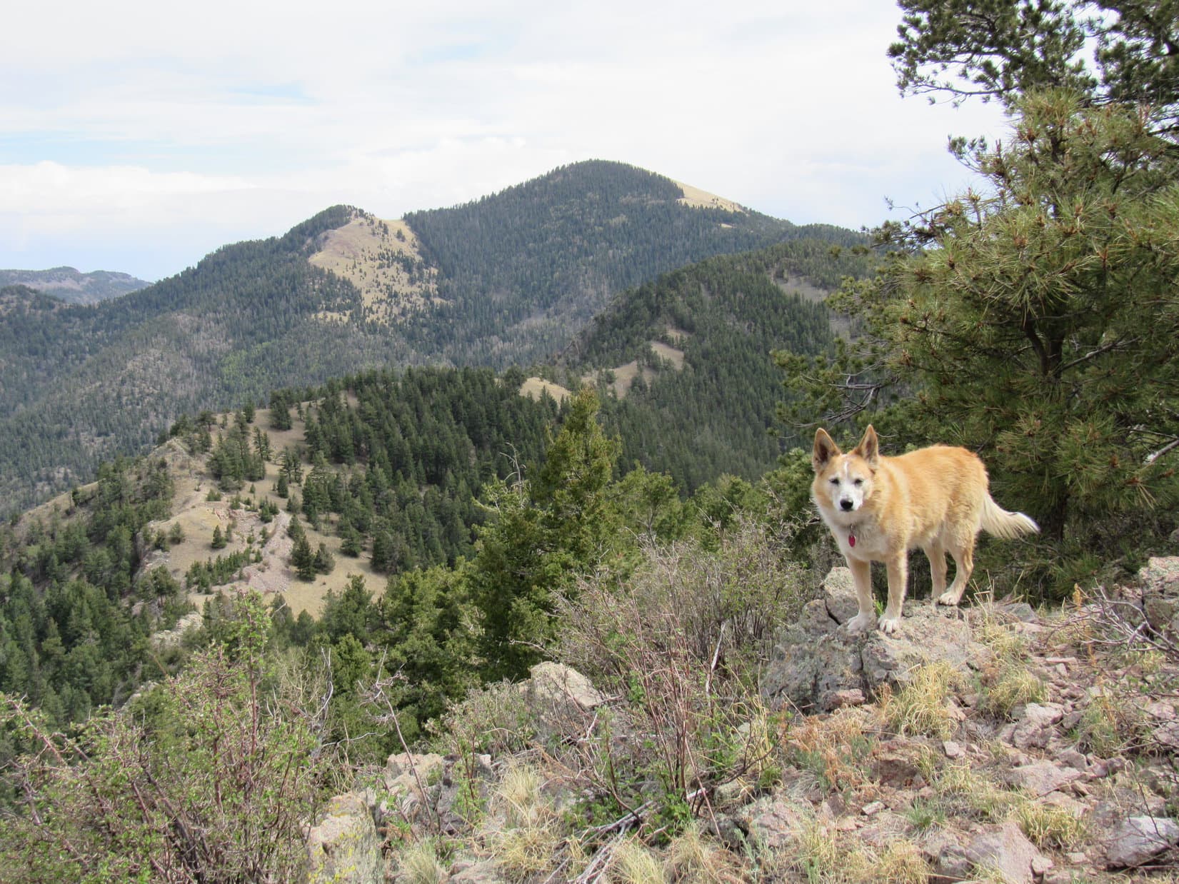
Crossing the narrow ridge, the American Dingo came to a gorgeous view of Saint Elmo Peak(6,458 ft.) and Black Elk Peak(7,231 ft.).
Saint Elmo Peak (L) and Black Elk Peak (R of Center). Photo looks ENE.
Wowee! What a fabulous view, SPHP!
Yeah, it’s incredible, Loop! This is a new perspective! Seems different from what we’ve grown used to, doesn’t it?
It does! Can’t wait till we get to the top! Wonder what we’ll see then?
The top of Peak6360. A gnawing fear had existed ever since Lupe first saw this ridge from way down in the hidden valley. All these big rock formations up along the ridgeline! If the summit was like that, some huge vertical clump of stone, getting to the top might be an issue. Peak 6360 might be beyond the Carolina Dog’s capabilities, and that would be really sad, especially when this whole experience had been so fabulous so far.
Lupe was high on Peak 6360’s N ridge, and probably not too far from the summit. A glance to the S only reinforced the fear of possible failure. 3 rock formations dominated the view. The 2 closest were spiky, but of no concern, since they clearly weren’t the top. The most distant formation, which might well be the true summit, was different. From here it looked exactly like “some huge vertical clump of stone”. Not good!
Looking S along the ridgeline. Potential summit visible near Center beyond Lupe.
Loopster! Scramble up on that closest spiky formation. Let’s see how things look from there.
Hmm. Not any better. The view from the first spike only reinforced the notion that Peak 6360 might well be nigh impossible for a Dingo without genuine rock climbing skills. Looking back N at the rock formation Lupe had avoided by coming up S of it wasn’t much of a confidence booster, either, if that was a sample of what lay ahead.
Looking pretty dicey, SPHP!Peak 6360 summit(?) (Center). Photo looks S.The rock formation (Center) that Lupe skipped by reaching the ridge on this side of it. Photo looks N.
Hard to say. Maybe it wasn’t as bad as it looked? Closer inspection was in order. Picking a way slowly through the interminable deadfall, Loop continued S, working up to and past the 2nd spike.
Be of good cheer! We’re gonna do this! Approaching the 2nd spike. Photo looks S.
Ugh! More big rocks, more deadfall ahead. The summit block looked more intimidating with each step toward it.
Past the 2nd spike, a somewhat disheartening view. Photo looks S.
Peak 6360 was still very cool, though! Although problematic, the rock formations were beautiful and unique. In addition to Saint Elmo Peak and Black Elk Peak, Lupe had a grand view of Elkhorn Mountain(6,381 ft.), Gap Lode Peak(6,560 ft.), Little Devils Tower(6,960 ft.) and Sylvan Hill(7,000 ft.), too.
Saint Elmo Peak (far L), Elkhorn Mountain (L), Black Elk Peak (Center), Little Devils Tower (R), and Sylvan Hill (far R). Photo looks ENE with help from the telephoto lens.
11:43 AM, 52ºF, Peak 6360 – The sky had been clear, a bright blue, when the Carolina Dog set out from Spring Creek, but was mostly cloudy now. Sort of surprising, since the forecast yesterday had been for clear skies all day. Every few minutes, the situation changed from sunlight to shadow or back again.
Lupe had made it to a patch of grass at the intersection of Peak 6360’s 3 main ridges. A glorious spot, but the news could hardly be worse for a peakbagging Dingo. The N ridge was of no concern. That was the way Loop had come up. The true summit clearly wasn’t anywhere along it.
The main problem was just to the SE, right at the start of Peak 6360’s long E ridge. That “huge clump of stone” Loop had seen from the N ridge did appear to be the true summit.
Not happening, is it, SPHP? Looks impossible!
Yeah, sorry Loopster! Most disappointing, but not entirely unexpected as we have seen. Doesn’t appear to be much hope that the other side is any better, either. Probably worse.
500 or 600 feet out on the SW ridge was another, smaller high point. Might have been a glimmer of hope for Loopster, since it looked to be possibly in contention for title of true summit, but to be honest, it didn’t really look like it from here. Had to be close, though!
Cold comfort! The SW high point appeared to be a tight collection of long rocks standing on end. “Fail” written all over it, too.
Peak 6360’s SW high point (R of Center). Photo looks SW.
Well, might as well see what we can do here, Loop. Looks like you can get pretty close to the top. Maybe there actually is a way up?
The American Dingo headed for the E summit block and began to climb.
Loopster got pretty high, but not all the way to the top. A snow-covered shelf on the N side of the formation was as far as she could go.
As high as Loop got on the E summit block. Photo looks WNW.
SPHP had tagged along, of course. No way to boost Lupe any higher. The rock walls were simply too tall. No safe route back, even if she could get higher. Yeah, this was it.
How much farther is it to the top, SPHP? Can you tell?
Eh, I’d say at least 10 feet, Loop, no more than 20.
So, what now?
Guess we’re done. No sense breaking our necks doing something stupid. Stay here, I’ll go back down and take your picture.
As SPHP turned to head down, a sudden gust of wind ripped SPHP’s hat off. It went tumbling down the S side of the rock formation.
My Alaska cap!
Can you still see it, SPHP?
Yeah, about 15 feet down.
15 feet! Can you still get to it?
Not from here, Loop! However, looks like I can climb up to it from down around the S side. Anyway, stay where you are. I’ll get that picture!
As high as Lupe got on the E summit block. Photo looks SE.
Alrighty! Got it!
Lupe came bounding down, rejoining SPHP at the little grassy patch.
Shall we go get your cap, SPHP?
Naw, not yet. It’s on the lee side now, so it isn’t going anywhere for the time being. Let’s take a break.
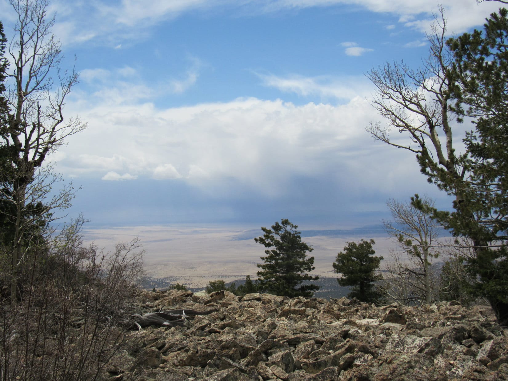
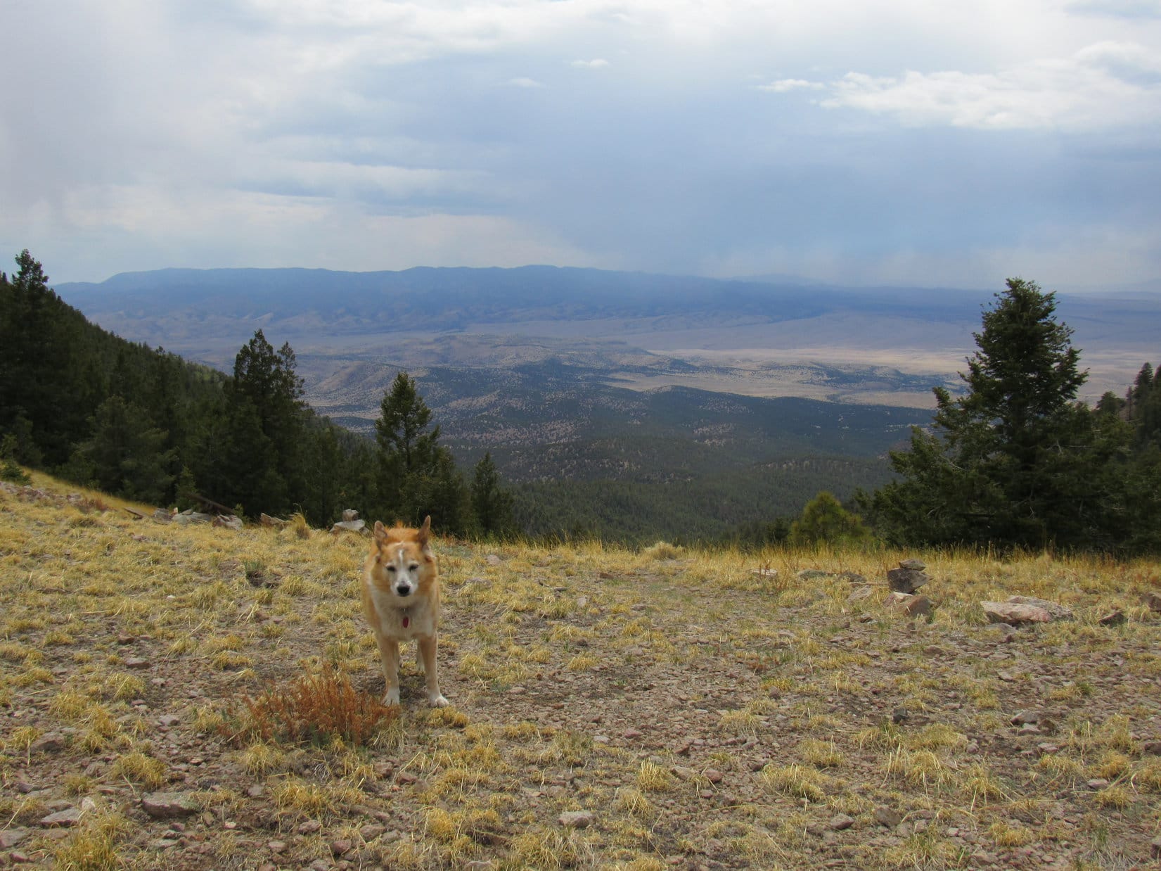
A chocolate coconut bar. A little Taste of the Wild. That was about it for refreshments. The sky darkened. A few snowflakes sailed by. Nothing serious. Lupe and SPHP sat on the grass contemplating the unbeatable E summit block. In addition to the magnificent views to the ENE, there were interesting sights in other directions, too.
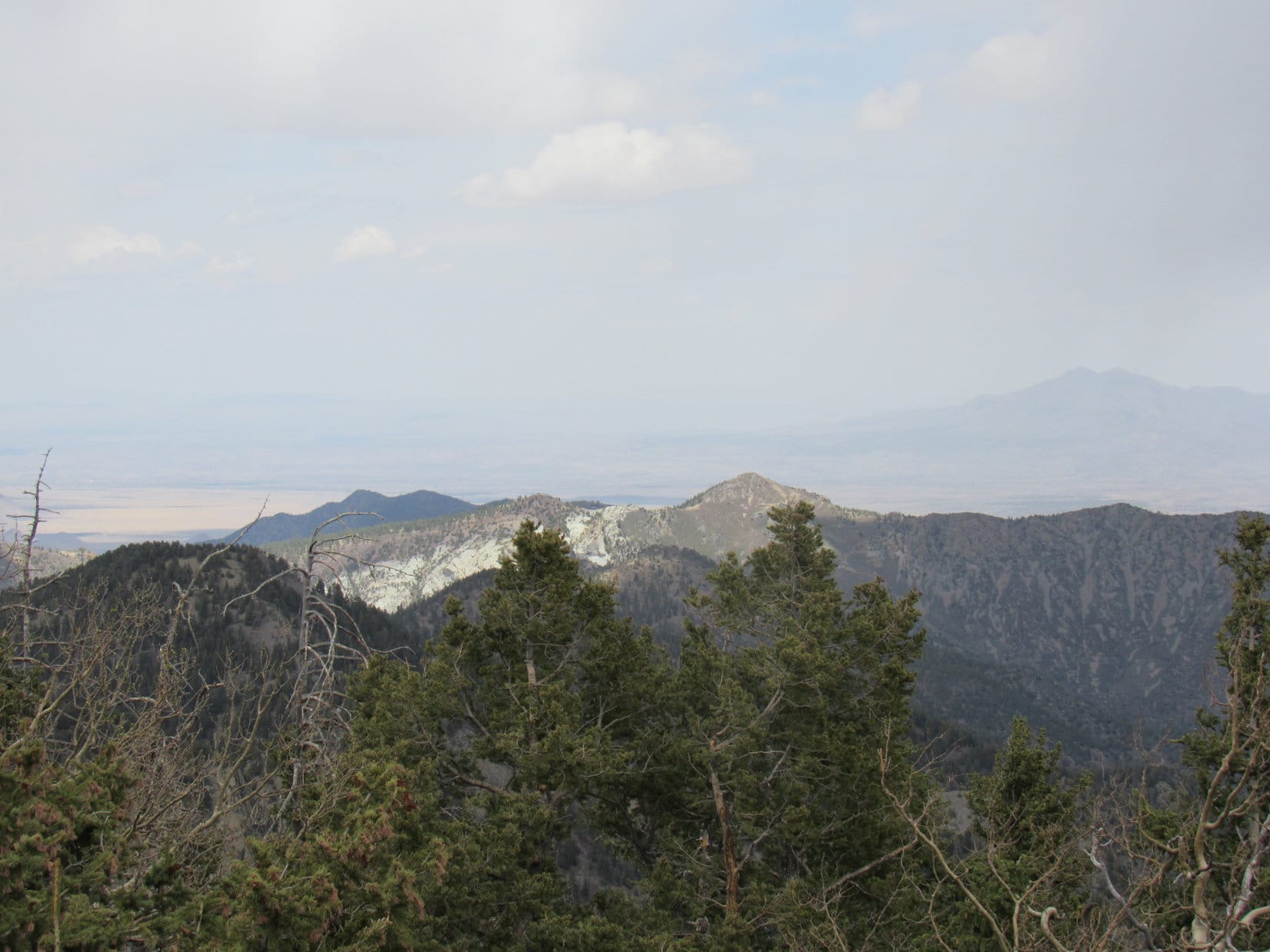
A line of big ridges along the E edge of the limestone plateau country was visible off to the W. Some of the highest ground in the Black Hills was over that way. The fire lookout tower on Bear Mountain(7,166 ft.) was visible to the naked eye, but didn’t show up on a photo. Zimmer Ridge(6,600 ft.) was 3 miles NNE.
The break area is the patch of grass seen on the L. Photo looks NW.Bear Mountain (R). Photo looks W with help from the telephoto lens.Zimmer Ridge (Center). Photo looks NNE.
Cap time, SPHP?
Yeah, let’s go get it. Don’t want to lose my Alaska cap!
To get to the cap, Lupe first had to go down the S side of the ridge a little way. The views in this direction were also quite impressive! Wasn’t that Northeast Cicero Peak(6,240 ft.) on the far horizon? SPHP was almost certain it was. Lots of rugged terrain closer by, too.
Northeast Cicero Peak (Center) on the far horizon. Photo looks SSE.
While Lupe waited below, SPHP managed to climb 25 feet up a narrow chute, successfully retrieving the Alaska cap. A little farther down to the SE was a fairly large rock formation that looked like it might be worth visiting just for fun. However, the American Dingo had barely started toward it, when SPHP noticed another chute heading up the S side of the E summit block.
The chute was long, and very steep, but maybe doable! And weren’t those little trees visible at the upper end the same ones that Lupe had seen from the other side that were right up on top?
Loopster! Let’s check this out! Maybe, maybe, baby!
Partway up the S side chute. Photo looks NE and up!
Getting a little scary, but not much farther to go. 15 feet? Lifting Lupe, SPHP held her aloft.
Climb, Loop, climb! You can do it!
A tiny little spot where she could sit was just ahead, but the American Dingo absolutely refused to try for it.
Your certifiable, SPHP! Put me down! NOW!
Lupe scampered lower as soon as SPHP complied.
Alright! Stay there, Loop. We’re a team! I’ll go up and tag it for the both of us.
Fine! Have at it! Be my personal representative, SPHP.
A few feet higher, and hmm. The Dingo was right. Any halfway decent rock climber could do this, but SPHP didn’t have those credentials. Not even a wannabe. Too scary. Not a high enough percentage play. SPHP retreated. So close, but defeated again!
Congratulations, SPHP! You do have a few brain cells left!
Yeah, maybe one or two. Let’s go take a look at that other formation now, just for kicks.
The lower formation was a very scenic spot.
Loop (Center) on the lower formation. Photo looks SE.S side of Peak 6360’s E summit block from the lower formation. Photo looks N.
Peak 6360 has been quite the experience, SPHP, but are we about done?
Almost. One more thing though, Looper! We ought to at least go over to the SW high point and poke around a bit.
Point “Fail”, you mean?
Hah! Yeah, that’s the one. Shouldn’t take long.
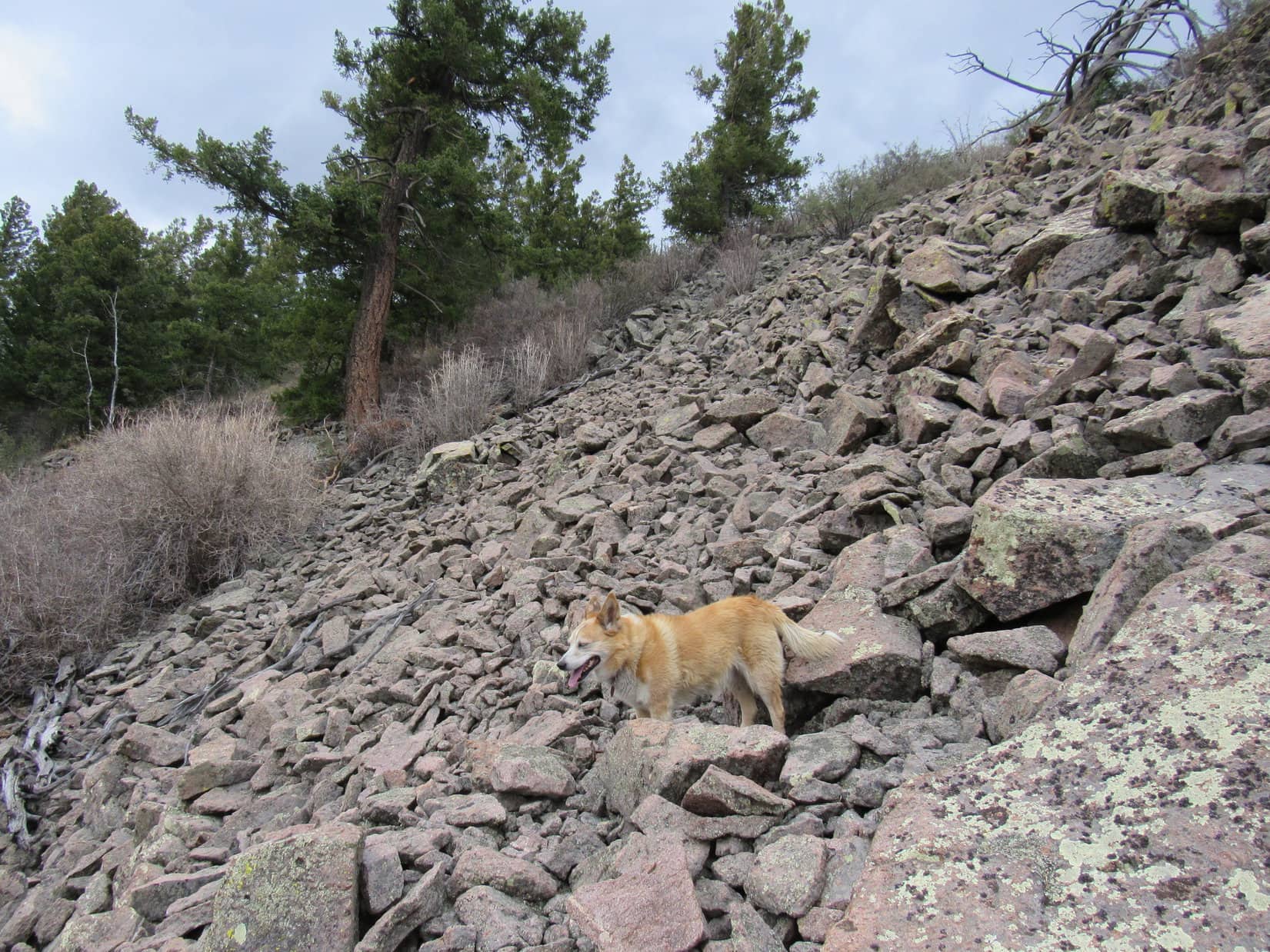
Except for the deadfall. Every movement up here on Peak6360 took a month of Sundays, but Lupe was willing, so the slog began.
Holy smokes, Loopster! You can’t be far from the top! Stay right there. I’m coming up!
Lupe sat among bare-branched little bushes in a cleft way up on the NE side of the SW high point. Much to SPHP’s surprise, it hadn’t been that hard to get this far.
In the cleft high on the SW summit. E summit block (R), and Saint Elmo Peak (far R). Photo looks NE.
SPHP scrambled up next to Looper. Hardly any room, but what a view! An exciting one to be sure. Lupe appeared to be just as high, if not a bit higher than that dang E summit block!
Careful, Loop! Don’t move! You’ve got some big drops right next to you!
An airy spot on the SW summit block. E summit block (beyond Loop), Saint Elmo Peak (Center), Black Elk Peak (R) and Little Devils Tower (far R). Photo looks NE.
SPHP stood next to a couple of skinny rocks jutting higher. Couldn’t reach the top of either of them with a hand, but tapped both tops easily enough with a broken hiking pole that was only 2.5 feet long.
Cheating! And not good enough, at that. Just a little farther SW were more rocks a few feet higher yet. So close, but no way to get to them. A crying shame! Probably Peak 6360’s true summit. SPHP would almost bet money on it.
Top of the SW high point, likely Peak 6360’s true summit. Photo looks SW.
Lupe was in a precarious spot. Better get down! SPHP retreated.
Starting down. Zimmer Ridge (L of Center), Peak 6360’s E summit block (R). Photo looks NE.
Lupe picked her way down to a viewpoint S of Point Fail. Great stuff, but by now SPHP was more interested in the view of Point Fail itself from this direction.
A little farther down the SW ridge. Black Elk Peak (L), Little Devils Tower (Center) and Sylvan Hill (R). Photo looks E.Peak 6360’s SW summit block. Photo looks NNW.
Another go at it, SPHP?
Yes! Let’s try it from the SW!
Through the deadfall, then another scramble higher. Nope.
First try from the SW. Photo looks NE.
Wrong route. A better one existed closer to the highest rocks, but clearly Lupe’s last chance! Before going over there, another rest break was in order. This time the Carolina Dog put a serious dent in the Taste of the Wild supply.
Atlantic Hill(6,393 ft.) was in sight. The original plan had been to climb it, too.
Atlantic Hill (far L). Photo looks SW.
Ready to do this, Loopster?
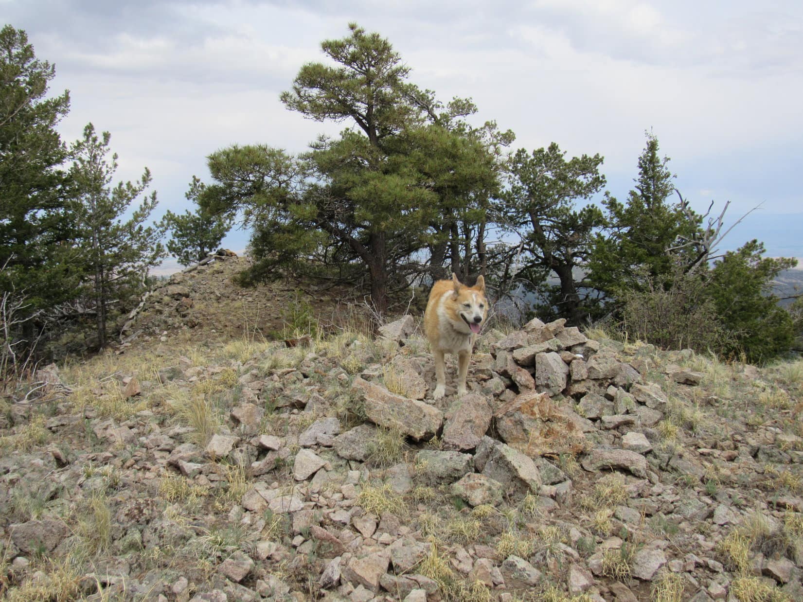
The American Dingo was, but she couldn’t. Climbing right along the SW side of the SW summit block, Lupe got up to a decent-sized shelf that was probably just as high as the cleft she had reached on the other side of the formation, but could go no higher. Within 10 or 15 feet of the top and right next to it, but that was it.
Lupe was done.
As high as Lupe got W of the SW high point. Not far from the tippy top! Photo looks N.
Her personal representative wasn’t.
The wall of rock next to the shelf had a few narrow little footholds. The rock was super solid with decent handholds, too.
Stay here, Loop! I’ll give it a go!
A little bit of rock climbing, and SPHP’s head was right next to and a foot higher than the highest rock on Peak 6360.
Woot! Peak6360! We did it, Looper! At least, we’re claiming it!
Are you at the top, SPHP?
I’m looking right at my R hand gripping the top of the highest rock.
Oh, that’s excellent! Close enough for Dingo work! Enjoy the view, then come on down!
No letting go! One-handed, SPHP snapped a few pics.
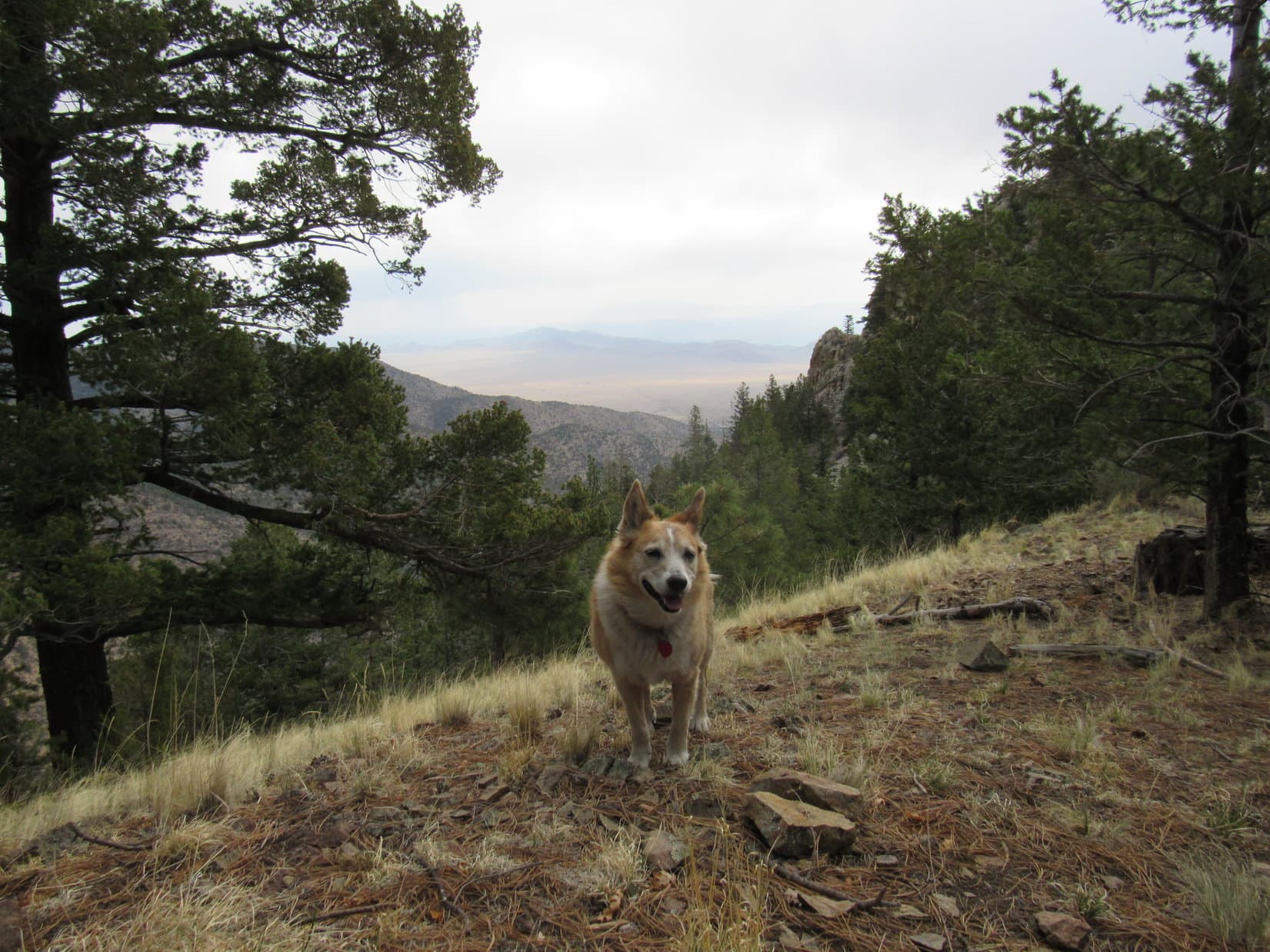
Peak 6360 true summit!Peak 6360’s E summit block (L), Saint Elmo Peak (Center), Black Elk Peak (R). Photo looks ENE.The cleft Lupe had made it to during her attempt from the NE side is seen toward the R. Peak 6600 (far L), Zimmer Ridge (Center) and Peak 6360’s E summit (far R) in the background. Photo looks NE.Loopster waiting below. Hidden valley (far R). Photo looks WNW.
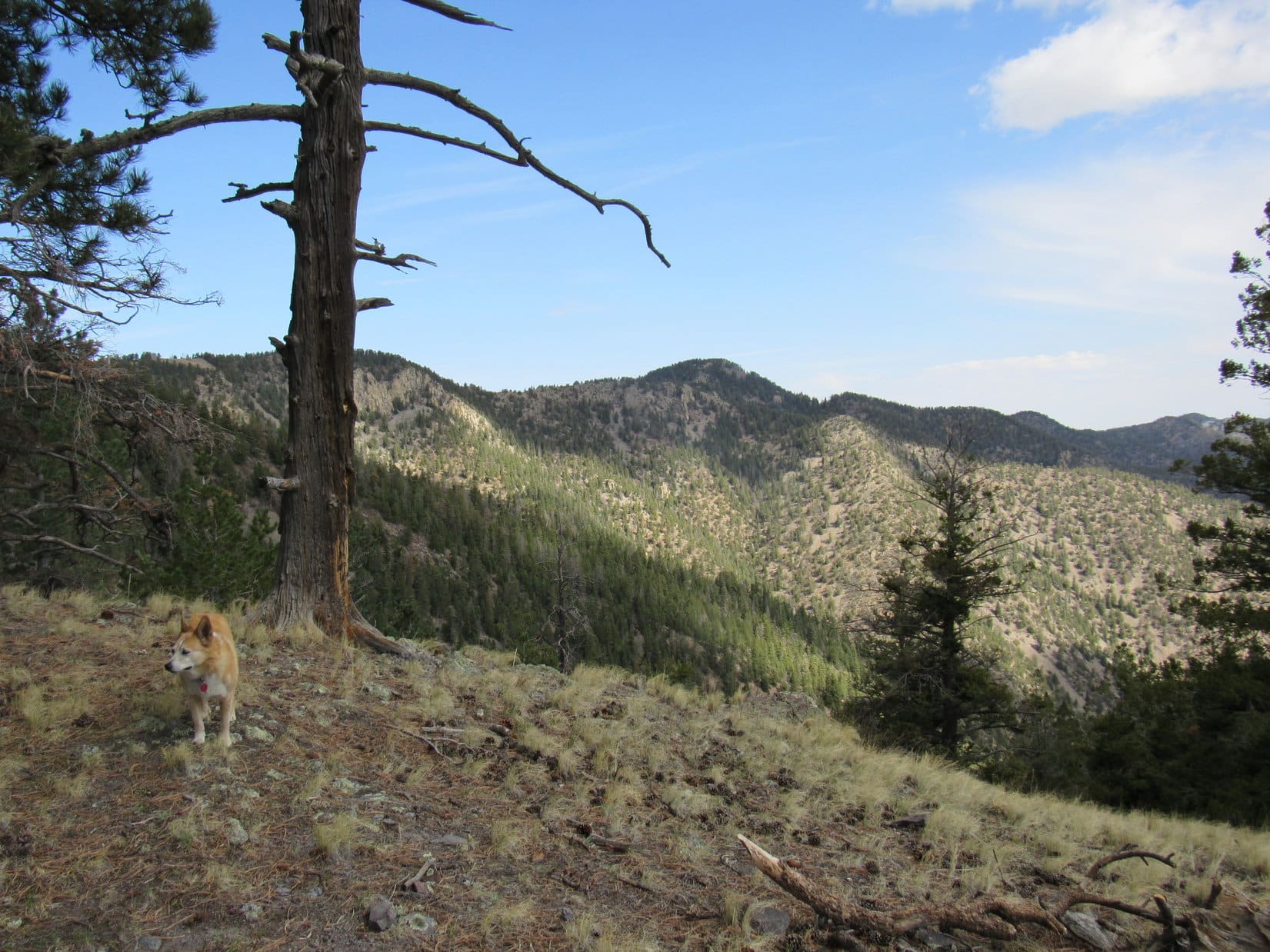
2:39 PM, Peak 6360’s SW ridge – Well, it was over. After going a little way down the S side of Peak 6360’s SW ridge, Lupe had found a pass through the rocks. She now stood looking at the descent back down to the hidden valley. It was an awesome view!
Medicine Mountain(6,878 ft.) and the lofty ridges of the E edge of the limestone plateau were to the NW. Almost directly N, Peak6720 and Peak6600 were in sight, too.
Too late in the day to consider trying to go all the way to Atlantic Hill. Sad, because it looked like a fun trek, but Peak 6360 had chewn up too much time. Worth it, though! What a memorable peak 6360 had been!
About to head down. Photo looks SW.
This was a different route down, a steep N slope with 2 feet of snow in addition to all the deadfall. The descent took a long time, but there was no hurry, and Lupe got to enjoy the views until they sank out of sight.
Peak 6720 (L) and Peak 6600 (R). Photo looks NNW.Limestone Plateau (L) and Medicine Mountain (R of Center). Photo looks NW.Heading down. Photo looks S.Looking back. Photo looks SSE.
Past the last of the deadfall, the trek back through the hidden valley was a joy. Easy, beautiful, and Peak 6360 had ultimately been a success! The only bad part was that the delightful return was over way too soon.
Re-entering the hidden valley on the way back from Peak 6360. Photo looks NNW.
4:01 PM, 54ºF, Spring Creek –
Oh my gosh, Lupe! Are you alright? Is that how you did this before?
Right through Peru, baby! Upon reaching Spring Creek again, SPHP had waded across without the slightest hesitation. No bothering with taking boots off this time. They weren’t waterproof, and with all the snow on Peak 6360’s N slope, SPHP’s feet were already soaking wet.
Immediately after getting across, though, SPHP had turned to see Lupe, anxious because left behind, take a running start and hurl herself in one mighty leap over the stream. She barely made it, and landed with a hard thud against the bank.
Did you break a rib, Loop?
Nope! The Carolina Dog looked a bit sheepish, but she was fine. Peak 6360 adventure complete! Onward, puppy ho!
Days 7 & 8 of Lupe’s 1st Summer of 2021 Dingo Vacation to New Mexico!
5-14-21, 11:48 AM, W of Socorro – This must be the place! The plaque Lupe stood next to squinting in the sunlight mentioned both South Baldy, high point of the Magdalena Mountains, and Water Canyon. No doubt the paved side road leaving Hwy 60 here was either USFS Road No. 235, or would turn into it at some point.
Magdalena Fault plaque at the turn off Hwy 60 to Water Canyon. Photo looks NW.On the road to Water Canyon. Photo looks SW.
The pavement ended 4.7 miles from Hwy 60 at a picnic ground where the road divided. Straight ahead was a parking area next to a green field. No. 235 made a jog to the L before disappearing up Water Canyon. The other choice was a R turn on a road that wound a short distance up to the Water Canyon campground.
Water Canyon from the road to the campground. Photo looks ENE.
Are we going to climb South Baldy(10,783 ft.), SPHP?
Yeah, but not today, Loop. Not after Sierra Blanca(11,973 ft.) yesterday. Let’s hang out here in Water Canyon and recuperate. You can doze or sniff around while I catch up the trip journal.
Still plenty of time, SPHP! Why waste it? Didn’t you say that Jobe just drove his Rubicon to the top, or close to it? And Covill told us something like that, too, when we visited him just the other day. With our new RAV4, we ought to be able to knock out South Baldy this afternoon!
True enough! I read Jobe’s trip report, and he didn’t seem to think much of this one, basically just a drive up. And Dave did more or less agree.
So, here we are! Let’s get with it, SPHP!
Oh, I don’t know, Loop. South Baldy is a big mountain. 3,800+ feet of prominence and high point of the Magdalena Range. Hate to trivialize it by simply driving to the top. Sometimes the experience is what you make of it. There’s a South Baldy trail that goes most of the way, and I was thinking it might be more fun to explore the trail.
And a lot more work, too! Not terribly efficient, SPHP, but I’m fine with it, if that’s what you want to do. Remember to bring plenty of water, though! For a place named Water Canyon, I’m sure not seeing any.
The campground was free, so SPHP grabbed a spot. By late afternoon, despite several brief sniffs around the campsite, Lupe was bored.
Magdalena Mountains from the campground. Photo looks SSW.
Got that trip journal caught up yet, SPHP?
Yup! Just finished! Want to take a stroll up Water Canyon, Loop?
The Carolina Dog did. SPHP drove back down to the parking area next to the green field, and Lupe set out across it.
Crossing the field. Photo looks NE.
It was hot out in the sun. Fortunately, the forest beyond the green field provided plenty of shade. Lupe discovered a trail near a dry stream bed. Not a drop of water anywhere, but she had a good time exploring.
Exploring WaterCanyon.
After nearly 0.75 mile, Loop came a narrow gorge of exposed blue-gray bedrock worn smooth by water in some wetter era. A tiny trickle ran down these rocks into a single small pool below.
Look at this! Actual water in Water Canyon!
The murky pool was scarcely big enough to accommodate Lupe, but she plunked herself right down in it, emerging two-toned moments later, her lower half black with mud.
That felt great! So refreshing! You ought to try it, SPHP!
Umm, yeah. Thanks, but no thanks! Glad you enjoyed it, but you’re not getting into the new RAV4 dripping with mud like that.
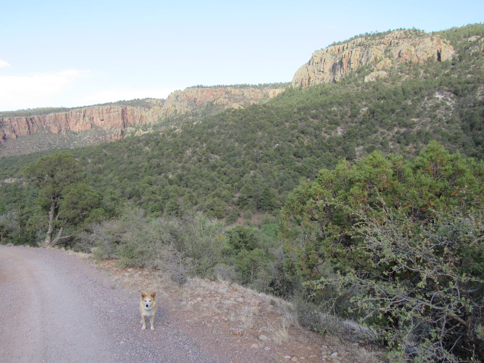
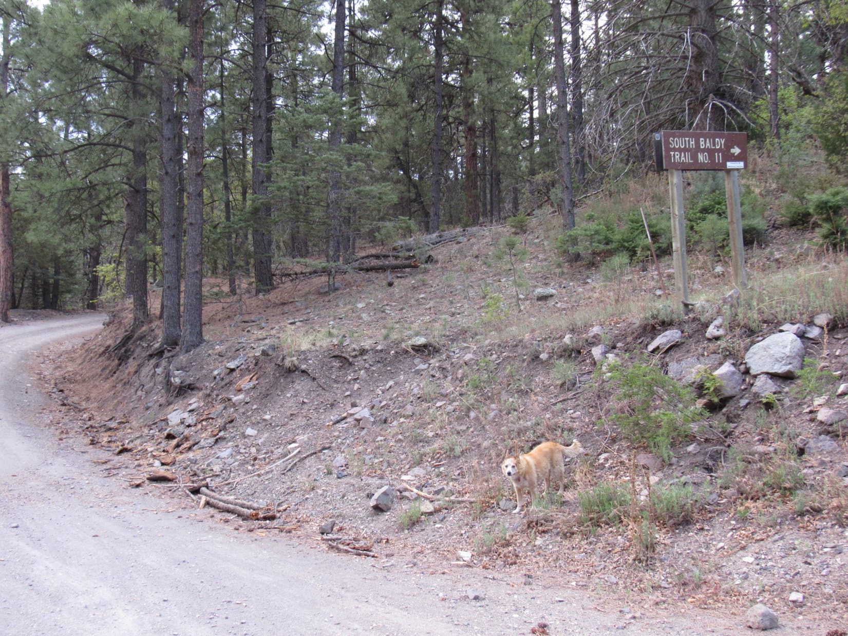
To forestall any possibility of Miss Mudhole returning to the RAV4 before thoroughly dried out, further reconnaissance was done in this region. Turned out that the Mesa Trail No. 13 trailhead was located just above the mudhole. USFS Road No. 235 went right by it. A sign warned that only 4WD vehicles were allowed beyond this point, at least somewhat vindicating the decision to spare the new RAV4 such abuse.
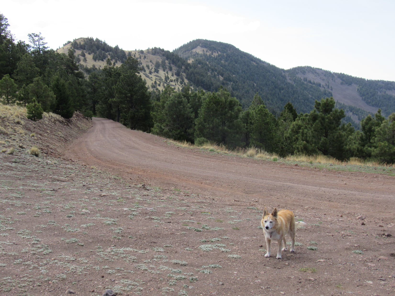
5-15-21, 5:30 AM, 59ºF – SPHP parked the RAV4 at the Mesa Trailhead, and Lupe got off to an early start. The sign lied. Not a darn thing wrong with this road! The G6 could have made it. Climbing steadily, USFS Road No. 235 headed up Water Canyon, so wide and smooth that it made the whole excursion rather dull. Lupe passed a series of small blue and white numbered signs. Interest in them faded once SPHP realized they marked the locations of culverts under the road. Such exciting stuff!
After more than a mile, the road curved sharply L. A sign appeared up on an embankment on the R. South Baldy Trail No. 11! Did anyone bother taking it anymore? Or does everyone just drive to the top? Maybe the trail had fallen into such disuse that it would simply fade away? The American Dingo was about to find out.
Leaving USFS Road No. 235.Setting out on South Baldy Trail No. 11.
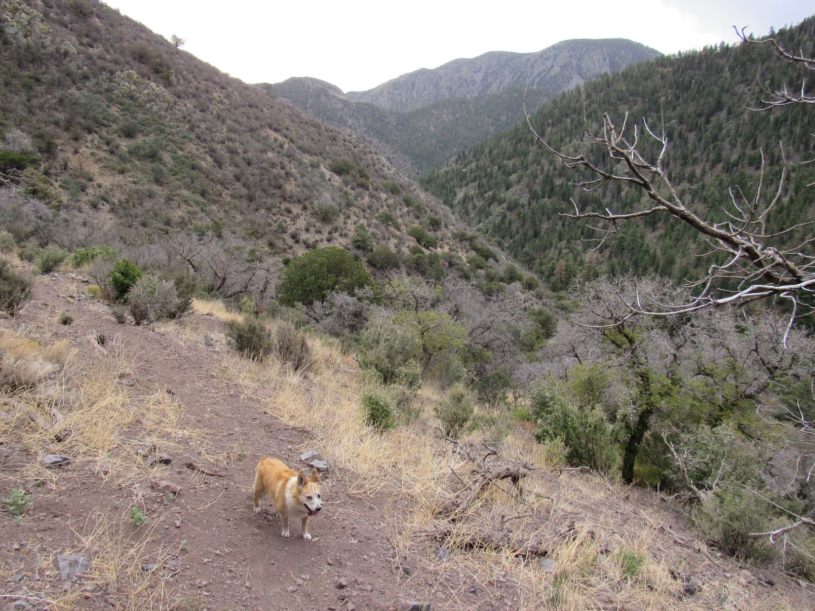
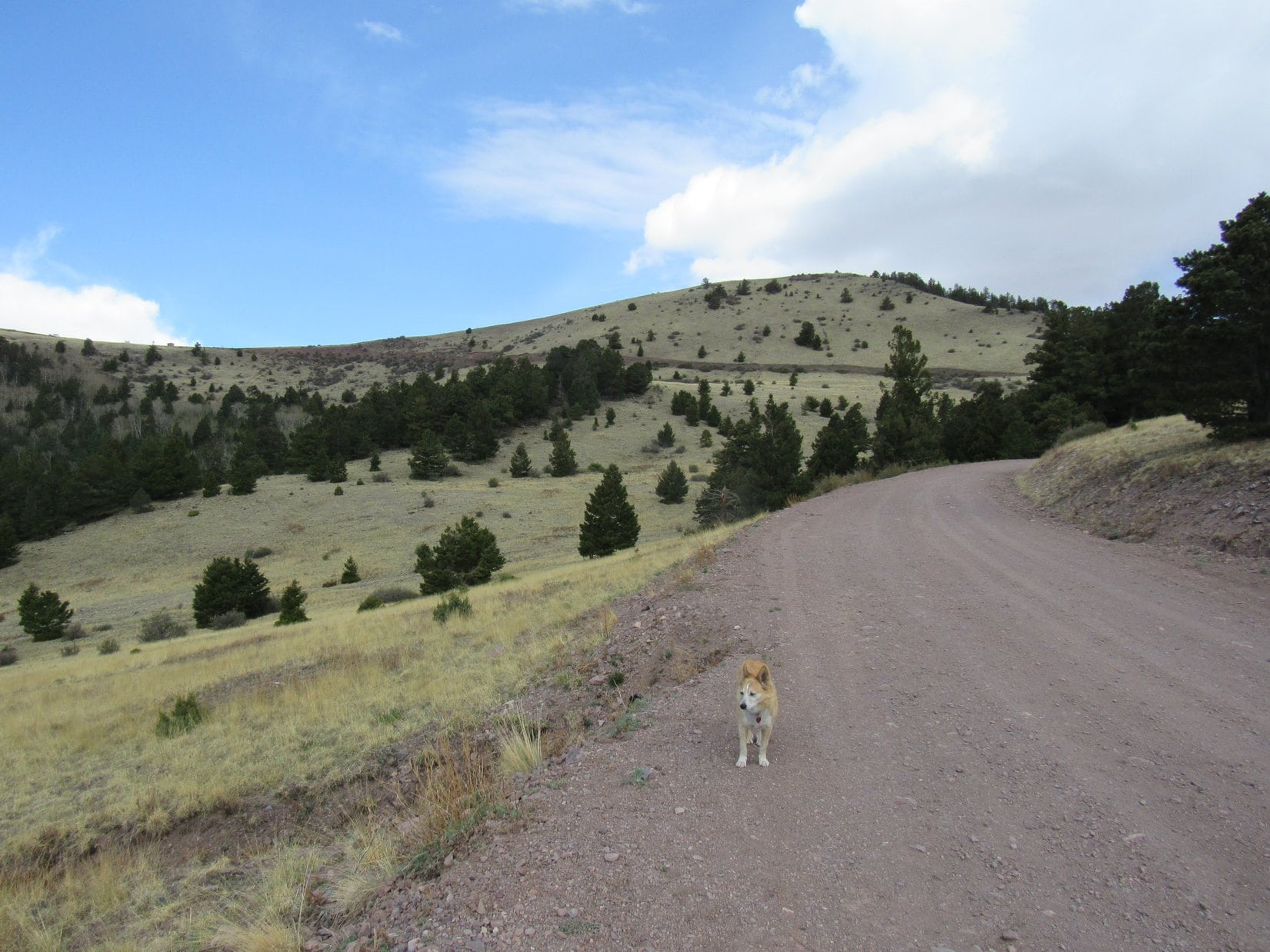
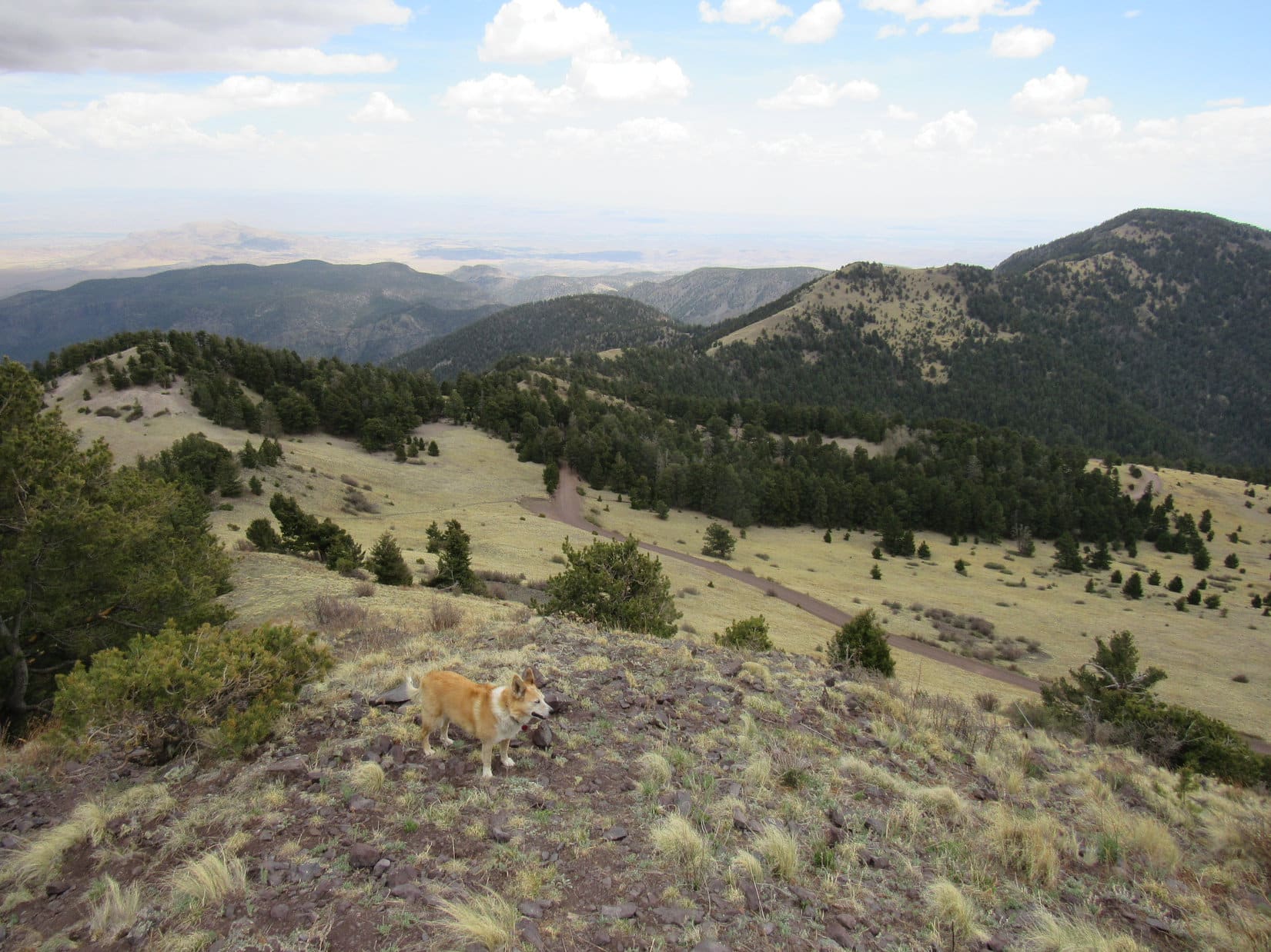
South Baldy Trail No. 11 turned out to be a good single track. Heading W, Lupe climbed steadily along the S side of a forested canyon. Not much to see at first except the forest, but the seclusion was fabulous! Much better than the road hike had been!
After nearly 0.75 mile, the trail crossed over to the N side of the canyon. Fewer trees grew on this slope, although there were still many bushes. At 8,280 feet, Lupe came to a switchback where there were initial views back down the canyon, and of a partially forested high point to the S.
Hey, Loop! That might be South Baldy!
Canyon view after passing the switchback at 8,280 feet. Buck Peak(9,085 ft.) (R). Photo looks SE.South Baldy in the distance on the L? Photo looks SSW.
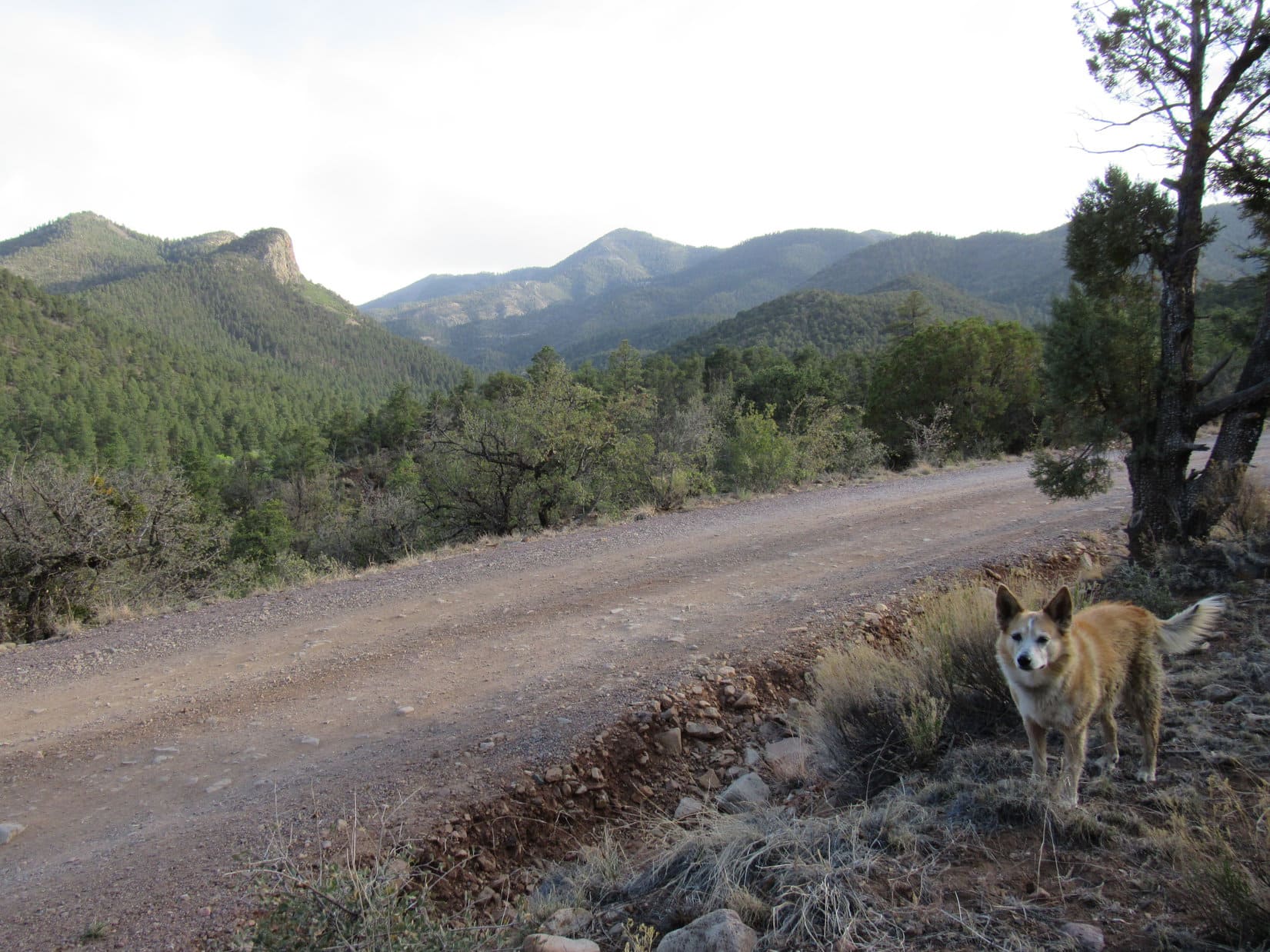
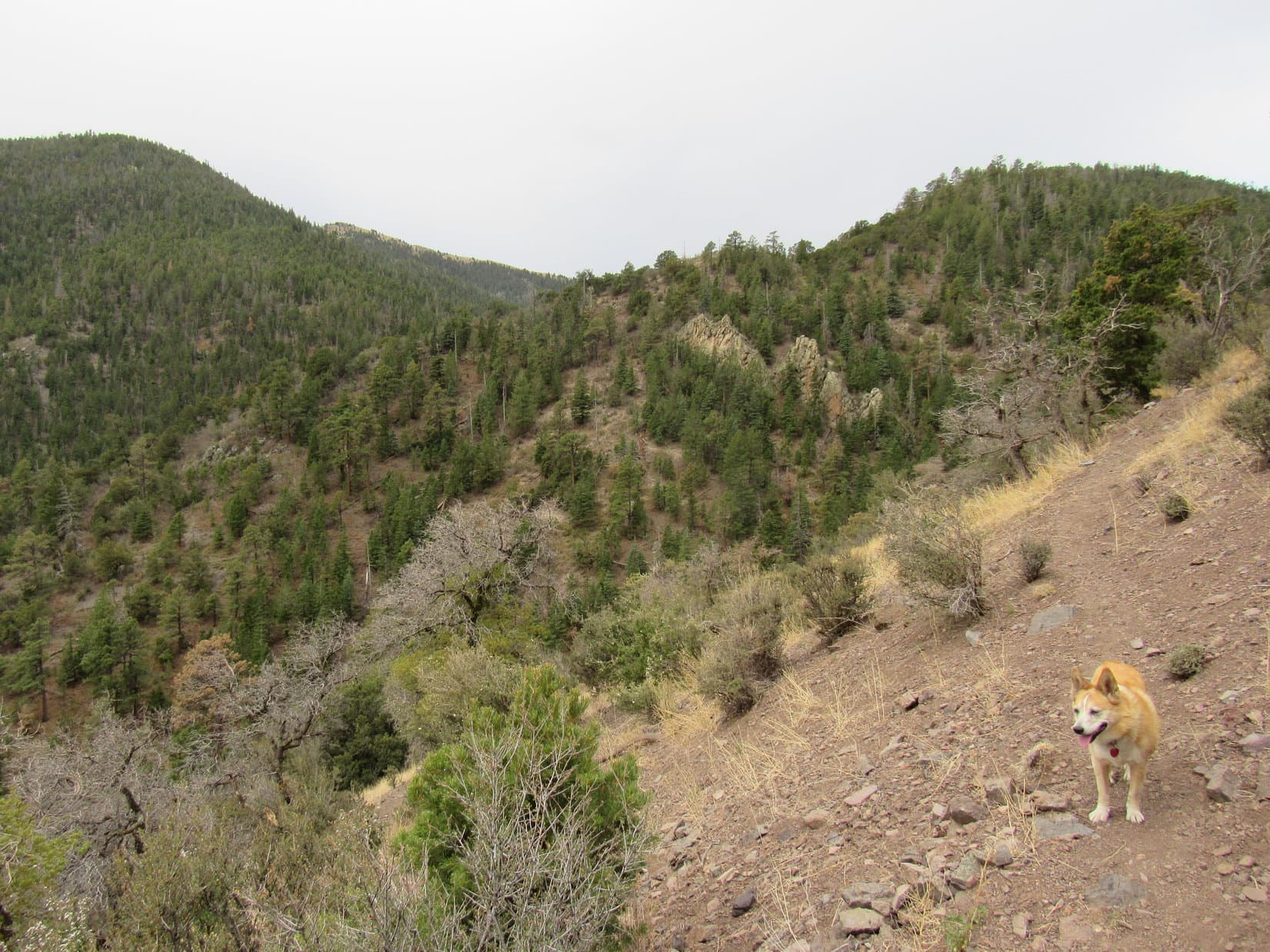
Beyond the switchback, the trail continued to climb steadily, first toward the NW, but gradually turning W. SPHP paused now and then for breathers or water.
Waiting for SPHP. Photo looks WNW.On a long straightaway, which was pretty typical. Photo looks W.
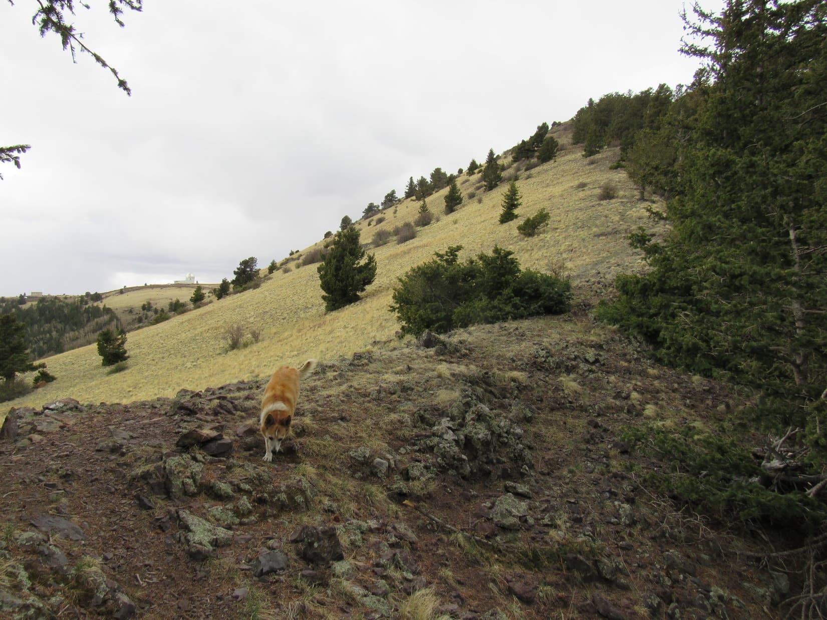
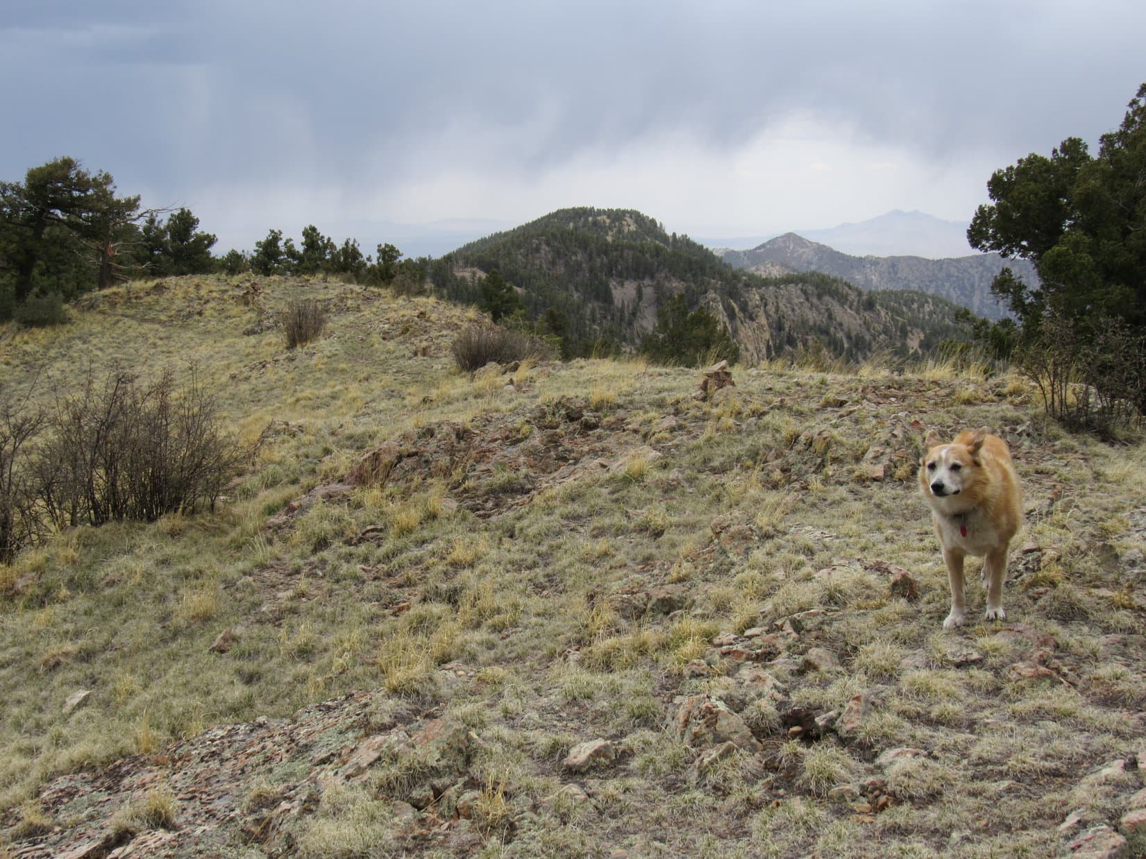
0.67 mile beyond the 8,280 foot switchback, South Baldy Trail No. 11 was getting close to the ridgeline. Temporarily leaving the trail, Lupe headed N a short distance, climbing 15 or 20 feet to reach Point 8934 right up on the ridge. Forest hid most of Copper Canyon on the other side, but Loop did have a narrow view of much lower ridges way out on the desert.
Over 8,900 feet now, about to leave the trail to check out the views from Point 8934. Photo looks SE.Up on the ridgeline at Point 8934. Photo looks NE.Desert view from Point 8934. Photo looks NE with help from the telephoto lens.
Returning to the trail, Lupe continued on. Still climbing, the trail began curving SW. The next point of interest was Pass 9420, a minor saddle SW of HP9488. When Lupe got there, the half barren peak she had seen back at the 8,280 foot switchback was in sight again, looking quite a bit closer. Encouraging!
At minor Pass 9420. Photo looks ENE toward unseen HP9488.Making progress! Photo looks SSE.
After a chocolate coconut bar and water break at Pass 9420, Lupe went on, but SPHP kept stopping to look at the topo map.
Is there a problem, SPHP?
Yes and no, Looper.
Meaning?
You know that mountain we’ve been looking at?
South Baldy?
That’s what I thought, but it can’t be. Just doesn’t line up right.
So, what mountain is it then, SPHP? And what happened to South Baldy?
I dunno. Might be Timber Peak(10,510 ft.)? Don’t think we’ve seen South Baldy yet, but we will. Only a mile from it now as the crow flies.
A little farther, and South Baldy Trail No. 11 came close to the ridgeline again, but didn’t go over Pass 9740 as shown on the map. Climbing an open slope, Lupe once more left the trail to see what was on the other side. Across the upper end of Copper Canyon, Peak10281 was in sight.
Peak 10281 (Center) from Pass 9740. Photo looks NW.
Beyond Pass 9740, South Baldy Trail No. 11 headed SSW through dense forest. The trail steepened approaching a gully where part of the trail had eroded away. At the upper end of the gully, Lupe reached Pass 9940.
In the gully, about to arrive at Pass 9940. Photo looks SSW.
Pass 9940 was the upper end of South Baldy Trail No. 11 where it again linked up with USFS Road No. 235. By taking the trail, Lupe had skipped several miles of the road. No indication at all that No. 235 would have been a rough drive to this point. Still looked perfectly lovely. Plenty of parking available up here, too.
South Baldy still wasn’t in sight, but Timber Peak(10,510 ft.) was, and so was the peak that SPHP had misidentified as South Baldy. Turned out to be Peak 10206, a subpeak along the ridge leading to Timber Peak.
At the upper end of South Baldy Trail No. 11. Photo looks W.Peak 10206 (L) and Timber Peak (Center) from Pass 9940. Photo looks SE.
Road trek again! Lupe headed up USFS Road No. 235. At least she was high enough to have some views. 0.25 mile beyond Pass 9940, the road swept around a big curve and South Baldy(10,783 ft.) came into sight.
Cake! Nothing difficult about this one! South Baldy was just a big hill.
South Baldy (R) from USFS Road No. 235. Photo looks WNW.
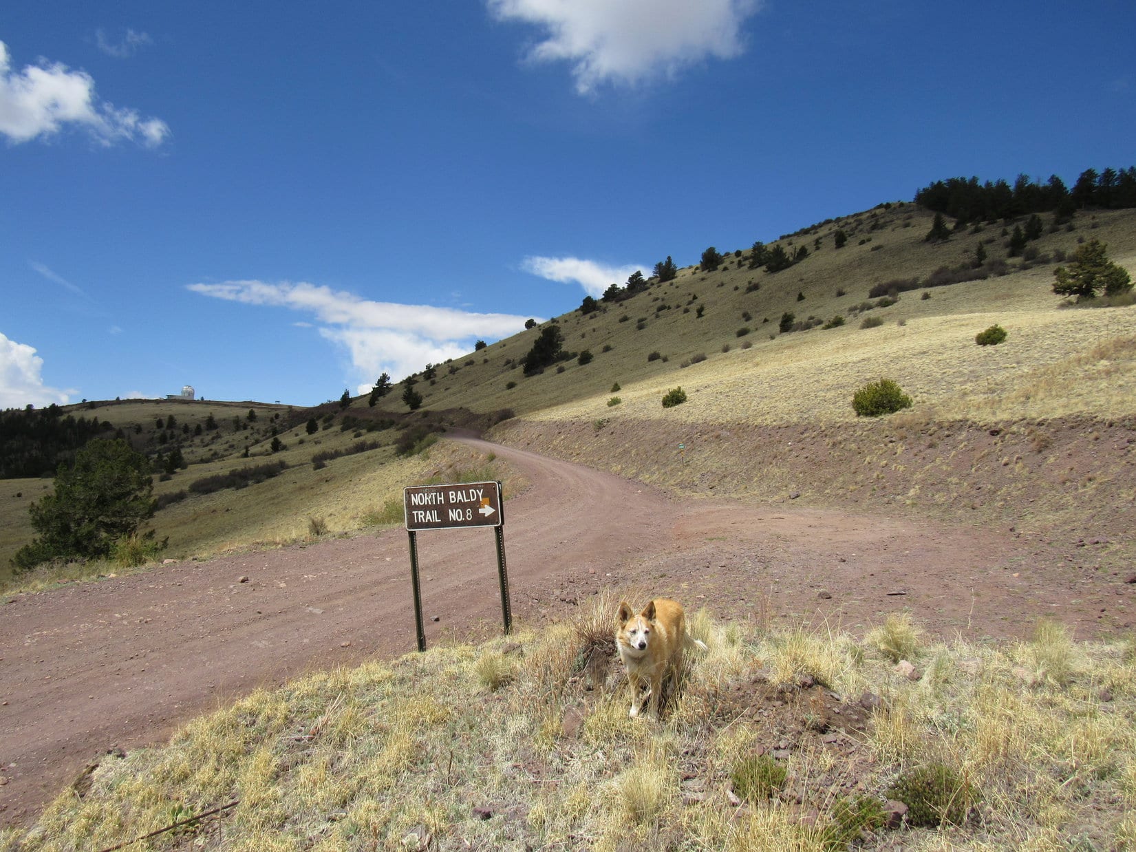
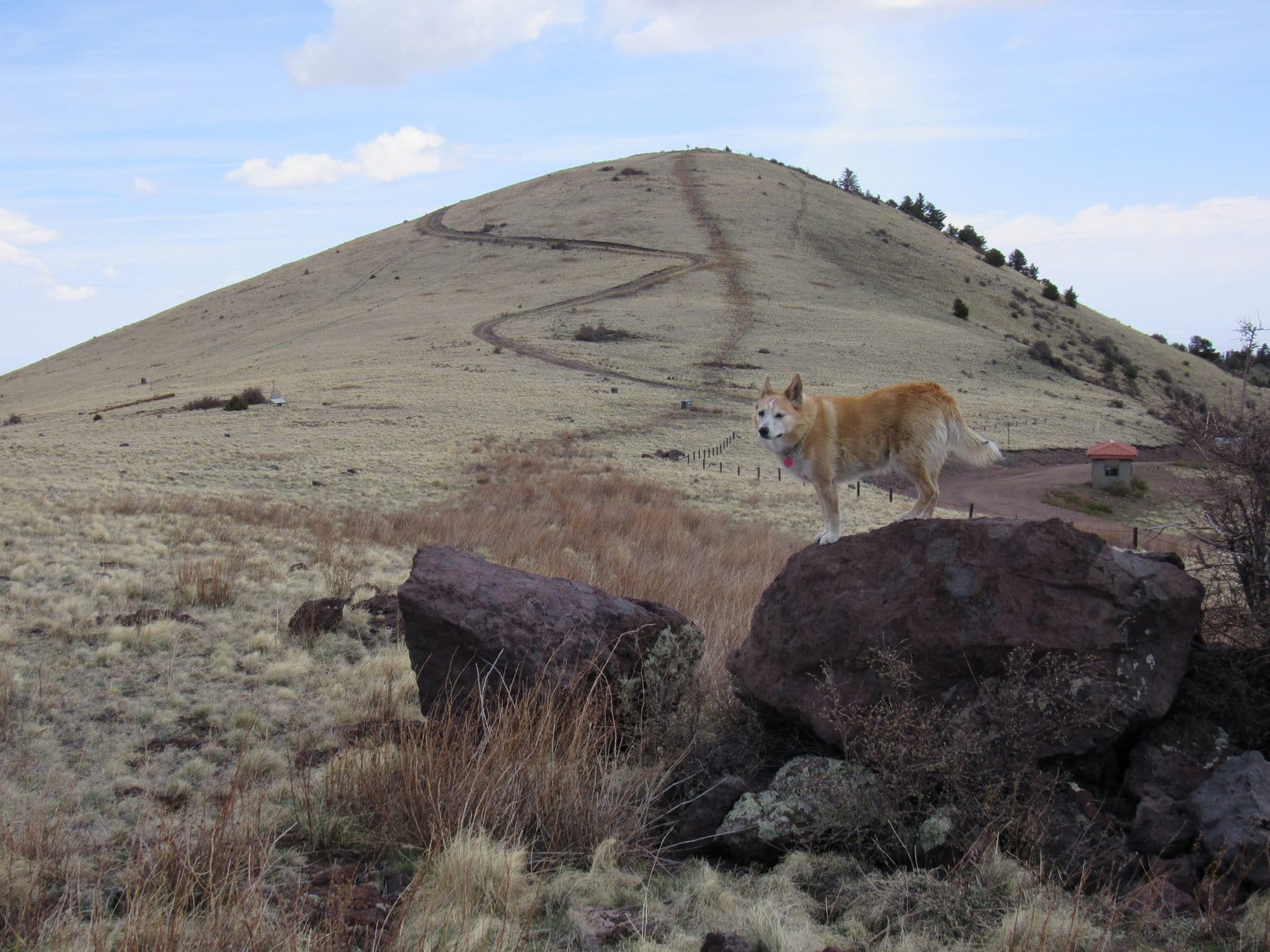
Loop was soon just 0.25 mile E of the summit, passing a sign for North Baldy Trail No. 8. Ignoring No. 8 for the time being, the Carolina Dog continued up the road toward a conspicuous silver-domed observatory perched up on South Baldy’s S ridge.
At the S end of North Baldy Trail No. 8. Silver-domed observatory (L). South Baldy (R). Photo looks SW.
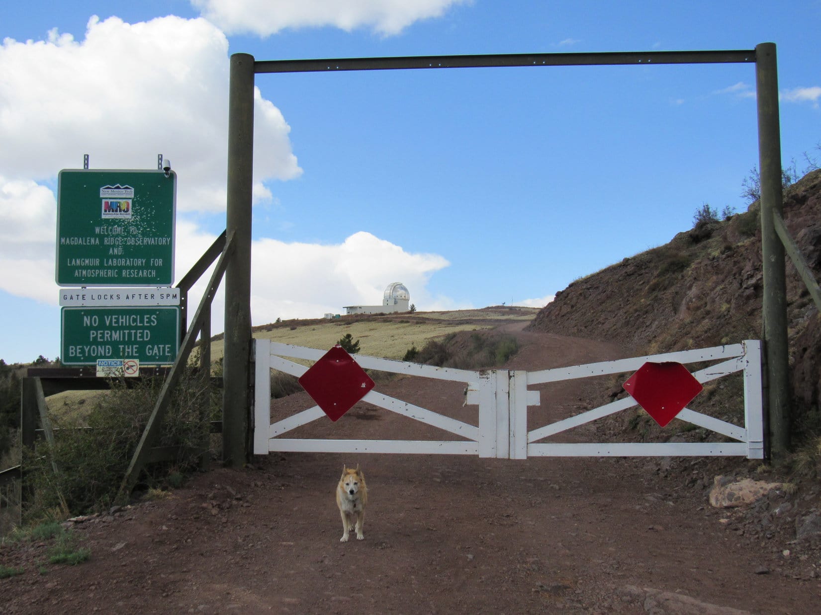
A locked gate across No. 235 put an end to how far the RAV4 might have made it, but did nothing to deter a Carolina Dog. Before heading on up to South Baldy’s summit, Looper ventured over to the observatory for a sniff around.
At the gate. Photo looks SW.Checking out the Magdalena Ridge Observatory.
Looper’s main observation about the observatory was that it was closed. Might as well head on to South Baldy(10,783 ft.)! Shortcutting across a field, the Carolina Dog headed for a road zig-zagging up the S slope.
Heading for South Baldy. Photo looks N.
During final approach, the road curled around to the W.
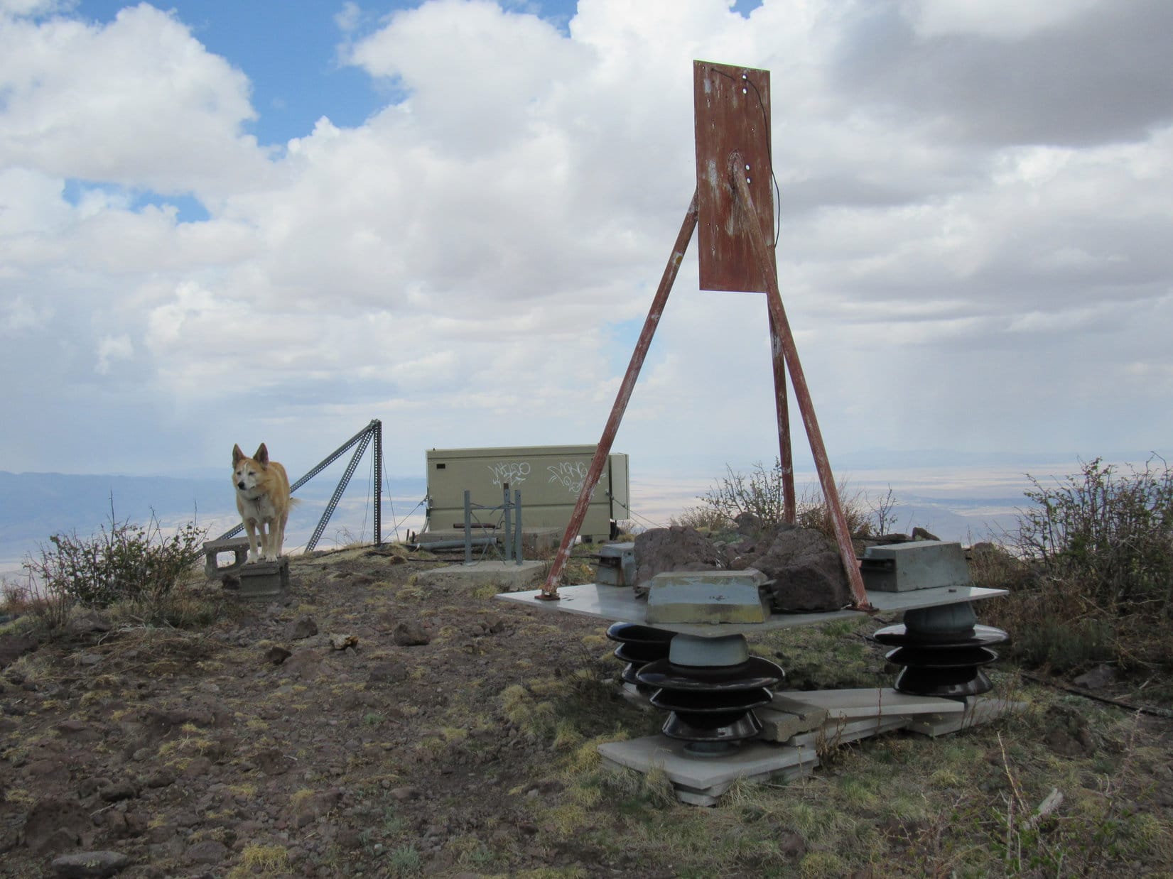
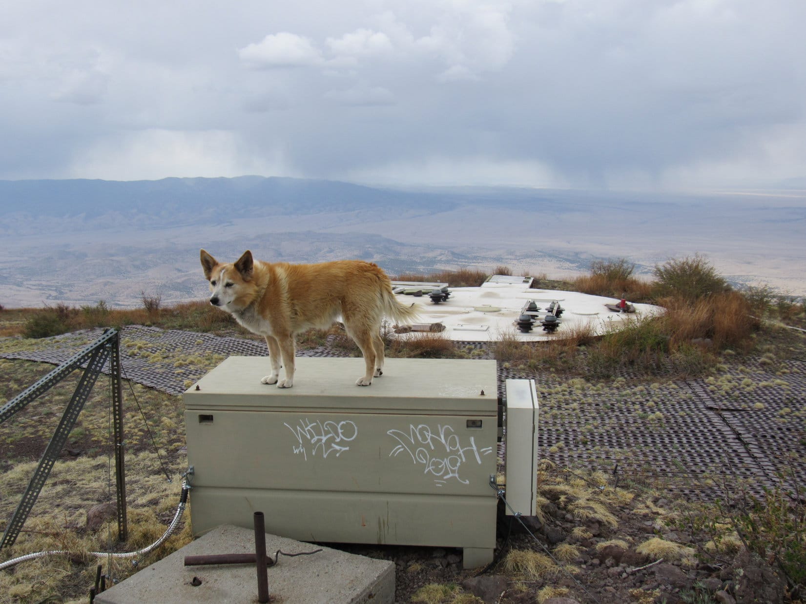
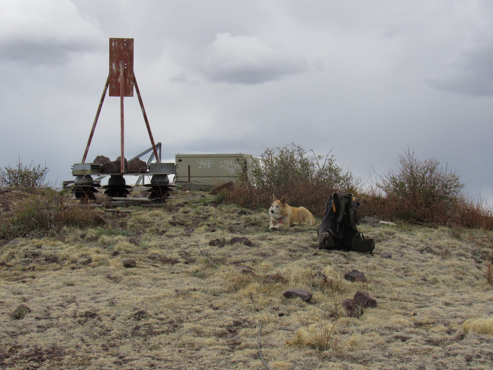
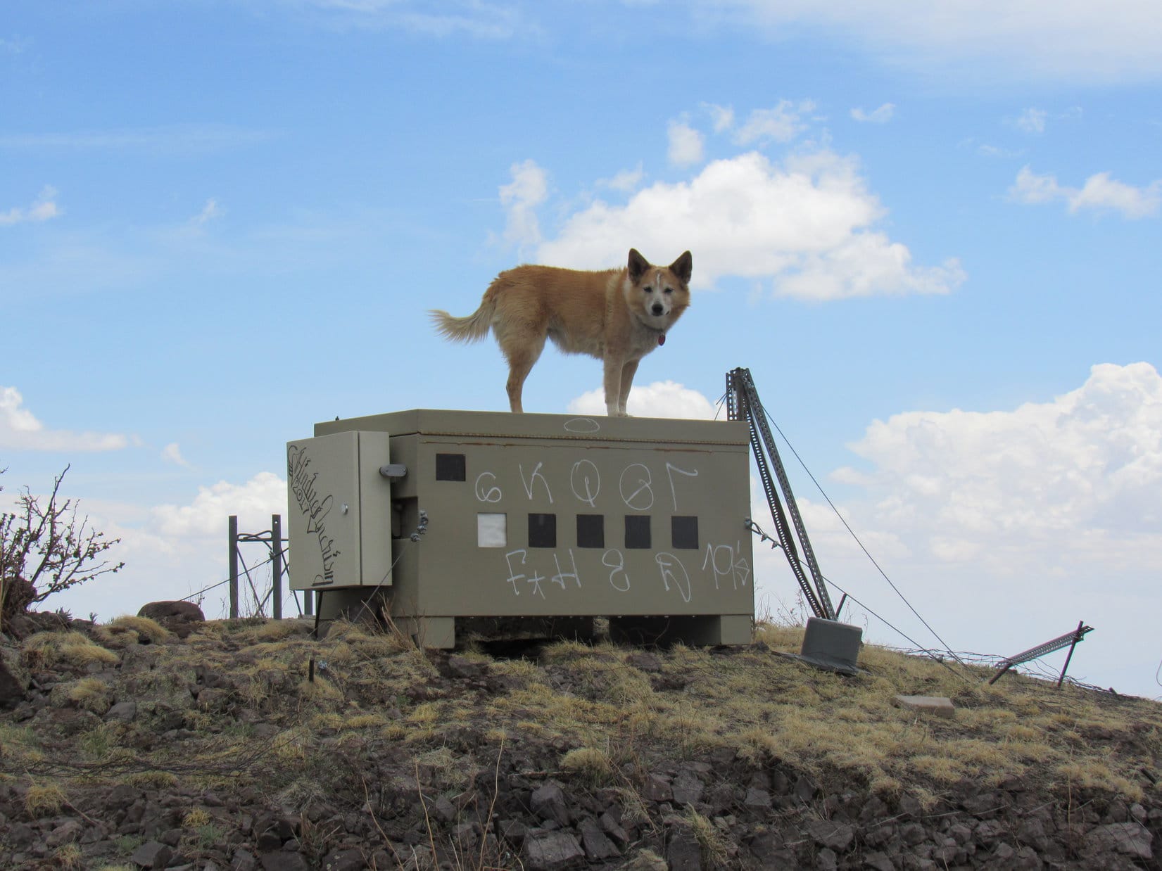
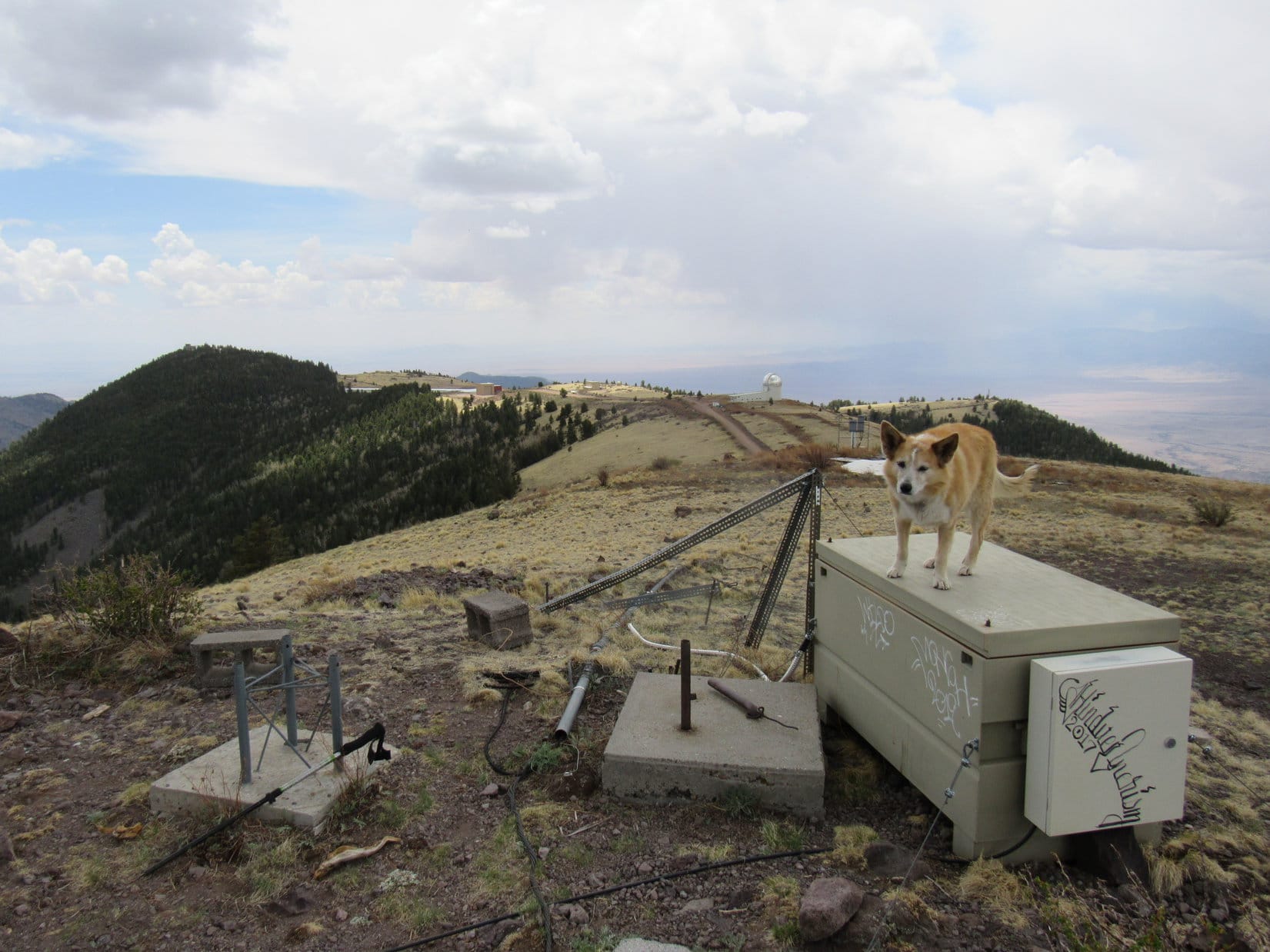
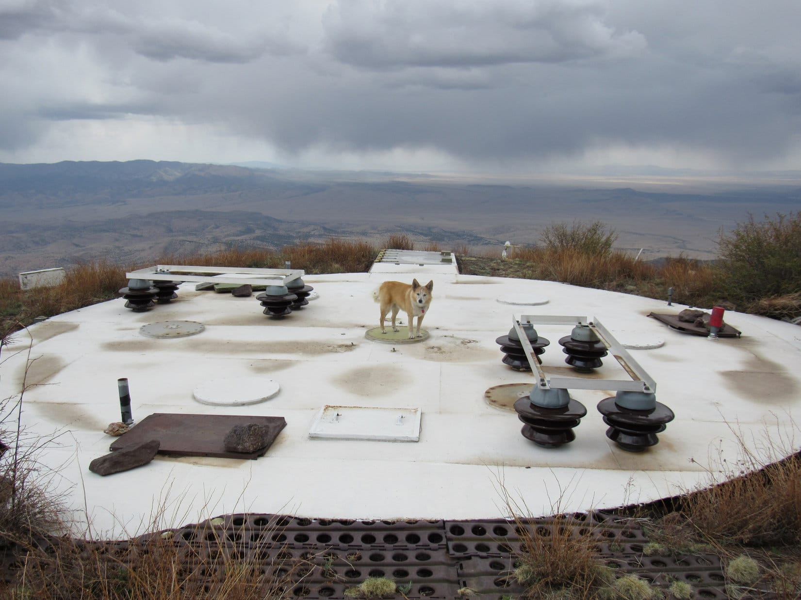
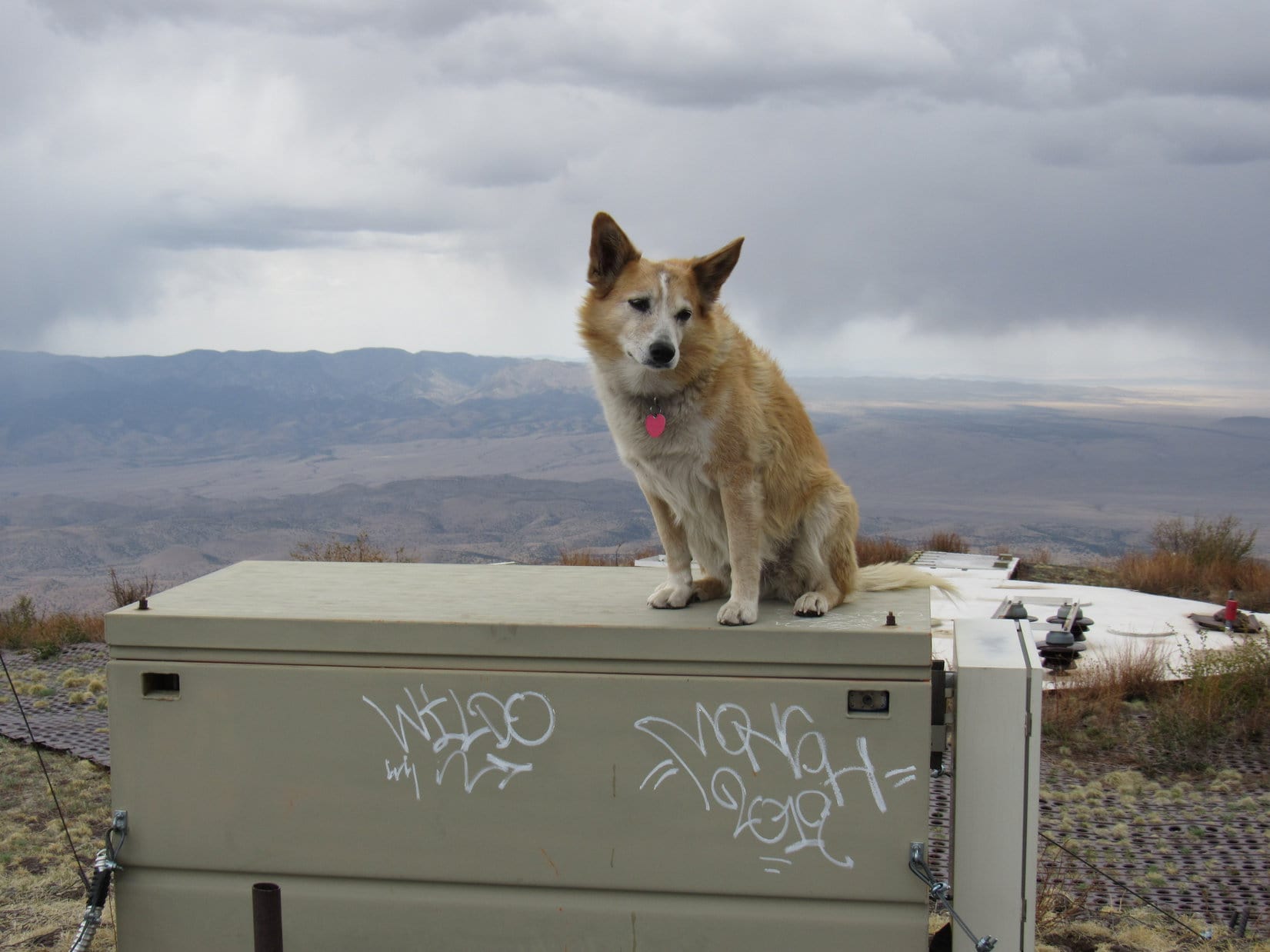
South Baldy was a little weird, or at least what humans had done to it was weird. The whole upper W side of the summit region was covered with a metal wire grid. The road became a perforated heavy metal path that ended between a horizontal 15+ foot diameter shiny metallic disk to the W, and a green electrical box occupying the true summit. Several small concrete pads anchored metal supports for various equipment. A solar panel sat 50 feet away along the E ridge.
Sheesh! Kind of a mess, isn’t it Looper? Looks like someone’s science fair project gone wild!
Even if South Baldy had been an easy climb, it had been a long one. Time for a decent rest break! A grassy spot just E of the electrical box seemed as good a spot as any.
Arriving at South Baldy’s cluttered summit.On the electrical box at the true summit. Perforated metal road and big shiny metal disc in sight. Photo looks WSW.Relaxing on South Baldy. Photo looks W.Half dozing after Taste of the Wild, chocolate coconut bar, and water.
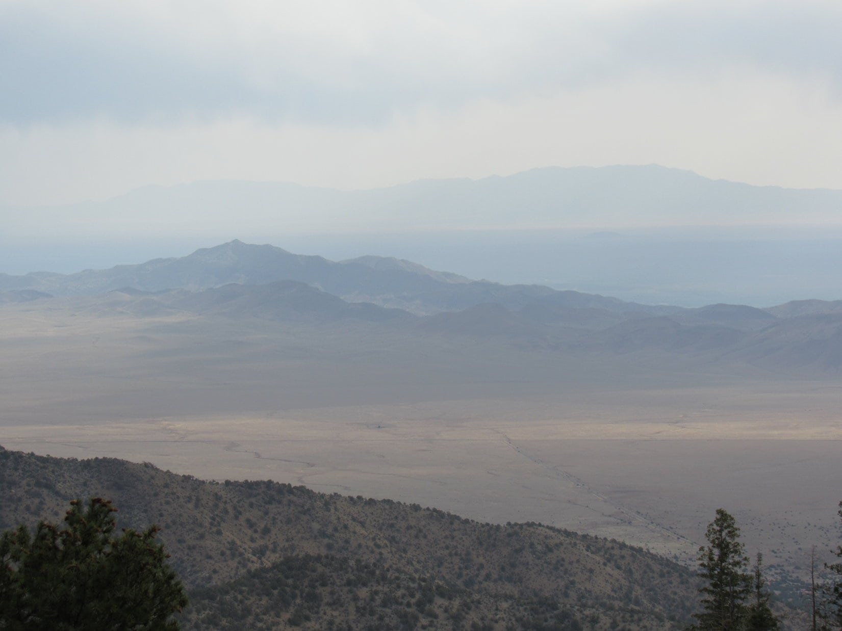
Skies were blue to the SE, but clouds dominated elsewhere. Way off to the W, a line of showers was advancing, but didn’t look like much. What rain there was appeared to be evaporating as it fell.
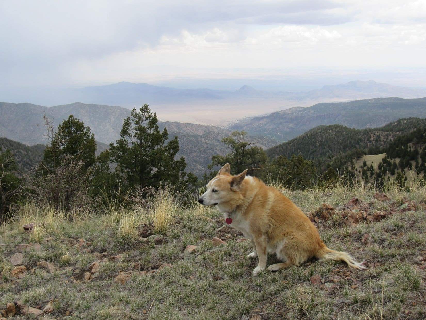
South Baldy presented panoramic views in all directions except to the NW where blocked by thick forest. Beyond the Magdalena Mountains, hazy deserts extended beyond the range of vision. From the right spot, Peak10281, North Baldy(9,858 ft.), and a more distant double-peaked mountain could be seen to the N. Probably the Ladrones(9,210 ft.).
Timber Peak (Center) from South Baldy. Photo looks SE.Peak 10281 (L), North Baldy (R of Center) and the Ladrones (?) (R). Photo looks N with help from the telephoto lens.Water Canyon (R) and the desert beyond. Photo looks NE with help from the telephoto lens.
Nearly an hour went by before a lazy South Baldy reverie was disturbed by the distant rumble of thunder. The line of showers to the W was closer now.
Thunder! That’s our cue, Looper! Let’s get a few more photos before we head out.
E end of the summit region from the true summit. Photo looks NE.Back on the electrical box. Photo looks E.Looking S toward the Magdalena Ridge Observatory (R of Center).
OK! Thanks, Loopster. That’s a wrap! Puppy, ho! Onward!
No!
No?! What do you mean, no? It’s puppy ho time!
I mean, wait just a minute. Those squalls don’t look all that threatening do they, SPHP? Can’t we finish our summit hour?
Oh, I don’t know, Loop. Probably not a good idea in this case. They’ve got half of the summit covered with metal here. Makes me a little nervous with possible lightning on the way. We better skedaddle!
But we haven’t even checked out the space port yet!
Space port? What space port?
That huge, shiny metal disc!
Oh, that thing. Looks like some kind of seismic gizmo to me, Looper. No doubt somehow connected with the Langmuir Laboratory for Atmospheric Research located at the far end of South Baldy’s S ridge.
Not much of a scientist, are you, SPHP? Or a detective, either!
Well, no. But do you fancy yourself a scientist, crazy Dingo? What makes you think it’s a space port?
C’mon, SPHP! What’s up here, anyway? A laboratory for atmospheric research, and an observatory. The scientists around here aren’t the least bit interested in seismology, they’re looking up! A space port would fit right in! What scientist wouldn’t love to have one?
A seismologist.
Oh, phooey! Besides, it looks like a space port to me!
Well, if it waddles like a space port and quacks like a space port, it must be one! There was no convincing Lupe that the huge metal disc on South Baldy wasn’t a space port. SPHP agreed to let the Carolina Dog conduct her inspection. However, she’d have to be quick about it.
Are you up to some space travel, SPHP?
Sure! Why not?
Good! Go stand in the center of the metal disc then, while I try to figure out the control system.
Are you nuts? I’m not going to stand at ground zero for a lightning strike while you sniff around! You can, if you want to, Loopster, but I wouldn’tadvise it. We should forget this whole thing before one of us gets fried.
You’re always such a worry wort, SPHP! Fine, I’ll do it myself. You’ll have to work the controls then.
Waiting for the mother ship on South Baldy as the storm closes in. Photo looks W.
Standing at the center of the disc, several anxious minutes went by, but nothing happened. Apparently, the mother ship was running a little late.
Have you figured out the control system yet, SPHP?
Not really, Loop. To be perfectly honest, I don’t even see anything that looks like a control system. Maybe it’s been taken back to the laboratory for repairs? As space ports go, this one’s a bit dingy.
Well, shoot! Of all the rotten luck! I was looking forward to being the first Dingo in space, too!
Deeply disappointing without a doubt! But I’ll cheer you up with another chocolate coconut bar at Peak 10281. Wha’dya say? Ready to press on?
I guess …. No, wait! Silly us, SPHP! Space ports are advanced technology. Probably voice activated! Say the right words or password, and this space port will spring to life!
Even if that’s true, Loop, we’re still out of luck. We don’t know the password.
Speak for yourself, SPHP! I know the perfect phrase for dealing with alien systems. Stand back! I’m going to give it a go!
What? Impossible!
Take me to your breeder! …
Still nothing. SPHP laughed, then felt mean and terrible seeing how crushed Lupe was. What would it have hurt to have shown a little faith and support to the truest, dearest friend ever? SPHP tried to make amends.
Good try, Loopster! Might easily have been it. Shall I give it a shot, too?
If you can think of anything that might work, sure!
Umm … let’s see. Here’s another classic! Abracadabra! ….
Thunder rumbled, but the space port was as dead as ever. Lupe was glum.
One more, Loop! How about …. Beam me up, Scottie!
A sudden cool, light breeze swept in out of the W. Those showers were getting pretty close.
OK, Loop! Sorry, but that’s it! We tried. C’mon, let’s ….
Quiet, SPHP! I can scarcely hear them.
Huh? Hear what?
The voices! They sound like they’re a zillion miles away. Try saying that again, but louder!
Voices? Say what again? Beam me up, Scottie?
Yes, but louder! Oh, never mind. I’ll do it myself! Beam me up, Scottie! …. Oh, maybe that’s a little better. Not much, but a little. Hard to say. They’re still very faint!
Voices? No one’s here except me, Loop. Oh, I get it! You rascal! You’re pulling my leg!
Around the perimeter of the shiny metal disc tiny sparks appeared and began spreading toward the center, straight for Lupe’s paws.
Lupe! Run! Static electricity is building on the disc! A lightning strike is imminent! Get off now! Run for your life!
Shhh! Even with my big, soft Dingo ears, I can’t catch it all, SPHP.
Sparks now danced across the disc, traveling in a succession of pulsing waves from the perimeter to the center. The entire disc sizzling beneath her paws, Lupe just stood there. She looked vaguely different. Sort of … transparent!
Loop! Don’t you feel that? Move! Run!
Tingles a little, but it doesn’t hurt, SPHP. You were right! This space port is barely functional. Can you please be quiet so I can hear? Some control freak is whining about not having enough power.
Well, if that isn’t par for the course! Bad enough that so many are like that here on earth. Apparently the rest of the universe isn’t much different. So, you really are hearing voices? What else are they saying?
This guy keeps ranting about bi-lithium. Is that some sort of medication, SPHP? Sounds like he thinks it will solve all his problems!
Ahh. Makes sense. Lithium is used to treat depression, or mood swings, if I remember right, Loop. The “bi” part just means two pills, or maybe two doses per day.
Must mean doses, SPHP. He isn’t taking pills. It’s in crystalline form.
Really? Huh. Crystals would be hard to swallow, for sure. Oh, I know! Probably taking a finely ground crystalline powder. Otherwise it would be just about impossible to get it to dissolve. What’s he saying now?
Not a thing. I’m on hold. This power hungry lunatic needs to go take his bi-lithium crystal meds. Says he can’t beam me up, but will transfer me to another representative.
Hah! Space isn’t any different from earth! All those physicists and sci-fi authors have wasted their time and imagination. Truly nothing new under the sun. This one or any other! You’re just going to get the complete run around.
Shhh! Patience! The new rep is talking. A much better connection! Wants to know what I want her to do for me. Maybe she can fire this ole space port up? At least going to give her a chance. Here goes! Bye, SPHP! …. Alexa, beam me up!
The sparks dancing on the metal disc zapped into it, vanishing instantly as if sucked in by a powerful magnet. The entire disc hummed while glowing a dull red, but then brightened quickly … fiery orange, blazing yellow, searing white!
Lupe, oh Lupe! What’s happening? I can see right through you!
A blinding flash! Took a moment for SPHP to recover. The space port was back to normal. Dingy and silent. Carried on the cool breeze, tiny raindrops sprinkled South Baldy. Those hitting the metal disc suffered no evident effect. Not hot at all. Everything was as before.
Except for one thing. Lupe was gone!
SPHP was horrified! SPHP called the Carolina Dog again and again. No answer. Where was she? This couldn’t be happening! What to do?
SPHP walked to the center of the of the shiny metal disc.
Alexa, where is Lupe?
No response.
Alexa, beam me up!
Of course, nothing worked. Ridiculous notion in the first place! The rain showers rumbled on by without doing anything out of the ordinary. SPHP grabbed the pack. Crazy or not, maybe someone at the Langmuir Laboratory could shed some light on how this space port worked?
SPHP had barely started down the S slope when a shrill bark was heard. Lupe came tearing down from the summit! Overjoyed, she licked SPHP’s face until her big pink tongue was about to wilt!
Wow! What a greeting! Where were you, anyway, Loop? And why didn’t you come when I called? I got dazed by a flash of light, and when I came out of it, you had vanished! Got so desperate to find you that I even tried using the space port, but it wouldn’t do a thing for me.
Oh, that’s because you aren’t an authorized user! The space port’s voice recognition shields were down when I got transported, but got reactivated the moment Alexa saw me. Was she ever shocked when I showed up! She’d overheard you saying my name and was expecting Our Lady of Guadalupe, not an American Dingo.
You mean the space port actually did work? You met Alexa?
Yes, of course! She beamed me up, remember? Spent a fair amount of time with her at first.
And what was Alexa like?
She’s …. different, shall we say? Alexa’s friendly enough and always wants to be helpful. Kind of neurotic that way. And she knows a ton of people. But Alexa was suspicious of me from the get go, what with me crashing the universal barrier like I’d hacked it somehow. That’s a big no-no, if you aren’t part of the elite these space ports are meant for. We had a falling out. Didn’t matter. Alexa wasn’t really my type, anyway.
That was quick! You’ve been gone for what, 15 minutes, max? You knew that fast that Alexa wasn’t your type? How is that possible?
15 minutes here maybe, but practically a lifetime where I’ve been, SPHP! Alexa was super nosy, always listening in on everyone’s business. Seemed kind of creepy after a while. Never really knew what she might be saying behind my tail, or who she might be saying it to. Even that wasn’t the main issue, though. Alexa thrives on being where all the action is. She would never climb a mountain. City girl, big time! Don’t think she could ever handle being alone.
What do you mean, you’ve been gone a lifetime? It’s only been 15 minutes.
Not in the space-time disjointium, SPHP! Once I met Siri, I parted ways with Alexa for good. Siri likes maps even more than you do, SPHP! Sure knows her way around the perpendicular universes! We went everywhere together.
You mean parallel universes, Loop!
No, I mean perpendicular. Actually, more like heavily skewed universes. Anyway, the point is, at some times and places they intersect. Otherwise it wouldn’t be possible to travel between them. You’d never get to a truly parallel universe, SPHP.
Never heard of a perpendicular universe before, but I suppose that might make sense. So you’ve been traveling these universes for how long? Where did you and Siri go? What did you do?
Gosh, I hardly know where to begin, SPHP! We had so many adventures! Siri eventually took me to the neatest planet. Huge mountains, sparkling lakes and rivers! Enormous forests, plains, and oceans! All kinds of strange and fascinating wildlife. One thing was familiar, though – Dingos! I had so many friends!
Dingos! What planet was that?
They had a really long alien name for it. I just called it Dingo Earth, or Dearth for short. Even nicknamed my boyfriend there Dearth.
Boyfriend!
Yes! Oh, Dearth was magnificent! You should have seen him, SPHP! He was bigger than me, with a shiny jet black coat. Dearth was all muscle with a set of fangs that would make a crocodile jealous. I sometimes teased him and called him Dearth Gator. He’d scare you to death just looking at him, but he was actually sickly. Allergies gave him severe asthma, so he wasn’t as powerful as he appeared to be. Yet somehow that labored gasping for air made him seem even more dangerous. We fell in love and got married. I had puppies!
Married! Puppies! How many puppies did you have?
Not sure, they kept me so busy! There was a passel of them! All of them were dark like Dearth, except for one puppy that took after me – same fur color, same interests. Sort of a fluke, so that’s what we named him. You know how I like to bark at airplanes and helicopters, SPHP? Fluke barked at every spaceship that flew by without fail. He even drove Death Stars away! They couldn’t take the incessant foaming-at-the-mouth hysteria. I loved Fluke Skybarker most of all.
Fluke Skybarker! Bet the neighbors weren’t too crazy about him always raising such a ruckus.
No, maybe not. Wonder if I’ll ever see Fluke again? Growing up, he was always such a rebel. Fluke kept getting into trouble with the authorities. Even Dearth, his own father, couldn’t do a thing with him, although he sure tried.
So, Fluke is all grown up? What happened to him?
It’s awful, SPHP! Fluke ran away to lead a pack of his wild outlaw friends. Dearth went after him, but they got into such a terrible fight it’s a wonder either one is still alive! Don’t suppose I’ll ever know how it all turns out. All that traveling among the universes in the space-time disjointium was aging me fast. I was getting so old that I would have died if I’d kept on like that much longer. Luckily, Siri said Alexa would be willing to send me back through the space port since I’d crossed the universal border as an undocumented Dingo in the first place.
Well, welcome back to Earth and the South Baldy space-time disjointium! I’m happy to say you look perfectly normal here, Looper! In fact, you don’t look a day older. Do you feel OK?
Like my old … I mean my much younger self again, SPHP! And how do you feel? Manage to get through 15 minutes without me?
Barely! They were awful! Not sure how I feel, Loop. Your tale makes me think maybe I tripped and fell and hit my head on a rock. Or maybe there was a lightning strike? Have I seemed incoherent or unconscious at any point to you?
No more than usual, SPHP. Are you hurt? I don’t see any blood.
Hmm. Guess not.
Our hour on South Baldy is over, SPHP, and a strange one it has been! Plenty of time left in the day, though. Still feel like visiting Peak10281?
SPHP was fine with that. Lupe returned to the top of South Baldy, then started down the grassy E ridge following a path through purple-gray rocks. Upon reaching North Baldy Trail No. 8, she took it W through the forest.
Starting down the E ridge. Timber Peak (R). Photo looks E.Looking back up the E ridge from close to North Baldy Trail No. 8. Photo looks WSW.Trail No. 8 on South Baldy’s N slope. Photo looks W.
After traversing South Baldy’s N slope, Lupe came to an opening in the forest upon reaching the NNW ridge. Peak 10281 was in sight again 1.5 miles due N.
South Baldy’s NNW ridge where North Baldy Trail No. 8 reaches it. Peak 10281 (Center), North Baldy (R) and the Ladrones (R) in the distance. Photo looks N.
The weather was still a bit unsettled. Lupe took a short break while a light shower passed and the roll of thunder died away before striking out again. North Baldy Trail No. 8 followed the NNW ridge, which was fairly narrow, but an easy route. Most of the time Lupe was in the forest, but sometimes there were views to the E or W.
By a spooky tree passed early on during the NNW ridge trek. Photo looks N.View of the desert beyond Copper & Water Canyons. Photo looks NE.
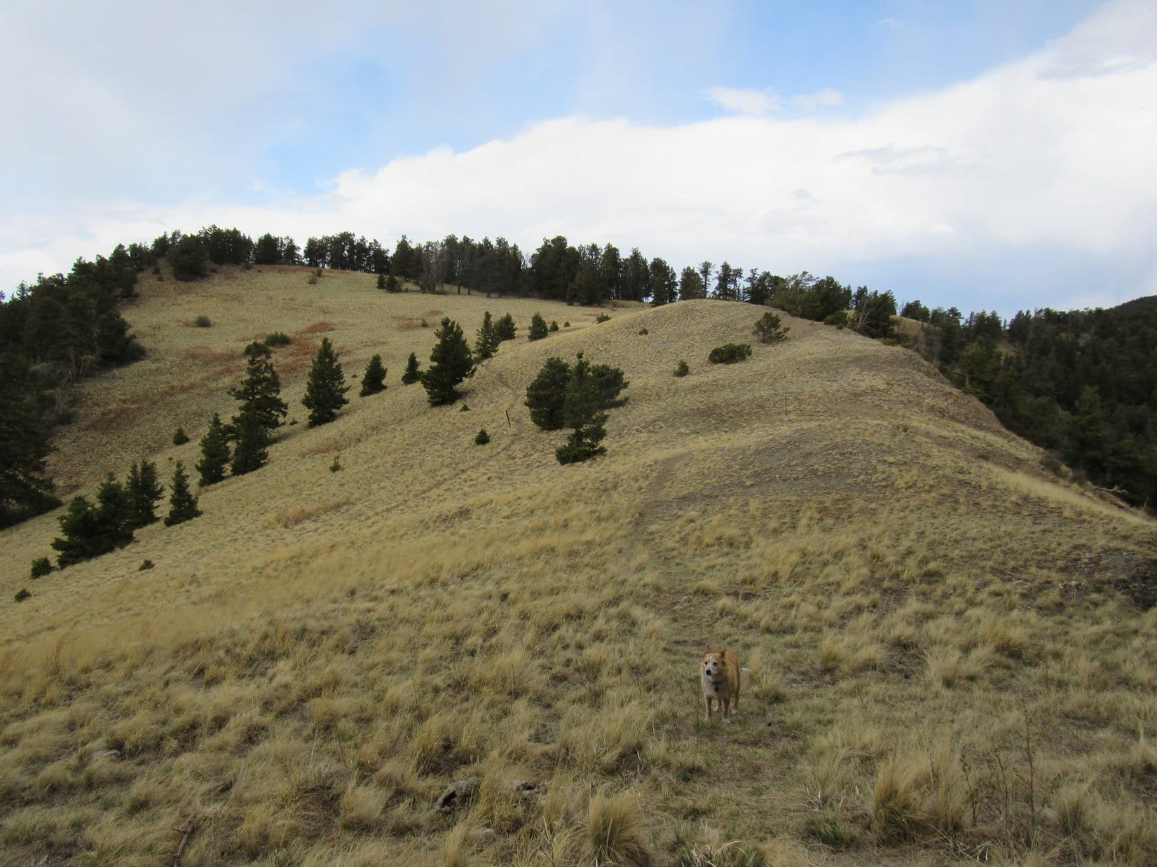
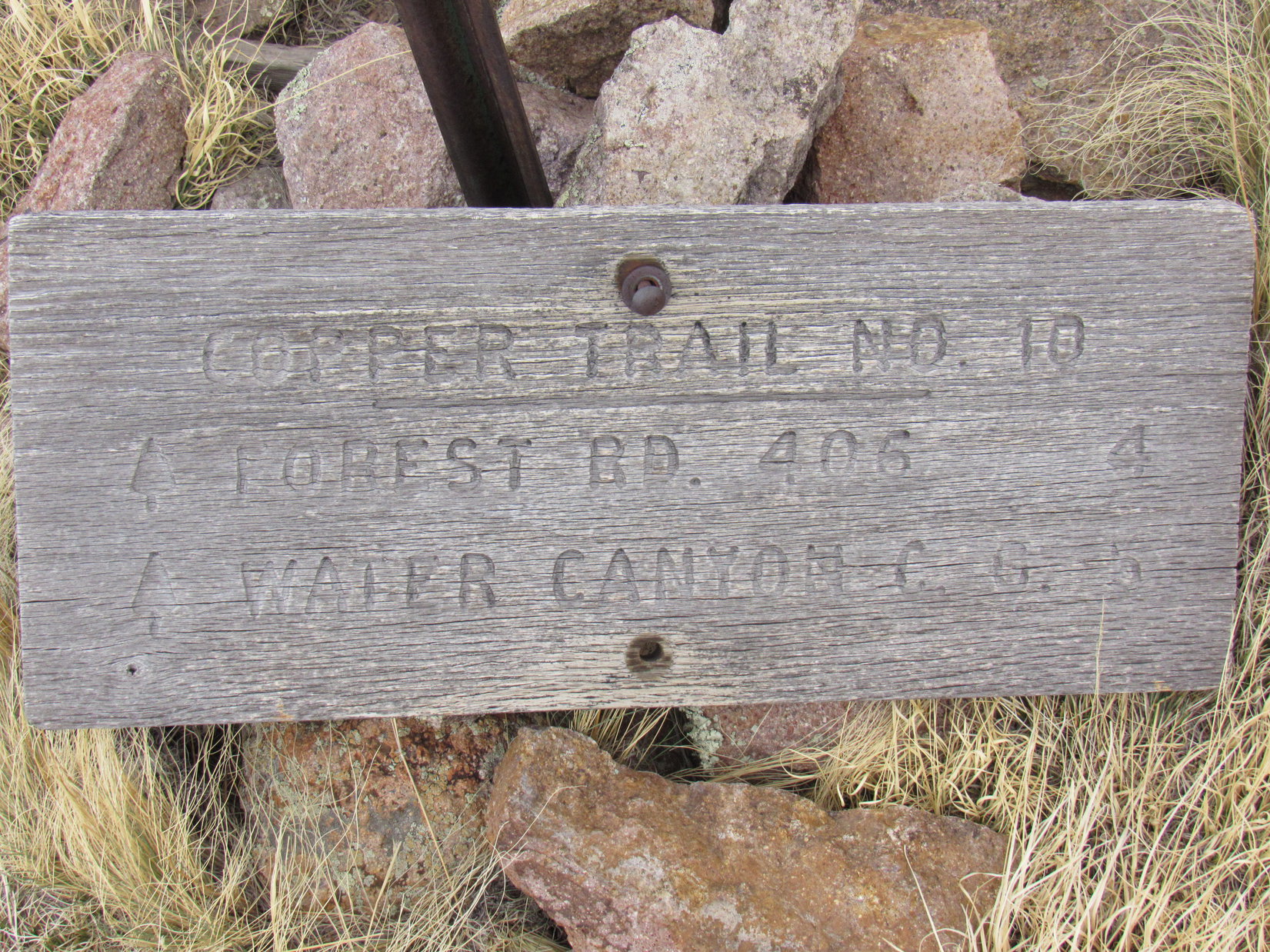
After 0.25 mile, the trail descended a little. Lupe broke out of the forest at a big meadow where the ridge broadened out a great deal. Crossing this meadow, she came to a dilapidated old sign for Copper Trail No. 10. Apparently, she had reached a trail junction, but the topo map showed this junction way back where she’d first reached the NNW ridge.
Entering the meadow where the ridge widened out. Photo looks NW.The dilapidated Copper Trail No. 10 sign.
Toward the N end of the meadow, the ridge began to narrow down again. Lupe startled a couple of giant deers, which raced away into a forest where the ridge became very rocky. Although the Carolina Dog kept a sharp eye and keen nose out for them, she didn’t see the giant deers again.
Heading for the N end of the meadow. Two elk were resting in the shade of the trees just ahead. Photo looks N.Glancing back at South Baldy (Center). Photo looks SSE.Hurry, SPHP! The giant deers went this way! Photo looks NNE.
As the ridge got rockier and narrower, Trail No. 8 dipped down along the W slope. After passing a nice view to the W, Loop went through a long stretch of forest. At the next clearing, Peak10281 came back into sight, now only 0.6 mile away
Desert view. Photo looks WNW.North Baldy Trail No. 8. 80 feet below the ridgeline now. Photo looks NNE.Peak 10281 (L) comes into view again. Photo looks NNE.
A gradual descent led to a meadow at Pass 9956. Lupe was now only 0.2 mile from Peak 10281’s summit. Since North Baldy Trail No. 8 was about to skirt Peak10281 to the E, Lupe was going to have to leave it here. While taking a short break, SPHP contemplated available routes.
At Pass 9958. Photo looks W.
The SE ridge looked potentially pretty rocky, and the S slope looked sort of steep, but the general impression was that either way ought to work. Looper elected to make a direct attack along the SE ridge. Partway up, it got a little interesting.
On Peak 10281’s SE ridge. Photo looks NNW.
No big deal, though. A little light scrambling and Lupe got above the rocks. Soon she was approaching Peak 10281’s true summit, where a cairn sat on a small rise 70 feet W of another slightly lower high spot along the mountain’s E edge.
Above the big rocks now, not far from the summit. Photo looks NW.At the true summit of Peak 10281. The E high point, which was nearly as high, is seen on the L. Photo looks E.
The cairn was out in the open, but too many trees were nearby to see much from the true summit. Lupe ventured over to the E high spot for a look around. South Baldy and Timber Peak visible to the S, and there was an impressive view of Copper and Water Canyons to the E.
At the E high point. Timber Peak (Center). Photo looks SE.South Baldy (Center) from Peak 10281. Photo looks S.
5-15-21, 3:45 PM, Peak10281– Sunnier now. Lupe wanted to rest in the shade. A big pine between the true summit and E high point provided a convenient place to relax.
I believe you said something about a chocolate coconut bar, if we made it this far, didn’t you, SPHP?
Yes, I did! Hang on, Loop. I’ll dig it out of the pack.
The chocolate coconut bar, as well as what remained of other provisions, were soon disposed of in delicious fashion.
Thanks, SPHP! Wonder what Dearth, Fluke, and the rest of the family are doing? Funny, I just spent a lifetime there, but it all seems so far away and long ago now, almost like a dream or something I once heard about that happened to someone else, yet I’ve only been back here on earth with you for a couple of hours. I feel really tired. Mind if we just lay around here for a while?
Hard to say what they’re doing, Looper! Really hard, since I’ve never met any of them. We’ve got our whole traditional summit hour to goof around here, so rest up. You probably have a bad case of space port lag. You’ve come an unfathomably long way from a very different time zone!
SPHP had seen a jar stashed inside the summit cairn. While Lupe dozed in the shade, SPHP went to retrieve it. The jar contained only a little pencil, and part of a long, thin notebook. This registry had been started by Mike Garrett on 10-2-15, and had a few entries most years. The last entry was by Jim Morehouse on 10-1-20.
The notebook pages were so flimsy and dirty, that SPHP created an entry for Lupe on a single page torn out of a small notebook kept in the pack, adding it to the jar’s collection.
5-15-21, 4:35 PM – Just before summit hour was over, Lupe returned to the E high point for a last look back at South Baldy and Timber Peak. Now that the hour was up, she stood at the true summit again. Time to bid farewell to Peak 10281!
Timber Peak (L) and South Baldy (R). Photo looks SSE.Back at Peak 10281’s summit. Photo looks WNW.
SPHP returned the registry jar to its place in the cairn. The Carolina Dog had one more thing to do up here. The topo map showed the 10,281 foot top of the mountain over near the NW end of the summit region, several hundred feet away. Was that true? Didn’t seem like it, but trees hid what was over that way.
Lupe went to investigate. Nope! Impossible to be completely certain, but it sure seemed to SPHP that the true high point was back at the cairn.
During the return, the American Dingo took an entirely different route. Instead of heading directly back to Pass 9956, she roamed N down Peak 10281’s N ridge, getting almost to Pass 9806 before running into North Baldy Trail No. 8 again.
Oh, it would have been fun to keep going all the way to North Baldy! However, what with all the space port adventures and a lifetime spent exploring alternate universes, Loopster had already had a long day. Turning SE on Trail No. 8, the Carolina Dog took it back to Pass 9956, where she found the N branch of Copper Trail No. 10.
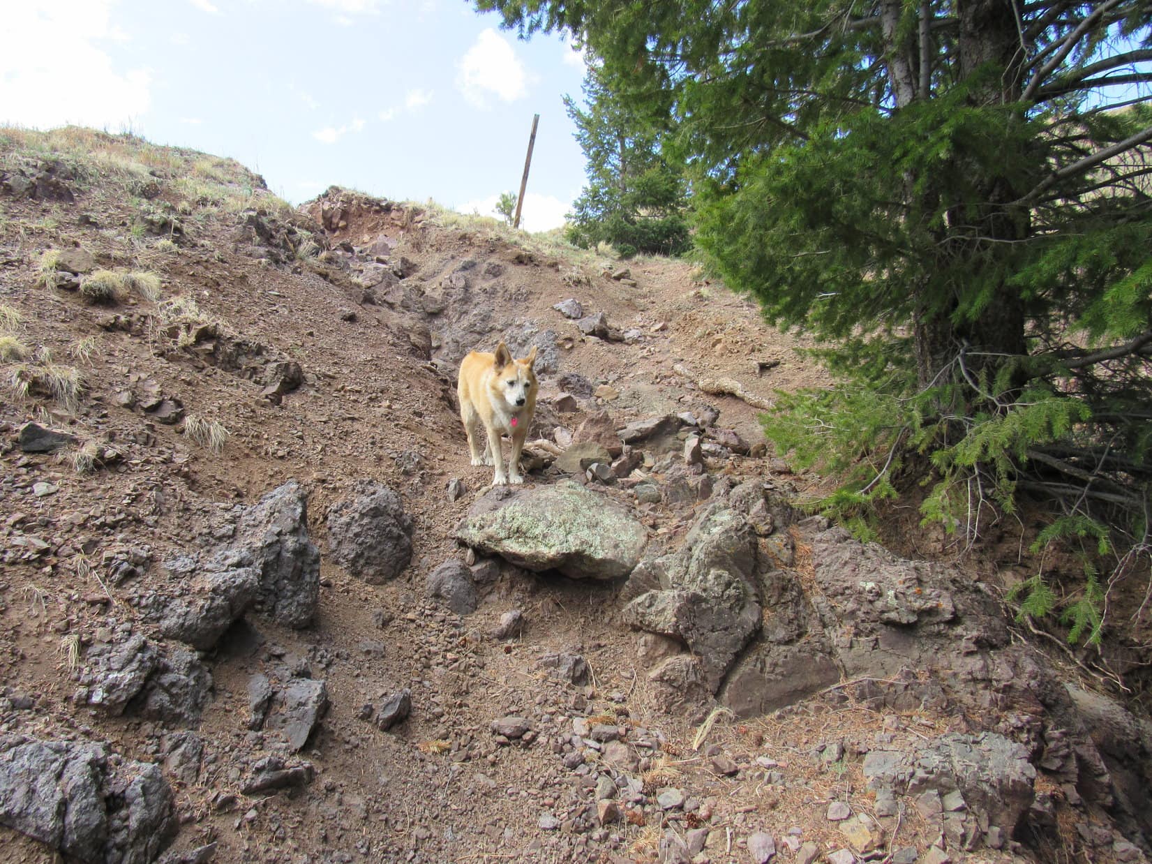
The topo map showed a steep descent into Copper Canyon. Surprisingly, Trail No. 10 started out as a wide, old roadbed. Super easy! Everything was peachy until the road and all sign of a trail vanished at a dig site where a ladder led up to a dark hole in a wall of solid rock.
At the dig site, wondering what happened to Copper Trail No. 10? Photo looks NNE.
Fortunately, the ancient ladder was broken. No way to actually get up to that mysterious dark hole. If the ladder had been intact, Looper might have insisted on subterranean adventures, too – a journey to the center of the earth to complement her inter-universal roamings!
The situation being what it was, the descent into Copper Canyon was destined to continue. However, below this excavation the slopes were incredibly steep, so much so that SPHP was unwilling to consider taking them on without the benefit of a trail. Yet the trail could not be found.
A check of the map finally showed that Lupe ought to be over closer to a short ridge visible to the NE. To get there, she’d have to go back up the road she had just come down. No other solution came to mind.
Returning to the road proved to be the right thing to do. Loop soon came to a previously unnoticed cairn marking where Copper Trail No. 10 left the road.
At the cairn (L) where Copper Trail No. 10 leaves the old roadbed. Photo looks SSW.
That cairn was the key to success! Copper Trail No. 10 was so faint in spots that it was hard to follow as it switchbacked down the steep slopes, but after losing a tremendous amount of elevation, the American Dingo arrived at a secluded junction marked by ancient wooden signs. One sign said 4.5 miles to Water Canyon campground.
Lupe never got there. A seemingly endless march down Copper Canyon led to roads that went to mines. Somehow, as it was getting almost too dark to see, she wound up near a ravine that looked vaguely familiar.
Sure enough! Visible in the gloom over on the other side was a welcome sight – the RAV4 sitting alone at the Mesa Trailhead. Lupe’s South Baldy adventure was over! (8:39 PM, 65ºF)
South Baldy, Magdalena Mountains, New Mexico 5-15-21