Day 2 of Lupe’s 2012 Dingo Vacation to the West Coast.
Lupe was doing somersaults. A squirrel was chattering away in a tree somewhere outside Lupe’s “tiny house”. Lupe was desperate to go bark at it. She was hurling herself repeatedly against the screen door of the tent, not realizing it was zipped shut. She couldn’t get out. The crazy Carolina Dog was going paws over head, and doing a complete somersault each time she charged the fabric. The whole tent shook. SPHP and Lanis woke up.
Lanis, SPHP and Lupe were camped at Shell Creek in the Bighorn Mountains of Wyoming. It was morning, and clearly time to get up to relieve the American Dingo’s anxiety. After breakfast, Lanis, Lupe and SPHP took a short walk along Shell Creek. Returning from the walk, it was time to leave Shell Creek campground. Someone else had reservations for Site No. 11 tonight.
Lupe runs along a trail next to Shell Creek.Lupe busy at Shell Creek.
Shell Creek, Bighorn Mountains, WYLanis and Lupe’s “tiny house” at Shell Creek.Lanis’ Honda Element was a great vehicle for Lupe’s first ever Dingo Vacation. There was lots of cargo space. Plenty of doors, including this set of double doors, provided easy access to everything. Lupe had a great time riding in the Element.
Where to next? Shell Falls was relatively close by farther down Shell Canyon. About a mile upstream of Shell Falls, there were also some smaller waterfalls just off Hwy 14 where Lupe could go wading. Lupe went to visit both Shell Falls, and the smaller falls.
Lupe and Lanis visit Shell Falls in the Bighorn Mountains.The gorge below Shell Falls.
Shell Creek cascades down a series of smaller waterfalls about a mile upstream of Shell Falls.
Lanis and Lupe at the smaller waterfalls in Shell Canyon.
After visiting Shell Falls and the other smaller waterfalls in Shell Canyon, there was a debate over what to do next. Should Lupe return to Shell Creek campground to see if another site had opened up?
In the end, Lupe wound up going to Burgess Junction instead. Lanis went into the store and bought ice cream bars again, just like he’d done the previous day at Spotted Horse. Lupe liked this new ice cream bar tradition. She sacrificed any concerns over her own health, to help make sure SPHP didn’t get fat.
Lupe, Lanis and SPHP headed W on Hwy 14A. There were two more waterfalls that would be worth seeing. One was Bucking Mule Falls. The other was Porcupine Falls. Both were miles N of the highway along gravel roads, but they were in the same general area. Since SPHP had seen Bucking Mule Falls once before, Porcupine Falls was chosen as Lupe’s destination.
The trail to Porcupine Falls wasn’t very long, but it was steep. Shortly after leaving the trailhead, it went steeply downhill most of the way. Porcupine Falls poured through a narrow gap in a rock wall into a big pool below. It was very pretty and dramatic looking gushing out between the high cliffs.
Porcupine Falls in the Bighorn Mountains, WY.Lanis relaxes at Porcupine Falls.
After seeing Porcupine Falls, and spending some time sniffing around the edges of the big pool below it, Lupe led everyone back up the trail to the Honda Element. Now that the trail was going steeply uphill, it didn’t seem nearly so short as before.
Once everyone was back at the Element, the consensus was that it was time to eat and secure a campsite. Bucking Mule Falls would have to wait for another day. Lupe went back to Hwy 14A. At the Bald Mountain campground, once again, Site 11 was the best one available. Lanis and SPHP pitched the tent and made dinner. After dinner, Lupe, Lanis and SPHP started climbing Bald Mountain. It was a really easy climb up a long grassy slope SE of the campground.
Lupe snoops around on her way to climb Bald Mountain. Photo looks NW toward Medicine Mountain(9,962 ft.), where the Bighorn Medicine Wheel is located. The Bald Mountain campground, where Lupe would spend the night, is at the closest clump of forest at the right edge of this photo.
When Lupe was about halfway up Bald Mountain(10,042 ft.), it started becoming apparent that a rainstorm was coming. A line of showers that had been quite some distance away to the W was moving in. By the time Lupe was near the top, rain showers were all around to the S, W & N. Now and then, there was some lightning off in these directions, too.
Within just a few minutes of when Lupe, Lanis and SPHP reached the top of Bald Mountain, the storm hit. A chill wind blew fiercely, and there was a cold stinging rain. The downpour was much harder than expected. With absolutely no cover on Bald Mountain, Lupe, Lanis and SPHP all got soaking wet. The storm wasn’t a big one, though, and would soon pass. SPHP expected to be able to just tough it out.
Suddenly there was a flash of lightning relatively close by, followed by the roar of thunder. There’s no toughing out lightning. Lupe, Lanis and SPHP all hastily abandoned the summit of Bald Mountain. Fifteen minutes later, the storm had blown on by. There was still light rain, but nothing of consequence. The rain had dampened everyone’s spirits, though. Lupe, Lanis and SPHP continued on down back to the campground.
After setting up Lupe’s “tiny house”, SPHP had thrown everything needed for the night into the tent. Unfortunately, SPHP had not put the rain cover on the tent. Most things were now damp. Lanis’ sleeping bag was just plain soaking wet. Lanis was not amused. Lupe and SPHP spent the night in the tent. Fortunately, there were still some dry blankets in the Honda Element. Lanis spent the night in the Element huddled under them, running the heater now and then to keep warm.Shell Falls is located 14 miles E of Greybull, WY in Shell Canyon. A parking lot and visitor center are right next to the N side of the highway. Shell Falls is a quick scenic stop for travelers on their way W to Yellowstone National Park.
Porcupine Falls and Bucking Mule Falls are located N of Hwy 14A (E of Lovell, WY) toward the W side of the Bighorn Mountain Range. Gravel roads lead to the trailheads. The 0.5 mile hike to Porcupine Falls leads to a large pool at the base of the falls. The trail to Bucking Mule Falls leads 1.5 miles to a scenic overlook from which the falls can be viewed from a distance.
Directions to Porcupine Falls and Bucking Mule Falls: E of Bald Mountain campground, there are two roads going N from Hwy 14A. (The first road is just E of the turn to Bald Mountain campground, the second is 2 miles farther E.) Both roads lead in just a few miles to an intersection with Devil’s Canyon Road. Take Devil’s Canyon Road W 4 miles to the Porcupine Falls trailhead, or 7 miles to the Bucking Mule Falls trailhead.
Advisory: Online information on the Bucking Mule Falls National Recreation Trail indicates that the trail to the scenic overlook of the falls is part of a much longer 15 mile trail. Continuing on beyond the viewpoint, the trail drops steeply 2,000 feet in 2 miles into Devil’s Canyon. One online trip report dating from July, 2013 said there were 5 miles of trail down in Devil’s Canyon choked with dead trees. In some places the trees had fallen 3 and 4 deep across the trail. Lupe recommends checking for current information on the trail’s condition before continuing beyond the overlook.
Lupe returned to Bald Mountain on the first day of her 2013 Dingo Vacation to the Beartooths and Canadian Rockies. Click the red link to view Lupe’s post about her return visit.
SPHP almost chickened out. Even though the forecast was for an unseasonably warm 52°F, it was supposed to be windy with possible rain showers. Rain showers are almost unheard of in the Black Hills of South Dakota in late January, but that was what the forecast said. The rain showers were supposed to end by noon, but a little rain was not the problem. The 35 mph NW wind in the forecast was. Up on a mountaintop, 52°F, if it even reached that, might be less than wonderful when combined with a 35 mph gale.
Lupe was bored and restless, though. She stared expectantly at SPHP with eager, pleading puppy eyes. She knew SPHP had been considering taking her into the mountains, due to preparations that had been underway before checking the forecast. Lupe was ready for action. She was expecting to go, eager to go, and doing her Carolina Dog best to demand to go!
Well, it would probably be alright. Lupe won out! At 9:46 AM, Lupe and SPHP left the G6 parked along Duran Road (USFS Road No. 679.1) just across Box Elder Creek from Nemo Road. It was already a very balmy 46°F. There wasn’t any rain yet. It was only partly cloudy, but those clouds were making good time across the sky. The wind was roaring in the trees. Fortunately, the breeze wasn’t too bad down at ground level.
Lupe had two peakbagging goals for the day. The first one was Green Mountain. No! Not the Green Mountain(7,164 ft.) along the E edge of the limestone plateau country of the western Black Hills, but the Green Mountain(5,240 ft.) located a little under 2 miles S of better known Steamboat Rock. Lupe’s second goal was Hat Mountain. No! Not the Hat Mountain(6,779 ft.) S of Deerfield Reservoir, but a much more diminutive Hat Mountain(4,883 ft.) located about 3 miles SE of Lupe’s Green Mountain goal.
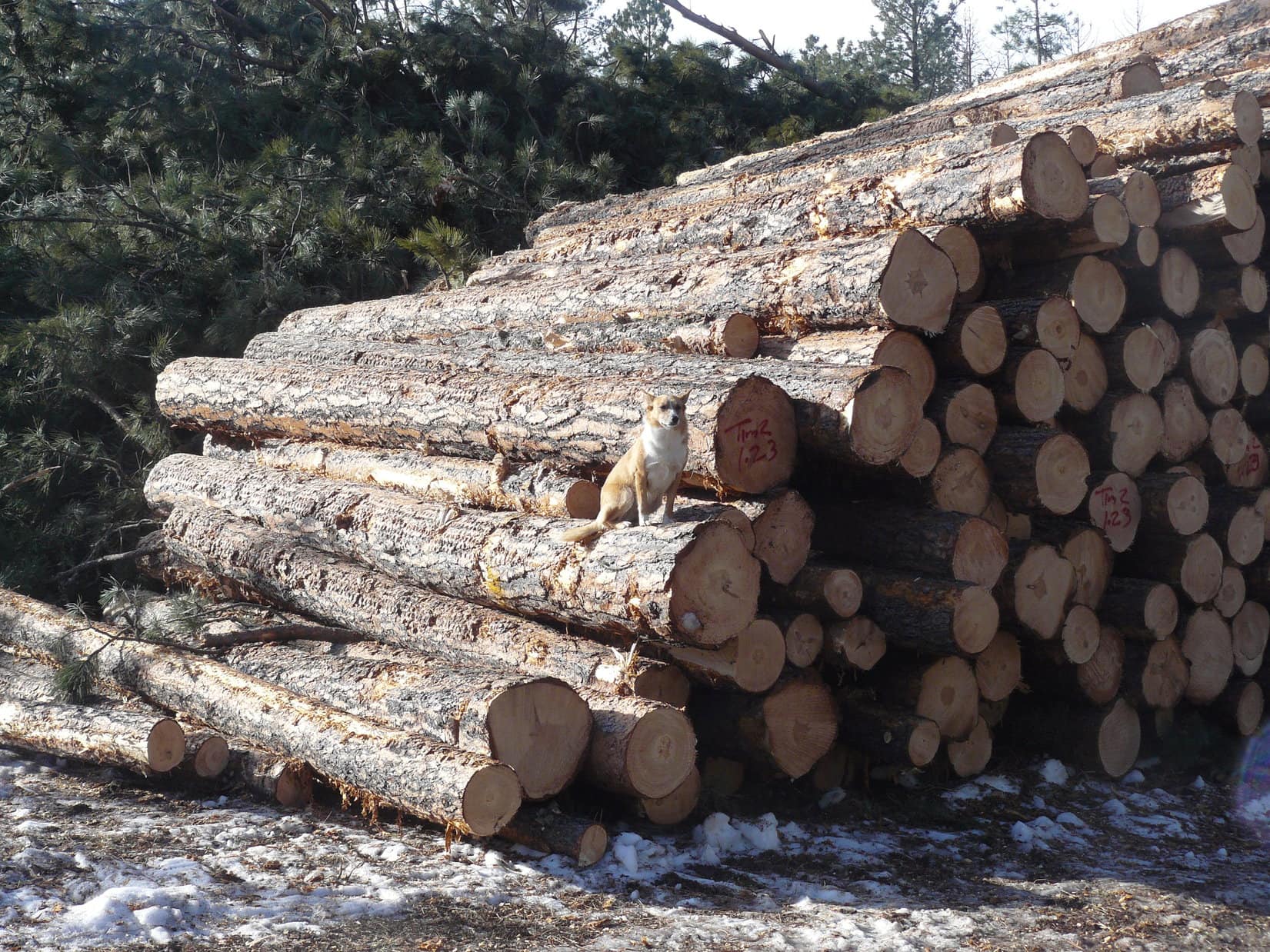
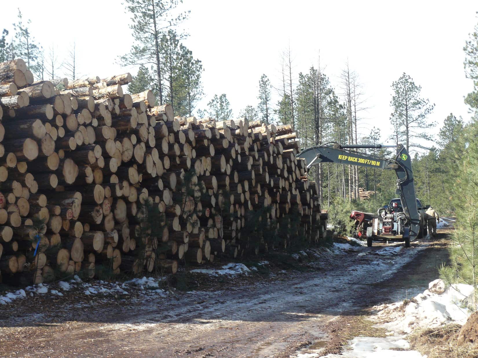
USFS Road No. 679.1 was covered with snow and ice. It wound around a lot, but steadily gained elevation while working its erratic way W. After Lupe had gone nearly 2 miles along the road (just 1 mile as the crow flies), she came to a huge pile of logs. A couple of loggers were there getting ready to go to work. The loggers had the interesting news that they had seen a mountain lion right there the previous day.
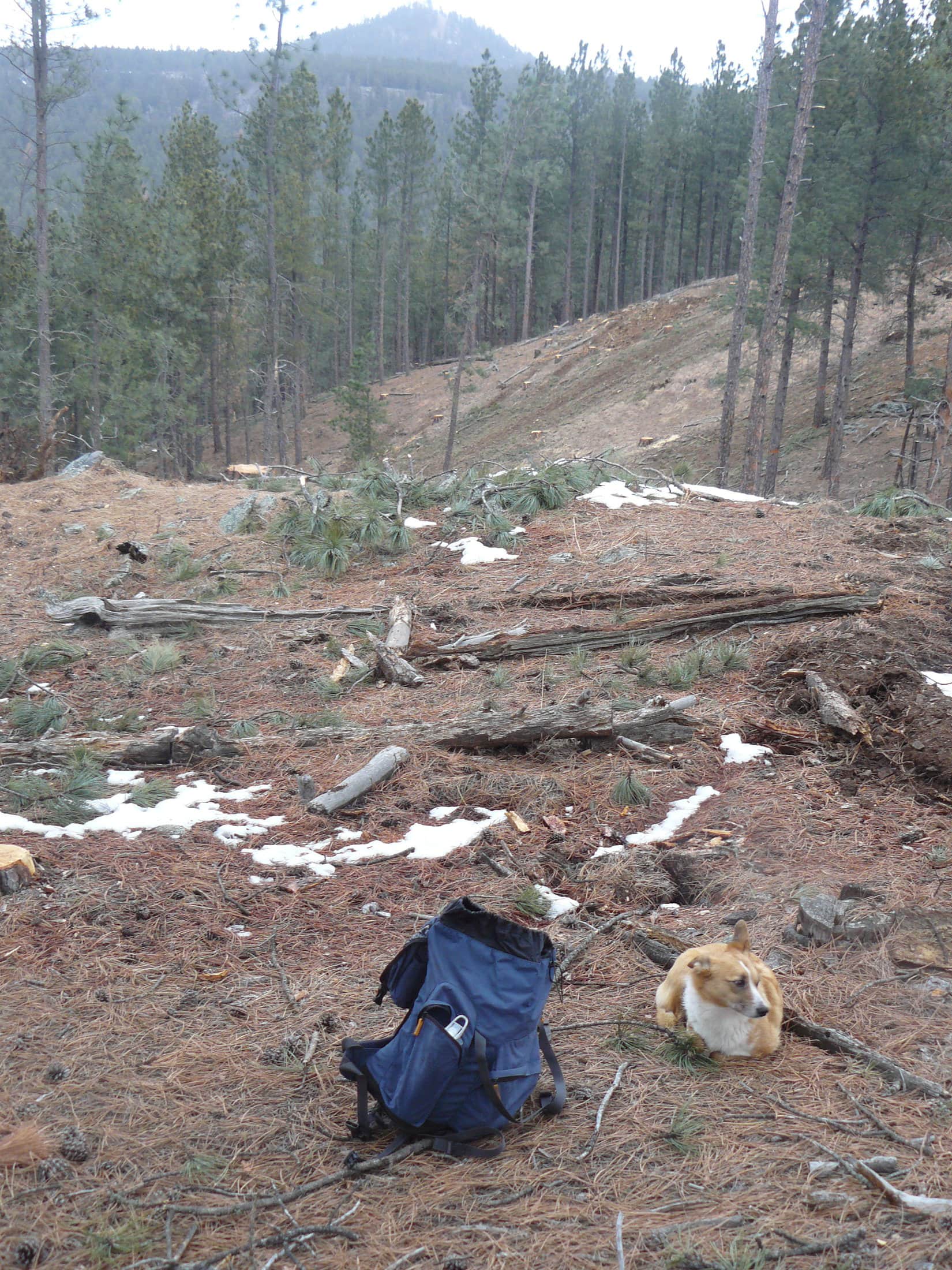
Lupe on the pile of logs along USFS Road No. 679.1 on her way to Green Mountain.Approaching the loggers.
Lupe had scarcely passed the loggers when the ridge to Green Mountain came into sight to the SW. Lupe and SPHP left the road to head up through an area where the forest had been greatly thinned to reach the top of the ridge. The top of the ridge was still forested. Lupe followed a faint path SE along the ridge.
Lupe on the forested ridge leading to Green Mountain. Photo looks SE the direction would take to the summit.
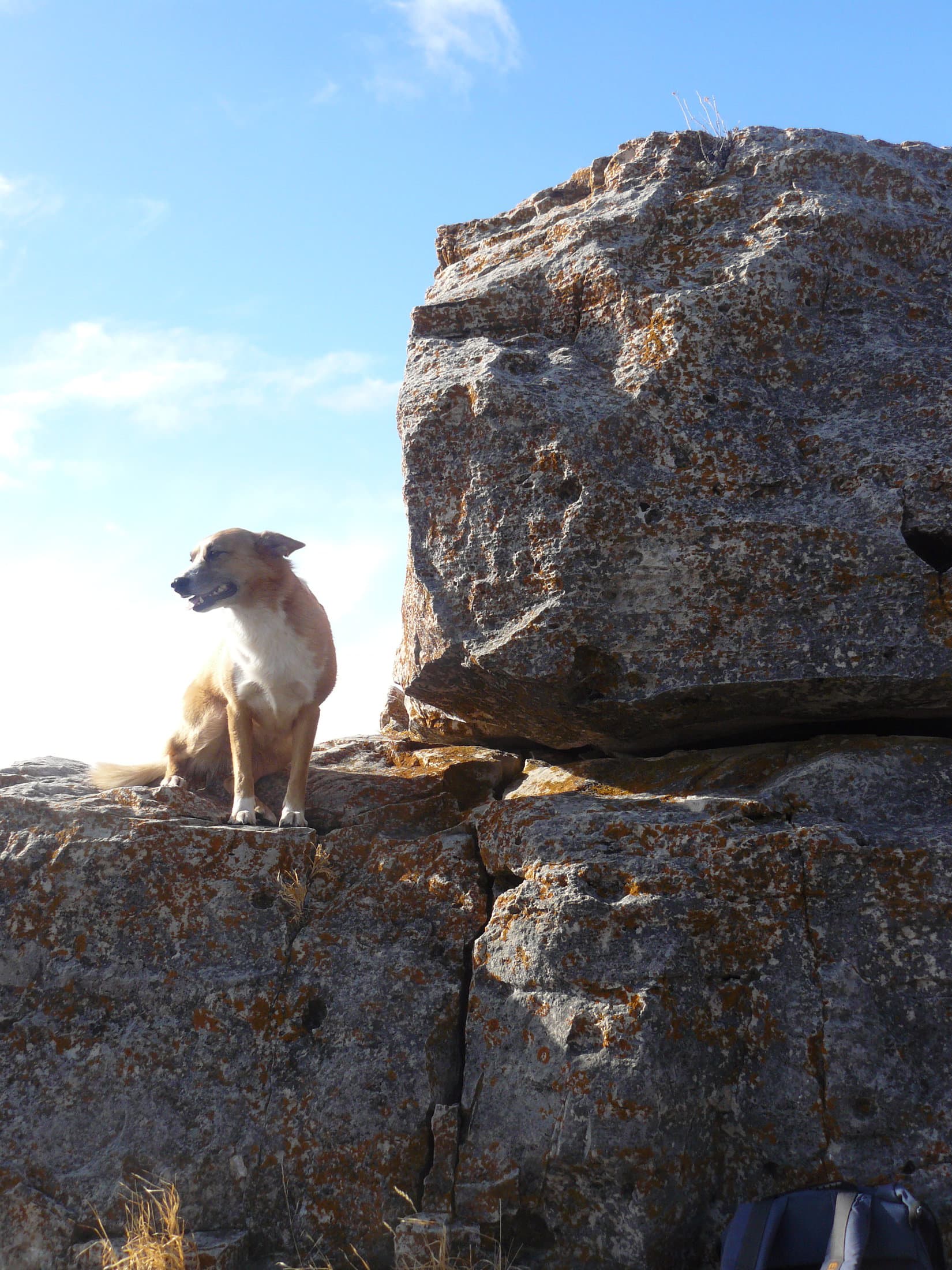
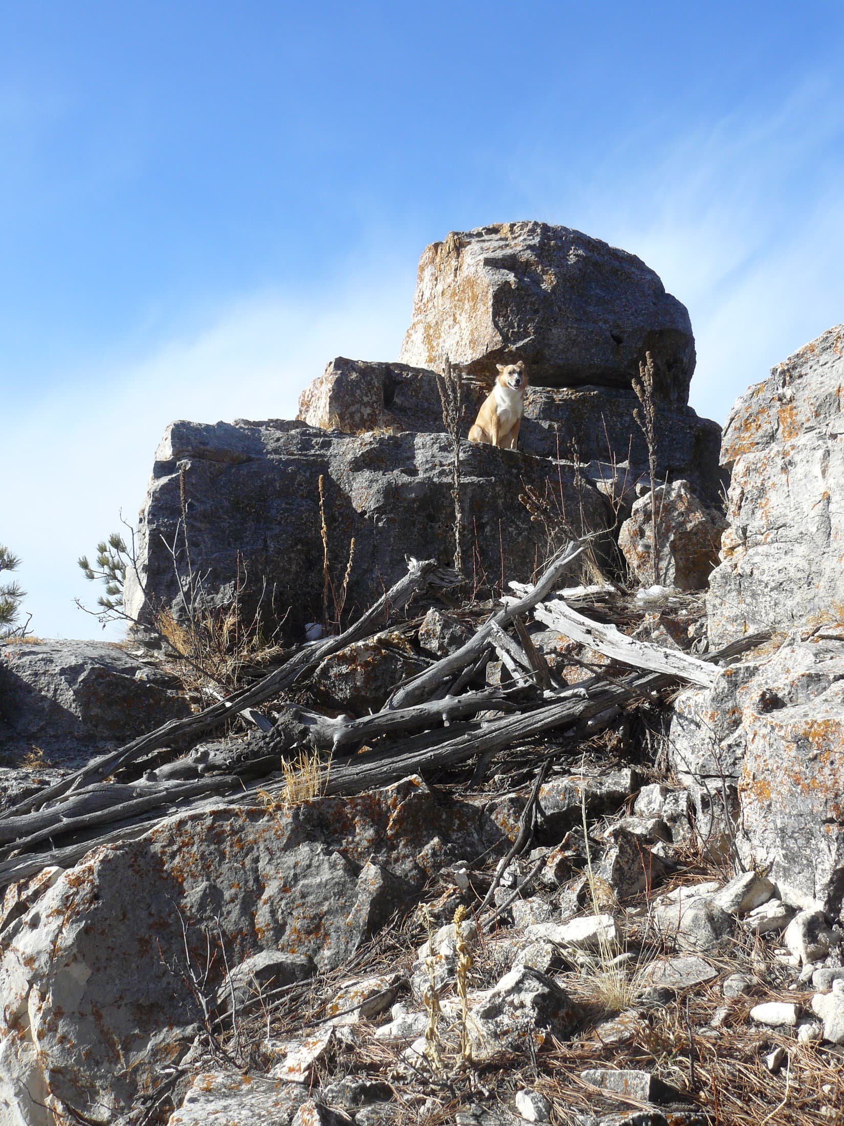
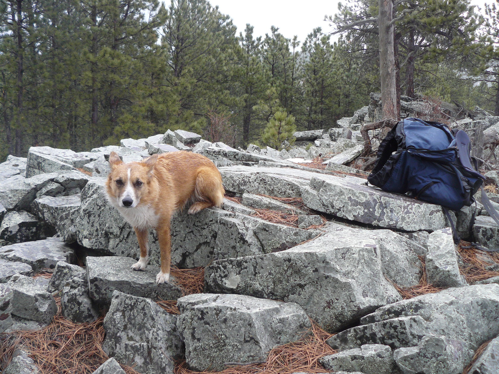
As Lupe got close to the summit of Green Mountain, she started to encounter rock outcroppings. At the summit, there was a small area of limestone jutting sharply up above the surrounding terrain. The limestone formation was about 20 – 25 feet high. It was pretty easy to climb almost all the way to the top. In order for Lupe to reach the very top, though, SPHP had to lift her up onto the highest rock.
Lupe didn’t like it up on the highest rock on Green Mountain. It was high enough to be a little scary. Mostly, though, she didn’t like the wind. The wind hadn’t been much of a problem, so far, but up on top of Green Mountain, Lupe felt its full force. SPHP wanted Lupe to stay up on the highest rock long enough for SPHP to climb down and get a good picture of her sitting up there.
The only picture SPHP got of Lupe on the very top of Green Mountain was one taken while still right beside her. As soon as SPHP moved away, despite SPHP’s protestations, Lupe leaped down. She wasn’t staying up there in that gale! No way! American Dingoes have lots better sense than that!
Lupe started to encounter limestone rock outcroppings as she got close to the summit of Green Mountain.Lupe sitting up next to the highest rock on Green Mountain. SPHP had to climb up there, too, in order to lift a reluctant Lupe up to the very top.Lupe was fine sitting next to the highest rock on Green Mountain. It was to her N and shielding her from the strong wind.This is the only photo SPHP would get of Lupe on the highest rock on Green Mountain. She did not like it up there in the wind! She jumped down at her first opportunity.
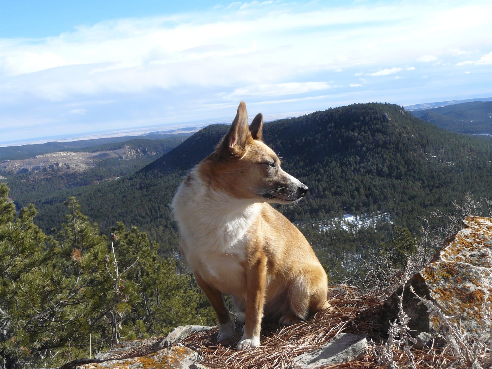
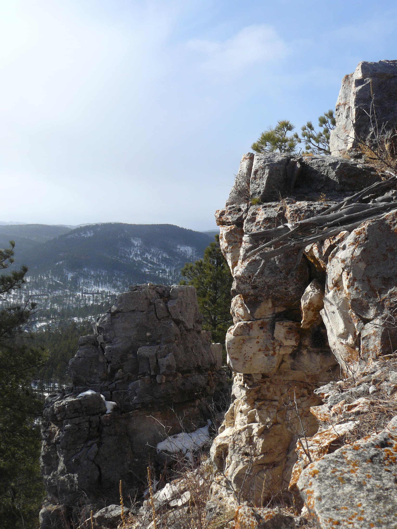
SPHP knew it was pointless to lift Lupe back up onto the top rock again. She would just jump down again. The 30+ mph N wind was just too annoying. Instead, Lupe and SPHP retreated maybe 20 feet down to the SE of the summit, where it wasn’t so breezy. There were some nice views to the S and E from here.
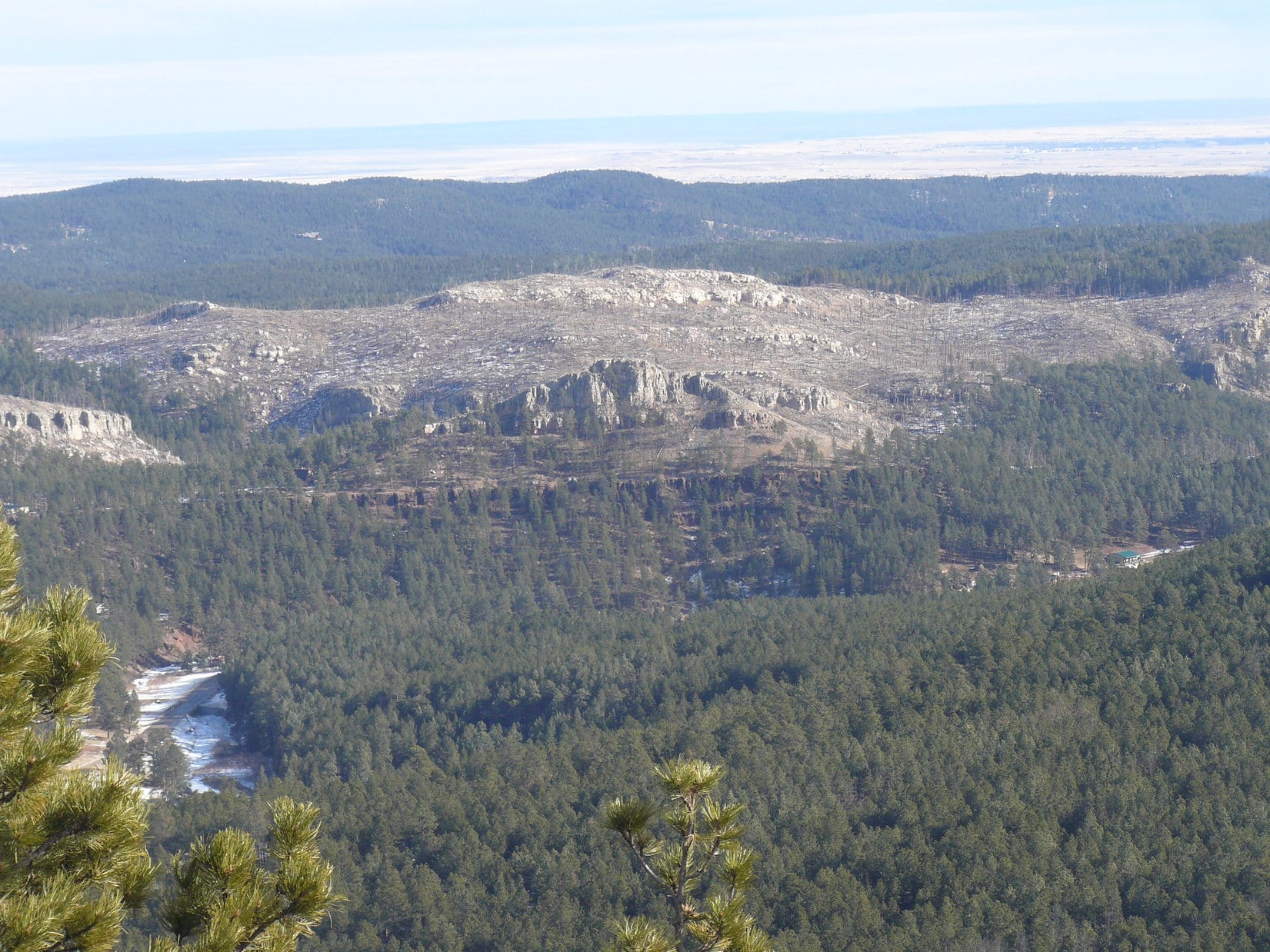
Lupe likes it better here. She’s just SE of the summit of Green Mountain, but much better protected from the wind. Photo looks SE toward forested High Point 5136.Looking E toward a burned area E of Nemo Road from Green Mountain.
The views were great from Green Mountain from the E around to the S, and all the way over to the WSW. SPHP tried to spot Hat Mountain, Lupe’s next objective, which was about 3 miles off to the SE. There was a clear view of a lot of territory in that direction, but SPHP had no success identifying Hat Mountain.
SPHP persuaded Lupe to go back up toward the summit of Green Mountain again. Lupe agreed to cooperate, but only if she didn’t have to sit way up on top getting blasted by the wind. She was fine with being just a little below the summit, sheltered from the wind by the rocks.
Lupe just below the summit of Green Mountain. There was a considerably larger drop off on the other side of the rocks. Photo looks NW.
Looking W from Green Mountain.
To get to Hat Mountain, Lupe’s next peakbagging goal, she needed to go SE. However, Green Mountain dropped off very steeply in that direction. The easiest way down was to go back to the NW along the ridge far enough to where the sides of the mountain weren’t so steep.
Lupe and SPHP were about to leave Green Mountain heading NW, when a series of squall lines started moving in from the N. Blown by the strong N wind, they came fast and left just as fast, spitting rain as they passed over.
Lupe caught a glimpse of the first of several rare Northern Rainbows that she would see during the day as she left Green Mountain. All the rainbows that SPHP could remember had always been in the E or the W, when slanting rays of the sun shone through raindrops in the air. These rare Northern Rainbows were due to the date, time, and unusually warm weather.
The January sun just isn’t all that high above the S horizon, even during the middle of the day. Ordinarily any precipitation this time of year would have been in the form of snow, not rain. The combination of the sun’s rays coming slanting in from the S, and shining through the rain squalls blowing in from the N, caused the Northern Rainbows.
Some of the rainbows were quite brilliant for a few moments, but they didn’t last long as the wind pushed the squall lines through quickly. Unfortunately, Lupe and SPHP were never where there was a clear view to the N when the rainbows formed. It was still fun to catch glimpses of them now and then.
Lupe caught a glimpse of this Northern Rainbow as she left Green Mountain. She saw several others during the day, too, but never had a good clear view of them.
As soon as the sides of Green Mountain’s NW ridge were less steep, Lupe and SPHP started heading S down off the ridge. When the ground eventually leveled out, Lupe turned more SE in the direction of Hat Mountain, still 3 miles away.
Soon Lupe and SPHP found themselves at the edge of a long limestone cliff above the Bogus Jim Creek valley. Even if there had been a way down, the land below was nearly all privately owned. Homes on acreages were scattered sparsely in the valley below.
Lupe and SPHP searched for a way down and around the private land. Finally, Lupe found a way, but it involved a long detour to the W. Lupe reached USFS Road No. 201.2J, and eventually made it to the main gravel road near Bogus Jim Creek. Now down in the valley, Lupe headed E on the main road. SPHP kept an eye out for USFS Road No. 201.1B.
Lupe trots along USFS Road No. 201.2J. This detour to the W took a lot of time, but did ultimately lead Lupe on down to County Road No. 270 (Bogus Jim Road), the main gravel road near Bogus Jim Creek.
When Lupe finally made it to USFS Road No. 201.1B, SPHP was still optimistic that Lupe would find and climb Hat Mountain. A lot of time had been lost on the detour way around to the W, but all Lupe had to do was follow No. 201.1B up over a big ridge on the S side of the Bogus Jim Creek valley, and then turn ESE until she came to Hat Mountain.
Lupe takes a break 100 yards from USFS Road No. 201.1B on the S side of the Bogus Jim Creek valley. Green Mountain, where Lupe had been just a couple hours ago, looms to the N. Only a few minutes earlier, there had been a bright Northern Rainbow, but by the time Lupe and SPHP got to this opening in the forest for a photo, the sky clouded over and the rainbow disappeared.
It sounded easy, but it wasn’t. No. 201.1B turned E before it got up over the ridge. Lupe and SPHP tried a side road, which may have been No. 201.1H, but it soon turned W. Lupe and SPHP abandoned the roads to climb directly up the slope, and ultimately succeeded in reaching flatter ground above. There Lupe and SPHP encountered a maze of little roads in the forest. Some of the roads were marked with ATV Trail Numbers, but they meant nothing on SPHP’s old USFS map.
Lupe and SPHP had by now crossed over the S ridge, and out of the Bogus Jim Creek drainage area. Hat Mountain was likely no more than 1.5 miles away, and probably less, but the weather was deteriorating. The sky was clouded over nearly all the time now. Although the rain showers were supposed to have ended by noon, the rain was really just getting going. The wind continued to roar in the trees. Occasionally the sun still made a brief appearance, but increasingly the low clouds and rain were closing in.
Without being able to see the sun, orientation became difficult. The relatively level forest provided no views. SPHP led Lupe on a series of little roads heading SE, but Hat Mountain did not appear. Finally, through the forest, SPHP saw a small rocky high point that looked like it would offer a view. Lupe and SPHP were soon there.
Lupe arrives at High Point 5219.
The little rock outcropping yielded a view alright, but not the view SPHP was expecting. SPHP expected to see Hat Mountain, or perhaps Norris Peak(4,982 ft.) or even Thrall Mountain(5,091 ft.). Hat Mountain was nowhere to be seen. Neither was Norris Peak. Much farther off to the E than it should have been, was a mountain that looked like it might be Thrall Mountain. It was hard to tell in the rain and clouds.
Just a glance was enough. SPHP knew instantly that Lupe was nowhere near Hat Mountain. Lupe and SPHP had been heading SW instead of SE. Far below, SPHP could see a short stretch of Hwy 44W that looked familiar. Lupe was well W of Johnson Siding, or even Pine Cliff. Miles off to the SW was a mountain that SPHP recognized. The Seth Bullock Lookout Tower was barely visible on Scruton Mountain(5,922 ft.).
Looking SW from High Point 5219. This view, which disappeared in the clouds minutes later, enabled SPHP to quickly figure out where Lupe was.
Time to look at the maps. Lupe sat uncomfortably on the rocks while SPHP tried to pinpoint where Lupe might really be. The wind continued blowing. It was raining, not hard, but enough so Lupe was gradually becoming a pretty soggy doggie. SPHP glanced up for another look at the view to the SW. It was gone. Now there was just fog.
Lupe sat uncomfortably on the rocks getting wetter and more miserable looking as SPHP checked the maps.A rather soggy doggie Lupe at High Point 5219. Why she chose to sit perched so strangely is a mystery.“Come on, SPHP, figure it out! You told me we were going to Hat Mountain. If this isn’t it, where in the world are we?”
It was OK. SPHP had seen enough. From the maps, the only thing that made sense was that Lupe and SPHP had inadvertently arrived at High Point 5219. Hat Mountain was now nearly 2 miles to the ENE. No way Lupe and SPHP were going to find it today. There wasn’t time, even if the weather had been better.
It was late, the weather wasn’t so hot, Hat Mountain had eluded Lupe, and it was a long way back to the G6. Time to start making tracks! Actually, time to start following tracks back the way Lupe and SPHP had come. It was a good thing there was some snow on the ground. SPHP set off from High Point 5219 at a lively pace retracing Lupe’s path in the snow. SPHP was making great progress until…..
Until SPHP turned around. Lupe wasn’t there! She wasn’t following, and SPHP hadn’t seen her up ahead for a few minutes either. SPHP was alone in the windy, rainy, almost foggy forest. Raindrops on SPHP’s glasses made it difficult to see clearly. Where had Lupe gone? She always stays close. She never runs off for more than a few minutes, without coming back to check on SPHP.
SPHP went back. Soon SPHP spotted Lupe. She was at the end of a dead tree trunk, digging furiously. Clouds of reddish brown dirt and rotten wood went up around her. SPHP was amazed to see her start ripping the old tree trunk apart with her teeth. Clearly, Lupe was convinced something mighty interesting was in that old log.
Lupe had forgotten all about SPHP and was digging furiously at the end of a hollow log.
Clouds of rotten wood flew; Lupe ripped big chunks of the old log off with her teeth. Lupe kept hard at it. When Lupe loosened a particularly big piece of wood, SPHP helped her break it off. She continued digging like a Dingo possessed.
Suddenly a bunny streaked out of the other end of the log, and made a mad dash through the forest. Lupe yipped and was after it. They were both out of view in a flash. SPHP ran after them. Lupe’s frustrated yipping led SPHP to her. The bunny knew this forest, and every hollow log in it. It was now hiding in Hollow Log No. 2. No telling how many hollow logs that rabbit was familiar with!
Lupe hadn’t lost an ounce of enthusiasm. She was digging furiously again, now at the end of Hollow Log No. 2. Well, this couldn’t go on. Time to leave the bunny alone. Lupe was plenty disappointed when SPHP made her leave. No doubt the American Dingo thought SPHP had absolutely no idea how to fend for oneself in the wild. Here was a perfectly good fresh rabbit dinner being passed up for a long trek in the wind and rain on an empty stomach. Humans have no instincts worthy of the name!
It was a long way, hours, back to the G6. Lupe and SPHP made it back to the main gravel road in the Bogus Jim Creek valley while there was still some light. The rain had stopped. The wind even died down somewhat. The sky partially cleared. Lupe and SPHP trudged onward.
Along USFS Road No. 679.1, the darkness came. It should have been easy to follow the road back, but SPHP got lost. More than once. Several times SPHP took wrong side roads, not realizing they were side roads. Lupe waited patiently while SPHP stopped to study maps with a flashlight each time it became clear something wasn’t right.
Orion was blazing brightly in the night sky by the time Lupe and SPHP reached the G6 again. It was 7:54 PM, and still 36°F when Lupe hopped into the G6 for the ride home. Back home, Lupe and SPHP feasted on spaghetti and chocolate cake. It was good, but SPHP suspected Lupe would have much preferred rabbit.
Near High Point 5219, Lupe rips apart Hollow Log No. 1 with her teeth in her anxiety to get at the bunny hiding inside!


 Shell Falls is located 14 miles E of Greybull, WY in Shell Canyon. A parking lot and visitor center are right next to the N side of the highway. Shell Falls is a quick scenic stop for travelers on their way W to Yellowstone National Park.