The Dolomites, Giant Mushroom & Cedar Mountain, Bighorn Mountains, Wyoming (6-10-18)

Day 2 of Lupe’s 2018 Dingo Vacation to the Bighorn Mountains & Beyond!

The wee hours – The Carolina Dog couldn’t sleep.  Loop shifted around repeatedly trying to get comfortable.  Nothing worked.  Her sunset trek to Prospect Benchmark (9,774 ft.) hadn’t been long enough to tucker her out.  This was the first night of the first Dingo Vacation in nearly 9 months.  Lupe was on an adventure high, excited beyond words.

The restless Dingo.

All choked up and needing to take some allergy medicine, SPHP stepped out of the G6.  Lupe shot out into the night.  At 9,600 feet, a zillion stars blazed with incredible intensity in a limitless, moonless void.

SPHP drank the medicine, then rearranged Lupe’s blankets for her.  She would be back soon enough.  For the moment she was off checking out whatever wafted on the chilly SW breeze.  Adjusting to being back on a Dingo Vacation can take a few days.  Even SPHP had dozed fitfully.

Before long, Lupe returned.

The next time SPHP stirred, the stars were gone.  The American Dingo was awake and alertly watching a gray pre-dawn world.  Had she slept at all?  Who knew?  SPHP rolled over.  Still too early.  Back to sleep.  The anti-histamine helped.

(Start – 7:16 AM, 47°F)  The sun had been shining just a little while ago, but in the brief time it took for Loop and SPHP to share some chicken for breakfast, it had disappeared behind a line of clouds.  Not that cold out, but the SW breeze had picked up to 20 mph, making it feel chilly.

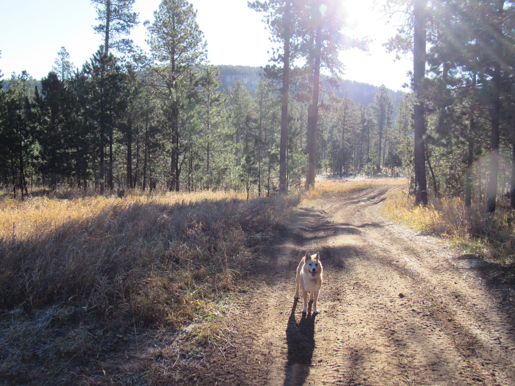
Loopster didn’t care for the wind, but was anxious to get going anyway.  Prospect Benchmark (9,774 ft.) was only 0.33 mile SW, an easy stroll up a grassy slope.  Wouldn’t take long to tag the summit again and get back.  The day’s main event would come soon after.

The Carolina Dog made it up to Prospect Benchmark in a flash.  The wind had lost its punch just as quickly.  Only a light W breeze up here.  Sweet!  Lots of high thin clouds around, but otherwise a promising June morning in the Bighorns.

Starting the new day out right with a grand view of Cloud Peak (13,167 ft.) (Center) from Prospect Benchmark. Photo looks SE.

The mood was far different from what it had been yesterday evening.  The same sweeping panoramas from the barren summit that had invited Lupe to linger until sunset were now an inspiring call to action!

Lupe by the cairn SPHP had built yesterday evening. The Prospect survey benchmark is hidden close to her right behind it. Photo looks NW.
Similar view, but from the N end of Prospect Benchmark’s NE escarpment on the way back to the G6.

Of course, Lupe had been primed for action all along.  Now SPHP was chomping at the bit, too!  Loopster had an ambitious day of adventures ahead.  Time to get with the program!  After a brief survey of the sights from Prospect Benchmark, Looper and SPHP hurried back to the G6.  (End – 7:51 AM, 46°F)

A mere 2 miles winding SE on USFS Road No. 10 brought Lupe to a view of the first part of her playground for the day, an area SPHP knew as the Dolomites (Dolo-Mighties!).

Lupe with an early view of the Dolomites, the rock escarpment along the far ridge. USFS Road No. 10 is seen below. USFS Road No. 216 (R) heads up the hill toward the Dolomites. Photo looks S.

Another mile on No. 10 got Lupe down to the junction with USFS Road No. 216.  The Dolomites were just up the hill to the S.  Loop and SPHP set off at once, following No. 216 part of the way before leaving it to climb toward the first escarpment.

Loop about to set off for the Dolomites (L). Photo looks S.

Dolomite is a type of sedimentary rock, but whether or not what Lupe was heading for truly consisted of actual dolomite SPHP didn’t really know.  The Bighorn Mountains feature many big outcroppings of the same sort of rock.  SPHP had simply guessed and given the name The Dolomites to the formations in this particular location years ago.

These Dolomites are clearly some sort of sedimentary stone, white to light tan in color, but otherwise don’t resemble the limestones or sandstones found in Lupe’s home territory back in the Black Hills at all.  The rock is hard, not crumbly, and pockmarked with small, sharp-edged, rounded depressions.

Whatever type of rock The Dolomites really are, they form a narrow band of distinctive formations featuring high points separated by deep vertical-sided passageways that are fun to explore.  Lupe had been here once before, long ago on the first day of her very first Dingo Vacation ever way back in 2012 when she had gone clear to the West Coast with Lanis.

When Lupe reached the first high points at the N end of The Dolomites she had a fabulous view back toward Prospect Benchmark (9,774 ft.) where she had started her day.

Lupe reaches the first high points at the N end of The Dolomites with a fabulous view of Prospect Benchmark (R) where she had just been. Photo looks NW.

Roaming SSE along the escarpment, Lupe sniffed and explored among The Dolomites as fancy struck her.  Many brightly colored wildflowers were in bloom.  Most were tiny.

Exploring The Dolomites. Photo looks SE.
This would be a fun place to play Hide & Seek! Too bad you’re not very tricky, SPHP. Bet I’d win every time! Photo looks ESE.
Look at those cool columns! Guess we’re not getting to the tops of all these rocks, are we? Photo looks SE.
Delicate wildflowers. Scientifically, blui feral floweri in the Dingo classification system.
Among blue and yellow wildflowers. Prospect Benchmark (Center) in the distance. Photo looks NW.

The best of The Dolomites started right where Lupe first reached the N end of the escarpment and ran SSE.  It didn’t take Loop long to wander past the most dramatic and interesting formations.  However, there was a special “must see” feature yet to come.  Lupe continued SSE looking for the Giant Mushroom.

The Carolina Dog crossed a field of crocuses along the way.

Lupe among the crocuses on her search for the Giant Mushroom. Photo looks ESE.
The prairie crocus (Pasque flower) is the state flower of South Dakota where Lupe lives.

It was farther to the Giant Mushroom than SPHP remembered.  Even so, Lupe only had to search 10 or 15 minutes before coming across it.  Loop had been only a bit over 1.5 years old when she was last here with Lanis in August, 2012.  That day seemed like a long time ago, but the Giant Mushroom still looked the same.

Here it is – the Giant Mushroom! Pretty spiffy, aye? Photo looks ESE.
Wow, almost 6 years ago now since I was last here with Lanis! Scary! Photo looks N.

No trip to the Dolomites is truly complete without going all the way to the narrow ridge extending E from the far S end.  The E ridge is a great viewpoint, and visiting it is a tradition.  Precisely how far E one wants to follow the ridge as it narrows is a matter of personal choice, however.

Naturally, Looper continued SE to explore the E ridge and wrap up her Dolomites tour.

Lupe reaches the W end of the Dolomite’s E ridge. Photo looks NW.
Loopster on the E ridge. The distant peak on the R may be Black Mountain (9,489 ft.). Photo looks NNE.
Looking ESE along the E ridge.
The E ridge eventually narrows to the point it becomes discontinuous. Photo looks SE.
A splendid view of Antelope Butte (9,935 ft.) (L), wouldn’t you agree? The Antelope Butte Ski Area closed in 2004, but they’re trying to get it going again for the 2018 – 2019 season! Photo looks SE.
Cloud Peak (13,167 ft.) (Center) & Black Tooth Mountain (13,005 ft.) (L) from The Dolomites. Photo looks SE with lots of help from the telephoto lens.
Unidentified peak (Center). Bruce Mountain? Dome Peak (10,828)? SPHP didn’t know. Photo looks SE with help from the telephoto lens.

Lupe had explored The Dolomites.  She had found the Giant Mushroom and seen the views from the E ridge.  In short, she had done all the easy preliminary stuff on today’s adventure action plan, but she still hadn’t gotten very far.  Loop wasn’t more than a mile from the G6.

That was about to change.  Cedar Mountain (9,813 ft.), a good 3 miles W of her current position at The Dolomites, was the American Dingo’s next objective.  SPHP even had visions of Loopster going another 3 or 4 miles beyond Cedar Mountain all the way to Copmans Tomb.  From the edge of Copmans Tomb she would have a giant view down into Shell Canyon, and might even see Shell Falls more than 2,500 feet below.

Looper was all for this plan!  She would get to see a lot of new territory, much of which was open ground offering views and endless room to run.  The Dolomites are located on the NE side of High Point 9702.  To put this plan into action, Lupe’s first task was to cross this hill heading SW for the saddle leading to Cedar Mountain.

Lupe and SPHP left The Dolomites.  The Carolina Dog was soon out of the pines traveling SW across a sunny meadow.  Crocuses bloomed here in magnificent profusion.  A barbed wire fence had to be crossed.  Lupe snuck under it.  She gained minor elevation, less than 100 feet, passing N of High Point 9702.

Crocuses flourished by the thousands in sunny meadows.

Slightly higher ground dotted with stands of pines and long, narrow snowbanks came into view a good 0.5 mile away.  That ridge would lead Lupe to Cedar Mountain.

OK. We’re almost across High Point 9702 now. That high ground in the distance will take us to Cedar Mountain! Photo looks WSW.

Lupe lost 100 feet of elevation crossing the wide saddle leading to Cedar Mountain.  She was already regaining it by the time she reached USFS Road No. 216 heading SW up the far side.

Loop on the way down to the wide saddle (not shown off the R edge). Part of Shell Canyon is seen in the distance on the L. Photo looks S.

The topo map showed that Lupe could simply follow No. 216 all the way to a point 0.25 mile directly S of the Cedar Mountain summit.  However, exploring the ridge N of the road seemed like more fun.  Shortly before reaching Pass 9721, Lupe abandoned No. 216 heading NW toward the top of the ridge.

Lupe near Pass 9721 shortly after leaving USFS Road No. 216. Antelope Butte is in the distance on the L. Photo looks S.

This climb didn’t amount to much at all, mere 10’s of feet, not hundreds.  After cresting a minor escarpment, Lupe traveled NW up a gentle open slope.  The terrain soon leveled out.  Stands of stunted pines grew along the N rim of the ridge.  Meadows were to the S.

As long as the pines and occasional snowdrifts weren’t too troublesome, Lupe sniffed her way W along the N rim.  She had sweeping views from the edge of a long dolomite cliff.  Prospect Benchmark (9,774 ft.) was again in sight 2 miles away beyond huge Cedar Creek canyon.  The cliff grew in height as Loop got farther W.

Lupe sniffs along the N rim of Cedar Mountain’s long E ridge. Prospect Benchmark (Center) is in view. Photo looks N.
Looking back across the wide saddle toward High Point 9702, which looks practically flat from here. Lupe had just come from this direction crossing somewhat toward the R (SE). Photo looks NE.
Loop up on the cliffs along the N rim. Photo looks SE.
Lupe loved the snowdrifts she encountered along the N rim, but some were so large it was easier to stay farther S in sunny, snow-free meadows. Photo looks NNW.

Eventually the pines and snowdrifts became harder to push past.  Lupe and SPHP abandoned the fabulous views along the N rim for meadows a short distance S.  Loop continued W, staying a bit N of a line of orange metal fence posts.  The original barbed wire fence was laying flat upon the ground, all the wooden posts and strands of barbed wire still intact.

Whether the fence had fallen over, or had been toppled on purpose wasn’t clear.  Whatever the case, the horizontal rows of barbed wire inches above the ground were a hazard for Lupe.  SPHP made certain she didn’t try to cross them by herself.

Another slightly higher, mostly forested ridge could be seen off to the SW.  The summit of Cedar Mountain had to be somewhere up there.

Lupe followed this line of orange fence posts W (R) until she got closer to the higher ground seen at Center. The summit of Cedar Mountain is somewhere up there! Photo looks SW.

While still N of the fence, Lupe discovered a shallow depression with a snow bank in it.  Sinkholes like this are fairly common in the dolomite.  This one wasn’t deep at all compared to some.

Lupe discovers a small sinkhole forming in the dolomite. Photo looks W.

Eventually Lupe needed to get S of the dangerous fence.  SPHP picked her up and carried her over the barbed wire.  Loopster had followed the fence for so long that the higher ground to the SW wasn’t much farther.  Unfortunately, the most direct route higher was heavily forested.

The American Dingo didn’t mind being in the forest at all.  She quickly reached a high point buried in deadfall and standing timber.  Was this the true summit of Cedar Mountain?  Maybe.  The terrain was almost flat, but seemed to drop at least slightly in all directions.  Hard to tell for certain, though, since absolutely nothing else could be seen from here.

Lupe leapt up onto the deadfall above the high point to claim a possible Cedar Mountain peakbagging success!

Lupe claims a possible peakbagging success of Cedar Mountain at a high point hidden among thick forest. Photo looks … hmm … not very far whatever direction this is.

Whether Lupe had found the top of Cedar Mountain or not, maybe it was time for a break?  As it turned out, the edge of the forest was only 30 feet S of the high point.  A nice opening provided a grand, but distant view of Cloud Peak (13,167) and Black Tooth Mountain (13,005 ft.) many miles beyond Antelope Butte (9,935 ft.).  Not a bad spot to relax!

Antelope Butte in the foreground with Cloud Peak (Center) directly beyond it. Black Tooth Mountain is on the L. Photo looks SE with help from the telephoto lens.

The rest break featured a veritable feast compared to the normal paltry fare.  SPHP had fried chicken and a Coke.  However, even though it was now noon, Lupe wasn’t the least bit hungry.  SPHP tried offering her a chicken skin, but the Carolina Dog decided to save it for later, spending several minutes burying it with her nose.

A ferocious Dingo on guard near the secret burial site of a valuable chicken skin.

A look at the topo map led SPHP to suspect that Lupe hadn’t made it to the top of Cedar Mountain yet.  The terrain here didn’t look right.  The true summit was likely farther W.  So after 20 minutes, Loop and SPHP continued WSW through the forest.

Loopster was having a blast looking for squirrels!  She found two in quick succession.  The forest rang with her shrill barking.  Good times, for sure, but she was gradually losing elevation.  After 10 minutes, though, a partially bare hillside came into sight.  The top was forested and couldn’t be seen, but this hill was definitely higher than the prior high point amid all the deadfall.

A short climb brought Lupe to the top of Cedar Mountain (9,813 ft.).  No doubt about it this time around!  The summit area was divided between open ground and forest, with the highest spot right along the edge of the trees.  Forest dominated to the N, while a much larger area covered only by white stones and sparse vegetation lay to the S.

Lupe reaches the true summit of Cedar Mountain. Photo looks N.
Looper finally claims a genuine Cedar Mountain peakbagging success!
A big, flat, open area S of the true summit was nearly as high. Photo looks SSW.

The best views from Cedar Mountain were once again off to the SE.

Loopster along the SE edge of the summit area. She could see a tremendous amount of territory all the way to Cloud Peak (Center). Photo looks SE.
Cedar Mountain’s S ridge from SE of the summit. USFS Road No. 216 is in view below. Photo looks S.

Going 50 feet down the forested slope NW of the true summit brought Lupe to a clearing from which she also had impressive views to the N.

Prospect Benchmark (Center) from Cedar Mountain. Photo looks NNE.
Looking NW over Cedar Creek canyon.

Copmans Tomb, still 3.5 miles to the SW, was Lupe’s final objective for the day.  She would lose 1,000 feet of elevation going there that would have to be regained on the return trip.  Since going to Copmans Tomb and back would add 7 total miles to today’s adventure, Loop clearly couldn’t stay too long at Cedar Mountain.  She needed to get going.  It was already early afternoon.

Lupe and SPHP went far enough W to get beyond the trees blocking the view to the SW.  For hours the sky had been clouding up, but so slowly that the deterioration drew hardly any attention.  To the SW, though, the weather looked particularly hazy, gray, and dark.  Not threatening, but suspect.  Loop could see a vast territory in this indistinct murk, but SPHP couldn’t pick out Copmans Tomb.

According to the map, it ought to be a cinch to follow Cedar Mountain’s giant W ridge to Copmans Tomb.  Piece of cake.  Yet the scene gave SPHP pause.  The air felt colder than before.  Maybe Copmans Tomb was being overly ambitious?  Being caught out in bad weather is rarely much fun.  Perhaps that was in the cards if Lupe kept going?

So you coming, SPHP?  What’s the holdup?

Oh, I don’t know, Looper.  Suddenly I’m not feeling it.  Copmans Tomb looks like a long way.  Not sure about this weather, either.

We don’t have to go, if you don’t want to.  Are you sick?

No, I’m fine.  I’d really like to see Shell Falls from Copmans Tomb, but it seemed like a better idea when everything was flowers and sunshine.  Maybe I’m just being lazy?

Well, then.  We could just relax here a bit and see how things develop.

Alright, maybe for a few minutes.  We need to make a decision soon, though, if we are actually going on.

The best place to relax was back at the SE edge of the summit area where those splendid views toward Cloud Peak were.  When Lupe got there, she curled up on a grassy slope dotted with little flowers.  SPHP sat beside her.  Yes, this was lovely!

A view to relax by. Photo looks SE.
Black Tooth Mountain (L) and Cloud Peak (R) with the Antelope Butte summit in the foreground. Photo looks SE with maximum assistance from the telephoto lens.
Quiet time on Cedar Mountain.

15 peaceful minutes alone together just watching this beautiful piece of the world.  SPHP stroked Lupe’s soft ears and talked to her.  She listened carefully to every word.  Not much changed.  The sky remained cloudy and gray.  Ambitions drained away.  Cedar Mountain was enough.

Sadly, Copmans Tomb wasn’t happening.  Whether due to nature’s mood swing or SPHP’s own laziness wasn’t clear.  What was clear was that Lupe could enjoy a leisurely return to the G6.  Plenty of time for that.

If Loopster was disappointed, she never let on.  After returning briefly to Cedar Mountain’s true summit and NW viewpoint, the Carolina Dog made a real show of having a great time heading back through the forest looking for a second shot at those always entertaining squirrels.

Busy Dingo fun times in the forest.

Lupe’s route back was essentially the same as the one she had taken to Cedar Mountain.  At her insistence, more rest breaks came along the N rim of the long E ridge.  Minus squirrel-inspired adrenaline, her energy level seemed to drop, too.

Heading back along the N rim. Photo looks SE.
These bright yellow flowers seemed to have absorbed all of the day’s sunshine.

After leaving Cedar Mountain’s E ridge, Lupe followed USFS Road No. 216 down into the wide saddle and up the other side.  She stayed on the road all the way to its high point at Pass 9623.

Scattered raindrops fell.  Patches of fog drifted along some of the ridges.  The G6 was less than a mile away now by the road.  No.  Not yet.  Lupe and SPHP left the road heading E well N of High Point 9702.

Lupe returned to The Dolomites.  Still time for a quick reverse tour!  Still time to see the Giant Mushroom once more!

Lupe nearing The Dolomites E ridge again. Photo looks SW back toward High Point 9702 (Center).
Back at the Giant Mushroom. Photo looks SE.

A light rain fell as Lupe explored the intricacies of The Dolomites again.  This morning a camper had been in view among trees not far from the G6.  On the way back, Loop slunk by to see who or what occupied it.  The answer: no one.  It was abandoned, full of trash and debris.  A tattered tarp flapped forlornly in the breeze.

Someone’s wilderness dream gone bad.  Creepy.  A haunted camper.

The fog rolled in 5 minutes after Lupe got back to the G6.  (4:14 PM, 57°F)  Never too thick, it sailed wispily by on a W breeze.  Half an hour later came a 5 minute deluge of pea-sized hail.  Another 30 minutes brought a second dose.

For a couple of hours, patches of blue sky reappeared.  Lupe and SPHP played with a tennis ball.  By 7:00 PM, though, the G6 was socked in by dense fog.  Coyotes howled eerily from somewhere near The Dolomites beyond the haunted camper.

Oh, and here I am safe and sound back at the G6 before 4:15 PM. And to think I could have been wandering around lost out there later on in rain, hail, and dense fog among hungry howling wild dogs and creaking haunted campers as night approached! Best we didn’t go all the way to Copmans Tomb! Sometimes it pays to forget silly ambitions and just take life easy!

Note:  USFS Road No. 10 leaves the W (R) side of Highway 14 roughly 9 or 10 miles S of Burgess Junction.  No. 10’s intersection with USFS Road No. 216 is a mile W of the highway.  The saddle 0.33 mile N of Prospect Benchmark is another 3 miles NW on No. 10.

Links:

Next Adventure          Prior Adventure

Want more Lupe adventures?  Choose from Lupe’s 2018 Dingo Vacation to the Bighorn Mountains of Wyoming & Beyond Adventure IndexDingo Vacations Adventure Index or Master Adventure Index.  Or subscribe free to new Lupe adventures.

Black Hills, SD Expedition No. 238 – Centennial Trail No. 89: South Boxelder Creek to Dalton Lake (10-28-18)

Start – 8:53 AM, 28°F, South Boxelder Creek trailhead of Centennial Trail No. 89 one mile W of Nemo, SD

Chilly.  Frost on the grass.  Lupe didn’t mind the brisk morning air at all.  She was eager to begin a big day of adventures exploring another section of Centennial Trail No. 89.  Dalton Lake, her objective, was 6.1 miles away.  If the Carolina Dog got off to a good start, she ought to have time enough to visit a few minor Black Hills peaks along the way, too.

As soon as SPHP was ready, Lupe set off on a level path heading NW by the main road.  The path quickly led to a ford of Boxelder Creek.  Since SPHP didn’t feel like fording Boxelder Creek on a cold morning, Lupe skipped the ford, too.  Two bridges along the road got Lupe and SPHP over the creek twice in rapid succession.

Beyond the second bridge was an ATV trail on the R.  A sign indicated the ATV trail also served as part of Centennial Trail No. 89.  Loop followed it into the forest.

Lupe at the 2nd bridge over Boxelder Creek. This bridge is a short distance upstream of the South Boxelder Creek trailhead. Photo looks SW.
Leaving the main road. Boxelder Creek is on the R. Photo looks NE.

Centennial Trail No. 89 headed N gaining elevation at an easy pace.  Lupe passed through a fairly dense pine forest featuring occasional stands of white-barked aspens.

Following the ATV trail through the first stretch of forest. Photo looks N.

Over less than 0.5 mile, Lupe gained 200 feet of elevation before arriving at a minor pass.  Looper simply ignored an intersection with a dirt road and went straight on over the pass.  The trail lost elevation before turning E toward more open country.

After going over a minor pass, Centennial Trail No. 89 heads for more open country. Photo looks E.

Lupe passed through a big meadow where several dirt roads intersected the trail.  Just E of this meadow a small rise led up to another section of forest.  The trail leveled off, curved SE, then began dropping again.

Temporarily on higher ground after crossing the big meadow. Photo looks SE.

Lupe wasn’t far from Nemo.  She started seeing buildings through the trees.  However, instead of going on into Nemo, Centennial Trail No. 89 turned sharply N.  The trail crossed over to the E side of Nemo Road, then went N 200 yards to a junction with Vanocker Canyon Road.

Just off Centennial Trail No. 89 near Nemo. Photo looks ENE.
Lupe reaches the junction of Nemo Road & Vanocker Canyon Road. Peak 5237, which she hoped to climb a little later in the day, is on the R. Photo looks N.

The trail now turned NE following Vanocker Canyon Road.  After going over a small tributary of Boxelder Creek, the road curved N.  Centennial Trail No. 89 continued to parallel the road for a little way, but then began angling E up a large forested draw.  Lupe gained elevation steadily again on her way up to a second, somewhat higher pass.

Looking S down a minor tributary of Boxelder Creek from Vanocker Canyon Road. This was the last water Lupe would come to before reaching Dalton Lake.
On the way up to the second pass after leaving Vanocker Canyon Road. Photo looks S.

At the second pass Centennial Trail No. 89 ran alongside USFS Road No. 144, which also headed E just S of the trail.

Going over the 2nd pass. USFS Road No. 144 is on the R. Photo looks E.

Once over the pass, the trail lost a bit of elevation before turning N away from USFS Road No. 144.  Centennial Trail No. 89 made a long sweeping curve up a large draw, eventually rounding a sharp bend leading up to much flatter ground.

Lupe was now on a long ridge she would be following for the next 1.5 miles.  This was the start some of the most remote country she would travel through today.  Along the way she could expect a couple of minor peakbagging opportunities and occasional distant views.

Lupe reaches the high ground of a long ridge she would be following NW & N for the next 1.5 miles. Photo looks NNW.

Centennial Trail No. 89 headed NW.  Loop was still gaining elevation, but very slowly.  The forest in this area had been thinned by loggers.  It was possible to see quite a bit of local territory between the remaining pines.  This first part of the ridge was very broad and flat.  The trail stayed far from the unseen edge.

After going 0.33 mile NW, it appeared that Lupe might be nearing the W end of the ridge.  Her first peakbagging objective, Peak 5237 couldn’t be far from here, yet there didn’t seem to be any higher ground around.  What could be seen of the terrain was almost perfectly level.  SPHP called a brief halt to check the topo map.

Thinking Lupe couldn’t be too far from Peak 5237, yet seeing nothing but flat terrain, SPHP called a brief halt here to check the map. Photo looks SW.

The map showed that Peak 5237 was likely still a good 0.25 mile away.  Before Lupe would get there, the trail ought to swing N a short distance then turn WNW crossing a much narrower and slightly lower section of the ridge.  When the ridge started widening out again, Peak 5237 should be close by off to the SW.

It all worked out just as the map foretold.  Within minutes of returning to the trail, Lupe did come to a decidedly narrower part of the ridge.  She crossed it quickly, and as the ridge began to widen out again, the roar of engines was heard.  ATV’s were approaching from the N.  A forested slope with considerable deadfall timber and slash rose toward the SW.

Crossing the narrower part of the ridge. Photo looks WNW.
Lupe reaches the point where the ridge widens out somewhat again. Peak 5237 is close by up the slope to the L.

Lupe and SPHP left Centennial Trail No. 89, disappearing up the slope before the ATV’s arrived.  It wasn’t far to the highest ground, maybe 200 yards.  Lupe found the top of Peak 5237 covered with slash.  Not pretty, but a minor peakbagging success nonetheless.

So this is it, SPHP? The towering summit of Peak 5237? Not too impressive, but I’ll take credit for another peakbagging success anyway! Photo looks W.

Peak 5237’s actual high point might not have been much to look at, but only a few 10’s of feet away to the S and W were small cliffs from which Lupe could get some fairly nice views.  The Carolina Dog could see SSW toward Nemo.  To the NW she had a good look at Green Top (5,360 ft.).

Hey, SPHP! I can see the intersection of Nemo & Vanocker Canyon roads from here! We were down there just a little while ago! Photo looks SSW toward the Nemo area.
Green Top (Center) from Peak 5237. The more distant high point a bit to the L of Green Top is Terry Peak (7,064 ft.). Photo looks NW.

After a short break by the cliffs, Lupe and SPHP returned to Centennial Trail No. 89.  The trail wound down a steepish slope to the N losing 100 feet of elevation before reaching a saddle.  This was the lowest point along the ridgeline.  Almost immediately, the trail began regaining all the elevation it had just lost.

Before topping out, Lupe came to a rock platform along the W edge of the ridge.  This platform was very close to the trail and provided another good look at a broad expanse of territory to the W.

Lupe discovers another viewpoint Just W of the trail. Photo looks WSW.

After a quick look, Lupe continued N.  She soon reached the next high ground along the ridge.  The Carolina Dog was virtually as high as she had been at Peak 5237.  This region was quite broad and flat again for 0.25 mile.  Near the N end, the ridge narrowed and began to drop slightly.  Across a wide valley, Lupe caught glimpses of cliffs near the S end of her next peakbagging objective.

Continuing N, Lupe caught glimpses of this line of small cliffs near the S end of her next peakbagging objective. Photo looks WNW.

This next objective, which SPHP planned on naming Mile High Plateau, sat more than 0.25 mile off to the W of Centennial Trail No. 89.  That was within reason.  Mile High Plateau might be a fun place to explore.  Lupe wouldn’t be able to head toward it, though, until she got to High Point 5217 where the ridge she was following more or less ended, and split off into branches going E and W.

High Point 5217 wasn’t much farther.  The American Dingo was soon there.  A power line went over the edge of the ridge here, producing an opening where Loop had a view to the N.

Lupe reaches the power line in the vicinity of High Point 5217. The ridge Lupe had been following N ended here, splitting into branches that went E or W. Photo looks NE.

Centennial Trail No. 89 turned E here, but Mile High Plateau was W.  Looper left the trail, and picked up a faint road going NW.  She gained a little elevation.  Pretty soon the road curved W and leveled out near the N end of a spacious, level, open forest interspersed with meadows.

SPHP was about to congratulate Lupe on reaching Mile High Plateau when a check of the topo map showed that the name didn’t fit.  The highest contour was actually only 5,260 feet, a smidgen short of being a mile high.  Well, phooey!  Welcome to Peak 5260 then, Looper!

Even “Peak” 5260 didn’t seem like such an apt name for this pancake flat region, but SPHP wasn’t going to call it Plateau 5260.  In any case, it was what it was.

Lupe arrives at “Peak” 5260 more than 0.25 mile WNW of High Point 5217 and Centennial Trail No. 89. Photo looks SW.

Lupe seemed perfectly happy with Peak 5260.  She roamed SSW looking for an obvious high point, a big boulder or anything recognizable as the true summit.  Nothing.  Eventually the ground began to slope away.

No discernible true summit.  Not even any views without dropping down to wherever the cliffs might be along the edge.  While Lupe headed back N across the plateau, SPHP hatched another plan.  A little farther NW of Peak 5260 was another slightly higher mountain.  Since Lupe was in the vicinity, why not climb it, too?

An initial look at Peak 5300 was encouraging.  Lupe could climb it easily enough.  Shouldn’t take too long.

An initial look at Peak 5300 from Peak 5260 was encouraging. Lupe could climb Peak 5300 easily enough. Photo looks NW.

Loop and SPHP headed down into the saddle leading to Peak 5300.  The easiest route up the mountain appeared to be a forested slope right in the middle of the SE face flanked by small cliffs on either side.

Lupe would have headed straight for this slope, but a huge long pile of logs stacked across the saddle forced her clear around the NE end.  The Carolina Dog consequently wound up taking on a steeper portion of the slope more toward the NE.

A steep, but relatively short climb brought Lupe up onto flat, forested ground near the true summit of Peak 5300.

Peak 5300 (Center) from Peak 5260. Green Top is on the L. Photo looks NW.
Loop makes it to the top of Peak 5300, the highest mountain she would climb today. Photo looks E.

The top of Peak 5300 wasn’t nearly as vast as the top of Peak 5260 had been, but this smaller summit was also quite flat.  Although Lupe had come up near the highest end of the mountain, once again no one point stood out as the exact location of the true summit.

Peak 5300 was as high as Loopster was going to get today, but she still couldn’t see much due to the forest.  The one fairly decent view was of Vanocker Canyon Road off to the NW.

Vanocker Canyon Road (R) from the N end of Peak 5300. The ridge toward the L is part of White Mansion (5,340 ft.). Photo looks NW.

The topo map showed more high ground only slightly lower than the summit near the S end of Peak 5300.  Lupe and SPHP headed that way in search of better viewpoints.  The Carolina Dog found some, too!  She came to a good spot to take another short break along the W edge.

Green Top (L) & White Mansion (R) from close to the S end of Peak 5300. Custer Peak (6,804 ft.) is much more distant between them. Photo looks W.
Lupe near the W edge of of Peak 5300 where she took a short break. This was a nice spot. Photo looks SSW.

It was the usual fare.  Lupe had Taste of the Wild.  SPHP consumed an apple.  Contemplating the views W of Peak 5300 was relaxing.  However, Lupe still had a long way to go to get to Dalton Lake.  Better get a move on.  Before leaving Peak 5300, Loop went to the far S end.  This was a somewhat lower area, but featured the most dramatic viewpoint.

Lupe on a limestone outcropping at the far S end of Peak 5300. Photo looks S.

Having explored the top of Peak 5300 from one end to the other, Lupe left the mountain by the easiest route down the middle of the SE slope.  She traversed the saddle leading back to the N end of Peak 5260, ultimately returning to Centennial Trail No. 89 near High Point 5217.

Loop on her way back to Peak 5260. Photo looks SE.

The time for peakbagging and any other dillydallying was over.  Lupe headed E on Centennial Trail No. 89.  To SPHP’s surprise, the trail did not stay on the high ground of the ridge to the E, but dropped into the forest a little down the N side.

Back on Centennial Trail No. 89 descending into the forest on the upper N slope of a long ridge going E. Photo looks E.

The trail quickly led to a cool gap between limestone formations.  Lupe emerged from the gap seemingly back on top of a ridge.  However, the trail almost immediately made a very sharp turn to the NW and started a long descent.  This jog NW proved to be a single long switchback.  At the lower end, Centennial Trail No. 89 veered sharply E again.

Passing through the limestone gap. Photo looks E.

Centennial Trail No. 89 maintained a course heading ENE for more than a mile.  Still well up on a vast forested slope, Lupe lost net elevation only gradually.  She could occasionally see the top of the ridge to the S as little as 100 feet higher than the trail.  Little Elk Canyon was off to the N, but the forest seldom permitted more than a glimpse.

Centennial Trail No. 89 stayed well up on the N side of a ridge for more than a mile, but Lupe couldn’t see much due to the forest. Photo looks ENE.
A glimpse of the upper end of Little Elk Canyon. Photo looks NW.
A partial view across Little Elk Canyon. Photo looks N.

Mid-afternoon was approaching, the busiest part of the day.  Several groups of ATV’s went by.  Eventually the trail split.  ATV’s were routed onto a lower track.  Lupe and SPHP continued ENE on the upper track.

The trail went on and on. Sometimes ATV’s went by. Photo looks E.
Centennial Trail No. 89 eventually divided. Motorized vehicles were directed onto the lower track on the L. Lupe & SPHP stuck with the upper track on the R. Photo looks E.

The trail went on and on without losing much elevation.  Dalton Lake was down in Little Elk Canyon, and couldn’t be much farther E.  Finally, just beyond a No Motorized Vehicles sign, Centennial Trail No. 89 left the roadbed it had been following and veered L (NE) down into the forest.

Centennial Trail No. 89 heads down into the trees on the L just beyond this sign. This is where the real descent to Dalton Lake begins. Photo looks NE.

For the first time today, Centennial Trail No. 89 was a single track trail instead of an ATV trail.  The descent into Little Elk Canyon now began in earnest.  The trail wasn’t really steep, but Lupe was losing elevation a lot faster than before.  She descended a series of tight switchbacks.  Lower down the switchbacks were longer and more gradual.

Loop begins the descent into Little Elk Canyon on the single track trail. Photo looks NE.
Getting close to the bottom. Photo looks NW.

The American Dingo passed through a gate as Centennial Trail No. 89 emerged from the forest.  This was it, Little Elk Canyon!  To Lupe’s R (E) was an outhouse.  Ahead was USFS Road No. 224.  On the other (N) side of the road was the Dalton Lake trailhead.

Of course, having come all this way, Lupe wanted to see more than just the trailhead.  She wanted to see Dalton Lake itself, which was 500 feet farther W.  Loop and SPHP trudged up USFS Road No. 224 to the Dalton Lake campground.

Loop arrives at the Dalton Lake campground along USFS Road No. 244. Photo looks W.

A walking path led to an arched bridge over the Dalton Lake spillway.  Emerald green Dalton Lake sparkled in the afternoon sunlight.

Dalton Lake. Photo looks W.
Lupe crosses the bridge over the Dalton Lake spillway. Photo looks SSE.
Lupe at emerald green Dalton Lake sparkling in afternoon sunlight. Photo looks WSW.

Dalton Lake is small, a glorified pond really.  Several docks exist along the shore.  Lupe and SPHP headed for the dock on the N side of the lake intending to take another short break.

Well, we made it! All the way to Dalton Lake! Photo looks E.
As low as the sun was getting, it was clear that Lupe couldn’t stay at Dalton Lake very long before beginning her journey back to the South Boxelder Creek trailhead. Photo looks WSW.

Lupe didn’t take much of a break at the dock.  A chipmunk among the cattails along the N shore caught her attention.  She spent the rest of her break time puzzling over how to get at that tricky, tiny squirrel.  Meanwhile, SPHP enjoyed the lake.

Looking toward the S shore from the N dock. Photo looks SE.

The sun was sinking.  SPHP encouraged the American Dingo to abandon her unsuccessful chipmunk quest.  Before leaving the area, Loop and SPHP took a stroll through the empty campground on the S shore.

Lupe at the Dalton Lake campground. The campground was closed and empty this time of year, but looked like a fun place to stay. Photo looks WSW.
Cattails near the W end of Dalton Lake. Photo looks NW.
The N shore. Photo looks ENE.

Late afternoon.  6.1 miles back to the South Boxelder Creek trailhead.  Lupe and SPHP headed back to Centennial Trail No. 89.

With the exception of the peakbagging side trips, Lupe had to retrace her entire route.  The Carolina Dog made great progress.  The sun was still up when she went through the limestone gap shortly before reaching High Point 5217.

Back at the limestone gap. Photo looks W.

The sun had just set as Loop reached Peak 5237 again.  Thinking there might be a great sunset, SPHP led Looper back to the summit, then on to the nearby W-facing cliffs.  However, the sun had disappeared behind a bank of clouds.  The whole sky was gray.

Lupe returns to Peak 5237 at sunset, but the sky is gray. Photo looks SW.

Rather than wait to see what would happen, Lupe and SPHP returned to Centennial Trail No. 89.  May as well use the fast diminishing twilight to get as far as possible before having to bring out the flashlight.

10 or 15 minutes later, the forest back to the W was on fire.  An orange glow highlighted the dark pines.  The sunset had developed after all.  Should have waited.  Oh, well.

Darkness descended upon the Black Hills.  By the time Lupe crossed Nemo Road to begin the final leg of the journey back to the South Boxelder Creek trailhead, a black, moonless, and nearly starless night had taken over.  An hour to go?  Something like that.  Tramp, tramp.  Sniff, sniff.  Puppy ho!  Onward!  (End – 7:36 PM, 35°F)

Dalton Lake, Centennial Trail No. 89, Black Hills of South Dakota, 10-28-18

Links:

Next Black Hills Expedition                Prior Black Hills Expedition

Next Trail Section N

Black Hills, SD Expedition No. 273 – Centennial Trail No. 89: Dalton Lake to Elk Creek (4-5-21)

Next Trail Section S

Black Hills, SD Expedition No. 237 – Centennial Trail No. 89: Pilot Knob to South Boxelder Creek (10-18-18)

Centennial Trail No. 89 map & brochure

Want more Lupe adventures?  Check out Lupe’s Black Hills, SD & WY Expeditions Adventure Index, Master Adventure Index, or subscribe free to new Lupe adventures!